The Karst Landscapes of Garraf and the Neolithic Mining Complex of Can Tintorer near Barcelona
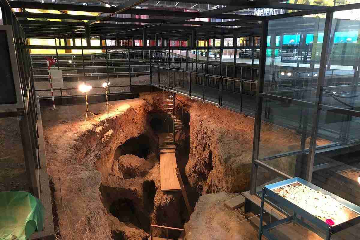
The Garraf Massif rises southwest of Barcelona as one of Catalonia’s most distinctive karst terrains — an arid limestone landscape that conceals, at its northeastern foot, one of the most remarkable archaeological complexes in prehistoric Europe. At Gavà, the Neolithic mining operations of Can Tintorer preserve the remains of a subterranean extraction industry that, beginning around six thousand years ago, supplied variscite ornaments across the western Mediterranean. This article examines both the karst geology of the Garraf and the engineering, social, and ecological dimensions of the remarkable landscape it shaped.
Key Takeaways
- The Garraf Massif is a karstic limestone formation covering approximately 12,376 hectares between the Mediterranean coast, the Llobregat valley, and the Penedès depression, with more than 400 documented caves and shafts formed by millennia of carbonate dissolution; it was declared a Natural Park in 1986.
- The Gavà Mines (Can Tintorer Mines) are considered Europe’s oldest known subterranean gallery-mining complex, with archaeological surveys identifying more than 54 distinct Neolithic mining operations across the greater Gavà area within a total extent of approximately 200 hectares.
- Neolithic miners at Can Tintorer sank vertical shafts through Quaternary alluvial cover into underlying Paleozoic rocks and extended interconnected gallery systems with chambers and supporting pillars reaching depths of 15 to 20 meters.
- Variscite ornaments produced at Gavà entered multilateral exchange networks linking northeastern Iberia with communities in southern France, with imported Provençal flint blades and Sardinian obsidian flowing in the reverse direction, establishing Can Tintorer as a hub of Middle Neolithic long-distance exchange.
- Dry-stone masonry (pedra seca) — walls, terraces, shepherd’s shelters, and water catchment structures built without mortar from locally quarried limestone — constitutes a vernacular engineering tradition on the Begues hillsides that modifies slope hydrology, retains thin calcareous soils, and enables cultivation in a low-rainfall karst environment.
- The Gavà Mines Archaeological Park continues as an active excavation and research site, declared a cultural asset of national interest (BCIN) by the Generalitat de Catalunya; the Venus of Gavà, a ceramic figurine recovered from within one of the mine shafts, remains among the most discussed Neolithic anthropomorphic objects in Iberia.
People Also Ask About the Karst Landscapes of Garraf and Can Tintorer
What is variscite and why was it so important to Neolithic communities?
Variscite is a hydrated aluminum phosphate mineral that forms as a secondary product in the weathering zone of aluminum-rich rocks where phosphate-bearing groundwater percolates through fractures. Its coloration ranges from pale green to deep emerald, caused primarily by trace concentrations of trivalent chromium and, to a lesser degree, iron impurities. In Neolithic and Copper Age western Europe, variscite served as the primary material for prestige ornaments — beads, pendants, and bracelets — that circulated through long-distance exchange networks. Its green coloration may have carried symbolic associations with fertility, renewal, or social status, though the meanings attributed to it by prehistoric communities are a matter of archaeological interpretation rather than documented record. The Gavà Mines were the most intensively exploited variscite source in the western Mediterranean during the Middle Neolithic, broadly the first half of the fourth millennium BCE, and ornaments produced there have been recovered from burial contexts across northeastern Iberia and southern France. By the Bronze Age the fashion for variscite ornaments had diminished, though the mineral continued to be worked at other Iberian sources into the third millennium BCE.
How deep are the Neolithic mine galleries at Can Tintorer, and how were they constructed?
The most complex galleries at Can Tintorer reach depths of approximately 15 to 20 meters below the surface. Access was gained through vertical shafts sunk through the Quaternary alluvial cover — accumulated sediments of the Baix Llobregat lowland — until the miners reached the Paleozoic metamorphic and metasedimentary rocks in which variscite veins occur. From the base of each shaft, horizontal or gently inclined galleries extended laterally, and at multiple depths these galleries interconnected, creating a three-dimensional network of passages supported by natural rock pillars left deliberately in place and chambers opened where the mineral concentration warranted. Excavation at this period relied on stone hammers, antler picks, and bone or wood tools; the fire-setting technique — heating the rock face and dousing it with cold water to induce thermal cracking — may also have been employed in some phases, though its use at Gavà specifically remains uncertain and should not be stated as established fact. The simpler mine workings at the adjacent Can Badosa–Les Ferreres area, which reached no more than five meters and opened directly onto surface phosphate outcrops, contrast with the elaborate spatial organization at Can Tintorer, indicating a community that had accumulated substantial geological knowledge through successive generations of extraction.
What are the defining karst features of the Garraf Massif?
The Garraf Massif is a compact karst block built predominantly from Mesozoic limestones that have been subject to dissolution across geological time. The surface expression of this process includes dolines (circular or elliptical collapse depressions), karren (grooved solution channels on exposed limestone pavement), avens (vertical shaft-like openings at the surface), and dry valley systems where drainage has been captured by the underground network. More than 400 karstic caves and vertical shafts have been mapped within the massif, including La Falconera, a large cavern with an underground lake. Underground rivers drain through the massif’s interior and resurge at the coast, discharging fresh water below the surface of the sea. The massif also incorporates two geological zones in addition to the dominant white limestone: a siliceous sandstone sector supporting heathland vegetation, and a darker schist-and-slate zone representing Paleozoic basement at the margins — the same geological context in which the variscite deposits at Can Tintorer occur. Declared a Natural Park in 1986, the Garraf forms part of the protected natural area network managed by the Diputació de Barcelona.
How does dry-stone masonry function as agricultural infrastructure in the Begues hills?
Dry-stone construction — the Catalan tradition of building with unmortered stone known as pedra seca — transforms steep or broken limestone slopes into usable agricultural terraces by intercepting runoff, stabilizing thin soil, and creating level growing platforms. On the arid hillsides around Begues and across the Garraf hinterland, farmers built retaining walls from locally available limestone blocks, clearing the stones from future fields and simultaneously edging the terrace they were creating. The resulting structures reduce erosion by breaking the continuous surface slope into a series of steps; each terrace step holds moisture longer than unmodified hillside, improving crop viability in a climate of low but torrential rainfall and prolonged dry summers. Beyond terrace farming, dry-stone technique was applied to water harvesting: cisterns, lined stone tanks, and channels cut through rock funneled runoff toward storage points. Shepherd’s shelters (barraques), property boundary walls, and beehive-supporting ledges built into terrace faces are further elements of the same tradition. In Catalonia and across the broader Mediterranean region, dry-stone landscapes have been recognized as significant elements of intangible and tangible agricultural heritage.
Extended multi-day tours – 5+ days
Featured Barcelona Multi-Day Tour Packages
3 days
Barcelona 3-Day Discovery Tour
- ✓ Comprehensive Barcelona experience
- ✓ Expert local guides included
- ✓ All accommodation included
- ✓ Transportation provided

5 days
Barcelona 5-Day Highlights Experience
- ✓ Comprehensive Barcelona experience
- ✓ Expert local guides included
- ✓ All accommodation included
- ✓ Transportation provided

7 days
Barcelona 7-Day Cultural Journey
- ✓ Comprehensive Barcelona experience
- ✓ Expert local guides included
- ✓ All accommodation included
- ✓ Transportation provided
10 days
Barcelona 10-Day Complete Adventure
- ✓ Comprehensive Barcelona experience
- ✓ Expert local guides included
- ✓ All accommodation included
- ✓ Transportation provided
Multi-day tour packages powered by TourRadar. Prices and availability subject to change.
A Landscape of Layered Depths: The Garraf and the Gavà Mines in Context
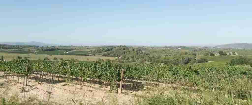
Southwest of Barcelona, between the mouth of the Llobregat River and the coastal town of Sitges, the land changes character abruptly. The alluvial plains of the Baix Llobregat — flat, densely populated, and intensively farmed — give way without transition to a massif of pale limestone that climbs steeply from the shoreline and runs inland toward the vine-covered hills of the Penedès. This is the Garraf: a compact, arid upland that bears little resemblance to the lush coastal mountains of the Costa Brava to the north or the rounded forested ridges of the Montseny inland. The Garraf is a karst landscape, meaning that its form and hydrology are governed primarily by the solubility of its dominant rock. Rainfall percolates downward through limestone rather than running off in surface channels; valleys are often dry; the subsoil is riddled with passages, shafts, and cavities that conduct water invisibly toward the sea. On the surface, the result is an austere terrain of grey-white rock outcrops, low spiny vegetation — kermes oak, rosemary, mastic, and the European fan palm, the only palm native to continental Europe — and a clarity of light and form that distinguishes the massif from every neighboring landscape.
At the northeastern edge of this massif, where the Garraf limestone gives way to Paleozoic basement rocks and then to the Quaternary sediments of the Baix Llobregat plain, something extraordinary happened six thousand years ago. Neolithic communities living in the foothills discovered variscite — a green phosphate mineral forming in narrow veins within the ancient rock — and began the systematic subterranean extraction that would continue for roughly a millennium. What they built underground at Can Tintorer is, by current archaeological knowledge, without parallel in Neolithic Europe: a gallery-mine complex of a sophistication that implies deep accumulated geological knowledge, organized labor, and sustained community investment. The hundreds of tunnels, shafts, chambers, and pillars of Can Tintorer represent not random digging but a planned exploitation of a geological resource that the miners clearly understood in three-dimensional terms.
Above ground, on the same limestone hills that form the backdrop to these ancient mines, another vernacular engineering tradition took shape across subsequent millennia. The hillsides around Begues and throughout the Garraf hinterland are terraced in dry-stone: walls placed against slopes to hold soil and water in a climate that reliably challenges both. The karst environment that shaped both traditions — its hard rock, its scarce surface water, its complex underground hydrology — connects the Neolithic miner and the historic terrace-builder across an immense span of time. Both were, in different ways, engineering responses to the same geological reality.
Geology of the Garraf Massif: Limestone, Caves, and Paleozoic Margins
The Garraf Massif belongs to the Catalan Coastal Range, a series of ridges running parallel to the Mediterranean coast. Structurally, it is a block of Mesozoic limestones — primarily Cretaceous and Jurassic in age — that has been uplifted relative to the surrounding plains by northwest-trending faults. Its highest point reaches 657 meters. The massif is bounded to the northeast by the Llobregat valley, to the southeast by the Mediterranean, and to the northwest by the Penedès depression, giving it a quasi-peninsular character: isolated in its geology, distinct in its ecology, and abrupt in the transitions at its margins.
The karst character of the Garraf results directly from the chemistry of limestone. Calcium carbonate, the principal mineral constituent of limestone, dissolves slowly in water that has absorbed carbon dioxide from the atmosphere and from soil, producing a weak carbonic acid that attacks the rock along fractures and bedding planes. Over geological time, this dissolution widens fractures into conduits and eventually creates a full karst drainage system in which water moves primarily through the rock rather than across it. The Garraf shows this development in a particularly complete form. Its surface is marked by dolines — circular depressions where overlying rock has collapsed into underlying voids — and by karren, the grooved and pitted solution surfaces visible on exposed limestone pavement. Avens punctuate the hills at irregular intervals: vertical shafts, sometimes tens of meters deep, opening at the surface as if the hillside had swallowed a hole. More than 400 caves and vertical shafts have been documented within the massif; underground rivers drain through it and emerge as submarine springs along the coast, a phenomenon visible to divers and first systematically mapped by speleologists in the twentieth century.
Visitors accustomed to thinking of karst as a single geological type discover in the Garraf three distinct sub-zones. The central and coastal portion — known informally as the white Garraf — is the limestone-dominant zone that gives the massif its characteristic pale appearance and supports the typical garrigue and brolla scrubland with its distinctive fan palms. A transitional band — the red Garraf — exposes siliceous sandstones and conglomerates, coloring the soil and rock outcrops in ochre and rust tones, and supporting a different plant community dominated by heathland species. At the massif’s margins, particularly at its northern and northeastern foot, Paleozoic basement rocks appear: schists, phyllites, and slates that predate the Mesozoic limestone by hundreds of millions of years. These dark metamorphic formations — sometimes called the black Garraf — are geologically distinct from the limestone above them, and it is precisely in this rock type, buried beneath Quaternary sediments at the foot of the massif, that the variscite deposits exploited by Neolithic miners at Can Tintorer were formed.
The formation of variscite in these Paleozoic rocks resulted from long-term weathering processes. Phosphate-bearing groundwater, circulating through aluminum-rich metamorphic rocks, precipitated aluminum phosphate minerals in fractures and cavities over geological time. The result was a scattered but locally concentrated set of variscite veins and nodules, accessible from the surface only by penetrating the Quaternary sedimentary cover that had accumulated across the Paleozoic outcrops during and after the last glacial period. From a geological standpoint, the Neolithic miners of Can Tintorer were not working in the karst limestone of the white Garraf: they were sinking shafts through alluvial and colluvial sediments to reach the phosphate-mineralized Paleozoic basement beneath. The karst landscape above and the variscite deposits below are products of entirely different geological processes, separated in age by hundreds of millions of years, yet spatially contiguous and jointly constituting the geological heritage of this territory.
The cave systems of the white Garraf are themselves archaeologically significant. La Falconera, one of the larger caverns in the massif, contains an underground lake. Several other cavities have yielded evidence of prehistoric occupation — Cova Negra among them — reflecting the long history of human use of the Garraf’s natural underground spaces. The relationship between the massif’s natural cave network and the human-made underground of Can Tintorer — both involving penetration of the rock in pursuit of resources, one natural and one engineered — provides one of the more resonant parallels in the prehistoric landscape of this region.
Variscite and the Western Mediterranean Exchange Network
To understand why Neolithic communities devoted such extraordinary labor to the underground extraction of variscite, it is necessary to understand the material’s role in prehistoric social economies. In the fifth and fourth millennia BCE, communities across western Europe exchanged a specific set of exotic and rare materials that served as prestige goods, grave offerings, and markers of long-distance social connections. Jadeite axes from the Alps, obsidian from Sardinia and other volcanic islands, high-quality flint from Provence, and green stone ornaments — including variscite — moved along overlapping exchange networks that connected communities separated by hundreds of kilometers. These movements were not the casual diffusion of goods between neighboring groups but structured exchange requiring sustained social relationships, probably maintained through periodic gatherings, marriage alliances, or reciprocal obligations.
Variscite from Gavà was a key commodity in this system during the Middle Neolithic. Ornaments made at Can Tintorer — beads, pendants, and bracelets fashioned from the green phosphate — have been found in Neolithic burials across the northeastern Iberian Peninsula and in southern France, establishing the mine as a productive center whose output was valued well beyond its immediate geographic setting. The exchange was multilateral, not unidirectional. Excavations within the mine complex and at associated settlement contexts have recovered imported Barremian-Bedoulian flint blades from the Vaucluse region of Provence — a material valued for its exceptional knapping quality — alongside obsidian from Monte Arci in Sardinia, a volcanic glass prized across the western Mediterranean for its sharp edges. The simultaneous presence of these imported materials at the same site that was producing variscite for export makes Gavà a particularly clear illustration of the principle that Neolithic exchange networks were not simple bilateral trades but complex, multi-node systems in which a single community could function simultaneously as a producer, a consumer, and an intermediary.
The chemical composition of variscite provides a significant advantage for archaeologists seeking to trace the origin of prehistoric ornaments. Different geological sources produce variscite with subtly different trace-element profiles, reflecting the particular chemistry of each deposit’s host rock. By the nineteenth century, scientific study had established that nearly all ancient European variscite originated from three locations in Spain: Gavà in Catalonia, Palazuelo de las Cuevas in Zamora, and Encinasola in Huelva. Geochemical provenance studies analyzing the ratios of trace elements and mineral inclusions in variscite ornaments from burial contexts have generally supported this picture, though the attribution of specific artifacts to specific sources involves methodological complexities and results from individual studies should be read with appropriate caution. What the evidence supports without controversy is that the Gavà deposits were among the most prolific producers of variscite ornaments in the western Mediterranean during the key period of Middle Neolithic exchange.
The variscite of Gavà may also have been known in ancient written culture under the name callaïs — a green stone mentioned by classical and Byzantine lapidary writers in connection with Iberian sources. Whether this term consistently referred to variscite, to turquoise, or to other green phosphate minerals is debated; the ambiguity of classical lapidary terminology is well established and any identification should be held as tentative. What the classical references do confirm, if they do apply to variscite, is that the green stone from this part of the peninsula was known and valued in ancient Mediterranean commerce well after the Neolithic production peak.
The social implications of variscite exchange matter for understanding how Neolithic communities were organized. The intensive and specialized exploitation of a raw material — involving substantial labor investment in mining infrastructure, ornament production, and exchange management — implies a level of economic organization not universally attributed to subsistence-based Neolithic communities. Some researchers interpret the evidence at Gavà as suggesting that certain individuals or groups controlled access to the variscite source and managed its distribution, accumulating social capital through exchange. This remains an interpretive position rather than an established conclusion; the archaeological evidence is consistent with both relatively egalitarian and more hierarchically organized social arrangements, and the debate continues in the scholarly literature on Neolithic Iberia.
Subterranean Archaeology of the Llobregat Delta Rim
The phrase “Llobregat Delta Rim” applied to the Can Tintorer mines requires a brief geological clarification. The Llobregat River drains the Pyrenean hinterland of Barcelona and has built its delta plain northward and eastward of Gavà; the mines themselves are situated not on the delta surface but at the base of the Garraf hills to its southwest. What connects the two geographically is the Quaternary depositional history of the broader Baix Llobregat basin: the sediments through which the Neolithic miners sank their shafts represent accumulated fluvial, colluvial, and alluvial material laid down across the lowland fringe of the delta system during and after the last glacial period. The mines occupy, in geological terms, the transitional zone where the Quaternary plain abuts the upstanding Paleozoic basement of the massif — the interface that can reasonably be described as the rim of the delta basin. Understanding the mines requires understanding the sedimentary and tectonic history of this margin zone, where three geological worlds — the Paleozoic basement, the Mesozoic limestone massif, and the Quaternary plain — converge within a few kilometers.
Chamber Excavation Mechanics in Prehistoric Variscite Quarries
Archaeological investigation across the Gavà area has distinguished two main mining zones with significantly different levels of technical complexity. At Can Badosa–Les Ferreres, located on the adjacent hillside where the Paleozoic rocks reach the surface as exposed outcrops, the workings are comparatively simple: single-entrance galleries or ramps cut directly into the phosphate-bearing rock, reaching no more than five meters in depth, with no Quaternary cover requiring penetration. These workings appear to represent a less intensive exploitation regime — whether because they were earlier, used as prospecting operations, or were secondary to the principal mining complex — and the geological knowledge they embody, while real, is less sophisticated than what the Can Tintorer workings imply.
At Can Tintorer, the situation is qualitatively different. Several meters of Quaternary sediments — alluvial sands, gravels, and clays that accumulated across the Baix Llobregat plain — overlie the phosphate-bearing Paleozoic basement. To reach the variscite veins, miners first sank vertical shafts through this cover, then extended horizontal galleries once they reached the mineralized rock. These galleries interconnected at multiple depths, creating a three-dimensional network of passages with a system of chambers and supporting pillars. The architectural vocabulary — communicated galleries, cameras, pillars — describes a spatial organization of underground space that presupposes a clear three-dimensional mental model of the resource and its distribution. The Can Tintorer workings are not prospecting tunnels but a mature, evolved mining complex whose spatial logic was built up across generations.
The mechanics of excavation relied on a limited but effective toolkit. Stone hammers — hard cobbles used to pound and fracture the rock face — are among the most abundant archaeological finds within the mine chambers. Antler picks, fashioned from red deer antler, served as lever and prying tools to detach fragments of loosened rock and to work the softer sedimentary cover at the shaft tops. Bone and wooden implements were used for finer operations; all three material classes are attested in the recovered assemblages, though organic materials are represented less completely than stone due to differential preservation. The removal of excavated material upward through vertical shafts required containers — presumably baskets or bags of organic material, none of which has survived — and a coordinated system of workers at different levels. Lighting underground would have been provided by animal fat lamps, small ceramic or stone vessels with a fiber wick, consistent with those known from Neolithic contexts across Europe.
The presence of supporting pillars within the Can Tintorer galleries is one of the most technically significant features of the complex. A pillar is left standing not because it contains no variscite but because its removal would increase the risk of roof collapse. The decision to leave pillars intact reflects an engineering judgment about the structural behavior of the rock and the forces acting on the gallery roof — made entirely through empirical observation accumulated over generations rather than through any formal calculation. Roof-fall events almost certainly occurred during the roughly one-thousand-year history of the mines; some chambers were found sealed by collapse material during excavation. That the mining community continued to work despite these hazards and continued to refine the spatial organization of their workings indicates a practical understanding of underground rock mechanics that is not less impressive for being empirical rather than theoretical.
In several mine chambers, the dead were buried alongside or within the worked spaces. Skeletal remains accompanied by grave goods — variscite ornaments, ceramic vessels, flint tools, and occasionally animal bones — have been found in chambers that were subsequently sealed with mining debris. The act of burying the dead within the mine appears to have been deliberate. Whether the underground space carried particular ritual significance for the mining community, or whether burial within the worked environment reflected the social importance of mining labor itself, remains a question that current evidence does not resolve conclusively. What the burials do demonstrate is that the mines were not purely utilitarian spaces: they were embedded in the symbolic and social life of the community that built and sustained them.
Geological Shifts and Coastal Line Evolution Since the Bronze Age
The geological environment in which the Can Tintorer mines operated has changed substantially since the Neolithic period, and understanding those changes is essential both for reconstructing the landscape the miners inhabited and for interpreting the depositional processes that preserved or modified the archaeological record. The most significant geological dynamic affecting this territory since the Neolithic is the continued evolution of the Llobregat coastal plain and the interplay between sea level, alluvial deposition, and delta progradation.
During the active phase of the Can Tintorer mines — broadly the fourth millennium BCE — the Mediterranean sea level was close to its current position, having completed the major post-glacial transgression that followed the Last Glacial Maximum. The Llobregat delta at that time was less extended than it is today: the coastline lay somewhat further inland, the delta plain was narrower, and the lowland between the Garraf foot and the sea was a more dynamic environment of marshes, lagoons, and wetland margins. The Quaternary sediments through which the Can Tintorer miners sank their shafts represent, in part, the accumulated fluvial and colluvial deposits of this late Pleistocene and early Holocene coastal history. The thickness of these sediments — sometimes several meters — was itself a consequence of the sea-level change history: as sea level rose, accommodation space for sediment opened up in the lowland fringe, and alluvial and coastal sediments accumulated over the Paleozoic basement.
Through the Bronze Age and into the historical period, the Llobregat delta continued to build seaward as the river carried sediment from its Pyrenean and Pre-Pyrenean catchment. This progradation extended the coastal plain incrementally, gradually positioning the foot of the Garraf hills further from the active shoreline. The archaeological consequence is that Neolithic period sites around the delta margin now lie under varying thicknesses of alluvial sediment, making their discovery largely dependent on construction activity — precisely the circumstances of the Can Tintorer mines’ rediscovery in 1978, when civil engineering works in the Gavà urban area encountered the mine shafts unexpectedly. The probability that further Neolithic features remain buried beneath the Baix Llobregat plain is real.
In the twentieth and twenty-first centuries, the directional trend of delta evolution has partially reversed. The construction of dams and water reservoirs upstream — capturing sediment that would previously have reached the coast — has drastically reduced the Llobregat’s sediment load. Without continuous deposition to counteract wave energy, the delta shoreline has retreated measurably in historical memory, reshaping the coastal geography of the bay. For the Can Tintorer mines, positioned inland at the foot of the Garraf hills, this shoreline change presents no direct threat. For other potential Neolithic sites buried beneath the delta plain itself, the interaction of reduced sediment supply with coastal erosion represents a genuine long-term preservation concern that is monitored by heritage and environmental management bodies.
The Paleozoic basement rocks in which the variscite deposits occur are simultaneously subject to ongoing geological processes, though on timescales far beyond human relevance. Weathering of the Paleozoic rock continues to generate the phosphate-bearing groundwater solutions from which variscite forms; new variscite is in principle still being created today in the same geological context the Neolithic miners exploited, though at rates imperceptible on human timescales. The karst limestone above, meanwhile, continues its slow dissolution with each rainfall event, imperceptibly widening shafts and extending cave passages across geological time. The landscape of caves, dolines, and underground drainage that characterizes the Garraf today is the product of processes measured in millions of years, and those same processes will continue long after all human structures have disappeared from the surface.
The Gavà Mines as a Neolithic Social Complex
The mines of Can Tintorer cannot be understood solely as an extractive site. The evidence accumulated through decades of archaeological investigation — funerary deposits, imported materials, ceramic assemblages, faunal remains, and botanical material — describes a place that was simultaneously a production zone, a community space, and a location with ritual dimensions. Taken together, this evidence places the Gavà Mines at the intersection of several major themes in Neolithic social archaeology: the emergence of economic specialization, the management of prestige goods exchange, and the relationship between labor, community identity, and the treatment of the dead.
The physical cost of mining labor is documented in the skeletal remains from the mine burials. Analysis of individuals interred within the mine chambers indicates that adults in the mining population showed physical markers consistent with sustained heavy labor — changes to bone morphology and joint wear that reflect repetitive physical stress. Average life expectancy in the mining population appears to have been low even by Neolithic standards, a finding consistent with the physical demands of underground work, exposure to dust in confined spaces, and the structural hazards of gallery mining. These data should be read with caution: the sample of individuals recovered from mine burials is limited, and individuals buried within the mine may not be representative of the broader community. Nevertheless, the skeletal evidence does suggest that variscite extraction was a costly occupation in terms of human health.
The Venus of Gavà is the most discussed single artifact from the complex. This partially preserved ceramic figurine — modeled in clay and decorated with incised motifs that various researchers have interpreted as representations of eyes, a face, or owl-like features — was recovered from within one of the mine shafts. Anthropomorphic figurines are known from Neolithic contexts across Europe and the Near East, and their interpretation is consistently contested: proposals range from representations of a deity, an ancestor, or a spirit guardian, to objects connected with ritual practices during extraction, to personal possessions associated with a buried individual. For the Venus of Gavà specifically, its find context within an active mine shaft is unusual and has prompted the hypothesis that underground extraction carried ritual or cosmological dimensions for the community. This interpretation is consistent with the evidence, but it remains a hypothesis rather than a documented conclusion. The figurine is displayed at the Gavà Mines Archaeological Park and is one of the most widely reproduced Neolithic ceramic objects in Iberian archaeology.
The import materials recovered from the mines — Provençal flint blades, Sardinian obsidian, and other exotic materials from the broader western Mediterranean exchange sphere — confirm that Gavà was embedded in networks reaching across several hundred kilometers. The simultaneous presence of variscite as an export material and these imports in the same archaeological context makes Can Tintorer one of the clearest documented examples of Neolithic exchange hub dynamics in western Europe. The site attracted goods from multiple distant sources not because of its geographic position or military power, but because it controlled access to a valued raw material that other communities wanted. This economic logic — the leverage of a scarce production resource to attract imports from distant partners — recurs in prehistoric contexts globally and represents one of the fundamental mechanisms by which exchange networks create and sustain social connections across large geographic distances.
Converging Solutions: Ancient Underground Mining Across Continents
The underground extraction of colored minerals for ornamental and prestige use is not a problem unique to Neolithic Catalonia. Across the ancient world, at different times and in entirely independent contexts, communities confronted the same challenge: a desirable mineral occurred below the surface, and reaching it required penetrating and managing underground space. The engineering solutions developed by different cultures, working from different geological materials with different toolkits and within different social frameworks, show a striking structural convergence — not because of any cultural contact or diffusion, but because the physical constraints of underground mining are universal and the viable engineering responses to those constraints are limited by the properties of rock and the capabilities of the human body working within it.
The Egyptian turquoise mines at Serabit el-Khadim in the Sinai Peninsula provide one of the most instructive points of comparison. This site was worked by Egyptian expeditions from approximately the Early Dynastic period onward — with evidence suggesting initial activity around or before 2650 BCE, and the most intensive exploitation occurring during the Middle and New Kingdoms, roughly 2000 to 1200 BCE. The scale of the Egyptian operations, supported by royal authority and large seasonal expeditions numbering potentially in the hundreds, differs enormously from the community-based mining at Gavà. The institutional context, the documentary record (Egyptian miners left inscriptions; Neolithic miners did not), and the relationship to a centralized state are all absent at Can Tintorer. Yet the technical parallels are significant: both sites targeted a green semi-precious phosphate mineral — turquoise, a copper aluminum phosphate, is chemically distinct from variscite but visually and functionally similar, occupying an analogous niche as a green ornamental stone of prestige value — both required penetrating underground rock through galleries and shafts, and both involved the construction of interconnected underground spaces managed for structural stability.
At Serabit el-Khadim, workers used stone hammers, copper tools (available in the Bronze Age Egyptian context), wooden supports, and — as at many ancient mining sites — possibly fire-setting techniques to loosen the rock. The fire-setting method — heating the rock face and then shocking it with cold water to induce thermal cracking — represents a widely and independently discovered solution to hard-rock excavation that appears at mining sites across the ancient world. At Gavà, the tool inventory was more restricted, limited to the pre-metal technology of the Neolithic period, but the organizational principle was functionally parallel: accumulated geological knowledge applied to systematic underground resource extraction, with gallery orientation following the mineral vein rather than proceeding in arbitrary directions.
The chronological separation between the two traditions is important for framing the comparison correctly, and it underscores the convergent rather than connected nature of the parallel. The Can Tintorer mines were operating at their peak roughly a millennium or more before the first Egyptian expeditions reached Serabit el-Khadim, and the two mining traditions developed in complete independence, separated not only by geography but by distinct material cultures, social structures, and geological contexts. The Neolithic miners of Gavà had no knowledge of the Sinai, and the Egyptian scribes who recorded their turquoise expeditions had no knowledge of variscite or Catalonia. The parallels are therefore convergent in the strict sense: they arise from the universal physics of rock and mineral occurrence, from the constraints imposed by the human body working in confined underground space, and from the social logic of prestige-good production — a logic in which scarcity and the labor of extraction enhance rather than diminish the social value of the product. Where different cultures facing the same physical constraints independently arrive at similar solutions — vertical access shafts, horizontal galleries following mineral veins, deliberate roof-support structures, specialized labor — the convergence reflects engineering logic rather than historical connection.
Other ancient mineral extraction traditions extend this comparative frame. Flint mines such as Grimes Graves in Norfolk, England, dating broadly to the third millennium BCE, deploy vertical shaft and horizontal gallery organization similar in principle to Can Tintorer, applied to a different mineral in a different geological environment. Ochre extraction sites in southern Africa, some predating the Gavà operations by tens of thousands of years, demonstrate that underground mineral extraction for colorants and prestige materials is among the oldest and most persistent patterns in human technological behavior. Within this long comparative sequence, Can Tintorer’s distinction lies in its scale, its organizational sophistication, and the exceptional preservation conditions that have allowed modern archaeology to reconstruct the three-dimensional structure of Neolithic underground engineering in unusual detail.
Dry-Stone Masonry (Pedra Seca) in the Arid Hills of Begues
The municipality of Begues occupies a broad basin within the Garraf massif, surrounded by limestone ridges and connected to the coastal plain by narrow valleys. Its terrain is typical of the inland Garraf: thin calcareous soils over fractured limestone, sparse vegetation, low and erratic annual rainfall, and a relief that combines gently rounded hilltops with sharply incised valley sides. From at least the medieval period onward — though the origins of individual elements of the tradition may be considerably older — the inhabitants of Begues and the broader Garraf hinterland adapted to this environment with a construction technique found throughout the Mediterranean world wherever limestone hills meet agricultural necessity: dry-stone masonry. The Catalan term pedra seca — literally “dry stone” — names both the technique and, by extension, the entire landscape of walls, terraces, shelters, and hydraulic structures built from unmortered local rock.
The logic of pedra seca in a karst landscape is productive in a circular way: the same geological properties of the limestone that make farming difficult also supply the raw material for the engineering responses to those difficulties. Stones cleared from a future field become the wall that retains the terrace on which that field sits; limestone blocks split by frost action become the structural elements of a shepherd’s shelter; a natural groove in the karren surface becomes the starting point for a channel directing runoff toward a cistern. The technique requires no imported materials, no specialized equipment beyond hand tools, and no binding agent beyond the carefully calculated interlocking of the stones themselves. Its primary cost is time and coordinated labor, both of which were available to farming communities working within the seasonal rhythms of Mediterranean agriculture.
Vernacular Retaining Walls for Soil Conservation and Terrace Farming
The retaining wall is the most structurally fundamental element of pedra seca terracing. On an unmodified slope, rainfall accelerates as it descends the hillside, picks up fine soil particles, and carries them downslope toward the valleys. On the arid limestone hillsides of the Garraf, where soils are thin and rainfall arrives in intense but infrequent events, this erosion dynamic operates with particular force. A retaining wall placed across the slope creates a step: above the wall, sediment accumulates over time to form a level or near-level platform; below it, the wall face holds the upslope material in place and dissipates the energy of runoff before it can reach the next terrace below. The platform created above can be cultivated for cereals, vines, olives, or vegetables, depending on the microclimate and the depth of soil that has been allowed to accumulate.
Construction of a pedra seca retaining wall in the Garraf follows consistent structural principles. The base course of stones is laid on the slope with the largest available blocks placed flat; subsequent courses are staggered — each stone bridging the joint between the two below it — to prevent the propagation of vertical cracks through the wall face. The wall’s outer face is maintained near-vertical or slightly battered, inclined slightly inward, with the larger and more regularly shaped stones placed toward the face while smaller rubble fills the interior core. Tie stones — longer blocks set transversally through the full thickness of the wall — are positioned at intervals to bind the outer face to the infill and resist the long-term lateral pressure of accumulated wet soil. In agricultural retaining walls of significant height, the thickness at the base can be substantial — up to half the total wall height — to provide adequate stability. These structural principles are not codified rules that craftsmen learned from manuals; they are empirical regularities that emerged from generations of trial, observation of what failed and what held, and transmission of successful practice through apprenticeship and direct imitation.
The ecological function of terrace walls extends beyond the immediate arrest of erosion. A well-constructed terrace system changes the microhydrology of a hillside by intercepting runoff that would otherwise carry moisture rapidly to the valley floor and holding it at multiple points up the slope, allowing it to infiltrate into the terrace soil over a longer period. In the Garraf, where summer drought is prolonged and rainfall comes primarily in autumn and spring in intense but brief events, this moisture retention significantly improves agricultural viability. The shaded northern face of a terrace wall also creates a microhabitat with different temperature and humidity conditions from the surrounding exposed limestone, supporting plant species and invertebrate communities not found on open rock. The biodiversity dimension of pedra seca walls — providing niches for insects, reptiles, amphibians, and nesting birds — has been recognized in ecological assessments of the Catalan rural landscape and represents one argument for the conservation value of these structures beyond their heritage significance.
The physical appearance of terrace systems in the Begues hills reflects centuries of maintenance, repair, and incremental extension. Dry-stone walls do not remain stable indefinitely: frost-thaw cycles, tree root growth, and the passage of livestock gradually displace individual stones. A tradition of periodic repair — replacing fallen stones, rebuilding collapsed sections, and adjusting courses that have been displaced — is therefore as essential as initial construction to the long-term function of the terrace landscape. In the twentieth century, rural depopulation of the Garraf interior reduced the labor available for terrace maintenance, and many structures in the Begues area show the progressive stages of neglect: individual stones fall, sections of wall slump, accumulated terrace soil begins to move downslope, and the land returns toward its pre-terrace character. Conservation organizations and heritage bodies in Catalonia have worked to document these structures and, in some cases, to support their restoration as elements of both cultural and ecological heritage.
Water Harvesting Structures in Limestone Karst Microclimates
The hydrology of a karst landscape creates a fundamental challenge for communities that depend on it: rainfall disappears underground rapidly, producing no permanent surface streams and few natural ponds. The Garraf’s underground drainage system, which routes precipitation through the massif’s cave network and eventually to submarine springs in the Mediterranean, means that water falling on the hills’ surface is largely unavailable for surface use within hours of any given rain event. In the arid hills around Begues and throughout the Garraf hinterland, the pedra seca tradition developed a set of water harvesting structures adapted to intercept and store the surface water that briefly becomes available before it drains underground.
The simplest water harvesting element is the runoff collector built along natural drainage lines. A stone-lined channel, cut into the limestone surface and following the natural gradient of a dry valley floor, directs the flow from even a modest rainfall event toward a collection point. At the collection point, a cistern — an underground or semi-underground chamber sealed with a flat stone cover — stores the collected water against the dry season. Cisterns in the Garraf were typically excavated into the soft subsoil or into weathered rock zones, then lined with flat stone slabs and sealed to minimize evaporation. Their storage capacity was limited by the labor of construction, but even a modest cistern providing a few hundred liters represented a critical resource for a shepherd’s family or agricultural crew during the summer months when no surface water was otherwise available.
More elaborate structures combined the channel with the terrace. Some terrace systems in the Garraf were designed not only to hold soil but to direct water: small catchment basins or weirs at the terrace ends concentrated runoff and directed it toward planted areas or storage points rather than allowing it to drain along the slope. Dry-stone fountains — structures in which natural seeps or groundwater discharges were captured, concentrated, and directed to a spout — appear at points where topography and local geology permitted shallow groundwater to approach the surface. Constructing such a fountain required the builders to identify the precise location where underground water was accessible, a form of empirical geological knowledge accumulated over generations of observing where the ground remained damp after rainfall ceased. In a landscape where this knowledge could mean the difference between a functioning summer pasture and an unusable one, it was practical knowledge of the highest value.
In the higher zones of the Garraf, where temperatures occasionally fall below freezing in winter, dry-stone construction served purposes related to the seasonal management of livestock and labor. Shepherd’s shelters — the barraques typical of Catalan and Balearic pastoral landscapes — provided protection from winter rain without requiring any imported material beyond the tools to shape the stone. Some barraques in the Garraf and neighboring limestone territories use a corbelled construction technique: successive courses of stones are laid so that each projects slightly beyond the one below, eventually closing to a sealed point without the need for a central supporting timber or any form of arch. This structural solution — effective, durable, and entirely self-sufficient in local material — appears independently in many Mediterranean and Atlantic limestone territories, from the trulli of Puglia to the clochans of Ireland, demonstrating again the convergent logic of construction in stone-rich, timber-poor environments where the same physical constraints produce similar engineering responses.
The combined water management capacity of the pedra seca landscape — terraces retaining soil moisture, cisterns storing surface runoff, channels directing precipitation, seep-capturing fountains providing drinking water — constitutes a sophisticated hydrological engineering system operating at the scale of a hillside catchment. No individual element of this system required advanced technology or specialized knowledge beyond what was accumulated through direct experience of the landscape. Each structure was built from the same local limestone, using the same basic stacking and leveling principles, by farmers whose understanding was practical and empirical rather than formally theoretical. The cumulative effect — the transformation of an arid, poorly watered karst hillside into a landscape capable of supporting both crops and livestock through a Mediterranean summer — represents an engineering achievement built from patience, observation, and the slow accumulation of successful practice across many generations.
Conservation, Heritage Status, and Visitor Access
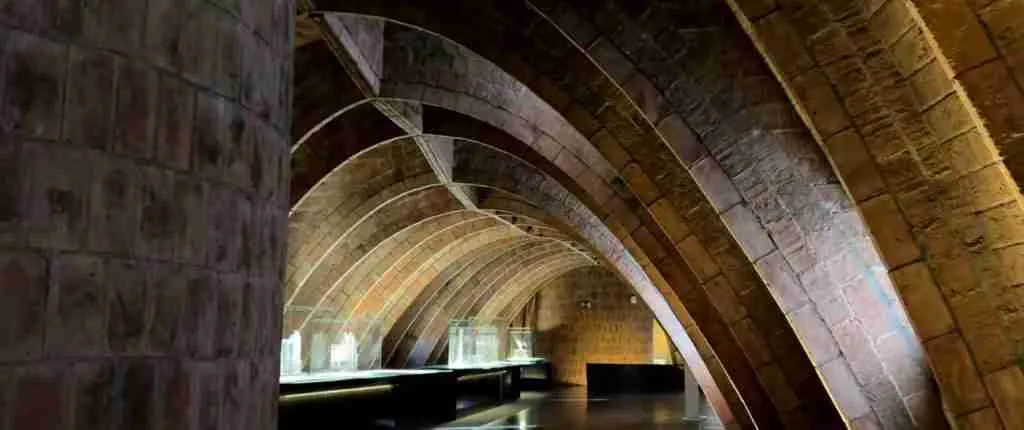
The Gavà Mines Archaeological Park is the principal public interface with the Can Tintorer mines. Declared a cultural asset of national interest (BCIN) by the Generalitat de Catalunya, the park combines a museum facility — with interpretive displays covering the geology of variscite, the mechanics of Neolithic underground mining, the social organization of the mining community, and recovered artifacts including ornaments, tools, and the Venus of Gavà — with controlled access to a section of the actual underground galleries. This combination of museum and in-situ heritage access is relatively unusual for a site of this antiquity and fragility, and reflects the exceptional preservation conditions of the Can Tintorer complex and the sustained investment in archaeological management over the decades since its 1978 rediscovery. Ongoing excavations continue within sections of the complex not yet opened to visitors, and the site’s scientific output continues to generate publications in the international archaeological literature.
The challenges of managing an active archaeological site as a heritage destination are real. The mine galleries are structurally sensitive: the same roof-collapse risk that the Neolithic miners managed empirically remains present, and the introduction of visitor humidity, vibration, and artificial lighting creates conditions different from the stable, dark, and consistently dry environment that has preserved the site. Conservation practice at the Gavà Mines has generally favored careful excavation and documentation over large-scale visitor access, preserving the majority of the underground complex from the stabilization interventions that broader public access would require. The sections made accessible to the public represent a managed sample of the whole complex. Current visiting hours and access conditions should be confirmed directly with the Gavà Museum (Museu de Gavà), as operational schedules are subject to change.
The Garraf Natural Park, which encompasses the karst massif surrounding the broader mine area, is managed by the Diputació de Barcelona as part of a protected natural area network. Management objectives include the protection of karst geological features — caves, shafts, and the underground drainage system — alongside the conservation of the distinctive Mediterranean scrubland ecology and the agricultural heritage landscape of traditional farmhouses (masies), pedra seca terraces, and historic path networks. Visitor infrastructure within the park is intentionally limited: a network of signed hiking routes allows landscape exploration, but vehicle access is restricted and the park’s development model prioritizes ecological and heritage integrity over volume tourism. The park is twinned with the Riserva Naturale Monte Soratte and the Parco Naturale della Maremma in Italy, reflecting recognized parallels between Mediterranean karst systems in different parts of the basin.
The pedra seca landscape of Begues and the surrounding Garraf hinterland occupies an intermediate position between informally maintained traditional land use and formal heritage recognition. Individual structures — particularly the most complete terrace systems and the best-preserved barraques — are inventoried in the Wikipedra citizen cataloguing project operated by the Observatori del Paisatge de Catalunya. The Associació per la Pedra Seca i l’Arquitectura Tradicional (Dry Stone and Traditional Architecture Association), founded in 2015, promotes the technique as both cultural heritage and a practical contribution to sustainable land management. UNESCO has recognized the art of dry stone walling as Intangible Cultural Heritage of Humanity across a multinational inscription covering several European countries, acknowledging the tradition’s shared character across Mediterranean and Atlantic stone-building regions.
Frequently Asked Questions
When were the Gavà Mines rediscovered, and by what means?
The Can Tintorer mines were rediscovered in 1978, not through planned archaeological survey but through construction activity in the Can Tintorer neighborhood of Gavà. Civil engineering works encountered the mine shafts unexpectedly, and the site’s significance was rapidly recognized by heritage authorities. Systematic archaeological excavation began following the discovery, and the site has since been the subject of sustained investigation by teams associated with the Gavà Museum and collaborating academic institutions, including researchers affiliated with Spanish universities and the Spanish National Research Council (CSIC). The irony of a Neolithic mine being recovered through the very kind of construction activity it had itself once supported — penetrating the same Quaternary sediments that the Neolithic miners had sunk their shafts through — is not lost on those who have studied the site.
What exactly is the Venus of Gavà, and where is it now?
The Venus of Gavà is a partially preserved ceramic anthropomorphic figurine recovered from within one of the Can Tintorer mine shafts. It was modeled in clay and decorated with incised motifs that different researchers have interpreted as representations of eyes, a face, or owl-like imagery. Anthropomorphic figurines from Neolithic contexts across Europe and the Near East are consistently difficult to interpret with confidence: proposed functions range from representations of a deity or ancestor to personal possessions associated with a specific individual. For the Venus of Gavà, its unusual find context — within an active mine shaft rather than in a settlement or cemetery — has prompted the hypothesis that underground extraction carried ritual dimensions for the mining community. This remains an interpretive hypothesis rather than an established conclusion. The figurine is displayed at the Gavà Mines Archaeological Park and is one of the most widely reproduced Neolithic ceramic objects in Iberian archaeology.
Is the Garraf karst comparable to other karst systems in Spain or Europe?
The Garraf is recognized as the most fully developed karst system in Catalonia and holds a distinctive position in the broader European karst landscape. Its coastal setting — a karst massif whose cliffs reach the Mediterranean directly — combines cave hydrology with submarine spring discharge in a way that makes it of particular interest to both speleologists and hydrogeologists. The presence of more than 400 documented caves and vertical shafts within a relatively compact massif of just over 12,000 hectares represents a high density of karst features. Its ecology is also unusual: the European fan palm, the only palm native to continental Europe, reaches here the northern boundary of its natural range, creating a vegetation character that resembles the maquis of North Africa more than the typical Catalan scrubland. In the context of Iberian natural parks, comparisons are often drawn with the Cabo de Gata in Almería; in a broader European context, the Garraf’s combination of coastal limestone scenery and southern flora makes it genuinely singular.
How was variscite processed into ornaments at Gavà?
The processing of variscite from raw mineral to finished ornament likely occurred within the mining complex itself, based on the recovery of partially worked pieces and production debris within the mine chambers and associated surface areas. The production sequence involved first extracting nodules or fragments of variscite-bearing rock, then separating the mineral from its host matrix, and finally shaping the ornaments — predominantly beads and pendants — through abrasion and drilling. Drilling small perforations through hard stone without metal tools required a combination of a pointed stone or bone drill and a rotary motion sustained by a bow-drill mechanism, a technique known from many Neolithic ornament-production contexts. The finished ornaments were then smoothed and polished, producing the characteristic luster of the Gavà variscite beads recovered from burial contexts across the region. The co-location of extraction and production at the mine site itself — rather than transporting the raw mineral to a separate workshop — implies that at least some degree of ornament manufacturing was the work of the mining community directly, though the full production and distribution chain remains an active topic of research.
What is the relationship between the Gavà Mines and the Sepulcros de Fosa culture?
The Gavà Mines are the most prominent material expression of the Sepulcros de Fosa (Pit-Grave) culture, a Middle Neolithic cultural complex centered on northeastern Iberia and characterized by individual inhumation burial in pits, a distinctive ceramic tradition, and participation in western Mediterranean exchange networks. The mines provided the prestige material — variscite ornaments — that circulated through the Sepulcros de Fosa sphere and linked it to neighboring cultural groups. The exchange connections documented at Gavà — Provençal flint entering, Sardinian obsidian entering, variscite moving outward to southern France and through the Iberian Peninsula — place the site at the intersection of several overlapping exchange circuits. In this sense the Can Tintorer mines function not as a purely local site but as a node in a pan-regional social and economic system, making them directly relevant to the archaeology of Neolithic France, the Iberian Peninsula, and western Mediterranean prehistory broadly.
How old is the dry-stone masonry tradition on the Garraf hills?
The precise origins of dry-stone masonry in the Garraf and Begues area are difficult to date archaeologically, as dry-stone walls rarely contain material that can be dated radiometrically, and their construction and repair across many generations further complicates chronological attribution. The tradition is attested in medieval and early modern sources for the broader Catalan landscape and is generally understood to reflect agricultural land use patterns that intensified from at least the medieval period. Whether any elements of the surviving landscape reflect Roman-period or earlier construction is a question that would require systematic archaeological investigation of individual structures. What is clear is that the technique is adapted to the geological and climatic conditions of the Garraf in ways that imply long local practice: the structural conventions for dealing with the specific failure modes of local limestone walls, and the knowledge of where to locate cisterns and channels in the specific karst microhydrology of the Begues basin, are the kinds of knowledge that accumulate over many generations rather than being invented de novo in any single period.
How does the cross-cultural comparison with Egyptian turquoise mining at Serabit el-Khadim work?
The comparison between Can Tintorer and Serabit el-Khadim is a study in convergent engineering: two entirely independent mining traditions, separated by geography, culture, and time, that arrived at structurally similar solutions because both were responding to the same fundamental challenge — extracting a valued green mineral from underground rock. The two traditions share the use of vertical shaft access, horizontal galleries following mineral veins, and the management of underground space for structural stability. They differ profoundly in institutional context (community-based Neolithic mining versus state-organized Egyptian royal expeditions), in available tools (pre-metal Neolithic technology versus Egyptian copper tools), and in documentary record (Neolithic miners left no written record; Egyptian expedition leaders left detailed inscriptions). The chronological separation further confirms the independence of the traditions: the Can Tintorer mines predate the first Egyptian expeditions to Serabit el-Khadim by at least a millennium. There is no connection between the two beyond the convergent logic of the engineering problem they each independently solved.
What are the main threats to the conservation of the Gavà Mines?
The primary conservation threats to the Gavà Mines complex fall into three categories. First, urban development pressure in the Gavà municipality creates ongoing risk of inadvertent destruction of buried archaeological features in areas of the mine complex not yet excavated and not yet subject to statutory protection. The 1978 rediscovery of the mines through construction work is itself a reminder of this risk. Second, the structural fragility of the underground galleries — which depend on maintaining the equilibrium between rock stresses that has held since the Neolithic — means that vibration, groundwater changes, or inadvertent loading from construction above could destabilize sections of the complex. Third, within the accessible sections of the park, the introduction of humidity and temperature variation associated with visitor activity creates conditions that must be carefully managed to prevent deterioration of the organic remains and other sensitive materials that have survived six thousand years in stable, dry underground conditions. The park’s management strategy balances these risks against the public access imperative, with the majority of the complex maintained in protected, unexcavated condition.
What visitor facilities are available at the Gavà Mines Archaeological Park?
The Gavà Mines Archaeological Park operates as a combined museum and in-situ archaeological site, managed by the Gavà Museum (Museu de Gavà). The museum facility includes interpretive displays covering the geology of variscite, the mechanics of Neolithic underground excavation, the social organization and daily life of the mining community, and the recovered artifact assemblages including ornaments, tools, ceramic vessels, and the Venus of Gavà figurine. Guided tours of a section of the actual underground galleries are available, providing direct experience of the scale and spatial organization of the Neolithic workings. The park is located in the municipality of Gavà in the Baix Llobregat comarca and is accessible by suburban railway from Barcelona on the Rodalies network. Current opening hours, admission fees, and guided tour schedules should be confirmed directly with the Gavà Museum, as operational details change seasonally.
What is the current scientific understanding of how long the Can Tintorer mines were in use?
Radiocarbon dating of charcoal, human bone, and other organic materials recovered from within the mine chambers and associated contexts has progressively refined the chronology of activity at Can Tintorer. The current evidence indicates that the mining complex was in active use primarily during the fourth millennium BCE, with some analyses suggesting a range broadly from around the mid-fifth millennium to the mid-fourth millennium BCE depending on the specific area and material dated. The funerary use of mine chambers — the deliberate burial of individuals within worked spaces — has been dated to the Middle Neolithic in the available radiocarbon program. The different areas of the Can Tintorer complex were broadly contemporaneous in their exploitation, though some spatial and temporal differentiation is apparent in the available dating. The question of whether mining activity began earlier than the current radiocarbon corpus suggests remains open, given evidence that variscite from Gavà has been found in archaeological contexts that may predate the main Can Tintorer dating range. Active research continues to address these chronological questions.