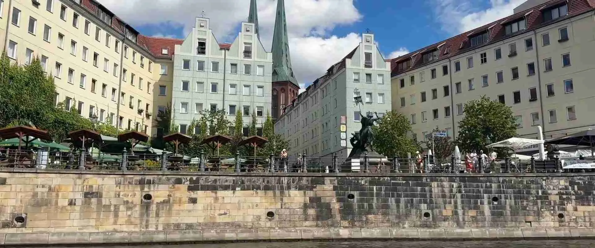
The Timber and the River: Urban Morphology and Hydrological Adaptation in the Historic Kolk Quarter in Berlin
Set in the floodplain of the Havel at its confluence with the Spree, the Kolk Quarter occupies the former Behnitz island in the historic center of Spandau — one of the oldest documented settlement areas of central Mark Brandenburg. Its narrow lanes, surviving sections of 14th-century town wall, and stock of Fachwerk (half-timbered) houses preserve a remarkably legible record of how medieval and early modern communities built on and with a braided river system, inviting comparison with the independently evolved timber canal towns of Jiangnan in China, where analogous hydrological pressures generated convergent spatial solutions through entirely separate building traditions.
Key Takeaways
- The Kolk Quarter takes its popular name from the German and Low German term Kolk — a deep scour hole formed by turbulent hydraulic action at a river bend, constriction, or confluence — making the neighborhood’s very name an index of the fluvial forces that created the site. The quarter occupies the Behnitz, a former elongated island between Havel channels whose Slavic name describes the same morphological reality: a sliver of land defined by the water around it.
- The Behnitz settlement is the oldest documented settlement area in Spandau’s Old Town, with first written records from the 13th century; a castle at Spandow — the predecessor of the Spandau Citadel — was already documented in a 1197 deed, establishing the island site’s strategic importance for controlling the Havel-Spree confluence and the trade that flowed through it.
- Fachwerk construction — a timber skeleton of posts, sill beams, and diagonal braces with non-structural infill panels — was the dominant building method of North German towns from the medieval period onward. In floodplain settings, the system’s structural flexibility on soft alluvial soils and the elevability of its sill beam above typical flood marks made it particularly appropriate for riverine sites like the Behnitz.
- The quarter’s surviving urban morphology — its island outline, narrow parcel grain, and lanes connecting interior plots to the water edge — encodes the organizing logic of a community built on river fishing and water-borne commerce, even where individual buildings have been rebuilt, reconstructed, or modified in the 18th, 19th, and 20th centuries.
- The Fachwerk buildings of the Kolk Quarter and the timber canal structures of Jiangnan water towns such as Wuzhen represent convergent but formally distinct responses to analogous environmental conditions: similar site-selection logic, comparable elevation strategies, and a shared sectional organization of commerce below and domestic space above, arrived at through entirely independent building traditions separated by thousands of kilometers and distinct cultural contexts.
- A 78-meter section of Spandau’s 14th-century brick town wall survives in the Kolk Quarter, representing the most legible structural artifact of the medieval phase and anchoring the quarter’s morphological identity as an edge zone between the island settlement, the defensive perimeter, and the surrounding water.
People Also Ask About the Kolk Quarter and Havel Riverine Architecture
What is the Kolk Quarter and why does its name derive from a geomorphological phenomenon?
The Kolk Quarter (Kolkviertel) is a historic neighborhood in the Old Town of Spandau — today a borough of Berlin but for most of its history an independent city in central Mark Brandenburg — situated on the former Behnitz island at the confluence of the Havel and Spree rivers. The quarter takes its popular name from the Low German term Kolk, denoting a deep pool or scour hole: a geomorphological feature created when turbulent hydraulic forces erode the bed of a river channel at a bend, constriction, or confluence, leaving a depression substantially deeper than the surrounding riverbed. In Spandau’s local usage, Kolk technically refers to one of the lanes on the Behnitz island, before expanding colloquially to denote the whole historic quarter. The geomorphological significance extends beyond the etymology: scour features characteristically develop at confluences where current velocities peak, producing the deepest, most reliably navigable water alongside elevated flanking banks well suited to building — precisely the conditions the Behnitz offered. The name is thus not merely a toponym but a compressed record of the hydraulic logic that made the site worth settling. Studies identify the Kolk as the oldest settlement area in Spandau, with first written records from the 13th century and an underlying Slavic settlement phase that likely extends into the 12th.
What characterizes Fachwerk construction in North German floodplain settlements?
Fachwerk — the German term for half-timbered construction — describes a structural system built around an articulated timber skeleton of upright posts (Ständer), horizontal sill beams and wall plates (Schwellbalken and Rähm), and diagonal bracing members, with the intervening infill panels (Gefache) filled with non-structural material such as wattle-and-daub, brick, or clay. In the North German lowland tradition, the system tends toward functionally placed bracing rather than the dense decorative elaboration of some Upper German variants. In floodplain contexts, three properties made Fachwerk particularly suited to riverine sites. First, the sill beam that carries the base of the frame can be set on a raised masonry plinth, keeping the most decay-vulnerable structural element above the saturation zone of typical annual flooding. Second, the jointed timber frame, when well constructed, accommodates the slight differential settlement that occurs on compressible alluvial soils without the cracking that a rigid masonry structure would exhibit under the same movement. Third, the relative lightness of the Fachwerk system reduces bearing pressure on weak substrates, broadening the range of sites where construction is viable. The Mark Brandenburg building environment, at the interface of Lower and Middle German Fachwerk traditions, produced buildings that combine the restrained northern structural vocabulary with moderate decorative articulation characteristic of the broader Brandenburg building practice.
How did medieval communities in Mark Brandenburg adapt their built environment to the Havel’s hydrology?
Medieval communities along the Havel adapted to the river’s hydrological character through accumulated practical responses at multiple scales rather than through any single engineered intervention. At the settlement scale, favored sites were the slightly elevated alluvial islands and natural levee crests that stood above seasonal flood levels — precisely the conditions the Behnitz offered. Building plots were oriented to maximize access to both the lane and the waterfront, with the river edge of a plot serving as a landing, a fishing station, or a water-borne goods depot. At the structural level, Fachwerk allowed habitable volume to be raised on a masonry sub-base without prohibitive complexity, separating the timber frame from direct contact with saturated soil. Oak heartwood — the primary structural timber — was selected for its exceptional durability in the wet-dry cycling that accelerates fungal decay in less resistant species. The fishing economy of the Behnitz community, documented in records that attest to the residents’ right to free fishing in the Havel, underlines how thoroughly the settlement organized itself around the river’s productive potential rather than treating the water primarily as a threat. The mill channel (Mühlengraben) that separated the Behnitz from the main Old Town island was simultaneously a hydraulic engineering artifact, a mill-power conduit, a defensive water barrier, and a managed navigation route — an infrastructure element whose multiple functions epitomize the integrated relationship between the river and the built environment in the medieval Havel town.
How do the timber riverine structures of the Kolk Quarter compare with the architecture of Jiangnan water towns?
The Fachwerk buildings of the Kolk Quarter and the timber canal structures of Jiangnan water towns such as Wuzhen represent convergent but formally distinct solutions to analogous environmental and economic pressures. In both traditions, buildings are organized to provide simultaneous access to the pedestrian commercial route and the water channel, and both orient habitable space above the seasonal flood zone — through raised sill beams on masonry plinths in the North German case, through stone canal walls and cantilevered timber platforms in the Jiangnan case. Both favor timber framing for the flexibility it provides on soft alluvial soils, and both place commercial or productive activity at the lowest accessible story with domestic living above. Yet the structural and formal expressions are entirely distinct. North German Fachwerk organizes the building around triangulated bracing within the wall plane, creating closed street frontages with the characteristic grid-and-diagonal surface pattern of exposed timber and filled panels. Jiangnan timber construction uses column-based post-and-beam framing independent of the wall, with cantilevered eaves, open canal-side arcades, and — distinctively in Wuzhen — cantilevered water pavilions (shuige) built on timber or stone piles directly over the canal, providing storage and commercial space literally suspended over the water. These are the products of two separate traditions responding to similar problems: the convergences reflect universal environmental logic; the differences reflect the distinct climatic, material, and cultural contexts within which each tradition developed.
Extended multi-day tours – 5+ days
Featured Berlin Multi-Day Tour Packages
6 days
6 Days of Discovery: Berlin’s Stories Through Time
- ✓ Comprehensive Berlin tour
- ✓ Expert local guides included
- ✓ All accommodation arranged
- ✓ Transportation provided

5 days
5 Days in Berlin: Discover Potsdam and Sachsenhausen with Expert Guides
- ✓ Comprehensive Berlin tour
- ✓ Expert local guides included
- ✓ All accommodation arranged
- ✓ Transportation provided
5 days
Berlin in 5 Days: From Sachsenhausen to Potsdam & Beyond
- ✓ Comprehensive Berlin tour
- ✓ Expert local guides included
- ✓ All accommodation arranged
- ✓ Transportation provided
7 days
Amsterdam, Berlin and Prague (9 destinations)
- ✓ Comprehensive Berlin tour
- ✓ Expert local guides included
- ✓ All accommodation arranged
- ✓ Transportation provided
Multi-day tour packages powered by TourRadar. Prices and availability subject to change.
Spandau and the Behnitz: Founding a City at the River’s Confluence
The site that would become Spandau was strategically compelling long before the first written record registered its existence. At the point where the Havel receives the Spree from the east, the river widens, slows, and braids around low-lying islands of glaciofluvial deposit. The medieval merchant, soldier, or administrator moving along either river encountered here not just a crossing but a chokepoint: anyone wishing to navigate from the Brandenburg interior toward the Elbe and the Hamburg trade network, or between the Slavic east and the German west, had to pass this confluence. The party controlling the islands controlled the passage, the toll, and therefore the trade.
A 1197 deed of the Ascanian margrave Otto II is the earliest surviving document placing a castle at Spandow — a fortress on a Havel island that would become the nucleus of the Spandau Citadel over the following four centuries. The castle’s island position was not incidental. By siting the defensive structure in the middle of the river channel, the Ascanian margraves ensured that the water itself became part of the fortification: attackers could not approach without navigating under the walls. This strategic logic of the defensive island, familiar from the episcopal complex on Cathedral Island (Dominsel) at Brandenburg an der Havel further upstream, was repeated and refined at Spandau, where the confluence geometry provided double water protection from both rivers simultaneously. Albert the Bear is credited in later accounts with building a frontier fortress at the confluence site in 1157, establishing the site’s military function well before the 1197 documentation; the long trajectory from that early frontier post to the fully articulated bastion fortress of the Spandau Citadel (built 1559–1594) reflects the evolving relationship between military technology, river control, and the political ambitions of the Mark Brandenburg margraves.
The civilian settlement grew alongside the castle. Spandau received civic rights on 7 March 1232 when the margraves John I and Otto III granted its citizens further privileges — a document implying an already-functioning urban community. The first church is recorded in 1240. By this date, the Behnitz settlement had almost certainly taken shape as a distinct sub-community: a fishing village stranded between river channels, separated from the main Old Town island by the mill channel (Mühlengraben), which provided hydraulic power for milling operations while functioning simultaneously as a defensible water barrier between the civilian sub-districts of the town.
The name Behnitz derives from a Slavic root describing an elongated island — the precise physical form that a braided river creates when differential deposition builds up sediment between channels of unequal velocity. Before the German settlement, a Slavic community had already occupied the Behnitz as part of the fortress settlement, practicing the river fishing that would remain the economic foundation of the island community through the early modern period. A surviving document attests to the Behnitz residents’ right to free fishing — a formal legal record that points to fishing as not merely a casual activity but a constitutive economic privilege worth protecting in writing, the legal crystallization of an entire community’s relationship with the river.
By the 14th century, the town had achieved sufficient urban confidence to commission a comprehensive defensive perimeter. Spandau’s town wall, built primarily in brick in the manner characteristic of North German Brick Gothic construction across the Mark Brandenburg, enclosed the Old Town and incorporated the Behnitz within its circuit. A 78-meter section of this 14th-century wall survives in the Kolk Quarter today, together with evidence of a tower incorporated in its rear face — the best-preserved stretch of Spandau’s original defensive boundary and the most tangible structural artifact of the medieval phase that the quarter retains. The integration of the wall circuit with the Behnitz island underlines the quarter’s dual character: a civilian fishing settlement and a defended node within the town’s military perimeter simultaneously, the island’s water boundaries serving both as natural defenses and as fishing grounds.
The Spandau Citadel built between 1559 and 1594 on the medieval castle’s foundations — incorporating the earlier Julius Tower (Juliusturm), recognized as Berlin’s oldest surviving structure — is today considered one of the best-preserved Renaissance military fortifications in Europe. The citadel’s island position, commanding the Havel-Spree confluence from a heavily moated bastioned fortress, represents the fully developed early modern expression of a defensive logic that the 1197 castle had already established: river islands do not merely provide a building site; they are themselves military infrastructure, transforming the water that surrounds them from a navigational resource into a weapon of defense.
Fluvial Geomorphology of the Middle Havel: Islands, Channels, and Alluvial Soils
To understand the Kolk Quarter as an architectural and urban phenomenon, it is necessary first to understand the physical character of the landscape that produced it. The Havel is a river of the North German Plain, rising in the lake district of Mecklenburg and flowing south and west through a broad lowland valley before joining the Elbe at Havelberg. Its hydrological character is that of a mature lowland river: low gradient, gentle current, and a tendency to braid around depositional islands and meander across a wide floodplain whose extent far exceeds what the river’s current discharge would naturally produce.
The valley through which the Havel flows in the Brandenburg region is not primarily the river’s own creation but the legacy of glacial processes that predate the present river by tens of thousands of years. During the Pleistocene, vast quantities of meltwater from the receding Scandinavian ice sheet carved broad, flat-bottomed valleys across the North German Plain — the glacial meltwater valleys (Urstromtäler) that are the dominant geomorphological signature of the landscape. The Havel occupies one such valley, and the width of its floodplain — often several kilometers across — far exceeds what the river’s current flow would naturally excavate. The Havel appears, in this sense, over-dimensioned for its valley: a modest modern river running slowly across a floor that was shaped by forces of an entirely different scale and age.
The soils of the floodplain reflect this glaciofluvial history. Beneath the modern alluvial deposits — silts, clays, and fine sands laid down by Holocene flood events — lie the glacial outwash sands and gravels of the Pleistocene. These underlying sands drain relatively freely, but the surface alluvium is more varied and often poorly drained, particularly where fine-grained deposits have accumulated in slack-water zones behind river bends or on the trailing edges of alluvial islands. At the Havel-Spree confluence, where the two rivers merge and simultaneously decelerate, deposition is particularly active: the loss of velocity as the tributary meets the main channel causes both rivers to drop their suspended sediment load, gradually building up the islands and bars around which the channels braid. The Behnitz is precisely such a depositional island — a feature of sedimentary accumulation whose form is continuously shaped by the balance between deposition during low flows and erosion during high-energy flood events.
The term Kolk as a geomorphological designation refers to a scour hole: a depression in the riverbed formed by turbulent hydraulic action. Scour occurs preferentially at channel bends, where centrifugal forces direct the fastest water toward the outer bank and drive helical secondary currents that excavate the bed; at constrictions, where the same discharge accelerates through a narrower cross-section; and at confluences, where two flow masses collide and the resulting turbulence can scour the bed to depths substantially greater than the surrounding channel. At the Havel-Spree confluence — precisely the downstream end of the Behnitz — all three scour-producing conditions overlap. The deep pool associated with the Kolk scour feature, navigable for laden medieval boats in conditions where surrounding shallows were impassable, was a primary determinant of the site’s value. The deepest water was at the confluence point, and the settlement grew on the adjacent bank and island because that was where the navigable depth was.
The alluvial soils of the Behnitz impose specific structural demands on any building placed upon them. Fine-grained alluvial deposits — silts and clays — are compressible under load: a heavy masonry structure can sink differentially into such soils as the moisture content varies seasonally with the rise and fall of flood waters, with one corner or wall settling more than another as the underlying material consolidates unevenly. Sandy alluvial deposits drain more freely but can be susceptible to hydraulic disturbance during major flood events. In practice, the mixed alluvial substrates of the Havel floodplain — variable across the Behnitz depending on proximity to the channel edge and the depth of depositional layers — present the builder with a foundation environment that rewards lightweight construction, distributed bearing loads, and structural systems that can tolerate modest differential movement without failure. All of these demands point toward timber framing as the appropriate structural system, and toward Fachwerk in particular as the North German expression of that system refined over centuries of building practice on the lowland riverine sites of the Mark Brandenburg.
The Havel’s seasonal flow regime shaped the physical form of the Behnitz settlement in ways that go beyond the simple matter of flood risk. The river’s peak discharge, in the pre-regulation era before modern upstream hydraulic management, followed winter and early spring rainfall and snowmelt, with lowest levels typically in late summer. The seasonal variation in water level affected not only the frequency of flood inundation but the navigability of the shallower channels around the island, the productivity of the fishery at different times of year, and the accessibility of the island to the rest of the town across the mill channel. The settlement’s physical organization — the siting of the most permanent structures on the highest ground, the location of working and storage functions nearer the water edge — was calibrated to this seasonal rhythm in ways that can still be read in the spatial structure of the surviving lane system and the island topography.
Medieval Urban Grain: Parceling, Plots, and Street Morphology on the Behnitz
Urban morphology — the study of the physical form of settlements and the processes that generated them — treats the parcel as one of its primary analytical units. Parcels encode the economic and social logic of the community that laid them out: their frontage width reflects the balance between land value (narrower frontages maximize waterfront or street access per unit of land) and structural practicality (a house must exceed a minimum width to be habitable). Their depth reflects the range of activities a household was expected to accommodate — frontage to the street or water, a working yard, outbuildings, a garden. And their orientation relative to the street or water body reflects the dominant direction of commercial and social access that the community valued most highly.
In the North German medieval town, the standard parcel type is the strip plot (Streifenparzelle): narrow in street frontage and deep perpendicular to the primary street, accommodating the full range of household and commercial functions in a longitudinal sequence from public face to private rear. This form appears across the region with remarkable consistency, from the Hanseatic ports of the Baltic coast to the river towns of the Mark Brandenburg interior. The explanation lies in the economics of medieval merchant urbanism: a household wishing to maximize its street presence — for display of goods, for accessibility to customers, for social visibility in a commercial community — would minimize its frontage width while extending its depth, fitting as many households as possible into a given length of commercially valuable street. The result is the distinctive narrow-house pattern of the North German medieval town: buildings two to five meters (or more, for prosperous households) wide at the street, reaching far back into a sequence of courtyard, outbuilding, and garden.
On the Behnitz island, the constraints of the riverine site gave this parcel logic a distinctive spatial elaboration. The island is elongated — its long axis running roughly parallel to the Havel channel — and bounded on multiple sides by water. This means that the Behnitz had not one commercially valuable edge but several: the mill channel (Mühlengraben) side and the main Havel channel side both offered direct access to the river traffic that sustained the island’s economy. Plots oriented toward either edge would have rear water access of commercial value — not merely a private garden but a productive interface with the river. The organization of the island’s narrow alleys and lanes — of which the Kolk lane running from Hoher Steinweg down to the river and the lock (Schleuse) is the most evocative survivor — reflects this double-fronted logic: a settlement organized to exploit access from multiple water edges simultaneously, with the lane system threading between plots that looked outward to the channels on both sides of the island.
The medieval process of parcel subdivision (Parzellierung) in Mark Brandenburg followed patterns established through the high medieval period of Ascanian urbanization. The margraves’ foundation towns of the 12th and 13th centuries — laid out to attract settlers and generate commercial activity in the newly consolidated eastern territories — typically assigned regular plots within a clearly bounded framework of streets, a market, and a parish church. On the Behnitz, the organizing framework was not a blank planning grid but the physical reality of the island: the edges of the water defined the parcel boundaries on the outer sides, and the lanes emerged organically as the connective tissue between the waterfront plots and the island’s interior. The slight irregularity of the surviving street geometry — the gentle curves and minor misalignments that give the Kolk lanes their evocative compressed quality — suggests not planned regularity but the organic accretion of a settlement shaped primarily by the topography of its island site rather than by the surveyor’s rod.
What survives of this morphological system in the Kolk Quarter today is not primarily the buildings — most of which date from the 18th or 19th century, with some reconstructed in the 1970s and 1980s — but the pattern: the lane alignments, the island outline, the width of plots as expressed in the rhythm of façades along the alley, and the preserved connections between the island interior and the water edge. The cobblestone paving of the narrow lanes, the relative scale of buildings to lane width (a compressed relationship characteristic of medieval riverine quarters, where land economy on an island demanded efficiency in every dimension), and the survival of the path between buildings that descends to the Havel and the lock — where local accounts note that Spandauers formerly drove their livestock to the water — all encode the morphological inheritance of the Behnitz even as the individual buildings have changed. This is the central insight of urban morphological analysis as applied to historic river towns: the plot boundaries and street alignments of a medieval settlement tend to outlast the buildings that originally defined them, persisting through centuries of rebuilding because the economic and legal logic that generated them remains operative across successive generations of property ownership. The urban morphology of the Kolk Quarter is, in this sense, a more ancient document than any of the buildings standing within it.
The functional logic of the surviving lane network becomes fully legible only when read against the dual water-access requirement of the Behnitz community. Each lane that penetrates the island from the mill-channel side connects through to the Havel side, or terminates at a working yard or water-access point at the island’s edge. The commercial and productive life of the settlement moved along these lanes between the two waterfronts: fish brought up from the Havel channel, processed or sold in the island’s interior, transported outward across the mill channel to the Old Town market. The lanes were not incidental features of a residential neighborhood but the arteries of an island economy organized around continuous movement between water edges. In preserving their alignments and widths, the Kolk Quarter preserves the spatial logic of that economy even after its economic content has long since transformed.
Vernacular Fachwerk Framing Techniques along the Havel Floodplains
The half-timbered Fachwerk tradition that characterizes the Kolk Quarter’s surviving building stock — and that, more broadly, defined the domestic and commercial architecture of the North German river towns of Mark Brandenburg from the medieval period through the 19th century — represents one of the most complete vernacular responses to the specific challenges of constructing on soft, seasonally inundated alluvial ground that the European building tradition developed. To understand it fully is to understand not merely a structural system but an accumulated body of empirical knowledge about materials, soils, moisture, and the behavior of timber under the particular stresses of a riverine building environment.
The Fachwerk buildings visible in the Kolk today — principally the examples at Kolk 4 and Kolk 5, the former dating in its current form from approximately the mid-19th century before being reconstructed in 1979, the latter displaying an extraordinary half-timbered façade restored in the same decade — are not medieval buildings. No building from the 12th or 13th-century Slavic and early German settlement phases survives above ground in the quarter; the oldest structural fabric present is the brick town wall of the 14th century. The Fachwerk houses of the Kolk represent a later building phase, continuing and adapting the timber-framing tradition, and they are significant primarily for the typological continuity they maintain with the earlier built environment and for the spatial and visual character they bring to a streetscape that preserves a medieval morphological inheritance. This distinction — between the morphological legacy (the parcel pattern, the island form, the lane grain, the water-edge connections) and the structural fabric (the specific buildings standing on those parcels today) — is fundamental to any honest architectural reading of the Kolk Quarter.
Structural Anatomy of North German Fachwerk: Sill Beams, Corner Posts, and Diagonal Bracing
The structural grammar of the North German Fachwerk system is built around a small number of carefully differentiated elements, each performing a specific and non-redundant structural role. The sill beam (Schwellbalken) is the horizontal base member that carries the entire timber frame. It sits on a masonry plinth or base-course — in floodplain contexts, deliberately elevated above ground level to prevent contact with saturated soil or flood water — and provides the datum from which all vertical members rise. The sill beam is both the most critical and the most vulnerable element of the system: if it rots, the structural integrity of the entire frame above is compromised from the base. Its careful selection from the most durable available timber, its precise elevation on the masonry plinth, and its detailed joinery at the corners where it intersects with the sill beams of adjacent walls are all expressions of the builder’s awareness of this vulnerability.
From the sill beam rise the upright posts (Ständer), the primary vertical structural elements. Corner posts (Eckständer) are typically the largest and most carefully worked posts in the system, receiving the diagonal braces from multiple directions and carrying concentrated loads from the upper structure to the corners of the masonry base. Intermediate posts divide the wall into structural bays — the repeating modular unit of the Fachwerk system — each bay defined by two posts and bridged at its top by a horizontal element (the Rähm or wall plate) that carries the floor joists of the story above. The number of bays per story and per façade establishes the structural and visual rhythm of the building: the alternation of exposed timber frame and filled panel that makes Fachwerk buildings instantly recognizable as a building type.
Diagonal bracing members (Streben) are inserted into the bays to resist the lateral forces — primarily wind, in the lowland building environment of the Havel plain — that would otherwise cause the frame to rack out of square. In the North German tradition, bracing geometry tends toward the functional rather than the decorative: a single diagonal or a paired set in each bay, angled to resist the predominant direction of loading, without the dense elaboration of overlapping and crossing members found in some South German and Alsatian examples. In floodplain buildings, the structural priority of efficient bracing is amplified by the additional lateral pressures that standing flood water can exert against the base of the wall, and by the risk of racking deformation as the soft alluvial foundation settles differentially under the building’s weight. A well-braced Fachwerk frame resists these forces through triangulation — the inherent geometric rigidity of the triangle — in a way that no purely rectangular frame of posts and beams could match without additional stiffening.
The infill panels (Gefache) between structural members are non-structural: their function is weather-tightness, thermal performance, and visual continuity, not load-carrying. The earliest and most widespread infill technique in North German vernacular construction was wattle-and-daub: a grid of interwoven branches or laths applied to wooden stakes driven into the post faces, then plastered on both sides with a mix of clay, sand, and chopped straw or hair. From the early modern period onward, brick infill (Backsteinausmauerung) became increasingly common as local brick production expanded, offering better durability and fire resistance at the cost of additional weight. In floodplain contexts, brick infill’s superior resistance to moisture penetration after flood events also argued in its favor over clay-based alternatives whose structural matrix can be softened by prolonged saturation.
Timber Selection and Durability in a Floodplain Building Environment
The choice of timber species for Fachwerk construction in the Havel region was, in the medieval and early modern periods, effectively constrained by local forest composition, with oak (primarily Quercus robur, the pedunculate oak that dominates the wet valley-floor forests of the North German lowlands) occupying a dominant position for all primary structural members. The practical reasons were empirically well understood by generations of craftsmen who worked with the material: oak heartwood is among the most naturally durable timbers available in the temperate European deciduous forest, demonstrating exceptional resistance to fungal decay and insect attack across the cycles of wetting and drying that define the building environment of a floodplain site.
The durability of oak heartwood in wet-dry cycling conditions derives from the high concentration of tannins and related phenolic compounds in the heartwood cells, which inhibit the enzymatic activity of wood-degrading fungi. In permanently wet conditions — consistently submerged or saturated timber — many wood species survive indefinitely because the exclusion of oxygen prevents aerobic fungal metabolism. It is precisely the repeated alternation of wetting and drying that is most destructive: the mechanical stress of swelling and shrinking cycles opens the wood structure to pathogen infiltration at the same time that the return of moisture and oxygen creates conditions for active biological degradation. Oak heartwood’s performance in this regime is substantially better than that of most other available North German species, making it the unambiguous choice for the sill beam — the element in most direct and sustained exposure to the floodplain moisture cycle — and for the corner posts most exposed to rain splash, rising damp, and wind-driven moisture at the critical transitions between masonry base and timber frame.
Pine (primarily Pinus sylvestris, the Scots pine dominant in the sandy-soil woodland of the Brandenburg uplands) was used for secondary structural roles — floor joists, rafters, internal partitions — where less durable material was acceptable because of protection from the worst moisture exposure. The Brandenburg region’s forests provided both timber types in proximity to river towns, and the transport of logs by raft along the Havel itself was a routine element of the medieval and early modern building economy: the river that challenged the builder was simultaneously the logistics infrastructure that supplied the solution. The mill channel (Mühlengraben) at the Behnitz, associated with milling operations requiring hydraulic power, was also likely involved in timber floating and sawmill operations, since mill sites characteristically combined multiple water-power applications at the same location.
The processing of structural timber for Fachwerk — the conversion from round log to hewn rectangular section — was accomplished in the North German tradition primarily through adzing and hewing rather than pit-sawing for the largest structural members. Hewn sections preserve the outer, denser layers of the trunk on all four faces, maintaining the more decay-resistant wood at the surface; pit-sawn sections expose the more porous interior material at the cut faces, creating pathways for moisture penetration that are absent in a hewn equivalent. The practical knowledge of this difference — that hewn members outlasted sawn ones in exposed conditions — was built into the craft tradition of Fachwerk carpentry without requiring a formal understanding of the underlying wood science. The craft tradition encoded the accumulated empirical evidence of which details worked and which failed, transmitted through apprenticeship and practice across generations of builders working on the alluvial sites of the Mark Brandenburg river towns.
Defensive Islets and Medieval Navigation Routes through Central Mark Brandenburg
The relationship between defensive island strategy and the control of riverine navigation in central Mark Brandenburg is not incidental but constitutive of the regional settlement pattern: the two functions were inseparable in the political and economic geography of the medieval margraviate, and the Behnitz island’s history illustrates the principle with unusual clarity. The island’s primary value in the earliest phase of settlement was positional: sitting between the Havel channels at the point where the Spree joined from the east, the Behnitz island and the adjacent castle island commanded both rivers simultaneously. Any vessel moving along either waterway had to pass within sight — and within striking range — of an occupant of the confluence islands.
The broader navigation network of central Mark Brandenburg organized itself around this logic of river-island control. The Havel, flowing from its Mecklenburg headwaters through the Brandenburg interior to the Elbe confluence at Havelberg, was the main artery of the region’s inland trade. Grain, wool, timber, fish, salt, and woven goods moved along its current in the shallow-draught flat-bottomed vessels suited to its slow, meandering character. The river’s strategic value was immense: control of the Havel meant influence over the economic life of a large agricultural hinterland. The Ascanian margraves who consolidated the Mark Brandenburg in the 12th century understood this in architectural terms, expressing it in their pattern of castle placement: the early fortresses of the Mark — Spandow, Brandenburg an der Havel, Havelberg — were systematically positioned at defensible island or peninsula sites along the Havel corridor, each controlling a critical navigation point while spacing their garrisons at intervals calibrated to the river’s geography and the reach of medieval mounted force.
The castle at Spandow, documented in 1197 and evolving across the Julius Tower into the Spandau Citadel of 1559–1594, occupied the most sensitive navigation point on the upper-middle Havel system: the confluence with the Spree, where the river network’s two main arteries met. A toll station at this confluence could levy dues on all traffic moving between the Baltic hinterland via the Spree and the Elbe trade network via the Havel — the two major axes of the region’s commerce crossing at a single geographic point. The defensive logic and the fiscal logic were inseparable: controlling the passage meant controlling the commerce. The Behnitz settlement grew up in the hydraulic and strategic shadow of this control function, its residents fishing the confluence waters that the castle’s garrison held politically, the island’s civilian and military uses coexisting within the same fortified perimeter as it expanded through the 13th and 14th centuries.
The navigation infrastructure of the medieval Havel was modest by later standards. The river’s natural channel, supplemented by mill channels and weirs at points where gradient changes made water-power extraction economically viable, served as the navigational corridor without the systematic locks and pound-weirs of the later canal era. Weirs — low structures built across the channel to back up water for mill operation — interrupted navigation, requiring either portage around the obstruction or a flash-lock: a removable section of the weir through which a vessel could shoot on the pulse of released water. The mill channel (Mühlengraben) associated with the Behnitz represents precisely this type of hydraulic infrastructure: a channel cut to divert water to a mill, functioning simultaneously as a controlled navigation route between the island settlement and the Old Town — a passage of short distance but significant strategic and economic importance, since it controlled access between the two main civilian zones of the town.
The Havel’s navigability as a trade artery connected the Mark Brandenburg’s interior to the wider economy of northern Europe. Upstream lay the Brandenburg lake district with its resources of freshwater fish, peat, and timber. Downstream, the Elbe connection at Havelberg opened access to Hamburg’s North Sea commerce, to the salt trade of Lüneburg that preserved the region’s fish catch for export, and to the Hanseatic network that integrated the commercial towns of the North Sea and Baltic coastlands into a single trading system. The towns strung along the Havel — Havelberg, Brandenburg an der Havel, Spandau — each occupied nodes in this network, each controlling a passage and hosting markets that extracted value from the through-traffic of the river system. The Behnitz and its Kolk Quarter were the smallest-scale expression of this navigational logic: not a major commercial hub but a specialist fishing community in the immediate hydrological shadow of the confluence’s strategic pivot point, sustained by the river’s biological productivity at precisely the site of its political control.
Foundation Strategies on Alluvial Ground: Adapting Fachwerk to the Havel Floodplain
The foundation of a Fachwerk building on the alluvial soils of the Behnitz required a characteristic negotiation between the structural requirements of the building, the load-bearing capacity of the substrate, and the seasonal hydrological conditions of the site. Unlike masonry construction, which concentrates load along continuous bearing walls and thus demands relatively even strip foundations, a Fachwerk structure concentrates load at the base of each post — particularly the corner posts and primary intermediate Ständer — creating a pattern of discrete, higher-intensity point loads at relatively wide spacings.
On competent soils, this load pattern allows a relatively simple foundation: a spread pad of stone or brick beneath each post, set at depth sufficient to avoid frost heave. On compressible alluvial soils, the critical challenge is differential settlement: if one area of the foundation substrate consolidates more than another — because of localized variation in soil composition, moisture content, or the thickness of soft layers — the building frame will rack, joints will open, infill panels will crack, and the integrity of the weathering envelope will be compromised. The Fachwerk system’s ability to tolerate modest differential settlement without catastrophic structural failure was, in the floodplain context, a genuine and perhaps decisive advantage over masonry: the jointed timber frame, when well proportioned and carefully constructed, can accommodate movements that would crack a rigid brick or stone box beyond repair.
The strategies that North German Fachwerk builders used to minimize differential settlement on river-valley sites included continuous stone or brick base-courses running beneath the sill beam along the full wall length — distributing load more evenly than isolated pads — and, in some documented cases, timber grillages laid at foundation depth to spread loads over a larger area of weak soil. Where the depth to more competent gravelly material was not excessive, the masonry base-course walls were extended downward as rubble-masonry strips to reach better-bearing ground. And in all cases, the elevation of the sill beam above the zone of frequent inundation — by seating the base-course on a plinth that extended above the empirically observed flood mark — kept the primary structural timber in the zone of air-drying rather than permanent saturation.
The visible “warped” and slightly irregular character of the surviving Fachwerk houses in the Kolk lanes — their gentle leans and modest deformations that observers consistently describe as giving the quarter its evocative historic character — are the surface expression of precisely these foundation dynamics: structures that have settled differentially over the decades and centuries of their occupation, the timber frame accommodating the movement through the flexibility of its jointed construction, successive generations of occupants and maintainers repointing panels, wedging settled joints, and renewing decayed sill sections without disturbing the frame above. The buildings’ imperfections are not defects but records — legible evidence of the alluvial foundation conditions that Fachwerk construction was specifically developed to manage.
Hydrological Adaptation: Building Strategies for a Braided River Environment
The term “hydrological adaptation” in architectural and urban geography denotes the suite of responses — in site selection, building form, construction material, spatial organization, and land use — that a community develops over time in calibrated response to the specific hydrological character of its location. In the Kolk Quarter, these adaptations were not the product of a single design moment or a programmatic engineering strategy but of an incremental, generational accumulation of building experience tested against the observed behavior of the Havel and its channels at the Behnitz site. The buildings and the street pattern encode this experience in spatial and material form.
At the most fundamental level, the selection of the Behnitz as a settlement site was itself a hydrological adaptation: the island’s slight topographic elevation above the surrounding floodplain — modest in absolute terms but sufficient to place the ground surface above the level of typical annual flood events — was the basic physical condition that made habitation viable. The island’s elongated form, with its long axis roughly aligned with the principal direction of current flow, minimized the cross-section presented to flood velocities, reducing hydraulic pressure against the built fabric and limiting the accumulation of flood-carried debris against the island’s upstream face. Both of these properties — elevated surface and streamlined form — are characteristics that the braided-river depositional process tends to produce in the islands it builds, and their simultaneous presence on the Behnitz reflects the convergence of depositional geomorphology with the requirements of human settlement.
Within the island, the spatial logic of the settlement further differentiated exposure to flood risk. The most elevated and least flood-prone ground — typically the central ridge of the island, where the cumulative effect of centuries of flood-deposited sediment has built up the highest surface — supported the most permanent and most valued structures. The lower, more flood-exposed areas near the waterfront and the mill channel accommodated functions that could tolerate intermittent inundation: storage for goods elevated on platforms within the building, fish-processing areas at or near the water edge, the working yards and landing stages that required direct river contact. This vertical and horizontal differentiation of land use by flood probability — habitation above on higher ground, production and storage below and nearer the water — is a spatial strategy that appears with striking consistency across the vernacular buildings of floodplain communities across many cultural contexts and reflects the universal logic of risk management in an environment of seasonal hydrological variability.
At the building scale, the elevated ground floor was the primary architectural expression of hydrological adaptation in the Fachwerk tradition. By setting the sill beam on a masonry plinth calibrated to the observed flood level — typically several centimeters to half a meter above the surface of the highest regular flood event, as recorded by empirical observation over generations — the builder created a dry habitable zone at ground level without the complexity or cost of a fully elevated structure on stilts. The plinth height was not calculated by formula but set by the accumulated knowledge of which buildings had flooded and which had not, translating the memory of past flood events into the physical dimension of a building detail. The base-course transition from masonry to timber, visible on the exterior of every surviving Fachwerk building in the quarter, is a direct architectural record of this calibration.
The management of moisture in the period after flood events was equally important. When the Havel’s waters receded from the lower areas of the Behnitz — a process that could take days to weeks depending on the scale of the flood event and the drainage capacity of the saturated island soils — the building fabric needed to dry as completely and rapidly as possible to prevent fungal colonization of moist timber and the failure of weakened infill panels. The relatively open nature of traditional Fachwerk construction — the vapor permeability of lime-plastered wattle-and-daub infill, the slight gaps at joints that allowed convective drying of wall-enclosed air volumes — facilitated this process. The vernacular wall breathed: moisture entered during floods and evaporated during the subsequent dry period through the same pathways, limiting the duration of each wet cycle within the building’s fabric and thereby reducing the cumulative decay stress on the structural timber.
Convergent Solutions: Timber Riverine Urbanism in the Kolk Quarter and Jiangnan China
The Jiangnan region of China — the area south of the Yangtze River, encompassing today’s Zhejiang and Jiangsu provinces and parts of Anhui — presents one of the world’s most extensively preserved and studied traditions of timber canal-side urbanism. The historic water towns of the Yangtze River Delta, among which Wuzhen, Tongli, Xitang, Zhouzhuang, and Nanxun are the most widely documented, were built on a floodplain geologically and hydrologically analogous in many respects to the Havel valley: a low-lying alluvial plain of considerable age, densely cut by a network of natural and engineered canals, and subject to seasonal inundation from the combined effects of monsoon rainfall and river overflow. The ancient town of Wuzhen, established according to local records during the Tang dynasty, preserves Ming and Qing dynasty architectural fabric alongside much earlier urban organizational patterns that reflect a centuries-long tradition of building in close integration with the canal system. The “Jiangnan Historic Water Towns” — encompassing Wuzhen, Xitang, Zhouzhuang, and Luzhi — were added to China’s UNESCO World Heritage Tentative List in 2008, reflecting international recognition of their cultural and architectural significance, though they have not yet achieved full World Heritage inscription.
A scholarly study published in the Traditional Dwellings and Settlements Review documented the urban form of Wuzhen and Zhouzhuang and noted that the Jiangnan water towns are “known for their timber-frame houses, historic commercial streets, and balanced land-water layout,” characterizing them as transitional spaces between rural-agrarian and urban-commercial systems that developed their distinctive urban culture over many centuries based on an integrated network of waterways. This characterization applies with near-equal precision to the Kolk Quarter on the Behnitz: a settlement whose urban form is determined by the balance between its land area and its water access, organized around the commercial and productive potential of the river system that surrounds it.
The most immediately apparent convergence between the two traditions is sectional: in both the Kolk Quarter and the Jiangnan water towns, the standard two-story building places commercial, storage, or productive functions at the ground floor and domestic private space above. This section organization is not cultural convention but direct environmental logic: the lower story, most exposed to the risk of inundation, is assigned uses that can tolerate occasional flood damage and recover from it — fish storage with elevated platforms, craft workshops, market displays. The upper story, protected by the height of the floor above the flood maximum, contains the domestic interior that must remain continuously habitable. The convergence of two independent building traditions on this same sectional strategy reflects the universality of the problem they are both solving: how to maintain habitable and productive space within a structure that is periodically subject to groundwater rise and flood inundation from below and from the sides.
A second convergence lies in the organization of each building’s relationship to the water. In both traditions, a functional connection between the building’s interior and the canal or river edge is maintained as a constitutive element of the building’s use, not an afterthought. In the Kolk Quarter, this takes the form of the paths between buildings that descend through the island to the water edge and the lock — spatial connectors whose persistence through successive building generations reflects the continuing functional necessity of direct water access for a fishing and trading community. In Wuzhen, the most striking architectural expression of this principle is the water pavilion (shuige): a cantilevered room or storage space built on timber or stone piles driven into the canal bed, with wooden beams and boards forming its floor directly over the water. The shuige allows loading and unloading from canal boats without leaving the building and provides additional floor area on land too narrow to accommodate a full-depth structure on solid ground. While the formal solution differs entirely — a cantilevered room over water versus a path down to the water’s edge — the functional requirement it addresses is identical: maintaining productive contact between the built environment and the waterway that is simultaneously the site’s primary transport infrastructure and economic resource.
The relationship between buildings and the commercial waterfront also shows convergent organizational logic while differing in geometric expression. In Jiangnan water towns, the primary streets run parallel to the canals, with buildings lining both the pedestrian walkway side and, via the shuige, the canal side directly. Along the waterfront walkway, the covered arcade (lang peng) — a cantilevered wooden porch extending over the waterside lane — provides continuous sheltered passage for pedestrians and traders along the canal edge. In the Kolk Quarter, the primary lanes are perpendicular to the water edges, threading across the island from the mill channel to the Havel channel, with individual buildings fronting the lanes and accessing the water via their rear plots and the inter-building passages. The geometric difference — parallel organization in Jiangnan versus perpendicular organization in the Kolk — reflects the different urban structures of the two contexts: in the Jiangnan water towns, streets and canals run in parallel systems, with buildings straddling the space between; in the North German river-island town, a perpendicular lane system threads across an island between multiple water edges, creating a double-fronted organization that runs counter to the canal-parallel grain of the East Asian tradition.
The structural systems diverge completely, and this divergence is as instructive as the convergences. North German Fachwerk is a wall-frame system: structural integrity is distributed through the wall plane via triangulated diagonal bracing, and the building’s visual exterior is the structural system made visible — a surface of timber members and infill panels that reads as a load-bearing enclosure. The dominant Jiangnan structural system is column-based post-and-beam construction: load-bearing columns within the floor plan carry roof and floor loads through a beam-and-rafter hierarchy entirely independent of the wall planes, which are lightweight partitions capable of being opened, moved, or omitted without affecting the building’s structural stability. The deeply cantilevered eaves of Jiangnan timber buildings — extending well beyond the wall face to shed the intense monsoon rainfall away from the base of the structure — have no equivalent in the steep-gabled Fachwerk buildings of the Havel plain, where the primary roof challenge is not tropical rainfall intensity but snow load accumulation over long winters.
These structural and formal differences reflect the divergent climatic, material, and cultural contexts within which the two traditions developed independently. The North German temperate maritime climate — cool, consistently moist, with significant snow loads — demands steep roofs, closed perimeter walls for thermal retention, and structural systems that can resist wind loading in exposed lowland conditions. The Jiangnan subtropical humid climate — hot, wet monsoon summers, mild winters — demands deep overhanging eaves to manage solar gain and monsoon rain, open interior planning for cross-ventilation, and canal-side covered walkways to provide shaded outdoor commercial space. That both traditions, working within these very different climatic envelopes, converged on the same fundamental organizing principles — elevation above flood, water-edge access, timber framing on alluvial soils, commerce below and domesticity above — argues for the robustness of those principles as environmental solutions rather than cultural choices. The differences in formal and structural expression argue equally for the autonomy and internal coherence of each tradition: two complete, self-consistent answers to a shared set of questions, developed without knowledge of each other’s existence.
Heritage Preservation and Conservation Challenges in the Kolk Quarter
The Kolk Quarter presents heritage professionals with a challenge more demanding in some ways than the conservation of straightforwardly intact historic fabric: maintaining and communicating the significance of a place whose primary heritage value lies in its urban morphology and spatial character rather than in the antiquity of its individual buildings. Most of the standing structures date from the 18th or 19th century; the reconstruction programme in the quarter was completed in 1986. The buildings are not ancient, but the place in which they stand is, and the relationship between the two — between relatively recent fabric and genuinely ancient spatial structure — is the central question for conservation thinking in the Kolk.
The physical conservation of Fachwerk buildings in a moisture-rich floodplain setting demands specific technical competencies. The most pervasive threat is biological decay — primarily fungal attack on structural timber, concentrated at the elements of greatest moisture exposure: the sill beam, the lower sections of corner posts, and the base of infill panels where rising damp and splash penetration are most intense. Conservation practice requires periodic inspection with probing instruments to detect hidden decay within apparently sound timber, followed by selective replacement of failed sections using timber of matched species and equivalent grain density. Replacement sill beams and post sections for North German Fachwerk buildings are properly specified as air-dried oak heartwood — not kiln-dried softwood substitutes that lack the durability characteristics of the original material — and connected to the surviving fabric using traditional peg-fastened mortise-and-tenon joinery that avoids the galvanic staining and differential thermal movement associated with metal fasteners in historic timber structures.
Infill panels present their own conservation challenges. Original wattle-and-daub panels, where they survive beneath later plaster coatings, require careful repair with compatible lime-clay mixes that preserve the panel’s vapor permeability — its capacity to transmit moisture in the vapor phase through the wall section without creating condensation within the assembly. The widespread use of cement-based mortars and renders in 20th-century repairs of historic Fachwerk buildings across North Germany has proved consistently damaging: cement is orders of magnitude less vapor-permeable than the lime-based materials it replaced, and it traps moisture behind the facing, creating conditions in which freeze-thaw cycling, sub-surface decay, and panel detachment are accelerated. Conservation programmes have progressively replaced cement repairs with lime-based systems specifically to restore the breathing capacity of historic wall assemblies — a quality that the floodplain building environment demands with particular urgency.
The specific floodplain character of the Kolk’s location adds further complexity. Periodic flood events — whether from the Havel itself or from groundwater rise during sustained rainfall — subject the building fabric to the wet-dry cycling that is most destructive to timber and most likely to trigger fungal activation if the subsequent drying phase is prolonged or incomplete. Post-flood assessment and accelerated drying of affected fabric — through improved sub-floor ventilation, temporary dehumidification, and the removal of floor coverings that impede evaporation from the ground slab — are essential elements of a maintenance programme in this environment. Conversely, any intervention to ground-floor construction must respect the flood-response behavior of the original building: sealing sub-floor ventilation openings, introducing impermeable floor finishes, or blocking the drainage pathways that the original construction left open can create moisture traps that the building’s long-term survival depends on avoiding.
Beyond the individual building, conservation of the Kolk Quarter’s heritage value requires the maintenance of the spatial relationships — lane widths, building heights relative to lane width, the visual rhythm of Fachwerk façades, and above all the connectivity between the built island interior and the water edge — that constitute the quarter’s morphological identity. The heritage significance of the Kolk resides not in any single building but in the totality of spatial relationships between building, lane, island edge, and surrounding water: an ensemble whose value is greater than the sum of its individual parts and whose integrity depends on the preservation of the organizing spatial logic rather than on the survival of any particular structure within it. The water-edge paths, the compressed lane widths, the scale relationship between building and lane — these are the spatial attributes that an authentic heritage experience of the Kolk Quarter conveys, and they are the attributes most vulnerable to incremental erosion by development pressures, infrastructure modifications, and the standardizing tendencies of tourism management.
The heritage community’s recognition of the “historic urban landscape” as a framework for thinking about places whose significance lies in ensemble rather than individual structure has been particularly useful in approaching the Kolk Quarter. This framework, developed in international heritage doctrine over recent decades, directs attention to the spatial and morphological dimensions of a historic place alongside its individual buildings and monuments, treating the street pattern, parcel grain, and topographical setting as heritage elements of equivalent standing to the buildings they frame. For the Kolk, this means that the 14th-century town wall section, the lane known as the Kolk, the island outline of the Behnitz, and the path to the Havel and the lock are all primary heritage assets — not supporting context for the Fachwerk houses, but independent expressions of the spatial logic that the quarter’s full significance requires.
Frequently Asked Questions
What does the word “Kolk” mean and why is its geomorphological significance relevant to understanding the quarter’s history?
The word Kolk derives from Low German and denotes a scour hole — a depression in the riverbed or bank created by turbulent hydraulic forces at bends, constrictions, or confluences where flow velocity and turbulence peak and the substrate is eroded to depths greater than the surrounding channel. At confluences, where two flow masses collide, scour pools are characteristically deep and persistent. For the Kolk Quarter, the name encodes the hydraulic character of the Behnitz site: the downstream end of the island, near the Havel-Spree confluence, coincides with precisely such a scour feature — deep water adjacent to the elevated bank, navigable when surrounding shallows were impassable. This deep-water access was commercially valuable (laden boats required navigable depth) and strategically significant (the deep channel was the primary navigation route, and controlling it meant controlling commerce). The geomorphological feature that named the street and quarter was also the feature that made the site worth settling, making the Kolk’s name a compressed record of the environmental logic of its own origin.
What is the key structural difference between North German Fachwerk and the half-timbered construction of Upper Germany and Alsace?
North German and Upper German half-timbered construction share the fundamental principle — a timber skeleton with non-structural infill panels — but differ in characteristic bracing patterns, decorative elaboration, and regional material traditions. The North German (Niederdeutsches Fachwerk) tradition tends toward restrained, functionally oriented bracing: diagonals placed specifically to resist wind and racking loads, without the dense, decoratively elaborated secondary members of many Upper German and Alsatian examples. Upper German traditions — particularly in Franconia, Swabia, and the Rhine valley towns — frequently feature elaborate patterning: St. Andrew’s crosses, herringbone arrangements, closely spaced decorative braces, and carved rails that create visually rich façades with complex secondary member systems. The North German approach reflects the lowland building environment’s priorities: structural efficiency and moisture management over decorative elaboration, in conditions where wind loading on exposed plains is a primary structural concern. The Mark Brandenburg building context, at the interface of North and Middle German Fachwerk traditions, produced buildings that combine the restrained structural vocabulary of the northern lowlands with moderate decorative articulation, neither as spare as the far-northern coastal types nor as elaborated as the Upper German examples.
How did medieval builders in the Kolk Quarter account for seasonal flood risk in their construction decisions?
Medieval builders in the Kolk Quarter addressed seasonal flooding through empirically calibrated responses at multiple scales rather than through systematic hydraulic engineering. At the site level, settlement concentrated on the Behnitz island’s slightly elevated central ground, which stood above the level of typical annual floods — a site selection that encoded accumulated knowledge of which ground flooded and which did not. At the building level, the masonry plinth that carried the sill beam was set at a height calibrated to observed flood marks: the elevation at which past flood events had reached, plus a modest margin of safety derived from generational building experience. The choice of Fachwerk over masonry reflected an understanding — whether articulated or simply embedded in practice — that a flexible timber frame on a masonry base tolerated the differential settlement of soft alluvial soils and the lateral pressures of standing flood water better than a rigid masonry structure. The vapor-permeable lime-based infill materials used in traditional wall construction facilitated the rapid drying of the wall assembly after flood events, limiting the duration of moisture exposure within the structural timber. None of these were theoretical strategies imposed from outside; they were the accumulated practical responses of generations of builders who observed which details worked and incorporated them into the transmitted craft knowledge of the local Fachwerk tradition.
What economic role did the Havel River play in the development of Spandau and the Behnitz community?
The Havel River was the economic foundation of medieval Spandau and the defining resource of the Behnitz community’s livelihood. At the regional scale, the river provided the primary transport infrastructure of the Mark Brandenburg interior, connecting the agricultural and forest resources of the margraviate to the Elbe trade network and, via the Elbe, to Hamburg and the Baltic commercial system. Spandau’s position at the Havel-Spree confluence made it a collection point for two river tributaries’ worth of cargo, a toll station able to levy dues on all traffic through the confluence, and a market town where goods of the interior changed hands before continuing downstream or overland. For the Behnitz specifically, the documentary record preserves evidence of fishing rights — the community’s most fundamental economic entitlement — reflecting an economy grounded in the direct exploitation of the river’s biological productivity. Fish were both a dietary staple and a commercially valuable commodity in the medieval economy, particularly during the Church-mandated fasting periods that created sustained demand for preserved fish across northern Europe. A settlement positioned at a scour-pool confluence site — among the most productive freshwater fishing locations, where fish concentrate in the deeper, better-oxygenated water of the scour feature — was economically self-explanatory. The mill channel at the island’s edge simultaneously extended the economic relationship with the Havel: the hydraulic energy of the diverted river current drove the milling of the Brandenburg agricultural hinterland’s grain, adding a manufacturing function to the island’s primary fishing economy.
Which timber species were used in Fachwerk construction in the Havel floodplain region, and what drove their selection?
Oak heartwood — primarily Quercus robur (pedunculate oak), the species dominant in the moist valley-floor forests of the North German lowlands — was the primary structural timber for Fachwerk construction in the Havel region, used for sill beams, corner posts, principal rafters, and the main frame members. Oak’s exceptional natural durability in wet-dry cycling conditions, derived from high concentrations of tannins and phenolic compounds in the heartwood, made it the appropriate material for elements subjected to the floodplain building environment’s most demanding moisture regime. Pine (Pinus sylvestris, dominant in the sandy-soil upland forests of the Brandenburg landscape) served for secondary structural elements — joists, internal rafters, boarding — where its lesser durability was acceptable because of protection from the worst moisture exposure. The transport of timber by raft down the Havel and its tributaries from forest sources in the margraviate’s interior meant that the river that challenged the builder also supplied the primary solution: logs floated to Spandau’s mills and building yards along the same waterway that imposed the floodplain building conditions. The processing of primary structural members by adzing and hewing — rather than pit-sawing — preserved the dense outer wood layers on all four faces, maintaining the most durable material at the exposed surfaces of the structural section, a practical preference that encoded centuries of empirical observation about which timber sections performed best over long periods in exposed floodplain conditions.
How were the medieval parcels of the Kolk Quarter organized, and what does their arrangement reveal about the community’s priorities?
The parcel structure of the Kolk Quarter reflects the organizing logic of a community whose economic life was oriented around the river on multiple sides rather than around a single commercial street. The characteristic North German strip plot (Streifenparzelle) — narrow in lane frontage, deep perpendicular to the lane — appears on the Behnitz in a configuration adapted to the island’s double-fronted water access: plots ran from the lane through the island to the water edge, providing each household with both lane presence and direct access to one of the surrounding channels. This arrangement differs from the standard North German street-town parcel, where only the lane face is commercially active and the rear of the plot is private garden; on the Behnitz, both the lane face and the water-edge face were productive interfaces. The surviving lane of Kolk, descending between buildings to the Havel and the lock, preserves the functional spatial expression of this logic: a maintained passage from the island interior to the river, kept open through successive building generations because the economic and practical need for direct water contact — for fishing, watering animals, loading boats — was never superseded. The overall parcel arrangement reveals a community that understood the water not as a boundary to its territory but as a second commercial street, equally or more important than the lanes, and organized its built environment accordingly.
What physical evidence of medieval river navigation infrastructure survives in or near the Kolk Quarter?
Physical evidence of medieval navigation infrastructure in the Kolk Quarter and its immediate surroundings is fragmentary but legible. The mill channel (Mühlengraben) separating the Behnitz from the main Old Town island is itself a hydraulic engineering artifact — a managed waterway cut to power milling operations — whose alignment and relationship to the surrounding urban fabric record the presence of medieval hydraulic infrastructure at the island’s margin. The lock (Schleuse) accessible from the foot of the Kolk lane represents the successor mechanism to the flash-locks or navigation sluices that would have controlled passage through this channel since the medieval period, when weirs and mill races first intersected with the navigation requirements of the Havel trade system. The 78-meter section of 14th-century town wall in the quarter, with its evidence of a tower at the rear face, integrates defensive infrastructure with the waterfront: the wall that enclosed the Kolk was also the wall that defined the river boundary, and any tower in it served simultaneously as a defensive lookout and a position from which river traffic could be observed. The Spandau Citadel — built from 1559 to 1594 on the site of the medieval castle and incorporating the Julius Tower — represents the most substantial surviving artifact of the confluence’s role as a controlled navigation point, its moated island position an architectural expression of the relationship between defensive engineering and waterway control that defined the site’s strategic significance from the 12th century onward.
How do repeated flood cycles affect the long-term structural performance of Fachwerk buildings?
The long-term structural performance of Fachwerk buildings under floodplain conditions is governed by the interaction of timber durability, moisture management detailing, and the cyclical nature of the wetting and drying events the building experiences. The most damaging pattern for structural timber is precisely the alternation of wetting and drying characteristic of a floodplain site: permanently wet or permanently dry timber decays substantially more slowly than timber that cycles repeatedly between the two states, because the wet-dry cycle simultaneously opens the wood structure to pathogen infiltration and provides the oxygen that aerobic fungal metabolism requires. A well-maintained Fachwerk building manages this cycle by ensuring rapid drying after flood events — through adequate sub-floor ventilation, permeable wall surfaces, and effective surface water drainage around the building perimeter — and by keeping the most vulnerable elements (sill beams, post bases, horizontal ledge surfaces that trap water) in the most durable available material with the most carefully executed joinery. Where these conditions are maintained through active stewardship, oak Fachwerk structures can remain structurally sound across many centuries of use. Where they are not — where moisture becomes trapped within sealed joints, where vapor-impermeable repairs prevent drying, or where sub-floor drainage is blocked — decay advances in the most exposed elements on timescales of decades, requiring intervention that could have been avoided by correct maintenance of the building’s moisture-management behavior.
What conservation principles guide the maintenance of Fachwerk buildings in floodplain conditions?
Conservation of Fachwerk buildings in floodplain conditions is governed by principles that balance material authenticity with the specific performance requirements of a high-moisture environment. The first principle is the priority of vapor permeability: all repair and intervention materials must be assessed for their effect on moisture movement through the wall assembly, with any repair that traps moisture within the wall fabric considered potentially more harmful than the defect it addresses. Lime-based mortars and plasters — permeable, chemically compatible with both timber and masonry, and reversible — are the appropriate materials for all pointing, rendering, and panel repair work. The second principle is selective replacement with matched materials: decayed structural timber is replaced with air-dried oak heartwood of comparable grain and density, connected to the surviving fabric with traditional peg-fastened joinery. The third principle is the maintenance of the building’s capacity to dry after flood events: sub-floor ventilation openings must be kept clear of debris and obstruction, ground-floor finishes must allow vapor transmission, and site drainage must direct surface water away from the building base. A fourth principle specific to the Kolk’s island location is the preservation of the water-edge access — the paths and passages between buildings that provide drainage routes for the island as well as functional access to the river — since their blockage by building or landscaping works can impair the island’s drainage in ways that worsen flood inundation of the built fabric.
Why is the Kolk Quarter significant beyond its surviving Fachwerk buildings, and what does it contribute to the study of riverine urban morphology?
The Kolk Quarter’s architectural significance extends beyond the individual buildings within it — most of which date from the 18th or 19th century, with several substantially reconstructed in the 1970s and 1980s — to encompass the morphological system within which those buildings sit: the island form of the Behnitz, the grain of its narrow lanes, the organization of plots in relation to both the lanes and the multiple water edges, and the persistence of the spatial connections between the built island interior and the surrounding river channels across centuries of structural rebuilding. This morphological persistence is the primary heritage artifact. The urban morphology of the Kolk — the pattern of streets, plots, and water edges established in the 12th and 13th centuries and maintained through successive building generations — is a document of medieval environmental and economic reasoning that individual buildings, however old, cannot provide independently. The quarter contributes to the study of riverine urban morphology by exemplifying a fundamental insight of the discipline: that the parcel boundaries and street alignments of a medieval settlement outlast the buildings that once defined them, encoding the original social and economic logic of the settlement across generations of physical transformation. For the Havel floodplain specifically, the Kolk Quarter’s legible island morphology — its double-fronted water access, its narrow parcel grain, its lane connections to the river edge — offers a spatial record of how medieval communities built with, rather than simply beside, the river systems that sustained them.