The Templar Grid: Exploring the Military Engineering and Limestone Urbanism of La Couvertoirade
On the wind-scoured limestone plateau of the Causse du Larzac, La Couvertoirade presents one of the most complete survivals of medieval military urbanism in southern France. Built by the Knights Templar in the twelfth century and fortified by their Hospitaller successors in the fifteenth, the village encodes eight centuries of strategic thinking in its stones: a planned commandery settlement whose walls, towers, street organisation, and vernacular architecture remain almost entirely intact within a UNESCO World Heritage landscape of extraordinary breadth and depth.
Key Takeaways
- La Couvertoirade was established by the Knights Templar on the Causse du Larzac in the twelfth century as a dependency of Sainte-Eulalie-de-Cernon, the principal Templar commandery of the Larzac network, serving simultaneously as a garrison settlement, pilgrimage waystation, and agro-pastoral production centre.
- Following the dissolution of the Templars in 1312, the Knights Hospitaller (Knights of Saint John of Jerusalem) inherited the site and undertook a major defensive building campaign between 1439 and 1445, constructing the curtain wall, five round corner towers, and two square gate towers that still enclose the village today.
- The Hospitaller ramparts are among the finest preserved examples of late-medieval military engineering in France: 420 metres in circuit, 12 metres in height, and 1.30 metres in thickness, incorporating archères-canonnières, a complete wall-walk, and an integrated church tower — built under the direction of master mason Déodat d’Alaus of Saint-Beauzély.
- The domestic fabric inside the walls is defined by Caussenard vernacular architecture: limestone houses with vaulted ground-floor sheep pens (oviles), living quarters reached by external stone staircases, and lauze roofs imposing loads of up to 450 kilograms per square metre — a building tradition adapted entirely to a plateau without timber.
- La Couvertoirade forms part of the UNESCO World Heritage Site “The Causses and the Cévennes, Mediterranean Agro-pastoral Cultural Landscape” (Property No. 1153, inscribed 2011), a 302,319-hectare property recognising the longstanding human relationship between pastoral practice and the limestone landscape of the southern Massif Central.
- The village survives in exceptional condition because rural depopulation in the nineteenth century left it essentially unmodified: from a functioning medieval community it fell to 362 residents by 1880, and this near-abandonment preserved a medieval fabric that elsewhere succumbed to modernisation — making La Couvertoirade one of the most complete commandery settlements in France.
People Also Ask About La Couvertoirade
What is the history of La Couvertoirade?
La Couvertoirade was founded by the Knights Templar in the twelfth century as an annex of the Commandery of Sainte-Eulalie-de-Cernon on the Causse du Larzac, in the southern French department of Aveyron. The Templars constructed a fortress castle and the church of Saint-Christophe on the site’s rocky promontory, establishing a garrison settlement that also served as a waystation on pilgrimage and supply routes toward the Mediterranean ports. Following the suppression of the Templar Order in 1312, the Knights Hospitaller assumed control of the entire Larzac commandery network. Responding to the raids and brigandage that devastated the region during the Hundred Years War, the Hospitallers erected the curtain wall and towers between 1439 and 1445. The village flourished through the fifteenth and sixteenth centuries, acquiring its characteristic limestone houses, then entered a long period of slow decline that paradoxically preserved it intact. Today La Couvertoirade stands as one of the most complete medieval fortified villages in France, enrolled in both the Les Plus Beaux Villages de France association and the UNESCO World Heritage Site of the Causses and the Cévennes.
Who built the fortifications of La Couvertoirade and when?
The fortifications of La Couvertoirade reflect two distinct building phases separated by roughly two centuries. The Templars erected the original castle, barbican, and the church of Saint-Christophe during the late twelfth and thirteenth centuries, when the site served as an active commandery post. The enclosing ramparts — the circuit wall, towers, and gates that define the village’s silhouette today — are entirely the work of the Knights Hospitaller, built between 1439 and 1445 under the direction of master mason Déodat d’Alaus of Saint-Beauzély. The Hospitaller construction programme was driven by the insecurity of the Hundred Years War and the raids of mercenary bands (routiers) that had been devastating the Larzac since 1346. The resulting wall is 420 metres long, 12 metres high, and 1.30 metres thick, pierced by archères-canonnières and crowned by a continuous wall-walk: one of the most intact examples of fifteenth-century curtain-wall construction in southern France.
Is La Couvertoirade part of a UNESCO World Heritage Site?
La Couvertoirade lies within the UNESCO World Heritage Site “The Causses and the Cévennes, Mediterranean Agro-pastoral Cultural Landscape” (Property No. 1153), inscribed by the World Heritage Committee in 2011 on the basis of criteria III and V. The property covers 302,319 hectares across four French departments — Aveyron, Lozère, Hérault, and Gard — and recognises an exceptionally maintained tradition of Mediterranean agro-pastoralism stretching back more than three millennia. La Couvertoirade is cited within the property as one of the Templar-Hospitaller sites representing the military-religious organisation of the Larzac plateau, and it sits within the Grands Causses Regional Nature Park component of the inscribed landscape. Beyond the UNESCO designation, the village’s Templar castle is classified as a Historic Monument of France, the ramparts carry their own heritage protection, and La Couvertoirade holds membership in the Les Plus Beaux Villages de France association.
What architectural features define the urban plan of La Couvertoirade?
The urban plan of La Couvertoirade is an example of commandery urban organisation: a disciplined, planned settlement imposed on the topography of a limestone promontory rather than accumulated through generations of organic growth. A principal spine road runs north-south through the village, connecting the two fortified gates — the Porte d’Amoun to the north and the Porte d’Aval to the south — both flanked by square towers. Secondary lanes branch from this axis at roughly right angles, creating the quasi-orthogonal fabric implied by the village’s common description as a “grid.” The Templar castle occupies the highest ground at the north end of the settlement, with the church of Saint-Christophe immediately adjacent and its tower incorporated into the rampart circuit. Houses align to the streets with party walls, their gabled ends presenting to the narrow calades (stone-paved lanes). The entire fabric — from ground-floor vaulted sheep pens to lauze rooftops — is built in local Jurassic limestone, giving the village a total material homogeneity that reinforces its planned, institutional character.
Extended multi-day tours – 5+ days
Featured Southern France Toulouse Multi-Day Tour Packages
9 days
In the South – West of France From Toulouse to Bordeaux
- ✓ Flights included

4 days
Canal du Midi – From Toulouse to Carcassonne 4 Days
- ✓ Comprehensive Southern France Toulouse tour
- ✓ Expert local guides included
- ✓ All accommodation arranged
- ✓ Transportation provided

7 days
Canal du Midi – from Toulouse to Sète (7 days)
- ✓ Comprehensive Southern France Toulouse tour
- ✓ Expert local guides included
- ✓ All accommodation arranged
- ✓ Transportation provided

8 days
Cycling in France – Canals and Castles of the Midi
- ✓ Comprehensive Southern France Toulouse tour
- ✓ Expert local guides included
- ✓ All accommodation arranged
- ✓ Transportation provided
Multi-day tour packages powered by TourRadar. Prices and availability subject to change.
Introduction: La Couvertoirade and the Commandery Urban Tradition
The fortified village of La Couvertoirade occupies an exceptional position in the European catalogue of medieval military architecture. It is not a castle, though it contains one. It is not merely a fortified town, though it possesses ramparts as fine as any in France. What distinguishes La Couvertoirade is its completeness as a commandery settlement: a purpose-built urban community created by a military-religious order to function simultaneously as garrison, pilgrim hospice, agricultural enterprise, and administrative node in a network of power extending from the Larzac plateau to the Crusader states of the Levant.
The Knights Templar arrived on the Causse du Larzac in the twelfth century and established a series of commanderies that turned this remote, austere limestone plateau into one of the most intensively organised ecclesiastical landscapes in medieval France. La Couvertoirade was their second most significant Larzac establishment, subordinate to the great commandery of Sainte-Eulalie-de-Cernon but independently fortified and capable of self-defence. When the Templar Order was dissolved in 1312 and its Larzac properties transferred to the Knights Hospitaller, the basic topographic structure of the settlement had already been fixed: a castle on the high ground, a church beside it, and a community of settlers and workers arranged in orderly streets below the fortifications.
What the Hospitallers added, two centuries later and under the pressure of a Europe convulsed by the Hundred Years War, was the element that makes La Couvertoirade so arresting today: a complete enclosing wall with towers, gates, and a continuous chemin de ronde (wall-walk) that sealed the community behind one of the most perfectly preserved circuits of late-medieval masonry in the south of France. The building campaign of 1439 to 1445, directed by master mason Déodat d’Alaus, produced walls 12 metres high and 420 metres long that have changed almost nothing in six centuries.
The subsequent history of La Couvertoirade is, in some ways, the story of its survival by neglect. The village never grew beyond its walls, and the walls were never demolished for urban expansion. Rural depopulation in the nineteenth century reduced the settlement to a few hundred inhabitants, and this demographic contraction prevented the modernisation that stripped so many comparable sites of their medieval character. The houses inside the walls are overwhelmingly fifteenth-century in date. The streets are still paved with calades. The lauze roofs still carry the same limestone tiles laid when the Hospitallers were building the ramparts outside. La Couvertoirade is, consequently, not simply a monument to the military orders but a perfectly preserved specimen of Caussenard urban life at its late-medieval height — a built document of how an entire plateau society organised itself in stone.
Geology and Geography: The Causse du Larzac as a Fortress Landscape
The Causse du Larzac is the southernmost of the four major limestone plateaux that dominate the southern Massif Central. It covers roughly 1,000 square kilometres at an altitude between 600 and 900 metres above sea level, stretching across the departments of Aveyron and Hérault, bounded by the gorges of the Tarn to the north, the Dourbie to the east, and the Lergue to the south. The plateau is composed of hard Jurassic limestones — Bathonian and Callovian in age — uplifted and exposed during the formation of the Massif Central, then heavily karsted by millions of years of dissolution. The surface presents pale rock, skeletal soils, sparse vegetation, and extraordinary light, interrupted at intervals by dolines (solution hollows) that concentrate thin clay soils and provide the only productive agricultural ground on an otherwise resistant terrain.
For medieval settlers, the Causse presented a specific set of advantages and constraints. The karst offers no permanent surface water: precipitation percolates directly into the limestone and re-emerges as springs far below in the gorges, making the plateau chronically dry. This absence of surface water dictated the creation of lavognes — carefully engineered stone-lined ponds that collected rainwater — and of cisterns within settlements. In exchange, the plateau offered exceptional defensive properties. Its open, treeless surface permits long visibility in all directions, making surprise attack almost impossible. The limestone itself was a building material of extraordinary quality, available in near-infinite quantity: hard enough to carry load, amenable to cutting, and workable into both precise ashlar and rough rubble walling. Every structure on the Larzac — from the humblest shepherd’s caselle to the ramparts of La Couvertoirade — is built from the plateau’s own bedrock.
The site of La Couvertoirade occupies a modest but defensible rocky outcrop rising from the plateau surface near the centre of the Larzac, at approximately 43.91°N, 3.32°E. The outcrop provided the natural high point on which the Templars planted their castle — not a commanding height by alpine standards, but sufficient on a flat plateau to give clear visibility across the surrounding landscape and to make direct assault on the castle’s base wall difficult. The slightly irregular ovoid shape of the plateau outcrop dictated the form of the Hospitaller enclosure: neither a pure rectangle nor a regular polygon, but a roughly elliptical circuit following the natural limestone contours, flattening on the eastern and western sides where the ground is most level and curving to a point at the north end where the castle promontory is steepest.
The broader plateau belongs to the UNESCO-inscribed Causses and Cévennes landscape, a 302,319-hectare property recognised for its agro-pastoral cultural tradition. The Larzac has sustained sheep grazing for at least three millennia, and it is the pastoral economy — transhumant flocks, lavognes, drove roads (drailles), shepherd shelters (caselles) — that gives the inscribed landscape its cultural rationale. La Couvertoirade is embedded in this pastoral economy both physically and functionally: the commandery depended on sheep farming for its income, the village houses were built with ground-floor sheep pens, and the oval lavogne inside the walls continues the plateau’s ancient tradition of water management for livestock into the present day.
The Knights Templar on the Larzac: Establishing the Commandery Network
The Knights Templar arrived on the Causse du Larzac in the late twelfth century through a process of donation and acquisition that transformed the remote plateau into one of the most strategically managed landscapes in medieval Languedoc. The Order’s interest in the Larzac was both logistical and ideological. Logistically, the plateau straddled the principal overland routes connecting the Mediterranean ports — above all Montpellier and Aigues-Mortes — with the interior of France, making it a critical waystation for the movement of men, horses, and supplies toward Crusader embarkation points. Ideologically, the vast open plateau, with its sparse indigenous population, offered the Order the opportunity to build an almost entirely new institutional landscape according to its own requirements.
The principal commandery was established at Sainte-Eulalie-de-Cernon, approximately 12 kilometres north of La Couvertoirade, during the late twelfth century. Sainte-Eulalie became the administrative and jurisdictional heart of the Larzac Templar network, responsible for the management of several subsidiary sites. La Couvertoirade was the most significant of these subsidiaries, recorded in medieval sources as the second major annex of the Sainte-Eulalie commandery. The relationship between the two sites was hierarchical but also complementary: La Couvertoirade controlled the southern approaches to the commandery network and occupied a position that made it the natural reception point for pilgrims and travellers moving northward from the Mediterranean coast.
The Templars’ institutional organisation gave their settlements a distinctive urban character. Commanderies were not casual accumulations of buildings: they were planned communities designed to support a specific programme of activities — worship, hospitality, agricultural production, and military readiness. The church occupied the spiritual centre; the castle or tower provided the military and administrative core; domestic and agricultural buildings arranged themselves according to functional logic. At La Couvertoirade, the rocky promontory determined the positioning of the castle at the highest point, with the church directly adjacent, and the settlement extending southward down the gentler slope of the outcrop. The streets and building plots that developed in the twelfth and thirteenth centuries followed the contours of this topography, creating the spine-and-ribs urban plan that the later Hospitaller walls would enclose and preserve.
The Templars’ economic base on the Larzac was pastoral. The plateau’s thin soils and dry climate made cereal cultivation marginal and sheep grazing natural. The Order managed flocks across the causse, extracting income through wool production, livestock sales, and the management of transhumance routes. This pastoral orientation had a direct architectural expression: the ground-floor sheep pen (ovile or jasse) that characterises virtually every house in La Couvertoirade reflects the intimate integration of livestock management into the domestic life of the commandery settlement. The Templars were not building a town in the conventional sense; they were building a functioning agricultural enterprise with residential and defensive components, and the built form of that enterprise survives almost intact.
The Templars’ occupation of La Couvertoirade lasted approximately 150 years, from their initial establishment in the twelfth century to their arrest and suppression between 1307 and 1312. During this period, they constructed the castle on the northern promontory, built the first phase of the church of Saint-Christophe, and organised the settlement’s basic topographic structure. The castle, completed in its original form during the late twelfth and early thirteenth centuries, was a significant structure with a Romanesque keep described in heritage documentation as unique in the Larzac for its unusual form. The building was classified as a Historic Monument of France in 1944 — one of the very few Templar-built castles from this period surviving in France. Its two upper floors have been lost, but the keep and barbican remain as evocative evidence of the Order’s architectural ambitions on the causse.
The Templar Castle of La Couvertoirade: Architecture of the Warrior-Monks
The Templar castle stands at the northern extremity of the village, occupying the highest point of the limestone promontory on which La Couvertoirade is built. Constructed during the late twelfth and early thirteenth centuries, it is one of the very few structures in France that can be directly attributed to the Knights Templar as castle-builders — a distinction that justifies its classification as a Historic Monument of France in 1944. The building today is in a partial state of ruin: its two upper floors were removed at some point after the Templar suppression, leaving a truncated core that nonetheless retains the essential character of its original Romanesque construction and conveys the scale and ambition of what the Templars built on this austere plateau.
The most architecturally distinctive feature of the Templar keep is its unusual form. Where most regional towers of the period adopt either a simple rectangular plan or a standard round tower configuration, the La Couvertoirade keep displays a more complex massing whose character sets it apart from all comparable Larzac examples. This formal distinction reflects, at least in part, the architectural exposure the Templars gained through their building programmes in the Crusader states, where they encountered Byzantine, Arab, and Frankish fortress typologies unavailable in metropolitan France. The transfer of architectural learning from the Levant to the Languedoc is a subject of ongoing scholarly interest, and the La Couvertoirade keep represents a tangible instance of that cross-cultural exchange.
The castle’s original defensive configuration included a barbican: a projecting outer gateway structure designed to control access to the castle entrance and provide a preliminary obstacle for any attacker who had cleared the outer settlement. The barbican survives in fragmentary form, its remains visible at the castle’s base, and represents the more sophisticated defensive thinking of the military-religious orders relative to the simpler fortifications built by secular lords of equivalent date. The integration of the barbican with the main keep structure suggests a planned defensive sequence rather than an ad hoc accretion of elements, consistent with the Templars’ institutional approach to military architecture.
The rocky promontory itself was part of the defensive system. The Jurassic limestone outcrops from the plateau surface at the northern end of the settlement, creating natural rock faces on at least two sides of the castle that required no additional wall construction. Medieval fortress builders recognised the value of natural rock as a defensive element, and the Templars’ choice of this specific site within the plateau landscape — when numerous alternatives were available — reflects a precise understanding of the topographic advantages available. The combination of artificial masonry and natural rock at the castle base is visible today and remains one of the most instructive features of the site for understanding how the Templars read landscape as military infrastructure.
The Romanesque Keep and Its Surviving Elements
The surviving portions of the Templar keep display the characteristic features of Romanesque military construction in the south of France. The masonry is in large, well-cut ashlar blocks of local Larzac limestone, laid in regular courses with fine jointing — a quality of stonework that distinguishes the Templar construction from both the rougher vernacular building of the contemporary settlement and the slightly later Gothic mason-work of the Hospitaller church renovations and ramparts. The arches surviving in the lower floors of the keep are semicircular, consistent with Romanesque practice, and the wall thicknesses are substantial, providing the structural capacity necessary to support the upper floors that no longer exist.
The dungeon — the central enclosed space of the keep — survives in recognisable form, and its proportions give a clear sense of the original building’s scale. Commandery keeps were not designed primarily as residences: that function was served by the various domestic buildings around the castle’s base. They were instead places of last resort, repositories for the Order’s documents and valuables, and symbols of institutional authority visible across the plateau landscape. The La Couvertoirade keep would have been the tallest structure on the causse when completed, asserting Templar power through sheer visual dominance over a landscape that offered no natural prominence except the modest outcrop on which it stood — a monument as much as a fortress.
From Templars to Hospitallers: The Suppression of 1312 and Its Consequences for the Larzac
The dissolution of the Knights Templar ranks as one of the most dramatic institutional catastrophes of the medieval period. In France, the process began with the arrest of Templar brothers on 13 October 1307 on the orders of King Philip IV, who had been seeking both to eliminate the Order’s considerable financial independence and to appropriate its assets. The subsequent years of trials, torture, and confessions culminated in the formal suppression of the Order by Pope Clement V at the Council of Vienne in 1312. The Council decreed that Templar properties should pass to the Knights Hospitaller of Saint John of Jerusalem rather than to secular rulers, though in France the transfer was contested and incomplete: the crown managed to retain significant Templar assets before Hospitaller succession was fully implemented.
On the Larzac, the transfer of commanderies from Templars to Hospitallers was substantially completed during the second quarter of the fourteenth century. The Hospitallers inherited not merely the buildings and lands of La Couvertoirade and Sainte-Eulalie-de-Cernon but the entire administrative, economic, and pastoral infrastructure the Templars had created over a century and a half. The pastoral economy continued, the drove routes remained in use, and the settlement layouts the Templars had established persisted as the framework for Hospitaller occupation. What changed was the institutional culture: the Knights Hospitaller were primarily organised around the defence of Rhodes — their Mediterranean headquarters from 1309 — and the provision of hospital and medical services, giving them a somewhat different institutional character from the Templars’ crusading military focus.
For more than a century after the transition, La Couvertoirade existed without enclosing walls. The Hospitaller inheritance of the site brought administrative continuity but not immediate defensive investment. It was the catastrophic military crisis of the Hundred Years War that forced action. From 1346 onwards, the Aveyron and the Larzac suffered repeated raids by routiers — freelance mercenary bands released from the armies of both England and France and reduced to brigandage. The routiers looted towns, demanded ransoms, and burned settlements across the south of France with near impunity. The inhabitants of La Couvertoirade petitioned in 1439 for permission to fortify their village, and the Hospitallers authorised and funded the construction that followed: the most consequential single building campaign in the village’s entire history.
The Hospitaller Rampart Programme: Military Engineering of the Hundred Years War
The construction of La Couvertoirade’s ramparts between 1439 and 1445 produced the defensive circuit that defines the village’s appearance today and constitutes one of the finest surviving examples of late-medieval curtain-wall construction in southern France. The project was directed by Déodat d’Alaus — also recorded as Déodat Alaux — a master mason from Saint-Beauzély whose name appears in the documentary record as the professional responsible for the execution of the works. His commission from the Knights Hospitaller was substantial: to enclose the entire village, incorporating the existing castle and church within the circuit and providing a perimeter capable of resisting the irregular warfare tactics of the routier bands.
The resulting structure is 420 metres in total circuit, 12 metres in height, and 1.30 metres in thickness. These dimensions place it among the more formidable examples of village enclosure construction in the region. The wall height of 12 metres made scaling by ladder extremely difficult, particularly given the additional defensive features incorporated into the wall-head design. The thickness of 1.30 metres, while modest by the standards of major fortress construction, provided adequate mass to resist battering and sufficient width to accommodate the wall-walk above and the arrow-loop embrasures within.
Déodat d’Alaus and the Design of the 1439 Construction Campaign
Master mason Déodat d’Alaus brought to La Couvertoirade a sophisticated understanding of mid-fifteenth-century military engineering. His design for the rampart circuit reflects the transition in French defensive architecture occurring at precisely this moment: the proliferation of firearms — particularly light artillery and arquebuses — was beginning to render some classical medieval defensive features obsolete while requiring the adaptation of others. The arrow loops incorporated into the La Couvertoirade wall are of the type described as archères-canonnières: combined openings designed to accommodate both traditional bow and arrow and the emerging firearms technology of the period. This adaptation demonstrates that d’Alaus was building not for the warfare of a previous generation but for the evolving military reality of the mid-fifteenth century.
The archères-canonnières are distributed at regular intervals around the circuit, set into the wall fabric at a height that gives defenders a commanding field of fire along the base of the wall while maintaining their cover. The spacing of the openings reflects careful calculation of the defensible arc available to each position, ensuring that no stretch of exterior wall could be approached without coming within range of multiple firing points. This systematic coverage is characteristic of professional military engineering rather than improvised construction — a quality consistent with the documented involvement of a named master mason working to a commission from an institutional patron with direct experience of fortification design throughout the Mediterranean.
The Curtain Wall System: Towers, Gates, and the Polygonal Enclosure
The rampart circuit of La Couvertoirade employs a mixed tower system: five round towers positioned at the angles and curves of the polygonal enclosure, and two square towers flanking the two gates. The distinction between round and square towers reflects functional logic refined across two centuries of European castle-building. Round towers, without the corners that square towers present to direct assault, provide better all-round coverage, deflect projectiles more effectively, and eliminate the dead ground at their base — the zone directly beneath a square tower’s corner where an attacker can stand undetected. Round towers are therefore positioned at the most vulnerable points of the enceinte, where the circuit changes direction and exterior angles are most exposed.
Square towers at the gates serve a different purpose: they provide platforms from which defenders can fire along both the exterior face of the gate and down the entrance passage, making any forced entry attempt extremely costly. The northern gate, the Porte d’Amoun, and the southern gate, the Porte d’Aval, are the only points of entry into the village. Both are defended by their square flanking towers and by the wall-walk that runs continuously around the entire perimeter, allowing defenders to respond to threats at any point without descending to ground level. The gate towers survive in essentially complete form, and their defensive arrangements — arrow loops covering the gate passage, provision for heavy timber doors — remain clearly legible.
One of the more ingenious features of the rampart design is a water-dispensing aperture built into the wall fabric, connected to an internal cistern. This allowed the garrison to provide water to pilgrims or travellers outside the walls during siege conditions without the risk of opening the gates — a practical solution to the Hospitallers’ obligation of charitable hospitality, balanced against the military imperative of gate security. The cistern and its wall opening survive in recognisable form and constitute one of the most distinctively Hospitaller details in the entire circuit: a feature that could only have been specified by an institution whose founding mission was the care of the sick and poor, even when that institution was also building serious military defences.
Defensive Mechanisms: Wall-Walk, Cornice, and the Chemin de Ronde
The continuous wall-walk (chemin de ronde) that crowns the La Couvertoirade ramparts is one of the best-preserved examples of its type in southern France. Running at 12 metres above ground level around the full 420-metre circuit, the wall-walk provided the garrison with a command position from which the entire exterior of the enceinte could be observed and defended. The parapet above the wall-walk — the merlons and crenellations that provided cover for standing defenders — partially survives, giving sufficient impression of the original arrangement to understand the defensive logic and allowing visitors today to experience the panorama over the Causse du Larzac that medieval sentries would have known.
The wall-head is constructed with a cantilevered cornice: the uppermost masonry courses project slightly outward from the wall face, creating an overhang that serves a precise defensive purpose. This projection makes it difficult for an attacker to place a scaling ladder flush against the wall, causing the ladder to splay outward from the base and become unstable under load. It is not a full machicolation — the deep corbelled gallery that major fortifications use to project defenders directly over the base of the wall — but an economical version of the same principle, appropriate to the scale and resources of a village fortification. The wall is also pierced at intervals with openings designed to allow defenders to drop heavy objects — stone, rubble, or hot sand — onto anyone attempting to mount the base. Contemporary accounts of the Hundred Years War period confirm that boiling water, often cited in popular descriptions of medieval defence, was virtually never used as a defensive projectile on the Larzac: water was too precious a commodity on the waterless causse to be wasted in warfare.
The Church of Saint-Christophe: Sacred Architecture at the Heart of the Citadel
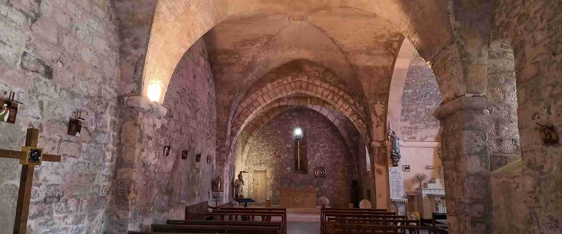
The church of Saint-Christophe occupies a position at the summit of the village, adjacent to the Templar castle, on the highest point of the limestone promontory. Its placement alongside the military building — rather than at the settlement’s geographic centre — reflects the commandery logic of the military orders, for whom the spiritual and martial functions of the institution were inseparable. The church is dedicated to Saint Christopher, patron of travellers, a dedication that declares La Couvertoirade’s function as a waystation on routes toward the Mediterranean and, ultimately, toward the Crusader ports. The alternative dedication encountered in local and regional sources — Saint-Cristol — is the Occitan variant of the same patron.
The foundation of the church dates to the twelfth and thirteenth centuries, coeval with the Templar castle beside it, and the surviving fabric retains both the scale and the essential forms of this original Romanesque construction. The building plan is rectangular — without the cruciform transept arms that most ecclesiastical buildings of this period employ — a simplicity reflecting both the austere priorities of a military-order chapel and the practical constraints of building on an irregular rocky outcrop where right-angled additions were difficult to construct. The church is built partly into the rock of the promontory, with the bedrock incorporated into the foundation and lower courses of the north wall, underscoring the Templars’ practice of reading the geological structure of a site as a building resource.
Romanesque Fabric and the Hospitaller Imprint
The nave of Saint-Christophe retains stonework of the Templar construction phase, including arches whose semicircular profiles confirm their Romanesque date. Among the most significant surviving details are the keystones of the nave vaulting, carved with Maltese crosses — the heraldic emblem of the Knights of Saint John. These Hospitaller-period keystones were either inserted into an existing vault or installed when the vault was rebuilt or re-vaulted during the fifteenth-century renovation that accompanied the Hospitaller rampart programme. Their presence at the crown of each vaulting bay makes the institutional identity of the building unmistakably clear and represents one of the few instances in La Couvertoirade where the transition from Templar to Hospitaller lordship is legible in explicit carved ornament rather than mere building chronology. The Maltese cross at the keystone is both a structural element and a statement of ownership, an act of heraldic inscription in stone at the summit of the sacred space.
The church’s west end carries a tower that, in its current form, belongs to the Hospitaller building phase of the 1439 to 1445 campaign. When the Hospitallers constructed the enclosing wall, they incorporated the church tower into the rampart circuit, converting it from a campanile into a dual-purpose structure: bell tower and defensive tower simultaneously. The tower’s integration into the wall is visible at the junction between the church’s western facade and the rampart, where the coursing of the masonry transitions from the religious building to the military one. This dual function — sacred tower as defensive tower — is one of the most architecturally distinctive moves at La Couvertoirade and underlines the indissolubility of the sacred and military in the Hospitaller institutional vision: the bell that called the community to prayer was housed in the same fabric that sheltered archers in time of attack.
The Cemetery and the Discoidal Steles
The cemetery surrounding the church of Saint-Christophe preserves a collection of discoidal steles — a form of funerary marker characteristic of the Languedoc and parts of the Iberian Peninsula from the medieval period onward. These circular-headed stone markers, carved from local limestone, represent one of the most distinctive regional funerary traditions in southern France, their precise origin and the iconography they bear remaining subjects of active scholarly discussion. The La Couvertoirade examples are among the best-known in the Aveyron and their presence in the commandery cemetery suggests a continuity of local funerary practice that persisted through both the Templar and Hospitaller occupations. The steles range in date from the medieval period to the early modern era, constituting a stratigraphic record of the village’s burial population across several centuries and providing material evidence that the social community of the commandery was not confined to the brothers of the Order but included the wider population of settlers and workers who lived under its authority.
The Urban Plan of La Couvertoirade: Spine, Grid, and Commandery Organisation
The urban plan of La Couvertoirade is the product of the commandery building tradition the military orders brought to the Larzac: a settlement designed not by the accumulation of individual building decisions over generations but by the institutional imposition of a functional order on the terrain. Understanding this plan requires distinguishing between the Templar framework established in the twelfth and thirteenth centuries and the Hospitaller enclosure added in the fifteenth, but both phases share a commitment to planned organisation that distinguishes the village from the organic medieval settlements of comparable date elsewhere in southern France.
The fundamental organising element of the plan is the main street — a north-south axis running the full length of the village from the Porte d’Amoun at the north to the Porte d’Aval at the south. This spine road follows the crest of the limestone promontory, exploiting the natural topographic alignment that offers the most level route through the site. Its direction is not perfectly straight — the promontory’s irregular surface introduces minor curves and adjustments — but the general alignment is maintained consistently, and the two gates at either end are positioned to align with this axis, creating a through-route that the village has preserved since the Templar period. The main street constitutes not merely a circulation route but the social spine of the community: the space along which commercial, religious, and civic life organises itself, flanked by the most prominent buildings and opening, at its northern terminus, onto the castle and church.
Secondary lanes branch from the main spine at roughly right angles, running east and west toward the rampart wall. These lateral lanes — calades paved with local limestone — divide the interior into building plots whose orientation is largely perpendicular to the spine. Houses are built with their gabled ends facing the calades, their party walls running parallel to the main axis: a pattern of alignment consistent with a planned layout in which plot boundaries were established before buildings were constructed, rather than after organic growth had already occurred. The resulting grid — never perfectly regular, always adjusted to the topography — is more legible in plan than at ground level, but its disciplined character becomes apparent to anyone who traces the street network systematically. It is this quality — planned, institutional, orthogonal in intention even when irregular in execution — that the article’s title invokes with the word “grid.”
The Role of the Castle and Church in Organising the Urban Plan
The castle and church at the north end of the main axis perform more than their obvious architectural and spiritual functions: they serve as the organising poles of the entire urban composition. Their placement at the highest and most northerly point of the settlement establishes a hierarchy in which authority — both military and sacred — is located at the literal apex of the plan. All movement within the village takes place in relation to this pole: the main street descends southward from the castle, the secondary lanes define building blocks below it, and the southern gate is the point at which the community opens onto the wider world. This hierarchical spatial organisation — with power located uphill and civic life arranged below — is characteristic of commandery settlements across the Mediterranean and reflects the institutional priorities of the military orders expressed in urban form. At La Couvertoirade, the relationship between topography and institutional hierarchy is unusually legible because the promontory’s modest but real elevation gives the castle a visible dominance over the settlement even at close range.
The Calades: Paved Lanes and the Material Logic of the Street
The calades of La Couvertoirade are the stone-paved lanes that form the secondary street network within the ramparts. Calades — from the Occitan calade, describing a sloping stone-paved surface — are characteristic of medieval village streets throughout the Languedoc and Provence, providing a durable, drainable surface on sites where earthen paths would erode rapidly under the feet of livestock and people. At La Couvertoirade, the calades are laid in irregular limestone flags quarried from the local plateau, and their survival in largely original condition is one of the more remarkable aspects of the village’s material integrity. The surface treatment reinforces the visual and tactile homogeneity of the site: from the wall base to the rooftop, the material is consistently local limestone, and the streets share this material language with every other element of the built environment. Walking the calades of La Couvertoirade is an experience of total material immersion that photographs and plans cannot adequately convey: the limestone underfoot is the same limestone overhead, a built world made from a single geological source.
Caussenard Vernacular Architecture: Limestone, Lauze, and the Ovile House
The domestic architecture of La Couvertoirade is among the best-preserved examples of the Caussenard vernacular tradition — a building practice adapted over centuries to the specific material and climatic conditions of the limestone plateau. The houses inside the ramparts date predominantly to the fifteenth century, constructed during and immediately after the Hospitaller fortification programme, when the security of the enclosing wall allowed the village to consolidate its residential fabric behind a defensible perimeter. Their survival into the present results from a combination of high construction quality and the demographic accident that prevented subsequent alteration.
The fundamental element of the Caussenard house is the structural vault. In the absence of quality timber — the limestone plateau is almost entirely treeless, and imported timber was expensive — builders on the causse used stone vaulting to span floor and roof levels. The standard Caussenard house is built as a sequence of two superimposed vaulted bays: a lower vault at ground level and an upper vault supporting the roof. The wall thicknesses required to absorb the lateral thrust of these vaults are substantial — approximately one metre — and the resulting buildings have a massiveness of form entirely different from timber-framed construction. The thick walls also provide exceptional thermal mass: Caussenard houses are naturally cool in summer and retentive of warmth in winter, a climatic advantage significant on a plateau exposed to both summer heat and winter cold with no mitigating topographic shelter.
The Ovile: Ground-Floor Sheep Pens and the Integration of Pastoral Economy
The ground floor of the standard La Couvertoirade house is a vaulted sheep pen — an ovile or jasse in the regional vocabulary. The vault at this level is barrel or pointed in form, providing a covered, enclosed space for housing livestock and their fodder through the cold plateau winters. The integration of sheep accommodation into the domestic building section is not incidental but structural: La Couvertoirade was primarily a sheep-farming settlement, and the ovile was as essential a component of the productive household as the kitchen and sleeping quarters above it. The animals’ body heat contributed to the warming of the living quarters overhead, and access between the two levels was provided by internal openings or by the external staircase that characterises the facade of every house on the main street and calades.
Today the former oviles house artisan workshops, galleries, and visitor services — a conversion that has preserved the vaulted spaces while transforming their function. The transition from livestock to craft commerce is evident throughout the village, where potters, weavers, leather workers, and enamel artists have occupied the ground-floor vaults that once housed flocks. This functional continuity — the same architectural shell serving a different but equally artisanal purpose — is characteristic of living heritage sites that have found new economic roles without falsifying their material fabric. The vaulted ground floors of La Couvertoirade are not museum exhibits; they are working spaces, inhabited in the same sense that they were inhabited when a Hospitaller shepherd’s flock spent winter beneath the living quarters of the household above.
External Stone Staircases and Vertical Organisation
The external stone staircase is one of the most visually distinctive elements of La Couvertoirade’s streetscape. Where domestic building in most European urban traditions internalises stair circulation, the Caussenard house externalises it: a stone stair built against the facade and rising to the upper-floor doorway provides access to the living quarters without passing through the ground-floor sheep pen. This arrangement serves both functional and social purposes. Functionally, it keeps the smell, humidity, and movement of animals out of the living zone above. Socially, it gives the household a visible point of access from the street — a threshold between the public realm of the calade and the private realm of the dwelling, marked by the stair as a legible architectural element.
The staircases of La Couvertoirade are built from the same local limestone as every other element of the buildings, their treads cut from single slabs or composed of two or three fitted stones. Many are original medieval work, their surfaces worn smooth by six centuries of foot traffic. The variety of stair positions and designs — some axial to the facade, others set at an angle, some with stone handrails, others open — introduces a rhythm of movement and incident that rescues what would otherwise be a monotonous sequence of identical facades, adding depth and interest to the streetscape that plans and photographs alone cannot convey.
Lauze Roofs: Weight, Technique, and Material Continuity
The lauze roofs of La Couvertoirade are the crowning element of a building tradition that extends material logic to its extreme conclusion: using stone not merely for walls and floors but for the covering of the building itself. Lauzes are limestone slates — flat tablets of local Jurassic limestone, 2 to 5 centimetres thick, 30 to 40 centimetres long, and 20 to 25 centimetres wide — quarried from deposits where the rock splits naturally along bedding planes into thin sheets. Laid in overlapping horizontal courses from eave to ridge, each course covering two-thirds of the one below, the lauzes create a covering that is functionally equivalent to conventional roofing tile but far heavier and, in the long term, far more durable.
The weight of a lauze roof is extraordinary by the standards of modern construction: between 200 and 450 kilograms per square metre, depending on the thickness and density of the material. This load is carried by the masonry vault below, which distributes it to the thick load-bearing walls. The structural logic of the entire Caussenard building system — massive walls, stone vaults, lauze roofs — constitutes a single integrated response to the limitation of building without timber. Every element reinforces the others: the vault needs thick walls to resist its thrust; the thick walls carry the lauze roof load; the lauze roof eliminates the need for the timber-framing that the plateau cannot supply. The result is a building tradition of extraordinary internal consistency, in which the solution to one material constraint generates the formal character of the whole.
Lauzes are bedded on a layer of earth laid over the vault, which provides a substrate for the tiles and contributes additional thermal mass and insulation. The earth layer is stabilised by the interlocking tile courses above it and by the lime mortar used to point the lauze joints. On the Causse, the limestone selected for lauze production is chosen for its low susceptibility to frost-shattering, a crucial property on a plateau that experiences sub-zero temperatures in winter. The maintenance of a lauze roof requires specialist skill: tiles must be regularly inspected and reset as the earth bedding settles, and skilled lauze craftsmen (lauzeurs) remain active in the region, their work essential to the preservation of La Couvertoirade’s historic fabric and to the continuation of a craft tradition that predates the Hospitallers by several centuries.
Water Management on a Waterless Plateau: Lavognes, Cisterns, and Rampart Fountains
Water is the strategic preoccupation of every settlement on the Causse du Larzac, and La Couvertoirade’s approach to water management is among its most technically and socially revealing characteristics. The karstic limestone of the plateau absorbs surface water almost immediately, leaving no streams, springs, or natural ponds at the plateau level. Precipitation — concentrated in autumn and spring — either evaporates from the exposed surface or disappears into the rock within hours. This hyperaridity, extreme for a temperate climate, forced both the military orders and the local population to develop engineering solutions that transformed water catchment and storage into a formal architectural tradition.
The Lavogne: Pastoral Water Infrastructure on the Causse du Larzac
The lavogne is the most distinctive water engineering form of the Causse du Larzac. Constructed by lining a natural or artificial hollow in the plateau surface with stone and compacted clay, the lavogne creates a sealed basin that collects and retains rainwater for the watering of sheep and other livestock. Lavognes are edged with a border of carefully fitted flat stones that provide a clean surface for animals to approach the water without churning the margin into mud. They range in diameter from a few metres for farm-scale examples to tens of metres for communal village installations. The La Couvertoirade lavogne, positioned inside the village walls, is oval rather than round — an unusual form for the region, where circular lavognes are the plateau standard — and is considered one of the finest surviving examples of the plateau’s pastoral water infrastructure.
The lavogne inside La Couvertoirade’s walls served the dual function of providing water for the sheep housed in the ground-floor oviles and ensuring the village’s pastoral operations were independent of the external water supply during periods of siege or unrest. Its position within the enclosing wall is therefore both practically and symbolically significant: water security was as essential to the commandery’s function as wall security, and the Hospitallers incorporated water provision into their defensive planning as deliberately as they positioned their towers and gates. The UNESCO inscription of the Causses and Cévennes landscape cites the lavognes of the plateau as one of the distinctive forms of the agro-pastoral cultural tradition, and the La Couvertoirade example is among the most often cited specimens of this engineering heritage.
The Rampart Cistern and the Gift of Water
Among the most technically refined water management features at La Couvertoirade is the cistern built into the rampart structure, connected to a dispensing opening in the exterior face of the wall. This system allowed the inhabitants of the village to provide water to pilgrims, travellers, or the destitute standing outside the walls without the need to open the gates. The opening — a small aperture set at a height convenient for filling a vessel — communicated with the cistern volume behind the wall, which was fed by roof drainage or direct rainwater collection from the wall surface. This feature belongs to the tradition of charitable water provision central to the Hospitaller rule: the Order was founded as a hospital brotherhood committed to caring for the poor and the sick, and the provision of water to the vulnerable was a practical expression of that institutional mission, made secure by the defensive architecture of the wall itself.
The cistern and its dispensing aperture survive in recognisable form within the rampart circuit and are among the most frequently cited details of the entire site. They stand as evidence that the architecture of La Couvertoirade was never purely military but simultaneously domestic, pastoral, and charitable — a material expression of the complex institutional identity of the Knights Hospitaller, who were simultaneously soldiers, farmers, and monks. The wall that kept enemies out also delivered water to the needy, and the same stone that housed the archères-canonnières housed the gift of water on its outer face.
The Civil Architecture of La Couvertoirade: Notable Houses and Mansions
Within the coherent uniformity of the Caussenard vernacular tradition, certain buildings in La Couvertoirade stand out for the quality of their construction and the social ambitions of their original owners. Two structures deserve particular attention: the Maison Scipione and the Maison Grailhe, both of which demonstrate the economic prosperity that the village achieved during the late fifteenth and sixteenth centuries and the architectural expression that prosperity sought.
The Maison Scipione takes its name from the widow of Monsieur Scipion Sabde, one of the house’s historical owners, colloquially known as “La Scipione.” Built at the end of the fifteenth century, the house is distinguished by a superb mullion window (fenêtre à meneau) of the type characteristic of late-medieval domestic architecture in the Languedoc: a central stone mullion divides the window opening into two lights under a continuous arch, a form that was a prestige element in the domestic architecture of the period, signalling the wealth and civic aspirations of the household. The same building also features a small turret added in the seventeenth century, a later addition that suggests continued investment in the property long after the medieval period. Today the Maison Scipione serves as the village’s information office (Point Accueil), occupying a historic building for a contemporary public function — an arrangement that maintains the building in active institutional use without falsifying its domestic character.
The Maison Grailhe is another example of the more prosperous domestic construction within the village, contributing to a townscape that, while fundamentally homogeneous in its material vocabulary, contains within that homogeneity a notable range of architectural ambition. The carved lintels, arched doorways, and occasional sculptural details that appear at intervals throughout the village — easily missed at a glance but rewarding close examination — collectively attest to a community that, for much of the fifteenth and sixteenth centuries, was not merely surviving behind its walls but accumulating sufficient resources to express social distinction in stone.
The communal bread oven, probably built in the fourteenth century and located within the village, was abandoned in the 1950s but has since been restored by a local resident. It is regularly used today for bread-baking and pastry-making over a wood fire, and represents one of the most compelling instances of the reactivation of historic fabric: not conservation as static preservation but the revival of function, restoring to a medieval building the use for which it was designed. The communal oven was an institution as much as a structure — a focal point of village social life in which the entire community participated — and its continuation connects the present village to the Hospitaller community that built it in a more direct way than any amount of interpretive signage.
La Couvertoirade Within the Templar-Hospitaller Larzac Circuit
La Couvertoirade is the most visited and most photographed of the Templar-Hospitaller sites on the Causse du Larzac, but it functions most meaningfully when understood as part of a network rather than as an isolated monument. The military orders established a constellation of commanderies across the plateau whose collective archaeology constitutes one of the most remarkable ecclesiastical heritage landscapes in southern France: a series of planned settlements, each with its own architectural character and functional role, organised around the administrative hub of Sainte-Eulalie-de-Cernon and connected by drove roads and paths that are still traversable today.
Sainte-Eulalie-de-Cernon, located approximately 12 kilometres north of La Couvertoirade, was the principal commandery of the Larzac network and the seat of the Order’s regional authority. It preserves the most complex ensemble of commandery buildings on the plateau — including its own circuit of walls, church, towers, and gateway — and is described by heritage authorities as the best-preserved Templar commandery in France. The architectural relationship between Sainte-Eulalie and La Couvertoirade is one of institutional hierarchy expressed in urban scale: Sainte-Eulalie is larger, its commandery precinct more elaborate and formally composed, while La Couvertoirade compensates with a more dramatic visual impact — the silhouette of its ramparts rising from the flat plateau is one of the great sights of medieval France — and a more complete preservation of its village fabric.
La Cavalerie, a third site in the circuit located approximately 9 kilometres northeast of La Couvertoirade, represents the Hospitallers’ administrative centre for the Larzac network after the Templar dissolution. Its own fortifications and medieval fabric, though less completely preserved than those of La Couvertoirade, add a further dimension to the circuit’s architectural diversity and reinforce the spatial logic of the commandery network: three fortified settlements positioned at intervals across the plateau, controlling the movement of people and flocks through the heart of the causse.
Le Viala-du-Pas-de-Jaux presents a different defensive solution: never equipped with enclosing ramparts owing to its smaller population, the settlement instead received a single defensive tower 30 metres high, built by the Hospitallers in 1430, designed as a place of refuge for people and livestock in times of danger. This tower — nicknamed the “Lighthouse of the Larzac” for its visibility across the plateau — offers a pointed contrast to La Couvertoirade’s complete enclosing circuit and demonstrates the range of defensive typologies the Hospitallers employed across a single landscape, calibrating their investment to the scale and vulnerability of each settlement.
The GR71 long-distance footpath, known as the Sentier des Templiers et des Hospitaliers (the Templar and Hospitaller Trail), connects these sites along a route that traverses the full breadth of the plateau. Walking the GR71 places La Couvertoirade in its proper geographical and historical context — not as an anomalous survival but as one node in a coherent medieval network whose spatial logic remains legible on the ground nearly seven centuries after the military orders that created it were dissolved or expelled from their Larzac possessions.
UNESCO Recognition and Heritage Conservation at La Couvertoirade
La Couvertoirade’s formal heritage recognition operates at multiple scales, from the individual classified monument to the international designation. At the monument level, the Templar castle carries the classification of Historic Monument of France (Monument Historique), a status conferred in 1944 and renewed under subsequent heritage legislation. The classification protects the castle fabric from modification and qualifies it for state conservation funding, though the building remains in private ownership. The ramparts carry their own heritage protection, and the village as a whole — its streets, houses, church, and water infrastructure — benefits from the legislative protections available to designated historic towns under French law.
The broader landscape received international recognition in 2011 when the World Heritage Committee inscribed “The Causses and the Cévennes, Mediterranean Agro-pastoral Cultural Landscape” on the UNESCO World Heritage List as Property No. 1153. The inscription covers 302,319 hectares across four departments and recognises two outstanding universal values. Criterion III acknowledges the landscape as unique testimony to a cultural tradition — specifically Mediterranean agro-pastoralism, a farming system integrating cereal cultivation, sheep grazing, and seasonal transhumance into a coherent productive cycle sustained across more than three millennia. Criterion V recognises it as an outstanding example of human interaction with the natural environment, demonstrated through the physical transformation of the limestone landscape by pastoral communities — lavognes, terraces, drove roads, fortified commandery villages — inscribed across the causse surface over a span of time without parallel in the European Atlantic zone.
La Couvertoirade is specifically cited in the UNESCO inscription as one of the Templar-Hospitaller sites within the Grands Causses Regional Nature Park component of the property. The village’s presence within the inscription is not incidental: it represents the institutionalised, militarised phase of the agro-pastoral cultural tradition, in which the management of the landscape and its pastoral resources was concentrated in the hands of international military-religious orders whose architectural legacy — the commanderies, walls, towers, and planned villages — is as much a part of the Causses and Cévennes cultural landscape as the drove roads and lavognes of the shepherds themselves.
Beyond the UNESCO designation, La Couvertoirade holds membership in the Les Plus Beaux Villages de France association, a quality certification awarded to villages that combine a population of fewer than 2,000 inhabitants with at least two classified heritage sites and a commitment to maintaining the quality of their built environment. Membership requires active conservation management and restricts the visual intrusions — advertising signage, inappropriate modern construction, unsuitable surface materials — that have degraded the character of comparable sites elsewhere. It is both a recognition of existing quality and a commitment to its maintenance, requiring regular revalidation against the association’s published criteria.
The Village Today: Living Heritage and Artisan Continuity
La Couvertoirade today is home to fewer than 200 permanent residents — a tiny community sustaining a village infrastructure built for a far larger medieval population. The paradox of this situation is that the village’s very smallness is the precondition of its integrity: with too few inhabitants to generate development pressure and too many visitors to permit indifference, La Couvertoirade has found a sustainable equilibrium between the requirements of contemporary life and the demands of heritage preservation. The medieval walls are not a constraint on the community’s future; they are its primary economic asset and its identity.
The artisan tradition that began to repopulate the village in the second half of the twentieth century has proved central to this equilibrium. Potters, weavers, leather craftspeople, enamel workers, and sculptors occupy the former ovile spaces, operating workshops directly accessible from the calades and visible to visitors as working ateliers rather than museum reconstructions. This arrangement preserves the economic vitality of the ground-floor vaulted spaces — maintaining them in active use rather than allowing them to become storage or dead exhibition space — while giving the village a commercial identity that extends beyond its role as a heritage attraction. The craft tradition also connects, at least symbolically, to the pastoral economy of the medieval commandery: the weaving and textile work continues a regional tradition whose origins lie in the wool of the Larzac flocks that the Templars and Hospitallers managed across this same plateau for two and a half centuries.
Guided tours run from April to November, with audio guides available in multiple languages, covering the ramparts, castle, church, and the domestic architecture of the main street and calades. Night tours operate during the summer months, offering a different visual experience of the fortifications and streets under artificial light. The communal bread oven is periodically activated for public baking sessions, maintaining a functional connection to the medieval infrastructure that interpretation alone cannot substitute. The GR71 footpath, which passes through the village as part of the Templar and Hospitaller Trail, brings hikers traversing the plateau into La Couvertoirade from both the north and south, embedding the village in a pattern of landscape use that recalls, at least in form, the pilgrimage and transhumance movements of the medieval period.
The result is a village that achieves the difficult balance between accessibility and authenticity. La Couvertoirade receives substantial visitor numbers — its proximity to the A75 motorway, minutes away, makes it accessible to travellers between Paris and the Mediterranean — without losing the inhabited character that distinguishes it from an open-air museum. The houses are still lived in, the workshops are still producing, the oven is still baking. The medieval fabric is not merely preserved but occupied, its longevity dependent on the continuation of real life within its walls, as it has been — in one form or another, under one institutional order or another — since the Templars first planted their castle on the rocky outcrop of the Causse du Larzac eight centuries ago.
Frequently Asked Questions About La Couvertoirade
What military order originally founded La Couvertoirade?
La Couvertoirade was founded and initially developed by the Knights Templar, the military-religious order established in Jerusalem in 1119. The Templars arrived on the Causse du Larzac during the twelfth century and established La Couvertoirade as a secondary commandery subordinate to Sainte-Eulalie-de-Cernon, the principal Templar establishment on the plateau. Following the suppression of the Templar Order in 1312, all Larzac properties transferred to the Knights Hospitaller (Knights of Saint John of Jerusalem), who remained the institutional authority at La Couvertoirade through the rest of the medieval period. The Hospitallers built the defining defensive element of the village — the curtain wall and towers — between 1439 and 1445. The village therefore bears the architectural signatures of both orders: Templar Romanesque in the castle keep and the earliest church fabric, Hospitaller late-Gothic in the ramparts, the vault keystones with Maltese crosses, and most of the surviving domestic buildings.
Why did the Hospitallers build the ramparts so long after acquiring the site?
The Knights Hospitaller inherited La Couvertoirade from the Templars following the 1312 suppression but did not fortify the village for more than a century afterward. The trigger was the Hundred Years War (1337–1453) and specifically the emergence of the routiers — mercenary bands released from the armies of both England and France and reduced to brigandage. From 1346 onward, these forces raided towns and villages across the Aveyron and the Larzac with near impunity, looting settlements and demanding ransoms. The inhabitants of La Couvertoirade petitioned formally in 1439 for permission to fortify their village, and the Hospitallers authorised and funded the construction that followed. The decision to fortify in 1439 — rather than earlier — reflects both the sustained nature of the threat and the financial capacity of the Hospitaller administration at this specific moment. The completion of the walls in 1445 coincided closely with the final expulsion of the English from France and the end of the period of most intense routier activity. The emergency that produced the walls had passed by the time they were finished, and the village was never subsequently enlarged or modified: threat had built the walls, and the absence of threat ensured they were never extended.
How does La Couvertoirade relate to the pilgrimage routes of southern France?
La Couvertoirade occupied a position on overland routes connecting the interior of France with the Mediterranean ports — particularly Montpellier and Aigues-Mortes — that were used by both pilgrims heading toward Santiago de Compostela via the Via Tolosana and by Crusaders embarking for the Holy Land. The Templar and Hospitaller commanderies of the Larzac were obligated by their institutional rules to provide hospitality and medical assistance to pilgrims and travellers, and La Couvertoirade functioned as a waystation offering shelter, provisions, and care to those making the crossing of the causse. The dedication of the church to Saint Christopher — patron of travellers — declares this hospitable function explicitly. The water-dispensing aperture built into the ramparts, which allowed the garrison to provide water to those outside the walls without opening the gates, is a physical expression of this charitable obligation in its most defensively cautious form. Today the GR71 footpath — the Templar and Hospitaller Trail — follows routes across the plateau that recall these medieval journey patterns.
What is a lavogne and why is the La Couvertoirade lavogne unusual?
A lavogne is a stone-lined pond engineered to collect and retain rainwater on the otherwise waterless Causse du Larzac. Constructed by lining a natural or artificial hollow with clay and stone, lavognes prevent the rapid loss of surface water through the karstic limestone and create reservoirs for watering sheep. They represent a technology developed and refined by plateau pastoral communities over many centuries and are among the most important elements of water engineering infrastructure in the Causses and Cévennes UNESCO landscape. The La Couvertoirade lavogne, positioned inside the village walls, is notable for being oval in plan rather than round — most lavognes on the plateau adopt a circular form — making it architecturally distinctive within the regional tradition. Its position inside the ramparts is also strategically significant: it ensured the village’s livestock water supply remained accessible during periods of siege or social unrest, demonstrating the integration of pastoral and military planning that defines the commandery settlement design.
What is Caussenard architecture and how does it differ from other French regional building traditions?
Caussenard architecture is the vernacular building tradition of the Causse du Larzac and the neighbouring limestone plateaux of the southern Massif Central. Its defining characteristic is the exclusive use of limestone as a building material — from wall rubble and ashlar to structural vaulting and roof tiling — as a direct response to the plateau’s near-total absence of timber. Where most French regional building traditions use timber for floor framing, roof structure, and cladding, Caussenard buildings substitute stone vaulting at every level. The standard Caussenard house features a vaulted ground-floor sheep pen (ovile), a vaulted upper-floor living space, and a lauze roof imposing loads of 200 to 450 kilograms per square metre. External stone staircases provide access between levels. The thick walls — approximately one metre — required to resist vault thrust give Caussenard architecture its characteristic massiveness, and the lauze roofing gives it a visual homogeneity: every building is the same colour and texture as the rock on which it stands. This total material continuity — from natural plateau to quarried wall to cut tile roof — is the most distinctive feature of the Larzac building tradition and makes La Couvertoirade one of the most visually coherent medieval settlements in France.
Why is La Couvertoirade so well preserved compared to other medieval villages?
La Couvertoirade’s exceptional state of preservation results from the coincidence of two factors that are individually common but rarely coincide in the same site. The first is high construction quality: the military orders built to institutional standards higher than most secular landlords could afford or motivate, and the walls, church, and houses of La Couvertoirade were constructed with the structural integrity of purpose-built institutional architecture. The second is demographic stagnation: the village’s population fell dramatically during the nineteenth century — to 362 residents by 1880 — leaving buildings unaltered because there were insufficient people, money, or motivation to modify them. This near-abandonment preserved medieval fabric that modernisation would otherwise have swept away. Unlike comparable sites rebuilt, extended, or demolished as populations grew in the eighteenth and nineteenth centuries, La Couvertoirade contracted and fell quiet, and its medieval buildings simply stood. This same pattern of abandonment-as-preservation is observed at other exceptional medieval sites across France and southern Europe: the accident of depopulation becoming, retrospectively, the precondition of outstanding universal heritage value.
What is the relationship between La Couvertoirade and Sainte-Eulalie-de-Cernon?
La Couvertoirade and Sainte-Eulalie-de-Cernon were the two principal Templar commandery sites on the Causse du Larzac, connected by a hierarchical administrative relationship in which Sainte-Eulalie was the superior — the seat of the commandery and its regional administration — and La Couvertoirade its most important dependency. The two sites are approximately 12 kilometres apart across the plateau and are connected today by the GR71 footpath. Sainte-Eulalie preserves a more complex ensemble of commandery buildings — including what heritage authorities describe as the best-preserved Templar commandery in France — while La Couvertoirade offers a more complete village environment, with its ramparts, houses, streets, church, and water infrastructure forming a coherent inhabited urban unit. Together they represent the institutional and residential dimensions of the same military-religious organisation: Sainte-Eulalie the administrative and monastic pole, La Couvertoirade the garrison, agro-pastoral, and hospice pole. Both sites lie within the UNESCO-inscribed Causses and Cévennes World Heritage landscape.
What do the Maltese crosses on the church keystones at La Couvertoirade signify?
The Maltese cross — the eight-pointed heraldic emblem of the Knights Hospitaller — appears carved into the keystones of the nave vaulting in the church of Saint-Christophe at La Couvertoirade. The cross takes its popular name from Malta, which became the Order’s headquarters after 1530 when the Hospitallers were expelled from Rhodes by the Ottomans, though the symbol was in Hospitaller use well before the Malta period. Its presence on the vault keystones dates from the Hospitaller occupation of the site — either from the fifteenth-century renovation of the church or from an earlier phase of Hospitaller modification — and marks the transition from Templar to Hospitaller lordship in explicit heraldic terms. The Maltese cross at La Couvertoirade is one of the most legible surviving instances of the Hospitaller imprint on the village’s architecture, placing the institutional identity of the building’s patron at the structural apex of the sacred interior: every worshipper looking upward at the vault crown was reminded of the Order under whose authority they lived.
Can visitors access the wall-walk of La Couvertoirade’s ramparts?
The chemin de ronde (wall-walk) of La Couvertoirade’s ramparts is accessible to visitors, offering a perspective on the village and the surrounding plateau that no ground-level approach can replicate. At 12 metres above the ground and running the full 420-metre circuit, the wall-walk reveals the positioning of the five round corner towers, the two square gate towers, and the integrated tower of Saint-Christophe, while the views outward over the Causse du Larzac — a vast, essentially treeless limestone plateau under an enormous sky — communicate the strategic logic of the Hospitallers’ defensive design more directly than any interpretation board. The near-total visibility across the surrounding terrain explains immediately why Déodat d’Alaus chose open crenellation over closed wall-head: sentries on the chemin de ronde had reliable early warning of anything moving toward the village across the flat plateau. Guided tours and audio guides operate from April to November, and night tours are available during the summer season.
How does La Couvertoirade contribute to the Outstanding Universal Value of the Causses and Cévennes UNESCO inscription?
La Couvertoirade contributes to both criteria under which the Causses and Cévennes was inscribed as a UNESCO World Heritage Site in 2011. Under Criterion III — unique testimony to a cultural tradition — the village represents the military-religious organisation of the agro-pastoral landscape by the Templars and Hospitallers, institutions that transformed the social and physical geography of the Larzac over several centuries through a programme of planned settlement, pastoral management, and fortification that has no precise parallel elsewhere in Europe. Under Criterion V — outstanding example of human interaction with the environment — the village demonstrates the material adaptation of human settlement to the karstic limestone plateau: the use of local stone for all construction elements, the engineering of lavognes for water management, the organisation of domestic architecture around sheep farming, and the planning of a complete commandery settlement within fortified walls whose form responds directly to the natural topography of the plateau outcrop. La Couvertoirade is cited in UNESCO documentation as a Templar site within the Grands Causses Regional Nature Park component of the inscribed property, alongside Sainte-Eulalie-de-Cernon, La Cavalerie, and Le Viala-du-Pas-de-Jaux.