
The Subterranean Sanctuary and Saxon Masonry: Geo-Astronomical Alignment and Sacred Geometries of Dover’s Roman-Norman Transition
Few landscapes in England compress more architectural history into so small a space as the clifftop at Dover. Within Dover Castle, a Roman lighthouse of the 1st or early 2nd century AD stands beside a Saxon church built around 1000 AD; below the town, some of the most complete Roman wall paintings in northern Europe survive beneath modern streets; and in the stones of lighthouse and church alike, the construction vocabularies of three civilizations intersect. This guide examines those intersections through materials, solar orientation, and sacred geometry, drawing a cross-cultural parallel with the rock-cut monastery caves of Buddhist India.
Key Takeaways
- St. Mary in Castro, the late-Saxon church within Dover Castle built around 1000 AD, is constructed primarily of coursed local flint incorporating reused Roman tiles and brick as quoin and window-arch dressings — a material strategy typical of the Saxon-Norman transition in coastal Kent, where Roman spolia were systematically integrated into new religious architecture rather than discarded.
- The adjacent Roman Pharos — one of only three Roman lighthouse towers to survive in the world, and the tallest surviving Roman structure in England — is faced with blocks of locally sourced Dour Valley calcareous tufa and green sandstone bound by double courses of flat red Roman brick at every seven courses; from the early 11th century onward, its inclusion in the Saxon church complex as a bell tower made Dover Castle one of very few sites where Roman, Saxon, and Norman fabric physically touch without reconstruction.
- The Roman Painted House, preserved beneath New Street in Dover town, contains one of the largest collections of in-situ Roman fresco paintings in northern Europe — over 400 square feet of Bacchic-themed painted plaster — their extraordinary survival owed to the paradox of intentional demolition: the Roman army buried the building around AD 270 when constructing the Saxon Shore fort, and that burial sealed the paintings for nearly 1,700 years until their discovery by archaeologists in 1970.
- The conventional east-facing orientation of early Christian churches carries both theological and solar dimensions; while St. Mary in Castro follows this universal convention with its chancel axis pointing east, scholarly claims of precise geo-astronomical calibration — specific alignment to a named feast-day sunrise, for instance — require case-by-case archaeoastronomical analysis and should be treated as an active interpretive framework rather than a settled conclusion for any individual building.
- A cross-cultural comparison between the controlled-illumination strategies of Anglo-Norman sacred interiors and the light-management architecture of the Ajanta Cave viharas and chaitya-grihas in Maharashtra reveals how two geographically and historically unconnected traditions independently arrived at related spatial solutions for creating contemplative enclosures where focused natural light carries theological weight — a case of convergent sacred architecture, not transmission or influence.
- The tufa deployed in Dover’s Roman-period structures is primarily Dour Valley calcareous tufa — a locally sourced riverine calcareous deposit — differing from the imported volcanic tuff (also called tufa in British architectural usage) used at some later Norman foundations elsewhere in England; understanding this distinction clarifies both the local geology of chalk-country Kent and the practical choices of Roman builders working on the Channel coast.
People Also Ask About Dover’s Roman-Norman Architecture
What is the connection between the Roman Pharos and St. Mary in Castro at Dover Castle?
The Roman Pharos and St. Mary in Castro stand immediately adjacent to one another within Dover Castle, and their relationship spans approximately a thousand years of reuse and adaptation. The Pharos — a Roman lighthouse almost certainly built in the 1st or early 2nd century AD — was incorporated into the Saxon church complex, probably from the early 11th century onward, as a bell tower; a doorway in the church’s west wall at first-floor level almost certainly linked to a corresponding opening in the Pharos, converted from a Roman window. This arrangement created a rare double western tower complex in which one tower predates the other by nearly a millennium. Beyond this functional bond, the church was built in significant part from materials quarried from the Pharos and other Roman structures: Roman tiles are visible in the window arches and throughout the church’s flint walls, making the Pharos simultaneously a collaborating monument and a quarry for later generations. Together, the Pharos and St. Mary in Castro represent one of the clearest examples in England of continuous sacred and architectural use across the Roman-Saxon-Norman transition — a physical palimpsest of three civilizations stacked on a single clifftop.
How were the Roman wall paintings at the Roman Painted House in Dover preserved?
The Roman Painted House’s wall paintings survived through an unusual combination of intentional destruction and accidental burial. Built around AD 200 as a mansio — an official lodging house for travelers and officials serving the Roman military port at Dubris — the building was demolished around AD 270 by the Roman army clearing ground for a new and larger Saxon Shore fort. During demolition, the standing painted walls were pushed inward and buried beneath the fort’s new rampart construction, rather than being fully removed. That burial sealed the painted plaster from weathering, biological growth, and temperature cycling for nearly 1,700 years. The site remained unknown beneath modern Dover until 1970, when construction work brought archaeologists from the Kent Archaeological Rescue Unit, led by Brian Philp, to the site. Excavation between 1970 and 1976 revealed six or more rooms with extensive surviving painted plaster featuring Bacchic panels and architectural trompe-l’oeil among the largest assemblages of in-situ Roman fresco painting in northern Europe. The paintings were opened to the public in 1977 and the site has operated as a specialist museum since.
What is tufa stone and why was it used in Saxon-Norman church construction in Kent?
Tufa — in the British architectural sense — refers to a soft, porous, lightweight calcareous stone formed by the precipitation of calcium carbonate from lime-rich spring or river water. It is distinct from volcanic tuff, though the two names appear interchangeably in some heritage literature. At Dover, the tufa used in the Roman Pharos was a locally sourced deposit from the Dour valley: the lime-rich chalk stream running below Castle Hill deposited calcareous material in its bed and margins over centuries, providing blocks light enough to handle, cut, and incorporate as ashlar facing alongside green sandstone and Roman brick. Elsewhere in Kent and across early Norman England, tufa — both local spring varieties and material imported from northern France or the Rhineland — was widely favored for church construction because its low density reduced structural loads in vaulted and arched building, its soft grain made it straightforward to carve for decorative detail, and it set readily in lime mortar. Canterbury Cathedral, Rochester Cathedral, and dozens of Kent parish churches employed tufa in their early Norman phases, placing the material at the centre of the regional construction vocabulary.
How does the spatial design of Anglo-Norman crypts compare with Buddhist rock-cut cave monasteries?
The comparison between Anglo-Norman sacred interiors and Buddhist rock-cut viharas at sites like the Ajanta Caves in Maharashtra is a study in convergent architectural thinking rather than any historical connection. The two traditions share no documented link and developed independently across roughly a thousand years and thousands of miles of geographical separation. What they hold in common is a structural answer to the same contemplative problem: how to create an enclosed interior that feels spiritually charged while admitting just enough natural light to direct the eye toward the sacred focus without flooding the space with ordinary illumination. In Anglo-Norman sacred interiors this was achieved through thick rubble walls, small round-headed apertures, and deliberate east orientation that admitted morning light through the chancel window. In the Ajanta chaitya-grihas it was achieved by carving into basalt and cutting a large horseshoe window into the cave facade to channel light down the nave and onto the stupa at the apse. Both strategies produce dimly luminous spaces where light functions as a spatial event rather than merely functional illumination — a convergent solution independently developed across cultures and traditions.
Extended multi-day tours – 5+ days
Featured South East England Multi-Day Tour Packages
3 days
South East England 3-Day Discovery Tour
- ✓ Comprehensive South East England experience
- ✓ Expert local guides included
- ✓ All accommodation included
- ✓ Transportation provided

5 days
South East England 5-Day Highlights Experience
- ✓ Comprehensive South East England experience
- ✓ Expert local guides included
- ✓ All accommodation included
- ✓ Transportation provided

7 days
South East England 7-Day Cultural Journey
- ✓ Comprehensive South East England experience
- ✓ Expert local guides included
- ✓ All accommodation included
- ✓ Transportation provided

10 days
South East England 10-Day Complete Adventure
- ✓ Comprehensive South East England experience
- ✓ Expert local guides included
- ✓ All accommodation included
- ✓ Transportation provided
Multi-day tour packages powered by TourRadar. Prices and availability subject to change.
Dover at the Crossroads: Roman, Saxon, and Norman Layers in a Channel Port
Dover sits at the narrows of the English Channel — the Strait of Dover — where the coast of France is visible on clear days across a passage barely 33 kilometers wide. This position made it the most strategically important cross-Channel crossing point in antiquity, and the Romans recognized the site immediately following their conquest of Britain. They called it Dubris and established a military and naval base there, constructing the harbor infrastructure, road connections, and maritime facilities required to sustain the Classis Britannica, Rome’s northern fleet. Dubris was one of the recognized starting points of Watling Street, the great Roman road running inland to Londinium (London) and onward through the province, cementing the town’s role as the principal gateway between Britain and the Continent.
The Roman presence at Dubris was intensive and multi-layered. Archaeological excavation across the modern town center has revealed successive phases of Roman occupation: an early naval base associated with the Classis Britannica, identifiable by the stamped tile bearing that fleet’s mark; a mansio complex of which the Roman Painted House is the most spectacular surviving element; and the Saxon Shore fort constructed around AD 270, whose rampart incorporated and buried the earlier mansio. On the heights above the harbor, the Romans built two pharoi — lighthouse towers — one on the Eastern Heights, now within Dover Castle, and one on the Western Heights. Together, and in coordination with a third pharos at Boulogne on the French coast, these beacons guided Roman shipping through one of the busiest and most demanding passages in European waters. The system of three interlocking lights — two at Dover and one at Boulogne — represented a sophisticated navigational infrastructure whose engineering sophistication is easy to underestimate when viewed from the surviving remnants alone.
The Saxon occupation of Dover bridged the end of formal Roman administration in Britain and the Norman Conquest of 1066. During this long period the Roman structures were neither fully demolished nor consistently maintained. Instead, they were selectively reused, quarried for materials, and gradually absorbed into a new architectural vocabulary. The Eastern Pharos remained standing throughout — its massive construction made demolition impractical without the mechanical means the Romans themselves had used — and it became the nucleus around which the Saxon community on the heights organized its religious life. The church of St. Mary in Castro, built around 1000 AD, was planned in direct relationship with the Pharos, incorporating the Roman tower as a bell tower and reusing Roman tile and brick throughout its fabric in a strategy that was economically rational, architecturally effective, and symbolically resonant.
This pattern of selective material reuse — known in architectural history as spolia, from the Latin for “spoils” — is far from unique to Dover, but it is unusually legible there. A visitor can trace Roman tile in the window arches of a Saxon church, identify Dour Valley tufa in the facing of a Roman lighthouse that later became a medieval bell tower, and descend below a modern street to see Roman wall paintings preserved by an act of Roman military demolition. The Roman-Norman transition at Dover is not an abstraction: it is written in stone, tile, painted plaster, and the geometry of space.
The geological substrate underpins everything. Dover stands on the chalk of the North Downs, where the white cliffs form the defining visual landmark. Chalk is a soft rock yielding two of the most characteristic building materials of Kent and Sussex: flint, occurring as dense siliceous nodules within the chalk matrix, and calcareous tufa, deposited by lime-rich spring water in river valleys and low-lying wetlands. Both materials appear across the sites discussed in this article, and both shape the particular character of the architecture that the chalk downland produced across Roman, Saxon, and Norman periods alike. Understanding these materials is essential to understanding why Dover’s buildings look and feel the way they do — and why the same stones recur in walls separated by centuries of construction history.
The Normans who arrived after 1066 were builders of exceptional ambition and speed. Within a generation they had transformed the English landscape with castles, cathedrals, and monasteries — but at Dover they found Roman and Saxon infrastructure so substantial that strategic adaptation was more rational than wholesale replacement. Henry II’s great rectangular Keep of the late 12th century and the castle’s elaborate concentric defenses were constructed within and around a landscape already organized by Roman and Saxon investment. The result is a site of extraordinary stratigraphic richness, in which the historian and archaeologist must think simultaneously across a span of more than a thousand years — not as isolated episodes but as an evolving conversation between builders who inherited from their predecessors and bequeathed to those who came after.
The Roman Painted House: Britain’s Most Complete In-Situ Roman Wall Paintings
The Roman Painted House is one of the most significant collections of in-situ Roman fresco painting accessible to visitors north of the Alps. It survives below street level in the center of Dover town, the entire monument accessible only by descending a staircase into the excavated and enclosed remains — a literal descent into the Roman city. The building was constructed around AD 200 by the Roman navy as part of a larger mansio: an official lodging facility for travelers and officials crossing the Channel to and from Dubris. Its construction and painted decoration reflect the investment the Classis Britannica made in maritime infrastructure along the Channel coast, providing the quality of accommodation appropriate for senior officials moving through one of the empire’s busiest gateways.
The building’s painted walls depict an elaborate architectural scheme in full color. Approximately 28 panels of trompe-l’oeil painting cover the surviving wall surfaces, featuring painted columns, framed decorative panels in red, green, and multiple pigments, and Bacchic iconography — figures and motifs associated with Bacchus, the Roman god of wine, a standard decorative choice for a hospitality building where travelers rested between crossings. The columns are rendered in a style that creates the illusion of depth and three-dimensionality against the flat plaster surface, a technique familiar across the Roman world from Pompeii and Herculaneum to villa paintings throughout Roman Britain. The remaining area of painted plaster exceeds 400 square feet (approximately 37 square meters), representing one of the single largest in-situ assemblages of Roman painted plaster in northern Europe.
The paintings’ extraordinary survival is the result of a sequence beginning with deliberate destruction. Around AD 270, the Roman army decided to construct a new and much larger fort on the Channel coast at Dubris — part of the broader Saxon Shore defensive network responding to intensified raiding pressure along the coast. The mansio complex stood in the way of the new fort’s rampart. Rather than carefully removing the paintings (labor-intensive and militarily pointless), the building was demolished rapidly: the walls were pushed inward and the debris buried beneath the new construction. This sudden burial sealed the painted plaster surfaces from air, moisture fluctuation, biological activity, and human interference. The conditions beneath the rampart remained stable for nearly seventeen centuries — a near-perfect accidental conservation environment created by an act of military necessity with no thought for preservation.
The site came to light in 1970, when construction work in central Dover exposed Roman remains. Brian Philp of the Kent Archaeological Rescue Unit recognized the significance of the finds and organized systematic excavation between 1970 and 1976. A complex of six or more rooms was progressively uncovered, revealing painted walls still standing to substantial heights in several places. The decision to preserve the discovery in situ — rather than relocating the paintings or simply recording and re-burying them — drove the creation of the museum building now enclosing the site. The Roman Painted House opened to visitors in 1977, managed for much of its history by a trust of local volunteers. In 2023 the trust returned stewardship to Dover District Council, and the site’s long-term future was under active review within the context of significant town-center investment projects at Dover, including the multi-million-pound Dover Beacon project.
The conservation of the painted plaster presents challenges simultaneously technical and environmental. Excavated Roman fresco surfaces are vulnerable to a range of decay mechanisms: salt crystallization as water moves through porous lime plaster; thermal and moisture cycling causing differential expansion and micro-cracking; biological growth — algae, fungi, bacteria — on damp surfaces; and vibration from surrounding urban infrastructure. The Roman Painted House’s below-ground location helps stabilize temperature and humidity relative to what the paintings would experience in an above-ground museum, but drainage management and humidity control remain permanent maintenance requirements. The museum’s cover building addresses these concerns, but the long-term care of in-situ painted surfaces requires ongoing specialist monitoring — a challenge common to Roman painted interiors across northern Europe.
The Bacchic iconography connects the Roman Painted House to a wider tradition of decorated interiors in Roman military and maritime contexts. Bacchus was a popular choice for hospitality settings, his imagery carrying associations of abundance, convivial welcome, and the pleasures available to the traveler at rest. The painted columns amplify this reading: the illusionistic architecture creates a spacious, colonnade-framed environment that would have felt richly refined to the official pausing here between one Channel crossing and the next. That this refined interior survives beneath a modern English town, sealed for nearly 1,700 years by accidental burial in a military construction project, makes the Roman Painted House one of the most poignant and improbable archaeological survivals in Britain.
The Hidden Mansio Frescoes: Pigment Chemistry and Underground Microclimates of the Roman Painted House
The survival of painted plaster across more than 400 square feet of the Roman Painted House’s interior walls represents one of the most remarkable accidents of conservation in Roman Britain. What preserved these images was not curation but catastrophe: the deliberate demolition and backfilling of the mansio c. AD 270, when the Roman army buried the building beneath the rampart of its new Saxon Shore fort. That act of military pragmatism created a sealed, lightless, pressure-stabilized environment in which pigment bonds and lime plaster could endure for close to seventeen centuries. Understanding what the paintings are made of, how they behave in the coastal subterranean environment into which they were frozen, and what the decorated spaces may have meant to the travelers who passed through them connects the Roman Painted House to the widest currents of Roman material culture and domestic religiosity.
Cinnabar and Egyptian blue preservation in coastal subterranean environments
The palette of Roman luxury interior painting was governed by a hierarchy of pigments that tracked closely with social aspiration and military prestige. At the summit of this hierarchy stood two materials that recur in the highest-status painted rooms across the empire: cinnabar, the mercury sulfide compound known to the Romans as minium, and Egyptian blue, the world’s earliest documented synthetic pigment, manufactured from a heated mixture of silica, lime, and copper minerals. Both appear in the Bacchic fresco tradition to which the Roman Painted House belongs — a tradition of colonnaded red-and-green interior schemes that decorated hospitality rooms from Pompeii to the northern provincial frontier — and both exhibit preservation behaviors that make their fate in a subterranean coastal setting of particular interest.
Cinnabar was one of the most expensive pigments available to Roman painters. Pliny the Elder recorded its value as ten times that of high-quality red ochre, its use in important rooms regulated in part by cost. The pigment’s chemical fragility, however, is as pronounced as its beauty: mercury sulfide undergoes a structural phase transition under sustained exposure to light and moisture, its surface chemistry destabilized by ultraviolet radiation and caustic environments, producing the characteristic blackening documented in laboratory studies of cinnabar-bearing Roman frescoes from Pompeii, Herculaneum, and more recently Cartagena. The precise pigment composition of the Dover frescoes has not, to the present author’s knowledge, been published through spectrographic analysis in the open literature; the documented Bacchic color scheme — reds alternating with greens in the panel lower zones, warm tones defining the illusionistic column shafts — is consistent with the cinnabar-and-green-earth palette standard for this class of decoration, though red ochre and other iron-based earths would have served equivalent chromatic purposes at significantly lower cost. Whatever the specific red employed at Dover, its survival in stable condition for nearly seventeen centuries argues for the primary preservative mechanism: the near-total exclusion of light produced by burial beneath the Saxon Shore fort rampart, which suspended the photochemical degradation pathways that destroy exposed Roman frescoes within decades.
Egyptian blue behaves very differently and offers a complementary lesson in the chemistry of Roman pigment survival. As a fired ceramic material — calcium copper silicate, manufactured at temperatures above 800°C — it is chemically inert and physically durable, resistant to the moisture and alkali environments that destroy many organic and metalite colorants. Egyptian blue fluoresces distinctively under ultraviolet light, a property that has allowed modern conservators to detect traces of it in frescoes where visible blue has faded or been covered. Its presence in Bacchic decorative schemes, typically in the painted bands separating figured panels or blended into green areas to achieve a cooler register, would have conferred a subtle luminosity on the Dover interior that transformed a functional lodging house into something approaching the visual language of elite metropolitan decoration.
The current conservation challenge at the Roman Painted House reframes the ancient preservation story. Added to Historic England’s Heritage at Risk Register in 2024 following assessment of the painted surface’s condition, the site has undergone environmental monitoring, mould removal, and climate remediation works since its return to Dover District Council stewardship in October 2023. The coastal position of Dover — Channel-facing, exposed to humidity and salt-laden air — creates conditions that press continuously against the fragile lime-plaster substrate. The hypocaust heating system documented in rooms 3 and 5, its underfloor channels now cold and no longer drawing moisture through the wall cores, contributes to a humidity regime that the original Roman builders managed through the damp-proofing properties of the opus signinum flooring material identified in both rooms. That the Romans embedded crushed-tile hydraulic concrete at the floor level of the rooms most at risk from rising damp suggests a construction awareness of the microclimate problem that modern conservators now confront from the opposite direction: where Roman engineering sought to keep moisture out, the post-burial environment seeks to keep it contained at stable, non-damaging levels.
Sacred domestic ritual spaces: Comparing Roman Kentish Lararia to South Asian domestic shrines
Roman domestic religion did not confine itself to temples. Every Roman household — and, the evidence from Pompeii makes clear, every significant commercial and institutional space — organized its relationship to the divine around a lararium: a shrine to the Lares and Penates, the protective spirits of the place and the people who inhabited it. Lararia could take many forms, from elaborate architectural niches with painted aedicules and bronze figurines in wealthy residences to modest wall paintings or portable altar stones in shops, kitchens, and service courtyards. What distinguished the Roman conception of the lararium from the merely decorative was its structural integration into daily life: offerings of food, wine, and incense at the household shrine marked the Kalends, Nones, and Ides of the Roman calendar, and the shrine’s location — typically in the atrium, near the entrance, or in the kitchen — situated it at the intersection of thresholds and daily passage.
A mansio, as a liminal space by definition — a place travelers entered, ate, slept, and departed from, crossing the most dangerous threshold of all, the Channel — would plausibly have required some accommodation of this religious expectation. Whether the Roman Painted House at Dover contained a formal lararium has not been established by the published archaeological record: no niche, portable altar, or votive assemblage has been reported in connection with the excavated rooms. What the building does contain, in the Bacchic iconographic program of its painted walls, is a closely related devotional layer. Bacchus — god of wine, transformation, liberation, and the convivial feast — was not merely a decorative motif in Roman painted interiors; he was a protective deity associated with the pleasures available to travelers at rest and with the divine safeguarding of hospitality spaces. The painted Bacchic colonnade that surrounded the mansio’s reception rooms performed, in this reading, some of the sacred-space work that an explicit lararium might otherwise have accomplished: it consecrated the interior as a space of divine favor, abundance, and welcome.
The parallel with embedded sacred spaces in South Asian domestic and institutional architecture is striking, and best understood as an instance of convergent spatial thinking. In the Hindu and Jain traditions of the Indian subcontinent, the domestic puja room — a dedicated room or alcove for daily worship, offerings, and the keeping of sacred images — occupies a structural position within the dwelling that closely echoes the Roman lararium: it is typically located near the entrance or kitchen, it participates in daily threshold ritual, and it consecrates the ordinary domestic space by the proximity of the sacred. In the monastic and institutional architecture of Buddhist South Asia — the viharas at Ajanta examined elsewhere in this article — the shrine cell at the rear of the assembly hall performs the same anchoring function for a communal space that the puja room performs for a domestic one. These are not genealogically related institutions: neither Roman lararium practice nor South Asian domestic shrine tradition borrowed from the other. They represent, rather, independent convergences on the insight that the threshold between everyday space and sacred space is not best maintained by separation but by integration — by placing the divine at the functional center of the habited environment rather than in a remote precinct accessible only through civic ceremony. The Bacchic frescoes of the Dover mansio, however we classify their precise religious function, belong to this broader human pattern of sacralizing the spaces of daily transit and rest.
The Pharos: Rome’s Lighthouse on the White Cliffs
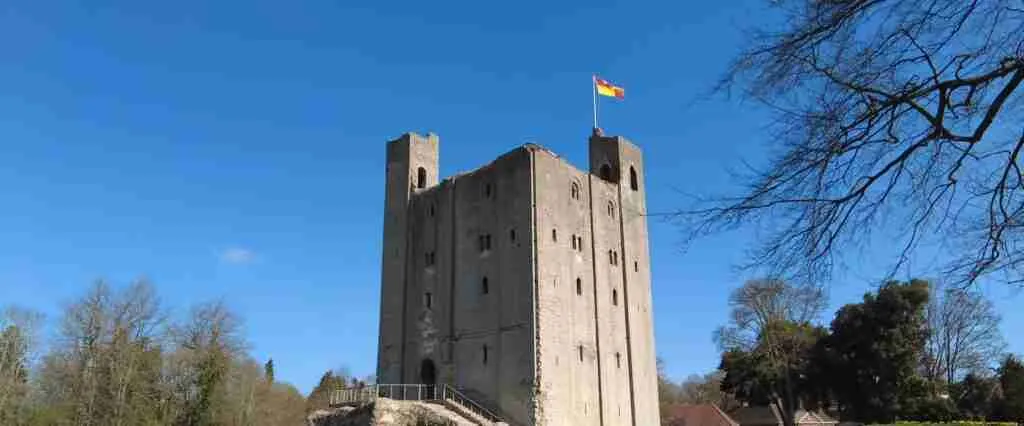
The Roman Pharos at Dover Castle is one of only three Roman lighthouse towers to survive anywhere within the former boundaries of the Roman Empire, and it is the tallest surviving Roman structure in England. These facts alone would make it exceptional; what makes it extraordinary is that for roughly a thousand years after the formal end of Roman administration in Britain, successive generations of builders continued to use it — as a functional bell tower, then as a structural anchor in the developing medieval castle — so that the monument today carries the physical marks of at least four distinct building phases while retaining its fundamental Roman character in the surviving lower stages.
The Pharos stands within the inner bailey of Dover Castle on the Eastern Heights, immediately west of St. Mary in Castro. It is octagonal in plan externally and square internally, its original profile a question that has engaged scholars since the 18th century. The antiquarian William Stukeley, examining the structure in 1722, argued for a conical profile rising smoothly from base to crown. The archaeologist Mortimer Wheeler, surveying it in 1929, argued instead for a stepped profile, each stage set back slightly from the one below. A metric survey of the above-ground fabric undertaken in 1999 and published in the English Heritage Historical Review reexamined the physical evidence accessible in the upper levels and argued in favor of Stukeley’s conical reading, suggesting that the stepped appearance may reflect partial smoothing of the original profile during medieval refacing. The debate has not been definitively resolved, and both readings deserve to be held as current scholarly positions rather than settled conclusions.
The construction material of the surviving Roman stages is a carefully chosen composite of locally available stones. At the very base is a plinth of Kentish ragstone. Above this the walls are built of rubble — flint fragments and various stones bound in hard pink Roman mortar — faced externally with dressed blocks of two contrasting materials: Dour Valley calcareous tufa and green glauconitic sandstone. These two facing materials alternate in roughly equal courses, and at every seven courses they are interrupted by a double course of flat orange-red Roman brick tile, creating the distinctive banded pattern that runs around the full perimeter of the surviving Pharos. The overall effect is a wall of considerable chromatic complexity: pale tufa, darker greenish sandstone, and vivid red brick courses creating a surface that is visually articulate as well as structurally efficient. The hard pink mortar, whose color and durability are characteristic of Roman concrete work, cements the entire assembly into a wall of remarkable cohesion.
The tower’s original height is estimated to have been approximately 24 meters (around 80 feet), rising across multiple internal stages — sources reconstruct between five and eight original levels, the uncertainty reflecting the incomplete survival of the upper section. Currently the structure stands approximately 19 meters (about 62 feet) high, of which around 12.5 meters constitutes surviving Roman work; the remaining section represents a medieval rebuilding. Records indicate that between 1426 and 1436 substantial works on the Pharos, funded by Humphrey, Duke of Gloucester, included five new stone windows in what may have been a significantly rebuilt upper stage, giving the tower the crenellated medieval appearance it retains.
The dating of the Pharos remains a matter of genuine scholarly debate. Historic England’s statutory listing assigns a construction date of AD 46, citing the reign of Emperor Claudius and interpreting the structure as part of the infrastructure assembled for the Roman invasion of Britain. Other analyses, examining the structural sequence and the relationship of the Pharos to other elements of the Roman military complex at Dubris, have proposed dates extending into the early 2nd century AD. The range of probable dates — spanning from the mid-1st century to perhaps the early 2nd century AD — should be understood as reflecting genuine uncertainty rather than a minor bibliographical quibble.
Two pharoi served Dover in the Roman period, forming a pair of synchronized beacons above the harbor entrance. The Eastern Pharos, now within Dover Castle, survives to significant height; the Western Pharos, on the Western Heights across the valley, survives only in fragmentary form, its foundations largely destroyed by the later fortifications of the Drop Redoubt. Together the two Dover pharoi and the contemporary lighthouse at Boulogne — the Tour d’Odre, which stood into the early modern period before its demolition — formed a triangulated beacon system of unusual sophistication, guiding Roman shipping through the tidal races and fog-prone narrows of the Strait of Dover.
The Saxon community on the Eastern Heights, building St. Mary in Castro around 1000 AD, did not simply find the Pharos useful: they incorporated it as a functional and symbolic partner to the new church. The Pharos’s height and visual prominence made it far more effective as a bell tower than any structure the relatively modest Saxon builders could easily have constructed from new materials. The first-floor doorway in the church’s west wall — which almost certainly connected to a corresponding opening in the Pharos converted from a Roman window — made the two structures physically linked, their combined mass forming the western anchor of the Saxon complex in a way that has almost no parallel elsewhere in England.
St. Mary in Castro: Saxon Church at the Edge of the Roman World
The church of St. Mary in Castro — “in Castro” meaning “within the castle,” or more precisely within the fortified enclosure on the Eastern Heights — stands as one of the most substantially intact pre-Conquest churches in England, even after the Victorian restorations that significantly transformed its interior in the 1860s and 1880s. Built around 1000 AD, the church’s exceptional scale for a community of modest population has led historians to speculate that it enjoyed royal or aristocratic patronage: English Heritage has identified Godwin, Earl of Wessex and father of King Harold, as one candidate, though documentary evidence for this specific attribution does not survive and the suggestion should be understood as a plausible inference rather than a confirmed historical fact.
The earliest documented reference to a church within Dover Castle dates to the 630s, in records associated with Eadbald of Kent, the son of the first Christian king of Kent, Æthelberht. Whether this reference is to the site of the current church or to a different earlier structure within the broader hilltop complex is unclear; the large late-Saxon cemetery discovered in archaeological excavation south of the current church, with burials dating to the pre-Conquest period, confirms that the hilltop community was established by at least the 7th century. The surviving building fabric is generally assigned to around 1000 AD — the “latest possible date” according to Historic England is around 1020 AD — with subsequent modifications in the 12th, 13th, and later centuries overlaying the original Saxon structure.
The church is cruciform in plan: a nave of notable width, transepts extending north and south, and a chancel projecting eastward, all centered on a crossing tower. The tower is the same width as the nave but broader than the chancel and transepts, creating a spatial hierarchy with the crossing as the dominant element at the point of intersection. The nave itself has no aisles, making the interior a single unbroken longitudinal space of considerable presence. The arches opening east and west from the crossing tower rise to approximately 28 feet (just under 9 meters) and are outlined on their western faces by projecting strips of tile — a characteristically Saxon decorative technique that produces a shallow surface articulation of the arch opening without the deep molding profiles of later Norman and Gothic work.
The north and south walls of the nave are pierced by double-splayed round-headed windows — openings that widen on both the interior and exterior faces, leaving a narrow aperture only at the mid-wall plane. This double-splayed form is a distinctive marker of late Saxon construction in England: it reduces the visible opening on the external face while maximizing the spread of light within the interior, distributing illumination across a broad section of the nave wall rather than projecting it as a narrow shaft. The resulting interior light quality is diffuse and even — different in character from the dramatic beam effects of later Gothic clerestories — and it governs the spatial atmosphere of the nave in a way that feels intentional rather than incidental.
The walls are built primarily of flint — the local stone readily available from the chalk substrate of Castle Hill — with systematic incorporation of reused Roman materials. Roman tiles appear in the window arches as dressings, providing a consistent arching surface that flint cannot easily produce, and they recur throughout the fabric wherever a flat, dimensionally regular material was needed. The quoins — corner stones — combine tile and large dressed stone. Throughout the wall fabric, this mixing of local flint and Roman spolia is deliberate and systematic: the builders were not improvising but deploying a well-established strategy of material assembly characteristic of Saxon-Norman building in coastal Kent.
The south doorway of the church, now blocked, retains its original Saxon proportions — tall and narrow, with alternating upright and flat stone slabs forming the arch facing. This alternating-slab technique (sometimes called long-and-short stonework at doorways) is recognized as a marker of late Saxon construction practice. Some accounts have described this doorway as the earliest surviving door arch in any standing English church, though this claim has been questioned in the scholarly literature and should be treated as a position within ongoing debate rather than settled consensus.
The 19th-century restorations left a profound imprint. Sir George Gilbert Scott undertook the principal structural restoration between 1860 and 1862, bringing the roofless and partially collapsed building back into use as a garrison church. His work is responsible for the current roof, windows, and door treatment; where original flint and Roman tile had decayed beyond repair, Scott replaced it with brick, working closely enough to early evidence that without photographs of the pre-restoration state it would be difficult to identify his insertions from surviving original fabric. A second restoration campaign by William Butterfield between 1888 and 1889 added the mosaic decoration now covering much of the nave wall surface — a late-Victorian intervention generally regarded as the more radical of the two, its polychromatic Byzantine-influenced design sitting in productive but tense relationship with the spare Saxon geometry of the building beneath it. The church continued to serve as the Dover Garrison church until 2014 and remains in active religious use.
Lithic Stratigraphy of Saint Mary in Castro: Reusing Imperial Roman Brick in Saxon Sacred Geometry
The walls of Saint Mary in Castro at Dover Castle are not, in the architectural sense, a single material artifact. They are a palimpsest — a layered record of different stone types, binding technologies, and constructional campaigns superimposed across the better part of two millennia. To read those walls with the attention that a geologist brings to a cliff face — registering the composition, origin, and relative dating of each stratum — is to recover a compressed history of Kent’s material culture at the moment when Roman Britain expired and the Saxon kingdom took its place. The concept of lithic stratigraphy, applied here to a standing building rather than an excavated deposit, names the method: each distinct lithic type (flint nodules, Roman brick courses, Dour Valley tufa blocks, later ragstone and medieval repairs) represents a distinct cultural episode, and the sequence of those episodes encodes a narrative of how successive builders understood both the physical substance of their predecessors and the sacred geometry those materials were being pressed into service to express.
Mortar composition and opus signinum re-appropriation in early Kentish nave construction
Opus signinum — the hydraulic concrete produced by mixing lime mortar with crushed ceramic tile or brick — was one of the Roman builder’s most versatile and durable materials. Its primary advantage was waterproofing: the pozzolanic reaction initiated by the crushed tile aggregate created a dense, impermeable matrix ideally suited to baths, cisterns, underfloor systems, and any surface requiring protection from rising damp. Vitruvius discusses its composition, and its use across the Roman world is extensively documented. At the Roman Painted House in Dover, opus signinum floors appear in rooms 3 and 5, covering the hypocaust systems in both rooms and providing the water-resistant substrate that the underfloor heating arrangement demanded. The presence of opus signinum at the Roman Painted House is therefore directly evidenced by the Kent Heritage archaeological record, connecting the technique physically to the urban context that Saxon Dover inherited.
What happened to this material — and to the knowledge embedded in it — after the formal end of Roman administration is one of the more illuminating questions of post-Roman Kent. The archaeological evidence is clear that early medieval Kentish church builders did not simply discard Roman construction materials; they actively salvaged and incorporated them, including opus signinum. The Glastonbury Abbey archaeological programme has documented that opus signinum flooring was characteristic of Kentish churches around AD 700, and excavations at churches in Essex and Kent have recovered Roman bricks with traces of opus signinum still adhering to their faces, indicating that the fragments were reused within Anglo-Saxon church walls with their original hydraulic mortar matrix intact. At St Martin’s Church in Canterbury — the earliest continuously used Christian church in England — opus signinum appears in flooring, tomb linings, and bonding layers, its hydraulic properties understood and deliberately exploited within the new ecclesiastical building program. At the chapel of St Pancras within the precinct of St Augustine’s Abbey, Canterbury, fragments of opus signinum were incorporated into the earliest phase of construction, dated between AD 597 and 609.
Saint Mary in Castro participates directly in this tradition. Its walls incorporate reused Roman tile and brick in considerable quantities — a feature so well established by survey and analysis that it forms part of the church’s standard architectural characterization. The precise mortar composition of the Saxon-period walling at Saint Mary in Castro has not, to the present author’s knowledge, been published as a systematic analysis; it would be overreaching to assert that specific courses of opus signinum can be identified within its nave without such documentation. What the Kentish comparanda establish, however, is that the practice of incorporating Roman ceramic material — including material with opus signinum still adhering — was the normal constructional behavior of Saxon church builders in this region, not an exceptional one. Saint Mary in Castro’s builders, working within a castle precinct that contained standing Roman structures including the Pharos, would have had direct access to Roman ceramic fabric and the residual knowledge of its hydraulic properties. The church’s nave fabric, read as a lithic stratigraphic record, almost certainly includes Roman ceramic material carrying the traces of its original mortar, even if that stratigraphy awaits the detailed petrographic study it deserves.
Solar alignment along the equinoctial axis in 11th-century Anglo-Norman chancels
The requirement that a Christian church orient its chancel toward the east is among the oldest surviving conventions of ecclesiastical architecture, rooted in the symbolic theology of the rising sun as an image of resurrection and the Second Coming. The early Church fathers wrote of facing east in prayer; the Didascalia and later the Apostolic Constitutions specify eastward orientation for the assembled congregation; and the practical implication — that the altar and sanctuary should be positioned at the eastern end of the nave — became so normative that it is difficult to reconstruct a period in English church building when it was seriously contested. Yet the practical execution of this requirement was neither simple nor uniform, and the archaeology of church alignment has revealed a far more complex solar relationship than the phrase “facing east” suggests.
A major study of 143 large early medieval English churches, most constructed between the mid-11th and late 12th centuries, found that the compass was not used to establish their orientations. Instead, the data indicated that builders most likely sighted the horizon at sunrise and sunset, aligning their buildings to solar positions that corresponded to the equinox, to patronal feast days, or to Easter sunrise. The researchers concluded that up to 78 percent of the surveyed churches exhibited orientations consistent with one or more of these sun-dependent categories, with equinoctial orientations — facing true east, toward the sunrise on the vernal or autumnal equinox — representing a significant subset. Richard Morris, in a separate analysis of the Norman reform period, documented “a new concern with alignment during the eleventh and twelfth centuries … evident in cathedrals which were rebuilt and re-orientated,” identifying the Norman period specifically as a moment of renewed attention to the relationship between chancel axis and solar geometry. This observation places the construction of Saint Mary in Castro — conventionally dated to around AD 1000, at the very threshold of the Norman reform’s liturgical influence — within precisely the cultural moment when equinoctial precision was becoming an architectural priority.
Whether the chancel of Saint Mary in Castro was deliberately aligned to the equinoctial sunrise cannot be confirmed without a dedicated archaeoastronomical survey measuring its precise compass bearing against the local horizon at Dover. No such published study has been identified in the sources consulted for this article. What can be stated with confidence is that the church’s general east-west axis — its chancel oriented toward the east, its nave extending to the west — conforms to the liturgical requirement universal in its period, and that Dover’s coastal position, with an unobstructed eastern horizon over the Channel, would have made solar sighting for alignment both straightforward and visually compelling to a builder trying to establish the liturgical east. The equinoctial axis in Anglo-Norman chancels was not merely a theological convention but an optical event: twice yearly, on the equinoxes, morning sunlight would have entered through the east window and traveled the full length of the chancel axis, illuminating the altar in a literal enactment of the theology the building was designed to embody. At Saint Mary in Castro, the presence of surviving double-splayed round-headed windows in the nave walls — deep window embrasures characteristic of the Saxon building tradition, designed to control and concentrate light entering a thick-walled interior — suggests that the manipulation of natural light was a deliberate element of the building’s design. The precise solar mathematics of that manipulation remains, at this site, an open question awaiting instrumentation.
Stone Upon Stone: Tufa, Flint, and the Material Language of Saxon-Norman Kent
The building materials of Dover’s Roman-period and Saxon-Norman monuments define a vocabulary specific to coastal Kent — one in which the geology of the chalk downland intersects with the availability of imported stone, the legacy of Roman quarrying and tile manufacture, and the practical constraints of construction on a clifftop exposed to Channel weather. Understanding these materials clarifies why Dover’s early buildings look and feel as they do, and why the same materials recur across centuries of building by culturally distinct communities.
Tufa in the British architectural context is a soft, lightweight, porous stone formed by the precipitation of calcium carbonate from spring or river water as it loses carbon dioxide on contact with the atmosphere. At Dover, the relevant deposit is the Dour Valley tufa: calcareous stone formed in and around the River Dour, the chalk stream whose course runs through the valley below Dover Castle. This is not volcanic tuff — a pyroclastic material produced by igneous activity and used in bulk at some major early Norman foundations in the Rhineland and further afield — despite the fact that the two materials are called by the same name in much historic building survey literature. The Dour Valley tufa is a sedimentary calcareous deposit, analogous in broad category to the travertine used in Roman construction at sites across the empire, though less dense, more porous, and more readily available from local geological sources.
The Roman builders of the Pharos selected Dour Valley tufa because its properties matched their structural and logistical requirements. As a facing material for an octagonal lighthouse tower, it was lightweight relative to its volume — an important consideration for a tall slender structure where reducing the overall mass was beneficial. It was easily worked with iron tools to produce consistent squared blocks, allowing the neat ashlar facing characteristic of the Pharos’s surviving stages. And it was locally abundant: the River Dour valley, immediately below the construction site, provided a ready source requiring no long-distance transport. The combination of Dour Valley tufa, green glauconitic sandstone from the local Greensand formation, and flat Roman brick — all bound in hard pink mortar characteristic of Roman concrete work — produced the banded, multi-tonal masonry that distinguishes the Pharos from all later building at Dover Castle and gives it a visual complexity unusual in structures of its period.
In wider Kent, tufa of various origins — local spring deposits and, from the early Norman period, imported material from northern France or the Rhineland — was a staple of church building from the late Saxon period through the 12th century. Canterbury Cathedral, rebuilt after the fire of 1067 under Archbishop Lanfranc, used tufa (alongside Caen limestone from Normandy) for vaulted construction in its crypt, where the material’s light weight reduced arch thrust and simplified centering. Rochester Cathedral, similarly Norman in its earliest surviving fabric, employs comparable material strategies. The appearance of tufa at these major Norman foundations reflects a well-established building culture that valued the stone for its workability and structural efficiency in vaulted and arched construction — a culture whose roots at Dover run through the Roman use of local Dour Valley deposits and the Saxon reuse of Roman-cut stone.
At St. Mary in Castro, the dominant building material is flint rather than tufa, reflecting both the different structural requirements of a broad-naved church versus a slender lighthouse tower and the different building practice of the late Saxon period. The church walls are built of coursed, unknapped local flint — rounded and irregular nodules from the chalk matrix, laid in rough horizontal courses with lime mortar — supplemented by Roman tile and brick for window arches, quoins, and wherever a flat, dimensionally consistent material was needed. Some tufa appears in the church’s fabric, but primarily as reused material drawn from the Pharos and other Roman structures: the Saxon builders quarried the existing Roman stock, and tufa blocks visible in the Norman and Saxon courses represent Roman material in a second architectural life.
The distinction between the Pharos — tufa-faced, multi-material, vertically structured — and the church — flint-walled, Roman-tile-dressed, horizontally extended — reflects the different functional requirements and construction eras of the two structures, as well as the specific material logic of chalk-country coastal building at different moments in history. For the archaeologist and architectural historian working at Dover, the ability to read these distinctions in the standing fabric is as informative as any written source: the materials themselves are a document of building choices, available resources, and evolving technical practice across a span of nearly a millennium.
Flint-Knapping and the Building Traditions of the Chalk Downland
Flint is among the most ancient building materials of southeast England, and its use in construction traces an unbroken line from the Neolithic long barrows and causewayed enclosures of the chalk downlands to the refined flushwork chequerwork of late-medieval Suffolk churches. In Kent, flint construction underlies the entire architectural tradition of the coastal and downland zones, and the techniques by which flint was prepared, selected, and laid evolved substantially across the span from Roman Britain through the Norman era and beyond.
In its natural state, flint occurs as irregular nodules within chalk deposits. The outer surface — the cortex — is dull and whitish; the freshly broken interior is dark, smooth, almost glassy, the result of the stone’s high silica content and its conchoidal fracture pattern — the same property that made flint invaluable for prehistoric toolmaking. Early builders had two broad approaches to working with this material: use flint in its natural rounded form, laying it in rough courses with generous mortar beds (the approach typical of Roman and early Saxon construction, including the walls of St. Mary in Castro), or knap the flint deliberately — split it to expose the smooth dark interior face — and use the resulting flat surface for decorative or structural purposes. Knapped flint used systematically, with selected nodules laid to show a regular dark face, produces a wall of striking visual quality: the surface appears almost uniformly dark and reflective, contrasting sharply with pale lime mortar joints and creating a wall of considerable visual refinement.
The more elaborate versions of knapped flint construction — squared knapping (each flint knapped and trimmed to a consistent block before laying) and flushwork chequerwork (knapped flint panels set within limestone frames in geometric patterns) — represent later medieval developments that extend well beyond the Saxon-Norman period at Dover. At St. Mary in Castro, the flint work is of the earlier, rougher type: rounded or naturally broken nodules laid in roughly horizontal courses, the wall surface irregular in texture and varied in the size and shape of individual stones. This coursed rough-flint construction is typical of late Saxon and early Norman building in Kent and Sussex, distinguished from later work not by quality of execution but by the different conventions and material expectations of the period.
The Saxon builders of St. Mary in Castro compensated for the inherent irregularity of their flint courses through the strategic use of Roman tile and brick. Flat, fired Roman tile is ideal as a leveling element: inserted at intervals within a flint wall, it creates a consistent horizontal bed that compensates for the variable thickness of individual flint courses and allows the builder to bring the wall to a true level before continuing. At St. Mary in Castro, Roman tile appears most visibly in the window surrounds — where the flat, regular tiles provide a consistent surface for the arching of the window opening that flint alone cannot easily achieve — and at the quoins, where the need for a strong and precisely shaped corner stone was met by reusing Roman brick or large dressed stone. This flint-and-Roman-tile combination is a signature of Saxon-Norman building in the southeast, found at dozens of Kent churches from Lyminge to Reculver.
The knowledge of how flint behaves — how to split it cleanly along predictable fracture planes, how to select nodules of appropriate size and quality for specific applications, how to work with a material that fractures conchoidally and unpredictably if struck incorrectly — represents a continuous tradition of lithic knowledge embedded in the working practice of the chalk-country builder. This knowledge connects the Saxon and Norman builders of ecclesiastical flint-work to a much older tradition of chalk-downland craft, one whose origins in the prehistoric exploitation of flint for tools long predate the building of churches. The same geological resource that supplied Neolithic communities with cutting tools supplied early medieval builders with wall material; the craft knowledge required to work it productively in each context is different in application but continuous in its understanding of the stone’s behavior.
Flint’s durability — its resistance to weathering, biological growth, and thermal cycling — helps explain why so many Saxon and early Norman flint buildings in Kent survive to significant height while contemporary timber construction has vanished entirely. The rough-coursed flint walls of St. Mary in Castro, buried in Victorian brick and plaster in many areas, retain the fundamental Saxon spatial structure of the building even where specific original surfaces have been lost. The material itself is nearly indestructible on the timescale of human building history; it is the mortar, the timber elements, and the dressings that fail, leaving the flint matrix as the record of where the walls were placed and how high they stood.
Orientation, Light, and the Liturgical East in Early Christian Architecture
The concept of east orientation in Christian church architecture is one of the most pervasive conventions in the history of European building. From at least the 2nd century onward, Christian communities organized their liturgical space around the axis of east and west, placing the altar and sanctuary at the eastern end of the building — toward the sunrise, toward the direction of Jerusalem, and toward the rising of Christ as Sol Iustitiae, the Sun of Justice, a theological metaphor that found architectural expression across the entire breadth of Christendom from Roman North Africa to the margins of Anglo-Saxon England.
The English word “orientation” encodes this convention directly: it derives from oriens, the Latin word for east — literally “the direction of the rising sun.” To orient a building is etymologically to align it with the east, and for the first millennium of Christian architecture in Britain, that alignment was achieved by pointing the principal sanctuary axis toward the horizon where the sun rose. The practice was so universal and so deeply embedded in liturgical culture that it required no explicit instruction in individual building projects: the east-facing church was simply what a church was, a spatial default as absolute as its function.
The theological arguments for east orientation appear consistently in early Christian writing. Origen, writing in the 3rd century, described the east as the direction of prayer, associating the rising sun with Christ’s second coming. Tertullian, slightly earlier, noted that Christians turned east to pray as a matter of settled practice. The consistency of this textual tradition, combined with the near-universal physical evidence from excavated early Christian buildings, confirms that east orientation was not a regional custom but a constitutive element of early Christian spatial practice across the Mediterranean world and its northern extensions into Britain and beyond.
What scholars have increasingly examined — since archaeoastronomy established itself as a recognized discipline in the later 20th century — is whether east orientation in early medieval churches was general (pointing broadly toward the eastern horizon) or specific (calibrated to the moment of sunrise on a particular liturgically significant date). The hypothesis of feast-day orientation proposes that a church dedicated to a specific saint might have been planned so that the chancel axis aligned precisely with the sunrise on the feast day of that saint, admitting direct morning light onto the altar on the one day of the year of greatest liturgical significance. Several examples have been proposed and analyzed in the British and Irish scholarship, using measured azimuth surveys combined with calculated sunrise azimuths for specific dates at specific latitudes.
The evidence for feast-day orientation in specific buildings is uneven and contested within the scholarly literature. Some researchers have identified statistically plausible alignments at a number of early medieval churches in Britain and Ireland; others have argued that the scatter of measured azimuths across the broader corpus of early churches is wider than a program of precise astronomical calibration would predict, suggesting that the general eastward pointing reflects liturgical intention without precise astronomical specification at the level of individual buildings. Both positions are held by serious scholars, and the debate continues.
For St. Mary in Castro specifically — dedicated to the Virgin Mary, whose principal feast days span from the Annunciation in March through the Assumption in August and the Nativity of Mary in September — a feast-day orientation hypothesis is theoretically possible but has not, to this author’s knowledge, been the subject of a published archaeoastronomical survey. The church’s chancel axis follows the conventional east-facing direction; whether this is calibrated to the sunrise at a specific Marian feast or simply aligned to the general liturgical east remains, in the current state of scholarship, an open interpretive question. The evidence in either direction has not been adequately assembled to support a confident claim.
What can be stated with confidence is that the spatial experience of an east-facing early medieval church is shaped by solar light in a predictable and meaningful way regardless of precise astronomical intention. On the equinoxes — when the sun rises exactly due east — a church oriented to due east will admit direct morning light through its chancel window directly onto the altar and sanctuary, creating a solar event coinciding with the liturgical moment. At Dover’s latitude (approximately 51 degrees north), sunrise at midsummer is considerably north of east, while midwinter sunrise is considerably south; the seasonal variation in the angle and quality of morning light entering through an eastern window creates a year-long cycle of illumination changes that the early medieval worshipper would have experienced across the full liturgical calendar. Whether or not this was precisely designed for, it would have been experienced as profoundly meaningful — the building aligning its architectural body with the movement of the sun through the year, marking time spatially as well as liturgically.
The Roman Pharos, standing immediately west of St. Mary in Castro, participates in this optical geography in a secondary way. Its height does not obstruct the church’s eastern light; it anchors the western end of the church’s longitudinal axis, providing a vertical element at the opposite pole from the liturgical east. The pairing of the tall Roman Pharos to the west and the lower-profile Saxon chancel to the east creates a spatial polarity — height and vertical mass behind the worshipper, depth and directional orientation ahead — that reinforces the liturgical movement of the building even without deliberate design intent.
Sacred Proportion and Spatial Grammar in Early Anglo-Saxon Churches
The spatial design of early Anglo-Saxon churches is governed by proportional relationships that, while rarely backed by surviving design drawings or written specifications, can be approached through the measured dimensions of surviving buildings and understood in relation to the Roman and Continental traditions from which Saxon architecture derived. The study of these proportions is a field where caution about overinterpreting the evidence is as important as identifying real patterns: the line between proportional system and practical convenience is difficult to draw in any pre-modern building tradition, and scholars have found it easy both to underestimate the sophistication of early medieval spatial thinking and to project modern analytical frameworks onto buildings that may have been organized by more pragmatic means.
At the most fundamental level, the spatial grammar of a church like St. Mary in Castro is expressed in the relationships between its primary elements: nave, crossing tower, chancel, and transepts. At St. Mary in Castro, the surviving fabric and historic descriptions agree that the tower is the same width as the nave, while the chancel and transepts are narrower. This proportional hierarchy — a broad nave and tower, with a narrower chancel projecting to the east — is well-attested in late Saxon church design and reflects the liturgical priorities of the period: the nave as the primary congregational space, the crossing tower as the acoustic and visual focus, and the chancel as the more intimate sanctuary for the officiating clergy. The spatial differentiation by width, without the dramatic vertical differentiation introduced by later Gothic building, creates a rhythmic progression along the building’s longitudinal axis from the broad nave to the narrower chancel — a spatial sequence the worshipper experiences as a narrowing and concentration of attention as they move toward the sanctuary.
The use of simple whole-number proportional ratios is consistent with what is known of early medieval building design more broadly. Roman architectural practice, inherited and adapted by early medieval builders across the former empire, employed the Roman foot (pes monetalis, approximately 29.5 centimeters) as a standard unit of measure, and whole-number relationships between room dimensions were practically convenient for builders working with ropes, pegs, and measurement rods rather than scaled drawings. Whether specific proportional systems were consciously applied at any individual building — as opposed to emerging from the practical use of standard units — is one of the persistent interpretive debates in early medieval architectural history. It is a question that requires published measured surveys to address adequately, and for St. Mary in Castro such a survey has not, to this author’s knowledge, been published in sufficient detail to allow confident statements about the specific proportional system (if any) that organized the building’s design.
The double-splayed windows of the nave deserve particular attention as spatial elements. A double-splayed window — one that widens on both the interior and exterior faces, leaving a narrow aperture only at the mid-wall plane — is a distinctive feature of late Saxon church building, appearing at a number of pre-Conquest foundations in England. The double splay reduces the visual opening on the external face (limiting rain penetration, heat loss, and vulnerability of the thin flint wall) while maximizing the distribution of light within the interior: the wide internal splay spreads light across a broad section of the nave wall rather than projecting it as a narrow focused beam. The result is a diffuse, even illumination that softens contrast within the nave — quite different from the dramatic directed light of a later Gothic clerestory — and creates an interior atmosphere of quiet, contained luminosity consistent with the theological valences of the Saxon sacred interior.
The crossing tower arches, rising to approximately 28 feet from their sill to their apex and outlined with projecting tile stripwork on their western faces, are among the most visually assertive features of the surviving Saxon fabric. The tile stripwork — flat Roman tile applied to the arch face in a thin projecting layer — creates a shadow line that articulates the arch profile and gives the opening a visual definition it would otherwise lack in rough flint construction. This decorative technique, common in late Saxon building but distinctly different from the carved-stone moldings that Norman architects would introduce after 1066, suggests a building culture with a refined sense of spatial effect achieved through surface articulation rather than plastic depth. The Saxon building tradition used material economy and surface intelligence in place of the labor-intensive carved-stone elaboration that characterizes the Norman era.
The Subterranean Logic: Buried Light and the Theology of Hidden Sanctuaries
The most dramatically subterranean of Dover’s heritage sites is the Roman Painted House, accessed by descending a staircase below the level of the modern street. The visitor who enters this monument makes a literal descent into the Roman city, crossing a threshold between the contemporary urban surface and a preserved layer of the late 2nd century AD. This spatial movement — downward, inward, into the earth and into the past — is characteristic of some of the most powerful heritage experiences in Kent, where Roman, Iron Age, and prehistoric remains survive at depths periodically accessible to excavation and, in a few remarkable cases, to direct public experience.
In ecclesiastical architecture, the crypt embodies the subterranean principle in its most formal sense. The early medieval crypt — a vaulted underground chamber, typically beneath the east end of a church, designed to house relics and provide a more intimate space for veneration separate from the main liturgical hall above — was a deliberate spatial theology. The crypt placed the believer below the level of the principal church floor, physically lower than the congregation worshipping above, in the presence of relics that mediated between the earthly and the heavenly. In the architectural thinking of the early medieval period, this downward movement was not a retreat from the sacred but an approach to it: the crypt was often the most intensely charged space in the ecclesiastical complex, the point of contact between the living church above and the sainted dead below.
St. Mary in Castro does not have a crypt in the formal sense — the site’s geology and the church’s construction on a projecting plinth above the chalk substrate made a full undercroft impractical — but the spatial and theological instinct that the crypt embodies is present in the church’s relationship to the Roman layers beneath and beside it. The buried Roman fort, the buried mansio of the Roman Painted House, and the partially buried lower stages of the Pharos all participate in a vertical archaeology of the site: the further one descends through the stratigraphy, the earlier the date of the surviving material. The archaeological movement of the site — from the medieval surfaces of the castle down through Saxon levels to Roman construction — mirrors the spatial descent of the crypt, with depth functioning as both temporal and spiritual register.
The Roman Painted House and the Pharos represent two spatial poles of this vertical logic. The painted house is horizontal and earthbound: its paintings preserved precisely because the structure was buried, its experience for modern visitors organized around the act of descent and immersion in a space that is literally underground. The Pharos is vertical and sky-reaching: the tallest structure on the clifftop, its function as a lighthouse requiring height above the landscape, its beacon designed to be seen from the sea. Both were essential to the functioning of Roman Dubris — the lighthouse guiding ships in from the Channel, the mansio housing and provisioning the officials who arrived — and both have survived through the specific circumstances of their respective uses: the Pharos through its structural massiveness and continuous utility; the painted house through the paradoxical preservation of accidental burial.
The architectural theology of the hidden and the buried appears across diverse sacred traditions as a recurring spatial instinct: the crypt beneath the shrine, the cave behind the cliff face, the rock-cut chamber carved into the hillside. This instinct reflects a broadly distributed association between depth, concealment, and the sacred — a sense that the divine presence is encountered in the act of withdrawal from ordinary, visible, surface-level space. The next sections examine how this instinct found architectural expression in a tradition geographically and historically remote from Anglo-Norman England: the rock-cut monastery caves of Maharashtra.
The Ajanta Caves: Vihara Spatial Layout and the Architecture of Controlled Light
The Ajanta Caves in Aurangabad district, Maharashtra, India, are a complex of approximately 30 rock-cut Buddhist monuments carved into a horseshoe-shaped basalt cliff above the Vaghorā River, inscribed as a UNESCO World Heritage Site in 1983. Excavated in two main phases of activity — the first associated with the Satavahana dynasty from around the 2nd century BCE, the second and more extensive associated with the Vakataka dynasty spanning roughly from the late 4th to the late 5th century CE — the complex represents one of the most significant achievements of ancient Buddhist rock-cut architecture, as well as one of the richest assemblages of ancient painted interiors anywhere in the world.
The caves fall into two main architectural types. The first is the chaitya-griha: a shrine hall with an apsidal plan, organized as a nave flanked by two side aisles separated from the nave by columns, the apse at the rear housing a stupa (and, in the later Vakataka phase, a sculpted figure of the Buddha before the stupa). The second type is the vihara: a monastery hall, roughly square in plan, its central hall surrounded on three sides by small cell doorways opening into rooms in which monks could sleep, study, and meditate, the whole fronted by a veranda or porch cut into the cliff face. In the later Vakataka-phase viharas, a shrine at the rear of the central hall contains a sculpted Buddha image, transforming the monks’ residential hall into a space that combines domestic and devotional functions within a single spatial sequence.
The spatial experience of both cave types is dominated by the management of light. Cut directly into the basalt cliff, the caves have no natural source of illumination other than what enters through their facade openings. In the chaitya-grihas, this challenge is addressed with considerable spatial intelligence: a large horseshoe-shaped chaitya window, cut into the upper portion of the rock facade above the main entrance, admits a shaft of light that travels down the nave and falls on the stupa at the apse end. The geometry of this light entry is deliberate in its effects: the high placement of the window ensures that the light falls at an angle from above, modeling the curved surfaces of the stupa and picking out the sculpted figures with directional illumination while leaving the lower nave in relative shadow. The experience of entering an Ajanta chaitya from the bright outdoor veranda — through a darkened entrance into the gradually lit interior — follows a calibrated sequence of visual adaptation: eyes adjusting from exterior brightness to interior dimness, then progressively recovering enough sensitivity to perceive the painted and sculpted surfaces that surround the worshipper on every side.
In the viharas, the light management is simpler in mechanism but no less considered in effect. The open veranda at the cave entrance is the primary source of daylight; the central hall receives diffuse reflected light from this opening, while the peripheral meditation cells are almost entirely dark except for the light that spills through their doorways from the central hall. The painted surfaces covering the ceilings, pillars, and walls of the vihara halls — executed in tempera technique on a prepared lime plaster ground applied to the basalt, according to the UNESCO documentation of the site — are designed for visibility in this diffuse, low-level light environment. The rich mineral pigments employed — ochres, greens, blues derived from malachite and lapis lazuli, organic blacks — were chosen partly for their visibility in dim conditions, and the compositional strategies of the painters, featuring bold outlines, high tonal contrast between figures and backgrounds, and concentrated detail at points of visual focus, reflect a sophisticated adaptation to the specific light quality of the rock-cut interior.
The orientation of the Ajanta Caves differs fundamentally from the deliberate east-west convention of Christian churches. The caves were carved into the south-facing cliff of the horseshoe ravine, so their facades face generally northward, across the Vaghorā River. The dominant constraint was geological and topographical — the quality and consistency of the basalt cliff, and the need for stable ground and reasonable access — rather than astronomical. The north-facing orientation of the cave facades means that direct sunlight enters the interiors only at oblique angles and for limited portions of the day, creating the relatively consistent, indirect, and manageable light quality that characterizes the Ajanta interiors. This is not the result of astronomical calculation in the Christian sense; it is the natural consequence of building into a particular cliff face in a particular geological setting, and its light-quality effects, while significant for the experience of the caves, are a consequence of the topographic circumstances rather than a deliberately designed astronomical program.
The wall paintings of the Ajanta viharas include some of the most celebrated works of ancient Indian art: the Padmapani Bodhisattva in Cave 1 and the Vajrapani Bodhisattva in the same cave are among the most reproduced images from the entire tradition. These paintings represent narratives from the life of the Buddha and the Jataka tales of his previous incarnations, rendered with a sophistication of spatial modeling and psychological characterization that places them among the highest achievements of any ancient painting tradition. Their preservation — already partial and fragile when the caves were rediscovered by a British hunting party in 1819 — reflects the same balance of fortunate circumstances and active deterioration that governs the survival of painted surfaces everywhere: the caves protected the paintings from rain and direct sunlight while also creating a humid environment conducive to biological and chemical decay. The paintings at Ajanta have been subject to conservation attention since the early 20th century, with ongoing work by the Archaeological Survey of India.
Cross-Cultural Convergence: Anglo-Norman Sacred Space and the Buddhist Cave Monastery
The architectural comparison between Anglo-Norman sacred interiors and the Buddhist rock-cut caves of Ajanta is an exercise in convergent cultural thinking rather than historical influence. The two traditions share no documented contact, no known channel of artistic or architectural transmission, and no plausible historical mechanism by which the builders of one might have known the design strategies of the other. The geographical distance between Kent and Maharashtra — more than 7,000 kilometers — and the temporal gap between the Ajanta excavations (2nd century BCE to late 5th century CE) and the construction of St. Mary in Castro (around 1000 AD) together rule out any direct genealogical connection. The similarities between these traditions — and they are real — arise from the independent operation of similar spatial instincts applied to comparable functional requirements, and they are illuminating precisely because they are independent: the convergence is evidence of universal architectural logic operating across separated contexts, not of cultural borrowing.
Both traditions address the same fundamental spatial problem: how to create an enclosed interior that registers as sacred, contemplative, and separated from ordinary experience while admitting enough natural light to make the sacred images or liturgical action perceptible, without flooding the space with the distracting, democratic illumination of ordinary daylight. The solution in each tradition involves controlled aperture: the small round-headed windows of an Anglo-Norman church or the restricted doorways of a Saxon building like St. Mary in Castro, admitting limited light through deliberate choice rather than structural necessity; the large chaitya window of an Ajanta shrine hall, cut precisely to direct light onto the stupa; the open veranda of a vihara, the principal light source for an otherwise wholly dark interior.
In both traditions, the result of this controlled aperture is a distinctive interior light quality: dim but not dark, focused rather than uniform, with specific points of greater illumination that draw the eye toward the sacred focus — altar, reliquary, stupa, or sculpted image. The spatial sequence of entry also parallels in structure across the two traditions: the visitor moves from a brighter, transitional space (the exterior porch or the exposed nave) toward a more dimly lit and spatially concentrated sanctuary (the chancel or the cave shrine), the light level dropping as the spatial investment deepens. This movement — from ordinary illumination toward controlled, concentrated sacred light — enacts a transition that the architecture marks as significant regardless of the specific theological tradition within which it operates.
The material strategies differ, reflecting the radically different geological contexts. Anglo-Norman builders in Kent worked with flint and tufa, constructing thin-walled structures that rely on cut apertures for light entry and that require buttressing to remain stable. The Ajanta builders cut into basalt, a far harder rock requiring different tools and techniques but offering the structural advantage of a monolithic, self-supporting construction requiring no independent bearing system. The painted surfaces of the two traditions represent different techniques — Ajanta’s paintings are tempera on prepared lime plaster applied to the basalt face; the Roman Painted House’s paintings are a fresco-related technique applied to lime render on a brick-and-rubble wall — but both traditions confronted the same fundamental challenge: applying color to a porous alkaline surface in conditions of low light and variable humidity, and both arrived at solutions involving carefully prepared plaster grounds, mineral-based pigments, and strong compositional line as the primary vehicle of expression.
The cross-cultural comparison does not require genealogical connection to be meaningful. It reveals that certain spatial instincts — the desire to mark the boundary between sacred and ordinary through the deliberate management of light, the use of controlled aperture to create a focused visual hierarchy within an enclosed interior, the willingness to invest extraordinary material and human effort in the decoration of enclosed and difficult-to-access spaces — appear independently across cultures separated by geography, religion, and historical time. Dover’s Roman-Norman complex and the Ajanta Caves are, in this sense, parallel documents of a broadly human architectural impulse: the instinct to shape space so that the act of entering it constitutes, in itself, a transformation of experience.
Conservation and Preservation of Dover’s Roman-Norman Heritage
The three principal sites of Dover’s Roman-Norman heritage — the Roman Painted House, the Pharos, and St. Mary in Castro — each present distinct conservation challenges reflecting their different building traditions, material compositions, and environmental contexts, while sharing the overarching challenge of all ancient masonry: the management of moisture, thermal change, biological colonization, and the cumulative weight of time on materials that were never designed for indefinite survival.
The Roman Painted House faces the most technically demanding conservation requirements of the three. In-situ painted plaster is among the most environmentally sensitive of all archaeological materials. Roman fresco painting was typically applied to wet lime render — a freshly mixed coat of lime, sand, and sometimes aggregate — onto which pigments in water solution were worked while the plaster remained fresh, bonding chemically with the lime as it carbonated and hardened. Once stabilized, the surface is chemically robust, but it is highly vulnerable to physical disruption through vibration, freeze-thaw cycling, salt crystallization (as soluble salts within the wall fabric migrate to the surface with water and recrystallize on evaporation), and differential expansion between plaster layers and the underlying wall structure. The below-ground environment of the Roman Painted House provides relative temperature stability — a genuine conservation advantage — but also creates persistent moisture management challenges. The surrounding chalk and rubble are permeable, and groundwater and surface-water infiltration must be carefully controlled to prevent hydric cycling within the painted-plaster assembly.
The Roman Painted House’s management history illustrates a conservation challenge faced by many small but significant archaeological sites in England: the tension between the resource demands of specialized in-situ conservation and the financial means of a small organization responsible for a public monument. The site was managed by a trust of local volunteers for much of its post-excavation history, operating with modest income from admissions and annual grants. In 2023 the trust returned the property to Dover District Council, and the site’s conservation and interpretation future was under review within a context of broader town-center regeneration at Dover. The long-term stabilization of the paintings — the primary conservation imperative — requires specialist monitoring, environmental control, and periodic intervention that neither volunteer management nor routine council oversight can readily provide without dedicated specialist resource.
The Pharos presents a contrasting profile. Its structural mass — rubble-cored walls of considerable thickness, bound in the durable pink Roman mortar whose hydraulic properties give it long-term strength comparable to modern cement — means that the tower is, in broad terms, self-conserving on any timescale relevant to management planning. The principal risks are those common to any ancient masonry tower exposed to English weather: moisture penetration through open joints and cracks leading to frost damage and efflorescence; biological colonization of the masonry face; and the progressive deterioration of pointing mortar, which must be periodically renewed to prevent water ingress into the rubble core. English Heritage manages the Pharos as part of Dover Castle and provides regular condition monitoring and maintenance as part of the castle’s overall conservation programme.
St. Mary in Castro’s conservation is complicated by the Victorian restorations, which created an internal mosaic surface and modified much of the original masonry with 19th-century brick while preserving the building’s fundamental Saxon spatial structure intact. The challenge of managing a building that is authentically Saxon in plan and historic significance, substantially Victorian in its decorative interior and repaired fabric, and continuously in active religious use is a common one in English parish church conservation. It requires a philosophy that recognizes all the layers of a building’s history without privileging any single period, and it demands ongoing negotiation between the requirements of liturgical use, visitor access, and structural maintenance — three imperatives that do not always align easily in a building of this age and complexity.
Visiting Dover’s Roman-Norman Heritage Sites
The three principal sites discussed in this article lie within close geographic proximity in and around Dover town and castle, and together they form one of the most concentrated Roman-Norman heritage circuits in England. Dover Castle, which contains both the Roman Pharos and St. Mary in Castro, is managed by English Heritage and is open throughout the year, with standard admission charges. The castle grounds are extensive and include the great Keep, the medieval tunnels, the wartime operations rooms, and a range of interpretation alongside the Roman Pharos and the Saxon church; visitors should allow a full day to see the castle comprehensively, or at least two to three hours for the outer enclosure and the Pharos-church complex alone. Access to the interior of St. Mary in Castro may be affected by services and events; current access conditions are best confirmed through the English Heritage website or the church’s own listings.
The Roman Painted House, located in the town center on New Street, is a separate site managed independently of Dover Castle. Following the management transition of 2023, visitors should verify its current opening status directly before making a specific journey. The monument is small — appropriate for the specialist visitor or those with a specific interest in Roman Britain, early Christian preservation, or painted-plaster conservation — but offers an experience of in-situ Roman paintings unmatched anywhere in northern England. An introductory talk by a site guide is typically available to explain the archaeology and the circumstances of the paintings’ survival and conservation.
For visitors interested in the broader Roman and Saxon heritage of coastal Kent, Dover fits naturally into a regional circuit that could also include the Saxon Shore fort and 7th-century church at Reculver (on the north Kent coast), the Roman fort and monumental arch remains at Richborough (Rutupiae, near Sandwich), and the great Romanesque and Gothic monuments of Canterbury — Lanfranc’s early Norman cathedral, the Romanesque crypt, and the associated monastic buildings of the medieval precinct. Together, these sites trace the arc of Roman, early Christian, Saxon, and early Norman building in the region that witnessed both the Roman invasion under Claudius and, in 597 AD, the arrival of St. Augustine from Rome — the event that initiated the conversion of the Anglo-Saxon kingdoms and established the English church in its Roman episcopal form. Dover’s Roman Pharos, repurposed as a Saxon bell tower and inherited by Norman builders, is perhaps the most compressed and concrete symbol of that long continuity: a Roman navigational beacon that became, without any single decisive transformation, the bell tower of a church whose successors still worship within its shadow.
Frequently Asked Questions
What is the Roman Pharos at Dover Castle, and how old is it?
The Roman Pharos is a lighthouse tower built by the Romans on the Eastern Heights at Dover, within what are now the grounds of Dover Castle, and it is the most complete Roman building in England as well as one of only three Roman lighthouse towers to survive anywhere in the world. Its precise date is a matter of ongoing scholarly debate: the most commonly cited early date is around AD 46, associating the structure with the Roman invasion of Britain under Emperor Claudius, though analysis of the structural sequence has also supported construction in the early 2nd century AD. The tower is octagonal in external profile and square internally, constructed of a rubble core faced with alternating courses of locally sourced Dour Valley calcareous tufa, green glauconitic sandstone, and double courses of flat orange-red Roman brick at every seven courses. Its original height is estimated at approximately 24 meters (around 80 feet), spanning multiple internal levels; currently the structure stands about 19 meters high, of which approximately 12.5 meters constitutes original Roman masonry, the remainder representing a medieval reconstruction of the 15th century carried out at the expense of Humphrey, Duke of Gloucester.
Why did the Roman Painted House survive for nearly 1,700 years underground?
The Roman Painted House survived because it was buried rapidly and completely by the Roman army around AD 270. The building — a mansio (official travelers’ lodging) built around AD 200 as part of the military infrastructure at Dubris — stood on ground needed for the construction of a new and larger Saxon Shore fort on the Channel coast. When the Roman army demolished the standing mansio to clear the site for the fort’s new rampart, the painted walls were pushed inward and covered by the rampart’s construction materials rather than being fully removed. That burial sealed the painted plaster from weathering, biological activity, temperature fluctuation, and human interference for nearly 1,700 years. The site remained unknown beneath modern Dover until 1970, when construction work disturbed the ground and archaeologists from the Kent Archaeological Rescue Unit, led by Brian Philp, identified the significance of the exposed remains and organized a systematic excavation that ran between 1970 and 1976. The resulting museum opened to the public in 1977 and continues to display the paintings in their original location.
What building materials were used in the construction of St. Mary in Castro?
The walls of St. Mary in Castro are built primarily of coursed local flint — the dense, siliceous stone available in abundance from the chalk deposits of Castle Hill — with systematic incorporation of reused Roman materials as dressings at structurally and visually critical points. Roman tile appears in the window surrounds, providing a consistent arching surface that flint cannot easily achieve; the quoins (corner stones) combine tile with large dressed stone. Throughout the wall fabric, reused Roman tile and brick from the adjacent Pharos and other Roman structures are mixed with the local flint in a strategy of pragmatic material assembly well-attested across Saxon-Norman building in coastal Kent. The church’s interior contains a chancel arch of Roman brick — one of several features documenting the systematic integration of Roman spolia into the Saxon building. Some tufa appears in the fabric as reused Roman material. The projecting plinth on which the church stands was built of new stone rather than reused material, suggesting that the builders were selective in their reuse practices rather than simply taking whatever was available.
What does “tufa” mean in the context of Kent’s early medieval architecture?
In the context of Kent’s early medieval and Roman architecture, “tufa” typically refers to a soft, porous, lightweight calcareous stone formed by the precipitation of calcium carbonate from spring or river water — not volcanic tuff, despite sharing a name with that igneous material in some heritage literature. At Dover, the tufa used in the Roman Pharos is locally sourced Dour Valley calcareous tufa, deposited in and around the River Dour from the lime-rich chalk springs feeding the valley. More broadly in early Norman Kent and Sussex, tufa — both locally sourced spring varieties and material imported from northern France or the Rhine valley — was widely used in church building because its low density reduced structural loads in vaulted construction, its soft grain made it readily workable for decorative carving, and it set rapidly in lime mortar. Canterbury Cathedral and Rochester Cathedral both employed tufa extensively in their early Norman phases, reflecting a material culture in which this lightweight calcareous stone played a structural role analogous to the much later use of fired-clay hollow blocks in modern construction — a light, thermally efficient, technically workable material whose properties suit specific building challenges particularly well.
What is the significance of east orientation in Saxon and Norman churches?
East orientation — placing the chancel and sanctuary at the eastern end of the church, pointing toward the sunrise — is the foundational spatial convention of early Christian architecture, rooted in theological associations between the east, Jerusalem, and the risen Christ as Sol Iustitiae (Sun of Justice). The practice appears consistently in Christian theological writing from the 2nd century and became universal across the early church. In practical spatial terms, an east-oriented church at a temperate northern latitude admits morning light through its east chancel window onto the altar and sanctuary, creating a solar dimension to the liturgical experience that varies predictably through the year. Some scholars have argued that specific early medieval churches were oriented to admit direct sunlight on the feast day of their patron saint — a phenomenon sometimes called feast-day orientation — though the evidence is uneven across the corpus of surveyed buildings, and evaluating any individual church for precise astronomical alignment requires a specific archaeoastronomical survey using measured azimuth data and calculated sunrise azimuths for the latitude in question. The general principle of east orientation is historically certain; the specifics of any particular building’s alignment require site-specific analysis.
How do the Ajanta Caves manage light in their interiors?
The Ajanta Caves manage light through strategies adapted to each cave type. In the chaitya-grihas (shrine halls), a large horseshoe-shaped chaitya window is cut into the upper portion of the rock facade above the main entrance; this window channels a shaft of light down the nave of the apsidal interior and onto the stupa at the apse end, illuminating the sacred focus from above and at an angle that models its three-dimensional form. The elevated position of the window creates a dramatic chiaroscuro effect in the otherwise dim interior. In the viharas (monastery halls), the open veranda at the cave entrance is the principal light source; the central hall receives diffuse reflected light from this opening, while the peripheral meditation cells are largely dark except for light spilling through their doorways from the central hall. The wall and ceiling paintings in both cave types — executed in tempera technique on prepared lime plaster applied to the basalt face, according to UNESCO’s documentation — are designed for visibility in this low-level diffuse light, with bold outlines and high tonal contrasts providing legibility in conditions where fine detail would be lost.
What is a vihara and how does its spatial layout differ from a Christian church?
A vihara is a Buddhist monastery hall — one of the two main architectural types in the rock-cut Buddhist tradition, the other being the chaitya-griha or shrine hall. In the rock-cut context of Ajanta and comparable sites, a vihara is carved directly into the cliff face and consists of a roughly square central hall fronted by a veranda cut into the cliff, with doorways opening along three sides of the central hall into small individual cells for monks. In the later Vakataka-phase viharas at Ajanta, a shrine at the rear wall contains a sculpted image of the Buddha, giving the hall both residential and devotional dimensions. This spatial organization differs significantly from the longitudinal axis of a Christian church: where the Christian building organizes worshippers along a single nave directed toward the eastern sanctuary, the vihara centers communal activity in a shared hall and places private contemplative practice in the peripheral cells. The sacred focus in the vihara is at the rear of the central space rather than at the end of a directed processional axis — a spatial choice that reflects a different understanding of the relationship between communal practice, individual meditation, and sacred space.
How does the Victorian restoration affect the interpretation of St. Mary in Castro today?
The Victorian restorations of St. Mary in Castro — Sir George Gilbert Scott’s structural restoration of 1860 to 1862 and William Butterfield’s interior decoration campaign of 1888 to 1889 — significantly altered the building’s appearance while preserving its fundamental Saxon spatial structure and plan intact. Scott replaced decayed flint and Roman tile with brick wherever the original material was beyond repair, closely following early evidence of the original window surround profiles; without photographs of the pre-restoration state it would be difficult to identify his insertions confidently against surviving original fabric. Butterfield’s mosaic decoration covering much of the nave wall surface represents a more radical intervention that transformed the interior atmosphere from the quiet material simplicity of rough flint and Roman brick to a dense polychromatic surface treatment more characteristic of Victorian church decoration. For the contemporary visitor, reading the building requires layered attention: the Saxon plan and spatial hierarchy are genuine; the surviving areas of original flint and Roman tile are identifiable; Scott’s structural restoration is 19th-century; and Butterfield’s mosaics are a distinct Victorian aesthetic layer superimposed on the Saxon structure. The restorations preserved the building from collapse while leaving an indelible imprint on its historic character — an outcome typical of ambitious 19th-century restoration campaigns applied to structurally compromised medieval buildings across England.
What is the Classis Britannica and what remains of it at Dover?
The Classis Britannica was the Roman Empire’s fleet stationed in British waters, responsible for patrol, logistics, and the maritime defense of the Channel coast. Its base at Dubris (Dover) made the town one of the most important military-maritime sites in Roman Britain, and the fleet’s presence has left a significant physical legacy across the town and region. The Classis Britannica built and maintained the two pharoi on the heights above the harbor, constructed the naval base within the town, and — according to current interpretation — built the mansio of which the Roman Painted House is the surviving example. The fleet’s stamped tile, bearing the mark CL BR (for Classis Britannica), has been found at numerous sites in Dover and across the southeast, providing one of the key diagnostic indicators of the fleet’s presence and construction activity. The visible remains accessible today — the Roman Painted House and the Pharos — represent the most complete surviving evidence of the fleet’s substantial engineering investment at Dubris, though ongoing archaeological monitoring of the town center continues to produce finds from the buried Roman layers associated with this long and important military-maritime occupation.
Are there other Roman-Norman transition sites in coastal Kent comparable to Dover?
Several other sites in coastal Kent offer evidence of the Roman-Norman transition, though none matches Dover’s density of surviving Roman and Saxon-Norman fabric within a single concentrated area. Reculver, on the north Kent coast, preserves the twin towers of a 12th-century church standing within the earthworks of the Roman fort of Regulbium; early medieval ecclesiastical use of the site, documented from the 7th century, mirrors Dover’s pattern of religious activity organized within surviving Roman defensive infrastructure. Richborough (Rutupiae), near Sandwich, retains the walls of the Saxon Shore fort and the massive piers of a monumental Roman arch that marked the ceremonial entry point to Roman Britain; fragmentary early Christian remains indicate devotional use of this highly charged landscape in the sub-Roman and early medieval periods. The Lullingstone Roman Villa in the Darent valley, while inland, contains a suite of rooms that served as an early Christian house-chapel in the late 4th century, complete with painted Christian iconography on its walls — one of the few genuinely early Christian painted interiors from Roman Britain, and a direct parallel for thinking about painted sacred space in the context of the province’s transition from Roman paganism to Christianity and then to the Saxon kingdoms.