Cusco’s South Valley Hydro-Road Trip: Tipón, Pikillacta, and Beyond
Southeast of Cusco, Route 3S carves through a thinly visited valley where Inca hydraulic engineering meets pre-Inca urban planning just thirty-two kilometers from the city center. The south valley circuit — anchored by Tipón’s still-functioning water channels and Pikillacta’s Wari grid — draws a fraction of the visitors who crowd the Sacred Valley yet packs comparable archaeological depth into a single self-drive day. This guide covers every logistical layer of the circuit for 2026 travelers planning to move independently along the corridor.
Key Takeaways
- Both Tipón and Pikillacta are covered by the Boleto Turístico (Tourist Ticket) Circuit 2 partial ticket at S/70 (~$19) per person, valid for two days; the full Boleto Turístico integral at S/130 (~$35) becomes better value if you plan to visit sites in a second circuit — buying two partials costs S/140, which exceeds the full ticket by S/10.
- Driving time from Cusco city center to Tipón is approximately 25–30 minutes via Route 3S southeast; Pikillacta lies a further 10 km on the same road, adding about 12 minutes; Andahuaylillas Church (separate entry, S/15–18) is 8 km beyond Pikillacta.
- Arriving at Tipón at the 7:00 AM opening on a weekday provides a crowd-free window of roughly 2–2.5 hours before the first agency tour buses arrive; midweek mornings are measurably quieter than Saturday or Sunday at any time of day.
- Day-trip costs per person run approximately $30–43 by public transport, $60–80 by private driver or self-drive economy car (two people sharing), or $90–115 on a fully inclusive guided group tour — the BTC Circuit 2 ticket ($19) is included in all estimates.
- The upper sector of Tipón connects to a surviving segment of the Qhapaq Ñan (Inca road network); the Pukara sector trail links the visible aqueduct system to the natural springs on the Pachatusan massif above, and walkers who reach the upper gate find themselves on a Qhapaq Ñan branch that continues toward Pachatusan summit for those with altitude fitness.
- Andahuaylillas Church — widely called the Sistine Chapel of the Americas for its Baroque mural program — is not covered by the Boleto Turístico and charges S/15–18 (~$4–5) independently; photography is strictly prohibited inside, and the church keeps shorter hours (7:30 AM – 5:30 PM) than the archaeological sites.
People Also Ask About Cusco’s South Valley Road Trip 2026
How long does a complete south valley day trip take in 2026?
A circuit covering Tipón, Pikillacta, and an optional stop at Andahuaylillas Church runs between 6 and 8 hours in total, depending on how deeply you explore each site and which transport mode you use. At Tipón, plan for at least 2–2.5 hours to walk the main terraces and reach the upper aqueduct sectors; most visitors who rush through in under 90 minutes miss the Pukara sector entirely. Pikillacta warrants 1.5 hours for a thorough perimeter walk through the Wari grid and a visit to the Rumicolca gateway adjacent to the site. Andahuaylillas Church takes 30–45 minutes. Adding transit time from Cusco and between sites, a 7:00 AM departure returns most travelers to Cusco by 2:00–3:00 PM, leaving the afternoon free.
What is the Boleto Turístico cost for Tipón and Pikillacta in 2026?
The Boleto Turístico (Tourist Ticket) Circuit 2 partial ticket covers both Tipón and Pikillacta along with six Cusco city museums, costs S/70 (~$19) per person for foreign adults, and is valid for two days. The full Boleto Turístico integral costs S/130 (~$35) for foreigners and covers all 16 sites across all three circuits for 10 days. If you are only making this one day trip and have no plans to visit the city museums or the Sacred Valley (Circuit 3) sites, Circuit 2 represents the most efficient spend. Tickets can be purchased at the COSITUC office on Avenida El Sol 103 in Cusco (Monday–Friday 8:00 AM – 5:30 PM, Saturday 9:00 AM – noon) or on-site in cash only in soles — bring enough soles as dollars are not accepted at the gate.
Is self-driving Route 3S safe and feasible from Cusco in 2026?
Route 3S is a paved, two-lane highway in generally good condition for the first 40 km out of Cusco, which is more than enough to reach Andahuaylillas at the far end of the standard circuit. The road descends gradually from Cusco’s altitude of 3,400 m before climbing again toward Tipón, so drivers experience no dramatic switchbacks in this section. Normal international driving licenses are recognized in Peru for tourist stays, and rental vehicles (economy cars starting at $24 per day, compact SUVs from $47) are bookable through agencies at or near Alejandro Velasco Astete International Airport. The main concern for unfamiliar drivers is the Cusco urban exit: the city center uses a vehicle-restriction scheme on certain days, so plan to exit via Avenida de la Cultura or Avenida Collasuyo, which connect directly to the Route 3S corridor without entering the restricted zone.
What timing strategy minimizes crowd overlap on the south valley circuit in 2026?
The first arrivals at Tipón — those who reach the gate at 7:00 AM opening — typically enjoy a 90-minute to 2-hour window with the site virtually to themselves. Organized tours from Cusco agencies depart between 8:30 and 9:30 AM and arrive at Tipón between 9:15 and 10:00 AM. By reversing the standard order (Pikillacta first, Tipón second) you add another crowd-avoidance option: Pikillacta receives almost no visitors before 10:00 AM regardless of day of week, so an 8:00 AM arrival there and a move to Tipón by 10:30 AM places you at Tipón just as the first wave of tours is leaving. Weekdays — particularly Tuesday through Thursday — are meaningfully less crowded than Saturday and Sunday at any time of day. The wet season months of November through February bring the thinnest crowds to both sites but also afternoon rain and muddy upper trails at Tipón.
Extended multi-day tours – 5+ days
Featured Machu Picchu Cusco Multi-Day Tour Packages

6 days
6 Days Of Adventure: Cusco, Machu Picchu, Humantay Lake, And Rainbow Mountain
- ✓ Comprehensive Machu Picchu Cusco tour
- ✓ Expert local guides included
- ✓ All accommodation arranged
- ✓ Transportation provided

3 days
Inca Quarry Trek to Machu Picchu 3D/2N
- ✓ Comprehensive Machu Picchu Cusco tour
- ✓ Expert local guides included
- ✓ All accommodation arranged
- ✓ Transportation provided
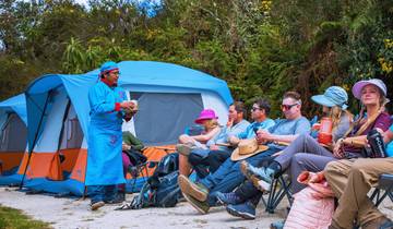
4 days
Private Luxury Inca Trail to Machu Picchu 4 Days – Glamping & Vistadome
- ✓ Comprehensive Machu Picchu Cusco tour
- ✓ Expert local guides included
- ✓ All accommodation arranged
- ✓ Transportation provided
4 days
INCA TRAIL 4 DAYS – Small Group
- ✓ Comprehensive Machu Picchu Cusco tour
- ✓ Expert local guides included
- ✓ All accommodation arranged
- ✓ Transportation provided
Multi-day tour packages powered by TourRadar. Prices and availability subject to change.
The South Valley Circuit as a Self-Drive Heritage Corridor in 2026
The south valley of Cusco rarely appears in the first paragraph of any Peru itinerary, yet it runs precisely where the narrative of Andean civilization is most compressed: Wari urban planning, Inca hydraulic innovation, and Spanish colonial Baroque art all sit within 45 km of each other along a single paved road. The contrast with the Sacred Valley — which runs northwest of Cusco toward Pisac, Ollantaytambo, and Maras — is primarily one of visitor volume, not archaeological significance. The south valley handles a fraction of the tour traffic, meaning the same quality of Inca stonework and the same scale of pre-Columbian planning are accessible with none of the gate-queuing or jostling that characterize high-season Sacred Valley visits in 2026.
Route 3S — the main paved axis connecting Cusco to the Puno direction — is the organizing spine of this circuit. It passes through or near every site worth visiting in the south valley, making navigation straightforward for self-drivers. The route also follows the approximate alignment of the ancient Qhapaq Ñan, the Inca road network branch that connected Cusco’s administrative core to the Collao region (around Lake Titicaca), which explains why Tipón, Pikillacta, and Rumicolca all cluster along this corridor: they were nodes on a transit and administrative network that the Incas (and before them the Wari) used for exactly the same purpose modern travelers use Route 3S — movement between Cusco and the highland south.
For 2026 travelers focused on avoiding the Sacred Valley’s peak-season crowding — which has intensified as Machu Picchu implements timed-entry restrictions that push visitors toward adjacent sites on the same day — the south valley offers a genuine alternative. Sites here are large enough to absorb visitors across different sectors at the same time, open from 7:00 AM, and far enough from the main Cusco tour hub that the first organized groups typically don’t arrive until mid-morning. The practical result is that a traveler willing to leave Cusco by 7:00 AM can have Tipón’s terraces almost entirely to themselves for the first two hours of the day.
The “hydro” framing in this guide’s title is deliberate and not merely stylistic. Tipón is above all a water site: its design, its purpose, its ongoing operation, and its place in the story of Andean engineering are all shaped by water. The site was declared a National Archaeological Park of Peru in 1984 and placed on the American Society of Civil Engineers’ List of Historic Civil Engineering Landmarks in 2006 — a recognition typically reserved for bridges and dams, not archaeological parks — specifically for the sophistication of its hydraulic engineering. Understanding Tipón as a water infrastructure monument, rather than simply as a set of terraces, changes the way visitors move through it; the most interesting features are the aqueduct channels and fountain systems, not the terraces themselves.
Pikillacta, 10 km further along Route 3S, answers a different question: what did a pre-Inca, non-Andean civilization do in this valley? The Wari culture, which reached its peak between roughly the 7th and 11th centuries AD (though precise dating remains a subject of ongoing archaeological investigation), built Pikillacta as one of its provincial administrative centers — a grid-planned urban complex that predates the Inca presence in the Cusco region by several centuries. That the Incas later built their own control gate, Rumicolca, into the Wari enclosure wall on the site’s eastern edge suggests they recognized and incorporated the site’s administrative logic rather than starting from scratch. Visiting both sites in the same day produces a layered understanding of how successive civilizations used this particular valley as an administrative and hydraulic asset.
Understanding Cusco’s South Valley Archaeological Corridor
The south valley corridor spans roughly 45 km from Cusco’s urban edge to the village of Huaro, with the main archaeological attractions concentrated between the 23 km and 33 km marks from the city center. The valley follows the Huatanay River as it drains southeast toward the Vilcanota River, maintaining an altitude range between approximately 3,200 m and 3,600 m across the sites — elevation changes that have practical implications for walkers tackling the upper sectors of Tipón, where the trail gain from the main terrace complex to the upper aqueduct approach adds around 150–200 m of ascent.
The three principal archaeological anchors of the corridor are distinct enough in type and period that combining them in a single day creates a genuine narrative arc rather than repetitive site-hopping. Tipón represents Inca imperial engineering at its most sophisticated hydraulic expression. Pikillacta represents the only significant Wari urban complex in the immediate Cusco region — a pre-Inca civilization that the Incas succeeded and partially incorporated. Rumicolca, the Inca gateway built directly into Pikillacta’s east wall, represents the moment of transition between these two civilizations, visible in a single stone structure where Wari masonry and Inca stonework meet at the same wall face. Andahuaylillas Church, 8 km further, adds a Spanish colonial layer: the early 17th-century Baroque murals that cover its interior walls represent the third major cultural imposition on this valley, following the Wari and the Inca.
Route 3S connects these layers without requiring navigation decisions at any point: all three main sites are signed from the highway, parking areas exist at each one (free and adequate for self-drive visitors), and the road surface is paved and in reasonable condition for standard passenger cars throughout the circuit. The route also passes through Oropesa, a village roughly 12 km from Cusco that is locally famous for its bread ovens — a practical lunch-stop option on the return leg for those who find the Tipón village restaurants insufficient.
Altitude is the main physical variable to plan around. Cusco sits at approximately 3,400 m, and the higher reaches of Tipón’s archaeological zone approach 3,600 m. Visitors arriving directly from sea level who tackle the upper Tipón sectors on their first or second day in the region are likely to experience shortness of breath and reduced stamina. Standard acclimatization advice recommends at least two full days in Cusco before undertaking any significant uphill walking; the south valley day trip is ideally positioned as a day-three or day-four activity for visitors who have already adjusted to altitude via lower-intensity city walks. The base level of both Tipón and Pikillacta — the main visitor entrances — sit below 3,400 m and are manageable for most travelers at any acclimatization stage, but the upper aqueduct trek at Tipón requires aerobic reserves that thin-air newcomers frequently underestimate.
Weather patterns follow Cusco’s standard Andean calendar. The dry season — May through October — delivers mostly clear mornings and cold nights, with the strongest visitor numbers between June and August. The wet season — November through April — brings afternoon rain and occasional morning mist, reduces visitor volumes substantially, and makes the upper trail sectors at Tipón significantly muddier. December through February represents the quietest period at both Tipón and Pikillacta; the trade-off is afternoon rain that typically begins around 1:00 PM, reinforcing the case for early-morning departures regardless of season.
Route 3S Self-Drive Guide 2026: Navigating the Cusco–Tipón–Pikillacta Corridor
The Route 3S exit from Cusco begins at the intersection of Avenida de la Cultura and the road south toward Saylla. From this point, drivers follow a single consistent road southeast without route changes until they reach the Tipón turnoff at approximately km 23, then the Pikillacta turnoff at approximately km 33. The road is identified as Route 3S on mapping applications and is the same highway used by travelers continuing to Puno and Lake Titicaca; it is well-signed and carries moderate traffic throughout the day, with truck volume increasing in the late afternoon as transport vehicles return from the altiplano.
The Tipón archaeological site is not directly on Route 3S but requires a turn inland (east) at the village of Oropesa — specifically at the Tipón turnoff sign on the highway — followed by approximately 4 km of ascending road to the site entrance. This connecting road narrows and steepens as it climbs; it is paved but tight in places where village traffic from Tipón village uses the same single lane. Economy cars navigate it without mechanical difficulty but should take it slowly. A small parking area at the archaeological park gate accommodates 15–20 vehicles; on weekday mornings it is generally empty at opening time. No parking fee is charged at Tipón as of 2026.
Returning to Route 3S from Tipón, continue southeast for approximately 10 km to reach the Pikillacta turnoff. The site is more directly accessible from the highway than Tipón: the access track from the main road to the Pikillacta entrance gate runs only about 500 m and is level. Parking adjacent to the gate is free and easily accommodates self-drive vehicles. Rumicolca — the Inca gateway structure set into Pikillacta’s east wall — is visible from the main road and reachable in approximately 15 minutes on foot from the Pikillacta parking area.
For Andahuaylillas Church, continue a further 8 km along Route 3S past Pikillacta to the town of Andahuaylillas. The church faces the town’s main plaza and is signed from the highway. Parking in the plaza is free. Hours run 7:30 AM to 5:30 PM, shorter than the archaeological sites; plan the church visit before 5:00 PM to allow time at the entrance before closing. The separate S/15–18 entry fee is payable in cash at the church door; cards are not always accepted, so carry soles.
Distances and approximate driving times from Cusco city center (starting from Avenida de la Cultura):
- Cusco → Tipón turnoff (Oropesa): 19 km, approximately 22 minutes
- Tipón turnoff → Tipón archaeological park gate: 4 km, approximately 8 minutes (ascending, slow)
- Tipón gate → return to Route 3S, then → Pikillacta gate: 14 km, approximately 18 minutes
- Pikillacta → Andahuaylillas: 8 km, approximately 10 minutes
- Andahuaylillas → Cusco (return via Route 3S): 41 km, approximately 45 minutes
Total driving distance for the full circuit (Cusco → Tipón → Pikillacta → Andahuaylillas → Cusco): approximately 115 km. Fuel for this round trip in an economy car consumes roughly 8–10 liters, adding S/120–150 (~$32–40) to the day’s costs split among occupants.
A note on the Cusco vehicle restriction scheme (pico y placa): Cusco applies day-based vehicle restrictions in parts of the city center based on license plate number. The restriction affects the historic center zone and does not apply to Route 3S itself or to the Avenida de la Cultura departure point. Rental vehicles operating on restricted days may need to exit the historic center before the restriction window or use an alternate route via Avenida Collasuyo. Rental agencies will advise on the current plate-number calendar at pickup, which changes annually. As a practical simplification, departing the city before 8:00 AM on any day avoids the peak restriction window regardless of plate.
Fuel stations appear along Avenida de la Cultura before leaving the city; filling the tank before departing is advisable since Route 3S has limited fuel options between Cusco and Urcos. The Saylla junction at approximately km 10 has a small station, but hours are not guaranteed early in the morning. Carrying a full tank from Cusco eliminates this variable for the standard circuit.
Tipón Hydraulic Archaeological Park: What to Expect in 2026
Tipón covers 239 hectares of southern slope on Mount Yanaorqo, which forms part of the Pachatusan massif. The part visitors actually walk covers a much smaller area — the main terraced complex occupies perhaps 20 hectares of the total — but the upper archaeological zone, accessed via the Pukara sector trail, adds significantly to the walkable footprint for those with time and altitude fitness. Opening hours in 2026 remain 7:00 AM to 6:00 PM daily. The BTC Circuit 2 ticket or full BTC integral is required for entry; no ticket is sold in dollars, and card machines are unreliable on-site, so arrive with soles.
The most visited sector — the main terrace complex and its central fountain system — is what most photographs of Tipón show: a series of wide, precisely built agricultural terraces irrigated by water channels cut directly into the terrace face and by a central canal that divides into paired streams at the main fountain structure. The water in these channels still flows continuously, fed by the natural spring system above the site and directed via the surviving stone aqueduct. The engineering requires no pumping, no management intervention, and no modern assistance; it has operated on the same hydraulic principles for more than five centuries. American civil engineer Kenneth Wright, who conducted field studies at the site in the late 20th century, documented this system and is credited in published engineering literature with calling it a “civil engineering wonder” — a characterization that became the basis for the 2006 ASCE landmark listing.
The main fountain structure, locally called Intimachay or simply the central fountain, is the visual anchor of the lower complex. Water drops from a precisely angled channel into a carved stone basin and flows from there into the terrace canal network. The geometry of the drop structure — its angle, width, and basin dimensions — controls both flow rate and erosion across the terraces. This level of intentional hydraulic design in a pre-industrial, pre-written-blueprint context represents the engineering achievement for which the site is recognized internationally.
Moving uphill from the main terraces, visitors pass through several distinct sectors: Sinkunakancha (an enclosure area with evidence of residential or storage function), Intiwatana (an astronomical alignment platform), and Cruzmoqo (a viewpoint sector on the north slope of the complex that provides views back toward Cusco on clear days). These upper areas see notably fewer visitors than the main terrace zone and are reached via a trail that gains altitude steadily. Altitude sensitivity becomes relevant from the Cruzmoqo sector upward; the walk is not technically demanding but requires steady aerobic output at 3,400–3,600 m.
Photography conditions at Tipón follow a reliable morning pattern: the main terraces face generally northeast and receive direct morning light between approximately 7:30 and 10:30 AM during the dry season (May–October). The channeled water catches this light and produces reflective detail that disappears in flat midday light. Arriving at opening and positioning in the lower terrace zone by 7:30 AM captures this window. The upper Cruzmoqo sector offers wider compositions including the full terrace staircase with the valley behind it; afternoon light (2:00–4:00 PM) favors this angle from late April through September when the sun’s position allows side-lighting on the terrace faces.
The site’s on-site interpretation infrastructure is limited. There are no permanent audio guide rental points, no site museum, and minimal signage in English. Hiring a local guide from Cusco before departure is the standard way to maximize interpretive value; guides available at the Tipón gate itself are rare and not guaranteed. Tour agencies in Cusco can arrange private guides for the full circuit at approximately $50–80 for a half-day, separate from any transport arrangement. Several of the agencies operating standard south valley tours in 2026 allow custom guide-only bookings for travelers who have their own vehicle.
2026 Field Logistics: Combining Tipón and Pre-Inca Pikillacta in One Day
Combining Tipón and Pikillacta in a single day is the standard configuration for this circuit and is entirely feasible for most fitness levels provided departure from Cusco is before 8:00 AM. The two sites together require approximately 4–5 hours of actual site time, leaving ample driving margins for an early-afternoon return to Cusco or an extension to Andahuaylillas. The sequencing question — which site to visit first — has a practical answer: Tipón first, Pikillacta second, regardless of transport mode. The upper trail sectors at Tipón demand the most physical effort and benefit from morning coolness; Pikillacta is largely flat and walkable at any time of day. The crowd dynamics also favor this order: Tipón receives the first organized-tour arrivals and benefits most from the early-bird advantage, while Pikillacta remains relatively quiet until late morning regardless of order.
Pikillacta’s scale is often underestimated from site photographs. The Wari complex covers approximately 2 km² and contains hundreds of rectangular structures arranged in a grid plan around several large open courts. The outer enclosure walls stand up to 8 m tall in places and run for considerable distances without break. Walking the full perimeter of the main walled compound takes approximately 45 minutes at a steady pace; the interior, where excavated structures are concentrated, adds another 30–45 minutes. The distinctive feature of Pikillacta — its orthogonal, non-adaptive grid layout, which ignores the natural topography in a way that contrasts sharply with Inca site planning — is most apparent from the northeast corner, where the relationship between the rigid grid and the surrounding terrain becomes spatially clear.
Rumicolca, directly adjacent to Pikillacta on its east side and accessible without a separate ticket, is a Inca-period gateway structure built into or over an existing Wari perimeter wall. The Inca stonework — smaller, more precisely fitted blocks — is visually distinct from the coarser Wari coursing around it. This meeting of masonry styles at a single wall face provides one of the most direct visual comparisons of the two civilizations available anywhere in the Cusco region without interpretation panels. Plan 20–30 minutes here in addition to the main Pikillacta circuit.
The combined day — Tipón from 7:00 AM to approximately 10:00 AM, drive to Pikillacta by 10:15 AM, Pikillacta and Rumicolca until 12:30 PM, optional Andahuaylillas by 1:30 PM and finished by 2:00 PM — returns travelers to Cusco by approximately 3:00 PM. This schedule is comfortable rather than rushed and allows adequate time in each sector without skipping the upper Tipón trail.
Navigating the Upper Aqueduct Trek: From Mount Pachatusan Spring to Main Terraces
The upper aqueduct trail at Tipón is the circuit’s most physically demanding and most scenically rewarding element, and it is the feature most frequently skipped by visitors who underestimate the site’s vertical extent. The trail connects the visible aqueduct canal in the main terrace zone to its source system in the upper Pukara sector, providing a walk that traces the water’s journey in reverse — from the main fountain complex uphill through progressively less-excavated archaeological sectors toward the high spring zone on the Pachatusan massif.
The Pachatusan massif rises to approximately 4,842 m above sea level southeast of Tipón. The site itself sits on the mountain’s lower western slopes at an altitude of roughly 3,400–3,600 m. The natural springs that feed the Tipón hydraulic system originate at higher elevations on the Pachatusan massif; the Inca engineers tapped these springs and directed their output via a system of surface and subterranean stone channels to the main terrace complex below. One of these channels runs on top of a surviving intact stone aqueduct — a linear stone structure elevated above the natural ground surface — that is visible in the upper sector of the site and represents some of the finest Inca hydraulic infrastructure in the Cusco region.
To reach the upper aqueduct sector from the main entrance, follow the central trail past the main terrace complex and through the Sinkunakancha enclosure area. The trail continues uphill through the Intiwatana sector — where a stone platform with possible astronomical alignment function sits above the main terraces — and then climbs further to the Pukara sector, which includes the site’s defensive perimeter wall and the highest excavated structures within the archaeological park boundaries. The aqueduct channel becomes visible in this upper zone, running along the hillside at a controlled grade that feeds the entire system below via gravity alone.
At the upper boundary of the Tipón archaeological park, the trail reaches a gate beyond which the path continues toward the higher Pachatusan slopes. This gate marks the junction with a surviving Qhapaq Ñan branch — a segment of the Inca road network that historically connected Tipón to the high-altitude routes toward the Antisuyu (eastern) quarter of the Inca empire. Walkers who pass through this gate and continue uphill are walking on authenticated Inca road surface in places, though the route becomes increasingly rough and unmarked above the archaeological park boundary. The Pachatusan summit itself is a half-day mountaineering objective from this point and is not part of the standard Tipón archaeological visit; it requires significantly more altitude fitness, appropriate footwear, and ideally local route knowledge or a mountaineering guide.
For the standard archaeological visitor, the upper aqueduct trek from the main entrance to the Pukara sector and back takes approximately 60–90 minutes additional to the lower terrace visit, adding a total of 3–3.5 hours to the full Tipón experience. The trail surface is uneven compacted earth and loose stone; hiking shoes or trail runners are recommended over sandals or flat-soled sneakers. Water consumption at altitude is higher than expected; carry at least 1.5 liters per person. The upper trail is narrower and sees almost no group-tour traffic — most organized tours restrict to the main terrace complex below — making the upper Pukara sector one of the most consistently crowd-free areas in the entire south valley circuit.
The altitude gain from the main entrance to the upper Pukara sector is approximately 150–180 m over roughly 1.5 km of trail. This is not a technical climb by any standard, but at an average altitude of 3,500 m it requires controlled pace, frequent short breaks, and awareness of individual acclimatization status. Travelers who have spent only one night at Cusco altitude should treat the upper trek as optional; those on their third or fourth day at Cusco altitude — who have successfully completed moderate walks without excessive breathlessness — will find it entirely manageable at a measured pace.
Public Transport vs. Private Transfer Logistics from Cusco Hub
Four distinct transport approaches serve the south valley circuit in 2026, each with different cost profiles, time structures, and flexibility levels. The correct choice depends primarily on group size, altitude acclimatization status (which affects whether rushed schedules are tolerable), and how much time each site warrants.
Public collectivo bus: The cheapest approach uses the Saylla–Huasao collective bus service departing from Avenida de la Cultura in Cusco, where several bus lines run southeast along Route 3S. The bus drops passengers near the Oropesa/Tipón junction for approximately S/3–5 per person each way (~$1–2). From the junction, a local moto-taxi or shared collectivo runs to the Tipón archaeological park gate for an additional S/3–5. The return journey from Pikillacta to Cusco follows the same highway, with collectivos picking up at roadside stops flagged by hand. Total public transport cost for the full circuit runs S/20–30 ($6–8) per person in transit alone, plus the BTC Circuit 2 ticket ($19). The limitation is inflexibility: buses run on their own schedule rather than yours, and the wait for an onward collectivo from Pikillacta to Andahuaylillas can run 30–45 minutes depending on timing. Budget travelers willing to plan around bus schedules and walk the 500 m from Route 3S to the Pikillacta gate can complete the circuit for approximately $30–38 per person all-in (excluding Andahuaylillas).
Private driver or taxi: Hiring a private driver from Cusco for a half-day circuit — covering Tipón, Pikillacta, and optionally Andahuaylillas — runs approximately $70 for a group of up to three people, or $35 per person for a couple. The driver waits at each site (standard practice and included in the quoted price) and returns the group to Cusco on completion. This approach provides full schedule flexibility, allows the upper Tipón trail to be tackled without worrying about catching the last collectivo, and works out significantly cheaper per person for groups of three than for solo travelers. One-way taxi to Tipón only runs $28–35 from central Cusco; round-trip direct-taxi for two sites runs $50–65 depending on negotiation. Per-person costs at group size of three: approximately $23–25 for the driver, plus $19 BTC, plus $5 Andahuaylillas, plus $12–18 lunch — total approximately $60–70 per person.
Self-drive rental car: An economy car rental at $24–32 per day shared between two people adds $12–16 per person to the day’s base cost, plus fuel of approximately $25–35 split between occupants. The advantage of self-drive over a private driver is primarily temporal: there is no negotiation time, no waiting for the driver to arrange pick-up, and no implicit pressure to move on from a site when the driver signals impatience. Self-drive also allows spontaneous route extensions — stopping at a village, exploring the Oropesa bread market, or arriving at Tipón 15 minutes before opening to secure a good parking position. The Route 3S driving requirement is straightforward for drivers comfortable on two-lane mountain roads. Compact SUVs (from $47/day) are recommended for the ascending Tipón access road, which includes some rough surface near the top, though economy sedans complete the route without difficulty in dry conditions.
Guided group tour: Standard agency group tours for the south valley circuit depart from Cusco hotels between 8:30 and 9:00 AM and return by 2:00–3:00 PM. Base price without entry tickets runs $60–62 per person; with BTC Circuit 2 included the price rises to approximately $80–87 per person; fully inclusive versions including Andahuaylillas entry run $100–108 per person. The main limitations are the fixed schedule — which typically arrives at Tipón after the best crowd-free window — and the restricted time at each site, usually 60–90 minutes at Tipón versus the 2–3 hours that independent visitors use. For first-time visitors who want interpretive context without navigation logistics, guided tours serve well; for those who want to spend real time in the upper Tipón sectors or explore Pikillacta’s full perimeter, self-guided or private-driver approaches are more appropriate.
Boleto Turístico Ticketing Strategy 2026: Partial Circuit vs. Full Ticket
The Boleto Turístico del Cusco (BTC) — managed by COSITUC, the Committee of Integrated Cultural Tourism Services of Cusco — is the primary entry system for both Tipón and Pikillacta and most other major archaeological sites in the Cusco region. Understanding the ticket structure before arriving at any site gate saves time, money, and the frustration of discovering that on-site purchases must be made in cash soles rather than card or foreign currency.
Three ticket configurations are relevant to south valley visitors in 2026. The full BTC integral costs S/130 (~$35) per person for foreign adults and is valid for 10 consecutive days across all three circuits and all 16 included sites. The Circuit 2 partial ticket costs S/70 (~$19) per person for foreign adults, is valid for 2 days, and covers six Cusco city museums plus Tipón and Pikillacta — the two south valley archaeological sites. The Circuit 3 partial ticket (Sacred Valley) also costs S/70, covers Pisac, Ollantaytambo, Chinchero, and Moray, and is valid for 2 days; it is irrelevant to the south valley circuit but worth noting for itinerary planning.
The ticket decision arithmetic is straightforward. If you plan to visit only the south valley sites on this trip, buy Circuit 2 at S/70. If you also plan to visit Sacred Valley sites on Circuit 3, buy the full BTC integral at S/130 rather than two separate partial tickets at S/140 — the full ticket is cheaper by S/10 (~$3) and saves the paperwork of two separate purchases. Students with valid ISIC cards pay S/70 for the full integral ticket — the same price as a single partial circuit — making the full ticket an obvious value pick for students who want access to any two or more circuits.
Peruvian nationals pay significantly lower rates: S/70 for the full integral ticket and S/40 per partial circuit. Foreign visitors traveling with Peruvian partners should purchase tickets separately to take advantage of the national rate for the Peruvian member of the group.
Where to buy matters. The COSITUC office on Avenida El Sol 103 in central Cusco is open Monday through Friday 8:00 AM to 5:30 PM and Saturday 9:00 AM to noon; it accepts cards for payment. The COSITUC office can be a better option than site gates for those who want card payment — gate purchases at Tipón and Pikillacta require cash soles only, with no card reader available as of early 2026. Travelers on an early morning departure who do not have sufficient soles can purchase at the COSITUC office the evening before.
A critical note on what the BTC does not cover: Andahuaylillas Church (San Pedro Apóstol) is explicitly excluded from the Boleto Turístico system and requires a separate S/15–18 cash payment at the church door. Qorikancha (the Inca sun temple in Cusco city center), the Cusco Cathedral on the main plaza, Machu Picchu, Rainbow Mountain, and Maras Salt Mines are all similarly excluded. The BTC Circuit 2 museums — Regional Historical Museum, Popular Art Museum, Contemporary Art Center, Qorikancha Site Museum (a separate institution from the Qorikancha temple itself), Qosqo Center for Native Art, and the Pachacútec Monument — are accessible in Cusco city center with the same Circuit 2 ticket and provide useful context for the archaeological sites if time allows a Cusco afternoon visit before or after the south valley day.
One practical consideration for independent travelers purchasing on-site: the BTC can be purchased at the entrance of either Tipón or Pikillacta using the Circuit 2 option, but you must carry the same physical ticket to both sites for validation. The ticket is stamped at first use and records the two-day validity from that date. Arriving at Tipón with no ticket means queuing at the site gate’s purchase window, which is staffed from opening and operates in soles cash only. Bring S/70–80 per person in soles to cover the ticket with small change buffer.
Crowd-Free Timing Windows 2026: Beat the Tour Buses
Both Tipón and Pikillacta maintain open hours from 7:00 AM to 6:00 PM daily, including weekends and public holidays. The gate personnel arrive at 7:00 AM and admit ticket-holding visitors from that time. On weekdays, the first organized group tour from a Cusco agency typically arrives at Tipón between 9:15 and 10:00 AM; on weekends, some tours depart earlier (8:30 AM) and may arrive by 9:00 AM. The practical result is that arrivals at Tipón’s gate at or before 7:30 AM on any weekday have the site effectively to themselves for at least 90 minutes and typically up to 2 full hours.
The crowd pattern at the two sites differs in a way that creates strategic options. Tipón is the more popular of the two with organized tours — it photographs better, it has a clearer “wow” feature in the water channels, and most agencies include it in their south valley standard itinerary. Pikillacta, by contrast, is less photogenic by conventional measures and receives noticeably fewer tour groups; the site remains manageable even at 11:00 AM on a Saturday, when Tipón may be handling several simultaneous groups. This asymmetry means that the urgency to arrive early is primarily about Tipón, not Pikillacta.
Day-of-week analysis from visitor pattern data shows that Tuesday, Wednesday, and Thursday are the quietest days at both sites. Monday is marginally busier because some tours skip Sunday for logistical reasons and double up on Monday. Friday begins the weekend surge. Saturday and Sunday carry the highest visitor volumes across the morning window, with Tipón receiving enough organized tours between 9:30 AM and 12:30 PM to fill the main terrace zone with simultaneous groups. For visitors arriving on weekends, the 7:00 AM opening is the clearest crowd-free window; arriving at 10:00 AM on a Saturday morning means joining the third or fourth tour group in the site simultaneously.
Seasonal timing adds another variable. The dry season (May–October) brings the highest visitor volumes, with June, July, and August at peak. The wet season (November–April) brings dramatically fewer visitors — November and March–April are transitional months with moderate rain; December through February is the wettest period and the emptiest at both sites. A traveler willing to manage afternoon rain (typically starting 1:00–2:00 PM in January) and muddy upper trails at Tipón can have both sites nearly alone on a weekday in January. The archaeological features at both sites are equally accessible in wet season; the upper Tipón trail becomes slippery from wet clay and requires extra caution.
Combining timing strategy and site sequence produces the most effective crowd-avoidance approach for the 2026 season. Departing Cusco at 6:30 AM reaches Tipón gate by 7:00 AM; two hours in the main terrace and upper sectors puts you back at the car by 9:15 AM; arriving at Pikillacta by 9:30 AM is still ahead of most tours; finishing Pikillacta and Rumicolca by 11:30 AM; Andahuaylillas Church by 12:00 PM and done by 12:30–1:00 PM; back in Cusco by 2:00 PM. This schedule maximizes time at each site, avoids the main tour-group window at both archaeological parks, and completes the circuit before afternoon deterioration in weather during wet-season months.
Beyond Tipón and Pikillacta: Extending the South Valley Route 2026
The standard two-site south valley circuit (Tipón + Pikillacta) leaves room for meaningful extensions that add interpretive and visual range to the day without significant additional driving. Three extension options stand out for 2026 visitors with flexible schedules: Andahuaylillas Church, the Huaro church on the Andean Baroque Circuit, and the Urcos lagoon for an end-of-day landscape stop.
Andahuaylillas Church (San Pedro Apóstol): Located 8 km beyond Pikillacta along Route 3S in the town of Andahuaylillas, this early 17th-century colonial church is legitimately exceptional and earns its comparison to the Sistine Chapel — not for scale, but for the density and quality of the Baroque mural program that covers every interior surface including the ceiling. The murals integrate Christian iconography with Andean decorative motifs in the hybrid style known as Andean Baroque, produced by indigenous and mestizo artists working under Jesuit patronage. The exterior of the church is extremely plain — a whitewashed facade with a simple entrance — which makes the interior revelation particularly striking for visitors who enter with no visual preview. Photography is strictly prohibited inside, making the experience entirely meditative; it is one of the rare heritage sites in the Cusco region where visitors cannot default to camera management. Entry costs S/15–18 (~$4–5) in cash soles, paid at the church door. Hours: 7:30 AM – 5:30 PM. Plan 30–45 minutes for a thorough visit.
Huaro Church (San Juan Bautista de Huaro): Located 10 minutes further along Route 3S from Andahuaylillas, the Huaro church completed its restoration in 2008 and contains its own mural program — less famous than Andahuaylillas but similarly combining Christian and Andean iconographic elements. Together with Andahuaylillas and the Canincunca chapel (a further 15 minutes south), these three churches form the Andean Baroque Circuit, a recognized heritage tourism route through the south valley. Huaro receives very few independent visitors and adds approximately 30 minutes to the day if included. Entry is managed on-site; carry additional soles for the separate fee.
Urcos Lagoon: Continuing approximately 20 km beyond Andahuaylillas, the Urcos town and its adjacent lagoon offer a landscape stop suitable for late afternoon — particularly on dry-season days when the water reflects the surrounding mountain profile. Urcos lagoon figures in local Andean mythology as a place where the Incas, according to tradition, deposited a golden chain too heavy to carry during the Spanish conquest — a legendary narrative that functions as a regional cultural reference without historical documentation. The lagoon itself is a straightforward natural attraction with no entry fee and minimal infrastructure. It rounds out a southward extension of the circuit for travelers willing to add 40 km of round-trip driving.
Oropesa: On the return leg from any south valley stop, the village of Oropesa at km 12 from Cusco is worth a 15-minute pause at one of its wood-fired bakeries. Oropesa has been Cusco’s primary bread-producing village for centuries — its large, round wheat loaves (pan de Oropesa) are sold along the road and at a small market near the plaza. This is a functional stop rather than an archaeological one, but it adds a useful caloric margin to a day that typically begins early and runs past standard lunchtime.
Car Rental and Self-Drive Practicalities on Route 3S 2026
Self-driving the south valley circuit requires a valid driver’s license from your home country, which is recognized in Peru for tourist driving without an International Driving Permit for stays under 90 days — though having an IDP eliminates ambiguity in rare enforcement interactions. Minimum driver age at most Cusco rental agencies is 21 years with at least 2 years of licensed driving experience; some agencies set the minimum at 25. Rental companies operating at Alejandro Velasco Astete International Airport include Hertz, Sixt, and several Peruvian agencies. Economy cars (Kia Picanto, Toyota Agya) start at approximately $24 per day; compact SUVs (Toyota Raize, Nissan Pathfinder category) run $46–55 per day. Booking 8–10 weeks in advance secures below-average rates according to aggregator booking data.
The base insurance coverage bundled with most rental packages carries a high deductible — often $1,000–2,000 — for collision damage. For a driving route that includes the narrow ascending road to Tipón (where passing a downcoming vehicle requires one car to back to a passing point) and Andean mountain road margins, upgrading to the rental agency’s supplemental collision coverage at $15–20 per day eliminates the deductible risk. This upgrade brings total daily vehicle cost for an economy car to approximately $39–52, split between two occupants as $20–26 per person — still significantly cheaper than a private driver for a couple.
Altitude has a minor effect on internal combustion vehicle performance at 3,400–3,600 m; fuel efficiency decreases by roughly 15–20% versus sea-level baselines. Air-cooled engines and small-displacement engines (common in rental economy cars) handle the altitude without mechanical issues. The ascending road to Tipón gate requires first or second gear for parts of the climb; automatic transmission rentals are recommended for drivers who have not driven extensively in mountainous terrain with manual gearboxes. Most available rentals at Cusco agencies offer automatic transmission as standard.
Parking at both main sites is free and adequate for self-drive visitors. The Tipón parking area fits 15–20 vehicles and is typically empty on weekday mornings at opening time. The Pikillacta parking area is similarly sized and receives even fewer self-drive vehicles. Street parking in Andahuaylillas town center near the church plaza is free and generally available. No paid parking facilities, parking machines, or time restrictions apply at any south valley circuit location.
Archaeological Road Corridors: Convergent Heritage Patterns
The south valley circuit as a self-drive heritage itinerary along Route 3S belongs to a travel pattern that appears independently across civilizations that built extensive road networks: the repurposing of ancient administrative infrastructure as a linear tourism corridor, with archaeological sites serving as nodes that modern visitors move between by vehicle in roughly the same spatial logic as ancient messengers, soldiers, and administrators moved between them on foot or by relay.
A structurally comparable pattern operates in the Provence region of southern France, where the Roman Via Domitia and related ancient routes form the organizing spine for a circuit of major Roman archaeological sites — the Pont du Gard aqueduct, the ancient city of Glanum (near Saint-Rémy-de-Provence), the Roman Theater of Orange, and the amphitheater and arena district of Arles — all reachable in a single multi-day self-drive from Avignon or Arles as a base. The Provençal circuit and the Cusco south valley circuit share no historical connection and no genealogical relationship; they emerge from entirely separate civilizations operating on different continents across different millennia. The parallel is structural, not cultural: both the Inca Qhapaq Ñan and the Roman road network were built to solve the same class of problem (territorial governance, military logistics, and supply chain over difficult terrain at continental scale), and the solutions they produced have left similar material conditions for modern archaeological tourism.
In both cases, the modern road broadly follows the ancient route’s alignment — Route 3S runs over or parallel to the Qhapaq Ñan branch connecting Cusco to the Collao; the modern D99 and D5 routes in Provence follow portions of the Via Domitia alignment. In both cases, the archaeological sites that the ancient roads served or passed through are now the tourism nodes that the modern roads connect. In both cases, a day’s drive produces a sequence of sites spanning different periods and functions: the Provence circuit moves through Roman imperial engineering, urban planning, and ceremonial architecture just as the south valley circuit moves through Wari urban planning, Inca hydraulic engineering, and colonial Baroque art. And in both cases, the traveler who follows the road is unknowingly retracing a movement pattern laid down by the administrative apparatus of a now-vanished state.
This convergence is neither surprising nor coincidental — it is an expression of the fact that durable road infrastructure tends to be reused by successive populations because the terrain advantages that made a route logical in antiquity remain terrain advantages in the present. What is notable is that two civilizations operating completely independently — the Inca empire and the Roman empire — arrived at strikingly similar solutions to the problem of organizing multi-site archaeological tourism in their respective heritage corridors, simply because both civilizations had the engineering capacity to build roads good enough that their routes are still followed two thousand years later.
For the traveler on Route 3S in 2026, this convergence has practical implications: the south valley circuit is navigable with the same “follow the road and turn at the signed sites” simplicity as the Provençal heritage drives, without requiring complex navigation decisions or off-highway detours. The road network does the organizational work that the ancient road network did for its original users — it sequences the sites in a logical order and connects them without ambiguity. The traveler’s job is simply to choose a departure time that maximizes crowd-free window at the first site and maintain the forward momentum that the road’s linear logic provides.
The cross-cultural parallel also carries a cautionary note about site preservation. The Roman sites of Provence benefit from decades of systematic heritage management, multi-language interpretation infrastructure, and tourist revenue flows that fund ongoing conservation. The south valley sites — particularly Tipón, which is still undergoing archaeological excavation and restoration work as of the mid-2020s — operate with more limited interpretive infrastructure and more acute conservation pressures. The ASCE landmark listing of 2006 brought international recognition to Tipón’s hydraulic engineering; ongoing fieldwork continues to document the full extent of the canal network and the upper aqueduct system. For visitors who engage with the site beyond the main terrace zone and reach the upper aqueduct sector, the ongoing nature of this documentation becomes tangible in the visible evidence of recent excavation and consolidation work in the Pukara sector.
Frequently Asked Questions
What is the most reliable transport option for reaching Tipón from central Cusco in 2026?
For solo or budget travelers, the collective bus from Avenida de la Cultura toward Saylla or Huasao costs S/3–5 per person each way and drops passengers near the Oropesa junction for Tipón, followed by a local moto-taxi or collectivo up the 4 km access road to the gate. The bus itself is reliable; the moto-taxi connection can require a 10–20 minute wait during off-peak morning hours. For couples or groups of three, a private driver for the half-day circuit at approximately $70 total is cost-competitive when split and eliminates all scheduling uncertainty. Self-drive is the most flexible option at $24–32 per day for an economy rental. Taxis directly from Cusco to Tipón run $28–35 one-way and are negotiated from the Plaza Regocijo taxi rank or via app-based services; they are the fastest single-trip option but more expensive for round-trip coverage of multiple sites.
Is Circuit 2 of the Boleto Turístico the right ticket choice for the south valley in 2026?
Circuit 2 at S/70 (~$19) is the correct partial ticket for this specific circuit and covers both Tipón and Pikillacta along with six Cusco city museums — the Regional Historical Museum, Popular Art Museum, Contemporary Art Center, Qorikancha Site Museum, Qosqo Center for Native Art, and the Pachacútec Monument. It is valid for two days from first use. The full Boleto Turístico integral at S/130 (~$35) becomes better value only if you also plan to visit Sacred Valley sites (Circuit 3: Pisac, Ollantaytambo, Chinchero, Moray) or the Sacsayhuamán area sites (Circuit 1: Sacsayhuamán, Q’enqo, Puca Pucara, Tambomachay). Buying both Circuit 2 and Circuit 3 separately costs S/140 — more than the S/130 full ticket. For travelers doing only the south valley circuit, Circuit 2 is the efficient choice. Andahuaylillas Church is excluded from all BTC options and requires a separate S/15–18 payment on-site.
How early should I arrive at Tipón to get ahead of organized tours in 2026?
Arrive at the Tipón gate at or before 7:00 AM opening. The first organized group tours from Cusco agencies arrive between 9:15 and 10:00 AM on weekdays and occasionally as early as 9:00 AM on busy weekend mornings. Arriving at 7:00 AM gives you roughly 2–2.5 hours in the main terrace complex and the opportunity to reach the upper Pukara sector before any groups appear. If an early departure is not possible, the upper Pukara and upper aqueduct sectors of Tipón remain crowd-free even when the lower terrace zone is busy, because organized tours almost never go above the main terrace complex. The upper sectors are the authentic crowd-avoidance zone when the lower terraces become congested.
Can I walk between Tipón and Pikillacta, or is a vehicle required in 2026?
Walking between the two sites along Route 3S is physically possible but not generally practical for standard visitors. The distance from the Tipón archaeological park gate to the Pikillacta gate is approximately 14 km, of which 4 km is the descending access road from Tipón to the main highway. This represents roughly 3–4 hours of road walking at altitude, which is a significant commitment for travelers who have already spent 2–3 hours inside Tipón. The more practical pedestrian option within Tipón itself is the upper aqueduct trail, which is entirely internal to the site. For travel between the two sites, flagging down a passing collectivo or pre-arranging a pick-up with a waiting driver is the standard approach for non-car visitors. Collectivos on Route 3S pass regularly and pick up roadside passengers headed southeast from the Oropesa junction — allow 20–40 minutes wait time for an onward collectivo at the roadside after exiting Tipón.
What are the road conditions on Route 3S between Cusco and Pikillacta in 2026?
Route 3S is paved throughout the relevant 33 km section from Cusco to Pikillacta and is in generally good condition as of 2026. Occasional potholes appear after the wet season (October–December transition period), and the pavement narrows through village sections where pedestrian and market traffic mix with vehicles. The access road from Route 3S to the Tipón gate is the most technically demanding segment: approximately 4 km of paved but narrow, ascending road that includes sections where passing oncoming traffic requires one vehicle to back to a wider point. Compact SUVs handle this road more comfortably than sedans, though both vehicle types complete it without mechanical difficulty in dry conditions. In wet season (November–April), the Tipón access road becomes slippery on unpaved sections near the top; four-wheel drive capability is useful after heavy overnight rain. Route 3S itself remains paved and passable year-round.
Is Andahuaylillas Church worth the additional stop on the south valley circuit in 2026?
For any traveler with an interest in colonial art, religious history, or cultural hybridity, Andahuaylillas Church is genuinely worth the 16 km of additional round-trip driving and the S/15–18 entry. The interior mural program — covering the ceiling, walls, and flanking chapels — is one of the finest surviving examples of Andean Baroque art in South America. The “Sistine Chapel of the Americas” description is sometimes dismissed as hyperbole, but the density and quality of the paintwork, the integration of Andean iconographic elements into a Christian framework, and the sheer spatial impact of entering an entirely painted space are collectively exceptional. Photography is prohibited inside; the visit is experiential rather than documentary. Travelers whose primary interest is Inca and pre-Inca archaeology and who have limited time may reasonably omit Andahuaylillas; travelers with broader interest in Cusco’s cultural layers should include it. Plan 30–45 minutes and carry S/20 in cash per person for the entry and any donation.
What is the total per-person cost of the south valley day trip from Cusco in 2026?
Costs vary substantially by transport mode. By public collectivo bus, the day runs approximately $30–38 per person for Tipón and Pikillacta (including S/70 BTC Circuit 2 ticket) or $35–43 with Andahuaylillas church included — this is the budget floor. By private driver shared among three people, with BTC ticket, Andahuaylillas entry, and a local lunch, the day costs approximately $60–70 per person. By self-drive economy car shared between two people (including rental, fuel split, BTC, Andahuaylillas, and lunch), total runs approximately $65–80 per person. Fully inclusive guided group tours — driver, guide, BTC entry, and often Andahuaylillas entry — run approximately $90–115 per person. None of these estimates includes accommodation in Cusco or any supplementary souvenirs. All arithmetic was calculated including the S/70 BTC Circuit 2 ticket at ~$19 USD per person.
Is altitude sickness a concern during the Tipón upper aqueduct trek in 2026?
The upper aqueduct trek at Tipón involves walking from approximately 3,400 m to 3,600 m altitude over the course of the Pukara sector trail. For visitors who have spent fewer than two full nights at Cusco altitude, this gain represents a genuine risk of worsening any mild altitude sickness symptoms already present. The standard recommendation is to spend at least two nights in Cusco (3,400 m) before attempting significant uphill walking, and to treat any headache, nausea, or unusual fatigue as a signal to descend rather than push higher. The main terrace and lower sectors of Tipón, at approximately 3,400–3,450 m, are accessible to most visitors at any acclimatization stage. The Pukara sector trail adds 150–180 m of altitude gain above this baseline. Coca tea, available at many Cusco hotels and restaurants, is a traditional Andean altitude remedy; no pharmaceutical intervention is needed for healthy visitors following standard acclimatization timelines.
Are local guides available for hire at Tipón and Pikillacta in 2026?
On-site guides at Tipón and Pikillacta are not reliably available as of 2026. Neither site operates a formal guide-hire desk, and freelance guides who position themselves at the gates appear inconsistently. The reliable approach is to arrange an English-speaking guide through a Cusco agency before departure; private guide-only bookings for the south valley circuit run approximately $50–80 for a half-day, charged separately from any transport or entry cost. Several agencies also offer guide-driver combinations where a single operator provides both services in one vehicle. If interpretive context is less important than personal exploration, the site’s ASCE landmark documentation and several free downloadable English-language guides on Tipón’s hydraulic engineering provide useful preparation reading before the visit. Pikillacta’s Wari context is well-covered in the Qorikancha Site Museum (covered by BTC Circuit 2 city museums) if you visit the city museums before or after the south valley day.
What time do Tipón and Pikillacta close in 2026, and what happens if I’m still inside?
Both Tipón and Pikillacta maintain closing hours of 6:00 PM daily in 2026. Gate personnel begin informing visitors of the approaching closing time at approximately 5:30 PM and begin clearing the site perimeter from 5:45 PM. For the standard day-trip itinerary beginning at 7:00 AM, this closing time poses no constraint — the full circuit of both sites plus Andahuaylillas is completed by early-to-mid afternoon for most visitor schedules. The closing time becomes relevant only for travelers making a late start from Cusco (after 11:00 AM) or who linger extensively at Tipón’s upper sectors. In that scenario, Pikillacta can be tight if arrival there is after 4:30 PM, as the guard circuit within the Wari complex takes approximately 90 minutes at a thorough pace. If pressed for time, arrive at Pikillacta no later than 4:00 PM to complete the main compound and Rumicolca without closure pressure.