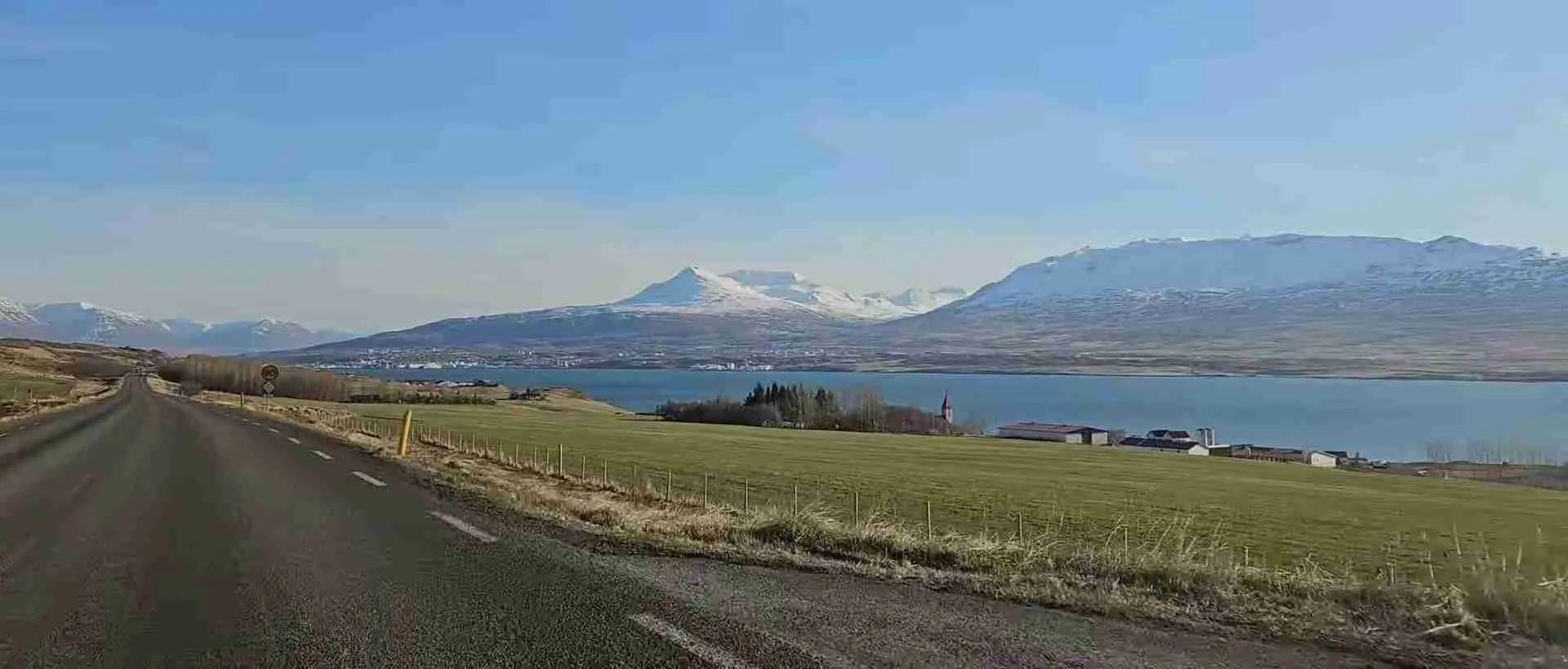
The Ring Road: Complete Guide to Driving Around Iceland
Iceland’s Route 1, universally known as the Ring Road, represents one of the world’s most spectacular driving routes, circling the entire island nation across 1,322 kilometers of diverse landscapes. This complete highway connects volcanic coastlines, glacial valleys, geothermal regions, and remote fishing villages while providing access to three UNESCO World Heritage Sites and countless natural wonders. Whether you’re planning a week-long adventure or an extended exploration, understanding this iconic route transforms a simple road trip into an unforgettable journey through one of Earth’s most geologically active regions.
Key Takeaways
- Complete Circuit Route: The Ring Road spans 1,322 kilometers (821 miles) around Iceland’s perimeter, completed in 1974 when the final bridge opened across the Skeiðará river, creating the longest ring road in Europe and connecting all major regions except the Westfjords and Snæfellsnes Peninsula.
- Fully Paved Year-Round Access: The entire route features paved asphalt surfaces maintained for year-round travel, though winter conditions require studded tires, regular weather monitoring, and preparation for temporary closures during extreme storms on mountain passes.
- UNESCO World Heritage Access: The route provides direct or nearby access to all three of Iceland’s UNESCO World Heritage Sites—Þingvellir National Park (cultural site inscribed 2004), Vatnajökull National Park (natural site inscribed 2019), and views toward Surtsey island (natural site inscribed 2008, not accessible to public).
- Geographic Diversity: Travelers experience dramatic landscape transitions including black sand beaches, glacier tongues, volcanic deserts, geothermal fields, fertile valleys, and fjord coastlines, with major geological transitions visible as the route crosses between tectonic plates and climate zones.
- Infrastructure and Planning: The highway maintains two lanes (one each direction) for most of its length, features 32 single-lane bridges requiring careful navigation, connects towns with full services every 50-100 kilometers, and demands flexible scheduling to accommodate weather conditions and attraction visits.
- Recommended Duration: While theoretically drivable in 15-16 continuous hours, comprehensive exploration requires 7-14 days to experience major attractions, regional detours, hiking opportunities, and the cultural experiences that make this route meaningful rather than merely completing a circuit.
People Also Ask About Driving Iceland’s Ring Road
How Long Does It Take to Drive Iceland’s Ring Road?
Driving Iceland’s Ring Road without stops requires 15-16 continuous hours to complete the 1,322-kilometer circuit, but this approach misses the route’s entire purpose. Most travelers allocate 7-10 days for a comprehensive journey that includes major attractions, with 10-14 days allowing deeper regional exploration and detours to places like the Snæfellsnes Peninsula or Westfjords. The 90 km/h speed limit on open sections, combined with single-lane bridges, animal crossings, weather considerations, and the sheer number of worthwhile stops, makes unhurried travel both safer and more rewarding. A typical day covers 200-300 kilometers with 2-4 hours of actual driving, leaving ample time for waterfall visits, glacier walks, museum stops, and spontaneous photo opportunities along Iceland’s dramatically changing landscapes.
What is the Best Direction to Drive the Ring Road?
Most travelers drive the Ring Road counterclockwise, starting east from Reykjavík toward the South Coast, because this sequence presents Iceland’s most dramatic attractions early in the journey when enthusiasm and energy levels peak. The counterclockwise route encounters Seljalandsfoss and Skógafoss waterfalls, Reynisfjara black sand beach, and Jökulsárlón glacier lagoon within the first three days, providing spectacular experiences that set a high standard for the remainder of the trip. This direction also positions photographers for optimal lighting at key locations and follows the natural tourism infrastructure that has developed around this flow. However, clockwise travel offers the advantage of lighter crowds at popular South Coast sites and works well for travelers arriving through Akureyri in the north. The route functions equally well in both directions, with the counterclockwise preference based on experiential pacing rather than logistical necessity.
Can You Drive Iceland’s Ring Road in Winter?
Iceland’s Ring Road remains open throughout winter, maintained as the country’s highest priority for year-round snow removal, but winter driving demands significant preparation and flexibility. The Icelandic Road Administration services Route 1 seven days per week with continuous monitoring, though extreme weather can force temporary closures on mountain passes like Öxi in the east or sections near Mývatn in the north. Winter drivers require vehicles equipped with studded tires, must monitor weather forecasts and road conditions through road.is and safetravel.is, and should expect daily driving distances of 100-150 kilometers rather than the 200-300 typical in summer. The rewards include dramatically reduced crowds, enhanced visibility of geological features against snow backgrounds, potential Northern Lights viewing, and access to ice cave tours in Vatnajökull. However, shorter daylight hours (4-5 hours in December), unpredictable blizzards, and icy road surfaces make winter Ring Road journeys appropriate only for confident drivers with cold-climate experience.
What Type of Vehicle Do You Need for the Ring Road?
A standard two-wheel-drive vehicle with good ground clearance suffices for Ring Road travel during summer months, as the fully paved route remains accessible to all vehicle types in favorable weather conditions. However, specific circumstances modify this baseline recommendation substantially. Winter travel demands a four-wheel-drive vehicle equipped with studded tires, mandatory for safe navigation of ice and snow. Travelers planning detours onto F-roads (highland routes designated by an “F” prefix) require 4WD vehicles regardless of season, as these unpaved mountain roads feature river crossings, loose gravel, and steep grades beyond standard vehicle capabilities. Campervan rentals suit extended trips by combining transportation and accommodation, though their height and weight affect handling in strong winds common along coastal sections. Vehicle selection should account for passenger count, luggage volume, planned detours, and travel season, with rental agreements clearly specifying which roads the insurance covers.
Extended multi-day tours – 5+ days
Featured Iceland Multi-Day Tour Packages
7 days
7 Day – Iceland Ring Road & Snæfellsnes Peninsula Small-Group Tour
- ✓ Comprehensive Iceland tour
- ✓ Expert local guides included
- ✓ All accommodation arranged
- ✓ Transportation provided
7 days
7-Day Small Group Journey Around Iceland with Premium Hotels
- ✓ Comprehensive Iceland tour
- ✓ Expert local guides included
- ✓ All accommodation arranged
- ✓ Transportation provided
5 days
5-Day Small Group Northern Lights Hunt & Glacier Lagoon Tour
- ✓ Comprehensive Iceland tour
- ✓ Expert local guides included
- ✓ All accommodation arranged
- ✓ Transportation provided
5 days
5 Days Land of Northern Lights
- ✓ Comprehensive Iceland tour
- ✓ Expert local guides included
- ✓ All accommodation arranged
- ✓ Transportation provided
Multi-day tour packages powered by TourRadar. Prices and availability subject to change.
Introduction: Iceland’s Iconic Circular Highway
The Ring Road, officially designated as Route 1 or Þjóðvegur 1 in Icelandic, functions as both Iceland’s primary transportation artery and its most comprehensive showcase of natural wonders. This 1,322-kilometer highway encircles the island nation, connecting remote fishing villages, agricultural communities, and regional centers through some of Earth’s most geologically active landscapes. Completed in 1974 after decades of construction that paralleled Iceland’s economic development, the road eliminated the isolation that once characterized vast portions of the countryside.
The route traverses dramatically contrasting environments as it circles the island. Travelers encounter black volcanic sands where the Atlantic Ocean crashes against basalt cliffs, pass beneath glaciers that calve icebergs into pristine lagoons, drive through geothermal fields where steam rises from fissures in the Earth’s crust, and navigate coastal sections where sheep graze on impossibly green hillsides beneath snow-capped peaks. These transitions occur not gradually but abruptly, with landscape character sometimes shifting within minutes of driving.
Iceland’s position atop the Mid-Atlantic Ridge, where the North American and Eurasian tectonic plates diverge at roughly 19 millimeters annually, creates the volcanic and geothermal activity that defines the Ring Road experience. The route crosses this boundary at Þingvellir National Park, one of three UNESCO World Heritage Sites accessible from the highway. Vatnajökull National Park, inscribed in 2019, encompasses the route’s southeast section where Europe’s largest glacier meets the coast. The third UNESCO site, Surtsey island, remains visible from portions of the south coast though inaccessible to the public as a protected natural laboratory.
The highway itself represents a remarkable engineering achievement given Iceland’s challenging conditions. Constructed almost entirely at sea level to avoid the impassable interior highlands, the road navigates around fjords, bridges glacial rivers, and tunnels through coastal headlands. Single-lane bridges, reduced from approximately 60 in 2010 to 32 currently, require drivers to yield to approaching traffic. Three major tunnels accelerate travel: the 5.8-kilometer Hvalfjörður tunnel bypassing a long fjord near Reykjavík, the 7.4-kilometer Vaðlaheiðargöng near Akureyri shortening northern routes, and the Almannaskarð tunnel in the southeast serving the Höfn region.
Traffic patterns on the Ring Road reveal Iceland’s tourism transformation. Annual vehicle counts rose from 57,000 daily in 2005 to over 90,000 by 2019, driven largely by international tourism growth. However, these numbers mask enormous regional variations. Sections near Reykjavík handle 20,000-50,000 vehicles daily, while remote eastern and northern stretches see only 2,000-5,000. Summer months concentrate traffic heavily, with winter travel dropping to a fraction of peak season volumes despite year-round accessibility.
The Ring Road excludes two significant regions that require separate planning. The Westfjords, Iceland’s remote northwestern peninsula, branches off Route 1 north of Borgarnes and demands dedicated time for exploration of its dramatic fjords and traditional fishing villages. The Snæfellsnes Peninsula, extending west from Route 1 between Reykjavík and Akureyri, offers a concentrated “Iceland in miniature” experience with its glacier-capped volcano, coastal cliffs, and cultural sites. Many comprehensive Iceland journeys combine the Ring Road circuit with one or both of these regional detours.
Understanding the Ring Road requires recognizing its dual nature as both infrastructure and attraction. Unlike most highways designed purely for efficient transportation, Route 1 serves as the primary means by which visitors experience Iceland’s landscapes. Nearly every kilometer offers visual interest, from expansive lava fields where green moss softens black rock to coastal vistas where mountains descend directly into the sea. The challenge lies not in finding things to see but in prioritizing among countless worthwhile stops and resisting the temptation to photograph every vista.
Understanding Iceland’s Ring Road: Route Specifications and History
Route 1 measures 1,322 kilometers (821 miles) in its complete circuit, making it the longest ring road in Europe and one of the world’s great driving routes by any measure. The highway maintains consistent two-lane configuration for the vast majority of its length, with one lane serving each direction of travel. This simple geometry works efficiently given Iceland’s modest population and the fact that even the busiest sections handle traffic volumes that would be considered light in most countries.
The road’s completion in 1974 marked a pivotal moment in Iceland’s development, coinciding deliberately with the 1,100th anniversary of the nation’s settlement. The opening of the Skeiðará bridge in the southeast provided the final link, eliminating the need for vehicles traveling between southern settlements like Vík and Höfn to detour north through Akureyri, a journey adding hundreds of kilometers. Prior to this connection, Iceland’s remote southeastern region remained effectively isolated from the rest of the country during much of the year.
Construction of the Ring Road occurred incrementally across decades, with each section reflecting the engineering capabilities and economic resources of its construction period. The earliest sections, built in the 1940s and 1950s, remain identifiable by their narrower width, sharper curves, and more frequent elevation changes as engineers worked within budget constraints and limited equipment. These older segments, primarily in the east and northeast, demand careful navigation with their blind curves, sudden elevation changes, and single-lane bridges.
Modern improvements have progressively upgraded the route’s safety and capacity. Recent decades have seen the replacement of dozens of single-lane bridges with modern two-lane structures, the construction of tunnels bypassing dangerous mountain passes, and the straightening of particularly hazardous curves. The Icelandic Road Administration maintains an ongoing program to eliminate remaining single-lane bridges, with 14 scheduled for replacement in the coming years, primarily along the southern coast where glacial river flooding previously made permanent structures impractical.
The route connects all of Iceland’s major population centers except those in the Westfjords. Reykjavík, the capital and largest city with approximately 130,000 residents, serves as most travelers’ starting point. Akureyri, Iceland’s second city with 19,000 people, anchors the northern section. Other significant towns along the route include Selfoss (8,000), Höfn (2,000), Egilsstaðir (2,500), Húsavík (2,300), and Borgarnes (2,000). Between these centers, smaller fishing villages, agricultural communities, and isolated farms dot the landscape, with some sections traveling 50-100 kilometers between any form of services.
The highway’s pavement quality varies significantly by section and maintenance cycle. Major sections near population centers and the heavily traveled South Coast feature smooth, well-maintained asphalt that allows comfortable travel at speed limits. Remote sections, particularly in the east and north, may show weathering, patching, and minor surface degradation that require attention but remain safely passable. Frost heaving, where freeze-thaw cycles create pavement undulation, affects some sections annually and receives repair during summer maintenance windows.
Speed limits reflect road conditions and population density. Open sections of the Ring Road carry a 90 km/h (56 mph) limit, the highest permitted on Icelandic roads. This drops to 50 km/h (31 mph) through urban areas and 70 km/h (43 mph) in tunnels. Short gravel sections, rare but present on some older bridges and construction zones, reduce the limit to 80 km/h (50 mph). Iceland enforces these limits rigorously with automated cameras and frequent police patrols, with fines calculated as percentage of income rather than fixed amounts, making violations potentially expensive.
The route’s elevation profile remains remarkably low given Iceland’s mountainous terrain. By following coastal routes and valley floors, Route 1 stays predominantly below 200 meters elevation, rising to mountain passes only where geographic features demand it. The highest sections cross passes in the east and north, climbing to approximately 600 meters where winter snow closure risks once ran high. Recent tunnel construction has eliminated several problematic high-altitude sections, improving winter reliability substantially.
Geographic Regions and Landscape Transitions
The Ring Road divides naturally into distinct geographic regions, each presenting characteristic landscapes and attractions. Understanding these regional divisions helps travelers plan logical stopping points and appreciate the dramatic transitions as the route circles the island. While the regions blur at their boundaries, their core characteristics remain distinct and recognizable.
South Iceland, extending east from Reykjavík to Höfn, concentrates the route’s most visited attractions along approximately 400 kilometers of coast. This section traverses the interface between ocean and ice, where glaciers descending from the interior highlands meet the Atlantic. The landscape features black volcanic sand beaches, powerful waterfalls descending from coastal cliffs, and vast outwash plains called sandur where glacial meltwater spreads across wide valleys before reaching the sea. Vatnajökull’s outlet glaciers dominate the eastern portion, with glacier tongues, icebergs, and meltwater channels creating constantly evolving scenery.
The Southeast region, from Höfn around to Djúpivogur, presents Iceland’s most remote coastal section. Here the Ring Road stays compressed between steep mountains and the sea, with limited development and long distances between services. This 200-kilometer stretch sees substantially lighter traffic than the South Coast, offering solitude and dramatic fjord scenery. The landscape shifts from glacial influence to mountainous coastline, with small fishing villages occupying narrow coastal flats at fjord heads.
East Iceland encompasses the section from Djúpivogur north to Egilsstaðir and beyond to Möðrudalur. The Eastfjords region features Iceland’s oldest exposed bedrock, dating to the Tertiary period 16-13 million years ago, visible in the colorful stratified layers of fjord walls. The road winds around numerous fjords, climbing over headlands and descending to fishing villages with each inlet. This section offers the Ring Road’s most challenging winter driving and most dramatic mountain scenery, with narrow valleys and steep grades requiring careful navigation.
North Iceland, stretching from Möðrudalur west past Akureyri to Blönduós, transitions to more fertile valleys and agricultural land. This region supports more extensive farming than other parts of Iceland, with green fields and substantial farms replacing the volcanic deserts of the south. Lake Mývatn and the surrounding geothermal area provide the north’s primary attractions, while the fishing town of Húsavík offers whale watching opportunities. The landscape here shows less volcanic activity than the south, though the area remains geologically active.
West Iceland completes the circuit from Blönduós back to Reykjavík, passing through some of the Ring Road’s most historically significant areas. This fertile region supported Iceland’s earliest settlements, with numerous saga sites and historical landmarks. The landscape features rolling hills, broad valleys, and the distinctive table mountains characteristic of Tertiary-age basalt. The section nearest Reykjavík handles the heaviest traffic volumes and features the most developed infrastructure, with numerous hotels, restaurants, and tour operators serving the capital region.
The transition between these regions occurs with remarkable abruptness in some locations. Drivers experience the shift from fertile green valleys to volcanic black desert within minutes near the Eldhraun lava field. The change from agricultural west to mountainous east presents equally dramatic contrast. These transitions reflect the complex interplay of volcanic activity, glaciation, and ocean currents that creates Iceland’s extraordinarily varied landscapes within such a compact area.
UNESCO World Heritage Sites Along the Route
Iceland’s three UNESCO World Heritage Sites represent the exceptional natural and cultural heritage accessible from the Ring Road, though they require different levels of effort to experience. Two sites integrate directly into Ring Road journeys, while the third remains visible but protected from human access as a natural laboratory studying ecological succession.
Þingvellir National Park, inscribed as a World Heritage Site in 2004, holds dual significance as both a cultural and geological landmark. Located 40 kilometers east of Reykjavík via Route 36 (not directly on the Ring Road but easily accessible as part of the Golden Circle route), Þingvellir served as the meeting place for Iceland’s parliament, the Alþingi, from approximately 930 CE until 1798. This site witnessed the adoption of Christianity in 1000 CE and Iceland’s declaration of independence in 1944, making it the symbolic and historical heart of Icelandic nationhood. The park’s UNESCO inscription recognizes this cultural significance, though the site’s natural features prove equally compelling. Here the Mid-Atlantic Ridge rises above sea level, creating a rift valley where the North American and Eurasian tectonic plates diverge. The Almannagjá gorge, through which visitors descend into the valley, represents the North American plate’s edge, while the opposing escarpment marks the Eurasian plate. The Silfra fissure, filled with crystal-clear glacial water filtered through lava rock, allows snorkeling and diving directly in the rift between continents. Þingvellir encompasses 9,270 hectares of protected landscape within the rift valley, with Iceland’s largest natural lake, Þingvallavatn, occupying the valley floor.
Vatnajökull National Park, inscribed in 2019, covers approximately 14,000 square kilometers—roughly 14 percent of Iceland’s total land area—making it Europe’s second-largest national park. The Ring Road provides direct access to the park’s southern boundary across a 200-kilometer section between Kirkjubæjarklaustur and Höfn. The park protects the Vatnajökull ice cap, Europe’s largest glacier by volume, along with the surrounding volcanic and geothermal regions that demonstrate the interaction between ice and fire. The UNESCO inscription recognizes the site as an outstanding example of Earth’s geological history, particularly the processes occurring when volcanic systems operate beneath glaciers. These subglacial eruptions trigger jökulhlaups—catastrophic glacial floods—that have carved the distinctive sandur plains visible from the Ring Road. The park encompasses ten central volcanoes, eight of them subglacial, including Grímsvötn and Bárðarbunga among Iceland’s most active systems. Öræfajökull, Iceland’s tallest peak at 2,110 meters, rises within the park boundaries. Multiple outlet glaciers descend from the main ice cap, with Breiðamerkurjökull calving icebergs into Jökulsárlón lagoon, the park’s most photographed feature. The Ring Road provides access to numerous glacier tongues, visitor centers, and hiking trailheads throughout this vast protected area.
Surtsey, inscribed in 2008, emerged from the Atlantic Ocean during volcanic eruptions between 1963 and 1967, creating a new island 32 kilometers off Iceland’s south coast. The UNESCO inscription recognizes Surtsey as a pristine natural laboratory where scientists observe how life colonizes new land without human interference. The island has been protected since its formation, with access restricted to approved researchers conducting long-term studies of ecological succession. Botanists have documented the arrival and establishment of plant species, while biologists track bird colonization and marine life development in surrounding waters. The island’s size has decreased from its formation maximum through erosion and subsidence, currently covering approximately 1.5 square kilometers at roughly half its original extent. Ring Road travelers can view Surtsey from vantage points along the south coast between Vík and Vestmannaeyjar (the Westman Islands), though always from a distance respecting the protective restrictions. The island appears as a dark hump on the horizon, its volcanic origins evident in the dark basalt composition. While not directly accessible, Surtsey’s presence adds context to the broader volcanic landscape visible throughout the south coast section of the Ring Road journey.
These three sites demonstrate Iceland’s UNESCO recognition spans both human heritage and natural processes. Þingvellir connects cultural history with tectonic activity, Vatnajökull showcases ice-volcano interactions on a massive scale, and Surtsey provides scientific insight into ecological establishment. Together they represent the “Land of Fire and Ice” through which the Ring Road travels, offering perspectives on Iceland’s formation, settlement, and ongoing geological evolution.
South Coast Highlights: Waterfalls, Beaches, and Glaciers
Iceland’s south coast, stretching from Reykjavík east to Höfn, concentrates an extraordinary density of natural attractions within a 400-kilometer section that forms the Ring Road’s most heavily traveled segment. This region experiences substantially higher rainfall than other parts of Iceland, feeding hundreds of waterfalls while creating the lush green vegetation that contrasts dramatically with the volcanic black sand beaches and stark glacial landscapes.
Seljalandsfoss waterfall, located approximately 120 kilometers east of Reykjavík, provides the first major stopping point for most travelers. This 60-meter cascade drops from the coastal cliffs that once marked Iceland’s shoreline before post-glacial rebound pushed the ocean farther south. The waterfall’s defining feature allows visitors to walk completely behind the falling water via a maintained path, creating photographic opportunities from inside the cascade looking outward. The path becomes slippery and sometimes icy, requiring careful footing, while spray ensures thorough soaking regardless of season. A nearby hidden waterfall, Gljúfrabúi, requires wading through a stream into a narrow canyon where a 40-meter cascade falls in an enclosed space, though high water sometimes prevents access.
Skógafoss waterfall, 30 kilometers farther east, presents a perfect rectangular curtain of water 25 meters wide dropping 60 meters from the same ancient coastal cliff line. The waterfall’s symmetry and power create nearly constant rainbows on sunny days, earning it status as one of Iceland’s most photographed natural features. A staircase climbing the cliff’s eastern side provides access to the upper river and viewing platform, while the Fimmvörðuháls hiking trail to Þórsmörk begins from this point. The mist from Skógafoss often drenches observers standing at its base, where the thunder of falling water overwhelms conversation.
Sólheimajökull glacier tongue extends from Mýrdalsjökull ice cap to within easy reach of the Ring Road, offering accessible glacier viewing and guided ice walking opportunities. This outlet glacier demonstrates the dramatic retreat occurring across Iceland’s glaciers, with the terminus receding approximately 100 meters annually in recent years. The glacier surface shows the complex interactions between ice, volcanic ash, and meltwater, with visible crevasses, seracs, and sediment layers. Guided glacier walks equipped with crampons and ice axes provide safe access to the ice surface, though independent approach to the glacier face is dangerous due to unstable ice and concealed crevasses.
Reynisfjara black sand beach, near the village of Vík, exemplifies Iceland’s volcanic coastline with its dramatic basalt formations and powerful Atlantic waves. The beach’s black sand derives from volcanic glass eroded from ancient lava flows, while hexagonal basalt columns form cathedral-like structures where the cliff meets the sand. The Reynisdrangar sea stacks, rising from the ocean offshore, represent basalt pillars resistant to erosion that legend identifies as trolls caught by sunrise. However, Reynisfjara demands extreme caution—powerful “sneaker waves” have killed multiple tourists who ventured too close to the waterline. Signs warn visitors to maintain distance from the surf and never turn their back on the ocean, advice that requires strict adherence given the beach’s deceptively calm appearance between wave sets.
Dyrhólaey promontory, located just west of Reynisfjara, provides elevated views across the south coast from a 120-meter-high former island now connected to the mainland. The massive natural arch extending into the ocean gives the promontory its name, which translates as “door-hole island.” The site serves as a seabird colony hosting Atlantic puffins from May through August, with thousands of birds nesting in cliff burrows. Access to the promontory closes during peak nesting season to protect breeding birds, though viewing remains possible from lower vantage points.
The drive between Vík and Kirkjubæjarklaustur crosses the Mýrdalssandur and Skeiðarársandur outwash plains, vast expanses of black volcanic sand and gravel deposited by glacial floods. These sandur regions, essentially active flood plains subject to periodic inundation during volcanic eruptions beneath the ice caps, present stark lunar landscapes with minimal vegetation. The 1996 eruption of Grímsvötn volcano beneath Vatnajökull triggered a massive jökulhlaup that destroyed portions of the Ring Road across Skeiðarársandur, washing away bridges and depositing house-sized ice blocks kilometers from the glacier. The current road and bridges incorporate designs meant to survive similar future events.
Skaftafell area, within Vatnajökull National Park, serves as a major base for glacier hiking, ice cave tours, and access to Svartifoss waterfall. Svartifoss, surrounded by dark basalt columns that inspired the design of Reykjavík’s Hallgrímskirkja church, requires a 45-minute hike from the visitor center but rewards the effort with its distinctive geometric setting. The surrounding valley offers numerous longer hiking options, from easy nature walks to challenging glacier ascents requiring guides and technical equipment.
Jökulsárlón glacier lagoon, 60 kilometers east of Skaftafell, represents the Ring Road’s most iconic attraction. Here Breiðamerkurjökull glacier calves icebergs into a deep lagoon formed as the glacier retreated from its terminal moraine. The icebergs, ranging from car-sized to house-sized chunks of thousand-year-old ice, drift through the lagoon toward a narrow outlet channel leading to the ocean. The ice displays intense blue coloration where compressed ancient ice remains free of air bubbles, while other sections show white from trapped air or black from volcanic ash. Boat tours navigate among the icebergs, offering close views and occasional seal sightings. Across the Ring Road from the lagoon, Diamond Beach features icebergs that have washed ashore on black sand, creating striking contrast as the ice catches sunlight.
The south coast section requires substantial time despite relatively short distances. The concentration of major attractions, combined with unpredictable weather that can enhance or obscure features, makes rushed travel through this region a missed opportunity. Most travelers allocate 3-4 days to the south coast section, allowing time for glacier walks, boat tours, and the flexibility to wait for favorable conditions at photographic locations.
Southeast and East Iceland: Fjords and Remote Coastlines
The Ring Road’s southeast and east sections, extending from Höfn through the Eastfjords to Egilsstaðir, present Iceland’s most remote and least developed coastal regions. This 350-kilometer stretch sees substantially lighter traffic than the south coast, offering solitude and dramatic mountain scenery for travelers willing to navigate the challenging road geometry and extended distances between services.
Höfn, a fishing town of approximately 2,000 residents, serves as the primary service center for southeast Iceland. The town’s economy centers on lobster fishing, with the harbor processing most of Iceland’s langoustine catch. Höfn provides the last substantial town facilities before the long drive through the Eastfjords, making it a logical overnight stop and meal location. The town offers clear views across Hornafjörður bay to the Vatnajökull ice cap, particularly dramatic at sunset when alpenglow colors the glaciers pink and orange.
The section between Höfn and Djúpivogur navigates around numerous small fjords and headlands, with the road alternating between sea-level coastal sections and climbs over steep headlands. This area receives less tourist attention than regions to the west and east, creating opportunities for uncrowded hiking, bird watching, and photography. The mountains show exposed geology dating to the Tertiary period, with colorful stratified layers visible in cliff faces revealing Iceland’s volcanic history across millions of years.
The Eastfjords proper begin at Djúpivogur and continue north past Fáskrúðsfjörður, Reyðarfjörður, Eskifjörður, and Neskaupstaður (accessed by tunnel off the main route). Each fjord features a small fishing village at its head, typically founded in the 19th century when herring fishing drove economic development. The road climbs over each headland separating the fjords, creating a roller-coaster profile of ascents and descents with spectacular views across the water to opposing mountain walls. Some headland crossings exceed 600 meters elevation, with sections that close temporarily during severe winter weather.
Stöðvarfjörður and Fáskrúðsfjörður showcase the region’s cultural diversity. Fáskrúðsfjörður served as the base for French fishing operations from the late 19th century into the mid-20th century, with French street signs and the French Hospital museum commemorating this heritage. The village’s dual Icelandic-French character persists in place names and architectural details uncommon elsewhere in Iceland. The museum documents the dangerous conditions faced by French fishermen working the North Atlantic, with hundreds dying far from home in shipwrecks and fishing accidents.
Egilsstaðir, eastern Iceland’s largest town with 2,500 residents, functions as the region’s commercial and transportation hub. The town provides full services including hotels, restaurants, supermarkets, and medical facilities, making it a crucial stopping point for Ring Road travelers. Egilsstaðir sits inland at the head of Lagarfljót lake rather than on the coast, with the Ring Road routing through the town before continuing north toward Möðrudalur. The surrounding area offers hiking opportunities in Hallormsstaður forest, Iceland’s most extensive woodland area, and access to Hengifoss waterfall, one of the country’s tallest at 128 meters.
The drive from Egilsstaðir to Möðrudalur crosses Iceland’s most desolate interior lowlands. This section traverses a vast volcanic desert where vegetation struggles to establish itself on the black gravel substrate. The landscape appears lifeless and lunar, with minimal development and no services across nearly 100 kilometers. The Jökulsá á Fjöllum river, Iceland’s second-longest, flows through this region, having carved enormous canyons including Jökulsárgljúfur, though these features remain invisible from the Ring Road, requiring detours to observe.
Möðrudalur farm, sitting at 469 meters elevation, claims distinction as Iceland’s highest inhabited farm. This tiny settlement operates a restaurant and guesthouse serving travelers crossing the highland section. The church, one of Iceland’s smallest, accommodates 20 people and serves a parish area of 1,500 square kilometers despite having virtually no permanent residents beyond the farm family. The farm demonstrates the extreme isolation and harsh conditions Icelandic farmers historically endured, with the growing season limited to 60-70 days and winter supplies requiring months of preparation.
This eastern section of the Ring Road challenges drivers with its geometry and isolation. The constant ascents and descents over fjord headlands demand concentration, while the long stretches without services require fuel and supply planning. However, the rewards include dramatic mountain and coastal scenery, opportunities to experience small Icelandic communities retaining traditional character, and the satisfaction of traveling through regions that see a fraction of the tourist traffic concentrated in the south.
North Iceland: Volcanic Landscapes and Whale Watching
North Iceland, extending from Möðrudalur west past Akureyri to Blönduós, presents landscapes dominated by volcanic activity, geothermal features, and relatively fertile valleys that support substantial agriculture. This 300-kilometer section experiences Iceland’s most stable weather patterns, with less precipitation than the south and more sunshine than coastal areas, though winter temperatures drop lower than in southern regions.
Lake Mývatn and the surrounding geothermal area constitute northern Iceland’s primary attraction complex, easily accessible from the Ring Road via a 20-kilometer detour east on Route 87. The lake, covering approximately 37 square kilometers, formed 2,300 years ago when a lava dam blocked the Laxá river, creating shallow waters that support exceptional bird populations. The name Mývatn translates as “Midge Lake,” referencing the dense populations of non-biting midges that hatch in summer, providing food for nesting birds while occasionally creating nuisance clouds for visitors.
The Mývatn region showcases volcanic features in exceptional variety and accessibility. Hverir (also called Hverarönd) geothermal area features boiling mud pools, steam vents, and sulfur deposits, with boardwalks allowing safe viewing of features that reach temperatures exceeding 100 degrees Celsius. The overwhelming sulfur smell, the hissing steam, and the vivid yellow, orange, and red mineral deposits create a distinctly alien environment. Krafla volcanic system, rising behind Hverir, erupted most recently between 1975 and 1984, with the Krafla fires creating new lava fields and the Víti crater, now containing a green lake within its explosion pit.
Dimmuborgir lava field, east of Mývatn, presents an extensive maze of lava formations where partially drained lava tubes collapsed into pillars, arches, and caves. The name translates as “dark castles,” describing the fortress-like appearance of the larger formations. Walking paths wind through the lava field, requiring 30-90 minutes depending on chosen routes, with interpretive signs explaining formation processes. Icelandic folklore associates Dimmuborgir with hidden people (álfar) and trolls, adding cultural context to the geological features.
Goðafoss waterfall, located directly on the Ring Road 45 kilometers west of Mývatn, drops 12 meters across a 30-meter-wide horseshoe formation in the Skjálfandafljót river. The waterfall’s name, meaning “waterfall of the gods,” references the tradition that Iceland’s law-speaker threw pagan idols into the cascade after the Alþingi adopted Christianity in 1000 CE, though historical documentation of this specific event remains uncertain. The accessible location makes Goðafoss a popular stopping point, with parking and viewing platforms on both sides of the river.
Akureyri, Iceland’s second-largest urban area with 19,000 residents, provides full city services, cultural attractions, and a pleasant break from rural travel. The town occupies the head of Eyjafjörður, Iceland’s longest fjord, with mountains rising steeply on both sides. Akureyri’s botanical garden, surprisingly diverse given the northern latitude, benefits from relatively warm microclimate, while the Akureyri Church on the hillside provides architectural interest and views across the fjord. The town serves as a base for whale watching tours in Eyjafjörður and ski resort access to slopes above the town.
Húsavík, 45 kilometers north of the Ring Road via Route 85, has established itself as Iceland’s whale watching capital based on the high cetacean encounter rates in Skjálfandi bay. The bay’s rich upwelling currents attract humpback whales, minke whales, white-beaked dolphins, and occasionally blue whales during summer months. Multiple tour operators offer traditional oak boats or modern RIB (rigid inflatable boat) excursions, with success rates exceeding 95 percent for whale sightings between June and August. The town’s Whale Museum provides comprehensive exhibits on cetacean biology, whaling history, and modern conservation efforts.
The Tröllaskagi peninsula, between Akureyri and the Ring Road’s continuation west, features some of Iceland’s most dramatic mountain scenery, though experiencing it fully requires detours on Routes 76 and 82 rather than the main highway. The Ring Road’s routing through the Öxnadalur valley misses the coastal sections and ski towns, prioritizing efficient transportation over scenic coastline. Travelers with extra time can explore Dalvík, Ólafsfjörður, and Siglufjörður via these northern routes, adding 100-150 kilometers but accessing traditional fishing communities and exceptional hiking terrain.
The western section of north Iceland, from the Tröllaskagi junction to Blönduós, crosses progressively flatter terrain with extensive agricultural development. This region supports substantial sheep farming and horse breeding, with Iceland’s distinctive horse population particularly visible in pastures along the route. The landscape shows less dramatic relief than eastern sections, with rolling hills, broad valleys, and the distinctive flat-topped mountains characteristic of Iceland’s older basalt formations.
West Iceland: Historical Sites and Return to Reykjavík
West Iceland completes the Ring Road circuit from Blönduós back to Reykjavík, passing through the country’s most historically significant regions where saga events unfolded and Iceland’s settlement patterns developed. This 300-kilometer section features relatively gentle topography, fertile valleys, and the densest concentration of services and population outside the capital area, making it the Ring Road’s most developed segment.
Borgarnes, 60 kilometers north of Reykjavík via the Ring Road (bypassing the Hvalfjörður tunnel option), functions as the western region’s commercial center with 2,000 residents. The Settlement Center museum presents comprehensive exhibits on Iceland’s settlement period and the Egils Saga, one of the most famous Icelandic sagas whose events unfolded largely in the surrounding area. The museum utilizes multimedia presentations and detailed dioramas to bring Viking-age Iceland to life, providing essential context for understanding Icelandic culture and the historical landscape visible from the Ring Road.
The Snæfellsnes Peninsula, jutting west from the Ring Road between Borgarnes and Stykkishólmur, offers a concentrated “Iceland in miniature” experience with its glacier-capped stratovolcano, coastal cliffs, lava fields, fishing villages, and cultural sites. While not technically part of the Ring Road circuit, the peninsula merits dedicated exploration via Routes 54 and 60, adding 200 kilometers and 1-2 days to the journey. Snæfellsjökull glacier, crowning the peninsula’s volcanic cone, gained literary fame through Jules Verne’s “Journey to the Center of the Earth” and mystical reputation in Icelandic folklore. The peninsula’s south coast features dramatic cliffs, seal colonies, and bird watching opportunities, while the north coast’s gentle bays host traditional fishing villages.
The Deildartunguhver geothermal area, Europe’s most powerful hot spring, discharges 180 liters of 97-degree Celsius water per second from the ground. The spring’s energy heats Borgarnes and Akranes through district heating pipelines extending 30 kilometers, demonstrating Iceland’s extensive use of geothermal resources for practical applications beyond bathing and tourism. The viewing area allows observation of the spring’s vigorous output, with steam visible from a distance along the Ring Road.
Reykholt, a short detour from the Ring Road, served as home to Snorri Sturluson, medieval Iceland’s most important historian and poet. Snorri wrote the Prose Edda and Heimskringla here in the early 13th century, documenting Norse mythology and Norwegian kings’ history before his murder in 1241 during Iceland’s civil war period. The Snorrastofa cultural center presents exhibits on Snorri’s work and medieval Icelandic society, while the Snorralaug pool where Snorri bathed remains preserved as Iceland’s oldest documented geothermal bath structure.
Hraunfossar and Barnafoss waterfalls, flowing from beneath the Hallmundarhraun lava field, demonstrate unusual hydrology where groundwater emerges from lava rather than descending from mountains. Hraunfossar appears as hundreds of small cascades flowing from the lava into the Hvítá river across nearly one kilometer, creating a distinctly different appearance from typical Icelandic waterfalls. Barnafoss, located upstream, churns through a narrow canyon in the rock, with folklore explaining its name (“Children’s Falls”) through a tragic story of two boys who fell into the rapids while crossing a natural stone bridge.
Glymur, Iceland’s second-tallest waterfall at 198 meters, requires a 4-kilometer round-trip hike from the Hvalfjörður fjord area. The trail crosses a river via log bridges, ascends through the canyon, and provides views from multiple angles of the cascade dropping through its narrow gorge. The hike demands reasonable fitness and secure footing, particularly when paths become muddy, but rewards effort with spectacular scenery and substantially fewer visitors than roadside attractions.
The Hvalfjörður tunnel, charging a toll to bypass the 50-kilometer drive around the fjord, connects to Reykjavík via a 5.8-kilometer underwater route that drops to 165 meters below sea level. The tunnel, completed in 1998, cut driving time from Reykjavík to Akureyri by 45 minutes and eliminated a winding coastal road prone to winter closures. Drivers can choose the free fjord route to visit Glymur or historical sites, or pay the tunnel toll for faster transit.
The final Ring Road section approaches Reykjavík through increasingly developed suburbs and commercial areas. Mosfellsbær and Kópavogur merge functionally with the capital, creating a metropolitan area of approximately 230,000 residents—nearly two-thirds of Iceland’s population. The transition from rural landscapes to urban development occurs gradually, with farms giving way to hobby properties, then suburbs, and finally city center density as the Ring Road becomes city arterial routes.
Driving Regulations and Road Safety
Iceland enforces comprehensive road regulations designed to ensure safety in challenging conditions, with particular emphasis on speed limit compliance and proper equipment requirements. Understanding and following these regulations prevents both accidents and substantial fines while ensuring positive interactions with local drivers and authorities.
Speed limits on the Ring Road vary by road type and location. Open paved sections carry a 90 km/h limit (56 mph), the maximum permitted on Icelandic roads. Urban areas reduce this to 50 km/h (31 mph), enforced strictly as towns often appear suddenly along rural sections. Tunnels impose a 70 km/h limit. Gravel sections, rare on the main Ring Road but common on connecting routes, require adherence to an 80 km/h limit. These limits reflect genuine safety requirements rather than arbitrary restrictions—Iceland’s roads include blind curves, single-lane bridges, sudden wind gusts, and animal crossings that make posted speeds reasonable maximums rather than minimums.
Iceland employs automated speed cameras extensively, particularly on the Ring Road’s busiest sections. These cameras photograph license plates and trigger fines sent to rental companies, who charge the renter’s credit card plus processing fees. Fines scale with the degree of violation, starting at approximately 5,000 ISK for minor speeding and escalating rapidly. Some serious violations, particularly in construction zones, can exceed 100,000 ISK. Police also conduct frequent speed patrols with handheld radar units. The combination of cameras and patrols creates an enforcement network that makes speeding violations likely to be detected and penalized.
Single-lane bridges require specific procedures that many international visitors find unfamiliar. These narrow structures, typically 30-50 meters long, accommodate only one vehicle at a time. The driver who arrives first at the bridge has right of way and should proceed across confidently, while the opposing driver waits before the bridge. If both drivers arrive simultaneously, the vehicle closest to the bridge typically proceeds, though this custom lacks formal codification. The key principle requires avoiding hesitation that confuses other drivers—decide whether to proceed or yield, then act decisively. These bridges often have limited approach visibility, requiring reduced speed when approaching to allow reaction time for oncoming vehicles already on the bridge.
Alcohol limits in Iceland set a maximum blood alcohol content of 0.05 percent, equivalent to roughly one standard drink for most adults. Iceland enforces this limit rigorously with random roadside testing and checkpoint programs, particularly on weekend evenings and following holiday periods. Penalties for violation include substantial fines, license suspension, and potentially criminal charges for higher levels or repeat violations. The practical approach for visitors requires avoiding any alcohol consumption before driving, as even modest drinking can exceed the relatively low legal threshold.
Headlights must illuminate at all times while driving, regardless of daylight conditions. This requirement, unusual for visitors from southern regions, reflects Iceland’s frequent fog, precipitation, and low sun angles that reduce visibility even during sunny days. Modern rental vehicles typically have automatic daytime running lights satisfying this requirement, but drivers should verify proper lighting function. Driving without lights risks fines and creates genuine safety hazards in Iceland’s variable lighting conditions.
Seatbelt use is mandatory for all vehicle occupants, with children requiring appropriate child safety seats based on age and size. Rental companies provide child seats but require advance reservation. Enforcement occurs through both automated camera detection and police stops, with fines issued per unbuckled occupant, making violation expensive for family groups.
Off-road driving carries severe penalties including fines up to 1,000,000 ISK and potential environmental damage compensation costs. Iceland’s fragile tundra vegetation and volcanic soils show tire tracks for decades, making “minor” off-road excursions environmentally destructive. The prohibition applies strictly, extending to parking alongside roads where no formal parking area exists. Drivers must use designated parking areas even when these require walking additional distance to viewpoints or attractions. The severity of enforcement reflects Icelandic priorities for environmental protection and frustration with tourists damaging landscapes through careless driving.
Mobile phone use while driving is prohibited except through hands-free systems. This includes hand-held phone conversations, texting, and manipulation of mapping applications while the vehicle is in motion. Drivers must pull completely off the road and stop to interact with handheld devices. The enforcement and fine structure mirror speed limit violations, with cameras and police patrols detecting violators regularly.
Iceland’s unique driving challenges extend beyond formal regulations. Sheep roam freely across rural areas and often occupy roads, requiring constant vigilance and willingness to stop or slow dramatically for livestock. Sheep tend to flee directly forward rather than to the roadside when vehicles approach, creating unpredictable movements. Horses similarly graze near roadways, sometimes startled by passing vehicles into sudden movements. Collisions with livestock create liability for drivers who cannot demonstrate reasonable caution, making defensive driving essential.
Wind poses a significant hazard often underestimated by visitors. Iceland’s exposure to Atlantic storms and lack of forest cover creates wind speeds that can exceed 30-40 meters per second (70-90 mph), with gusts strong enough to overturn vehicles or blow open doors forcefully enough to damage hinges. Crosswinds on open sections can push vehicles into adjacent lanes, while headwinds reduce fuel economy substantially. The Icelandic Meteorological Office issues wind warnings that should be taken seriously, with travel delayed when warnings indicate dangerous conditions. Particular caution is required when driving high-sided vehicles like campervans, which catch wind more significantly than standard cars.
Emergency services in Iceland use the 112 number for all situations requiring police, fire, or medical response. The safetravel.is website and associated smartphone app provide crucial resources for travelers, including weather forecasts, road conditions, and the ability to register travel plans. The app includes emergency contact features and GPS location sharing that can prove crucial if assistance becomes necessary in remote areas. Registration of travel plans, while voluntary, assists rescue services in locating individuals who become overdue or report emergencies from uncertain locations.
Winter Travel Considerations and Seasonal Variations
Iceland’s Ring Road remains technically accessible throughout the year, but winter conditions transform the driving experience fundamentally, requiring different preparation, equipment, skills, and expectations. The transition between summer and winter travel conditions occurs gradually across autumn, with full winter conditions typically prevailing from November through March or April, though significant variation occurs year to year.
Daylight hours constrain winter travel planning dramatically. December experiences only 4-5 hours of dim daylight in southern Iceland, with northern sections receiving even less. The sun rises around 11:00 and sets by 15:30, creating extended darkness that limits sightseeing to a narrow window. January and November offer slightly more daylight, while February begins the rapid spring transition toward longer days. This limited light means winter Ring Road circuits require substantially more days to complete the same route than summer trips, as driving in darkness on unfamiliar roads with potential ice hazards proves both dangerous and unproductive. Many winter travelers focus on the south coast rather than attempting a complete circuit, recognizing that weather delays and short days make full loops challenging.
Snow and ice conditions vary enormously by region and weather pattern. The south coast receives less snow than north or east sections but experiences more freezing rain creating black ice conditions. The east coast fjords accumulate substantial snow and experience frequent closures on mountain passes between fjords. North Iceland generally maintains passable conditions given lower precipitation, though extreme cold can create other hazards. The highlands interior sections, particularly between Egilsstaðir and Möðrudalur, close frequently during storms, sometimes for multiple days until conditions improve and road crews complete clearing operations.
Vehicle requirements for winter Ring Road travel extend significantly beyond summer standards. Four-wheel drive becomes essentially mandatory, combining traction benefits with the higher ground clearance needed for snow accumulation and the stability required in crosswinds. Studded tires provide crucial grip on ice and packed snow, legally required from November through April and practically necessary for safe travel. Standard all-season or summer tires prove inadequate and dangerous on winter roads, making proper tire specification a non-negotiable rental requirement. Rental agreements should explicitly confirm studded tire provision and 4WD capability if traveling between November and April.
Road.is provides real-time road conditions, construction updates, and closure information essential for winter travel planning. The website’s map interface uses color coding to indicate road status: green for clear conditions, yellow for difficult but passable, orange for challenging conditions requiring 4WD, and red for closed. These designations update frequently as conditions change. Checking road.is before each day’s travel and monitoring throughout the day prevents arriving at closed road sections or attempting drives through conditions beyond safe limits. The website also provides webcam access at key locations, allowing visual assessment of conditions rather than relying solely on text descriptions.
The Icelandic Meteorological Office (vedur.is) issues weather forecasts and warnings critical for travel safety. Winter storms can develop rapidly, with conditions deteriorating from clear to zero-visibility blizzard within hours. Warnings typically use color-coded systems indicating severity, with orange and red warnings suggesting travel should be postponed until conditions improve. Wind warnings prove particularly important, as storms commonly generate sustained winds exceeding 20 meters per second (45 mph) with gusts reaching 30-40 meters per second (70-90 mph). These winds make driving extremely difficult and dangerous, particularly for high vehicles.
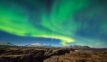
Aurora borealis viewing opportunities represent winter travel’s primary advantage, with dark skies and frequent auroral activity between September and April. However, successful aurora viewing requires clear skies, solar activity, and willingness to venture from lodging late at night or before dawn. The aurora forecast at en.vedur.is/weather/forecasts/aurora/ provides activity predictions on a 0-9 scale, with values of 3 or higher suggesting good viewing potential. Light pollution from towns and settlements degrades viewing, making aurora observation most successful in remote sections of the Ring Road away from population centers. Cloud cover frequently obscures the aurora even when activity occurs, requiring flexibility and multiple attempts across several nights for likely success.
Ice cave tours in Vatnajökull National Park operate exclusively during winter when glacier ice achieves sufficient stability and accessible cave formations develop. These tours, led by experienced guides with technical equipment, explore naturally formed caves in glacier ice, revealing vivid blue ice and stunning formations. However, cave access depends on specific conditions each season, with some winters offering exceptional access while others provide limited or no opportunities. Tours typically operate from November through March, requiring advance booking and confirmation that caves have formed and remain accessible.
Accommodation availability decreases substantially in winter outside major towns, with many guesthouses, hotels, and restaurants along the Ring Road closing from October through April. This necessitates advance booking for the reduced number of open accommodations and limits flexibility to adjust routes based on conditions. The reduced options also concentrate travelers into fewer locations, potentially creating crowding at popular properties despite overall lower tourism volumes. Travelers should confirm that booked accommodations remain open for their planned dates, as opening schedules sometimes shift based on owner circumstances or bookings received.
Fuel station availability and hours require attention during winter travel. While major towns maintain normal hours, rural stations sometimes operate reduced schedules or close entirely during quieter months. Maintaining a fuller tank becomes more critical in winter, both for the obvious fuel supply reasons and for the heat and safety provisions that adequate fuel provides if weather forces delays or stops. Running a vehicle’s engine for heat during weather delays consumes fuel rapidly, making starting each driving segment with full or nearly full tanks prudent practice.
Spring and autumn represent shoulder seasons with intermediate conditions. April-May and September-October offer reduced crowds, moderate weather, and the possibility of both snow landscapes and green vegetation depending on specific dates and elevation. However, these periods also experience the most unpredictable weather, with rapid changes between conditions. Autumn tends toward more stable weather than spring, when melting creates slush and ice while snow remains possible. These shoulder months can provide excellent experiences for flexible travelers able to adjust plans based on conditions, but frustrate those with rigid schedules requiring specific activities or destinations on predetermined dates.
Vehicle Selection and Rental Considerations
Choosing an appropriate vehicle for Ring Road travel requires balancing budget constraints, season, passenger count, luggage requirements, and planned detours. The fully paved Ring Road technically accommodates any vehicle type during summer, but practical considerations make some choices more suitable than others for different travel styles and circumstances.
Standard compact and economy cars function adequately for basic summer Ring Road circuits restricted to paved routes. These vehicles offer the lowest rental costs, best fuel economy, and sufficient capability for the main highway. Two adults with moderate luggage fit comfortably, while four adults plus luggage creates cramped conditions. The limited ground clearance restricts these vehicles to paved roads exclusively, preventing detours on gravel roads to less accessible attractions. Wind buffeting affects lighter vehicles more significantly, making driving in Iceland’s frequent strong winds more challenging than in heavier cars. Economy vehicles suit budget-focused travelers planning to stay strictly on the Ring Road without highland detours.
Mid-size sedans and small SUVs provide meaningful comfort upgrades and moderately better capability while maintaining reasonable fuel economy. These vehicles accommodate four adults comfortably with luggage, handle wind conditions better than compact cars, and typically include more powerful engines useful for highway merging and mountain passes. Some models offer adequate ground clearance for maintained gravel roads, though rental agreements often prohibit such use even when vehicles physically could manage it. These represent good compromises for small groups prioritizing comfort without requiring true off-road capability.
Four-wheel-drive SUVs expand destination access significantly, permitting travel on maintained gravel roads and F-roads when specifically included in rental agreements. These vehicles provide essential capability for winter Ring Road travel and summer highland excursions. Ground clearance accommodates rougher surfaces, while 4WD systems improve traction on loose gravel, mud, and snow. Cargo space suits larger groups or extended trips requiring substantial gear. However, 4WD vehicles consume more fuel (typically 25-40 percent more than comparable 2WD models), cost substantially more to rent, and prove unnecessary for travelers staying strictly on the paved Ring Road during summer. The decision to rent 4WD should align clearly with specific plans requiring the capability rather than assuming its necessity.
Campervans combine transportation and accommodation, potentially reducing overall trip costs while providing maximum flexibility for overnight locations. Iceland permits camping only in designated campgrounds or with landowner permission, eliminating the “free camping anywhere” model practiced in some other countries. Campervans suit travelers comfortable with basic facilities and desire to minimize accommodation expenses, which consume a substantial portion of Iceland trip budgets. However, campervans present disadvantages including poor fuel economy, handling characteristics affected by height and weight in strong winds, challenging maneuvering in parking lots and tight spaces, and limited appeal during poor weather when spending extended time in confined spaces loses attraction. Winter campervan travel requires specialized winter-equipped units with heating systems, insulation, and plumbing protection against freezing, available from fewer rental companies at premium prices.
Motorhomes and larger RVs provide apartment-level comfort and amenities at the highest rental costs and fuel consumption. These vehicles suit groups or families able to share costs and appreciate the full kitchens, bathrooms, and sleeping capacity. However, their size restricts maneuverability, excludes them from some narrow roads and parking areas, and creates challenges in Iceland’s frequent strong winds. The expense justifies itself primarily for larger groups where per-person costs remain reasonable or travelers who prioritize comfort substantially over budget considerations.
Insurance and damage waivers represent complex decisions affecting rental costs substantially. Iceland’s rental market includes numerous insurance options beyond basic third-party liability, with different companies using varying terminology. Collision damage waiver (CDW) reduces renter liability for vehicle damage, typically with excess amounts of $1,500-3,000. Super CDW further reduces excess to $300-500. Sand and ash protection covers wind-blown particle damage to paint and glass, common in Iceland but excluded from standard policies. Gravel protection covers rock chip damage to windshields and paint. Theft protection covers vehicle theft, rare but possible. Each coverage layer adds to daily costs, potentially doubling or tripling base rates.
The decision regarding insurance coverage balances risk tolerance against expense. Travelers with credit cards offering rental car insurance should verify whether coverage applies in Iceland and what exclusions exist (many credit card policies exclude 4WD vehicles, vans, or vehicles rented for more than 15-31 days). Personal auto insurance policies occasionally extend to international rentals but rarely with comprehensive coverage. The practical approach for most travelers involves accepting at least CDW and considering additional coverages based on season (winter increases damage risk), vehicle type (expensive vehicles increase liability), and planned routes (gravel roads increase rock chip likelihood). Reading rental agreements completely and photographing vehicle condition thoroughly before accepting vehicles prevents disputes about pre-existing damage.
Fuel costs represent a significant expense component for Ring Road trips. Iceland’s fuel prices typically exceed European averages substantially, with gasoline costing approximately 300-350 ISK per liter. A complete Ring Road circuit consumes 100-150 liters depending on vehicle type and driving conditions, translating to 30,000-50,000 ISK ($200-350) in fuel costs alone. Wind conditions affect fuel consumption significantly, with headwinds increasing usage 20-30 percent. Four-wheel-drive vehicles and campervans consume substantially more fuel than efficient cars. Factoring realistic fuel costs into trip budgets prevents financial surprises.
Rental companies require credit cards for deposits and charge holds, typically unavailable with debit cards. Deposit amounts vary by vehicle type and insurance selections, ranging from a few hundred to several thousand dollars held on the card for the rental duration. Understanding these holds prevents card limit issues during trips. International credit cards should notify issuing banks of Iceland travel to prevent fraud blocks on charges that might appear unusual in spending patterns.
Accommodation Options and Booking Strategies
Ring Road accommodation spans from basic guesthouses and campgrounds to luxury hotels, with distribution, quality, and pricing varying substantially by region. Understanding the accommodation landscape and booking strategically impacts both trip costs and flexibility to adjust routes based on conditions or interests.
Hotel options concentrate in larger towns like Reykjavík, Akureyri, Höfn, Egilsstaðir, and Vík, with major chains and independent properties offering predictable quality and amenities. These locations provide full-service hotels with restaurants, bars, and business facilities suitable for travelers prioritizing comfort and consistency. Pricing follows supply and demand closely, with summer rates substantially exceeding winter except for Reykjavík where year-round business travel maintains higher baseline pricing. Mid-range hotels typically charge 20,000-35,000 ISK ($140-245) per night for double rooms in summer, rising to 40,000-60,000 ISK ($280-420) for higher-end properties in prime locations.
Guesthouses and smaller inns dominate accommodation in smaller communities and rural areas along the Ring Road. These family-run properties typically offer 5-15 rooms with shared or private bathrooms, basic furnishings, and breakfast included or available. Quality varies more than standardized hotels, ranging from immaculate and charming to dated and basic. Guesthouses provide opportunities for interaction with Icelandic hosts and other travelers while typically costing 15,000-25,000 ISK ($105-175) per night for double rooms. Many occupy converted farms or residential buildings, providing authentic Icelandic architectural experiences rather than international hotel standardization.
Farmstays represent a distinctively Icelandic accommodation option where working farms offer rooms to guests. These range from simple bedroom rentals in farmhouses to purpose-built guesthouse structures on farm properties. Farmstays provide cultural experiences including opportunities to observe sheep farming, horse keeping, or other agricultural activities, though guests should understand these are working farms rather than tourism operations with structured activities. Some farms offer optional horseback riding or farm tours for additional fees. Pricing typically matches guesthouses at 15,000-25,000 ISK per night.
Hostels serve budget-conscious travelers with dormitory beds and private rooms at substantially lower costs than hotels. Iceland’s hostel network includes both independent properties and HI (Hostelling International) affiliated locations, with varying facility quality and amenities. Dormitory beds typically cost 5,000-8,000 ISK ($35-55) per night, with private rooms in hostels running 12,000-18,000 ISK ($85-125). Most hostels provide shared kitchens allowing meal preparation, which significantly reduces food costs for budget travelers. However, summer availability in popular locations fills months in advance, requiring early booking for this economical option.
Camping represents the most economical accommodation choice, with campgrounds distributed approximately every 50-100 kilometers around the Ring Road. Icelandic campgrounds range from basic fields with minimal facilities to well-equipped sites with heated bathrooms, cooking shelters, and electrical hookups. Costs typically run 1,500-2,500 ISK ($10-17) per person per night, with some sites charging per tent rather than per person. Most campgrounds operate only during summer (June-August or May-September), closing in winter when demand drops and facility winterization becomes necessary. The camping experience depends heavily on weather, with windy or rainy conditions making tent camping unpleasant. Campervans provide weather protection while accessing campground facilities and pricing.
Booking timing significantly affects both availability and pricing. Summer travel (June-August) requires booking accommodations months in advance, particularly for popular South Coast locations where hotels and guesthouses fill completely. Last-minute bookings during peak summer often face extremely limited options or must deviate substantially from planned routes to find vacancy. Shoulder season (April-May, September-October) offers more flexibility, with advance booking recommended but not critical except for specific popular locations. Winter travel (November-March) provides maximum flexibility given reduced tourism volumes, though this coincides with reduced accommodation options as many properties close.
Pricing strategies vary by property type and ownership. Independent guesthouses and farmstays often maintain relatively fixed pricing with modest seasonal variation, while hotels practice dynamic pricing where rates fluctuate based on demand and booking timing. Comparing prices across booking platforms (Booking.com, Hotels.com, direct property websites) sometimes reveals significant differences, making price checking across multiple sources worthwhile for expensive multi-night bookings. Some properties offer better rates for direct bookings to avoid platform commissions, indicated by notices on their websites.
Location strategy for overnight stops depends on travel style and route planning. Some travelers prefer booking accommodations in major towns like Höfn, Egilsstaðir, and Akureyri, accepting longer daily drives but ensuring consistent facility quality and dining options. Others favor distributing stays in smaller communities closer to attractions, minimizing driving distances but sometimes sacrificing amenities. The Ring Road’s uneven attraction distribution makes logical stopping points somewhat predetermined—the south coast requires multiple nights given its density of attractions, while other sections accommodate longer drives between stops. Flexible strategies that adjust to weather and energy levels work best but require accepting last-minute booking limitations or occasional backtracking.
Reykjavík accommodation pricing substantially exceeds the rest of Iceland, with the capital’s hotel rates reflecting urban demand and limited supply. Many travelers minimize Reykjavík nights to reduce costs, staying only at trip beginning and end for logistical convenience. Others eliminate Reykjavík stops entirely, picking up rental cars directly at Keflavík airport and beginning Ring Road travel immediately. This approach maximizes time and budget allocation to the actual circuit rather than expensive capital region lodging.
Dining, Provisions, and Food Planning
Food costs represent a substantial component of Iceland Ring Road budgets, with limited dining options in rural areas and high prices throughout the country requiring strategic planning. Understanding the food landscape and implementing appropriate strategies prevents both excessive costs and the frustration of inadequate meal options in remote sections.
Restaurant dining in Iceland costs substantially more than most visitors expect, with casual meals at moderate restaurants typically running 3,000-5,000 ISK ($20-35) per person before beverages, and sit-down dinners at quality restaurants reaching 6,000-10,000 ISK ($40-70) per person. These prices reflect Iceland’s high labor costs, import-dependent food supply, and small market supporting limited competition. Restaurant density varies dramatically by location—Reykjavík offers extensive choices across cuisines and price points, while rural sections of the Ring Road sometimes provide only one dining option within 50-100 kilometers or no restaurants at all.
Grocery shopping and meal preparation provide the primary cost-control strategy for budget-conscious travelers. Iceland’s supermarket chains—Bónus, Krónan, Nettó, and Hagkaup—provide substantially lower prices than restaurants, with typical grocery costs running 30-50 percent below Western European equivalents despite popular perception of Iceland as exceptionally expensive. A week’s worth of groceries for self-catered meals typically costs 15,000-25,000 ISK ($105-175) per person, compared to 50,000-80,000 ISK ($350-550) for restaurant meals. However, grocery shopping requires appropriate preparation facilities, meaning either accommodation with kitchen access, campervan facilities, or acceptance of cold meals and sandwiches.
Supermarket distribution around the Ring Road requires planning to ensure grocery access when needed. Larger towns like Akureyri, Egilsstaðir, Selfoss, and Borgarnes maintain multiple supermarkets with full selection. Smaller communities typically host one small shop with limited selection and higher prices than chain supermarkets. Some Ring Road sections span 100+ kilometers between any grocery options, making Reykjavík area shopping before departure practical for travelers planning initial days in remote southeastern sections. Non-perishable foods purchase in larger towns extends flexibility for subsequent days without grocery access.
Gas station convenience stores proliferate along the Ring Road, often representing the only food source for extended sections. These facilities stock sandwiches, hot dogs, packaged snacks, beverages, and sometimes hot food items like soup or pizza. Pricing significantly exceeds supermarkets for comparable items, but convenience and availability make gas station food practical for quick meals or situations where grocery shopping windows were missed. The quality ranges from adequate to disappointing, with pre-made sandwiches particularly variable depending on freshness and specific location.
Icelandic cuisine features seafood prominently, with restaurants along the Ring Road serving fresh fish caught locally. Cod, haddock, Arctic char, langoustine, and salmon appear frequently on menus, prepared in various styles. Lamb from free-ranging Icelandic sheep provides another traditional protein, typically served as grilled chops or slow-cooked roasts. Dairy products, particularly Icelandic yogurt-like skyr, offer affordable and nutritious options available in all supermarkets. Traditional dishes like hákarl (fermented shark) and svið (sheep’s head) appear primarily in Reykjavík restaurants catering to adventurous tourists rather than standard Ring Road dining.
Breakfast strategies significantly impact daily food budgets. Many guesthouses and hotels include breakfast in room rates, providing substantial value through comprehensive buffets with bread, cereals, dairy products, eggs, fish, and sometimes hot items. These breakfasts support skipping or minimizing lunch, reducing daily meal costs. Accommodations charging separately for breakfast typically price it at 2,000-3,000 ISK ($14-20) per person, making evaluation worthwhile against grocery breakfast costs or gas station options. Campground and hostel stays without included breakfast necessitate grocery shopping for breakfast supplies.
Alcohol pricing reflects Iceland’s regulatory environment and high taxation, with beer and wine costing substantially more than in most countries. Vinbúðin state liquor stores maintain monopoly on alcohol sales above 2.25 percent by volume, operating limited hours (typically closed Sundays) with locations only in larger towns. A six-pack of domestic beer costs approximately 2,500 ISK ($17), while wine bottles start around 2,000 ISK ($14) for basic selections. Restaurants mark up alcohol even more dramatically, with beer costing 1,200-1,800 ISK ($8-12) per pint and wine glasses 1,500-2,500 ISK ($10-17). Travelers prioritizing alcohol consumption should purchase supplies at Keflavík airport duty-free before departing the terminal, where prices run 30-50 percent below Vinbúðin.
Vegetarian and vegan options have expanded significantly in Iceland in recent years, with most restaurants offering at least limited plant-based choices. However, rural areas and small establishments may provide minimal options beyond salads and side dishes. Travelers with dietary restrictions should research specific restaurant menus in advance and maintain grocery supplies for locations where suitable restaurant options appear unlikely. Supermarkets stock diverse plant-based products in larger towns, though selection decreases in smaller community shops.
Water in Iceland flows clean and safe from all taps, making bottled water purchases unnecessary. Many Icelanders express puzzlement at tourists buying bottled water given the exceptional quality of municipal supplies. Refillable bottles filled from accommodation or public restroom taps provide unlimited fresh water without cost or environmental impact. The water sometimes carries slight sulfur smell in geothermal areas but remains safe for consumption.
Food storage in vehicles during Ring Road travel requires attention to prevent spoilage and maintain food safety. Summer temperatures in parked cars can reach levels promoting bacterial growth in perishable foods within hours. Coolers or insulated bags with ice packs extend safe storage time but require regular ice replacement from grocery stores or gas stations. Winter storage proves easier given exterior temperatures below refrigeration levels, though freezing can occur. Planning meals to minimize time perishable foods spend in vehicles, purchasing smaller quantities more frequently, and prioritizing shelf-stable foods reduces risks.
Photography Opportunities and Equipment Considerations
Iceland’s Ring Road ranks among the world’s premier photography destinations, offering extraordinary landscape diversity, dramatic lighting conditions, and subjects ranging from intimate natural details to vast scenic panoramas. However, the environment presents specific challenges requiring appropriate equipment and techniques for successful image capture.
Landscape photography along the Ring Road benefits from several camera system considerations. Wide-angle lenses in the 16-35mm range (full-frame equivalent) capture the expansive vistas and dramatic foregrounds characteristic of Icelandic scenes. Standard zoom lenses covering approximately 24-70mm handle general photography including waterfalls, glacier details, and travel documentation. Telephoto lenses, while less critical than in wildlife photography destinations, prove useful for isolating distant mountain details or compressing layered landscape elements. Serious landscape photographers typically carry both wide-angle and standard zoom lenses as minimum kit, with telephoto options adding versatility without being essential.
Tripod use dramatically improves landscape photograph quality by enabling slower shutter speeds for motion blur in waterfalls, long exposures for smooth water effects, and precise composition refinement. Iceland’s frequent wind makes tripod stability crucial, requiring either heavy-duty tripods or lighter models with techniques like hanging weight from the center column or using stones to add mass. Carbon fiber tripods provide strength with reduced weight compared to aluminum alternatives, worthwhile investment for photographers planning extended hiking with equipment. Ball heads offer faster adjustment than three-way heads, advantageous when conditions change rapidly or wind makes extended setup times difficult.
Neutral density filters enable long exposure photography during daylight hours, smoothing water motion and cloud movement while controlling exposure in bright conditions. Variable ND filters provide flexibility to adjust light reduction without carrying multiple fixed filters, though high-quality filters prove essential to prevent color casts or sharpness degradation. Graduated neutral density filters help balance exposure between bright skies and darker foregrounds in scenes with strong dynamic range, though modern cameras’ dynamic range and post-processing flexibility reduces this need compared to film era requirements. Polarizing filters reduce glare on water surfaces, enhance sky contrast, and saturate colors, remaining one of few effects difficult to replicate in post-processing.
Weather protection for camera equipment represents essential rather than optional consideration. Iceland’s frequent rain, sea spray near coastal locations, and wind-blown volcanic ash create conditions potentially damaging to cameras and lenses. Weather-sealed camera bodies and lenses provide first-line defense, with gasketed controls and mount interfaces preventing moisture and particle intrusion. Rain covers, either commercial products or improvised plastic bags, protect equipment during use in precipitation. Cleaning supplies including microfiber cloths, lens tissue, and air blowers remove water droplets and dust particles before they cause problems. Some photographers carry multiple camera bodies to avoid lens changes in adverse weather, reducing exposure risk to sensors and internal mechanisms.
Light conditions in Iceland vary dramatically by season and location, creating both opportunities and challenges. Summer’s extended daylight from midnight sun in the north provides 20-24 hours of usable light, though harsh midday sun creates flat lighting unsuitable for quality landscape photography. The golden hours extend for hours during summer, with sunset transitioning directly to sunrise in June-July at high latitudes. Winter’s limited daylight concentrates photography into narrow windows but provides dramatic low-angle sunlight throughout brief days, with sunrise and sunset occurring almost consecutively. Overcast conditions, frequent year-round, provide soft, even lighting ideal for waterfall photography and detailed work, eliminating harsh shadows and highlights that plague sunny day photography.
Aurora photography during winter months requires specific techniques and equipment. Fast lenses (f/2.8 or faster) gather more light, enabling shorter exposures that reduce star trailing and freeze aurora movement. Wide-angle lenses capture expansive sky areas where aurora displays occur. Sturdy tripods prevent camera movement during the 5-30 second exposures typically required. Remote releases or self-timers eliminate shutter-press vibration. Manual focus set to infinity or focused carefully on stars ensures sharp results, as autofocus fails in darkness. Sensor capability matters significantly, with modern cameras’ high ISO performance allowing 1600-6400 ISO settings producing acceptable noise levels impossible with earlier generation sensors.
Waterfall photography presents opportunities throughout the Ring Road circuit, with hundreds of significant falls and countless smaller cascades. Slow shutter speeds (1/4 to several seconds) create the smooth, silky water motion characteristic of professional waterfall images, requiring neutral density filters in bright conditions or careful timing during overcast periods and twilight. Faster shutter speeds freeze water droplets, creating alternative aesthetic suitable for powerful falls like Dettifoss. Polarizing filters reduce glare on wet rocks and enhance rainbow visibility in waterfall spray. Tripods prove essential for sharp images during slow shutter work, with sturdy platforms necessary given spray, wind, and unstable footing near many waterfalls.
Ice and glacier photography benefits from understanding how to expose for snow and ice without creating gray, underexposed results. Exposure compensation of +1 to +2 stops prevents cameras’ meter systems from darkening bright scenes. However, overexposure destroys detail in ice highlights, requiring careful histogram monitoring. Polarizing filters enhance ice texture and reduce surface glare, though rotating the filter to find optimal effect matters more than simply attaching it. Blue hour lighting (twilight before sunrise or after sunset) creates stunning colors in glacier ice and mountain snow, with the brief window requiring preparation and rapid shooting.
Black sand beach photography showcases Iceland’s volcanic geology while presenting exposure challenges from extreme contrast between dark sand and bright sky or white waves. Graduated neutral density filters or bracketed exposures for HDR processing help manage this contrast. Wave photography requires awareness of Iceland’s dangerous “sneaker waves” that have killed photographers focused on cameras rather than monitoring the surf. Maintaining safe distance from the waterline, choosing positions with escape routes, and never turning away from the ocean prevent tragic outcomes in pursuit of dramatic images.
Puffin photography opportunities concentrate in coastal areas during the May-August nesting season, with locations including Dyrhólaey, Látrabjarg, and various coastal cliffs hosting colonies. Telephoto lenses, ideally 300mm or longer, bring these small birds to useful image size while maintaining distance from nesting areas. Fast autofocus and continuous shooting modes capture puffins in flight or during landing sequences. Respect for nesting areas requires staying on designated paths and observing from appropriate distances despite pressure to approach closer for better images.
Equipment management in Iceland’s conditions extends beyond photography technique to basic gear protection and functionality. Camera batteries drain faster in cold weather, requiring spares kept warm in pockets. Lens fogging when bringing cold equipment into warm interiors necessitates allowing gradual temperature equalization in camera bags before opening. Memory card capacity sufficient for multi-day remote sections prevents running out of storage. Regular battery charging whenever electrical outlets are available maintains readiness despite irregular accommodation schedules. Backing up images to laptop, external drives, or cloud storage prevents catastrophic loss if memory cards fail or are damaged.
Environmental Responsibility and Leave No Trace Principles
Iceland’s fragile environments and increasing tourism pressures make responsible travel practices essential for preserving the landscapes that make the Ring Road journey valuable. Understanding environmental sensitivities and implementing appropriate behaviors helps protect Iceland’s natural heritage while preventing regulatory restrictions that might limit future access.
Off-road driving causes severe and lasting damage to Iceland’s tundra vegetation and volcanic soils. Moss and plant cover take decades to centuries to establish on lava fields and glacial deposits, with vehicle tire tracks destroying vegetation instantly and remaining visible for 50-100 years in this climate. The volcanic soils and tephra layers compact under vehicle weight, preventing water infiltration and creating erosion channels. Iceland enforces strict prohibition against off-road driving anywhere in the country, with severe fines (up to 1,000,000 ISK) and environmental damage compensation potentially exceeding these amounts. The prohibition applies to all terrain, including areas that appear barren or already damaged—even desert-like lava fields host fragile ecosystems.
Designated parking areas exist at all major attractions and many minor sites along the Ring Road. Using these facilities, even when they require walking additional distance to viewpoints, prevents parking damage to vegetation and respects the considerable effort and expense invested in providing proper infrastructure. Creating new parking spots by driving onto vegetation or shoulder areas contributes to cumulative damage that has accelerated dramatically with tourism growth. In rare cases where no formal parking exists, parking on paved road shoulders without driving onto any vegetation represents the least-impact approach, though this should be exceptional rather than common practice.
Toilet facilities along the Ring Road vary from good to nonexistent depending on location. Tourist facilities at major attractions provide maintained restrooms, while remote sections offer nothing. When nature calls in areas without facilities, proper waste disposal becomes crucial. Human waste should be buried 15-20 centimeters deep at least 70 meters from water sources, trails, and campsites, with toilet paper either packed out or burned completely. Iceland’s thin soils and cold climate slow decomposition, making improper waste disposal environmental contamination lasting months or years. The increasing practice of packing out waste in specialized bags, while initially unpleasant, represents the most environmentally sound approach in heavily visited areas.
Litter prevention requires conscious effort given Iceland’s wind conditions that can scatter even secured trash. Bringing reusable containers and bags rather than disposable packaging reduces waste generation. Packing out all trash, including food scraps that might seem biodegradable, prevents attraction of predators and maintains site cleanliness. Cigarette butts, which take years to decompose and contain toxic compounds, warrant particular attention. Many popular stopping points along the Ring Road show disgraceful litter accumulation from careless visitors, creating maintenance burdens for volunteers and landowners.
Camping regulations in Iceland prohibit wild camping except on uncultivated public land with landowner permission, which rarely applies to Ring Road areas. Designated campgrounds provide appropriate facilities while concentrating impact in areas designed to handle it. Illegal camping has increased dramatically with tourism growth, creating sanitation issues, property damage, and conflict between tourists and landowners that threatens broader access. Using established campgrounds, even when free camping appears possible, supports infrastructure maintenance and prevents regulatory backlash that might restrict access further.
Geothermal areas require special care given both environmental sensitivity and safety concerns. Walking only on designated paths protects fragile mineral deposits while preventing breakthrough into boiling water or mud beneath thin crusts. The temptation to approach features closely for photographs has resulted in serious burns when ground gave way beneath weight. Removing rocks, minerals, or other natural features from geothermal areas (or anywhere in Iceland) violates regulations protecting geological resources and deprives future visitors of the complete natural setting.
Water quality protection matters in a country where most municipal water comes from surface sources requiring minimal treatment. Soaps, detergents, and personal care products should never be used directly in streams or lakes, even biodegradable formulations. Washing activities should occur at least 70 meters from water sources using minimal amounts of biodegradable soap, with waste water dispersed rather than concentrated. Iceland’s cold climate slows natural breakdown of contaminants, making impact persist longer than in warmer environments.
Wildlife disturbance, while less prominent than in many other destinations given Iceland’s limited fauna, still warrants attention. Bird nesting areas, particularly puffin colonies and Arctic tern sites, merit observation from appropriate distances without approach that causes birds to flush from nests. Arctic terns defend nests aggressively by dive-bombing perceived threats, creating both disturbance to birds and potential injury to visitors. Seals occasionally haul out on beaches and become easily stressed by close approach, requiring observation from 50+ meters. Feeding wildlife, including birds, disrupts natural behaviors and should never occur.
Cultural site respect extends beyond environmental concerns to preservation of Iceland’s historical heritage. Ancient ruins, turf houses, and archaeological sites require observation without physical contact or climbing. Stone cairns marking hiking routes should not be disturbed or supplemented with new unauthorized cairns. The modern practice of building cairns at tourist sites creates visual clutter and disrespects the navigational purpose of legitimate trail markers, making this trend particularly problematic despite appearing harmless.
Property respect acknowledges that much Ring Road scenery crosses private land where access depends on landowner tolerance. Closing gates after passing through them prevents livestock escape. Staying on established paths rather than creating shortcuts protects vegetation and respects property boundaries. Photography of farms and buildings should avoid intrusion on privacy or disruption of agricultural operations. The perception of Iceland as vast wilderness obscures the reality that most accessible areas remain privately owned, with public access representing privilege rather than right.
Climate impact from international travel to Iceland and driving the Ring Road merits acknowledgment despite individual actions’ limited ability to affect the broader problem. Fuel-efficient vehicle choices, trip consolidation to minimize annual travel, and carbon offset programs represent available mitigation options, though their effectiveness varies. The fundamental tension between environmental values and environmentally impactful travel has no perfect resolution, requiring personal decision-making about priorities and acceptable trade-offs.
Connectivity, Navigation, and Technology
Modern navigation technology and connectivity have transformed Ring Road travel from an adventure requiring paper maps and accepting uncertainty to a highly managed experience where precise planning and real-time information access enable efficient route optimization. Understanding available tools and appropriate usage balances technology benefits against potential overreliance that reduces self-sufficiency and situational awareness.
Mobile phone coverage in Iceland achieves remarkably comprehensive network availability given the country’s population and geography. The Ring Road maintains 4G LTE coverage for the vast majority of its circuit, with signal gaps limited to specific remote sections in the east and highlands interior. Coverage extends surprisingly far inland from the road in most areas, making mobile internet access reliable for navigation, information lookup, and communication. This reliability makes smartphone-based navigation practical as primary direction-finding methodology rather than backup to dedicated GPS units.
SIM card options for international visitors include prepaid cards from Icelandic carriers Síminn, Vodafone, and Nova. These typically offer data packages of 5-20 GB with unlimited Icelandic calling for 2,000-4,000 ISK ($14-28) depending on data allowance. Purchasing SIM cards at Keflavík airport or Reykjavík shops provides immediate activation, useful for navigation from arrival. Most current phones support SIM swapping, though travelers should verify their phones are unlocked for international SIM use before traveling. The data allowances suffice for normal map navigation, web browsing, and communication across typical Ring Road trips of 7-14 days.
GPS navigation apps including Google Maps, Apple Maps, and specialized applications provide comprehensive coverage of Iceland’s road network with generally accurate routing. Google Maps specifically includes detailed coverage with real-time traffic updates, business listings, and photo contributions making it useful both for navigation and attraction research. However, these services sometimes suggest routes on closed winter roads or F-roads inappropriate for standard vehicles, making verification against road.is essential rather than blind GPS following. Downloading offline maps before departing cellular coverage areas provides backup navigation when internet access lapses.
Dedicated GPS units offer little advantage over smartphone navigation for Ring Road travel, though they provide insurance against phone failure or battery depletion. Travelers concerned about phone reliability might pack GPS units as backup, but the extensive mobile coverage makes dedicated devices largely redundant for this specific route. The situation differs substantially from highland interior travel where satellite communicators prove valuable given limited cellular coverage.
Wi-Fi availability varies substantially by accommodation type and location. Most hotels provide Wi-Fi to guests, quality ranging from adequate to excellent depending on facility and investment in infrastructure. Guesthouses and farmstays typically offer Wi-Fi though sometimes with limited bandwidth shared among all guests. Campgrounds rarely provide Wi-Fi, with cellular data representing primary internet access for camping travelers. Coffee shops and restaurants in larger towns offer Wi-Fi, though some require passwords provided to paying customers. Data speeds and reliability in rural Iceland sometimes disappoint expectations set by urban broadband, requiring patience and realistic expectations.
Power outlets in Iceland use European-standard Type F sockets requiring two round pins, with 230V/50Hz electrical systems. North American and UK travelers require plug adapters (and voltage converters for devices not supporting 110-240V operation). USB charging has become ubiquitous in Iceland with many accommodations, restaurants, and even some rest areas providing USB ports, though traditional outlet availability sometimes proves limited in older guesthouses and budget accommodations. Portable battery packs provide phone charging independence from outlet access, particularly useful during long driving days or locations where outlets are scarce.
Emergency communication via 112 emergency services number provides all-country coverage for police, fire, and medical emergencies. The number works from any phone including those without SIM cards, though obviously providing limited service without active phone service. The 112 Iceland app, available for iOS and Android, should be installed by all travelers as it provides GPS location sharing with emergency services, offline survival information, and the ability to register travel plans. The location sharing proves crucial in emergencies when describing unfamiliar Icelandic place names proves difficult or uncertain locations require search and rescue response.
Weather information access through vedur.is (Icelandic Meteorological Office) and road.is (Icelandic Road Administration) represents essential preparation for each day’s travel. These websites provide desktop and mobile access to forecasts, warnings, road conditions, and webcams showing current visual conditions at key locations. Checking these resources before departing each morning and monitoring throughout the day prevents encounters with dangerous weather or closed roads. The information updates frequently enough that morning checks can be obsolete by afternoon, making periodic rechecks during travel sensible practice.
Social media and travel apps provide supplementary information and real-time updates from other travelers. Instagram and Facebook posts tagged with specific locations show current conditions and attraction states that official sources might not document. Travel forums like TripAdvisor, Reddit’s Iceland subreddit, and specialized Iceland travel sites host discussion threads where asking specific questions often generates helpful responses from recent travelers or Icelandic residents. However, discriminating between accurate, current information and outdated or mistaken advice requires critical evaluation of sources and cross-checking against official information.
Photography backup and storage utilizing cloud services like Google Photos, Apple iCloud, or Dropbox provides insurance against memory card failure or loss during travel. Uploading each day’s images to cloud storage when Wi-Fi permits prevents catastrophic loss of entire trip documentation. Data usage concerns sometimes limit this approach unless accommodations provide unlimited Wi-Fi or travelers purchase sufficient cellular data allowances. Physical backup to laptop computers or portable hard drives provides alternative approach independent of internet connectivity, though requiring additional equipment weight and volume.
Navigation overreliance represents the primary technology pitfall, with travelers sometimes so focused on GPS instructions that situational awareness and common sense suffer. The practice of following GPS onto inappropriate roads, into dangerous situations, or past obvious warning signs has led to numerous tourist incidents in Iceland. Technology should augment rather than replace attention to road signs, weather conditions, and obvious warning indicators. Learning basic Icelandic road sign meanings and terminology prevents misunderstanding critical information.
Extending the Journey: Highland Routes and Regional Detours
The Ring Road circuit, while comprehensive, bypasses Iceland’s interior highlands and certain coastal regions accessible only via detour routes. Travelers with extended time and appropriate vehicles can supplement the basic circuit with highland crossings and regional explorations that reveal landscapes and experiences unavailable from the main highway.
F-roads (Fjallvegir in Icelandic) designate highland routes requiring four-wheel-drive vehicles, often including river crossings, loose gravel, steep grades, and conditions beyond standard vehicle capabilities. These roads typically open only during summer months, generally from late June through early September, with specific dates varying annually based on snow melt and river conditions. Road.is maintains current status for each F-road, requiring verification before attempting highland crossings as conditions change rapidly and earlier opening/later closing can occur.
The Kjölur route (F35) crosses Iceland’s interior between Gullfoss in the south and the Ring Road north of Hvítársíða, creating a highland shortcut connecting south and north Iceland. This route, among the most accessible highland roads, features maintained gravel suitable for capable 4WD vehicles without requiring extreme technical driving ability. The landscape traverses between the Hofsjökull and Langjökull glaciers through volcanic desert showing Iceland’s barren interior character. Hveravellir geothermal area, roughly halfway along the route, provides hot spring bathing and basic facilities. The Kjölur crossing requires 3-4 hours driving each direction, with no services between endpoints making fuel reserves and self-sufficiency essential.
The Sprengisandur route (F26) provides a more challenging alternative highland crossing, running between the south coast near Goðafoss and the Mývatn area in the north. This route crosses even more remote terrain than Kjölur, with rougher road conditions and multiple river crossings requiring careful navigation. The sparse volcanic landscape shows virtually no vegetation across vast expanses, creating dramatic but desolate scenery. The route suits experienced highland drivers with appropriate vehicles rather than casual tourists, and should be attempted only after careful research and preparation.
The Landmannalaugar area, accessible via F208 and F224 from the Ring Road near Hella, offers exceptional hiking, geothermal bathing, and rhyolite mountain landscapes in vivid colors. The access road includes river crossings and rough gravel sections requiring 4WD capability, though tour buses service the area for those without appropriate vehicles. Landmannalaugar functions as base for the Laugavegur hiking trail to Þórsmörk, Iceland’s most famous multi-day trek, along with numerous day-hike options. The geothermal bathing area provides natural hot pools fed by ground water, creating unique wilderness bathing experiences.
The Þórsmörk valley, accessible from the Ring Road via F249 near Skógafoss, nestles among glaciers in a sheltered valley offering extensive hiking amid dramatic mountain scenery. The access road includes major river crossings requiring high-clearance 4WD vehicles, with most visitors utilizing tour buses or super jeep services rather than driving personal rental vehicles. The valley provides numerous day hikes and serves as northern terminus of the Laugavegur trail from Landmannalaugar, making it popular with both day visitors and multi-day hikers.
Askja caldera in the remote interior northeast of Vatnajökull provides access to Víti explosion crater containing a warm lake suitable for bathing, plus the much larger Öskjuvatn lake filling the broader caldera. The approach via F88 and F910 requires rugged 4WD vehicles capable of navigating extremely rough gravel, multiple river crossings, and steep grades. The route demands full day commitment with early starts to ensure adequate time for unexpected delays. However, the dramatic volcanic landscapes and sense of isolation reward the challenging access with experiences unavailable anywhere else in Iceland.
The Westfjords region, while not technically highlands, requires substantial detour from the Ring Road via routes branching north from Borgarnes or later western junctions. This remote northwestern peninsula features dramatic fjord scenery, traditional fishing villages retaining authentic character, and the Látrabjarg bird cliffs hosting Iceland’s largest seabird colony. The Westfjords demand minimum 3-4 dedicated days for meaningful exploration, with gravel roads, challenging geometry, and limited services making this genuine adventure territory. Highlights include Ísafjörður, the region’s largest town, Dynjandi waterfall cascading in multiple tiers, and Rauðasandur beach with unusual red-gold sand.
The Snæfellsnes Peninsula extends west from the Ring Road north of Borgarnes, offering concentrated natural attractions often described as “Iceland in miniature.” The peninsula circuit via Routes 54 and 60 requires just 1-2 days, making it practical addition to Ring Road itineraries. Snæfellsjökull glacier caps the peninsula’s distinctive volcanic cone, while the southern coast features dramatic cliffs and the northern coast hosts fishing villages and gentler landscapes. Kirkjufell mountain near Grundarfjörður has achieved fame as Iceland’s most photographed mountain, particularly when combined with Kirkjufellsfoss waterfall in foreground.
Adding highland routes and detours to Ring Road itineraries requires realistic time assessment and vehicle capability verification. Rental agreements typically specify which F-roads (if any) coverage permits, with violations potentially voiding insurance and creating liability for damage. River crossing capability specifically requires verification, as most rental 4WD vehicles exclude river crossings from permitted use. Tour operator services provide access to these regions for travelers without appropriate vehicles or experience, combining expertise with purpose-built super jeeps equipped for extreme conditions.
Frequently Asked Questions
Do You Need to Book the Ring Road Itinerary in Advance?
Summer Ring Road travel (June-August) requires advance booking for accommodations, typically 2-4 months ahead for popular South Coast locations and at least several weeks for other regions. Without advance reservations, travelers face limited availability forcing route modifications, backtracking to find accommodation, or settling for remaining expensive options. Vehicle rentals also benefit from advance booking with better selection and pricing for reservations made weeks or months ahead. However, the itinerary route itself needs no formal booking—travelers drive the public highway independently without requiring permits or registrations except for specific tour activities. Shoulder season (April-May, September-October) offers more flexibility with shorter advance booking windows, while winter provides maximum flexibility given reduced tourism though this coincides with reduced accommodation options as many properties close.
Can You Drive the Ring Road in a Campervan Year-Round?
Campervans can drive the Ring Road year-round with appropriate winter equipment and preparation, though this suits only travelers experienced with winter driving and comfortable with the limitations. Winter campervans require specialized equipment including heating systems, insulation, and plumbing protection against freezing, available only from certain rental companies at premium prices. Campground availability drops dramatically in winter with most closing from October through May, requiring camping in designated winter-open sites or parking lots permitted for overnight camping. The experience differs fundamentally from summer campervan travel, with limited daylight, frequent weather delays, and cold temperatures testing commitment and comfort tolerance. However, dramatic winter landscapes, Northern Lights viewing, and profoundly reduced crowds reward those accepting the challenges. Standard summer-equipped campervans prove inappropriate for winter use given inadequate heating and insulation for below-freezing temperatures.
What Emergency Equipment Should You Carry?
Ring Road emergency equipment should include first aid kit with supplies for minor injuries and common medications, portable phone charger or battery pack maintaining communication capability, flashlight or headlamp with spare batteries, basic tools for minor vehicle repairs, warm clothing layers and emergency blanket for cold exposure protection, bottled water and non-perishable food for unexpected delays, and ice scraper plus brush for winter travel. The 112 Iceland app provides emergency services contact and GPS location sharing crucial if assistance becomes necessary. While Iceland’s developed infrastructure and regular traffic on main Ring Road sections make extended vehicle breakdowns rare, weather delays or minor issues can extend what seemed simple drives into multi-hour ordeals where prepared travelers experience inconvenience rather than emergency. Additional winter equipment includes shovel, traction mats or sand, and ice chipper for severe conditions.
Are There Toll Roads or Fees on the Ring Road?
The Ring Road itself charges no tolls except for the Vaðlaheiðargöng tunnel near Akureyri in north Iceland, which costs 1,500 ISK ($10) for passenger vehicles and can be bypassed via the free mountain route when weather permits. This tunnel shortens travel time by approximately 20 minutes while eliminating a mountain pass prone to winter closure. Payment occurs through automated system photographing license plates and billing rental companies or registered owners, with rental companies passing costs to renters. No toll booths exist requiring cash or card payment while driving. The Hvalfjörður tunnel near Reykjavík previously charged tolls but eliminated fees in 2018, making it now free despite its substantial length. Certain parking areas at major attractions charge fees (typically 700-1,000 ISK) but these represent parking rather than road tolls and can usually be avoided by visiting outside peak hours when attendants are absent.
How Do You Handle Breakdowns or Accidents on the Ring Road?
Vehicle breakdowns require calling the rental company’s emergency assistance number provided at pickup, with most companies offering 24-hour roadside assistance throughout Iceland. Service response time varies by location from 30 minutes in areas near large towns to several hours in remote sections. While waiting, activate hazard lights, move vehicles off the roadway if safely possible, and set up warning triangles if provided. For accidents involving injuries, property damage, or other vehicles, call 112 immediately for emergency services. Even minor accidents require police reports for insurance claims, making 112 notification necessary. Take photographs documenting vehicle damage and accident scene from multiple angles. Exchange information with other parties including names, contact details, insurance information, and rental company details. Iceland’s insurance and legal system generally mirrors European norms, with police determining fault and insurance covering damages according to policy terms. Never leave accident scenes before authorities arrive and authorize departure.
Can You See the Northern Lights from the Ring Road?
The Ring Road provides excellent Northern Lights viewing opportunities during the aurora season from September through April, with dark skies away from population centers allowing observation directly from roadside locations or nearby areas. Aurora viewing requires several factors aligning simultaneously—auroral activity (checked via aurora forecast at en.vedur.is), clear skies (weather dependent), and darkness (limiting winter viewing to evening through early morning hours). The Ring Road’s eastern and northern sections offer particularly dark skies given minimal light pollution, while areas near Reykjavík and Akureyri require driving farther from town centers for darker conditions. Safety considerations during aurora viewing include pulling completely off roadways with hazard lights activated, maintaining awareness of traffic despite distraction from sky displays, and dressing warmly for extended outdoor viewing in winter temperatures. Aurora displays occur unpredictably with variation from faint glows to brilliant dancing curtains, making multiple viewing attempts across several nights more likely to produce spectacular sightings than single efforts.
What Wildlife Might You Encounter Along the Ring Road?
Iceland’s limited terrestrial wildlife means Ring Road encounters primarily involve sheep, horses, and birds rather than diverse fauna seen in many other countries. Sheep graze freely across rural areas and frequently occupy roadways, requiring constant vigilance and willingness to stop or slow for livestock. Icelandic horses, distinctively small and stocky with thick manes, appear in pastures along the route, sometimes approaching fences for interaction with visitors though feeding is discouraged. Arctic foxes, Iceland’s only native terrestrial mammal, remain rare sightings limited primarily to remote sections with patience and luck required. Seabirds including puffins, Arctic terns, kittiwakes, and fulmars concentrate around coastal cliffs and islands during summer breeding season, particularly May through August. Seals occasionally haul out on beaches, visible from safe distances without approach that would disturb them. Whales appear offshore from coastal sections, though dedicated boat tours from Húsavík or Reykjavík provide better viewing opportunities than roadside watching. Reindeer populations in east Iceland sometimes appear near the Ring Road though these remain relatively uncommon sightings. The absence of dangerous large predators or venomous creatures makes Icelandic wildlife encounters benign compared to destinations requiring precautions against bears, big cats, or dangerous snakes.
How Does Weather Affect Ring Road Driving Plans?
Weather impacts Ring Road travel significantly with potential for delays, route modifications, or full day cancellations when conditions become dangerous. Summer weather typically poses minimal delays beyond occasional rain making photography less appealing or limiting visibility at viewpoints, though summer storms can still create challenges. Winter weather creates frequent delays with snowfall requiring cautious driving at reduced speeds, ice formation making traction unreliable, and blizzards occasionally closing road sections entirely until conditions improve. Wind affects all seasons but peaks during autumn and winter storms, with sustained speeds exceeding 20 meters per second (45 mph) making driving difficult and gusts potentially overturning vehicles or blowing open doors with force damaging hinges. The practical response requires building flexibility into itineraries, monitoring weather forecasts daily, accepting that some planned activities may be postponed or cancelled, and recognizing that staying safely in accommodation during severe weather sometimes represents the only responsible choice despite frustration with delay. Icelandic weather changes rapidly with conditions improving or deteriorating within hours, making patience during poor weather often rewarded with clearing that allows proceeding rather than cancellation requiring rescheduling.
Is Drinking Water Safe from Taps Along the Ring Road?
Icelandic tap water ranks among the world’s cleanest and best-tasting, sourced from glacial melt and underground springs requiring minimal treatment. Water from any accommodation, restaurant, or public restroom tap along the Ring Road flows safe for consumption without filtration or purification. Cold water taps provide drinking water, while hot water often derives from geothermal sources carrying slight sulfur smell though remaining safe. The sulfur smell, particularly noticeable in geothermal areas, results from natural minerals rather than contamination and dissipates quickly after running taps. Icelanders express confusion at tourists purchasing bottled water given the exceptional tap water quality, viewing such purchases as environmentally wasteful and economically unnecessary. Refillable water bottles filled from taps provide unlimited free drinking water throughout Ring Road journeys without health risk, environmental impact, or expense of bottled alternatives. In rare instances where concerns arise about water source, asking accommodation providers confirms safety though genuine problems remain virtually unknown.
What Language Barriers Might You Encounter?
English proficiency in Iceland reaches levels making language barriers minimal for Ring Road travelers, with most Icelanders speaking English fluently particularly in tourism-related businesses. Hotel staff, restaurant servers, gas station attendants, and tour operators communicate effectively in English, often supplemented by German, French, or other European languages among those working extensively with international visitors. Road signs use Icelandic exclusively but employ international symbols and conventions making interpretation straightforward even without language knowledge. Restaurant menus frequently provide English translations or explanations, with staff happy to clarify dishes or ingredients. Smaller rural establishments sometimes employ staff with more limited English, though basic communication remains possible even when vocabulary proves limited. Learning basic Icelandic courtesies (hello, thank you, excuse me) demonstrates respect and often delights locals, though remains unnecessary for practical communication. The primary language challenge involves pronunciation of Icelandic place names and road names when requesting directions or discussing locations, as names use letters and letter combinations uncommon in English creating sounds difficult for non-native speakers to reproduce accurately.