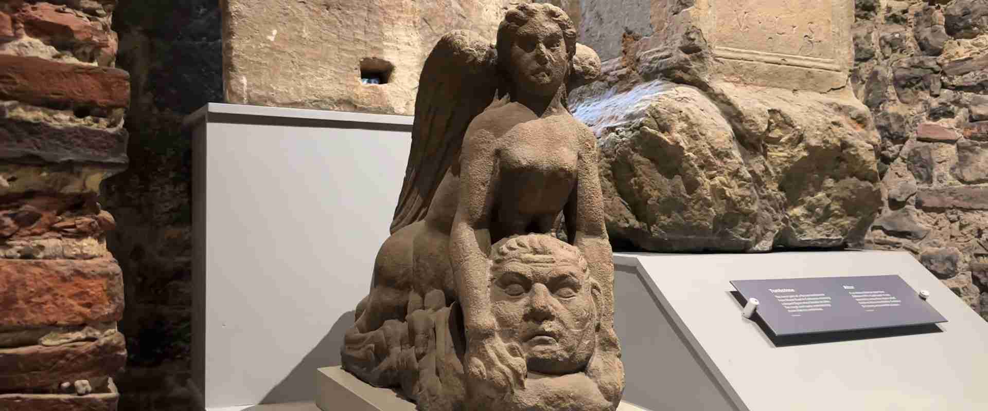
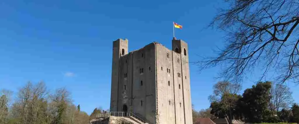
The Largest Keep in Europe: Roman Sub-Structures and Defensive Engineering of Colchester Castle, East of England
Beneath the floors of England’s largest Norman keep, Roman concrete laid nearly two thousand years ago still carries load. Colchester Castle’s keep, measuring 46 metres by 34 metres and roughly one and a half times the ground-plan of the Tower of London’s White Tower, owes its exceptional scale to a decision made around 1076: to build on the surviving podium of the Temple of Claudius rather than break fresh ground in Essex clay. This article traces the sequence of defensive engineering at Camulodunum, from Iron Age dyke systems at Gosbecks to Norman curtain wall strategy and the 1216 siege.
Key Takeaways
- Colchester Castle’s keep, measuring 46m by 34m, is the largest surviving Norman keep in Europe by floor area — roughly 50% larger than the Tower of London’s White Tower — because the Normans built directly on the footprint of the Roman Temple of Claudius podium, which forced the plan to exceed the scale of any purpose-built Norman foundation in Britain.
- The Temple of Claudius podium, approximately 32m by 23.5m and 4m high, was built of ragstone rubble faced with septaria and brick; it survives intact beneath the castle and contains four arched vaults originally packed with sand to conserve scarce stone, later excavated to form the accessible vaults visible today.
- The castle walling combines septaria nodules — calcareous clay concretions sourced from the Essex coast near Walton-on-the-Naze — with courses of Roman tile and brick spolia robbed from the ruined colonia, creating a banded rubble masonry whose material shifts remain primary archaeological evidence for the construction phasing.
- Attribution of the castle’s design to Gundulf, Bishop of Rochester, rests entirely on its close architectural similarities to the White Tower; no contemporary document directly links Gundulf to the Colchester commission, and the Colchester Chronicle that credits Eudo Dapifer with building it dates from the late thirteenth century and is considered of uncertain reliability.
- The pre-Roman landscape at Camulodunum comprised successive earthwork dyke systems — including Gosbecks Dyke, Kidman’s Dyke, and Oliver’s Dyke — enclosing one of Britain’s largest Iron Age oppida; the Balkerne Gate, the largest surviving Roman gateway in Britain, incorporates an earlier first-century monumental arch celebrating the Claudian conquest within a later four-passage gatehouse.
People Also Ask About Colchester Castle Architecture
What makes Colchester Castle the largest surviving Norman keep in Europe?
The exceptional floor area of Colchester Castle’s keep — 46 metres by 34 metres, or 152 by 112 feet — is a direct consequence of the Normans’ decision to build on the surviving podium of the Roman Temple of Claudius. Because the Norman walls abut the outer edges of the existing Roman concrete platform rather than resting on a fresh foundation, the plan of the keep was constrained to match the podium’s footprint and then exceed it: the keep’s longer dimension runs north to south over the full length of the temple site. The resulting area of approximately 1,564 square metres is around 50 per cent greater than the 1,040 or so square metres of the White Tower, which itself was the next largest Norman keep in Britain. No other Norman keep in Europe comes close to Colchester’s floor area, and every account of its dimensions leads back to the same structural explanation: the Roman temple underneath made it impossible to build small.
How did the Temple of Claudius podium determine the dimensions of the Norman keep?
The Roman podium beneath Colchester Castle is a rectangular concrete platform measuring approximately 32 metres by 23.5 metres and standing about 4 metres above the surrounding ground. Its core is ragstone rubble, and its outer faces are built of septaria and Roman brick — the same materials the Normans would later use for the keep’s own walls. Within the platform, four arched vaults run beneath the central floor area of the temple: two long vaults approximately 18.5 metres by 6.5 metres, under the position of the cella, and two shorter vaults of about 8.5 metres by 6.5 metres under the pronaos. When the Normans arrived, the podium was the most substantial surviving masonry element on the site, and rather than demolish it — a task that would have required enormous effort and produced little usable stone — the builders placed the keep’s outer walls in narrow trenches that abut directly against the Roman platform’s edges. The keep is therefore not just built over the podium: it is structurally clasped to it, with the Roman concrete forming part of the castle’s own vertical load path.
What building materials were used to construct Colchester Castle?
Colchester Castle was built from a combination of locally available and salvaged materials, reflecting both the geology of Essex and the abundance of Roman ruins on the site. The primary walling material is coursed rubble incorporating septaria — calcareous clay nodules quarried from the London Clay outcrops along the Essex coast near Walton-on-the-Naze and Harwich — combined with Roman bricks and tiles robbed from collapsed or demolished structures across the colonia. These Roman tile courses were laid at intervals through the rubble as levelling and binding courses, a technique consistent with contemporary Norman practice elsewhere but here reinforced by the sheer availability of recycled material. For the corners and the structural ashlar work — window surrounds, the entrance arch, and the quoin dressing of the angle buttresses — the builders imported Caen stone from Normandy and Barnack stone from the East Midlands, both materials better suited to precise cutting than the irregular septaria nodules.
Who designed and built Colchester Castle, and what evidence supports this attribution?
Two names are most commonly associated with Colchester Castle, but the evidence for each is of a different character. Eudo Dapifer — High Steward first to William the Conqueror, then to William II, then to Henry I — is credited in the Colchester Chronicle with commissioning and constructing the castle, and a charter of Henry I dated 1101 granting Eudo “the town and castle of Colchester as my father had them and my brother and myself” confirms the castle’s royal foundation from the outset. The Chronicle’s 1076 start date is the primary documentary anchor for the building chronology, though scholars note that the Chronicle dates from the late thirteenth century and is of uncertain reliability for events nearly two hundred years before its composition. Gundulf, Bishop of Rochester from 1077, has long been associated with the design on the basis of the close plan similarities between Colchester and the White Tower at the Tower of London, where Gundulf’s supervisory role is attested by a near-contemporary description of him as “competent and skilled at building in stone” and the principal overseer of that project. However, the attribution to Gundulf at Colchester rests entirely on this architectural resemblance; both keeps also share design features with the earlier Château d’Ivry-la-Bataille in Upper Normandy, which complicates any single-designer inference.
Extended multi-day tours – 5+ days
Featured South East England Multi-Day Tour Packages

3 days
South East England 3-Day Discovery Tour
- ✓ Comprehensive South East England experience
- ✓ Expert local guides included
- ✓ All accommodation included
- ✓ Transportation provided

5 days
South East England 5-Day Highlights Experience
- ✓ Comprehensive South East England experience
- ✓ Expert local guides included
- ✓ All accommodation included
- ✓ Transportation provided
7 days
South East England 7-Day Cultural Journey
- ✓ Comprehensive South East England experience
- ✓ Expert local guides included
- ✓ All accommodation included
- ✓ Transportation provided

10 days
South East England 10-Day Complete Adventure
- ✓ Comprehensive South East England experience
- ✓ Expert local guides included
- ✓ All accommodation included
- ✓ Transportation provided
Multi-day tour packages powered by TourRadar. Prices and availability subject to change.
Camulodunum: From Tribal Capital to Roman Colonia
The site of modern Colchester carries one of the longest unbroken records of defended occupation in Britain. The sequence begins not with Rome but with the complex of earthwork territories that the Late Iron Age tribes of Essex and Hertfordshire — principally the Trinovantes and the Catuvellauni — had constructed over several generations before the Claudian invasion of AD 43. What the Romans encountered when they crossed into Essex was not a single walled town but a diffuse, territorially organised oppidum: a network of dyked enclosures, farmsteads, royal compounds, industrial zones, and ritual precincts extending across roughly ten square miles of the Colne valley, with the river and its tributaries providing natural boundaries and the earthwork dykes providing artificial ones.
Camulodunum takes its name from Camulos, a Celtic war god widely venerated in Britain and Gaul. By the early first century AD the settlement served as the political and economic heart of a territory that Cunobelin — the historical figure behind Shakespeare’s Cymbeline — had made into the dominant power north of the Thames. The settlement’s sophistication is attested by quantities of imported Gaulish pottery, wine amphorae, and fine metalwork recovered from sites across the oppidum, and by gold and silver coin minting at Camulodunum itself, which circulated across south-east Britain as currency of prestige. Farming was concentrated at the Gosbecks complex to the south-west of the later Roman town, while the industrial and commercial zone occupied the riverside site of Sheepen, from which goods moved along the River Colne to the estuary and beyond.
When Claudius ordered the invasion in AD 43, Camulodunum was the primary military objective — the symbolic heart of resistance. After the collapse of organised opposition, Claudius himself led his forces into the oppidum in a calculated act of theatre, reportedly accompanied by war elephants intended to overawe the surviving population. The town was subsequently reorganised as Colonia Victricensis — the Colony of the Victorious — the first and for a period the only Roman colonia in Britain, a settlement of retired legionary veterans holding full Roman citizenship. The Claudian colonia was a statement of permanence: its forum, theatre, council chamber, and temple were long-term investments in provincial culture rather than emergency structures, and the Temple of Claudius — the largest known classical temple in Roman Britain — sat at the heart of that programme.
The Boudiccan revolt of around AD 60 or 61 interrupted the colonial project with catastrophic violence. The Iceni queen’s attack on Camulodunum was directed specifically at the temple, which the local population experienced as a symbol of subjugation. The Roman historian Tacitus records that the citizens made their final stand inside its walls, holding out for two days before their end. The temple was destroyed and the town burned. The physical legacy of that destruction shaped every subsequent phase of building at Colchester: the rubble of the pre-revolt colonia became the quarry from which Roman and Norman builders alike drew their materials, and the temple podium — so massive it could not economically be removed — became the foundation of a new monument of authority a millennium later.
The rebuilt colonia was enclosed within a defensive town wall begun around AD 65 to 80, whose 2,800-metre circuit and six gateways established the topographic framework within which the Normans would eventually build. Colchester’s Roman wall, surviving in substantial stretches today, represents the earliest and one of the most complete town wall circuits in Roman Britain. It was built of a rubble core faced with septaria stone and brick — the same geology and the same material logic that would dominate the Norman keep. Understanding the Roman wall is essential context for the Norman castle, because in both cases the builders worked with the same limited palette of local materials against the same fundamental constraint: there is no naturally occurring building stone in the Essex lowlands, and every element called on to perform structural precision — arch, ashlar, cornering — required either long-distance quarrying or systematic reuse of what lay to hand.
The Earthworks of Camulodunum: Pre-Roman Iron Age Ramparts and Legionary Defences
The Iron Age landscape around Colchester is one of the most extensively earthworked in Britain. The system of dykes that enclosed and defined the Late Iron Age oppidum of Camulodunum is remarkable both for its scale and for the territorial complexity it represents: rather than a single perimeter wall, it consists of multiple dykes laid in approximately parallel alignments across the western, northern, and southern approaches to the oppidum core, creating a defended zone tens of metres deep rather than a simple linear boundary. The eastern side of the oppidum was protected by the Rivers Colne and Roman River, which converge south-east of the site and made artificial defences on that flank unnecessary. The dykes on the landward approaches were therefore the primary investment in territorial security, and their successive phases of construction reflect the changing political and military circumstances of the late first century BC and early first century AD.
The dyke system around Camulodunum is not architecturally uniform. The individual earthworks vary considerably in their dimensions, profiles, and apparent functions: some appear primarily as territorial markers, demarcating zones of ownership or ritual significance rather than providing military obstruction, while others were clearly designed to funnel movement through controlled entry points. The broader dyke network includes Gryme’s Dyke, the Lexden Dyke, the Heath Farm Dyke, and the Triple Dyke, each positioned to control a distinct approach corridor to the oppidum interior. Taken together, these earthworks enclosed a territory roughly equivalent in area to several later medieval English towns, and their construction represents a major investment of coordinated labour sustained over generations.
The Engineering of Gosbecks Dyke Systems and Oppidum Perimeter Fortifications
The Gosbecks complex, located approximately two kilometres south-west of the later Roman town, was the primary seat of tribal power within the Camulodunum oppidum. The site preserves an ancient farmstead of pre-Roman origin surrounded by enclosures that developed over several centuries, and by the first half of the first century AD it appears to have served as the residence of the tribal king — probably Cunobelin — together with enclosures for cattle and facilities for the concentrated economic and religious activities that were typical of high-status Late Iron Age compounds in south-east Britain. Archaeological investigation of the Gosbecks area has identified multiple enclosure ditches, evidence for ritual activity in at least one large enclosure immediately north of the main farmstead, and the characteristic dark soils of intensive occupation accumulation.
The western boundary of the Gosbecks complex underwent a sequence of defensive reinforcements in the first half of the first century AD, probably in response to the growing threat of Roman intervention or to local political pressures that are no longer directly recoverable. The Historic England record for the Gosbecks site documents how the western perimeter was successively strengthened by the addition of parallel earthwork dykes: Kidman’s Dyke and Gosbecks Dyke were added to reinforce the western boundary, and Oliver’s Dyke was constructed to secure the southern perimeter as far as the Roman River. This sequence of successive additions — each new dyke laid slightly further out from the previous one, creating a layered defensive depth — is characteristic of the engineering response of communities under increasing territorial pressure: rather than demolishing an existing dyke and constructing a new, larger one, builders at Camulodunum augmented the existing line with parallel works, producing the multi-phase profile that archaeologists later excavated.
Each dyke in the Camulodunum system follows the same basic constructional logic. A ditch was dug into the subsoil — typically the London Clay or the gravel terraces above it — and the upcast material was piled on the inner (defended) side to form a bank. At Camulodunum the ditches vary in width and depth but most were V-profiled or flat-bottomed, with widths sufficient to obstruct a mounted charge and depths that would have been formidable obstacles even without additional palisading. The banks behind these ditches, where not subsequently quarried or ploughed flat, survive as low ridges visible from the ground and, more clearly, from aerial photography and LiDAR survey. The Gryme’s Dyke, which represents one of the outer limits of the oppidum system on its northern and western sides, survives in stretches as a scheduled ancient monument and preserves the bank-and-ditch profile at something approaching its original proportions.
The total enclosure created by the various dyke alignments was one of the largest Iron Age territorial oppida in Britain, covering an area within which the different functional zones — aristocratic residence at Gosbecks, industry and trade at Sheepen, elite burial at Lexden, and presumably agricultural production across the valley floor — were organised in a way that has more in common with urban zoning than with the simple defended hillforts of an earlier Iron Age tradition. The Romans who invaded in AD 43 encountered this landscape as a complex political entity, not merely a military target, and the organisation they imposed upon it after the conquest drew directly on the topographic articulation that the dyke system had already created: the legionary fortress of the immediate post-conquest period was positioned at the point where two existing trackways crossed, and the later colonia was laid out across street blocks whose alignment in part respected the orientation of the pre-existing Roman River and oppidum organisation.
Balkerne Gate: Tactical Design of Britain’s Oldest Surviving Roman Gateway
The Balkerne Gate is by any measure the most imposing piece of Roman military architecture surviving in Britain. It stands on the western side of Colchester’s Roman town wall, at the point where the Roman road from Londinium — the predecessor of the modern road to London — intersected the wall circuit. In antiquity it served as the main ceremonial and commercial entrance to the colonia: the road that passed through it connected Camulodunum to the rest of the province, carried the official post, and served as the axis along which military units, merchants, and travellers arrived. Its survival — partial, but substantial — owes something to accident: the gate was infilled and blocked around AD 300, when the main entrance to the town was moved southward to the Headgate, and the sealed masonry was preserved beneath accumulated deposits until modern times.
The gate’s design is in two phases, and understanding that sequence is essential to understanding its exceptional dimensions. The earlier phase consists of a free-standing monumental arch, probably built around AD 50 at the foundation of the colonia, designed to celebrate the Claudian conquest of Britain. This arch was faced with tufa stone brought from the Hampshire coast — a fine-grained limestone chosen for its workability and its capacity to carry carved decoration — and formed a twin-arched structure straddling the main road into the western side of the early colony. When Camulodunum was rebuilt and walled following the Boudiccan revolt, in the period approximately AD 65 to 80, the existing monumental arch was incorporated into a much larger gatehouse structure. The new design expanded outwards from the earlier arch in both directions, adding flanking carriageway passages and pedestrian footways to either side, together with external guardrooms projecting forward of the wall face, to create a total frontage approximately 33 metres wide — the largest surviving Roman gateway in Britain by any measure of frontage.
The Balkerne Gate’s detailed dimensions are known from excavations carried out by Sir Mortimer Wheeler in 1917 and from subsequent investigations in the 1980s. The gate as enlarged consisted of two broad carriageways, each approximately 5.2 metres wide, flanked on each side by a pedestrian footway approximately 1.8 metres wide. The whole structure projected about 9 metres in front of the line of the town wall, giving the gateway a pronounced outward thrust that would have allowed defenders in the flanking guardrooms to observe and fire along the face of the wall in both directions. The gate survives today in truncated form: the south pedestrian footway arch and part of a guardroom still stand to heights of approximately 4 to 6 metres, but the central carriageways and the northern half of the structure were demolished and overbuilt in later centuries, with the eighteenth-century Hole in the Wall public house now occupying the northern portion of the gate’s footprint.
In tactical terms, the Balkerne Gate’s design reflects the dual function common to Roman gateways of the colonial period: part fortified checkpoint, part triumphal monument. The quadruple-passage format — two carriageways for vehicles and draft animals, two footways for pedestrians — optimised throughput on what must have been one of the busiest routes into the town, while the projecting towers and flanking guardrooms gave the garrison the firing positions needed to defend the wall face against approach. The incorporation of the earlier monumental arch into the later structure added a commemorative dimension that the original builders evidently wished to preserve: the first-century arch celebrated the Claudian conquest, and its retention within the Flavian-period wall gate meant that every traveller entering Camulodunum passed through a visible reminder of the military event that had brought the colonia into existence.
The Temple of Claudius: Podium, Vaults, and Roman Structural Inheritance
The Temple of Claudius was the largest classical temple ever built in Roman Britain and the symbolic centrepiece of the Claudian colonial project. Construction began under Claudius, probably around AD 49, and when he died in AD 54 and was deified by his successor Nero, the temple was rededicated to the deified emperor — giving it the full title Templum Divi Claudii. Its setting was deliberately overwhelming: the temple stood within a vast temenos precinct of roughly 164 by 150 metres, enclosed by a colonnaded arcade, and the whole complex occupied the highest ground within the colonia, visible from the surrounding countryside and from arriving ships on the Colne estuary. For the Trinovantes and other local peoples, this was not simply a religious building but a physical assertion of Roman ownership of the landscape itself.
Podium Construction and the Four Vaulted Arches
The engineering of the Temple of Claudius began with its podium — the raised platform on which the main temple structure stood. The Historic England entry for the site records the podium as a rectangular platform measuring approximately 32 metres north to south by 23.5 metres east to west, standing approximately 4 metres above the level of the surrounding ground. Its outer walls are built of ragstone rubble faced with septaria and brick; the solid outer foundations are up to approximately 6 metres thick on the east and west sides and approximately 2.5 metres thick on the north and south. This massive perimeter of concrete and stone created the structural frame into which the internal arched foundations were set.
Within the outer framework of the podium, the floor area is supported not by solid concrete but by four arched vaults. Archaeological investigation has established that these arches were constructed by smoothing the sandy subsoil into curved formwork profiles, laying wooden shuttering over them, and then building the arch structure of stone and mortar over the shuttering. When the shuttering eventually rotted away, the marks it left in the mortar on the underside of the arches remained preserved, providing direct evidence for the original construction technique. The four vaults consist of two long chambers — each approximately 18.5 metres long and 6.5 metres wide — underlying the position of the temple’s cella, and two shorter chambers approximately 8.5 metres long and 6.5 metres wide, positioned beneath the pronaos or entrance porch. The spaces between the vaults and the outer wall perimeter were filled with packed sand rather than stone, a decision that reflected the relative scarcity of good building stone in the Essex lowlands and produced a structure that was adequate for bearing the temple’s superimposed loads without the enormous expense of a completely solid platform.
The Boudiccan Revolt and the Endurance of the Concrete Platform
When Boudicca’s forces sacked Camulodunum in approximately AD 60 or 61, the temple’s superstructure was destroyed. The colonnade, the cella walls, and the roof were demolished or burned, and the building ceased to function as a place of Roman imperial cult. But the podium — some 4 metres of Roman concrete and mortared rubble — proved effectively indestructible by the techniques available to an attacking force in the first century. It remained in place throughout the succeeding centuries of Roman occupation, long after the temple above it had been cleared away, reduced to a heavily robbed and eroded platform visible above the surrounding ground surface. When the Saxons occupied the site and when the Normans began their castle works in the 1070s, the podium was the dominant surviving element of the Roman landscape at this point in the town, and its dimensions dictated the scale of everything built upon it thereafter.
The temple superstructure above the podium was octastyle in its columnar arrangement — meaning it had eight columns across the front façade. Archaeological analysis suggests the column spacing was consistent with Vitruvian design principles for this temple type, with column centres approximately 3.4 metres apart across the front and the cella proportioned in keeping with this module. No columns have been recovered, but the podium dimensions and the Vitruvian proportional system together suggest the columns would have stood approximately 35 feet — roughly 10.7 metres — above the podium level. The temple was faced with polished stone including Purbeck marble from south-east England and, according to some accounts, giallo antico marble from Tunisia, giving the building a visual richness entirely different from the rubble-and-septaria pragmatism of the structures that would eventually replace it.
Building the Keep on Roman Concrete: Foundation Strategy and First Phase
The Norman conquest of England in 1066 was followed rapidly by a programme of castle building whose purpose was as much political as military: to establish visible symbols of Norman dominance at strategic centres and to provide secure residences for the new ruling class. At Colchester — the oldest recorded town in Britain and the former capital of Roman Britain — the symbolic dimension was particularly charged. The Normans did not simply need a defensible base; they needed a monument, and the most dramatic monument available was the surviving Roman infrastructure of the colonia itself. The decision to site the keep on and around the temple podium was therefore both an engineering choice and a statement of continuity with the most prestigious building tradition in Western Europe.
Wall Placement, the Podium Interface, and the Constraint of Scarce Stone
The walls of the Norman keep were laid in narrow foundation trenches cut through the Norman ground level — a layer of mortar rubble created by the demolition of whatever remained of the Roman temple superstructure. In most areas, the wall foundations abut directly against the outer edges of the Roman podium; in the south, the keep walls are set slightly further back to avoid the original temple steps and to allow the digging of a well. This configuration means the podium’s outer face essentially acts as a retaining element for the lower portions of the Norman walling, and the concrete Roman platform provides an effective spread of load across the Essex clay subsoil that a fresh Norman foundation would not have matched without considerably greater excavation and material investment.
The constraint of scarce stone exercised a decisive influence on how the Norman keep was built. Essex has no natural building stone: the county’s underlying geology is almost entirely London Clay, sandy glacial deposits, and river gravels. The septaria nodules that occur in the clay could be extracted and used as rubble, but they are irregular in form and cannot be cut to precise ashlar faces. For any element requiring dressed stone — quoin angles, arch voussoirs, window and door surrounds — the builders had to import material from outside the county. Caen stone came from Normandy, shipped across the Channel and up the Colne to the site; Barnack stone, from the oolitic limestone belt of the East Midlands, was brought by water from the Midlands via the Fen waterways. These imports were reserved for the architectural details that most required precise cutting, while the bulk of the wall fabric was built from the most abundant available materials: septaria from the coast, Roman tile and brick from the ruins of the colonia, and the Roman flint and rubble that the demolition of the temple had produced on site.
The Initial Single-Storey Keep and Its Crenellated Parapet
The Colchester Heritage Explorer records that the initial form of the Norman keep was a single-storey stone structure with a crenellated parapet wall. This first phase — built around 1076 to 1080 by Eudo Dapifer’s workforce — established the keep’s great footprint and its basic structural vocabulary, but it appears that the ambition of the first programme was curtailed in ways that were not anticipated at the outset. The sheer scale of the Roman podium on which the keep was being built imposed dimensions that may have exceeded what could be completed at full height within the resources available: reusing a Roman base that was larger than any Norman keep foundation in Britain meant that the volume of masonry required for even a single-storey structure was enormous.
What is certain is that the keep was subsequently raised by at least one storey in the early twelfth century, and a forebuilding was added on the south side to protect the main entrance — a feature that would have been critical for security, since the keep’s ground-floor entrance was accessible from outside via the temple podium’s elevated platform rather than at the level of the surrounding ground. This forebuilding was itself later replaced by a barbican in the thirteenth century, reflecting ongoing attention to the vulnerability of the entry sequence at a keep whose unusual siting on a raised Roman platform created a distinctive set of access-control challenges. The original height of the keep at its completion remains debated: sources differ between two, three, and four storeys, and the demolition of the upper parts in the seventeenth century means that the question cannot now be resolved from fabric evidence alone.
Septaria, Roman Tile Spolia, and the Material Grammar of the Keep
The walling of Colchester Castle is a textbook in the resourcefulness of Norman builders working in a stone-poor landscape. A close examination of the castle’s surviving fabric reveals a consistent constructional hierarchy: septaria rubble forms the bulk of the wall body, Roman tile and brick courses appear at regular intervals as levelling and bonding elements, and worked stone of various kinds — Caen, Barnack, and occasional other imports — appears only at the points of maximum structural demand. This hierarchy reflects both the availability of each material type and its structural properties, and it produces a wall surface of considerable visual interest that has been observed and commented upon by antiquaries since the eighteenth century.
The Properties and Sourcing of Septaria Nodules
Septaria — known in some older references as septarian nodules or cement stones — are concretions formed within the London Clay by the precipitation of calcium carbonate and other minerals around a nucleus of organic or mineral material during diagenesis. They take their name from the internal network of radiating and concentric cracks (septa) that forms as the nodule dries and contracts after burial, and which in many specimens is subsequently filled with calcite crystals. Externally, septaria present as irregular, sub-rounded masses of brownish or grayish calcareous mudstone, ranging from fist-sized pieces to nodules weighing several kilograms. They occur throughout the London Clay wherever it outcrops — notably along the cliffs and foreshore of the north Essex coast between Harwich and Walton-on-the-Naze — and can be collected from the beach at low tide or quarried from the cliffs by hand.
The ease of collection and transport made septaria the default building stone for both Roman and Norman builders in Essex. The Roman town wall of Camulodunum was faced with carefully arranged horizontal courses of septaria and brick, and the Colchester Heritage Explorer confirms that the septaria used in the town wall was sourced from the coast near Walton-on-the-Naze and Harwich — a coastal route of approximately 20 kilometres, easily managed by small boats working the Colne estuary. The Norman builders of the castle used the same source, extending the same supply chain that had served the Roman colonia a thousand years earlier. Despite their value as a rubble material, septaria cannot easily be cut to a precise flat face: the internal crack network and the variability of the nodules’ hardness make consistent ashlar dressing impractical. They are therefore used throughout the castle as undressed rubble rather than as worked stone, and the courses they form in the wall face are deliberately laid with their flattest natural surfaces outwards to create the most regular appearance possible.
Roman Brick and Tile as Levelling Courses
At intervals through the rubble walling, horizontal courses of Roman tile and brick appear as sharp lines running across the wall face. These levelling courses served a structural function that was well understood by Roman builders and continued by their Norman successors: in rubble masonry, where the individual stones are irregular in height and the mortar beds vary in thickness, the accumulation of small errors in level across the width of the wall face leads over time to a cumulatively uneven surface that can create differential stresses if left unaddressed. A continuous course of flat tile, laid across the full width of the wall at intervals of approximately every metre of height, resets the bed level and redistributes vertical loads evenly before the next phase of rubble walling is added.
At Colchester the Roman tile courses are formed from brick and tile robbed from the ruins of the colonia — from hypocaust floors, from demolished public and domestic buildings, from the debris of the Boudiccan destruction layer, and from structures demolished specifically to supply the castle works. This recycling of Roman tile is visible in the wall fabric as a mixture of sizes, since Roman bricks and tiles were made in several standardised formats and the castle’s builders used whatever came to hand. An eighteenth-century account of the castle fabric, preserved in the Transactions of the Essex Archaeological Society, describes the wall surface with evident admiration: “it is impossible for the attentive spectator not to be struck with the labour which the directing mason evidently expended in this work of mural decoration,” with the courses “generally followed out with great care” but “varied on the different sides and in different divisions of the wall.”
Ashlar Cornering, Barnack Stone, and the Structural Geometry of Quoins
The corners and angle buttresses of the keep’s exterior required a precision that neither septaria rubble nor recycled Roman tile could supply. Here, the Norman builders deployed cut ashlar in a material carefully chosen for its workability: the plinth — the projecting base course that marks the transition between the foundations and the main wall face — is dressed in Barnack stone, an oolitic limestone from the quarries near Stamford in the East Midlands, transported to Colchester by river and road. Above the plinth, the towers and buttresses are dressed with quoins of various cut stones to a height of approximately seven and a half metres — roughly 25 feet — above the plinth level, and above that height the quoin dressing transitions to courses of brick.
The structural logic of ashlar cornering in rubble masonry is straightforward: irregular rubble can sustain high compressive loads but has poor resistance to the differential settlement and lateral forces that tend to concentrate at corners and re-entrant angles. Precisely cut and tightly bedded ashlar quoins interlock the perpendicular faces of a corner, distributing the loads from both walls into each other, and their mass and precision prevent the gradual unravelling of a rubble angle under long-term stress. At Colchester the quoin stones are described by the eighteenth-century observer as “of various sizes, but never large, commonly presenting a face of about 8 or 9 inches square” — that is, approximately 20 to 23 centimetres in face dimension, rather than the large, monolithic quoins used at some contemporaneous English keeps. This relatively modest scale of ashlar may reflect a deliberate economy in the use of expensive imported stone rather than any structural limitation, since the keep’s corners appear to have performed adequately over the centuries that the structure remained in use.
The Scale and Internal Organisation of the Keep
The keep’s exceptional dimensions produced an internal arrangement of spaces that is similarly unparalleled among surviving Norman keeps in England. The orientation of the longer axis runs north to south, aligned with the Roman temple beneath it, and the corners of the keep are reinforced by square angle turrets projecting from three of the four corners, with a semi-circular apse projecting from the eastern face at the south-east angle in place of the fourth turret. This apse — a form with clear liturgical associations — almost certainly housed a chapel at the first-floor level, as was standard in great Norman keeps where the lord’s private chapel was one of the essential programmatic elements.
Dimensions, Orientation, and the South Apse
The floor area of approximately 1,564 square metres at ground level created a spatial programme comparable in scale to a medium-sized parish church. The ground floor of the keep was divided by internal cross walls into two main chambers — an eastern and a western room — with the staircase access organised within the south-west turret, which houses the Great Stair: a wide, generously proportioned ascending passage that is itself the largest Norman stair in Britain. The staircase within the south-west turret, which rises through the keep’s surviving height, reflects the deliberate investment in processional movement that distinguishes great keeps from purely functional tower structures: the visitor or garrison member ascending to the great hall on the floor above traversed a stair of sufficient width to pass another person without discomfort, a luxury that reflects the social ambitions of the patron as much as the requirements of defence.
The walls of the keep survive at approximately their first-floor height on the south and east sides and somewhat higher on the north and west. The wall thickness — approximately 2.5 metres throughout the main faces, slightly greater at the base — is consistent with other major Norman keeps of the late eleventh century, and it provided not only structural robustness but also the mural passage space needed to incorporate arrow loops, fireplaces, and private chambers within the wall thickness itself. The fireplaces within the first floor are particularly notable: they are equipped with Y-shaped chimney flues, a feature described as unique in surviving Norman domestic architecture, and they provide direct evidence that the first floor was intended from the outset as a comfortable habitation rather than a purely functional space.
Wall Thickness, Mural Passages, and the Spatial Logic of the Ground Floor
The ground floor of the keep, as it survives, is not simply a basement but a functioning series of spaces that relate directly to the Roman podium beneath. The castle’s ground-floor entrance is elevated above the external ground level by the height of the podium platform, meaning that access from outside required either a staircase or a ramp running up against the south face of the keep — a design that the Norman builders addressed first with a forebuilding and later with a barbican. Within the ground floor, the spaces on the east side of the central dividing wall communicate with the Roman vaults beneath: access to the vaulted chambers of the Roman podium was available from the castle interior, and these spaces would have served for storage or as areas out of direct observation from outside the keep.
The mural passages within the walls provided routes for movement around the interior perimeter without crossing the central floor spaces, a feature that combined defensive utility — allowing defenders to move quickly between arrow loops and positions without exposing themselves in the main chambers — with a degree of spatial organisation that kept service circulation separate from the lord’s hall and reception spaces on the first floor. The thickness of the walls also accommodated the castle’s drainage: a large Roman-period drain that predated the Norman construction continued in use beneath the floor, running south from the temple area, and the Norman builders incorporated this existing underground channel into their water-management system.
Architectural Authorship: Gundulf of Rochester and Eudo Dapifer
The question of who designed and who built Colchester Castle resists clean resolution, not because the information is entirely lacking but because the available evidence is of two entirely different kinds — architectural analogy on one side, documentary record on the other — and neither is wholly satisfactory. The two figures most commonly associated with the castle’s creation, Gundulf of Rochester and Eudo Dapifer, occupied quite different roles in the construction process, and distinguishing between design authority and building patronage is essential to reading the evidence correctly.
Gundulf’s Role at the Tower of London and the Basis for Attribution
Gundulf was consecrated Bishop of Rochester on 19 March 1077, having previously been a monk at Bec Abbey in Normandy and then at Saint-Étienne in Caen before coming to England as part of Archbishop Lanfranc’s reforming mission in 1070. He is described in a near-contemporary source as “competent and skilled at building in stone” and as the principal overseer and surveyor of the White Tower at the Tower of London, where King William employed his expertise from 1078. The White Tower’s plan — a large rectangular keep with angle turrets, a corner apse housing the Chapel of St John the Evangelist, a forebuilding, and walls approximately 2.7 to 4.6 metres thick — is the closest architectural relative to Colchester Castle. Both keeps share the apse feature, the forebuilding, the general massing, and the material vocabulary of rubble walling with ashlar dressings. Both are among the earliest stone towers in England.
The attribution of Colchester Castle to Gundulf rests entirely on this architectural similarity, as the Wikipedia article on Colchester Castle explicitly confirms: “The design of the castle has been associated with Gundulf of Rochester purely on the basis of the similarities between Colchester and the White Tower at the Tower of London.” No contemporary document recording a commission to Gundulf at Colchester has been identified, and there is a further complicating factor: both Colchester and the White Tower also resemble the earlier Château d’Ivry-la-Bataille in Upper Normandy, which suggests that the design type — tall rectangular keep with apse and forebuilding — may have been a shared vocabulary of royal Norman military architecture rather than the invention of a single designer. Gundulf’s skill in stone was clearly exceptional for his day, and his involvement at Colchester is entirely plausible given his concurrent work at the Tower of London, but it remains an attribution by inference rather than by evidence.
Eudo Dapifer, the Colchester Chronicle, and the Royal Commission
Eudo Dapifer — also known as Eudo Fitz-Hubert, born around 1055 — served as High Steward, or Dapifer, to three successive English kings: William I, William II, and Henry I. The Colchester Chronicle, a compilation written in the late thirteenth century and considered of uncertain reliability for events more than two centuries before its composition, credits Eudo with constructing the castle and gives a commencement date of 1076. The documentary anchor for the castle as a royal commission comes from a charter of Henry I dated 1101, in which Henry grants the town and castle of Colchester to Eudo “as my father had them and my brother and myself” — establishing that the castle had been in royal hands from William I through William II to Henry I before its grant to Eudo. Eudo became the castle’s first Constable and retained custody of it until his death in 1120, after which it reverted to the Crown.
The distinction between Gundulf as possible designer and Eudo as patron-builder reflects a division common in great Norman building projects. The bishop brought technical expertise in stone construction; the king’s steward brought the administrative capacity to organise materials, labour, and logistics across the wide territory of the new Norman settlement. Eudo also built the nearby St John’s Abbey, which suggests that the role of architectural patron at Colchester was consistently his rather than incidental. Whether Gundulf and Eudo worked in collaboration, or whether Gundulf’s involvement was limited to the Tower of London, remains beyond documentary recovery.
Norman Earthworks, Bailey Defences, and Ditch Strategy
The Norman castle at Colchester was not limited to the great stone keep. Like most Norman castles of the late eleventh century, it comprised a system of earthwork enclosures — baileys — surrounding and protecting the keep, within which the secondary buildings of the garrison and household were arranged. What made Colchester’s bailey system unusual was its siting: because the keep was placed not at the edge of the town but at its centre — an arrangement dictated by the location of the Roman temple podium — the baileys extended into the existing urban fabric, and the relationship between castle and town was more complex and more contested than at most Norman fortresses.
Upper and Lower Bailey Configuration at Colchester
The Colchester Heritage Explorer records that the castle’s earthwork defences consisted of an upper and a lower (or “nether”) bailey. The upper bailey, whose bank and ditch defences were built by 1101, lay to the north of the keep, extending between the keep and the Roman town wall. The northern and eastern arms of the upper bailey earthworks survive today as landscaped ridges within Castle Park, the public park that now occupies the castle grounds; the southern arm runs beneath the modern High Street, and the western arm passes close to Maidenburgh Street. The lower bailey lay downslope to the north, between the upper bailey and the town wall, providing a secondary defensive zone between the keep and the Roman perimeter. At least one entrance into the upper bailey was located in its south-west corner, giving controlled access from the direction of the town centre.
The relationship between the Norman castle and the Roman town wall was not one of simple superimposition but of deliberate integration. The Roman circuit of the town wall already enclosed the site, so the castle’s own defences were in effect an inner layer within an existing outer perimeter. This meant that an attacker who had breached the Roman town wall would still face the bailey bank and ditch before reaching the keep. Conversely, the garrison of the castle could retreat to the keep even if the town wall and the bailey were overrun, and defenders of the town could use the bailey as a muster point before the ultimate fallback of the keep itself. This tiered system of defence — Roman wall, bailey earthworks, keep — was a characteristic feature of town-centre castle design in England and created the defensive depth that late eleventh-century Norman military thinking valued in stone fortifications.
Ditch, Bank, and Entrance Design in the Norman Defensive Framework
The ditch-and-bank system of the Colchester baileys followed the same basic logic as the Iron Age dykes that had preceded them on the same landscape: a ditch dug into the subsoil whose upcast formed a bank on the defended side, with the combination creating an obstacle roughly twice the effective height of the ditch alone. At Colchester the subsoil conditions — London Clay overlaid with gravels and made ground from the Roman occupation — would have made the digging reasonably straightforward but the bank relatively unstable without careful turf facing or timber revetment. The bailey palisade — a timber fence or wall running along the bank crest — provided the actual line of defence, and records of palisade maintenance from the thirteenth century confirm that these timber elements required regular renewal: a palisade blown down in 1218 was replaced at a cost of approximately £6, blown down again in 1237, and re-erected at a cost of around £39 in 1239. The recurring expense of palisade maintenance was one of the practical arguments for the eventual translation of curtain wall defences into stone, though at Colchester the stone curtain walls appear to have been built on the south and west sides of the upper bailey during a phase of work recorded around 1182.
Entry into the upper bailey was controlled at its south-west corner, the point of closest approach from the town. This positioning — placing the gateway at the most overlooked and most conveniently defended angle of the earthwork perimeter rather than at the most accessible point for everyday use — reflects a consistent principle of Norman entry design: the entrance should be visible to defenders on the bank or in the keep, should require an attacker to turn and expose their unshielded side, and should not be immediately adjacent to the keep itself, since a breach at the gateway should not immediately endanger the final refuge. The forebuilding on the keep’s south face similarly controlled entry into the keep proper, requiring visitors to pass through a separate external structure before reaching the main entrance door.
Curtain Walls, Forebuilding, and Siege Engineering
The curtain walls of Colchester Castle — stone walls enclosing the bailey and connecting the keep to the perimeter earthworks — were among the castle’s most vulnerable features throughout its active military life. Unlike the keep, which survives largely intact to its first-floor height, the curtain walls were demolished in the seventeenth century when the castle fell into disrepair and its stonework was sold off for building material. The earthwork banks on which they stood survive as the landscaped ridges of Castle Park, but the stone walls themselves are gone, and what is known about their configuration comes from documentary records, the surviving earthwork profile, and the evidence accumulated during the various phases of medieval repair and improvement.
The Forebuilding, Barbican, and Controlled Entry
The main entrance to the Norman keep was on its south side, elevated above the surrounding ground by the height of the Roman podium on which the keep rests. This elevation — which would have been approximately 4 metres above the external ground level at the foot of the south wall — meant that the entrance was not accessible from ground level without a staircase or ramp, and this stair was enclosed within the forebuilding that was added to the keep’s south face during the early twelfth century. The forebuilding served several defensive purposes simultaneously: it protected the stair from direct assault, controlled the approach to the keep’s entrance door, provided a secondary line of defence before an attacker could reach the door, and created a transitional space where access could be checked and visitors could be held while authority was sought from within the keep.
The forebuilding was itself replaced by a barbican in the thirteenth century, a development consistent with the general refinement of entry control in English castle design during this period. The barbican — a more elaborate external defensive structure providing a longer and more fully enclosed approach to the main gate — represented the accumulated thinking of two centuries of siege experience and architectural development. At Colchester, the investment in a barbican during the reign of King John or shortly thereafter was probably connected to the broader programme of castle strengthening that records indicate was under way in the years preceding the 1216 siege: a carpenter was paid 22 marks for work at the castle in 1214, and Stephen Harengood was allowed 45 marks for its repair in 1215.
The 1216 Siege and the Limits of the Castle’s Defences
Colchester Castle’s most significant military test came in January 1216, during the First Barons’ War between King John and the rebellious barons and their French allies. The castle had been in the custody of William de Lanvalai, a baron opposed to John, and when war broke out Lanvalai left the castle in the care of the Sheriff of Essex before joining the rebel barons at Bury St Edmunds. The castle was subsequently garrisoned with a French contingent and held against the royal forces. In January 1216, Savari de Mauléon — a French mercenary captain acting on John’s behalf — began a siege that lasted three months, from January to March. The castle was eventually evacuated by the French garrison by arrangement on 24 March 1216, and it subsequently passed briefly to Prince Louis of France before being recovered by the Crown following John’s death and the Treaty of Lambeth in 1217.
The three-month duration of the 1216 siege reflects both the inherent strength of Colchester Castle’s defensive position — a massive stone keep on an elevated podium, within a walled town that itself provided an outer perimeter — and the limitations of twelfth and thirteenth-century siege technique against a well-supplied and determined garrison. Siege operations in this period typically prioritised starvation and attrition over direct assault or mining, since the cost and risk of a frontal attack against a fully manned stone keep were prohibitive. The 1216 garrison appears to have been reduced by a combination of blockade and, possibly, by the negotiated terms that eventually ended the siege rather than by direct breach of the walls. Repairs in 1218 and 1219 — the documentary record shows significant expenditure — presumably made good damage sustained during the two sieges of 1216, suggesting that both the main assault and the subsequent recovery period had left their mark on the fabric.
What the 1216 siege reveals about the castle’s defensive configuration is essentially its adequacy under the conditions of contemporary siege warfare: the keep held. The curtain walls of the bailey evidently provided insufficient resistance to keep an investing force entirely outside the castle precincts for three months — the garrison was eventually obliged to negotiate withdrawal rather than raising a relief — but the keep itself, and perhaps the upper bailey, remained in garrison hands to the end of the siege, and no source records the keep being stormed or breached. The Boudiccan revolt, which destroyed the Temple of Claudius a thousand years earlier, had left the Roman podium intact; the First Barons’ War, which tested the Norman structure built on that podium, left the keep standing. In both cases, the engineered mass at the heart of the site proved more durable than the circumstances of its siege.
Spolia Engineering and the Convergent Logic of Building on Conquered Foundations
The practice of building a monument of political authority on the structural foundations of a preexisting, conquered civilisation’s most important building is not a peculiarity of medieval England. It represents an engineering choice available to any conquering power that inherits a landscape already furnished with large-scale monumental construction, and it has emerged independently in different periods, on different continents, under entirely different cultural conditions. The convergence is driven by the same engineering logic in each case: large monumental foundations are expensive and labour-intensive to remove, they are structurally superior to anything a newly arrived occupying force can construct from scratch in unfamiliar terrain, and building on top of them carries a symbolic weight — the old power literally supporting the new — that is not always consciously calculated but is rarely entirely accidental.
The Norman Podium Strategy: Structural Pragmatism and Symbolic Authority
At Colchester, the Norman decision to build on the Temple of Claudius podium was almost certainly made on engineering grounds first. The podium was the most substantial piece of masonry on the site: 32 metres by 23.5 metres in plan, 4 metres high, and composed of Roman concrete of a quality that had already proven itself against a thousand years of Essex weather and the destruction wrought by the Boudiccan revolt. To demolish it and construct a new Norman foundation of equivalent bearing capacity would have required the importation of large quantities of stone that simply was not available locally, and would have consumed years of labour that the Normans needed elsewhere. The podium’s dimensions, which exceeded those of any purpose-built Norman foundation in England, were therefore a constraint accepted in exchange for structural security — and the constraint produced the largest Norman keep in Europe.
The symbolic dimension of building on the Roman temple was not incidental, however. The Normans were acutely conscious of the prestige of Roman precedent: their legal system drew on Roman law, their Latin literacy gave them direct access to classical texts, and their own Romanesque architectural vocabulary — round arches, ashlar cornering, the proportional system of column and arcade — was a deliberate quotation of Roman architectural authority. To build a new castle on the platform of Rome’s greatest temple in Britain was to claim continuity with the most legitimate form of power available in the Western European imagination. The keep’s siting at the centre of the town rather than at its edge — the standard Norman position — is explicable only by reference to the podium: the podium was where it was, and the castle followed.
The Church and Convent of Santo Domingo on Inca Foundations in Cusco: An Independent Parallel
On the other side of the Atlantic, in the former Inca imperial capital of Cusco, Peru, a structurally and symbolically comparable decision was made by Spanish Dominican friars in the sixteenth and early seventeenth centuries. The Qorikancha — the Temple of the Sun, the holiest site in the Inca Empire, dedicated to the solar deity Inti and reportedly faced with sheets of hammered gold — was seized by the Spanish after the conquest of 1532. Rather than demolish the Inca structure entirely and build a new colonial church on cleared ground, the Dominicans built their Church and Convent of Santo Domingo directly on the surviving Inca stone foundations, incorporating the lower courses of the Inca walls into the fabric of the colonial building.
The engineering logic of this decision was, at the level of structure, identical to that of the Norman builders at Colchester. The Inca masonry was of exceptional quality: ashlar blocks of andesite cut and fitted together without mortar, with each stone individually shaped to interlock with its neighbours so precisely that, in the words of multiple sixteenth-century Spanish chroniclers, a blade could not be inserted between the joints. This mortar-free ashlar construction — entirely different in technique from the Roman concrete of the Claudian podium but comparable in its structural consequence — proved earthquake-resistant in a way that Spanish colonial masonry was not. The 1650 and 1950 earthquakes that damaged or destroyed large parts of Cusco’s colonial architecture left the Inca walls of the Qorikancha largely intact, while the Dominican church above was severely damaged and required reconstruction. The colonial building literally stood on a better foundation than it could have provided for itself.
The symbolic parallel is equally precise. The Dominicans built their convent on the Inca temple not only because the foundations were sound but because the act of superimposition was itself a statement: the cross was placed above the solar disc, the Christian colonial order above the Andean imperial one, new authority literally resting on the bones of the old. The Dominicans even adapted some of the Inca trapezoidal doorways into their arched colonnades, a formal translation that simultaneously acknowledged and subordinated the Inca architectural vocabulary. At Colchester, the Norman keep sat on the platform of Rome’s provincial imperial cult: the stone cross that Eudo Dapifer’s masons raised above the destroyed temple of a conquered civilisation was not the Christian cross but the Norman keep, and its message of dominion was no less legible for that.
These two cases — Colchester in the eleventh century and Cusco in the sixteenth and seventeenth — arrived at the same engineering and symbolic logic independently, separated by half a millennium and an ocean, each responding to its own particular combination of structural inheritance, material scarcity, and political ambition. They share no genealogical connection: there is no line of influence running from Norman England to Spanish Peru. What they share is the universal recognition, on the part of competent builders, that monumental foundations are a resource, and that a conquered civilisation’s greatest engineering achievement is itself the most eloquent foundation for the architecture of its successor.
Archaeological Investigation and Conservation of the Castle and Its Roman Substructures
The study of Colchester Castle’s Roman substructures has been an ongoing scholarly project for over a century. The recognition, attributed to R. E. M. Wheeler in 1920, that the massive Norman keep encapsulated the podium of the Temple of Claudius provided the framework within which all subsequent investigation has proceeded. Wheeler’s identification was followed by systematic excavations in the 1920s and 1930s carried out by P. G. Laver and E. J. Rudsdale, assisted by E. J. Rudsdale, which investigated both the interior and the southern surroundings of the keep and produced the first detailed plan of the Roman podium’s structure and extent. The results of those excavations, combined with later interventions and building surveys, were synthesised in Rex Hull’s Roman Colchester (1958), which remained the standard reference for the Roman period until more recent work by the Colchester Archaeological Trust substantially expanded the corpus of evidence.
The castle itself became a museum in 1860 and has housed Colchester’s collections of Roman archaeology ever since. A major renovation project completed around 2014 at a cost of approximately £4.2 million improved visitor access to the Roman vaults and introduced interpretive displays using reconstructed and projected imagery to explain the spatial sequence of the Roman temple and the relationship between its structure and the Norman keep above. Guided tours of the roof — available at a supplementary charge — give access to the castle’s surviving parapet walk and afford views of the remaining earthworks of the upper bailey in Castle Park below.
The Roman vaults beneath the keep are themselves a scheduled ancient monument, protected under legislation managed by Historic England. The vaults were originally formed, as noted above, not by deliberate medieval excavation but by the post-medieval removal of the sand that originally packed the Roman arched foundations: the soil was dug out in the seventeenth century, converting the previously solid base of the podium into the accessible vaulted chambers that are now among the most visited Roman spaces in England. The structural integrity of the vaults has been a persistent conservation concern: the arches carry the full weight of the Norman keep above, and the mortar that binds the Roman masonry has been subject to gradual deterioration and periodic repair over the centuries of the castle’s use. Monitoring and targeted conservation works continue as part of the museum’s ongoing maintenance programme.
The wider Roman landscape of Colchester — the town wall, the Balkerne Gate, the Gosbecks dykes, and the buried remains of the colonia’s street grid, forum, and temple precinct — is protected through a combination of scheduling as ancient monuments and designation as a Conservation Area within the modern city. The Colchester Heritage Explorer, maintained by the Colchester Archaeological Trust, provides a publicly accessible record of the known and suspected extent of buried and upstanding Roman, Iron Age, and medieval remains, updated as new excavation evidence becomes available. The continued development pressure on one of England’s fastest-growing regional centres means that monitoring and mitigation of development impacts on the buried Roman and Norman fabric of the city is a permanent element of the local planning authority’s remit.
Frequently Asked Questions
What is Camulodunum and why was it important in Roman Britain?
Camulodunum was the Latin name for the settlement at Colchester, derived from the Celtic tribal name of the site and the name of the war god Camulos. Following the Claudian invasion of AD 43, it was established as Colonia Victricensis — the Colony of the Victorious — and became the first and for a period the only Roman colonia in Britain, with a population of veteran Roman legionaries holding full citizenship. As the administrative capital of the new province of Britannia and the seat of the provincial imperial cult centred on the Temple of Claudius, Camulodunum occupied a symbolic importance in Roman Britain out of proportion to its eventual size: it was the first settlement of its kind on the island, and its foundation represented the formal annexation of Britain into the Roman imperial framework.
How does the Gosbecks complex relate to the later Roman and Norman town at Colchester?
The Gosbecks complex, approximately two kilometres south-west of the later Roman town, was the primary seat of tribal power within the Late Iron Age oppidum of Camulodunum. After the Roman conquest it was incorporated into the wider Roman settlement as a distinct sub-centre: a small Roman fort was established within the Gosbecks compound in the post-conquest period, and later a Roman temple and theatre were constructed there, suggesting that the Romans deliberately maintained and formalised the religious and ceremonial functions of the site within the new provincial framework. The site was thus not abandoned or erased by the conquest but adapted and reused — a pattern consistent with Roman provincial management throughout the empire — and the complex continued in use, in various forms, through much of the Roman period. The Norman castle was built within the Roman town walls, not at Gosbecks, and the connection between the two is primarily chronological and topographic rather than structural.
Why did the Boudiccan revolt target the Temple of Claudius specifically?
The Roman historian Tacitus, writing several decades after the revolt, identifies the Temple of Claudius as a particular object of anger for the Trinovantes and other peoples who joined the Boudiccan uprising, describing it as a citadel of eternal domination and a chosen spot for the worship of Roman authority. The temple’s symbolic function as the centre of the imperial cult — the official worship of the deified emperor — made it the most visible and legible expression of Roman rule in Britain. It had been built on Trinovantian territory using resources extracted from the local population, and its priests were drawn from the local elite who were required to fund the ceremonies of the imperial cult at their own expense. The assault on the temple and the killing of the citizens sheltering within it were therefore not incidental acts of destruction but the deliberate targeting of a structure that embodied conquest, subordination, and forced religious obligation.
What is the relationship between Colchester’s Roman town wall and the castle?
Colchester’s Roman town wall, built approximately AD 65 to 80 and enclosing a roughly rectangular area of some 108 acres, provided the outer defensive perimeter within which the Norman castle was eventually sited. The Norman keep was placed near the centre of the walled area rather than at its edge, because the location was determined by the Roman temple podium rather than by the standard Norman preference for siting a castle at the town’s perimeter. The castle therefore sat within the protection of the Roman wall circuit without being part of it: the Roman wall formed the town’s outer defence, the Norman bailey earthworks formed an inner perimeter around the castle, and the keep formed the innermost and most defensible element. This layered arrangement gave the castle a degree of defensive depth that more conventionally sited Norman castles lacked, though it also placed the keep at a structural distance from the town wall rather than integrated with it.
What is septaria and how does it behave structurally in masonry walls?
Septaria are calcareous concretions formed within the London Clay by mineral precipitation around an organic or mineral nucleus during the geological process of diagenesis. They occur as irregular nodules ranging from small pebbles to masses of several kilograms, with a characteristic internal network of radiating cracks (septa) typically filled with calcite crystals. In structural terms, septaria are reasonably strong in compression — they can sustain significant vertical load — but they are irregular in shape, variable in hardness, and cannot easily be cut to flat faces. They are therefore used as rubble rather than as ashlar, and their structural contribution in masonry walls is primarily as mass: they add weight to the wall, distribute load broadly across the mortar beds, and — in combination with the Roman tile levelling courses — form a coherent rubble mass capable of carrying the loads imposed by a keep of Colchester’s scale. Their limitation is that they cannot provide the precision needed at corners, openings, and arch springings, which is why imported ashlar stone was used at those critical points.
What debate exists about the original height of Colchester Castle?
The upper portions of Colchester Castle were demolished in the seventeenth century when the building had fallen into disrepair and its stonework was sold for building material, leaving the keep truncated at approximately the first-floor level on its south and east sides. What the castle looked like at its full original height is therefore a matter of inference from comparative evidence and from traces of demolished upper fabric. Proposals range from two to four storeys: the Colchester Heritage Explorer suggests the initial form was a single-storey keep raised by at least one additional storey in the early twelfth century, while some older accounts, noting the scale of the lower walls and the apparent position of structural features, argue for up to four storeys with corner towers exceeding 30 metres in height. The evidence of first-floor crenellations — if they are indeed primary rather than a temporary completion measure — is sometimes cited to support the view that the castle was originally finished at a lower height than planned, with subsequent work adding the additional storey or storeys. The question is likely to remain unresolved without new fabric evidence.
Who held Colchester Castle after Eudo Dapifer, and how did its fortunes change?
Following Eudo Dapifer’s death in 1120, the castle reverted to the Crown and was governed by a succession of crown-appointed constables or by the High Sheriff of Essex. It remained a royal possession of considerable strategic importance through the twelfth and thirteenth centuries, associated with visits by King John on at least five known occasions and used as both a garrison and a prison for prisoners of war. By the thirteenth century it was in regular use as a county gaol, a function it retained — with varying levels of maintenance and repair — until 1835. The physical condition of the castle deteriorated significantly from the late medieval period onwards: much of it was described as ruinous by the sixteenth century, and at the end of the seventeenth century it was purchased by a private owner who sold much of the stonework for building material. In 1727 the castle was given as a wedding present to Charles Gray, a lawyer and antiquarian, who was responsible for its initial restoration — mistakenly believing it to be a Roman rather than a Norman construction, a misidentification reflected in the Mediterranean-style roof tiles he added that are still visible from Castle Park. The castle was acquired by Colchester Borough Council in 1922 and has been in public ownership and museum use since that time.
How did the 1648 Siege of Colchester differ from the 1216 siege in its impact on the castle?
The 1648 siege during the Second English Civil War was a town siege rather than a castle siege, and its primary impact was on the town of Colchester as a whole rather than specifically on the castle. Parliamentarian forces under Sir Thomas Fairfax surrounded the town with earthwork forts and siege works in an attempt to starve the Royalist garrison into submission over twelve weeks. The town was extensively bombarded and several churches bore the physical marks of cannonball and mortar fire that are still visible today. The castle’s role in this siege was secondary — it functioned as part of the wider defended perimeter rather than as an independent defensive unit — and the siege ended in surrender and the subsequent occupation of the town by Parliamentary forces. The demolition of the castle’s curtain walls and upper battlements that occurred in the seventeenth century is generally associated with the post-Civil War period, when the castle’s strategic usefulness had been superseded and its materials were more valuable as building stone than as military infrastructure.
What are the main elements of the Roman heritage that visitors can see at Colchester today?
Colchester preserves an unusually extensive collection of Roman fabric surviving above ground or accessible to visitors. The Roman town wall circuit, begun around AD 65 to 80, survives in substantial stretches and at several points reaches its original height of approximately 6 metres, with the most impressive section located within Castle Park near Duncan’s Gate. The Balkerne Gate on the western side of the old town circuit survives in its south pedestrian arch and part of a guardroom, both accessible from the pavement of Balkerne Hill; the former gate’s full extent is comprehensible from interpretive signage and from the layout of the adjacent street. Beneath Colchester Castle itself, the four vaulted chambers of the Roman Temple of Claudius podium are accessible on the standard museum tour and represent some of the most extensive Roman vaulted spaces anywhere in Britain. The Gosbecks Archaeological Park, south-west of the city centre, preserves elements of the Iron Age and Roman landscape in a managed public open space, though most of the visible features are earthwork ridges and cropmark interpretations rather than upstanding structures.
What conservation challenges does the Roman podium beneath the keep present today?
The Roman podium beneath Colchester Castle faces the characteristic conservation challenges of buried and partially accessible Roman masonry that has been subject to continuous load and periodic intervention for nearly two thousand years. The arched vaults, which carry the weight of the Norman keep above them, are subject to gradual deterioration of the Roman mortar that binds their stonework, and periodic repointing and structural monitoring are required to maintain their integrity. The excavation of the sand fill in the seventeenth century — which created the accessible vault spaces that visitors now experience — also removed the material that had originally supported the arch intrados and provided lateral restraint to the vault haunches, making the long-term structural behaviour of the arches dependent on the quality of the remaining masonry fabric and the mortars used in historic repairs. Historic England’s schedule entry for the site, amended in 2017, reflects the ongoing assessment of the monument’s condition and the risks posed by urban development pressure in the immediate vicinity. The Roman podium’s status as both a structural element of the existing castle and a scheduled ancient monument in its own right creates a dual layer of conservation obligation that shapes every intervention in the fabric of the building above it.