
The High Pyrenees and Andorra Alternative Route 2026: A Curated Road Trip Through the Hidden Granite Passes
Seven stages. Three UNESCO World Heritage Sites. One microstate where fuel costs less than anywhere else in Western Europe. The alternative route through the High Pyrenees bypasses every motorway and toll tunnel to follow the old mountain roads — the ones that still climb past 2,000 metres and arrive at granite summits most road-trippers never see. This 2026 guide maps every stage, every pass, every border crossing, and every cost.
Key Takeaways
- Route length and duration: Seven curated stages covering approximately 900–1,000 kilometres of mountain road; optimal pace is 8–10 days to avoid rushing any stage.
- Best season 2026: Late June through late September, when all high passes including Port de la Bonaigua (2,072 m) and Port d’Envalira (2,408 m) are fully open. Early June and October add a margin of risk for the highest sections.
- Budget travel costs: Budget travelers sharing a pensión or refugio need approximately €50–100 per person daily, or €350–700 for the full week.
- Mid-range travel costs: Mid-range travelers sharing a quality casa rural or three-star hotel spend approximately €120–220 per person daily, or €840–1,540 for a seven-day trip.
- Luxury and high end: Luxury travelers sharing a Parador or boutique mountain lodge invest approximately €300–580 per person daily, or €2,100–4,060 for the week.
- UNESCO density: The route passes directly through or beside three World Heritage Sites — Pyrénées-Mont Perdu (inscribed 1997/1999), the Catalan Romanesque Churches of the Vall de Boí (2000), and the Madriu-Perafita-Claror Valley in Andorra (2004) — making it one of the most heritage-rich road trip corridors in Europe.
People Also Ask About the High Pyrenees and Andorra Route 2026
How much does the High Pyrenees and Andorra road trip cost per person per day in 2026?
Daily costs per person (assuming two travelers sharing accommodation) range from €50–100 for budget travelers staying in pensiones and mountain refugios, €120–220 for mid-range travelers using casas rurales and three-star hotels, and €300–580 for those choosing Paradors and boutique mountain lodges. These figures include accommodation per person, meals, fuel and tolls divided between two, and typical daily activities. Andorra’s lower fuel taxes (IGI at 4.5% versus Spain’s full VAT) make the final stage of the route the cheapest for filling a tank, at approximately €1.30–1.55 per litre for 95-octane gasoline. For a complete breakdown by tier with component itemisation, see the Daily Budget Breakdown section.
When do the high mountain passes on the alternative Pyrenees route open in 2026?
Port de la Bonaigua (2,072 m) and Port d’Envalira (2,408 m) are the two critical altitude points on this route. Port de la Bonaigua opens fully in mid to late June depending on snowpack, and closes again in October or November; check the Generalitat de Catalunya traffic service before departure. Port d’Envalira is technically open year-round but subject to short closures in winter weather — the Envalira Tunnel serves as the reliable bypass. The lower passes of the Aragonese stages (Puerto de Cotefablo, approaches to Ordesa) open earlier, from May. For this itinerary, late June through September offers the most reliable window for all seven stages without risk.
What documents do you need at the Andorra border crossing in 2026?
EU and EEA citizens enter Andorra on a valid national identity card or passport — no visa required. Non-EU nationals need whatever documents they use to enter the Schengen Area (a valid multi-entry Schengen visa, if applicable). There are no passport stamps entering Andorra. When leaving Andorra back into Spain or France, customs checks may apply. Each traveller may bring back duty-free up to 300 cigarettes (or 150 cigars under 3g, or 75 cigars over 3g, or 400g of pipe tobacco), 1.5 litres of spirits over 22%, or 3 litres of lower-strength spirits, plus 5 litres of table wine. Industrial goods are subject to a per-person value limit — verify current figures at the official Andorran customs website before travel, as bilateral adjustments occur periodically. Fuel in the vehicle tank is freely transported; a 10-litre portable jerry can is permitted.
Which are the most demanding passes to drive on the alternative Pyrenees route in 2026?
Port d’Envalira (2,408 m) is the highest paved road in the entire Pyrenees and involves a 28-kilometre climb with hairpin bends; manageable in summer in any standard car but requiring full attention. Port de la Bonaigua (2,072 m) has narrower sections with steep drops and no central barrier on parts of the descent — an early morning drive avoids oncoming cyclists and coaches. The Puerto de Bielsa (2,415 m), the optional variant in Stage 4 near Benasque, crosses a remote granite massif and can carry loose gravel across the road after heavy rain. All passes on this curated route are paved; the challenge is altitude, narrowness, and gradient rather than surface quality. Confident drivers with a standard road car find all passes straightforward in dry conditions between late June and September.
Extended multi-day tours – 5+ days
Featured Andorra Multi-Day Tour Packages

3 days
Andorra 3-Day Discovery Tour
- ✓ Comprehensive Andorra experience
- ✓ Expert local guides included
- ✓ All accommodation included
- ✓ Transportation provided
5 days
Andorra 5-Day Highlights Experience
- ✓ Comprehensive Andorra experience
- ✓ Expert local guides included
- ✓ All accommodation included
- ✓ Transportation provided

7 days
Andorra 7-Day Cultural Journey
- ✓ Comprehensive Andorra experience
- ✓ Expert local guides included
- ✓ All accommodation included
- ✓ Transportation provided
10 days
Andorra 10-Day Complete Adventure
- ✓ Comprehensive Andorra experience
- ✓ Expert local guides included
- ✓ All accommodation included
- ✓ Transportation provided
Multi-day tour packages powered by TourRadar. Prices and availability subject to change.
Introduction: The Roads That Survived the Tunnels
The Pyrenees are the one major mountain range in Western Europe where the tunnels have not yet won. The Alps surrendered their passes decades ago: the Mont Blanc Tunnel (opened 1965), the Grand Saint-Bernard (1964), and the Fréjus (1980) evacuated traffic from the high roads and left them to cyclists and nostalgics. In the Pyrenees, the tunnels — Bielsa, Somport, Envalira — exist, but so do the roads. The old mountain routes still carry cars, still see tourists, still offer what tunnels categorically cannot: the view from the top.
This matters for the 2026 road tripper because it creates a genuine choice. The motorway option exists: the A-2/E-90 across Aragon, the AP-7 along the coast, the A-64 across the French foothills. These routes are fast, predictable, and empty of nearly everything worth seeing. The alternative route — the one this guide maps — is none of those things. It is slow by design. It climbs to 2,408 metres. It requires driving through a village built in the twelfth century, past a church whose original frescoes were so extraordinary they were dismantled by the Barcelona art museum for safekeeping.
The specific corridor covered here runs west to east across the central and eastern Pyrenees, beginning in the Aragonese valleys that most Spanish road-trippers drive past at speed and ending in Andorra, the microstate sandwiched between France and Spain at an average altitude of nearly 2,000 metres. Between those endpoints, the route crosses seven stages and three distinct mountain personalities: the pastoral limestone valleys of Aragon, the granite-and-lake high country of the Catalan Pyrenees, and the compact granite world of Andorra itself.
The phrase “hidden granite passes” in the title requires a geological clarification that the route itself demonstrates. The Pyrenees are not a uniform rock type. Their outer flanks — particularly the dramatic canyons of Ordesa y Monte Perdido — are carved from Mesozoic limestone, the same calcareous rock that gives those vertical canyon walls their grey-white colour and their tendency toward spectacular dissolution features. But the inner spine of the range — the axial zone from Benasque eastward through the Pallars Sobirà and Andorra — is ancient granite and granodiorite: harder, more massive, more rounded in form, shaped by ice rather than water into the cirque-and-lake landscape that characterises the highest passes on this route. Driving from Ordesa to Benasque to Andorra is driving across that geological boundary, from the dramatic limestone canyons of the west to the massive granite buttresses of the east. Both are extraordinary. They are not the same.
Three World Heritage Sites punctuate the route. Pyrénées-Mont Perdu, inscribed in 1997 and extended in 1999, is a transboundary mixed natural and cultural landscape centred on Monte Perdido (3,352 m) that encompasses the Spanish canyon country of Ordesa and the French cirque amphitheatres of Gavarnie. The Catalan Romanesque Churches of the Vall de Boí, inscribed in 2000, are nine 11th-and-12th-century stone churches in a single Pyrenean valley, their Lombard bell towers still standing as they were consecrated, their original frescoes among the finest in medieval Europe. The Madriu-Perafita-Claror Valley in Andorra, inscribed in 2004, covers 4,247 hectares of glacially carved terrain — nearly 9% of the entire principality — and preserves a communal land-management system dating to the 13th century.
The practical planning sections that follow cover everything from the seven-stage itinerary to accommodation by tier, daily budget ranges, border crossing documents, and vehicle requirements. All prices in this guide are stated in euros; the route is entirely within the euro zone or in Andorra, which uses the euro de facto.
Why the Alternative Route Rewrites the 2026 Pyrenees Road Trip
The standard Pyrenees road trip, as sold by every mainstream travel aggregator, looks roughly like this: fly into Barcelona or Bilbao, drive north to one or two headline sites, see the Cirque de Gavarnie from a viewpoint car park, spend a night in Andorra buying cigarettes, fly home. The itinerary is not wrong. It is just very thin.
The alternative route is a different proposition: it prioritises depth over coverage, and it rewards drivers who accept that mountain roads are not optimised for speed. The Valle de Hecho in the western Aragonese Pyrenees sees a fraction of the tourist volume that floods Ordesa in July. The medieval hilltop town of Ainsa, which controls the confluence of two great Pyrenean rivers and has one of the finest Romanesque churches in Aragon, appears in none of the headline itineraries. The approach to Benasque through the Ésera valley passes beneath the Maladeta granite massif — the range’s highest glaciated terrain, home to Aneto (3,404 m), the highest summit in the entire Pyrenees — in near-total silence compared to the Ordesa coach parks.
Three characteristics define the alternative route and distinguish it from the mainstream options.
The first is the sequencing. The route is designed to move from intimacy to grandeur: from the intimate pastoral valleys of Aragon, where stone villages still have the scale of the medieval economy that built them, to the increasingly dramatic granite landscape of the Catalan high Pyrenees, to the concentrated intensity of Andorra’s mountain circuits. The progression feels earned.
The second is the geological contrast. The route crosses two distinct rock worlds: limestone canyon country in the west (Ordesa) and granite cirque country in the east (Benasque, Bonaigua, Andorra). Understanding that contrast — seeing both in sequence — gives the Pyrenees a coherence that the standard “one stop” approach cannot convey.
The third is the UNESCO density. Three World Heritage Sites in seven stages is not a number that can be replicated on many road trip corridors in Europe. These are not decorative designations: Pyrénées-Mont Perdu is one of only a handful of mixed cultural and natural World Heritage Sites in Europe. The Romanesque of Vall de Boí represents the finest surviving concentration of Lombard Romanesque art anywhere in the world. Andorra’s cultural landscape is the only World Heritage Site in the principality. The route threads all three, without a detour, because all three lie on the natural geographic line from Jaca to Andorra la Vella.
Planning the Drive in 2026: Season, Duration, and Preparation
The single most important planning decision for this route is timing. The two critical altitude points — Port de la Bonaigua and Port d’Envalira — set the seasonal window. Both are theoretically accessible from early June, but early season snow can close them without notice, and the descent roads retain icy patches into late June in heavy snow years. The safest window for driving all seven stages without disruption is late June through late September.
Peak season (July–August) brings the maximum number of other drivers. The Ordesa valley entrance is restricted to shuttle bus access in high season; the villages of Ainsa and Benasque fill with Spanish and French families on school holiday. Accommodation books out weeks in advance. The advantage is guaranteed pass openings and the long mountain daylight — sunset does not occur until after 21:00.
Shoulder season (late June and September) is the optimal choice for this route. Pass openings are reliable, accommodation is available without advance booking in most cases, and the mountain light is extraordinary: lower sun angles, longer golden hours, and the first touches of autumn colour in the beech and birch forests from mid-September. The Valle de Hecho is particularly beautiful in September when the morning mist sits in the valley and clears by mid-morning.
Duration requires honest assessment. Seven stages in seven days is achievable but produces fatigue in drivers unaccustomed to mountain roads. The passes demand full concentration, and the temptation to stop — at a viewpoint, at a village fountain, at a cirque lake — is constant. Eight to ten days allows one rest day, which the route naturally places in either Ainsa or Andorra.
Vehicle choice matters but not in the way most travellers assume. A four-wheel drive is not required on any stage in summer conditions — all passes are paved — but it provides genuine reassurance on the Bonaigua and Envalira. A standard small car (Renault Clio, Seat Ibiza category) handles every pass on this route in dry summer conditions. What matters more than drivetrain is tyre condition; worn tyres are dangerous on steep mountain descents with limited runoff areas. A roof box or large external load affects stability on hairpin bends. Travel light.
Car rental considerations: Drivers renting rather than bringing their own vehicle should collect from Zaragoza, Pamplona, Barcelona, or Pau. Check that the rental agreement permits travel in Andorra, as some budget rental companies exclude it. Economy cars run €30–50 per day (€210–350 per week), mid-size €50–80 per day (€350–560 per week), and SUVs €80–130 per day (€560–910 per week). These costs are additional to the daily per-person figures in the Budget section.
Pre-departure checklist: Download offline maps for Spain and Andorra before entering mountain areas where mobile data is intermittent. Carry a physical road atlas as a backup — the granularity of mountain roads in the Pyrenees defeats some digital routing algorithms. Emergency contacts: Spanish mountain rescue is on 112; in France the same number applies. Andorra’s emergency services operate on 116. A first aid kit, warning triangle, and high-visibility vest are legally required in Spain and France and advisable regardless.
The Route at a Glance: Seven Stages Through the High Pyrenees
The itinerary below runs east to west across the northern Iberian arc, beginning at Jaca — the traditional Pyrenean gateway city in Aragon — and ending in Andorra la Vella. The route hugs the southern (Spanish) side of the range for most of its length, with brief incursions into the high terrain that straddles the French border. No section requires leaving Spain except for Stage 7 in Andorra and any optional French excursion near Ordesa.
- Stage 1 — Jaca to Hecho/Ansó: 55–70 km, approximately 1.5 hours. Aragonese pastoral valleys, pre-Romanesque monasteries, near-zero tourist traffic.
- Stage 2 — Hecho to Torla-Ordesa: 80–90 km, approximately 2 hours. Mountain transition stage through Biescas and the Gállego valley; gateway to Ordesa.
- Stage 3 — Torla-Ordesa to Ainsa: 40–50 km, approximately 1.5 hours. UNESCO World Heritage territory (Pyrénées-Mont Perdu) plus the finest medieval hill town in Aragon.
- Stage 4 — Ainsa to Benasque: 90–110 km, approximately 2–2.5 hours. The Bielsa valley approach; entry into the granite axial zone; views of the Maladeta massif and Aneto.
- Stage 5 — Benasque to Vall de Boí: 80–90 km, approximately 2 hours. UNESCO World Heritage Churches; the finest Lombard Romanesque ensemble anywhere in existence.
- Stage 6 — Vall de Boí to Andorra la Vella via Port de la Bonaigua: 120–140 km, approximately 3 hours including pass time. The route’s most dramatic mountain pass crossing; granite cirque lakes above treeline.
- Stage 7 — Andorra la Vella full circuit: 70–80 km, approximately 2.5–3 hours driving plus stops. Port d’Envalira (2,408 m), Coll d’Ordino, UNESCO valley trailhead, duty-free, fuel fill.
Stage by Stage 2026: Full Itinerary from Aragon to Andorra
Stage 1: Jaca to the Valle de Hecho and Ansó
Jaca is the logical starting point for the western approach to this route: a university city with a genuine Romanesque cathedral (one of the earliest in Spain, begun around 1077), a formidable 16th-century star fort (Ciudadela), and enough good restaurants and accommodation to justify a night of acclimatisation before the mountain stages begin. From Jaca, the A-176 northwest enters a landscape that most visitors to the Spanish Pyrenees never reach.
The Valle de Hecho is the first of the Aragonese Valles Occidentales — the western Pyrenean valleys that run deep into the range but carry almost no international tourist traffic. The village of Hecho itself (also written Echo) sits at 833 metres, surrounded by stone houses with the thick walls and small windows of a pre-central-heating mountain vernacular. The main street reveals little: walk the lanes behind the church to find the architectural grain of a 15th-century Pyrenean trading community.
Eight kilometres north of Hecho, the Monasterio de San Pedro de Siresa merits 40 minutes. The core of the church dates from the early 11th century, making it pre-Romanesque in strict architectural terms, though the south portal and apse display the emerging formal vocabulary of Pyrenean Romanesque. It sits alone in the valley, backed by beech forest and largely ignored by the coach parties that queue at more famous sites.
The Valle de Ansó, accessed by a mountain road 12 kilometres east of Hecho, is the final destination of the day. Ansó village at 860 metres is the most photographed settlement in the Aragonese Pyrenees — a valid response to genuinely extraordinary architecture. The honey-coloured stone houses with their distinctive trébede chimney caps, the stone-flagged streets, the ethnographic museum in the former Franciscan convent — Ansó retains the physical integrity of a mountain economy that ended within living memory. Overnight here gives the route a slow, contemplative start that Stage 4’s granite grandeur will eventually put in sharp relief.
Stage 2: Hecho to Torla via Biescas
The transition stage eastward from the Ansó-Hecho world to the Ordesa gateway follows the A-176 back to Jaca, then the N-260 east along the foot of the mountains — the Pyrenean highway that connects the main valley towns. At Biescas (roughly 60 kilometres from Jaca), the route turns north up the Valle de Tena and the Río Gállego into the high ground.
The Valle de Tena deserves more than its primary reputation as the approach road to the Formigal ski resort. In summer the valley floor is a broad green meadow landscape, the Embalse de Bubal occupies the lower valley, and the upper reaches near Sallent de Gállego and Formigal (1,505 m) reveal the first genuinely high-altitude terrain of the route — granite-and-slate summits rather than the softer limestone of the Ansó valleys below. From Sallent, a minor road descends northwest to the Jaca-Broto junction and then via the Puerto de Cotefablo (1,427 m) — manageable, scenic, relatively unmarked on tourist maps — to Broto and the gateway village of Torla-Ordesa.
Torla (872 m) is the obligatory base for Ordesa access: a compact village of dark stone with a strong mountain-guiding tradition and enough hotels, hostals, and camping to absorb summer visitor numbers. In high season (late June to mid-September), private vehicles do not access the Ordesa valley floor. The shuttle bus from the Torla parking area (€3.10 per person round trip, under-5s free) departs every 15–20 minutes and deposits visitors at the Pradera de Ordesa, the traditional walk starting point. Book shuttle tickets in advance in July and August when the 1,800-person daily valley capacity is reached by mid-morning.
Stage 3: Torla-Ordesa to Ainsa
The Ordesa valley itself requires a separate morning. This is the UNESCO World Heritage Site of Pyrénées-Mont Perdu in its most accessible form: a 15-kilometre limestone canyon with 1,000-metre vertical walls, multiple hanging waterfalls, and the classic Pyrenean walk to the Cola de Caballo waterfall (12 km round trip, 4–5 hours). The valley floor trail is easy; the variant routes onto the canyon rim and balcony ledges are more serious and require appropriate footwear and fitness. Monte Perdido (3,352 m) closes the canyon at its head on clear mornings. The Circo de Soaso at the upper end of the valley, where the waterfall spills from the high plateau, is the natural theatrical culmination.
Pyrénées-Mont Perdu was inscribed as a mixed cultural and natural World Heritage Site in 1997 (French portion, centred on the Cirque de Gavarnie) and extended to include the Spanish Ordesa canyon in 1999. The site covers 30,639 hectares across both countries and was cited under five criteria — for its geological landforms, its cultural pastoral landscapes, and its outstanding scenic beauty.
The 40-kilometre descent from Torla to Ainsa follows the A-138 south through the Broto gorge and then into the broader Ara valley. Ainsa announces itself as a walled hilltop above the confluence of the Río Ara and Río Cinca: a sight so theatrical it genuinely justifies the word magnificent. The Villa Medieval — the upper walled town — clusters around a Plaza Mayor of arcaded houses on three sides and an open fourth side facing the snow-capped Pyrenees. The Romanesque church of Santa María de Aínsa (12th century) and the adjacent castle (11th–12th century) complete a historic core of extraordinary coherence. Ainsa’s lower town has serviceable restaurants and accommodation; the upper town has three excellent places to eat and two small hotels in medieval houses. An overnight here is one of the best decisions the route offers.
Stage 4: Ainsa to Benasque via the Bielsa Valley
Stage 4 is the route’s geological pivot. Leaving Ainsa on the A-138 north, the road enters the Cinca gorge — a dramatic slot cut through the limestone — before the valley widens and climbs into the Bielsa comarca. The village of Bielsa at 1,013 metres sits at the junction of the N-138 (continuing north to France via the Túnel de Bielsa) and the local roads that feed the high mountain terrain on either side.
The optional variant for experienced mountain drivers follows the HU-6401 northeast from Bielsa toward the Parque Natural Posets-Maladeta, climbing to the Puerto de Bielsa (approximately 2,415 m) before descending into France’s Vallée de l’Aure. This pass, rarely appearing in road trip guides, crosses pure granite terrain and delivers sustained views of the Maladeta massif from an angle that the main valley roads never offer. The pass is typically open from late June. Return via the Bielsa tunnel is straightforward.
The primary route continues east from Bielsa on the A-139 to Castejón de Sos, then north up the Ésera valley toward Benasque. The valley narrows progressively as elevation increases; by Anciles (1,050 m), the Maladeta massif is directly visible ahead, a massive wall of granite and glacier with Aneto (3,404 m), the highest summit in the Pyrenees, at its eastern end. In clear conditions from the approach road, the Maladeta glacier — now much reduced from its 19th-century extent — catches the afternoon sun with a distinction unavailable from lower terrain.
Benasque (1,138 m) is the route’s highest valley base. The old town is compact, its stone streets sheltered under deep arcades, its church of Santa María de Benasque (Romanesque apse, Gothic nave) quiet in the mornings before the trekking groups assemble. The town carries a double economy: summer mountaineering and trekking, winter skiing on the Cerler slopes above. In July and August, the approach roads fill with high-performance car convoys heading for the Refugio de la Renclusa (Aneto trailhead). Outside those peak months, Benasque functions as a working Pyrenean town with good food and honest accommodation. The thermal springs of Baños de Benasque, 7 km up the valley, offer a long-standing local tradition of mountain recovery.
Stage 5: Benasque to the Romanesque Churches of Vall de Boí
The descent from Benasque follows the L-500 south to El Pont de Suert, the main town of the Alta Ribagorça comarca, then doubles back north up the L-500 to the Vall de Boí. The valley entrance at Barruera (750 m) is modest — a narrow road climbing between forested slopes — but the Romanesque architecture that awaits justifies the approach at any distance.
The UNESCO World Heritage designation covers nine churches and one hermitage built in the Vall de Boí between the 11th and 12th centuries under the patronage of the Lords of Erill: Sant Feliu de Barruera, Sant Joan de Boí, Santa Maria de Taüll, Sant Climent de Taüll, Santa Eulàlia d’Erill la Vall, la Nativitat de Durro, Santa Maria de Cardet, l’Assumpció de Cóll, and the Hermitage of Sant Quirc de Durro. All follow the Lombard Romanesque template: slender multi-storey bell towers, blind arcading on the exterior wall planes, barrel-vaulted interiors, and original fresco cycles of extraordinary quality.
Sant Climent de Taüll is the most important. Its bell tower (six storeys, five bays of Lombard blind arcading) is one of the defining images of Catalan medieval art; the interior contains reproductions of the original Pantocrator — the enthroned Christ figure in a mandorla surrounded by the Evangelists — that now hangs in the Museu Nacional d’Art de Catalunya in Barcelona, removed in 1919 for preservation. Seeing it in the building for which it was painted, even in reproduction, communicates something that Barcelona’s spotlit gallery version cannot.
Santa Maria de Taüll, 300 metres further up the hill, has free admission (check official opening hours at the Romanesque Centre in Erill la Vall). Individual church tickets cost €5 per person; combined tickets cover three churches for €7 or five churches for €8. The Centre del Romànic de la Vall de Boí in Erill la Vall serves as the visitor hub, with ticketing, a permanent exhibition on Lombard Romanesque art, and guided tours available by appointment or at scheduled times in summer.
Stage 6: Vall de Boí to Andorra la Vella via Port de la Bonaigua
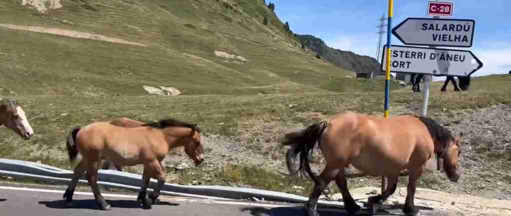
Stage 6 is the route’s mountain centrepiece. The approach leaves the Boí valley south, passes El Pont de Suert again, then follows the C-28 north through Sort and the Pallars Sobirà comarca toward Esterri d’Àneu and the Bonaigua pass. The distance from Barruera to Andorra la Vella is approximately 130 kilometres, but four to five hours should be allocated — partly for driving time, partly for the stops that the road demands.
Port de la Bonaigua at 2,072 metres is the route’s first genuinely high granite pass. The approach from the south climbs from Sort through a canyon section, then through progressively open terrain where Scots pine gives way to alpine meadow and finally bare granite. The summit lies in a broad saddle between two rounded granite massifs — the Aigüestortes massif to the north, the Montsent de Pallars to the south — and commands unrestricted views in both directions when clear. The descent into the Val d’Aran (north side of the pass) is gentler, through the beech forests and hayfields of the most French-feeling of all the Spanish Pyrenean valleys.
The standard route to Andorra does not descend into the Val d’Aran; instead, it continues east from the pass junction on the C-28 toward La Seu d’Urgell, the last Spanish city before the Andorran border. La Seu d’Urgell retains a magnificent Romanesque cathedral (the Cathedral of Santa Maria, 12th century, the finest Romanesque church in Catalonia) and a compact medieval quarter worth an hour on the way through. From La Seu, the CS-2 continues north into Andorra, entering the principality at the Sant Julià de Lòria crossing — the first border check of the trip.
Stage 7: Andorra — Pass, Parishes, and the UNESCO Valley
Andorra la Vella (1,023 m) is simultaneously the smallest capital in Europe by area and the highest by altitude — a combination that produces a very particular kind of city: a strip of commercial main streets along the Gran Valira river, hemmed in on all sides by mountains rising to over 2,000 metres within the city limits. The duty-free shopping zone along the Meritxell avenue is well-known and self-explanatory; less well known is that 10 minutes’ walk from the main commercial strip brings a visitor to the Barri Antic (old quarter), where the Casa de la Vall (the former parliament building, 1580) and the church of Sant Esteve (Romanesque apse, 12th century) form a concentrated historic core.
The essential circuit for Stage 7 begins early to catch Port d’Envalira before the morning coach convoys. The CG-2 climbs east from Les Escaldes-Engordany through Encamp, ascending 1,400 metres in 28 kilometres via a series of long switchbacks. At 2,408 metres, Port d’Envalira is the highest paved road in the entire Pyrenees — confirmed by every European pass database — and the view from the summit on a clear morning encompasses the French Pyrénées to the north, the Andorran granite massifs in every direction, and the snowfields of the Estany de Font Negra below the Pic Negre d’Envalira. Pas de la Casa, the ski town on the French border 4 kilometres beyond the summit, provides practical coffee and fuel at Andorran prices.
The Envalira Tunnel (toll applies; payment by card accepted at the booth) provides an alternative bypass for the pass in poor conditions or for those not comfortable with the switchbacks. The tunnel opens at approximately 2,052 metres altitude — itself the highest road tunnel in the Pyrenees — and saves the exposed summit section without sacrificing the dramatic mountain approach entirely.
From Pas de la Casa, the return circuit follows CG-2 west back through Grau Roig, then cuts north on the CS-340 to the Coll d’Ordino (1,981 m), which traverses the northern parishes. Ordino village, reached by the descending CS-340, is the most traditional of the Andorran parish capitals: a main square with a Baroque church, stone houses with wrought iron balconies, and a surprising density of museums (the Iron Metallurgy Museum, which traces Andorra’s pre-tourism industrial economy, is the most interesting).
The trailhead for the Madriu-Perafita-Claror Valley UNESCO Cultural Landscape is reached from the Escaldes-Engordany parish. The valley, inscribed in 2004 under criterion (v) for its millennia of communal pastoral management, covers 4,247 hectares — approximately 9% of Andorra’s total territory — and is accessible only on foot. The main trail from the Fontverd car park to the valley’s lower sections takes roughly two hours return. The valley preserves summer shepherd settlements (bordes), stone irrigation channels, and a glacial topography of tarns and moraines that represent the oldest human-modified landscape in the principality. No road enters the valley; no development is permitted within it.
Andorra on the Route 2026: The Microstate Beyond the Duty-Free
Most road-trippers use Andorra as a fuel stop and a cigarette purchase and leave in three hours. That is an accurate description of the minimum engagement possible with the principality, and it is roughly as satisfying as driving through Florence to buy an espresso at an Autogrill. The additional half-day that Stage 7 allocates to Andorra — beyond the Envalira circuit — reveals a country with genuine mountain character and one of the most unusual cultural landscapes in UNESCO’s register.
Fuel strategy: Andorra applies an IGI (General Indirect Tax) of 4.5% to fuel, compared to Spain’s 21% VAT plus the Impuesto Especial sobre Hidrocarburos, and France’s 20% TVA plus the Taxe Intérieure de Consommation sur les Produits Énergétiques. The result is Andorran fuel prices that run approximately €0.10–0.30 per litre lower than Spain and considerably lower than France. As of mid-2025 to early 2026, 95-octane gasoline in Andorra ranged approximately €1.30–1.55 per litre depending on station and timing. Fill up at Pas de la Casa (the border town on the French side, with one station) or at any station in Andorra la Vella, Escaldes, or La Massana. Customs regulations permit a full vehicle tank plus one 10-litre approved portable container when leaving into France or Spain.
Shopping context: Andorra’s 4.5% IGI on consumer goods versus Spain’s 21% VAT and France’s 20% TVA creates price differentials of 10–30% on electronics, perfumes, alcohol, and tobacco. The customs allowance when returning to EU territory per adult traveller covers 300 cigarettes (or 150 cigars under 3g, or 400g pipe tobacco), 1.5 litres of spirits over 22%, or 3 litres of lower-strength spirits, plus 5 litres of table wine, plus general goods up to the bilateral value limit. Verify the current general goods value limit on the official Andorran Customs website before travel.
Caldea Spa: The Caldea thermal complex in Escaldes-Engordany uses thermal spring water from beneath the town to fill pools and hot springs at temperatures of 36–40°C, set in a glass tower structure that is Andorra la Vella’s most visible building. Day access rates change seasonally; check the official Caldea website for 2026 prices. After two days of mountain passes, thermal water has particular logic.
Heritage beyond shopping: The Casa de la Vall, built in 1580 as a farmhouse and subsequently used as the parliament building until the new Casa del Consell Andorra la Vella opened in 2011, contains Andorra’s most important historic room — the Chamber of the General Council, unchanged since the 17th century, with heraldic decoration and a locked cabinet that once required seven different keys held by seven different parishes to open. The Casa de la Vall has variable opening hours; guided visits are available in Catalan, Spanish, French, and English.
The Hidden Granite Passes: Elevation, Geology, and Driving Conditions
Five passes define the alternative route’s character. Each is paved, each requires no special vehicle, and each delivers something that tunnel travel categorically cannot.
Port de la Bonaigua — 2,072 m
Port de la Bonaigua connects the Pallars Sobirà comarca (south side, Sort direction) to the Val d’Aran (north side) via the C-28 road. The pass sits within the granite axial zone, and the summit terrain — rounded granite knolls, wind-cropped bilberry and heather, a scatter of cirque lakes in depressions to the north — is characteristic high-granite Pyrenees. The south face is steeper and more technical than the north. The pass is closed to vehicles from approximately November to mid-June depending on snowpack; the regional road authority’s website and the Generalitat de Catalunya traffic information service (transit.gencat.cat) publish real-time access status. Historically one of the most important summer transhumance routes in the central Pyrenees; the ghost of that movement is visible in the drove roads that converge on the summit from multiple valley directions.
Port d’Envalira — 2,408 m
Port d’Envalira is not a pass in the technical sense of a notch between two summits; it is a high plateau crossing, the road reaching its maximum elevation on a broad granite shoulder rather than a sharp col. This accounts for the long exposure — several kilometres at or near summit altitude — and the exceptional views in multiple directions simultaneously. The cycling history is extensive: the Envalira has featured in multiple editions of the Tour de France and Vuelta a España, and the roadside at the summit carries memorial markers to notable ascents. The approach from the west (Andorra la Vella direction) is the more demanding; the east side to Pas de la Casa descends more rapidly. The summit station at the Grandvalira ski domain remains open for food and shelter.
Coll d’Ordino — 1,981 m
Coll d’Ordino lies within Andorra’s northern circuit, on the CS-340 between the Ordino parish capital and the Arcalís ski area. The pass traverses a granite ridge and descends through high alpine meadows into the Ordino valley. Less dramatic than Envalira, but significantly quieter — the narrow road sees mainly local traffic and cyclists — with genuine access to the high pastoral terrain of the Andorran interior. The views south from the summit take in the full arc of the principality’s central valley system.
Puerto de Bielsa — approximately 2,415 m (optional variant)
The Puerto de Bielsa is the alternative route’s most demanding optional pass, requiring a deliberate detour in Stage 4. The road climbs from Bielsa through the Parque Natural Posets-Maladeta on the HU-6401 — a single-lane road in places — to the French border. The terrain is entirely granite: the Maladeta massif (including Aneto at 3,404 m) occupies the skyline to the east throughout the ascent. Loose gravel carried onto the road surface by seasonal snowmelt is the main hazard; driving early in the day after rain and before the surface is swept is inadvisable. The pass opens from late June to early October. French-side descent into the Vallée de l’Aure requires the Bielsa tunnel return unless drivers plan an extended France loop.
Puerto de Cotefablo — 1,427 m
Puerto de Cotefablo carries the transition road between the Tena valley and the Ordesa gateway, traversing a narrow limestone ridge on a largely untravelled single-track road. At 1,427 metres it falls short of the dramatic altitudes of the other passes, but it delivers something equally valuable: 25 kilometres of mountain driving with no other vehicles, no coach traffic, and no development — just forest, limestone outcrops, and the occasional forest clearing with mountain views. An introduction to the spirit of the alternative route before the grand altitudes begin in earnest.
Accommodation Along the Route 2026
The Pyrenean accommodation landscape divides into three distinct tiers that map cleanly onto the route’s stages. Budget travelers have a genuine mountain-specific option that does not exist on most European road trips: the mountain refugio, a staffed hut offering meals and dormitory or small private rooms at prices well below any hotel equivalent.
Budget Accommodation 2026
Mountain refugios charge €15–25 per person for a bunk bed with half board (dinner and breakfast included), or €25–40 for a basic private room where available. The Refugio de Linza in the Ansó valley, the Refugio de Góriz in the Ordesa high country (reservation essential in summer), and the Refugio de la Renclusa near Benasque are the most relevant to this route. At valley level, pensiones and hostales (budget guesthouses) in towns such as Hecho, Ainsa, and Benasque provide rooms at €40–70 per room, translating to €20–35 per person sharing. Andorra la Vella has budget hotels from €55–80 per room; these are higher per-person rates than the Spanish Pyrenean towns and reflect Andorra’s different cost base. Total accommodation budget per person for a seven-night trip: approximately €140–245.
Mid-Range Accommodation 2026
The casa rural (rural guesthouse) is the optimal mid-range option for this route. These family-run stone farmhouses converted for tourism combine Pyrenean architecture, local food, and service standards that often exceed their price point. Quality casas rurales in the Ansó, Broto, and Benasque valleys charge €80–130 per room per night; the same category in the Vall de Boí runs €90–140. Three-star hotels in Ainsa and Benasque centre range from €90–150 per room. Andorra mid-range hotels — three-star properties in Andorra la Vella and Escaldes — run €100–170 per room. Total accommodation per person (two sharing) for seven nights: approximately €280–525.
Luxury Accommodation 2026
The Paradores network has two properties relevant to this route. The Parador de Bielsa (Valle de Pineta, 25 km northwest of Bielsa) occupies a mountain lodge position beneath the Pineta cirque at 1,300 metres; rooms cost €160–240. The Parador de Vielha in the Val d’Aran (not on the primary route but a possible detour extension from Bonaigua) provides similar luxury standards. Boutique mountain hotels in Benasque (including the Hotel Aneto, one of the Pyrenees’ most respected four-star properties) charge €180–280 per room. Andorra’s luxury tier is represented by the Hesperia Andorra and Sport Hotel Hermitage (adjacent to Grandvalira ski domain, ski-in/ski-out in winter): €200–350 per room in summer. Total per person (two sharing) for seven luxury nights: approximately €560–1,225.
Daily Budget Breakdown for the Pyrenees Road Trip 2026
All daily cost figures below are per person, per day, assuming two travelers sharing accommodation. Hotel and room rates are divided by two before any total calculation. Car rental, if applicable, is a separate cost not included in these figures.
Budget Tier — €50–100 per person daily
Budget accommodation per person runs €15–35 (hostel bunk, mountain refugio, or budget pensión). Daily meals at village bars, roadside merenderos, and self-catered picnics from local shops cost €25–45 per person (mountain towns have good local bakeries and charcuterías; a packed lunch from Ainsa’s Mercadona costs under €10). Fuel and tolls divided between two passengers run €8–14 per person daily based on approximately 100–130 km of mountain driving at a mixed fuel cost of around €1.50 per litre. Activities and entry fees average €2–8 per day on this route — Ordesa and Pyrénées-Mont Perdu are free to enter, the shuttle bus from Torla costs €3.10 per person, and individual Vall de Boí church tickets are €5. Total: approximately €50–100 per person daily. Over seven days: approximately €350–700 per person.
Mid-Range Tier — €120–220 per person daily
A quality casa rural or three-star hotel runs €80–150 per room, translating to €40–75 per person sharing. Meals at mountain restaurants — the Pyrenean menú del día at lunch (€14–20 for three courses with wine), plus a dinner at a regional restaurant (€35–55 per person with local wine) — run €55–95 per person daily. Transport at the same daily mileage runs €10–18 per person once tolls and slightly more driving are factored in. Activities and attractions — the five-church combined ticket at Vall de Boí (€8), cable car or guided excursion at one stage, entry to a museum — average €15–30. Total: approximately €120–220 per person daily. Over seven days: approximately €840–1,540 per person.
Luxury Tier — €300–580 per person daily
A Parador or boutique mountain lodge at €160–350 per room costs €80–175 per person sharing. Fine dining at Pyrenean destination restaurants — the Cerler area, La Seu d’Urgell, and Andorra la Vella all have quality tables — runs €135–225 per person daily when three meals are counted. Private mountain guide days, helicopter flightseeing over Maladeta, spa access at Caldea, or premium guided tours push activity costs to €55–120 per person. Transport in a higher-spec rental car with more kilometres per day and occasional private transfers runs €30–60 per person. Total: approximately €300–580 per person daily. Over seven days: approximately €2,100–4,060 per person.
Additional Costs to Budget Separately
Car rental runs €210–350 per week for an economy car, €350–560 for a mid-size, and €560–910 for a small SUV — these figures are per car, divided between two travelers. The Envalira Tunnel toll in Andorra applies each direction (keep cash and card available; rates change seasonally). French autoroute tolls apply if the route includes any French motorway sections: the approach from Pau or Toulouse to the Spanish border uses the A-64, which carries tolls. Spanish autopistas are toll-free as of 2024 but this may vary by section — check the DGT (Dirección General de Tráfico) toll calculator before departure.
Dining Along the Route: Aragonese, Catalan, and Andorran Flavors
The alternative route crosses three distinct culinary traditions that share the mountain ingredient base but express it differently. Understanding the food geography is useful not just for pleasure but for budgeting: the price gradient is steep (Andorra is considerably more expensive than rural Aragon), and knowing where to eat what prevents overspending at the wrong stage.
Aragonese mountain food is built on lamb, game, and river fish. The canonical dish is ternasco de Aragon — a specific designation for milk-fed lamb raised in the Pyrenean and Ebro valley areas — roasted in clay pots in wood-fired ovens and served with nothing but its own juices. In the Ansó and Hecho valleys, chilindrón (a slow-cooked sauce of dried red peppers, tomato, and rabbit or chicken) appears on almost every menú del día. Migas (fried breadcrumbs with bacon and chorizo) are the standard mountain breakfast. Village bars in the western Aragonese stages serve menús del día for €12–16 with wine included — the best value eating on the route.
Catalan Pyrenean food shifts toward dairy and pork preparations. Esqueixada (salt cod salad), mongetes amb botifarra (white beans with grilled pork sausage), and the extraordinary range of embotits (cured sausages) — fuet, llonganissa, salchichón, bisbe — define the charcuterie tradition of the Catalan valleys. In the Vall de Boí specifically, the village restaurants in Barruera and Boí provide straightforward mountain cooking of genuine quality: grilled Pyrenean mushrooms in autumn, braised wild boar, and an invariably excellent cured meat plate to start. Lunch menu prices run €14–20 per person.
Andorran food has its own preparation even within the Catalan tradition. Trinxat de la Cerdanya (a cake of mashed potato, cabbage, and fried pork fat — Andorra’s closest equivalent to a national dish) appears on menus throughout the principality. Escudella i carn d’olla (the great Catalan mountain meat and vegetable stew) is the winter restaurant staple. The most interesting recent addition to the Andorran food scene is the cluster of quality modern restaurants in Andorra la Vella and Escaldes — mostly Spanish and Catalan chefs operating within the principality’s tax advantages — where a tasting menu at a one- or two-star level costs €60–100 per person excluding wine.
Practical dining advice: The menú del día — the set lunch menu offered by Spanish and Andorran restaurants from 13:00 to 15:30 — provides the best quality-to-price ratio at every point on the route. Three courses including bread and wine or water for €12–20 is standard; never pay restaurant à la carte prices at lunchtime when the menu is available. Dinner in mountain towns is served from 20:00; arriving before 20:00 means eating with other foreigners in an otherwise empty room.
Border Crossings and Customs Essentials 2026
The route crosses two border types: the Spain-France border (Schengen internal, no passport controls) and the Spain-Andorra or France-Andorra border (exit from Schengen; Andorra is not an EU or Schengen member). The practical implications differ significantly.
Spain-France Border
Schengen Area internal borders have no passport controls; crossing from Spain into France at any mountain pass on this route requires no documentation check. Drivers may be subject to random police or customs spot checks, which are legal under Schengen provisions, but these are exceptional. The optional Puerto de Bielsa variant and any French-side excursion from the Ordesa area cross the Schengen internal border without formalities.
Andorra Border (Spain-Andorra and France-Andorra)
Andorra is neither an EU member nor a Schengen Area member. Border checks apply in both directions. Entry into Andorra from Spain (at Sant Julià de Lòria or Pas de la Casa) requires a valid identity document: EU citizens use a national identity card or passport; non-EU travelers need whatever document they use to enter the Schengen Area, including a valid multi-entry Schengen visa where applicable.
Exit from Andorra back into EU territory triggers customs checks. Andorran customs officers (and/or Spanish or French customs at the exit point) inspect vehicles and check purchased goods against the duty-free allowances. The confirmed allowances per adult traveler entering the EU from Andorra:
- Tobacco: 300 cigarettes, or 150 cigars under 3 grams each, or 75 cigars over 3 grams each, or 400 grams of pipe tobacco.
- Alcohol: 1.5 litres of spirits over 22% ABV, or 3 litres of spirits or sparkling wine under 22% ABV, plus 5 litres of still wine, plus 16 litres of beer.
- Coffee and tea: 1,000 grams of coffee or 400 grams of coffee extract; 200 grams of tea or 80 grams of tea extract.
- General industrial goods: A per-person value limit applies. Verify the current threshold on the official Andorran customs site (duanes.ad) before departure, as the figure is subject to bilateral revision.
Goods above limits must be declared at the customs post and attract Spanish or French import duties. Receipts from Andorran shops are worth retaining for inspection. The Andorran customs agency has discretion to inspect vehicles at any crossing point; queues are common at the Sant Julià de Lòria crossing on Sunday afternoons and during peak season.
Driving Documents
An EU driving licence is valid throughout the route. Non-EU drivers should carry their national licence and an International Driving Permit as a standard precaution. Third-party motor insurance is the legal minimum in Spain, France, and Andorra; confirm with your insurer that Andorra is covered (some policies exclude it; if uncertain, Andorran border insurance is purchasable at crossing points). A Green Card is not legally required from EU insurers but serves as internationally recognised proof of coverage.
Vehicle Requirements and Mountain Driving
Spain requires all vehicles to carry a warning triangle, a high-visibility vest for each occupant, and a valid technical inspection certificate (ITV for Spanish-registered vehicles). France requires a breathalyser kit per vehicle (though fines for non-compliance were suspended in 2013 and have not been reinstated). Both countries require winter tyres or snow chains on certain mountain roads when signs indicate mandatory fitting — this applies on sections of the route in spring and autumn shoulder months. In summer (late June to mid-September) all passes on this itinerary are accessible on summer tyres.
Speed limits on mountain roads: Spanish secondary mountain roads have a default limit of 90 km/h; many sections of the passes on this route carry advisory limits of 40–60 km/h through hairpin series. These advisory limits are not legally binding but reflect the genuine engineering parameters of the road. The French rural road limit is 80 km/h. Andorran roads have a maximum of 90 km/h on major arteries and 50 km/h in villages; enforcement includes speed cameras on the Envalira approach.
Road widths: Several stages include single-track sections with passing places — principally the Cotefablo pass road, the approach to Puerto de Bielsa on the HU-6401, and sections of the Coll d’Ordino in Andorra. The convention on single-track mountain roads is that the descending vehicle yields to the ascending one when a passing place requires one party to reverse. Large vehicles (campervans, trailers) should assess the Cotefablo and Bielsa options with particular care.
Parking in peak season: The Ordesa valley access at Torla operates a mandatory shuttle system in high season (late June to mid-September) with private cars left in the Torla parking area (paid). The Vall de Boí churches have small free parking areas adjacent to each church village; these fill quickly in July. Arriving before 09:00 at both sites eliminates parking problems.
Money-Saving Strategies for 2026
The alternative route has several structural cost advantages that the mainstream tourist circuits do not offer, and a few additional tactics that experienced mountain road-trippers use instinctively.
The Andorra fuel strategy is the most quantified saving on the route. Filling a 50-litre tank in Andorra rather than France saves approximately €5–15 depending on the France-Andorra price differential at the time of travel. Filling a second approved 10-litre portable container (the legal limit for road import) adds proportionally. For drivers who enter Andorra from the west (Spanish side via La Seu d’Urgell) and exit east into France, this means filling before the French mountain roads, where fuel is most expensive on the route.
UNESCO free zones: Two of the three World Heritage Sites on the route are free to enter. Ordesa y Monte Perdido National Park charges no entry fee; the shuttle bus from Torla costs €3.10 per person round trip and that is the full cost of a half-day in a UNESCO landscape of extraordinary quality. The Madriu-Perafita-Claror Valley in Andorra charges no access fee — it is a walking trail into a mountain valley, not a managed attraction. Only the Vall de Boí churches charge admission (€5 per church, €8 for five churches combined). Across the three UNESCO sites, a person spending a half-day at each pays a maximum of €8 for the churches and €3.10 for the Ordesa shuttle.
The menú del día discipline is the single most effective food cost strategy on any road trip in Spain. Eating the restaurant’s set lunch menu (€12–20 for three courses with wine) at the largest meal of the day, and keeping dinner to a simple bar meal or self-catered picnic (€8–12), reduces daily food costs by 30–40% compared to eating à la carte at two meals. This approach also aligns with the local eating rhythm, where almuerzo is the serious meal.
Off-peak shoulder season: September pricing at casas rurales and mountain hotels runs 15–30% lower than July-August peak rates, with identical pass conditions and markedly better atmospheric light for landscape photography. Accommodation that books out months in advance in August is available in September with a few days’ notice.
Accommodation booking timing: For the Refugio de Góriz (Ordesa high country) and the most popular casas rurales in Ainsa and Benasque, booking six to eight weeks in advance secures peak season availability without last-minute premium surcharges. Budget and mid-range options at other stages (Hecho, Barruera, Andorra la Vella) allow walk-in booking until peak July weeks.
UNESCO Heritage Along the Alternative Route
The alternative route threads three World Heritage Sites in sequence — one at Stage 3, one at Stage 5, and one at Stage 7 — making it one of the most concentrated UNESCO corridors on any European road trip itinerary. Understanding the inscriptions separately clarifies what each site actually recognises.
Pyrénées-Mont Perdu — Stages 2 and 3
Inscribed as a transboundary site between France and Spain in 1997 (French portion) and extended to Spain in 1999, Pyrénées-Mont Perdu (reference 773bis) covers 30,639 hectares and was cited under five criteria: (iii) as an outstanding example of traditional land use in an upland pastoral environment; (iv) for the geological landforms of deep canyons and cirque walls; (v) for combining scenic beauty with a socio-economic structure illustrating a nearly-vanished mountain way of life; (vii) for its outstanding natural beauty; and (viii) for geological formations of scientific significance. The calcareous massif of Monte Perdido (3,352 m) is the world’s third highest purely limestone mountain. On the Spanish side, the Ordesa canyon (Stage 3) and the Añisclo gorge (optional detour, east of the main route) are the primary accessible expressions of the site’s natural values.
Catalan Romanesque Churches of the Vall de Boí — Stage 5
Inscribed in 2000 (reference 988) under criteria (ii) and (iv), the nine churches and one hermitage of the Vall de Boí were cited for exhibiting significant interchange of human values in the development of Romanesque art across medieval Europe, and for representing an especially pure and consistent example of Romanesque architecture in a largely untouched rural setting. The churches were built between the 11th and 12th centuries by the Lords of Erill following the Lombard Romanesque model — a building template imported from northern Italy characterised by slender blind-arcaded bell towers, austere exteriors, and vaulted stone interiors richly decorated with fresco cycles. The original frescoes were systematically removed in 1919–20 by specialist teams working for the Museu Nacional d’Art de Catalunya, and the resulting collection of Romanesque painting in the MNAC Barcelona is the finest in the world. The churches themselves retain high-quality reproduction frescoes in situ.
Madriu-Perafita-Claror Valley — Stage 7
Inscribed in 2004 and extended in 2006 (reference 1160bis) under criterion (v), the Madriu-Perafita-Claror Valley is Andorra’s only World Heritage Site and the only case of an entirely preserved major valley in the Pyrenean range. The inscription cited the valley as a microcosm of the way its inhabitants have harvested the scarce resources of the high Pyrenees over the past millennia, with a communal land-management system — the quart system of parish-owned pasture rights — surviving unbroken since the 13th century. The valley, accessible only on foot from the Escaldes-Engordany parish, covers 4,247 hectares of glacially sculpted granite terrain: high pastures, mountain tarns, bordes (summer shepherd shelters), stone-flagged drove tracks, and evidence of 10th-to-18th-century iron smelting. The absence of any road into the valley is not an oversight — it is the management policy that made the inscription possible.
Frequently Asked Questions About the High Pyrenees Route 2026
Is a four-wheel drive necessary for this route in summer?
No. All passes on the curated route — Port de la Bonaigua, Port d’Envalira, Coll d’Ordino, Puerto de Cotefablo — are fully paved and manageable in a standard front-wheel drive road car in dry summer conditions. Four-wheel drive provides additional confidence on the Bonaigua’s narrower sections and on the optional Puerto de Bielsa road, but it is not a requirement. What matters more than drivetrain is tyre condition and driver confidence on long descents with engine braking.
How do I time the route to avoid the worst crowds at Ordesa?
The Ordesa valley operates a mandatory shuttle bus system in peak season with a maximum 1,800 simultaneous visitors. To avoid queues for the shuttle: arrive at the Torla parking area before 08:30, which places you among the first departures before the coaches and day-tripper traffic builds from 10:00 onward. September is dramatically quieter than July-August, with the same access conditions and autumn colour beginning in the beech forests from mid-month.
How long should I spend in the Vall de Boí to see the churches properly?
A full day is the correct allocation — not because any single church requires hours, but because the churches keep staggered opening hours (some morning only, some afternoon only) and the combined visit to four or five across the valley floor requires travel between villages. The Centre del Romànic de la Vall de Boí in Erill la Vall is the booking hub for combined tickets and guided tours; arriving there first in the morning establishes the day’s logistics. The five-church combined ticket at €8 is the most efficient approach for first-time visitors.
Can I fuel up in Andorra for the drive into France?
Yes. Fueling in Andorra before exiting via Port d’Envalira into France is one of the route’s standard money-saving manoeuvres. The Pas de la Casa petrol station (just inside the French border) charges full French prices; all Andorran stations (including those at Andorra la Vella, Escaldes, and Encamp on the way to Envalira) charge Andorran prices — approximately €1.30–1.55 per litre for 95-octane as of 2025-2026 conditions. French fuel on the far side runs considerably higher. Fill the tank in Andorra and, if applicable, one approved 10-litre portable container.
Is Ainsa worth an overnight stay or just a lunch stop?
Overnight. Ainsa’s medieval upper town is one of the most visually coherent historic centres in the Aragonese Pyrenees, and it takes late afternoon light in a way that a midday lunch stop entirely misses. The castle and church are best visited after 17:00 when the day-tripper coach traffic has left; the Plaza Mayor in the evening, with the Pyrenees framed at the open end of the arcaded square, is one of the route’s best moments. There are two small hotels in historic buildings in the upper town, and several excellent rural casas on the outskirts.
What is the hiking situation in Andorra for non-mountaineers?
Andorra has an extensive network of marked hiking trails calibrated to all fitness levels. The GRP (Grand Randonnée du Principat), a multi-day circumnavigation of the country at high altitude, is for experienced mountain walkers. Day routes accessible to general-fitness visitors include the circuit around Estany de l’Angonella from La Massana (4–5 hours, moderate), the Coma Pedrosa trail from Arinsal (full day, the highest point in Andorra at 2,942 m, for fit walkers), and the lower Madriu valley approach from Fontverd (2 hours return, easy). All trails are signposted and marked on free maps available from Andorra Tourism offices in Andorra la Vella.
What should I eat in Benasque that I cannot eat elsewhere on the route?
Recao de Binéfar (a stew of white beans, rice, Swiss chard, and pork traditionally from the Litera comarca but found in Benasque restaurants) is the Aragonese Pyrenees specialty least known outside the region. Equally specific is the range of locally cured meats — particularly jamón serrano from pigs raised at altitude in the Ésera valley farms — available at the butchers and deli counters in the Benasque market area. Trout from the Ésera river, grilled simply with garlic and olive oil, appears on almost every restaurant menu in town.
Is there mobile coverage on the mountain passes?
Coverage is variable and should not be relied upon. Major Spanish operators (Movistar, Orange, Vodafone) have 4G coverage on the main valley roads (N-260 corridor, A-138 to Benasque) but coverage deteriorates on the passes themselves, particularly on the Puerto de Cotefablo road and the Puerto de Bielsa approach. Port de la Bonaigua has intermittent coverage; Port d’Envalira has reasonable Andorran network coverage at the summit. Download offline maps (Google Maps, Maps.me, and OsmAnd all support offline Pyrenean detail) before entering the mountain stages.
How do Andorra’s road speed cameras work for visiting drivers?
Andorra enforces speed limits via fixed and mobile cameras. The CG-2 Envalira approach has camera enforcement; the main commercial artery through Andorra la Vella (50 km/h) is also monitored. Fines issued to foreign-registered vehicles are pursued through bilateral agreements with Spain and France; EU driver details are accessible to Andorran authorities. The enforcement reality is that attentive driving within limits requires no additional measures — the speeds involved on mountain passes are naturally conservative.
What is the best single photograph location on the entire route?
The west face of Port de la Bonaigua at approximately 1,800 metres elevation on the ascent, at 07:00–08:00, when low morning light hits the granite massifs above the tree line and the valley below retains a thin band of mist. This is not listed in any photography guide specific to the route, which is part of why it remains unoccupied by tripods. Second choice: the Plaza Mayor of Ainsa from the castle battlements in late afternoon, with the Pyrenees framed in the open southern end of the square and the Río Ara confluence visible 100 metres below.