
The Geometric Harmony of Todi: Why It Was Named the World’s Most Livable Medieval Town
Perched on a hilltop 400 meters above the Tiber Valley, Todi embodies a rare architectural achievement where three concentric walls from different civilizations create nested geometric rings, while Renaissance perfection stands sentinel outside the medieval core. This Umbrian town earned international recognition in 1991 when urban planner Richard S. Levine identified it as exemplifying ideal urban balance, a designation that thrust this quiet commune into global architectural discourse and revealed why geometric harmony translates directly into quality of life.
Key Takeaways: Understanding Todi’s Architectural Distinction
- The 1991 Livability Designation: Richard S. Levine of the University of Kentucky presented Todi in academic exercises for “The Sustainable City of the Past and the Sustainable City of the Future,” analyzing its balance of urban infrastructure against medieval preservation, ratio of green space to built environment, accessibility of services, and intact social fabric—criteria that Italian press subsequently simplified into “world’s most livable city.”
- Three Concentric Defensive Rings: Todi’s urban geometry consists of Etruscan walls from the 3rd century BC forming the innermost circle, Roman fortifications from the 1st century BC creating the middle ring, and medieval walls from the 13th century as the outermost boundary—each expansion documenting precise moments when population growth demanded new geometric frameworks.
- Deliberate Medieval Urban Planning: Archaeological evidence reveals that Todi’s apparently organic medieval character actually resulted from explicit communal statutes and careful micro-planning that created an interconnected, integrated urban environment through incremental urbanism rather than chaotic growth.
- Renaissance Geometric Perfection: The Temple of Santa Maria della Consolazione outside the walls (1508-1607), attributed to Bramante, demonstrates pure geometric harmony through its Greek cross plan where square, triangle, circle, cylinder, and sphere combine in mathematically precise relationships visible from every approach angle.
- Piazza del Popolo as Urban Heart: This medieval square, positioned over Roman cisterns and the ancient forum, creates a coherent ensemble of Gothic civic buildings—Palazzo del Popolo (1213-1228), Palazzo del Capitano (late 13th century), and Palazzo dei Priori (1334-1347)—that represent communal governance translated into architectural geometry.
- Compact Scale Preserving Human Relationships: With approximately 15,682 residents contained within the medieval walls’ maximum extension, Todi maintains proportions where every service remains accessible on foot, social networks remain intact across generations, and architectural monuments integrate into daily life rather than becoming isolated tourist attractions.
People Also Ask About Todi’s Geometric Harmony
What Did Richard Levine Mean by “Most Livable City” When Describing Todi?
Richard S. Levine’s 1991 assessment identified Todi as exemplifying sustainable urban design through specific measurable criteria rather than subjective quality-of-life rankings. Levine, an architect and urban planner at the University of Kentucky, included Todi in academic design exercises for a conference titled “The Sustainable City of the Past and the Sustainable City of the Future,” examining how medieval towns could inform contemporary planning challenges. His analysis focused on four quantifiable factors: the balance between urban infrastructure and medieval preservation (meaning modern utilities existed without compromising historic fabric), the ratio of green space to built environment (agricultural land and gardens integrated throughout the urban core), accessibility of services (essential facilities reachable within walking distance), and intact social fabric (multi-generational community networks still functioning). The Italian press subsequently reported this academic assessment as Todi being named “the world’s most livable city,” a simplification that, while not entirely accurate, captured the essence of Levine’s findings about geometric planning principles creating superior urban living conditions.
How Do Todi’s Three Concentric Walls Create Geometric Harmony?
Todi’s three concentric defensive rings create nested geometric frameworks that document the town’s expansion across 16 centuries while maintaining proportional relationships between each layer. The innermost Etruscan wall from the 3rd century BC established the original settlement perimeter around what would become Piazza del Popolo, using massive travertine blocks that remain visible today in fragments along Via Santa Prassede. The Roman wall from the 1st century BC, built when Todi achieved municipium status, expanded the protected area by roughly doubling the enclosed space, creating a middle ring that followed the hill’s natural contours while maintaining sight lines to the Etruscan core. The medieval wall from the 13th century represents Todi’s maximum expansion, when the commune’s population briefly exceeded that of Rome during the latter’s medieval decline, enclosing approximately 4 kilometers of fortifications with monumental gates aligned with road axes. These three rings create a visual geometry readable from the valley below, where each successive expansion maintains proportional relationships to the earlier walls rather than arbitrary growth, producing concentric circles that echo classical theories about ideal city planning while adapting to topographical realities of hilltop construction.
Why Is Santa Maria della Consolazione Considered Geometrically Perfect?
Santa Maria della Consolazione achieves geometric perfection through its Greek cross plan where every design element derives from five essential geometric forms: square, triangle, circle, cylinder, and sphere. The church’s foundation establishes a perfect square, from which four equal apses extend to create the Greek cross, each apse crowned by a semicupola that transitions from square to circular geometry. Above this square base rises a massive drum—a perfect cylinder—that supports the hemisphere of the main dome, itself a geometric sphere truncated at its base and crowned by a lantern that repeats the cylindrical-spherical relationship at smaller scale. The four eagles positioned on the corners of the square terrace in 1601-1604 mark the vertices of the foundational geometry, while the building’s 50-meter height creates proportional relationships to its footprint that echo Vitruvian ideals about harmonic ratios. Construction spanning 1508 to 1607 allowed multiple Renaissance architects—Cola da Caprarola, Baldassare Peruzzi, Galeazzo Alessi, Ippolito Scalza—to refine the geometric relationships across successive phases, resulting in a structure where every viewing angle reveals different combinations of these basic forms while the overall mathematical perfection remains constant, a three-dimensional demonstration of Renaissance architectural theory about geometric harmony reflecting divine order.
Extended multi-day tours – 5+ days
Featured Umbria Multi-Day Tour Packages
3 days
Umbria 3-Day Discovery Tour
- ✓ Comprehensive Umbria experience
- ✓ Expert local guides included
- ✓ All accommodation included
- ✓ Transportation provided

5 days
Umbria 5-Day Highlights Experience
- ✓ Comprehensive Umbria experience
- ✓ Expert local guides included
- ✓ All accommodation included
- ✓ Transportation provided
7 days
Umbria 7-Day Cultural Journey
- ✓ Comprehensive Umbria experience
- ✓ Expert local guides included
- ✓ All accommodation included
- ✓ Transportation provided

10 days
Umbria 10-Day Complete Adventure
- ✓ Comprehensive Umbria experience
- ✓ Expert local guides included
- ✓ All accommodation included
- ✓ Transportation provided
Multi-day tour packages powered by TourRadar. Prices and availability subject to change.
How Did Medieval Todi Plan Its Urban Layout So Deliberately?
Medieval Todi’s urban planning operated through explicit communal statutes that regulated everything from building heights and street widths to material choices and facade alignments, creating deliberate design rather than organic growth. City records reveal that the commune enacted specific ordinances governing architectural elements: buildings fronting Piazza del Popolo required stone construction and porticoed ground floors to create unified civic space, street widths were standardized to allow cart passage while preventing excessive shadowing of ground-floor workshops, and building heights were limited to maintain sight lines between the piazza and surrounding hills. This regulatory framework employed incremental urbanism, where individual property owners built according to communal guidelines that, aggregated across decades, produced the integrated aesthetic modern visitors perceive as spontaneous medieval character. The positioning of major civic buildings—Palazzo del Popolo, Palazzo del Capitano, Palazzo dei Priori—on Piazza del Popolo’s perimeter created a geometric ensemble that served both practical governance functions and symbolic representation of communal authority, while their Gothic arches, crenellations, and proportional relationships followed deliberate architectural programs rather than evolving organically. Archaeological studies demonstrate that even apparently chaotic medieval lanes preserve traces of planning initiatives relating to Italian urban design trends, where tortuous streets often resulted from property division regulations and defensive strategies rather than haphazard construction, revealing a sophisticated understanding of how geometric principles could be applied at the scale of individual streets and buildings to create livable urban density.
Introduction: Reading Geometry in Umbria’s Stone Archive
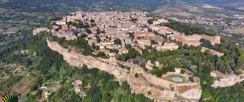
Todi presents itself from the Tiber Valley as a vertical composition of stone ascending a double-crested hill, its silhouette dominated by the dome of Santa Maria della Consolazione standing sentinel outside medieval walls that ring the historic core in concentric bands of fortification. This first impression reveals the town’s fundamental architectural character: layers of geometric intention accumulated across 2,700 years, from Umbrian hilltop settlements through Etruscan fortress walls to Roman municipium expansion and medieval commune assertion, each civilization adding another ring to a bull’s-eye pattern centered on what would become Piazza del Popolo. The visual coherence of these nested geometries, readable from kilometers away, explains why urban planner Richard S. Levine identified Todi in 1991 as exemplifying principles of sustainable urban design that contemporary cities struggle to achieve—not through romantic nostalgia for pre-industrial life, but through rigorous analysis of how geometric planning creates measurable improvements in accessibility, social cohesion, environmental integration, and architectural preservation.
Understanding Todi’s geometric harmony requires rejecting the persistent myth that medieval towns evolved organically through centuries of unplanned construction, a misconception that treats historical urbanism as charmingly chaotic rather than deliberately designed. Archaeological research, communal statute analysis, and architectural surveys demonstrate that Todi’s medieval rulers employed sophisticated geometric principles to regulate building, creating explicit urban policies that shaped every aspect of the townscape from individual facade details to the proportional relationships between civic monuments. The apparently irregular street pattern that modern visitors experience as quaint medieval character actually follows precise defensive geometries, property division regulations, and topographical adaptations that medieval planners understood as systematic responses to specific urban challenges. This deliberate planning manifests most clearly in Piazza del Popolo, where three Gothic palaces create a coherent architectural ensemble that balances civic authority, commercial function, and aesthetic unity through controlled proportions, material consistency, and geometric alignment—achievements that required decades of regulatory enforcement rather than spontaneous development.
The town’s geometric framework rests on three concentric defensive rings that document specific moments when population growth demanded spatial expansion while maintaining defensive integrity and proportional relationships to the existing core. The Etruscan wall, constructed in the 3rd century BC using massive travertine blocks that survive in fragments along the innermost circuit, established the original settlement perimeter around the hilltop’s highest point, where the Roman forum and subsequently Piazza del Popolo would anchor the urban center. Roman expansion in the 1st century BC, coinciding with Todi’s elevation to municipium status, doubled the enclosed area through a middle ring of fortifications that incorporated the earlier Etruscan walls as an interior line of defense while extending protection to newly developed neighborhoods descending the hillside. The medieval wall, built in the 13th century when Todi’s population briefly exceeded that of contemporary Rome, created the outermost circuit—approximately 4 kilometers of fortifications that remain largely intact today, with monumental gates aligned along road axes radiating from the central piazza toward Perugia, Rome, Orvieto, and the Tiber valley below.
These defensive rings create more than military geometry; they establish nested frameworks that organize social space, economic activity, and civic identity into concentric zones of decreasing density as one moves from the piazza outward toward the walls. The innermost Etruscan circuit contains the densest concentration of civic monuments and commercial activity, where Piazza del Popolo functions as the urban heart and buildings reach maximum heights permitted by communal statutes. The middle Roman zone transitions from civic density to residential neighborhoods punctuated by churches and smaller piazzas, where building heights decrease and street widths narrow to create intimate urban spaces. The outermost medieval ring encompasses the least dense development, where gardens, workshops, and agricultural plots intermix with housing, creating the green space-to-built environment ratio that Levine identified as contributing to Todi’s livability. This geometric organization from dense core to permeable periphery creates urban gradients that later planning movements—from Ebenezer Howard’s garden cities to contemporary new urbanism—would attempt to codify as theoretical principles, though medieval Todi achieved these relationships through pragmatic responses to defensive requirements, topographical constraints, and economic realities rather than abstract planning ideology.
The Renaissance addition of Santa Maria della Consolazione outside the medieval walls introduces a contrasting geometric vocabulary that amplifies rather than contradicts the concentric medieval framework. Positioned deliberately beyond the defensive perimeter on the road descending toward the Tiber, this temple sits in open landscape where its pure geometric forms—Greek cross plan, central dome, symmetrical apses—can be experienced as isolated architectural perfection rather than integrated urban fabric. The church’s positioning creates a geometric dialogue between medieval concentricity inside the walls and Renaissance centrality outside them, between the pragmatic geometry of defensive urbanism and the idealized geometry of mathematical perfection, between architecture serving urban community and architecture serving abstract aesthetic principles. Visitors approaching Todi from the valley encounter Santa Maria della Consolazione first, its pale travertine and geometric purity preparing the eye for the subsequent transition through medieval gates into the compressed, darker, geometrically complex streets of the historic core—a spatial sequence that Renaissance planners understood as pedagogical, teaching visitors to read geometric language before entering the medieval text.
Levine’s 1991 assessment synthesized these geometric elements into four quantifiable criteria that transcended romantic appreciation of medieval aesthetics to identify specific urban planning achievements: balance of infrastructure against preservation, ratio of green to built space, service accessibility, and social fabric integrity. Each criterion directly correlates to geometric planning decisions visible in Todi’s physical fabric. Infrastructure balance results from concentric organization that allows utilities to follow defensive ring geometry, minimizing disruption to medieval building stock. Green space ratio derives from the permeable outer medieval zone where gardens and agriculture integrate into residential fabric. Service accessibility follows from compact scale where the outermost medieval walls remain walkable from Piazza del Popolo in under fifteen minutes. Social fabric integrity emerges from population size (approximately 16,000 residents) contained within geometric boundaries that prevent suburban sprawl, maintaining concentrated density that supports face-to-face community networks across generations.
The subsequent Italian press reporting that simplified Levine’s academic analysis into “world’s most livable city” created a tourism narrative that obscures the rigorous geometric principles underlying his assessment. Todi’s livability doesn’t derive from generic medieval charm or picturesque hilltown aesthetics, qualities shared by dozens of Umbrian communes. Instead, it results from specific geometric planning achievements: three concentric defensive rings creating density gradients from core to periphery, deliberate medieval urban statutes regulating building to create architectural coherence, Renaissance geometric perfection positioned to dialogue with medieval concentricity, and compact scale maintaining human proportions where architecture serves daily life rather than tourism spectacle. Understanding these geometric foundations transforms casual appreciation of Todi’s beauty into recognition of how intentional planning across multiple civilizations created sustainable urbanism that contemporary cities, despite advanced technology and unlimited resources, struggle to replicate.
Three Concentric Walls: Geometry as Historical Archive
Todi’s three concentric defensive rings function as geological strata recording urban expansion, each circuit preserving in stone the geometric thinking of its builders while constraining subsequent development into nested frameworks that created the town’s characteristic concentric organization. The innermost Etruscan wall, constructed in the 3rd century BC from massive travertine blocks quarried from nearby deposits, establishes the foundational geometry around the hilltop’s summit where Umbrian settlement preceded Etruscan fortification by several centuries. Surviving fragments along Via Santa Prassede demonstrate the Etruscan approach to defensive geometry: enormous ashlar blocks fitted without mortar using precise cutting and weight distribution, creating walls that relied on mass and geometric stability rather than binding agents. These blocks, some exceeding two meters in length, established a circuit roughly 800 meters in perimeter that enclosed approximately 12 hectares at the hill’s highest elevation, protecting what would become the civic and religious center when Romans later positioned their forum at this strategic summit.
The Etruscan defensive strategy employed topographical geometry, aligning walls to follow natural contours that maximized height advantage while minimizing construction effort required to achieve defensive elevations. Porta Marzia, one of the few surviving Etruscan gates, demonstrates this geometric thinking through its positioning at a natural saddle point where terrain drops away steeply on both sides, creating a bottleneck that concentrated defensive force while allowing controlled access along the primary ridge route. The gate’s construction, using the same massive travertine blocks as the walls, creates a simple geometric opening—a rectangular void through massive stone thickness—that Renaissance builders later adorned with a decorative balustrade but left structurally unaltered, testament to Etruscan engineering geometry that required no subsequent improvement. Walking the fragmentary Etruscan circuit today reveals how these builders understood defensive geometry as inseparable from topographical geometry, placing walls not according to abstract ideal circles but following terrain that created natural moats through steep slopes while positioning gates where ridge spurs provided controlled approach routes.
The Roman wall, constructed in the 1st century BC when Todi achieved municipium status under Roman administrative reorganization, expanded the defended perimeter to approximately 2,000 meters, more than doubling the enclosed area to accommodate population growth and assert Roman urban identity through monumental fortification. This middle circuit demonstrates evolved defensive geometry that incorporated lessons from the Punic Wars, where Hannibal’s siege tactics after the Battle of Trasimeno (217 BC) tested Italian fortification systems and revealed vulnerabilities in simple perimeter walls. Roman engineers responded by creating defensive depth through parallel walls, towers projecting beyond the main circuit to provide enfilading fire, and gates designed as killing zones where attackers entered a confined space overlooked by defenders on three sides. The Nicchioni, massive Roman niched substructures visible today near the cathedral, exemplify this sophisticated defensive geometry—though their precise purpose remains uncertain, their scale and positioning suggest either foundations for towers that commanded sight lines across the expanded circuit or monumental buttressing that prevented downslope movement of fill used to create level building platforms within the defensive perimeter.
Roman geometric planning integrated defensive circuits with urban infrastructure in ways that Etruscan walls, focused purely on perimeter security, did not achieve. The forum positioned over massive underground cisterns demonstrates this integration: defensive geometry that controlled the hilltop summit coincided with hydraulic geometry that collected and stored rainfall runoff in vaulted chambers carved into bedrock, creating water security that allowed the town to withstand prolonged sieges. These cisterns, numbering over 500 individual chambers connected by tunnels that total approximately 3 kilometers, remained operational until 1925, testament to Roman engineering geometry that solved multiple urban challenges—water storage, foundation stability, defensive resilience—through integrated design rather than separate systems. The cistern geometry follows the hilltop’s natural drainage patterns, with collection channels aligned along slope gradients that maximized runoff capture during Umbrian winter rains, while storage chambers positioned at different elevations allowed gravity distribution to public fountains and private connections throughout the expanded urban area.
The medieval wall, constructed in the 13th century during Todi’s period as an independent commune when the town’s population briefly exceeded contemporary Rome’s, created the outermost defensive circuit that established Todi’s maximum extent—approximately 4 kilometers of fortifications enclosing roughly 56 hectares including agricultural zones, gardens, and lower-density residential areas. This circuit demonstrates medieval defensive geometry adapted to evolved siege technology, particularly the increasing effectiveness of siege engines and early artillery that rendered simple perimeter walls vulnerable. Medieval engineers responded by creating complex defensive geometries: walls thickened to absorb projectile impact, towers positioned to provide overlapping fields of fire that eliminated dead angles, and gates designed as elaborate chicanes where attackers navigated multiple direction changes under continuous defensive observation. The medieval gates, each named for the city they faced—Porta Perugina toward Perugia, Porta Romana toward Rome, Porta Orvietana toward Orvieto—aligned with road axes that radiated from Piazza del Popolo, creating geometric relationships between urban center and territorial connections that expressed Todi’s medieval political geography through defensive architecture.
The medieval circuit’s geometry incorporated the earlier Etruscan and Roman walls as interior defensive lines, creating defense in depth where attackers breaching the outer medieval walls faced successive inner circuits that compartmentalized the urban area into defensible zones. This nested defensive geometry allowed defenders to conduct fighting retreats from outer to inner circuits without conceding the entire town, a strategy that proved effective during medieval Italian conflicts where sieges often aimed at exhausting defenders through attrition rather than achieving immediate breakthrough. The geometric relationships between the three circuits—outer medieval walls roughly 2.5 times the perimeter of the Etruscan walls, Roman walls positioned at the geometric midpoint—created proportional spacing that maximized defensive effectiveness while organizing urban development into concentric zones of decreasing density as distance from the center increased.
Walking Todi’s walls today reveals these geometric relationships as lived experience rather than abstract planning diagrams. Starting from Piazza del Popolo at the Etruscan-Roman core, descending through medieval neighborhoods toward Porta Perugina at the northern extent, the transition through successive defensive rings manifests as gradual shifts in street width, building density, architectural scale, and urban character. The innermost zone, immediately surrounding the piazza, features buildings reaching four to five stories pressed against narrow streets barely wide enough for cart passage, creating dense urban fabric where every ground floor functioned as commercial workshop or storage. Moving outward through the Roman zone, buildings decrease to three stories, streets widen to accommodate residential rather than purely commercial functions, and small piazzas punctuate the urban fabric where neighborhood churches anchor local identity. The outermost medieval zone transitions to two-story buildings with attached gardens, workshops occupying structures that blur boundaries between urban and agricultural functions, and open spaces where defensive requirements mandated sight lines but peacetime use converted to cultivation.
These concentric zones created economic geography organized by the defensive rings: high-value commercial and craft activities clustered near the piazza where defensive protection was strongest and access to civic authority most convenient, while lower-value agricultural processing and bulk storage occupied the outer medieval zone where larger structures and garden plots were economically viable despite greater distance from the civic center. This economic gradient, driven by defensive geometry rather than market forces alone, created urban density patterns that modern planning calls “mixed use”—residential, commercial, and productive activities integrated throughout the urban fabric rather than segregated into single-function zones. The defensive circuits, initially designed purely for military geometry, generated economic and social geographies that contributed to the urban livability Levine would identify seven centuries after the medieval walls’ completion.
The three walls’ geometric relationships also create visual rhythms that organize perception of Todi from the valley below. Approaching from the south along the road from Orvieto, the medieval walls’ crenellations establish the outer silhouette, while towers marking the circuit’s strongest points create vertical accents that draw the eye upward toward the hilltop summit. The Roman walls, less visible but suggested by changes in building density and occasional surviving fragments, create a middle band of visual compression where the town’s mass appears to contract before expanding again at the base. The Etruscan core, crowned by cathedral and civic palaces rising above the surrounding building fabric, completes the vertical composition as the geometric climax of concentric accumulation. This visual geometry, readable across kilometers of valley landscape, communicated Todi’s power and permanence to medieval travelers while creating the picturesque composition that modern visitors photograph, though medieval builders intended defensive legibility rather than aesthetic effect.
Piazza del Popolo: Civic Geometry and Medieval Governance
Piazza del Popolo occupies the geometric center of Todi’s concentric defensive rings, positioned at the hilltop summit where Etruscan fortifications first enclosed Umbrian settlement and Romans subsequently positioned their forum over massive underground cisterns that provided water security for the garrison and civilian population. This civic square, measuring approximately 60 by 40 meters, achieves geometric coherence through deliberate planning that medieval commune authorities enforced across decades of construction, creating an architectural ensemble where three Gothic palaces—Palazzo del Popolo, Palazzo del Capitano, Palazzo dei Priori—frame public space with unified material palette, proportional relationships, and functional program that translated abstract ideals about communal governance into built geometry that citizens experienced daily.
The square’s positioning at the Roman forum site was no accident but deliberate medieval appropriation of ancient civic geometry. Archaeological investigation beneath the piazza’s pavement reveals Roman paving stones aligned to grid coordinates that organized the forum into distinct functional zones: a raised tribunal area where magistrates administered justice, market stalls positioned along the perimeter to maximize merchant visibility while preserving central space for public assembly, and temples flanking the forum’s southern edge where religious authority reinforced civil governance. Medieval planners preserved this geometric organization while substituting communal palaces for Roman temples and covering the forum’s open space with new pavement that raised the piazza’s elevation approximately two meters above the Roman level, using fill that created level building platforms while concealing the cistern system that continued functioning beneath the medieval surface.
Palazzo del Popolo, constructed 1213-1228 as one of Italy’s earliest documented communal town halls, establishes the piazza’s primary geometric axis along its western edge. The palace’s Lombard-Gothic architecture employs geometric principles codified in northern Italian civic building: a ground-floor portico creates covered public space where citizens could shelter during rain while conducting business or political discourse, massive stone walls rising four stories above the portico establish vertical emphasis that asserts communal authority through architectural mass, and the square tower anchoring the palace’s southern corner provides both defensive capability and symbolic height that dominated the medieval skyline before the cathedral’s later campanile exceeded it. The palace’s proportions derive from geometric ratios that Renaissance theorists would later codify but medieval builders employed intuitively: the ground floor height equals one-third the total elevation, creating a visual base that grounds the structure; upper floor windows align vertically in three bays that divide the facade into proportional sections following rough thirds; and the crenellated roofline adds visual termination that emphasizes horizontal extension across the piazza’s length.
The palace’s functional program translates governance geometry into architectural reality. The ground floor portico provided public access where citizens could petition authorities without entering the palace interior, maintaining symbolic separation between popular sovereignty and administrative apparatus. The first floor housed the main assembly hall where commune councils debated legislation, a vast space spanning the palace’s full width with windows on both long sides providing natural illumination while allowing councilors to maintain visual connection to the piazza where constituents gathered during important votes. Upper floors contained administrative offices, archives storing communal statutes and property records, and residential quarters for civic officials whose continuous presence ensured government functioned beyond scheduled assembly meetings. This vertical organization—public portico below, legislative assembly at piano nobile, administration and residence above—created governance hierarchy expressed through geometric stacking that citizens read as they approached the palace from the piazza.
Palazzo del Capitano, constructed circa 1293 adjacent to Palazzo del Popolo and connected via an impressive external staircase that bridges between the two structures, extends the civic architectural ensemble while introducing refined Gothic geometry that demonstrates medieval Todi’s wealth and artistic sophistication. The palace employs similar geometric principles as its neighbor—ground floor portico, four-story elevation, square tower—but executes these elements with greater decorative elaboration: pointed Gothic arches rather than rounded Romanesque openings, carved stone capitals displaying vegetative motifs and heraldic symbols, and window tracery that divides openings into geometric patterns following advanced Gothic design. The palace’s interior spatial geometry reflects its function as headquarters for the Capitano del Popolo, a magistrate position imported from northern Italian communes to provide impartial justice administration separate from factional politics. The Justice Hall occupying the main floor employed architectural geometry to reinforce judicial authority: a raised tribunal at one end created physical and symbolic elevation for magistrates, benches arranged in parallel rows organized litigants and witnesses into geometric order, and windows positioned to illuminate the tribunal while leaving the hall’s opposite end in relative shadow created lighting geometry that focused attention on judicial proceedings.
The external staircase connecting Palazzo del Popolo and Palazzo del Capitano introduces dynamic geometry to the piazza’s static architectural facades. This monumental stair, added in the late 13th century, creates diagonal geometry cutting across the square’s orthogonal organization, its sweeping ascent from piazza level to the palaces’ first floors providing theatrical access for civic officials and ceremonial processions. The stair’s geometry serves practical purposes—elevating entrances above the piazza’s often muddy surface, creating imposing approach that reinforced official dignity, providing accessible connection between adjacent palaces—while introducing visual dynamism that animates the otherwise static architectural composition. Medieval Todi’s citizens gathering in the piazza would watch officials ascending and descending this architectural stage, governance made visible through geometric choreography that connected popular assembly below with administrative authority above.
Palazzo dei Priori, constructed 1334-1347 on the piazza’s opposite side from Palazzo del Popolo, completes the civic architectural ensemble while demonstrating evolved Gothic geometry that reflects mid-14th century artistic developments. The palace employs more slender proportions than its earlier neighbors, with a facade that divides into four vertical bays rather than three, creating more delicate geometric rhythm. Its crenellated tower, taller and more refined than Palazzo del Popolo’s blocky corner tower, introduces vertical accent that balances the horizontal mass of the palace facades around the piazza. The palace’s ground floor features an elegant portico with pointed arches springing from slender columns, creating covered space that mirrors Palazzo del Popolo’s public access while achieving lighter, more graceful geometry through reduced structural mass. A bronze eagle, symbol of Todi’s communal identity, crowns the facade above the central bay, introducing sculptural geometry that personalizes the otherwise austere Gothic architecture.
The cathedral, positioned on the piazza’s southern edge perpendicular to the civic palaces, introduces religious geometry that completes the square’s functional program while creating architectural dialogue between sacred and secular authority. Built primarily in the 12th century with later Gothic modifications, the cathedral employs Romanesque geometry that contrasts with the civic palaces’ Gothic language: rounded arches rather than pointed Gothic openings, massive walls with minimal fenestration creating fortress-like solidity, and a rose window positioned high on the facade providing the building’s primary decorative element through geometric tracery that divides the circular opening into twelve radiating segments. The cathedral’s positioning perpendicular to Palazzo del Popolo creates geometric tension that animates the piazza: rather than facing each other across open space, religious and civic authority occupy adjacent edges meeting at right angles, their facades visible simultaneously only from the piazza’s center where citizens assembled for markets, festivals, and political demonstrations. This geometric arrangement prevented either religious or civic authority from visually dominating the square while ensuring both remained continuously present in citizens’ peripheral vision as they conducted daily business.
The piazza’s pavement geometry, largely preserved from medieval construction though re-laid during subsequent centuries, organizes the open space through subtle level changes and material transitions that guide circulation and define functional zones. A slight crown running the square’s length creates drainage geometry that prevents water accumulation, routing rainfall toward peripheral gutters that feed the underlying Roman cistern system. Darker stone delineates a pathway from the cathedral steps to Palazzo del Popolo’s portico, creating processional geometry for religious ceremonies that moved from sacred to civic space. The area immediately before Palazzo dei Priori features different paving material marking the traditional location for public markets, where geometric stall layout allowed merchants to display goods while maintaining circulation space for customers. These pavement geometries, barely perceptible to casual visitors, organize spatial behavior through environmental cues rather than barriers or explicit regulations, demonstrating medieval understanding of how subtle geometric interventions could guide public activity without coercive enforcement.
The piazza’s geometric relationship to the surrounding medieval street network demonstrates sophisticated urban planning that integrated the civic center into broader circulation patterns while maintaining its identity as special precinct distinct from ordinary urban fabric. Six streets radiate from the piazza at irregular intervals, their positioning determined by topographical constraints and property boundaries rather than geometric regularity, yet their collective geometry creates circulation network that funnels movement from all parts of the medieval town toward the civic center. The streets’ entrances into the piazza occur at the architectural composition’s weak points—between buildings rather than facing palace facades directly—preserving the square’s geometric integrity as a defined space while allowing necessary urban connectivity. This planning demonstrates medieval planners’ ability to balance ideal geometric order with pragmatic accommodation of existing conditions, creating civic geometry that functioned within real urban contexts rather than imposing abstract perfection that ignored topographical and social realities.
Levine’s 1991 assessment identified Piazza del Popolo as demonstrating the accessibility criterion that contributed to his livability designation: essential civic services concentrated in a central location walkable from all parts of the medieval town within fifteen minutes. This accessibility geometry results directly from the concentric defensive rings that constrained urban expansion into compact form centered on the piazza. Unlike sprawling modern cities where civic functions scatter across automobile-oriented development, medieval Todi’s defensive geometry enforced density that kept all residents within walking distance of governance, justice, religious services, and market commerce. The piazza’s positioning at the geographic center of the concentric rings was not accidental but deliberate planning that recognized compact urban geometry as prerequisite for civic participation—citizens could attend council meetings, observe judicial proceedings, participate in religious festivals, and conduct market transactions without dedicating entire days to travel, maintaining political and social engagement that required only minutes of walking rather than hours of commuting.
Santa Maria della Consolazione: Renaissance Geometric Perfection
Santa Maria della Consolazione sits in open landscape 600 meters outside Todi’s medieval walls along the road descending toward the Tiber, its pale travertine facades and soaring 50-meter dome visible across kilometers of Umbrian countryside as pure geometric form isolated from urban fabric. This Renaissance church, constructed 1508-1607 and attributed to Donato Bramante though lacking documentary proof of his authorship, achieves architectural perfection through rigorously geometric design where every element derives from five essential forms—square, triangle, circle, cylinder, sphere—combined in mathematically precise relationships that Renaissance theorists believed reflected divine order governing cosmic harmony. The church’s positioning outside the medieval defensive perimeter was deliberate rather than circumstantial, creating isolation that allows the geometric design to be experienced as abstraction rather than contextualized within urban surroundings, a Renaissance architectural strategy that prioritized ideal form over functional integration.
The church’s foundational geometry begins with a perfect square establishing the plan’s base dimension, from which four equal arms extend to create the Greek cross configuration that Renaissance architects favored for centralized churches following early Christian precedents and Byzantine models. Each arm measures identically, creating four-fold symmetry that ensures the church presents equivalent facades regardless of approach direction. The four apses terminating each arm introduce curved geometry that transitions from the square plan to circular form: three apses employ polygonal geometry using twelve-sided figures that approximate circles through faceted construction, while the fourth apse on the northern side employs pure semicircular geometry, creating subtle variation within overall symmetry that prevents mechanical repetition. Each apse rises to a semicupola—a half-dome that creates transition from vertical walls to overhead covering—establishing geometric progression from square base through polygonal or circular perimeter to hemispherical vault.
Above the crossing where the four arms intersect, a massive square terrace establishes the base for the church’s dominant feature: a cylindrical drum supporting the main dome that crowns the entire composition. This terrace, accessed from interior stairs and ringed by balustrade, creates intermediate geometry between the lower church body and upper dome, its four corners marked by bronze eagles installed 1601-1604 that symbolize Todi’s communal authority while defining the vertices of the square geometry. The drum rising from this terrace employs perfect cylindrical geometry, its circumference precisely calculated to inscribe within the square terrace while maximizing interior diameter for the dome above. Sixteen tall windows pierce the drum at regular intervals, their vertical geometry creating rhythm that divides the cylinder into equal segments while flooding the interior with natural light that emphasizes the dome’s hemispherical form. The dome itself achieves pure spherical geometry, a hemisphere that caps the cylindrical drum and terminates in an oculus—a circular opening at the apex that repeats the circle-sphere relationship at reduced scale while providing zenithal illumination that traces the sun’s daily path across the interior surface.
A lantern crowning the dome introduces final geometric element: a small cylindrical structure supporting its own miniature dome, repeating the drum-dome relationship of the main church at diminished scale. This geometric recursion—the same formal relationship between cylinder and sphere appearing at both large and small scale—demonstrates Renaissance fascination with proportional systems where basic geometric forms combine in hierarchical relationships that create visual harmony through mathematical precision rather than intuitive arrangement. The total height from ground to lantern apex reaches approximately 50 meters, creating proportional relationship to the church’s footprint dimension that approximates golden ratio, though whether Renaissance builders consciously employed this proportion or achieved it through intuitive design remains debated among architectural historians.
The church’s exterior facades demonstrate how Renaissance architects translated abstract geometry into architectural reality through careful articulation of walls, pilasters, and entablatures that divide surfaces into proportional sections following classical precedents. Each apse facade features identical organization: paired Corinthian pilasters frame the wall surface, dividing it into three vertical bays; a continuous entablature runs around the entire perimeter at the transition between apse walls and semicupolas; and a single arched window pierces each apse, positioned centrally within the middle bay. This tripartite division creates geometric rhythm that repeats around the church’s perimeter, establishing visual coherence despite the building’s complex three-dimensional form. The pilasters employ classical proportions codified by Vitruvius and revived by Renaissance theorists: column diameter determines all other dimensions through geometric relationships, with height equal to ten times diameter, capital height one-tenth of total column height, and base proportions derived from the same modular system. This proportional geometry creates visual relationships that appear harmonious even to viewers unfamiliar with classical orders, demonstrating Renaissance belief that geometric proportion transcended cultural knowledge to operate at perceptual level accessible to all observers.
Interior spatial geometry creates experience of pure mathematical relationships unencumbered by decorative elaboration that might distract from form itself. The four arms of the Greek cross create identical spatial volumes, each terminating in apse that curves to embrace the altar positioned against its far wall. Standing at the crossing, a visitor experiences four-fold symmetry where every direction presents equivalent spatial experience—no privileged orientation, no hierarchical progression from entrance to altar, but instead democratic geometry where all positions around the perimeter enjoy equal architectural dignity. The dome soaring above the crossing creates vertical geometry that draws vision upward toward the oculus, its hemispherical form painted pale blue to suggest celestial sphere while the sixteen windows in the drum below create ring of light that dematerializes the transition between drum and dome, making the hemisphere appear to float above its cylindrical support through geometric illusion achieved purely through proportional relationships and lighting strategy.
The floor pattern employs geometric paving that reinforces the church’s centralized symmetry: radiating lines extend from the crossing center toward the four apses, dividing the floor into twelve triangular sectors like a compass rose, while concentric circles centered on the crossing create secondary geometry that subdivides the triangular sectors into smaller geometric units. This floor geometry serves both practical and symbolic functions: practically, it guides liturgical processions around the church’s perimeter and toward the crossing center where the altar originally stood before later Baroque renovations; symbolically, it represents cosmic order radiating from divine center, the geometric pattern translating theological concepts about God as source of all creation into mathematical relationships that visitors literally walk across. Renaissance architects believed such geometric symbolism made abstract theological truths tangible through spatial experience, creating architecture that functioned simultaneously as building and diagram, as shelter and theological text.
The church’s construction history reveals how geometric perfection was achieved through collaborative refinement across multiple architects rather than single genius executing a predetermined plan. Initial construction under Cola da Caprarola (1508-1512) established the foundational geometry and began raising walls, but subsequent phases involved consultation with leading Renaissance architects including Baldassare Peruzzi (1518), Galeazzo Alessi (1567), and Ippolito Scalza (1597), each contributing refinements to proportional relationships, material selection, and decorative details while maintaining the underlying geometric conception. This collaborative approach, unusual for modern architecture where single-author attribution dominates, reflects Renaissance understanding of geometric design as objective system that could be transmitted between architects as mathematical specifications rather than subjective vision requiring original creator’s continuous oversight. The fact that Santa Maria della Consolazione achieves such coherent geometric perfection despite involving multiple architects across nearly a century of construction demonstrates the power of geometric principles to coordinate collective effort toward unified aesthetic result.
The church’s attribution to Bramante, though lacking documentary confirmation, rests on geometric similarities to his documented designs for St. Peter’s Basilica in Rome and the Tempietto at San Pietro in Montorio. All three buildings employ centralized Greek cross plans, dome-and-drum compositions, and proportional systems derived from classical architecture through geometric ratios rather than archaeological copying. Bramante’s death in 1514, just six years after Santa Maria della Consolazione’s construction began, complicates attribution—if he designed the church, his involvement would have been limited to initial conceptual geometry with subsequent architects realizing the design. However, the geometric sophistication of the church, particularly its integration of multiple pure forms into coherent composition, demonstrates mastery characteristic of Bramante’s work and uncommon among lesser-known architects who executed the construction. Whether Bramante physically drew the plans remains uncertain, but the church’s geometric language speaks his architectural vocabulary with such fluency that attribution reflects the design’s intellectual pedigree even if documentary proof remains absent.
Santa Maria della Consolazione’s relationship to Todi’s medieval urban fabric creates geometric dialogue between Renaissance perfection and medieval practicality. The church sits outside the defensive walls by deliberate choice: isolating geometric purity from urban complexity, positioning ideal form in landscape where it could be appreciated from multiple approach angles without surrounding buildings obscuring its facades, and creating pilgrimage destination that required movement beyond the town’s protective embrace into open countryside where spiritual journey manifested as physical displacement. This positioning strategy reflects Renaissance architectural theory that distinguished between urban buildings necessarily compromised by contextual constraints and ideal buildings liberated from such limitations through isolation. Approaching Todi from the valley, visitors encounter Santa Maria della Consolazione first, its geometric perfection establishing architectural standard against which subsequent medieval architecture within the walls is measured, creating hierarchical relationship where Renaissance ideal precedes medieval reality, where mathematical perfection introduces chaotic vitality, where the church stands as geometric proposition and the town as practical response.
Medieval Urban Statutes: Codifying Geometric Order
Todi’s medieval appearance, often romanticized as organic evolution resulting from centuries of unregulated construction, actually resulted from explicit communal statutes that regulated building practices with precision comparable to modern zoning codes, enforcing geometric standards that created the architectural coherence modern visitors perceive as spontaneous medieval character. These statutes, preserved in communal archives and analyzed by urban historians including Samuel D. Gruber, reveal sophisticated understanding of how geometric regulations applied at the scale of individual buildings could aggregate into integrated urban environments that served both practical functions and aesthetic ambitions. The commune enacted ordinances governing building heights, facade materials, street widths, portico dimensions, roof forms, and even specific architectural details like window proportions and door placements, creating regulatory framework that treated urban design as deliberate geometric project rather than laissez-faire accumulation.
Building height regulations demonstrate medieval planners’ recognition that vertical dimensions determined urban character as significantly as horizontal layout. Statutes limited buildings fronting Piazza del Popolo to four stories maximum, ensuring civic monuments—Palazzo del Popolo, Palazzo del Capitano, Palazzo dei Priori—dominated the square’s silhouette without competition from private construction. This height restriction created horizontal visual rhythm where building cornices aligned at similar elevations, establishing geometric datum that organized the square’s perimeter into coherent ensemble despite buildings’ construction spanning decades by different owners. Secondary piazzas throughout the medieval town received similar but less stringent height limits, typically three stories maximum, creating hierarchical urban geometry where the civic center asserted vertical dominance while neighborhood squares maintained more intimate proportions. Streets received the most restrictive height regulations: buildings fronting narrow lanes could not exceed three stories, preventing excessive shadowing that would render ground floors uninhabitable and creating proportional relationships between building height and street width that maintained adequate daylight access for workshops and residences.
These height regulations employed geometric ratios relating building elevation to street width, anticipating modern planning concepts about street canyon proportions and solar access angles. Medieval Todi’s statutes specified that building heights should not exceed 1.5 times the street width for major commercial streets, ensuring sunlight reached ground level during midday hours when workshop activity peaked. Narrower residential lanes received more permissive ratios allowing heights up to twice the street width, accepting greater shadowing in exchange for maximizing buildable area on expensive hilltop real estate. These ratios demonstrate medieval planners’ empirical understanding of geometric relationships between vertical and horizontal urban dimensions, knowledge gained through practical observation rather than theoretical calculation but nonetheless creating proportional urban geometries that modern planning would rediscover through solar angle analysis and environmental psychology research.
Facade material regulations enforced architectural coherence that created Todi’s characteristic grey stone appearance. Statutes required buildings fronting major piazzas and primary streets to employ stone construction rather than brick or timber framing, ensuring material consistency that unified diverse building programs—civic palaces, merchant houses, churches, guild halls—into visually coherent architectural ensembles. Stone selection was further specified: local grey limestone from quarries surrounding Todi for ordinary buildings, pale travertine from Titignano quarries for prestige structures like Santa Maria della Consolazione and prominent civic monuments. This material geometry created subtle gradations of architectural status readable through stone color and texture rather than requiring explicit ornamental hierarchies, allowing relatively modest buildings to participate in civic architectural dignity through shared material palette while accepting their subordinate position through use of less expensive stone varieties.
Portico regulations governing ground-floor arcades demonstrate medieval understanding of how architectural geometry could create public amenities while serving private property interests. Statutes required buildings fronting Piazza del Popolo and major commercial streets to provide porticoes—covered walkways created by extending building structure beyond the facade to create sheltered space between building line and street. These porticoes served multiple geometric and functional purposes: they widened effective street space without reducing private building area, creating circulation zones protected from rain and sun; their arcaded openings provided visual rhythm that organized long building facades into proportional bays; and their uniform ceiling heights created continuous covered galleries that connected separate buildings into unified pedestrian networks. The statutes specified portico dimensions geometrically: arcade openings should measure approximately four meters wide by three meters deep, creating proportional relationships that balanced adequate coverage with structural feasibility given medieval construction techniques. Column or pier placement followed geometric spacing that divided facades into regular bays, typically three to five openings per building frontage depending on overall building width.
Window regulations controlled facade fenestration through geometric specifications that ensured adequate interior lighting while maintaining exterior architectural coherence. Statutes required windows to employ proportional relationships between width and height, typically specifying heights 1.5 to 2 times the width for vertical emphasis that drew the eye upward and created slender openings consistent with Gothic aesthetic preferences. Window spacing followed geometric rhythms where openings aligned vertically on successive floors, creating ordered facade patterns rather than random fenestration placement. The regulations even addressed window details: pointed Gothic arches for primary facades facing piazzas, simpler rectangular openings for secondary facades facing lanes, and corbel tables supporting window sills to create shadow lines that articulated facade surfaces. These detailed geometric specifications created architectural vocabulary shared across buildings erected by different owners at different times, producing cumulative coherence that appears organic but resulted from deliberate regulatory enforcement.
Roof form regulations ensured coherent urban silhouette viewed from approaching valleys and neighboring hilltops. Statutes mandated tile roofs with specific pitch angles—typically 30 to 35 degrees—that prevented excessive height at ridgelines while ensuring adequate rainfall drainage during Umbrian winter storms. Roof materials were specified as terracotta tiles in traditional red-orange color, creating unified roofscape that contrasted with grey stone walls while harmonizing individual buildings into collective urban composition. Exceptions allowed more elaborate roof geometries for civic and religious buildings: the cathedral’s timber roof structure employed steeper pitches to create dramatic interior volumes, while civic palaces could add crenellated parapets that concealed roofs behind defensive-inspired battlements that symbolized communal authority even after military function became obsolete. These regulated roof geometries created urban skyline where individual buildings asserted identity through controlled variation—slightly different ridge heights, chimney placements, dormer positions—while maintaining overall coherence through shared material and pitch standards.
Street width regulations demonstrated medieval planners’ sophisticated understanding of how horizontal urban geometry served multiple functions simultaneously: circulation, commerce, defense, sanitation, and social interaction. Primary streets radiating from Piazza del Popolo toward the defensive gates received width specifications of approximately six meters, adequate for cart traffic in both directions while preventing excessive separation between facing building facades that would diminish commercial vitality and social connection across the street. Secondary streets within residential quarters narrowed to four meters, privileging pedestrian movement over vehicular access while creating intimate spatial enclosure that fostered neighborhood identity. The narrowest service lanes, providing access to rear courtyards and workshops, measured as little as two meters, barely adequate for single-file passage but sufficient for their utilitarian functions while maximizing buildable area on constrained hilltop terrain. These differentiated street widths created geometric hierarchy that guided movement through the urban fabric: wider streets channeled through-traffic and commercial activity, medium streets served local residential circulation, narrow lanes accommodated purely private access.
The statutes’ enforcement mechanisms reveal medieval communes’ determination to implement geometric order through institutional power rather than relying on voluntary compliance. Communal officials conducted annual inspections documenting violations of height, material, portico, window, and roof regulations, with property owners receiving specified time periods to remedy non-compliance before facing fines calculated as percentages of property value. Repeat violations incurred escalating penalties including property confiscation for particularly egregious departures from communal standards. New construction required approval from communal building committees that reviewed plans for compliance with geometric regulations before authorizing foundation excavation, creating regulatory oversight comparable to modern building permit systems. These enforcement mechanisms transformed abstract geometric principles into physical reality, ensuring individual property owners’ building decisions aggregated into collective urban geometry that served communal rather than purely private interests.
The cumulative effect of these geometric regulations, enforced across centuries of medieval construction, created the architectural coherence that Levine’s 1991 assessment identified as contributing to Todi’s livability. The regulations prevented the chaotic visual cacophony that results when unrestricted individual construction ignores collective urban consequences, instead creating environments where buildings relate to neighbors through shared proportions, materials, and architectural language while retaining sufficient variation to express individual identity and functional differences. This balance between unity and diversity, achieved through geometric regulations that controlled key design parameters while allowing flexibility in details, demonstrates medieval urbanism’s sophistication in using institutional mechanisms to implement design visions that transcended individual builders’ capabilities or motivations. Modern zoning codes attempt similar objectives through setback requirements, height limits, and use restrictions, though often with less aesthetic success than medieval Todi’s statutes achieved through their explicit focus on geometric relationships rather than purely functional categorization.
Scale and Proportion: The Human Dimension
Todi’s livability, identified in Levine’s 1991 assessment, derives fundamentally from scale relationships between urban extent, population size, and architectural dimensions that create environments calibrated to human physical capabilities and social needs rather than abstract planning ideals or economic optimization. The medieval town’s maximum extent, defined by the 13th-century defensive walls enclosing approximately 56 hectares, establishes compact urban geometry where the farthest residential areas remain within fifteen-minute walk from Piazza del Popolo, ensuring all residents could participate in civic life without dedicating excessive time to travel. This walking-scale geometry contrasts sharply with modern cities where automobile-oriented development creates sprawling metropolitan regions where essential services scatter across territories requiring vehicular access, fracturing urban communities into isolated neighborhoods connected only through mechanical transport networks that exclude non-drivers and create traffic congestion that degrades environmental quality.
The town’s population, approximately 16,000 residents distributed between the historic core and surrounding countryside, creates social scale where face-to-face recognition remains possible across substantial portions of the community, maintaining what sociologists call primary social relationships rather than the anonymous secondary relationships characteristic of large cities. Medieval Todi’s population likely peaked around 10,000 residents contained entirely within the defensive walls during the 13th-14th centuries, creating urban density of roughly 180 persons per hectare—substantially higher than modern American suburban density but considerably lower than contemporary urban cores, a middle-density condition that provided sufficient concentration to support specialized commercial activities and civic institutions while avoiding overcrowding that creates public health hazards and social friction. This population size allowed the commune to maintain political institutions—citizen assemblies, elected councils, rotating magistracies—that required direct participation rather than representative delegation, creating governance geometry where citizens could personally observe decision-making processes rather than experiencing governance as distant bureaucratic apparatus.
Architectural scale reinforces human dimensions through building heights, room proportions, and decorative details calibrated to pedestrian perception rather than vehicular speed or aerial viewpoints. Medieval buildings in Todi’s core rarely exceed four stories, creating street-to-building height ratios that maintain visual connection between ground-level pedestrians and upper-floor residents, allowing social interaction across vertical dimension rather than isolating different floors into separate social worlds. Ground-floor ceiling heights typically measure 3.5 to 4 meters, providing generous vertical space for workshops and commercial activities while remaining proportionally related to human stature—tall enough to feel spacious without becoming cavernous. Upper residential floors employ slightly lower ceiling heights, approximately 3 meters, creating more intimate domestic spaces while reducing construction costs and structural loads. These varied ceiling heights create architectural hierarchy readable through window proportions visible on building facades: tall ground-floor openings signal commercial functions, shorter upper windows indicate residential use, creating visual communication about building program that pedestrians interpret unconsciously through geometric cues.
Street widths demonstrate sophisticated calibration to human scale and urban function. The widest streets, approximately six meters between building facades, create generous pedestrian space that accommodates market stalls, informal gatherings, and occasional cart traffic without forcing pedestrians against building walls or into dangerous proximity with vehicles. This width allows two adults walking abreast in opposite directions to pass comfortably while leaving central space for a merchant’s table or craftsman’s outdoor workspace, creating street geometry that functions as outdoor room rather than pure circulation corridor. Medium-width streets, four to five meters across, shift balance toward pedestrian movement over stationary activities, their narrower dimensions creating spatial enclosure that provides shelter from sun and wind while maintaining adequate circulation capacity for residential neighborhood traffic. The narrowest lanes, barely two meters wide, become almost intimate spaces where facing buildings create tunnel-like geometry that channels movement while enabling residents on opposite sides to converse across the street gap without raising voices, fostering the neighborly social connections that contribute to community cohesion.
Piazza del Popolo’s dimensions—approximately 60 by 40 meters—represent ideal geometric scale for public space serving a town of Todi’s population size. The square is large enough to accommodate several hundred people during festivals, markets, or political assemblies without dangerous overcrowding, yet small enough that individuals standing at opposite ends can recognize faces across the distance and speakers addressing the assembly from palace stairs can project voices to listeners throughout the space without amplification. This acoustic geometry, where human voice carries adequately across the square’s maximum dimension, creates practical limit on public space size that medieval planners understood empirically: plazas larger than roughly 70 meters in any dimension exceed effective range of unamplified speech, requiring speakers to position themselves centrally or forcing peripheral listeners to receive information second-hand from neighbors, undermining the democratic geometry of public assembly where all citizens theoretically enjoy equal access to discourse and decision-making.
The concentric defensive rings create density gradients that provide diverse residential environments within walking distance of the civic center, allowing residents to select living conditions matching their economic means, family size, and lifestyle preferences while remaining integrated into the urban community. The innermost Etruscan-Roman core offers high-density urban living where commercial ground floors, compact building plots, and minimal private outdoor space suit merchants, artisans, and professionals whose livelihoods depend on central location and high foot traffic. The middle Roman zone provides moderate density where building plots allow small courtyard gardens, mixed residential-commercial uses predominate, and neighborhood piazzas anchored by parish churches create local gathering spaces supplementing the central civic piazza. The outermost medieval zone offers lowest density where houses include substantial gardens for vegetable cultivation, workshops occupy separate structures from residences, and agricultural activities integrate into residential fabric, creating semi-urban conditions that appeal to families with children, retirees, and workers in agricultural processing trades.
This diversity of residential environments within compact urban geometry contrasts with modern planning approaches that segregate land uses into separate zones—downtown commercial districts, suburban residential neighborhoods, industrial parks—requiring automobile travel to access different urban functions and creating homogeneous environments where residents encounter limited demographic and economic diversity. Medieval Todi’s concentric organization allowed different densities and land uses to coexist within walking distance, creating what contemporary new urbanism advocates call “complete neighborhoods” where residents could satisfy daily needs through local circulation rather than long-distance travel. The defensive walls that constrained this compact geometry served medieval military requirements but incidentally created sustainable urban form that modern cities attempt to recreate through growth boundaries, green belts, and transit-oriented development strategies that aim to restore walking-scale urbanism that medieval towns achieved through different motivations but similar geometric results.
Architectural details demonstrate medieval builders’ attention to human-scale perception: door handles positioned at comfortable reaching height, stair treads dimensioned for average human stride length, window sills placed to allow seated occupants to view street activity, corbels and capitals carved with figures scaled to remain legible from ground level. These details create environments where architecture addresses human users directly rather than operating purely at monumental scale designed for distant viewing. The combination of human-scaled details with monumental civic buildings creates hierarchical environment where ordinary residential structures provide intimate, personally-scaled spaces while public buildings assert collective identity through larger dimensions and more elaborate decoration, a geometric differentiation that communicates social values about balance between individual dignity and collective aspiration.
Levine’s livability assessment recognized these scale relationships as fundamental to urban quality that transcends stylistic preferences or technological sophistication. Cities can employ contemporary architecture and advanced infrastructure while still failing to achieve livable environments if their geometric scale mismatch human capabilities: sprawling development patterns that exceed walking range, public spaces too large for acoustic communication, building heights that isolate upper floors from ground-level social interaction, or density so high that overcrowding creates public health hazards. Medieval Todi’s geometry demonstrates that livability results from matching urban scale to human dimensions—walking distances, visual recognition ranges, acoustic communication capacities, residential density tolerances—rather than from specific architectural styles or technological systems. Modern cities possessing exponentially greater resources and technical knowledge than medieval communes nonetheless struggle to replicate the livability that Todi achieved through geometric calibration to human scale, suggesting that the challenge lies not in technical capability but in prioritizing human-scaled geometry over competing values like economic efficiency, vehicular mobility, or architectural monumentality that push urban design toward scales exceeding human dimensions.
Green Space Integration: The Agricultural Periphery
Todi’s livability designation cited the ratio of green space to built environment as criterion distinguishing the town from purely dense urban cores that exclude nature from the urban experience. This green space integration results from the outermost medieval defensive zone where lower building density, gardens attached to residences, agricultural plots serving urban markets, and permeable urban edges create transitional landscape between fully urban core and surrounding countryside. Unlike modern cities where sharp boundaries separate urban development from agricultural hinterland—suburban growth consuming farmland completely or preserving it as isolated parks divorced from productive use—medieval Todi’s concentric organization creates gradual transition from dense commercial core through moderate-density residential neighborhoods to semi-urban agricultural zone where cultivation and habitation intermix within the defensive perimeter.
The defensive walls’ geometric constraint prevented unlimited outward expansion that would consume agricultural land, instead channeling development into vertical growth and infill construction that densified the protected urban area while preserving countryside beyond the walls for cultivation. This constraint created economic necessity: with building area limited by defensive geometry, land values inside the walls increased, making intensive use economically rational while agricultural use outside the walls remained profitable despite proximity to urban markets that might otherwise drive development pressure. The walls thus functioned as medieval equivalent of modern growth boundaries, creating artificial scarcity that directed development intensity inward while maintaining agricultural green belt surrounding the urban area.
Within the medieval walls, the outermost defensive zone accommodated gardens and small agricultural plots that provided fresh produce for urban markets without requiring transport from distant rural areas. These urban gardens, typically 200 to 500 square meters attached to residential properties, grew vegetables, herbs, fruit trees, and maintained small livestock—chickens, rabbits, occasionally pigs—that supplied household consumption with surplus sold in Piazza del Popolo markets. The gardens’ positioning within the defensive perimeter ensured security during periods of rural insecurity when bandits or warring armies made agricultural work outside the walls dangerous, allowing urban residents to continue food production protected by fortifications. This integration of productive landscape within urban fabric created green space that served utilitarian function rather than purely aesthetic or recreational purposes, though residents certainly appreciated the gardens’ visual amenity and cooling effect during summer months as secondary benefits beyond food production.
The gardens’ geometry followed elongated rectangular plots positioned perpendicular to street frontages, maximizing productive area while maintaining narrow street facades that concentrated building density along circulation routes. A typical plot might measure 8 meters wide by 40 meters deep, creating 320 square meters of cultivable area while requiring only 8 meters of street frontage—proportions that balanced productive land use with efficient urban form. Buildings occupied the street-facing portion of these plots, with gardens extending behind into the property’s depth, creating spatial sequence from public street through semi-private building to private garden that graduated from fully urban to semi-agricultural character within a single property’s geometry. This arrangement allowed residents to transition from commercial workshop or public-facing residence to contemplative garden within meters, providing psychological relief from urban density without requiring travel to distant parks or countryside.
Larger agricultural plots occupied zones immediately inside the defensive walls where military requirements demanded open ground providing sight lines for wall defenders while peacetime use converted this security glacis into productive cultivation. These plots, ranging from 1,000 to 3,000 square meters, supported more intensive agriculture than household gardens: vineyard cultivation producing wine for urban consumption, olive groves yielding oil for cooking and lighting, grain fields supplying flour mills positioned to exploit water power from streams flowing off the hillside. The agricultural workers tending these plots often resided in houses positioned at plot edges near the defensive walls, creating settlement pattern that transitioned from dense urban core to dispersed rural character as one approached the perimeter, a geometric gradient that reinforced the concentric organization established by the three defensive rings.
Church and monastery properties within the medieval walls maintained substantial gardens serving both utilitarian and symbolic functions. Monastic communities cultivated medicinal herbs for their infirmaries, vegetables for refectory tables, and ornamental plants for altar decoration, creating enclosed gardens that medieval theology interpreted as earthly approximations of Paradise. These religious gardens employed geometric layouts—rectangular beds divided by intersecting paths creating quadripartite organization, central fountains or wells providing water and symbolic purification, perimeter walls ensuring contemplative privacy—that contrasted with the organic forms of secular household gardens. The geometric precision of monastic gardens reflected theological beliefs about divine order imposing rational structure on chaotic nature, while their enclosure within walls symbolized spiritual protection from worldly corruption, creating landscape geometry that communicated religious meaning through spatial organization rather than explicit iconography.
The integration of productive green space within the defensive perimeter provided multiple benefits that Levine’s assessment recognized as contributing to livability. Environmentally, the gardens moderated urban microclimate by providing evaporative cooling during summer heat, absorbing rainfall that would otherwise run off paved surfaces causing erosion and flooding, and supporting biodiversity—birds, beneficial insects, soil microorganisms—that would disappear from purely built environments. Economically, the gardens reduced dependence on distant agricultural regions whose supply chains were vulnerable to warfare, harvest failures, or transport disruptions, creating food security that allowed the town to withstand sieges lasting months rather than weeks. Socially, the gardens provided outdoor spaces where residents could work, relax, and socialize away from congested streets and buildings, supporting mental health and social relationships that dense urban living might otherwise strain. Aesthetically, the gardens created visual relief from stone buildings and paved streets, their seasonal changes marking time’s passage and connecting urban residents to natural cycles that purely built environments obscure.
The green space beyond the medieval walls, though not protected by defensive perimeter, remained economically connected to the urban population through market relationships that made agricultural preservation profitable. Farmers cultivating the Tiber valley below Todi sold produce, wine, olive oil, and livestock in urban markets, creating economic incentive to maintain agricultural use rather than convert to urban development. The hilltop’s steep slopes rising from valley floor to town summit created topographical constraint that made construction difficult and expensive, further discouraging development that would consume agricultural land. This combination of economic incentive and topographical constraint preserved green belt surrounding Todi that provided visual amenity—views across agricultural landscape from the town walls—and recreational access where residents could walk through vineyard-covered hillsides and olive groves without traveling significant distances from their urban residences.
Modern visitors approaching Todi experience this green space integration as the town emerges from agricultural landscape rather than dominating it through sprawling development. The valley floor and lower hillsides remain cultivated with crops, vineyards, and olive groves that have occupied the same terraces for centuries, creating pastoral setting that frames the medieval town perched above. This integration of urban settlement and productive landscape represents sustainable relationship between city and countryside that modern planning seeks to recreate through agricultural preservation zoning, greenbelts, and urban growth boundaries, though often with less success than medieval Todi achieved through defensive constraints that incidentally created environmental benefits alongside military security. The geometric containment provided by defensive walls prevented the sprawl that characterizes modern development, maintaining compact urban form surrounded by working landscape rather than consuming countryside through low-density residential expansion that eliminates agricultural productivity while creating automobile-dependent settlement patterns.
Social Fabric: Community Networks in Concentric Space
Levine’s livability assessment identified Todi’s intact social fabric as criterion distinguishing the town from urban environments where modern development patterns fragment community networks and isolate residents in anonymous neighborhoods lacking social cohesion. This social fabric results from geometric relationships between population size, urban scale, institutional structures, and spatial organization that create environments supporting face-to-face social interaction across economic classes, age groups, and occupational categories. Medieval Todi’s concentric urban geometry facilitated these social networks by concentrating population within walking distance of civic center, mixing residential and commercial uses throughout the urban fabric rather than segregating functions into separate zones, and providing diverse public spaces—piazzas, porticoes, church atriums—where residents encountered neighbors during daily activities rather than isolating within private domains.
The parish system overlay ecclesiastical geography onto Todi’s concentric defensive rings, dividing the urban area into neighborhood units anchored by parish churches that provided not only religious services but social identity, mutual aid networks, and institutional structure for community organization. Each parish encompassed roughly 500 to 1,000 residents, a population scale that allowed personal recognition and face-to-face relationships rather than anonymous coexistence characteristic of larger urban units. Parish churches positioned throughout the medieval town created distributed network of community centers that supplemented Piazza del Popolo’s civic functions: while the central piazza served town-wide governance and commerce, parish churches provided neighborhood-scale institutions where residents baptized children, married, buried dead, celebrated local festivals, and organized charitable assistance for widows, orphans, and indigent neighbors. This dual-scale social geometry—town-wide institutions at the civic center, neighborhood institutions distributed through residential areas—created social networks operating at both comprehensive and intimate scales simultaneously.
Occupational guilds organized workers into corporate bodies that transcended neighborhood geography, creating cross-cutting social networks based on shared economic interests rather than residential proximity. Wool merchants, stone masons, blacksmiths, bakers, wine sellers, and other trades established guild halls, regulatory systems, mutual insurance schemes, and patron saint festivals that connected members across different parishes and economic strata within each occupation. Guild membership provided social identity that complicated simple class divisions: a master craftsman and journeyman in the same workshop belonged to the same guild despite substantial wealth differences, creating vertical social connections that bridged economic inequality. The guilds’ institutional presence in Todi’s urban fabric—guild halls fronting on or near Piazza del Popolo, patron saint chapels in major churches, processional routes through streets during annual festivals—created spatial manifestations of occupational social networks that residents encountered through daily movement across the urban landscape.
Market commerce in Piazza del Popolo created regular social encounters that reinforced community networks through repeated face-to-face transactions. Unlike modern supermarket shopping where customers select merchandise without human interaction, medieval market commerce required negotiation between buyers and sellers that created social relationships extending beyond purely economic exchange. Regular customers developed relationships with particular merchants whose products they trusted, creating social bonds that involved inquiries about family health, discussion of current events, and exchange of neighborhood gossip alongside commercial transactions. Market day crowds forced physical proximity that enabled casual encounters between acquaintances who might not otherwise interact: a blacksmith purchasing vegetables might encounter a client owing payment for ironwork, creating opportunity for debt collection within social context that encouraged settlement; a widow might encounter parish neighbors who could offer assistance with household repairs or childcare, facilitating informal mutual aid networks that formal institutions inadequately addressed.
The compact walking-scale geometry that confined urban extent within fifteen-minute radius from Piazza del Popolo ensured residents regularly encountered neighbors throughout daily activities rather than isolating within automobile-oriented suburban developments where residents drive from private homes to private garages to private office buildings without encountering neighbors. Walking to market, attending church services, conducting business at civic palaces, drawing water from public fountains, or simply strolling through streets for exercise created continuous opportunities for social interaction that reinforced community networks through accumulated encounters. These chance meetings, multiplied across hundreds of residents moving through shared public spaces daily, created dense social networks where most residents recognized most other residents by sight even if personal relationships remained superficial, generating social environment where anonymity was difficult to maintain and behavioral norms were enforced through communal observation rather than requiring intensive police surveillance.
Residential stability contributed to social fabric by ensuring community networks persisted across generations rather than fragmenting through population turnover characteristic of modern cities where residents frequently relocate for employment opportunities or housing preferences. Medieval Todi’s population remained relatively stable: property inheritance through family lines meant residential locations remained associated with particular families across centuries, creating neighborhoods where residents knew not only current occupants but family histories extending back multiple generations. This stability allowed social networks to accumulate depth where current relationships built upon parents’ and grandparents’ relationships, creating community memory that modern transient populations cannot develop. Multi-generational stability also created social accountability where reputational damage affected not only individuals but families whose descendants would continue living in the same neighborhoods after the original offender’s death, encouraging behavior that maintained family honor across extended time horizons.
Age integration resulted from mixed-use development patterns where commercial workshops, residential apartments, and institutional buildings occupied the same urban fabric rather than segregating into age-specific zones. Children grew up observing adult work activities in ground-floor workshops visible from streets, learning occupational skills through informal apprenticeship that began with childhood observation and progressed to formal training during adolescence. Elderly residents continued participating in community life through maintaining commercial activities at reduced intensity, sitting in porticoes observing street life, or attending church services that accommodated reduced mobility through proximate location rather than requiring automobile travel to distant facilities. This age integration created community environment where children, working adults, and elderly interacted daily rather than isolating into age-segregated institutions—schools for children, workplaces for adults, nursing homes for elderly—that fragment life-course experience into disconnected stages lacking intergenerational contact.
Economic diversity within compact urban geography created social mixing that bridged class divisions: wealthy merchants resided on Piazza del Popolo in close proximity to modest artisan workshops, aristocratic palazzi occupied streets near working-class housing, and servants employed by wealthy households lived in attic rooms within their employers’ buildings rather than commuting from distant neighborhoods. This economic integration created daily encounters between social classes that reinforced hierarchical relationships while preventing complete isolation of elites from working populations. Wealthy residents walking to church passed through streets where their employees, clients, and economic dependents lived and worked, maintaining social visibility that discouraged exploitation visible to community observation. Working-class residents observed aristocratic consumption patterns, architectural displays, and social behaviors that communicated status differences while demonstrating that elites remained subject to communal norms and religious obligations that transcended economic inequality.
Public space design facilitated social interaction through architectural elements that encouraged lingering rather than rapid transit: porticoes providing shelter where residents could stand observing street activity without occupying building interiors, wide stair treads fronting civic buildings and churches creating informal seating where groups could gather, piazza perimeters offering building foundations at comfortable sitting height, and fountain surrounds designed to accommodate extended conversations while residents waited to draw water. These architectural provisions recognized that social fabric required physical spaces supporting casual encounter and extended conversation, not merely circulation corridors designed for efficient movement. The time residents spent in public spaces—waiting for market transactions, conversing with neighbors, observing civic ceremonies, or simply enjoying favorable weather—created social capital that strengthened community networks through accumulated familiarity and repeated interaction.
Religious festivals punctuating the annual calendar created temporal structure for community gathering that reinforced social networks through collective celebration. Patron saint festivals, Easter processions, Corpus Christi celebrations, and Christmas observances required community-wide participation that temporarily suspended normal economic activities and brought residents together in shared ritual performance. These festivals employed urban geography as ceremonial stage: processions moved through streets connecting parish churches to cathedral, creating routes that residents observed from windows and doorways or joined as participants, physically mapping religious community onto urban fabric. The festivals’ annual repetition created temporal rhythm where residents anticipated seeing neighbors in familiar roles—carrying banners, singing in choirs, organizing refreshments—that reinforced social identity through ritualized performance repeated across decades of individual participation and centuries of community tradition.
Contemporary Livability: What Todi Teaches Modern Urbanism
Levine’s 1991 assessment of Todi as exemplifying sustainable urban design emerged during period when contemporary planning movements—new urbanism, smart growth, transit-oriented development—were rediscovering principles that medieval towns achieved through different motivations but similar geometric results. These contemporary movements advocate compact urban form, mixed-use development, pedestrian-oriented design, and growth boundaries that prevent sprawl—precisely the characteristics that medieval Todi manifested through defensive constraints, economic realities, and institutional regulations that created dense, walkable, socially integrated communities without conscious sustainability intentions. The irony that medieval towns pursuing military security and economic efficiency incidentally achieved environmental sustainability and social livability that modern cities deliberately attempt but struggle to replicate suggests fundamental principles about urban geometry transcending historical period or planning ideology.
The compact urban form that defensive walls enforced in medieval Todi represents principle that contemporary planning implements through urban growth boundaries, green belts, and agricultural preservation zoning attempting to prevent sprawling development that consumes countryside while creating automobile-dependent settlement patterns. Portland, Oregon’s urban growth boundary, established 1979, creates geometric constraint analogous to Todi’s medieval walls: development inside the boundary achieves higher density that supports transit service and maintains walkable neighborhoods, while land outside the boundary remains agricultural or natural, preserving green space and preventing sprawl. The boundary’s success in maintaining compact urban form while accommodating population growth demonstrates that geometric containment remains viable planning strategy in contemporary contexts, though political resistance from property owners desiring suburban development creates challenges that medieval communes enforcing defensive perimeters did not face.
Mixed-use development that characterized medieval Todi, where commercial workshops, residential apartments, and civic institutions occupied the same urban fabric, contrasts with 20th-century zoning that segregated land uses into separate zones requiring automobile travel between home, work, shopping, and recreation. Contemporary new urbanism advocates return to mixed-use patterns that medieval towns manifested naturally: ground-floor commercial uses activated streets with pedestrian traffic while providing goods and services within walking distance of residential areas, upper-floor residences maintained 24-hour occupation that increased street safety and social surveillance, and distributed civic institutions—parish churches, neighborhood piazzas—created community centers throughout urban fabric rather than concentrating all public facilities in isolated civic centers. This functional mixing that medieval Todi achieved through organic development and incremental construction contemporary planning must deliberately mandate through form-based codes and mixed-use zoning that override default development patterns favoring single-use segregation.
Pedestrian-oriented design that medieval street networks prioritized because walking represented the only practical transport option for most residents has become contemporary planning objective requiring deliberate intervention to counteract automobile-oriented development patterns that dominated 20th-century urbanism. Medieval Todi’s street widths calibrated to walking speeds, building facades designed for pedestrian viewing distances, and public spaces scaled to acoustic communication without amplification create environments that contemporary planning attempts to recreate through traffic calming, pedestrian-only zones, and street design standards that prioritize walking over vehicular speed. The challenge modern cities face in retrofitting automobile-oriented infrastructure to support pedestrian activity demonstrates advantages that medieval towns retained by never abandoning walking-scale geometry, maintaining street networks and building relationships that function effectively for pedestrian movement without requiring expensive reconstruction.
The social fabric that Levine identified as distinguishing Todi from anonymous modern cities results partly from geometric characteristics that contemporary planning can replicate—compact scale maintaining walking distances, mixed-use development creating diverse daily encounters, public spaces facilitating social interaction—and partly from cultural factors more difficult to engineer through planning intervention. Population stability across generations that allowed deep social networks to accumulate cannot be mandated through zoning codes when economic mobility and housing markets encourage frequent relocation. Face-to-face market commerce that created repeated social encounters has largely succumbed to supermarket shopping and online retail that eliminate personal interaction from economic transactions. Religious institutions that anchored neighborhood identity and organized mutual aid networks have declined in influence, leaving gaps that secular institutions struggle to fill. These cultural transformations suggest that replicating medieval livability requires more than geometric planning principles, though geometric foundations remain necessary prerequisites even if insufficient alone to guarantee social outcomes.
The geometric lessons that Todi offers contemporary urbanism center on scale relationships between urban extent, population size, building dimensions, and human capabilities that create livable environments regardless of architectural style or technological sophistication. Cities maintaining compact form where essential services remain accessible through walking, developing at densities that support transit service without creating overcrowding, preserving green space ratios that provide environmental amenity and productive landscape, and designing public spaces calibrated to human social interaction can achieve livability that transcends specific historical precedents or cultural contexts. Medieval Todi demonstrates these principles through physical evidence that survives centuries of social change, economic transformation, and technological evolution, proving that geometric foundations of livability possess durability independent of particular social systems or cultural practices that originally produced them.
Contemporary cities attempting to learn from Todi’s example face challenges that medieval communes did not confront: automobile infrastructure creating path dependency that makes pedestrian-oriented redevelopment expensive and politically difficult, property rights regimes that limit regulatory control over private development, and economic pressures favoring land uses that maximize financial return rather than community benefit. However, these challenges do not invalidate geometric principles that Todi exemplifies but rather require adapted implementation strategies that achieve similar spatial relationships through contemporary institutional mechanisms. Form-based codes can replicate medieval building regulations’ control over height, scale, and facade organization without requiring historical architectural styles. Transit-oriented development can create pedestrian-accessible density around station areas without requiring entire cities to abandon automobile infrastructure. Mixed-use zoning can permit functional diversity that medieval towns achieved organically without mandating specific commercial-residential ratios.
The ultimate lesson that Todi offers contemporary urbanism concerns priority hierarchies in planning decisions: when geometric relationships calibrated to human scale—walking distances, visual recognition ranges, acoustic communication capacities, density tolerances—receive priority over competing values like vehicular mobility, economic efficiency, or architectural monumentality, livable urban environments result almost inevitably. Medieval Todi achieved such environments not through superior planning knowledge or enlightened social values but through practical constraints—defensive requirements, technological limitations, economic realities—that incidentally enforced human-scaled geometry. Contemporary planning possesses vastly greater resources and technical capabilities than medieval communes commanded, yet struggles to replicate livability that medieval towns achieved because modern priorities often subordinate human-scaled geometry to automobile accommodation, economic optimization, or architectural spectacle that pushes urban design toward scales exceeding human dimensions. Recognizing that livability results from geometric calibration to human scale rather than from technological sophistication or unlimited resources represents the fundamental insight that Todi’s medieval fabric communicates across eight centuries of urban evolution.
Frequently Asked Questions
Is Todi a UNESCO World Heritage Site?
No, Todi is not currently designated as a UNESCO World Heritage Site, despite possessing remarkable medieval urban fabric, architectural monuments, and historical significance that would qualify it for such recognition under several UNESCO criteria. The absence of UNESCO designation results from Italy’s extensive cultural heritage portfolio that includes more World Heritage Sites than any other nation—59 inscribed properties as of the current UNESCO list—creating intense competition among Italian candidates for limited nomination slots that each country receives annually. Todi competes with numerous other well-preserved medieval hill towns throughout Tuscany, Umbria, Marche, and other central Italian regions, many of which possess comparable architectural quality, historical importance, and urban planning significance. The Italian government prioritizes nominations based on factors including global comparative analysis demonstrating unique value, management plans ensuring long-term preservation, and political considerations regarding regional distribution of UNESCO sites, all of which influence which properties receive nomination support in competitive selection processes.
Can You Visit the Underground Roman Cisterns Beneath Piazza del Popolo?
Yes, visitors can access portions of the Roman cistern system beneath Piazza del Popolo through guided tours that descend into the vast underground chambers carved into bedrock during the 1st century BC when Todi achieved Roman municipium status. The cistern complex comprises over 500 individual chambers connected by tunnels totaling approximately 3 kilometers, though only selected sections open to public access to preserve structural integrity and ensure visitor safety in the underground environment. The accessible cistern chambers demonstrate Roman hydraulic engineering through vaulted ceilings that distribute weight from the piazza above, collection channels that captured rainfall runoff from streets and roofs, and distribution systems that supplied public fountains and private connections throughout the Roman and medieval town. The cisterns remained operational until 1925, providing testament to Roman engineering durability across two millennia of continuous use. Guided tours typically last 30 to 45 minutes, descending modern stairs installed for tourist access while viewing original Roman stonework, explaining hydraulic principles that governed cistern design, and discussing how underground water storage enabled Todi to withstand sieges by ensuring supply security when enemies controlled surrounding countryside and blocked access to external water sources.
What Architectural Styles Coexist in Todi’s Historic Center?
Todi’s historic center preserves architectural layers spanning over 2,000 years, creating palimpsest where Etruscan fortifications, Roman infrastructure, medieval civic buildings, Renaissance churches, and Baroque modifications coexist within concentric defensive rings that document successive civilizations’ contributions to the urban fabric. Etruscan architecture survives primarily in defensive walls constructed from massive travertine blocks fitted without mortar, employing megalithic building techniques that created permanent fortifications through precise stone cutting and weight distribution rather than binding agents. Roman architecture manifests through underground cisterns demonstrating advanced hydraulic engineering, wall fragments showing opus quadratum construction using regular ashlar blocks, and the Nicchioni—massive niched substructures whose original purpose remains debated but whose monumental scale testifies to Roman engineering ambition. Medieval architecture dominates the visible historic center, particularly the Lombard-Gothic civic palaces around Piazza del Popolo—Palazzo del Popolo (1213-1228), Palazzo del Capitano (circa 1293), Palazzo dei Priori (1334-1347)—that employ pointed arches, crenellated rooflines, stone construction, and proportional systems characteristic of northern Italian communal architecture during the 13th-14th centuries. The cathedral combines Romanesque foundations from the 12th century with Gothic modifications including the rose window and later baroque interior alterations that added decorative elaboration to the austere medieval structure. Renaissance architecture achieves its purest expression in Santa Maria della Consolazione (1508-1607), attributed to Bramante, which employs Greek cross plan, central dome, classical proportions, and geometric perfection representing High Renaissance architectural theory about mathematical harmony reflecting divine order. Baroque additions appear primarily as interior modifications to medieval churches—elaborate altarpieces, decorative stucco work, ceiling frescoes—that overlaid medieval architectural shells with later aesthetic preferences without fundamentally altering the buildings’ Gothic spatial geometry.
How Does Todi’s Population Today Compare to Medieval Peak?
Todi’s current population of approximately 15,682 residents distributed between the historic core and surrounding rural territory represents slight increase from the medieval population peak of roughly 10,000 to 12,000 residents contained entirely within the defensive walls during the 13th-14th centuries when the town functioned as independent commune rivaling larger Italian cities. This population comparison reveals how medieval Todi achieved higher urban density within the walled area than exists today: the historic center that once housed the entire population now accommodates only a fraction of total residents, with majority living in modern development outside the medieval walls and throughout the surrounding rural territory. The medieval population peak occurred during Todi’s period of maximum political and economic power when the commune controlled substantial surrounding territory, maintained trade connections with major Italian cities, and supported specialized craft industries—particularly wool cloth production—that employed significant urban workforce. The population declined dramatically during the 14th century due to Black Death epidemics that killed roughly one-third of European population, economic disruptions from prolonged Italian wars, and political decline as Todi lost independence to larger regional powers. The population stabilized at lower levels during the 15th-18th centuries, with the walled town housing approximately 4,000 to 6,000 residents who occupied buildings originally constructed for larger population, creating residential densities lower than medieval peak. Modern population growth beginning in the 20th century expanded beyond the medieval walls through suburban development that violated the compact urban geometry medieval defensive constraints had enforced, though recent planning policies attempt to concentrate new development in defined zones rather than allowing unlimited sprawl that would consume agricultural landscape surrounding the historic town.
What Role Did Jacopone da Todi Play in the Town’s Cultural Heritage?
Jacopone da Todi, born Jacopo dei Benedetti circa 1230, represents Todi’s most significant cultural figure, a Franciscan friar and mystic poet whose Italian-language religious verse pioneered vernacular poetry that influenced subsequent Italian literary development including Dante’s Divine Comedy. Jacopone pursued successful legal career in Todi before experiencing religious conversion following his wife’s death in building collapse during wedding celebration, abandoning his prosperous practice to join the Franciscan order as lay brother dedicated to extreme asceticism and mystical spirituality. His poetry, written in Umbrian dialect rather than Latin that dominated medieval religious literature, employed intense emotional language, dramatic imagery, and theological sophistication to express mystical experiences and critique ecclesiastical corruption, particularly targeting Pope Boniface VIII whose temporal ambitions Jacopone condemned as betraying Franciscan poverty ideals. This criticism resulted in Jacopone’s imprisonment 1298-1303 after Boniface suppressed the Spiritual Franciscan movement advocating strict poverty interpretation that threatened papal authority. Jacopone’s most famous work, the “Stabat Mater” hymn describing Mary’s suffering at Christ’s crucifixion, became one of medieval Christianity’s most enduring liturgical texts, translated into numerous languages and set to music by composers including Palestrina, Pergolesi, and Rossini across subsequent centuries. His remains rest in the Church of San Fortunato where his tomb has become pilgrimage destination for scholars studying medieval Italian literature and religious movements. Jacopone’s cultural legacy connects Todi to broader Italian literary traditions while demonstrating how the town’s medieval society produced intellectual and spiritual figures whose influence extended far beyond the walls that contained their physical existence.
How Did Medieval Todi’s Government Function?
Medieval Todi functioned as independent commune governed through republican institutions that distributed political authority among citizen assemblies, elected councils, and rotating magistracies designed to prevent concentration of power while ensuring efficient administration of urban affairs, territorial jurisdiction, and economic regulation. The commune’s legislative authority resided in the General Council comprising all male citizens meeting periodically in Piazza del Popolo or Palazzo del Popolo’s assembly hall to debate major policy decisions, approve tax levies, authorize military campaigns, and elect officials to administrative positions. This direct democracy coexisted with oligarchical tendencies where wealthy merchants, aristocratic families, and guild leaders exercised disproportionate influence through their economic resources, social networks, and rhetorical skills that dominated assembly debates. The executive authority operated through multiple magistracies including the Podestà, a professional administrator imported from another city to serve fixed-term appointment as chief executive and military commander, ensuring impartial governance uncompromised by local factional loyalties; the Capitano del Popolo representing popular interests against aristocratic domination; and the Priori, council members elected from different neighborhoods and occupational guilds to provide collective leadership balancing diverse constituencies. These magistrates occupied the civic palaces around Piazza del Popolo, conducting government business in spaces designed to communicate authority through architectural monumentality while maintaining accessibility that allowed citizens to observe and petition officials. The commune enacted detailed statutes codifying everything from building regulations and market prices to criminal penalties and military obligations, creating legal framework that governed daily life through written law rather than customary practice or arbitrary aristocratic authority. This governmental system, while excluding women, propertyless workers, and rural subjects from political participation, represented more democratic governance than contemporary monarchies or ecclesiastical states, creating precedent for republican political theory that influenced later democratic movements.
What Festivals and Events Celebrate Todi’s Cultural Heritage Today?
Contemporary Todi maintains active cultural calendar celebrating the town’s artistic heritage, medieval traditions, and regional identity through annual festivals that attract both local residents and international visitors seeking authentic Italian cultural experiences beyond mass tourism circuits. The Todi Festival, established 1987, presents music, theater, and dance performances during late summer weeks, utilizing the town’s historic spaces—Piazza del Popolo, church atriums, palazzo courtyards—as performance venues that integrate contemporary arts with medieval architectural settings. This festival attracts international artists performing classical music, jazz, contemporary dance, and experimental theater, creating cultural programming that demonstrates how medieval urban fabric can accommodate modern artistic expression without requiring purpose-built performance facilities. The Festival of San Fortunato, celebrating Todi’s patron saint on October 14th, maintains medieval religious traditions through processions carrying the saint’s relics through town streets, ecclesiastical ceremonies in the Church of San Fortunato, and communal festivities including traditional foods, music, and social gatherings that reinforce local identity and religious devotion that medieval Todi’s citizens would recognize despite intervening centuries. The Benediction of Grapes ceremony during grape harvest season blesses vineyards surrounding Todi, maintaining agricultural ritual connecting urban community to rural landscape that supplies wine production sustaining regional economy and culinary traditions. These festivals employ Todi’s concentric urban geometry as ceremonial stage where processions, performances, and celebrations activate public spaces that medieval planners designed to accommodate community gatherings, demonstrating continuity of urban function across historical periods despite transformed social contexts and cultural practices.
How Accessible Is Todi for Visitors with Mobility Limitations?
Todi presents significant accessibility challenges for visitors with mobility limitations due to its medieval urban fabric characterized by steep hillside topography, narrow cobblestone streets, numerous staircases connecting different elevation levels, and historic buildings predating modern accessibility requirements that mandate elevators, ramps, and barrier-free entrances. The town’s positioning 400 meters above the Tiber Valley creates dramatic elevation changes within the urban fabric: ascending from the lower town near the defensive gates to Piazza del Popolo at the hilltop summit requires navigating steep inclines and stone steps that medieval planners designed for able-bodied pedestrians rather than wheeled mobility devices. However, contemporary accessibility improvements have ameliorated some challenges: a funicular railway installed at the base of the hill provides mechanized access from parking areas to the upper town, eliminating the most strenuous walking required to reach the historic center; Piazza del Popolo and surrounding streets feature relatively level terrain once visitors reach the summit elevation, allowing wheelchair users and others with limited mobility to experience the civic center without continuous climbing; and selected historic buildings including some museums and churches have installed ramps or elevators providing access to ground-floor spaces, though upper levels often remain inaccessible due to architectural constraints protecting historic fabric from modifications that would compromise structural integrity or aesthetic character. Visitors with mobility limitations should contact Todi’s tourism office before visiting to identify accessible routes, arrange appropriate parking near upper-town access points, and confirm which specific sites offer barrier-free entry, recognizing that experiencing Todi’s complete architectural heritage may prove impossible without ability to navigate stairs and inclines that constitute integral components of the medieval urban geometry.
What Local Foods and Wines Represent Todi’s Culinary Traditions?
Todi’s culinary traditions reflect broader Umbrian regional cuisine characterized by simple preparations emphasizing high-quality local ingredients, rustic flavors deriving from agricultural and pastoral economies, and recipes preserving centuries-old techniques passed through family generations. Strangozzi, thick hand-rolled pasta resembling elongated spaghetti, represents Todi’s signature pasta preparation, traditionally served with black truffle sauce during autumn truffle season when these precious fungi are harvested from oak forests surrounding the town, or with simple tomato sauce and pecorino cheese for everyday meals. Porchetta, whole roasted pig seasoned with wild fennel, garlic, and rosemary then slow-cooked until the meat becomes tender while skin crisps into crackling, appears at festivals, markets, and specialty shops, continuing medieval tradition of preserving pork through salt-curing and transforming entire animals into consumable products minimizing waste. Lentils from nearby Castelluccio, cultivated at high elevations in the Sibillini Mountains, feature in traditional soups combining legumes with local sausage, creating hearty dishes that sustained agricultural workers during cold Umbrian winters. Olive oil pressed from groves covering hillsides around Todi provides fundamental ingredient for virtually all savory preparations, its fruity flavor and low acidity reflecting the region’s ideal climate and traditional cultivation methods that avoid industrial processing. Local wines include Grechetto, white wine produced from grapes grown in volcanic soils around Orvieto and Todi that yields crisp, mineral character suited to pairing with light pasta dishes and fresh vegetables; and Sagrantino di Montefalco, powerful red wine from nearby Montefalco commune known for intense tannins and aging potential that develops complex flavors complementing roasted meats and aged cheeses. These foods and wines maintain direct connections to the agricultural landscape visible from Todi’s walls, the same hillside vineyards, olive groves, and grain fields that supplied medieval markets and continue feeding contemporary residents through traditions linking present consumption to centuries of accumulated culinary knowledge.
How Does Todi Balance Tourism with Residential Community Life?
Todi maintains relatively successful balance between tourism development and residential community integrity compared to more famous Italian destinations like Venice, Florence, or Cinque Terre where mass tourism has overwhelmed local populations and transformed historic centers into outdoor museums serving visitors rather than living communities. This balance results partly from Todi’s geographic position in central Umbria lacking convenient access from major transportation hubs: the town sits approximately 40 kilometers from Perugia, the regional capital with airport and rail connections, requiring visitors to rent cars or arrange bus transport rather than accessing Todi through mass tourism infrastructure of high-speed trains or cruise ship arrivals that funnel thousands of daily visitors into limited historic areas. The absence of world-famous monuments comparable to Florence’s Uffizi Gallery or Venice’s St. Mark’s Basilica means Todi attracts culturally-engaged travelers seeking authentic Italian hill town experiences rather than mass-market tourists checking obligatory destinations from bucket lists, creating visitor demographics more compatible with residential community life. The town’s compact size and limited tourist accommodation—approximately 15 small hotels and numerous vacation rental apartments rather than large resort complexes—constrains visitor numbers to levels that historic center can absorb without overwhelming residents’ daily activities. Local government policies regulate new tourist accommodation development, limiting conversion of residential properties into vacation rentals that would reduce permanent population and erode community fabric, while encouraging adaptive reuse of historic buildings for cultural facilities, artisan workshops, and local businesses serving residents alongside visitors. The result maintains viable residential community where schools, medical services, food markets, and civic institutions continue functioning for permanent residents rather than converting entirely to tourist services that would create the hollowing-out effect visible in overtouristed destinations. However, this balance remains fragile: increasing recognition of Todi through travel media, growing vacation rental markets enabled by online platforms, and aging permanent population requiring services that tourism income alone cannot sustain all threaten gradual transformation from living town to preserved heritage site, suggesting that maintaining residential vitality alongside tourism requires continuous policy attention rather than assuming current balance persists automatically without deliberate community effort.
What Contemporary Artists and Cultural Figures Are Associated with Todi Today?
Contemporary Todi maintains active artistic community attracting sculptors, painters, writers, and musicians who establish studios and residences in the historic town and surrounding countryside, drawn by the architectural beauty, cultural heritage, and relatively affordable property costs compared to more famous Tuscan destinations like Florence or Siena. Beverly Pepper, American sculptor (1922-2020), maintained residence near Todi for decades and donated permanent sculpture installation along the medieval walls connecting Santa Maria della Consolazione to the historic center, creating outdoor sculpture park where contemporary steel and stone works dialogue with ancient fortifications and Renaissance architecture. This installation, Todi Collescienze Beverly Pepper Art Park, comprises sixteen large-scale sculptures positioned along naturalistic-urban path that demonstrates how contemporary art can enhance rather than compete with historic settings when artists engage seriously with existing architectural and landscape contexts. Various international artists maintain studios in renovated historic buildings throughout the town, conducting workshops, exhibiting in local galleries, and participating in cultural events that bring contemporary artistic practice into conversation with medieval urban fabric without requiring purpose-built modern museum facilities that might compromise historic character. The town supports several artist residency programs offering temporary accommodation and studio space for emerging artists, writers, and performers whose presence injects creative energy while avoiding permanent conversion of residential properties to purely tourist functions. However, the contemporary artistic community remains relatively small-scale compared to major art centers, reflecting Todi’s position as provincial town rather than international cultural destination, a status that some residents and cultural advocates view as protecting authentic character while others see as limiting economic opportunities and cultural vitality that larger artistic communities might generate through expanded galleries, performance venues, and creative industries attracting educated professional residents who could support community services and institutions.