The Beiras: Castles, Cobblestones, and Medieval Secrets
Stretching across the corrugated heart of Portugal, the Beiras hold a concentration of medieval architecture, ancient fortifications, and living heritage villages that rivals any region in Iberia. Here, the granite uplands of the frontier zone meet the schist ravines of the Atlantic-facing slopes, and between them lie twelve officially designated historic villages, two UNESCO World Heritage Sites, and an unbroken urban fabric of cobblestoned lanes that has changed little since the Reconquista reshaped this landscape. This guide moves across the full depth of what the Beiras contain — the visible and the hidden, the celebrated and the overlooked, from Palaeolithic riverbanks to Baroque library ceilings.
Key Takeaways
- Three traditional provinces, one shared identity: The Beiras encompasses Beira Litoral (Atlantic coast and Coimbra), Beira Alta (upland plateau around Viseu and Guarda), and Beira Baixa (the drier southern interior toward Castelo Branco) — together forming the historic heartland of central Portugal, shaped above all by the frontier with Castile.
- Twelve living medieval villages: Portugal’s nationally designated network of 12 Aldeias Históricas de Portugal — established under a 1991 government conservation program — is concentrated almost entirely within the Beiras, representing the most intact ensemble of inhabited medieval settlement in the country, connected by the 600-kilometer GR22 walking route.
- Two UNESCO World Heritage Sites spanning deep time: The region contains the University of Coimbra – Alta and Sofia (inscribed 2013, criteria ii, iv, vi) and the Prehistoric Rock Art Sites in the Côa Valley (inscribed 1998, extended 2010 as a transboundary site with Spain’s Siega Verde), which together span from the Upper Palaeolithic to the Baroque.
- Europe’s most complete medieval frontier landscape: The eastern Beiras formed the most intensely fortified border zone in medieval Iberia, creating a continuous chain of castles and walled towns from Almeida in the north to Monsanto in the south — the archaeological backbone of Portuguese national identity, many still inhabited today.
- Two vernacular building traditions divided by a watershed: The Beiras display granite-built fortress villages of the mountain frontier (pale grey, massive, defensive) east of the Serra da Estrela, and schist-built terraced settlements of the Atlantic slopes (dark blue-grey, layered, organic) to the west — two completely distinct architectural worlds separated by a single mountain ridge.
- Stratigraphy of civilizations: The Beiras are layered with Palaeolithic rock art, Roman road networks, Visigothic episcopal centers, Moorish occupation layers, and medieval Christian reconquest urbanism — all visible within the same landscape at sites like Idanha-a-Velha and the Côa Valley, giving the region a depth of historical time unmatched in Portugal.
People Also Ask About the Beiras
What makes the Beiras region of Portugal historically significant?
The Beiras form the geographic and cultural core from which modern Portugal was consolidated during the Reconquista. The eastern frontier between the Beiras and the Kingdom of Castile and León was the most contested territory in the Iberian Peninsula during the 12th through 15th centuries, producing a density of castle construction unmatched anywhere in Portugal. The first king of Portugal, Afonso Henriques, established his court at Coimbra before Lisbon became the capital, making the Beiras the original seat of Portuguese royal power. The region also preserves pre-medieval layers of extraordinary depth: the Côa Valley contains Upper Palaeolithic rock art dating back 22,000 years, while Idanha-a-Velha served as a Visigothic bishopric and preserves the largest concentration of Roman and Visigothic architectural fragments in the country.
What are the Aldeias Históricas de Portugal?
The Aldeias Históricas de Portugal (Historic Villages of Portugal) is a network of 12 villages in the Centro region — largely within the historic Beiras — officially designated under a 1991 government conservation program aimed at preserving ancient border settlements of national historical importance. The twelve villages are Almeida, Belmonte, Castelo Mendo, Castelo Novo, Castelo Rodrigo, Idanha-a-Velha, Linhares da Beira, Marialva, Monsanto, Piódão, Sortelha, and Trancoso. They are connected by the GR22 walking route, a 600-kilometer network of footpaths linking all twelve settlements through the upland interior. Each village retains its medieval castle or fortification, its original street plan, and a living community of permanent residents.
What are the most impressive medieval castles in the Beiras?
The most architecturally significant medieval fortifications in the Beiras include the star-shaped Vauban fortress of Almeida (built in the 17th century on medieval foundations), the dramatic ruined castle of Castelo Rodrigo perched above its half-abandoned village, and the intact curtain walls of Trancoso enclosing the entire medieval town. The boulder-integrated keep of Monsanto, where castle merges indistinguishably with the granite outcrops on which it sits, is among the most singular military sites in Europe. The earlier medieval frontier is represented by Sortelha’s complete circuit of walls, the tower of Linhares da Beira, the double walls of Marialva, and the Roman-to-medieval accumulated fortifications of Idanha-a-Velha. Belmonte Castle, birthplace of Pedro Álvares Cabral who reached Brazil in 1500, rounds out this exceptional ensemble.
What UNESCO World Heritage Sites are found in the Beiras region?
The Beiras contain two UNESCO World Heritage Sites. The University of Coimbra – Alta and Sofia was inscribed in 2013 under criteria (ii)(iv)(vi), reference number 1387, and encompasses the entire hilltop university district including the Joanine Library, the Royal Palace of Alcáçova, and the Romanesque Cathedral of Santa Cruz. The Prehistoric Rock Art Sites in the Côa Valley, near Vila Nova de Foz Côa in the eastern Beiras, was originally inscribed in 1998 under criteria (i)(iii), reference number 866, and extended in 2010 to form a transboundary World Heritage Site with Siega Verde in Spain. The Côa Valley component protects over 1,200 engraved rock panels, of which approximately 580 bear Upper Palaeolithic motifs dated to between 22,000 and 10,000 BCE.
Extended multi-day tours – 5+ days
Featured Coimbra Multi-Day Tour Packages
6 days
Wine and Gastronomy in the Heart of Portugal
- ✓ Booking needs min. 2 travelers
4 days
Northern Portugal
- ✓ Comprehensive Coimbra tour
- ✓ Expert local guides included
- ✓ All accommodation arranged
- ✓ Transportation provided
6 days
Northern Portugal with Lisbon
- ✓ Comprehensive Coimbra tour
- ✓ Expert local guides included
- ✓ All accommodation arranged
- ✓ Transportation provided

7 days
Porto to Coimbra self-guided bike tour
- ✓ Comprehensive Coimbra tour
- ✓ Expert local guides included
- ✓ All accommodation arranged
- ✓ Transportation provided
Multi-day tour packages powered by TourRadar. Prices and availability subject to change.
Introduction: The Three Provinces and Their Shared Medieval Identity
The Beiras are not one landscape but three, each shaped by different geology, climate, and history. Beira Litoral — the coastal province — is Atlantic and green, its central city Coimbra positioned at the point where the Mondego River breaks through the limestone ridges toward the sea. Beira Alta — the high plateau — is granite and severe, occupying the elevated terrain between the Serra da Estrela and the Spanish frontier, with Viseu and Guarda as its principal cities. Beira Baixa — the low Beira — is drier and more southerly, stretching toward the Tejo valley, its landscape punctuated by isolated castle-crowned hills and vast cork-oak forests. Together these three provinces encompass the interior of central Portugal, from the Atlantic piedmont to the eastern border.
What unites the Beiras historically is the frontier. The eastern edges of Beira Alta and Beira Baixa form the Raia, the long land border with Spain, and it is this border that gave the Beiras their distinctive medieval character. During the four centuries of the Reconquista — the Christian reconquest of the Iberian Peninsula from Moorish rule — the frontier between the emerging Kingdom of Portugal and the kingdoms of Castile and León was drawn, erased, and redrawn across the Beiras terrain. Every hilltop that offered a strategic view became a castle site. Every natural gap became a fortified town. The result, preserved across a relatively compact geography, is the most complete medieval military landscape in Portugal.
Yet the Beiras are far more than their castles. Coimbra is one of Europe’s oldest university cities, its hilltop campus a functioning center of scholarship since the 13th century and a UNESCO World Heritage Site since 2013. The region’s Palaeolithic prehistory is encoded into the cliff faces of the Côa Valley, where thousands of engraved images of aurochs, horses, and ibex constitute one of the largest open-air rock art complexes in the world — a UNESCO site since 1998. The vernacular villages of the western slopes, built entirely of schist stone in colors that shift from dark blue-grey to honey-brown depending on the light, represent a tradition of construction rooted in geological necessity and refined over a millennium. Threading through all of this is the cobblestone — the calçada portuguesa — the hand-laid granite and limestone paving that defines the texture of every Beiras street, linking castle to cathedral, village to valley, in a continuous tactile record of medieval and early modern urban life.
This guide moves across the full depth of the Beiras: from the UNESCO summits to the half-forgotten border villages, from the Romanesque apse to the Palaeolithic riverbank, across the granite plateau and down through the schist ravines to the river beaches where the medieval world ends and something older begins.
Frontier Fortresses: The Castle Network of the Beiras
The eastern Beiras constitute the most intensely fortified zone in the Iberian Peninsula, a corridor of castles, walled towns, and fortified villages stretching from the Douro Valley in the north to the Tejo tributaries in the south. Medieval Portuguese kings invested heavily in this border infrastructure, and the result is a concentration of military architecture without parallel in Western Europe for the compactness of the territory.
Almeida and the Star-Shaped Fortifications of the Frontier
Almeida is among the finest examples of early modern military architecture in Europe. The town itself occupies the interior of a perfectly preserved star-shaped fortress — a hexagonal Vauban-influenced design with six pointed bastions — built in its final form in the 17th century on the site of a medieval castle. The strategic position at the edge of the Côa river plateau, overlooking the approach from Spain through the border crossing at Vilar Formoso, made Almeida the most important Portuguese military fortification of the early modern period. Its bastions, glacis, and covered way survive virtually intact, and the interior village — with its stone houses, parish church, and café-lined central square — occupies the fortress floor in a relationship between habitation and military architecture that is unique in Portugal.
The fortress saw its most dramatic action during the Peninsular War when, in 1810, a powder trail ignited the main magazine in a catastrophic explosion that destroyed much of the interior and opened the town to French occupation. The ruins of the powder magazine and the Governor’s House stand preserved within the fortress as the most atmospheric war-landscape in Portugal: collapsed vaulting, shattered walls, and the silence of a building whose destruction changed the course of a campaign. Almeida is one of the 12 Aldeias Históricas de Portugal and presents the most extraordinary combination of habitation and military architecture of any village in the country.
Castelo Rodrigo: A Ruined Village at the Edge of Portugal
Castelo Rodrigo stands on a granite ridge above the Côa Valley, its ruined castle and partially abandoned upper village making it the most dramatically desolate of the Aldeias Históricas. The castle dates from the 12th century, when Dom Sancho I granted the settlement a foral (municipal charter) to encourage Christian settlement of the frontier. The upper village — a labyrinth of narrow lanes, stone doorways, and roofless houses — was burned by its own inhabitants in 1640 as an act of defiance against the Marquis of Castelo Rodrigo, who had supported the Spanish claim to the Portuguese throne during the period of Iberian Union. The ruins have remained partially abandoned ever since, creating a ghost-village effect that is simultaneously haunting and extraordinarily photogenic.
Below the ruined upper village, a working lower settlement preserves the agricultural life of the granite frontier — almond orchards, olive groves, and the low stone walls that terrace the hillside vineyards. The landscape around Castelo Rodrigo, particularly the area around Figueira de Castelo Rodrigo in the valley below, bursts into white almond blossom in late February, creating one of Portugal’s most celebrated natural spectacles and drawing visitors to a region that is otherwise among the least touristed in the country.
Trancoso: Walled City of Medieval Drama
Trancoso is the most complete medieval walled town in the Beiras, its roughly square circuit of medieval walls still enclosing the entire historic core. The walls were built in the 12th century by Dom Sancho I, who gave the town its foral in 1187, and reinforced in the 13th century by Dom Dinis I, whose connection to Trancoso is particularly intimate — the town is the birthplace of the legendary soothsayer Bandarra, whose 16th-century prophecies became central to Sebastianism, the Portuguese messianic cult that grew from the death of Dom Sebastião at the Battle of Alcácer Quibir in 1578.
Within the walls, Trancoso preserves its Jewish quarter (juderia) largely intact — a series of medieval houses with characteristic double doors, the main entrance opening onto the street above and a lower internal door allowing access to a retail space or workshop at ground level. This architectural typology, found across the Beiras frontier towns, is the physical expression of the medieval economic integration of Jewish communities into the commercial life of the frontier. The castle at the northern corner of the walls is one of the best-preserved in the Beiras, its keep rising from the plateau with the clean lines of 13th-century construction under Dom Dinis I. Trancoso’s walls are walkable in sections and offer the most complete experience of a medieval Portuguese walled town outside Óbidos.
Sortelha and the Rock-Embraced Fortresses of Beira Baixa
Sortelha is perhaps the most cinematically perfect of the Aldeias Históricas, its complete circuit of medieval walls enclosing a village where time appears to have stopped in the 16th century. The castle and walls were built in the 12th and 13th centuries using the extraordinary granite boulders of the site as natural foundations and — in some places — as the walls themselves, so that the human construction and the geological formation are effectively inseparable. The village inside the walls retains its original medieval street plan, its stone houses with external staircases and carved granite doorways, its pillory in the small square, and its 16th-century church of the Annunciation.
The landscape around Sortelha — rolling granite moorland punctuated by enormous erratic boulders and crossed by dry stone walls — is characteristic of the Beira Baixa interior. The municipality of Sabugal, which contains Sortelha, also holds the ruined castle of Sabugal itself, a 13th-century construction with a distinctive pentagonal keep — one of the few examples of pentagonal tower architecture in Portugal and a testament to the experimental variety of frontier military construction under Dom Dinis I.
The Raia Frontier and Its Castle Sequence
Beyond the Aldeias Históricas network, the Raia frontier preserves a continuous sequence of castle sites at Penamacor, Vilar Maior, Pinhel, Celorico da Beira, and Freixo de Espada à Cinta, each representing a different phase of medieval frontier construction. The castle-building program initiated under Dom Afonso II in the early 13th century and systematized under Dom Dinis I by the late 13th century created the first planned defensive network in Portuguese military history — a series of fortifications spaced roughly a day’s march apart along the entire length of the eastern frontier. This military geography remained essentially unchanged for three centuries and continues to define the settlement pattern of the Beiras interior: every significant town east of the Serra da Estrela sits on a defensive promontory, and every promontory shows the ghost of a tower.
The Aldeias Históricas de Portugal: Portugal’s Twelve Living Museums
The twelve Aldeias Históricas de Portugal represent the most significant cultural heritage conservation program in Portuguese history and the most concentrated ensemble of medieval settlement in Iberia. Established under a 1991 government initiative to combat rural depopulation and preserve built heritage, the program identifies villages of exceptional national historical significance and provides structured investment in restoration, tourism infrastructure, and local economic development. What makes the network extraordinary is not merely the quality of individual sites — though that quality is consistently exceptional — but the fact that all twelve remain inhabited communities, their medieval fabric lived in rather than museified.
Monsanto: Village Born from the Boulders
Monsanto is the most singular village in Portugal. Built on and around an enormous granite outcrop rising from the Beira Baixa plain, it was declared “the most Portuguese village in Portugal” in a national competition held in 1938 — a distinction commemorated by the silver rooster atop the Lucano Tower. The village’s extraordinary character derives from its complete integration with its geological substrate: houses are built between boulders, against boulders, and under boulders, with the rock forming walls, ceilings, and entire rooms. The castle at the summit, reached via a path that winds between massive granite monoliths, commands panoramic views across the agricultural plain toward Spain and demonstrates how comprehensively the medieval builders chose to exploit natural terrain rather than impose upon it.
Monsanto’s annual Festa dos Rapazes, held on the first Sunday of May, preserves a medieval ritual in which flower-filled clay pots are thrown from the castle walls in memory of a medieval siege during which the inhabitants — rather than surrendering — allegedly threw their last food at the besieging army to demonstrate their abundance. Whether historical or legendary, the story captures something essential about the Beiras frontier character: defiance as identity, and landscape as fortress.
Marialva: The Ghost Town with a Castle
Marialva presents the most complete picture of a medieval village in decline. The upper settlement within the castle walls has been largely abandoned since the 17th century, its houses roofless and overgrown, its streets returned to grass and wildflower. The castle itself, with its 13th-century keep and double circuit of walls built under Dom Dinis I, remains structurally substantial and is one of the finest examples of medieval castle architecture in the Beiras. Below the abandoned upper village, a small working community occupies the lower town, where the parish church, pillory, and stone houses around the largo maintain a functioning village life entirely separate in character from the ruins above.
The landscape around Marialva is among the most atmospheric in the Beiras, its low granite hills covered with ancient olive and almond trees that were already centuries old when the upper village was abandoned. The combination of intact castle walls, abandoned village lanes, and ancient agricultural landscape makes Marialva one of the most emotionally resonant sites in Portugal — a place that articulates the passage of time more eloquently than any formal monument could.
Linhares da Beira: Guardian of the Mountain Pass
Linhares da Beira occupies a commanding position on the northern slopes of the Serra da Estrela, its 13th-century castle controlling the mountain pass between the Atlantic lowlands and the interior plateau. The village preserves its medieval street plan largely intact, including its pillory, its 16th-century church, and several examples of Manueline domestic architecture — the late-Gothic Portuguese style with maritime decorative motifs that flourished during the Age of Discovery and found expression even in this remote upland village. The castle keep, built under Dom Dinis, incorporates one of the finest cisterns of any frontier fortress in Portugal, a reminder that water supply was as strategically critical as walls and towers in the economics of medieval castle construction on the dry upland plateau.
Idanha-a-Velha: Seven Civilizations in One Village
Idanha-a-Velha is unique among the Aldeias Históricas and arguably among all heritage sites in Portugal: it is an inhabited archaeological site where the occupation layers of seven successive civilizations — pre-Roman, Roman, Visigothic, Moorish, medieval Christian, early modern, and modern — are visible above ground in a village of approximately 80 permanent residents. The village occupies the site of the Roman city of Egitânia, capital of the Roman administrative territory of Lusitania, and much of the Roman urban fabric — roads, thresholds, column bases, sections of the forum — remains exposed or half-buried in the village streets and gardens.
The most remarkable structure in Idanha-a-Velha is the Paleo-Christian cathedral, a Visigothic bishop’s church built in the 6th century incorporating Roman structural elements and subsequently converted to a mosque during the Moorish occupation, then restored to Christian use during the Reconquista. The building contains the largest collection of Visigothic architectural fragments in Portugal — carved capitals, inscribed stones, baptismal font elements — assembled from across the site. The Visigoths established their bishopric at Egitânia in the 5th century, and the site produced Bishop Wamba, elected King of the Visigoths in 672 AD, making Idanha-a-Velha the birthplace of one of the last Visigothic monarchs to rule a united Iberian Peninsula.
Belmonte, Castelo Mendo, and Castelo Novo
Belmonte is the birthplace of Pedro Álvares Cabral, the Portuguese navigator who commanded the expedition that reached Brazil in April 1500 — a connection commemorated in the castle, a well-preserved 13th-century structure whose towers command views across the Covilhã plain. Belmonte also preserves an important Sephardic Jewish heritage: the local community of Crypto-Jews, who maintained Jewish practices secretly through centuries of Inquisitorial pressure after the forced conversions of 1497, emerged publicly in the 20th century and restored the town’s synagogue as a functioning house of worship and heritage site. The combination of Cabralian discovery heritage and Sephardic survival heritage makes Belmonte one of the most historically layered towns in Portugal.
Castelo Mendo is the easternmost of the Aldeias Históricas, a small fortified village near the Spanish border whose medieval walls, gateway with carved heraldic bears flanking the arch, and pillory within the circuit of walls represent frontier architecture in its most compact and elemental form. Castelo Novo, in the foothills of the Serra da Gardunha, preserves a 12th-century castle on a granite outcrop above a village remarkable for its Manueline pillory — one of the finest examples of this distinctively Portuguese decorative style outside the major cities — and for the carved stone doorways of its 16th-century houses.
The GR22 Walking Route Connecting the Twelve Villages
The GR22, known as the Grande Rota das Aldeias Históricas, is a 600-kilometer marked walking route that connects all 12 Aldeias Históricas through the upland terrain of the Centro region. The route traverses pine and oak forests, granite moorland, river valleys, and Roman road alignments, linking the medieval villages in a continuous walking itinerary that has received the Leading Quality Trails – Best of Europe certification from the European Ramblers’ Association. Several sections of the route pass through protected landscape areas including the Serra da Estrela Natural Park, and multiple stages follow pre-Roman and Roman path alignments that encode the original topographic logic of the territory. A network of rural accommodation — converted granite farmhouses and purpose-built walkers’ lodges — serves the route, and the full circuit requires three to four weeks of walking. Individual stages between villages range from 15 to 35 kilometers, making it accessible in self-selected sections as well as a thru-route.
Coimbra: Romanesque Grandeur and a City That Shaped a World
Coimbra is the Beiras’ most complex and layered city — a place where 12th-century Romanesque architecture, 13th-century scholastic tradition, 17th-century Baroque excess, and 20th-century authoritarian urbanism occupy the same hill, coexist in the same streets, and share the same listing on the UNESCO World Heritage register. The University of Coimbra – Alta and Sofia, inscribed in 2013 under criteria (ii)(iv)(vi), encompasses not only the formal university campus but the entire urban-architectural complex of colleges, churches, libraries, and streets that grew around the institution over seven centuries of continuous academic life.
The Sé Velha and Portugal’s Finest Romanesque Cathedral
The Sé Velha (Old Cathedral) of Coimbra is the best-preserved Romanesque cathedral in Portugal and one of the finest in the Iberian Peninsula. Construction began in the 1060s and continued through the mid-12th century, spanning the transition from pre-Romanesque to fully developed Romanesque, and the exterior presents an almost fortress-like austerity — heavy stone walls with small round-arched windows, a crenellated roofline, and a single square tower — that reflects both the architectural language of its Lombard builders and the political reality of its construction during active military campaigns of the Reconquista. The tower survives from the original 11th-century building, making it the oldest intact architectural element of any cathedral in Portugal.
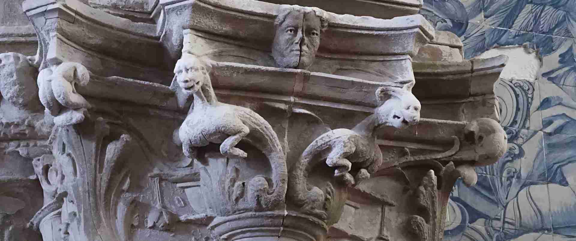
The interior is more refined than the exterior suggests, with a nave of round arches, carved capitals in the Romanesque tradition, and a gilded Gothic altarpiece of the late 15th century by the Flemish sculptor Olivier de Gand (Mestre Olivier) — one of the finest examples of late Gothic religious art in Portugal. The cloister, built in the Gothic style in the 13th century, preserves the original carved capitals with vegetable and figural motifs that represent a pivotal moment in the transition from Romanesque to Gothic in Portuguese ecclesiastical architecture. The Sé Velha was the cathedral of Coimbra until the construction of the New Cathedral (Sé Nova) in the 17th century; it was also the site of the coronation of Afonso II in 1211, the first Portuguese coronation to take place in Coimbra.
The University of Coimbra: A UNESCO World Heritage Hilltop
The University of Coimbra is one of the oldest universities in Europe, founded in 1290 under Dom Dinis I — initially at Lisbon, transferred to Coimbra in 1308, returned to Lisbon in 1338, and permanently established at Coimbra in 1537 within the Royal Palace of Alcáçova. The palace, perched at the summit of the Alta, became the university’s principal building, and its main courtyard — the Pátio das Escolas — the symbolic center of Portuguese academic life for more than five centuries. The landmark iron bell tower (Torre da Universidade), completed in 1733, has served as the timekeeper of the city and as the visual emblem of the university in its hilltop position above the Mondego.
The University of Coimbra – Alta and Sofia was inscribed as a UNESCO World Heritage Site in 2013 under criteria (ii)(iv)(vi), reference 1387. The inscription recognized three distinct values: the university’s outstanding contribution to architectural development in the Portuguese-speaking world, the exceptional quality of its architectural ensemble spanning from the 12th to the 20th century, and its unique living cultural traditions — including the academic black cloak (capa e batina) still worn by students during ceremonial occasions, the end-of-year Queima das Fitas celebration, and the Coimbra tradition of Fado. The inscribed property covers 36.2 hectares in the Alta and Sofia districts, with a buffer zone of 80.8 hectares extending across the historic urban fabric of the hilltop city.
The Joanine Library and the Baroque Sublime
The Biblioteca Joanina (Joanine Library) is among the most extraordinary Baroque interiors in the world. Built between 1717 and 1728 under the orders of Dom João V, at the height of the Brazilian gold revenues that funded a generation of Portuguese royal building projects, the library occupies three interconnected halls of dazzling ornamental intensity: gilded bookshelves of Brazilian jacaranda wood rising to painted ceilings, trompe-l’oeil architectural details extending the apparent space beyond its actual dimensions, and an atmosphere of excess controlled by the geometry of the shelving into something approaching grandeur. The collection holds approximately 300,000 volumes including manuscripts and printed books from the 15th to the 18th centuries, a significant corpus of incunabula, and manuscripts related to the Age of Discovery.
The Joanine Library is also famous for a practical curiosity: a colony of pipistrelle bats has inhabited the building for centuries, the bats emerging at night to feed on the insects that would otherwise destroy the ancient volumes. The leather covers of the desks are changed seasonally in response to the bats’ nocturnal presence, and the colony is considered an integral part of the library’s conservation system — a piece of natural history embedded within one of the greatest Baroque monuments in Europe.
Rua da Sofia and the Lower Town Colleges
Below the Alta, the district of Sofia preserves the earliest university campus in Coimbra — a series of 16th-century colleges built along Rua de São Boaventura and the surrounding lanes after the university’s permanent establishment in the city in 1537. These colleges, most now converted to institutional or cultural uses, form an ensemble of Renaissance and Manueline architecture that is exceptional in the Portuguese context. The College of Jesus (Colégio de Jesus), now housing collections related to the Machado de Castro National Museum; the College of Grace (Colégio da Graça), with its prominent Ionic facade; and the College of the Holy Trinity (Colégio de São Tomás) anchor this lower campus. The Rua da Sofia district was included in the UNESCO inscription specifically as evidence of the integrated urban typology of a European university city during the Age of Discovery — a rare surviving example of 16th-century academic urban planning at the scale of an entire neighborhood.
Coimbra Fado and the Old Town
The lanes of the Almedina quarter — below the cathedral and descending toward the Mondego — preserve a medieval urban fabric of considerable density and authenticity. The Arco de Almedina, the surviving gateway of the original Islamic medina, marks the passage from the modern commercial center to the old town: through it, the streets narrow, the gradient steepens, and the stone buildings press close. Coimbra Fado, distinct from the Lisbon tradition in its use of a Portuguese guitar with flat metal strings, its literary and academic lyrical tradition, and its historically exclusive male performance context at the most formal level, originated in these lanes and the student communities above them. The music’s character — melancholic, self-conscious, and intellectually structured — reflects the psychological landscape of a city that has educated students for over seven centuries and sent them out into the world.
Guarda: The Highest City on the Iberian Plateau
Guarda is described by its inhabitants through the five-F formula: fria (cold), farta (abundant), forte (strong), fiel (loyal), and formosa (beautiful). Of these, fria is the attribute most immediately verifiable — at 1,056 meters above sea level, Guarda is the highest city in Portugal and one of the highest in the Iberian Peninsula, receiving snowfall in most winters and maintaining a northern-feeling climate even in summer. Its granite architecture reflects the severity of both its climate and its frontier history, and the Cathedral of Guarda is among the most important late Gothic buildings in Portugal.
The Cathedral of Guarda and Late Gothic Magnificence
Construction of the Cathedral of Guarda (Sé de Guarda) began in 1390 and continued for more than a century — a period that saw the architectural language shift from Gothic to Manueline, the distinctively Portuguese late Gothic style with maritime and naturalistic decorative motifs that emerged from the wealth of the Age of Discovery. The result is a building occupying a transitional moment in Portuguese architectural history: its basic Gothic structure overlaid with Manueline ornament at the portals, buttresses, and corbels, creating a visual complexity that rewards close reading of the stone surface. The principal portal is a particularly fine example of the Manueline vocabulary, its stonework incorporating armillary spheres, twisted ropes, and naturalistic foliation.
The high altar retable, a monumental stone work by João de Ruão (Jean de Rouen) dating from the early 16th century, is one of the finest Renaissance sculptural programs in Portugal, depicting scenes from the life of Christ in a framework of Gothic-to-Renaissance transitional ornament that documents the moment when Italian Renaissance compositional logic began to displace Gothic narrative arrangement in Portuguese religious art. João de Ruão, a French sculptor who worked extensively in Coimbra and its region, is the dominant figure in early 16th-century Portuguese sculpture, and the Guarda retable is his most ambitious surviving commission.
The Historic Center and the Jewish Heritage of the Frontier Towns
Guarda’s historic center preserves its medieval street plan largely intact, descending from the cathedral promontory toward the lower commercial districts in a series of lanes and alleyways whose scale and texture remain essentially medieval. The city had a significant Jewish community during the medieval period, and the Judiaria (Jewish quarter) is identifiable in the street pattern and in the characteristic architecture of houses with portais duplos — double doors indicating workshops that operated at street level below the living quarters above. This architectural typology, found across the Beiras frontier towns from Trancoso to Castelo Mendo, is the physical expression of the medieval economic integration of Jewish merchants and craftsmen into the commercial life of the frontier. The Guarda Museum, housed in the former Episcopal Palace, holds archaeological and artistic collections from across the region, including a significant group of Visigothic stonework from the eastern Beiras.
Viseu: Capital of Beira Alta and Cradle of Portuguese Painting
Viseu is the commercial and cultural capital of Beira Alta, and the most domestically comfortable of the Beiras cities — its streets broader, its architecture less austere, its relationship to the surrounding agricultural landscape more immediately legible than either Coimbra’s academic grandeur or Guarda’s frontier severity. The city’s historical importance derives equally from its position on the trade routes between the Atlantic coast and the Castilian interior, and from its production of the most significant school of Renaissance painting in Portugal.
The Cathedral and the Adro da Sé
The Cathedral of Viseu (Sé de Viseu) occupies a hilltop position that has been sacred since pre-Christian times. The current structure is substantially 16th and 17th century in its main fabric, though it incorporates Romanesque elements in its lower walls. The west facade, rebuilt in the 17th century in a restrained granite Baroque, is one of the most dignified cathedral facades in Portugal — its simplicity a product of local granite discipline, its proportions characteristic of the sober Baroque that developed in the Portuguese north as a counter to the exuberance of the Joanine style. The cloister, built in the Manueline style in the early 16th century, is among the finest in the Centro region, its carved columns displaying the maritime motifs — armillary spheres, twisted cables, coral forms — that constitute the Portuguese architectural vocabulary of the discovery era. The Adro da Sé — the cathedral forecourt — flanked by the Misericórdia church and opening toward the old town in a sequence of granite-paved terraces, forms one of the most harmonious urban ensembles in the Beiras.
The Grão Vasco Museum and the Viseu School of Painting
The Museu Grão Vasco, housed in the former Episcopal Palace adjacent to the cathedral, contains one of the most important collections of Portuguese Renaissance painting in the country, and the finest surviving works of Vasco Fernandes — known as Grão Vasco (the Great Vasco) — the dominant figure of the Viseu School. Grão Vasco and his contemporaries, working in Viseu in the first quarter of the 16th century, developed a painting tradition that combined the Flemish naturalistic influence brought to Portugal through the Atlantic trade networks with a local specificity of landscape, character, and materials drawn directly from the Beiras environment. The characteristic landscape backgrounds of Viseu school paintings — granite and schist surfaces, chestnut and oak forest, the specific quality of Beira Alta light — constitute an artistic record of the region as it appeared in the early 16th century.
The museum’s altarpiece panels from the Viseu Cathedral, including the Pentecost masterpiece, represent the high point of the Viseu school and of Portuguese Renaissance painting outside Lisbon. The Viseu School is unusual in the broader European Renaissance context for its documentary completeness: surviving archival evidence documents Grão Vasco working alongside named collaborators including Gaspar Vaz, making this one of the few Portuguese workshop traditions that can be reconstructed from records rather than exclusively from stylistic analysis.
The Medieval Urban Fabric of Viseu
Below the cathedral hill, the lanes of the Cava de Viriato district — named after the legendary Lusitanian warrior-king Viriatus, said to have camped within the earthwork enclosure whose traces remain partially visible in the urban fabric — preserve a texture of small-scale commercial streets, Baroque-fronted palaces, and the granite-cobbled Rua Direita that has served as the main commercial axis of the city since the medieval period. The Roman camp, whose earthwork remains describe a roughly square perimeter in the modern street plan, represents the deepest historical layer of the city, predating the medieval Christian settlement by more than a millennium and establishing the topographic logic that all subsequent urban development has followed.
The Côa Valley: Palaeolithic Secrets Beneath the Medieval Landscape
The Prehistoric Rock Art Sites in the Côa Valley represent the deepest chronological layer in the Beiras heritage landscape — a gallery of Upper Palaeolithic engravings carved into granite cliff faces along the Côa River and its tributaries between approximately 22,000 and 10,000 BCE, making them contemporaneous with the cave paintings of Lascaux in France and Altamira in Spain, and exceptional in Europe for their open-air rather than cave context.
Discovery, Controversy, and UNESCO Recognition
The Côa Valley rock art was discovered in 1992 by João Zilhão, then director of the Portuguese Institute of Archaeology, during surveys preparatory to the construction of a dam that would have flooded the valley and submerged the engravings permanently. The subsequent controversy — between the dam construction interests, the Portuguese state, international archaeologists, and heritage bodies — became a defining moment in Portuguese cultural politics and established open-air Palaeolithic rock art site protection as a principle of international heritage law. In 1995, Portugal halted the dam construction and created the Côa Valley Archaeological Park.
The Prehistoric Rock Art Sites in the Côa Valley were inscribed on the UNESCO World Heritage List in 1998, at the 22nd Session of the World Heritage Committee, under criteria (i)(iii), recognizing them as an outstanding example of human creative genius at the dawn of artistic expression, and as exceptional testimony to the cultural traditions of Upper Palaeolithic humanity. In 2010, the inscription was extended to include the Siega Verde site on the Águeda River in Spain, creating a transboundary World Heritage Site (reference 866) that protects the largest known ensemble of open-air Palaeolithic rock art on the Iberian Peninsula.
The Three Principal Sites and Their Imagery
The Côa Valley Archaeological Park encompasses three principal visitor sites — Penascosa, Canada do Inferno, and Ribeira de Piscos — each accessible exclusively by guided tour departing from the Côa Museum in Vila Nova de Foz Côa. Each site presents a different character within the shared tradition of Palaeolithic engraving. At Penascosa, the engravings concentrate on a series of large schist panels above the river, with aurochs — the extinct wild cattle that dominated the Upper Palaeolithic Iberian fauna — as the primary subject. The technique is incised line and pecked contour, using the natural topography of the rock surface to suggest the three-dimensional volume of the animals in a manner that demonstrates sophisticated spatial understanding and consistent artistic intention.
At Canada do Inferno, the site most directly threatened by the proposed dam, panels at different heights along the canyon walls demonstrate the stratigraphic accumulation of images across thousands of years — horses, ibex, deer, and rare anthropomorphic figures superimposed in layers of different ages and techniques. The Ribeira de Piscos site contains some of the most refined examples of Côa Valley engraving technique, including panel no. 1 — a composition of multiple animals arranged with a spatial organization that suggests deliberate compositional intention and has been the subject of sustained scholarly discussion about the degree of artistic premeditation in Upper Palaeolithic art. The Côa Valley as a whole preserves over 1,200 engraved rock panels, of which approximately 580 bear confirmed Pleistocene-era motifs, making it one of the most important concentrations of prehistoric art in the world.
The Côa Museum and the Wider Valley
The Museu do Côa, opened in 2010 in Vila Nova de Foz Côa and designed by architect Camilo Rebelo, is among the most accomplished examples of landscape-integrated contemporary architecture in Portugal. The building, constructed in dark schist tones that mirror the valley geology, descends into the hillside above the confluence of the Côa and Douro rivers, its interior spaces organizing the archaeological collections — stone tools, replica engravings, stratigraphic sections from valley excavations — in a narrative that moves from the Palaeolithic to the historic occupation of the valley. The museum operates an active archaeological research program, and new engraved panels continue to be identified within the park’s boundaries; as recently as 2022, a new stone was excavated featuring one of the largest individual prehistoric figures ever recorded, at 3.5 meters across.
The wider Côa Valley landscape contains additional prehistoric and protohistoric sites beyond the official rock art panels, including the Chalcolithic and Bronze Age settlement of Castelo Velho de Freixo de Numão, a defended promontory site with circular monumental architecture dating from approximately 3000–2500 BCE. The archaeological density of the valley — from the Upper Palaeolithic through the Chalcolithic, Bronze Age, Iron Age, and Roman periods — reflects its consistent strategic and economic value as a river corridor through the granite plateau.
Vernacular Architecture: Granite, Schist, and the Building Traditions of the Beiras
The Beiras display one of the sharpest vernacular architecture transitions in Europe. Moving from east to west — from the granite plateau of the frontier zone across the Serra da Estrela watershed to the Atlantic-facing slopes — the primary building material shifts from granite to schist, and with it every characteristic of the built environment: color, texture, massing, roofline, and spatial organization. This transition is not gradual but abrupt, following the geological boundary of the Serra da Estrela massif, and it creates two architectural worlds as distinct from each other as they are internally coherent.
The Granite Fortification Tradition of the Mountain Frontier
The granite tradition of the eastern Beiras is a product of geology, climate, and defensive imperative. The Beira Alta and Beira Baixa plateaus are underlain by exposed granite, available in large blocks and slabs suitable for construction without elaborate processing. Medieval builders used this material in a massive, load-bearing tradition with thick walls, small window openings — appropriate for both defensive security and thermal management in the harsh continental climate — and a characteristic surface texture of large, irregularly coursed blocks with minimal mortar pointing. The frontier castles and walled villages of the Raia represent this tradition at its most monumental, but the same granite vocabulary is expressed in the domestic architecture of every village and farm in the zone: stone houses with external staircases (escadas exteriores), granite wine presses (lagares) in the farmyard, and the espigueiros (raised stone granaries) of the northern Beiras, standing on mushroom-shaped staddle stones to protect grain stores from rodents.
The granite building tradition of the Beiras also encompasses a specialized military typology — the torre — the isolated defensive tower that punctuates the rural landscape at intervals of two to five kilometers across the frontier plateau. Many of these towers predate the major castle construction programs, representing individual noble or ecclesiastical investment in border security during the 11th and early 12th centuries, before the royal castle-building programs rationalized the defensive network. Several survive in fragmentary form embedded in later farmstead complexes, their medieval masonry identifiable by its course height and surface treatment within 18th or 19th-century additions.
The Schist Villages of the Serra do Açor and Central Beiras
West of the Serra da Estrela, the geology changes to schist — a metamorphic rock that splits into thin, flat plates suitable for a layered rather than massive construction technique. The schist villages of the Beiras, concentrated in the municipalities of Arganil, Góis, Oleiros, Pampilhosa da Serra, Proença-a-Nova, and Sertã, represent a tradition of extraordinary visual coherence: the walls, roofs, floors, and streets are all built from the same dark, layered stone, creating villages that appear to grow organically from the hillside as if the rock itself had been shaped into habitation. The steeper rooflines of the schist tradition — appropriate to the higher rainfall of the Atlantic zone — and the darker coloration of the stone create a visual character diametrically opposed to the pale, horizontal granite villages of the east.
The Aldeias do Xisto (Schist Villages) network — a conservation and rural tourism program separate from the Aldeias Históricas — encompasses 27 villages in the schist zone, organized around artisanal revival, rural accommodation infrastructure, and architectural conservation. While not carrying the military heritage focus of the Aldeias Históricas, the schist villages represent an equally ancient occupation pattern, with evidence of continuous settlement in some sites from the Iron Age through the present. Several schist villages retain their terraced agricultural landscapes intact: narrow stone-walled terraces descending the hillside supporting chestnut and olive groves, with the village at the crown and the stream at the base, creating a vertical agricultural system of considerable visual drama.
Piódão: The Impossible Village
Piódão, member of both the Aldeias Históricas and connected to the schist village tradition, represents the most extreme version of the Atlantic schist building culture. The village clings to a steep hillside in the Serra do Açor at approximately 800 meters of altitude, its blue-grey schist houses arranged in terraces like a natural amphitheater, their roofs and walls merging in a continuous dark surface broken only by the white-painted door and window frames applied during 20th-century restoration. The village church, painted white with a blue-tiled tower, creates the single deliberate note of contrast in an otherwise monochrome composition — a design decision that has become the visual signature of Piódão and one of the most reproduced images in Portuguese heritage photography.
Piódão was effectively road-isolated until the 1970s — the community survived through subsistence agriculture, pastoral farming on the Serra do Açor slopes, and the local production of a schist-filtered aguardente. The road that now connects Piódão to the broader network climbs through the Serra do Açor in a series of dramatic hairpin bends through pine and oak forest, an approach experience that retains much of the original feeling of remoteness even as the village has become one of the most visited heritage sites in the Centro region.
Serra da Estrela: Medieval Settlements in Portugal’s High Mountains
The Serra da Estrela is the highest mountain range in continental Portugal, rising to 1,993 meters at Torre — the highest point on the Iberian Peninsula south of the Spanish Cordillera Central. The massif has shaped the Beiras since before human settlement: it defines the drainage divide between the Atlantic-flowing Mondego and the Atlantic-to-Mediterranean Douro systems, creates the climatic barrier between the Atlantic west and the continental east, and has historically separated the pastoral communities of the upland plateau from the agricultural settlements of the lower valleys.
Mountain Villages and the Pastoral Heritage
The villages on the Serra da Estrela slopes — Manteigas in the glacial valley of the Zêzere River, Gouveia on the northern flanks, Unhais da Serra on the western piedmont — preserve both the architectural character of their respective geological zones and the economic heritage of transhumant pastoralism that has characterized the mountain since at least the Roman period. The wool trade that supported the Serra da Estrela economy through the medieval and early modern periods left its mark in the town of Covilhã, which developed into one of Portugal’s principal textile manufacturing centers from the 17th century onward. Covilhã preserves an industrial archaeology of wool-processing buildings — lanifícios — in its lower quarters, a material record of the transition from pastoral to industrial economy that nowhere else in the Beiras is so legibly inscribed in the built fabric.
The Serra da Estrela cheese — queijo Serra da Estrela — made from the milk of Bordaleira sheep using thistle flower as a coagulating agent rather than animal rennet, is among the most celebrated regional products in Portugal and holds protected designation of origin status. The cheese-making tradition is documented from at least the 14th century and represents an unbroken continuity of pastoral practice from the medieval period to the present: the same breed of sheep, the same mountain grazing, the same thistle coagulation, the same rush-grass wrapping. Few food traditions in Europe provide so direct a material connection to medieval agricultural practice.
The Glacial Landscape and Its Medieval Settlement Logic
The Zêzere valley at Manteigas is a classic U-shaped glacial valley, carved by a Pleistocene glacier into the granite massif of the Serra da Estrela and subsequently occupied by human settlement that exploited its relatively flat floor for agriculture while using the steep valley walls as summer grazing. The medieval settlement pattern of this valley — villages on the valley sides above the flood plain, with communal grazing rights over the surrounding upland — is preserved essentially intact in the current land use. The natural park status of the Serra da Estrela, established in 1976, protects this landscape but also constrains development, keeping the mountain settlements in a state of relative stasis that serves heritage preservation as effectively as any formal conservation program.
Lamego and the Religious Architecture of the Northern Beiras
Lamego sits at the northern edge of the Beiras, where the Douro tributaries cut through the pre-Douro hills toward the great river. It is a town of unusual architectural richness for its size: a Romanesque cathedral with the most complete Romanesque tower in Portugal, a Cistercian monastery of international significance in the immediate vicinity, and the most dramatically staged Baroque sanctuary in the country.
Lamego Cathedral and Early Romanesque Foundations
The Cathedral of Lamego (Sé de Lamego) preserves the most complete Romanesque tower in Portugal — a 12th-century structure that predates the later Gothic and Manueline additions to the cathedral fabric and stands as the earliest substantial Romanesque structure still standing above ground in the country. The tower’s survival in largely unaltered form is the result of the cathedral’s relative isolation from the major building campaigns that transformed the great cathedrals of Coimbra, Porto, and Braga through the Gothic and Manueline periods. The cathedral is associated with the Cortes de Lamego of 1143, a foundational event in the mythology of the Portuguese state — whether historical or legendary, the association gives Lamego a symbolic importance in Portuguese national identity out of proportion to its modest size. The Regional Museum of Lamego, housed in the former Episcopal Palace, holds the finest collection of Flemish tapestries outside Lisbon: a set of five 16th-century hangings depicting scenes from the Creation and the story of Oedipus, acquired through the Bishop of Lamego during the peak of Portugal’s commercial relationship with Flanders.
The Sanctuary of Nossa Senhora dos Remédios
The Sanctuary of Nossa Senhora dos Remédios, positioned on a forested hill above Lamego, is the most theatrically conceived Baroque pilgrimage site in Portugal. The sanctuary church at the summit is reached via a monumental granite staircase of 686 steps, articulated with a sequence of terraces, lateral chapels, fountains, obelisks, and azulejo (ceramic tile panel) compositions representing scenes from the Old Testament and the mysteries of the Rosary. The staircase was built in phases from the 17th to the 19th century, each phase adding new architectural episodes to the ascent, creating a pilgrimage experience in which the physical act of climbing corresponds to a narrative and theological progression. The overall design draws comparison with the Bom Jesus sanctuary near Braga, but the Lamego staircase is more architecturally varied and more historically layered, each section reflecting the stylistic preoccupations of its construction period.
The Cistercian Monastery of São João de Tarouca
The Monastery of São João de Tarouca, in the valley of the Varosa River fifteen kilometers southeast of Lamego, was the first Cistercian monastery founded in Portugal, established in 1124 — fourteen years before Portugal existed as an independent kingdom. The foundation by a group of Benedictine monks who adopted the Cistercian rule under the influence of Bernard of Clairvaux represents a pivotal moment in Portuguese monastic history, and the monastery’s early architecture — the Romanesque choir and transepts surviving beneath later medieval additions — is among the most important evidence of 12th-century religious construction in the country. The church preserves an exceptional set of 17th-century azulejo tile panels depicting scenes from the life of Saint Bernard, the finest program of narrative tile decoration in the northern Beiras, and the tomb of the Infante Dom João, an illegitimate son of Dom Pedro I, whose 14th-century monument is one of the most important Gothic funerary sculptures in Portugal.
Cobblestones and Urban Heritage: The Medieval Street Networks of the Beiras
The cobblestone — calçada portuguesa — is the most pervasive material legacy of the medieval and early modern Beiras. Every village, town, and city in the region preserves sections of hand-laid stone paving that constitute a continuous material record of the human occupation of the landscape: the textures underfoot shift from Roman basalt road-surface to medieval granite cobble to 18th-century limestone mosaic, and each transition marks a different phase of investment, use, and urban development. To walk the Beiras is, inevitably, to read the geological and economic history of the region through the soles of your feet.
The Calçada Portuguesa and Its Beiras Variants
The calçada portuguesa reaches its most refined form in Lisbon and Coimbra, but its origins lie in the practical requirements of mountain terrain: cobblestone paving is the only reliable surface for pack animal and wheeled traffic on steep, wet slopes. In the frontier villages of the eastern Beiras, paving is utilitarian — large, roughly dressed granite blocks laid in simple courses or herringbone patterns, designed for durability under livestock and cart traffic rather than ornament. In the university streets of Coimbra, the same material becomes fine art: the intricate mosaic patterns of the Pátio das Escolas and the Largo da Portagem use white limestone cubes against black basalt backgrounds in geometric and figurative compositions of considerable sophistication. This transition between utilitarian and ornamental registers — traceable through every grade of Beiras settlement — encodes in stone the full range of the region’s economic and social history, from the subsistence frontier village to the cosmopolitan university city.
Reading the Medieval City Through Its Streets
The medieval street plans of the Beiras cities encode the history of their development in the geometry of their lanes. In Guarda and Trancoso, the grid-within-walls plan characteristic of 12th and 13th-century royal foundation is legible in the regular blocks of the historic center, the principal streets connecting the main gates, and the secondary lanes dividing each block into building plots of standardized width. In Coimbra’s Almedina quarter, the more organic street pattern of Islamic urban planning — curved lanes, dead-end passages, building-to-building adaptation without external regulation — reflects the pre-Christian occupation layer that the Christian Reconquista never fully rationalized. In Viseu’s Cava de Viriato district, the Roman grid establishes an alignment that subsequent medieval and early modern construction followed without ever quite replicating, creating a hybrid street plan legible only when the Roman and medieval phases are understood as separate design decisions operating on the same terrain. These differences in street geometry are not merely aesthetic curiosities: they are historical documents in stone, readable by anyone who knows what to look for.
Planning a Journey Through the Beiras
The Beiras’ internal distances are deceptive. While the region is geographically compact relative to, say, Alentejo or Trás-os-Montes, the mountain terrain and the winding roads of the interior mean that travel times between sites are significantly longer than map distances suggest. A journey from Coimbra to Almeida — approximately 220 kilometers by the most direct route — takes three to four hours by car, and many of the Aldeias Históricas are separated from each other by 30 to 60 kilometers of mountain road requiring patience and attention to route-finding.
Suggested Routes Through the Medieval Landscape
The most logical organizational framework for exploring the Beiras is the watershed division between east and west. A western circuit covers the Atlantic Beiras: Coimbra as the natural base, with excursions to Piódão and the Serra do Açor schist villages, Linhares da Beira on the Serra da Estrela northern slopes, the Zêzere glacial valley at Manteigas, and Viseu as a northern anchor. Lamego and São João de Tarouca extend this circuit into the Douro fringe. An eastern circuit covers the frontier Beiras, with Guarda as the practical base for day excursions to Almeida, Castelo Rodrigo, Marialva, Trancoso, Castelo Mendo, and the Côa Valley. Belmonte and Idanha-a-Velha serve as natural hinges between the two circuits, positioned on the southern flanks of the Serra da Estrela where the granite plateau begins to descend toward Beira Baixa. A third southern circuit covers Monsanto, Sortelha, Castelo Novo, and Penamacor, with the Tejo valley as the natural southern boundary.
The GR22 walking route offers the most immersive alternative to vehicle travel, and individual stages between pairs of Aldeias Históricas — Trancoso to Castelo Mendo, Marialva to Almeida, Linhares da Beira to Piódão — can be walked in 2-5 day sections using the rural accommodation network along the route. The stages connecting Castelo Rodrigo, Marialva, and Trancoso across the northern granite moorland are among the finest walking in Portugal: open plateau with distant views into Spain, stone walls, almond orchards, and the occasional ruined torre punctuating the skyline.
Seasonal Rhythms and When to Explore
The Beiras express completely different characters across the seasons. Spring — from late February through May — is the season of almond and cherry blossom on the eastern plateau (peaking in mid-February around Castelo Rodrigo and Figueira de Castelo Rodrigo), wild flowers on the Serra da Estrela slopes, and full rivers for the Côa Valley sites. Summer brings intense heat to the interior plateau — temperatures above 35°C are common in Guarda and on the frontier in July, despite the altitude — and reliably dry conditions for castle exploration and mountain walking. Autumn softens the colors of the upland forests with chestnut and oak color, brings the Dão wine harvest to the region around Viseu, and reduces tourist pressure on the more visited Aldeias Históricas. Winter in the eastern Beiras, with regular snowfall in Guarda and Trancoso and the Serra da Estrela snowfields accessible from Covilhã, reveals a landscape that is genuinely medieval in its austerity — the frontier villages occupied only by their permanent residents, the castle walls white with frost, the cobblestones empty of all but local traffic.
Essential Preparation for the Beiras Interior
Independent exploration of the Aldeias Históricas and the Côa Valley requires a vehicle — public transport connections between the frontier villages are minimal, and several sites including Marialva, Castelo Rodrigo, and the Côa Valley rock art panels are inaccessible without private transport. The Côa Valley sites require advance booking through the Archaeological Park: visits to Penascosa, Canada do Inferno, and Ribeira de Piscos operate exclusively on guided tours of restricted group size, ensuring both site conservation and interpretive quality. Booking well in advance is advisable in spring and early autumn, when demand from specialist heritage travelers is highest.
The upland interior of the Beiras, particularly the Serra da Estrela and the eastern plateau above Guarda, experiences genuinely harsh weather in winter and early spring. Road surfaces in the mountain villages become icy, and some minor roads serving the more isolated Aldeias Históricas remain unpaved or poorly maintained. A high-clearance vehicle is an advantage for exploring the terrain between the official villages, though the villages themselves are accessible on normal surfaces. The Serra da Estrela peaks, reaching nearly 2,000 meters, close to skiing in winter — Torre has the only ski area in mainland Portugal — and the approach roads from Covilhã and Seia require snow chains in periods of heavy snowfall.
Frequently Asked Questions
What are the three traditional provinces of the Beiras?
The three traditional provinces are Beira Litoral (the coastal and Coimbra zone, facing the Atlantic), Beira Alta (the upland plateau including Viseu and Guarda), and Beira Baixa (the drier southern interior toward Castelo Branco). These divisions correspond to distinct geological, climatic, and historical sub-regions, though all three are now administratively organized under the Centro regional authority. The term “the Beiras” in modern usage refers to all three collectively, united by a common frontier identity forged during the Reconquista and by the shared experience of being the interior heartland from which the Portuguese state expanded toward the coast and the sea.
How many Aldeias Históricas de Portugal are there, and what are their names?
There are 12 officially designated Aldeias Históricas de Portugal: Almeida, Belmonte, Castelo Mendo, Castelo Novo, Castelo Rodrigo, Idanha-a-Velha, Linhares da Beira, Marialva, Monsanto, Piódão, Sortelha, and Trancoso. All twelve are within the Centro region of Portugal, concentrated in the historic Beiras provinces, with the majority in the eastern frontier zone of Guarda and Castelo Branco districts. The network was established in 1991 under a Portuguese government program to conserve these villages and address rural depopulation. All twelve remain permanently inhabited communities, distinguishing them from open-air museums, and all are connected by the GR22 walking route of approximately 600 kilometers.
What is the UNESCO World Heritage Site status of the Côa Valley rock art?
The Prehistoric Rock Art Sites in the Côa Valley were inscribed on the UNESCO World Heritage List in 1998 under criteria (i)(iii), reference number 866. Criterion (i) recognizes the Côa Valley art as an outstanding example of human creative genius; criterion (iii) recognizes it as exceptional testimony to the Upper Palaeolithic cultural tradition. In 2010, the inscription was extended to form a transboundary World Heritage Site with the Siega Verde site on the Águeda River in Spain. The Côa Valley component protects over 1,200 engraved rock panels with approximately 580 bearing confirmed Palaeolithic motifs. Three principal visitor sites are accessible by guided tour only: Penascosa, Canada do Inferno, and Ribeira de Piscos, all managed by the Côa Valley Archaeological Park.
What architectural style characterizes the frontier castles of the Beiras?
The frontier castles of the Beiras span several overlapping periods. The 12th and 13th-century structures — Trancoso, Sortelha, Marialva, Linhares da Beira, Castelo Rodrigo — represent the Portuguese Romanesque military tradition: square or rectangular curtain walls with round or square corner towers, simple gatehouses, and a central keep (torre de menagem) of massive masonry. Later 14th and 15th-century campaigns added Gothic refinements including corbelled parapets and more elaborate gatehouse designs. Almeida belongs to an entirely different tradition: a 17th-century Vauban-influenced star fortress with six pointed bastions designed to absorb and deflect artillery fire rather than resist it, reflecting the military architecture revolution of the early modern period. The sequence from Almeida to Sortelha thus spans five centuries of military architectural development within a single regional landscape.
What makes Idanha-a-Velha unique among the Aldeias Históricas?
Idanha-a-Velha is unique in being a continuously inhabited archaeological site layering seven successive civilizations within a single small village. The site was the Roman city of Egitânia, a significant administrative center whose road grid remains visible beneath the modern village. The Visigothic cathedral — built in the 6th century incorporating Roman structural elements, subsequently used as a mosque during the Moorish period — is the most important Visigothic architectural monument in Portugal and contains the country’s largest collection of Visigothic stonework. Bishop Wamba, elected King of the Visigoths in 672 AD, came from Idanha-a-Velha. Unlike the other Aldeias Históricas, which are primarily medieval in their principal heritage layer, Idanha-a-Velha functions as a multi-period archaeological park with a living community at its center.
When was the University of Coimbra inscribed as a UNESCO World Heritage Site, and what criteria were used?
The University of Coimbra – Alta and Sofia was inscribed on the UNESCO World Heritage List in 2013 (37th Session) under criteria (ii)(iv)(vi), reference number 1387. Criterion (ii) recognizes the university’s outstanding contribution to the exchange of human values, specifically its role as a reference model for higher education institutions across the Portuguese-speaking world on four continents. Criterion (iv) acknowledges its exceptional architectural ensemble spanning seven centuries. Criterion (vi) recognizes its direct association with living traditions, ideas, and literary works of outstanding universal significance, including Coimbra Fado and the living academic ceremonial culture. The inscribed property covers 36.2 hectares in the Alta and Sofia districts of Coimbra, with a buffer zone of 80.8 hectares.
What is the Viseu School of Painting?
The Viseu School of Painting is the most significant regional school of Renaissance painting in Portugal, active in the first half of the 16th century and centered on the workshop of Vasco Fernandes — known as Grão Vasco (the Great Vasco). The school developed a Flemish-influenced naturalistic style with landscape backgrounds drawn from the specific visual character of the Beiras environment: granite surfaces, schist valleys, and chestnut forests identifiable as the local landscape. The Viseu school is unusual in European Renaissance art history for the degree to which its workshop relationships are documented in archival records rather than reconstructed purely from stylistic analysis. The principal works are held in the Museu Grão Vasco in Viseu, housed in the former Episcopal Palace adjacent to the Cathedral of Viseu.
How does granite vernacular architecture of the eastern Beiras differ from the schist vernacular of the western slopes?
The granite vernacular of the eastern Beiras uses massive, load-bearing construction with thick walls, small window openings, and a pale grey surface texture of large, irregularly coursed blocks — a tradition shaped by both the material properties of granite and the defensive imperatives of the frontier zone. The schist vernacular of the western slopes uses thin, flat plates of metamorphic rock in a layered construction producing thinner walls, steeper rooflines suited to the higher Atlantic rainfall, and a dark blue-grey coloration that changes to honey-brown in certain lighting conditions. Both traditions use stone exclusively, but the resulting built environments are fundamentally different in character, scale, and atmospheric quality. The transition between them follows the geological boundary of the Serra da Estrela watershed — a change that takes place within a few kilometers of road and shifts the architectural vocabulary completely.
What is the significance of the GR22 walking route?
The GR22, or Grande Rota das Aldeias Históricas, is a 600-kilometer marked long-distance walking route connecting all 12 Aldeias Históricas de Portugal through the upland terrain of the Centro region. It is Portugal’s longest and most complete cultural heritage walking route, traversing granite moorland, river valleys, pine and oak forests, and sections of the Serra da Estrela Natural Park. The route holds the Leading Quality Trails – Best of Europe certification from the European Ramblers’ Association. Several sections follow alignments of pre-Roman and Roman paths, embedding the route in the original topographic logic of the landscape. The full circuit requires three to four weeks; individual stages between pairs of villages range from 15 to 35 kilometers and can be completed independently using the network of rural accommodation along the route.
What is the Joanine Library of Coimbra and why is it significant?
The Biblioteca Joanina (Joanine Library) is a Baroque library in the University of Coimbra complex, built between 1717 and 1728 under Dom João V, and considered one of the most extraordinary Baroque interiors in the world. The library occupies three interconnected halls decorated with gilded jacaranda wood bookshelves, painted trompe-l’oeil ceilings, and elaborate gilt ornament in a style reflecting the exuberance of the Joanine Baroque, funded by Brazilian gold. The collection holds approximately 300,000 volumes including 15th through 18th-century manuscripts, printed books, and incunabula. The library is home to a colony of pipistrelle bats, tolerated for centuries because their nocturnal insect-feeding protects the ancient volumes from pest damage. The Joanine Library forms a central component of the University of Coimbra UNESCO World Heritage Site inscribed in 2013.