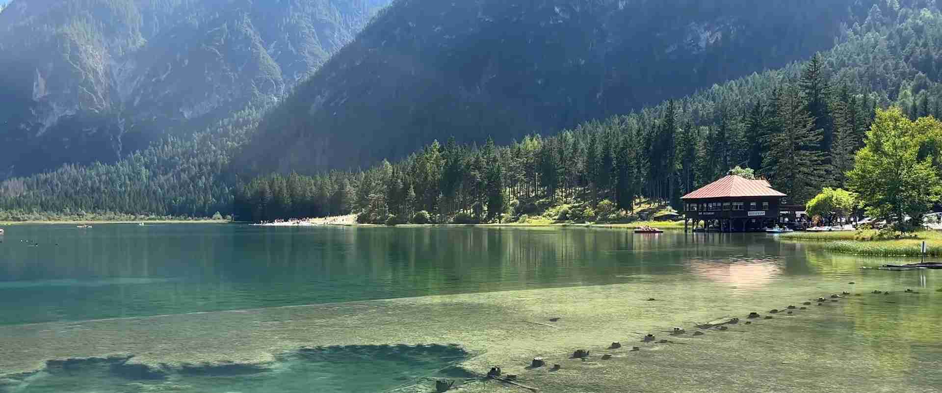
Stone and Silence: The Cultural Landscape of the Carnic Alps and Ancient Villages
The Carnic Alps rise along the ancient border between what is now northeastern Italy and Austria, enclosing a world of high passes, dark forests, and stone villages so still that visitors often describe them using the same word: silence. This is a landscape shaped over three thousand years by Celtic tribes, Roman engineers, medieval parish priests, transhumant shepherds, and the soldiers of two world wars — each leaving traces in the stone that can still be read today. Understanding the cultural depth of Carnia and its mountains means learning to see not only what stands, but what endures beneath and around what stands.
Key Takeaways: The Carnic Alps Cultural Landscape
- Ancient tribal origins: The name “Carnia” derives directly from the Carni, a Celtic tribe that controlled these mountain passes from at least the fourth century BC, making this one of the few European regions to carry its founding people’s name into the present.
- Roman urban legacy: Zuglio, the village of fewer than five hundred inhabitants in the upper Tagliamento valley, sits on the exact footprint of Iulium Carnicum, a full Roman municipium with forum, basilica, thermal baths, and monumental arch — one of the most intact Roman urban plans in the Alpine world.
- Linguistic archipelago: Three German-speaking villages — Sauris, Timau, and Sappada — survive as islands of medieval Bavarian dialect in the Italian mountains, isolated enough over seven centuries that their speech diverged from standard German and is now studied as a distinct linguistic phenomenon.
- Slate and stone architecture: Traditional Carnian architecture uses local pietra grigia (grey stone) for walls and lastra (split slate) for roofing, producing buildings of exceptional visual coherence. The technique of splitting and laying slate has been practiced continuously since medieval times and survives in active restoration work across the region.
- World War One landscape: The Carnic Alps formed one of the highest and most brutal fronts of the First World War, with Austrian and Italian positions separated by only hundreds of meters at altitudes above 2,000 meters. Trenches, tunnels, supply roads, and cemeteries from 1915–1918 remain accessible and largely uninterpreted across dozens of mountain routes.
- Living cultural traditions: Wood carving in Sutrio, lace-making in Paularo, the preparation of frico and cjalsòns, the festival calendar rooted in agricultural and pastoral cycles — Carnia maintains a density of living traditional culture rare even in the Alps, sustained by small communities with deep local memory.
People Also Ask About the Carnic Alps Cultural Landscape
What makes the ancient villages of the Carnic Alps historically significant?
The ancient villages of the Carnic Alps carry a stratified history beginning with Celtic settlement, running through Roman colonization, medieval parish organization, Venetian and Habsburg rule, and twentieth-century war — all visible in the same landscape. Unlike many Alpine areas that were rebuilt or modernized, Carnia’s depopulation in the twentieth century paradoxically preserved its older building stock. Villages like Zuglio, Sauris, Cercivento, and Cleulis retain pre-industrial architectural fabrics essentially intact, with stone houses, open porticos, carved wooden balconies, and narrow lanes unchanged in plan since the medieval period. The region also preserves pre-Roman place names, Celtic-derived surnames, and ritual traditions that academic ethnographers have traced to pre-Christian practices. This layering — tribe, empire, church, republic, war — concentrated in a small mountain area and still legible in stone, landscape, and living memory, is what gives these villages their particular historical weight.
What are the German-speaking villages in the Italian Carnic Alps?
Three villages in the Italian Carnic Alps preserve Germanic dialects descended from medieval Bavarian settlers: Sauris (German: Zahre) in the province of Udine, Timau (Tischlbong) in the upper But valley near Paluzza, and Sappada (Plodn) in the Comelico area to the west. These communities were established between the twelfth and fourteenth centuries by settlers from what is now southern Austria, and their isolation in high mountain valleys allowed their dialects to evolve independently. Today Zahrisch (spoken in Sauris), Tischlbongarisch (Timau), and Plodnarisch (Sappada) are each classified as distinct linguistic varieties, studied by Germanic philologists as examples of medieval speech preserved into the present. All three villages have maintained local identity markers beyond language, including distinct house styles, food traditions, and dress, and all three have become subjects of serious ethnolinguistic preservation efforts since the late twentieth century.
What traces of the First World War survive in the Carnic Alps?
The Carnic front of World War One was fought along the ridge system separating Italy from the Habsburg Empire, with positions often just a few hundred meters apart at elevations between 1,800 and 2,700 meters. The physical remains are exceptional in their extent and accessibility: Austrian and Italian trenches cut directly into rock, underground tunnels serving as command posts and barracks, aerial tramway anchor points for supply lines, ammunition caves, observation posts, officer shelters, and field cemeteries — all distributed across dozens of hiking routes that were once military roads. The most concentrated surviving landscapes are found around Pal Piccolo and Pal Grande near Paluzza, Monte Freikofel near Timau, and the passes of Cason di Lanza and Monte Croce Carnico. Several outdoor museums have been created along these routes, but the majority of the landscape remains uninterpreted, presenting the war’s physical reality with unusual directness.
What is the traditional architecture of Carnian mountain villages?
Traditional Carnian architecture is defined by two materials: grey limestone and phyllite slate. House walls are built in roughly coursed stone, often rendered with lime plaster in older structures but increasingly left bare in restoration work. Roofs are covered with lastra, hand-split slate tiles laid in overlapping courses without mortar, their grey-green color matching the surrounding mountains so closely that villages seem to grow from the hillsides rather than stand upon them. The standard farmhouse type, the stavolo or casale di monte, combines ground-floor animal stabling and storage with residential space above, accessed by external stone stairs leading to a wooden loggia. The loggia, projecting on carved wooden brackets, serves as a transitional space for drying herbs, storing tools, and social gathering in good weather. This building typology appears with minor regional variations from the lowest valley floors to the highest permanent settlements, creating an architectural coherence across the entire Carnic territory that is immediately legible as belonging to this landscape and no other.
Extended multi-day tours – 5+ days
Featured Northern Italy Multi-Day Tour Packages

8 days
Hiking in the Dolomites
- ✓ Comprehensive Northern Italy tour
- ✓ Expert local guides included
- ✓ All accommodation arranged
- ✓ Transportation provided
7 days
Cycling Lake Garda to Venice: The Epic Route
- ✓ Comprehensive Northern Italy tour
- ✓ Expert local guides included
- ✓ All accommodation arranged
- ✓ Transportation provided

8 days
Cycle Dolomites, Lake Garda and Verona
- ✓ Comprehensive Northern Italy tour
- ✓ Expert local guides included
- ✓ All accommodation arranged
- ✓ Transportation provided
4 days
4 Days Dolomites Tour – from Milan
- ✓ Comprehensive Northern Italy tour
- ✓ Expert local guides included
- ✓ All accommodation arranged
- ✓ Transportation provided
Multi-day tour packages powered by TourRadar. Prices and availability subject to change.
Introduction: The Geography of Deep Memory
Carnia — the mountainous heart of Friuli Venezia Giulia in northeastern Italy — is one of those European places where the density of history per square kilometer reaches unusual concentrations. The territory covers roughly 1,200 square kilometers, bordered to the north by the Carnic Alps and the Austrian border, to the east by the Julian Pre-Alps, to the south by the Friulian plain, and to the west by the Dolomitic zone of the Comelico and Cadore. Within this compact area, the human record extends from the Paleolithic through Celtic Iron Age occupation, Roman imperial infrastructure, medieval ecclesiastical organization, centuries of Venetian and Habsburg competition, and two devastating world wars — each phase leaving its material traces in a landscape that never fully erased what came before.
The name itself is the first historical statement. Carnia derives from the Carni, the Celtic tribe that held these passes and valleys from at least the fourth century BC. That the name of an Iron Age people should still designate a European territory in the twenty-first century is not common; it places Carnia in the same category as the Lombards in Lombardy, the Franks in France. The difference is that in Carnia the tribal name has not been diluted to the scale of a nation or a large region but has remained attached to a mountain territory of modest size, concentrated memory, and unusual cultural tenacity.
The landscape that held this memory is one of geological austerity. The Carnic Alps are not the dramatic, photogenic peaks of the neighboring Dolomites; they are older, more eroded, built from limestone, phyllite, and sandstone rather than the pale Dolomia di Raibl that makes its southern neighbors glow at sunset. The Carnic summits — Monte Coglians at 2,780 meters, the highest point; Monte Peralba; Monte Avanza; the long ridge of Pal Piccolo — are rounded rather than spired, their profiles softened by deep geological time. The valleys they enclose are narrow and shadowed, the rivers — the upper Tagliamento, the But, the Chiarsò, the Degano — running fast and cold between walls of grey stone. It is a landscape that demands adaptation rather than inviting conquest, and the human communities that formed here over three millennia carry the marks of that demand in their architecture, their economy, and their culture.
What distinguishes Carnia from many other Alpine regions of comparable historical depth is the survival, in remarkable quantity, of its physical and cultural fabric. The twentieth century brought significant depopulation — emigration to the Friulian plain, to the industrial north, to Switzerland, France, and Belgium was a constant feature of Carnian life from the late nineteenth century onward, intensifying after the Second World War. But this emigration, while hollowing out many communities, also slowed the processes of modernization that elsewhere dismantled old building stock, interrupted oral traditions, and replaced craft knowledge with industrial production. The villages left behind by emigration were often simply left intact rather than rebuilt. The old house stood empty rather than being torn down. The old craft was practiced by the remaining elderly rather than being actively replaced. The result, paradoxically, is a degree of cultural and architectural preservation that more prosperous mountain areas often lack.
The Carni: An Iron Age People and Their Mountain Territory
The Carni appear in ancient sources — Polybius, Livy, Strabo — as a Celtic people occupying the eastern Alps and the approaches to the Adriatic plain. Their territory was positioned at one of the most strategically sensitive points in the ancient world: the passes through which armies, traders, and migrants moved between the Mediterranean and the trans-Alpine world. The amber route from the Baltic to the Adriatic passed through Carnic territory. The invasion routes by which successive waves of peoples from the north entered Italy ran through or adjacent to Carnic-held passes.
The Carni were not passive inhabitants of this geography. Ancient sources record their participation in the great Celtic migration that reached the Adriatic coast in 186 BC, when a large body of Carni and Histri attempted to establish a settlement at what is now Aquileia. The Roman response was to found Aquileia themselves in 181 BC as a Latin colony — in part as a direct counter to Carnic pressure from the north. This founding date makes Aquileia, today a UNESCO World Heritage site on the Friulian plain below the Carnian mountains, one of the direct consequences of Carnic territorial ambition.
Archaeological evidence of the Carni survives in the mountains in the form of castellieri — defended hilltop enclosures of the Iron Age type common throughout northeastern Italy and the eastern Alps. The castelliere of Monte Sorantri above Raveo, the hilltop sites near Zuglio, and scattered finds of Celtic metalwork and ceramic assemblages across the Carnic valleys give material substance to the literary record. The Carni practiced mixed mountain agriculture, transhumance, and trade; their material culture shows strong connections to the broader La Tène Celtic world while maintaining regional characteristics that archaeologists distinguish as specifically Carnic.
The Roman conquest of the eastern Alps brought the Carni into the imperial system without erasing their identity. Their name survived as the designation of the mountain territory, their settlements became the framework for Roman administrative geography, and their trade routes were formalized as Roman roads. The Via Iulia Augusta, the principal Roman road connecting Aquileia to the Noricum province (roughly modern Austria), ran directly through Carnic territory and through the settlement that would become the region’s most important Roman town.
Iulium Carnicum: The Roman City Beneath Zuglio
Zuglio is a village of fewer than five hundred people at the confluence of the But and Lumiei rivers in the upper Tagliamento basin, forty kilometers north of Tolmezzo. It is also one of the most archaeologically significant Roman sites in the Alpine world, preserving beneath and around its modest houses the footprint of Iulium Carnicum, the municipium that served as the administrative center of Roman Carnia from the first century BC through the late imperial period.
The physical remains are concentrated in the archaeological area immediately north of the modern village. A monumental column, re-erected in the nineteenth century on its original base, marks the former forum. Excavations visible beneath protective covers reveal the plan of the basilica — the civic and judicial building that flanked every Roman forum — along with sections of the forum pavement, column bases, and fragments of the architectural orders in local stone. Thermal bath complexes have been partly excavated to the east of the forum zone, revealing the standard hypocaust heating system in unusually good condition. The entire urban area extends under both the modern village and the surrounding fields, with the grid of Roman streets occasionally emerging in foundation lines visible from the surrounding heights.
The museum in Zuglio’s medieval church of San Pietro — itself a building of the fifth to twelfth century, constructed over an earlier Roman sacred building — holds the most important finds from the site: inscription stones recording dedications to Jupiter Optimus Maximus, Hercules, and the imperial cult; architectural fragments in local limestone carved to standard Augustan profiles; funerary reliefs depicting the middle-class townspeople of the Roman municipium in their best clothes; and votive altars recording the names of individuals and family groups that can be cross-referenced with inscriptions from across the Alpine Roman world. The inscriptions name people of Celtic, Italic, and Greek origins, confirming Iulium Carnicum’s role as a cosmopolitan urban node on a major route rather than a purely local settlement.
The Via Iulia Augusta itself is traceable at multiple points in the Carnic landscape. Its paving stones emerge in sections near the But valley floor; its bridge abutments survive at river crossings; its route is preserved in the alignment of medieval and modern roads that followed the same logic of terrain. Walking sections of this route today means walking a surface that Roman merchants, soldiers, officials, and travelers from across the empire used for three centuries, and that medieval pilgrims and Habsburg military surveyors used for centuries after.
The Medieval World: Parish, Fortress, and Stone Community
The collapse of the western Roman Empire in the fifth century brought successive waves of disruption to Carnic territory: Visigoth, Hun, Ostrogoth, and Lombard movements through and across the mountain passes transformed the settled landscape. Iulium Carnicum ceased to function as an urban center; its buildings became quarries for the smaller communities that contracted onto defensible hilltops and valley terraces. The material base of Roman civic life — roads, markets, administration, water supply — simplified back toward subsistence, and the complex network of trade that had sustained an Alpine municipium narrowed to local exchange.
The organizing institution of the post-Roman Carnic world was the church, specifically the Patriarchate of Aquileia, which maintained ecclesiastical authority over this territory from the early medieval period until the Patriarchate’s dissolution in 1751. The Patriarchs of Aquileia were not merely spiritual figures; they were secular rulers of a significant territory, feudal lords with military and economic power, and builders of a network of parish churches, chapels, and eventually collegiate churches and abbeys that structured the Carnic landscape for over a thousand years.
The parish church system that the Patriarchate established across Carnia between the eighth and thirteenth centuries created the skeleton of the modern settlement pattern. Each village center was organized around its church and its piazza; the church held not only spiritual authority but administrative functions, record-keeping, and social regulation. The survival of pre-Romanesque and Romanesque church fabric across the Carnic territory is exceptional: the church of San Pietro in Zuglio, with its fifth-century foundation walls; the Romanesque baptistery at Illegio; the Pieve di San Floriano near Illegio with its cycle of Byzantine-influenced frescoes; the church of Sant’Osvaldo at Mels — these are not isolated monuments but nodes in a dense network of sacred buildings whose cumulative presence defines the character of the Carnic cultural landscape.
Fortified structures punctuate this ecclesiastical geography. The castle of Ceconis near Verzegnis, the fortified tower of Forni di Sotto, the castle ruins above Paluzza, the fortifications at Passo di Monte Croce Carnico — each marks a node of secular power or a point of territorial control in the medieval system. The border between Venetian and Habsburg authority, contested and adjusted repeatedly between the fifteenth and eighteenth centuries, ran through Carnic territory and generated a landscape of fortification, customs posts, and boundary markers that survives in ruins, local memory, and the distinct character of communities that fell on different sides of the administrative divide.
The Architecture of Stone and Slate: Building with the Mountain
Traditional Carnian architecture is among the most coherent regional building traditions in the Alps, deriving its character from the strict use of local materials and the functional demands of mountain life at altitudes between 400 and 1,600 meters. The two defining materials are pietra grigia — the grey limestone and phyllite quarried from surrounding hillsides — and lastra, the split slate tile that covers virtually every roof in the traditional village fabric.
The technique of lastra roofing is ancient and demanding. Phyllite slate, found in specific geological formations throughout the Carnic Alps, is split by hand along its natural cleavage planes into roughly rectangular tiles between two and four centimeters thick and thirty to sixty centimeters long. These tiles are laid in overlapping courses on a closely spaced wooden rafter structure, pinned with iron nails or wooden pegs. The result is a roof of enormous weight — a traditional Carnian roof can weigh three to five times more than a comparable terracotta tile roof — which is why traditional Carnian walls are massively built, with stone courses of unusual thickness. This weight gives Carnian rooflines their characteristic flat-to-moderate pitch; a roof that weighs several tonnes per square meter cannot be steep without imposing catastrophic lateral forces on the walls below.
The grey-green of slate against the grey stone of walls against the grey-brown of winter forest produces the visual signature of the Carnian village: a palette so restrained and so consistent with the natural surroundings that the built environment reads as an extension of the geological landscape rather than a contrast to it. This is not a designed aesthetic; it is the direct consequence of building with what the mountain provides. But its visual effect is powerful and immediately distinguishable from the terracotta-roofed, white-plastered villages of the Friulian plain sixty kilometers to the south, or from the wooden chalets of the Swiss and Tyrolean Alps to the west.
The stavolo — the combined house-barn of the mountain farmer — is the basic building unit of the Carnic village. Its plan is simple: a ground floor of stone for animals and storage, accessed from the outside through wide arched doorways, and a residential upper floor accessed by external stone stairs. The upper floor typically features a wooden loggia — the sporto or balcone — that runs the full width of the building’s southern or eastern facade, supported on heavy carved brackets and providing covered outdoor space for drying, storage, and social life. This loggia type, found with variations across the entire Alpine arc, reaches a particularly refined expression in Carnia, where the brackets are often carved with geometric or naturalistic motifs and the balustrades use traditional joinery techniques transmitted across generations of local craftsmen.
The village of Cleulis, in the Paluzza municipality, is often cited as the most complete surviving example of the traditional Carnian building fabric. Its stone houses and slate roofs, its narrow lanes paved with irregular stone flags, its fountain and washhouse at the village center, its parish church on the highest point of the ridge — the entire assemblage survives with minimal modern intrusion, and the village has been the subject of detailed architectural surveys that document its building stock as a reference point for understanding the traditional Carnian type. Equally intact, in different landscape settings, are the upper village of Ligosullo, the historic center of Cercivento, and the mountain hamlets of the Paularo valley.
Sauris: Seven Centuries of German Speech in the Italian Mountains
At the end of a long road that climbs from the Tagliamento valley through dense forest to a high mountain basin at 1,200–1,400 meters, the village of Sauris (German: Zahre) announces itself by its difference. The architecture is different — lower, darker, with smaller window openings than the Carnian norm, the wooden elements heavier and more elaborately decorated. The language heard in the streets is different — a dialect of Middle High German, structurally distinct from both modern standard German and from the Austrian dialects spoken across the border. The food is different — the smoked ham of Sauris, prosciutto di Sauris IGP, is the best-known product of the Carnian mountains and derives its distinctive flavor from a combination of cold smoking over local woods and the particular climatic conditions of the high basin.
The foundation of the Sauris community dates to the late thirteenth or early fourteenth century, when settlers from what is now the Carinthian-Tyrolean border region of Austria came through the Passo di Sauris and established permanent farms in the high basin. The motivations for this colonization remain debated among historians: some emphasize the need for labor in a sparsely populated mountain area, citing recruitment by the Patriarchs of Aquileia; others point to pressure from population growth in the source area. What is not debated is the result: a community speaking a German dialect, organized around German-pattern farmsteads, and maintaining a cultural distinctiveness from its Italian-speaking Carnian neighbors that survived seven hundred years of political change, economic transformation, and the intensive assimilation pressures of the twentieth century.
The dialect of Sauris — Zahrisch — is classified by linguists as a Bavarian dialect with specific archaic features preserved by isolation. It retains distinctions in case and gender that standard German has largely simplified; it preserves phonological features of Middle High German that modern German has shifted; and it incorporates Friulian and Italian loanwords accumulated over centuries of bilingual contact. Zahrisch is the mother tongue of the older generation of Sauris residents and a language of conscious cultural identity for younger residents, many of whom study it formally through local cultural associations. The community newspaper, the dialect dictionary produced by local scholars, and the regular cultural events organized around dialect use and traditional knowledge represent a sophisticated response to the threat of language loss.
Sauris is divided into two hamlets — Sauris di Sotto (Zahre Hintersee) at the lower edge of the basin and Sauris di Sopra (Zahre Obersee) on the slopes above — connected by a road that curves through hay meadows and past the artificial Lake of Sauris, created in 1951 by a hydroelectric dam that flooded the original hamlet of La Maina. The lake, while a twentieth-century intrusion, has become part of the landscape’s identity; its surface reflects the surrounding mountains with a stillness that, in early morning or evening light, makes the basin feel like a separate world entirely removed from the Friulian plain below.
Timau, Sappada, and the Linguistic Mosaic of the Carnic Alps
Timau (Tischlbong) occupies a different position in the Carnic linguistic map than Sauris. Where Sauris is isolated in a high basin, Timau sits directly on the main road through the But valley, immediately below the Passo di Monte Croce Carnico — the principal pass between Italy and Austria, traveled since the Roman period. This exposure to traffic and exchange makes Timau’s survival of its Germanic dialect less explicable by isolation and more attributable to active cultural resistance and community solidarity. The Timau dialect — Tischlbongarisch — is among the most intensively studied of the Alpine German island dialects, with a dedicated linguistic atlas, a complete grammatical description, and a series of publications produced in collaboration between the community and university researchers from Udine, Klagenfurt, and Vienna.
Timau’s history intersects dramatically with the First World War. The community sat on the front line of the Carnic front from 1915 to 1918, its houses visible across the valley from Austrian positions on the slopes of Monte Freikofel. The experience of having one’s village in the combat zone while speaking the language of the enemy army created an existential tension that the Timau community navigated by emphasizing its Italian civic loyalty while maintaining its German cultural identity — a balance that resonates in local memory and is explicitly discussed in the community’s cultural self-presentation today.
Sappada (Plodn) lies at the western edge of the Carnic cultural zone, administratively in Veneto rather than Friuli, in the upper Piave valley. Its Germanic dialect, Plodnarisch, derives from Tyrolean sources different from the Bavarian roots of Sauris and Timau, and its architectural tradition — with characteristic carved wooden facades and elaborate painted decorations — is visually distinct from the grey stone culture of the central Carnic Alps. Sappada represents the westernmost point of a broader phenomenon: the medieval German-speaking islands of the Alpine region that once covered a much larger area and have contracted under modern assimilation pressures to these few surviving communities.
Beyond the German-speaking enclaves, the Carnic Alps preserve other linguistic minority traditions. The Resian valleys to the east of Carnia proper shelter speakers of Resian, a Slavic language with archaic features that linguists treat as a distinct variety within the South Slavic group. The Friulian language — itself a Romance language descended from the Latin of Aquileia and the Patriarchate, distinct from both Italian and the Venetian dialect spoken to the west — is the majority language of Carnia and is spoken in local variants that differ from valley to valley. This concentration of linguistic diversity within a small Alpine territory — Latin-derived Friulian, archaic Bavarian German, Tyrolean German, Resian Slavic, and standard Italian as the administrative overlay — makes Carnia one of the most complex linguistic landscapes in the Alps and the subject of continuous academic interest in romance philology, Germanic linguistics, and Slavic studies.
The Sacred Landscape: Churches, Chapels, and Votive Shrines
The density of sacred architecture in the Carnic Alps is extraordinary. In a territory of roughly 1,200 square kilometers and a current population of approximately 35,000 people, there are over 200 parish churches, chapels, and oratories — a ratio reflecting the medieval parish system’s requirement that no community be more than a short walk from a place of worship, regardless of the difficulties of mountain terrain. Walking the Carnic valleys means encountering sacred buildings with a regularity that reflects this medieval spatial logic: the chapel at the edge of the village, the wayside shrine at the stream crossing, the oratory at the high meadow, the pieve (mother church) at the valley confluence.
The fresco cycles that survive in many of these buildings represent one of the most significant bodies of medieval painting in the Italian northeast. The church of Sant’Osvaldo at Mels preserves a late-Romanesque fresco cycle of the twelfth to thirteenth century depicting the legend of Saint Oswald of Northumbria — a cult that arrived in this Alpine area through Austrian and German pilgrimage routes. The frescoes of San Giorgio at Illegio, the fragments at San Floriano near Zuglio, the painted saints at San Biagio in Sutrio — each represents a local node of medieval artistic production, often by painters who worked a circuit of small Alpine churches rather than metropolitan workshops, adapting Byzantine iconographic traditions and early Gothic formal innovations to local devotional needs.
The pilgrimage tradition is active and ancient. The sanctuary of Monte Santo di Lussari (Višarje/Luschare), a few kilometers east of the Carnic Alps proper at 1,790 meters on the Julian Alps’ border, is one of the oldest and most frequented Alpine pilgrimage sites, drawing Italian, Slovenian, and Austrian pilgrims to a Gothic chapel housing a medieval wooden statue of the Virgin. The pilgrimage routes to Lussari — some reaching back to the fifteenth century — cross the Carnic-Julian boundary zone and have historically been routes of cultural and linguistic contact between Carnic, Friulian, and Slovenian communities. Closer within Carnic territory, the sanctuary of Maria Luggau (Mariahilf am Luggauer) just over the Austrian border in Carinthia has been a destination for pilgrims from both sides of the Alps for five centuries, and the Passo di Monte Croce Carnico road that leads toward it was maintained for centuries partly by the economics of pilgrimage traffic.
The votive culture — the tradition of commissioning ex-voto paintings and objects in fulfillment of vows made during illness, accident, or danger — survives in Carnian churches in accumulations of painted tablets, wax figures, and crutches that constitute an archive of village experience across two or three centuries. The collection at the sanctuary of Casanova near Tolmezzo, the tablets at Sant’Osvaldo, the objects at the mountain chapels of the But valley — these devotional objects record the accidents, illnesses, drownings, falls, and wartime near-misses of specific named individuals in specific years, mapping the dangers and fears of mountain life with an intimacy that official historical sources rarely capture.
The Great War and the Carnic Front: A Landscape of Memory
The First World War arrived on the Carnic Alps on 24 May 1915, the day Italy declared war on Austria-Hungary and the mountain boundary became a military front. For three and a half years, Italian and Austrian forces faced each other along the ridge system that had previously been an administrative border, a route of trade, and a zone of cultural exchange. The front that formed here was one of the most extreme of any war in history: positions at 2,000 to 2,500 meters altitude, temperatures in winter reaching minus 30 degrees Celsius, supply lines running up exposed slopes under enemy observation, fighting in conditions of permanent cold, rock, and snow.
The physical legacy of this experience is preserved across the Carnic ridges in a condition that reflects both the durability of rock construction and the absence of the agricultural and development pressures that have erased most Western Front sites in France and Belgium. The Pal Piccolo and Pal Grande massif near Paluzza is the most visited of the Carnic war landscapes. Here, at altitudes between 1,800 and 2,100 meters, the Austrian and Italian trench systems are separated in places by fewer than 150 meters of open ground. The trenches are cut directly into the limestone, their profiles still sharp after a century; wooden beam supports have rotted away but the rock-cut forms they once held remain; ammunition niches, drainage channels, and observation slits are identifiable in the stonework. The Austrians, with the advantage of higher ground and better logistical connections to their base areas, built more elaborately — their positions include underground rooms with carved stone furniture, electric lighting systems (the cables have been removed but the fixtures survive), and drainage infrastructure of unexpected sophistication.
Between the opposed positions at Pal Piccolo, the ground has been left as it fell: the meadow between the wire lines still shows the uneven terrain of contested no-man’s-land, the soil still yields small metal objects after rain, and the silence is the silence of a place where the disturbance has ended but the disturbance is remembered in the earth. Signage is minimal. The visitor’s experience is of confrontation with the reality of the landscape rather than mediation by interpretation.
The community experience of the war is present throughout Carnia in war memorials, military cemeteries, and the altered landscape of villages that were partially or fully destroyed in the retreat of 1917. The Caporetto disaster — the Austrian-German breakthrough at Kobarid (Caporetto) in October 1917, which pushed the Italian front back to the Piave and caused the evacuation of the entire Carnic civilian population — is not merely a historical event in these communities; it is a family memory, recorded in the testimony of evacuees who were carried south as children and returned to find their villages emptied, damaged, or used as military headquarters. The post-war reconstruction of several Carnic villages — carried out under Friulian and national programs between 1919 and 1925 — produced the most significant body of twentieth-century architecture in the region, with buildings in a simplified classicism or vernacular revival style that is now itself considered historically significant.
Living Traditions: Wood Carving, Craft, and Festival
Sutrio, a village of approximately 1,300 inhabitants in the Degano valley, is known throughout northeastern Italy for its tradition of wood carving — an art form that here encompasses religious statuary, domestic objects, architectural elements, and independent sculptural work at a level of craft sophistication that draws collectors, restorers, and students from across Italy and beyond. The tradition is documented in Sutrio from at least the seventeenth century, when local carvers were supplying altarpieces, choir stalls, and devotional figures to churches across Carnia and the neighboring Cadore. The guild structure that once organized the craft dissolved long ago, but the knowledge transmission continued through family workshops and informal apprenticeship, and the village today supports an unusually high density of active carvers relative to its population.
The annual presepe competition — a living nativity and carved nativity scene exhibition mounted each December — draws visitors from across Friuli and beyond and serves as both a showcase for current work and a demonstration of the tradition’s continuity. The wood carving school organized through local cultural institutions offers formal instruction to young people from Carnia and elsewhere, providing a structural mechanism for skill transmission that supplements the informal family-workshop model. The carvers of Sutrio work in local woods — linden, walnut, cherry, stone pine — and in styles ranging from the Baroque devotional tradition that is the historical mainstream of the craft to contemporary abstraction, creating a present-tense vitality in a tradition that could easily have become a heritage performance.
Paularo, in the upper Chiarsò valley, is the center of Carnia’s lace-making tradition, specifically the technique known as tombolo — pillow lace made with bobbins, producing complex geometric and floral patterns in linen thread. The tradition arrived in Carnia from the Venetian mainland in the seventeenth century and was adopted enthusiastically in a mountain economy where women needed productive work during the long winter months when outdoor agricultural activity was impossible. The tombolo school in Paularo maintains the tradition in organized classes and produces work of exhibition quality; the annual lace market draws specialists and collectors; and the designs preserved in paper patterns handed down through families represent an archive of craft knowledge extending back three centuries.
The festival calendar of Carnia is rooted in the agricultural and pastoral cycles that structured village life before industrialization and has survived the transformation of that economy with remarkable tenacity. The Carnevale di Sauris — the carnival celebration of the German-speaking village — is among the most distinctive in northeastern Italy, featuring masked figures in traditional costumes whose iconography blends Alpine carnival types with locally specific characters evolved over centuries. The Aria di Festa summer festival circuit, the agricultural fairs of Tolmezzo and Paularo, the harvest festivals in the chestnut and hay zones — each represents a community assembling around shared seasonal rhythms that have not entirely lost their meaning even in a post-agricultural society.
The Table of Carnia: Mountain Food Culture
Carnian cuisine is a direct expression of mountain ecology and the demands of subsistence agriculture at altitude. The dominant flavors — smoked and dried meats, aged cheeses, polenta, wild herbs, dried legumes, preserved vegetables — are the flavors of a food system built around preservation against long winters and the absence of refrigeration. That this system also produces dishes of genuine and sophisticated character is a truth that becomes apparent in the agriturismo kitchens and family restaurants of the Carnic valleys.
Frico is the emblematic dish of Friuli and of Carnia in particular. In its basic form, frico is simply grated Montasio cheese cooked in butter until it forms a crisp, golden pancake — a preparation so simple that its quality depends entirely on the quality of the cheese and the exactness of the cook’s attention. In its richer form, frico is made with potatoes and onion added to the cheese, the whole mass cooked together until the outside is crisp and the inside remains soft and molten. Montasio, the semi-hard cow’s-milk cheese produced throughout Friuli and parts of Veneto under a PDO designation, is the necessary ingredient, and its quality varies dramatically between the industrial product widely available in supermarkets and the hand-made versions produced by small dairies using milk from local herds. In Carnia, where small-scale cheese production has survived alongside industrial competition, finding superior Montasio is still possible and worth the effort.
Cjalsòns — the Friulian word, pronounced roughly “chahl-SOHNZ” — are a fresh pasta form unique to Carnia, related to the broader ravioli family but distinguished by a filling that has no parallel in Italian cuisine. The traditional cjalsòns filling combines potato with dried fruit (raisins or prunes), chocolate, cinnamon, smoked ricotta, and sometimes fresh herbs or citrus zest — a sweet-savory combination that derives from medieval cooking traditions when sugar and spices were expensive prestige ingredients used in small quantities to elevate simple preparations. The resulting dumplings are boiled and served with melted butter and smoked ricotta, or with a sauce of sugar and cinnamon. The combination is startling to palates conditioned by the clean savory-sweet division of modern Italian cuisine, but it is historically coherent and, in the hands of a good cook using quality ingredients, genuinely delicious.
The smoked products of the Carnic Alps — prosciutto di Sauris, speck, smoked trout from the mountain streams — reflect a tradition of cold-smoking over local woods (beech, juniper, cherry) that produces a flavor distinct from the more aggressive smoking of the South Tyrolean tradition or the salt-only curing of Parma. The altitude and climate of the Carnic valleys contribute to the slow drying that characterizes the best prosciutto di Sauris: the low temperatures of the high basin, the natural circulation of mountain air through traditional curing houses, and the long aging period — typically twelve to twenty-two months — produce a ham with a gentler smoke character and a sweetness in the fat that is the product of specific local conditions.
The herb culture of Carnia is less commercially prominent but equally authentic. The high meadows of the Carnian Alps support a flora of alpine and sub-alpine plant species with long documented uses in mountain medicine and cooking: arnica, gentian, mountain sorrel, wild garlic, bear’s garlic, St. John’s wort, and dozens of others. The knowledge of these plants — which to gather, when, how to prepare them — is part of the informal ethnobotanical tradition maintained by older residents and increasingly documented by local research projects in collaboration with the University of Udine’s botanical and agricultural faculties.
The Landscape of Abandonment and Return
The silence in the title of this article is not only the geological silence of ancient stone or the contemplative quiet of mountain landscape. It is also, in significant part, the silence of human withdrawal. The twentieth century removed from Carnia a substantial portion of its population, with emigration waves in every decade from the 1880s through the 1970s and a continued slow drainage in subsequent decades. Villages that held five hundred people in 1900 hold fifty today; high mountain hamlets that were permanent settlements are now summer houses visited for a month each year; winter populations in some valleys are a fraction of what they were two generations ago.
The physical consequences are visible everywhere: abandoned houses whose slate roofs have collapsed inward, leaving stone walls standing around voids of blue sky; hay meadows reverting to scrub as the labor to cut them is no longer available; stone-walled terraces on hillsides losing their walls as the agriculture they supported disappears. In the ecological and landscape-management literature, this process — common to many European mountain areas — is described as land abandonment, and its long-term consequences for biodiversity, wildfire risk, and the maintenance of the open mosaic landscape that centuries of human activity created are the subject of ongoing research and policy debate.
But abandonment in Carnia has a cultural dimension as well as an ecological one. The disappearance of population takes with it not only agricultural labor but craft knowledge, oral tradition, dialect vocabulary, social memory, and the human attention that makes a landscape legible. The grandmother who knew which meadow plants were used for which ailments, the grandfather who could read a roof’s age from its slate laying pattern, the neighbor who remembered the pre-war name of every field in the valley — their deaths and absences leave gaps in the cultural record that no archive can fully compensate.
Against this, the region has developed responses of varying effectiveness. The Museum of Carnic Arts and Popular Traditions in Tolmezzo, one of the oldest and most comprehensive ethnographic collections in northeastern Italy, holds an archive of agricultural implements, craft tools, domestic objects, and documentary photographs assembled over a century of systematic collection. The network of small community museums and interpretation centers — at Zuglio, Sutrio, Paularo, Sauris, Paluzza, Ligosullo — represents a serious effort to make local knowledge visible and accessible. The research programs of the University of Udine’s faculties of letters, agriculture, and environmental sciences have produced substantial documentation of Carnic cultural and natural heritage. And a visible, if small, counter-migration — young people choosing to return or arrive, attracted by landscape quality, lower land costs, and the possibilities of a different kind of life — has begun to bring new energy to some communities.
Writers, Artists, and the Cultural Imagination of Carnia
Carnia has produced writers, painters, and intellectuals whose work engages directly with the landscape and culture described in this article, and whose names are known primarily within Italian literary and artistic culture but deserve wider recognition. Pier Paolo Pasolini’s connections to Friuli — he was born in Bologna to a Friulian mother, spent formative periods in Casarsa della Delizia on the plain, and wrote his first poems in Friulian dialect — touch the edges of the Carnic world without penetrating its mountains. But the Carnic literary tradition is substantial independently of Pasolini’s reflected light.
Carlo Sgorlon (1930–2009), born in Cassacco and deeply connected to the Friulian-Carnic world, wrote fiction that placed the mountain communities, their histories, and their mythologies at the center of serious literary attention. His novels — in particular La conchiglia di Anataj and Il trono di legno — use the Carnic landscape as the ground for narratives that move between historical realism and myth, treating the mountain communities with an ethnographic precision and a narrative respect that resists both the folklorizing tendency of regional literature and the condescension of metropolitan literary production toward peripheral cultures.
The painter Luigi Spacal (1907–2000), Triestine but deeply connected to the Carso and the borderland culture of the northeastern Alps, worked in a tradition of landscape painting that engaged with the abstract qualities of the rocky, grey, specific terrain of the region. His work points toward a broader tradition of Friulian and Carnic visual art in which the particular geological character of the landscape — its greys, its hardnesses, its refusal of the picturesque — becomes a formal challenge and a subject of sustained artistic inquiry.
The contemporary Carnic intellectual and artistic community, small but active, produces literary journals, documentary films, ethnographic research, and cultural initiatives that engage seriously with the questions of identity, memory, and transformation that an aging mountain community in the early twenty-first century must face. The annual Carnia folk music and traditional culture festival, the ethnographic research associated with the Museum of Carnic Arts, and the digital archiving projects undertaken by local cultural associations represent a present-tense intellectual life in a landscape that easy observation might mistake for merely historical.
Arriving in Carnia: The Experience of Entry
The standard entry to Carnia from the Friulian plain is through the Venzone gorge, where the Tagliamento river has cut through a limestone ridge to create the natural gateway that determined the region’s settlement history. Venzone itself — a medieval fortified town completely destroyed by the earthquake of 1976 and completely reconstructed in the following decade by the local community using salvaged original stone — stands at this gateway as both a monument to medieval urbanism and a demonstration of the cultural tenacity that characterizes this region. The reconstruction of Venzone, undertaken not by government agencies but by the community itself, stone by stone, rebuilding the cathedral, the town walls, and the civic buildings from rubble sorted and catalogued with almost archaeological precision, has become a paradigm case in the international literature on post-disaster heritage reconstruction.
Beyond Venzone the valley narrows, the mountains close in, the slate roofs begin, and the visual register shifts from the open, terracotta-colored world of the Friulian plain to the enclosed, grey, mineral world of the Carnic mountains. The change is abrupt — a single bend of the road suffices — and those who pay attention to it describe it as a transition not only of landscape but of atmosphere: a lowering of temperature, a darkening of color, a concentration of the visual field onto the immediate walls of the valley. This is the entry into the landscape described in this article, and it is an experience for which there is no adequate substitute.
Frequently Asked Questions About the Cultural Landscape of the Carnic Alps
Where exactly are the Carnic Alps and which areas do they cover?
The Carnic Alps (Alpi Carniche in Italian, Karnische Alpen in German) form the central section of the southern Alpine chain along the border between northeastern Italy and Austria. On the Italian side, they encompass the sub-region of Carnia, which covers most of the mountainous interior of Friuli Venezia Giulia province between Tolmezzo and the Austrian border. The main valleys on the Italian side are the upper Tagliamento, the But, the Degano, and the Chiarsò. On the Austrian side, the Carnic Alps descend into eastern Tyrol and Carinthia. The highest peak, Monte Coglians, reaches 2,780 meters. The territory is roughly bounded by the Dolomites to the west, the Julian Alps to the east, the Friulian plain to the south, and the Gail valley in Austria to the north.
What is the best base for exploring the ancient villages of Carnia?
Tolmezzo, the principal town of Carnia with approximately 10,000 inhabitants, is the natural base for exploring the region. It offers the most complete range of accommodation, restaurants, and services in the mountain zone, and its Museo delle Arti e Tradizioni Popolari della Carnia provides essential ethnographic context before venturing into the valleys. From Tolmezzo, the main valleys radiate in several directions: north up the But valley toward Paluzza, Timau, and the Passo di Monte Croce Carnico; northwest up the Degano valley toward Sutrio, Ovaro, and Ravascletto; west up the Tagliamento toward Zuglio and Forni di Sopra; and south toward Venzone and the Friulian plain. Paularo, at the head of the Chiarsò valley, is a secondary base with good accommodation for those focusing on the eastern valleys. Sauris requires a dedicated visit and offers limited but high-quality accommodation directly in the German-speaking village.
Is Carnia suitable for visitors without a car?
Carnia is significantly more accessible by car than by public transport, and the most interesting villages and landscapes are difficult to reach without private transportation. A regional bus network operated by SAF (Società Automobilistica Friulana) connects the main valley floor settlements — Tolmezzo, Paluzza, Paularo, Sutrio — on regular schedules, and the train from Udine reaches Carnia station near Tolmezzo. However, the higher hamlets, the war landscape sites, the most intact historic villages like Cleulis and Cercivento, and destinations like Sauris require either a car or a willingness to walk substantial distances from valley floor bus stops. For visitors planning a walking-based itinerary using the network of marked trails that connects many villages and mountain areas, car-free travel is feasible but requires careful planning around accommodation and supply logistics.
What languages are spoken in the Carnic Alps?
The majority language of Carnia is Italian, the official language of everyday administration, education, and business. Alongside Italian, Friulian — a Romance language distinct from Italian and derived from the Latin of the Aquileian area — is spoken by a significant portion of the population, with protection under Italian regional minority language law since 1999. In Sauris, Timau, and Sappada, the community-specific Germanic dialects (Zahrisch, Tischlbongarisch, and Plodnarisch respectively) are spoken by older community members and maintained by cultural institutions. In the Resia valley east of Carnia proper, the Resian Slavic language survives as a further linguistic minority. Most visitors will find Italian sufficient for all practical purposes; Friulian, while not universally understood by Italians from outside the region, is structurally close enough to Italian that speakers of Italian can often follow it with effort.
What is the best time of year to visit the Carnic Alps for cultural tourism?
Late spring (May–June) and early autumn (September–October) offer the best conditions for cultural tourism in the Carnic Alps. In May and June, the mountain meadows are in flower, the high passes are open, the war landscape sites accessible, and the village centers not yet affected by summer tourism pressure. September and October bring the harvest season — the most intense period of the traditional food calendar, with the production of Montasio cheese, the smoked meat curing season beginning, and local festivals around agricultural products. Summer (July–August) is the busiest period, with Italian domestic tourism filling accommodation in the main valley centers; the mountains are accessible and the conditions good, but the character of the quieter villages can change significantly. Winter (December–March) closes many high roads and reduces services, but offers the Carnevale di Sauris (usually February), the wood carving exhibitions in Sutrio, and a landscape of snow-covered slate roofs that is visually extraordinary.
Are there guided tours available for the WWI sites in the Carnic Alps?
Guided tours of the Carnic front war landscape are available through local alpine guide associations and through the outdoor museum organizations that have developed interpretation programs at the main sites. The Ente Turismo of Carnia in Tolmezzo maintains current listings of authorized guides specializing in the war landscape. The Pal Piccolo outdoor museum above Paluzza is the most developed interpretation site, with marked routes, informational panels, and seasonal guided visits. The Monte Freikofel area near Timau, the Cason di Lanza zone, and several other front-line sites are also accessible on marked hiking routes, though with less interpretation infrastructure. Independent visits are entirely feasible for visitors comfortable with mountain hiking at altitudes of 1,500–2,200 meters; the sites are on standard trail maps and in good weather present no technical difficulty. The summer season (July–September) offers the most reliable access; spring and autumn visits are possible but require checking current snow conditions on the higher routes.
What is the significance of the 1976 Friuli earthquake for the Carnic cultural landscape?
The earthquake of 6 May 1976 — magnitude 6.5, epicenter near Gemona del Friuli — was the most destructive seismic event in Italian history since the 1915 Avezzano earthquake. In Carnia and the Friulian mountain zone, the destruction was extensive: entire historic centers were heavily damaged or destroyed, including Venzone, Osoppo, Gemona, and numerous smaller settlements. The death toll for the wider Friulian area reached nearly a thousand. The reconstruction that followed over the subsequent decade has been studied internationally as a model of community-led, culturally sensitive post-disaster recovery. The principle adopted by the Friulian communities — com’era, dov’era (as it was, where it was) — meant rebuilding historic structures on their original footprints using original materials where recoverable and matching materials where not, prioritizing the continuity of spatial and architectural identity over the efficiencies of modern urban planning. The reconstruction was far from perfectly executed in every case, but the commitment to cultural continuity it embodied produced historic centers that, thirty years on, have reintegrated into the regional architectural fabric far more successfully than the modernist replacement schemes adopted elsewhere in post-earthquake Italy.
What role does the Carnic Alps landscape play in current ecological and conservation debates?
The Carnic Alps are at the center of several active ecological and conservation debates that have significant implications for the cultural landscape described in this article. The abandonment of mountain agriculture — documented across Carnia since the mid-twentieth century — is converting traditionally managed hay meadows, terraced fields, and grazed alpine pastures into closed forest, with consequences for biodiversity (many species dependent on open habitats are declining), wildfire risk (dry scrub on abandoned agricultural land burns more easily than managed meadow), and the visual character of the landscape (the open, mosaic quality of the traditionally farmed mountain valley is being replaced by unbroken forest). Conservation agencies, local agricultural associations, and academic researchers debate the appropriate policy responses: incentivizing continued small-scale agriculture, introducing managed grazing by returning domesticated animals, or accepting the ecological succession while focusing protection on the most significant surviving open habitats. The outcome of this debate will determine, in large part, what the Carnic cultural landscape looks like in fifty years.
How is the Friulian dialect related to the culture of Carnia?
Friulian (furlan) is a Romance language descended from the Latin spoken in the Aquileian zone and bearing traces of the Celtic, Rhaetian, and Lombard languages spoken in this territory before and alongside Latin. It is classified by linguists as a Rhaeto-Romance language, related to Ladin (spoken in the Dolomitic valleys) and Romansh (spoken in the Swiss Graubünden), though this classification is debated. In Carnia, Friulian is the traditional language of rural and village life — the language of domestic conversation, agricultural practice, oral narrative, and folk song. Carnian Friulian dialects differ from those of the plain in phonology, vocabulary, and grammatical features, incorporating more Germanic loanwords from centuries of contact with the Austrian Alpine world and preserving more archaic forms than the dialect of the Udine urban area. The relationship between Friulian language use and Carnic cultural identity is strong: speaking Friulian signals belonging to the regional community, and the recent decades of increased attention to Friulian language rights and education have reinforced rather than weakened this identification.
What photographic subjects does the Carnic Alps region offer for landscape and cultural photographers?
The Carnic Alps offer photographic subjects of exceptional diversity and relative accessibility. The architectural photography of slate roofs and stone walls is best pursued in early morning or overcast light, when the grey tones of the materials are most differentiated and the shadows within the village fabric most readable; direct afternoon sun flattens the texture and loses the detail in the stone. The WWI landscape at Pal Piccolo and Monte Freikofel photographs most powerfully in early summer when the trenches are emerging from snow but the vegetation has not yet covered them, or in autumn when the long shadows model the earthworks clearly. The village of Cleulis in late afternoon light from the hillside above presents the most complete traditional Carnian roof-scape. Sauris photographs well from the eastern end of the lake at dawn, when the village and its German-style farmsteads are reflected in still water with the surrounding ridge line behind. The wood-carving workshops of Sutrio, the lace-making rooms of Paularo, and the cheese production facilities of the Carnic dairy cooperatives offer documentary photography subjects that require introductions through the local tourist office but reward the effort with access to active traditional crafts.