
Ring of Kerry Day Trip & Driving Guide: 2026 Route, Best Stops & Tips from Killarney
The Ring of Kerry stands as Ireland’s most celebrated scenic drive, delivering 179 kilometers of Atlantic drama, ancient heritage, and emerald landscapes around the Iveragh Peninsula. This circular route from Killarney transforms a single day into an immersive journey through coastal villages, misty mountain passes, and golden beaches that capture Ireland’s wild soul in concentrated form, making it the country’s premier self-drive adventure.
Key Takeaways About the Ring of Kerry in 2026
- Complete Circuit Length and Duration: The Ring of Kerry measures exactly 179 kilometers around the Iveragh Peninsula, requiring 4-6 hours of pure driving time when completed clockwise from Killarney. Strategic stop planning for photography, meals, and attraction visits typically extends this to a full 8-10 hour day trip, with flexibility to compress into 6 hours for express travelers or expand across two days for comprehensive exploration including side routes like the Skellig Ring.
- Self-Drive Budget Costs 2026: Independent travelers driving the Ring of Kerry spend €90-120 per person daily when sharing car rental and fuel costs between two people. This covers car rental share €23, fuel €50-60, parking €5-8, one paid attraction €7-15, packed lunch provisions, and coffee stops along the route.
- Mid-Range Self-Drive Investment 2026: Comfortable self-drive exploration costs €140-170 per person daily for two sharing vehicle expenses. This budget accommodates car rental share €23, fuel €60-75, parking €8-10, admission to two major attractions like Muckross House and Kerry Cliffs totaling €22, restaurant lunch €20-30, and refreshment stops €8-12 throughout the day.
- Guided Tour Alternative 2026: Organized day tours from Killarney operators range €70-130 per person, including transportation, driver-guide narration, and strategic stop scheduling at major viewpoints. Lunch, attraction admissions, and optional experiences like jaunting car rides require additional budgeting beyond the base tour price, making total day costs comparable to self-drive mid-range when all elements are included.
- Clockwise Direction Advantage: Driving clockwise from Killarney positions vehicles on the ocean side with optimal pullout access for photography stops while moving opposite to large tour coaches restricted to counterclockwise travel. This directional strategy reduces traffic congestion encounters, minimizes time stuck behind slow-moving buses on narrow sections, and provides superior coastal viewing angles throughout the western and southern peninsula stretches.
- Spring 2026 Optimal Conditions: April through May 2026 delivers the Ring of Kerry’s most favorable driving conditions, combining mild temperatures around 13-15°C, emerging wildflower blooms across hillsides, reduced crowd pressure compared to July-August peaks, and extended daylight hours reaching 16 hours by late May. Autumn months September-October offer similar crowd advantages with different color palettes as bracken turns golden across the mountains.
People Also Ask About Ring of Kerry Day Trips in 2026
How much does a Ring of Kerry day trip cost per person in 2026?
Ring of Kerry day trip costs range €70-170 per person in 2026 depending on transportation choice and budget approach. Guided coach tours from Killarney operators start at €50-80 for basic transportation and guide services, with additional €20-50 needed for lunch, attraction admissions, and optional extras like jaunting car rides, bringing total guided tour costs to €70-130. Self-drive options split car rental and fuel between passengers, with budget self-drivers spending €90-120 per person when two share a €45 daily rental plus €100-120 fuel costs, while mid-range self-drive travelers invest €140-170 per person covering higher fuel consumption from frequent stops, multiple attraction admissions, and restaurant dining versus packed provisions.
Solo self-drivers face higher per-person costs since car rental and fuel aren’t split, with budget solo costs reaching €145-175 and mid-range solo approaching €200-240 for the same day trip experience. Couples or small groups achieve the most economical per-person rates through cost sharing, particularly when renting larger vehicles that accommodate 4-5 passengers without significant fuel penalty. Spring and autumn shoulder seasons in 2026 offer identical pricing structures to summer peaks, as Ring of Kerry attractions and services maintain consistent rates year-round with only accommodation costs varying seasonally.
Can you drive the Ring of Kerry in one day from Killarney in 2026?
Driving the complete Ring of Kerry circuit in a single day from Killarney works perfectly for 2026 travelers when planned with realistic time allocation and selective stop strategies. The 179-kilometer route requires 4-6 hours of actual driving under normal conditions, leaving 4-6 additional hours within a typical 10-12 hour day trip for stops, meals, and exploration. Successful one-day completion demands early departure between 8-9 AM to maximize daylight hours, particularly important during shorter winter days when sunset occurs around 5 PM, while summer extends usable daylight until 9:30-10 PM providing comfortable pacing flexibility.
Strategic stop selection proves essential for meaningful one-day experiences rather than rushing past highlights in a blur. Core stops consuming 2-3 hours collectively include Muckross House gardens and grounds, Torc Waterfall short walk, Ladies View panoramic photography, Kerry Cliffs coastal drama, and lunch in Sneem or Waterville villages. Additional time buffers account for narrow road navigation requiring slower speeds than highway driving, unexpected traffic delays behind agricultural vehicles or tour coaches despite clockwise routing advantages, and spontaneous stops at unmarked viewpoints that make the Ring of Kerry experience magical rather than merely checking boxes. Two-day itineraries allow deeper exploration including side routes to Skellig Ring, Valentia Island, Gap of Dunloe, and extended hiking in Killarney National Park while maintaining relaxed pacing.
What is the best time of year to drive the Ring of Kerry in 2026?
April through May and September through October represent the Ring of Kerry’s optimal driving windows in 2026, balancing favorable weather, manageable crowds, and cost efficiency. Spring months April-May deliver awakening landscapes as gorse blooms golden yellow across hillsides, rhododendrons burst purple and pink through Killarney National Park woodlands, and lambing season fills fields with young sheep under increasingly long daylight hours reaching 16 hours by late May. Average temperatures hover 11-15°C providing comfortable exploration conditions without summer heat, while tourist numbers remain 40-50% below July-August peaks meaning shorter lines at Muckross House, easier parking at popular viewpoints, and more intimate village experiences.
Autumn months September-October transform the Ring of Kerry’s palette as bracken and gorse turn amber-gold across mountains, creating photographic opportunities distinct from spring’s green freshness. September extends summer’s mild weather with temperatures 14-16°C and reduced but still substantial tourist presence, while October brings increased rainfall probability but dramatic storm-light conditions beloved by photographers and near-empty roads at month’s end. Winter months November-March offer the lowest crowds and accommodation rates but face challenges including 8-9 hour daylight windows limiting itinerary flexibility, higher rainfall frequency averaging 15-20 days monthly, potential road closures on mountain passes during severe weather, and reduced operating hours or seasonal closures at some attractions. Summer peak season July-August guarantees longest daylight and warmest weather but confronts heavy coach tour traffic, crowded attractions, fully booked accommodations requiring advance reservations, and maximum pricing across services.
Is it better to drive clockwise or counterclockwise around the Ring of Kerry in 2026?
Clockwise driving from Killarney heading first toward Killorglin proves decisively superior for Ring of Kerry self-drivers in 2026 due to traffic flow patterns, viewing angles, and pullout accessibility advantages. Tour coaches face regulatory requirements to travel counterclockwise, creating a system where independent clockwise drivers meet oncoming coaches face-to-face on narrow sections rather than getting trapped behind them for extended stretches. This directional separation reduces frustration dramatically, as clockwise drivers can pull into frequent layby turnouts on their left side to allow coaches to pass, then resume progress immediately rather than crawling behind 40-passenger vehicles stopping every 2-3 kilometers for passenger photography.
Viewing angles favor clockwise travel along the western and southern coastal sections where dramatic Atlantic vistas unfold on the driver’s left side, making pullout stops safer and more convenient as layby parking naturally appears on the ocean side of the road. Counterclockwise drivers face the challenge of crossing traffic lanes to access these same viewpoints, particularly problematic on the narrow sections between Caherdaniel and Waterville where road width barely accommodates two-way traffic and sightline distances remain short around coastal curves. The Dingle Bay panoramas from Kells to Glenbeigh reward clockwise travelers with unobstructed front-seat views requiring no neck craning or awkward positioning, while photographers can safely exit vehicles directly into viewpoint areas rather than crossing active traffic lanes. The only counterclockwise advantage lies in slightly easier morning light angles for photography along the eastern Killarney-to-Kenmare section, a minimal benefit outweighed by the substantial traffic and logistics advantages of clockwise routing for the majority of the circuit.
Extended multi-day tours – 5+ days
Featured Ring Of Kerry Multi-Day Tour Packages
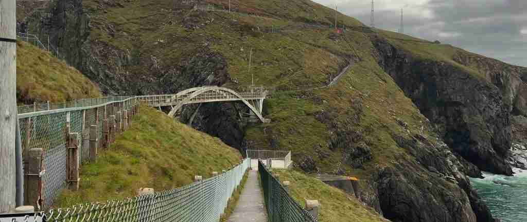
3 days
Ring Of Kerry 3-Day Discovery Tour
- ✓ Comprehensive Ring Of Kerry experience
- ✓ Expert local guides included
- ✓ All accommodation included
- ✓ Transportation provided
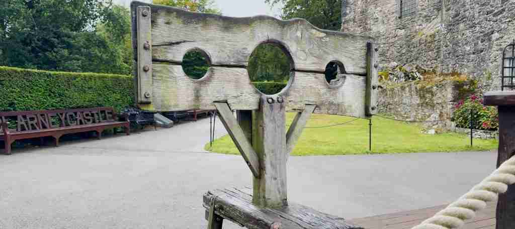
5 days
Ring Of Kerry 5-Day Highlights Experience
- ✓ Comprehensive Ring Of Kerry experience
- ✓ Expert local guides included
- ✓ All accommodation included
- ✓ Transportation provided
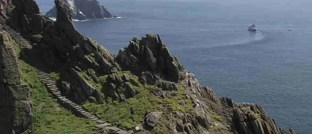
7 days
Ring Of Kerry 7-Day Cultural Journey
- ✓ Comprehensive Ring Of Kerry experience
- ✓ Expert local guides included
- ✓ All accommodation included
- ✓ Transportation provided

10 days
Ring Of Kerry 10-Day Complete Adventure
- ✓ Comprehensive Ring Of Kerry experience
- ✓ Expert local guides included
- ✓ All accommodation included
- ✓ Transportation provided
Multi-day tour packages powered by TourRadar. Prices and availability subject to change.
Introduction: Discovering Ireland’s Premier Scenic Drive in 2026
The Ring of Kerry encircles the Iveragh Peninsula in County Kerry along Ireland’s southwestern Atlantic coast, where the Wild Atlantic Way’s most concentrated scenic drama unfolds across a single 179-kilometer circular route. Starting and ending in Killarney town, this iconic drive threads through environments that shift every few kilometers from oak-forested lakeshores to bare mountain passes exceeding 300 meters elevation, then descend to wave-pounded coastal cliffs before entering sheltered harbors where fishing villages have anchored Irish life for a millennium. The route’s accessibility from international gateways makes it Ireland’s most-traveled scenic circuit, yet its scale and topographic diversity prevent the crowding that diminishes some European coastal drives, particularly when explored during spring or autumn shoulder seasons.
The Ring of Kerry’s significance extends beyond scenic grandeur into Ireland’s cultural and historical narrative. The peninsula preserves stone forts dating to Celtic Iron Age societies, early Christian monastic sites that maintained learning through Europe’s Dark Ages, and 19th-century manor estates reflecting Anglo-Irish ascendancy and subsequent independence struggles. Roadside monuments mark Great Famine mass grave sites where thousands perished between 1845-1852, providing sobering context to the landscape’s beauty. Contemporary Kerry culture thrives in market towns where traditional music sessions fill pubs nightly, artisan food producers craft farmhouse cheeses and smoked seafood using centuries-old techniques, and Irish language remains a living presence rather than museum relic.
Planning a Ring of Kerry day trip in 2026 requires understanding route options, timing strategies, and cost considerations that determine experience quality. The complete circuit divides naturally into distinct sections each offering different character and stop opportunities. The eastern lakeland section from Killarney through Killarney National Park to Kenmare traverses Ireland’s largest national park with its ancient oakwoods, mountain-framed lakes, and Victorian manor houses. The southern coastal section from Kenmare to Waterville delivers intimate harbor villages, golden strand beaches, and the Skellig Ring spur route overlooking UNESCO-listed Skellig Michael monastery island. The western section from Waterville northward along Ballinskelligs Bay and Dingle Bay presents the route’s most dramatic coastal scenery with Kerry Cliffs, Valentia Island, and relentless Atlantic horizons. The northern section from Killorglin back to Killarney offers gentler pastoral landscapes, market town atmosphere, and access to Gap of Dunloe mountain pass extensions.
Self-drive versus guided tour decisions fundamentally shape Ring of Kerry experiences in ways extending beyond mere transportation logistics. Independent drivers gain flexibility to linger at personally compelling locations whether that means extended photography sessions at lesser-known viewpoints, spontaneous detours down unmarked coastal lanes, or unhurried afternoon hours in village cafes absorbing local atmosphere without schedule pressure. The freedom to start early and beat tour coach crowds to major attractions, or conversely to begin late morning and enjoy empty roads after coaches depart, provides control over crowd exposure that fixed-schedule tours cannot match. However, self-driving demands attention to navigation, left-side road positioning, and narrow lane maneuvering that can induce stress for drivers unaccustomed to Irish road conditions, potentially diminishing scenic appreciation when constantly focused on avoiding stone walls mere inches from wing mirrors.
Guided coach tours eliminate driving stress and provide professional narration explaining historical and cultural contexts that independent exploration might miss. Experienced driver-guides know precisely where to stop for optimal light conditions, which viewpoints offer perspectives worth the climb, and which villages contain authentic traditional music venues versus tourist traps. Tour scheduling handles logistics of lunch reservations, attraction entry coordination, and realistic time allocation that prevents the common self-drive mistake of overambitious itineraries resulting in rushed stops and incomplete experiences. The social dimension of shared coach tours appeals to solo travelers seeking company and conversation during long driving sections between major stops, while small group tours in mini-coaches provide middle ground between large bus impersonality and complete independence.
Seasonal considerations in 2026 extend beyond weather into crowd density, service availability, and photographic opportunities that vary dramatically across calendar months. Spring emergence transforms the Ring of Kerry between March and May as dormant vegetation awakens, lambs appear in hillside fields, and migrating birds return to coastal habitats. April and May represent the sweet spot combining green freshness, mild temperatures, and manageable tourist numbers before summer crowds arrive. Summer months June through August guarantee maximum daylight hours and warmest temperatures but confront peak tourist density, fully booked accommodations, and roads congested with rental cars, campervans, and tour coaches creating bottlenecks at narrow sections and popular stops. Autumn September through October offers changing color palettes, softer light angles beloved by photographers, and substantially reduced crowds while maintaining generally favorable weather before November’s onset of Atlantic storm systems.
Winter months November through March present the Ring of Kerry’s emptiest roads and lowest prices but challenge visitors with short 8-9 hour daylight windows, increased rainfall frequency, and potential road closures on mountain passes during severe weather events. Some attractions reduce operating hours or close entirely during winter, particularly smaller private operations dependent on summer revenue to sustain year-round operations. However, winter delivers unique atmospheric conditions as Atlantic storms create dramatic cloud formations, shafts of light pierce between squalls illuminating specific landscape features, and snow occasionally caps MacGillycuddy’s Reeks creating Alpine-like backdrops rare in typically mild Irish winters. Photographers specifically seeking moody, dramatic conditions rather than postcard-blue skies often prefer winter’s theatrical weather despite logistical challenges and wet conditions.
Budget planning for Ring of Kerry day trips requires understanding distinct cost categories and how choices within each category compound into total daily expenditure. Transportation costs form the largest single expense whether through car rental fees, fuel consumption, parking charges, or guided tour packages. Self-drivers in 2026 face car rental rates starting around €45 daily for compact manual transmission vehicles, with automatic transmissions commanding €60-75 premiums and larger vehicles scaling upward from there. Fuel costs fluctuated substantially during early 2026 due to geopolitical tensions affecting oil markets, with petrol prices ranging €1.82-1.91 per liter and diesel €2.08-2.14 per liter in April 2026 following government excise duty reductions. The complete Ring of Kerry circuit plus Killarney-area driving typically consumes €100-150 in fuel depending on vehicle efficiency and stop frequency, a significant expense that cost-conscious travelers split among multiple passengers.
Attraction admission fees add incrementally throughout the day as individual entry costs seem modest but accumulate quickly when visiting multiple sites. Muckross House charges €15 admission, Ross Castle €5, Kerry Cliffs €7, and various other heritage sites €3-8 each. Savvy budget travelers prioritize free natural attractions like Torc Waterfall, Ladies View, Inch Beach, and Rossbeigh Strand which offer equivalent scenic rewards without admission fees, reserving paid entries for one or two must-see cultural sites matching personal interests. Mid-range and luxury travelers incorporate more paid experiences including boat tours on Killarney lakes €15-25, jaunting car rides through national park €40-60 per vehicle, and Skellig Michael landing trips €100-130 when accessible, though Skellig access requires advance booking months ahead due to limited daily landing permits protecting the fragile island ecosystem.
Dining choices significantly impact daily budgets through meal selections spanning picnic provisions assembled from Killarney supermarkets for €10-15 covering full-day grazing, casual village pub meals €15-25 per person for hearty soup-and-sandwich combinations or traditional Irish stew, mid-range restaurant lunches €20-35 per person in towns like Kenmare or Sneem featuring fresh seafood and local lamb, or upscale dining experiences €40-60+ per person at destination restaurants like QC’s Seafood Bar in Caherdaniel or Mulcahy’s in Kenmare. Coffee and refreshment stops throughout the day add €3-5 per stop, easily totaling €15-20 for multiple breaks at scenic cafe locations. Budget-conscious travelers bring thermoses and homemade treats, while others embrace cafe culture as part of the Ring of Kerry social experience worth the cumulative cost.
The complete Ring of Kerry day trip therefore scales from absolute minimum budgets around €70-90 per person combining guided tours with packed provisions to comprehensive mid-range experiences €140-170 per person incorporating quality dining and major attractions to luxury approaches exceeding €200-250 per person adding premium accommodations for overnight extensions, private driver-guides, and exclusive experiences. Understanding these cost structures before departure allows realistic budget setting and prevents the frustration of discovering mid-trip that desired experiences exceed available funds, forcing disappointing choices between attractions or meals that diminish overall satisfaction.
Understanding the Ring of Kerry Route in 2026
The Ring of Kerry follows the N70 and N71 national secondary roads circling the Iveragh Peninsula’s coastline and interior valleys, supplemented by smaller R-roads providing alternative routes and coastal spurs that enhance the standard circuit. The journey begins in Killarney town, County Kerry’s tourism capital situated at the eastern gateway to Killarney National Park where three large lakes nestle beneath Ireland’s highest mountain range. From Killarney, the N71 curves southwestward through the national park passing Muckross House estate, Torc Waterfall, and Ladies View panoramic overlook before descending into Kenmare market town after approximately 35 kilometers. This opening section introduces the route’s lakeland character with ancient oak woodlands, red deer sightings, and mountain backdrops that establish visual themes recurring throughout the circuit.
From Kenmare, the N70 departs westward along the southern peninsula coast delivering the first sustained ocean views as the road hugs hillsides above intimate coves and sandy beaches. The villages of Templenoe and Blackwater offer early refreshment stops before Parknasilla’s wooded peninsula extends into Kenmare River estuary with subtropical gardens exploiting Gulf Stream-warmed microclimates. Sneem village marks the southern route’s midpoint approximately 60 kilometers from Killarney, where colorful buildings cluster around a river bridge and sculpture park celebrates local artistic traditions. Beyond Sneem, the route enters wilder terrain as Castle Cove and Staigue Fort area presents dramatic coastal cliffs, Bronze Age stone fortifications, and increasingly sparse settlement patterns reflecting the peninsula’s harsh Atlantic exposure.
The Skellig Ring spur route branches from the main N70 near Waterville, offering an 18-kilometer alternative loop along the peninsula’s southwestern tip with superior views toward Skellig Michael and Little Skellig islands lying 12 kilometers offshore. This detour reconnects at Ballinskelligs village, adding 30-40 minutes to total journey time but rewarding with emptier roads and UNESCO World Heritage site perspectives that justify the extension. Waterville town itself sprawls along a sandy beach where Charlie Chaplin famously vacationed annually, with contemporary hotels and restaurants serving fresh-caught Atlantic seafood. North from Waterville, the N70 tracks Ballinskelligs Bay’s sweeping arc past Derrynane Beach and House, Daniel O’Connell’s ancestral estate commemorating Ireland’s greatest 19th-century political liberator.
Caherdaniel village provides the southern coast’s final service cluster before the route turns inland briefly through Coomakista Pass, ascending to 200 meters elevation for panoramic perspectives across Kenmare River bay toward the Beara Peninsula. The descent reaches sea level again at Castlecove before climbing once more to traverse Caherdaniel to Waterville section’s dramatic topography. North of Waterville, the Kerry Cliffs turnoff near Portmagee village leads to privately-owned clifftop viewpoints rising 300 meters above Atlantic breakers, charging €7 admission but delivering perspectives rivaling more famous Cliffs of Moher at a fraction of the crowds.
Portmagee village occupies a strategic harbor position where boat tours depart for Skellig Michael landings during limited summer seasons, while the adjacent bridge connects to Valentia Island, Ireland’s westernmost substantial inhabited land. Valentia extends the Ring of Kerry circuit by 11 kilometers each way to island highlights including Geokaun Mountain viewpoint and Bray Head clifftop walks, a worthwhile detour adding 60-90 minutes to total driving time. Beyond the Valentia turnoff, the N70 continues north along Dingle Bay’s southern shore past Kells village toward Cahersiveen market town at 110 kilometers from Killarney, roughly the circuit’s western apex.
Cahersiveen functions as the peninsula’s western service center with substantial supermarkets, fuel stations, medical facilities, and accommodation concentrated in one location more than any point since Kenmare. The town honors native son Daniel O’Connell with heritage center housed in former Royal Irish Constabulary barracks. Beyond Cahersiveen, coastal scenery continues along Dingle Bay with views north toward Dingle Peninsula’s Brandon mountain massif and Slea Head Drive, Ireland’s second-most-famous scenic route visible across the bay. Kells Bay attracts gardening enthusiasts with subtropical plantings similar to Parknasilla, while Glenbeigh village marks the transition toward the circuit’s northern pastoral section.
The Rossbeigh Strand turnoff near Glenbeigh leads to a 6-kilometer sandy peninsula extending into Dingle Bay, popular for walking, horse riding, and windsurfing when weather permits. The main N70 continues inland through Glenbeigh climbing toward 180-meter-elevation Windy Gap pass before descending into Killorglin town at 155 kilometers from Killarney. Killorglin hosts the famous Puck Fair each August, Ireland’s oldest annual festival where townspeople crown a wild goat as symbolic king for three days of traditional music, livestock sales, and celebration dating to pre-Christian Celtic practices. The town’s elevated riverside position provides attractive lunch stops with terrace restaurants overlooking the Laune River salmon runs.
The final 24 kilometers from Killorglin back to Killarney follow the N72 and N22 through relatively flat agricultural land where dairy farms and cattle pastures reflect Kerry’s reputation for quality grass-fed beef and farmhouse cheese production. This section lacks the dramatic scenery of western and southern coastal stretches but offers easy driving and opportunities to reflect on the day’s experiences before arriving back in Killarney to complete the circuit. Alternative return routes including the Gap of Dunloe mountain pass provide dramatic finale options for travelers with energy and daylight remaining, though the Gap requires separate planning as its narrow single-track road prohibits standard cars, accessible only by foot, bicycle, or traditional jaunting cars.
Total Ring of Kerry driving distance measures exactly 179 kilometers when following the standard N70/N71 circuit without detours. Adding the Skellig Ring spur, Valentia Island extension, and Rossbeigh Strand turnoff increases this to approximately 225-240 kilometers depending on specific route choices. Realistic driving times under normal conditions without stops range 4 hours for the basic circuit to 6 hours when incorporating major spurs, though actual journey times typically extend 8-12 hours once stops for meals, photography, and attraction visits factor into practical planning. The route’s circular nature allows starting from any point and proceeding in either direction, though Killarney remains the most common base due to accommodation concentration and accessibility from Shannon and Cork international airports.
Complete Route Map and Key Stops
The Ring of Kerry’s 179-kilometer circuit divides naturally into four distinct sections, each offering different landscapes, attractions, and stopping opportunities that collectively create the route’s comprehensive appeal. Understanding these sections and their signature stops allows strategic planning that balances driving time against exploration depth, preventing common mistakes of attempting too many stops and experiencing none satisfactorily versus selecting too few and missing essential highlights.
The Killarney to Kenmare eastern section spans 35 kilometers through Killarney National Park along the N71, requiring 45-60 minutes driving time but offering attractions that could easily consume half a day. Muckross House and traditional farms complex operates as the section’s anchor attraction, a Victorian mansion estate with elaborate gardens, working farm demonstrations, and woodland trails along Muckross Lake shoreline. The house interior tours consume 45-60 minutes, while grounds exploration extends indefinitely depending on trail selections and garden interests. Admission costs €15 in 2026, with combination tickets available covering both house and traditional farms.
Torc Waterfall lies 5 kilometers beyond Muckross House, accessible via short 400-meter paved path from dedicated car park to the 20-meter cascade pouring through mossy boulder formations. The walk takes 10-15 minutes each direction with modest elevation gain, suitable for all fitness levels and offering classic Irish waterfall photography opportunities particularly attractive after rainfall when volume increases. No admission fee applies, making this an ideal budget-conscious stop. More ambitious hikers continue beyond the waterfall base on steep switchback trails ascending to viewpoints overlooking Killarney lakes, adding 60-90 minutes round trip for serious elevation gain rewarded with panoramic perspectives.
Ladies View occupies an elevated position 8 kilometers south of Torc Waterfall where Queen Victoria’s ladies-in-waiting reputedly declared the vista Ireland’s finest during an 1861 royal visit. The viewpoint looks northeast across all three Killarney lakes—Lough Leane, Muckross Lake, and Upper Lake—framed by MacGillycuddy’s Reeks mountain range rising to 1,038 meters at Carrauntoohil summit, Ireland’s highest peak. A large car park, cafe, and craft shop serve the location, which suffers tourist bus crowding during midday summer peaks but rewards early morning or evening visits with sublime light conditions and peaceful contemplation. No admission charge applies, though coffee and refreshments tempt spending €5-8 at the viewpoint cafe.
The descent from Ladies View to Kenmare town traverses 12 kilometers of winding mountain road where pullouts offer successive views across Kenmare River bay before arriving in Kenmare’s colorful market town atmosphere. Kenmare serves as the Ring of Kerry’s southern gateway with excellent restaurants, artisan food shops, and wool craft stores justifying 60-90 minute exploration stops or extended lunch breaks. The town’s triangular central park and surrounding Georgian buildings create attractive urban spaces for relaxed wandering between Ring of Kerry driving segments.
The Kenmare to Waterville southern coastal section covers approximately 60 kilometers along the N70, requiring 90 minutes driving time without stops but expanding to half-day experiences when incorporating beach walks, stone fort visits, and village exploration. Sneem village appears 27 kilometers west of Kenmare, distinctive for houses painted vibrant colors creating Instagram-ready streetscapes around twin village squares separated by a small river. The South Square features sculpture park commemorating local personalities and Irish political figures, while craft shops and cafes line surrounding streets. Budget 30-45 minutes for Sneem exploration including coffee breaks and gallery browsing.
Staigue Fort lies 5 kilometers inland from the N70 via narrow single-track road approximately 15 kilometers beyond Sneem, representing Ireland’s finest preserved Iron Age stone fort dating to approximately 300-400 CE. The circular structure measures 27 meters diameter with dry-stone walls 5 meters high and 4 meters thick at the base, constructed entirely without mortar using precisely fitted stones weighing up to half a ton each. Interior staircases built into wall thickness access elevated rampart positions offering defensive advantages and contemporary visitor perspectives of sophisticated engineering predating Roman influence. A small admission fee of €3 supports site maintenance, while the access road’s narrow width requires careful driving attention but rewards with pastoral landscapes and minimal tourist presence compared to roadside attractions.
Derrynane Beach and House complex sits 8 kilometers west of Caherdaniel village, combining a 2-kilometer golden sand beach with Daniel O’Connell’s ancestral estate house and gardens. The beach connects to Abbey Island at low tide where 6th-century monastic ruins occupy windswept positions above rock pools and shell-scattered strands. House tours detail O’Connell’s life as Ireland’s greatest 19th-century political liberator who achieved Catholic Emancipation through peaceful mass organization, while surrounding woodlands contain subtropical plants thriving in Gulf Stream-warmed microclimates. Budget 60-90 minutes for combined beach walking and house visiting, with €5 house admission though beach access remains free. The location’s southern exposure delivers excellent swimming conditions during summer months when Atlantic water temperatures reach surprisingly tolerable 14-16°C.
Waterville occupies a beach town position at the southern section’s western terminus, approximately 75 kilometers from Killarney. The town sprawls along a 2-kilometer strand beach between Ballinskelligs Bay and Lough Currane, Ireland’s deepest lake extending inland into mountain valleys. Charlie Chaplin’s annual visits during the 1960s-70s established Waterville’s tourism credentials, commemorated with bronze statue on the seafront and Chaplin-themed cafe murals. Contemporary Waterville functions primarily as accommodation and dining center with several hotels, guesthouses, and seafood restaurants serving fresh Atlantic catches. The beach itself rewards walking, particularly during evening hours when Atlantic sunsets create dramatic color displays, though water temperatures and Atlantic wave conditions challenge swimming except during calm summer weather.
The Waterville to Cahersiveen western coastal section presents the Ring of Kerry’s most dramatic Atlantic scenery across 45 kilometers requiring 75 minutes driving without stops. The Kerry Cliffs turnoff appears 12 kilometers north of Waterville near Portmagee village, leading via steep narrow road to privately-owned clifftop viewpoints. The site charges €7 admission but delivers perspectives rising 300 meters above Atlantic breakers with direct sightlines toward Skellig Michael and Little Skellig islands lying 12 kilometers offshore. The clifftop walk extends 1 kilometer between fenced pathways with multiple viewpoint platforms, consuming 30-45 minutes for complete circuit. Photography conditions vary dramatically with weather and light, with morning visits offering backlit island silhouettes and afternoon visits illuminating cliff face geology and cascading vegetation.
Portmagee village functions as departure point for Skellig Michael boat tours during limited May-September seasons when weather permits landing. The village itself comprises a single colorful street of houses, cafes, and craft shops stretched along a narrow channel separating the mainland from Valentia Island, connected by modern bridge. Seafood restaurants featuring fresh crab and lobster justify lunch stops, particularly at The Bridge Bar with harbourside terrace seating. The Skellig Experience heritage center on Valentia Island side provides multimedia exhibits explaining the Skellig monastery’s history, seabird colonies, and lighthouse operations when actual island landing remains impossible due to weather or booking availability, charging €8 admission for comprehensive interpretation.
Valentia Island extends 11 kilometers west from Portmagee bridge, requiring 60-90 minutes for circuit including stop time at key locations. Geokaun Mountain viewpoint occupies the island’s highest point at 266 meters elevation, accessible via steep switchback road to summit car park and short uphill walk to viewing platforms. The €5 admission supports private land access and site facilities, rewarding visitors with 360-degree perspectives encompassing the Skellig islands, mainland Kerry mountains, and Dingle Peninsula across the bay. Clear weather reveals the Blasket Islands 40 kilometers northwest and potentially Fastnet Rock lighthouse 90 kilometers southwest. Fogmore Cliffs and Bray Head tower on Valentia’s western tip provide alternative high viewpoints accessible via cliff-edge walking paths.
Cahersiveen town marks the circuit’s western apex at 110 kilometers from Killarney, functioning as the peninsula’s largest service center with substantial supermarkets, fuel stations, medical clinic, and diverse accommodation. The old barracks heritage center commemorates Daniel O’Connell with exhibits detailing his life, political achievements, and lasting impact on Irish nationalism. The building itself represents rare Irish example of Royal Irish Constabulary barracks architecture. Just east of town, Cahergall and Leacanabuaile stone forts offer well-preserved Iron Age structures similar to Staigue Fort but with easier access from main roads, charging modest €3 admission each. Budget 45-60 minutes for Cahersiveen town exploration including refreshment stops, or extend this substantially if overnighting.
The Cahersiveen to Killorglin northern section spans 45 kilometers of increasingly pastoral landscapes along Dingle Bay’s southern shore, transitioning from dramatic coastal scenery toward agricultural valleys. Rossbeigh Strand turnoff near Glenbeigh village leads to a 6-kilometer sandy peninsula popular for beach walking, horse riding, and bird watching, particularly attractive during evening hours when sunset light illuminates the Dingle Peninsula mountains across the bay. Glenbeigh village itself offers limited services but attractive setting beneath mountain slopes, with several traditional pubs maintaining evening music sessions during tourist season.
Killorglin town occupies an elevated riverside position commanding the Laune River salmon runs, functioning historically as market town serving the peninsula’s eastern agricultural zone. The town’s fame rests primarily on Puck Fair, held annually during the second weekend of August when townspeople capture a wild mountain goat and crown it “King Puck” for three days of music, livestock sales, and celebration dating to pre-Christian Celtic festivals. Outside Puck Fair dates, Killorglin maintains subdued market town atmosphere with several pubs, cafes, and supermarkets serving Ring of Kerry tourists. The town marks the practical end of the circuit’s scenic highlights, with the final 24 kilometers to Killarney following relatively flat agricultural land requiring 30 minutes driving without intermediate stops.
Alternative routes and extensions modify the standard Ring of Kerry circuit for travelers with extra time or specific interests. The Skellig Ring spur branches from the N70 near Waterville, following minor roads along the peninsula’s southwestern tip through Ballinskelligs village with superior Skellig Islands views and emptier roads, adding 18 kilometers and 30-40 minutes to total journey time. The Gap of Dunloe mountain pass provides dramatic alternative return from Killarney National Park to Killarney town, though the narrow single-track road prohibits standard cars, accessible only by foot, bicycle, or traditional jaunting cars. The Beara Peninsula Ring of Beara offers second major scenic circuit south of Kenmare, delivering similar Atlantic coastal drama with significantly fewer tourists, though completing both Rings requires multi-day itineraries rather than single-day trips.
Self-Driving the Ring of Kerry in 2026: Complete Guide
Self-driving the Ring of Kerry provides maximum flexibility and intimate engagement with the landscape at personally-determined pacing, though success requires understanding Irish road conditions, left-side driving conventions, and practical logistics that determine whether the experience proves liberating or stressful. Car rental in Ireland operates through familiar international agencies including Enterprise, Hertz, Budget, and Europcar, plus local operators like Dan Dooley and Irish Car Rentals offering competitive rates particularly for longer rental periods. Advance online booking through comparison sites typically secures better rates than walk-in rental, with prices starting around €45 daily for compact manual transmission vehicles in 2026, rising to €60-75 for automatic transmissions reflecting Ireland’s persistent premium for automatic options, and scaling upward for mid-size and larger vehicles.
Rental cars in Ireland operate with manual transmissions as standard, with automatic transmissions available but commanding 30-50% price premiums and requiring specific advance booking to ensure availability. Drivers unfamiliar with manual transmission operation face significant challenges navigating the Ring of Kerry’s frequent hills, narrow roads with steep gradients, and stop-start traffic in villages where stalling on inclines causes embarrassment and traffic disruption. This consideration alone justifies automatic transmission premiums for many travelers, particularly when sharing driving duties among multiple people not all equally comfortable with manual gear shifting. Left-side driving and right-hand-drive vehicles represent the more fundamental Irish driving adjustment, requiring conscious attention particularly during the first few hours until mirror positioning and lane discipline become automatic responses.
Insurance coverage decisions significantly impact rental costs and liability exposure in damage scenarios. Basic collision damage waiver included in most rental rates typically carries excess liability of €1,500-2,500, meaning renters pay this amount out-of-pocket for any damage regardless of fault before insurance coverage begins. Third-party insurance comparison sites offer supplemental coverage reducing excess to €0-300 for €8-12 daily premiums, providing worthwhile peace of mind given the Ring of Kerry’s narrow roads, stone walls bordering many sections, and tourist drivers’ unfamiliarity with local conditions. Credit card rental car coverage benefits vary by issuing bank and card tier, with premium cards sometimes providing primary coverage that eliminates excess entirely, though careful review of specific terms prevents assumptions that prove incorrect when claims arise.
Fuel costs represent Ring of Kerry self-drive expenses second only to car rental, with volatile 2026 pricing reflecting geopolitical tensions affecting global oil markets. Petrol prices ranged €1.82-1.91 per liter in April 2026 following government excise duty reductions, while diesel costs €2.08-2.14 per liter, substantially higher than historical averages but somewhat stabilized after March’s extreme volatility when prices briefly exceeded €2.20 for diesel. The complete Ring of Kerry circuit plus Killarney area driving typically consumes 25-35 liters fuel depending on vehicle size and driving style, translating to €100-150 total fuel costs that independent travelers split among passengers. Compact cars achieve better fuel economy on the route’s hilly terrain and frequent acceleration from stops compared to larger vehicles, while diesel engines deliver 20-25% better fuel consumption than petrol equivalents though facing higher per-liter costs that partially offset the efficiency advantage.
Parking logistics along the Ring of Kerry combine free roadside pullouts at natural viewpoints, modest parking fees at major attractions, and standard town center pay-and-display systems requiring coins or card payments. Ladies View, Torc Waterfall, and numerous unmarked coastal viewpoints offer free parking in paved or gravel lots sized for 20-50 vehicles, typically adequate except during peak summer midday hours when spillover parking lines roadsides illegally. Muckross House charges nominal €5 parking fees collected at staffed barrier gates, while Kerry Cliffs includes parking in the €7 site admission. Town centers like Kenmare, Sneem, and Killorglin operate pay-and-display parking typically costing €1-2 per hour with 2-4 hour maximums, though enforcement varies and locals advise feeding meters preemptively versus risking €40-60 parking fines.
Navigation technology has transformed Ring of Kerry driving from requiring paper maps and local directions to straightforward smartphone GPS guidance, though several caveats apply. Google Maps, Apple Maps, and Waze all provide reliable routing around the standard circuit with real-time traffic updates warning of delays or road works, though satellite signal reception can prove intermittent in mountain valleys where cliffsides block sky view. Downloaded offline maps prevent data connectivity gaps from disrupting navigation, essential for travelers using international phone plans without Irish data coverage or facing coverage holes in remote peninsula areas. Physical map backups remain worthwhile for route overview perspective and contingency against technology failures, with quality Ring of Kerry touring maps available at Killarney tourist information centers and bookstores for €5-8.
Road condition realities on the Ring of Kerry require mental preparation and appropriate speed expectations, particularly for drivers accustomed to North American highway standards or even continental European secondary routes. The N70 and N71 designated as national roads carry misleading implications of substantial width and smooth surfaces, when reality presents single-track sections with passing places, frequent potholes requiring evasive maneuvers, and surface quality varying dramatically between recently-resurfaced stretches and neglected segments where pavement edges crumble into gravel. Maximum posted speeds of 100 kilometers per hour reflect legal limits that actual conditions rarely permit, with realistic average speeds between 50-70 kilometers per hour accounting for curves, elevation changes, oncoming traffic negotiation, and spontaneous stops for photography.
Stone walls border many Ring of Kerry road sections at distances measured in centimeters rather than meters from pavement edges, creating psychological pressure and real risk for drivers misjudging vehicle width or drifting during distracted moments. Modern cars’ exterior dimensions typically exceed driver intuitions formed in parking lots and urban streets, with wing mirrors extending 15-20 centimeters beyond body width and representing the first contact points with walls or oncoming vehicles during tight passes. Frequent stone wall contact mars many rental vehicles, with insurance excess liability triggering for damage regardless of how minor the scrapes appear. Conservative driving maintaining center lane position and yielding space to oncoming traffic prevents most wall contacts, though this sometimes requires reversing to wider sections when two vehicles meet on particularly narrow stretches.
Tour coach encounters represent inevitable aspects of Ring of Kerry driving requiring patience and strategic responses rather than frustration and aggressive overtaking attempts. Coaches measure 12 meters length and 2.5 meters width, moving substantially slower than cars on hills and requiring wide berth on curves where rear overhang swings toward roadside obstacles. Clockwise routing from Killarney reduces coach encounters by traveling opposite to their mandatory counterclockwise direction, meeting them head-on at intervals rather than following behind for extended stretches. When trailing coaches proves unavoidable, safe passing opportunities rarely materialize on the narrow, winding sections where coaches travel, requiring 10-15 minute acceptance of slow progress until villages or straight sections allow overtaking. Attempting passes on blind curves or narrow sections risks head-on collisions with oncoming traffic, accidents that occur annually despite obvious dangers to frustrated tourists.
Weather conditions influence Ring of Kerry driving safety and enjoyment beyond obvious rain considerations into wind exposure, fog frequency, and seasonal variations. Atlantic weather systems move rapidly across Kerry, creating conditions where sunshine alternates with rain squalls every 30-60 minutes during unsettled periods. Windscreen wipers receive heavy use as drivers toggle between intermittent and full speed settings, while temperature fluctuations between sun and cloud passages create windscreen condensation requiring defrost system activation. Atlantic winds buffet coastal sections particularly strongly, generating crosswinds that push vehicles toward road edges requiring steering corrections, especially challenging for high-sided vehicles like campers and SUVs. Fog develops frequently on mountain passes including Ladies View, Coomakista Pass, and sections inland from Waterville, reducing visibility to 20-50 meters requiring hazard lights and dramatically reduced speeds.
Seasonal considerations affect Ring of Kerry self-drive experiences substantially beyond weather into daylight availability and road surface conditions. Summer months June through August provide maximum daylight extending past 9:30 PM by late June, allowing relaxed pacing with time flexibility for spontaneous stops and evening exploration in Killarney after completing the circuit. Spring and autumn transitions feature progressively shorter days, with sunset occurring around 8:30 PM in April and 5:00 PM by late October, requiring earlier starts to complete full circuits with adequate stop time before darkness arrives. Winter months November through March confront severely limited daylight windows of 8-9 hours between 8:30 AM sunrise and 5:00 PM sunset, effectively preventing complete Ring of Kerry circuits with meaningful stops unless accepting partial darkness driving.
Ice and snow rarely affect the Ring of Kerry’s main N70 and N71 routes due to mild Atlantic climate moderation, though occasional winter storms deposit snow at higher elevations including Ladies View, Coomakista Pass, and inland mountain sections, creating slippery conditions lasting hours until road crews apply salt and clear accumulations. Black ice formation on cold clear nights following rain represents more insidious winter hazard, creating invisible slick patches on shaded road sections and bridge surfaces where temperatures drop below freezing while surrounding areas remain clear. Rental cars in Ireland rarely include winter tires or chains even during cold months, leaving drivers relying on cautious speeds and gentle braking responses to manage reduced traction.
Emergency preparedness for Ring of Kerry self-drive trips includes several practical considerations beyond generic travel insurance and mobile phone connectivity. European emergency number 112 connects to all emergency services including police, ambulance, and fire services throughout Ireland, functioning even without mobile network coverage by accessing any available carrier. Breakdown coverage through rental car agencies typically includes roadside assistance phone numbers printed on rental agreements, though response times in remote peninsula locations can extend 60-90 minutes before technicians arrive. Carrying high-visibility vests required by Irish law, warning triangles, and basic first aid supplies demonstrates prudent preparation, though rental vehicles should supply these items as standard equipment.
Physical stamina requirements for Ring of Kerry self-driving prove more demanding than casual day trips suggest, with 8-12 hours combining actual driving concentration, frequent stops requiring vehicle exits and re-entry, walking to viewpoints and attractions, and meal planning all consuming energy beyond sedentary expectations. Drivers particularly bear concentration demands maintaining left-side positioning, navigating narrow sections, negotiating oncoming traffic, and processing navigation while passengers admire scenery. Rotating driving duties among multiple licensed drivers prevents single-person fatigue accumulation and allows everyone experiencing the route from both driver and passenger perspectives. Solo drivers should acknowledge fatigue honestly and incorporate more frequent breaks including extended stops in villages for walking around rather than rushing back into vehicles after brief viewpoint pauses.
Clockwise vs Counterclockwise: Why Direction Matters
The clockwise versus counterclockwise driving direction decision fundamentally shapes Ring of Kerry experiences through traffic encounter patterns, viewing angle optimization, and pullout accessibility differences that compound into substantially different day trip quality. Tour coach companies operate under regulatory requirements mandating counterclockwise travel from Killarney through Killorglin, Cahersiveen, Waterville, Sneem, Kenmare, and return through Muckross to Killarney, a directional restriction implemented to minimize head-on encounters between large coaches on the route’s narrowest sections. This regulation creates systematic traffic flow where all coaches move counterclockwise at predictable times—typically departing Killarney 9:30-10:30 AM and returning 5:00-6:00 PM—establishing windows when independent travelers can optimize their experiences by traveling opposite directions.
Clockwise independent drivers departing Killarney through Muckross toward Kenmare encounter outgoing coaches head-on during morning hours, passing opportunities requiring pullouts and brief pauses but allowing resumed progress immediately afterward rather than trailing behind coaches for extended periods. The psychological difference between meeting oncoming traffic briefly versus following slow-moving vehicles for kilometers proves substantial, with clockwise drivers maintaining sense of forward momentum and schedule control that counterclockwise drivers sacrifice when trapped behind coach convoys. The narrow coastal sections between Caherdaniel and Waterville particularly challenge counterclockwise travelers who find themselves queued behind multiple coaches stopping every 2-3 kilometers for passenger photography, transforming what should be 30-minute drives into 60-75 minute frustrations.
Viewing angles favor clockwise travel along the southern and western coastal stretches where Atlantic Ocean drama unfolds on the left side of the road from Sneem through Waterville to Cahersiveen. Irish left-side driving positions drivers and front passengers directly adjacent to ocean views with unobstructed sightlines, while rear passengers simply lean left for equivalent perspectives. Frequent layby turnouts appear naturally on the ocean side allowing safe pullout stops for photography without crossing traffic lanes or executing awkward reversing maneuvers. Counterclockwise drivers face ocean views from the right passenger side, necessitating either neck-craning passenger positions or pullout stops that require crossing oncoming traffic lanes to access layby parking on the opposite side of the road, particularly problematic on narrow sections where sightline distances remain short around coastal curves.
The Dingle Bay panoramas along the northern section from Cahersiveen through Glenbeigh similarly reward clockwise travelers with left-side views across the bay toward Dingle Peninsula’s Slieve Mish Mountains and Mount Brandon rising 952 meters above the Atlantic. The elevated coastal road positioning between Cahersiveen and Kells delivers particularly stunning perspectives during clear weather when the entire Dingle coastline stretches across the horizon, with clockwise drivers enjoying unobstructed front views while counterclockwise travelers glimpse these scenes through rear windows or from awkward right-side passenger positions. Morning light angles during typical 8:00-10:00 AM departures from Killarney create slight photography advantages for counterclockwise drivers along the eastern Killarney-Kenmare section, but these represent minimal benefits compared to the substantial viewing and traffic advantages clockwise routing provides throughout the remaining circuit.
Pullout accessibility and safety considerations reinforce clockwise preferences through practical logistics of entering and exiting layby parking areas relative to traffic flow. Clockwise drivers approaching viewpoints see parking areas naturally appearing on their left side, requiring simple left turns into layby entrances with clear visibility of oncoming traffic and ample decision time. Departing these same pullouts involves right turns merging into traffic, requiring brief pauses to identify gaps but facing oncoming vehicles approaching from clear visible directions. Counterclockwise drivers attempting to access these same locations must cross oncoming traffic lanes executing right turns into parking areas often partially obscured until the last moment, then departing via left turns across traffic requiring longer gaps and limited visibility of approaching vehicles around preceding curves.
Traffic volume patterns throughout typical Ring of Kerry days create windows where direction choices interact with coach movements, local traffic, and tourist rental car density. Early morning departures between 7:30-8:30 AM encounter minimal traffic regardless of direction, with roads nearly empty before coach tours commence and day-trip tourists begin their circuits. Mid-morning through early afternoon periods 9:30 AM-3:00 PM represent peak traffic windows when coaches, campers, rental cars, and local vehicles concentrate on the circuit, making direction choices most consequential. Clockwise travel during these hours maintains advantages of meeting rather than following coaches, though traffic density overall increases compared to early or late departures. Late afternoon and evening hours after 4:00 PM see reduced traffic as coaches return to Killarney and many tourists conclude their circuits, creating peaceful conditions for late starters willing to sacrifice earlier daylight hours.
Local Irish drivers generally travel clockwise when touring the Ring of Kerry recreationally, recognition among people familiar with the route that this direction optimizes experiences for independent travelers. Tourism industry professionals including hotel staff, rental car agents, and tourist information advisors consistently recommend clockwise routing to visitors requesting guidance, though surprisingly many tourists remain unaware of the directional implications until experiencing frustrations of counterclockwise travel. Some guidebooks and online resources perpetuate counterclockwise recommendations through outdated information or insufficient practical experience with contemporary traffic patterns, creating unfortunate situations where visitors follow printed advice contradicting optimal on-ground reality.
Exceptions to clockwise preferences exist in specific circumstances worth acknowledging for comprehensive understanding. Photographers specifically seeking morning light conditions along the Kenmare Bay section from Killarney through Ladies View toward Kenmare benefit from counterclockwise routing that positions them approaching these locations during optimal morning hours rather than late afternoon when clockwise travelers arrive. Weather considerations occasionally favor counterclockwise approaches when Atlantic storm systems move eastward across the peninsula, with counterclockwise travelers potentially staying ahead of rain fronts while clockwise drivers meet deteriorating conditions, though weather prediction difficulty makes this strategy unreliable. Multi-day itineraries splitting the Ring of Kerry across two days eliminate directional pressure entirely, allowing travelers to complete different sections on different days without concern for coach encounters or full-circuit completion timeframes.
The counterclockwise coach restriction itself raises questions about why regulatory authorities mandate this specific direction rather than clockwise or alternating schemes. The answer relates to the route’s asymmetric geography where the narrowest, most challenging road sections concentrate along the southern coastal stretch from Waterville through Caherdaniel toward Kenmare. Counterclockwise travel requires coaches to navigate these difficult sections during late morning through early afternoon periods 11:00 AM-2:00 PM when driver alertness remains high and daylight provides maximum visibility, rather than facing the same challenges during late afternoon when fatigue accumulates and winter daylight fades. The system also concentrates all coaches traveling in one direction rather than dividing them, making encounters between coaches more predictable and manageable at designated wide points where two coaches can pass safely.
Regardless of direction choice, the Ring of Kerry’s inherent appeal transcends traffic frustrations through landscape grandeur that rewards patience and flexible attitudes. Even travelers caught behind coach convoys for portions of the circuit discover the overall experience delivers memorable beauty and cultural immersion that temporary inconveniences cannot diminish. The key lies in setting realistic expectations understanding that shared roads require accommodation of all users from large coaches to local farmers on tractors, with courteous driving behavior and philosophical acceptance of occasional delays contributing to positive experiences rather than mounting frustration over circumstances beyond individual control.
Best Stops Along the Ring of Kerry
Selecting optimal stops along the Ring of Kerry requires balancing comprehensive circuit completion against meaningful engagement at individual locations, a tension between breadth and depth that defines successful versus disappointing day trip experiences. Attempting every possible attraction guarantees superficial rushing past each location with insufficient time to appreciate subtle beauties or absorb cultural contexts, while excessively selective stopping risks missing signature highlights that justify the Ring of Kerry’s international reputation. Strategic stop planning identifies personal priorities from natural scenery, historical sites, cultural experiences, photography opportunities, or dining adventures, then allocates realistic time budgets allowing satisfying experiences without schedule pressure.
Killarney National Park anchors the Ring of Kerry’s eastern section with Ireland’s largest national park encompassing 10,000 hectares of ancient oak woodlands, mountain-framed lakes, and preserved Victorian estates. The park’s highlights cluster within 10 kilometers of Killarney town including Muckross House, Ross Castle, and Torc Waterfall, allowing selective visiting based on interests. Muckross House represents the centerpiece attraction, a 65-room Victorian mansion completed 1843 showcasing aristocratic Anglo-Irish lifestyle during the period immediately preceding the Great Famine. The house interior tours guided by knowledgeable docents consume 45-60 minutes, revealing elaborately decorated rooms furnished with period pieces, while self-guided garden exploration adds 30-45 minutes wandering through formal plantings, water gardens, and lakeside paths.
The traditional farms complex adjacent to Muckross House recreates 1930s-1940s rural Kerry life with working demonstrations of butter churning, turf cutting, and traditional farming techniques using period-accurate tools and heritage livestock breeds. Three separate farmhouses represent different social classes from laborer’s cottage to substantial farmer’s residence, each furnished authentically and staffed by costumed interpreters explaining daily life routines. Budget 60-90 minutes for meaningful traditional farms exploration if this historical interpretation appeals, or skip entirely if Victorian architecture holds greater interest than rural folklife. Combined admission costs €15 covering house, gardens, and farms, representing fair value for comprehensive half-day immersion though perhaps excessive for rushed 30-minute house-only visits.
Ross Castle occupies lakefront position 2 kilometers from Killarney town center, a 15th-century tower house stronghold typical of Gaelic Irish chieftain fortifications before Tudor conquest. The castle maintains romantic setting on Lough Leane’s shore with mountain backdrops and opportunities for boat tours across the lake from adjacent dock. Interior access requires guided tours departing hourly during tourist season, consuming 30-40 minutes climbing narrow spiral staircases through restored living quarters while guides explain castle construction, defensive features, and turbulent ownership history through Irish-English conflicts. The €5 admission provides worthwhile experience for castle architecture enthusiasts or families with children fascinated by medieval settings, though those indifferent to historic buildings might allocate time to natural attractions instead.
Torc Waterfall delivers instant natural drama through short accessible walk, making it ideal stop for travelers prioritizing efficiency or those less comfortable with extended hiking. The paved 400-meter path from car park to waterfall base accommodates wheelchairs and strollers during dry weather, though modest incline and potential wet conditions challenge true wheelchair independence. The 20-meter cascade pours through mossy boulder formations creating the archetypal Irish waterfall scene particularly photogenic after rainfall when volume increases substantially. Peak summer midday visits confront crowded conditions as tour buses include Torc Waterfall on standard itineraries, while early morning or late afternoon hours reward with peaceful experiences and superior light angles for photography. No admission fee applies, making this budget-friendly natural highlight easily incorporated into any Ring of Kerry itinerary.
Ladies View occupies essential position on every Ring of Kerry itinerary through combination of dramatic lake-and-mountain vistas, accessible viewing platform, and social atmosphere drawing international visitors who compare experiences and exchange travel tips. The viewpoint looks across Killarney’s three lakes framed by MacGillycuddy’s Reeks, with Carrauntoohil summit often cloud-capped above 1,000-meter elevation. The large car park accommodates dozens of vehicles though summer midday crowds overfill parking and create congestion as motorists circle waiting for departures. The on-site cafe serves adequate coffee and tea for €3-5, with craft shop selling woolens, photography prints, and souvenirs at prices reflecting captive audience positioning. Budget 15-30 minutes at Ladies View depending on photography ambitions and refresh needs, though the location’s accessibility means quick stops remain worthwhile even when rushed for time.
Kenmare town functions as southern gateway to the Ring of Kerry, positioned at tidal estuary where Roughty River meets Kenmare River bay. The town’s compact core of colorful buildings arranged around triangular park creates attractive urban space rewarding 60-90 minute exploration including lunch or refreshment stops. Kenmare’s reputation for quality restaurants makes it logical lunch location when timing aligns, with options spanning casual pub meals €15-25 to upscale dining €35-50 featuring fresh Kerry lamb, Atlantic seafood, and locally-sourced vegetables. The town center hosts artisan food shops selling farmhouse cheeses, smoked salmon, specialty chocolates, and other Kerry products that make memorable souvenirs or picnic provisions for later circuit sections. Wool shops concentrate on Kenmare’s main streets offering traditional Aran sweaters, scarves, and blankets with prices reflecting genuine quality versus cheap imports found in more touristy locations.
Sneem village appears midway along the southern coastal section, distinctive for brightly-painted houses creating postcard-ready streetscapes around twin village squares separated by small river. The colorful buildings tradition apparently originated from individual owner preferences rather than coordinated planning, but the cumulative effect generates cheerful atmosphere that makes Sneem popular photography stop and refreshment break location. Sculpture park occupying South Square commemorates local and national personalities with modern abstract works and traditional figurative pieces creating outdoor gallery. Several cafes and pubs line surrounding streets offering coffee, snacks, and pub meals, though Sneem’s small size means limited options compared to larger towns like Kenmare or Cahersiveen. Budget 30-45 minutes for Sneem stops including coffee and gallery browsing, or compress to 15-minute photography-only pauses when schedule demands.
Staigue Fort represents Ireland’s finest preserved Iron Age stone fort, though reaching it requires 5-kilometer detour inland from the N70 via narrow single-track road demanding careful driving attention. The circular fort measures 27 meters diameter with dry-stone walls rising 5 meters high constructed entirely without mortar approximately 300-400 CE, predating Roman influence in Ireland. The sophisticated engineering employing precisely-fitted stones weighing up to half-ton impresses visitors while raising questions about construction techniques and defensive effectiveness against period weapons. Interior staircases built into wall thickness access elevated rampart positions offering visitor perspectives and defending archer advantages. Small admission fee of €3 supports site maintenance and landowner compensation for public access across private property. Budget 45-60 minutes total including drive time and site exploration, or skip entirely when prioritizing coastal scenery over archaeological heritage.
Derrynane Beach combines 2-kilometer golden sand beach with adjacent Daniel O’Connell house and estate, offering natural beauty and historical interpretation in single location. The beach ranks among Kerry’s finest with clean sand, rock pool exploration opportunities at northern end, and Abbey Island tidal access where 6th-century monastic ruins occupy windswept positions. Swimming proves feasible during summer when Atlantic water temperatures reach 14-16°C and calm weather creates manageable wave conditions, though lifeguard coverage does not exist requiring self-assessment of abilities and conditions. The house tours detail O’Connell’s life achieving Catholic Emancipation through peaceful mass organization, displaying period furnishings and personal possessions with guided commentary explaining 19th-century Irish political struggles. Budget 60-90 minutes for combined beach walking and house visiting, with €5 house admission while beach access remains free.
Waterville occupies position at southern coastal section’s western terminus, functioning primarily as accommodation and dining center rather than attraction destination. The town’s 2-kilometer beach strand between Ballinskelligs Bay and Lough Currane provides attractive setting though wind exposure and Atlantic wave conditions challenge swimming. Charlie Chaplin’s annual 1960s-1970s visits established Waterville’s tourism credentials, commemorated with bronze statue on seafront though contemporary travelers might question what specifically drew the famous comedian to this particular location over countless other scenic Irish spots. Waterville’s practical value lies in lunch stop options, fuel station access, and overnight accommodation for multi-day Ring of Kerry itineraries, rather than possessing must-see attractions justifying stops on tight single-day schedules.
Kerry Cliffs rival more famous Cliffs of Moher for dramatic Atlantic precipice scenery while attracting fraction of the crowds, located near Portmagee village requiring short detour from main N70 route. The privately-owned site charges €7 admission for access to clifftop viewpoints rising 300 meters above Atlantic breakers, with fenced pathways extending 1 kilometer between multiple viewing platforms. The perspectives look directly toward Skellig Michael and Little Skellig islands lying 12 kilometers offshore, with binoculars or telephoto lenses revealing monastery buildings and seabird colonies covering the rocky outcrops. Photography conditions vary dramatically with weather and time of day, with morning visits offering backlit island silhouettes against rising sun while afternoon light illuminates cliff face geology and cascading vegetation. Budget 30-45 minutes for complete clifftop circuit, though weather conditions occasionally prevent access entirely when Atlantic gales create dangerous winds at exposed viewpoints.
Portmagee village functions as Skellig Michael boat tour departure point during limited May-September season when weather permits island landings. The village itself comprises single colorful street of houses, cafes, and craft shops stretched along narrow channel separating mainland from Valentia Island. Seafood restaurants featuring fresh crab and lobster justify lunch stops particularly at The Bridge Bar with harbourside terrace seating, though small village size means limited options and potential for fully-booked tables during peak midday hours. The Skellig Experience heritage center on Valentia Island side provides multimedia exhibits explaining monastery history, seabird colonies, and lighthouse operations when actual island landing remains impossible due to weather or booking, charging €8 admission for comprehensive interpretation delivered through films, interactive displays, and guided talks.
Valentia Island extends Ring of Kerry circuit requiring 60-90 minute detour from Portmagee bridge around island perimeter to Geokaun Mountain viewpoint and return. The island represents Ireland’s westernmost substantial inhabited land with approximately 650 permanent residents concentrated in Knightstown and Chapeltown villages. Geokaun Mountain occupies island’s highest point at 266 meters elevation, accessible via steep switchback road to summit car park and short uphill walk to viewing platforms. The €5 admission rewards visitors with 360-degree perspectives encompassing Skellig islands, mainland Kerry mountains, Dingle Peninsula, and on exceptional clarity days the Blasket Islands 40 kilometers northwest. Fogmore Cliffs and Bray Head on Valentia’s western tip provide alternative high viewpoints via cliff-edge walking paths. Budget full 90 minutes for meaningful Valentia exploration or skip entirely when schedule pressure demands, as the island detour adds significant driving time without drastically different scenery from mainland coastal sections.
Cahersiveen town marks the circuit’s western apex providing substantial service concentration including supermarkets, fuel stations, medical facilities, and diverse accommodation. The old barracks heritage center commemorating Daniel O’Connell warrants 30-45 minute visits for those interested in Irish nationalism and 19th-century political history, housed in distinctive Royal Irish Constabulary barracks architecture representing rare surviving example. Nearby Cahergall and Leacanabuaile stone forts offer well-preserved Iron Age structures with easier access than Staigue Fort’s remote location, charging €3 admission each. Cahersiveen’s practical value for Ring of Kerry travelers lies primarily in service access for fuel, food provisions, and bathroom breaks rather than unique attractions, though overnight stays allow unhurried exploration of surrounding countryside including Valentia Island and offshore Skellig viewing opportunities.
Rossbeigh Strand near Glenbeigh village extends as 6-kilometer sandy peninsula into Dingle Bay, popular for beach walking, horse riding, and bird watching particularly during evening hours when sunset light illuminates Dingle Peninsula mountains across the bay. The beach parking area accommodates dozens of vehicles with basic facilities including portable toilets during summer months. Windswept conditions prevail even during calm weather due to exposed Atlantic position, making Rossbeigh more attractive for walking and nature appreciation than swimming or sunbathing. The strand’s orientation provides exceptional sunset viewing opportunities during summer when sun descends behind Dingle Peninsula peaks, creating silhouette effects and color-saturated skies that photographers prize. Budget 30-45 minutes for beach walking and coastal appreciation, or compress to 15-minute stops for quick photography pauses when schedule demands efficiency.
Killorglin town represents the circuit’s final substantial service center before returning to Killarney, positioned at elevated location overlooking Laune River salmon runs. The town’s fame rests on Puck Fair held annually second weekend of August when townspeople capture wild mountain goat crowned “King Puck” for three days of music, livestock sales, and celebration dating to pre-Christian Celtic traditions. Outside Puck Fair dates, Killorglin maintains subdued market town atmosphere with several pubs, cafes, and supermarkets but limited attractions justifying extended stops. River views from town center bridge provide pleasant settings for short breaks, while pubs maintain evening traditional music sessions during tourist season though these obviously benefit overnight visitors rather than day-trippers returning to Killarney.
Killarney National Park: Your Starting Point
Killarney National Park forms the Ring of Kerry’s natural launching point, encompassing 10,000 hectares of protected wilderness immediately adjacent to Killarney town where most travelers base themselves for day trip excursions. The park designation dating to 1932 makes it Ireland’s oldest national park, established when Muckross estate owner donated the property to the Irish state rather than allow it fragmentation through development pressures. The protected area encompasses three interconnected lakes—Lough Leane, Muckross Lake, and Upper Lake—collectively called Lakes of Killarney, along with surrounding ancient oak woodlands, mountain valleys extending into MacGillycuddy’s Reeks range, and diverse ecosystems supporting Ireland’s only remaining native red deer herd numbering approximately 1,000 individuals.
The park’s ecological significance extends beyond scenic beauty into rare habitat preservation for species declining elsewhere in Ireland and Western Europe. Ancient oak woodlands covering valley slopes represent Ireland’s most extensive remaining native forest, with some individual trees exceeding 400 years age and supporting specialized lichen communities found nowhere else. The acidic brown-water lakes harbor unique aquatic invertebrate species adapted to low-nutrient peat-stained conditions, while surrounding blanket bogs preserve pollen records documenting 10,000 years of vegetation changes following ice age glacial retreat. UNESCO designated Killarney National Park as Biosphere Reserve in 1981 recognizing its global conservation importance, though this designation remains less familiar to casual visitors than the national park status itself.
Red deer represent Killarney National Park’s most visible and historically significant wildlife, descended from herds that roamed Ireland since post-glacial periods before human arrival. These are genetically distinct from introduced deer populations elsewhere in Ireland, maintaining pure lineage without hybridization from escaped farm deer or deliberate introductions. Mature stags reach 190 kilograms with impressive antlers shed and regrown annually, while females and young remain year-round in family groups grazing parkland clearings. Autumn rutting season during September-October creates spectacular wildlife viewing opportunities as stags gather harems, bugle challenges echo across valleys, and males engage in shoving contests establishing dominance hierarchies. Visitor sightings occur regularly along park roads and walking trails though deer remain wild and maintain distance from humans, requiring binoculars or telephoto lenses for detailed observation.
Park infrastructure balances public access against conservation priorities through developed facilities concentrated in specific zones while maintaining wilderness character across most protected area. Muckross House and traditional farms complex function as visitor center and interpretation hub, offering parking, restrooms, cafes, and gift shops alongside historical attractions. Ross Castle at Lough Leane’s edge provides second major facility cluster with castle tours, boat launch docks, and nearby accommodation. Torc Waterfall car park supplies basic facilities including parking and toilets serving the waterfall trail, while Ladies View offers parking, cafe, and craft shop at the famous viewpoint. Beyond these developed nodes, the park maintains wild character with minimal infrastructure, no entrance fees or gates, and free public access to trails and shorelines throughout the protected area.
Walking and hiking opportunities span difficulty levels from short paved paths to multi-day wilderness routes, accommodating casual strollers through serious mountain trekkers. The Torc Waterfall trail represents easiest option with 400-meter paved path suitable for wheelchairs and strollers during dry conditions, consuming 10-15 minutes each direction to waterfall base. Blue Pool Nature Trail near Muckross House offers 2.5-kilometer loop through ancient oakwoods past viewpoints overlooking Muckross Lake, taking 60-75 minutes at moderate pace on gravel paths with modest elevation changes. The Muckross Lake Loop extends to 11 kilometers circumnavigating the lake through varied woodland and shoreline environments, requiring 3-4 hours for complete circuit though shorter sections work for partial explorations.
More challenging routes ascend into mountain terrain including Torc Mountain summit trail climbing 535 meters elevation via steep rocky path consuming 2-3 hours round trip from Torc Waterfall car park, rewarding effort with panoramic perspectives across all three Killarney lakes and surrounding peaks. Carrauntoohil summit at 1,038 meters represents Ireland’s highest point, accessible via multiple routes ranging from straightforward but long slog up the Devil’s Ladder to technical scrambles requiring rock climbing skills on the Caher ridges. Summit attempts require mountain navigation competence, proper equipment, and weather awareness, with conditions deteriorating rapidly when Atlantic storms sweep across exposed ridges. Casual day-trippers without mountain experience should restrict ambitions to valley trails, saving peak ascents for prepared hillwalkers equipped with maps, compasses, and emergency provisions.
Jaunting car rides offer traditional horse-drawn transportation through national park, maintaining connection to 19th-century tourism when wealthy visitors toured Killarney landscapes from open carriages driven by local guides called “jarveys.” Contemporary jaunting cars operate from stands near Muckross House and Killarney town center, charging €40-60 per vehicle for 30-60 minute tours accommodating up to four passengers. Drivers provide running commentary explaining park history, ecology, and local folklore while horses walk at steady 6-8 kilometer per hour pace allowing conversation and relaxed scenery appreciation impossible from cars. The experience appeals particularly to families with young children, elderly visitors unable to walk long distances, and romantics seeking nostalgic connection to Ireland’s tourism traditions, though practical types might question value when modern cars provide faster transport for lower cost.
Boat tours on Killarney lakes launch from Ross Castle dock, offering different perspectives on landscape dominated by water rather than land. Standard tours lasting 60 minutes cruise across Lough Leane visiting Innisfallen Island where monastic ruins date to 7th-century foundation, stopping briefly for island exploration before returning to Ross Castle. Longer tours extend into Muckross Lake through Old Weir Bridge passage, threading narrow channel where overhanging oak branches brush boat roofs creating tunnel-like passage. Boats accommodate 30-40 passengers with open seating and basic weather protection, operating April through October weather permitting. Tours cost €15-25 per person representing reasonable value for hour-long experiences, though lake conditions remain placid compared to ocean boat trips for those comparing Kerry experiences.
Fishing opportunities throughout Killarney lakes attract anglers pursuing brown trout, salmon during spawning runs, and pike in Lough Leane’s extensive shallows. Fishing requires licenses obtained through local tackle shops in Killarney town, with separate licenses for salmon versus brown trout reflecting conservation priorities for threatened Atlantic salmon populations. Traditional wet fly fishing from boats proves most effective for brown trout during summer months, while salmon fishing concentrates at river inflows during autumn spawning migrations. Pike fishing employs lures or live bait targeting predators exceeding 10 kilograms in weedy Lough Leane bays, though pike remain non-native species originally introduced during 19th century and viewed ambivalently by fisheries managers concerned about impacts on native trout populations.
Killarney town provides essential Ring of Kerry base combining accommodation concentration, dining variety, evening entertainment, and proximity to circuit starting points. The compact town center clusters within 10-minute walk of most hotels, guesthouses, and B&Bs, creating pedestrian-friendly environment where cars remain unnecessary once daily Ring of Kerry drives conclude. High Street and Plunkett Street form commercial cores lined with restaurants, pubs, outdoor gear shops, and souvenir stores catering to tourist trade. Traditional music sessions occur nightly during tourist season at pubs including Murphy’s, Cronin’s, and The Laurels, with performances beginning around 9:30-10:00 PM and continuing past midnight featuring local musicians playing fiddles, accordions, tin whistles, and bodhran drums in informal jam session format.
Accommodation in Killarney ranges from budget hostels charging €25-35 per bed in shared dormitories through mid-range hotels €120-180 per room to luxury properties €250-400+ featuring spas, fine dining, and extensive grounds. Advance booking proves essential during peak summer months July-August when popular properties fill weeks ahead, while spring and autumn shoulder seasons offer easier availability and sometimes lower rates. The town’s accommodation concentration creates competitive market pressuring quality standards upward, with even budget properties maintaining cleanliness and reasonable comfort that reflects Ireland’s overall hospitality culture. Location within town matters primarily for evening convenience, with properties near High Street offering shortest walks to restaurants and pubs while peripheral locations provide quieter nights and sometimes better value for equivalent quality.
Day Trip Costs 2026: Self-Drive vs Guided Tours
Ring of Kerry day trip costs scale across wide ranges depending on transportation mode, dining choices, attraction selections, and group size determining whether fixed costs like car rental split among multiple people or fall entirely on solo travelers. Understanding cost structures and typical expenditure patterns allows realistic budget setting that prevents mid-trip disappointments when desired experiences exceed available funds or conversely over-budgeting that leaves money unnecessarily unspent while foregoing worthwhile attractions.
Self-drive budget day trips minimize costs through strategic choices prioritizing free natural attractions over paid entries, packed provisions over restaurant meals, and cost-sharing among multiple passengers. A compact car rental costs €45 daily in 2026, split between two people yields €23 per person for transportation. Fuel consumption for the complete 179-kilometer circuit plus Killarney area driving totals €100-120 depending on vehicle efficiency and stop frequency, dividing to €50-60 per person when shared. Parking fees accumulate modestly across multiple stops totaling €5-8 per person for the day including Muckross House parking and town center stops. Prioritizing one paid attraction like Muckross House admission €15 or Kerry Cliffs €7 provides cultural element without excessive admission accumulation. Packed lunch assembled from Killarney supermarket provisions costs €5-8 per person, while coffee stops add €3-5. Total budget self-drive costs reach €90-120 per person for two sharing vehicle expenses.
Mid-range self-drive approaches incorporate restaurant dining, multiple attraction admissions, and comfort amenities elevating experiences without reaching luxury tier. Vehicle and fuel costs remain identical at €23 per person for car rental share and €60-75 fuel split, assuming similar sharing arrangement. Parking fees increase marginally to €8-10 with more frequent stops and premium parking choices. Two major attractions like Muckross House and Kerry Cliffs total €22 admission costs. Restaurant lunch in Kenmare or Sneem ranges €20-30 per person for quality pub meals or casual dining featuring local ingredients. Coffee and snack stops accumulate to €8-12 across multiple breaks. Mid-range self-drive totals reach €140-170 per person daily for two sharing vehicle expenses, delivering substantially enhanced experiences through dining quality and attraction access compared to budget approaches.
Solo self-drivers face significantly higher per-person costs since car rental and fuel expenses aren’t split, fundamentally altering cost-benefit calculations of self-drive versus guided tour options. The €45 car rental cost falls entirely on solo drivers, while €100-120 fuel consumption similarly becomes individual expense rather than shared burden. Combined transportation costs alone reach €145-165 before adding any parking, admissions, or dining expenditures. Budget solo self-drivers choosing packed provisions and selective attraction visits still spend €155-185 per person, while mid-range solo approaches incorporating restaurant dining and multiple attractions reach €200-240 per person. These elevated solo costs make guided group tours financially competitive even before factoring stress reduction and social benefits of shared experiences.
Guided coach tour costs from Killarney operators range €50-80 per person in 2026 for basic day trip packages including transportation, driver-guide narration, and strategic stop scheduling at major viewpoints. PaddyWagon Tours, Deros Tours, and Gap of Dunloe Tours operate standard full-day Ring of Kerry circuits departing Killarney 9:30-10:00 AM and returning 5:30-6:00 PM with stops at Killorglin, Glenbeigh, Waterville, Caherdaniel, Sneem, Ladies View, and Muckross House areas. Tour prices typically exclude lunch, attraction admissions, and optional extras like jaunting car rides, requiring additional €20-50 budgeting for complete day experiences. A €65 tour combined with €20 lunch and €15 Muckross House admission totals €100 per person, while more comprehensive approaches adding multiple attractions and refreshment stops reach €120-130 per person.
Guided tour advantages extend beyond transportation cost comparisons into stress reduction, narration value, and social interaction opportunities. Professional driver-guides navigate narrow roads confidently while passengers relax without left-side driving concentration demands or navigation concerns. Commentary explains historical contexts, cultural significance, and local folklore that independent exploration might miss, with experienced guides knowing which details resonate with international audiences versus overwhelming with excessive minutiae. The social dimension appeals particularly to solo travelers who gain instant companions for day-long shared experiences, conversation during driving segments, and group camaraderie at stops that prevents isolation independent travelers sometimes experience. Coach tour scheduling also eliminates timing decisions and stop prioritization choices, providing structured itineraries that ensure covering major highlights without risk of poor planning leaving key attractions unvisited.
Guided tour disadvantages manifest through inflexibility and crowds that diminish spontaneous experiences and personal connection to landscapes. Fixed schedules prevent lingering at personally compelling locations when 15-minute stop allocations prove insufficient, while popular attractions visited at standard tour times confront crowds from multiple simultaneous coach arrivals. Photography opportunities suffer when 40 passengers simultaneously crowd viewpoints, though guides generally allow those willing to rush first opportunities before masses descend. Lunch stops at pre-arranged restaurants sometimes feel institutional compared to discovering hidden village cafes independently, though tour operators balance reliable service against adventurous exploration based on what most passengers prefer. The inability to adjust itineraries based on weather conditions, personal energy levels, or discovered interests along the route represents fundamental limitation of group travel that independent drivers escape.
Small group tours in minibuses accommodating 12-16 passengers provide middle ground between large coach impersonality and complete independence, typically priced €80-100 per person reflecting higher per-passenger costs for smaller vehicles but delivering more intimate experiences. Smaller groups enable conversation with guides, easier photography without mass crowds, and sometimes slight flexibility in stop duration or sequence when group consensus emerges. These tours book through specialized operators rather than mass market companies, requiring online research and advance reservation but rewarding with superior experiences for those willing to invest slightly higher costs.
Private driver-guides offer maximum flexibility and personalization for groups willing to invest €350-500 total daily rates regardless of passenger count, making them cost-effective for 4-6 person groups while prohibitively expensive for couples or solo travelers. Private arrangements allow complete itinerary customization, adjusting pace and stops based on real-time preferences rather than pre-planned schedules. Guides tailor commentary to specific interests whether photography, history, genealogy, or natural history, while providing insider access to locations not featured on standard tours through personal connections and local knowledge. Booking private guides requires advance planning through specialized agencies or recommendations from Killarney accommodations, with quality varying substantially between operators necessitating due diligence through reviews and references.
Cost comparison summary across typical Ring of Kerry day trip scenarios demonstrates how choices compound into significantly different total expenditures. Budget self-drive for two sharing vehicle costs €90-120 per person, mid-range self-drive €140-170 per person, and solo self-drive €155-240 per person depending on comfort level. Guided coach tours range €70-130 per person depending on base tour price and additional expenditures for meals and attractions. Small group minibus tours €90-110 per person provide enhanced experiences at modest premium over large coaches. Private driver-guides €90-125 per person when four share €350-500 daily rates, approaching luxury tier costs but delivering maximum personalization. Travelers should match budget allocations to personal priorities, whether emphasizing cost minimization, experience quality, convenience, or social interaction, recognizing that Ring of Kerry rewards diverse approaches rather than prescribing single optimal strategy.
Guided Tour Options from Killarney 2026
Killarney’s competitive guided tour market offers multiple operators providing Ring of Kerry day trips with varying approaches, price points, and experience styles. Standard large coach tours accommodate 40-50 passengers in climate-controlled buses with onboard restroom facilities, reclining seats, and large windows optimized for scenery viewing. Small group tours limit capacity to 12-16 passengers in minibuses providing more intimate atmospheres and easier passenger-guide interaction. Private tours arrange exclusive vehicles and guides for families or friend groups seeking complete flexibility and personalized experiences. Understanding operator differences and tour structure variations allows selecting options matching personal preferences and budget constraints.
PaddyWagon Tours operates Ireland’s most recognizable tour brand with distinctive green coaches and established reputation spanning decades serving international visitors. The company’s Ring of Kerry day tour departs Killarney 10:00 AM from their Bridge Street office, following clockwise route through Killorglin, Glenbeigh scenic coastline, Cahersiveen, Waterville, Sneem, Kenmare, and return through Ladies View to Killarney arriving approximately 5:30-6:00 PM. Stops include photograph opportunities at major viewpoints, 45-minute lunch break in Waterville, and shorter pauses at villages for refreshments or restroom access. Driver-guides provide running commentary explaining Kerry history, pointing out celebrity connections including Charlie Chaplin’s Waterville visits, and sharing local folklore with practiced delivery honed through thousands of trips. Tour prices range €55-65 per person depending on booking timing and promotional periods, representing solid value for reliable full-day transportation and narration without hidden fees or surprise charges.
Deros Tours offers similar full-day Ring of Kerry circuits from Killarney with slight route variations and stop sequence differences that don’t fundamentally alter the experience. The company emphasizes smaller coach sizes compared to PaddyWagon’s largest vehicles, typically operating 30-35 passenger buses that maneuver narrow roads somewhat easier while maintaining coach tour economics. Deros routes sometimes incorporate Valentia Island extension or Skellig Ring alternative sections depending on season and driver preferences, adding variety for repeat visitors who’ve completed standard circuits. Prices align with PaddyWagon around €55-65 per person, with advance online booking sometimes securing €5-10 discounts versus walk-up purchases. Both PaddyWagon and Deros maintain strong safety records, professional driver standards, and punctual schedules that business travelers and risk-averse tourists value.
Killarney Guided Tours operates smaller group sizes limiting capacity to 16 passengers in Mercedes minibuses, charging €80-90 per person premiums over large coach tours but delivering more personalized experiences. The reduced passenger count allows easier conversation with guides, less crowded stops where photography becomes feasible, and slightly more flexible timing when entire group agrees on extending particularly compelling locations. Smaller vehicles navigate narrow Ring of Kerry sections with greater confidence, accessing some viewpoints where large coaches cannot physically fit. The company emphasizes local guides born and raised in Kerry versus imported guides reading scripts, though reality varies as staff turnover affects consistency and any guide working specific route regularly develops deep knowledge regardless of origins. Advance booking proves essential as limited capacity sells out weeks ahead during peak summer season.
Gap of Dunloe Tours combines Ring of Kerry circuit with boat cruise across Killarney lakes and traditional jaunting car ride through Gap of Dunloe mountain pass, creating comprehensive Kerry experience compressed into single long day. The tour begins with boat departure from Ross Castle across Lough Leane and through connecting waterways to Lord Brandon’s Cottage at Upper Lake head, where jaunting cars wait to transport passengers through the Gap’s narrow valley past five mountain lakes surrounded by 800-meter peaks. Participants then board coaches for Ring of Kerry circuit before returning to Killarney evening. This combination tour runs €95-110 per person depending on options selected, representing excellent value for multiple experiences though requiring stamina for 10-12 hour day spanning water, horse-drawn, and motor transport modes. Weather sensitivity proves higher than standard Ring of Kerry tours since boat and jaunting car portions cancel during heavy rain or high winds, with backup plans substituting bus transport through Gap when traditional methods prove impossible.
Private tour arrangements through specialized operators or direct negotiation with independent driver-guides provide maximum customization for groups willing to invest higher costs. Killarney Gourmet Tours specializes in food-focused Ring of Kerry circuits incorporating visits to farmhouse cheese producers, artisan chocolatiers, and seafood smokehouses, with tastings and producer conversations replacing standard tourist stops. Tours accommodate 2-6 passengers in luxury vehicles at €400-500 total regardless of party size, making them cost-effective for larger groups but prohibitively expensive for couples. Irish Horizons and Hidden Ireland Tours offer similar private arrangements emphasizing photography opportunities, genealogy research, or specific historical interests, with guides researching client backgrounds and planning customized routes maximizing personal relevance.
Booking timing significantly impacts tour availability and sometimes pricing, with advance reservation recommended particularly during peak summer months July-August when daily departure slots fill completely. Most operators accept online bookings through websites or travel booking platforms like Viator and GetYourGuide, sometimes offering modest discounts for early booking or accepting flexible scheduling. Walk-up bookings on the day prove possible during shoulder seasons but risk finding tours fully booked or facing premium prices for last-minute availability. Cancellation policies vary by operator with most allowing free cancellation up to 24-48 hours before departure but charging full fees for same-day cancellations or no-shows, making advance booking relatively risk-free for travelers with firm itineraries.
Tour departure logistics require attention to specific meeting points and times varying by operator. PaddyWagon departs from their Bridge Street office requiring passengers arrive 15 minutes early for check-in and coach boarding. Other operators use Killarney town center hotels as pickup points, collecting passengers from 3-4 central locations eliminating walk requirements for those staying nearby. Pickup sequences add 20-30 minutes before actual circuit departure as coaches circle collecting passengers, a minor inconvenience offset by door-to-door convenience. Tour confirmations specify exact meeting locations, times, and emergency contact numbers for problems or delays, with most operators maintaining responsive phone lines during operating hours.
Weather contingency planning remains participant responsibility as Ring of Kerry tours operate in virtually all conditions short of severe storms preventing safe coach operation. Guides recommend layers allowing temperature adjustments as weather shifts between sun and clouds, rain gear as afternoon showers occur frequently even during generally fine days, and comfortable walking shoes for stops on potentially muddy or wet surfaces. Coaches maintain climate control keeping interiors comfortable regardless of external conditions, though frequent stops expose passengers to elements requiring appropriate dress. Winter tours face shorter daylight windows limiting itinerary extent and creating late afternoon returns in darkness, while summer extends comfortable daylight throughout full circuit.
Best Time to Visit Ring of Kerry in 2026
Seasonal variations affect Ring of Kerry experiences dramatically beyond mere weather into crowd density, service availability, attraction operating hours, and photographic light quality that collectively determine whether visits prove magical or frustrating. Understanding these temporal patterns allows strategic planning that maximizes probability of favorable conditions while managing realistic expectations about inevitable Irish weather variability.
Spring months April through May 2026 represent optimal Ring of Kerry visiting windows combining awakening landscapes, mild temperatures, extended daylight, and manageable tourist numbers. April temperatures average 9-12°C with increasing warmth toward month’s end as Atlantic high pressure systems bring settled weather periods lasting several days between frontal passages. Rainfall frequency decreases substantially from winter peaks though showers remain common requiring flexible attitudes and appropriate gear. Gorse blooms vivid yellow across hillsides from March through May, creating distinctive visual marker of spring seasons supplemented by bluebells carpeting woodland floors in Killarney National Park and rhododendrons bursting purple-pink throughout estate gardens. Lambing season fills fields with young sheep under watchful ewes, adding pastoral charm to agricultural landscapes.
May extends spring advantages into warmer temperatures averaging 11-15°C and extended daylight reaching 16 hours by month’s end, with sunrise occurring 5:50 AM and sunset delaying until 9:50 PM by late May. These long days provide tremendous scheduling flexibility allowing early morning starts capturing empty roads and optimal photography light, mid-day exploration without time pressure, and evening activities in Killarney continuing past dinner into twilight hours. Tourist numbers increase substantially from April levels but remain 40-50% below July-August peaks, meaning attraction queues stay manageable, restaurant tables available without advance booking, and accommodation offers reasonable availability though popular properties begin filling on weekends. May weather proves more settled than April overall though Atlantic systems continue delivering periodic rain requiring acceptance versus disappointment.
Summer months June through August guarantee warmest temperatures and longest daylight but confront peak tourist density, highest prices, and potential for overcrowding that diminishes intimate landscape connection. June temperatures reach 13-16°C daytime highs with occasional spells exceeding 20°C when continental high pressure extends Atlantic influence, though Irish summers rarely reach uncomfortable heat levels that plague Mediterranean destinations. July and August maintain similar temperature patterns with marginal increases, while daylight extends its maximum reach with sunset occurring 10:00 PM in mid-summer allowing evening activities and late-afternoon driving in full light. The prolonged daylight enables ambitious itineraries combining Ring of Kerry circuit with additional explorations extending into evening hours impossible during shorter spring or autumn days.
Tourist pressure during summer peaks transforms Ring of Kerry from peaceful scenic drive into crowded highway, particularly during midday hours 11:00 AM-3:00 PM when coach tours, rental cars, campervans, and motorcycles converge creating traffic congestion at narrow sections and overcrowded conditions at popular viewpoints. Muckross House receives visitor numbers exceeding facility capacity, generating entry queues and diminished enjoyment from masses simultaneously touring rooms designed for Victorian family living. Ladies View parking overflows onto roadsides creating hazardous conditions as vehicles circle seeking spaces while through traffic navigates around parked obstacles. Restaurant reservations become essential in Kenmare and Waterville as walk-in diners face waits or full booking, while accommodation throughout Killarney and Ring of Kerry towns requires advance booking weeks or months ahead as properties fill capacity.
Pricing reaches annual maximums during July-August peak season with rental cars, hotels, and even casual dining commanding premium rates reflecting supply-demand imbalances. A compact rental car costing €45 daily in April rises to €60-70 daily in August when demand from families coinciding with school holidays overwhelms available vehicle fleet. Killarney hotel rooms priced €120-150 in spring escalate to €180-250 during summer for equivalent properties and room types, with best-located accommodations booking solid months ahead leaving only expensive or inconvenient options for late planners. These cost and crowding factors lead experienced Ireland travelers to avoid summer peaks entirely, reserving Ring of Kerry visits for shoulder seasons despite weather trade-offs.
Autumn months September through October deliver changing color palettes, softer photography light, and substantially reduced crowds while maintaining generally favorable weather before November’s storm onset. September extends summer’s mild conditions with average temperatures 13-15°C and daylight remaining substantial through month’s midpoint, sunset occurring around 8:00 PM early September and 7:00 PM by month’s end. Tourist numbers decrease 50-60% from August peaks as families return to school schedules and summer vacation season concludes, creating noticeably emptier roads, shorter attraction queues, and relaxed village atmospheres. Accommodation availability improves dramatically while rates decrease toward spring levels, with mid-week visits particularly attractive for value-conscious travelers willing to trade summer heat for autumn comfort.
October transforms landscape palettes as bracken covering hillsides turns golden-amber, creating warm color contrasts against evergreen conifers and grey stone walls distinctly different from spring’s fresh greens. Photography benefits from lower sun angles generating longer shadows and richer light quality compared to summer’s overhead illumination, though shorter days constrain shooting windows and require earlier starts for optimal conditions. Rainfall increases from September levels averaging 12-15 days monthly with measurable precipitation, though October remains drier than winter months and Atlantic storm intensity stays moderate compared to November through February extremes. The month represents final opportunity for comfortable Ring of Kerry exploration before winter conditions arrive, with many savvy travelers specifically targeting mid-late October for ideal balance of weather, light, crowds, and costs.
Winter months November through March present Ring of Kerry’s emptiest roads and lowest prices but challenge visitors with short daylight windows, increased rainfall, and reduced service hours that limit itinerary options. November marks transition into winter storm pattern as Atlantic systems intensify and track more directly across Ireland, delivering frequent rain and occasional gales that close mountain passes and create hazardous driving conditions. Daylight shrinks dramatically with December sunset occurring 4:30 PM and sunrise delayed until 8:45 AM, leaving barely 8 hours potential daylight for circuit completion. The practical impossibility of completing full Ring of Kerry circuits with meaningful stops during winter daylight windows relegates winter visits to abbreviated explorations or multi-day itineraries spreading highlights across several shortened daily drives.
December through February temperatures average 6-9°C with frost occurring occasionally inland though coastal moderation prevents snow except at high elevations. Rain falls 18-22 days monthly during winter peaks, creating persistently damp conditions that require accepting versus hoping for sunny weather windows. Some attractions reduce operating hours or close entirely during winter, including Muckross House shortening to weekend-only opening and various cafes, restaurants, and tourist services suspending operations until spring reopening. Accommodation likewise contracts as seasonal properties close for annual maintenance and staff holidays, concentrating remaining options in Killarney town center year-round hotels rather than distributed throughout Ring of Kerry villages.
Winter’s advantages for determined visitors include dramatic atmospheric conditions when Atlantic storms create theatrical cloud formations, shafts of light pierce between squalls illuminating specific landscape features, and wind-driven waves crash against Kerry Cliffs generating spectacular spray displays. Photographers specifically seeking moody, dramatic imagery prefer winter’s ever-changing conditions over summer’s predictable sunshine, accepting weather discomfort and logistical challenges as worthwhile trade for unique visual opportunities. Empty roads and complete absence of tour coaches allow uninterrupted connection with landscapes, while deeply discounted accommodation rates and reduced service costs make winter Ring of Kerry extremely budget-friendly for those accepting reduced options.
Shoulder season strategies targeting early April or late October provide sweet spots balancing weather probability, crowd avoidance, and cost efficiency. These transition periods deliver 65-70% chance of day trips without significant rain interference, substantially reduced tourist presence compared to summer peaks, moderate pricing reflecting off-peak positioning, and reasonable daylight windows around 13-14 hours allowing complete circuits with adequate stop time. Flexible travelers who can monitor weather forecasts and adjust travel dates by several days either direction maximize success probability, booking accommodation with free cancellation policies and positioning Kerry visits mid-itinerary allowing schedule shuffling based on evolving conditions.
Practical Driving Tips and Road Conditions 2026
Driving the Ring of Kerry safely and enjoyably requires understanding specific Irish road characteristics, left-side traffic conventions, and Kerry’s unique challenges from narrow lanes to unpredictable weather affecting visibility and traction. These practical considerations determine whether self-drive experiences prove liberating adventures or stressful ordeals, with preparation and realistic expectations making critical differences in outcomes.
Left-side driving represents the most fundamental adjustment for North American and Continental European visitors accustomed to right-side traffic, requiring conscious mental override of ingrained patterns until left-side positioning becomes automatic. The initial rental car departure from Killarney proves most challenging as drivers simultaneously process unfamiliar surroundings, navigation decisions, and reversed traffic flow while potentially managing manual transmissions and right-hand gear shifting. Deliberately slow pacing during first 30-60 minutes allows adaptation without overwhelming stress, with confidence building progressively as patterns internalize. Common early mistakes include turning into wrong lanes after intersections, positioning too far left and striking curbs or walls, and reaching for nonexistent gear shifts on driver’s left side.
Right-hand-drive vehicles position driver controls reversed from left-hand-drive configurations, placing turn signal stalks and windscreen wiper controls on opposite sides from North American vehicles. This reversal causes frequent unintended wiper activation when attempting turn signals, a minor annoyance that decreases as muscle memory adjusts. Gear shifts appear on driver’s left side for manual transmissions, requiring left-hand operation that feels awkward initially for right-hand-dominant individuals though adaptation occurs within hours of practice. Automatic transmissions eliminate gear shifting complications while maintaining all other right-hand-drive peculiarities, justifying premium rental costs for many visitors prioritizing stress reduction over budget optimization.
Mirror positioning and blind spot management require conscious attention as right-hand-drive vehicles place driver on right side looking through unfamiliar sight lines. The driver’s door mirror becomes primary reference for roadside clearance judgments replacing passenger-side mirror reliance from left-hand-drive experience. Judging vehicle width proves challenging initially as right-side positioning removes familiar left-edge references, causing conservative drivers to drift center-ward risking side-swipe collisions with oncoming traffic or stone walls. Passenger assistance helps during tight passages, though solo drivers must develop independent spatial awareness through cautious practice on wider roads before tackling Ring of Kerry’s narrowest sections.
Road width varies dramatically along Ring of Kerry from generous two-lane sections accommodating simultaneous passing to single-track stretches requiring one vehicle reversing to passing places when meeting oncoming traffic. The N70 and N71 designated as national roads create misleading expectations of consistent modern standards when reality presents medieval-origin routes simply paved over existing cart tracks. Recently-resurfaced sections deliver smooth surfaces and reasonable width, while neglected stretches feature pothole clusters requiring evasive maneuvering and pavement edges crumbling into gravel margins. Quality varies unpredictably every few kilometers as maintenance budgets and priorities focus on worst sections while allowing adequate roads to deteriorate until reaching crisis thresholds triggering intervention.
Speed limits post at 100 kilometers per hour on national roads and 80 kilometers per hour on regional routes, though these represent legal maximums rarely achievable given actual road conditions. Realistic average speeds between 50-70 kilometers per hour reflect curve frequency, elevation changes, narrow width requiring reduced speeds for oncoming traffic encounters, and spontaneous photography stops that successful Ring of Kerry drives incorporate rather than resist. Attempting to maintain posted limits creates stress and safety risks as drivers exceed abilities navigating unfamiliar challenging roads, while accepting comfortable pacing allows scenic appreciation and reduces accident likelihood. Time pressure represents enemy of enjoyable Ring of Kerry experiences, with relaxed schedules permitting natural rhythm finding rather than forcing artificial speed.
Stone walls bordering many Ring of Kerry sections present intimidating obstacles mere centimeters from pavement edges, creating psychological pressure and real collision risk during momentary inattention or misjudgment. Traditional Irish field boundaries constructed from local stone without mortar stand 1-1.5 meters high immediately adjacent to roads, leaving zero margin for error when passing oncoming vehicles. Modern cars’ exterior dimensions exceed driver intuitions, with wing mirrors extending 15-20 centimeters beyond door panels representing first contact points during wall strikes. Rental car damage from wall contacts represents common insurance claim triggering excess liability regardless of minor appearance, as even superficial scratches require professional repair costing hundreds of euros.
Conservative driving maintaining center lane position prevents most wall contacts though sometimes requires yielding space to oncoming traffic by pulling left toward walls, creating chicken-game dynamics where one driver must commit to narrower positioning first. Courtesy conventions generally award priority to uphill traffic over downhill, and cars over larger vehicles like coaches and trucks, though these guidelines depend on specific situation geometry and participant cooperation. Ego conflicts between stubborn drivers refusing to yield waste time and create dangerous standoffs, while gracious immediate yielding when appropriate maintains traffic flow and reduces stress for all road users. The Ring of Kerry teaches humility and cooperation through physical constraint that modern wide highways obscure.
Tour coach encounters require special attention as these 12-meter vehicles demand substantial road width and struggle on tight curves where rear overhang swings toward roadside obstacles. Clockwise routing reduces coach encounters overall by traveling opposite their mandatory counterclockwise direction, though some meetings prove inevitable particularly at widely-used viewpoints where coaches stop blocking road width entirely. When encountering stationary coaches at viewpoints, pass cautiously watching for departing passengers potentially stepping into road, and anticipating sudden coach movements as drivers complete passenger loading. Moving coaches require greater following distances than cars due to longer stopping distances and limited acceleration, with safe passing opportunities rare on winding narrow sections where coaches normally travel.
Agricultural vehicle encounters add local traffic mixing into tourist flows, with tractors, cattle trucks, and farm equipment moving slowly and stopping frequently as farmers conduct daily operations. Kerry remains working agricultural landscape despite tourism prominence, with dairy farming, sheep grazing, and cattle ranching continuing operations that predate tourist influx by centuries. Showing courtesy and patience toward agricultural vehicles represents both practical necessity and cultural respect, acknowledging that visitors share space with permanent residents conducting livelihoods. Most farmers wave appreciation when given space to complete maneuvers, generating positive interactions that enhance overall experience versus resentment from hostile attitudes.
Weather affects driving conditions substantially beyond obvious rain impacts into wind exposure, fog frequency, and visibility variations that require speed adjustments and heightened awareness. Rain occurs frequently throughout Irish seasons with rapid transitions between dry and wet conditions as Atlantic weather systems track across Kerry. Windscreen wipers receive heavy use during Ring of Kerry drives, with drivers frequently toggling between intermittent and full-speed settings as intensity fluctuates. Road surfaces become slippery when wet particularly on painted lane markings and metal drain covers that lose friction before surrounding pavement, requiring smooth braking and acceleration avoiding sudden inputs that break traction.
Atlantic winds buffet coastal Ring of Kerry sections creating crosswinds that push vehicles toward road edges, particularly challenging for high-sided vehicles like SUVs and campervans. Strong wind warnings issued during storm passages recommend avoiding exposed coastal roads entirely, with speeds above 80 kilometers per hour creating dangerous conditions where gusts overpower steering corrections. Vulnerable locations include the Coomakista Pass section, exposed coastlines between Waterville and Caherdaniel, and Ballinskelligs Bay stretches where wind funnels through gaps between offshore islands and mainland shores. Gripping steering wheels firmly and anticipating wind gusts when passing walls or vehicles that temporarily block wind allows maintaining control without overcompensation.
Fog develops frequently on mountain passes particularly at Ladies View, Moll’s Gap, and higher elevation sections where moist Atlantic air meets cooler upland temperatures creating condensation. Visibility can drop to 20-50 meters within minutes as drivers ascend into cloud bases sitting on ridgelines, requiring immediate speed reduction, headlight activation, and hazard light use alerting following traffic. Fog patches prove unpredictable with clear valleys suddenly giving way to zero visibility at pass summits, then clearing again on descent. Conservative speed approaching known fog-prone areas prevents finding oneself traveling too fast when visibility collapses, while maintaining following distances allows reaction time if vehicles ahead stop suddenly in thick fog.
Parking logistics require attention throughout Ring of Kerry as combination of free natural viewpoint pullouts, modest attraction fees, and town center pay-and-display systems create varied payment scenarios. Roadside viewpoint parking generally operates free on honor system with expectations that visitors won’t block traffic or damage vegetation, though no formal rules govern duration or specific spot claiming. Popular locations like Ladies View offer formal car parks with no payment required, simply first-come first-served space claiming. Paid attractions including Muckross House, Kerry Cliffs, and some other privately-owned sites include parking in admission fees or charge separate nominal amounts €3-5 collected at barrier gates.
Town center parking in Kenmare, Sneem, Killorglin, and Killarney operates pay-and-display systems requiring coins or card payments at ticket machines, with rates typically €1-2 hourly and 2-4 hour maximum stays. Display tickets prominently on dashboards prevents parking fines averaging €40-60 for violations, though enforcement varies with smaller towns showing lax oversight while Killarney maintains active warden patrols. Some towns offer free parking on peripheral streets beyond central business districts, requiring short walks but avoiding fees for budget-conscious travelers. Overnight parking in towns generally prohibits leaving vehicles on streets past midnight, requiring movement to designated long-term lots or hotel parking when staying overnight.
Fuel station locations concentrate in larger towns including Killarney, Kenmare, Cahersiveen, and Killorglin, with sparse coverage along intervening rural sections. Planning fuel stops at these service centers rather than expecting convenient mid-route options prevents running low in areas lacking stations. Fuel prices vary marginally between stations and brands, with differences rarely exceeding €0.05 per liter making price shopping unnecessary versus choosing convenient locations. Self-service pumps predominate though some stations maintain attendant service, with payment accepted at pumps via card or inside cashier desks. Irish fuel pumps measure in liters and price per liter rather than gallons, with typical fill-ups requiring 30-50 liters costing €60-100 at 2026 rates.
Hidden Gems and Alternative Routes
The Ring of Kerry’s fame creates paradox where popularity generates crowds that diminish the intimate landscape connection that made it famous initially, while lesser-known locations mere kilometers away offer equivalent beauty without tourist presence. Strategic incorporation of alternative routes, hidden viewpoints, and overlooked attractions transforms standard Ring of Kerry circuits into personalized discoveries that feel authentic rather than choreographed tourism experiences.
The Skellig Ring spur route branches from the main N70 near Waterville, following minor coastal roads through Ballinskelligs village with superior Skellig Islands perspectives and dramatically reduced traffic. This 18-kilometer alternative loop adds 30-40 minutes to total journey time but rewards with empty roads winding through traditional farming landscapes where stone walls, grazing sheep, and whitewashed cottages maintain centuries-old patterns largely untouched by tourism development. The road hugs coastline closely at several points delivering Atlantic views and Skellig sightlines that rival more famous Kerry Cliffs without admission fees or developed infrastructure. Photography opportunities abound at unmarked pullouts where cars can safely stop on wider verge sections, with morning light particularly favorable for eastern-facing island views.
Ballinskelligs village occupies sheltered harbor position at the Skellig Ring’s western apex, comprising scattered houses, small church, and friendly pub serving as community gathering place. Ballinskelligs Beach extends several hundred meters as gold sand strand popular with locals for swimming during summer months and dog walking year-round, while maintaining visitor numbers far below more accessible Ring of Kerry beaches. The beach parking area accommodates dozen vehicles with no facilities beyond portable toilets during summer, creating casual atmosphere where families picnic undisturbed and walkers explore rock pools at low tide without crowds. Ballinskelligs Abbey ruins occupy cemetery grounds overlooking the harbor, dating to pre-Norman Christian settlement though current visible remains show medieval reconstruction.
Coomanaspig Pass offers dramatic mountain crossing alternative to the main coastal route between Waterville and Sneem, climbing steeply inland through isolated valley past small lakes reflecting surrounding peaks. The narrow single-track road with passing places demands confident driving and zero rush, rewarding patience with wilderness atmosphere and complete tourist absence. Wild goats frequently appear grazing rocky slopes, descendants of feral populations established centuries ago and maintaining independent existence without human intervention. The pass reaches approximately 250 meters elevation at its summit where views extend both directions across valleys toward distant ocean horizons, providing sense of expedition adventure missing from the comfortable main N70 highway. Allow 45-60 minutes for the Coomanaspig crossing versus 30 minutes on standard coastal route, with time consumed by slow speeds and inevitable photography stops rather than actual distance.
The Black Valley tucked east of Ladies View represents Killarney National Park’s most remote section, accessed via narrow road threading between Upper Lake and towering mountain walls toward Gap of Dunloe’s southern approach. The valley earned its name from appearing darker than surrounding areas due to steep sides blocking sunlight for extended portions of day, creating moody atmospheric conditions that photographers prize. The valley road eventually deteriorates beyond standard car suitability, though the initial 5 kilometers from Ladies View turnoff remain accessible offering perspectives on the Reeks range and Upper Lake that tour buses miss entirely. Hiking trails depart from valley parking areas ascending into mountain wilderness including challenging routes to Carrauntoohil summit via Caher ridge, requiring proper equipment and mountain skills beyond casual day-tripper capabilities.
Cromane Peninsula juts northward from near Killorglin into Castlemaine Harbor, creating windswept promontory position popular with bird watchers observing migrating shorebirds and wintering waterfowl. The single-lane road extends 6 kilometers to Cromane village scattered along the peninsula’s tip, with beach access at several points along the route. Cromane’s distinction rests partially in its near-complete tourist absence despite proximity to Ring of Kerry circuit, functioning primarily as working fishing village and holiday home location for Kerry residents rather than international visitor destination. The peninsula’s exposure to prevailing westerlies creates dramatic weather watching opportunities as storms sweep across Dingle Bay delivering wind-driven rain and spectacular cloud formations. Budget 45-60 minutes for Cromane detour including beach walking and village exploration, worthwhile when desiring complete tourist crowd escape.
Inch Beach extends as 5-kilometer sandy peninsula into Dingle Bay approximately 15 kilometers west of Killorglin, accessible via turnoff from the N70 just before reaching the town. The strand represents Kerry’s longest beach with clean sand, consistent Atlantic surf creating popular surfing conditions, and mountain backdrops framing both Dingle Peninsula to north and Iveragh Peninsula to south. Unlike more accessible Rossbeigh Strand closer to the Ring of Kerry circuit, Inch maintains relatively undeveloped character with single cafe-surf shop complex and small car park charging €5 daily parking fees. The beach gained Hollywood fame as filming location for Ryan’s Daughter and other productions seeking quintessential Irish coastal scenery, though international visitors remain relatively sparse compared to domestic Irish tourists and surfing enthusiasts. Swimming proves feasible during calm summer conditions though Atlantic wave energy and occasional riptide currents require caution and strong swimming ability.
Valentia Island’s interior lanes beyond the main Geokaun Mountain tourist routes offer quiet exploration through stone-walled fields and along dramatic cliff edges where Atlantic breakers crash against 200-million-year-old Devonian sandstone formations. The island’s geological significance extends beyond scenic beauty into scientific importance as location where transatlantic telegraph cable first connected Europe and North America in 1858, with heritage center in Knightstown village commemorating this technological achievement that revolutionized global communications. The slate quarries at island’s northern end operated commercially until 1911, producing distinctive purple-grey roofing slates that appear on buildings throughout Britain and Ireland. Old quarry workings remain accessible via rough tracks creating surreal landscapes of exposed rock faces and water-filled excavations, though caution applies as edges lack protective barriers and depths prove deceptive.
Looscaunagh Lough lies tucked in mountain hollow above Waterville town, accessible via steep climbing road that deteriorates to gravel surface unsuitable for standard rental cars. Those comfortable with rough tracks or willing to walk the final 2 kilometers reach isolated mountain lake surrounded by 700-meter peaks, complete silence broken only by wind and ravens calling overhead. The lake historically sustained fishing pressure but now sees few anglers, maintaining pristine water quality and wild brown trout populations. No facilities exist beyond natural setting, requiring self-sufficiency and navigation competence as weather changes rapidly at 300-meter elevation and descending fog can obscure routes. This represents advanced alternative requiring confident driving and mountain awareness, rewarding adventurous spirits with wilderness immersion hour from tourist crowds.
The Beara Peninsula south of Kenmare offers complete alternative Ring circuit rivaling the Ring of Kerry’s scenic qualities while attracting fraction of tourist numbers. The Ring of Beara measures approximately 140 kilometers circling the peninsula through towns of Glengarriff, Castletownbere, Allihies, and Eyeries before returning to Kenmare. The route delivers similar combination of mountain passes, coastal cliffs, and traditional villages while maintaining quieter atmosphere that Kerry lost decades ago to tourism development. Highlights include Healy Pass crossing spectacular mountain barrier at 334 meters elevation with hairpin turns and expansive views, Dursey Island cable car accessing Ireland’s only inhabited cable car island, and Allihies copper mining heritage where vibrant colored buildings reflect 19th-century mining boom prosperity. Completing both Rings requires multi-day itineraries as attempting both in single day forces superficial rushing, though Beara makes excellent second-day complement to Ring of Kerry for travelers with extended Kerry visits.
Gap of Dunloe mountain pass provides dramatic alternative return route from Killarney National Park to Killarney town, though vehicular restrictions limit access to traditional jaunting cars, bicycles, and foot traffic. The narrow valley threads between MacGillycuddy’s Reeks and Purple Mountain over 11 kilometers featuring five mountain lakes, boulder-strewn passes, and intimate scale that contrasts dramatically with the Ring of Kerry’s broader coastal vistas. Combined boat-Gap-jaunting car tours incorporating this route alongside Ring of Kerry circuits create comprehensive Kerry experiences though requiring full-day commitments. Those specifically interested in Gap of Dunloe’s dramatic mountain scenery might prioritize dedicated Gap days rather than attempting combination itineraries that sacrifice depth for breadth.
Frequently Asked Questions About Ring of Kerry Day Trips in 2026
How long does it take to drive the Ring of Kerry without stops?
Driving the complete Ring of Kerry circuit without any stops requires 4-6 hours under normal traffic conditions, covering the 179-kilometer route at average speeds of 50-70 kilometers per hour that reflect road conditions rather than posted speed limits. The variance depends primarily on traffic density with early morning or late afternoon drives achieving faster times than midday periods when tour coaches, rental cars, and local traffic concentrate on the circuit. Clockwise routing from Killarney generally saves 15-30 minutes overall compared to counterclockwise travel by avoiding extended periods trapped behind slow-moving coaches, though individual encounters with agricultural vehicles or road works can add unpredictable delays regardless of direction. Realistic planning for Ring of Kerry day trips should allocate 8-12 total hours accounting for driving time plus stops for meals, photography, attraction visits, and refreshment breaks that transform mechanical circuit completion into meaningful experiences.
Is the Ring of Kerry suitable for beginner drivers or those nervous about driving?
The Ring of Kerry presents moderate driving challenges manageable for reasonably confident drivers but potentially overwhelming for true beginners or those with severe driving anxiety. Left-side driving requires conscious attention that becomes automatic within hours but initially demands concentration that some find stressful, while narrow roads bordered by stone walls create psychological pressure even when actual collision risk remains low with careful speed management. Nervous drivers should honestly assess whether self-driving stress diminishes scenic appreciation to the point where guided coach tours prove superior despite reduced flexibility, as spending entire day white-knuckling steering wheels through perceived dangers prevents the relaxation that scenic drives should provide. Alternatively, nervous drivers traveling with confident companions can share responsibilities, handling easier sections while yielding to partners for narrow coastal stretches and challenging passes. Solo nervous drivers genuinely concerned about abilities should strongly consider guided tours eliminating driving stress entirely, or build confidence through practice on easier roads before attempting the Ring of Kerry’s more demanding sections.
Can you do the Ring of Kerry and Dingle Peninsula in one day?
Attempting both the Ring of Kerry and Dingle Peninsula in a single day forces superficial rushing that diminishes both experiences, though technically possible for those prioritizing breadth over depth. The Ring of Kerry alone requires 8-10 hours for satisfying completion including reasonable stops, while the Dingle Peninsula’s Slea Head Drive adds another 50 kilometers and 3-4 hours minimum. Combined itineraries totaling 13-14 hours of driving and minimal stops leave travelers exhausted and landscapes blurred in memory, having checked boxes without actually experiencing either circuit meaningfully. Multi-day Kerry visits should dedicate separate full days to each circuit allowing relaxed exploration, proper meal breaks, and flexibility for weather or personal interest adjustments. Travelers genuinely constrained to single days in Kerry must choose one circuit based on personal priorities, with Ring of Kerry offering more dramatic coastal scenery and Dingle providing stronger cultural immersion through Irish-speaking Gaeltacht communities and archaeological density.
What should I pack for a Ring of Kerry day trip?
Essential Ring of Kerry packing includes layered clothing accommodating temperature fluctuations between sun and clouds, waterproof rain jacket mandatory regardless of morning weather forecast as showers develop rapidly from initially clear skies, comfortable walking shoes with grip for wet surfaces at viewpoints and waterfall trails, sunscreen and sunglasses for Irish sun that burns surprisingly despite clouds, and camera equipment plus spare batteries as photographic opportunities occur constantly throughout the circuit. Consider bringing packed snacks and drinks reducing dependence on commercial stops and allowing spontaneous picnics at scenic locations, though don’t overpack food as villages offer numerous cafes and restaurants for those preferring supporting local businesses. Binoculars enhance wildlife viewing opportunities for red deer in Killarney National Park, seabirds on Skellig islands, and distant landscape details across bays and valleys. Cash remains useful despite widespread card acceptance as some small cafes and attraction car parks prefer coins, while small backpack carries items during viewpoint walks without leaving valuables visible in parked cars.
Are there restroom facilities along the Ring of Kerry?
Restroom facilities distribute unevenly around the Ring of Kerry with concentration in major towns and tourist attractions but sparse availability along remote coastal sections. Killarney town offers numerous public and commercial facilities before departure, with Muckross House, Ross Castle, and Torc Waterfall providing toilets serving national park visitors. Ladies View cafe maintains facilities available to customers, while Kenmare town offers multiple options throughout the commercial center. Southern coastal villages including Sneem, Waterville, and Caherdaniel maintain public toilets though cleanliness and maintenance vary. Northern section towns Glenbeigh and Killorglin provide facilities in town centers. Extended driving sections between major stops sometimes create 60-90 minute gaps without facilities, requiring advance planning particularly for families with young children or travelers with medical conditions affecting bladder control. Cafes and pubs along the route typically allow non-customer restroom use when requested politely, though purchasing coffee or snacks demonstrates courtesy and supports local businesses. Emergency situations in truly remote sections sometimes necessitate discreet roadside stops behind walls or vegetation, accepted pragmatic reality of rural driving though obviously avoided when alternatives exist.
Is the Ring of Kerry wheelchair accessible?
The Ring of Kerry offers partial wheelchair accessibility varying dramatically by specific location and user mobility levels. The scenic drive itself provides fully wheelchair-accessible experiences for passengers in adapted vehicles, with numerous pullout viewpoints including Ladies View offering paved or firm gravel surfaces allowing wheelchair users to enjoy panoramic vistas without leaving vehicles or negotiating difficult terrain. Muckross House maintains wheelchair-accessible ground floor rooms though upper floors remain inaccessible via stairs, while gardens feature paved paths suitable for wheelchairs during dry conditions though slopes and gravel sections present challenges. Torc Waterfall’s lower viewing area reaches via 400-meter paved path with modest incline manageable for some wheelchair users with assistance, though true independence proves difficult without powered chairs. Ross Castle exterior and grounds remain accessible though interior tours require climbing narrow spiral staircases impossible for wheelchair users. Town centers in Kenmare, Sneem, and Killarney offer mostly accessible sidewalks and shop entrances though some older buildings maintain steps or narrow doorways preventing access. Overall, wheelchair users can enjoy substantial Ring of Kerry experiences though expectations should reflect reality that a 1960s-era scenic route predating modern accessibility standards cannot match purpose-built accessible facilities.
What is the best month to visit the Ring of Kerry in 2026?
May 2026 represents the optimal single month for Ring of Kerry visits, balancing favorable weather probability, extended daylight, manageable crowds, and reasonable costs into ideal combination. May temperatures average 11-15°C providing comfortable exploration conditions without summer heat, while rainfall frequency decreases substantially from winter and early spring peaks though showers remain possible requiring flexible attitudes. Daylight extends to 16 hours by late May allowing relaxed itinerary pacing with morning departures around 8:00-9:00 AM and return to Killarney possible as late as 7:00-8:00 PM while maintaining full daylight throughout. Tourist numbers stay 40-50% below July-August peaks meaning attraction queues remain manageable, restaurant tables available without advance booking, and accommodation offers reasonable availability at moderate pricing. Landscape aesthetics peak during May as spring wildflowers bloom across hillsides, rhododendrons burst through Killarney National Park woodlands, and farm fields display vibrant green intensity before summer’s golden tones emerge. The month combines favorable characteristics across all dimensions without major compromises, though individual preferences regarding crowds versus guaranteed warm weather might shift optimal timing toward less-crowded April or warmer June depending on priority weighting.
Do I need to book Ring of Kerry accommodation in advance?
Advance accommodation booking proves essential during peak summer months July-August when Killarney and Ring of Kerry properties fill to capacity weeks or even months ahead, while shoulder season months April-May and September-October allow shorter booking windows of 1-2 weeks though popular weekend dates still sell out. Budget hostels and campgrounds maintain somewhat better availability than hotels though prime locations fill during peaks requiring peripheral properties or next-day relocation for procrastinators. Winter months November-March offer easiest booking with walk-in availability common outside Christmas and New Year’s weeks, though accommodation selection contracts as seasonal properties close for annual maintenance. Travelers prioritizing specific properties or locations should book as early as practical once travel dates confirm, while flexible travelers willing to accept whatever remains available can sometimes secure last-minute deals as properties prefer filling rooms at discounted rates versus leaving them empty. Booking platforms like Booking.com and Airbnb allow free cancellation periods providing flexibility to reserve early while maintaining option to adjust plans, the optimal strategy balancing advance booking security against maintaining travel flexibility.
Are there electric vehicle charging stations along the Ring of Kerry?
Electric vehicle charging infrastructure along the Ring of Kerry remains limited in 2026 with stations concentrated in larger towns rather than distributed evenly around the circuit. Killarney offers multiple public charging points including fast chargers capable of adding substantial range in 30-45 minutes, with locations at shopping centers and public car parks. Kenmare maintains several charging points serving the southern section, while Killorglin provides stations at the northern end. However, the 100-kilometer western coastal section from Kenmare through Waterville to Cahersiveen contains sparse charging options requiring careful range planning particularly for electric vehicles with limited battery capacity. Most electric rentals available in Ireland in 2026 achieve 300-400 kilometer ranges under favorable conditions, theoretically sufficient for Ring of Kerry circuits though real-world consumption increases substantially on hilly terrain with frequent acceleration cycles. Conservative EV drivers should plan charging stops in Kenmare or overnight charging in Killarney before departure, avoiding range anxiety that diminishes scenic drive enjoyment. Plug-in hybrid rentals offer safety net of petrol backup for drivers concerned about pure electric limitations on remote routes.
Can you swim at beaches along the Ring of Kerry?
Swimming at Ring of Kerry beaches proves feasible during calm summer conditions though Atlantic wave energy, cool water temperatures, and absence of lifeguard coverage require realistic assessment of abilities and conditions. Derrynane Beach, Rossbeigh Strand, and Waterville Beach represent the circuit’s primary swimming locations with clean sand and generally manageable wave conditions during settled weather. Water temperatures reach maximum 14-16°C during July-August, cold by Mediterranean standards but tolerable for hardy swimmers acclimated gradually or wearing wetsuits. Strong currents and riptides develop unpredictably particularly during incoming tides and storm swell conditions, with no lifeguard services at any Ring of Kerry beaches leaving swimmers responsible for self-rescue if difficulties arise. Local Irish swimmers familiar with specific beach conditions understand where currents concentrate and when conditions prove dangerous, information unavailable to visitors without personal knowledge or asking locals present at beaches. Conservative approach involves beach walking and paddling in shallow water rather than swimming beyond depth, particularly for families with children or individuals without strong ocean swimming experience and wave familiarity.