Paracas National Reserve: Where the Peruvian Desert Meets the Pacific Ocean
Peru’s first marine reserve sprawls across 335,000 hectares of stark coastal desert where ochre cliffs plunge into turquoise Pacific waters. Established in 1975 on the Ica Region’s southern coast, Paracas National Reserve protects one of South America’s most biodiverse marine ecosystems while preserving archaeological evidence of pre-Columbian civilizations that thrived in this seemingly inhospitable environment for over two millennia.
Key Takeaways About Paracas National Reserve
- Marine Biodiversity Hotspot: The reserve safeguards 216 bird species, 36 mammal species, and over 200 fish species within the nutrient-rich Humboldt Current ecosystem, including endangered Humboldt penguins and large colonies of South American sea lions
- Geological Drama: Wind and wave erosion have carved red sandstone cliffs, natural arches, and pristine beaches from ancient marine sediments deposited millions of years ago when the coastal desert lay beneath a prehistoric ocean
- Cultural Significance: Archaeological sites throughout the reserve document the Paracas culture (800 BC – 200 AD), known for producing the finest ancient textiles in the Americas and creating the enigmatic 183-meter Candelabra geoglyph visible from the sea
- Unique Desert-Ocean Interface: The reserve encompasses both the driest coastal desert on Earth and one of the world’s most productive marine environments, creating stark ecological contrasts within a single protected area
- Photography Paradise: Dramatic landscapes range from blood-red beaches and salt flats to turquoise bays and sculpted cliff formations, offering exceptional opportunities for landscape, wildlife, and seascape photography
- Conservation Importance: Designated a Ramsar wetland site and Western Hemisphere Shorebird Reserve Network location, Paracas serves as a critical stopover for migratory shorebirds traveling between North and South America
- Contact us by filling out the trip planner form, and our partner’s expert travel advisors will work closely with you to create your tailor-made itinerary (Free Service)
People Also Ask About Paracas National Reserve
Why is Paracas National Reserve Important?
Paracas National Reserve protects the convergence zone where Peru’s hyperarid coastal desert meets the extraordinarily productive Humboldt Current marine ecosystem. This unique environmental interface creates habitats supporting species found nowhere else on Earth while providing critical breeding grounds for marine mammals, nesting sites for seabirds, and feeding areas for migratory species traveling the Pacific flyway. The reserve’s marine waters contain some of the highest concentrations of marine life in the world due to cold-water upwelling that brings nutrient-rich deep ocean water to the surface, supporting massive populations of anchovies and sardines that form the base of an intricate food web. Beyond ecological significance, the reserve preserves archaeological sites documenting human adaptation to extreme coastal desert environments over two thousand years, offering insights into how pre-Columbian civilizations harvested marine resources sustainably while developing sophisticated textile and ceramic traditions.
What Wildlife Lives in Paracas National Reserve?
The reserve shelters substantial populations of South American sea lions, with colonies numbering thousands of individuals concentrated on rocky shorelines and offshore islands. Humboldt penguins, classified as vulnerable on the IUCN Red List, maintain breeding colonies throughout the reserve’s coastal zones where cold upwelling waters provide abundant fish stocks. Marine bird diversity includes Peruvian boobies, Guanay cormorants, Peruvian pelicans, and Inca terns, with some species numbering in the tens of thousands during peak breeding seasons. The reserve’s beaches and shallow waters host bottlenose dolphins and occasional visits from southern right whales during migration periods. Over sixty migratory shorebird species use the reserve’s beaches and wetlands as stopover sites, including sanderlings, semipalmated plovers, and western sandpipers traveling from Arctic breeding grounds to southern South American wintering areas. Chilean flamingos congregate in shallow coastal lagoons where they filter-feed on brine shrimp and algae. Marine mammals such as South American fur seals and dusky dolphins patrol offshore waters hunting schooling fish attracted by the nutrient-rich Humboldt Current.
What Makes the Landscape of Paracas So Distinctive?
The reserve’s landscape results from millions of years of geological transformation combined with extreme aridity and relentless coastal winds. Ancient marine sediments deposited when the region lay beneath ocean waters have been uplifted by tectonic forces, then sculpted by wind erosion and wave action into dramatic cliffs, natural arches, and isolated rock formations. The famous red beaches derive their crimson color from iron oxide concentrations in weathered volcanic rocks and marine sediments, creating striking visual contrasts against turquoise ocean waters and pale desert sands. Salt flats formed by evaporation of seawater trapped in shallow depressions create stark white expanses dotted with mineral formations. The coastal desert receives virtually no rainfall—some areas record less than 2 millimeters annually—yet morning fog from the cold Humboldt Current occasionally blankets the landscape, creating ethereal conditions where moisture condenses on rock surfaces. Wind-carved rock formations like the former La Catedral arch (collapsed in the 2007 earthquake but still impressive as a fractured cliff face) demonstrate the ongoing geological processes shaping this dynamic coastal environment where desert and ocean engage in perpetual transformation.
Can You Visit Archaeological Sites Within Paracas National Reserve?
The reserve contains numerous archaeological sites documenting the Paracas culture’s occupation of this coastal region from approximately 800 BC to 200 AD, though most significant artifacts have been relocated to museums for preservation. The Julio C. Tello Museum, located near the reserve entrance, displays textiles, ceramics, and mummified remains excavated from nearby burial sites, showcasing the Paracas people’s extraordinary weaving techniques that produced intricately patterned mantles using natural dyes. Within the reserve itself, visitors can view the Paracas Candelabra (also called El Candelabro), a 183-meter-tall geoglyph etched into a north-facing slope of the Paracas Peninsula. The geoglyph’s origins remain uncertain—pottery fragments found nearby date to 200 BC, suggesting Paracas culture creation, though some researchers propose later construction by related Nazca culture groups. The meaning and purpose of this massive ground drawing continue to generate scholarly debate, with theories ranging from astronomical markers to maritime navigation aids. Shell middens (prehistoric refuse heaps composed largely of marine mollusk shells) scattered throughout the reserve provide evidence of sustained marine resource harvesting over centuries, revealing dietary patterns and fishing technologies of ancient coastal populations.
Extended multi-day tours – 5+ days
Featured Paracas Multi-Day Tour Packages
3 days
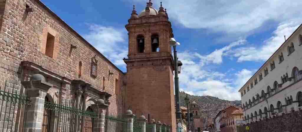
Paracas 3-Day Discovery Tour
- ✓ Comprehensive Paracas experience
- ✓ Expert local guides included
- ✓ All accommodation included
- ✓ Transportation provided
5 days
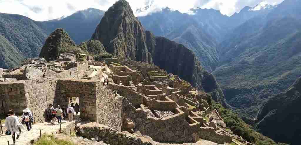
Paracas 5-Day Highlights Experience
- ✓ Comprehensive Paracas experience
- ✓ Expert local guides included
- ✓ All accommodation included
- ✓ Transportation provided
7 days
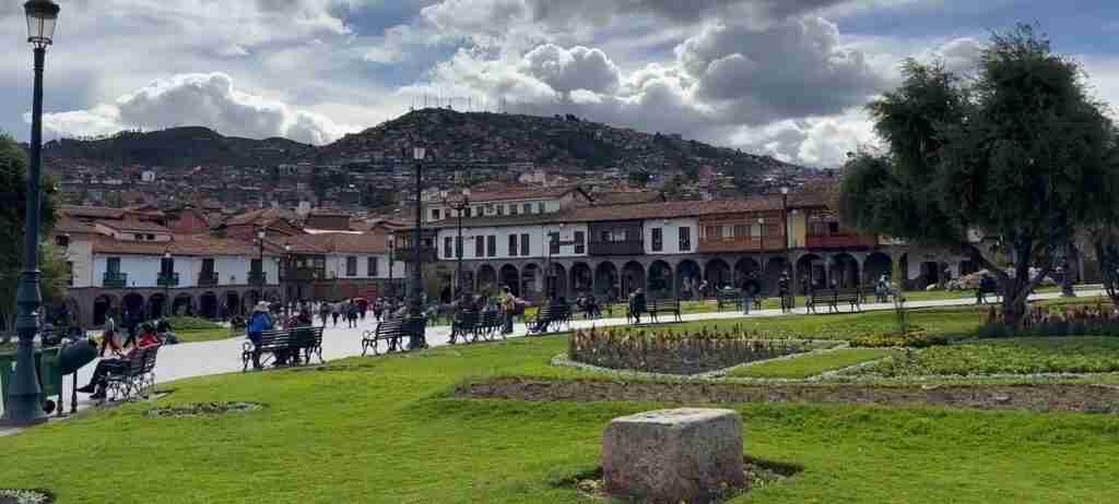
Paracas 7-Day Cultural Journey
- ✓ Comprehensive Paracas experience
- ✓ Expert local guides included
- ✓ All accommodation included
- ✓ Transportation provided

10 days
Paracas 10-Day Complete Adventure
- ✓ Comprehensive Paracas experience
- ✓ Expert local guides included
- ✓ All accommodation included
- ✓ Transportation provided
Multi-day tour packages powered by TourRadar. Prices and availability subject to change.
Introduction: Understanding Peru’s Premier Marine Reserve
Located 250 kilometers south of Lima along Peru’s central coast, Paracas National Reserve occupies the Paracas Peninsula and surrounding coastal waters where the Atacama Desert reaches its northernmost extent. The reserve’s creation in 1975 marked Peru’s first effort to protect marine ecosystems through formal conservation designation, establishing a model that influenced subsequent coastal reserve development throughout South America.
The reserve’s 335,000-hectare extent divides roughly into 217,000 hectares of Pacific Ocean waters and 118,000 hectares of land including beaches, cliffs, salt flats, and desert plains. This predominantly marine focus reflects the area’s ecological significance as a breeding ground, nursery habitat, and feeding zone for species dependent on the Humboldt Current—the cold, nutrient-rich ocean current flowing northward from Antarctica along South America’s Pacific coast.
Paracas sits at a critical juncture where oceanographic, geological, and climatic forces intersect to create exceptional biodiversity within an environment that appears, at first glance, utterly barren. The coastal desert receives minimal rainfall—stations record annual precipitation below 2 millimeters in some locations—yet the adjacent ocean teems with life sustained by upwelling that brings nutrient-laden deep water to sun-lit surface zones where photosynthesis occurs. This juxtaposition of biological abundance and terrestrial aridity defines Paracas’s essential character.
The reserve’s international recognition extends beyond national park status. Ramsar Convention designation acknowledges its wetlands’ importance for migratory waterbirds, while inclusion in the Western Hemisphere Shorebird Reserve Network reflects its role in hemispheric-scale bird migration patterns. The area appears on UNESCO’s tentative list as part of Peru’s broader proposal to protect guano islands and coastal reserves, though formal World Heritage inscription remains pending.
Human occupation of this harsh environment dates back at least three millennia. The Paracas culture developed sophisticated technologies for harvesting marine resources, created textiles of unparalleled intricacy, and left behind monuments like the Candelabra geoglyph whose purpose remains enigmatic. Later Nazca culture influence appears in some archaeological sites, demonstrating continuity of human adaptation to these marginal lands where desert and sea provide contrasting resource bases.
Modern visitors encounter a landscape of extraordinary visual drama. Red sandstone cliffs weathered into fantastical shapes plunge into turquoise waters where sea lions bark from rocky perches and seabirds wheel overhead in massive flocks. Beaches range from white sand crescents to crimson shores where iron-rich sediments stain the strand. Salt flats glitter under intense sun while morning fog from the cold ocean occasionally transforms the desert into an otherworldly realm of muted colors and limited visibility.
The reserve’s accessibility—approximately four hours by road from Lima—and diversity of ecosystems, wildlife, and archaeological features make it one of Peru’s most visited protected areas. Yet its scale and the distribution of attractions across a large geographic area mean that even during peak visitation periods, many locations within the reserve offer solitude and intimate encounters with wildlife undisturbed by human presence.
The Humboldt Current Ecosystem: Foundation of Marine Abundance
The Humboldt Current defines Paracas National Reserve’s ecological character more than any other single factor. This massive ocean current flows northward along South America’s Pacific coast, carrying cold Antarctic waters toward the equator and creating one of the world’s most biologically productive marine environments through a process called upwelling.
Upwelling occurs when prevailing southeasterly winds push surface waters offshore, allowing cold, nutrient-rich water from ocean depths to rise and replace them. These deep waters contain high concentrations of nitrates, phosphates, and other nutrients accumulated from decomposing organic matter sinking from surface zones. When this nutrient-rich water reaches the sunlit photic zone where photosynthesis occurs, it fuels explosive growth of phytoplankton—microscopic marine plants that form the base of ocean food webs.
Phytoplankton concentrations in Paracas waters can exceed levels found in most ocean regions by factors of ten or more during peak upwelling periods. This phytoplankton supports vast populations of zooplankton (tiny animals including larval fish, krill, and other crustaceans), which in turn sustain enormous schools of anchovies, sardines, and other small fish. These forage fish attract predators including larger fish, marine mammals, and seabirds, creating the complex food web that makes Paracas waters so rich with visible wildlife.
The cold Humboldt Current maintains water temperatures substantially below what latitude alone would predict. Surface waters average 14-19°C throughout the year—significantly colder than tropical waters at similar latitudes elsewhere in the world. This temperature regime selects for cold-adapted species including Humboldt penguins, whose presence at these latitudes surprises many visitors expecting penguins only in polar regions.
Seasonal variations in upwelling intensity create predictable patterns in marine life abundance. Strongest upwelling occurs during austral winter (May through September) when southeasterly winds blow most consistently. During these months, nutrient concentrations peak, phytoplankton blooms intensify, and fish schools aggregate in dense formations that attract predators. Seabird breeding cycles align with these periods of maximum food availability, ensuring that chicks hatch when parents can most easily obtain sufficient fish for feeding.
El Niño events periodically disrupt this pattern. During El Niño years, warm tropical water pushes southward along the coast, suppressing upwelling and dramatically reducing nutrient availability. Phytoplankton populations crash, fish stocks decline or migrate to areas with better feeding conditions, and seabird breeding often fails completely. Marine mammal populations may experience elevated mortality or abandon traditional haul-out sites in search of better fishing grounds. The reserve’s managers have documented these El Niño impacts through decades of monitoring, providing valuable data on how marine ecosystems respond to oceanographic disruptions.
The Humboldt Current’s influence extends beyond marine waters to shape coastal terrestrial environments. The cold ocean water cools air masses passing over it, reducing their moisture-carrying capacity and creating the extreme aridity that characterizes the coastal desert. However, this same cool, moist air forms fog banks that roll inland during mornings, providing the only significant moisture many coastal desert organisms receive. Some plant species in the reserve depend entirely on fog moisture for survival, having evolved specialized structures to capture water droplets from passing fog.
This interconnection between ocean currents, atmospheric conditions, and terrestrial ecosystems illustrates the holistic nature of Paracas National Reserve’s conservation mandate. Protecting marine waters proves insufficient if terrestrial habitats degraded; conversely, intact coastal desert ecosystems provide essential nesting habitat for seabirds and haul-out sites for marine mammals whose feeding occurs entirely at sea.
Marine Mammals of Paracas: Seals, Sea Lions, and Cetaceans
South American sea lions dominate the reserve’s marine mammal fauna, with several thousand individuals utilizing rocky shorelines and offshore islands for breeding, resting, and social activities. Males reach weights exceeding 300 kilograms and lengths approaching 2.5 meters, dwarfing females that typically weigh 140-150 kilograms. The size dimorphism reflects the species’ polygynous mating system where dominant males defend territories containing harems of multiple females during breeding season.
Sea lion colonies concentrate at sites offering both suitable haul-out platforms (rocky shores or beaches with easy water access) and proximity to productive fishing grounds. The largest colonies within the reserve contain several hundred individuals during peak seasons. Rookeries become particularly active during austral summer (December through February) when females give birth and mating occurs. Pups are born with dark fur that molts to a lighter brown after several months. Mothers alternate between nursing pups on shore and foraging trips lasting 12-24 hours where they hunt fish, squid, and octopus in waters up to 200 meters deep.
Male sea lions engage in elaborate territorial displays and physical combat during breeding season. Dominant males patrol their territories, bellowing resonant calls that carry across the colony and engaging in aggressive encounters with challenging males. These confrontations sometimes result in serious injuries, though fights typically end when one combatant retreats rather than escalating to life-threatening violence. Outside breeding season, male territoriality relaxes and mixed groups of males and females haul out together at favored resting sites.
South American fur seals, smaller relatives of sea lions, also occur in the reserve though in much lower numbers. Fur seals grow to approximately 1.5 meters length with males weighing 120-200 kilograms. Their dense underfur (giving rise to the name “fur seal”) historically made them targets for commercial hunting that nearly eliminated the species from much of its range during the 19th century. Protected status has allowed gradual population recovery, and Paracas represents an important refuge where fur seals breed and rest without human disturbance.
Cetaceans frequent Paracas waters year-round, with bottlenose dolphins being the most commonly observed species. Groups of 10-30 bottlenose dolphins often hunt cooperatively, herding fish schools into tight balls before individuals take turns feeding. These dolphins sometimes interact with sea lion groups, following them to productive fishing areas or even engaging in apparently playful swimming alongside sea lions.
Dusky dolphins, smaller cetaceans growing to approximately 2 meters length, travel in large schools sometimes numbering hundreds of individuals. These highly acrobatic dolphins frequently leap clear of the water in spectacular displays that may serve social functions or assist with navigation and communication. Dusky dolphins prefer waters over the continental shelf edge where upwelling concentrates their prey of anchovies and other small fish.
Southern right whales occasionally appear in Paracas waters during their northern migration from Antarctic feeding grounds to calving areas in warmer waters further north. These massive whales—adults reach 15 meters length and weigh 50 tons—move slowly through coastal waters where mothers and calves swim close together. Right whale sightings remain uncommon but create remarkable wildlife viewing opportunities when they occur.
The reserve’s marine mammal populations face ongoing conservation challenges including entanglement in fishing gear, disturbance from boat traffic, and climate variability affecting prey availability. Reserve management includes regulations limiting boat approach distances to marine mammals, establishing no-entry zones around critical breeding sites, and coordinating with commercial fisheries to reduce bycatch. Long-term population monitoring provides data tracking how marine mammal numbers respond to management actions and environmental changes.
Birdlife and Seabird Colonies: Avian Diversity at the Desert-Ocean Interface
Paracas National Reserve supports 216 recorded bird species divided roughly between marine species dependent on ocean resources and terrestrial species adapted to coastal desert conditions. This diversity results from the reserve’s position at the interface between highly productive marine waters and arid terrestrial environments, creating habitat niches for specialized species from both realms.
Seabird colonies constitute the most visually spectacular component of the reserve’s avifauna. Three guano-producing species—Peruvian booby, Guanay cormorant, and Peruvian pelican—nest in massive colonies that historically numbered millions of individuals before 20th century population declines. These species evolved adaptations for exploiting the dense fish schools supported by Humboldt Current upwelling. Peruvian boobies plunge-dive from heights of 10-15 meters, streamlined bodies hitting the water at high speed to capture anchovies swimming near the surface. Guanay cormorants pursue fish underwater, swimming with powerful webbed feet to depths of 20-30 meters where they capture prey with sharp hooked bills. Peruvian pelicans scoop fish from surface waters using their enormous pouches, often fishing cooperatively in groups that encircle and concentrate fish schools.
The accumulation of these seabirds’ droppings (guano) on nesting islands created massive deposits that supported Peru’s guano export industry during the 19th and early 20th centuries. Guano mining removed centuries of accumulated bird excrement valued as agricultural fertilizer for its high nitrogen and phosphorus content. While unsustainable harvesting depleted historical guano deposits and disrupted seabird populations, managed guano collection continues on some islands within the reserve using rotational harvesting systems that minimize impacts on nesting birds.
Humboldt penguins nest on rocky islands and isolated coastal cliffs where they excavate burrows in accumulated guano deposits or occupy natural rock crevices. As the only penguin species breeding on Peru’s coast, Humboldt penguins represent a unique adaptation to cold-current upwelling environments at relatively low latitudes. Adults stand approximately 65 centimeters tall with distinctive black-and-white plumage featuring a black horseshoe-shaped band across the breast. Breeding occurs opportunistically when food availability permits, typically aligned with periods of peak fish abundance. Parents share incubation duties and take turns foraging at sea while the partner guards eggs or chicks. Fledging occurs at 10-12 weeks after hatching when young penguins leave nests and begin learning to hunt independently.
Chilean flamingos gather in shallow coastal lagoons and salt flats where they filter-feed on brine shrimp, algae, and other small organisms. These tall, pink-plumaged birds wade through shallow water with heads submerged upside-down, using specially adapted bills with fine filtering structures to strain food particles from sediment-laden water. Flamingo flocks sometimes number hundreds of individuals during favorable conditions when food concentrations support large aggregations. The pink coloration comes from carotenoid pigments in their diet—birds feeding on shrimp and algae rich in these compounds develop more intensely colored plumage.
Inca terns, elegantly plumaged seabirds with slate-gray bodies, white facial plumes, and coral-red bills and feet, nest in rock crevices throughout the reserve. These specialized predators often associate with marine mammal groups, following dolphins and sea lions to productive fishing areas where their prey of small fish concentrate. Inca terns exhibit remarkable flying ability, maneuvering with precision to pluck fish from the water’s surface or steal catches from other seabirds.
The reserve serves as a critical stopover site for migratory shorebirds traveling the Pacific flyway between Arctic breeding grounds and southern South American wintering areas. Over sixty shorebird species have been recorded, with peak numbers occurring during spring and autumn migration periods. Sanderlings, semipalmated plovers, western sandpipers, and ruddy turnstones arrive exhausted after long overwater flights, spending days or weeks resting and feeding on the reserve’s beaches and tidal flats before continuing their journeys. These migratory species depend on a network of protected stopover sites extending from Alaska to Tierra del Fuego—degradation or loss of critical sites anywhere along this network threatens populations throughout their hemispheric range.
Terrestrial bird species adapted to desert conditions include Peruvian thick-knee, coastal miner, and cactus canastero. These species exhibit adaptations for extreme aridity including physiological mechanisms for conserving water, behavioral patterns avoiding midday heat, and dietary flexibility allowing them to exploit sparse food resources. Many desert birds breed opportunistically following rare rainfall events when temporary plant growth and insect emergence provide concentrated food for raising young.
The reserve’s birdlife faces threats from climate variability affecting food availability, human disturbance at nesting sites, and introduced predators including rats and cats. Management responses include establishing seasonal access restrictions to sensitive nesting areas, conducting predator control programs on critical islands, and maintaining long-term monitoring to detect population trends requiring conservation intervention.
Coastal Desert Geology: Formation and Landscape Evolution
The landscape visible at Paracas National Reserve today results from geological processes operating over tens of millions of years, shaped by tectonic forces, erosion, and climate extremes that have alternately submerged and uplifted this coastal region. Understanding this geological history reveals how the reserve’s distinctive landforms—red beaches, sculpted cliffs, natural arches, and salt flats—came into existence.
Approximately 20-30 million years ago during the Oligocene and Miocene epochs, much of what is now coastal Peru lay beneath shallow ocean waters. Marine sediments accumulated in layers as calcium carbonate shells, sand particles, and organic material settled to the seafloor. These sedimentary deposits, compressed and lithified over millions of years, form the sandstone and limestone formations visible throughout the reserve today. The red and ochre colors characteristic of many cliff faces result from iron oxide minerals within these sediments that oxidized as layers were exposed to air following later uplift.
The Nazca tectonic plate subducts beneath the South American plate along Peru’s coast, creating the Peru-Chile Trench and generating the tectonic forces that continue uplifting the Andes mountains and coastal regions. This ongoing convergence has gradually elevated former seafloor sediments above sea level, creating the coastal platforms and terraces visible at Paracas. Multiple uplift episodes separated by millions of years created the stepped terrace formations where each level represents a former shoreline that rose above the ocean as tectonic forces drove continued elevation gain.
Once exposed above sea level, these marine sediments became subject to erosional forces that have sculpted them into the dramatic landforms characterizing Paracas today. Wind erosion dominates in this hyperarid environment where rainfall seldom occurs and water erosion plays minimal roles. Persistent southeasterly winds carrying sand and salt particles abrade exposed rock surfaces, gradually wearing away softer layers while more resistant formations remain as isolated pillars, arches, and cliff faces. The rate of wind erosion depends on rock hardness—softer sandstone layers erode rapidly while harder limestone or cemented layers resist longer, creating differential weathering that produces complex sculptural forms.
Wave action along the coastline provides another powerful erosive force. Pacific swells generated by storms thousands of kilometers distant pound against cliffs continuously, exploiting weaknesses in rock formations to excavate caves, arches, and isolated sea stacks. The former La Catedral rock formation—a natural arch resembling a cathedral nave—demonstrated this process of progressive wave erosion until structural weakening led to collapse during the 2007 earthquake. The remaining fractured cliff face shows the internal structure of layered sedimentary rocks that composed this once-iconic formation.
Salt weathering accelerates rock breakdown in coastal zones. Seawater spray deposits salt on rock surfaces where it crystallizes in pores and cracks. When temperature changes cause salt crystals to expand, they exert tremendous pressure that fractures rock from within. Over thousands of cycles of salt deposition, crystallization, and expansion, this salt weathering gradually disintegrates solid rock into loose sediment that wind removes, accelerating the erosion of coastal cliffs.
The reserve’s beaches display remarkable color variations reflecting their source materials. White sand beaches derive from pulverized marine shells—predominantly mollusk shells ground to fine particles by wave action and containing calcium carbonate that gives them pale coloration. Red beaches obtain their distinctive crimson hue from iron oxide-rich volcanic rocks and sediments eroded from cliffs and transported alongshore by currents. The intensity of red coloration varies with iron oxide concentration—beaches receiving sediment from particularly iron-rich source rocks display blood-red sands while those with mixed sediment sources show more subdued reddish-brown tones.
Salt flats form in low-lying areas where seawater occasionally floods during extreme high tides or storms, then evaporates under intense sun leaving dissolved salts crystallized on the surface. Over repeated flooding cycles, salt accumulates in thick deposits creating stark white expanses devoid of vegetation. These salt flats expand and contract seasonally—winter fog provides slight moisture that partially dissolves surface salts, while summer heat drives complete evaporation and maximum salt crystallization. Mineral variations within the salt deposits create subtle color changes from white to gray to pinkish tones depending on specific mineral compositions and impurities present.
Geologists recognize Paracas as an accessible field laboratory for studying arid-region coastal processes, sedimentary rock formations, and the interplay between tectonic uplift and erosion. Research conducted within the reserve contributes to broader understanding of how similar arid coastlines worldwide evolve over geological timescales and respond to changing environmental conditions including sea level fluctuations driven by climate change.
Archaeological Heritage: The Paracas Culture and Pre-Columbian Coastal Adaptation
Human occupation of the Paracas region extends back at least three millennia, with the Paracas culture representing the most significant pre-Columbian civilization to inhabit this coastal desert zone. Archaeological research has documented sophisticated technologies, artistic achievements, and social organization that allowed the Paracas people to thrive in an environment that appears hostile to permanent settlement.
The Paracas culture emerged around 800 BC and persisted until approximately 200 AD, though scholars debate precise chronological boundaries and relationships to earlier and later cultures. Two main phases characterize Paracas cultural development: the Cavernas phase (approximately 800-200 BC) and the Necropolis phase (approximately 200 BC – 200 AD), distinguished primarily by burial practices and ceramic styles.
Cavernas-phase burials occurred in underground chambers excavated into rocky hillsides, with multiple individuals interred in shared tombs over extended periods. Ceramic vessels placed as burial offerings display distinctive incised decorations with designs filled with colored pigments after firing. Common motifs include feline figures, serpents, and geometric patterns that may have held cosmological or religious significance.
Necropolis-phase burials involved wrapping deceased individuals in multiple layers of elaborately woven textiles to create mummy bundles, then placing these bundles in large underground chambers containing dozens or even hundreds of burials. The textiles wrapping these mummies represent the supreme artistic achievement of Paracas culture. Weavers created intricate patterns using threads dyed with natural pigments derived from plants, minerals, and marine invertebrates. Color palettes included reds from cochineal insects, blues from indigo plants, yellows from tree bark extracts, and other hues achieved through sophisticated dye chemistry. Designs depicted stylized humans, animals (particularly felines, birds, and marine creatures), and complex geometric arrangements whose meanings remain subjects of scholarly debate.
The technical sophistication of Paracas textiles astonishes modern researchers. Weavers achieved thread counts and pattern complexities that rival or exceed contemporary textile production capabilities. Some mantles contain over 100 embroidered figures, each unique in detail and positioned according to overall design principles that create balanced, visually striking compositions. The labor investment in producing a single elaborate mantle may have required months or years of skilled work, suggesting these textiles held tremendous social, religious, or political significance rather than serving purely utilitarian functions.
Paracas economic life centered on marine resource exploitation. Archaeological excavations have recovered massive shell middens—refuse heaps composed primarily of mollusk shells accumulated over centuries of continuous harvesting. The species composition of these middens reveals dietary preferences and seasonal harvesting patterns. Limpets, mussels, clams, and other intertidal species contributed protein to Paracas diets. Fish bones indicate capture of nearshore species including drum fish, corvina, and anchovies. Sea mammal bones suggest occasional hunting of sea lions, though whether this occurred regularly or opportunistically remains unclear.
While marine resources provided the protein foundation of Paracas subsistence, agricultural products supplemented diets during certain periods and in specific locations. Small-scale agriculture occurred in valley oases where groundwater reached the surface, allowing cultivation of maize, beans, squash, and cotton. The limited extent of agricultural land forced Paracas people to rely primarily on marine harvesting, distinguishing them from contemporary cultures in more productive agricultural zones where farming dominated subsistence strategies.
The Paracas Candelabra geoglyph visible on the north face of the Paracas Peninsula represents the most enigmatic monument attributable to Paracas culture, though alternative theories propose later creation by Nazca culture groups. This ground drawing measures approximately 183 meters from top to bottom, created by excavating trenches roughly 1-2 meters deep and 2-4 meters wide into hardened soil and placing removed material alongside trenches to enhance contrast. The design resembles a three-branched candelabra or trident visible from distances of many kilometers when viewed from the ocean.
Numerous theories attempt to explain the Candelabra’s purpose and meaning. Maritime navigation aid hypotheses suggest the geoglyph served as a landmark visible to sailors approaching shore, though counterarguments note that natural landmarks would serve this function equally well with far less labor investment. Astronomical alignment theories propose the three branches point toward celestial phenomena such as solstice sunrise positions, though precise surveying has not confirmed significant astronomical correlations. Religious or cosmological hypotheses interpret the design as representing important deities, cosmic concepts, or ritual symbols, though without written records these interpretations remain speculative. The Candelabra’s true meaning may remain permanently unknowable unless future discoveries provide clearer context.
Paracas culture transitioned into or was succeeded by Nazca culture around 200 AD. The nature of this transition—whether gradual cultural evolution, migration and replacement, or conquest—remains debated. Nazca people continued many Paracas traditions including textile production (though with different stylistic emphases) while developing distinctive ceramic styles and, most famously, creating the elaborate geoglyphs visible in the Nazca desert further inland. The continuity of some cultural elements alongside changes in others suggests complex processes of cultural transmission rather than simple replacement.
Archaeological research within Paracas National Reserve continues revealing new information about pre-Columbian coastal adaptation. Excavations identify previously unknown settlement sites, burial grounds, and resource extraction locations. Analyses of preserved organic materials including textiles, basketry, and food remains provide insights into daily life, economic activities, and social organization. These ongoing investigations contribute to broader understanding of how human societies adapted to marginal environments and developed sophisticated cultural traditions under challenging environmental conditions.
Climate and Weather Patterns: Understanding Paracas’s Desert Environment
Paracas National Reserve experiences one of Earth’s most extreme arid climates despite its coastal location. The reserve’s weather patterns result from the interaction between the cold Humboldt Current, stable high-pressure atmospheric systems, and the rain-shadow effect of the Andes mountains, creating conditions where years may pass without measurable rainfall.
Annual precipitation averages less than 2 millimeters across most of the reserve, with some monitoring stations recording zero precipitation in multiple consecutive years. This extreme aridity rivals or exceeds the driest locations in the Atacama Desert further south, establishing Paracas as one of the driest permanently inhabited regions on Earth. The lack of rain results primarily from the cold Humboldt Current cooling air masses passing over the ocean, reducing their moisture-carrying capacity and causing water vapor to condense as fog over water or immediately inland rather than forming rain-producing clouds.
When rainfall does occur, it typically arrives during El Niño events when warmer ocean waters shift weather patterns and occasionally allow tropical moisture to penetrate southward along the coast. These rare rains can produce dramatic impacts in an ecosystem where organisms have adapted to permanent aridity. Desert wildflower seeds that have lain dormant for years germinate en masse, creating temporary blooms of color across otherwise barren landscapes. Ephemeral streams may flow briefly from hills toward the ocean, carving erosion channels that persist long after water disappears. While these rain events bring temporary abundance, they also cause disruptions as flash floods, unusual humidity, and rapidly changing conditions stress organisms adapted to stable aridity.
Temperature patterns at Paracas reflect the moderating influence of the cold ocean current. Coastal temperatures remain remarkably stable throughout the year, with average daily maximums ranging from 19-22°C in winter (June-August) to 24-28°C in summer (December-February). Overnight minimums fall to 13-15°C in winter and 18-20°C in summer. This limited temperature range—rarely exceeding 30°C or dropping below 10°C—contrasts sharply with interior desert regions where daily temperature swings of 20-30°C occur regularly. The maritime influence creates a relatively benign thermal environment despite the region’s desert classification.
Humidity follows an inverse relationship with temperature. Coastal fog forms frequently during winter months when cold ocean water and slightly warmer air temperatures create condensation. These fog banks roll inland during morning hours, reducing visibility to tens of meters and depositing moisture on exposed surfaces through direct condensation. Some organisms in the fog zone have evolved specialized adaptations for capturing and utilizing this fog moisture—the primary or only source of water they receive. Summer months bring clearer conditions with less fog but lower relative humidity as warmer temperatures increase the atmosphere’s capacity to hold water vapor.
Wind dominates Paracas’s weather experience more than temperature or precipitation. Southeasterly winds blow almost constantly, with velocities averaging 15-25 kilometers per hour but frequently exceeding 40-50 kilometers per hour during afternoon and evening hours. These persistent winds arise from pressure gradients between the South Pacific high-pressure system and lower pressures over the warmed South American landmass. Wind velocities peak during late afternoon and early evening when land-sea temperature contrasts maximize, then diminish somewhat overnight when temperature differentials decrease.
The wind’s effects permeate every aspect of the Paracas environment. Windborne sand abrades exposed surfaces, sculpts rock formations, and accumulates in dunes that migrate slowly across the landscape. Salt crystals blown from breaking waves coat everything in the coastal zone with white deposits that enhance weathering effects. Even vegetation that does establish in more sheltered microhabitats grows in wind-pruned forms, branches shaped by constant pressure into asymmetrical configurations bent away from prevailing wind directions.
For human visitors, wind represents the most challenging aspect of Paracas’s climate. The relentless breeze quickly causes dehydration even when temperatures feel moderate. Sand and salt particles borne on the wind irritate eyes and skin, necessitating protective eyewear and windproof clothing. Photography becomes difficult as wind-driven dust reduces visibility and camera equipment requires protection from abrasive particles. The wind’s constant presence creates a sense of exposure and vulnerability in this open landscape lacking wind-breaks or sheltered zones.
Seasonal patterns influence visitor experience and wildlife activity. Austral winter (May-September) brings cooler temperatures, increased fog, and strongest upwelling that concentrates marine life and attracts seabirds to breeding colonies. Summer (December-March) offers warmer conditions, clearer skies, and calmer seas ideal for boat trips to view marine mammals, though seabird colonies are less active outside breeding season. Spring and autumn represent transitional periods with moderate conditions and, during migration seasons, exceptional shorebird diversity as thousands of individuals stop to rest and feed during hemispheric migrations.
Climate change impacts on Paracas remain a subject of ongoing research and concern. Ocean warming scenarios could alter upwelling patterns that sustain the region’s extraordinary marine productivity. Changes in El Niño frequency or intensity would affect the rare rainfall events that some terrestrial organisms depend upon. Sea level rise threatens coastal habitats and archaeological sites. Monitoring programs track environmental parameters and wildlife populations to detect changes that may require adaptive management responses to maintain the reserve’s conservation values under changing conditions.
Flora and Fauna of the Coastal Desert: Life in Extreme Aridity
The terrestrial portion of Paracas National Reserve appears largely barren at first glance—vast expanses of sand, gravel, and exposed rock devoid of obvious plant life. Yet closer examination reveals scattered organisms that have evolved remarkable adaptations for surviving in one of Earth’s harshest environments where water availability limits biological activity more than any other factor.
Tillandsia species, commonly called air plants, represent the most visible and ecologically significant desert vegetation. These bromeliads grow without soil, instead anchoring to rock surfaces or accumulating in sandy depressions where they harvest moisture directly from fog. Tillandsia purpurea and Tillandsia latifolia occur throughout the reserve’s fog zones—areas where morning fog provides sufficient moisture to support their minimal water requirements. These plants lack functional roots for water absorption, instead absorbing moisture through specialized leaf scales (trichomes) that capture water droplets from passing fog. During dry periods, Tillandsia plants enter dormancy with metabolic processes slowed to minimal levels, then resume growth when fog returns.
The accumulation of senescent Tillandsia leaves creates small mounds of organic matter called “lomas”—isolated patches of slightly enhanced soil where other organisms may establish. Small invertebrates including beetles, spiders, and mites colonize these lomas, feeding on decaying plant material and each other. Desert birds occasionally visit lomas to hunt invertebrates. The lomas system demonstrates how pioneer species like Tillandsia can facilitate establishment of more complex ecological communities by creating localized resource concentrations in otherwise resource-poor environments.
Cryptogamic crusts—thin layers of cyanobacteria, algae, lichens, and mosses growing on soil surfaces—play important ecological roles despite their inconspicuous appearance. These crusts stabilize soil against wind erosion, capture and retain moisture, and fix atmospheric nitrogen into forms available to other organisms. While widespread in desert regions worldwide, cryptogamic crusts in Paracas face particular challenges from extreme aridity and strong winds that periodically strip away established crusts. Their presence marks microsites where moisture availability slightly exceeds surrounding areas, often associated with rock outcrops that cause fog condensation or topographic features that capture wind-blown moisture.
Few vertebrate species permanently inhabit the terrestrial desert portions of the reserve due to extreme resource limitations. Peruvian thick-knee, a crepuscular bird species, nests in open sandy areas where its cryptic plumage provides camouflage against predators. These long-legged plovers feed primarily on insects, scorpions, and small invertebrates detected visually while walking slowly across open ground. Thick-knees avoid midday heat through behavioral thermoregulation—remaining inactive in whatever shade they can find during hottest hours, then resuming activity during cooler evenings and mornings.
Coastal miner, a small terrestrial bird, excavates burrow nests in sandy slopes where it feeds on insects and seeds. Miners travel substantial distances from nesting burrows to forage, exploiting scattered resource patches across the desert landscape. Their ability to survive on minimal water intake—obtaining moisture primarily from prey items—allows occupation of zones lacking any surface water or dependable fog moisture.
Invertebrate diversity exceeds vertebrate diversity by large margins, though many desert invertebrates remain poorly studied. Darkling beetles, particularly species in the genus Physalterna, scavenge on detritus and demonstrate remarkable physiological adaptations for water conservation. These beetles obtain moisture from occasional fog and from prey items, concentrating their urine to minimize water loss. Their dark coloration may aid in absorbing fog moisture through condensation on cool exoskeletons during morning hours. Scorpions hunt nocturnal insects and possess some of the most efficient water conservation mechanisms in the animal kingdom, losing minimal moisture through specially adapted respiratory structures and concentrated excretory products.
Desert spiders construct webs in sheltered locations between rocks where wind velocities decrease enough for web maintenance. These predators capture flying insects blown from more vegetated areas elsewhere or emerging from larval stages in the reserve. Spider survival depends on opportunistic feeding—consuming large prey items when available, then enduring extended periods without food by reducing metabolic rates to minimal levels.
The terrestrial ecosystem’s low productivity means that most energy and nutrients ultimately derive from marine sources. Seabird guano deposited on nesting islands and coastal haul-outs leaches into surrounding soils and washes into tidal zones, providing nutrients that support enhanced terrestrial plant growth near colonies. Dead marine organisms washed ashore decompose and release nutrients into coastal soils. Even the invertebrate communities in dunes and desert flats depend partially on detritus and nutrients originating from the ocean. This marine subsidy prevents the terrestrial ecosystem from collapsing entirely under extreme aridity that would otherwise preclude almost all biological activity.
Introduced species threaten native desert organisms in some areas. Feral cats and rats from nearby human settlements prey on ground-nesting birds and consume invertebrates, reducing native species populations. These invasive predators require management intervention to prevent permanent impacts on vulnerable desert fauna. Introduced plants occasionally establish in disturbed areas, though extreme aridity limits their spread compared to invasive plant problems in less arid protected areas.
Photography at Paracas: Capturing Desert-Ocean Landscapes
Paracas National Reserve offers extraordinary photography opportunities spanning multiple genres from wildlife and seascape imagery to landscape photography and astrophotography. The reserve’s unique environmental conditions, dramatic geology, and abundant wildlife create visual possibilities that attract serious photographers from around the world while also rewarding casual photographers seeking memorable images.
Landscape photography at Paracas centers on capturing the stark beauty of desert-meets-ocean interfaces. The crimson beaches of Playa Roja present compositional opportunities contrasting blood-red sand against turquoise water and ochre cliffs. Optimal lighting occurs during early morning when oblique sunlight enhances color saturation and creates long shadows that emphasize textural details in sand and rock formations. Late afternoon also offers excellent light, though afternoon wind typically increases, creating blowing sand that can obscure distant features and coat equipment with abrasive particles.
The cliff formations throughout the reserve demand wide-angle lenses to capture their scale and drama. Sculptural rock features weathered into fantastical shapes benefit from careful viewpoint selection that emphasizes three-dimensional form. Including human figures for scale helps convey the massive dimensions of cliff faces and natural arches. Graduated neutral density filters assist in balancing exposure between bright sky and darker land features, particularly important when shooting into the sun during golden hour periods.
Salt flat photography requires attention to horizon line placement and inclusion of foreground interest. The geometric patterns created by salt crystallization provide compelling textures when shot from low angles that emphasize their three-dimensional relief. Midday lighting actually works well for salt flats since overhead sun illuminates texture details while minimizing distant atmospheric haze. Including reflections when thin water films cover salt surfaces doubles the visual interest and creates surreal effects where sky and land merge indistinguishably.
Wildlife photography at Paracas divides into marine mammal photography, seabird photography, and shorebird photography, each requiring different equipment and techniques. South American sea lion colonies permit close approach at designated viewing areas, allowing portraits and behavior documentation with moderate telephoto lenses in the 200-400mm range. Colony activity peaks during early morning when sea lions return from nocturnal fishing trips and during late afternoon when temperatures moderate and social interactions intensify. Fast shutter speeds freeze action during male territorial disputes and pup nursing sequences. Including environmental context by shooting wider to show colony settings against cliffs and ocean provides documentary value alongside tighter portraits.
Seabird photography requires longer focal length lenses (400mm minimum, 500-600mm preferable) to fill the frame with individual birds from the approach distances that regulations mandate. Flight photography challenges photographers to track rapidly moving targets against bright sky backgrounds—proper exposure requires careful attention to avoid blowing out highlights while maintaining adequate shutter speed (minimum 1/1600 second, preferably 1/2000 second or faster) to freeze wing motion. Shooting against water rather than sky backgrounds often improves results by reducing contrast range and allowing more detail in dark plumage.
Plunge-diving behavior by boobies creates dramatic action opportunities but requires anticipation and rapid reaction. Pre-focusing on locations where birds are actively working and using high-speed continuous shooting mode increases success rates. The moment of water entry when spray explodes around the bird’s body offers the most dynamic imagery, though capturing this split-second requires both skill and luck even with modern high-speed cameras.
Shorebird photography benefits from low shooting positions that place the camera at the birds’ eye level rather than shooting downward from standing height. This perspective creates more intimate portraits and cleaner backgrounds where distant birds or water occupy the out-of-focus areas behind subjects. High tide periods concentrate shorebirds into smaller areas where tidal zones compress, increasing bird density and photographic opportunities. Overcast conditions often improve shorebird photography by eliminating harsh shadows and reducing contrast in white and dark plumage patches.
Seascape photography captures the meeting point of desert and ocean through various approaches. Long-exposure techniques using neutral density filters smooth wave motion into ethereal mist while keeping rock formations sharply rendered, creating dreamy effects contrasting solid land against fluid water. Alternatively, fast shutter speeds freeze breaking waves mid-action, capturing suspended droplets and explosive spray. The choice between these approaches depends on creative intent and the specific conditions at hand.
Astrophotography at Paracas benefits from minimal light pollution, dry air, and stable atmospheric conditions that create exceptional transparency. The Milky Way arcs dramatically across the sky during austral winter months, providing opportunities for nightscapes combining celestial features with terrestrial landscapes. Rock formations and arches make strong foreground elements anchoring compositions. Light-painting techniques using flashlights or portable strobes illuminate foreground features during long exposures that capture stars as points rather than trails. Balancing foreground illumination with the naturally low light levels from stars requires experimentation and often multiple exposures blended in post-processing.
Practical considerations for photography at Paracas include wind protection for equipment—sand and salt particles abrade lens surfaces and infiltrate camera bodies through even small gaps. Keeping lens filters in place when not actively shooting protects expensive front elements from wind-borne abrasives. Regular cleaning removes salt deposits before they can corrode metal components. Backup batteries are essential since cold morning air and strong wind drain battery power faster than normal conditions. Memory card capacity must accommodate high-frame-rate shooting during wildlife action sequences.
Drone photography opens new perspectives on Paracas’s landscapes and wildlife aggregations, though regulations restrict drone operations in many areas of the reserve to minimize disturbance to nesting birds and marine mammals. Where permitted, aerial perspectives reveal patterns invisible from ground level—the sinuous curves of coastlines, the geometric arrangements of salt crystallization, and the full scale of geological formations. Responsible drone operation maintains significant distances from wildlife colonies and respects no-fly zones established to protect sensitive areas.
Conservation Challenges and Management Strategies
Paracas National Reserve faces ongoing conservation challenges that require active management responses to maintain the ecological integrity and natural values that justified its protected status. These challenges span issues of visitor impacts, climate change, invasive species, and balancing conservation with sustainable use by local communities.
Visitor management represents a primary challenge as tourism growth increases pressure on sensitive habitats and wildlife. Annual visitation exceeds several hundred thousand people, with numbers concentrated during summer holiday periods when Peruvian families vacation at coastal destinations. Heavy foot traffic erodes fragile soils, particularly in areas where cryptogamic crusts stabilize surfaces. Vehicle access to beaches and viewpoints creates disturbance corridors where wildlife avoids human presence. Litter accumulation affects both aesthetic values and wildlife that may ingest or become entangled in plastic debris.
Management responses include establishing designated viewing areas where visitor use concentrates, leaving other zones undisturbed for wildlife. Boardwalks and marked trails prevent uncontrolled foot traffic from spreading across sensitive areas. Seasonal access restrictions protect critical breeding colonies during vulnerable periods when disturbance could cause nest abandonment or reduced breeding success. Boat approach regulations specify minimum distances for wildlife viewing, preventing vessels from getting close enough to cause stampedes or colony evacuations that waste energy and may result in injury or death of young animals.
Education programs inform visitors about appropriate behavior minimizing impacts. Interpretive signs explain why certain areas remain closed and how individual actions affect wildlife. The Julio C. Tello Museum provides context about the reserve’s natural and cultural values, ideally visited before touring the reserve itself to enhance understanding and appreciation of what visitors will encounter. School group programs bring local students into the reserve with guided educational activities, building constituency for conservation among communities whose futures are tied to the reserve’s health.
Climate change presents longer-term challenges less amenable to direct management intervention. Ocean warming scenarios threaten to disrupt the upwelling patterns sustaining exceptional marine productivity that defines Paracas’s ecological significance. Changes in El Niño frequency or intensity would alter the episodic rainfall events that some terrestrial species depend upon. Sea level rise threatens low-lying habitats including beaches, salt flats, and archaeological sites. Monitoring programs track key environmental parameters including ocean temperature, upwelling intensity, seabird breeding success, and marine mammal population trends, providing early warning of changes that may require adaptive management responses.
Invasive species management focuses primarily on controlling introduced predators that threaten native wildlife. Feral cats prey on ground-nesting birds and compete with native predators. Rats consume seabird eggs and chicks while also competing with native small mammals. Eradication programs targeting these invasives on critical islands have successfully restored some nesting colonies to full productivity. Ongoing vigilance prevents re-establishment while controlling populations in mainland areas where complete eradication proves impossible.
Sustainable resource use by local communities requires balancing conservation objectives with livelihood needs of people whose ancestors have utilized marine resources for millennia. Artisanal fishing continues in some zones under regulations limiting catch methods, seasonal timing, and species that may be harvested. These regulations aim to prevent overfishing while allowing traditional uses to continue. Conflicts occasionally arise when fishers believe restrictions unnecessarily limit their activities or when enforcement proves insufficient to prevent illegal harvesting in no-take zones.
Guano harvesting continues on some islands using management protocols that minimize impacts on nesting seabirds. Rotational harvesting allows guano accumulation over multiple years before collection, ensuring birds have stable substrate for nesting during breeding seasons when harvesting does not occur. The economic value of guano provides incentives for maintaining healthy seabird populations, aligning conservation and economic interests. However, market fluctuations in guano prices occasionally create pressure for unsustainable harvesting rates that management must resist.
Archaeological site protection challenges reserve managers who must prevent looting and vandalism while allowing legitimate research and visitor appreciation of cultural resources. Illegal excavations seeking artifacts for black market sale have damaged numerous sites, destroying scientific context that makes archaeological materials valuable for understanding past cultures. Patrol programs deter looters through visible presence while criminal penalties provide legal deterrence. Fencing and active monitoring protect the most vulnerable sites. Public education emphasizes that archaeological resources belong to all Peruvians and that removing artifacts from their context destroys irreplaceable information about human history.
Reserve management operates under Peru’s National Service of Natural Protected Areas (SERNANP), which establishes policies, allocates funding, and coordinates with other government agencies on conservation issues. A management committee including representatives from local governments, user groups, NGOs, and academic institutions provides input on management decisions and helps resolve conflicts. Master planning occurs on five-year cycles, setting objectives and strategies that guide day-to-day operations while remaining flexible enough to address emerging issues.
Research programs provide the scientific foundation for management decisions. Long-term monitoring tracks wildlife populations, visitor use patterns, climate parameters, and other indicators of ecosystem health. Specific research projects investigate particular questions about species ecology, geological processes, or archaeological interpretation. Partnerships with universities and research institutions leverage external expertise while providing graduate students field sites for thesis research. Management-relevant research receives priority in project selection since protected area managers need scientific information addressing questions directly relevant to conservation decisions they face.
International collaboration extends conservation efforts beyond the reserve’s boundaries. Migratory species like shorebirds depend on habitat protection throughout their hemispheric ranges—Paracas’s participation in the Western Hemisphere Shorebird Reserve Network acknowledges this reality and commits the reserve to coordination with other sites along the flyway. Climate change research benefits from data-sharing with coastal reserves in Chile and beyond where similar oceanographic and climatic processes operate. Archaeological research increasingly takes comparative approaches examining how different coastal cultures adapted to similar environments, requiring information exchange among researchers working throughout Pacific South America.
Best Beaches and Coastal Features for Exploration
The reserve contains numerous beaches and coastal features, each offering distinct characteristics for swimming, wildlife observation, photography, or simply contemplating the stark beauty of desert coastlines. Understanding the qualities of different locations helps visitors prioritize destinations matching their particular interests.
Playa Roja ranks among the most photographically distinctive beaches worldwide due to its crimson-colored sand derived from iron oxide-rich volcanic rocks. The contrast between red sand, turquoise water, and ochre cliffs creates visual drama that shifts with changing light conditions throughout the day. The beach occupies a protected cove where wind velocities decrease relative to exposed coastlines, making it more comfortable for extended stays. Swimming is generally safe during calm conditions though cold water temperatures (typically 14-18°C) deter prolonged immersion for many visitors. The beach lacks facilities, requiring visitors to bring all necessities including drinking water and sun protection.
Playa La Mina features white sand contrasting with the red beaches elsewhere in the reserve. This beach offers good swimming conditions during calm weather with gentle wave action and sandy bottom free of rocks. Small sea lion colonies occasionally haul out on rocks at the beach’s ends, providing wildlife viewing opportunities from safe distances. La Mina’s accessibility makes it popular with families seeking beach recreation combined with light wildlife observation. The beach’s name (The Mine) references historical mining activities in nearby cliffs where minerals were extracted before reserve establishment.
Lagunillas represents the reserve’s most developed beach with basic facilities including restrooms and small vendors selling refreshments and snacks. The beach fronts a sheltered bay where fishing boats launch and sea kayaking beginners find protected waters for learning paddle techniques. A small fishing village adjacent to the beach provides authentic glimpses of coastal livelihoods dependent on marine resources. Swimming conditions are generally good, though boat traffic requires attention to avoid collision hazards. The beach serves as a lunch stop for many tour groups, creating midday crowds that diminish during morning and evening hours when the beach offers more tranquil experiences.
Supay Beach occupies a remote location requiring longer travel from the main entrance, resulting in lower visitation than more accessible beaches. The isolation appeals to visitors seeking solitude and more intimate nature experiences. Rocky substrates support tidepools where marine invertebrates including sea stars, crabs, and anemones inhabit zones exposed during low tides. The beach’s name derives from Quechua mythology where Supay represents death and the underworld—the beach’s isolation and stark beauty may have inspired this ominous association.
The Istmo de la Península (Peninsula Isthmus) forms the narrow land bridge connecting the Paracas Peninsula to the mainland. This strategic location offers viewpoints overlooking both sides of the isthmus where desert landscapes transition abruptly to marine environments. Strong winds consistently blow across the isthmus, creating conditions that windsurfers and kitesurfers find ideal for their sports. The isthmus experiences intense wave action from both sides during storms, with overwash occasionally cutting across the narrowest sections and depositing beach materials from one side to the other.
La Catedral, though partially collapsed during the 2007 earthquake, remains an impressive geological feature worth visiting for its scale and the fractured rock faces revealing internal sedimentary structures. The site demonstrates ongoing geological processes as wave action continues eroding the cliff base while weathering attacks exposed surfaces. The partial ruins of the once-intact arch create a dramatically different scene than historical photographs show, illustrating how coastal landscapes continually evolve under erosive forces.
Punta Arquillo extends as a narrow rocky peninsula into the ocean where wave action creates dramatic displays during stormy weather. The point provides excellent vantage for observing seabirds including boobies, cormorants, and pelicans that hunt in offshore waters where upwelling concentrates fish. Sea lions haul out on offshore rocks visible from the point. The exposed location means strong winds typically blow, requiring windproof clothing and secure footing on uneven rocky terrain.
Playa Mendieta curves in a long arc of golden sand fronted by gentle surf suitable for swimming during calm conditions. The beach’s length allows long walks where tracks in wet sand are the only signs of human presence beyond footprints soon erased by incoming tides. Shorebirds feed along the tide line, probing sand for invertebrates with sensitive bills. The open aspect means full sun exposure and steady wind—beach umbrellas and windbreaks provide little protection and often blow away despite attempts to anchor them.
The coastal cliffs between beaches offer dramatic viewpoints where visitors can observe geological formations, watch seabirds in flight at eye level, and contemplate the power of ocean waves carving into ancient rock. Many viewpoint locations lack barriers or safety railings—cautious approach to cliff edges is essential since wind gusts can affect balance and crumbling rock edges may collapse underfoot. Sunrise and sunset observations from cliff viewpoints provide exceptional lighting conditions for photography and quiet moments of natural beauty contemplation.
Tour Options and Visitor Logistics
Visiting Paracas National Reserve requires planning decisions about transportation, tour options, and timing to maximize experiences while respecting regulations protecting sensitive areas and wildlife. Multiple approaches suit different visitor preferences, budgets, and physical capabilities.
Independent exploration by rental vehicle offers maximum flexibility for visitors comfortable with self-navigation and willing to pay entrance fees and handle logistics personally. The main tourist circuit covering key beaches and viewpoints spans approximately 25-30 kilometers on maintained gravel roads accessible to standard passenger vehicles during dry weather. Four-wheel-drive vehicles provide advantages on rougher secondary roads leading to more remote locations. Rental bicycles present an economical alternative though the distances involved, strong winds, and lack of shade make cycling strenuous for many visitors—physical fitness and generous time allowances are essential for bicycle exploration.
Scooter and motorcycle rentals provide middle-ground options balancing independence, affordability, and practicality. Motorized two-wheelers handle winds better than bicycles while costing less than car rentals. However, they offer minimal protection from sun, wind, and blowing sand, and carry risks of accidents on gravel roads where loose surfaces reduce traction. Proper safety equipment including helmets and protective clothing is mandatory, and riders should possess appropriate motorcycle operating skills and licenses.
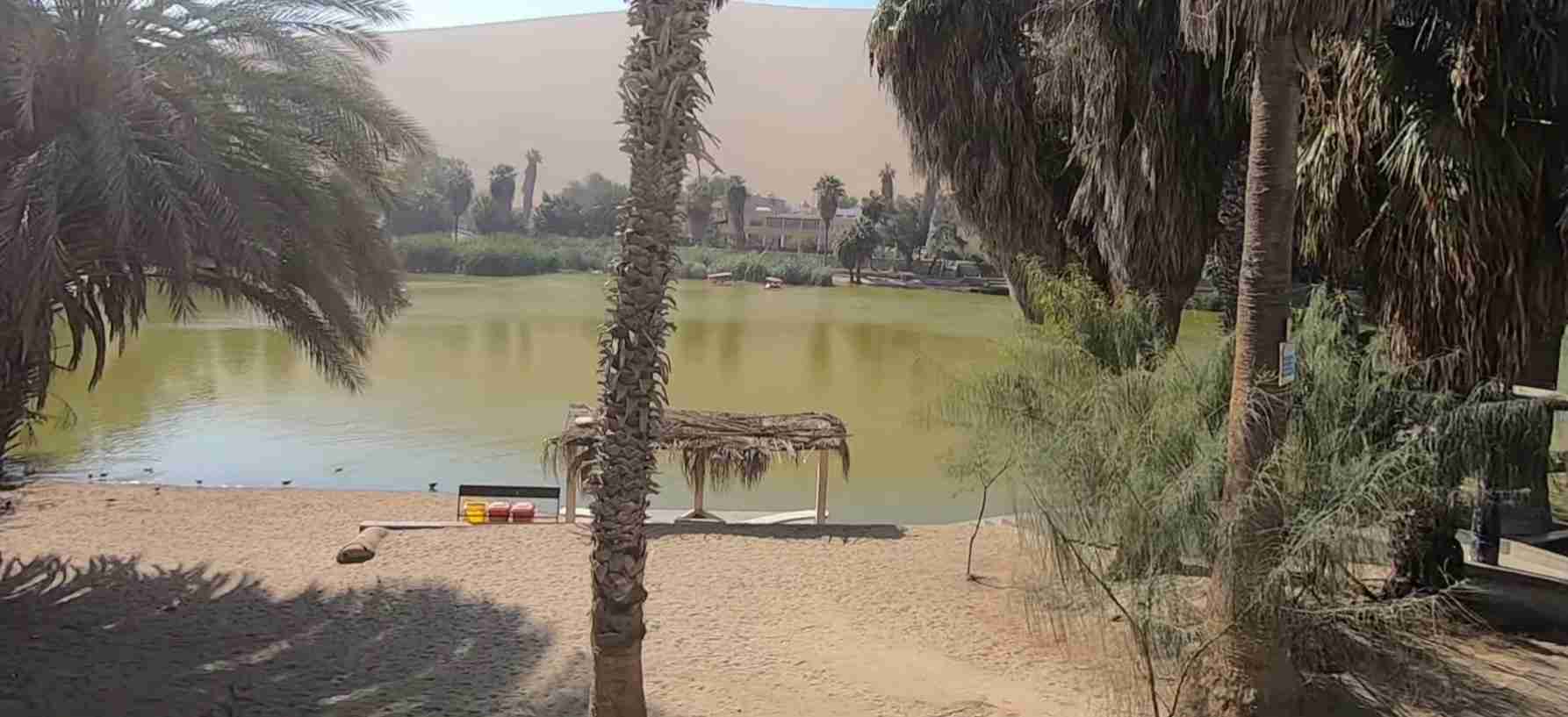
Organized tours eliminate navigation concerns and often include guide commentary explaining natural and cultural features encountered along routes. Half-day tours typically cover the main circuit including Playa Roja, La Catedral, and one or two additional beaches with viewpoint stops for photography. Full-day tours may combine the reserve circuit with boat trips to nearby Ballestas Islands where larger seabird colonies and more concentrated marine mammal viewing occur. Multi-day packages incorporate Paracas with other regional destinations including the Nazca Lines geoglyphs, Huacachina desert oasis, and pisco vineyard visits.
Tour quality varies significantly among operators—vehicle condition, guide knowledge, group sizes, and itinerary flexibility differ substantially. Smaller group tours generally provide more personalized experiences with opportunities for questions and itinerary adjustments based on wildlife sightings or participant interests. Large group tours cost less but involve more structured schedules with limited flexibility and potential crowding at popular stops when multiple tour groups arrive simultaneously.
Specialized tours focus on particular interests beyond general sightseeing. Birdwatching tours led by ornithologically knowledgeable guides target specific species and optimize timing for greatest bird diversity. Photography tours accommodate extended stops at photogenic locations with considerations for optimal lighting conditions. Adventure tours incorporate activities like kayaking in sheltered bays, stand-up paddleboarding along protected coastlines, or even paragliding from coastal cliffs (though paragliding requires special permits and weather conditions meeting safety criteria).
Entry to the reserve requires purchasing tickets at the entrance control point. The entrance fee remains very affordable at 11 soles (approximately $3 USD) for most visitors, with reduced rates for Peruvian nationals and local residents. Combined tickets covering both the reserve and Ballestas Islands sectors cost slightly more but provide minor savings over purchasing separate tickets. Payment typically must be made in cash (Peruvian soles), and credit card acceptance cannot be assumed. Keeping the entry ticket is important as checkpoints within the reserve may request verification of payment.
Reserve hours officially run from 9:00 AM to 4:00 PM, though enforcement of departure times varies and visitors entering before closing may remain later to complete their circuits. Early arrival provides advantages of cooler temperatures, calmer winds, better wildlife viewing as animals are more active, and emptier sites before tour groups arrive mid-morning. Late afternoon visits offer excellent photography lighting and the possibility of having popular beaches nearly empty as earlier visitors depart.
Food and beverage availability within the reserve is limited to small vendors at Lagunillas beach selling basic snacks and drinks. Bringing adequate water (minimum one liter per person, more for extended visits or hot weather), snacks, and if staying through lunch period, meal provisions, is prudent. The reserve’s aridity, wind, and limited shade cause faster dehydration than many visitors anticipate. Lightweight, electrolyte-enhanced drinks help maintain hydration better than water alone during extended physical activity in the desert environment.
Safety considerations include sun protection (high-SPF sunscreen, wide-brimmed hat, sunglasses, protective clothing), wind protection (windproof jacket, scarf to prevent sand inhalation), sturdy closed-toe footwear suitable for walking on sand and rock, first aid supplies for minor cuts and scrapes, and charged mobile phone in case emergency assistance becomes necessary. The reserve’s remoteness means that emergency response times may be extended, making self-sufficiency important. Swimming carries risks from cold water, occasional strong currents, and absence of lifeguard services—conservative judgment about water conditions and swimming abilities is essential.
Combining Paracas National Reserve visits with boat trips to the Ballestas Islands creates a comprehensive coastal wildlife experience. The islands host much larger seabird colonies and marine mammal concentrations than mainland areas of the reserve since these offshore locations provide isolation from terrestrial predators and ready access to productive fishing grounds. Boat departures typically occur during early morning hours (starting around 8:00 AM) from Paracas town pier, with trips lasting approximately two hours. Booking in advance during high season ensures space, though walk-up availability often exists during off-peak periods. Motion sickness affects some passengers on the open-ocean portions of boat trips—medications taken preventively help susceptible individuals.
Surrounding Destinations and Regional Context
Paracas National Reserve sits within the broader Ica Region that offers multiple attractions worth incorporating into extended itineraries. Understanding the regional context helps visitors allocate time appropriately and plan logical routing connecting various destinations.
The town of Paracas serves as the gateway to the reserve and provides accommodation, restaurants, and tour services. This relatively small coastal community has developed rapidly due to tourism growth, with lodging options ranging from budget hostels to luxury beachfront resorts. The town’s malecón (waterfront promenade) offers sunset views, seafood restaurants serving fresh catches, and departure points for Ballestas Islands boat tours. Staying overnight in Paracas allows early morning reserve access and more relaxed exploration compared to day-trip visits from Lima or other cities.
Pisco, located approximately 15 kilometers north of Paracas, represents a larger city with additional services, historic architecture, and the regional airport serving flights to the Nazca Lines. Pisco’s maritime history includes roles in Peru’s war of independence and subsequent development as a fishing port. The 2007 earthquake severely damaged much of Pisco’s historic center, and reconstruction continues though many buildings remain in deteriorated condition. Pisco’s main attraction for visitors typically involves tasting pisco brandy at nearby vineyards that produce this Peruvian national spirit.
The Nazca Lines, located approximately 200 kilometers south of Paracas, constitute one of Peru’s most enigmatic archaeological wonders—a series of massive geoglyphs etched into desert floor depicting animals, plants, and geometric designs visible primarily from aircraft. Theories explaining the lines’ purpose and meaning remain contentious, with proposals ranging from astronomical calendar functions to ritual pathways to extraterrestrial intervention (the latter dismissed by serious archaeologists). Viewing flights typically depart from airports at Pisco or Nazca, with Pisco departures more accessible from Paracas. The flight experience involves small aircraft executing steep banking maneuvers so passengers on both sides can view the designs—motion sickness frequently affects passengers unaccustomed to this type of flying.
Huacachina oasis, approximately 75 kilometers southeast of Paracas near the city of Ica, offers desert adventure activities contrasting with Paracas’s coastal orientation. This natural oasis—one of very few in the world—consists of a small lagoon surrounded by towering sand dunes that attract sandboarders and dune buggy enthusiasts. Tours race across dunes in high-powered vehicles before stopping at peak heights for sunset views and sandboarding descents. The oasis town surrounding the lagoon caters to backpackers with budget accommodations, bars, and tour operators. While Huacachina’s developed atmosphere and party reputation differ dramatically from Paracas’s natural focus, the contrasting environments complement each other in multi-day itineraries.
Pisco distillery tours and vineyard visits provide cultural immersion into Peruvian agricultural traditions and artisanal production methods. Pisco production follows regulated specifications including approved grape varieties (eight permitted types), distillation methods (single-distillation to proof, no water addition), and aging requirements. Tours typically include vineyard walks, explanations of production processes, and tastings of various pisco styles. Some facilities produce both traditional pisco and experimental variations not meeting official denomination requirements but offering interesting flavor profiles. The desert climate around Ica creates ideal growing conditions for high-quality grapes—intense sunlight, minimal disease pressure, and controlled irrigation enable production of concentrated flavors that translate into distinctive spirits.
The Tambo Colorado archaeological site preserves one of the best-maintained Inca structures on Peru’s coast, located approximately 45 kilometers northeast of Paracas. This administrative center served as a way station along the Inca road network, providing lodging and supply storage for travelers and official messengers. Adobe architecture retains traces of original red and yellow ochre pigments that give the site its name (Colorado means colored in Spanish). The buildings demonstrate Inca architectural principles including trapezoidal doorways, precise stonework, and strategic positioning for defensive purposes and resource control. While not as famous as highland Inca sites like Machu Picchu or Ollantaytambo, Tambo Colorado offers insights into how Inca civilization extended administrative control over conquered coastal territories.
Lima, Peru’s capital city, lies approximately 250 kilometers (3.5-4.5 hours by road) north of Paracas. Many international visitors use Lima as their arrival point and either make day trips to Paracas or stop overnight while traveling south to other destinations. Lima itself merits several days for exploring colonial architecture in the historic center (a UNESCO World Heritage Site), museums including the Museo Larco’s pre-Columbian collection and the Museo de Arte de Lima, diverse neighborhoods from upscale Miraflores to bohemian Barranco, and exceptional gastronomy establishing Lima as South America’s culinary capital. Scheduling flexibility allowing extra time in Lima both before and after Paracas visits enables more complete experiences of Peru’s central coast.
Understanding transportation connections between these destinations helps plan efficient itineraries. Direct bus services connect Lima to Paracas with multiple departures daily by various companies offering different service levels from basic to luxury. Continuing south from Paracas to Nazca and beyond toward Arequipa involves bus travel through desert landscapes with few intermediate stops. Most visitors travel these routes by comfortable long-distance buses with reclining seats, onboard services, and scheduled meal stops. Alternative options include rental cars for maximum independence, though this requires comfort with Peruvian driving conditions and navigation. Some tour companies offer hop-on/hop-off bus passes allowing flexible travel between destinations at travelers’ preferred pace.
Sustainable Tourism and Responsible Visitation
As visitor numbers to Paracas National Reserve continue growing, practicing sustainable tourism principles becomes increasingly important for minimizing impacts on the fragile desert and marine ecosystems that constitute the reserve’s conservation priorities. Individual visitor choices collectively determine whether tourism supports or undermines long-term conservation objectives.
Waste management represents a fundamental responsibility for every visitor. The desert environment degrades materials extremely slowly due to minimal rainfall and limited biological activity—plastic items discarded today may persist visibly for decades or centuries. Carrying out all trash including small items like bottle caps, food wrappers, and cigarette butts maintains landscape aesthetics while preventing wildlife from encountering dangerous materials. Sea turtles, seabirds, and marine mammals frequently ingest plastic debris mistaken for prey items, causing intestinal blockages, malnutrition, and death. Even biodegradable materials like fruit peels decompose slowly in the hyperarid environment and introduce organic matter to ecosystems that evolved without such inputs.
Wildlife observation demands maintaining respectful distances that prevent behavior alterations. Approaching too closely to sea lion colonies causes stampedes where animals panic and flee into water, wasting energy needed for foraging and potentially injuring pups trampled in the rush. Nesting seabirds may abandon eggs or chicks when humans approach nest sites, allowing predators to raid nests or exposing young birds to lethal heat stress. Photographing wildlife should never compromise animal welfare—the desire for closer shots or more dramatic images does not justify disturbance that causes stress or abandons normal behavior patterns. Using telephoto lenses allows compelling wildlife photography from distances that animals tolerate without alarm.
Staying on designated trails and roads prevents soil compaction and vegetation damage in areas where plant establishment already faces extreme challenges from aridity and wind. Driving off established roads creates tracks that persist for years as erosion scars. Cryptogamic crusts that stabilize soil and enable initial plant colonization break under foot traffic and vehicle wheels, setting back ecological succession by years or decades. While the vast desert landscape may appear able to absorb impacts from a few off-trail explorers, cumulative effects from thousands of visitors choosing similar behavior create substantial damage.
Respecting archaeological sites means never removing artifacts, disturbing features, or climbing on fragile structures. Pottery fragments scattered on the surface represent scientific data documenting past human activities—removing them destroys context that makes archaeological materials valuable for research. Walking on fragile adobe walls or geoglyph features accelerates weathering that already proceeds rapidly in this harsh environment. Taking only photographs allows these cultural resources to persist for future visitors and researchers while satisfying personal interest in historical connections.
Water conservation matters even in a place surrounded by ocean since desalination and water transport require energy inputs. Short showers at accommodation facilities, turning off taps when not actively using water, and reusing towels reduce water consumption. In this context of extreme aridity, water represents a precious resource despite its seeming abundance in the adjacent ocean.
Supporting local communities through economic spending that benefits regional residents rather than external corporations creates incentives for conservation by demonstrating tangible value from protected areas. Choosing locally-owned accommodations, restaurants serving regional cuisine using local ingredients, and tour operators employing community members distributes tourism revenue more broadly than patronizing international hotel chains and externally-owned tour companies. Purchasing authentic locally-made crafts directly from artisans or at community markets provides fair compensation while supporting traditional skills. Avoiding wildlife products including shells, seahorses, or bird feathers eliminates market incentives for illegal collecting.
Minimizing carbon footprints associated with travel involves choices about transportation modes, activity types, and consumption patterns. Ground transportation generates lower per-passenger emissions than flying for comparable distances—choosing bus travel over flights between Lima and Paracas reduces climate impacts. Participating in human-powered activities like kayaking, hiking, or cycling creates minimal emissions compared to motorized tours. Reducing meat consumption during travel decreases climate impacts since meat production generates higher emissions than plant-based foods.
Learning about conservation challenges and sharing knowledge upon returning home extends positive impacts beyond the immediate visit. Understanding threats facing Humboldt penguins, the ecological importance of upwelling systems, or archaeological insights from Paracas culture creates advocates for protection. Sharing experiences through social media, blogs, or conversations raises awareness about Peru’s coastal ecosystems and cultural heritage, potentially inspiring others to visit responsibly or support conservation initiatives even without visiting personally.
Providing feedback to reserve management, tour operators, and accommodation providers helps improve sustainability practices. Complimenting businesses that demonstrate environmental responsibility encourages continuation and expansion of sustainable practices. Constructively critiquing operations that fall short provides information that well-intentioned managers may act upon to improve. Participating in post-visit surveys or writing thoughtful online reviews contributes to accountability systems that incentivize responsible tourism operations.
Scientific Research and Ongoing Discoveries
Paracas National Reserve serves as an important field laboratory where scientists conduct research advancing understanding of coastal desert ecology, marine biology, geology, and archaeology. This research generates both fundamental knowledge about how natural systems function and applied information supporting evidence-based management decisions.
Marine ecology research examines how upwelling intensity affects food web productivity and species distributions. Long-term monitoring programs track phytoplankton concentrations, fish abundance, seabird breeding success, and marine mammal populations, creating datasets spanning decades that reveal patterns invisible in short-term studies. These data document how El Niño events disrupt marine ecosystems and how long recovery takes following disturbances. Researchers have identified threshold conditions beyond which seabird breeding fails completely, informing predictions about how climate change scenarios may affect future populations.
Oceanographic studies measure upwelling patterns, water temperatures, nutrient concentrations, and current velocities, characterizing the physical processes sustaining Paracas’s extraordinary marine productivity. Sophisticated instruments deployed from research vessels map three-dimensional ocean structure revealing where and when nutrient-rich deep water reaches surface zones where light enables photosynthesis. These measurements feed into computer models predicting how ocean dynamics may change under various climate scenarios, providing crucial information for anticipating conservation challenges.
Seabird ecology research has quantified diet composition through analysis of regurgitated prey items and fecal samples, revealing that some species depend almost entirely on anchovies while others show more dietary flexibility. Studies tracking individual birds using electronic tags document foraging ranges extending dozens of kilometers from colonies and diving behaviors reaching surprising depths. This information identifies marine areas most critical for seabird survival, informing marine spatial planning that balances conservation with fisheries and other ocean uses.
Marine mammal research employs photo-identification techniques tracking individual sea lions over multiple years based on natural markings, scars, and distinctive features. These longitudinal studies reveal how long individuals live, when they reach reproductive maturity, how frequently females successfully raise pups, and how movement patterns change with age and sex. Population trends derived from systematic surveys provide early warnings of declines requiring management intervention or positive responses to conservation measures.
Geological research at Paracas investigates erosion rates, sediment transport patterns, and how tectonic processes continue shaping the landscape. Precise measurements using GPS technology detect millimeter-scale land movements reflecting ongoing tectonic deformation. Studies of sediment cores extracted from offshore waters reveal past environmental conditions extending back thousands or millions of years, providing context for understanding current conditions and predicting future changes. Research into sand dune migration patterns and coastal erosion processes helps predict how sea level rise associated with climate change may affect the reserve’s geography.
Archaeological research continues revealing new information about Paracas culture and subsequent occupations. Recent excavations have discovered previously unknown burial sites containing textiles and artifacts that expand understanding of Paracas artistic traditions and social organization. Analysis of preserved organic materials using modern techniques reveals dietary patterns, disease prevalence, and migration histories documented in chemical signatures within bones and teeth. Studies of agricultural terraces and water management features demonstrate sophisticated environmental engineering that enabled cultivation in this extremely arid environment.
Climate science research at Paracas contributes to understanding how arid coastlines worldwide function and respond to climate variability. The reserve’s extreme aridity and well-documented fog patterns provide model systems for investigating fog moisture capture by vegetation and how desert organisms extract water from non-rainfall sources. These insights have applications for water management in arid regions globally where fog collection represents an underutilized water resource.
Conservation science research evaluates management effectiveness through experimental designs comparing outcomes under different management regimes. Studies assess how tourist access restrictions affect wildlife behavior and breeding success, whether predator control programs successfully increase native species populations, and which restoration techniques most effectively rehabilitate degraded areas. This research provides evidence supporting adaptive management where strategies are adjusted based on measured results rather than assumptions.
Genetic research analyzes DNA from Paracas wildlife populations, documenting genetic diversity and identifying distinct subpopulations that may require separate management strategies. Studies of Humboldt penguins have revealed genetic differentiation among colonies suggesting limited mixing between locations, meaning local extinctions may not be compensated by immigration from other colonies. These findings emphasize importance of protecting all breeding sites rather than assuming some colonies can serve as sources repopulating others.
Collaboration between researchers from Peruvian institutions and international partners brings diverse expertise and resources to Paracas research programs. Joint expeditions combine field skills and equipment from multiple institutions. Graduate students pursuing degrees at universities worldwide conduct thesis research at Paracas, building capacity in local institutions while advancing scientific knowledge. Publications resulting from Paracas research appear in peer-reviewed journals reaching global audiences, establishing the reserve’s significance extends beyond regional importance to global scientific relevance.
Frequently Asked Questions
How Much Time Should You Spend at Paracas National Reserve?
A meaningful visit to Paracas National Reserve requires at least a half day to cover the main tourist circuit including Playa Roja, La Catedral, and several viewpoints. A full day allows more relaxed exploration with time for extended stops at beaches for swimming or wildlife observation, lunch at Lagunillas, and visits to more remote locations beyond the primary circuit. Photography enthusiasts and serious birdwatchers benefit from two days enabling visits during different lighting conditions and tide stages that affect wildlife activity and accessibility. Combining the reserve with Ballestas Islands boat tours creates a comprehensive full-day coastal wildlife experience covering both terrestrial and marine environments.
Is Swimming Safe in Paracas National Reserve Waters?
Swimming is permitted at designated beaches within the reserve and is generally safe during calm weather conditions, though several factors require consideration. Water temperatures remain cold year-round (14-19°C) due to the Humboldt Current, limiting comfortable swimming duration for many people and creating risk of hypothermia during extended immersion. Wave conditions vary by location and weather—sheltered bays like Lagunillas and La Mina offer gentler surf than exposed beaches where waves and undertows can be strong. No lifeguard services operate within the reserve, making swimmers entirely responsible for their own safety. Avoiding swimming alone, assessing conditions carefully before entering water, staying close to shore, and exiting when feeling cold or fatigued constitute essential safety practices.
What Wildlife Will You See at Paracas National Reserve?
Visitors reliably observe South American sea lions at multiple colonies throughout the reserve where hundreds or thousands of individuals haul out on rocks and beaches. Seabirds including Peruvian pelicans, boobies, and cormorants are abundant and visible from most coastal viewpoints. Humboldt penguins occur on rocky shorelines though their relatively small size and preference for areas with less disturbance means sightings require patience and often binoculars. Shorebirds feeding on beaches are numerous during migration seasons (spring and fall) when dozens of species may be present simultaneously. Bottlenose dolphins frequently appear in offshore waters where they hunt schooling fish. Chilean flamingos gather in shallow lagoons and salt flats when conditions are favorable. Marine iguanas, despite popular misconceptions, do NOT occur at Paracas—they are endemic to the Galápagos Islands and confused with marine iguanas by visitors unfamiliar with South American wildlife.
Can You Visit Paracas National Reserve Independently Without a Tour?
Independent visitation is permitted and straightforward for visitors with their own transportation or rental vehicles. The reserve’s main tourist circuit follows marked roads accessible to standard passenger cars during dry weather conditions. Entrance fees are paid at the control point where you receive basic maps showing major attractions and roads. Self-guided exploration allows flexible timing, extended stops at preferred locations, and avoiding tour group crowds at popular sites. However, independent visitors miss guide commentary explaining natural features, wildlife identification assistance, and cultural-historical context that enhances understanding and appreciation. Bicycles and scooters provide alternative independent transportation options, though distances involved (25-30 kilometers for the complete circuit), strong winds, and lack of shade make these options physically demanding.
What Is the Best Time of Year to Visit Paracas National Reserve?
The reserve offers worthwhile visitation year-round, with “best” timing depending on priorities and tolerances. Austral summer (December-March) brings warmest temperatures, clearest skies, and calmest ocean conditions ideal for boat trips and swimming, though beaches and popular sites experience higher visitation from Peruvian domestic tourists on summer holidays. Austral winter (May-September) features cooler temperatures, more frequent fog, and strongest upwelling supporting peak seabird breeding activity and maximum marine life concentrations—optimal for serious wildlife observers willing to accept less comfortable weather. Spring and fall (March-May, September-November) offer moderate conditions and, during shorebird migration periods, exceptional bird diversity as thousands of migratory species stop to rest and feed. The driest months (May-October) provide most consistent sunny weather, while summer months occasionally see unusual rain from El Niño effects.
Are There Accommodations Inside Paracas National Reserve?
No accommodations exist within the reserve boundaries. All lodging options are located in Paracas town approximately 10-15 kilometers from the reserve entrance, or in Pisco further north. Camping is permitted in designated areas near the Interpretation Center and at Lagunillas beach with prior authorization from reserve authorities. Camping requires complete self-sufficiency including tents, sleeping bags rated for cool coastal temperatures, all food and water, and equipment for waste management since no services are provided. Most visitors stay in Paracas town where accommodation ranges from budget hostels to luxury beach resorts, with easy morning access to the reserve for early visits that avoid crowds and maximize wildlife activity viewing.
How Does Paracas National Reserve Compare to the Galápagos Islands?
While both Paracas and the Galápagos protect exceptional coastal ecosystems with diverse marine wildlife, they differ substantially in character, visitation experience, and conservation status. The Galápagos Islands are volcanic oceanic islands isolated from mainland influences for millions of years, resulting in high endemism where many species occur nowhere else. Paracas is a coastal mainland reserve where species generally have broader distributions though the Humboldt Current creates unique conditions supporting distinctive fauna. Galápagos receives intensive visitor management with strictly guided tours in small groups and regulated itineraries. Paracas allows more independent exploration with less restrictive visitation rules. Galápagos requires expensive access involving flights to the islands and multi-day cruise ship tours, while Paracas is easily reached by road from Lima with affordable entrance fees. Both sites provide extraordinary wildlife viewing opportunities, though Galápagos offers closer animal approaches due to wildlife naiveté toward humans, while Paracas animals show more wariness from longer human exposure history.
What Should You Bring When Visiting Paracas National Reserve?
Essential items for reserve visits include high-SPF sunscreen, wide-brimmed hat, sunglasses with UV protection, windproof jacket or windbreaker, sturdy closed-toe footwear suitable for walking on sand and rock, minimum one liter of water per person (more for extended visits), snacks or lunch if staying through midday, and cash in Peruvian soles for entrance fees. Photography equipment should include telephoto lenses for wildlife (400mm or longer recommended for seabirds), filters to protect lenses from wind-blown sand, extra batteries affected by wind and cool temperatures, and adequate memory cards for high-volume shooting. Binoculars significantly enhance wildlife observation. First aid supplies address minor injuries. Bringing trash bags to carry out all waste demonstrates environmental responsibility. Layered clothing accommodates temperature variations from morning coolness to midday heat. A scarf or buff protects mouth and nose from wind-blown sand.
Is Paracas National Reserve a UNESCO World Heritage Site?
Paracas National Reserve is NOT currently inscribed as a UNESCO World Heritage Site, though it appears on Peru’s tentative list as part of a broader proposal to protect the country’s guano islands and coastal reserve system. UNESCO tentative list inclusion represents the first step toward potential World Heritage designation but does not confer the legal protections and international recognition that formal inscription provides. The reserve holds protected status under Peruvian national law as part of the country’s system of protected natural areas administered by SERNANP. It is designated under the Ramsar Convention as a wetland of international importance and recognized by the Western Hemisphere Shorebird Reserve Network for its significance to migratory bird conservation. These international designations reflect the reserve’s ecological importance even without World Heritage status.
What Makes the Paracas Candelabra Geoglyph Significant?
The Paracas Candelabra represents one of South America’s most enigmatic ancient monuments—a massive ground drawing whose purpose, meaning, and even age remain uncertain despite decades of research and speculation. Its massive scale (183 meters tall), prominent coastal position visible from ships many kilometers offshore, and unknown symbolism inspire numerous theories ranging from plausible to fantastical. The geoglyph demonstrates sophisticated surveying and construction capabilities by ancient cultures who created permanent landscape modifications visible over two millennia later. Its design precision—maintaining proportional relationships and symmetry across its enormous dimensions—required mathematical knowledge and engineering skills that challenge simplistic assumptions about pre-Columbian technical capabilities. Whether interpreted as navigational aid, astronomical calendar, religious symbol, or something entirely different, the Candelabra exemplifies how ancient peoples invested tremendous labor creating monuments whose meanings may remain permanently beyond modern comprehension, reminding us that past cultures operated within worldviews fundamentally different from contemporary perspectives.