North Macedonia Hidden Gems Guide: Secret Spots & Lesser-Known Treasures
North Macedonia folds an extraordinary concentration of ancient civilisations, medieval monasteries, and alpine wilderness into one of the Balkan Peninsula’s smallest and least-visited nations. While Lake Ohrid draws the majority of travellers who cross the border, the country rewards those who venture further with Bronze Age observatories, Roman cities half-buried beneath farmland, and village traditions unchanged by centuries of conquest. This guide reveals the destinations and experiences that most visitors never reach.
Key Takeaways
- North Macedonia remains among Europe’s most overlooked destinations, yet its cultural and natural heritage — spanning Hellenic, Roman, Byzantine, and Ottoman layers — rivals countries with far larger tourism industries.
- Matka Canyon, carved by the Treska River just fifteen kilometres west of Skopje, combines medieval monasteries, one of the world’s deepest underwater caves, and sheer limestone walls within a single afternoon’s reach of the capital.
- Kokino, a Bronze Age megalithic site at 1,013 metres altitude, was featured on NASA’s Ancient Observatories educational programme as one of the most significant ancient observatories in the world — a site discovered only in 2001 yet already drawing astronomers and archaeologists in equal measure.
- Krusevo, at 1,300 metres the highest town in the Balkans, was the birthplace of a revolutionary republic in 1903 that lasted just ten days yet permanently reshaped Macedonian national identity; its architecture, food traditions, and mountain setting remain largely unmarked by mass tourism.
- Lake Prespa sits precisely at the tripoint where North Macedonia, Albania, and Greece converge, its waters feeding Lake Ohrid through underground karst channels and its surface sheltering the only island on North Macedonian territory.
- The country’s monastery circuit threads through dozens of active religious communities set in river gorges, cliff faces, and old-growth forest — many reachable only on foot or by unmarked track, their frescoes intact and their guestbooks largely empty.
People Also Ask About Macedonia Hidden Gems
What are the most underrated destinations in North Macedonia?
The most underrated destinations in North Macedonia include Krusevo (the Balkans’ highest town), Berovo in the Malesevo Mountains, Demir Kapija’s wine gorge, Kratovo in its volcanic crater, and Lake Prespa at the Greek-Albanian border. Matka Canyon sits just fifteen kilometres from Skopje yet receives only a fraction of the visitors its scale and history deserve. The ancient Roman city of Stobi, eighty kilometres south of the capital, equals Pompeii in ambition if not in fame, while the Bronze Age observatory at Kokino northeast of Kumanovo stands alongside Stonehenge in archeoastronomical significance despite receiving almost none of the same recognition.
Where can I find hidden gems outside Ohrid and Skopje in North Macedonia?
Beyond Ohrid and Skopje, North Macedonia’s richest hidden-gem territory divides into four zones. The northwest holds Mavrovo National Park with its submerged church and traditional highland villages including Galichnik. The northeast produces Kokino Observatory and the medieval tower-town of Kratovo. The south offers the Prespa lakes, the Roman ruins at Stobi and Heraclea Lyncestis near Bitola, and the wine gorge at Demir Kapija. The east, centred on Berovo, delivers mountain air, Malesevo forest walks, and traditional crafts. The monastery circuit connects all four zones, threading active religious communities through otherwise unreachable valleys and cliff faces.
What ancient and archaeological sites exist in North Macedonia beyond the main tourist trail?
North Macedonia holds three major under-visited archaeological sites. Stobi, at the confluence of the Crna and Vardar rivers, is the country’s largest excavated site: a Roman provincial capital covering twenty-seven hectares with a second-century theatre, mosaic-floored basilicas, and a preserved synagogue. Heraclea Lyncestis, one kilometre south of Bitola, was founded by Philip II of Macedon in the fourth century BC; its floor mosaics depicting endemic Macedonian fauna rank among the finest surviving examples of late Roman mosaic work in the Balkans. Kokino’s Bronze Age megalithic observatory at 1,013 metres dates to approximately 1800 BC and demonstrates a sophisticated nineteen-year astronomical calendar aligned to precise solar and lunar markers.
How do I travel to hidden destinations in North Macedonia without a tour group?
Independent travel to North Macedonia’s hidden gems requires a rental car for most destinations outside Skopje, Bitola, and the main corridor south to Greece. The public bus network connects major towns including Ohrid, Bitola, Krusevo, and Berovo, but timings can be infrequent and stops for sites like Kokino, Matka Canyon, and Stobi involve onward walking or taxi connections. Hiring a car in Skopje opens the entire country within a two-hour radius. Accommodation exists in every major hidden-gem town — Berovo’s guesthouses, Krusevo’s heritage hotels, and Prespa’s village rooms all operate year-round — making self-drive loops of four to seven days entirely practical for independent travellers.
Extended multi-day tours – 5+ days
Featured Macedonia Multi-Day Tour Packages

3 days
Macedonia 3-Day Discovery Tour
- ✓ Comprehensive Macedonia experience
- ✓ Expert local guides included
- ✓ All accommodation included
- ✓ Transportation provided
5 days
Macedonia 5-Day Highlights Experience
- ✓ Comprehensive Macedonia experience
- ✓ Expert local guides included
- ✓ All accommodation included
- ✓ Transportation provided
7 days
Macedonia 7-Day Cultural Journey
- ✓ Comprehensive Macedonia experience
- ✓ Expert local guides included
- ✓ All accommodation included
- ✓ Transportation provided
10 days
Macedonia 10-Day Complete Adventure
- ✓ Comprehensive Macedonia experience
- ✓ Expert local guides included
- ✓ All accommodation included
- ✓ Transportation provided
Multi-day tour packages powered by TourRadar. Prices and availability subject to change.
Introduction: Macedonia’s Layered Hidden World
Most conversations about North Macedonia’s travel appeal begin and end with Ohrid. The dual UNESCO World Heritage site — recognised for both its natural and cultural significance since 1979 and 1980 respectively — commands Lake Ohrid’s western shore with a density of Byzantine churches, Ottoman architecture, and medieval fortifications that genuinely justifies its international reputation. But concentrating everything on Ohrid creates a peculiar blind spot. North Macedonia is a country where civilisations did not merely pass through — they settled, built, worshipped, fought, and were buried in layers that still surface in unexpected places. A Bronze Age people built an astronomical calendar on a mountain in the northeast. A Roman provincial capital grew wealthy on the trade route between the Danube and the Aegean, then was destroyed by earthquake and Hunnic cavalry, then slowly re-emerged from a farmer’s field. Medieval Serbian kings commissioned frescoes in canyon monasteries so remote that no one thought to whitewash them during the Ottoman period, and they still survive in near-perfect condition five centuries later.
The country’s geography amplifies this richness. North Macedonia is essentially a series of mountain ranges interrupted by river valleys and highland plains, giving every region a distinct character. The northwest is dominated by Mavrovo National Park and the Shar Mountains, their villages preserving customs from the medieval Vlach and Albanian communities that inhabited them for centuries. The northeast descends toward the Pcinja River valley, where the Bulgarian and Serbian borders press close and the ancient observatory of Kokino watches solstice sunrises from its volcanic ridge. The central corridor follows the Vardar south through wine country and the Iron Gate gorge to the Greek border. The east holds the Malesevo and Osogovo Mountains, their forests thick with spruce and their towns producing cheese and potatoes of local renown. The southwest opens onto the Prespa basin, where three countries share a high-altitude lake system that feeds Lake Ohrid through underground channels.
What makes all of this particularly compelling for travellers is the near-total absence of visitor infrastructure at most of these sites. There are no queues at Kokino. The Roman theater at Stobi holds summer performances for audiences of a few dozen. The monastery at Treskavec above Prilep offers guestroom beds in a fourteenth-century building that receives walkers and pilgrims rather than bus parties. The highland village of Galichnik empties to a handful of permanent residents outside the summer festival season. North Macedonia has been discovered by a growing number of independent travellers over the past decade, but it has not yet been packaged — and for those willing to navigate the occasional unmarked road or infrequent bus schedule, that gap represents one of Europe’s most rewarding travel opportunities.
Matka Canyon: Medieval Monasteries and One of the World’s Deepest Caves
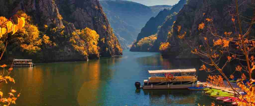
Matka Canyon delivers one of the most concentrated combinations of natural drama and medieval history anywhere in the Balkans, within fifteen kilometres of central Skopje. The gorge follows the Treska River through near-vertical limestone walls draped in oak and scrub, the water below running an improbable shade of blue-green depending on the light and season. A hydroelectric dam built in the 1930s created the narrow lake that now fills the lower canyon, submerging an old road once used by merchants travelling toward Skopje and raising the water level around the medieval monasteries that cluster along the banks.
The Canyon’s Medieval Monasteries
Six monasteries occupy the Matka canyon system, the most significant being the Monastery of St. Andrew, founded in the fourteenth century and decorated with frescoes attributed to the workshop of Metropolitan Jovan — among the finest examples of late Byzantine painting in the country. The church interior preserves almost its entire fresco cycle, including a remarkable Deësis composition on the apse wall. The Monastery of the Holy Mother of God occupies a cave cut into the canyon wall above the lake, accessible by a steep stone path that requires neither guide nor ticket. St. Nicholas Monastery, dating to the twelfth century, is the oldest in the canyon and sits close enough to the water that its reflection appears in the lake on still mornings. Walking from the parking area at the canyon entrance past all three primary monasteries takes roughly two hours on the lakeside path, which involves no significant elevation gain.
Vrelo Cave: One of the World’s Deepest Underwater Caves
The canyon’s most extraordinary geological feature is Vrelo Cave, accessible by short boat ride from the canyon entrance. Divers have measured the cave’s underwater passages to a depth of approximately 220 metres, placing it among the deepest known underwater cave systems in the world — though exploration remains incomplete and the true bottom has not been definitively established. The above-water portions of Vrelo are visitable on guided boat trips that enter the cave mouth and reveal stalactite formations built over millennia of water action. The cave’s entrance sits at water level, requiring passengers to duck slightly beneath a limestone overhang that then opens into a chamber large enough to manoeuvre a small boat. Above-water cave chambers feature columns, curtains, and a shallow underground lake, all illuminated by the guide’s torch and whatever daylight filters from the entrance.
Rock Climbing, Kayaking, and the Canyon at Depth
Matka’s limestone walls carry more than two hundred rock climbing routes across varying grades, making the gorge one of the premier sport climbing destinations in the western Balkans. Most routes concentrate on the southern wall above the lake, where overhangs and pocketed limestone provide both technical challenges and dramatic exposure above the water. Kayak rental operates from the canyon entrance during warmer months, with the narrow gorge upstream of the dam producing calm paddling conditions between walls that narrow in places to twenty metres across. The hiking trail above the canyon rim offers a different perspective — looking down onto the monastery rooftops and the turquoise water — and connects to longer routes into the hills west of Skopje that are practically unknown to anyone outside the local climbing community.
Kokino: The Bronze Age Observatory Beneath Open Skies
Kokino is one of Europe’s most extraordinary and least-visited archaeological sites: a Bronze Age megalithic observatory perched on a volcanic andesite ridge at 1,013 metres altitude, thirty kilometres northeast of Kumanovo, where a civilisation roughly contemporaneous with the Minoan culture of Crete built a sophisticated astronomical calendar into the landscape itself. The site was rediscovered by archaeologist Jovica Stankovski in 2001, having sat in plain view for nearly four millennia without attracting systematic study. In 2005, NASA’s Sun-Earth Connection Education Forum featured Kokino on its Ancient Observatories educational poster alongside Stonehenge, Abu Simbel, and Angkor Wat — a recognition that brought the site to international attention and led to accelerated archaeological investigation.
The Astronomical Architecture of Kokino
The observatory’s design exploits the natural properties of the andesite outcrop, where geothermal cooling produced a series of natural platforms and channels that the Bronze Age inhabitants enhanced with carved stone markers and thrones. Seven primary markers define the site’s astronomical functions. Viewed from the lower platform, these markers frame precise alignments for the summer and winter solstice sunrises and the spring and autumn equinox positions — essentially fixing the key points of the agricultural year with accuracy sufficient to govern planting, harvest, and ceremonial calendars. The astronomical system operated on a nineteen-year Metonic cycle, alternating twelve standard years with seven leap years, demonstrating a depth of naked-eye astronomical observation that scholars estimate required generations of systematic record-keeping to develop.
The most distinctive carved element is a feature known as the Throne — a rock seat with carved armrests that positions an observer precisely at the focal point from which all seven markers are simultaneously visible. A second throne site occupies the upper platform, suggesting a hierarchy of ritual observation between different social groups. The oldest astronomical marker at Kokino dates to approximately 1917 BC based on pottery analysis of associated artifacts, making the site’s active use span at least several centuries of the middle Bronze Age. Around the wider Kokino plateau, researchers have identified nine regional and two local sanctuaries, suggesting a ceremonial landscape considerably larger than the observatory’s central platform.
What to Expect at the Site
The Kokino archaeological site sits on Tatichev Kamen summit above the village of the same name. The drive from Kumanovo on mountain roads takes approximately forty-five minutes. From the parking area below the ridge, a clear footpath climbs the volcanic rock to the observatory platform in twenty minutes. Signage is modest, and a visit without background reading can leave the carvings looking like natural formations — the context transforms the experience. The site is unfenced and unguarded outside peak season, meaning early-morning and late-afternoon visits in low season involve complete solitude on a ridge where the andesite glows amber in low light and the views extend northeast toward the Serbian border. The nearest town with reliable accommodation is Kumanovo.
Krusevo: The Rebel Republic and the Highest Town in the Balkans
Krusevo occupies a series of interlocking hills at 1,300 metres above sea level — making it the highest town in the Balkans — and combines three distinct reasons to visit: a revolutionary history that forged Macedonian national identity, a remarkably intact collection of nineteenth-century architecture, and a mountain setting that produces genuine isolation from the lowland tourist circuit. The town sits between Skopje and Lake Ohrid without being directly on the route between them, which partly explains why it receives so little attention from travellers making the standard capital-to-lake transit.
The Krusevo Republic of 1903
On 2 August 1903 — St. Elijah’s Day, known as Ilinden — insurgents of the Internal Macedonian Revolutionary Organisation launched a coordinated uprising across Macedonia against Ottoman rule. The Krusevo detachment, numbering a few hundred fighters, captured the town and declared the Krusevo Republic, a revolutionary government that issued proclamations of equality for all citizens regardless of ethnicity and religion. The republic survived ten days before Ottoman forces crushed it with overwhelming military superiority, burning much of the town and killing a substantial portion of its population. The Ilinden Uprising became the foundational event of modern Macedonian national consciousness, celebrated every year on 2 August as the national day.
The town’s most architecturally striking monument to this history is the Makedonium, a futuristic spherical structure completed in 1974 to the design of Jordan and Iskra Grabul. The building’s exterior shell, covered in aluminium discs and stainless steel geometric panels, rises on a hill above the town in a form that deliberately references neither Byzantine nor Ottoman nor socialist-realist tradition — a statement of national distinctiveness in concrete and metal. The interior houses a memorial hall with bas-relief panels and a stained-glass dome. The contrast between the modernist monument and the Ottoman-era stone houses below it encapsulates Krusevo’s layered identity.
Architecture and Traditional Crafts
The older quarters of Krusevo preserve a high concentration of late Ottoman domestic architecture — two- and three-storey stone houses with projecting upper floors, carved wooden ceilings, and internal courtyards that remain in family use or have been converted to small guesthouses. The Old Bazaar, though modest in scale compared to Ohrid’s or Skopje’s, retains several working craftspeople including woodcarvers, weavers, and metalworkers. The town is historically associated with Turkish delight production, and small family operations continue making lokum in flavours tied to local fruit traditions. In winter, Krusevo’s altitude produces reliable snow cover and a small ski area that draws regional visitors — a combination that makes it one of the very few Balkan towns equally functional as a summer heritage destination and a winter mountain resort.
Tose Proeski and the Town’s Musical Legacy
Krusevo is the birthplace of Tose Proeski, the North Macedonian pop and ballad singer who died in a road accident in 2007 at age twenty-six and is widely regarded as the most beloved musician in the country’s modern history. The Tose Proeski Memorial House in the town receives visitors year-round and functions as a small museum of his life and career. His popularity in North Macedonia, Serbia, Croatia, and Bosnia-Herzegovina was genuine and cross-ethnic, which gives his memorial a significance beyond local sentiment — the house attracts pilgrims from across the former Yugoslav region and serves as an unexpected contemporary draw alongside the town’s historical sites.
Mavrovo and the Submerged Church of St. Nicholas
Mavrovo National Park, covering the upper Radika River valley in northwestern North Macedonia near the Albanian border, is the country’s largest protected area and one of its least-visited despite combining alpine meadows, Shar Mountain approaches, traditional highland villages, and a lake view that belongs on any list of the Balkans’ most unusual landscapes. The park’s signature image is the partially submerged bell tower and ruined nave of the Church of St. Nicholas, rising from the surface of the artificial Lake Mavrovo at varying heights depending on water level — a romantic accident of engineering that has made the church one of the most photographed scenes in the country.
The Drowned Church
The Church of St. Nicholas was built in the nineteenth century in the village of Mavrovo. When the hydroelectric dam was constructed in the 1950s and Lake Mavrovo filled, the village was relocated and the church was left standing at the water’s edge. Fluctuating water levels over the decades have produced the characteristic image of the church partially submerged — its tower rising clear of the water in dry periods, its entire nave submerged in high-water seasons. The small grassy promontory in front of the church provides a natural viewpoint for the spectacle, and during low-water periods it is possible to walk across exposed lakebed to the church door and enter the roofless interior, where watermarks show the varying historical flood levels on the remaining walls. The surrounding mountains — snowcapped from October through April — complete a scene that photographers return to repeatedly across different light and seasons.
Traditional Villages of the Mavrovo Highlands
The park contains numerous highland villages that existed in various states of occupation for centuries, their populations combining Orthodox Macedonians, Muslim Macedonians (called Torbeshi), and Roma communities in patterns that reflected the Ottoman millet system rather than ethnic geography. The village of Galichnik, twenty kilometres into the hills above Mavrovo Lake, is among the most celebrated: an almost perfectly preserved collection of stone houses built by craftsmen who spent winters in Ottoman-period construction guilds across the empire and returned to Galichnik in summer. The houses’ architecture reflects skills acquired across a vast geographic range — stone carving techniques from Anatolia, proportional systems from Venetian Dalmatia, courtyard layouts from Thessaloniki — assembled on a Macedonian mountainside. Galichnik is best known internationally for the Galichnik Wedding Festival, held on the weekend of Petrovden in July each year, when a traditional Macedonian wedding is performed in full ceremonial costume by local participants. Outside festival season, the village holds only a handful of permanent residents but operates several guesthouses for hikers and those seeking complete mountain isolation.
Wildlife and Wilderness in Mavrovo
Mavrovo National Park hosts one of the westernmost stable populations of Eurasian lynx in the Balkans, along with wolf packs that range between North Macedonia and Albania and bear populations concentrated in the higher elevations above the Radika valley. The park’s rivers — the Radika, Mala Reka, and their tributaries — hold brown trout populations that attract fishing enthusiasts from across the region. The alpine zone above 2,000 metres transitions from beech forest through dwarf pine to open rock and meadow, supporting endemic Balkan flora that has been studied relatively little compared to better-known alpine regions of Western Europe. The longest hiking trails in the park traverse three to four days of continuous wilderness walking between the Albanian border and the Shar Mountains approaches.
Berovo and the Malesevo Highlands: The Country’s Eastern Secret
Berovo sits in the Malesevo Mountains in eastern North Macedonia, close to the Bulgarian border, at an altitude that keeps it cool through summer and heavily snowed through winter. It has the distinction — documented by air quality monitoring stations — of recording the cleanest air of any town on the Balkan Peninsula, an average of 6.4 sunshine hours per day, and a climate so stable that it attracted sanatoria in the late nineteenth century for the treatment of respiratory conditions. Berovo is among the very few North Macedonian towns with a genuine local tourism infrastructure oriented specifically toward its natural setting rather than its history.
Berovo Lake and the Forest Circuit
Berovo Lake, a reservoir three kilometres above the town in old-growth spruce forest, is the focal point of the area’s outdoor offer. The lake covers roughly three square kilometres at an altitude of approximately 900 metres, surrounded by trails that circuit the shore in two hours or extend into the mountain forest for full-day walks toward the Bulgarian border ridge. Fishing from the lakeshore and from small rowing boats is the traditional local recreation; the cold, clear water supports brown trout, carp, and smaller species. The surrounding forest contains stands of spruce and fir old enough to qualify as primary forest in some classifications, a rarity in a region where Ottoman-era and socialist-period timber extraction cleared most old-growth stands. Local guesthouses organise forest walks, mushroom-gathering excursions in autumn, and cross-country skiing in winter.
Traditional Crafts and the Berovo Distinction
Three things define Berovo’s local identity beyond its air quality: the Berovo potato (a waxy, high-altitude variety grown in the surrounding fields and regarded by Macedonian chefs as the country’s finest for slow-cooking), the local white cheese (a brined sheep’s milk product aged in wooden barrels and sold by weight at the weekly market), and wood-crafting. The latter has deep roots in the Ottoman-era gurbet tradition — skilled craftsmen from the eastern Macedonian mountains who spent decades working across the empire built exceptional competence in wood joinery, furniture-making, and decorative carving, and this tradition persists in a small number of workshops still operating in the Berovo area. The Carving Workshop at the Cultural Centre occasionally hosts visiting craftspeople and open-studio events, though scheduling is informal.
Pehchevo and the Osogovo Approaches
Twenty kilometres north of Berovo, the small town of Pehchevo serves as a base for the eastern face of the Osogovo Mountain range, which reaches 2,252 metres at its highest point and straddles the border with Bulgaria. The mountain’s approaches from the Macedonian side receive substantially fewer visitors than the western and northern routes despite holding an equal density of highland trails, beech forest, and open summit ridges. The village of Ponikva, at 1,500 metres altitude on the Osogovo plateau, serves as a starting point for summit approaches and holds a modest ski infrastructure used primarily by residents of Kocani and Berovo. The isolation of this corner of the country — three hours from Skopje, without a motorway connection — is precisely what preserves its character.
Demir Kapija: The Iron Gate, the Gorge, and the Wine Country
Demir Kapija translates from Turkish as Iron Gate, a name earned by the narrow gorge where the Vardar River cuts through a ridge of limestone and metamorphic rock in central-southern North Macedonia, sixty kilometres from the Greek border. The town that developed beside this geological gateway is small, exposed to the hottest temperatures in the country (the national record of 45.7°C was measured here in 2007), and largely overlooked by travellers transitioning between Skopje and Thessaloniki on the E-75 corridor — which runs precisely through the gorge. This oversight creates an opportunity, because Demir Kapija combines wine production, river adventure sports, and birdwatching credentials that would anchor a major tourism destination anywhere else in Europe.
The Oldest Winery in the Balkans
The vineyard estate at what is now the Agropin winery was originally established as a summer residence and private wine operation by King Alexander I of Yugoslavia in the early twentieth century, making it the oldest continuously operating winery in the Balkans. The limestone gorge’s heat accumulation, combined with the altitude cooling effect from the surrounding ridges, produces growing conditions of exceptional intensity for indigenous Macedonian varieties. The Vranec grape — North Macedonia’s principal red variety, producing dark, tannic wines with dried fruit concentration — reaches peak expression in this part of the Povardarie wine region. The newer Popova Kula estate, built as both a premium winery and a destination hotel, offers cave-cellar tastings and an above-ground terrace looking across the gorge that has attracted regional wine-tourism attention.
Important Bird Area and the Gorge Wildlife
BirdLife International has designated the Demir Kapija Gorge as an Important Bird Area, a recognition driven by the exceptional diversity of raptors and cliff-nesting species that the combination of limestone walls, river, and thermal air columns supports. Egyptian vultures breed in the gorge cliffs — one of the species’ northernmost regular breeding sites in Europe. Short-toed snake-eagles, Levant sparrowhawks, western rock nuthatches, and eastern subalpine warblers all occur in concentrations that make structured birdwatching productive. The Vardar River corridor through the gorge functions as a migration flyway, concentrating passerine movement in spring and autumn. The Bela Voda cave system, 955 metres in length, lies within the gorge walls and provides additional habitat depth for bat species.
Rock Climbing and Kayaking the Vardar
The gorge walls above Demir Kapija carry sport climbing routes on limestone that has been developed by regional climbers since the 1980s, with routes ranging from easy multi-pitch climbs accessible to recreational leaders to demanding overhanging sport lines that attract visiting Skopje and Belgrade climbers. Kayaking the Vardar through the gorge requires appropriate experience — the river’s gradient through the Iron Gate section produces technical water that is not suitable for beginners — but operators in Kavadarci and Negotino arrange guided descents for paddlers with whitewater experience. The combination of climbing, wine, and bird observation in a single gorge environment within two hours of the capital makes Demir Kapija one of the most logical hidden-gem itinerary additions for any visitor spending more than four days in the country.
Kratovo: The Medieval Town in the Volcanic Crater
Kratovo occupies a position that is, literally, unique in Europe: a medieval settlement built inside the caldera of an extinct volcano in northeastern North Macedonia, roughly forty kilometres southeast of Kumanovo. The volcanic bowl that forms the town’s topography is covered with a dense arrangement of stone-built houses, Ottoman-era mosques and churches, ancient stone bridges, and — most distinctively — a series of medieval towers that rise above the rooflines like chess pieces above a board. The town’s isolation within its crater kept it partially insulated from the worst disruptions of the twentieth century, and its historic fabric survives with a completeness rare even by Balkan standards.
The Towers and Bridges of Kratovo
Kratovo’s medieval towers — dating from the eleventh to fifteenth centuries and associated with the period of Serbian medieval rule under the Nemanjić dynasty — were built as defensive structures commanding the town’s main approaches and as symbols of mercantile wealth from the silver and lead mining that made Kratovo prosperous through the medieval period. Six towers survive in varying states of completeness, each with a distinct silhouette against the crater walls and each accessible by narrow cobbled paths through the residential quarters. The stone bridges connecting the different volcanic terraces of the town are equally distinctive: six medieval bridges cross the Kratovska Reka gorge that cuts through the crater floor, the oldest dating to the sixteenth century. Walking the network of bridges and alleys between towers takes a full afternoon and requires no map — the town is small enough to be navigable by intuition.
The Kuklica Stone Dolls
Twelve kilometres from Kratovo, the geological formation known as Kuklica holds one of the most unusual landscapes in the country: a field of approximately two hundred volcanic tuff pillars, ranging from one to ten metres in height, sculpted by differential erosion into forms that bear an uncanny resemblance to human figures. The local legend holds that a man who loved two women simultaneously was turned to stone on his wedding day along with all his guests — the pillars representing the petrified wedding party. The geological reality is that a harder volcanic cap protects each pillar from the erosion that removes the softer tuff around it, creating progressively isolated columns that weather into organic forms. The site receives little formal attention but is freely accessible across open terrain, and the late-afternoon light that catches the pillars from the west transforms the landscape entirely.
Lesnovo Monastery
In a wooded ravine fifteen kilometres southeast of Kratovo, the Monastery of St. Gabriel of Lesnovo represents one of the finest concentrations of fourteenth-century Byzantine fresco painting anywhere accessible to independent travellers. Founded in the eleventh century and substantially rebuilt under Serbian rulers in 1341, the monastery church houses a fresco programme commissioned by the nobleman Jovan Oliver that covers every surface of the naos, narthex, and exonarthex with compositions including an exceptional Last Judgment cycle on the western wall. The monastery remains active, maintained by a small monastic community, and accepts visitors through the main gate during daylight hours. The setting — deep in a beech forest with a small stream crossing the entrance path — amplifies the isolation of the experience.
Stobi: The Roman Capital Beneath the Central Plain
Stobi is North Macedonia’s largest and most thoroughly excavated archaeological site, yet it remains almost completely unknown outside specialist archaeological circles and Macedonian domestic tourism. Located at the confluence of the Crna and Vardar rivers, eighty kilometres south of Skopje and fifteen kilometres from Kavadarci, the site occupies approximately twenty-seven hectares of open ground just off the E-75 highway — visible from passing vehicles yet visited by only a fraction of the travellers who pass within sight of it each day. What lies within that twenty-seven hectares is a substantial Roman provincial capital: the administrative centre of Macedonia Salutaris province, positioned at the intersection of the Via Diagonalis and the Axios Way that connected the Danube to the Aegean Sea.
The Roman City
Stobi’s history of occupation runs from the pre-Macedonian Paionian period — the earliest artefacts date to the seventh century BC, and the first written record of the city appears in 197 BC in an account of Philip V’s military campaign — through the Roman provincial period that saw its greatest expansion in the second and third centuries AD, to its final collapse under Hunnic invasion in 447 AD, subsequent sackings by the Ostrogoths in 479 AD, and a series of earthquakes culminating in the devastating earthquake of 518 AD. The remains visible at the site today span this entire period. The Roman theatre, dating to the second century AD, survives with its seating arrangements, orchestra, stage building, and underground service passages largely intact — large enough to hold several hundred spectators and still occasionally used for summer performances. The street grid follows the Roman orthogonal plan, with the Via Sacra and Via Principalis Superior crossing the site at near-right angles and flanked by the remains of colonnaded porticoes.
The Mosaics and Early Christian Heritage
The most celebrated features of Stobi are its floor mosaics, preserved in the remains of several early Christian basilicas that were built over the Roman civic buildings during the fourth and fifth centuries. The mosaics of the Episcopal Basilica represent some of the largest and best-preserved floor compositions in the Balkans, covering the nave, aisles, and narthex with geometric patterns, vine scrolls, and figurative panels in tesserae of marble, glass, and local stone. Equally important is the remains of a synagogue identified from inscriptions and architectural analysis — one of the earliest synagogues identified in the Balkans, attesting to Stobi’s role as a significant Jewish community centre in late antiquity. The Theodosian Palace, a lavishly appointed residential complex named after an inscription connecting it to the Emperor Theodosius I’s visit to the city in 388 AD, continues to yield mosaics and architectural detail in ongoing excavations. A tetraconchal baptistery — a rare architectural form representing the intersection of eastern and western early Christian building traditions — stands near the Episcopal Basilica in a state of partial preservation sufficient to convey its original spatial drama.
Visiting Stobi
The site is open to visitors and managed by the National Institution Stobi. The scale of the excavated area rewards at least two hours of exploration, and those with particular interest in mosaic art or early Christian architecture will find sufficient material for considerably longer. The flat terrain and clear path marking make the site accessible to visitors of all fitness levels. The surrounding agricultural plain provides no shade, meaning visits in midsummer should begin early in the morning. The road junction for Stobi is clearly signed from the E-75 highway at the Gradsko interchange, and a short access road leads directly to the site entrance. No significant accommodation exists at Stobi itself; Kavadarci and Negotino, both within twenty kilometres, hold standard hotels and guesthouses.
Lake Prespa and Snake Island: The Triple-Country Secret
Lake Prespa sits at 853 metres above sea level at the exact tripoint of North Macedonia, Albania, and Greece — an altitude that gives the lake a clarity and coolness unusual for a Balkan body of water and a political complexity that has paradoxically kept it undervisited despite its extraordinary natural beauty. The Great Prespa Lake covers approximately 259 square kilometres, of which roughly sixty-five percent lies within North Macedonia, with the remainder divided between Albania and Greece. The lake drains not through a surface river but through underground karst channels that carry its water northwest into Lake Ohrid, a geological relationship that makes the two lakes a hydrologically connected system separated by the ridge of Galichica National Park.
Golem Grad: North Macedonia’s Only Island
The Great Prespa Lake contains Golem Grad — meaning Big Town in Macedonian — the only island on North Macedonian territory, rising from the lake surface with steep white limestone cliffs approximately 750 metres long and 450 metres wide. The island is uninhabited and declared a natural reserve, accessible only by boat arranged from the lakeshore villages. Its popular nickname, Snake Island, reflects the reality of the resident population: Golem Grad hosts a high density of water snakes (primarily non-venomous species) along its shoreline, along with a pelican breeding colony and a diversity of other water birds that makes it a significant ornithological site. The island’s surface carries ruins spanning an extraordinary chronological range: Neolithic settlement evidence, Hellenic graves, Roman structures, Byzantine fortifications and church remains, and a fourteenth-century church with partially surviving frescoes. Walking the island’s perimeter path takes roughly forty minutes on clear terrain, with the limestone cliffs dropping directly into the lake on the windward side.
The Prespa Villages and the Apple Country
The North Macedonian shore of Lake Prespa is defined by a series of small villages — Stenje, Nakolec, Konjsko, Podmocani, Brajcino — that have adapted over generations to the unusual combination of high altitude, lake climate, and relative isolation from the country’s commercial centres. The Prespa basin is one of the primary apple-growing regions of North Macedonia, the altitude and temperature variation producing fruit of high acidity and keeping quality. The village of Brajcino, eight kilometres above the lake shore in old-growth beech forest, is frequently cited as one of the most beautiful villages in the country, with a cluster of stone houses, a nineteenth-century church, and several heritage guesthouses that operate as the primary accommodation option for independent travellers exploring the area on foot.
Galichica National Park: The Ridge Between Two Worlds
The mountain ridge of Galichica National Park separates Lake Prespa from Lake Ohrid along a narrow north-south watershed, reaching 2,288 metres at its highest point. From the summit ridge, both lakes are visible simultaneously — a perspective that dramatises their proximity and their difference. Lake Ohrid, deep blue and surrounded by town lights and hotel terraces, lies one side; Lake Prespa, smaller in surface area but significantly higher in altitude, occupies the other. The park protects Balkan pine forest, alpine meadows with endemic flora, and wildlife including chamois on the upper ridges. The road crossing the park between Ohrid and Resen passes through the summit zone, providing the view without requiring any hiking — though the trails extending north and south from the road reward those who leave the car for an hour in either direction.
The Hidden Monastery Circuit: The Fresco Route Less Travelled
North Macedonia holds more medieval monasteries per square kilometre than almost any region of comparable size in the Orthodox world, a legacy of the intense religious patronage of the Serbian Nemanjić dynasty and their successors during the thirteenth and fourteenth centuries. Many are famous — Sveti Naum on Lake Ohrid, the frescoed churches of Ohrid’s old town, the great Monastery of St. Panteleimon at Plaoshnik. But the majority of the monastic circuit runs through places that appear on no tourist itinerary and carry their medieval art in conditions of near-total anonymity.
Treskavec Monastery Above Prilep
The Monastery of the Holy Theotokos at Treskavec sits on the rocky Zlatovrv peak above the city of Prilep, accessible by a steep hiking path that climbs through marble outcrops and scrub oak for approximately ninety minutes from the road below. The monastery was founded in the twelfth century and expanded substantially in the fourteenth century under Serbian patronage; its church retains fresco fragments of exceptional quality in the apse and nave, including a rarely depicted iconographic programme that has attracted art historians from across Europe. The setting is extraordinary: the monastery walls appear to grow directly from the mountain’s marble core, and the open terrace in front of the church faces southwest across the Pelagonia Plain with views that extend, on clear days, to the mountains of Greece. A small number of beds are available for overnight guests in the monastic rooms, making Treskavec one of the few places in North Macedonia where a traveller can spend the night in a functioning fourteenth-century building.
Markovi Kuli and the Prince Marko Landscape
The rocky hills immediately above Prilep carry the ruins of the medieval fortress Markovi Kuli — Marko’s Towers — associated by tradition with Prince Marko (Marko Kraljevic), the Serbian vassal ruler of Prilep whose exploits became the subject of the most extensive cycle of epic poetry in the South Slavic tradition. The historical Prince Marko ruled in the late fourteenth century as an Ottoman vassal; the legendary Marko of the epic poems is an immortal warrior hero capable of feats impossible by human standards. The ruins of his fortress occupy a series of marble summits above the city, with walls, cisterns, and tower bases surviving amid the characteristic landscape of white marble boulders and scrub vegetation. The site is freely accessible and involves a forty-minute walk on marked trails from the city edge. The view from the highest surviving tower encompasses both the Pelagonia Plain to the south and the monastery at Treskavec on its peak to the north.
Staro Nagorichane and the Byzantine Frescoes of the Northeast
The Church of St. George at Staro Nagorichane, thirty kilometres northeast of Kumanovo and close to the road for Kokino, was rebuilt by the Serbian King Milutin in 1313 over a pre-existing Byzantine foundation. The fresco programme covering the church interior dates from the early fourteenth century and was painted by Michael Astrapas and Eutychios — the two artists responsible for some of the finest Byzantine frescoes in existence, whose work also appears at the famous monastery of Peribleptos (now St. Kliment) in Ohrid. At Staro Nagorichane their work survives in exceptional condition across the full compositional programme: the prophets and evangelists in the upper register, the narrative cycles of the Christological programme, and the military saints in full processional array on the lower walls. The church is active and visitors are welcome; a keeper is sometimes present to provide access when the main door is closed.
Lesnovo, Zrze, and the Deep Valley Monasteries
Beyond the sites already detailed, the monastery landscape continues across the entire country in forms ranging from cliff-face hermitages accessible by iron-rung ladders (the Monastery of Zrze, cut into a limestone cliff above the Pelagonia Plain west of Prilep) to active urban communities embedded in town centres. The Monastery of Zrze deserves particular mention: its church and residential buildings sit on a ledge in a vertical cliff face at approximately 900 metres, reached by a metal ladder fixed to the rock. The interior frescoes, dating to the fourteenth century, are among the least-studied in the country. The monastery accepts visitors throughout the day and the resident monk occasionally guides groups through the church programme. The combination of physical drama and artistic content at Zrze — sheer cliff, ancient paint, a monk who has lived there for decades — represents the monastic circuit at its most concentrated and least diluted by tourism.
Bitola and Heraclea Lyncestis: The Underrated Southern Gateway
Bitola is North Macedonia’s second-largest city and arguably the most liveable — a compact, walkable place with a distinguished Ottoman and Austro-Hungarian-influenced architecture, an active café culture on the pedestrian boulevard Shirok Sokak (Broad Street), and a depth of archaeological heritage on its southern edge that exceeds its modest visitor numbers by a considerable margin. The city served as an Ottoman administrative capital, a late nineteenth-century diplomatic post for European powers (hence the row of honorary consulates along Shirok Sokak), and a Greek, Jewish, Turkish, and Macedonian commercial centre for several centuries. The layered urban palimpsest of mosques, Orthodox churches, synagogue sites, and Austro-Hungarian-era civic buildings makes a walk through the old town a genuinely rich experience even without the archaeological site on the outskirts.
Heraclea Lyncestis: Philip II’s Founding and the Via Egnatia
One kilometre south of central Bitola, the archaeological site of Heraclea Lyncestis was founded in the fourth century BC by Philip II of Macedon — the father of Alexander the Great — as a strategic city on the route between Macedon and the Adriatic coast. The city’s position on the Via Egnatia, the great Roman road that eventually connected the Adriatic to Istanbul, kept it commercially significant for centuries after the Roman conquest in 168 BC. The visible remains date primarily from the Roman and early Christian periods: a Roman theatre of the second century AD (still occasionally used for performances), Roman baths with surviving hypocaust heating systems, and the exceptional floor mosaics of the Small and Great Basilicas, constructed in the late fifth century after earlier Gothic destruction. The basilica mosaics are unique in depicting endemic Macedonian trees and animals — juniper, wild boar, deer, and fish — in compositions that blur the boundary between decorative programme and natural history document. The site remains partially under excavation, and new discoveries appear regularly; visitors can observe ongoing fieldwork during the summer excavation season.
Bitola’s Living Heritage
The city’s Shirok Sokak boulevard, flanked by nineteenth and early twentieth-century buildings in a mix of Ottoman merchant architecture and Austro-Hungarian classical facades, functions as the primary social artery of a city that still operates at a pace comfortable for a long afternoon walk. The clock tower at the bazaar end of the boulevard dates to the eighteenth century. The Old Bazaar adjacent to the central mosque retains working copper and metalsmithing shops alongside the inevitable souvenir stalls. The city’s position sixty kilometres from the Greek border and forty kilometres from Albania makes it a natural staging point for explorations of the southern zone — Prespa, Heraclea, Pelister National Park — that its tourist infrastructure, modest but competent, is adequately equipped to support.
Under-the-Radar Flavors: Macedonia’s Culinary Secrets
North Macedonian food culture operates on several distinct registers that rarely map onto the international reputation of the cuisine. The tourist version — grilled meats, shopska salad, roasted peppers — is genuine but incomplete. The deeper register involves a set of preparations, ingredient combinations, and production traditions that are highly localised, seasonally constrained, and almost entirely absent from the menus of restaurants oriented toward visitors.
Tavche Gravche and the Bean Pot Tradition
Tavche gravche — white beans slow-cooked in an earthenware pot with peppers, tomato, and onion, sometimes with lamb or pork, and finished with a paprika-red crust — is the national dish of North Macedonia by common consent, and the debate about where it is made best is genuinely heated. Tourist-district restaurants in Skopje serve a pale approximation of the dish. The genuine article requires specific Macedonian white beans (the Tetovo bean, grown in the northwestern valleys, is considered the standard), a wood-fired or very slow electric oven, and a tolerance for a preparation time that takes the better part of a day. The best versions are encountered in highland village guesthouses, family-run konobas (small restaurants) in towns off the main tourist circuit, and at village celebrations where the dish is prepared in quantity. The Malesevo region around Berovo has a particularly strong reputation for bean preparation, combining local beans with the region’s smoked pork.
Ajvar and the Pepper Traditions
Ajvar — the roasted red pepper relish that is almost synonymous with Macedonian home cooking in the Balkans — is made throughout the region, but its most celebrated production is in the Strumica valley in the country’s southeast, where a specific variety of horn pepper (roga pepper) is grown in conditions that produce exceptional sweetness and flesh thickness. The ajvar-making season in September and October turns the Strumica valley roads into informal markets for fresh peppers, and families across the country travel specifically to buy Strumica peppers for their home ajvar production. The process — roasting, peeling, grinding, slow-cooking in large copper cauldrons over wood fires — takes an entire day and produces enough jars to supply a household through winter. Watching this process in a village farmyard in early autumn is one of the most deeply characteristic Macedonian food experiences available to visitors, though it requires knowing someone with a garden or securing an invitation to a local family’s production session.
Rakija Culture and the Hidden Distilleries
North Macedonia produces fruit brandy — rakija — from grapes, plums, quinces, and figs in a distillation tradition that precedes Ottoman rule and is regulated in the contemporary period with a mixture of official licensing and widespread unofficial production for family use. The grape rakija of the Povardarie region, produced from Vranec and Smederevka varieties in operations ranging from the professional (Popova Kula, Bovin, Tikves winery) to the purely domestic, achieves concentrations of fruit character that compare favourably with better-known Balkan spirits. The quince rakija of the Berovo highlands and the plum rakija of the Polog valley in the northwest are regional specialities rarely encountered outside their production areas. Small distilleries and village producers do not advertise or maintain formal visitor hours, but guesthouse owners throughout the country maintain connections to local production and can facilitate introductions for travellers who express interest.
The Practical Art of Getting Off the Beaten Path in Macedonia
Exploring North Macedonia’s hidden geography requires accepting a moderate level of logistical uncertainty that disappears almost entirely once the country’s patterns become familiar. The basic infrastructure — roads, guesthouses, fuel, mobile data — covers the entire country adequately. What does not always exist is the layer of tourist infrastructure (signage in multiple languages, online booking systems, scheduled guided tours) that travellers accustomed to Western European destinations are used to finding.
Transport and Self-Drive
A rental car collected in Skopje or Ohrid remains the most practical means of accessing the majority of the destinations in this guide. The country’s road network connects all significant towns in paved condition, and the drive times are manageable: Berovo is three hours from Skopje, Prespa two and a half hours, Kratovo ninety minutes, Demir Kapija ninety minutes. Mountain roads to sites like Kokino, Treskavec, and Galichnik involve winding single-track sections that require patient driving and occasionally reward unexpected views. The public bus network operates between all major towns and several intermediate ones, with connections to Ohrid, Bitola, Krusevo, Berovo, Kavadarci (for Stobi), and Kumanovo (for Kokino) running at least once daily and, on main routes, several times. Local taxis complete the connection for sites not directly served by buses. The north-south E-75 highway provides rapid transit between Skopje and the Greek border, passing through Veles, Stobi, Kavadarci, Negotino, and Demir Kapija without requiring detours on slower roads.
Language, Local Hospitality, and Navigation
English is widely spoken in Skopje and Ohrid but becomes progressively less reliable in smaller towns and completely absent in many villages. A basic Macedonian or Serbian phrase set — greetings, thank you, food and drink vocabulary, directional questions — opens doors disproportionate to its simplicity, as North Macedonians respond with particular warmth to visitors who make any effort with the language. Navigation in rural areas can be challenging due to inconsistent or absent road signage; downloading offline maps (Maps.me or the relevant Google Maps area) before departure is strongly advisable. Guesthouses and family-run accommodation in towns like Berovo, Krusevo, Kratovo, and the Prespa villages operate reliably and provide a quality of human interaction — breakfasts prepared from local ingredients, evening conversations in hybrid Macedonian-English, informal guidance from hosts who know their local area in depth — that characterises the best of this style of travel.
The Best Hidden-Gem Circuit
A seven-day self-drive circuit from Skopje that captures the core of this guide’s territory begins with Matka Canyon on day one (half-day, return to Skopje), continues northeast to Kokino and Kratovo with a night in the volcanic crater town on day two, south to Berovo through the eastern mountains on day three, then west through Stip and Kavadarci with a stop at Stobi to Demir Kapija and the wine country on day four, south to Prespa for two nights on days five and six, and returns north through Bitola and Heraclea with a stop at Krusevo on day seven before rejoining the main highway north. The circuit covers the country’s diagonal from northeast to southwest and back again, touching the majority of the hidden-gem destinations without retracing any significant section of road. Total driving is approximately twelve hours across seven days — a comfortable amount that leaves substantial time at each destination.
Frequently Asked Questions
Is North Macedonia safe for independent travellers?
North Macedonia is consistently rated among the safer travel destinations in the western Balkans. Petty theft in the usual tourist contexts — crowded markets, bus stations — warrants the standard precautions. Rural areas and small towns present effectively no security concern for independent travellers. The country’s EU candidate status has driven significant improvements in road safety and emergency services infrastructure over the past decade. Solo female travellers, LGBTQ+ visitors, and travellers from non-European backgrounds report positive experiences overall, with the usual caveat that rural areas tend toward conservative social norms. The border crossings with Greece, Bulgaria, Serbia, Kosovo, Albania, and North Macedonia are all straightforward with standard European travel documentation.
When is the best time to visit North Macedonia’s hidden gems?
The most rewarding season for the hidden-gem circuit divides between late spring and early autumn. May and June offer wildflowers in highland areas, comfortable temperatures, and light that extends past 8 PM — ideal conditions for monastery visits and mountain walking. July and August bring reliable sunshine but also peak heat in the lowland areas (Demir Kapija, Stobi, and the Vardar valley regularly exceed 38°C) and moderate crowds at Ohrid and Skopje. September is the finest month overall: the heat has passed, the wine harvest begins in the Povardarie region, ajvar production fills the Strumica valley with roasting peppers, and the mountain trails remain clear. October holds excellent hiking weather and dramatic autumn colour, particularly in the Mavrovo beech forests and the Malesevo spruce stands. Winter brings reliable snow to Krusevo, Mavrovo, and Berovo, making them functional winter destinations, while Stobi, Heraclea, and the canyon monasteries are quietest and most atmospheric in low-season winter light.
What is the Ilinden celebration and where is it observed?
Ilinden — St. Elijah’s Day, observed on 2 August — is North Macedonia’s national holiday, commemorating the Ilinden Uprising of 1903 when the Internal Macedonian Revolutionary Organisation launched its coordinated rebellion against Ottoman rule and declared the Krusevo Republic. The principal national ceremony takes place at the Makedonium monument in Krusevo, which draws significant crowds from across the country for the morning commemoration on 2 August. Secondary observances occur at the Ilinden monument complex at Meckin Kamen above Krusevo, where the fiercest fighting occurred, and at memorial sites across the country associated with the uprising’s key moments. Visiting Krusevo on Ilinden provides direct contact with the national memory in its most concentrated form, though accommodation books up well in advance and access roads to the monument site require arriving early in the morning.
How should I combine North Macedonia’s hidden gems with Ohrid?
Ohrid serves best as a base for the western hidden-gem circuit: Prespa Lakes, Galichica National Park, and the village of Galichnik are all within easy striking distance. From Ohrid, the Bitola and Heraclea combination is a ninety-minute drive. Krusevo is approximately an hour northeast of Ohrid and makes an obvious half-day excursion. Mavrovo National Park is accessible from Ohrid in around ninety minutes. For the eastern circuit — Berovo, Kratovo, Kokino, Stobi — Skopje provides the better base, with the E-75 highway shortening the south-to-north transit considerably. A two-centre approach (two nights Ohrid for the west, three nights Skopje for the east and north) followed by the Prespa and Bitola southern zone in between covers the majority of hidden-gem territory within a ten-day itinerary.
Does North Macedonia have national parks and what are they?
North Macedonia has three national parks. Mavrovo, covering 730 square kilometres in the northwest, is the largest and most diverse, encompassing the Radika River valley, the Shar Mountain approaches, Lake Mavrovo with its submerged church, and traditional highland villages. Galichica, at 227 square kilometres, occupies the mountain ridge between Lake Ohrid and Lake Prespa, protecting Balkan pine forest, endemic flora, and the panoramic summit views over both lakes simultaneously. Pelister, at 125 square kilometres in the Baba Mountain range southeast of Bitola, is the oldest of the three parks (designated 1948) and the most strictly protected, holding the Molika pine — a Macedonian endemic — and the country’s highest concentration of chamois. All three parks have hiking trail networks in varying states of maintenance, with Galichica’s traversal road providing vehicle access to the mountain zone and Pelister and Mavrovo requiring foot travel to their interior.
What is the Galichnik Wedding Festival and how can visitors attend?
The Galichnik Wedding Festival is an annual cultural event held in the remote mountain village of Galichnik on the weekend of Petrovden — St. Peter’s Day, falling in early to mid-July — in which a traditional Macedonian wedding is performed according to the full ceremonial sequence of the old Mijo Galichanot wedding tradition. The ceremony spans two days and involves costumed participants, traditional instruments (gayda bagpipes, zurna oboe, tapan drum), processions between the village fountains and churches, ritual gift-giving, and communal dancing that continues through the night. The festival is not a recreated theatrical performance but an event involving real community members in a living tradition, though the village’s now-tiny permanent population means that many participants travel specifically for the festival from Skopje and other cities. Access to Galichnik requires driving twenty kilometres of mountain road from Mavrovo village, and accommodation in the village is limited — booking guesthouses months in advance is essential for festival weekend. Non-festival visitors can attend weddings as spectators with no formality required.
What makes Ohrid’s UNESCO designation special compared to other sites in the country?
Ohrid holds an extremely rare dual UNESCO World Heritage designation: it was recognised for its outstanding natural value in 1979 (one of Europe’s oldest and deepest lake ecosystems, with more than 200 endemic species in Lake Ohrid) and for its outstanding cultural value in 1980 (one of Europe’s most complete concentrations of early medieval architecture, Byzantine art, and early Slavic cultural heritage). The combined site is officially listed as the Natural and Cultural Heritage of the Ohrid Region and is shared with Albania, whose portion of the lake’s shoreline was added to the inscription in 2019. Fewer than thirty sites worldwide hold dual cultural-and-natural designation simultaneously. Other archaeological and cultural sites in North Macedonia — Stobi, Kokino, Heraclea Lyncestis, the Kratovo tower complex — appear on the country’s UNESCO Tentative List but have not yet achieved full inscription status.
What languages do people speak in North Macedonia and how does this affect travel?
Macedonian, a South Slavic language written in Cyrillic script, is the official language and the first language of the majority. Albanian is co-official in municipalities where Albanian speakers constitute twenty percent or more of the population — primarily in the west of the country, including Tetovo, Gostivar, and the Debar region near Albania. Romani is widely spoken in communities across the country, particularly in the Shutka district of Skopje. Serbian remains mutually intelligible with Macedonian and is understood by older generations throughout the country. English is the primary foreign language taught in schools and is reliably spoken by younger people in cities, less consistently in smaller towns, and rarely in villages. For travellers, Cyrillic literacy helps with navigation — town names and road signs are primarily in Cyrillic — but the Latin-script versions of most names are sufficiently similar that offline map navigation requires little adjustment. Downloading the Macedonian Cyrillic keyboard to a smartphone allows phonetic input that, combined with a basic phrasebook, covers most practical travel communication.
What are Markovi Kuli and why are they significant?
Markovi Kuli — Marko’s Towers — are the remains of a medieval fortress complex built on the marble peaks above the city of Prilep in central North Macedonia. The site is associated with Prince Marko (Marko Kraljevic), the historical Serbian vassal ruler who governed Prilep under Ottoman suzerainty from approximately 1371 until his death in 1395, and whose legend subsequently became the subject of the most extensive and widely distributed cycle of epic poetry in the South Slavic oral tradition. The historical fortifications, dating primarily to the fourteenth century, include tower bases, cisterns, and wall sections built in the characteristic Serbian medieval style of the Nemanjić period’s successor states. The marble landscape of the site — white rock outcrops weathered into organic forms by the limestone karst processes — creates a visual setting quite unlike the forested or agricultural hillsides typical of medieval Balkan fortress sites. The combination of epic literary association, accessible ruins, and the dramatic view from the summit towers over the Pelagonia Plain makes Markovi Kuli an excellent half-day addition to any itinerary that passes through central North Macedonia.
What traditional music and performing arts survive in North Macedonia?
North Macedonia holds one of the richest surviving traditions of polyphonic folk singing in Europe — a tradition recognised by UNESCO in its Intangible Cultural Heritage records through the inscription of the Tesk to (a ceremonial folk dance from the Polog valley) and related performing traditions. The country’s folk music divides between the Macedonian tradition (centred on the tapan drum, gayda bagpipe, and kaval flute for rural music; a more elaborate urban tradition for the old Macedonian-Turkish town music of Bitola and Ohrid) and the Albanian tradition of the western regions (using the lahuta fiddle and cifteli lute in genres that differ substantially from the Macedonian forms). The Galichnik Wedding Festival provides the most concentrated public access to the traditional music of the northwest highlands. The Ohrid Summer Festival (July-August) presents classical and contemporary music in the open-air Roman theater of Plaoshnik and in the Church of St. Sophia — a programming combination that juxtaposes Byzantine architecture with international chamber music in a way that is genuinely unusual. Smaller regional folklore festivals occur throughout the year in towns including Struga, Bitola, and Krusevo, concentrated primarily in July and August.