Malaga Axarquía Coastal Road Trip 2027: Exploring Vélez-Málaga, Bentomiz Castle & Frigiliana Without the Crowds
Three heritage monuments within a single day’s drive of the Costa del Sol, and almost none of the crowds that fill the Alhambra queues: the Axarquía comarca east of Málaga holds a Nasrid alcazaba, a ruined mountain castle at 709 meters, and Andalusia’s finest surviving Mudéjar village quarter within a 90-kilometer circuit that most beach visitors never consider. This guide maps the driving route, site logistics, crowd-avoidance timing, and practical costs for the Vélez-Málaga–Bentomiz Castle–Frigiliana loop in 2027.
Key Takeaways
- Three complementary heritage stops in one circuit: the Nasrid Alcazaba of Vélez-Málaga with the adjacent Church of Santa María la Mayor in the comarca capital; the ruined Bentomiz Castle perched at 709 meters above the village of Arenas; and the prize-winning Mudéjar Barribarto quarter of Frigiliana, five kilometers inland from the coast at Nerja.
- All entry is free. The Alcazaba of Vélez-Málaga, Bentomiz Castle ruins, and the pedestrian streets of Frigiliana’s Barribarto historic quarter are publicly accessible at no charge. Your only expenditure is fuel, parking, and food.
- Vehicle note: a standard car reaches Vélez-Málaga and Frigiliana without difficulty; the track from Arenas to the Bentomiz Castle summit requires a 4×4 or a 45–60-minute walk from the village — which most visitors find the better and more rewarding approach.
- Day-trip costs: budget travelers spend €25–40 per person (fuel share, simple meals, free parking and entries); mid-range visitors choosing a restaurant lunch and Moscatel wine tasting spend €45–65 per person.
- Best crowd-free window: weekday mornings in March–May and October–November, when Frigiliana’s car park is rarely more than a quarter full before 10 AM and the Bentomiz Castle ascent can be completed in comfortable temperatures away from summer-peak heat.
- Full day required: allow 7–8 hours door-to-door from a Torre del Mar or Nerja base; a half-day covers Vélez-Málaga alone or Frigiliana alone, but not all three segments.
People Also Ask About Malaga Axarquía Road Trip 2027
How long does the full Axarquía road trip circuit take in 2027?
From a Torre del Mar or Nerja base, allow 7–8 hours for the three-stop circuit. Driving between stops accounts for roughly 1.5 hours total. Vélez-Málaga — the Alcazaba of Vélez-Málaga and the Church of Santa María la Mayor — warrants 1.5–2.5 hours on foot. The village of Arenas plus the Bentomiz Castle ascent and return adds 3–4 hours. Frigiliana’s Barribarto calls for 2–3 hours of relaxed exploration. Depart by 8:30–9:00 AM to complete all three stops with a 60-minute lunch break and return to the coast before dusk in spring and autumn. A half-day itinerary should focus on Vélez-Málaga alone or Frigiliana alone, not both.
Can I drive a standard car to Bentomiz Castle in 2027?
The village of Arenas, which serves as the departure point for the ascent, is fully accessible by standard car via the A-335 from Vélez-Málaga (approximately 25 km, 30–35 minutes on mountain roads). The track above Arenas to the castle summit is a different matter: steep, rough terrain with loose surfaces and deep ruts after rain, described by local guides as practical only for horses, 4×4 vehicles, and off-road motorcycles. Most visitors park in Arenas and walk — a round trip of roughly 6–8 km with around 500 meters of elevation gain, taking 45–60 minutes uphill and 35–45 minutes down. Comfortable walking shoes, at least one litre of water, and sun protection are essential. In July and August, summit temperatures frequently exceed 35°C, making a midday ascent genuinely dangerous.
What does the Axarquía day trip cost per person in 2027?
Entry to every major heritage site on this circuit is free: the Alcazaba of Vélez-Málaga, Bentomiz Castle, and the streets of Frigiliana’s Barribarto quarter all carry no admission charge. Your costs are fuel (roughly €5–8 per person sharing a car for the 90–110 km circuit), parking (free at all recommended stops), and food. Budget travelers who bring their own lunch or choose simple village cafés spend €25–40 per person for the day. Those opting for a sit-down menú del día lunch and a glass of local Moscatel wine spend €45–65 per person. No timed-entry systems, booking fees, or guided-tour requirements apply at any of the three stops.
When is the best time to visit Frigiliana and avoid crowds in 2027?
The widest crowd-free window runs on weekdays from mid-October through late April. During these months, Frigiliana’s free village-entrance car park is rarely more than a quarter full before 10 AM, and the Barribarto alleys are genuinely quiet before the late-morning tour groups arrive from Nerja. The summer peak — mid-June through September — sees the car park fill by 9:30 AM on weekends and by 11:00 AM on weekdays. Late March and early April combine comfortable walking temperatures (16–22°C), flowering almond and fruit trees in the surrounding orchards, and the lowest visitor numbers of the year. Mid-October brings the bonus of Moscatel harvest activity in nearby Cómpeta and the surrounding villages.
Extended multi-day tours – 5+ days
Featured Malaga Multi-Day Tour Packages

3 days
Malaga 3-Day Discovery Tour
- ✓ Comprehensive Malaga experience
- ✓ Expert local guides included
- ✓ All accommodation included
- ✓ Transportation provided
5 days
Malaga 5-Day Highlights Experience
- ✓ Comprehensive Malaga experience
- ✓ Expert local guides included
- ✓ All accommodation included
- ✓ Transportation provided

7 days
Malaga 7-Day Cultural Journey
- ✓ Comprehensive Malaga experience
- ✓ Expert local guides included
- ✓ All accommodation included
- ✓ Transportation provided

10 days
Malaga 10-Day Complete Adventure
- ✓ Comprehensive Malaga experience
- ✓ Expert local guides included
- ✓ All accommodation included
- ✓ Transportation provided
Multi-day tour packages powered by TourRadar. Prices and availability subject to change.
The Axarquía in 2027: Why This Circuit Belongs in Your Andalusia Itinerary
The road east from Málaga city along the A-7 motorway carries the traffic that fuels the Costa del Sol resort economy — package tourists heading to Torremolinos, Fuengirola, Nerja. The same motorway skirts the southern edge of the Axarquía comarca without anyone on a beach holiday needing to leave it. The result is one of the better paradoxes of Andalusian tourism: a region dense with medieval heritage, dramatic mountain scenery, and some of the most intact Islamic urban fabric in southern Spain sitting within twenty minutes of one of Europe’s busiest resort corridors, essentially unvisited by international travelers.
The Axarquía spans thirty-one municipalities across a landscape that rises from sea-level subtropical cultivation — avocado plantations, mango orchards, Moscatel vineyards — to the limestone ridges of the Sierra de Tejeda, Almijara y Alhama, a mountain chain whose highest peak, La Maroma, briefly exceeds 2,000 meters. Vélez-Málaga, the administrative capital and circuit starting point, sits in the fertile lower plain where the Vélez river valley meets the coast. Arenas occupies a hillside roughly 400 meters above sea level in the Axarquía interior. Frigiliana clings to the lower slopes of the Sierra Almijara five kilometers from the sea at Nerja. Driving between them is an exercise in rapid vertical change: the A-335 rises from the Vélez-Málaga plain through terraced cultivation to village altitudes in under twenty kilometers.
The historical thread connecting all three stops is the Reconquest of 1487. Fernando and Isabel, the Catholic Monarchs, launched their campaign to retake the Axarquía in the spring of that year. The fall of Vélez-Málaga — preceded by the surrender of Bentomiz Castle — opened the road to Málaga city, which fell that same summer. This 1487 sequence was one of the final acts of the eight-century process of Christian territorial recovery from Islamic rule in Iberia, preceding the fall of Granada in January 1492 by only five years. Every monument on this circuit was shaped by that specific moment: the alcazaba adapted, the castle surrendered, churches built on mosque sites, the Moorish community that remained slowly pushed out by forced-conversion edicts and, ultimately, the violent suppression of the 1569 Morisco uprising recorded in Frigiliana’s famous ceramic panels.
For 2027 visitors, the practical implication of this heritage concentration is that a single driving day covers an arc of Islamic Andalusia more varied and better-preserved than many dedicated heritage tours in the larger cities. No advance tickets exist; no audioguide rentals are required; no timed entries operate at any of these sites. The crowds that have discovered Granada’s Alhambra, Córdoba’s cathedral-mosque, and Sevilla’s Alcázar have not yet found the Axarquía in comparable numbers. This gap will likely narrow as AI-driven travel discovery surfaces overlooked destinations, but it holds firmly for the time being.
A note on the circuit’s physical character: this is a driving itinerary with substantial walking at each stop. The Vélez-Málaga ascent to the alcazaba involves 15–20 minutes of uphill walking on uneven stone streets. The Bentomiz Castle round trip from Arenas is a genuine hill walk. Frigiliana’s Barribarto involves steep, cobbled alleys. The circuit suits reasonably fit adults and older children comfortable with hills. It is not appropriate for pushchairs or visitors with significant mobility limitations at the Bentomiz segment, though Vélez-Málaga and Frigiliana offer accessible lower areas for those unable to complete the full ascents.
The comarca’s food culture is an additional argument for a slow, exploratory day rather than a rushed drive-through. The Moscatel grape grown on the eastern Axarquía slopes produces the sweet dessert wines and sun-dried raisins that have been exported from this coast since Phoenician times. Cold-pressed olive oils from Verdial and Hojiblanca olives cultivated on the mountain terraces appear on the tables of every village restaurant. The honey-cane product of Frigiliana’s El Ingenio — the last working cane-sugar mill of its type in Europe — is arguably the most distinctive artisan souvenir available anywhere in the province.
Transportation & Logistics: Driving Route, Bus Connections, and Timing
This circuit is designed as a car-based itinerary, and that is the practical reality. While bus connections exist for individual stops, no combination of public transport links Vélez-Málaga, Arenas, and Frigiliana in a logical day-trip sequence at useful frequencies. A hire car or private vehicle is the assumed mode for the planning advice below.
The most efficient driving sequence follows a loop rather than an out-and-back: from the coastal A-7 (via the Torre del Mar or Vélez-Málaga exit), drive north into Vélez-Málaga for the first segment; continue north on the A-335 to Arenas for the Bentomiz section; return south on the A-335 toward the coast; then take the A-7 east to the Frigiliana/Nerja exit for the final stop. Returning to the coast via Nerja after Frigiliana adds only five kilometers and allows dinner in a larger town before the A-7 drive home. This sequence places the most physically demanding stop — the Bentomiz Castle ascent — in the mid-morning when temperatures are coolest, and leaves the more leisurely Frigiliana walk for the afternoon.
Total circuit distance from a Torre del Mar base: approximately 90–100 km. From Málaga city, add 30–35 km each direction on the A-7. Approximate drive times between stops: Torre del Mar to Vélez-Málaga center (5 km, 10–15 minutes); Vélez-Málaga to Arenas via A-335 (25 km, 30–35 minutes on mountain roads); Arenas back south on A-335, then A-7 east to Frigiliana exit (approximately 40 km, 40–50 minutes); Frigiliana to Torre del Mar or Nerja (10–15 km, 15–20 minutes). Total driving time approximately 1.5 hours, leaving 5.5–6 hours for the three sites and a lunch break in a full day.
For those without a car: Portillo/Avanza buses operate on the Málaga–Nerja coastal corridor with stops at Torre del Mar and the Vélez-Málaga area; check current timetables locally, as frequencies vary seasonally. From Vélez-Málaga, bus service toward Arenas exists but is infrequent. The practical car-free solution for the full circuit is to combine buses for the Vélez-Málaga and Frigiliana segments with a taxi for the Arenas leg. Local taxi firms in Vélez-Málaga serve Arenas; confirm fares before departure, as the mountain road extends the journey time. From Nerja, local taxis run to Frigiliana (5 km); the village car park at the entrance accepts taxis for drop-off and collection.
The optional Cómpeta extension adds a celebrated wine village without significant time cost. Rather than returning south to the A-335 from Arenas, drive east on the MA-5123 through Cómpeta (approximately 10 km from Arenas), then continue south toward Nerja and the Frigiliana exit (approximately 20 km). Total Arenas-to-Frigiliana distance via Cómpeta: roughly 30 km on mountain roads, taking 45–55 minutes. Cómpeta anchors the Axarquía’s Moscatel wine production and has several bodegas welcoming visitors for tastings without prior appointment. Adding 30–40 minutes in Cómpeta turns this into a full itinerary requiring a 7:30–8:00 AM departure.
Vehicle Selection for Axarquía Mountain Roads and Fuel/EV Charging Points
The A-335 regional road, backbone of this circuit from Vélez-Málaga north to Arenas and beyond, is well maintained with a standard paved surface and clear signage. Village approach roads — including the final kilometers to Frigiliana via the MA-5105 — are paved and accessible by any standard vehicle. The single exception is the track above Arenas rising toward the Bentomiz Castle summit, which is unpaved, steep, and highly variable in condition after rain. For most visitors, the correct treatment of this section is as a walk from the village rather than a drive.
A standard small saloon car (SEAT Ibiza class or similar) handles every paved section of this circuit without difficulty. The mountain roads on the A-335 and the village approach roads involve tight bends, occasional blind corners, and stretches of single-track road where passing requires one driver to reverse to a wider point — familiar territory for anyone who has driven rural roads in Italy or the Sierra Nevada, but potentially stressful for first-time mountain drivers. Reduced speed and patience are more useful on these roads than a large engine.
A crossover or light 4×4 with modest ground clearance (Dacia Duster class or similar) adds the option of driving the rough Arenas–Bentomiz track part-way toward the summit before parking and walking the final section. This saves roughly 15–20 minutes of ascent and is the recommended approach if driving a vehicle in that category. High-clearance 4×4 vehicles can reach within a short walking distance of the castle structure itself; guided off-road tours occasionally operate from Vélez-Málaga and Nerja and use this access route.
Fuel is available in Vélez-Málaga at multiple stations on the A-7 approach road and in the urban area. No fuel stations operate in Arenas or Frigiliana. After leaving Vélez-Málaga heading north, the next reliable fuel point is the Nerja or Torre del Mar junction on the A-7 coast road. Start the circuit with a full tank to eliminate any concern.
Electric vehicles are increasingly viable in the Axarquía’s larger towns. Vélez-Málaga has publicly accessible AC charging in the town center area — verify current point locations via Electromaps or PlugShare before departure, as provision is expanding and specific locations change. Arenas and Frigiliana have no known public charging points as of the time of writing. An EV with 200 km or more of real-world range charged overnight at the accommodation base completes the 90–110 km circuit comfortably. Shorter-range EVs should plan a top-up stop in Vélez-Málaga (30–45 minutes on an AC charger during the historic-quarter visit).
Time Allocations and Parking Strategies for Historical Centers
Vélez-Málaga: the most practical free parking is at the car park adjacent to the municipal sports complex, Polideportivo Fernando Hierro, on the road toward Arenas on the northeastern edge of the urban area. From here, the Villa Quarter (Barrio de la Villa) historic center is a 10–15 minute walk through the lower commercial town. The Villa Quarter has no vehicle access; metered street parking and small paid underground car parks in the lower commercial center (approximately €1.20–1.80 per hour) offer a closer starting point at a small cost. Allow 1.5–2.5 hours total for the Vélez-Málaga segment.
Arenas: the village has no dedicated car park. Roadside parking is available on the main approach road (Avenida Antonio Fernández Ramos) and on broader streets near the village center. Space is limited: arriving before 11:00 AM on any day generally secures a spot without difficulty. The village is compact enough that any parking near the center places you within a short walk of the castle trailhead on Calle de la Carretera. Allow 3–4 hours for the Arenas segment including the village walk and the Bentomiz Castle round trip on foot.
Frigiliana: the free public car park at the foot of the village, off the MA-5105 access road, is the standard arrival point for all visitors. In the October-to-May shoulder season on weekdays, parking is rarely a problem before midday. In July and August on weekends, the car park fills by 9:00–9:30 AM; arriving after 10:00 AM on a peak summer weekend means waiting for a space or parking on the descent road, adding 20–30 minutes. The Barribarto historic quarter begins a short uphill walk from the car park; the entire pedestrian zone above is car-free. Allow 2–3 hours minimum; 3–4 hours including El Ingenio and a sit-down lunch.
A practical timing template for a full-day circuit departing from Torre del Mar or Nerja:
- 8:30 AM — depart base
- 8:45–9:00 AM — arrive Vélez-Málaga, park
- 9:00–11:30 AM — Vélez-Málaga historic quarter, Alcazaba of Vélez-Málaga, Church of Santa María la Mayor
- 11:30 AM–12:00 PM — drive to Arenas via A-335
- 12:00–12:30 PM — brief Arenas village walk
- 12:30–2:30 PM — Bentomiz Castle ascent, summit, descent
- 2:30–3:00 PM — lunch in Arenas or drive toward Frigiliana
- 3:00–4:00 PM — drive to Frigiliana (via A-335 south and A-7 east, or via Cómpeta)
- 4:00–6:30 PM — Frigiliana Barribarto quarter
- 6:30–7:00 PM — return to coast base via Nerja
Daily Costs 2027: Budget Planning for the Axarquía Circuit
The Axarquía circuit is among the most affordable heritage day trips in Andalusia because all three main sites are free. The Alcazaba of Vélez-Málaga, Bentomiz Castle ruins, and the pedestrian streets of Frigiliana’s Barribarto quarter carry no admission charge. The churches — Santa María la Mayor in Vélez-Málaga and the Church of San Antonio de Padua in Frigiliana — may request a voluntary donation or nominal contribution for interior access (typically €1–2, and entirely optional). El Ingenio in Frigiliana welcomes visitors to its courtyard without charge and sells products in an on-site shop.
The real costs are fuel, parking, and food. The figures below assume two travelers sharing one car.
Fuel per person: the 90–110 km circuit from Torre del Mar uses approximately 6–8 litres in a standard petrol car. At typical Andalusian pump prices, this represents roughly €10–14 per car, or €5–7 per person sharing. A diesel vehicle reduces this slightly; an EV costs approximately €2–4 per person for the equivalent distance.
Parking: free at all recommended stops — Polideportivo Fernando Hierro in Vélez-Málaga, roadside in Arenas, village car park at Frigiliana’s entrance. Central paid parking in Vélez-Málaga instead adds €3–5 per car for 1.5–2 hours. Total parking cost on the recommended approach: zero for most drivers.
Budget traveler per person: fuel share €5–7, parking €0, café breakfast €4–6, simple packed lunch or bocadillo €5–8, coffees and snacks €4–6. Total: €25–40 per person for the full day, including a small margin for incidentals.
Mid-range traveler per person: fuel share €6–8, parking €0–3, café breakfast with pastry €6–9, menú del día lunch at a village restaurant €12–18 (a set three-course meal with a drink), afternoon tapa and glass of Moscatel wine €8–12. Total: €45–65 per person. The menú del día is the best-value dining option on the circuit and is available in Arenas and at most Frigiliana restaurants between 1:00 and 3:30 PM.
Optional paid experiences: guided wine tasting at a Cómpeta bodega (if taking the extension) typically costs €8–15 per person; guided walking tours of Vélez-Málaga’s historic quarter, when available, run €15–25 per person; El Ingenio products (miel de caña in various formats) range from €5–8 for a small jar to €20–30 for a gift set.
For visitors extending to an overnight stay in the Axarquía, rural guesthouses and casas rurales in the village interiors (Arenas, Cómpeta, Frigiliana) run €30–55 per person per night assuming two sharing a double room. Boutique guesthouses in Frigiliana itself — a popular base for the area — range from €55–90 per person per night and typically fill well ahead at weekends in spring and autumn. Adding an overnight stay opens a natural two-day extension incorporating Cómpeta, the hilltop village of Comares, and the natural park interior without any sense of rush.
Segment 1: Vélez-Málaga — The Strategic Islamic Gateway to the Coast
Vélez-Málaga is the administrative and commercial capital of the Axarquía comarca, with a municipal population approaching 80,000 including the coastal district of Torre del Mar. It is not a small village but a functioning modern city — which is precisely what most day-trippers to the Axarquía overlook. Below the modern commercial center, an entirely intact medieval street grid climbs the hillside to a hilltop fortress that commanded the territory for eight centuries of Islamic rule. The contrast between the 21st-century lower town and the 15th-century upper quarter is as complete as anything in the province.
The city’s Islamic history predates the Nasrid period significantly. Vélez-Málaga, known during the taifa era as Ballix Malaqqa, formed part of the taifa of Málaga before its incorporation into the Nasrid kingdom of Granada. Under Nasrid rule, the fortress on the hilltop was developed into one of the principal military installations of the kingdom’s western coastal territory, controlling the Axarquía valley roads, the coast, and the sea lanes south of the city. The Costa del Sol tourism documentation describes it as one of the most important alcazabas in the Nasrid kingdom during the 14th and 15th centuries — a claim consistent with its position guarding the coastal approach corridor to Granada from the west.
The Christian capture of Vélez-Málaga in April 1487 was a pivotal moment in the final phase of the Reconquest. Fernando and Isabel’s forces had conducted a campaign along the Axarquía coast, and the fall of the city — accompanied shortly beforehand by the surrender of Bentomiz Castle — opened the last corridor to Málaga. Málaga fell that same summer of 1487. The path to Granada, which fell in January 1492, ran directly through this comarca.
In the immediate aftermath of the conquest, Vélez-Málaga’s principal mosque was designated for Christian use: the Church of Santa María la Mayor was established on the site, following the pattern applied consistently across reconquered cities and towns of Andalusia. The Villa Quarter (Barrio de la Villa) above the modern town preserves this layered history in its street grid, gate alignments, and surviving architectural details.
Accessing the Alcazaba of Vélez and the Church of Santa María la Mayor
The logical arrival point for the Vélez-Málaga segment is the free car park at the Polideportivo Fernando Hierro sports complex, on the northeastern edge of the city on the road toward Arenas. From here, a ten-minute walk through the lower commercial streets leads to the Plaza de las Carmelitas, the traditional threshold of the upper historic quarter. The route continues through Calle Romero Pozo and the Paseo Nuevo to the Plaza de la Constitución, the main civic square at the base of the Villa Quarter hill. From the square, the Royal Gate (Puerta Real) marks the formal entrance to the medieval streets above.
The Villa Quarter is a coherent medieval neighborhood that retains its Islamic-era street plan: lanes that curve to follow the hill contour, houses that adapt continuously to the slope, and alleys that served defensive purposes in the original urban design. Once through the Royal Gate, Calle Real de la Villa climbs steeply toward the church through a sequence of traditional Andalusian town houses presenting whitewashed facades and discreet doorways to the street. The ascent from the gate to the church takes roughly fifteen minutes at a comfortable pace.
The Church of Santa María la Mayor stands on the summit plateau just below the fortress, occupying the site of the city’s principal mosque. Established in the late 15th century following the 1487 conquest, the church was built and modified across the 15th and 16th centuries by craftsmen working in both the Islamic decorative tradition and the emerging Renaissance vocabulary of Christian Andalusia — the architectural hybrid the region calls Mudéjar. The exterior shows elements of this blend in certain portal details and geometric patterning that recall the workshop traditions common to pre-conquest Andalusian construction. The interior, accessible during opening hours (times vary seasonally; confirm locally or at the church door), shows the spatial proportions of a building modified across two centuries. It is one of the characteristic buildings of the Axarquía’s Mudéjar Route, the signposted heritage circuit connecting similar structures across the comarca.
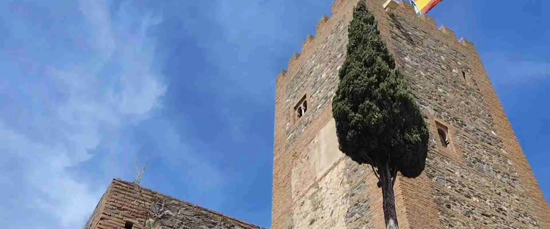
Above the church, a short final ascent along Calle Puerta de Granada reaches the Alcazaba of Vélez-Málaga — the hilltop fortress whose construction is documented from the 10th century. The main tower and principal gateway were substantially reconstructed in the early 1970s as part of a regional heritage restoration program, and the reconstruction is visible in the more regular masonry coursework of the tower compared to the original surviving wall sections. This intervention allows visitors to read the fortress’s scale and commanding position clearly; sections of original medieval wall survive between the rebuilt elements and give a sense of the construction methods of the Nasrid period.
The views from the Alcazaba’s upper terraces are the direct reward for the twenty-minute climb from the car park. To the south, the land falls steeply to the coastal plain, Torre del Mar, and the Mediterranean; on clear days, the Moroccan coast is visible on the horizon. To the north, the Axarquía valley opens across intensively terraced cultivation — avocado plantations and Moscatel vineyards stacked on every available slope — before rising to the Sierra de Tejeda. To the west, the rooftops of the Villa Quarter cascade below the fortress walls. Few viewpoints in the comarca match this one for the legibility of the layered historic landscape.
Allow 30–40 minutes on the Alcazaba terraces before descending. An alternative return route through the Villa Quarter — taking narrower alleys north of the main Calle Real de la Villa — adds fifteen minutes and passes several well-preserved traditional doorways and a small 16th-century street fountain. The complete Vélez-Málaga segment, from car park through the historic quarter, the church, the alcazaba, and back, takes 1.5–2.5 hours at an unhurried pace.
The lower commercial center of Vélez-Málaga has full café and restaurant provision for a pre-circuit breakfast or post-circuit coffee. The Thursday market, a longstanding weekly tradition in the city, adds significant activity and some navigational complexity to Thursday morning visits — an enjoyable complication if you are interested in local agricultural products, but worth knowing about for parking and walking-time purposes.
Segment 2: Bentomiz Castle — High-Altitude Military Architecture
The Bentomiz Castle summit sits at 709 meters in the municipal territory of Arenas, a whitewashed village twenty-five kilometers north of Vélez-Málaga via the A-335. Where the Alcazaba of Vélez-Málaga is a city monument embedded in urban fabric, Bentomiz Castle is entirely rural: an isolated hilltop ruin above olive groves and abandoned terraced fields, accessible by rough track and on foot, with panoramic views that justify the physical effort comprehensively. It is among the least-visited significant medieval castles in the province of Málaga precisely because it requires that effort.
Multiple local historical sources place the castle’s origins in at least the 9th century; the area is associated in regional medieval chronicles with the territories contested during the rebellion of Ibn Hafsun, the leader who held much of the eastern Axarquía against Umayyad Córdoba in the late 9th and early 10th centuries, though the extent of any direct connection between the historical figure and the specific castle structure is not definitively documented. From the 11th century onward, Bentomiz Castle’s role as an administrative and military center for the comarca is better attested in the sources: it became the hub of an extensive territorial district that organized settlements and controlled communications between the Axarquía interior and the Mediterranean coast.
By the Nasrid period of the 14th and 15th centuries, the castle had grown into a complex covering more than 40,000 square meters, organized around two principal enclosures. The northern and higher enclosure — the citadel (ciudadela) — housed the garrison and command functions. The larger southern zone, the outer enclosure (albacar), served as a refuge for the surrounding civilian population and livestock during periods of threat. The entrance to the citadel was defended by two flanking towers at the northern gate, a standard configuration for Nasrid frontier installations. Multiple underground cisterns provided water for prolonged defensive use.
In 1487, the Bentomiz garrison surrendered to the forces of Fernando and Isabel without battle — a detail noted specifically in contemporary accounts of the Axarquía campaign. This peaceful surrender allowed the castle fabric to survive the conquest intact. What damaged Bentomiz Castle was not military assault but centuries of post-conquest neglect and progressive dismantling for building materials by nearby villages, a fate common to most remote Andalusian fortresses. What remains — substantial sections of wall, the outlines of both enclosures, and several intact or partially-intact cistern chambers — gives a clear reading of the castle’s scale even in its ruined state.
The castle’s name encodes its function: local etymology preserved in multiple Axarquía sources derives “Bentomiz” from Arabic words approximating “the mountain from which you see the sea” — a description confirmed by the Mediterranean view that opens from the summit on clear days despite the castle’s position twenty-five kilometers inland at altitude.
The village of Arenas, from which the ascent begins, deserves a brief walk before or after the climb. Its whitewashed houses and narrow streets follow the contours of a lower hill at the base of the Bentomiz ridge, and the village participates in the Axarquía’s Mudéjar Route. The Church of Santa Catalina in Arenas, built in the 16th century on the site of the village mosque, preserves a visible section of the original mosque’s minaret (alminar) within its fabric — a tangible physical trace of the Islamic-period community whose built structures were otherwise repurposed or demolished after the Reconquest. Look for the minaret base, incorporated into the church tower structure; it is one of the more accessible surviving examples of this kind of architectural layering in the comarca.
Navigating the Ascent to San Bentomiz Citadel from Arenas
The trailhead for the Bentomiz Castle ascent is marked by a signpost on Calle de la Carretera in Arenas, identifiable from the main access road into the village. From this signpost, the initial section of the route descends gently toward the course of the Río Seco — a stream whose name reflects its seasonal character, often entirely dry by summer — before the sustained ascent to the summit begins. The lower section of the path passes through abandoned agricultural terraces planted with olive trees and the remnants of almond orchards. These stone-walled terrace systems, though now largely out of cultivation, represent an Islamic-period agricultural landscape that was intensively productive for eight centuries before the depopulation that followed the Reconquest and the subsequent Morisco expulsions.
Above the lower terraces, the path steepens significantly. The track here is loose stone and compacted earth, with gradient sections that require care in dry conditions (dusty, slippery underfoot) and considerably more care after rain (wet clay, high slip risk). This is the section that low-clearance passenger cars cannot safely navigate: ruts left by 4×4 vehicles and seasonal erosion make the surface unpredictable. On foot, the same terrain is entirely manageable with appropriate footwear — walking boots or sturdy trail shoes rather than trainers or sandals. Do not attempt this section in footwear without ankle support in wet conditions.
The ascent from Arenas village to the San Bentomiz Citadel summit on foot takes approximately 45–60 minutes at a moderate pace, covering roughly 3–4 km one way with approximately 500 meters of elevation gain. The descent takes slightly less time: 35–45 minutes, as the path is mostly clear of technical obstacles on the return. Total round-trip time including exploration at the summit: 2–2.5 hours.
At the summit, the ruins of the San Bentomiz Citadel open across a broad ridge enclosed by the castle’s outer walls. Surviving elements include substantial sections of the citadel’s perimeter wall on the northern side, with original Nasrid-period masonry visible in several coursework runs; the outline of two flanking towers at the northern gate, collapsed but readable in plan; and three or four underground cisterns accessible through low openings in the ground. Bring a small torch (flashlight) if you intend to inspect the cistern interiors — they are intact enough to enter partially, and the stonework of the vaulting is well-preserved. The southern outer enclosure’s perimeter is less clearly visible but traceable across the ridge as a low earth-and-rubble embankment.
The 360-degree views from the summit are, on clear days, among the finest available from any accessible hilltop in the province. The Mediterranean coast appears to the south as a blue line with Torre del Mar and Algarrobo visible on the coastal plain. To the west, the Vélez-Málaga valley floor and the rooftops of Arenas below. To the north and east, the mountain chains of the Sierra de Tejeda and Sierra Almijara — La Maroma prominent at 2,069 meters to the north — rise in a series of limestone ridges. On exceptional-clarity days following rain, the Sierra Nevada range above Granada is visible behind the nearer peaks.
Practical requirements for the ascent: walking boots or trail shoes are essential, not optional; at least one litre of water per person (more in warm months); sun protection including a hat; a first-aid kit for solo walkers. In July and August, temperatures on the exposed ridge regularly exceed 35°C by mid-morning and the complete absence of shade above the lower terrace zone makes a summer midday ascent inadvisable. The practical ascent season runs from mid-September through June. Spring mornings — March through May — are the most comfortable, with summit temperatures typically 10–15°C and wildflowers covering the lower slopes in a sequence of flowering that begins with almond blossom in February and continues through poppies, rockroses, and Axarquía’s endemic cistus species into May.
Segment 3: Frigiliana — The Mudéjar Urban Layout Above Nerja
Frigiliana occupies a hillside position at the foot of the Sierra Almijara, five kilometers inland from Nerja and roughly 40 kilometers east of Vélez-Málaga along the A-7 coastal corridor. Its proximity to Nerja’s large resort population makes it a standard half-day excursion for many coastal visitors, and on summer weekends it is emphatically not a hidden village. What separates Frigiliana from other Axarquía settlements on this circuit, however, is the quality and completeness of its historic Mudéjar urban fabric. The Barribarto quarter is by most measures the most intact example of an Islamic-period village layout in the province of Málaga — a distinction that earned it the First National Prize for Village Embellishment (Premio Nacional de Embellecimiento de los Pueblos de España) in 1982 and a place in the “Los Pueblos Más Bonitos de España” register.
Frigiliana’s history after the 1487 Reconquest follows the broader Axarquía Moorish-community pattern: nominal conversion to Christianity under the forced-conversion edicts of the early 16th century, creating the Morisco community that continued to occupy the Barribarto while maintaining elements of pre-conversion cultural practice. The tension between the Morisco community and the Spanish Crown escalated across the 16th century, culminating in the Revolt of the Alpujarras (1568–1571) — a Morisco uprising that began in Granada and spread to the mountainous Axarquía communities. In Frigiliana, the uprising produced a confrontation in 1569 at a rocky fortification above the village: the Battle of Peñón de Frigiliana. The ceramic panel inscriptions throughout the Barribarto record that a royal army of approximately 6,000 men under the command of Don Luis de Zúñiga y Requesens defeated and expelled the last Morisco holdout from the village, ending the continuous Moorish presence in Frigiliana that had defined the Barribarto for centuries.
The physical fabric of the Barribarto survived that confrontation largely intact — the ruins were on the hilltop, not in the village lanes — and the quarter has been continuously inhabited since. Its preservation is the product of that continuous habitation: a living neighborhood maintains itself in ways that an abandoned heritage site does not. The white lime-washed facades, maintained by a planning regulation that requires external repaint in the traditional color, give the quarter its signature visual identity. The underlying street geometry, however, is more significant: the alleys curve, branch, and dead-end in patterns that reflect the defensive topography of an Islamic-period settlement, and the houses adapt to the slope in height and plan in ways no standardized building code would produce.
Pedestrian Navigation and Architectural Highlights of El Barribarto
The Barribarto — a name derived from the local pronunciation of “Barrio Alto” (Upper Quarter), as the official Frigiliana tourism documentation records — begins at the upper edge of the village’s modern lower town. Two principal pedestrian routes ascend through the quarter, and the most rewarding approach for first-time visitors combines elements of both: ascend via one, descend via the other, and allow two to three hours for the full exploration without rushing.
The first and steeper ascent route follows Calle Hernando el Darra from the lower village upward into the core of the Barribarto. A stone arch near the base of the street marks the entrance to the upper quarter. The whitewashed houses on either side adapt continuously to the slope: facades are vertical while doorways and window sills are set at varying heights as the ground level changes between adjacent buildings. Flower pots in terracotta and painted ceramic, geraniums cascading over every available ledge, and the scent of jasmine from interior courtyard gardens characterize this ascent in every season except deep winter. The narrowest point of Calle Hernando el Darra is barely wide enough for two adults to pass sideways — a practical demonstration of the non-vehicular scale at which the Barribarto was built.
The second main route follows Calle Real from the level of El Ingenio upward through the center of the historic quarter to the Plaza de la Iglesia. This is the Barribarto’s commercial spine — restaurants, craft shops, and small guesthouses occupy its ground floors — and it carries the highest foot traffic of any street in the village. It is also the viewpoint from which the most frequently reproduced photographs of Frigiliana are made: the midpoint of Calle Real, looking northward, frames the white cascade of the Barribarto against the Sierra Almijara backdrop that appears on most regional promotional imagery. Go here before 10 AM to make this photograph without tourist backs filling the foreground.
Branching laterally from both main routes, a network of narrower alleys — El Zacatín, El Garral, Chorrera, and others — constitutes the authentic Barribarto experience. These passages branch, dead-end, staircase upward, and emerge unexpectedly onto wider streets or small viewpoints. Twelve ceramic panels installed throughout the quarter narrate the 1569 events in archaic Castilian Spanish with accompanying imagery; taken together, they function as an outdoor museum display that transforms the walk into a structured historical narrative. Most panels are concentrated between Calle Real and El Zacatín. The final panel — encountered near the end of the suggested circuit — describes the outcome of the 1569 battle and the deportation of the surviving Morisco population.
The Church of San Antonio de Padua stands at the Plaza de la Iglesia, roughly at the Barribarto’s mid-altitude point. Built in 1676 in a modest Renaissance style, it serves as the living parish church of the current village community. Its exterior is plain and whitewashed in keeping with the surrounding architecture; the interior, when open, shows a simple single nave with 17th-century altar furnishings. The Plaza de la Iglesia immediately in front of the church functions as the quarter’s natural breathing space — a slightly wider area where the alley geometry pauses — and makes a good reference point for navigation.
El Ingenio stands at the lower margin of the Barribarto and is Frigiliana’s most architecturally singular building: the Palacio de los Condes de Frigiliana, a 16th-century Renaissance palace with esgrafiado (incised plasterwork) decoration on its facade. The building now operates as the production facility for miel de caña — a sugar-cane derived product sometimes described as honey-cane syrup — and is widely cited as the last working mill of this type in Europe. The operating brand name is Nuestra Señora del Carmen. Visitors can enter the courtyard freely, observe the production process during operating periods, and purchase products in the on-site shop. Small jars begin at approximately €5–8, making El Ingenio’s products the most distinctive artisan purchase available on this circuit.
Two fountains mark the quarter’s public water history. The Fountain of the Three Cultures (Fuente de las Tres Culturas), positioned in the lower village, commemorates the Islamic, Jewish, and Christian communities whose presence shaped the Axarquía’s history. The Old Fountain (Fuente Vieja) higher in the Barribarto is a functioning historic water source that has served the village continuously.
Above the Barribarto, the minimal ruins of Lízar Castle (Castillo de Lízar) occupy the hilltop directly above the village. The fortification has largely collapsed, but the position offers the highest accessible vantage point within the village area: a panorama taking in the Barribarto cascade below, the coastal plain, the sea at Nerja, and on clear days the mountains above Granada. The Santo Cristo Viewpoint (Mirador Santo Cristo), set lower on the hillside above the residential Barribarto, combines coast and mountain views with the white-rooftop cascade below in the framing that characterizes most serious photography of the village.
Practical navigation notes for the Barribarto: the alleys are too steep and narrow for pushchairs or wheelchairs in the upper sections; the quarter is pedestrian-only by physical necessity, not just regulation. The best light for photography falls in the late afternoon — from approximately 3:30 PM in summer, 2:00 PM in winter — when the low western sun catches the whitewashed facades at a raking angle. For crowd avoidance, entering the Barribarto before 10:00 AM on any day and before 9:00 AM on summer weekends eliminates most of the group-tour traffic from Nerja that fills Calle Real between 11:00 AM and 2:00 PM. The Barribarto is a living residential neighbourhood, not a museum: loud voices and intrusive photography of residents’ open doorways disrupt the community that maintains this space. A slow, quiet individual or small-group visit is both more rewarding and more respectful.
Best Season and Timing 2027: When to Drive the Axarquía Circuit
March and April are the circuit’s optimal months. Valley temperatures range from 14–22°C and the Bentomiz Castle summit typically reads 8–16°C — cool enough for the ascent to be entirely comfortable, warm enough for terrace lunch in Arenas or Frigiliana to be pleasant without a heavy jacket. Almond trees flower through February and early March in the lower Axarquía; higher orchards and the wild plants of the Bentomiz hillside follow through April in a sequence that runs from white almond blossom to yellow and orange wildflowers. Visitor numbers are at their annual low: the coastal resort season has not yet begun, and the Axarquía interior receives almost no international visitor traffic in these months. Village restaurants are fully open and unhurried.
October and November offer an equivalent autumn window. By mid-October the Moscatel harvest — typically August into September — has concluded, but the remaining sun-dried grape clusters visible on valley terraces against the autumn light are a distinctive visual element of the season. Bodegas in Cómpeta continue to offer tastings through the winter period. October’s atmospheric clarity following the first autumn rains frequently produces exceptional visibility on the Bentomiz summit: the Sierra Nevada above Granada, normally hazy in summer, appears in sharp relief on post-rain days in October.
May and September are transitional months with generally favorable conditions but rising visitor numbers at Frigiliana. May is manageable on weekdays and offers excellent mountain conditions for the Bentomiz ascent; mid-May can see warm-to-hot afternoons (25–30°C at valley level). September’s second half sees the resort crowd thinning and is one of the most pleasant driving months, with warm afternoons and comfortable evenings.
Summer (June–August) requires careful management. Frigiliana peaks in August, when weekend crowds are dense and the car park fills before 9:30 AM. More significantly, the Bentomiz Castle ascent in July or August is genuinely hazardous for unprepared walkers: temperatures at the exposed summit exceed 35°C by mid-morning, the entire upper section is without shade, and the water requirements are substantially higher than in cooler months. If visiting in summer, the Bentomiz segment must begin no later than 7:30–8:00 AM and be completed before 10:30 AM; this means a very early departure from the coast base. Frigiliana should be reached by 7:30–8:00 AM and explored before the heat builds. Vélez-Málaga, with its street shade and traditional building mass, is the most tolerable summer stop of the three.
Winter (December–February) delivers the most consistently crowd-free conditions at all three stops. The Vélez-Málaga Villa Quarter and Frigiliana’s Barribarto are essentially empty on weekday mornings in January and February, and the quietness of both quarters at this season reveals the residential character of both historic neighborhoods with unusual clarity. The Bentomiz Castle ascent in winter is subject to significant weather variability: rain and low cloud are frequent between November and February, and while the access road and village are always passable, the summit may be socked in on many winter days, removing the principal reward of the climb. Winter-only visitors should treat Vélez-Málaga and Frigiliana as the primary stops and hold Bentomiz for a clear-day opportunistic visit.
Frequently Asked Questions
Is the Axarquía road trip circuit suitable as a day trip from Málaga city in 2027?
Yes. From Málaga city center, the circuit adds approximately 30–35 km of A-7 motorway driving each direction to the base timings described in this guide. Departing Málaga by 8:00 AM, the full three-stop circuit — Vélez-Málaga, Bentomiz Castle, and Frigiliana — can be completed with a lunch break and a comfortable return to Málaga before 7:00–7:30 PM. The A-7 connection is fast and well signed: Málaga center to Vélez-Málaga is typically 30–40 minutes. From the western Costa del Sol — Torremolinos, Fuengirola — add 20–30 minutes; the circuit still fits within a single day from these bases.
Do I need to book tickets or make reservations for any stop in 2027?
No advance booking is required or currently available for the three main heritage sites on this circuit. The Alcazaba of Vélez-Málaga, Bentomiz Castle, and the Frigiliana Barribarto streets are all free, open-access, and operate without timed entries or capacity limits. For restaurants in Arenas and Frigiliana — small villages with limited seating — a reservation for lunch at peak weekend times (1:00–3:00 PM on Saturdays and Sundays in summer) is worth making the morning of your visit. Mid-week and in the shoulder season, walk-in lunch is generally straightforward. The Nerja Caves (Cuevas de Nerja), if adding that visit, do operate timed-entry ticketing and should be booked in advance for peak periods — check the official website for current 2027 availability.
How physically demanding is the Bentomiz Castle ascent in 2027?
The round-trip walk from Arenas to the castle summit and back is approximately 6–8 km with around 500 meters of elevation gain on loose and uneven terrain. For walkers who regularly do hill walking or equivalent fitness activities, it is a moderate exertion — comparable to a medium-grade hill walk in Tuscany, Scotland, or the Pyrenean foothills. For those who do not regularly walk on steep terrain, it is challenging, particularly on the upper section where the gradient is sustained and the ground loose. The walk is significantly harder and genuinely dangerous in summer heat; see the seasonal notes above. It is not suitable for pushchairs or for visitors with limited mobility. Non-walkers can drive to Arenas, explore the village and the Church of Santa Catalina with its preserved minaret, and see the castle outline on the ridge above before continuing to Frigiliana — a worthwhile stop even without the full ascent.
Are there restaurants open along the route on weekdays in 2027?
Village restaurants in Arenas and Frigiliana operate year-round on most weekdays, though some reduce hours or close on Mondays outside peak season. Arenas has several bars and at least one restaurant near the Plaza de la Ermita serving traditional Axarquía dishes including local Moscatel by the glass; menú del día service typically runs 1:00–3:30 PM. Frigiliana has more options — around a dozen establishments ranging from simple café-bars on Calle Real to full-service restaurants with terraces. Vélez-Málaga’s lower commercial town has extensive café and restaurant provision at all hours and is a natural breakfast stop before the historic-quarter walk. On the Bentomiz section, there is no food or water available between the village and the summit; carry supplies from Arenas.
What is the ZTL situation in Vélez-Málaga’s historic center in 2027?
The Villa Quarter (Barrio de la Villa) above the modern Vélez-Málaga lower town is inaccessible by motor vehicle for physical reasons: the medieval lanes are simply too narrow for cars, and many have built-in step-ramps on their surfaces. This is not a digital ZTL permit system of the kind found in Italian historic centers; it is purely physical impossibility. You park in the lower town or at the recommended Polideportivo Fernando Hierro free car park, and walk. No traffic cameras, access control systems, or permit requirements of the Italian type operate in Vélez-Málaga’s historic area. The modern commercial lower town has metered street parking and small paid underground car parks with no access restrictions.
Is the Axarquía circuit suitable for families with children in 2027?
Partially, depending on children’s ages and fitness. Vélez-Málaga’s Villa Quarter walk (15–20 minutes of uphill on stone streets) suits children comfortable with sustained climbing; the alcazaba terrace views typically engage older children who enjoy lookout points. Frigiliana’s Barribarto, with its labyrinthine alleys, ceramic history panels, and El Ingenio courtyard, is generally the most engaging stop for younger children. The Bentomiz Castle ascent (6–8 km round trip on rough terrain with 500 meters of elevation gain) is realistically appropriate only for older children of ten and above with some hill-walking experience. Families with younger children or strollers should skip the Bentomiz ascent segment and substitute a longer lunch and more time in Frigiliana, which offers more walking-pace entertainment at a lower physical level.
What should I know about El Barribarto before visiting Frigiliana in 2027?
El Barribarto is a living residential neighbourhood, not a heritage park. People live in the whitewashed houses on either side of the alleys; their laundry hangs on lines above the passage, their cats occupy the doorsteps, and their daily routines continue alongside tourist visits. The most rewarding experience — and the most respectful one for the community that maintains this space — is a slow, quiet, individual or small-group walk that treats the neighbourhood as what it is: a functioning Andalusian village quarter with extraordinary historical depth. Reading the twelve ceramic history panels at walking pace takes about forty minutes and adds substantial context to the architectural observation; they narrate the specific local history that the generic “white village” framing omits.
Can I combine this circuit with a visit to Nerja in 2027?
Yes, and this is a natural extension. Completing Frigiliana in mid-to-late afternoon leaves time for a walk along Nerja’s Balcón de Europa clifftop promenade and a seafront dinner before returning to the base. The combination requires no extra driving — the Nerja approach road is on the return route from Frigiliana. The Nerja Caves (Cuevas de Nerja), the cave system famous for its Paleolithic-period paintings and dramatic geological formations, require a separate timed-entry visit (check the official website for 2027 ticket prices and availability; peak-season slots fill well ahead). A combined full Axarquía circuit plus Nerja Caves visit in a single day is overloaded for most visitors; treat them as a two-day programme if both are priorities.
What navigation tool works best for driving the Axarquía in 2027?
Google Maps and Waze handle the A-335, all paved village approach roads, and the Frigiliana access road accurately and reliably. For the Arenas–Bentomiz Castle walk, standard navigation apps do not map the track consistently; download an offline hiking track from Wikiloc or AllTrails before departure — multiple GPS-accurate user tracks for the Arenas-to-Bentomiz route are available on both platforms and remain accurate on the ground. General offline map capability (downloaded Axarquía region tile set) is useful for the mountain sections where mobile data signal can be intermittent on the A-335 north of Arenas. Offline capability is the practical recommendation for any driving in the comarca interior.
Is there an entry fee for the Alcazaba of Vélez-Málaga in 2027?
The Alcazaba of Vélez-Málaga — also officially known as the Fortaleza de Vélez-Málaga — is free to visit. Unlike the Alcazaba of Málaga city, which charges a standard admission fee, the Vélez-Málaga fortress is a municipal heritage site accessible to the public at no charge. Access to the exterior walls, terraces, and principal viewing points is free on all days. Verify locally before your visit, as municipal admission policies can change, but free access has been the consistent arrangement here and remains the expectation for 2027. The adjacent Church of Santa María la Mayor operates under separate ecclesiastical administration with its own opening hours; a voluntary donation for interior access may be requested.