Luxembourg UNESCO World Heritage: Old Quarters & Fortifications Guide
Luxembourg City’s Old Quarters and Fortifications represent one of Europe’s most remarkable examples of military architecture spanning over a millennium. Inscribed on the UNESCO World Heritage List in 1994, this 138-hectare site showcases the strategic evolution of fortress design through successive European powers while preserving the authentic character of a medieval city that adapted to life within formidable defensive walls.
Key Takeaways: Luxembourg UNESCO World Heritage Site
- UNESCO Recognition: The site “City of Luxembourg: its Old Quarters and Fortifications” achieved World Heritage status in 1994 under criterion (iv), recognizing its outstanding universal value as one of Europe’s most significant fortified cities from the 16th to 19th centuries.
- Strategic Importance: Luxembourg’s position at the confluence of the Alzette and Pétrusse rivers on a steep rocky outcrop made it one of Europe’s greatest fortresses, earning the nickname “Gibraltar of the North” through continuous reinforcement by successive European powers including the Holy Roman Emperors, House of Burgundy, Habsburgs, French, Spanish, and Prussians.
- Underground Defenses: The Bock and Pétrusse Casemates form an extraordinary 17-kilometer network of underground tunnels carved through rock at depths reaching 40 meters, originally housing 1,200 soldiers with their horses, equipment, artillery workshops, kitchens, and bakeries, later sheltering 35,000 civilians during World War II.
- Preserved Medieval Urban Fabric: The old quarters maintain their authentic medieval street layout and architectural character despite partial dismantlement of fortifications from 1867-1883, with the Ville Haute (Upper Town) and Ville Basse (Lower Town) districts showcasing centuries of European architectural evolution from Romanesque through Baroque styles.
- Living Heritage: Unlike many fortress ruins, Luxembourg’s UNESCO site functions as a vibrant modern capital where residents live and work within the same medieval street patterns that defensive requirements shaped centuries ago, creating a unique blend of historical preservation and contemporary urban life.
- Accessible Historical Experience: Both casemate networks opened to public access in 1933, allowing visitors to explore the underground galleries, view fortification remnants including bastions and ramparts, walk along the Corniche promenade known as “Europe’s most beautiful balcony,” and experience the multi-level topography that defines Luxembourg’s distinctive character.
People Also Ask About Luxembourg UNESCO World Heritage
Why Is Luxembourg City a UNESCO World Heritage Site?
Luxembourg City earned UNESCO World Heritage designation in 1994 under criterion (iv) for its outstanding representation of European military architecture and urban development. The site demonstrates exceptional significance as one of Europe’s largest fortified cities from the 16th century until 1867, continuously strengthened and modified by successive European powers including the Holy Roman Empire, Burgundy, Habsburg Austria, Spain, France, and Prussia. The fortifications exemplify the evolution of military engineering over three centuries, while the old quarters preserve authentic medieval urban fabric adapted to life within defensive constraints. The combination of surviving fortification elements—including 17 kilometers of underground casemates, bastions, ramparts, and gates—with the intact medieval street layout creates a complete representation of how strategic military importance shaped urban development across multiple centuries of European history.
What Are the Bock Casemates in Luxembourg?
The Bock Casemates constitute a vast underground defense system of tunnels and galleries carved through solid rock beneath Luxembourg’s old fortress, extending 17 kilometers across multiple levels reaching depths of 40 meters. Spanish forces initiated construction in 1644 on the Bock promontory where Count Siegfried founded Luxembourg’s original castle in 963. French military engineer Sébastien Le Prestre de Vauban expanded the system extensively between 1684-1688 during Louis XIV’s reign. The casemates housed 1,200 soldiers along with their horses, artillery, workshops, kitchens, bakeries, and slaughterhouses—functioning as a self-contained underground fortress city. During both World Wars, these tunnels sheltered up to 35,000 civilians during bombardments. Numerous loopholes carved into the rock provide spectacular views of the Grund and Pfaffenthal neighborhoods below. The casemates opened to public exploration in 1933 and remain Luxembourg’s premier historical attraction, accessible from Montée de Clausen near St. Michael’s Church.
When Was Luxembourg’s Fortress Dismantled and Why?
Luxembourg’s fortress underwent systematic dismantlement from 1867 to 1883 following the Treaty of London signed on May 11, 1867. This treaty declared Luxembourg perpetually neutral after the Austro-Prussian War and broader European power reorganization, requiring the destruction of fortifications that had made it one of Europe’s strongest defensive positions. The dismantling work consumed 16 years of intensive labor, removing surface fortifications, leveling walls, and sealing much of the underground network. However, substantial portions survived either through incomplete demolition or deliberate preservation decisions. The Bock and Pétrusse Casemates retained approximately 17 kilometers of accessible underground tunnels that were not filled in. Several gates, bastions, redoubts, and fortification wall sections remained standing. The medieval street layout of the old quarters, which UNESCO explicitly recognizes as part of the heritage value, preserved the spatial organization shaped by defensive requirements, creating the distinctive multi-level topography that characterizes modern Luxembourg City.
What Is the Difference Between Ville Haute and Grund in Luxembourg?
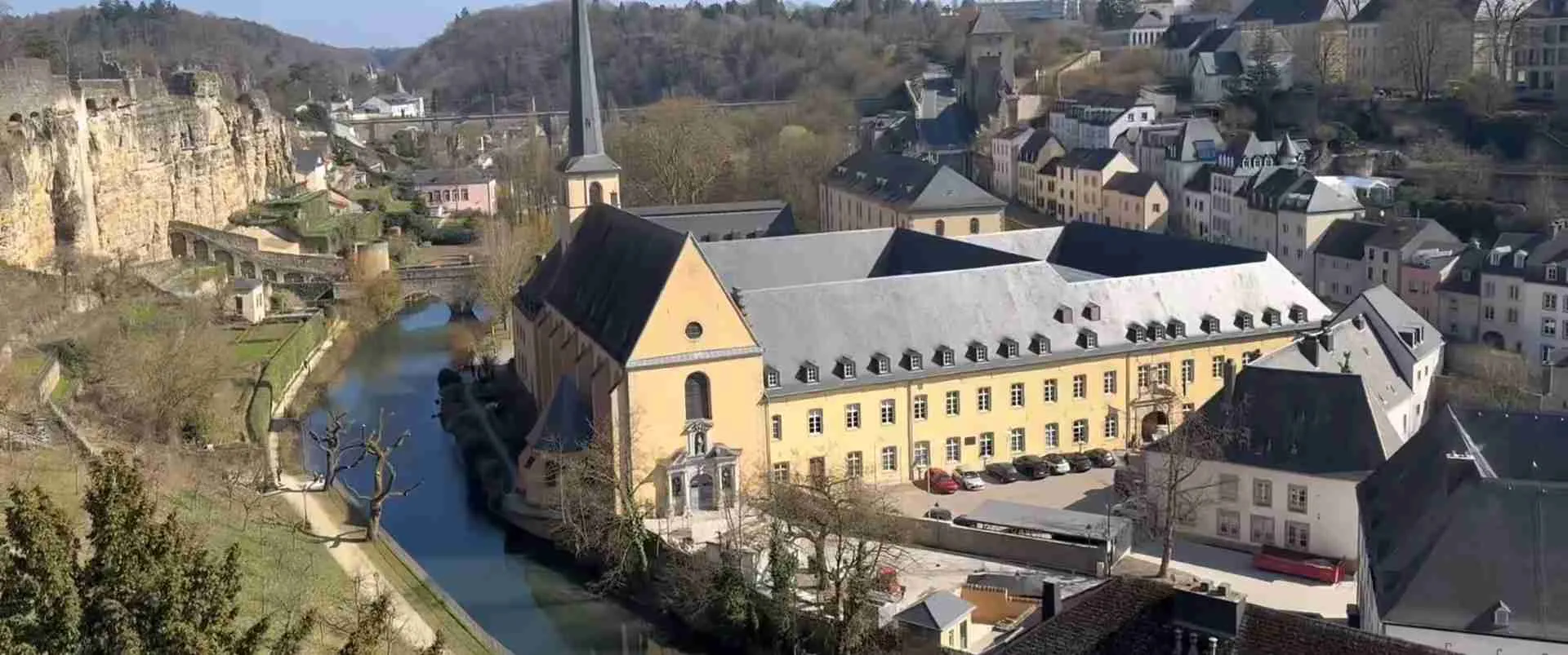
Ville Haute and Grund represent Luxembourg City’s upper and lower quarters respectively, separated by dramatic elevation changes created by the Alzette and Pétrusse river valleys. Ville Haute (Upper Town) occupies the rocky plateau where the original medieval fortress stood, concentrating political and religious power with the Grand Ducal Palace, Chamber of Deputies, Notre-Dame Cathedral, and major squares including Place Guillaume II and Place d’Armes. While many Ville Haute buildings date from the 18th-19th centuries, the street plan preserves the medieval framework shaped by ramparts and the promontory’s irregular outline. Grund (Ground) spreads along the Alzette River bend in the valley below, overlooked by the Bock cliff and the Corniche promenade above. This lower quarter developed differently, following river valley contours with traditional half-timbered architecture, narrow bridges, and some of Luxembourg’s oldest surviving houses. Neumünster Abbey, a 17th-century former Benedictine monastery, serves as a landmark in Grund. Visitors move between levels via panoramic elevators, spiral staircases, or the dramatic Wenzel Circular Walk.
Extended multi-day tours – 5+ days
Featured Western Europe Multi-Day Tour Packages

3 days
Western Europe 3-Day Discovery Tour
- ✓ Comprehensive Western Europe experience
- ✓ Expert local guides included
- ✓ All accommodation included
- ✓ Transportation provided
5 days
Western Europe 5-Day Highlights Experience
- ✓ Comprehensive Western Europe experience
- ✓ Expert local guides included
- ✓ All accommodation included
- ✓ Transportation provided
7 days
Western Europe 7-Day Cultural Journey
- ✓ Comprehensive Western Europe experience
- ✓ Expert local guides included
- ✓ All accommodation included
- ✓ Transportation provided

10 days
Western Europe 10-Day Complete Adventure
- ✓ Comprehensive Western Europe experience
- ✓ Expert local guides included
- ✓ All accommodation included
- ✓ Transportation provided
Multi-day tour packages powered by TourRadar. Prices and availability subject to change.
Introduction: Understanding Luxembourg’s UNESCO Heritage Significance
The inscription of “City of Luxembourg: its Old Quarters and Fortifications” on the UNESCO World Heritage List in 1994 recognized a site of exceptional universal value that transcends national boundaries to represent fundamental chapters in European military, political, and urban history. Reference number 699 on the World Heritage register protects 138 hectares—29.94 hectares of core heritage area plus 108.73 hectares of buffer zone—encompassing one of the continent’s most complete examples of how strategic military importance shaped urban development across a millennium.
Luxembourg’s heritage value emerges from the convergence of geography, politics, and military innovation. The city’s position at the confluence of the Alzette and Pétrusse rivers, perched on steep rocky outcrops that form natural defensive barriers, attracted Count Siegfried in 963 when he established a small castle on the Bock promontory. This modest beginning evolved into one of Europe’s most formidable fortresses as the Duchy of Luxembourg became a strategic prize contested by successive European powers. From the 16th century until neutralization in 1867, each ruling authority—the Holy Roman Emperors, the House of Burgundy, the Habsburg dynasty, the kings of France and Spain, and finally Prussia—reinforced and expanded the defenses, creating a palimpsest of military architecture that UNESCO criterion (iv) recognizes as an outstanding example of fortification evolution.
The fortifications earned Luxembourg the sobriquet “Gibraltar of the North,” reflecting defensive capabilities that rivaled the Mediterranean stronghold. The comparison held substance: massive stone bastions ringed the upper town, underground casemate networks honeycomb the cliff faces at multiple levels, and strategic positioning of artillery emplacements covered all approaches. Military engineers considered Luxembourg nearly impregnable, a reputation tested through numerous sieges from the 15th through 18th centuries. French forces under Louis XIV invested enormous resources between 1684-1688 when the renowned military engineer Sébastien Le Prestre de Vauban redesigned much of the defensive system according to his revolutionary principles of fortification geometry.
The Treaty of London in 1867 fundamentally altered Luxembourg’s trajectory. European powers agreed to guarantee Luxembourg’s perpetual neutrality in exchange for complete dismantlement of the fortress that had made it a military flashpoint. The systematic destruction consumed 16 years, from 1867 to 1883, as workers leveled surface fortifications, demolished walls, and sealed underground passages. Yet demolition proved incomplete. Technical challenges prevented filling all the casemate networks, particularly where multiple levels descended 40 meters through solid rock. Approximately 17 kilometers of underground galleries survived, along with significant portions of bastions, gates, and ramparts. These remnants, combined with the entirely preserved medieval street layout of the old quarters, provide the authentic material evidence that justified UNESCO inscription.
The old quarters themselves represent equally significant heritage. Within the fortress walls, life adapted to defensive constraints in ways that shaped urban form. Narrow streets wind irregularly, following the dictates of topography and fortification geometry rather than planned grids. Building plots crowd together, maximizing limited space within defensive perimeters. The Ville Haute developed as the administrative and religious center where aristocratic families and major religious orders built their mansions and monasteries close to seats of power. The lower quarters—Grund, Pfaffenthal, Clausen—emerged in the river valleys, initially as working-class neighborhoods housing artisans, craftsmen, and laborers who served the fortress garrison and administrative apparatus.
Architectural heritage within the old quarters spans Romanesque, Gothic, Renaissance, and Baroque periods, reflecting continuous development under successive rulers. The Grand Ducal Palace exemplifies Renaissance elegance with later renovations. Notre-Dame Cathedral, Luxembourg’s only cathedral, demonstrates late Gothic architecture with distinctive spires. St. Michael’s Church, the oldest extant religious structure, preserves elements from its 10th-century origins. Neumünster Abbey anchors the Grund district with its 17th-century Benedictine heritage, now serving as a cultural center. These individual monuments exist within an urban fabric whose overall character—irregular street patterns, mixed architectural styles, adaptation to topographical constraints—demonstrates how fortification requirements shaped civilian life.
The UNESCO designation acknowledges that authenticity survives despite the 19th-century dismantling. The massive defensive structures, by their nature, resisted significant alteration in shape or materials beyond surface demolition. The medieval urban fabric within the ramparts maintains its spatial organization intact. Street names often preserve historical memory of former defensive elements or military functions. The casemate networks, though no longer housing soldiers and artillery, retain original rock-carved galleries, loopholes, and connecting passages. This high degree of authenticity distinguishes Luxembourg from many European fortress cities where later development obscured historical layers.
Integration of heritage preservation with contemporary urban life presents ongoing management challenges. Luxembourg City functions as a modern European capital housing EU institutions, international banks, and a diverse population of 135,000 residents. The old quarters are not museum pieces but living neighborhoods where people reside, work, and conduct daily business within medieval street patterns. Traffic management, infrastructure modernization, and building conservation must balance preservation imperatives with contemporary needs. The site management plan, overseen by Luxembourg’s Ministry of Culture and the City administration, addresses these tensions through zoning regulations, architectural review processes, and infrastructure projects designed to respect historical character while accommodating modern functions.
Public access forms a cornerstone of heritage management. Both the Bock and Pétrusse Casemates opened to visitors in 1933, establishing a tradition of public engagement with underground heritage. Modern interpretive installations, including cutting-edge scenography with light displays in the Pétrusse Casemates and informational displays in the Bock network, enhance visitor understanding without compromising authenticity. The Wenzel Circular Walk, a 5.5-kilometer pedestrian route, connects major heritage sites while providing panoramic views of the fortification topography. Educational programs target local residents and international visitors alike, fostering appreciation for the site’s significance across multiple audiences.
The 30th anniversary of UNESCO inscription in 2024 prompted reflection on three decades of World Heritage management. Initiatives during this period included accessible tourism programs for visitors with special needs, development of UNESCO-focused guide training, creation of family-friendly educational materials like the UNESCO4Kids tour, and enhanced digital documentation of heritage assets. These programs aim to fulfill UNESCO’s requirements for raising awareness of outstanding universal value while ensuring sustainable heritage management that protects authenticity for future generations.
Luxembourg’s World Heritage significance extends beyond national pride to represent collective European memory. The fortifications document military technology evolution over three centuries. The old quarters preserve urban patterns shaped by defensive constraints common to fortress cities across the continent. The site’s history reflects broader European power dynamics as ruling authorities changed through warfare, dynastic marriage, and diplomatic maneuvering. Understanding Luxembourg’s heritage contributes to comprehending how military considerations shaped urban development throughout European history, making the site valuable not merely as a Luxembourg landmark but as testimony to shared continental experience.
The Foundation: Count Siegfried and the Birth of Luxembourg
Luxembourg’s story begins in 963 when Count Siegfried, a Frankish nobleman, acquired a rocky promontory known as the Bock through an exchange agreement with the Abbey of St. Maximin in Trier. The Latin designation “Lucilinburhuc”—meaning “little castle”—described the modest fortification Siegfried constructed on this naturally defensive position. The site’s selection demonstrated astute military judgment: the Bock rises as a steep cliff above the Alzette River, creating a nearly impregnable natural barrier on three sides that required artificial fortification only along the western approach.
Archaeological evidence and historical records indicate Siegfried’s original castle occupied a relatively compact footprint atop the promontory. The structure likely consisted of a stone keep surrounded by wooden palisades and defensive ditches, standard construction for minor fortifications of the early medieval period. The natural topography provided the primary defense, with the castle serving as a secure residence and administrative center for Siegfried’s territorial holdings in the region.
Settlement developed rapidly around the castle as merchants, craftsmen, and service providers established themselves to support the count’s household and garrison. By the 12th century, this growing community warranted protection through construction of a stone fortification wall extending beyond the immediate castle environs. This first urban wall, portions of which survive in modified form, defined Luxembourg’s initial expansion from a single fortified residence to a defended town. The wall followed topographical contours, creating an irregular perimeter that would characterize Luxembourg’s urban form throughout subsequent centuries.
Siegfried’s descendants expanded their political influence significantly, transforming Luxembourg from a minor county into a major European power. The House of Luxembourg produced four Holy Roman Emperors between 1308 and 1437, elevating the duchy’s prestige far beyond its modest territorial extent. This imperial connection brought wealth, political attention, and the strategic importance that would ultimately drive continuous fortification enhancement. The Wenzel Wall, constructed during the reign of Wenceslas II (Duke from 1383 to 1419), represents the third major expansion of urban defenses, pushing the fortified perimeter substantially beyond earlier limits.
The original Bock castle underwent continuous modification and expansion through the medieval period. Each generation of rulers adapted the structure to evolving military technology and increased garrison requirements. By the 15th century, the Bock had evolved from Siegfried’s simple stone keep into a complex fortified ensemble with multiple towers, defensive walls at various levels, and early gun emplacements adapted to emerging artillery warfare. The Spanish conquest in 1443 initiated the transformation from medieval fortress to modern bastion system, beginning Luxembourg’s evolution into one of Europe’s premier military installations.
Strategic Crossroads: Geography and Geopolitical Significance
Luxembourg’s transformation into a fortification of exceptional importance stemmed directly from its geographic position at a European crossroads. The city occupies a strategic location where major overland routes connecting the Rhine valley, the Moselle region, France, and the Low Countries converge. Control of Luxembourg meant control over military movements, commercial traffic, and communication lines between major European power centers. This strategic value made the fortress a perpetual object of contest between rival states seeking regional dominance.
The natural topography amplified strategic advantages. The confluence of the Alzette and Pétrusse rivers creates deep ravines that slice through the landscape, forming natural moats around elevated plateaus. The Bock promontory rises as a sheer cliff face approximately 70 meters above the Alzette valley floor, creating a defensive barrier that medieval siege engines and later artillery struggled to overcome. The Kirchberg plateau to the northeast, the Rham plateau to the east, and the Bourbon plateau to the south provided additional elevated positions that successive military engineers incorporated into expanding defensive systems.
River valleys served dual purposes in the defensive scheme. The Alzette and Pétrusse created wet moats that prevented direct assault on cliff faces while providing water supply for the garrison. The steep valley slopes, often approaching vertical in certain sections, precluded scaling attempts and forced attackers into predictable approach routes where defenders concentrated firepower. The lower quarters that developed in these valleys—Grund along the Alzette, the Pétrusse valley along its namesake river—gained additional protection from the fortifications ringing the heights above, creating defense in depth unusual for medieval fortress cities.
Luxembourg’s location relative to major European powers intensified strategic importance through the 16th to 19th centuries. The fortress stood at the intersection of French, Germanic, and Low Countries spheres of influence, making it valuable to whichever power could hold it. From a French perspective, Luxembourg controlled access routes into Germanic territories and secured eastern frontiers. For the Holy Roman Empire and later Habsburg Austria, Luxembourg guarded western approaches and maintained imperial influence in the Low Countries. For Spain during its Habsburg period, Luxembourg anchored defensive systems protecting the Spanish Netherlands. This multi-directional strategic value meant no major European power could afford to concede Luxembourg to rivals.
The fortress changed hands repeatedly through warfare and dynastic arrangements. Burgundian forces captured Luxembourg in 1443, beginning a pattern of conquest and reconquest that would continue for four centuries. Through Habsburg inheritance, control passed to Spain in 1506, initiating the Spanish period that witnessed massive fortification expansion. France seized Luxembourg in 1684, prompting Louis XIV to commission Vauban’s famous redesign. The Treaties of Utrecht and Rastatt returned Luxembourg to Habsburg Austria in 1714. Prussia gained control in 1815 following Napoleon’s defeat. Each transition brought new fortification philosophies, additional defensive layers, and increased strategic investment in an already formidable position.
Military theorists recognized Luxembourg as one of a handful of fortresses whose capture or defense could determine broader campaign outcomes. Siege operations against Luxembourg in 1684 and 1794-95 involved tens of thousands of troops and consumed months of effort, demonstrating the resource commitment required to reduce the defenses. The French siege of 1794-95 during the Revolutionary Wars lasted seven months before Austrian defenders capitulated, highlighting defensive capabilities even against armies employing modern artillery and siege tactics. Luxembourg’s reputation as nearly impregnable was well-earned through demonstrated resistance to repeated assault.
The Gibraltar of the North: Military Architecture Evolution
Luxembourg’s sobriquet “Gibraltar of the North” reflected genuine military engineering achievement rather than mere promotional hyperbole. Like its Mediterranean counterpart, Luxembourg combined natural defensive advantages with artificial fortifications of exceptional strength, creating a position military professionals considered among Europe’s most formidable. The comparison appeared in military treatises, diplomatic correspondence, and popular accounts throughout the 18th and 19th centuries, establishing Luxembourg’s reputation as a fortress rivaling any on the continent.
The evolution from medieval castle to early modern fortress system occurred gradually through the 15th and 16th centuries. Medieval walls designed to resist siege engines proved inadequate against gunpowder artillery that could batter down vertical stone barriers. Military engineers adapted fortifications to the artillery age through several innovations: thickening walls to absorb cannon fire, lowering profiles to present smaller targets, angling faces to deflect projectiles, and creating bastions that projected from main walls to provide flanking fire along defensive perimeters. Luxembourg’s fortifications incorporated all these elements as successive rulers invested in modernization.
The Spanish period from 1506 to 1684 witnessed Luxembourg’s transformation into a bastion fortress following principles developed in Italy and the Low Countries. Spanish military engineers, including the Swiss fortress builder Isaac von Treybach, directed construction of massive earthwork bastions with stone revetments, extensive outworks protecting main defenses, and the first systematic development of underground casemate galleries. The Beck Bastion, built in 1644 and named for Governor Baron Johann von Beck, exemplified Spanish military architecture with its angular trace, earthen core reinforced by stone facing, and gun emplacements positioned for maximum fields of fire. The ravelin du Pate, a triangular outwork constructed in 1673, added another defensive layer protecting the Beck Bastion’s approaches.
French control beginning in 1684 initiated Luxembourg’s most ambitious fortification phase under the direction of Sébastien Le Prestre de Vauban, the era’s preeminent military engineer. Vauban served Louis XIV as Commissioner General of Fortifications, designing or modifying over 300 fortresses across France and conquered territories. His work at Luxembourg between 1684 and 1688 applied his systematic fortification theories to the site’s unique topography. Vauban redesigned the Pétrusse valley fortifications, constructed the elaborate “Small Staircase” connecting different defensive levels, and vastly expanded the underground casemate networks. His modifications transformed Luxembourg from a strong regional fortress into a first-rank European stronghold capable of withstanding extended siege by large armies.
The Austrian period following the 1714 Treaties brought additional enhancements. Austrian military engineers added the “Bourbon Lock” in 1728-29, improving security of passages connecting different fortification sectors. The “Large Staircase” constructed during this period provided additional communication routes between defensive levels. In 1746, the Austrians built the Pétrusse Battery with 54 gun emplacements, creating concentrated artillery positions capable of devastating firepower against approaches from the south and west. These Austrian additions represented the final major expansion phase before Luxembourg’s eventual neutralization and dismantlement.
The fortifications at their maximum extent in the mid-19th century covered approximately 180 hectares—far larger than the 138-hectare UNESCO site that preserves surviving elements. Three concentric defensive rings protected the city: the innermost medieval walls enclosing the original settlement, middle-period bastions constructed during Spanish and early French rule, and outer detached forts and redoubts from the late 18th and early 19th centuries. This defense-in-depth configuration meant attackers penetrating outer works faced successive defensive lines, each independently defensible and mutually supporting through coordinated fire.
The casemate system represented Luxembourg’s most innovative defensive element. These underground galleries, carved through solid rock at multiple levels, served diverse military functions beyond simple troop shelter. Artillery casemates housed cannon protected from counter-battery fire while maintaining clear fields of fire through embrasures cut in rock faces. Personnel casemates provided barracks space for garrison troops, protecting them from bombardment while keeping them ready for rapid deployment to threatened sectors. Storage casemates held ammunition, provisions, and military equipment secure from both weather and enemy action. Workshop casemates contained facilities for weapon repair, ammunition production, and other support activities.
The extent of underground works distinguished Luxembourg from most European fortresses. While many fortifications included limited casemate elements, Luxembourg developed an integrated subterranean city spanning 17 kilometers of tunnels and galleries arranged across multiple levels. The deepest galleries descended 40 meters below the surface, well beyond reach of the era’s heaviest siege mortars. Interior spaces within the casemates accommodated 1,200 soldiers along with their horses, providing not merely shelter but functional military infrastructure underground. Separate chambers housed kitchens with proper ventilation, bakeries producing bread for the garrison, slaughterhouses processing meat, and arsenals storing weapons and gunpowder.
Ventilation engineering in the casemates demonstrated sophisticated understanding of air circulation principles. Natural draft systems using temperature differentials drew fresh air through carefully positioned openings while exhausting stale air through vertical shafts. This ventilation proved sufficient for human habitation and even supported cooking fires in underground kitchens without dangerous smoke accumulation. The preservation of these ventilation systems allows modern visitors to experience the casemates without artificial air circulation despite depths of 40 meters below surface level.
Luxembourg’s reputation deterred several potential attacks while forcing besiegers who did commit to extended operations. The 1684 French siege under Louis XIV required massive force deployment and sophisticated siege works before defenders negotiated honorable surrender. The 1794-95 siege during the French Revolutionary Wars demonstrated defensive effectiveness even as military technology advanced: Austrian defenders held out seven months against French revolutionary armies, capitulating only after starvation and disease depleted garrison strength beyond sustainable levels. These historical examples validated Luxembourg’s status among Europe’s premier fortresses.
The Underground City: Bock and Pétrusse Casemates
The Bock Casemates constitute Luxembourg’s most dramatic heritage element, offering tangible connection to the fortress city’s military past through direct physical engagement with spaces that housed soldiers, artillery, and support infrastructure. This 17-kilometer network of tunnels and galleries carved through solid sandstone represents engineering achievement comparable to more famous underground works like Dover’s White Cliffs tunnels or Malta’s wartime shelters, yet remains less internationally known despite exceptional preservation and accessibility.
Spanish military engineers initiated casemate construction in 1644 on the Bock promontory, the same rocky outcrop where Count Siegfried established his original castle nearly seven centuries earlier. The strategic logic was clear: the Bock’s cliff face, while providing natural defensive barriers, also presented dead ground vulnerable to enemy approach if not actively defended. Carving galleries and gun positions directly into the cliff allowed defenders to maintain fields of fire covering approaches from the Alzette valley while protecting artillery and soldiers from counter-battery fire. The rock itself, dense sandstone formed millions of years prior, provided structural strength sufficient to support overhead loads without artificial reinforcement while remaining workable with hand tools and limited explosives available to 17th-century engineers.
French expansion under Vauban between 1684-1688 dramatically increased the casemate system’s extent and sophistication. Vauban’s engineers excavated additional galleries at multiple levels, creating interconnected passages that allowed troops and artillery to shift position rapidly in response to attack directions. Cross-passages linked parallel galleries, providing redundant communication routes that maintained connectivity even if individual sections suffered collapse from bombardment or deliberate demolition by besiegers. Vertical shafts connected different levels, enabling ammunition and supplies to move from storage chambers to gun positions efficiently. The resulting three-dimensional network functioned as an underground fortress city with its own internal organization and defensive logic.
Gallery dimensions reflect their specific military functions. Artillery casemates feature high ceilings—often 4-5 meters—accommodating cannon and their crews plus ventilation for powder smoke. Gun embrasures cut through the rock face at strategic angles, providing clear shots at approach routes while limiting enemy ability to return effective fire into the protected interior. Personnel galleries tend toward smaller dimensions, typically 2-3 meters high and wide, sufficient for troop movement and habitation but requiring less excavation labor. Storage chambers vary widely based on intended contents, with powder magazines featuring particularly robust construction and careful ventilation to prevent accidental detonation.
Loopholes carved into the cliff face at irregular intervals provide viewpoints and firing positions covering the valleys below. Modern visitors experience these openings as spectacular viewing platforms offering panoramic vistas of the Grund and Pfaffenthal neighborhoods, the Alzette River, and surrounding fortification remnants. During the fortress’s active military period, soldiers positioned at these loopholes provided surveillance of approaches and directed musket or rifle fire at attackers attempting to scale cliffs or assault lower defensive works. The irregular spacing of loopholes prevented enemy marksmen from suppressing all positions simultaneously, maintaining continuous defensive coverage along the cliff face.
Interior spaces within the casemates reveal adaptation to underground living requirements. Chambers designated as barracks show evidence of sleeping platforms, storage niches carved into walls, and ventilation channels ensuring breathable air for troops during extended occupancy. Kitchen areas preserve remnants of hearths and chimney channels venting cooking smoke to surface openings while drawing fresh air for combustion. Well chambers accessed underground water sources, critical for garrison survival during siege operations when surface water collection might expose personnel to enemy fire. These domestic details humanize the military engineering, demonstrating how soldiers lived and worked in this underground environment.
The Pétrusse Casemates, while part of the same overall defensive system, developed somewhat independently based on different topographical conditions. Where the Bock casemates exploit a dramatic cliff face, the Pétrusse network occupies gentler slopes along the valley of its namesake river. Construction began in 1644 contemporaneously with the Bock expansion, with Spanish engineers under Isaac von Treybach directing excavation beneath the Beck Bastion. The triangular ravelin du Pate constructed in 1673 protected the bastion’s approaches, with casemate galleries carved beneath the earthwork providing protected firing positions and troop accommodation.
Vauban’s redesign of the Pétrusse fortifications between 1684-1688 integrated casemate development with above-ground bastion modifications. The “Small Staircase” he constructed provided secure communication between defensive levels, allowing troops to move from the Ville Haute down to positions along the valley floor without exposure to enemy observation or fire. Austrian engineers added the “Large Staircase” and the massive Pétrusse Battery with 54 gun emplacements in the mid-18th century, further developing the network’s military capabilities. The battery’s underground galleries stored ammunition for the artillery park above while providing alternative firing positions if surface emplacements suffered damage.
The 1867-1883 dismantlement period posed existential threats to the casemate networks. The Treaty of London required destruction of Luxembourg’s fortifications, and initial dismantlement plans called for completely filling underground galleries with rubble to prevent future military use. Practical considerations prevented total destruction: the labor and material requirements to fill 17 kilometers of tunnels proved prohibitive, while concerns about structural stability argued against aggressive collapse attempts that might damage buildings in the old quarters above. Pragmatic compromise left most galleries intact though sealed at major entrances, preserving the networks for eventual reopening as historical monuments.
Tourism development began in 1933 when both the Bock and Pétrusse Casemates opened to public access, establishing Luxembourg’s underground heritage as a visitor attraction nearly six decades before UNESCO inscription. Early interpretive approaches remained minimal—guided tours with torch illumination allowed exploration of principal galleries while communicating basic historical context. Gradual improvements through the 20th century added electric lighting, improved accessibility features, and more sophisticated interpretive content. The commitment to public access ensured that post-UNESCO inscription management built on established visitor infrastructure rather than creating entirely new tourism frameworks.
Contemporary presentation balances heritage conservation with engaging visitor experience. The Pétrusse Casemates underwent major interpretive redesign, installing cutting-edge scenography with LED lighting installations that highlight architectural features while creating atmospheric effects evoking the military period. Video projections on tunnel walls present historical narratives, with the Bock and Pétrusse promontories themselves appearing as animated characters explaining fortress history through engaging dialogue. These modern installations enhance understanding without altering the authentic rock-carved galleries, lighting systems designed for complete removal when necessary for conservation purposes.
The Bock Casemates maintain more traditional presentation emphasizing architectural authenticity. Lighting accentuates the rock-carved chambers and passages while allowing visitors to appreciate original features—loopholes, ventilation channels, stone steps cut directly into living rock. Informational panels provide historical context about military functions, construction techniques, and garrison life. The emphasis remains on direct physical engagement with heritage fabric rather than multimedia mediation, offering complementary experience to the Pétrusse installation’s more interpretive approach.
Conservation challenges specific to underground heritage require ongoing management attention. Rock faces within the casemates, protected from weathering during centuries of closure, now experience accelerated deterioration from moisture introduced by visitor respiration, temperature fluctuations from climate control systems, and physical contact with surfaces. Monitoring systems track humidity levels, temperature, and structural movement, allowing preventive intervention before deterioration reaches critical thresholds. Access restrictions limit visitor numbers in particularly fragile sections, balancing public engagement with conservation imperatives.
Both casemate networks demonstrated unexpected utility during 20th-century conflicts despite military obsolescence following the 19th-century dismantlement. World War I saw limited use as civilian shelters during air raid warnings, though Luxembourg’s declared neutrality largely spared the city from sustained bombardment. World War II brought more intensive utilization: despite German occupation violating Luxembourg’s neutrality, the casemates provided critical protection during Allied air raids targeting strategic infrastructure. Historical accounts document up to 35,000 civilians sheltering in the underground galleries during bombing alerts, capacity far exceeding the 1,200 military garrison the spaces originally served. This wartime use added another historical layer to the casemates’ significance, demonstrating continued protective function two generations after fortress dismantlement.
Post-war repurposing revealed creative adaptability of underground spaces. Various chambers served as mushroom cultivation facilities, exploiting stable temperature and humidity for commercial agriculture. Other sections housed beer storage, wine cellars, and even champagne production, leveraging consistent cool conditions for beverage maturation. Small-scale shooting ranges operated in selected galleries, sound insulation from surrounding rock preventing disturbance to surface activities. These diverse uses, while not contributing to heritage significance, demonstrated how abandoned military infrastructure could serve civilian purposes before eventual dedication as historical monuments.
Endemic species unique to the casemate environment present unexpected ecological significance. Specialized spiders adapted to perpetual darkness and stable conditions inhabit sections of the underground network, representing biological heritage alongside architectural and historical values. These arachnids, found nowhere else globally, demonstrate evolution in isolation within the casemate microclimate. Conservation protocols now account for this biological dimension, restricting access to known spider habitat areas and monitoring populations to ensure interpretive development does not threaten endemic species.
The Old Quarters: Urban Life Within Fortress Walls
The old quarters inscribed as part of Luxembourg’s UNESCO designation represent more than architectural monuments—they preserve authentic urban fabric demonstrating how civilian life adapted to military constraints over centuries of fortress existence. Unlike many European fortress cities where later development obliterated medieval patterns, Luxembourg maintains spatial organization and architectural character shaped by defensive requirements, offering exceptional documentation of fortress city urbanism across multiple historical periods.
The Ville Haute (Upper Town) developed as Luxembourg’s administrative, religious, and aristocratic center from the medieval period through the 19th century. Occupying the plateau above the river valleys, the Ville Haute concentrated institutions requiring security and proximity to political power: the count’s (later duke’s and grand duke’s) residence, administrative offices, major churches and religious houses, residences of noble families serving the court and garrison. The street pattern reflects topographical constraints and fortification geometry rather than planned urban design. Streets wind irregularly, following contours of the rocky plateau and adapting to bastions that projected into the urban fabric. Building plots vary dramatically in size and proportion as property lines accommodated defensive structures, sight lines for artillery, and irregular terrain.
Narrow streets throughout the Ville Haute demonstrate spatial efficiency dictated by limited area within fortification perimeters. Medieval and early modern fortress cities faced inherent tension between defensive requirements and urban expansion: extending walls outward provided more internal space but increased defensive perimeter length, construction costs, and garrison requirements. Luxembourg’s successive wall expansions—the 12th-century first urban wall, the Wenzel Wall of the late 14th century, and various Spanish and French extensions—represent periodic resolutions of this tension as population growth forced defensive perimeter expansion. Between these expansion phases, however, urban development intensified within existing walls, producing the dense street networks and minimal building setbacks characteristic of the Ville Haute.
Architectural heritage in the Ville Haute spans multiple periods and styles, creating what architectural historians describe as a palimpsest where successive building phases layer over earlier structures. Few buildings preserve purely medieval fabric—continuous occupation and modification adapted structures to changing needs and tastes. Most visible architecture dates from the 17th through 19th centuries, incorporating Renaissance, Baroque, and Neoclassical elements. The Grand Ducal Palace, Luxembourg’s most prominent civic building, exhibits this layering clearly: the original 16th-century town hall structure underwent major Renaissance expansion, 19th-century Neoclassical modifications, and 20th-century restoration work, creating an architectural ensemble whose present appearance reflects multiple centuries of development.
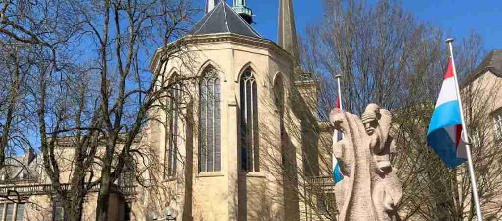
Notre-Dame Cathedral exemplifies late Gothic architecture adapted to Luxembourg’s specific religious and cultural context. Construction began in 1613, making it relatively late for Gothic styling—Renaissance and Baroque designs dominated contemporary European ecclesiastical architecture. The cathedral’s designers nonetheless employed Gothic structural principles—pointed arches, ribbed vaults, flying buttresses—while incorporating Renaissance decorative elements in portals, altars, and interior furnishings. The distinctive spires, added in the mid-20th century, follow late Gothic precedents while representing modern heritage additions rather than original construction. As Luxembourg’s only cathedral, Notre-Dame serves symbolic functions beyond its architectural significance, anchoring the religious dimension of national identity.
St. Michael’s Church preserves Luxembourg’s oldest continuous religious presence, with foundations dating to the 10th century contemporaneous with Count Siegfried’s original castle. Successive rebuilding and expansion obscured most early medieval fabric, yet the church maintains its original hilltop location overlooking the Alzette valley. The present structure largely dates from 17th-century reconstruction following earlier destruction, with further modifications and restorations through subsequent centuries. St. Michael’s significance derives less from architectural purity than from continuous religious function across a millennium, providing tangible connection to Luxembourg’s origins while demonstrating how sacred sites persisted through political and military upheavals.
Aristocratic mansions throughout the Ville Haute, many now housing government offices or cultural institutions, demonstrate adaptation of residential architecture to fortress city constraints. Limited plot sizes necessitated vertical development—three or four-story structures maximizing habitable volume on restricted footprints. Facades presented formal fronts to narrow streets while internal courtyards provided light, ventilation, and private outdoor space inaccessible from public thoroughfares. These courtyard arrangements, common in Mediterranean urban traditions, proved equally functional in Northern European fortress cities where security concerns reinforced advantages of inward-oriented residential planning.
The Ville Basse (Lower Town) encompasses several distinct neighborhoods occupying the Alzette and Pétrusse valleys beneath the fortified heights: Grund, Pfaffenthal, and Clausen each developed unique characters while sharing common features of valley-floor urbanism. These lower quarters originally housed working populations—artisans, craftsmen, laborers, and merchants whose trades served the garrison and administrative apparatus on the heights above. Occupational specialization often concentrated geographically: tanners along watercourses where leather processing required abundant water, smiths near gates where horseshoes and ironwork needed replacement, bakers in proximity to garrison facilities requiring daily bread supply.
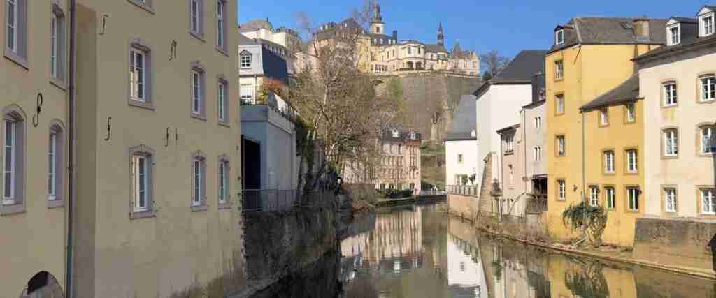
Grund, spreading along an Alzette River bend directly beneath the Bock promontory, preserves some of Luxembourg’s oldest surviving residential structures. Traditional half-timbered construction, though common throughout Northern Europe during medieval and early modern periods, survives in Grund better than in the Ville Haute where stone reconstruction replaced many earlier wooden buildings. The timber-frame technique—structural skeleton of heavy timbers infilled with wattle-and-daub or brick—allowed rapid construction using relatively modest materials accessible to working-class builders. Preservation of this vernacular architecture provides documentation of ordinary urban dwellings contrasting with the monumental structures dominating the Ville Haute.
Neumünster Abbey anchors Grund as an architectural and cultural landmark. Founded as a Benedictine monastery in 1606, the abbey complex developed through the 17th century into a substantial religious institution with church, cloisters, conventual buildings, and associated structures. The Benedictines served educational and charitable functions alongside their contemplative religious life, operating schools and providing poor relief. Following general secularization trends across Europe, the abbey ceased monastic functions in the 19th century, subsequently serving various institutional purposes including prison use that added unfortunate chapters to its history. Contemporary renovation has transformed Neumünster into a cultural center hosting concerts, exhibitions, and educational programs while preserving significant architectural fabric from its monastic origins.
Bridges connecting the multi-level topography constitute essential urban infrastructure whose architectural significance often receives insufficient recognition. The Adolphe Bridge, inaugurated in 1903 and named for Grand Duke Adolphe, exemplifies early 20th-century civil engineering applied to Luxembourg’s dramatic terrain. This double-deck stone arch bridge spans the Pétrusse valley with a main arch reaching 84 meters, at completion ranking among the world’s largest stone arch bridges. The structure’s engineering accomplishment lies not merely in span distance but in height clearance—the bridge rises approximately 40 meters above the valley floor, allowing the Pétrusse River and valley roads to pass beneath while carrying multiple lanes of traffic and eventually light rail above. The Adolphe Bridge demonstrates how infrastructure development adapted to topographical constraints while contributing architectural monuments in their own right.
The Viaduc, another prominent bridge structure, crosses the Pétrusse valley further south, carrying rail traffic into Luxembourg’s central station. Completed in 1861, the viaduct employs multiple stone arches supporting an elevated railway alignment—engineering solution necessary given the valley topography that prevented at-grade rail construction. Like the Adolphe Bridge, the Viaduc combines functional infrastructure with architectural presence, its repetitive arch rhythm creating visual landmark visible throughout the old quarters. These 19th and early 20th-century bridges, while post-dating the fortress period, respond to the same topographical conditions that shaped military engineering, demonstrating continuity in how human construction adapts to Luxembourg’s distinctive terrain.
Street layout preservation throughout the old quarters provides exceptional documentation of fortress city spatial organization. Modern Luxembourg retains street patterns established during the medieval and early modern periods, with roads following medieval alignments despite complete transformation of surface materials, buildings, and functions. This continuity allows analysis of how fortification constraints shaped urban form: streets avoiding fields of fire from bastions, routes providing rapid garrison deployment to threatened sectors, communication arteries connecting gates to interior strongpoints. Contemporary residents and visitors navigate spaces whose geometry reflects military logic from centuries past, experiencing urban patterns shaped by defensive requirements even after fortifications themselves largely disappeared.
UNESCO’s recognition of the old quarters alongside the fortifications acknowledges that fortress city heritage comprises both military structures and the civilian urban fabric they shaped. Many World Heritage fortress sites protect primarily defensive works—bastions, walls, gates—treating associated urban development as context rather than significance. Luxembourg’s inscription explicitly includes the old quarters as integral heritage components, recognizing that understanding fortress city history requires examining how military requirements influenced civilian life, urban form, social organization, and architectural development. This comprehensive approach treats the site as a cultural landscape where military and civilian elements interacted across centuries rather than separate categories of monuments.
Architectural Heritage: Monuments of the Old Quarters
The Grand Ducal Palace stands as Luxembourg’s most prominent civic building, serving as the official residence of the Grand Duke and the location where the head of state performs ceremonial and administrative functions. The palace’s architectural evolution reflects Luxembourg’s political history: initial construction in 1572 as a town hall served municipal government, Renaissance expansion in the 17th century enhanced its representative functions, and 19th-century renovations following Luxembourg’s elevation to Grand Duchy adapted the structure for royal residence. The facade facing Place Guillaume II exhibits harmonious Renaissance proportions with regular window arrangements, stone quoins emphasizing corners, and decorative elements appropriate to civic architecture. Interior spaces, while not regularly accessible to public tourism, house state rooms decorated with period furnishings, tapestries, and artwork reflecting Luxembourg’s cultural heritage.
The Palace of the Grand Dukes functions simultaneously as working administrative building and historical monument. The Grand Duke maintains offices within the palace, conducting official meetings, hosting diplomatic receptions, and performing constitutional duties as Luxembourg’s head of state. This continued governmental use distinguishes the palace from many European royal residences that function purely as museums following monarchies’ abolition or removal from active governance. The palace’s status as both heritage site and working government building creates management challenges balancing conservation, security, and limited public access through guided tours during summer months when the Grand Duke’s court relocates to other residences.
Notre-Dame Cathedral, Luxembourg’s sole cathedral and the country’s principal Roman Catholic church, combines Gothic architectural heritage with ongoing religious function. Construction commenced in 1613 under Jesuit direction, employing late Gothic structural systems—ribbed vaulting supported by slender columns, pointed arches creating vertical emphasis, large windows admitting abundant natural light—while incorporating Renaissance decorative elements reflecting contemporary artistic fashions. The three-nave basilica plan provides generous interior volume for liturgical ceremonies and congregational gatherings, while the western facade’s elaborate portal demonstrates stone carving craftsmanship typical of Counter-Reformation Catholic church architecture.
The cathedral’s crypt houses the royal burial vault containing tombs of Luxembourg’s Grand Ducal family, connecting the building’s religious functions to national heritage and dynastic continuity. This funeral chapel receives royal burials following state funeral ceremonies, most recently for Grand Duke Jean in 2019. The combination of active parish church, national cathedral, and royal necropolis makes Notre-Dame central to Luxembourg’s religious and civic life beyond purely architectural significance. Ongoing liturgical use requires careful balancing of conservation requirements with the building’s primary religious purpose, as modifications for contemporary worship—sound systems, lighting, accessibility features—must respect historical fabric while enabling effective pastoral ministry.
The distinctive twin spires, though late additions constructed between 1935-1938, have become Notre-Dame’s most recognizable features and symbols of Luxembourg City’s skyline. Architect Hubert Schumacher designed the spires following late Gothic precedents while employing reinforced concrete—modern construction technology enabling height and detail impossible with traditional masonry alone. This 20th-century addition to a 17th-century building exemplifies how historical monuments continue evolving through successive generations, each contributing layers that become part of accumulated heritage. The spires’ relatively recent construction does not diminish their heritage value—they represent legitimate architectural contribution reflecting their own period while enhancing the cathedral’s urban presence and liturgical symbolism.
St. Michael’s Church preserves Luxembourg’s oldest continuous Christian presence, with documented religious use dating to the 10th century coinciding with Count Siegfried’s fortress establishment. The present structure largely results from 17th-century reconstruction following earlier destruction, with subsequent modifications obscuring most medieval fabric. Architectural historians identify Romanesque elements in the church’s foundations and crypt areas, providing tangible connection to the building’s early medieval origins. The church’s elevated position on a rocky outcrop offers commanding views of surrounding valleys, strategic location explaining both its defensive value and its designation as an early religious site where visibility reinforced spiritual symbolism.
Transformation of St. Michael’s into a museum of sacred art following secularization demonstrates adaptive reuse strategies for religious heritage no longer supporting active congregations. The museum displays liturgical objects, religious paintings, sculptures, vestments, and devotional items documenting Luxembourg’s Catholic heritage across multiple centuries. This cultural institution function preserves the building while providing public access and educational programming impossible during exclusive religious use. The museum’s establishment required careful interior modifications installing climate control, lighting, security systems, and display infrastructure while respecting the building’s architectural integrity and avoiding irreversible alterations to heritage fabric.
Neumünster Abbey in Grund represents Luxembourg’s most significant surviving monastic complex. Benedictine monks established the abbey in 1606, constructing church, cloisters, dormitories, refectory, and supporting structures following monastic architectural traditions. The church demonstrates early Baroque styling with emphasis on interior decoration, elaborate altars, ceiling frescoes, and architectural elements directing attention toward liturgical focal points. The cloisters, surrounding a peaceful courtyard garden, provided contemplative spaces for monastic life while connecting various conventual buildings. Architectural historians value Neumünster as exemplary of Counter-Reformation Catholic monastery design, demonstrating how religious orders expressed their spiritual missions through built environments.
The abbey’s dark period as a prison during the 19th and 20th centuries caused significant damage to original monastic fabric as institutional requirements of incarceration contradicted contemplative religious architecture. Cell installations, security barriers, and institutional modifications obscured or destroyed decorative elements and spatial arrangements. Liberation and prison closure opened possibilities for restoration, though decisions about which historical layer to privilege—monastic origins versus prison period—created heritage management dilemmas. Contemporary restoration chose to emphasize monastic heritage while acknowledging the prison period through interpretive content rather than physical preservation of institutional modifications.
Current function as a cultural center positions Neumünster Abbey as one of Luxembourg’s premier venues for performing arts, exhibitions, conferences, and cultural programming. Concert performances utilize the former church’s excellent acoustics and atmospheric setting, exhibition spaces in renovated conventual buildings display contemporary art and heritage presentations, conference facilities support international academic and professional gatherings. This cultural institution role generates revenue supporting building maintenance while fulfilling UNESCO’s emphasis on living heritage that serves contemporary communities rather than preserved as inert museum artifacts. The successful transformation demonstrates how adaptive reuse can honor heritage significance while enabling economically sustainable new functions.
The Corniche promenade, often described as “Europe’s most beautiful balcony,” provides spectacular pedestrian route along remnants of the 17th-century fortification walls overlooking Grund and the Alzette valley. This elevated walkway, constructed atop surviving ramparts, offers panoramic views encompassing the lower quarters, the Pétrusse and Alzette valleys, Luxembourg’s modern business districts on opposite hillsides, and portions of the surrounding countryside. The Corniche’s appeal derives from both scenic beauty and tangible connection to fortification heritage—visitors literally walk along defensive walls, experiencing the topographical advantages that made Luxembourg’s position so valuable militarily.
Integration of the Corniche into the UNESCO site recognizes that fortress heritage includes not only preserved military structures but also spaces created through defensive construction that now serve entirely civilian recreational and cultural purposes. The promenade functions as public park, tourist attraction, and local amenity simultaneously—Luxembourg residents utilize the Corniche for exercise, dog walking, and casual socializing while international visitors photograph the dramatic vistas. This multiple-use character exemplifies UNESCO’s living heritage concept: historical structures continuing to serve communities through adapted functions maintaining relevance across generations.
Casemate access points from the Corniche provide direct connections between above-ground fortification remnants and underground defensive galleries. These entry points—specifically the Bock Casemates entrance on Montée de Clausen—allow visitors to descend from the elevated promenade into the rock-carved tunnels, experiencing the vertical dimension of Luxembourg’s multi-level defensive system. The transition from outdoor promenade to underground casemate creates powerful spatial experience illustrating how military engineers exploited every dimension of the site’s topography for defensive advantage.
The Dismantlement: Treaty of London and Fortress Destruction
The Treaty of London signed on May 11, 1867, fundamentally altered Luxembourg’s trajectory from military strongpoint to neutral state, requiring dismantlement of the fortifications that had defined the city’s character for centuries. This diplomatic agreement emerged from complex negotiations following the Luxembourg Crisis of 1867, itself a manifestation of broader European power dynamics in the aftermath of Prussia’s decisive victory over Austria in 1866. The Austro-Prussian War shifted the European balance of power, creating instability as France and Prussia competed for influence in the German states and buffer territories like Luxembourg.
Napoleon III’s France sought to acquire Luxembourg from the Netherlands through purchase negotiations with King William III, who ruled Luxembourg in personal union with the Dutch crown. Prussia opposed this transaction, viewing French acquisition as unacceptable westward expansion threatening German security. The resulting crisis brought Europe dangerously close to war between major powers over Luxembourg’s status. Diplomatic intervention, primarily from Britain seeking to prevent major conflict, produced the London Conference where European powers negotiated a compromise avoiding military confrontation.
The Treaty of London’s core provision declared Luxembourg perpetually neutral under collective European guarantee, similar to Belgium’s status established earlier in the century. In exchange for neutrality guarantees, Luxembourg accepted complete dismantlement of its fortress and withdrawal of the Prussian garrison that had occupied the city since 1815. This arrangement satisfied competing French and Prussian interests: France prevented Prussian control of Luxembourg’s strategic position while Prussia prevented French acquisition. Luxembourg gained genuine independence with its neutrality internationally guaranteed, though this independence came at the cost of destroying the defensive infrastructure that had shaped the city’s development for centuries.
Dismantlement commenced almost immediately following treaty ratification, with initial work beginning in 1867. The scale of destruction proved enormous: 180 hectares of fortifications required systematic demolition, including massive stone bastions, multi-layered ramparts, defensive towers, gates, drawbridges, and supporting structures accumulated through three centuries of continuous enhancement. Military engineers who had perfected techniques for building fortifications now applied reverse engineering to their destruction, determining optimal demolition sequences preventing cascading structural failures while removing defensive capabilities as the treaty mandated.
The underground casemate networks presented particular challenges. Treaty provisions specifically prohibited leaving any military utility in the fortifications, suggesting complete filling of underground galleries to prevent future garrison use. Initial demolition plans called for explosively collapsing tunnel ceilings and filling resulting voids with rubble from demolished surface fortifications. Practical obstacles prevented full implementation: the sheer volume of material required to fill 17 kilometers of tunnels proved prohibitive, while concerns arose that aggressive collapse attempts might destabilize buildings in the old quarters built above portions of the underground network.
Pragmatic compromise preserved most underground galleries intact though sealed at major access points through rubble barriers and bricked-up entrances. This approach satisfied treaty requirements by preventing military reuse while avoiding massive labor and material expenditures complete filling demanded. The decision, driven by practical rather than heritage considerations, fortuitously preserved Luxembourg’s most distinctive fortification element for eventual recognition as historical monuments worthy of public access and ultimately UNESCO inscription.
Surface demolition proceeded systematically over sixteen years, concluding in 1883. Substantial fortification elements survived either through incomplete dismantlement or deliberate preservation decisions. Some bastions proved too massive for complete removal, their earthen cores and stone revetments left partially intact after removing military infrastructure atop them. Certain gates survived as architectural monuments disconnected from defensive functions, their symbolic and aesthetic value outweighing dismantlement imperatives. Sections of rampart walls remained standing, particularly where removal threatened adjacent buildings or where walls formed integral structural elements of civilian construction. The Pétrusse fortifications retained significant portions visible today, demonstrating the imperfect nature of 19th-century demolition even when politically mandated.
The dismantlement’s aftermath presented Luxembourg with challenges and opportunities. Destruction of defensive perimeters opened land for urban expansion previously impossible within fortress constraints. The city grew rapidly as building development spread onto former fortification sites, industrial development utilized spaces previously reserved for military purposes, and transportation infrastructure improved with defensive barriers removed. Population increased as Luxembourg transitioned from garrison town to commercial and administrative center, its strategic location now serving economic rather than military purposes.
However, loss of fortification revenue created economic difficulties. The Prussian garrison’s presence had generated substantial income through military contracts, housing rentals, and soldiers’ spending in local businesses. Dismantlement eliminated these revenue sources simultaneously with costs of demolition and urban redevelopment. Luxembourg’s economy gradually adapted through emphasis on finance, steel production, and administrative functions, eventually achieving prosperity far exceeding levels possible as a fortress city. The transition proved economically successful though requiring decades to complete.
Heritage consciousness regarding the surviving fortification remnants developed slowly through the late 19th and early 20th centuries. Initial attitudes toward surviving structures emphasized their obsolescence and impediment to modernization rather than historical value. Gradually, appreciation emerged for the fortifications’ role in Luxembourg’s history and their potential as tourist attractions. The 1933 decision to open the casemates to public access marked official recognition of heritage significance, establishing precedent for systematic conservation and interpretation efforts that eventually justified UNESCO inscription six decades later.
Conservation and Heritage Management
Management of Luxembourg’s UNESCO World Heritage Site balances preservation of historical authenticity with accommodation of contemporary urban functions in a living city that serves as modern European capital. Unlike archaeological sites or rural heritage landscapes where preservation can emphasize stasis, Luxembourg’s old quarters and fortifications must integrate heritage conservation with ongoing residential, commercial, administrative, and cultural activities supporting a metropolitan population exceeding 135,000 residents within a broader urban region approaching 200,000 inhabitants.
Legal protection for the UNESCO site derives from multiple legislative and regulatory frameworks operating at national, municipal, and international levels. Luxembourg’s Law of July 18, 1983, relating to conservation and protection of national sites and monuments provides primary domestic heritage protection. This legislation designates specific structures and areas as protected monuments requiring approval for modifications, establishes review procedures for development proposals affecting heritage areas, and empowers authorities to reject or modify projects threatening heritage values. Municipal zoning regulations supplement national protection through building height restrictions, architectural design guidelines, and land-use controls maintaining the old quarters’ character.
The UNESCO World Heritage Convention, ratified by Luxembourg, establishes international obligations for site protection beyond domestic legislation. These obligations include maintaining the outstanding universal value that justified inscription, preventing deterioration through appropriate conservation measures, integrating heritage protection into regional planning systems, and reporting periodically to UNESCO on conservation status and management effectiveness. While UNESCO lacks direct enforcement power over sovereign states, the Convention creates reputational incentives for effective heritage management—states risk international criticism and potential “danger list” designation if protection proves inadequate.
Day-to-day site management responsibility rests with Luxembourg’s Ministry of Culture in partnership with Luxembourg City administration. The Ministry’s heritage division employs specialist staff including architectural historians, conservation architects, and archaeological professionals who review development proposals, oversee conservation projects, and advise on heritage policy. The City administration implements zoning regulations, manages municipal heritage properties including portions of the fortifications, and coordinates heritage considerations with broader urban planning objectives. Regular coordination between national and municipal authorities addresses inevitable tensions between heritage protection and development pressures.
A dedicated UNESCO site manager position, created specifically for the Luxembourg World Heritage Site, provides focused coordination of heritage management activities. This manager serves as primary liaison between UNESCO, government agencies, the City administration, property owners, developers, and the public. Responsibilities include development review consultation, public engagement and education programming, tourism management coordination, and preparation of periodic reports to UNESCO documenting conservation activities and site condition. The position’s establishment recognized that effective World Heritage management requires dedicated professional attention beyond what general heritage staff could provide alongside broader responsibilities.
The site management plan, developed through multi-stakeholder consultation and formally adopted by competent authorities, provides comprehensive framework guiding heritage conservation and development decisions. The plan identifies heritage values justifying UNESCO inscription, assesses threats to these values from various sources including development pressure, tourism impacts, climate change, and deferred maintenance, establishes conservation priorities for different heritage elements, and defines policies balancing preservation with sustainable development. Regular updates ensure the management plan responds to evolving conditions rather than becoming static document disconnected from management reality.
Development pressure in the old quarters creates ongoing management challenges. Luxembourg City’s role as European Union institutional center and international financial hub generates intense demand for office space, luxury residential development, hotels, and supporting commercial infrastructure. Property values in the old quarters reflect this demand, creating economic incentives for development that may conflict with heritage conservation. The management framework must navigate between preserving heritage character and allowing reasonable property development that maintains the old quarters as economically viable, lived-in neighborhoods rather than museum districts.
Architectural review procedures require developers to submit detailed proposals for any construction or modification affecting heritage areas. Review criteria assess whether proposed development respects historical character through appropriate scale, materials, architectural vocabulary, and relationship to surrounding heritage fabric. Outright bans on development rarely occur—such prohibitions risk legal challenge and can prevent beneficial adaptive reuse of historic structures. Instead, review processes seek to guide development toward heritage-compatible designs through dialogue between developers, architects, and heritage authorities. This negotiated approach produces better outcomes than adversarial relationships where heritage protection and development become zero-sum conflicts.
Tourism management represents both opportunity and challenge for the UNESCO site. Visitor numbers provide economic benefits supporting heritage conservation through admission revenues, commercial activity in heritage districts, and political constituencies supporting preservation investment. However, excessive visitation causes degradation through physical wear on heritage fabric, congestion degrading visitor experience and local quality of life, and economic pressures toward tourism monoculture displacing other urban functions. Sustainable tourism strategies aim to optimize visitor benefits while mitigating negative impacts through visitor dispersal encouraging exploration beyond primary honeypot attractions, temporal distribution promoting off-season visitation, and infrastructure investment managing visitor flows efficiently.
The casemates present specific conservation challenges due to their underground location and continuous visitor access. Rock surfaces within the galleries, protected from weathering during centuries of closure, now experience accelerated deterioration from moisture introduced through visitor respiration, temperature fluctuations from artificial lighting and climate systems, and chemical changes from air pollutants. Monitoring programs track deterioration rates through regular photographic documentation, structural movement sensors detecting potentially dangerous shifts, and environmental sensors measuring temperature, humidity, and air quality parameters. Data from these monitoring systems informs conservation interventions ranging from adjusted climate control strategies to physical stabilization of degrading rock faces.
Access management in the casemates balances public engagement with conservation requirements. Unrestricted access would allow visitor numbers exceeding sustainable thresholds, while excessive restrictions would contradict UNESCO’s emphasis on public heritage access. Current approaches employ timed-entry ticketing limiting simultaneous visitors, designated routes concentrating traffic on reinforced pathways while protecting fragile areas, and periodic closures for conservation work or environmental recovery. These strategies allow substantial public access—both casemate networks receive hundreds of thousands of annual visitors—while preventing degradation that unrestricted access would cause.
Climate change presents emerging threats requiring adaptive management responses. Increased precipitation intensity may accelerate erosion of exposed fortification remnants and increase water infiltration into underground galleries. Temperature increases could affect biological growth on stone surfaces and alter microclimates within the casemates. Extreme weather events—severe storms, flooding, heat waves—may cause acute damage requiring emergency intervention. The management framework incorporates climate adaptation strategies including enhanced drainage systems, protective treatments for vulnerable stone surfaces, and emergency response protocols for extreme weather scenarios.
Community engagement forms an essential component of effective heritage management. Local residents, property owners, businesses, and civic organizations constitute primary stakeholders whose cooperation determines management success. Educational programs targeting Luxembourg residents, including school curricula incorporating local heritage, public lectures and events highlighting heritage significance, and volunteer opportunities for heritage conservation activities build community investment in heritage protection. When residents understand and value heritage significance, they become allies rather than opponents of conservation efforts, supporting protective regulations and actively participating in heritage stewardship.
The 25th anniversary of UNESCO inscription in 2019 and 30th anniversary in 2024 provided opportunities for public engagement and heritage celebration. Anniversary programming included temporary exhibitions documenting site history and conservation efforts, guided tours highlighting lesser-known heritage elements, academic conferences bringing international heritage experts to Luxembourg, and cultural events connecting heritage to contemporary creative expression. These celebrations raised public awareness of UNESCO designation’s significance while demonstrating heritage’s continued relevance to contemporary Luxembourg identity.
Research and documentation support evidence-based heritage management. Archaeological investigations preceding development projects document subsurface heritage before construction disturbs stratigraphic evidence. Architectural surveys record heritage buildings in detail, creating archival documentation protecting against information loss from future deterioration or destruction. Historical research in archives and libraries deepens understanding of how the fortress and old quarters developed, informing conservation approaches respectful of historical authenticity. This research investment creates knowledge base supporting informed decision-making when management challenges arise requiring historical context for appropriate responses.
International cooperation through heritage networks shares expertise and best practices benefiting Luxembourg’s management while allowing Luxembourg to contribute to broader heritage conservation discourse. Participation in the Organization of World Heritage Cities, which held its 2025 regional conference in Luxembourg, facilitates exchange of experience among cities managing similar living heritage challenges. Technical cooperation with other fortress city World Heritage Sites—including Valletta, Malta; Rhodes, Greece; and Carcassonne, France—allows comparative analysis of management approaches and collaborative problem-solving addressing common challenges.
Visitor Experience: Exploring Luxembourg’s UNESCO Heritage
Experiencing Luxembourg’s UNESCO World Heritage Site requires engaging with multiple heritage elements distributed across the old quarters and accessible through various entry points. Unlike single-monument heritage sites where visits focus on one primary attraction, Luxembourg’s significance emerges from the relationship between fortifications, underground casemates, old quarter architecture, and topographical setting. Comprehensive exploration demands multiple hours or ideally multiple days, allowing time to appreciate individual monuments while understanding how they function as integrated heritage landscape.
The Bock Casemates provide essential foundation for understanding Luxembourg’s fortress heritage. Access from Montée de Clausen, a pedestrian pathway climbing from Grund to the Ville Haute, positions visitors at the casemate entrance near St. Michael’s Church. Entry into the underground galleries creates immediate sensory contrast—transition from bright daylight to controlled artificial illumination, from open air to enclosed rock-carved spaces, from contemporary urban environment to preserved military infrastructure. The entrance sequence deliberately emphasizes this transition, using atmospheric lighting and interpretive content to prepare visitors for descent into spaces carved centuries ago.
Navigation through the Bock Casemates follows designated routes connecting principal galleries, chambers, and viewpoints. The pathways descend through multiple levels via rock-cut staircases, some original to the military period and others added during tourist development to improve accessibility and safety. Handrails, lighting, and directional signage facilitate movement while minimizing physical intrusion into heritage fabric—fixtures attach to walls with removable mountings avoiding permanent damage to rock surfaces. The route design balances efficient circulation allowing reasonable visitor numbers with opportunities to appreciate architectural features and historical significance through interpretive panels and audio guide content.
Loopholes carved into the cliff face provide dramatic viewpoints overlooking Grund and the Alzette valley. These openings, originally serving military surveillance and firing positions, now function as photography locations where visitors capture panoramic images documenting Luxembourg’s distinctive multi-level topography. The views encompass traditional architecture in Grund’s valley-floor neighborhoods, the Alzette River winding through the urban landscape, modern business districts on opposite hillsides, and countryside beyond the immediate urban core. These vistas communicate Luxembourg’s geographical context more effectively than any text or diagram, allowing visitors to understand visually why this location attracted fortress development.
Interior spaces within the casemates—former barracks chambers, artillery positions, storage magazines—receive interpretive treatment explaining military functions and garrison life. Some chambers display reproduction equipment suggesting historical use: cannon positioned at gun emplacements, sleeping platforms indicating barracks arrangements, storage barrels representing provisioning requirements. These installations enhance understanding without claiming authenticity—clear labeling distinguishes reproduction interpretive elements from original heritage fabric. Audio guides and informational panels supplement physical displays with historical narratives, biographical sketches of military engineers and commanders, and technical explanations of fortification principles.
The Pétrusse Casemates offer complementary experience emphasizing atmospheric interpretation through modern technology. The entrance near Place de la Constitution, marked by the iconic Gëlle Fra (Golden Lady) monument, provides access to the underground network beneath the former Beck Bastion and Pétrusse valley fortifications. Contemporary scenography employing LED lighting installations creates dramatic effects highlighting architectural features while evoking military-period atmosphere. Video projections on tunnel walls present historical narratives through animated content engaging visitors who might not read extensive text panels.
The interpretive approach in the Pétrusse Casemates emphasizes emotional engagement and historical imagination alongside factual information. Lighting effects simulate conditions garrison troops experienced—torchlight flickering in tunnels, darkness broken by minimal illumination, dramatic shadows cast by loopholes admitting exterior light. Sound installations provide acoustic environment suggesting historical activities—military commands, cannon fire, footsteps echoing through stone corridors. These multisensory elements create immersive experience complementing the Bock Casemates’ more traditional presentation, demonstrating different valid approaches to heritage interpretation.
The Wenzel Circular Walk provides above-ground exploration connecting multiple heritage elements through an approximately 5.5-kilometer pedestrian route. Named for Duke Wenceslas II who ruled Luxembourg from 1383 to 1419 and commissioned the Wenzel Wall expansion, this walking circuit links the Bock promontory, portions of surviving fortification walls, the Corniche promenade, gates and bastions, valley-floor neighborhoods including Grund and Pfaffenthal, and panoramic viewpoints revealing Luxembourg’s topographical complexity. Interpretive signage along the route explains heritage elements, historical events, architectural features, and urban development patterns.
The Corniche promenade constitutes the Wenzel Walk’s most scenic section, following the rampart walls high above the Alzette valley. The designation “Europe’s most beautiful balcony” reflects genuine scenic merit—the elevated perspective combines immediate proximity to fortification remnants with sweeping vistas encompassing natural and built heritage. Walking the Corniche requires no special fitness, as the path follows relatively level grades atop the ramparts with gentle inclines at approach points. This accessibility makes the Corniche popular with diverse visitor demographics including families with children, elderly visitors, and those with limited mobility unable to navigate the casemate staircases.
Grund, accessible via the panoramic elevator from the Plateau du Saint-Esprit or pedestrian staircases and pathways, offers ground-level perspective on Luxembourg’s multi-level topography. Walking Grund’s narrow streets among half-timbered houses and alongside the Alzette River creates intimate-scale experience contrasting with the grand panoramas from the Corniche above. Neumünster Abbey serves as cultural destination with concert programs, exhibitions, and café facilities encouraging extended time in the quarter. Small restaurants, cafés, and boutiques provide commercial vitality supporting Grund’s character as lived-in neighborhood rather than preserved historic district devoid of contemporary functions.
The Ville Haute merits exploration for architectural heritage, civic monuments, and urban character shaped by fortress constraints. Place Guillaume II and Place d’Armes function as primary public squares hosting markets, outdoor cafés, and public events maintaining traditions of civic gathering spaces. The Grand Ducal Palace, while not regularly accessible internally, presents impressive street frontage worthy of appreciation from public spaces. Notre-Dame Cathedral welcomes visitors during non-liturgical hours for architectural inspection and contemplative experience. The narrow streets radiating from these primary nodes preserve irregular medieval layouts rewarding exploratory walking without rigid itinerary.
Museum options complement outdoor heritage exploration. The Luxembourg City History Museum, located in restored historic houses in the Ville Haute, provides chronological narrative of urban development from early settlement through contemporary capital city status. Permanent exhibitions employ multimedia presentations, artifact displays, architectural models, and interactive elements explaining how Luxembourg evolved from Count Siegfried’s 10th-century castle to modern European institutional center. Temporary exhibitions address specific themes related to urban heritage, allowing repeat visitors to encounter new content beyond permanent displays.
The Lëtzebuerg City Museum (Luxembourg City Museum) maintains specific exhibitions related to the UNESCO World Heritage designation, explaining outstanding universal value, fortification history, urban development within defensive constraints, and contemporary heritage management challenges. These exhibitions serve both international visitors seeking context for their site exploration and local residents developing deeper appreciation for their city’s heritage significance. Educational programming targets school groups, using hands-on activities and age-appropriate content to engage young people with heritage themes.
Seasonal and temporal considerations affect visitor experience significantly. Summer months bring peak visitor numbers, particularly July and August when European vacation patterns concentrate tourism. The old quarters and casemates experience crowding during these peak periods, with wait times for casemate entry potentially extending to 30-60 minutes without advance reservation. Shoulder seasons—April through June and September through October—offer more comfortable visiting conditions with moderate temperatures, reduced crowds, and full accessibility to all heritage elements. Winter visits remain viable, though shorter daylight hours limit time for outdoor exploration and some heritage sites reduce operating hours.
Weather influences outdoor heritage exploration considerably. Luxembourg’s temperate oceanic climate brings frequent precipitation year-round, with rainfall possible during any season. Visitors should prepare for wet conditions even during summer months, as rain can occur with minimal warning. The Corniche and Wenzel Walk remain accessible during rain, though wet conditions make surfaces slippery and reduce visibility for photography. The casemates provide weather-protected alternative during inclement conditions, their underground location offering consistent environment regardless of surface weather.
Recommended visit duration varies based on interests and available time. Minimum meaningful engagement requires half a day allowing casemate exploration, Corniche walk, and limited time in the old quarters. A full day permits more comprehensive experience including both casemate networks, extended old quarter exploration, museum visits, and unhurried appreciation of individual monuments. Multiple days allow detailed investigation of specific heritage elements, participation in specialized tours, and integration of heritage exploration with Luxembourg’s broader cultural offerings including contemporary art, dining, and urban amenities unrelated to heritage tourism.
Guided tours enhance understanding beyond self-guided exploration, particularly for visitors unfamiliar with fortress architecture, European military history, or Luxembourg’s specific historical context. Professional guides trained in UNESCO heritage interpretation provide narratives connecting individual monuments to broader themes, answer questions addressing specific interests, and adjust pace and content to group composition. Specialized tours focus on particular themes—military engineering, religious heritage, urban development, contemporary heritage management—allowing deep engagement with specific aspects of the site’s significance.
Photography opportunities abound throughout the UNESCO site, from dramatic cliff-top vistas along the Corniche to intimate architectural details in Grund’s narrow streets. The multi-level topography creates varied perspectives—elevated views from the Corniche and casemate loopholes contrast with ground-level perspectives from valley neighborhoods. Seasonal variation in vegetation, light quality, and atmospheric conditions produces different aesthetic character: spring brings fresh greenery and clear light, summer offers long daylight hours and vibrant colors, autumn provides warm tones and interesting cloud formations, winter presents stark architectural forms against minimal vegetation. Serious photographers may wish to visit multiple times capturing seasonal variations.
Luxembourg in European Heritage Context
Luxembourg’s UNESCO World Heritage designation positions the site within broader European fortress city heritage, inviting comparative analysis with similar sites sharing military architectural significance. Understanding Luxembourg’s distinctive characteristics requires appreciating both commonalities with other fortress cities and unique attributes justifying individual UNESCO recognition. The fortress city typology represents widespread European urban development pattern shaped by military considerations, yet each example manifests this pattern differently based on specific geographical, political, and cultural contexts.
Valletta, Malta, inscribed as UNESCO World Heritage in 1980, provides instructive comparison as another extensively fortified city whose defenses shaped urban development. Like Luxembourg, Valletta occupies a naturally defensive peninsula position requiring artificial fortification only along limited landward approaches. Both sites preserve substantial fortification remnants despite partial dismantlement, maintain bastioned trace geometries characteristic of early modern military engineering, and function as living cities integrating heritage preservation with contemporary urban functions. However, Valletta’s Mediterranean island context created different strategic dynamics than Luxembourg’s continental crossroads position, while Malta’s extended British colonial period introduced architectural influences absent from Luxembourg’s Central European heritage.
Carcassonne, France, UNESCO World Heritage since 1997, represents medieval fortress city heritage emphasizing earlier fortification periods than Luxembourg’s primarily 17th-19th century defenses. Carcassonne’s double curtain walls, multiple towers, and essentially medieval defensive systems contrast with Luxembourg’s bastion fortifications reflecting artillery-age military engineering. Furthermore, Carcassonne underwent controversial 19th-century restoration under Eugène Viollet-le-Duc, introducing elements critics argue represent romantic interpretation rather than historical authenticity. Luxembourg’s fortifications, while partially dismantled, preserve authentic fabric without the extensive reconstruction characterizing Carcassonne, providing different evidence value for understanding fortress heritage.
The fortified city of Elvas, Portugal, inscribed in 2012, shares Luxembourg’s status as border fortress controlling strategic routes between major powers—in Elvas’s case, between Spain and Portugal. Both sites demonstrate extensive outworks and bastioned systems designed by leading military engineers incorporating cutting-edge fortification theory. However, Elvas preserves more complete bastioned trace than Luxembourg’s partially dismantled defenses, while Luxembourg’s underground casemate networks exceed Elvas’s underground elements in extent and accessibility. These differences reflect specific topographical constraints and military requirements each site addressed through adapted engineering solutions.
The Old Town of Edinburgh and Edinburgh Castle, while not inscribed specifically for fortress heritage, share Luxembourg’s dramatic topographical setting with castle atop volcanic rock outcrop overlooking lower town. Both sites demonstrate how natural defensive positions attracted initial fortification and subsequent urban development adapted to topographical constraints. Edinburgh’s distinction between Old Town and New Town parallels Luxembourg’s Ville Haute/Ville Basse division, though Edinburgh’s New Town represents planned 18th-century expansion rather than organically developed valley neighborhoods. The comparison illustrates how similar topographical conditions produce comparable urban patterns despite different historical trajectories.
San Marino’s historic center and Mount Titano, UNESCO site since 2008, provide another example of fortress city heritage in dramatic topographical setting. San Marino’s mountain-top fortifications and the historic city’s position on steep slopes create defensive advantages similar to Luxembourg’s river valley cliffs. Both sites preserved independence through geographical defensibility and diplomatic maneuvering between larger neighbors. However, San Marino maintained continuous independence since medieval times, while Luxembourg experienced repeated conquest and changing sovereignty. This political difference shaped different heritage narratives despite comparable fortress city characteristics.
Comparative analysis reveals Luxembourg’s distinctive contributions to European fortress heritage. The exceptional extent of preserved underground casemate networks—17 kilometers across multiple levels—exceeds most comparable sites, providing outstanding documentation of subterranean military architecture. The authentic preservation of medieval street patterns despite partial fortification dismantlement demonstrates urban fabric continuity uncommon among extensively fortified cities that underwent modernization. The site’s documentation of successive European powers’ fortification philosophies—Spanish, French, Austrian, Prussian—creates exceptional palimpsest value illustrating military engineering evolution across multiple political and cultural contexts.
Luxembourg’s significance extends beyond individual monuments to embody fortress city urbanism as comprehensive cultural phenomenon. The interrelationship between fortifications, topography, and civilian urban fabric creates integrated cultural landscape where understanding any component requires appreciating its connection to other elements. Military requirements shaped civilian street patterns, building densities, and architectural forms. Topographical constraints influenced both defensive strategies and urban development patterns. Political history determined which fortification theories successive rulers applied. This systems-level heritage value distinguishes Luxembourg from sites where individual monuments dominate significance.
The living city character represents both heritage value and management challenge. Luxembourg functions as modern European capital hosting EU institutions, international business, and metropolitan population, requiring contemporary urban services and infrastructure within heritage context. This ongoing urban vitality demonstrates how historical cities adapt to modern functions while preserving heritage character—relevant model for heritage practitioners worldwide addressing similar challenges. The successful integration of heritage conservation with contemporary urban development provides transferable lessons benefiting other historic cities navigating preservation and development tensions.
Luxembourg’s heritage discourse contributes to European collective memory regarding military history, political geography, and urban development shaped by security concerns. The fortress documented in Luxembourg’s surviving elements represents patterns repeated across Europe wherever strategic positions attracted fortification investment. Understanding Luxembourg’s specific history illuminates broader European experience of warfare, territorial competition, diplomatic maneuvering, and eventual transition from military fortifications to peaceful heritage sites. This continental-scale significance justifies UNESCO’s universal value determination beyond merely national heritage importance.
Educational and Cultural Significance
Luxembourg’s UNESCO World Heritage Site serves essential educational functions communicating historical knowledge, architectural appreciation, heritage conservation principles, and European cultural heritage to diverse audiences. The site functions as outdoor classroom where tangible heritage fabric provides primary source material supporting learning objectives across multiple educational levels and subject areas. This educational dimension constitutes important component of the site’s value beyond its physical and aesthetic characteristics.
Primary and secondary education programs utilize the UNESCO site extensively. Luxembourg’s national curriculum incorporates local heritage study, recognizing that understanding one’s immediate environment provides foundation for broader historical and cultural learning. School groups visit the casemates, old quarters, and heritage monuments regularly, participating in age-appropriate guided tours and educational workshops. These programs adapt content and pedagogical approaches to developmental levels: younger children engage through hands-on activities, storytelling, and sensory experiences, while older students address more complex historical concepts, architectural analysis, and critical thinking about heritage conservation.
The UNESCO4Kids program specifically targets family audiences and school groups through child-friendly interpretive content making heritage accessible and engaging for young visitors. Coloring pages featuring historic buildings allow creative engagement with architectural heritage while building visual familiarity with iconic structures. Interactive elements in museum exhibitions provide tactile and participatory learning experiences maintaining children’s attention while communicating educational content. The program recognizes that developing heritage appreciation among young people creates future constituencies supporting conservation and builds cultural literacy regarding Luxembourg’s historical significance.
University-level education benefits from the UNESCO site through multiple academic disciplines. Architectural history programs study fortress architecture evolution, analyzing how successive military engineers adapted defensive systems to changing technology and strategic requirements. Urban studies courses examine how fortress constraints shaped urban development, providing case study of military influences on civilian urbanism. Heritage conservation programs investigate conservation methodologies, management challenges, and sustainable tourism strategies as applied in real-world heritage site. European history courses use Luxembourg as documentary evidence for broader narratives about territorial competition, warfare, diplomacy, and political geography across multiple centuries.
Professional training for heritage practitioners utilizes Luxembourg as practical learning environment. The 87 official guides who completed specialized training on UNESCO heritage interpretation in 2023 exemplify professional development supporting quality visitor experiences. This training covered outstanding universal value concepts, specific historical knowledge about Luxembourg’s fortress and old quarters, interpretation techniques engaging diverse audiences, and UNESCO World Heritage Convention principles guiding site management. Ongoing professional development ensures guides maintain current knowledge and pedagogical skills as heritage interpretation best practices evolve.
Research opportunities attract scholars investigating various aspects of fortress heritage, military history, urban development, and heritage management. Archaeological investigations preceding development projects generate new knowledge about construction techniques, chronological development, and material culture associated with fortress life. Architectural documentation projects create detailed records of heritage structures supporting conservation planning and historical understanding. Archival research in historical documents illuminates political, military, and social dimensions of fortress city existence. This scholarly research produces knowledge benefiting both academic understanding and practical heritage management decisions.
Public lecture series, symposia, and conferences disseminate research findings and facilitate scholarly exchange. The 2025 regional conference of the Organization of World Heritage Cities held in Luxembourg brought together heritage professionals from across Europe and beyond, enabling comparative discussion of fortress city heritage management, sustainable tourism strategies, and contemporary challenges affecting living historical cities. Such events position Luxembourg as active participant in international heritage discourse rather than passive subject of outside expertise, contributing Luxembourg’s experience to broader professional knowledge while learning from other sites’ approaches.
Cultural programming extends heritage engagement beyond traditional educational frameworks to include artistic and creative responses to historical sites. Concerts in Neumünster Abbey and other heritage venues connect contemporary performing arts to historical settings, creating aesthetic experiences merging past and present. Contemporary art exhibitions in heritage contexts generate dialogue between historical architecture and modern creative expression. These cultural activities demonstrate heritage’s continued relevance to contemporary life rather than relegating historical sites to purely retrospective educational purposes.
The educational significance operates across generational and national boundaries. Local Luxembourg residents develop deeper understanding of their city’s heritage and their community’s historical identity. International visitors gain appreciation for European fortress city heritage and Luxembourg’s specific contributions to this architectural and urban tradition. Students at various educational levels encounter tangible evidence supporting classroom learning about history, architecture, engineering, and cultural heritage. Scholars advance academic knowledge through original research. Heritage professionals learn practical approaches to conservation and management challenges. This multi-audience educational value constitutes significant component of the site’s outstanding universal value justifying UNESCO inscription.
Frequently Asked Questions About Luxembourg UNESCO Heritage
How Long Does It Take to Visit the Bock Casemates?
A thorough visit to the Bock Casemates requires 45-90 minutes depending on exploration pace, interest level, and photography time. The designated visitor route extends approximately 1 kilometer through multiple levels of underground galleries, descending via rock-cut staircases to depths of 40 meters below the surface. Rushing through in 30 minutes allows seeing primary spaces but sacrifices time to appreciate architectural details, read interpretive panels, or contemplate the remarkable engineering achievement. Most visitors find 60 minutes optimal, providing time to explore all accessible sections, pause at loopholes for valley views, and absorb historical context through available interpretive content. Photography enthusiasts or history buffs may extend visits to 90 minutes or more, thoroughly documenting spaces and engaging deeply with the military architecture. Visitors should note that the casemates involve significant stair climbing—though gradual rather than strenuous, the cumulative elevation change between levels may challenge those with mobility limitations or cardiovascular conditions. Combining Bock Casemate exploration with the Pétrusse Casemates requires additional time, as these constitute separate underground networks requiring distinct visits.
Is Luxembourg’s Old Town Walkable for People With Mobility Issues?
Luxembourg’s old quarters present significant accessibility challenges due to steep topography, cobblestone streets, and staircases connecting different elevation levels, though accessible routes and facilities exist allowing partial engagement with heritage sites. The Ville Haute’s primary squares and streets feature relatively level terrain navigable by wheelchair users, though cobblestone paving creates uneven surfaces requiring attention. Panoramic elevators installed at key locations including Plateau du Saint-Esprit provide accessible transitions between the Ville Haute and lower quarters like Grund, eliminating the need to navigate steep staircases or pathways. The Corniche promenade, while elevated, follows gentle grades accessible to most mobility levels, offering dramatic views without requiring stair negotiation. However, the casemate networks present substantial barriers: extensive staircases, uneven rock-cut passages, and multi-level configurations make underground exploration impossible for wheelchair users and difficult for those with moderate mobility impairment. Alternative accessibility options include virtual tours employing 360-degree photography and video documentation allowing digital exploration of spaces physically inaccessible to some visitors. The 2019 accessible cultural tourism initiative developed specific routes and interpretive materials for visitors with special needs, recognizing that complete physical access remains impossible given heritage constraints while seeking to maximize engagement opportunities through adapted approaches. Visitors with mobility concerns should contact the Luxembourg City Tourist Office in advance to plan routes utilizing accessible features and identifying which heritage elements they can reasonably experience given their specific limitations.
Can You Visit Luxembourg’s Casemates in Winter?
Both the Bock and Pétrusse Casemates remain open for visits throughout winter months, though operating hours typically reduce compared to summer schedules and weather conditions affect the overall site experience. The underground galleries maintain stable temperatures year-round, staying cool in summer and relatively warm in winter—generally ranging between 8-12 degrees Celsius regardless of surface conditions. This temperature stability makes winter casemate exploration comfortable with appropriate layered clothing, as the underground environment proves warmer than surface temperatures during cold weather while avoiding summer’s oppressive heat. Reduced daylight hours in winter compress available time for outdoor heritage exploration, though this limitation does not affect underground casemate visits which occur in artificially lit spaces independent of natural light. Winter precipitation—rain, sleet, occasional snow—can make outdoor heritage elements including the Corniche, Wenzel Walk, and valley neighborhoods less comfortable for extended exploration, though weatherproof clothing mitigates these effects. The reduced tourist numbers during winter months create more intimate casemate experiences without summer’s crowds, allowing unhurried exploration and better opportunities for photography without other visitors obscuring views. However, potential visitors should verify specific winter operating schedules in advance, as holiday closures around Christmas and New Year may affect access on particular dates. The Luxembourg City Tourist Office website maintains current schedules and any weather-related closure notices affecting winter visitation.
What Is the Difference Between the Bock and Pétrusse Casemates?
The Bock and Pétrusse Casemates constitute separate sections of Luxembourg’s underground fortification network, differing in location, architectural character, interpretive approach, and the visitor experiences they provide. The Bock Casemates occupy the dramatic cliff face rising above the Alzette valley at the Bock promontory—the same rocky outcrop where Count Siegfried established Luxembourg’s original 10th-century castle. These galleries emphasize vertical development across multiple levels descending 40 meters through solid rock, with numerous loopholes providing spectacular panoramic views of Grund, Pfaffenthal, and the Alzette valley. The Bock installation maintains more traditional heritage presentation, emphasizing authentic rock-carved architecture with minimal interpretive installations beyond informational panels and lighting. The Pétrusse Casemates develop beneath the Beck Bastion in the Pétrusse valley, exhibiting gentler topography than the Bock cliff face. These galleries receive contemporary interpretive enhancement including cutting-edge scenography with LED lighting installations creating atmospheric effects, video projections presenting historical narratives through animated content, and multimedia elements engaging visitors through multiple sensory modalities. The different interpretive philosophies—Bock’s emphasis on architectural authenticity versus Pétrusse’s multimedia engagement—provide complementary experiences appealing to different visitor preferences. Both networks connected during the fortress’s military period, forming integrated defensive system, though modern tourist access treats them as separate attractions requiring distinct visits and separate admission fees. Comprehensive heritage engagement benefits from visiting both installations to appreciate the full range of Luxembourg’s underground fortification system and contrast traditional versus contemporary heritage interpretation approaches.
Why Was Luxembourg Called the Gibraltar of the North?
Luxembourg earned the designation “Gibraltar of the North” through exceptional defensive strength combining natural topographical advantages with artificial fortifications of unusual power, creating a military position European military professionals considered comparable to the Mediterranean’s famous fortress. Like Gibraltar, Luxembourg occupied a naturally defensive location—steep river valley cliffs providing barriers on multiple sides—that required extensive artificial fortification only along limited approaches. The extensive underground casemate networks, eventually extending 17 kilometers across multiple levels up to 40 meters deep, paralleled Gibraltar’s tunnel systems carved through rock for military purposes. Both fortresses developed through continuous enhancement by successive military powers over multiple centuries, accumulating defensive layers incorporating evolving fortification theories and technologies. Luxembourg’s strategic position controlling overland routes between major European power centers paralleled Gibraltar’s control of maritime passages between the Mediterranean and Atlantic, making both locations prizes that rival powers sought to control or deny to adversaries. The comparison appeared in 18th and 19th-century military treatises, diplomatic correspondence, and popular accounts, establishing Luxembourg’s reputation among Europe’s premier fortresses. Military professionals’ assessments validated this reputation: extended sieges in 1684 and 1794-95 demonstrated Luxembourg’s exceptional resistance to assault even by large armies employing modern artillery and siege tactics. The sobriquet remained in use even after the 1867-1883 dismantlement eliminated Luxembourg’s military function, persisting as historical reference recognizing the fortress’s former significance within European military architecture.
Do You Need Tickets in Advance to Visit Luxembourg’s UNESCO Sites?
Advance ticket purchase proves advisable though not mandatory for visiting Luxembourg’s casemate networks, particularly during peak summer months when visitor numbers create capacity constraints and potential wait times. The Bock and Pétrusse Casemates both operate on timed-entry systems limiting simultaneous visitors to sustainable numbers protecting heritage fabric and ensuring reasonable visitor experience quality. During high season—roughly June through September—arriving without advance tickets risks significant wait times for available entry slots, potentially extending to 60-90 minutes during peak afternoon hours when tour groups and independent visitors concentrate. Purchasing tickets online through the Luxembourg City Tourist Office website allows selecting specific entry times, avoiding queues, and guaranteeing access during preferred visit windows. Shoulder season visits—April-May and September-October—involve lower visitor numbers reducing advance purchase urgency, though securing tickets ahead still provides schedule certainty and eliminates on-site transaction time. Winter visits generally experience minimal crowding, making advance purchase unnecessary except during holiday periods around Christmas and New Year when tourist numbers spike briefly. Other UNESCO heritage elements including the Corniche promenade, old quarters, and exterior fortification remnants require no tickets or reservations—these public spaces remain freely accessible for self-guided exploration. Museum visits to the Luxembourg City History Museum or other heritage institutions generally accommodate walk-in visitors during standard operating hours, though special exhibitions or guided tours may require advance booking. The practical recommendation balances flexibility with security: purchasing casemate tickets 1-2 days ahead during high season provides insurance against sold-out time slots while maintaining reasonable spontaneity in daily planning.
How Did Luxembourg Become Independent After Being a Fortress?
Luxembourg’s transition to independence emerged from the 1867 Treaty of London resolving the Luxembourg Crisis—a diplomatic standoff between France and Prussia that threatened European war over Luxembourg’s status. Following Prussia’s decisive victory over Austria in the 1866 Austro-Prussian War, France’s Napoleon III sought compensation for Prussia’s strengthened position by acquiring Luxembourg from King William III of the Netherlands, who ruled Luxembourg in personal union with the Dutch crown. Prussia opposed French acquisition as unacceptable westward expansion threatening German security, creating diplomatic crisis as both powers mobilized military forces. British-led mediation produced the London Conference where European powers negotiated compromise avoiding war: Luxembourg received guaranteed perpetual neutrality under collective European protection similar to Belgium’s status, while accepting complete fortress dismantlement and withdrawal of the Prussian garrison occupying the city since 1815. This arrangement satisfied competing French and Prussian interests by preventing either power from controlling Luxembourg’s strategic position while granting Luxembourg genuine sovereignty it had not previously enjoyed under various European overlords. The fortress dismantlement from 1867-1883, though requiring destruction of defensive infrastructure that had shaped Luxembourg’s character for centuries, represented the price of independence and neutrality guarantees. Luxembourg maintained neutrality through World War I, though German occupation during both World Wars violated these guarantees. Following World War II, Luxembourg abandoned neutrality to join NATO and pursue European integration, eventually hosting EU institutions that transformed the former fortress city into a center of European cooperation rather than military competition.
What Architectural Styles Are Represented in Luxembourg’s Old Quarters?
Luxembourg’s old quarters present architectural palimpsest spanning Romanesque, Gothic, Renaissance, Baroque, Neoclassical, and modern styles accumulated through continuous urban development from the medieval period to the present. Romanesque elements survive primarily in building foundations, crypt spaces, and occasional architectural fragments incorporated into later structures—St. Michael’s Church preserves Romanesque elements in its foundations dating to the 10th-century original construction. Gothic architecture appears prominently in Notre-Dame Cathedral, constructed beginning 1613 employing pointed arches, ribbed vaulting, and vertical emphasis characteristic of Gothic structural systems despite the relatively late construction date when Renaissance and Baroque designs dominated contemporary European architecture. Renaissance styling characterizes the Grand Ducal Palace and numerous aristocratic mansions, featuring classical proportions, symmetrical facades, regular window arrangements, and decorative elements derived from classical antiquity. Baroque architecture appears in religious buildings including Neumünster Abbey and various churches, emphasizing theatrical interior spaces, elaborate decoration, and architectural elements directing attention toward liturgical focal points. Neoclassical designs from the 19th century reflect changing aesthetic preferences following Luxembourg’s neutralization, with public buildings and private mansions adopting classical revival styling emphasizing rational planning, simplified ornamentation, and references to Greek and Roman architectural precedents. The 20th and 21st centuries added modernist and contemporary architecture particularly in the Ville Basse, where valley-floor neighborhoods accommodated newer construction with fewer heritage constraints than the protected Ville Haute. This architectural diversity reflects Luxembourg’s continuous occupation and development across multiple political regimes, each contributing building styles reflecting contemporary fashions while adapting to the topographical and defensive constraints that shaped available building sites.
Can You Walk From the Upper Town to Grund?
Multiple pedestrian routes connect the Ville Haute (Upper Town) to Grund, utilizing staircases, pathways, and panoramic elevators that traverse the approximately 70-meter elevation difference between the upper plateau and the Alzette valley floor. The Wenzel Circular Walk incorporates several descent routes as part of its comprehensive heritage circuit, including both gradual pathways suitable for most mobility levels and steeper staircases requiring reasonable fitness. The panoramic elevator at Plateau du Saint-Esprit provides accessible mechanical alternative to stair climbing, operating year-round to transport visitors between levels in approximately 30 seconds while offering valley views through glass elevator cars. Walking descent via staircases takes 10-20 minutes depending on route selection and pace, with some pathways featuring hundreds of steps requiring attention to footing particularly when wet. The Montée de Clausen pathway represents one popular descent route, following a gradual grade that reduces physical demands while providing access to the Bock Casemate entrance partway down the slope. For visitors preferring gentler ascent when returning to the Ville Haute, using the elevator for upward travel while descending via staircases on legs fresh from recent rest proves practical compromise between accessibility and experiencing the dramatic topographical transitions on foot. The various routes offer different perspectives on Luxembourg’s multi-level character—staircases provide intimate engagement with fortification remnants and cliff faces, while the elevator emphasizes panoramic overview of the landscape’s dramatic relief. First-time visitors benefit from descending via stairs to appreciate the elevation change viscerally, then ascending via elevator to avoid fatigue that might diminish enjoyment of subsequent heritage exploration.
How Is Luxembourg Managing Tourism Growth While Preserving Heritage?
Luxembourg addresses tourism growth pressures through sustainable tourism strategies balancing visitor access with heritage conservation, employing capacity management in sensitive areas, visitor dispersal encouraging exploration beyond primary attractions, temporal distribution promoting off-season visitation, infrastructure investment improving visitor flow efficiency, and community engagement ensuring local residents benefit from rather than suffer under tourism development. The timed-entry ticketing systems implemented for both casemate networks limit simultaneous underground visitors to levels conservation analysis determined sustainable based on structural monitoring, environmental conditions, and visitor experience quality thresholds. These capacity restrictions prevent overcrowding that would accelerate heritage deterioration while maintaining positive visitor experiences through comfortable exploration conditions without excessive congestion. Interpretive development highlighting lesser-known heritage elements encourages visitor dispersal away from the casemates and Corniche toward other significant sites receiving less attention—the Viaduc, Pétrusse valley fortifications, valley neighborhoods like Pfaffenthal and Clausen, and architectural heritage throughout the old quarters. Marketing strategies emphasizing Luxembourg’s appeal across seasons rather than concentrating promotion on summer months aims to distribute annual visitation more evenly, reducing peak-season pressures while extending tourism’s economic benefits throughout the calendar year. Infrastructure investments including improved signage, pedestrian routing, public transportation access, and visitor amenity facilities support increased visitor numbers without degrading heritage fabric or overwhelming local infrastructure designed primarily for resident populations. The UNESCO site management framework explicitly addresses tourism impacts through monitoring programs tracking visitor numbers, heritage condition assessments identifying tourism-related deterioration, and adaptive management adjusting policies when monitoring reveals unsustainable trends. Community engagement processes ensure local residents participate in tourism planning decisions, their quality of life considerations balanced against tourism revenue generation, and their neighborhoods protected from tourism monoculture that could displace residential and traditional commercial functions in favor of exclusively tourist-oriented businesses.