
Lofoten Islands Travel Guide: Norway’s Arctic Paradise
The Lofoten Islands rise dramatically from the Norwegian Sea like a jagged wall of ancient mountains, creating one of the world’s most spectacular archipelagos. Located 300 kilometers north of the Arctic Circle, these seven main islands combine towering peaks that plunge directly into turquoise waters, white sand beaches that rival tropical destinations, and a vibrant fishing culture that has thrived for over a millennium.
Key Takeaways
- The Lofoten archipelago consists of seven main islands extending approximately 150 kilometers through the Norwegian Sea, featuring some of Europe’s most dramatic coastal scenery with peaks reaching 1,161 meters rising directly from the ocean
- Despite its Arctic location 300 kilometers north of the Arctic Circle, Lofoten experiences surprisingly mild temperatures due to the Gulf Stream, creating one of the world’s largest temperature anomalies relative to latitude
- The islands have been the center of Norwegian cod fisheries for over 1,000 years, with approximately 70% of all fish caught in Norwegian and Barents seas using Lofoten waters as breeding grounds
- Lofoten is currently on UNESCO’s Tentative List for World Heritage inscription, recognized for its unique combination of natural beauty, geological significance, and extraordinary cultural heritage linked to traditional fishing practices
- The midnight sun illuminates the islands continuously from late May to mid-July, while the polar night and Northern Lights dominate the winter months, creating dramatically different experiences depending on season
- The archipelago’s population of approximately 25,000 inhabitants lives primarily in picturesque fishing villages along the coasts, with the interior dominated by sharp mountain peaks that create a natural barrier
People Also Ask About Lofoten Islands
What makes the Lofoten Islands unique compared to other Norwegian destinations?
The Lofoten Islands stand apart from other Norwegian destinations through their extraordinary combination of dramatic Alpine mountains rising directly from the sea, creating a landscape unlike anywhere else in Scandinavia. While mainland Norway features fjords carved between mountains, Lofoten presents sheer peaks ascending from open ocean, with summits reaching over 1,000 meters elevation within meters of the shoreline. The archipelago’s position within the Arctic Circle yet bathed by the Gulf Stream creates a remarkable climate paradox, allowing for both midnight sun experiences and surprisingly mild temperatures that support white sand beaches and diverse ecosystems. The islands’ millennium-long fishing heritage, particularly the annual winter cod migration, has shaped a unique cultural landscape of traditional rorbu (fishermen’s cabins), stockfish drying racks, and historic villages that preserve centuries of maritime tradition. Unlike the cruise-ship crowds of southern Norwegian fjords, Lofoten offers a more remote, authentic Arctic experience where traditional fishing communities continue their ancestral practices alongside modern tourism.
How many islands make up the Lofoten archipelago?
The Lofoten archipelago comprises seven main islands: Austvågøya, Gimsøya, Vestvågøya, Flakstadøya, Moskenesøya, Værøy, and Røst (Røstlandet). These primary islands extend approximately 150 kilometers from northeast to southwest, connected by bridges, tunnels, and ferry services along the E10 highway. Beyond these main islands, the archipelago includes numerous smaller islands, skerries, and rocky reefs that dot the surrounding waters. The five largest islands (Austvågøya, Gimsøya, Vestvågøya, Flakstadøya, and Moskenesøya) form a continuous chain connected by road infrastructure, while the outer islands of Værøy and Røst remain accessible only by ferry or small aircraft. The total land area of the archipelago covers approximately 1,227 square kilometers, with the mountainous interiors largely uninhabitable, concentrating the population of 25,000 residents in coastal villages and settlements.
Why is Lofoten so important for Norwegian fishing?
Lofoten serves as the epicenter of Norwegian cod fisheries due to extraordinary oceanographic conditions that make these waters among the world’s richest fishing grounds. Each winter, millions of Arctic cod migrate south from the Barents Sea to spawn in the relatively warm, nutrient-rich waters around Lofoten, creating one of nature’s most spectacular marine phenomena. Approximately 70% of all fish caught in Norwegian and Barents seas use Lofoten waters as breeding grounds, concentrating enormous cod populations in accessible coastal waters. This annual migration, occurring from February through April, has drawn fishermen to Lofoten for over 1,000 years, establishing the islands as Norway’s historic fishing capital. The combination of deep, oxygen-rich waters meeting shallow coastal banks, influenced by the Gulf Stream, creates perfect spawning conditions. Traditional stockfish production, where cod are hung on wooden racks to dry in Arctic wind without salt, has been a major export since Viking times, particularly to Mediterranean countries like Italy. The fishing industry remains central to Lofoten’s economy and cultural identity, with modern fishing coexisting alongside centuries-old preservation methods.
What is the best way to explore the Lofoten Islands?
Exploring Lofoten by rental car provides the greatest flexibility and access to the archipelago’s diverse landscapes, allowing visitors to stop at scenic viewpoints, remote beaches, and small villages at their own pace. The E10 highway forms the main artery through the islands, designated as one of Norway’s National Scenic Routes with improved rest stops, viewing platforms, and architectural enhancements. However, this route only scratches the surface; exploring the smaller roads branching from the E10 reveals hidden fishing villages, secluded beaches, and trailheads to mountain peaks. Public transportation exists but operates on limited schedules, with some bus routes running only once daily and reduced service on weekends, making it challenging for time-constrained visitors. Cycling has become increasingly popular, combining well with camping for those with time and physical fitness to navigate the hilly terrain. Ferry services connect the outer islands of Værøy and Røst, essential for reaching these remote destinations. For many visitors, a hybrid approach works best: rent a car for the main islands, embark on hiking expeditions to reach beaches and viewpoints inaccessible by road, and use ferries to explore outer islands, creating a comprehensive Lofoten experience.
Extended multi-day tours – 5+ days
Featured Lofoten Multi-Day Tour Packages

3 days
Lofoten 3-Day Discovery Tour
- ✓ Comprehensive Lofoten experience
- ✓ Expert local guides included
- ✓ All accommodation included
- ✓ Transportation provided
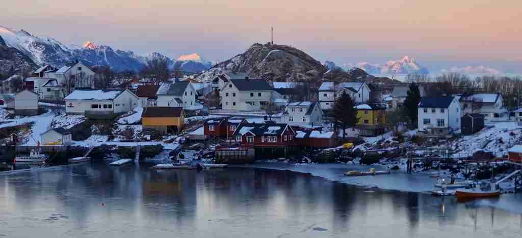
5 days
Lofoten 5-Day Highlights Experience
- ✓ Comprehensive Lofoten experience
- ✓ Expert local guides included
- ✓ All accommodation included
- ✓ Transportation provided
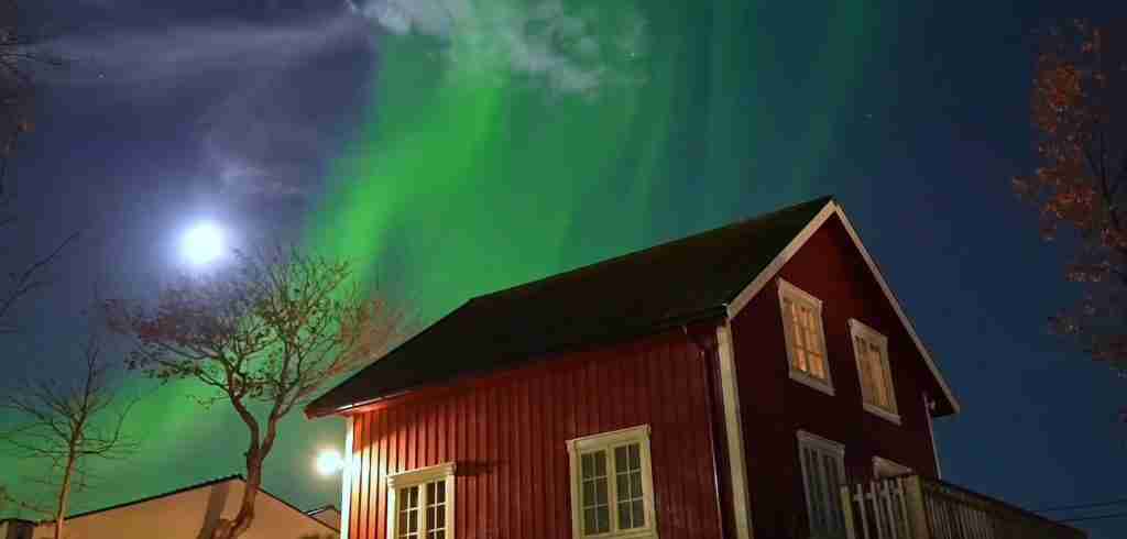
7 days
Lofoten 7-Day Cultural Journey
- ✓ Comprehensive Lofoten experience
- ✓ Expert local guides included
- ✓ All accommodation included
- ✓ Transportation provided

10 days
Lofoten 10-Day Complete Adventure
- ✓ Comprehensive Lofoten experience
- ✓ Expert local guides included
- ✓ All accommodation included
- ✓ Transportation provided
Multi-day tour packages powered by TourRadar. Prices and availability subject to change.
Introduction: Norway’s Arctic Archipelago
The Lofoten Islands represent one of Earth’s most improbable landscapes, where Arctic geography collides with temperate climate to create an environment that defies expectations. Rising abruptly from the Norwegian Sea at 68 degrees north latitude, these islands present a geological spectacle: ancient Precambrian bedrock, over 3 billion years old, sculpted by glaciers and weather into dramatic peaks that ascend directly from sea level to heights exceeding 1,100 meters. This vertical relief creates a visual drama unmatched in Scandinavia, with mountains seemingly impossibly steep, their bare rock faces plunging into deep fjords and open ocean.
What makes Lofoten truly extraordinary is the paradox of its climate. Located well within the Arctic Circle, sharing latitude with Greenland and Siberia, the islands experience temperatures moderated by the Gulf Stream, the North Atlantic Current, and the Norwegian Current. This creates one of the world’s most significant positive temperature anomalies relative to latitude, allowing for surprisingly mild conditions that support white sand beaches, diverse birdlife, and outdoor activities nearly year-round. Summer temperatures can reach comfortable levels rarely associated with the Arctic, while winters, though dark, remain far warmer than comparable latitudes elsewhere on Earth.
The human story of Lofoten centers on fishing, an industry that has shaped every aspect of island life for over a millennium. Archaeological evidence reveals continuous habitation since at least 1120 CE, when King Øystein built lodgings for fishermen near Kabelvåg, though settlements date back thousands of years earlier. The annual winter cod migration has been the lifeblood of these communities, drawing tens of thousands of fishermen during peak seasons to harvest the abundant stocks. This fishing heritage manifests in the landscape itself: traditional rorbu (fishermen’s cabins) line harbors, massive wooden racks hold thousands of drying cod creating the distinctive stockfish, and entire villages exist solely because of their strategic positions relative to fishing grounds.
Recognition of Lofoten’s exceptional qualities led to its inclusion on UNESCO’s Tentative List for World Heritage inscription. The nomination emphasizes the archipelago’s unique combination of natural phenomena and cultural landscape, highlighting how human communities have adapted to and thrived in this remote Arctic environment while maintaining sustainable fishing practices across centuries. The proposal recognizes Lofoten’s geological significance, its role as critical habitat for marine and bird species, and the extraordinary cultural monuments that document human resilience and adaptation.
Today’s Lofoten presents a complex balance between preservation and development. The islands have evolved from isolated fishing communities to one of Norway’s premier tourist destinations, attracting photographers, hikers, surfers, and travelers seeking dramatic landscapes and authentic cultural experiences. This transformation brings both opportunities and challenges: economic diversification benefits local communities, yet increased visitation pressures fragile ecosystems and traditional ways of life. Summer sees an influx of visitors drawn by the midnight sun, while winter attracts Northern Lights enthusiasts willing to brave short days for glimpses of aurora borealis dancing above snow-capped peaks.
Geographic Setting and Formation
The Lofoten archipelago extends approximately 150 kilometers from northeast to southwest off the coast of Nordland county in northern Norway. The seven main islands form a natural barrier between the open Norwegian Sea and the protected Vestfjord, creating a unique geographic configuration that influences both climate and marine ecology. This positioning places Lofoten at the southern end of the larger Lofoten-Vesterålen archipelago, with the distinction that Lofoten proper comprises the southwestern portion characterized by the most dramatic mountain scenery.
Geologically, Lofoten belongs to the Lofoten Eruptive Province, composed primarily of Precambrian rocks dating back 3 billion years or more, making this some of Earth’s oldest exposed bedrock. The islands represent a horst structure, a tectonic uplift of the basement rock, pushed upward during ancient mountain-building episodes. The dominant rock types include various gneisses, schists, and granites, highly metamorphosed and incredibly resistant to erosion, explaining the sharp, angular peaks that define the skyline.
Glaciation during the Pleistocene epoch carved the landscape into its current form. Massive ice sheets advanced and retreated multiple times, sculpting valleys, creating fjords, and sharpening mountain ridges. The U-shaped valleys typical of glacial erosion are clearly visible, particularly where glaciers carved completely through mountains creating passes between valleys. When glaciers retreated, rising sea levels flooded these valleys, creating the complex coastline of bays, inlets, and protected harbors that characterize Lofoten today.
The archipelago’s dramatic topography concentrates most human settlement along narrow coastal strips, where small fishing villages nestle between mountains and sea. The interior remains largely uninhabited, dominated by steep peaks, high plateaus, and rocky terrain unsuitable for agriculture or development. The highest summit, Higravstinden, reaches 1,161 meters, with numerous other peaks exceeding 1,000 meters. These mountains rise with exceptional steepness from sea level, creating vertical relief compressed into minimal horizontal distance, producing the wall-like appearance that makes Lofoten’s profile instantly recognizable.
Climate and Seasons
Lofoten’s climate defies Arctic stereotypes, presenting conditions far milder than latitude alone would suggest. The Gulf Stream, carrying warm water from tropical latitudes across the Atlantic, combined with the North Atlantic Current and Norwegian Current, bathes the islands in temperate waters that moderate air temperatures year-round. This oceanic influence creates what climatologists recognize as one of Earth’s most extreme positive temperature anomalies, where actual temperatures far exceed those typical for 68-69 degrees north latitude.
Winter temperatures, while cool, rarely plunge to the extreme cold experienced at similar latitudes in Canada, Alaska, or Siberia. Average winter temperatures hover around freezing, with January lows reaching -2°C to -4°C, remarkably mild for a location well within the Arctic Circle. The maritime influence prevents the severe continental cold that characterizes inland Arctic regions. However, winter brings the polar night, with Svolvær experiencing no sunrise from early December through early January, though extended twilight provides some daylight during midday hours.
Summer transforms the islands under the midnight sun, with continuous daylight from late May through mid-July. In Svolvær, the sun remains above the horizon from May 25 to July 17, creating surreal conditions where time loses conventional meaning and activities continue around the clock. Summer temperatures reach comfortable levels, averaging 12-15°C but occasionally climbing above 20°C during warm spells. The combination of continuous daylight and moderate temperatures creates ideal conditions for hiking, photography, and outdoor exploration, though visitors should always prepare for rapid weather changes characteristic of coastal mountain environments.
Spring and autumn serve as transitional seasons, each offering distinct experiences. Spring, from April through May, sees increasing daylight and warming temperatures, with snow lingering on high peaks while coastal areas green. This season coincides with the end of the cod fishing season, when activity in fishing villages peaks. Autumn, September through November, brings spectacular displays of fall colors in the limited vegetation, decreasing daylight hours, and the first opportunities to observe Northern Lights as darkness returns. These shoulder seasons often provide the best weather for hiking, with fewer visitors, stable conditions, and dramatic lighting for photography.
Precipitation occurs year-round, with autumn and winter receiving the highest amounts. Coastal storms can bring fierce winds and heavy seas, particularly exposed western shores facing open ocean. The mountainous terrain creates microclimates, with western slopes receiving more precipitation than eastern slopes in rain shadow. Clouds often cap peaks even when valleys remain clear, and weather can change rapidly as fronts move through. Despite oceanic moderation, Lofoten experiences true Arctic conditions: winter darkness, summer midnight sun, and dramatic seasonal contrasts that define northern latitudes.
The Seven Main Islands
Austvågøya: The Eastern Gateway
Austvågøya, the largest of the Lofoten islands, serves as the eastern gateway to the archipelago and hosts Svolvær, the administrative center and largest town. The island features impressive mountain landscapes, including the famous Svolvær Goat (Svolværgeita), a distinctive twin-peaked formation popular among experienced climbers. Kabelvåg, site of King Øystein’s historic 12th-century lodgings for fishermen, preserves important cultural heritage and houses several museums documenting Lofoten’s fishing history.
The island’s geography combines gentle eastern slopes with dramatic western peaks. The fishing village of Henningsvær, situated on small islands connected by bridges, exemplifies traditional Lofoten architecture and has evolved into a thriving arts community while maintaining active fishing operations. Northern Austvågøya features the entrance to Trollfjord, a narrow, spectacular fjord enclosed by vertical cliffs, accessible by boat and popular among cruise ships and smaller vessels.
Gimsøya: The Agricultural Exception
Gimsøya stands apart from other Lofoten islands through its relatively gentle topography and agricultural character. Lower elevation and less mountainous terrain allowed development of farms and potato cultivation, unusual in an archipelago where fishing dominates and agriculture remains limited. The island connects to both Austvågøya and Vestvågøya via bridges, serving as a central link in the E10 highway.
White sand beaches fringe Gimsøya’s coastline, particularly along northern shores where Hov and Kilan beaches attract surfers and swimmers brave enough to endure Arctic waters. The island’s open landscape provides excellent views of surrounding peaks on neighboring islands, creating dramatic photographic compositions. Population remains concentrated in small villages, with the island maintaining a quieter, more rural character compared to busier fishing centers.
Vestvågøya: Cultural Heart
Vestvågøya combines significant cultural heritage sites with dramatic natural landscapes. Borg, on the island’s northern coast, houses the Lofotr Viking Museum, built around the remains of the largest Viking longhouse ever discovered, measuring 83 meters in length. This chieftain’s residence, dating to the Iron Age, provides crucial insights into Viking Age society and Lofoten’s importance in pre-medieval Norway.
Leknes, Lofoten’s second-largest town, serves as a commercial hub with the archipelago’s main airport, supermarkets, and services. The island features diverse landscapes: mountains rising to over 900 meters, agricultural valleys in sheltered areas, and pristine beaches along northern coasts. Unstad, on the northwestern coast, attracts cold-water surfers to consistent swells and has developed basic infrastructure supporting this growing sport in Arctic conditions.
Flakstadøya: Hidden Treasures
Flakstadøya presents some of Lofoten’s most photographed landscapes, though it receives fewer visitors than islands further west. The island features dramatic peaks, secluded beaches, and the preserved fishing village of Nusfjord, recognized as Norway’s best-preserved fishing village and listed on UNESCO’s heritage list. Nusfjord maintains traditional architecture, continues fishing operations, and operates as a living museum where visitors can stay in historic rorbu accommodations.
The island’s southern coast hosts spectacular beaches including Ramberg, Flakstad, and Skagsanden, where white sand contrasts with turquoise Arctic waters and jagged mountain backdrops. These beaches rank among Norway’s most beautiful, offering surreal tropical appearances despite Arctic location. The E10 highway crosses Flakstadøya via mountain passes and coastal stretches, providing continuous scenic driving designated as part of Norway’s National Scenic Routes program.
Moskenesøya: The Western Crown
Moskenesøya, the westernmost major island accessible by road, contains Lofoten’s most concentrated collection of iconic landscapes. The fishing village of Reine consistently appears on lists of world’s most beautiful villages, its red rorbu cabins clustered between mountain peaks and sheltered harbor creating endlessly photographed scenes. Nearby Hamnøy, Sakrisøy, and Olenilsøya present similar compositions, each with distinctive character.
The island hosts some of Lofoten’s most popular hiking destinations, including Reinebringen, a steep but short climb providing panoramic views over Reine and surrounding peaks. Kvalvika beach requires a moderate hike but rewards visitors with pristine white sand and complete isolation. The village of Å, at the E10’s southwestern terminus, preserves traditional fishing village architecture and operates the Norwegian Fishing Village Museum, documenting cod fishing heritage and stockfish production.
Moskenesøya’s western coast faces open ocean, creating dramatic conditions. Between Moskenesøya and the small island of Mosken lies the Moskenstraumen, historically known as the Maelstrom, where powerful tidal currents create dangerous conditions that have featured in literature from Edgar Allan Poe to Jules Verne. Modern vessels navigate carefully, timing passages with tidal conditions, but the waters remain treacherous, particularly during storms.
Værøy: The Remote Outpost
Værøy, accessible only by ferry from Bodø or Moskenes, offers a more remote Lofoten experience. The island’s steep coastline provides nesting habitat for enormous seabird colonies, including puffins, eagles, and various seabirds numbering in hundreds of thousands. Bird cliffs on the western coast create spectacular viewing opportunities during nesting season, though access requires careful navigation of steep terrain.
The island’s population of approximately 700 residents concentrates in villages along sheltered eastern shores. Traditional fishing continues, though tourism has grown as visitors seek authentic Arctic experiences away from main island crowds. Hiking trails lead to mountain summits providing views across open ocean, while coastal paths access abandoned fishing stations and historic sites documenting the island’s maritime heritage.
Røst: The Extreme West
Røst, the westernmost inhabited point of the Lofoten archipelago, consists of approximately 365 small islands and skerries, with human settlement concentrated on the main island of Røstlandet. The archipelago’s position far from mainland mountains creates gentler topography but exposes it fully to North Atlantic weather, creating harsh conditions during storms. The island’s significance lies primarily in its seabird colonies, with millions of birds nesting annually in coastal cliffs.
Røst’s remote location and limited infrastructure attract few tourists, but those who make the journey by ferry or small aircraft find an authentic fishing community where traditions persist largely unchanged. The surrounding waters provide important fishing grounds, and the island maintains a strong fishing economy despite its isolation. For birdwatchers and nature enthusiasts, Røst represents one of Europe’s premier seabird destinations, particularly during spring and summer nesting seasons.
Fishing Heritage and Stockfish Tradition
The annual winter cod migration to Lofoten represents one of Earth’s great natural spectacles, drawing millions of fish from feeding grounds in the Barents Sea to spawning areas in the relatively warm, nutrient-rich waters surrounding the islands. This migration, occurring from late January through April, has shaped Lofoten’s culture, economy, and settlements for over a millennium. Historical records document organized cod fisheries since at least the Viking Age, with archaeological evidence suggesting fishing activity dating back thousands of years.
The scale of historic fisheries was extraordinary. During peak years in the 19th and early 20th centuries, over 30,000 fishermen descended on Lofoten each winter, arriving from fishing communities throughout western and northern Norway. These seasonal workers required accommodation, leading to construction of rorbu, simple wooden cabins provided by property owners in exchange for portions of the catch or rental fees. The rorbu tradition continues today, though many historic cabins now serve tourists rather than fishermen.
Stockfish production distinguishes Lofoten’s fishing industry from other major fisheries. The process takes advantage of Arctic winter conditions: cod caught during spawning season are beheaded, gutted, and hung in pairs on large wooden racks called fiskjehell or hjell. Arctic wind and temperatures just below freezing create perfect conditions for drying without salt preservation. The fish lose approximately 80% of their water weight over 2-3 months, transforming into rock-hard stockfish that can be stored for years.
This preserved fish became one of Norway’s most important exports, particularly to Mediterranean countries lacking preservation salt. Italy remains the largest market for Lofoten stockfish, where it’s reconstituted and used in traditional dishes. The sight and smell of thousands of cod drying on wooden racks has become synonymous with Lofoten, creating distinctive landscapes that blend industrial production with traditional methods largely unchanged across centuries.
Modern fishing continues these traditions while incorporating contemporary technology. Today’s Lofoten fishing fleet uses advanced equipment, GPS navigation, and motorized vessels, yet the basic techniques of long-line and gillnet fishing persist. The seasonal character remains, with fishing activity peaking during winter spawning runs. Regulatory frameworks ensure sustainable harvests, protecting stocks that generate hundreds of millions of kroner annually for local economies.
Several museums preserve and interpret this fishing heritage. The Norwegian Fishing Village Museum in Å presents comprehensive exhibits on traditional fishing methods, stockfish production, and daily life in historic fishing communities. The Lofoten Stockfish Museum documents the complete stockfish production process, from catch to export. These institutions work to preserve knowledge, techniques, and cultural practices as mechanization and changing economics transform the industry.
Mountain Landscapes and Hiking
Lofoten’s mountains provide some of Europe’s most dramatic hiking opportunities, combining Alpine peaks, Arctic conditions, and coastal scenery in accessible terrain. Trails range from short walks to beach viewpoints to challenging technical climbs requiring mountaineering skills. The compressed vertical relief, with mountains rising from sea level to over 1,000 meters within horizontal distances often measured in hundreds of meters, creates intensity unusual in mountain hiking.
Reinebringen ranks among Lofoten’s most popular hikes despite punishing steepness. The trail climbs approximately 450 vertical meters in less than 2 kilometers horizontal distance, much of it via stone steps constructed to prevent erosion from heavy foot traffic. The summit rewards hikers with panoramic views over Reine, surrounding peaks, and countless islands scattered across turquoise waters. The popularity has necessitated infrastructure improvements to protect fragile alpine vegetation from thousands of annual hikers.
Ryten, near the village of Fredvang, offers more moderate gradients while still providing spectacular views. The trail traverses through varying terrain: coastal meadows, rocky slopes, and finally exposed summit ridges. From the top, hikers overlook Kvalvika beach far below, framed by vertical cliffs and open ocean beyond. The beach itself can be reached via separate trail, creating opportunities for combined beach and mountain experiences.
Munkebu to Munkan represents a classic Lofoten traverse, starting from a mountain hut accessible only by hiking and continuing across exposed ridges to the summit of Munkan. This route requires good weather, solid navigation skills, and comfort with exposure, as sections follow narrow ridges with significant drop-offs. The rewards include perhaps Lofoten’s finest views, encompassing the full sweep of the archipelago from sea to peaks to distant horizons.
Hiking in Lofoten demands respect for changeable Arctic mountain conditions. Weather shifts rapidly, with storms developing quickly and visibility dropping to near-zero in fog or snow. Even summer hiking requires warm layers, waterproof gear, and emergency equipment. Many trails involve scrambling over boulders and exposed rock, requiring solid footwear and confidence on steep, loose terrain. Winter and early spring hiking enters serious mountaineering territory, with snow, ice, avalanche risk, and extreme cold demanding winter mountain skills and equipment.
The midnight sun enables unusual hiking opportunities during summer. Trails can be hiked at any hour, with photographers particularly favoring late evening and early morning light. Starting a mountain hike at midnight beneath low-angle Arctic sun creates surreal experiences, though it requires discipline to rest adequately despite 24-hour daylight.
Beaches and Coastal Beauty
Lofoten’s beaches present startling contrasts, combining tropical-appearing white sand with Arctic waters and mountain backdrops. The finest beaches cluster along northern and western coasts, where sand deposits from glacial erosion accumulated in protected bays. These beaches rival any in Europe for pure scenic beauty, though water temperatures rarely exceed 14°C even in summer, limiting swimming to the hardiest souls or those equipped with wetsuits.
Haukland and Uttakleiv beaches on Vestvågøya exemplify Lofoten’s coastal perfection. White sand arcs between rocky headlands, turquoise water laps gently in protected conditions, and mountains rise directly behind the beach. These beaches attract photographers year-round, with winter providing dramatic conditions when snow-covered peaks contrast with sand and surf, and summer offering midnight sun illuminating landscapes in golden light.
Kvalvika, accessible only via hiking trail over mountain pass from Fredvang, offers complete isolation. The crescent beach sits in a dramatic amphitheater of peaks, facing open ocean that generates consistent surf. A handful of primitive campsites behind the beach allow overnight stays for those willing to carry camping gear over the pass. The beach has become popular among surfers willing to hike equipment in exchange for uncrowded waves and spectacular setting.
Unstad, on Vestvågøya’s northwestern coast, developed as Norway’s premier cold-water surfing destination. Consistent North Atlantic swells, a forgiving beach break, and basic infrastructure including a surf school and hostel make this Arctic surfing accessible. Surfers from around the world visit to experience surfing beneath midnight sun or Northern Lights, creating a unique international community in this remote fishing village.
Southern beaches along Flakstadøya and Moskenesøya present equally stunning scenery. Ramberg, directly adjacent to the E10, provides easy access to excellent beach walking and photography. Skagsanden, near Flakstad village, offers pristine white sand framed by distinctive peaks. These southern beaches tend to be less crowded than northern equivalents, providing solitude despite easy access.
Wildlife and Natural Environment
Lofoten’s position at the intersection of temperate oceanic and Arctic ecosystems creates exceptional biodiversity. The marine environment supports abundant life, from microscopic plankton to whales, with fish stocks including not only cod but herring, haddock, and numerous other species. The spring and summer plankton blooms feed everything from tiny crustaceans to baleen whales, creating a complete marine food web visible from shore.
Seabird populations reach extraordinary numbers during nesting season. Sea eagles, Europe’s largest raptor, maintain territories throughout the archipelago, often visible soaring above coastal cliffs or perched on rocky outcrops. Puffins nest in colonies on offshore islands, particularly Værøy and Røst, where hundreds of thousands gather during breeding season. Other seabirds including cormorants, guillemots, razorbills, and various gull species occupy different niches in the coastal ecosystem.
Whale watching opportunities exist, particularly during summer months when orcas and humpback whales follow herring migrations along the coast. Sperm whales inhabit deeper waters offshore, occasionally visible from western shores. White-beaked dolphins and harbor porpoises appear regularly in coastal waters, while common and grey seals haul out on rocky shores throughout the archipelago.
Terrestrial wildlife remains limited by harsh winter conditions and lack of vegetative cover. Reindeer were historically present but have been absent for centuries. The challenging terrain and climate restrict mammal populations, with red foxes representing the primary terrestrial predator. Arctic foxes occasionally appear during winter, while small rodent populations support the limited mammal community.
The terrestrial flora demonstrates remarkable adaptation to Arctic-maritime conditions. Coastal meadows bloom spectacularly during brief summer, with Arctic wildflowers creating colorful carpets. Dwarf birch and willow grow in sheltered locations, while higher elevations support only hardy grasses, mosses, and lichens. The growing season’s brevity concentrates plant reproduction into intense summer months, when continuous daylight maximizes photosynthesis.
Cultural Life and Communities
Lofoten’s approximately 25,000 permanent residents maintain communities shaped by geography, isolation, and fishing heritage. Population concentrates in coastal settlements, with inland areas remaining largely uninhabited. Svolvær, the largest town with approximately 4,700 residents, serves as administrative center and commercial hub, offering services, schools, hospital, and transportation connections. Leknes, second largest with around 3,500 residents, provides similar infrastructure for western Lofoten.
Traditional fishing villages preserve cultural heritage while adapting to tourism economies. Henningsvær exemplifies this transition, maintaining active fishing while developing arts galleries, cafes, and tourist accommodations in historic buildings. The village’s striking setting on small islands connected by bridges, combined with preservation of traditional architecture, attracts photographers and visitors seeking authentic atmosphere. Similar transformations occur in Reine, Å, Nusfjord, and other historically significant settlements.
Arts and culture thrive despite remote location. Lofoten hosts annual cultural events including the Lofoten International Chamber Music Festival, attracting performers and audiences for week-long celebration of classical music in intimate venues. The Lofoten International Art Festival showcases contemporary art, often utilizing unconventional spaces in historic buildings. Numerous artists maintain studios throughout the islands, drawn by dramatic light and landscapes that have inspired painters, photographers, and writers for generations.
Language and dialect reflect Norwegian linguistic patterns, with local variations in vocabulary and pronunciation marking Lofoten residents. Most younger residents speak excellent English, essential for tourism economy, while older generations may be less comfortable with English but often speak German learned from generations of German tourism. Traditional Lofoten culture emphasized self-sufficiency, community cooperation during fishing seasons, and resilience necessary for Arctic living.
Education and modern services reach even small communities, with schools, medical facilities, and internet connectivity available throughout populated areas. The challenge of maintaining services across scattered island communities requires creative solutions, including shared resources, digital technologies, and transportation networks. Young people face decisions about staying in traditional communities versus pursuing opportunities in larger cities, creating demographic challenges common to rural areas across Norway.
Transportation and Access
Reaching Lofoten requires either air travel followed by ferry or road connection, or extended road journey from southern Norway. Two small airports serve the islands: Svolvær Airport (Helle) and Leknes Airport, both receiving regular flights from Bodø and other northern Norwegian cities. Bodø serves as the primary hub, with connections to Oslo, Trondheim, and other major cities. International visitors typically fly to Oslo, then connect to Bodø for final flight to Lofoten or ferry crossing.
The ferry connection between Bodø and Moskenes provides scenic introduction to Lofoten. The 3-4 hour crossing traverses Vestfjord, with Lofoten’s mountain wall rising dramatically as the ferry approaches. Several ferries operate daily during summer, with reduced service in winter. Reservations are essential during peak season, particularly for vehicles. The route functions as critical lifeline for residents and commercial traffic while providing tourist access.
The E10 highway forms the spine of Lofoten transportation, connecting islands from Å in the southwest to the junction with the E6 near Narvik in the northeast. Bridges and tunnels eliminated ferry dependencies between main islands, creating continuous road connection. The Norwegian Public Roads Administration designated the E10 through Lofoten as a National Scenic Route, implementing improvements including rest areas, viewing platforms, and architectural elements enhancing the driving experience.
Car rental provides optimal flexibility for exploring Lofoten, allowing stops at viewpoints, beaches, and trailheads impossible to reach via public transportation. Rental availability exists in Bodø, Svolvær, Leknes, and Moskenes, with advance booking strongly recommended, especially summer. Rates reflect Norwegian costs but provide essential mobility. The alternative of purchasing an older, inexpensive vehicle for extended stays can be economical for long-term visitors.
Public bus service connects major towns and some villages, operated primarily by local companies. Schedules favor commuters rather than tourists, with limited service on weekends and some routes operating only once or twice daily. The 100 bus route follows the E10, connecting major points, but timetables require careful planning. For budget travelers with time flexibility, bus travel remains viable, though significantly more limiting than private vehicle.
Cycling attracts adventurous travelers, with the Lofoten Insomnia race demonstrating the archipelago’s appeal to endurance cyclists. The 234-kilometer route from Å to Svolvær challenges riders with steep climbs and unpredictable weather but rewards with intimate landscape engagement. Support services for cyclists remain limited outside main towns, requiring self-sufficiency with camping equipment and supplies. Cyclists must contend with narrow roads, tunnels without bike lanes, and weather that can shift from perfect to dangerous within hours.
Frequently Asked Questions
Is Lofoten a UNESCO World Heritage Site?
Lofoten is currently listed on UNESCO’s Tentative List for World Heritage inscription but has not yet been officially inscribed as a World Heritage Site. Norway submitted the nomination recognizing Lofoten’s unique combination of natural beauty, geological significance, and exceptional cultural heritage linked to traditional fishing practices spanning over a millennium. The tentative listing acknowledges the archipelago’s potential Outstanding Universal Value, particularly the interaction between dramatic Arctic-maritime landscapes and sustainable fishing communities that have adapted to this environment across centuries. Whether and when Lofoten progresses from tentative listing to full inscription depends on Norwegian government priorities and UNESCO evaluation processes.
What is the difference between the midnight sun and polar night in Lofoten?
The midnight sun and polar night represent opposite extreme light conditions resulting from Lofoten’s position within the Arctic Circle at 68-69 degrees north latitude. During the midnight sun period, from approximately May 25 to July 17 in Svolvær, the sun never fully sets, remaining above the horizon continuously for nearly two months. This creates 24-hour daylight, though the sun’s position changes throughout the day, providing varying light quality particularly valued by photographers during “golden hour” that extends for hours. Conversely, polar night occurs in winter, with Svolvær experiencing no sunrise from early December through early January. However, polar night doesn’t mean complete darkness; extended twilight during midday hours provides several hours of dim light when the sun remains just below the horizon. These extreme conditions profoundly affect daily life, requiring adaptation to sleep during perpetual daylight in summer and function during winter darkness.
Can you see the Northern Lights in Lofoten?
Lofoten offers excellent opportunities to observe aurora borealis during winter months, from September through April, with peak activity typically occurring from November through February. The archipelago’s position within the auroral oval and minimal light pollution in rural areas create ideal conditions for aurora viewing. However, Lofoten’s coastal location results in more frequent cloud cover compared to inland locations like Tromsø or Alta, potentially obscuring views. Weather becomes the critical factor; clear skies are essential, and the changeable coastal climate means aurora viewing is never guaranteed. Several factors favor Lofoten despite weather challenges: dramatic landscape provides spectacular foregrounds for aurora photography, combining green lights with snow-covered peaks and frozen beaches; numerous accessible locations eliminate need for extensive travel to dark sites; and fishing villages offer infrastructure lacking in more remote viewing areas. Multiple smartphone applications predict aurora activity and local cloud cover, allowing visitors to maximize chances by choosing clear nights for viewing attempts. For visitors whose primary goal is Northern Lights, combining Lofoten with time in Tromsø provides both coastal beauty and higher statistical probability of clear skies.
What makes Lofoten’s climate unusual for its Arctic location?
Lofoten experiences one of Earth’s most significant positive temperature anomalies, with actual temperatures far exceeding those typical for 68-69 degrees north latitude. The Gulf Stream, North Atlantic Current, and Norwegian Current carry warm tropical water across the Atlantic Ocean, bathing the islands in temperate conditions that moderate air temperatures year-round. This oceanic influence prevents extreme cold, with winter average temperatures around freezing rather than the severe continental cold of -30°C to -40°C experienced at similar latitudes in Canada, Alaska, or Siberia. Summer temperatures reach comfortable levels between 12-15°C, occasionally climbing above 20°C, allowing outdoor activities and even occasional swimming in Arctic waters. This mild climate supports white sand beaches, diverse bird life, and limited agriculture impossible at comparable latitudes elsewhere. The paradox becomes evident when considering that Lofoten shares latitude with northern Greenland, central Alaska, and northern Siberia, yet maintains ice-free harbors year-round and winter temperatures rarely dropping below -10°C.
How long does stockfish production take?
Stockfish production from fresh cod to finished product typically requires 2-3 months of drying under optimal Arctic winter conditions. The process begins immediately after fishing during the winter spawning season, from February through April, when temperatures hover just below freezing and Arctic winds provide consistent air circulation. Freshly caught cod are beheaded, gutted, and hung in pairs by their tails on large wooden racks called fiskjehell, where they remain exposed to weather throughout the drying period. The combination of cold temperatures (ideally -2°C to 2°C), low humidity, and constant wind creates perfect conditions for dehydration without bacterial decomposition. Over 2-3 months, the fish lose approximately 80% of their water weight, transforming from soft, fresh cod to rock-hard stockfish that can be stored for years without refrigeration. Production requires monitoring weather conditions; excessive warmth risks spoilage, while extreme cold freezes fish rather than drying them. Once fully dried, typically by late May or early June, stockfish are taken down, sorted by quality, and prepared for export. This ancient preservation method remains largely unchanged across centuries, with modern producers using the same natural process that made Lofoten stockfish famous throughout medieval Europe.
What is a rorbu and can visitors stay in one?
A rorbu is a traditional fisherman’s cabin, originally built to house seasonal workers during winter cod fishing season. These distinctive red wooden buildings, typically situated on stilts above water to accommodate tidal fluctuations, line harbors throughout Lofoten and have become iconic symbols of the archipelago. Historically, rorbuer were simple accommodations provided by property owners or merchants, who received payment in fish or cash rent. The structures evolved to standard designs: single story, painted red with white trim, featuring sleeping quarters, cooking facilities, and storage space for fishing equipment. During peak fishing seasons in the 19th and early 20th centuries, tens of thousands of fishermen occupied rorbuer throughout Lofoten. Today, many historic rorbuer have been renovated as tourist accommodations, allowing visitors to experience traditional fishing village atmosphere with modern amenities including heating, kitchens, and bathrooms. Staying in a renovated rorbu provides authentic cultural immersion, direct water access, and often spectacular views of harbors and mountains. Options range from basic cabins maintaining historical simplicity to luxury conversions with premium facilities. Villages including Å, Nusfjord, Reine, Henningsvær, and Kabelvåg offer various rorbu accommodations, with advance booking essential during summer peak season.
What wildlife can be observed in Lofoten?
Lofoten’s wildlife concentrates in marine and avian species adapted to Arctic-maritime environments, with terrestrial mammals limited by harsh conditions and limited vegetation. Sea eagles represent the most impressive bird species, with Europe’s largest raptor population concentrated in Lofoten, often visible soaring above coasts or perched on rocky outcrops hunting fish. During nesting season from April through July, enormous seabird colonies occupy coastal cliffs, particularly on outer islands Værøy and Røst, with hundreds of thousands of puffins, guillemots, razorbills, cormorants, and various gull species creating spectacular viewing opportunities. Marine mammals including orcas and humpback whales follow herring migrations along Lofoten coasts during summer months, with organized whale-watching tours operating from several ports. Sperm whales inhabit deeper offshore waters, occasionally visible from western shores. White-beaked dolphins and harbor porpoises appear regularly in coastal waters, while common and grey seals haul out on rocky shores throughout the archipelago. Terrestrial wildlife remains limited: red foxes represent the primary land predator, while small rodent populations support the limited mammal community. The rich marine environment, from microscopic plankton to large whales, creates visible food webs, with fish stocks including not only cod but herring, haddock, and numerous other species attracting larger predators including eagles, seals, and whales.
Is Lofoten suitable for families with children?
Lofoten offers excellent family travel opportunities, combining outdoor activities with cultural experiences suitable for children, though requires planning around terrain challenges and weather conditions. Beaches provide safe, engaging environments for children, with white sand, shallow waters, and dramatic scenery creating memorable experiences despite cold water temperatures that limit swimming. Beach walking, rock pooling, and sandcastle building work well even without swimming, while calm summer weather allows extended beach time. Many hiking trails accommodate families, particularly shorter walks to viewpoints or beach access routes that avoid technical terrain. The Lofotr Viking Museum in Borg provides interactive experiences specifically designed for children, including Viking costume dress-up, traditional games, and opportunities to explore the reconstructed longhouse. Several fishing villages operate museums with exhibits engaging for children, particularly those demonstrating traditional stockfish production, boat building, and fishing techniques. Boat tours, including fjord cruises and whale watching, generally accommodate families, offering wildlife viewing and scenic experiences. However, parents should consider challenges: many trails involve steep, rocky terrain unsuitable for young children; weather changes rapidly, requiring appropriate clothing and flexibility with plans; accommodations vary significantly in family-friendliness, with some rorbuer lacking amenities for children. Transportation presents considerations, as roads can be narrow and winding, potentially causing motion sickness, while public transport limitations make rental car nearly essential for families.
What is the best island to visit for first-time Lofoten travelers?
Moskenesøya and Vestvågøya offer the best combination of iconic landscapes, accessible attractions, and infrastructure for first-time Lofoten visitors. Moskenesøya contains the most photographed locations including Reine, Hamnøy, and Sakrisøy, where dramatic peaks frame red rorbu cabins above turquoise waters creating instantly recognizable Lofoten scenery. The island provides numerous hiking opportunities from short walks to challenging mountain ascents, spectacular beaches requiring minimal effort to access, and excellent infrastructure including accommodations, restaurants, and services. The E10 highway traverses the island, designated as a National Scenic Route, making driving itself a major attraction with viewpoints, rest areas, and constant scenic rewards. Vestvågøya complements this with the Lofotr Viking Museum providing cultural context, Leknes offering practical services, beautiful beaches along northern coasts, and the cold-water surfing destination of Unstad. Together, these islands encompass the full range of Lofoten experiences: mountain peaks, pristine beaches, historic fishing villages, cultural sites, outdoor activities, and practical facilities. First-time visitors with limited time should prioritize these two islands, perhaps adding Flakstadøya for Nusfjord’s preserved fishing village and additional beaches. Austvågøya, while offering attractions including Svolvær and Henningsvær, presents less concentrated scenic drama, making it lower priority for short visits. The outer islands of Værøy and Røst require ferry access and appeal primarily to those seeking maximum remoteness or specific seabird viewing opportunities.
How does the fishing season affect visiting Lofoten?
The winter cod fishing season, from late January through April, profoundly affects Lofoten communities and visitor experiences, creating both attractions and challenges for travelers. During peak fishing, harbor villages transform into bustling centers as fishing vessels crowd harbors, processing facilities operate at maximum capacity, and the distinctive smell of stockfish production permeates coastal areas where thousands of cod hang drying on wooden racks. This provides authentic cultural immersion, opportunities to observe traditional practices, and dynamic village atmosphere absent during quieter months. However, fishing season also means accommodations may be scarcer as fishermen occupy some rorbuer, restaurants and services cater primarily to workers rather than tourists, and fishing operations take priority in harbors and processing areas. The season coincides with winter darkness, challenging weather, and snow-covered landscapes, creating dramatically different conditions from summer tourism season. For photographers and cultural enthusiasts, this provides unparalleled opportunities to document traditional practices, capture stockfish drying racks against mountain backdrops, and experience Lofoten’s authentic character. For visitors prioritizing hiking, comfortable weather, and easy access to attractions, summer provides better conditions. The transition periods of late April through May, when fishing concludes but snow remains on peaks and drying racks still display stockfish, offer perhaps optimal balance of cultural interest and improving weather conditions.