Iceland National Parks & UNESCO Sites Complete Guide: Cultural Heritage & Natural Wonders
Iceland protects its most significant landscapes and cultural sites through three national parks—Þingvellir, Vatnajökull, and Snæfellsjökull—covering 14% of the country, alongside three UNESCO World Heritage Sites recognizing global importance for parliamentary history, volcanic island formation, and glacial-volcanic dynamics. This comprehensive guide explores the geology, history, ecology, and cultural significance of Iceland’s nationally and internationally protected areas, from the tectonic rift where Europe’s oldest parliament met to pristine volcanic islands studied as natural laboratories.
Key Takeaways for Iceland’s National Parks and UNESCO Sites
- Three National Parks: Iceland maintains three official national parks—Þingvellir (established 1930, covering 9,270 hectares), Snæfellsjökull (established 2001, covering 17,000 hectares), and Vatnajökull (established 2008, covering 1,400,000 hectares or 14% of Iceland)—each protecting unique geological, ecological, and cultural features.
- UNESCO Recognition: Three sites hold UNESCO World Heritage status—Þingvellir National Park (inscribed 2004 as cultural site), Surtsey volcanic island (inscribed 2008 as natural site), and Vatnajökull National Park (inscribed 2019 as natural site)—representing outstanding universal value for human history and earth sciences.
- Parliamentary Heritage: Þingvellir served as Iceland’s parliamentary assembly location from 930 AD to 1798, making it one of the world’s longest-functioning democratic institutions and a symbol of Icelandic independence, with the Alþingi (parliament) meeting annually in natural amphitheater formed by tectonic rifting.
- Tectonic Significance: Iceland straddles the Mid-Atlantic Ridge where North American and Eurasian tectonic plates diverge at 2 centimeters annually, creating the rift valley visible at Þingvellir and driving the volcanic activity that formed Surtsey and continues reshaping Vatnajökull’s landscape.
- Glacial-Volcanic Dynamics: Vatnajökull National Park contains eight central volcanoes beneath Europe’s largest ice cap (8,100 cubic kilometers), producing jökulhlaups (glacial outburst floods) that create unique sandur plains and river systems while hosting endemic groundwater fauna surviving since the Ice Age.
- Protected Access: While Þingvellir and Vatnajökull welcome millions of visitors annually with extensive infrastructure, Surtsey remains strictly off-limits to the public to preserve its pristine state as a natural laboratory for studying ecological succession on newly formed land without human interference.
People Also Ask About Iceland National Parks & UNESCO Sites
What Makes Þingvellir Unique Among World Heritage Sites?
Þingvellir National Park holds dual significance as both a cultural landmark and geological wonder, making it unique among UNESCO World Heritage Sites. Culturally, Þingvellir served as the meeting place for Iceland’s Alþingi (parliament) from 930 AD to 1798, representing one of the world’s oldest democratic assemblies where chieftains gathered annually to create laws, settle disputes, and maintain social cohesion across dispersed Viking settlements. The Law Rock (Lögberg) served as the assembly’s focal point, where the law speaker recited all Icelandic laws from memory over three years and announcements carried across the natural amphitheater formed by rift valley cliffs. Major historical events unfolded here, including Iceland’s conversion to Christianity in 1000 AD and the declaration of independence from Denmark in 1944. Geologically, Þingvellir occupies a rift valley created by the divergence of North American and Eurasian tectonic plates, making it one of few locations worldwide where continental rifting occurs above sea level and is directly observable. The valley floor drops 40 meters below surrounding lava fields through normal faulting, with Almannagjá gorge’s towering cliffs marking the eastern boundary of the North American Plate. This combination of parliamentary tradition in a dramatic geological setting created by earth’s fundamental tectonic processes gives Þingvellir its Outstanding Universal Value under UNESCO criteria.
How Was Surtsey Volcanic Island Formed?
Surtsey emerged from the North Atlantic through submarine volcanic eruptions lasting from November 14, 1963 to June 5, 1967, creating a new island 32 kilometers south of Iceland’s mainland. The eruption began 130 meters below sea level when magma rising through the Mid-Atlantic Ridge encountered seawater, producing explosive phreatomagmatic eruptions that sent steam columns 10 kilometers high and built a tephra (volcanic ash and fragments) cone above the surface within days. The island was named after Surtr, the fire giant from Norse mythology. Initial explosive activity continued until April 1964 as seawater access to the vent maintained steam-driven eruptions, then transitioned to effusive lava flows once the cone rose high enough to prevent water infiltration. Lava flows expanded the island to 2.7 square kilometers at its maximum extent, with the cone reaching 174 meters elevation. The eruption added substantial new land through both tephra accumulation and lava flow platforms, demonstrating the island-building process that created all of Iceland over millions of years. Post-eruption erosion has reduced Surtsey to approximately 1.4 square kilometers as North Atlantic waves attack unconsolidated tephra on the island’s flanks, though the lava-protected core remains stable. The island’s formation provided scientists with unprecedented opportunity to observe volcanic island creation in real-time and document initial ecological colonization of barren land, making it invaluable for understanding how life establishes on newly available territory.
Why Is Vatnajökull National Park a UNESCO World Heritage Site?
Vatnajökull National Park achieved UNESCO World Heritage status in 2019 for demonstrating earth’s major geological processes through the dynamic interaction between volcanism, glaciation, and river systems in an accessible landscape of outstanding beauty. The park contains Europe’s largest ice cap covering 8,100 cubic kilometers, beneath which lie eight major volcanic systems including two of Iceland’s most active volcanoes. This unique coexistence of ice and fire creates phenomena found nowhere else on earth, particularly jökulhlaups—catastrophic glacial outburst floods occurring when subglacial volcanic eruptions melt massive ice volumes rapidly, releasing water suddenly in floods reaching 300,000 cubic meters per second. These jökulhlaups have created Iceland’s extensive sandur plains (glacial outwash deserts), constantly evolving river systems, and rapidly forming canyons like Jökulsárgljúfur, demonstrating fluvial geomorphology at accelerated rates. The park’s volcanic zones host endemic groundwater fauna including crustaceans and bacteria that survived Ice Age conditions in geothermally heated aquifers, potentially replicating conditions on early Earth and icy satellites like Europa, making them scientifically invaluable for astrobiology research. The park encompasses complete sequences from highland ice cap through proglacial lakes, outlet glaciers, and river systems to coastal lagoons, illustrating the full cycle of glacial landscape evolution. UNESCO recognized this as an outstanding example representing major stages of Earth’s history and significant ongoing geological processes worthy of protection and study.
Can You Visit All Three UNESCO Sites in One Trip?
Visiting two of Iceland’s three UNESCO World Heritage Sites—Þingvellir and Vatnajökull—is straightforward and commonly accomplished within a single trip, while Surtsey remains permanently inaccessible to the public. Þingvellir National Park sits 45 kilometers northeast of Reykjavík as part of the Golden Circle route, making it Iceland’s most visited natural site accessible within one hour’s drive from the capital with extensive visitor facilities including parking, information center, marked trails, and viewing platforms. Vatnajökull National Park encompasses vast areas in southeast and northeast Iceland accessible via Ring Road (Route 1), with major visitor zones including Skaftafell area near Kirkjubæjarklaustur (4-5 hours from Reykjavík), Jökulsárlón glacier lagoon (5 hours from Reykjavík), and Ásbyrgi canyon in the north (6 hours from Reykjavík). A comprehensive Iceland circuit including both parks requires 7-10 days minimum, combining Golden Circle for Þingvellir with south coast driving to Vatnajökull’s glacial features. Surtsey volcanic island, located 32 kilometers southwest of Heimaey in the Westman Islands, has been strictly protected since 1965 with access limited exclusively to approved scientists conducting research—no tourism, boat landings, or even swimming near the island is permitted to preserve its status as a pristine natural laboratory. Visitors can view Surtsey from boat tours departing Heimaey that circle the island at distance, or from aircraft, but cannot set foot on the island itself, making it Iceland’s only UNESCO site that remains permanently off-limits to general public visitation.
Extended multi-day tours – 5+ days
Featured Iceland Multi-Day Tour Packages
7 days
7 Day – Iceland Ring Road & Snæfellsnes Peninsula Small-Group Tour
- ✓ Comprehensive Iceland tour
- ✓ Expert local guides included
- ✓ All accommodation arranged
- ✓ Transportation provided
7 days
7-Day Small Group Journey Around Iceland with Premium Hotels
- ✓ Comprehensive Iceland tour
- ✓ Expert local guides included
- ✓ All accommodation arranged
- ✓ Transportation provided
5 days
5-Day Small Group Northern Lights Hunt & Glacier Lagoon Tour
- ✓ Comprehensive Iceland tour
- ✓ Expert local guides included
- ✓ All accommodation arranged
- ✓ Transportation provided
5 days
5 Days Land of Northern Lights
- ✓ Comprehensive Iceland tour
- ✓ Expert local guides included
- ✓ All accommodation arranged
- ✓ Transportation provided
Multi-day tour packages powered by TourRadar. Prices and availability subject to change.
Introduction to Iceland’s Protected Areas System
Iceland’s approach to nature conservation balances accessibility with preservation, protecting approximately 25% of the country’s land area through various designation categories while maintaining public access traditions rooted in Iceland’s “right to roam” cultural heritage. The three national parks—Þingvellir, Snæfellsjökull, and Vatnajökull—represent the highest level of protection for areas combining exceptional natural features with cultural or scientific significance. These parks function as outdoor classrooms where visitors experience Iceland’s geological forces, ecological processes, and historical legacy firsthand through well-developed infrastructure including visitor centers, marked trails, and ranger programs.
Beyond the three national parks, Iceland maintains over 130 additional protected areas including nature reserves, natural monuments, country parks, and habitat management areas. This diverse protection framework allows tailored conservation strategies matching each area’s specific values and vulnerabilities. Surtsey, though designated a nature reserve rather than a national park, receives UNESCO recognition for its pristine state and scientific importance as a natural laboratory studying ecological succession. The various protection categories share common restrictions including prohibitions on off-road driving (enforced Iceland-wide regardless of protection status), requirements to stay on marked trails in sensitive areas, and camping only in designated locations.
The national parks operate under different administrative structures reflecting their distinct histories and priorities. Þingvellir answers to the Þingvellir Commission established by special legislation recognizing the site’s unique cultural importance to Icelandic national identity. Vatnajökull and Snæfellsjökull operate under Iceland’s Nature Conservation Agency within the Ministry for the Environment and Natural Resources, following standard national park management protocols. This administrative diversity enables specialized management suited to each park’s particular conservation challenges while maintaining overarching environmental protection standards.
Iceland’s UNESCO World Heritage Sites—three properties inscribed across cultural and natural categories—represent the country’s most globally significant heritage. UNESCO designation brings international recognition and tourism interest but also imposes monitoring requirements and conservation obligations ensuring Outstanding Universal Value remains protected for future generations. The combination of national park designation (providing domestic legal protection and funding) and UNESCO status (bringing international oversight and prestige) creates robust protection frameworks for Iceland’s most treasured landscapes and cultural sites.
Þingvellir National Park: Where Democracy and Geology Converge
Þingvellir National Park occupies 9,270 hectares in southwest Iceland, situated in a rift valley between the North American and Eurasian tectonic plates. Established in 1930 as Iceland’s first national park on the 1,000th anniversary of the Alþingi parliament, Þingvellir holds unmatched importance in Icelandic cultural identity as the birthplace of the nation’s democratic traditions and the setting for pivotal moments in Iceland’s history.
The Alþingi assembled at Þingvellir from approximately 930 AD through 1798, creating Europe’s oldest parliament and one of the world’s first democratic assemblies. Each summer, chieftains (goðar) from across Iceland gathered for two weeks at the Law Rock (Lögberg), where the law speaker recited all Icelandic laws from memory over a three-year cycle and new legislation was debated and adopted. The natural amphitheater formed by rift valley cliffs provided excellent acoustics, allowing thousands of assembled people to hear proceedings. Beyond lawmaking, the Alþingi served as Iceland’s supreme court where disputes were settled, marriages arranged, business conducted, and social bonds maintained across the scattered island population.
Þingvellir witnessed Iceland’s most consequential historical moments. In 1000 AD, under threat of Norwegian invasion, the Alþingi voted to adopt Christianity as Iceland’s official religion while maintaining private pagan worship rights, demonstrating the pragmatic consensus-building that characterized Icelandic governance. In 1944, following dissolution of the Danish-Icelandic union, Iceland declared independence at Þingvellir on June 17, deliberately choosing this historically resonant location to proclaim sovereignty. The site embodies Icelandic national identity more than any other location, representing self-governance, independence, and cultural continuity across eleven centuries.
The geological setting creates Þingvellir’s dramatic landscape. The rift valley formed through normal faulting as the North American and Eurasian plates separate at approximately 2 centimeters annually, causing the valley floor to subside through a series of parallel fissures. Almannagjá gorge marks the eastern boundary with cliffs rising 40 meters, representing the North American Plate’s edge. Visitors walk through this fissure, quite literally stepping between continental plates. The western boundary, though less dramatic, shows similar rifting patterns. This tectonic activity continues today—the valley widens measurably over decades, and earthquakes regularly remind visitors of ongoing geological processes.
Þingvallavatn, Iceland’s largest natural lake covering 84 square kilometers, fills the southern portion of the rift valley. Fed by cold springs filtering through porous lava, the lake reaches depths of 114 meters and hosts unique ecosystems including four endemic fish morphs found nowhere else on Earth. The lake’s crystal-clear water creates exceptional visibility for diving and snorkeling, particularly in Silfra fissure where a crack between the plates allows swimmers to literally float between continents in water filtered through lava over decades, maintaining 2-4°C temperature year-round.
The park’s vegetation reflects Iceland’s ecological zones, from lush birch woodlands in sheltered valleys to sparse highland vegetation on exposed plateaus. Arctic fox occasionally appear, while diverse birdlife includes great northern divers, harlequin ducks, and various waterfowl species nesting along Þingvallavatn’s shores. The park’s accessibility—just 45 minutes from Reykjavík—makes it Iceland’s most visited natural site, receiving over one million visitors annually who come to experience the unique combination of cultural heritage and geological spectacle.
Surtsey: Pristine Volcanic Island Laboratory
Surtsey emerged explosively from the North Atlantic on November 14, 1963, when fishermen witnessed steam columns erupting from the ocean surface 32 kilometers south of Iceland’s mainland. Over the following three and a half years, submarine volcanic eruptions built a new island reaching 2.7 square kilometers at maximum extent and 174 meters elevation. The island’s formation provided unprecedented scientific opportunity to observe volcanic island creation and subsequent ecological colonization in real-time without human interference.
The eruption began 130 meters below sea level when magma ascending through the Mid-Atlantic Ridge encountered seawater, triggering violent phreatomagmatic explosions that fragmented magma into fine ash and tephra. Within days, the growing cone breached the ocean surface, creating an island that initially consisted entirely of unconsolidated volcanic fragments vulnerable to wave erosion. The explosive phase lasted until April 1964 when the tephra cone grew high enough to prevent seawater from reaching the vent directly. The eruption then transitioned to effusive lava flows that cascaded down the cone’s slopes, forming protective armor that stabilized the island against North Atlantic waves.
Multiple vents contributed to Surtsey’s growth and form. The main crater Surtur I built the island’s core, while subsidiary vents Surtur II and Surtla created temporary islands that later eroded away or merged with the main island. Lava flows from these vents expanded Surtsey’s area and created the solid foundation that persists today. By the eruption’s end in June 1967, lava covered approximately 2.0 square kilometers of Surtsey’s 2.7 square kilometer total area, protecting this portion from erosion while unconsolidated tephra areas along the northern and eastern shores began rapid retreat under wave attack.
Surtsey’s scientific value stems from its pristine state and strict access controls implemented immediately after the island’s formation. In 1965, Iceland designated Surtsey a nature reserve with access restricted to approved scientists conducting authorized research. This protection ensures the island remains free from human-introduced organisms, contamination, or disturbance, creating a natural laboratory where ecological succession proceeds without anthropogenic interference. No tourism, boat landings, camping, or even swimming near the island is permitted—scientists visiting for approved research must follow rigorous protocols including sterilizing boots and equipment to prevent accidentally introducing non-native species.
Ecological colonization began almost immediately after the island’s formation. The first vascular plant, sea rocket, appeared in 1965 from seeds likely transported by ocean currents. Birds began nesting in 1970, bringing additional seeds in their droppings and on their feathers, accelerating plant establishment. By 2000, sixty-nine plant species had been recorded on Surtsey, though only thirty established permanent populations—the others failed to persist in the harsh environment. Seabirds including fulmars, guillemots, and gulls now nest on the island in substantial colonies, contributing nutrients through guano deposits that improve soil fertility and enable more diverse vegetation communities. Seals haul out on Surtsey’s shores, while insects, spiders, and other invertebrates have colonized via wind dispersal or bird transport.
The island continues changing through both ecological succession and physical erosion. Wave action has reduced Surtsey to approximately 1.4 square kilometers, roughly half its maximum size, with erosion concentrated on unconsolidated tephra areas lacking lava protection. The eruption’s geothermal legacy persists—in 1992, temperatures of 100°C were measured just 20 centimeters below ground surface on the crater floor, indicating residual heat from the magma that built the island. Scientists predict Surtsey will stabilize at approximately 1.0-1.2 square kilometers as lava-protected areas resist further erosion while exposed tephra continues retreating, eventually creating a smaller but more stable island that could persist for centuries.
Surtsey achieved UNESCO World Heritage status in 2008 based on its Outstanding Universal Value for representing earth’s history and ongoing geological processes. The island provides a rare natural experiment in island biogeography—the study of how species colonize and persist on isolated landmasses. Data collected over six decades of monitoring document colonization rates, succession pathways, and population dynamics for plants, birds, invertebrates, and marine organisms establishing on newly available habitat. This information improves understanding of how volcanic archipelagos worldwide, including Iceland itself, were originally colonized by life following their formation.
Vatnajökull National Park: Fire and Ice Landscapes
Vatnajökull National Park encompasses 1,400,000 hectares (14,000 square kilometers) of Iceland’s southeast and northeast, covering approximately 14% of the country’s total land area. Established in 2008 through the merger of Skaftafell National Park (founded 1967) and Jökulsárgljúfur National Park (founded 1973) plus substantial additional territory, Vatnajökull ranks as one of Europe’s largest national parks and Iceland’s most geologically dynamic protected area.
The park takes its name from Vatnajökull ice cap, Europe’s largest glacier covering 8,100 cubic kilometers with ice depths reaching 900 meters in places. This massive ice sheet caps the volcanic plateau, with eight major volcanic systems lying beneath the ice creating the fire-and-ice juxtaposition that defines Iceland. The volcanic systems include Bárðarbunga, Grímsvötn, Öræfajökull, and Kverkfjöll, with Grímsvötn erupting on average every 5-10 years, making it Iceland’s most frequently active volcano. When subglacial eruptions occur, the interaction between magma and ice produces explosive phreatomagmatic activity, rapid ice melting, and ultimately jökulhlaups—glacial outburst floods that rank among Earth’s most powerful natural phenomena.
Jökulhlaups occur when volcanic heat melts ice rapidly beneath the glacier, creating subglacial lakes that accumulate meltwater until the ice dam fails catastrophically. Water bursts from beneath the glacier in floods reaching 300,000 cubic meters per second—comparable to the Amazon River’s average discharge—carrying ice blocks the size of houses, volcanic ash, and sediment across the lowlands. These floods have occurred repeatedly throughout Iceland’s history, most recently in 1996 when a Grímsvötn eruption created a jökulhlaup that destroyed sections of Ring Road and washed away bridges. The floods create and maintain Iceland’s extensive sandur plains—vast glacial outwash deserts of black sand stretching from the glacier margin to the ocean, constantly reshaped by both normal glacial meltwater and catastrophic flood events.
The park contains Iceland’s highest peak, Hvannadalshnjúkur (2,110 meters), rising from the Öræfajökull stratovolcano at the ice cap’s southern edge. Öræfajökull last erupted in 1727-1728, producing Iceland’s largest historical explosive eruption and devastating the surrounding district (Öræfi means “wasteland,” reflecting the eruption’s impact). The volcano remains dormant but monitored closely, as renewed activity could produce massive jökulhlaups and widespread ash fall affecting European airspace similar to the 2010 Eyjafjallajökull eruption.
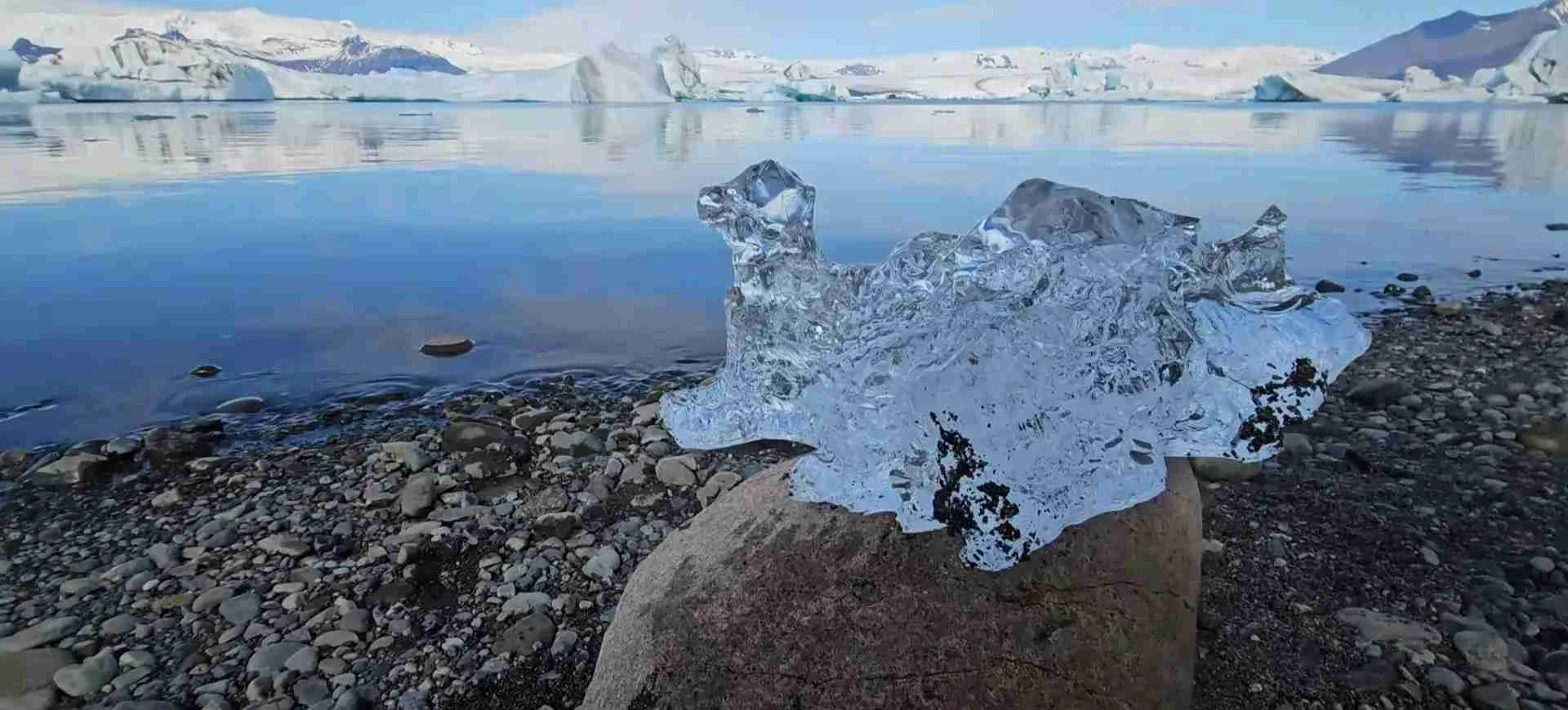
Outlet glaciers descend from Vatnajökull in all directions, creating accessible ice experiences for visitors. Svínafellsjökull and Falljökull in the Skaftafell area serve as popular glacier hiking destinations, while Breiðamerkurjökull feeds Jökulsárlón glacier lagoon, Iceland’s most photographed natural feature. The lagoon formed beginning in the 1930s as the glacier retreated, creating a 25-square-kilometer lake filled with icebergs calving from the glacier terminus. Icebergs float through the lagoon and out through a narrow outlet to the ocean, often washing back onto the black sand beach where they create the famous “Diamond Beach” spectacle of ice chunks glistening on dark volcanic sand.
The park’s volcanic zones host unique endemic fauna living in geothermally heated groundwater beneath the lava fields. These subterranean ecosystems, isolated for potentially 15,000 years since the last Ice Age, contain crustaceans and bacteria species found nowhere else on Earth, surviving in complete darkness in water temperatures of 20-40°C warmed by volcanic heat. Scientists study these organisms as potential analogs for life in similar environments on Mars or ice-covered moons like Europa, where subsurface liquid water might exist beneath ice shells.
The northern section of Vatnajökull National Park contains Jökulsárgljúfur canyon, carved by the glacial river Jökulsá á Fjöllum that drains a substantial portion of northern Vatnajökull. The canyon reaches 100 meters depth and 500 meters width in places, demonstrating the erosive power of jökulhlaups that have periodically sent catastrophic floods down the river course. Dettifoss waterfall, Europe’s most powerful waterfall by volume, drops 45 meters within the canyon, with peak flows reaching 500 cubic meters per second carrying glacial sediment that gives the water a distinctive brown-gray color. The canyon’s formation illustrates accelerated landscape evolution where normal geological processes that require millions of years elsewhere occur over mere millennia due to Iceland’s intense volcanic and glacial activity.
Ásbyrgi canyon, a horseshoe-shaped amphitheater with 100-meter cliffs at the northern end of Jökulsárgljúfur, formed when a massive jökulhlaup from northern Vatnajökull approximately 8,000-10,000 years ago carved through the bedrock in a single catastrophic event. The canyon measures 3.5 kilometers long and up to 1.1 kilometers wide, with a birch woodland and pond on the flat canyon floor creating an oasis-like environment in the otherwise barren northern highlands. Ásbyrgi’s dramatic formation demonstrates how jökulhlaups create landforms far exceeding the erosive capability of normal river flows.
Vatnajökull National Park achieved UNESCO World Heritage status in 2019, recognized for representing earth’s major geological processes through the dynamic interaction of volcanism, glaciation, tectonics, and river systems. The park demonstrates these processes in an accessible, visually stunning landscape where visitors can directly observe glaciers, active volcanic areas, powerful waterfalls, glacial lagoons, sandur plains, and canyons all created by the ongoing interplay of fire and ice. The combination of scientific value, landscape beauty, and educational opportunity fulfills UNESCO’s criteria for Outstanding Universal Value deserving international protection and study.
Snæfellsjökull National Park: Coastal Wilderness and Literary Icon
Snæfellsjökull National Park occupies 17,000 hectares on the western tip of the Snæfellsnes Peninsula, established in 2001 as Iceland’s third national park and the only one extending to the ocean shoreline. The park centers on Snæfellsjökull, a 1,446-meter stratovolcano capped by a small glacier, renowned for its distinctive conical profile visible from Reykjavík on clear days 120 kilometers distant.
Snæfellsjökull volcano dominates the peninsula’s western end, built through eruptions over the past 700,000 years with the most recent significant eruption occurring approximately 1,900 years ago. The volcano consists of multiple overlapping lava flows and pyroclastic deposits forming the classic stratovolcano cone shape. Despite Iceland’s general cooling trend reducing glacier extent, Snæfellsjökull maintains a small summit ice cap due to high elevation and exposure to moisture-laden Atlantic winds. The glacier’s slow retreat over recent decades reflects broader climate change impacts on Iceland’s smaller ice caps, which are more vulnerable to warming than the massive Vatnajökull ice sheet.
The volcano gained literary fame through Jules Verne’s 1864 novel “Journey to the Center of the Earth,” which depicted Snæfellsjökull as the entry point for the protagonists’ subterranean adventure. This fictional association, combined with the mountain’s striking appearance and alleged spiritual energy, has made Snæfellsjökull an icon in popular culture and New Age spirituality, though geological reality shows no extraordinary properties beyond those inherent to any stratovolcano. Nevertheless, the literary connection attracts visitors interested in Verne’s work and the mountain’s mystical reputation.
The park’s coastal section provides habitat for diverse seabirds and marine mammals. Black sand and rocky beaches, lava fields extending to the ocean, and sea cliffs create nesting sites for Arctic terns, fulmars, kittiwakes, guillemots, and puffins during breeding season (May-August). Seal colonies including both common and gray seals haul out on rocks and beaches, while whale sightings offshore include orcas, minke whales, and occasionally humpback whales feeding in productive waters where Atlantic currents meet. The park’s marine component recognizes the ecological connectivity between terrestrial and ocean environments, unusual for Iceland’s national park system which traditionally focused on inland landscapes.
Vatnshellir lava cave, formed 8,000 years ago during an eruption from the volcanic system, extends 200 meters into the earth with depths reaching 35 meters below the surface. Guided tours explore the cave’s lava tunnel, demonstrating how flowing lava creates caves when the surface crust solidifies while liquid lava continues flowing beneath, eventually draining out and leaving hollow tubes. The cave maintains constant 0°C temperature year-round, with ice formations developing on the ceiling and walls. Vatnshellir serves as one of Iceland’s most accessible lava caves, providing insight into volcanic processes through direct underground observation.
The park encompasses diverse landscapes beyond the central volcano, including lava fields of varying ages showing ecological succession from barren recent flows to ancient flows supporting thick moss and grassland vegetation. Djúpalónssandur beach on the southern coast features black sand, unusual rock formations created by wave erosion of lava, and remnants of a shipwreck from 1948. The beach historically served as a testing ground where fishermen proved their strength by lifting progressively heavier “lifting stones”—the weakest stone weighing 23 kilograms marked “Amlóði” (Useless), while the heaviest at 154 kilograms marked “Fullsterkur” (Full Strength) qualified a man for particularly demanding positions on fishing boats.
Londrangar basalt cliffs rise dramatically from the ocean on the park’s southwestern coast—volcanic plugs representing the erosion-resistant cores of ancient craters while softer surrounding material has eroded away. The cliffs reach heights of 75 meters and 61 meters, creating nesting habitat for fulmars and serving as prominent landmarks visible from the coastal road. Londrangar exemplifies differential erosion where volcanic features of varying hardness erode at different rates, creating the dramatic coastal scenery characteristic of Iceland’s volcanic coastlines.
The park’s establishment in 2001 reflected growing recognition of the Snæfellsnes Peninsula’s combined natural and cultural values. The area’s relative compactness—most sites lie within 30 kilometers of each other—makes it accessible for day trips from Reykjavík or as part of western Iceland itineraries, earning the peninsula the nickname “Iceland in Miniature” for containing diverse geological features, coastal environments, and volcanic landscapes representative of the country as a whole. While not achieving UNESCO World Heritage status, Snæfellsjökull National Park protects significant natural heritage and provides educational opportunities demonstrating volcanic processes, ecological succession, and human-nature interactions in Iceland’s coastal environments.
Geological Processes Creating Iceland’s Protected Landscapes
Iceland’s three national parks and UNESCO sites exist because of the island’s position straddling the Mid-Atlantic Ridge, where the North American and Eurasian tectonic plates diverge. This unique geological setting drives the volcanic activity, tectonic rifting, and landscape evolution that create the features worthy of national and international protection.
The Mid-Atlantic Ridge represents the divergent boundary where oceanic crust forms as plates separate, with magma rising from the mantle to fill the gap created by plate spreading. Most of the ridge lies underwater along the Atlantic Ocean floor, but in Iceland, elevated magma production associated with the Iceland mantle plume has built the ridge above sea level, creating the only substantial landmass along the entire Atlantic spreading center. The plates separate at approximately 2 centimeters annually, measured precisely using GPS stations across Iceland. This spreading manifests visibly at Þingvellir in the rift valley’s normal faults and growing fissures.
Volcanism in Iceland stems from decompression melting as mantle material rises beneath the spreading ridge. The ascending mantle partially melts at depths of 60-80 kilometers when pressure drops sufficiently, generating basaltic magma that rises toward the surface. Some magma erupts directly, creating fissure eruptions and shield volcanoes, while other magma stalls in crustal magma chambers where fractional crystallization produces more evolved compositions capable of explosive eruptions. The variety of volcanic types in Iceland—from gentle effusive basalt flows to explosive stratovolcano eruptions—reflects this range of magma compositions and eruption styles.
The Iceland mantle plume, a stationary upwelling of unusually hot mantle material possibly sourced from the core-mantle boundary 2,900 kilometers deep, provides the excess heat and magma production that built Iceland above sea level. The plume’s elevated temperatures produce 3-4 times more magma than typical mid-ocean ridges, explaining Iceland’s size (103,000 square kilometers) compared to the tiny volcanic islands dotting most of the Atlantic Ridge. The plume’s influence creates Iceland’s central volcanic zone, where volcanism concentrates along the plate boundary and produces the island’s most active systems including those beneath Vatnajökull.
Glaciation has profoundly shaped Iceland’s volcanic landscape over the past 2.5 million years. During glacial periods, ice sheets up to 2,000 meters thick covered most of Iceland, with only the highest peaks protruding as nunataks. Glacial erosion carved U-shaped valleys, cirques, and fjords into volcanic bedrock, while glacial deposition created moraines and outwash plains. The weight of ice depressed Iceland’s crust by hundreds of meters, and ongoing post-glacial rebound continues raising the land as remaining ice mass declines. This isostatic adjustment contributes to ongoing topographic changes detectable in precise elevation measurements.
Subglacial volcanism occurs when eruptions happen beneath ice, creating unique volcanic forms and hazards. Eruptions beneath thin ice quickly melt through to the surface, producing normal volcanic features, but eruptions beneath thick ice (>100 meters) are confined by ice pressure, preventing explosive dispersal of volcanic material. Instead, eruptions build pillow lava and hyaloclastite (fragmented volcanic glass) accumulations underwater within ice-dammed lakes, forming table mountains (tuyas) with flat tops at the ice surface level and steep sides where lava met ice walls. Many of Iceland’s mountains show this distinctive profile, formed during eruptions beneath Ice Age glaciers.
The jökulhlaup phenomenon represents Iceland’s most distinctive geological hazard, occurring when subglacial eruptions melt ice rapidly or geothermal activity slowly accumulates meltwater beneath glaciers. Unlike normal glacial streams flowing in englacial or subglacial channels, jökulhlaups represent sudden release of impounded water when ice dams fail. Peak discharge can exceed 300,000 cubic meters per second—orders of magnitude beyond normal river flows—carrying icebergs, volcanic material, and sediment across lowlands. These floods create sandur plains through repeated depositional events, build and destroy river channels, and modify landscapes at rates far exceeding normal fluvial processes. Jökulhlaups from Vatnajökull, particularly those from Grímsvötn eruptions, have repeatedly damaged infrastructure including Ring Road bridges and power lines, making Iceland’s glacier-volcano interactions both scientifically fascinating and practically challenging.
Ecological Communities in Iceland’s Protected Areas
Iceland’s ecosystems operate under severe environmental constraints including short growing seasons, cool temperatures, strong winds, volcanic disturbances, and limited soil development, creating simplified communities dominated by hardy species adapted to harsh conditions. The national parks protect representative examples of Iceland’s major ecosystem types across elevational and climatic gradients.
Birch woodland represents Iceland’s only native forest ecosystem, though “forest” overstates the stature of these communities—most birch trees reach only 3-5 meters height, stunted by wind, cold, and poor soil. Downy birch dominates, forming the climax vegetation community in lowland areas protected from severe exposure. Understory vegetation includes dwarf shrubs like crowberry and bilberry, herbaceous plants, mosses, and lichens. Birch woodlands once covered 40% of Iceland before human settlement, but extensive clearing for pasture and fuel wood combined with grazing pressure reduced coverage to just 1-2% by the mid-20th century. Active replanting efforts in recent decades have increased woodland area, and protected stands in Þingvellir and southern Vatnajökull demonstrate mature birch ecosystem structure.
Heathland covers extensive areas throughout Iceland, particularly on better-drained soils where birch woodland doesn’t develop due to exposure or historical clearing. Heather, crowberry, and bilberry form low shrub canopies rarely exceeding 30 centimeters height, with mosses and lichens occupying spaces between shrubs. These communities provide important habitat for nesting birds including golden plovers and whimbrels, while also serving as traditional sheep grazing areas—though overgrazing has degraded many heathlands through preferential removal of palatable species leaving less nutritious vegetation.
Wetlands occupy poorly drained areas throughout Iceland, ranging from extensive lowland marshes to small mountain bogs. Sedges, rushes, and cottongrass dominate these waterlogged environments along with Sphagnum moss species that acidify water and create characteristic bog conditions. Wetlands provide critical breeding habitat for waterfowl including harlequin ducks, common scoters, and various goose species, while also serving as feeding areas for wading birds. The national parks protect significant wetland areas, particularly in Þingvellir around Þingvallavatn’s margins and in low-lying portions of Vatnajökull park.
Alpine and highland vegetation zones extend above the treeline (effectively sea level in exposed areas, rising to 400-500 meters in sheltered locations) where only the hardiest plants survive. Cushion-forming species adapted to extreme exposure, including moss campion and various saxifrages, create dense mats clinging to rocky surfaces. Lichen-dominated communities occupy the harshest sites, particularly at high elevations where only lichens and a few mosses can tolerate the combination of cold, wind, and limited nutrients. These communities demonstrate extreme stress tolerance, with some lichen species growing just millimeters per decade.
Birdlife dominates Iceland’s wildlife communities due to the country’s isolation preventing colonization by most terrestrial mammals. Arctic fox represents the only native land mammal, arriving during Ice Age periods when sea ice connected Iceland to Greenland, and persists in remote areas including highlands within Vatnajökull park. Marine mammals including seals and whales visit Iceland’s coasts but aren’t protected within terrestrial national parks except in Snæfellsjökull’s marine component.
Breeding seabirds concentrate in massive colonies on coastal cliffs, particularly in protected areas along the coast. Puffins, guillemots, razorbills, fulmars, and kittiwakes nest in numbers exceeding millions of individuals collectively across Iceland, with protected sites in Snæfellsjökull park hosting significant populations. These seabirds link marine and terrestrial ecosystems by depositing nutrients from ocean feeding in coastal nesting areas, enriching otherwise nutrient-poor soils and supporting specialized plant communities tolerant of high nitrogen inputs from guano.
Aquatic ecosystems in Þingvallavatn lake host unique endemic fish populations including four distinct Arctic char morphs evolved in isolation within the lake—large benthic char, small benthic char, planktivorous pelagic char, and piscivorous pelagic char occupy different ecological niches, demonstrating adaptive radiation where a single colonizing population diversified into multiple specialized forms. These morphs show genetic differences and behavioral variations sufficient to maintain reproductive isolation despite occupying the same water body, making them valuable for evolutionary studies of speciation processes.
Invasive species pose increasing threats to Iceland’s native ecosystems. Nootka lupine, introduced for soil stabilization and nitrogen fixation, has spread extensively beyond planted areas, outcompeting native vegetation and altering ecosystem structure. Alaska lupine similarly invades disturbed areas. Mammalian invasives including American mink (escaped from fur farms), rabbits, and rodents impact ground-nesting bird populations. Park management includes invasive species control programs, particularly aggressive lupine removal to protect native plant communities, though eradication proves challenging once establishment occurs.
Cultural Heritage and Human History in Protected Sites
Iceland’s protected areas contain not only natural features but also significant cultural heritage demonstrating human adaptation to the island’s challenging environment over 1,100+ years of settlement. Þingvellir stands preeminent for cultural values, but Vatnajökull and Snæfellsjökull also contain archaeological and historical sites illustrating Iceland’s settlement and resource use patterns.
The Alþingi’s role at Þingvellir extended beyond lawmaking to encompass all aspects of medieval Icelandic society. The assembly served as Iceland’s primary social gathering where marriages were arranged, business conducted, news exchanged, and social networks maintained across the dispersed population. Traders set up temporary booths (búðir) selling goods from Norway and continental Europe, while local products including wool, sheepskins, and dried fish were traded. The two-week assembly period in late June coincided with best summer weather and the peak of Iceland’s brief growing season, allowing farmers to gather without missing critical agricultural work.
Archaeological remains at Þingvellir include fifty stone and turf booth foundations where participants constructed temporary shelters during the assembly. These booths ranged from simple windbreaks to substantial structures with sleeping platforms and hearths, occupied by the same families generation after generation. The booths’ locations reflected social hierarchy, with powerful chieftains occupying prominent positions while less influential families built booths on the periphery. Excavations have recovered artifacts including iron tools, soapstone vessels, and imported goods demonstrating the trading activities that accompanied the assembly.
The Law Rock (Lögberg) location remains uncertain despite its central importance to Alþingi proceedings. Historical sources describe it as a prominent outcrop providing elevated position from which the law speaker could be heard across the assembly grounds, but exact identification proves elusive among multiple candidate rocks. Current interpretation places Lögberg at the eastern cliff edge, though this represents informed conjecture rather than definitive identification. The uncertainty reflects limitations in archaeological site interpretation at Þingvellir where centuries of activity, limited written descriptions, and natural landscape changes combine to obscure specific feature locations.
Þingvellir church occupies the site of successive churches serving the assembly and local farm population since Iceland’s Christianization in 1000 AD. The current building dates to 1859, constructed of timber and painted white in the style of 19th-century Icelandic churches, but replaces earlier structures extending back to medieval times. The church cemetery contains graves of prominent Icelanders including poet Jónas Hallgrímsson (1807-1845), whose burial at Þingvellir reflected the site’s symbolic importance to 19th-century Icelandic nationalism. The church and associated farm represent continuity of human presence and activity at Þingvellir across eleven centuries.
Farms within Vatnajökull National Park boundaries demonstrate human persistence in marginal environments subject to volcanic hazards, glacial floods, and harsh climate. The park contains both occupied and abandoned farms, with the pattern of abandonment reflecting volcanic catastrophes and economic changes. Öræfi district farms were devastated by the 1362 Öræfajökull eruption that killed perhaps 200-300 people and destroyed agricultural land, leading to long-term population decline. Subsequent eruptions and jökulhlaups periodically destroyed farms and infrastructure, creating repeated cycles of abandonment and reoccupation as people returned to rebuild after disasters passed.
Turf houses—traditional Icelandic structures with stone foundations, timber frameworks, and thick turf walls providing insulation—survive within park boundaries as examples of vernacular architecture adapted to Iceland’s conditions. The turf construction utilized Iceland’s abundant turf resource while conserving scarce timber for structural elements. Thick walls (often 1+ meters) provided excellent insulation essential in a climate where keeping warm determined survival. Some turf structures have been preserved as museums demonstrating traditional Icelandic living conditions, while others remain as archaeological features slowly deteriorating as turf erodes.
The parks contain no permanent indigenous populations, but traditional resource use rights persist in some areas. Sheep grazing continues in portions of Vatnajökull and Þingvellir under special permits balancing cultural practices with conservation objectives. These grazing rights reflect Iceland’s pastoral economy where sheep provided wool, meat, and milk as dietary staples, making sheep husbandry central to Icelandic culture and economy. Contemporary conservation management seeks sustainable balance between preserving grazing traditions and preventing overgrazing damage to vegetation and archaeological features.
Visiting Iceland’s National Parks: Access and Infrastructure
Iceland’s three national parks offer varying levels of accessibility and visitor infrastructure reflecting their size, location, and management priorities. All three welcome visitors year-round, though winter conditions and road closures limit access to remote areas particularly in Vatnajökull.
Þingvellir National Park, located 45 kilometers northeast of Reykjavík via Route 36, provides the most accessible national park experience with excellent infrastructure including multiple parking areas, visitor center at Hakið, marked trails ranging from easy 1-kilometer walks to challenging full-day hikes, viewing platforms at key geological and historical features, and accessible facilities meeting universal design standards. The park receives over one million visitors annually, making it Iceland’s most visited natural site. Summer visits (May-September) encounter crowds particularly at peak Golden Circle tour times (10 AM-4 PM), while winter brings snow-covered landscapes, smaller crowds, and potential aurora borealis viewing. The park charges no admission fee, following Iceland’s tradition of free access to natural areas, though some parking areas implement modest fees (ISK 500-1,000) during peak season to fund maintenance.
Vatnajökull National Park’s immense size (1,400,000 hectares) necessitates multiple visitor center locations serving different access points. The main visitor centers include Skaftafell center near Kirkjubæjarklaustur on the south coast (accessible year-round via Ring Road), Höfn information center serving the southeast sector, and Ásbyrgi visitor center in the north (summer only due to road closures). Each center provides exhibits explaining the park’s geology, ecology, and management plus information on current trail conditions, weather forecasts, and safety considerations. The park offers extensive marked trail networks ranging from 30-minute walks to multi-day backcountry routes requiring wilderness skills and self-sufficiency. Glacier hiking, ice cave tours, and boat tours on Jökulsárlón require joining guided tours with licensed operators due to safety considerations—these activities carry inherent risks that make professional guiding essential. Winter visits to most of Vatnajökull are challenging due to road closures, limited daylight, and severe weather, though the Jökulsárlón and Skaftafell areas remain accessible year-round for prepared visitors.
Snæfellsjökull National Park’s compact size and proximity to Route 54 (the main Snæfellsnes Peninsula road) makes it readily accessible from Reykjavík (2.5-3 hours drive) or as part of western Iceland itineraries. The visitor center in Hellnar provides park information, exhibits, and ranger assistance during summer months (reduced hours or closure in winter). Hiking trails access the summit of Snæfellsjökull glacier (demanding 5-7 hour round trip requiring glacier equipment and experience), coastal routes exploring beaches and lava formations, and shorter interpretive walks explaining volcanic and cultural features. The Vatnshellir cave requires joining guided tours (hourly departures in summer, advance booking recommended) as independent cave entry is prohibited for safety and conservation reasons. Winter conditions make the glacier summit dangerous and many trails impassable due to ice and wind, focusing winter visits on lower-elevation coastal areas and lava cave tours (operated year-round).
Camping is permitted only in designated campgrounds in all three national parks, with wild camping prohibited to concentrate impacts and protect sensitive areas. Campgrounds provide varying facilities from basic (toilets, water) to full-service (showers, cooking shelters, electricity) with per-person fees (ISK 1,500-2,500 nightly) during operating season (typically May-September, though some operate year-round). Advance booking for campgrounds near popular sites (Skaftafell, Þingvellir) is advisable in July-August when demand exceeds capacity.
Safety considerations apply across all national parks but particularly in Vatnajökull’s glacial and volcanic terrain. Weather changes rapidly with storms bringing high winds, rain, and temperature drops even in summer—visitors must carry warm, waterproof clothing regardless of initial conditions. Glacier travel requires technical equipment (crampons, ice axes, ropes) and expertise or professional guiding due to crevasse hazards. River crossings can be dangerous or impossible when glacial melt increases flow in afternoons and during warm periods. Mobile phone coverage exists only near major roads and settlements, with vast areas having no signal—visitors should inform others of planned routes and expected return times before entering remote areas.
Conservation Challenges and Management Strategies
Managing Iceland’s national parks and UNESCO sites requires balancing conservation priorities with visitor access, traditional resource uses, and ongoing natural processes that continuously reshape these dynamic landscapes. Each protected area faces unique challenges reflecting its specific environmental conditions, visitation patterns, and conservation values.
Tourism impacts represent the primary management challenge at Þingvellir where concentrated visitation creates pressure on trails, parking areas, and sensitive vegetation. Soil compaction from foot traffic, informal trail creation as visitors cut across switchbacks or seek optimal photography positions, and littering despite adequate waste facilities require ongoing maintenance and visitor education. The park implements trail hardening using imported gravel and boardwalks to reduce erosion while directing visitors along designated routes, with restoration efforts replanting vegetation in trampled areas. Vehicle management remains problematic as the number of rental cars visiting Iceland has grown exponentially, overwhelming parking capacity at peak times and leading to roadside parking that damages vegetation and creates safety hazards.
Climate change affects all three national parks but most visibly impacts glaciers in Snæfellsjökull and Vatnajökull. Snæfellsjökull’s small summit glacier has retreated significantly over recent decades and may disappear entirely within coming decades if warming continues, fundamentally altering the mountain’s character and iconic appearance. Vatnajökull shows slower but still measurable retreat in outlet glaciers, with accelerating ice loss raising concerns about long-term persistence. Glacial retreat affects not only aesthetics but also ecosystems adapted to glacial streams, jökulhlaup hazards as subglacial lake volumes change, and water resources depending on glacier storage and summer melt.
Volcanic hazards require monitoring and emergency planning particularly in Vatnajökull where eruptions can occur with limited warning and produce jökulhlaups endangering downstream areas. The Icelandic Meteorological Office maintains seismic monitoring networks detecting earthquake swarms that often precede eruptions, GPS stations measuring ground deformation as magma rises, and gas sensors detecting volcanic emissions. When activity increases, authorities implement warning systems and evacuation plans for at-risk areas, though the unpredictability of volcanic events makes perfect safety impossible—the 1996 Gjálp eruption beneath Vatnajökull was detected only when the ice surface began cracking, providing minimal advance warning before jökulhlaup initiation.
Surtsey’s management focuses on strict access control and contamination prevention to maintain the island’s value as a pristine natural laboratory. Only scientists with approved research permits can land on the island, and they must follow rigorous protocols including boot sterilization to prevent introducing non-native organisms. Despite these precautions, accidental introductions have occurred—a tomato plant grew on Surtsey in 2017, likely from seeds in human waste improperly disposed by a scientist, demonstrating the difficulty of maintaining absolute isolation even with strict protocols. The plant was immediately removed, but the incident highlighted vulnerability to contamination even under controlled access.
Invasive species management challenges all parks but particularly affects areas with developed infrastructure where human activity facilitates species introduction and establishment. Nootka lupine removal programs attempt to control spread in Þingvellir and Vatnajökull, though complete eradication appears unlikely given the species’ aggressive spread and seed longevity. American mink, escaped from fur farms decades ago, prey on ground-nesting birds in all three parks, requiring ongoing trapping programs to reduce populations. The eradication approach used successfully on islands proves impractical on Iceland’s mainland where continuous recolonization from surrounding areas prevents local elimination.
Traditional land use rights including sheep grazing create tension between cultural heritage preservation and natural ecosystem protection. Grazing reduces vegetation height and diversity, creates erosion through trampling, and prevents tree regeneration in areas that could support woodland. However, sheep husbandry represents centuries of Icelandic culture and provides livelihoods for contemporary farmers who hold historic use rights. Park management seeks middle ground through controlled grazing regimes that limit animal numbers and exclude sheep from particularly sensitive areas while maintaining the cultural practice. This compromise satisfies neither conservationists seeking pristine natural conditions nor farmers seeking traditional access, but reflects pragmatic negotiation of competing values.
Research and monitoring programs in all parks collect data on vegetation communities, wildlife populations, glacial changes, volcanic activity, and visitor impacts to inform adaptive management. Long-term monitoring at Surtsey provides the longest continuous record of ecological succession on newly formed land anywhere on Earth, while Vatnajökull studies advance understanding of glacier-volcano interactions and jökulhlaup processes. Þingvellir’s extensive archaeological and geological research has revealed insights into Iceland’s settlement history and rifting mechanics. These research programs justify park protection by producing scientific knowledge while also providing data needed for evidence-based management decisions.
Frequently Asked Questions About Iceland’s National Parks and UNESCO Sites
How Many National Parks Does Iceland Have?
Iceland has three national parks: Þingvellir National Park (established 1930), Snæfellsjökull National Park (established 2001), and Vatnajökull National Park (established 2008 through merger of former Skaftafell and Jökulsárgljúfur national parks plus substantial additional territory). These three parks collectively protect approximately 1,426,270 hectares or 14% of Iceland’s total land area. While Iceland formerly had five separate national park designations including Skaftafell and Jökulsárgljúfur before they merged into Vatnajökull, the current count is three parks operating under different administrative structures—Þingvellir under the Þingvellir Commission and Vatnajökull plus Snæfellsjökull under Iceland’s Nature Conservation Agency. Beyond the national parks, Iceland maintains over 130 additional protected areas including nature reserves, natural monuments, and habitat protection areas representing varying conservation priorities.
Are Iceland’s National Parks Free to Visit?
Iceland’s three national parks charge no admission fees following Iceland’s cultural tradition of free public access to natural areas under the “right to roam” principle. Visitors can enter the parks, use trails, and access viewpoints without purchasing tickets. However, some parking areas implement modest parking fees (typically ISK 500-1,500, approximately $4-12) during peak summer season to fund infrastructure maintenance and visitor services, particularly at high-traffic locations in Þingvellir and Vatnajökull. Camping in designated campgrounds requires payment (ISK 1,500-2,500 per person nightly, approximately $12-20) covering basic facilities, while guided activities such as glacier hiking, ice cave tours, and boat trips at Jökulsárlón operate under concession agreements with private tour companies that charge commercial rates (typically ISK 8,000-25,000 or $64-200 per person depending on activity duration and complexity). The free access policy enables all visitors to experience Iceland’s protected natural heritage regardless of economic means, though some amenities and guided experiences carry costs.
Which UNESCO Site in Iceland Can’t You Visit?
Surtsey volcanic island, designated a UNESCO World Heritage Site in 2008, remains completely off-limits to general public visitation under strict protection as a pristine natural laboratory. Access is restricted exclusively to approved scientists conducting authorized research, who must follow rigorous protocols including boot sterilization and equipment decontamination to prevent introducing non-native organisms to the island. No tourism, boat landings, swimming near the island, or unauthorized visits of any kind are permitted. The restriction ensures Surtsey remains free from human interference, allowing ecological succession to proceed naturally without contamination by introduced species, pollution, or physical disturbance. Visitors can view Surtsey from boat tours departing Heimaey in the Westman Islands that circle the island at respectful distance, or from aircraft flying over the island, but cannot approach closer or set foot on land. This makes Surtsey unique among Iceland’s UNESCO sites as the only one completely prohibited to public access, contrasting with Þingvellir and Vatnajökull which welcome millions of visitors annually through well-developed infrastructure.
What Is the Largest National Park in Iceland?
Vatnajökull National Park is Iceland’s largest national park covering 1,400,000 hectares (14,000 square kilometers or approximately 5,400 square miles), representing about 14% of Iceland’s total land area. Established in 2008 through merger of Skaftafell National Park and Jökulsárgljúfur National Park plus substantial additional territory, Vatnajökull ranks as one of Europe’s largest national parks. The park encompasses Europe’s largest glacier (Vatnajökull ice cap covering 8,100 cubic kilometers), Iceland’s highest peak (Hvannadalshnjúkur at 2,110 meters), and diverse landscapes ranging from glacial ice caps through proglacial lakes, outlet glaciers, and volcanic areas to coastal lowlands and canyons. The park contains eight major volcanic systems including two of Iceland’s most active volcanoes, demonstrating the dynamic fire-and-ice interactions that create Iceland’s unique landscapes. In comparison, Þingvellir covers 9,270 hectares and Snæfellsjökull 17,000 hectares, making Vatnajökull approximately 150 times larger than Þingvellir and 82 times larger than Snæfellsjökull.
When Was Þingvellir Established as a National Park?
Þingvellir became Iceland’s first national park in 1930, established to commemorate the 1,000th anniversary of the Alþingi parliament’s founding in 930 AD. The designation reflected growing nationalist sentiment in early 20th-century Iceland as the country moved toward independence from Denmark (achieved in 1944), with Þingvellir symbolizing Icelandic democracy and self-governance across eleven centuries. A special law passed in 1928 decreed that Þingvellir “shall always be the property of the Icelandic nation, under the preservation of Alþingi,” establishing unique governance where Iceland’s parliament directly oversees the park through the appointed Þingvellir Commission rather than standard environmental ministry administration. This makes Þingvellir not only Iceland’s oldest national park but also its most politically significant protected area. The park achieved UNESCO World Heritage status much later in 2004, seventy-four years after national park designation, when international recognition of its combined cultural and geological values led to inscription for the site’s role in parliamentary history and its position in the tectonic rift between North American and Eurasian plates.
What Is Special About Vatnajökull National Park?
Vatnajökull National Park is special for containing the largest glacier in Europe, eight major volcanic systems, and the dynamic interaction between ice and fire that creates phenomena found nowhere else on Earth. The park’s Outstanding Universal Value, recognized through UNESCO World Heritage inscription in 2019, stems from its demonstration of ongoing geological processes where subglacial volcanism triggers jökulhlaups—catastrophic glacial outburst floods reaching 300,000 cubic meters per second that create unique sandur plains, river systems, and canyons. The park hosts endemic groundwater fauna surviving in geothermally heated aquifers since the Ice Age, potentially replicating conditions on early Earth and ice-covered moons, making them scientifically invaluable for astrobiology. Iceland’s highest peak (Hvannadalshnjúkur at 2,110 meters), Europe’s most powerful waterfall by volume (Dettifoss), and the famous Jökulsárlón glacier lagoon where icebergs calve into a lake before washing onto black sand beaches all lie within park boundaries. The combination of accessibility, landscape diversity, ongoing geological activity, and scientific importance makes Vatnajökull globally significant while remaining open to visitors who can directly observe processes that shape planetary surfaces.
Can You Hike on Glaciers in Iceland’s National Parks?
Glacier hiking is possible in Vatnajökull and Snæfellsjökull National Parks but requires either professional guiding or proper technical equipment and training due to serious hazards including crevasses, unstable ice, and rapidly changing conditions. Outlet glaciers from Vatnajökull including Svínafellsjökull, Falljökull, and Skaftafellsjökull serve as popular guided glacier hiking destinations where licensed operators provide crampons, ice axes, helmets, and expert leadership navigating safe routes avoiding crevasse fields. Snæfellsjökull glacier summit hikes require mountaineering experience, glacier travel skills, and full technical equipment due to steep slopes, crevasses, and exposed terrain. Independent glacier travel without proper equipment and training is extremely dangerous and responsible for numerous rescue incidents and fatalities—visitors lacking glacier skills should join guided tours rather than attempting solo glacier access. Ice cave visits in Vatnajökull similarly require professional guiding as caves form in dynamic glacial ice that shifts, melts, and occasionally collapses, creating risks that make expert knowledge essential. Most national park visitor centers maintain lists of licensed glacier guiding companies operating under park concession agreements and meeting safety standards, providing reliable options for visitors seeking glacier experiences.
What Animals Live in Iceland’s National Parks?
Iceland’s national parks host limited terrestrial mammal diversity but abundant birdlife reflecting the island’s isolation and recent geological age. Arctic fox represents Iceland’s only native land mammal, present in remote areas of Vatnajökull and occasionally spotted in Þingvellir and Snæfellsjökull, having arrived during Ice Age periods when sea ice connected Iceland to Greenland. Introduced mammals including reindeer (found in highlands near Vatnajökull), American mink (escaped from fur farms, now widespread), and rodents including house mice and brown rats occupy all three parks despite not being native. Marine mammals including harbor seals and gray seals haul out on coasts within Snæfellsjökull National Park’s marine boundaries, while whales including minke whales and orcas occasionally appear in coastal waters. Birdlife dominates with over 80 species recorded in the parks including year-round residents (ptarmigan, raven, wren) and summer breeding visitors (golden plover, whimbrel, Arctic tern, numerous waterfowl and seabirds). Massive seabird colonies in Snæfellsjökull include puffins, guillemots, fulmars, and kittiwakes nesting on coastal cliffs. Freshwater fish including Arctic char, brown trout, and introduced Atlantic salmon occupy lakes and rivers in all three parks, with Þingvallavatn hosting four endemic Arctic char morphs found nowhere else on Earth.
How Long Does It Take to Visit All Three National Parks?
Visiting all three national parks comprehensively requires 7-10 days minimum, though surface visits hitting major highlights can compress into 4-5 days with intensive driving. Þingvellir can be thoroughly explored in a single day from Reykjavík (45-minute drive) as part of the Golden Circle route, with 3-5 hours sufficient for visitor center, walking major trails including Almannagjá gorge, viewing Öxarárfoss waterfall, and understanding both geological and historical significance. Vatnajökull’s immense size requires multiple days—visiting just the south coast highlights including Skaftafell hiking area and Jökulsárlón glacier lagoon takes 2-3 days from Reykjavík (4-5 hours each direction) plus time for glacier hikes, ice cave tours, and trail exploration. Adding Vatnajökull’s northern section (Dettifoss, Ásbyrgi) requires additional 2-3 days due to distance and site density. Snæfellsjökull occupies the western Snæfellsnes Peninsula 2.5-3 hours from Reykjavík, requiring 1-2 days for coastal exploration, lava cave tour, and potentially glacier summit hike if conditions and skills permit. A comprehensive Iceland Ring Road circuit naturally includes all three parks over 10-14 days, combining park visits with other attractions including south coast waterfalls, northern towns, and western peninsulas. Time-constrained visitors can prioritize Þingvellir and southern Vatnajökull over 4-5 days, deferring Snæfellsjökull and northern Vatnajökull for future trips.
What Makes Iceland’s UNESCO Sites Different from National Parks?
UNESCO World Heritage Site designation represents international recognition of Outstanding Universal Value for all humanity, while national park designation provides domestic legal protection and management under Icelandic law—the two systems serve different but complementary purposes with two of Iceland’s three national parks also holding UNESCO status. UNESCO Sites must meet at least one of ten criteria demonstrating exceptional cultural or natural significance at global level, undergo rigorous evaluation by international experts, and commit to protection standards satisfying UNESCO’s World Heritage Committee. Iceland’s three UNESCO Sites include Þingvellir (cultural site recognizing parliamentary history and geological significance), Surtsey (natural site representing volcanic island formation and ecological succession), and Vatnajökull (natural site demonstrating earth’s major geological processes). National parks protect areas of national significance through Icelandic legislation, focusing on conservation, recreation, education, and research without requiring international approval or meeting UNESCO’s global significance standards. Snæfellsjökull National Park, while protecting important Icelandic natural heritage, lacks UNESCO designation because it doesn’t demonstrate Outstanding Universal Value under UNESCO criteria despite substantial national importance. Surtsey, conversely, holds UNESCO designation without being a national park because it’s classified as a nature reserve under Icelandic law. The overlap of Þingvellir and Vatnajökull as both national parks and UNESCO Sites provides multiple protection layers and funding sources while bringing international prestige that attracts visitors and research collaborations.