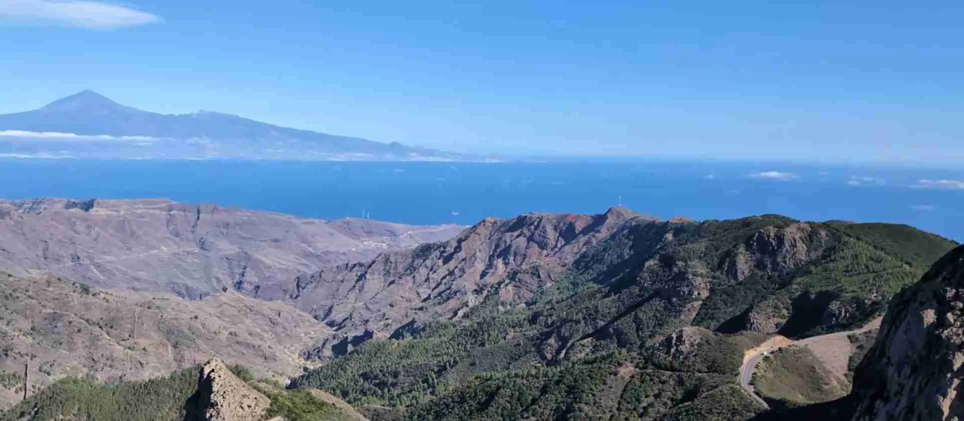
Garajonay National Park La Gomera: 15-Million-Year Jurassic Forest Guide
Key Takeaways
- Garajonay National Park protects Europe’s largest surviving laurel forest, a Tertiary period ecosystem unchanged for 15 million years that once covered Mediterranean regions
- The park encompasses 3,984 hectares of pristine cloud forest sustained by trade wind moisture at elevations between 800-1,487 meters above sea level
- Endemic species concentration reaches exceptional levels with 81 plant species and 38 invertebrate species found nowhere else on Earth
- Eighteen distinct hiking trails totaling over 120 kilometers traverse the park, ranging from easy nature walks to challenging summit approaches
- UNESCO World Heritage status recognizes the park as an outstanding example of Macaronesian laurel forest ecosystems of global scientific significance
- The mystical forest atmosphere created by persistent mist, moss-draped trees, and filtered light generates unique photographic and sensory experiences
Understanding Garajonay’s Ancient Forest Ecosystem
Garajonay National Park represents one of the world’s most remarkable living fossils, preserving a forest ecosystem that covered vast areas of Southern Europe and North Africa during the Tertiary period before climate changes eliminated these humid subtropical forests from continental regions 15-20 million years ago. The park occupies the mountainous heart of La Gomera island in the Canary archipelago, where unique geographical and climatic conditions maintain the specific environmental requirements that ancient laurel forests demand for survival.
The forest ecosystem draws its extraordinary character from the continuous interaction between northeast trade winds and the island’s mountainous topography. Moisture-laden trade winds ascending La Gomera’s northern slopes cool as they rise, creating a persistent cloud layer that blankets the central highlands between 600-1,500 meters elevation. This phenomenon, known locally as the “mar de nubes” (sea of clouds), delivers constant humidity through horizontal precipitation where wind-driven fog droplets deposit directly on vegetation surfaces, providing the abundant moisture that sustains this specialized ecosystem.
The term “laurel forest” or “laurisilva” derives from the dominance of trees in the Lauraceae family, though the ecosystem encompasses far greater botanical diversity with over 400 plant species documented within park boundaries. The forest structure creates multiple vertical layers with emergent canopy trees reaching 15-20 meters height, dense understory vegetation, and ground cover of ferns, mosses, and herbaceous plants. This complex architecture supports remarkable biodiversity despite the relatively small geographical area, functioning as an ecological island where evolution produced numerous endemic species found nowhere beyond these mist-shrouded mountains.
Garajonay’s global significance extends beyond its status as Europe’s finest laurel forest to encompass its role as a scientific reference point for understanding Tertiary period ecosystems. Paleobotanical research comparing Garajonay’s living flora with fossil evidence from continental Europe reveals extraordinary continuity, with many genera and some species showing minimal evolutionary change across millions of years. This living museum quality makes the park invaluable for scientific research into plant evolution, ecosystem dynamics, and the long-term effects of geographical isolation on biological communities.
People Also Ask About Garajonay National Park
What makes Garajonay National Park’s laurel forest unique?
Garajonay’s laurel forest represents the world’s most extensive and best-preserved example of Macaronesian laurisilva, a subtropical humid forest type that once covered vast Mediterranean and North African regions during the Tertiary period 15-20 million years ago. The forest survives in the Canary Islands because oceanic climate moderates temperature extremes while persistent trade wind clouds provide year-round moisture. This creates stable environmental conditions similar to those that existed across southern continents before ice age climate shifts eliminated laurel forests from all but a few Atlantic island refuges.
The ecosystem demonstrates exceptional species diversity with four distinct laurel forest subtypes based on elevation and moisture gradients. Valley bottoms support humid laurel forest dominated by Laurus novocanariensis and Persea indica with dense undergrowth of tree heathers and ferns. Ridge tops feature drier laurel forest with Erica arborea and Myrica faya adapted to more exposed conditions. Between these extremes, transitional zones create microhabitat mosaics supporting specialized plant and animal communities adapted to precise environmental niches.
How old is the Garajonay forest ecosystem?
The laurel forest ecosystem type dates to the Tertiary period approximately 15-20 million years ago when similar forests covered extensive areas of southern Europe and northern Africa. While individual trees within Garajonay rarely exceed 300-400 years in age due to natural mortality and regeneration cycles, the ecosystem itself represents an unbroken ecological continuity extending back millions of years. Genetic analysis of endemic species reveals evolutionary lineages isolated since La Gomera’s geological formation, making this both an ancient ecosystem type and a relatively young geographical expression of that ancient biological heritage.
Paleoecological evidence from pollen cores and plant macrofossils demonstrates that laurel forest vegetation colonized the Canary Islands soon after volcanic islands emerged from the Atlantic, approximately 10-12 million years ago. The ecosystem survived subsequent climate oscillations including ice age periods through the moderating influence of oceanic climate, maintaining stable conditions while continental equivalents succumbed to increasing aridity and temperature extremes. This makes Garajonay’s forest among Earth’s oldest continuously functioning ecosystems in terms of ecological structure and species composition.
What endemic species live in Garajonay National Park?
Garajonay harbors exceptional endemic species concentrations with 81 plant species and 38 invertebrate species found exclusively within La Gomera or the Canary Islands. Notable endemic plants include Geranium rubro-atrum with distinctive red-black flowers, Convolvulus floridus displaying spectacular pink blooms, and Gonospermum gomerae, a rare compositae restricted to rocky outcrops within park boundaries. The understory hosts numerous endemic ferns, lichens, and bryophytes adapted to the humid forest microclimate.
Endemic fauna concentrations peak among invertebrates where the isolated island environment and diverse microhabitats drove evolutionary radiation. Notable examples include the Gomera giant lizard (Gallotia bravoana), rediscovered in 1999 after presumed extinction, and numerous endemic land snail species with restricted distributions in specific valley systems. Bird endemics include La Gomera subspecies of several passerines showing morphological and behavioral adaptations to laurel forest habitat. The invertebrate fauna includes dozens of beetle, spider, and insect species documented nowhere beyond Garajonay’s forest boundaries.
Why was Garajonay designated a UNESCO World Heritage site?
UNESCO inscribed Garajonay National Park on the World Heritage List in 1986 recognizing it as the best example of Macaronesian laurel forest and an ecosystem of outstanding universal value for science and conservation. The designation cited three primary criteria: exceptional representation of major stages in Earth’s ecological history, outstanding example of ongoing evolutionary processes in isolated island environments, and superlative natural phenomena including the unique cloud forest ecosystem sustained by trade wind interactions.
The World Heritage status acknowledges Garajonay’s role as the most intact example of a once-widespread ecosystem type that existed across the Mediterranean basin during warmer, more humid climatic periods millions of years ago. The park functions as an evolutionary laboratory where geographical isolation produced remarkable endemic species diversity while preserving ancient ecological relationships lost from continental ecosystems. This combination of relict ecosystem integrity and active evolutionary processes creates exceptional scientific value transcending regional significance to merit global protection.
Extended multi-day tours – 5+ days
Featured Tenerife Multi-Day Tour Packages
3 days
Tenerife 3-Day Discovery Tour
- ✓ Comprehensive Tenerife experience
- ✓ Expert local guides included
- ✓ All accommodation included
- ✓ Transportation provided
5 days
Tenerife 5-Day Highlights Experience
- ✓ Comprehensive Tenerife experience
- ✓ Expert local guides included
- ✓ All accommodation included
- ✓ Transportation provided

7 days
Tenerife 7-Day Cultural Journey
- ✓ Comprehensive Tenerife experience
- ✓ Expert local guides included
- ✓ All accommodation included
- ✓ Transportation provided

10 days
Tenerife 10-Day Complete Adventure
- ✓ Comprehensive Tenerife experience
- ✓ Expert local guides included
- ✓ All accommodation included
- ✓ Transportation provided
Multi-day tour packages powered by TourRadar. Prices and availability subject to change.
Geological Formation and Island Origins
Volcanic Architecture and Landscape Evolution
La Gomera emerged from the Atlantic Ocean floor through volcanic activity beginning approximately 10-12 million years ago during the Miocene epoch, making it one of the older islands in the Canary archipelago. The island’s geological foundation consists of layered basaltic lava flows, pyroclastic deposits, and intrusive rock formations produced through multiple eruptive cycles as the African tectonic plate moved over a stationary mantle hotspot. This geological process created a roughly circular island spanning 378 square kilometers with a central elevated plateau where Garajonay National Park now protects the laurel forest ecosystem.
The park’s highest elevation point reaches 1,487 meters at Alto de Garajonay peak, representing the erosional remnant of ancient volcanic edifice that once stood significantly higher. Millions of years of weathering and erosion carved the original volcanic landscape into the current configuration of steep-sided ravines (barrancos) radiating from the central plateau toward the coast. This radial drainage pattern creates pronounced topographic diversity within compact geographical space, with elevation differences of 600-800 meters occurring within horizontal distances of just 2-3 kilometers.
Geological diversity within park boundaries includes well-preserved examples of basaltic lava flows, volcanic dikes cutting through older formations, and isolated outcrops of phonolite and trachyte representing more evolved magma compositions. These varied rock types weather at different rates, creating substrate heterogeneity that influences soil characteristics, water retention patterns, and ultimately plant community distributions. Rocky outcrops of erosion-resistant phonolite create distinctive landscape features including the formations at Fortaleza and Roque Cano that serve as geographical landmarks and ecological refuges for specialized rock-dwelling species.
Soil Development and Nutrient Cycling
Volcanic parent materials weather into fertile soils rich in minerals including iron, magnesium, and phosphorus that support the exceptional plant productivity characterizing laurel forest ecosystems. Soil depths vary dramatically depending on slope angle and erosion history, ranging from shallow mineral soils on steep rocky slopes to deep organic-rich profiles exceeding 100 centimeters in valley bottoms where sediment accumulation creates favorable growing conditions. The persistent cloud cover and high humidity prevent the intense leaching that would otherwise remove nutrients from these volcanic soils in high-rainfall environments.
Organic matter accumulation proceeds rapidly in the cool, humid forest environment where decomposition rates remain moderate despite abundant moisture. Forest floor litter layers of leaves, branches, and fallen trees create a spongy substrate hosting complex fungal and bacterial communities that break down organic materials and recycle nutrients into forms accessible to plant roots. This efficient nutrient cycling allows the forest to maintain high productivity despite the island’s geological isolation from continental nutrient sources.
Mycorrhizal fungi form essential partnerships with laurel forest trees, colonizing root systems and dramatically expanding the effective nutrient and water absorption capacity of plants. Research has documented over 200 fungal species within Garajonay’s forests, many endemic to the Canary Islands and some restricted to specific host plants. These fungi transfer soil nutrients to trees while receiving carbohydrates from plant photosynthesis, creating mutually beneficial relationships that enhance forest productivity and resilience to environmental stresses including periodic drought events during unusually dry years.
Laurel Forest Ecosystem Structure and Dynamics
Canopy Architecture and Tree Diversity
The laurel forest canopy reaches 15-20 meters height in the most favorable locations where deep soils and protected topography allow maximum tree growth. Dominant canopy species include Laurus novocanariensis (Canary Island laurel), Persea indica (viñátigo), Ocotea foetens (til), and Apollonias barbujana (barbusano), all members of the Lauraceae family giving the ecosystem its common name. These evergreen broad-leaved trees create dense shade that filters sunlight to just 5-15% of full intensity at ground level, generating the characteristic dim, mystical atmosphere of the forest interior.
Canopy structure varies significantly with elevation, exposure, and soil moisture conditions. Valley bottoms support the tallest and most species-rich forests with emergent trees creating an irregular canopy profile punctuated by occasional giants reaching 22-25 meters. Ridge crests experience stronger winds and periodic water stress, resulting in shorter forest stature of 8-12 meters with increased dominance of Erica arborea (tree heath) and reduced presence of moisture-demanding laurel species. Between these extremes, the forest displays complex mosaics where local topography creates sheltered pockets supporting valley-type vegetation adjacent to more exposed zones with heath-dominated communities.
Tree age structure reveals dynamic populations where continuous mortality and regeneration maintain mixed-age stands. Large canopy trees typically range 150-300 years in age, though exceptional individuals in protected locations may exceed 400 years. Recruitment of new trees occurs primarily in canopy gaps created by treefalls during storms or natural senescence, with shade-tolerant species like Persea indica and Ocotea foetens showing superior survival in low-light understory environments. This gap-phase regeneration creates a shifting mosaic of forest age classes across the landscape, maintaining structural diversity essential for ecosystem resilience.
Understory Layers and Vertical Complexity
Beneath the main canopy, a dense understory layer of smaller trees and shrubs creates additional vertical structure occupying the 3-10 meter height zone. Dominant understory species include Ilex canariensis (Canary Island holly), Viburnum rigidum (follao), and various Heberdenia excelsa individuals waiting to reach canopy status when gap opportunities arise. These understory plants demonstrate shade tolerance adaptations including large thin leaves maximizing light capture efficiency and slow growth rates allowing survival during extended periods in suppressed conditions.
Tree heathers (Erica arborea and Erica scoparia) form dense thickets in areas receiving more light, particularly along forest edges and in secondary succession following disturbances. These ericaceous shrubs demonstrate remarkable ecological amplitude, tolerating both the humid laurel forest environment and transitional zones toward drier pine forest at lower elevations. Their tangled branching creates important microhabitat for numerous invertebrate species and provides nesting sites for endemic bird subspecies including La Gomera blue chaffinch.
The ground layer hosts exceptional diversity of ferns, mosses, and herbaceous plants adapted to low light and high humidity conditions. Fern species richness peaks in Garajonay with over 30 species documented, including impressive stands of Woodwardia radicans with fronds exceeding 2 meters length forming dense understory colonies. Epiphytic mosses, liverworts, and lichens drape tree trunks and branches, creating hanging gardens that add to the primeval atmosphere while playing important ecological roles in moisture retention and nutrient cycling. These bryophyte communities support specialized invertebrates including several endemic springtail and mite species found exclusively in these aerial microhabitats.
Ecosystem Productivity and Carbon Storage
Laurel forest ecosystems demonstrate remarkably high productivity rates despite moderate temperatures and limited direct sunlight reaching the forest floor. Annual above-ground biomass production reaches 8-12 tons per hectare, comparable to tropical rainforests despite occurring at subtropical latitudes where productivity would be expected to be lower. This exceptional productivity results from year-round favorable temperature conditions, abundant moisture from cloud interception, and nutrient-rich volcanic soils supporting rapid plant growth.
The forest functions as significant carbon sink, accumulating organic matter in living biomass, dead wood, and soil organic horizons. Research estimates total carbon storage at 200-300 tons per hectare, with approximately 40% in living vegetation, 20% in dead wood and litter, and 40% in soil organic matter. The slow decomposition rates characteristic of cool, humid conditions mean carbon resides in the ecosystem for extended periods, with fallen logs persisting 30-50 years before complete decomposition. This carbon storage capacity makes laurel forest conservation important not just for biodiversity protection but also for climate change mitigation.
Water cycle regulation represents another critical ecosystem service where the forest intercepts trade wind clouds, extracting moisture through horizontal precipitation that supplements rainfall. Measurements indicate cloud water interception contributes 30-40% of total water input to the ecosystem during summer months when direct rainfall decreases. The forest canopy, trunk surfaces, and epiphytic vegetation act as collection surfaces channeling fog drip to the ground, where it infiltrates to recharge aquifers supplying water to communities across La Gomera. This hydrological function makes the forest essential infrastructure for island water security beyond its ecological significance.
Endemic Flora and Botanical Significance
Canary Islands Endemic Plant Radiation
The flora of Garajonay National Park exemplifies the evolutionary processes driving plant diversification on oceanic islands, where geographical isolation and diverse microhabitats create conditions favoring speciation. Of approximately 400 vascular plant species documented within park boundaries, 81 occur nowhere else on Earth, representing endemic species concentrated in particular plant families. The Compositae (daisy family) shows exceptional endemic radiation with genera like Pericallis and Sonchus developing numerous island-specific species and subspecies adapted to different ecological niches within the laurel forest landscape.
Geranium rubro-atrum represents one of the most striking endemic plants, producing deep red to nearly black flowers on herbaceous stems in forest clearings and along trail edges. This species demonstrates adaptations to the laurel forest understory environment including shade tolerance and specialized pollination by endemic insects. Similarly, Convolvulus floridus creates spectacular displays of pink flowers on woody shrubs occupying sunny rocky outcrops within the forest matrix, showing how endemics exploit specialized niches unavailable to widespread generalist species.
The laurel family itself shows limited endemic speciation at species level within the park, with most dominant canopy trees representing Macaronesian endemics shared across the Canary Islands, Madeira, and Azores archipelagos. However, ongoing genetic research reveals cryptic diversity with distinct lineages and local adaptations potentially warranting subspecies or variety recognition. Persea indica populations in Garajonay show genetic differentiation from populations on other islands, suggesting evolutionary divergence proceeding though not yet producing morphologically distinct species.
Rare and Threatened Plant Species
Several plant species within Garajonay occupy critically limited ranges, occurring in just single valley systems or particular geological formations within park boundaries. Gonospermum gomerae restricts its distribution to specific rocky outcrops where particular substrate and microclimate conditions exist, with total global population estimated at fewer than 500 individuals. Conservation management includes population monitoring, habitat protection from tourism impacts, and ex-situ cultivation in botanical gardens as insurance against extinction.
Bencomia exstipulata var. brachypoda represents another rare endemic occupying specialized habitats including rocky ledges and cliff faces within the park. The species belongs to the Rosaceae family and demonstrates adaptations to exposed rocky environments including deep taproots accessing water in rock fissures and waxy leaf coatings reducing water loss. Population genetics research reveals low genetic diversity suggesting small population sizes throughout recent evolutionary history, making the species vulnerable to stochastic extinction events despite current protection within park boundaries.
Ancient laurel trees themselves merit conservation attention as individual specimens of exceptional size and age become increasingly rare. The largest Persea indica and Laurus novocanariensis individuals serve as keystone structures in the ecosystem, providing critical habitat features including large branch systems supporting epiphyte communities, substantial deadwood resources when they eventually die, and genetic reservoirs of potentially unique alleles. The park management protects these champion trees through visitor impact controls and monitors their health as indicators of overall forest ecosystem condition.
Cryptogam Diversity and Epiphytic Communities
The constant humidity and shade characterizing Garajonay’s interior support exceptional diversity of non-vascular plants including mosses, liverworts, and lichens. Over 150 bryophyte species have been documented, with many occupying specialized epiphytic niches on tree trunks, branches, and even living leaves. These cryptogamic communities create hanging gardens that dramatically enhance visual appeal while playing essential ecological roles including moisture retention, nutrient cycling, and microhabitat provision for numerous invertebrate species.
Epiphytic moss communities show distinct zonation patterns on tree trunks, with different species occupying base, mid-trunk, and upper canopy positions based on moisture gradients and light availability. Leucodon canariensis dominates mid-canopy positions while Frullania spp. occupies upper branches where greater light intensity exists. This vertical stratification multiplies effective habitat area and creates numerous microhabitat types supporting specialized invertebrate assemblages adapted to particular cryptogam communities.
Lichen diversity peaks in Garajonay with over 100 species identified, including numerous Macaronesian endemics and several species at their northern or southern range limits. The lungwort lichen Lobaria pulmonaria reaches exceptional abundance in the humid laurel forest, creating draped masses on branches that contribute substantially to the primeval forest atmosphere. Lichens serve as sensitive biological indicators of air quality and climate conditions, with community composition shifts potentially signaling environmental changes affecting ecosystem health. Long-term monitoring programs track lichen community dynamics as early warning systems for detecting subtle environmental impacts.
Fauna and Wildlife Communities
Endemic Vertebrate Species
Garajonay’s vertebrate fauna shows lower endemic diversity compared to invertebrates, but includes notable island-specific subspecies and recent surprising rediscoveries. The La Gomera blue chaffinch (Fringilla teydea polatzeki) represents the most significant endemic bird, restricted to the laurel forest and pine forest ecotone. This subspecies differs from the Tenerife blue chaffinch in plumage characteristics and vocalizations, with current population estimated at approximately 200-250 breeding pairs confined to higher elevation forest zones.
The dramatic rediscovery of the Gomera giant lizard (Gallotia bravoana) in 1999 ranks among the most significant recent findings in European herpetology. Presumed extinct since the 1980s, small populations survived in inaccessible cliffs within the park’s southern margins. The species reaches 50-55 centimeters total length, making it among the largest of Canary Island endemic lizards. Conservation programs including captive breeding and habitat protection aim to secure this critically endangered species whose entire wild population numbers fewer than 100 individuals.
Endemic bird subspecies include La Gomera forms of common raven, Canary Islands chiffchaff, and several other passerines showing morphological and behavioral adaptations to the laurel forest environment. These birds play essential roles in ecosystem function through seed dispersal, particularly for fleshy-fruited plants like Persea indica and Laurus novocanariensis. The absence of large mammalian herbivores makes bird-dispersed plants dominant components of forest regeneration, creating tight coevolutionary relationships between plants and their avian dispersers.
Invertebrate Endemic Radiation
Invertebrate fauna demonstrates extraordinary endemic diversity with dozens of species restricted to Garajonay or La Gomera. Land snails show particularly impressive radiation with genera like Napaeus developing multiple species occupying different valley systems and elevation zones within compact geographical space. These snails demonstrate shell morphology variations adapted to specific microhabitat conditions including rock crevices, leaf litter, and epiphytic vegetation, illustrating evolution in action within isolated island landscapes.
Endemic beetles include numerous weevil species in the genus Laparocerus showing restricted distributions associated with particular host plants. Some species occupy single valley systems, representing potentially unique evolutionary lineages vulnerable to localized extinctions from habitat disturbances or climate changes. Cave-adapted invertebrates including springtails and pseudoscorpions show exceptional diversity in the volcanic lava tubes underlying portions of the park, with several species demonstrating troglomorphic adaptations including loss of eyes and pigmentation.
Spiders and harvestmen display notable endemic diversity with several families showing Macaronesian radiation patterns. The endemic harvestman genus Maiorerus includes species restricted to Garajonay’s humid forests where they occupy specialized niches in moss mats and leaf litter. These arachnids serve as important predators controlling invertebrate prey populations while themselves forming prey for birds and other vertebrate predators, linking multiple trophic levels in the forest food web.
Ecological Interactions and Food Web Structure
The laurel forest food web centers on plant productivity supporting diverse herbivore communities including insect larvae feeding on leaves, wood-boring beetles utilizing dead wood, and frugivores consuming the abundant fleshy fruits produced by laurel family trees. These herbivores experience predation pressure from birds, spiders, and predatory insects, creating complex trophic interactions that regulate population dynamics and energy flow through the ecosystem.
Decomposer communities play critical roles breaking down the substantial organic matter input from leaf fall, branch drop, and tree mortality. Fungi dominate decomposition processes with hundreds of species documented, many endemic to Macaronesia. Invertebrate decomposers including millipedes, isopods, and larvae of various beetles and flies fragment large organic materials, increasing surface area for microbial decomposition. This decomposer community converts organic matter into humus and releases nutrients in plant-available forms, closing nutrient cycles essential for sustained forest productivity.
Mutualistic interactions abound including mycorrhizal partnerships between fungi and plant roots, pollination relationships linking flowering plants with endemic bees and flies, and seed dispersal mutualisms between fleshy-fruited trees and frugivorous birds. These positive interactions create interdependencies where specialized endemic species depend on particular partners, making the ecosystem vulnerable to disruptions affecting any component. The network of ecological relationships creates resilience through redundancy while also creating potential fragility if keystone species or critical interactions face impacts from environmental changes or disturbances.
UNESCO World Heritage Significance
Outstanding Universal Value Criteria
UNESCO’s 1986 inscription of Garajonay National Park recognized the site under natural heritage criteria, specifically as an outstanding example of ongoing ecological and biological processes and as a superlative natural phenomenon of exceptional beauty. The park exemplifies Macaronesian laurel forest ecosystems at their finest development, protecting the most extensive and best-preserved example of this relict vegetation type that once covered vast Mediterranean and North African regions during warmer, more humid geological periods millions of years ago.
The Outstanding Universal Value statement emphasizes Garajonay’s role as an evolutionary laboratory where geographical isolation on an oceanic island created conditions driving endemic species development across multiple taxonomic groups. The combination of Tertiary relict ecosystem preservation and ongoing evolutionary radiation creates exceptional scientific significance transcending regional conservation values to merit global recognition and protection. The park demonstrates how island biogeography principles operate over geological timescales, producing biological assemblages found nowhere else on Earth.
The aesthetic values contributing to World Heritage status include the mystical forest atmosphere created by persistent mist, moss-draped ancient trees, and filtered green light producing otherworldly ambiance. This visual quality generates powerful emotional responses in visitors, creating appreciation for natural heritage that complements scientific values. The combination of ecological significance and experiential quality makes Garajonay exceptional among protected areas, offering both research value for understanding Earth’s biological history and transformative experiences for people encountering its primeval beauty.
Global Context of Laurel Forest Ecosystems
Garajonay exists within the broader context of Macaronesian laurel forests distributed across the Canary Islands, Madeira, and Azores archipelagos in the eastern Atlantic Ocean. These island laurel forests represent the last refuges of a vegetation type that dominated Southern Europe and Northern Africa during the Tertiary period before Pleistocene climate changes eliminated them from continental regions. The Macaronesian islands’ oceanic climate moderated temperature extremes and maintained humidity levels essential for laurel forest survival, creating biological museums preserving ancient ecosystem types.
Among Macaronesian laurel forests, Garajonay represents the finest example in terms of extent, structural integrity, and species diversity. The 3,984-hectare protected area exceeds individual laurel forest patches on Madeira or the Azores, providing population sizes and habitat areas supporting viable endemic species populations and complete ecosystem functioning. The forest’s minimal historical human disturbance compared to more accessible areas on other islands enhances its value as a reference ecosystem for scientific research and conservation planning.
Globally, subtropical humid forests sharing ecological similarities with Garajonay’s laurel forest occur in restricted areas including southern Chile, Tasmania, New Zealand, and parts of southern China and Japan. However, the Macaronesian laurel forests represent unique phylogenetic heritage derived from Mediterranean Tertiary flora rather than Gondwanan origins characterizing southern hemisphere forests. This distinct evolutionary origin makes Garajonay and related Macaronesian sites irreplaceable components of global biodiversity representing unique biogeographical patterns and evolutionary histories.
Conservation Challenges and Management Priorities
Despite comprehensive legal protection and World Heritage recognition, Garajonay faces ongoing conservation challenges requiring active management intervention. Climate change poses long-term threats through potential shifts in trade wind patterns that sustain the cloud forest, with climate models suggesting possible reductions in cloud frequency or elevation changes in cloud base heights. Such alterations could fundamentally transform ecosystem conditions, favoring drought-tolerant species while eliminating moisture-dependent endemics adapted to current humidity regimes.
Invasive species introduction represents persistent pressure requiring vigilant control programs. Several non-native plants including Ageratina adenophora and Pennisetum setaceum demonstrate invasive potential in disturbed areas, competing with native vegetation and potentially altering ecosystem processes. The park management implements early detection and rapid response protocols removing invasive plants before they establish extensive populations, combined with restoration efforts replanting native species in cleared areas. These programs require sustained commitment given the ongoing propagule pressure from cultivated invasive species outside park boundaries.
Visitor impact management balances conservation priorities with providing access for the substantial tourism the park attracts. Trail maintenance programs include surface hardening to prevent erosion, boardwalk construction through particularly sensitive areas, and periodic trail closures allowing vegetation recovery in heavily used zones. Interpretation programs aim to increase visitor awareness of conservation values, fostering appreciation and responsible behaviors that minimize ecological impacts. The challenge lies in maintaining the wilderness character and ecological integrity that make Garajonay exceptional while accommodating visitor numbers that provide economic benefits supporting conservation and public support for protection.
Hiking Trails and Nature Exploration
Trail Network Overview and Difficulty Ratings
Garajonay National Park maintains eighteen official hiking trails totaling over 120 kilometers, providing access to diverse forest types, spectacular viewpoints, and significant ecological features. Trails range from easy 30-minute nature walks suitable for families with young children to demanding full-day expeditions requiring good fitness and mountain hiking experience. The well-maintained trail network uses consistent signage with difficulty ratings, distance markers, and estimated hiking times allowing visitors to select appropriate routes matching their capabilities and interests.
Easy trails (difficulty rating 1-2 out of 5) include the Laguna Grande loop and portions of the interpretive trail from the visitor center. These routes follow gentle gradients on well-surfaced paths, covering 2-4 kilometers in 45-90 minutes at leisurely pace. The trails traverse representative laurel forest providing excellent introduction to ecosystem characteristics without demanding physical exertion, suitable for visitors of all ages and fitness levels including those with mobility limitations who can navigate moderate terrain.
Moderate trails (difficulty rating 3 out of 5) encompass popular routes like the Alto de Garajonay summit trail and the route connecting Las Hayas with El Cedro valley. These trails involve 300-500 meter elevation changes over 6-10 kilometer distances, requiring 3-5 hours including stops for nature observation and photography. Good physical fitness enhances enjoyment though hikers can complete routes at relaxed pace with appropriate time allocation. The moderate trails access the most spectacular forest zones including ancient tree groves and pristine valley ecosystems.
Challenging trails (difficulty rating 4-5 out of 5) include the Cañada de Jorge to Benchijigua traverse and the complete circular route around the park’s highest elevations. These demanding hikes cover 12-18 kilometers with 600-800 meter elevation changes, requiring 5-8 hours of active hiking plus additional time for observation and rest stops. Rocky sections demand sure footing, and some routes involve steep descents requiring careful navigation. These trails reward capable hikers with access to the most remote and pristine forest areas where solitude and wilderness character remain largely intact.
Popular Routes and Key Destinations
The Alto de Garajonay summit trail ranks among the most popular routes, ascending 200 meters over 2.5 kilometers from Laguna Grande to the 1,487-meter park high point. The well-graded path winds through exceptional laurel forest before emerging at the summit where a viewing platform provides 360-degree panoramas extending to Tenerife’s Teide volcano on clear days. The summit area supports interesting transition vegetation between laurel forest and more exposed heath communities, with endemic plants including Pericallis and Echium species flowering in forest clearings.
The Las Hayas to El Cedro trail descends 400 meters through pristine valley forest showcasing the ecosystem at peak development. The 7-kilometer route requires 3-4 hours, passing through zones of exceptional tree size including ancient Persea indica specimens with trunks exceeding 2 meters diameter. The trail crosses numerous small streams where fern diversity peaks, and epiphytic moss communities create hanging gardens on every tree trunk and branch. This route provides perhaps the most immersive laurel forest experience available anywhere in the park, justifying its popularity despite the moderate difficulty level.
The circular route from Laguna Grande through the Contadero area and returning via different trails creates excellent half-day hiking covering 8-10 kilometers through varied forest types and terrain. The route passes interpretive signs explaining ecosystem ecology, geological features, and conservation management, combining hiking exercise with educational content. Several viewpoints along the circuit provide panoramic vistas extending across the forest canopy to the Atlantic Ocean, creating visual context for understanding how cloud interception sustains the ecosystem.
Trail Conditions and Seasonal Considerations
Trail conditions remain generally good year-round thanks to consistent maintenance programs, though winter months (December-February) occasionally bring muddy sections following heavy rainfall events. The park’s basaltic soils drain reasonably well, but certain trails crossing clayey substrates become slippery when wet, requiring cautious foot placement and appropriate footwear with aggressive tread patterns. Summer months (June-September) offer driest conditions with minimal trail mud, though the persistent cloud cover means “dry” remains relative and waterproof hiking boots prove valuable throughout the year.
Cloud conditions vary seasonally with most persistent coverage during summer when trade winds strengthen and cloud base heights lower to 600-800 meters elevation. This creates frequent fog within the forest, reducing visibility but enhancing the mystical atmosphere many visitors seek. Winter months experience more variable conditions with days of complete clarity alternating with cloudy periods, providing better opportunities for long-distance views and summit panoramas. Spring and autumn transition periods offer intermediate conditions with morning cloud often burning off by early afternoon, ideal for photography capturing both ethereal mist effects and clear mountain landscapes.
Vegetation phenology creates subtle seasonal variation with certain endemic species showing peak flowering periods. Spring (March-May) brings maximum wildflower displays including Geranium rubro-atrum and various Compositae family endemics. Autumn (September-November) features fruit ripening attracting enhanced bird activity, and the year’s greenest vegetation following summer moisture accumulation. These seasonal patterns remain subtle compared to temperate forests given the mild year-round temperatures, but awareness of phenological timing can enhance nature observation opportunities for visitors targeting particular species or phenomena.
Photography Guide for Capturing Forest Beauty
Technical Challenges and Equipment Recommendations
Photographing Garajonay’s laurel forest presents distinct technical challenges stemming from low light levels, high humidity, and persistent mist conditions. The dense canopy blocks 85-95% of incoming sunlight, creating dim interior conditions requiring fast lenses (f/2.8 or wider apertures), high ISO capabilities, and tripod use for sharp images at slow shutter speeds. The constant moisture necessitates weather-sealed camera bodies and lenses protecting against fog and occasional rain, with lens hoods and microfiber cloths essential for removing condensation from front elements.
Wide-angle lenses (16-35mm focal lengths for full-frame sensors) prove most useful for capturing forest scenes including the vertical architecture of tall trees and the sense of being enveloped by vegetation. These focal lengths exaggerate perspective, emphasizing tree height and forest depth when composed carefully. Mid-range zooms (24-70mm or 24-105mm) provide versatility for isolating particular trees, capturing trail scenes, and photographing flowering endemic plants. Telephoto lenses find limited application given the restricted visibility within the forest, though longer focal lengths work well for compressing layers of vegetation in the few areas where sightlines extend beyond 30-40 meters.
Tripod selection should prioritize stability over light weight given the absence of long-distance hiking to remote locations. Sturdy tripods handle the slow shutter speeds necessary for low-light forest photography, and their weight becomes less problematic when day hiking from accessible trailheads rather than multi-day backpacking. Ball heads provide faster composition adjustments than pan-tilt designs when working in the complex three-dimensional environment of the forest, where compositional elements exist at all angles rather than primarily horizontal landscape orientations.
Compositional Strategies and Creative Approaches
Effective forest compositions require identifying visual organization within the apparent chaos of tangled vegetation. Leading lines from tree trunks, trails, or streams guide viewer attention through images, creating coherent narrative despite complex scenes. Vertical compositions emphasize tree height and the layered forest structure, while horizontal orientations work well for broader forest vistas captured from elevated viewpoints or trail sections traversing hillsides with views across valleys.
The filtered green light creates color harmony throughout forest scenes, but this monochromatic quality can result in flat, uninteresting images without careful attention to contrast and tonal variation. Including brighter elements like patches of sky visible through canopy gaps, sunbeams penetrating mist, or flowering plants with colorful blooms creates visual interest and prevents overall green uniformity. Epiphytic moss communities provide textural richness for detailed close-up work, with backlit moss creating glowing green highlights against darker tree bark.
Mist and fog transform ordinary forest scenes into atmospheric images with depth, mystery, and ethereal quality. Light fog creates subtle layering effects where successive tree trunks fade progressively into gray backgrounds, suggesting infinite forest depth beyond the visible zone. Heavier fog simplifies compositions by obscuring distant clutter, allowing focus on foreground subjects like ancient trees, endemic plants, or trail elements. The rapidly changing fog conditions require patience and repeated visits to particular locations, as scenes transform dramatically within minutes as mist density fluctuates.
Optimal Lighting Conditions and Timing
Traditional golden hour lighting holds limited relevance in the deeply shaded forest interior where direct sunlight rarely penetrates except in large canopy gaps or along forest edges. Instead, overcast conditions with complete cloud cover create ideal diffuse lighting eliminating harsh shadows and reducing contrast to manageable ranges. Light rain or mist enhances color saturation, making vegetation appear intensely green and creating reflective surfaces on leaves adding visual interest through highlights and reflections.
When direct sun does penetrate the canopy through gaps or along forest edges, dramatic effects occur including sun stars with appropriate small apertures (f/11 to f/22), strong compositional elements from beams of light, and highlighting of atmospheric moisture particles creating visible god rays. These conditions occur most frequently during early morning or late afternoon when low sun angles allow light penetration through gaps that would remain shaded during midday. Positioning yourself to capture backlit vegetation with translucent leaves glowing green creates striking graphic images distinct from the moody atmospheric approach better suited to fully shaded conditions.
Seasonal and daily weather pattern awareness improves photography success rates. Summer mornings often feature thick fog that gradually lifts through late morning to early afternoon, providing opportunities to photograph both misty conditions and clearer forest scenes with better visibility in single visits. Winter weather varies more unpredictably but occasionally delivers crystal clear days with dramatic long-distance views unsuitable for forest detail work but excellent for landscape photography from elevated viewpoints. Checking weather forecasts and cloud base predictions helps timing visits to match desired photographic conditions.
Conservation Efforts and Ecosystem Protection
Historical Protection Measures
Garajonay received initial protection in 1981 when the Spanish government designated the area as a national park, recognizing the exceptional natural values requiring conservation beyond standard forest management practices. This designation ended logging activities that had historically impacted peripheral forest areas, though the remote central highlands remained largely unexploited due to difficult access and limited commercial timber value. The UNESCO World Heritage inscription in 1986 reinforced protection by establishing international recognition and accountability for conservation standards.
Legal protection mechanisms include restrictions on construction, prohibition of extractive activities, and controlled public access through designated trail systems. The park boundaries encompass 3,984 hectares under the highest protection level, with surrounding buffer zones implementing additional restrictions to minimize edge effects and protect ecosystem integrity. Water extraction limitations prevent aquifer drawdown that could affect forest moisture regimes, while regulations control lighting in adjacent areas to minimize light pollution affecting astronomical observation and nocturnal wildlife behaviors.
Land ownership within park boundaries includes both public lands managed by national park authorities and private holdings where landowner rights remain subject to conservation restrictions. Compensation programs address economic losses from restricted land use, while partnership approaches engage private landowners in conservation stewardship. This mixed ownership creates management complexity but also opportunities for innovative conservation models combining public oversight with private sector efficiency and local community engagement in heritage protection.
Active Management Interventions
Contemporary park management extends beyond passive protection to include active interventions addressing identified threats and degradation. Invasive species control programs employ dedicated field teams removing problematic non-native plants before they establish extensive populations. Early detection protocols involve systematic surveys of vulnerable areas including disturbed zones near trails and park boundaries where invasive propagules most commonly arrive. Removed invasive biomass receives careful disposal preventing seed dispersal, with follow-up monitoring ensuring complete eradication before sites receive clearance.
Trail restoration work addresses erosion and vegetation damage from concentrated foot traffic on popular routes. Interventions include trail hardening with locally sourced stone, construction of drainage features preventing water concentration and erosion, and vegetation transplanting to restore damaged areas. Some severely degraded trail sections receive temporary closures allowing vegetation recovery, with visitors redirected to alternative routes distributing use more evenly across the trail network. These active measures maintain both ecosystem integrity and visitor experience quality as tourism continues growing.
Fire prevention programs reduce catastrophic wildfire risk through fuel management in transitional zones between laurel forest and more fire-prone vegetation types at lower elevations. While the humid laurel forest interior shows natural fire resistance, drier forest edges and adjacent pine woodlands could carry fires into sensitive areas during unusual drought periods. Controlled burns and selective vegetation removal in strategic zones create firebreaks limiting potential fire spread, while suppression resource positioning ensures rapid response capability if fires do occur despite prevention efforts.
Research and Monitoring Programs
Long-term ecological monitoring programs track key ecosystem parameters detecting changes that might indicate conservation concerns or climate change impacts. Permanent vegetation plots receive repeated surveys documenting tree growth rates, recruitment success, mortality patterns, and community composition shifts over time. These data reveal whether the ecosystem maintains stable structure and composition or experiences directional changes requiring management response. Current data spanning 30+ years show remarkable stability in tree composition and forest structure, though subtle shifts in understory species distributions warrant continued observation.
Climate monitoring stations throughout the park collect continuous data on temperature, humidity, precipitation, and cloud base height. These measurements document the precise environmental conditions sustaining laurel forest ecosystem and will detect any trends toward drier conditions, reduced cloud frequency, or other changes potentially affecting ecosystem viability. Integration with global climate datasets allows researchers to understand Garajonay’s climate patterns in broader context, improving predictions of future climate change impacts on Macaronesian laurel forests.
Biodiversity monitoring focuses particular attention on endemic species populations, early detection of invasive species arrivals, and ecosystem health indicators including lichen community composition and bird population trends. Specialized surveys target threatened endemics like Gomera giant lizard and La Gomera blue chaffinch, tracking population sizes and reproductive success as measures of conservation effectiveness. Invertebrate monitoring employs standardized sampling protocols allowing detection of population changes in diverse species assemblages, many of which serve as sensitive indicators of environmental conditions and ecosystem integrity.
Frequently Asked Questions About Garajonay National Park
How do I access Garajonay National Park?
Garajonay National Park sits in the central highlands of La Gomera island, accessible via winding mountain roads from all coastal settlements. The main visitor center and Laguna Grande recreation area lie at the park’s heart, reached by paved highways from the capital San Sebastián (45 minutes drive) or the ferry port at Valle Gran Rey (50 minutes). Rental cars provide maximum flexibility for exploring multiple trailheads and accessing different park zones, while taxi services offer transportation to popular trailheads for hikers preferring not to drive. Public bus routes serve some park access points with limited frequency requiring advance schedule research.
Are there entrance fees for visiting the park?
Garajonay National Park maintains free public access with no entrance fees for hiking trails, viewpoints, or self-guided nature observation. The visitor center museum charges modest admission fees supporting interpretive program operations, though outdoor areas remain freely accessible. Guided naturalist tours offered through park authorities or private operators involve separate fees, while basic trail access and independent hiking require no payments. This open access policy reflects Spanish national park philosophy prioritizing public heritage enjoyment while managing visitor impacts through education and trail infrastructure rather than access restrictions.
What facilities exist within the park?
The Juego de Bolas visitor center near the northern park boundary provides comprehensive interpretation through museum exhibits, audiovisual presentations, and botanical gardens showcasing laurel forest plant species. Staff members offer trail advice, current conditions updates, and educational materials in multiple languages. The Laguna Grande recreation area at the park’s center features picnic facilities, restrooms, and an information kiosk, serving as the primary trailhead for popular routes including the Alto de Garajonay summit hike. Additional facilities remain minimal by design, preserving wilderness character and requiring visitors to bring adequate provisions for day hikes.
What wildlife might I see while hiking?
Bird observations dominate wildlife sightings with the La Gomera blue chaffinch representing the most sought endemic species, though its restricted distribution and shy behavior make encounters unpredictable. Common ravens patrol forest edges and clearings, while endemic subspecies of robins and Canary Islands chiffchaffs occupy the understory vegetation. Reptile sightings occur occasionally including various skink species, though the critically endangered Gomera giant lizard remains extremely rare and restricted to remote cliff areas inaccessible to casual visitors. Invertebrate diversity impresses specialists examining moss mats and leaf litter, though most species remain inconspicuous to untrained observers.
When do endemic plants flower?
Peak flowering periods for endemic plants occur during spring months from March through May when many species including Geranium rubro-atrum produce spectacular floral displays. Some endemic Compositae family plants extend flowering into early summer while scattered individuals bloom sporadically throughout the year given the mild climate. The dominant laurel family trees flower less conspicuously with small greenish blooms attracting limited attention compared to colorful herbaceous endemics. Fruit ripening follows flowering by several months with many fleshy-fruited species maturing seeds during autumn, creating enhanced food availability for frugivorous birds during September through November.
Can I camp overnight in the park?
Overnight camping is prohibited throughout Garajonay National Park with regulations requiring visitors exit before dark. This policy protects fragile ecosystems from impacts associated with camping including vegetation trampling, soil compaction, and fire risks, while also addressing visitor safety concerns given the lack of facilities and services in remote areas. Nearby communities offer accommodation options ranging from rural guesthouses to hotels, many located within short drives of popular trailheads allowing early morning hiking starts without violating overnight camping prohibitions.
How difficult is the hiking?
Hiking difficulty varies substantially across the trail network with options suitable for all fitness levels. The easiest interpretive trails near visitor centers involve gentle gradients on well-surfaced paths appropriate for families with young children and visitors with limited mobility. Moderate trails to destinations like Alto de Garajonay summit require good physical fitness and comfort with 300-500 meter elevation changes but involve no technical climbing or exposure to dangerous terrain. The most challenging trails demand strong fitness, mountain hiking experience, and comfort with steep rocky sections, rewarding capable hikers with access to pristine forest zones experiencing minimal visitation.
What should I bring for a day hike?
Essential items include sturdy hiking boots with good traction for potentially muddy or rocky trails, layered clothing accommodating temperature variation from cool misty conditions to warm sunny periods, and rain protection given the variable weather. Carry adequate water (minimum 1.5 liters per person) as no potable water sources exist on most trails, plus snacks or lunch for extended hikes. Navigation aids including trail maps and GPS devices enhance safety though the well-marked trail system minimizes getting lost risks. Camera equipment deserves protection from moisture, while binoculars aid bird and wildlife observation in forest environments with restricted visibility.
Is the forest accessible to people with disabilities?
The visitor center at Juego de Bolas features wheelchair-accessible exhibits and facilities providing comprehensive introduction to park ecology and conservation without requiring hiking. Several short interpretive trails near visitor facilities maintain relatively flat gradients and improved surfaces allowing access for visitors with mobility limitations, though true wheelchair access remains limited given the mountain terrain. Guided vehicle tours arranged through tour operators allow less mobile visitors to appreciate forest views from roadside viewpoints and parking areas, providing partial access to park values without requiring extensive hiking capabilities.
What makes Garajonay globally significant?
Garajonay’s global significance stems from its status as Earth’s finest example of Macaronesian laurel forest, an ecosystem type that once covered vast Mediterranean regions during the Tertiary period but survived only on Atlantic islands following ice age climate changes. The park preserves ancient evolutionary lineages including endemic species found nowhere else, while demonstrating ongoing evolutionary processes in isolated island environments. This combination of relict ecosystem preservation and active evolution creates exceptional scientific value complemented by outstanding natural beauty, justifying UNESCO World Heritage recognition and international conservation priority status.