Dolomites Complete History Guide: Geology, Culture & Heritage
The Dolomites stand as one of Earth’s most spectacular geological formations, rising from northeastern Italian valleys in pale limestone towers that glow pink at sunrise and sunset. This mountain range preserves 250 million years of Earth’s history in visible rock layers, records human presence spanning two millennia, and witnessed some of history’s most dramatic military conflicts.
Key Takeaways
- The Dolomites formed over 250 million years through three distinct geological phases: Triassic coral reefs, tectonic uplift, and glacial sculpting creating today’s distinctive pale limestone peaks
- French mineralogist Déodat de Dolomieu discovered the unique calcium magnesium carbonate mineral in 1791, giving both the rock type and mountain range their name
- The Ladin people maintain 2,000 years of continuous cultural presence preserving a Romance language distinct from Italian and retaining unique traditions across five valleys
- World War I transformed the Dolomites into the highest battlefield in history, with 150,000 casualties between Italian and Austro-Hungarian forces fighting at elevations above 3,000 meters
- UNESCO World Heritage designation in 2009 recognized nine separate mountain systems covering 142,000 hectares for outstanding universal value in geology, paleontology, and natural beauty
- The golden age of alpinism (1860-1914) saw British, German, and Austrian climbers establishing routes that remain classic ascents, with Paul Grohmann completing 27 first ascents of major Dolomite peaks
Introduction: Understanding Dolomites Heritage
Understanding the Dolomites requires exploring multiple intersecting histories: geological processes that created distinctive rock formations, indigenous cultures that developed unique languages and traditions, scientific discoveries that revolutionized mineralogy, alpine exploration that defined mountaineering, and wartime events that forever changed these peaks.
The name “Dolomites” derives from French geologist Déodat de Dolomieu who identified the distinctive calcium magnesium carbonate mineral in 1791. His discovery explained why these mountains differ from typical limestone ranges through their unique chemical composition and physical properties. The rock exhibits unusual erosion resistance creating vertical walls rising 1,500 meters from valley floors. Chemical weathering produces the characteristic pale gray color that distinguishes Dolomite peaks from surrounding ranges. These geological peculiarities attracted early scientists, mountaineers, and artists who documented and explored this exceptional landscape.
Human history in the Dolomites centers on the Ladin people, descendants of Romanized Alpine populations who maintained cultural continuity through two thousand years of political change. Their language evolved from Vulgar Latin into a distinct Romance language preserving elements lost in modern Italian. Five valleys retain Ladin as a primary language: Val Gardena, Val Badia, Livinallongo, Ampezzo, and Comelico. Traditional architecture, agricultural practices, woodcarving crafts, and oral traditions reflect centuries of adaptation to mountain life. This cultural heritage intertwines with geological and natural history creating a comprehensive story of human-landscape interaction.
People Also Ask About Dolomites History
How did the Dolomites form?
The Dolomites formed through three major geological phases spanning 250 million years. First, tropical coral reefs developed in the Tethys Ocean during the Triassic Period (252-201 million years ago) when this region occupied equatorial latitudes. Massive coral colonies accumulated calcium carbonate forming thick reef systems. Volcanic islands dotted the shallow sea, contributing volcanic rock layers visible today in distinctive red and green strata. These ancient reefs built limestone foundations hundreds of meters thick.
Second, tectonic collision between the African and Eurasian plates compressed Mediterranean rocks during the Alpine orogeny beginning 65 million years ago. This mountain-building process lifted former sea floor to current elevations reaching 3,343 meters at Marmolada. Compression fractured rock creating the characteristic vertical faces and sharp peaks. Chemical alteration during uplift converted portions of the calcium carbonate limestone into dolomite rock through magnesium replacement, producing the distinctive mineral that gives the range its name.
Third, glaciation during Pleistocene ice ages (2.6 million to 11,700 years ago) carved current topography. Massive glaciers filled valleys, eroding softer rock and accentuating vertical walls. Valley glaciers sculpted U-shaped profiles visible today in valleys like Val Gardena and Val Badia. Cirque glaciers carved bowl-shaped depressions at mountain flanks. Ice retreat left distinctive moraines, hanging valleys, and scree slopes. The combination of reef structure, tectonic uplift, and glacial erosion created the dramatic landscape recognized today.
Who discovered the Dolomites?
The Dolomites have supported human populations for millennia, but European scientific “discovery” began with French mineralogist Déodat Gratet de Dolomieu. Born in 1750, Dolomieu studied geology throughout Mediterranean regions collecting rock samples and documenting mineral compositions. In 1789, he visited the Tyrol region and collected pale limestone samples from mountains near Bolzano. Laboratory analysis revealed unusual chemical composition: calcium magnesium carbonate rather than pure calcium carbonate comprising typical limestone.
Dolomieu published his findings in 1791, describing this new mineral without naming it for himself. Swiss chemist Nicolas-Théodore de Saussure later named the mineral “dolomite” in honor of its discoverer. German geologist Leopold von Buch extended this nomenclature to the entire mountain range in 1822 when he recognized that extensive peaks in northeastern Italy consisted predominantly of dolomite rock. This scientific naming established the Dolomites as a distinct geological entity separate from the broader Alps.
However, indigenous populations knew these mountains intimately long before European scientists arrived. The Ladin people called them different names in their valleys: Monti Pallidi (Pale Mountains) referencing the distinctive color, or specific names for individual peaks and valleys. Roman sources referenced mountain passes through this region as early as the 1st century CE. The scientific “discovery” represented European academic recognition rather than first human knowledge of these mountains.
What role did the Dolomites play in World War I?
The Dolomites became the highest battlefield in history during World War I when Italy joined the Allied powers in 1915. The Italian-Austro-Hungarian front stretched along the Dolomite ridges and peaks dividing the two empires. Italy attacked northward attempting to capture Tyrol and reach Austria proper. Austro-Hungarian forces defended from fortified positions on commanding heights. Combat occurred at elevations exceeding 3,000 meters under extreme conditions including avalanches, frostbite, and supply difficulties that killed soldiers beyond direct combat.
Both armies performed extraordinary engineering feats carving tunnels through solid rock, constructing supply routes on vertical faces, and building fortifications at extreme altitude. The Italian army excavated tunnels under Austro-Hungarian positions on Col di Lana, packing them with explosives. The detonation on April 17, 1916 destroyed the mountain summit killing hundreds of defending soldiers and creating a crater visible today. Similar mine warfare occurred throughout the front. Soldiers installed cable ways transporting supplies across valleys. They cut trails on vertical walls now serving as via ferrata routes popular with modern adventurers.
The front remained largely static through three years of fighting. Major battles occurred at Monte Piano, Lagazuoi, Marmolada, and Pasubio with terrible casualties producing minimal territorial gains. The Caporetto offensive in October 1917 broke the stalemate when German and Austro-Hungarian forces pushed Italian armies back to the Piave River. Fighting continued until the Armistice of Villa Giusti in November 1918 ended hostilities. Approximately 150,000 soldiers died in the Dolomite sector. Modern hikers encounter war remains including trenches, tunnels, fortifications, and military artifacts throughout the range. The Dolomites preserve outdoor museums commemorating this tragic history.
Why are the Dolomites a UNESCO World Heritage Site?
UNESCO designated the Dolomites as a World Heritage Site in 2009 recognizing outstanding universal value across multiple criteria. The nomination covered nine separate mountain systems rather than the entire range, selecting areas demonstrating exceptional geological, paleontological, and aesthetic significance. The designated area encompasses 142,000 hectares protecting key mountain groups including Pelmo-Croda da Lago, Marmolada, Pale di San Martino, Dolomiti Bellunesi, Dolomiti Friulane, Dolomiti Settentrionali, Puez-Odle, Sciliar-Catinaccio, and Latemar.
Criterion (vii) recognized the Dolomites as “among the most beautiful mountain landscapes anywhere, with vertical walls, sheer cliffs and a high density of narrow, deep and long valleys.” The distinctive pale peaks create scenery unmatched globally. Erosion patterns produce dramatic contrasts between vertical walls and scree slopes. The enrosadira phenomenon bathes peaks in pink and orange light at sunrise and sunset, creating ethereal beauty celebrated in photography and art.
Criterion (viii) acknowledged exceptional geological and geomorphological value. The Dolomites contain outstanding examples of carbonate platform and reef systems preserving Triassic Period marine ecosystems. Exposed rock sequences display 250 million years of geological history in readable strata. The mountains demonstrate textbook examples of dolomitization processes where magnesium replaced calcium in limestone. UNESCO recognized these formations as internationally significant for understanding Earth’s geological evolution and past climates.
Extended multi-day tours – 5+ days
Featured The Dolomites Multi-Day Tour Packages

3 days
The Dolomites 3-Day Discovery Tour
- ✓ Comprehensive The Dolomites experience
- ✓ Expert local guides included
- ✓ All accommodation included
- ✓ Transportation provided
5 days
The Dolomites 5-Day Highlights Experience
- ✓ Comprehensive The Dolomites experience
- ✓ Expert local guides included
- ✓ All accommodation included
- ✓ Transportation provided
7 days
The Dolomites 7-Day Cultural Journey
- ✓ Comprehensive The Dolomites experience
- ✓ Expert local guides included
- ✓ All accommodation included
- ✓ Transportation provided
10 days
The Dolomites 10-Day Complete Adventure
- ✓ Comprehensive The Dolomites experience
- ✓ Expert local guides included
- ✓ All accommodation included
- ✓ Transportation provided
Multi-day tour packages powered by TourRadar. Prices and availability subject to change.
Geological Formation and Evolution
The Dolomite story begins 280 million years ago during the Permian Period when this region occupied the southern margin of the Pangaea supercontinent. Volcanic activity deposited ash and lava creating the Athesian Volcanic Platform visible today in porphyry rock formations around Bolzano. These volcanic foundations underlie the later reef systems. Red and green volcanic rocks appear in distinctive layers throughout the range providing colorful contrast to overlying pale limestone and dolomite.
The Triassic Period (252-201 million years ago) witnessed the main reef-building phase. Continental drift carried this region into equatorial latitudes positioning it in warm, shallow tropical seas. The Tethys Ocean, precursor to the Mediterranean Sea, covered what would become the Alps. Marine conditions favored massive coral reef development. Various coral species, sponges, algae, and other carbonate-secreting organisms constructed extensive reef systems similar to modern tropical reefs. These reefs accumulated layers hundreds of meters thick. Volcanic islands punctuated the shallow sea, their eruptions occasionally burying reefs under ash.
Different reef environments created varying rock types now exposed in distinct formations. The Sciliar Formation developed in sheltered lagoon settings accumulating fine carbonate sediments. The Cassian Formation preserved high-diversity reef communities with exceptional fossil assemblages including ammonites, gastropods, bivalves, and corals. The Dolomia Principale formed massive reef structures reaching 1,000 meters thickness in some locations. These variations in original depositional environments explain current topographic differences between blocky massive peaks like Sella and more varied terrain in areas like Cortina d’Ampezzo.
The process converting limestone to dolomite rock occurred through chemical alteration as magnesium-rich fluids percolated through porous reef rock. This dolomitization process replaced some calcium ions with magnesium, creating calcium magnesium carbonate (CaMg(CO3)2) rather than pure calcium carbonate (CaCO3). The transformation increased rock strength and erosion resistance compared to pure limestone. This chemical change explains why dolomite peaks maintain vertical walls and sharp edges while limestone mountains erode into more rounded forms. The incomplete nature of dolomitization left some areas as pure limestone creating varying erosion patterns visible across the range.
Alpine Orogeny and Mountain Building
The Alpine orogeny transformed horizontal reef layers into vertical mountain peaks through tectonic collision between African and Eurasian plates. This mountain-building process began approximately 65 million years ago as Africa’s northward drift closed the Tethys Ocean. Compression crumpled former sea floor sediments, folding and faulting rock layers. The process lifted ancient reefs from sea level to current elevations exceeding 3,000 meters.
Tectonic forces created the characteristic Dolomite structure of vertical walls rising from relatively gentle slopes. The original horizontal reef layers tilted and fractured into massive blocks separated by faults. These blocks rose at varying rates creating the stepped appearance visible in many Dolomite peaks. Fracture patterns controlled subsequent erosion, with water and ice exploiting weak planes in tilted strata. The result produced distinctive towers, pinnacles, and vertical faces characteristic of Dolomite topography.
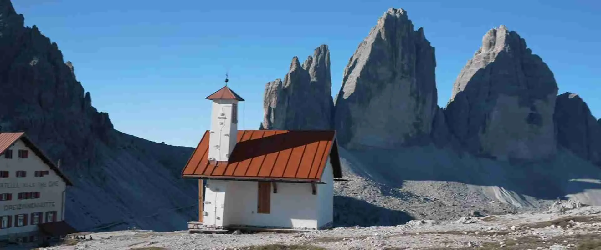
The Alpine orogeny affected different rock types unequally. Harder dolomite rock resisted deformation better than softer shales and marls interbedded with reef formations. This differential resistance created dramatic relief. Massive dolomite formations like Sella Group rose as resistant blocks while surrounding softer rocks eroded away. The process created the isolated tower appearance of peaks like Tre Cime di Lavaredo where three massive dolomite pillars stand separated by eroded cols.
Volcanic activity resumed during the orogeny as tectonic stress created magma pathways through the crust. The Adamello and Presanella granite intrusions formed during this phase, though located west of the main Dolomite range. Volcanic necks and dikes appear scattered through the Dolomites representing small-scale volcanic activity during mountain building. These igneous intrusions altered surrounding rocks through contact metamorphism, creating zones of harder, altered limestone and dolomite that influenced subsequent erosion patterns.
Glacial Sculpting and Modern Landscape
Pleistocene glaciation (2.6 million to 11,700 years ago) carved the final topographic details creating the modern Dolomite landscape. Ice ages repeatedly covered the Alps with extensive glaciers. During glacial maxima, ice sheets reached 2,000 meters thickness burying all but the highest Dolomite peaks. Valley glaciers extended 50-70 kilometers from mountain sources into surrounding lowlands. This ice mass acted as powerful erosive force sculpting valleys, sharpening peaks, and creating distinctive glacial landforms.
Valley glaciers excavated deep U-shaped valleys with flat floors and steep sides. Val Gardena, Val Badia, and Val di Fassa display classic glacial valley profiles. The Isarco and Piave valleys served as main glacier drainage routes. Ice erosion deepened valleys by 300-500 meters compared to pre-glacial topography. This deepening steepened valley walls creating the dramatic relief visible today. Tributary valleys eroded less deeply than main valleys because their smaller glaciers carried less erosive power. When ice retreated, these tributaries remained as hanging valleys with waterfalls cascading down to main valley floors.
Cirque glaciers carved bowl-shaped depressions at mountain flanks. These cirques appear as amphitheater-like hollows with steep headwalls. The Tre Cime di Lavaredo towers rise from cirque headwalls. Multiple cirques eroded mountain sides from different directions creating sharp ridges and pointed peaks. When cirques eroded completely through mountains, they created cols (passes) like Passo Pordoi and Passo Sella. These glacially-formed passes now serve as road routes connecting valleys.
Glacial deposits left distinctive landforms as ice retreated. Moraines mark former ice margins as ridges of rock debris deposited at glacier fronts and sides. Terminal moraines dam some valleys creating lakes like Lago di Misurina and Lago di Braies. Glacial erratics—large boulders transported by ice and deposited far from source areas—scatter across valley floors and slopes. Glacial polish and striations mark bedrock surfaces showing ice flow directions. These features preserve evidence of ice age conditions and help scientists reconstruct past climate patterns.
Indigenous Populations and Early Settlement
Human presence in the Dolomites dates to the end of the last ice age approximately 12,000 years ago. Paleolithic hunter-gatherers followed game into alpine valleys as glaciers retreated and vegetation colonized newly exposed terrain. Archaeological evidence remains sparse due to ongoing erosion and limited preservation in harsh mountain environments. Stone tools recovered from high-altitude sites indicate seasonal occupation as hunters pursued ibex, chamois, and marmots during summer months.
The Neolithic period (6,000-3,000 BCE) saw establishment of permanent settlements in major valleys. Agriculture reached alpine regions as communities cleared forest and established pastures. The famous “Ötzi” ice mummy discovered in 1991 near the Austrian border dates to approximately 3,300 BCE, demonstrating sophisticated mountain adaptation. Though found outside the Dolomites proper, Ötzi represents the cultural complex occupying the entire Alpine arc. His equipment included copper axe, bow and arrows, and fur clothing showing technological sophistication and extensive trade networks connecting mountain communities.
Bronze Age (2,200-750 BCE) settlements expanded as metallurgy developed. Copper deposits in nearby areas supported metal working communities. Trade routes crossed mountain passes connecting Mediterranean and Central European cultures. The Dolomite valleys participated in this Bronze Age trade network exchanging metal goods, salt, and amber. Rock art sites in Valcamonica (west of the Dolomites) preserve Bronze Age images including figures, animals, and symbols. Similar rock art likely existed in the Dolomites but has not survived the harsh weathering environment.
The Iron Age (750-15 BCE) witnessed increasing cultural complexity. The Raetian culture dominated the Alps including the Dolomites region. Raetians spoke a non-Indo-European language and maintained distinctive cultural practices. They constructed fortified hilltop settlements, practiced advanced agriculture, and developed regional artistic styles. The Romans encountered Raetian populations when expanding northward into the Alps. Archaeological sites at Säben near Chiusa and other locations preserve Raetian materials including pottery, metalwork, and inscriptions.
Roman Period and Ladin Origins
Roman conquest of the Alps occurred between 15 BCE and 15 CE when Emperor Augustus launched campaigns securing mountain passes. The Roman province of Raetia encompassed the Dolomites connecting Italy to the Danube frontier. Romans constructed roads through major valleys facilitating military movements and trade. The Via Claudia Augusta crossed the Brenner Pass west of the Dolomites becoming the primary route between Italy and southern Germany. Secondary routes traversed Dolomite valleys including the Pusteria Valley (Val Pusteria) which provided east-west passage.
Romanization gradually transformed indigenous populations. Roman administration introduced Latin language, legal systems, and urban culture. Veterans of Roman legions settled in Alpine valleys receiving land grants. Roman merchants established trading posts. Christian missionaries arrived in the 3rd-4th centuries CE converting populations. These influences merged with existing Raetian culture creating a hybrid mountain society. The Latin language mixed with indigenous languages developing into local dialects that eventually became Ladin.
Roman engineering transformed Alpine settlement patterns. Roads enabled expanded commerce. Aqueducts brought water to towns. Public buildings including baths, theaters, and temples appeared in major settlements like Sebatum (San Lorenzo). Roman agricultural techniques including terracing and irrigation expanded cultivable land. Mining operations extracted copper, iron, and silver from mountain deposits. These developments increased population density and economic complexity in previously isolated valleys.
The fall of the Western Roman Empire (476 CE) began a transition period as Germanic tribes migrated through Alpine regions. Ostrogoths, Lombards, and later Bavarians entered the Dolomites area. Rather than replacing existing populations, these groups integrated with Romanized communities. Latin continued as the language of administration and church even as Germanic languages spread in surrounding lowlands. The isolated mountain valleys preserved Latin-derived speech more faithfully than accessible areas, allowing development of the distinct Ladin language.
Ladin Culture and Language Development
The Ladin people represent direct descendants of Romanized Alpine populations maintaining cultural and linguistic continuity through two millennia. Their language evolved from Vulgar Latin spoken in the Alpine provinces, developing distinctive characteristics separate from Italian, French, and other Romance languages. Ladin preserves archaic Latin features lost in other Romance languages while incorporating elements from Germanic neighbors. Linguists classify Ladin as part of the Rhaeto-Romance language family along with Romansh in Switzerland and Friulian in northeastern Italy.
Five valleys maintain Ladin as a living language: Val Gardena, Val Badia, Livinallongo, Ampezzo, and Comelico. Each valley developed distinct dialects reflecting geographical isolation and varying external influences. Val Gardena Ladin shows German influence due to proximity to German-speaking Tyrol. Val Badia Ladin maintains closer links to Italian. Despite dialectical variations, mutual intelligibility remains high allowing communication across valleys. Modern standardization efforts created written Ladin merging elements from all dialects while respecting local variations.
Traditional Ladin culture adapted to harsh mountain conditions through sophisticated agricultural and pastoral practices. Communities practiced transhumance moving livestock between valley farms in winter and high mountain pastures (alms) in summer. This system maximized available grazing while preserving valley meadows for hay production. Families maintained winter food stores requiring careful preservation techniques including smoking meat, fermenting dairy products, and storing root vegetables. The agricultural calendar dictated social rhythms with major festivals marking seasonal transitions.
Ladin woodcarving developed into renowned artistic tradition. Using local pine and larch, craftsmen created functional items including furniture, tools, and architectural elements while developing elaborate decorative carving. Religious sculptures for churches demonstrated exceptional skill. The tradition continues today with modern Ladin artisans maintaining centuries-old techniques. Museums in Ortisei and other towns preserve historical examples showing stylistic evolution. Ladin architecture employed massive timber construction creating distinctive multi-story farmhouses with ground-floor stables, living quarters above, and hay storage in attics. These structures provided weatherproof environments for both people and animals.
Medieval Period and Political Fragmentation
The medieval period saw the Dolomites divided between various political powers. The Prince-Bishopric of Brixen (Bressanone) controlled western valleys from the 10th century. The County of Tyrol expanded influence from the 13th century eventually incorporating most of the Dolomites region. The Republic of Venice dominated eastern valleys from the 15th century. The Bishop of Belluno governed southern approaches. This political fragmentation created complex borders dividing valleys and even individual communities between different jurisdictions.
Feudal lords constructed castles controlling strategic locations. Castle Trostburg in the Isarco Valley, Castle Thurn near Vipiteno, and numerous other fortifications dominated valley routes. These castles served both defensive purposes and administrative centers controlling surrounding territories. Noble families including the Counts of Tyrol, Bishops of Brixen, and Venetian patricians competed for influence. Their conflicts occasionally erupted into armed struggles damaging mountain communities caught between competing powers.
Monastic communities played crucial roles in medieval Dolomites society. Benedictine and Cistercian monasteries established at locations including Novacella and Marienberg cleared forest, introduced advanced agriculture, and preserved learning. Monasteries operated schools educating local populations. They maintained scriptoria producing illuminated manuscripts. Monastic chroniclers recorded regional history providing modern historians with essential sources. Religious orders constructed churches and chapels throughout valleys, many decorated with frescoes depicting biblical scenes and local saints.
The medieval economy centered on subsistence agriculture, animal husbandry, and limited trade. Most communities remained largely self-sufficient growing cereals at lower elevations and maintaining livestock. Seasonal migration to alpine pastures continued ancient transhumance patterns. Some communities specialized in crafts including woodworking, textile production, and metalworking. Market towns like Bolzano served as trade centers where mountain products exchanged for lowland goods. Mining operations extracted silver, copper, and iron from mountain deposits providing cash income to otherwise subsistence communities.
Early Modern Period and Austrian Rule
The Dolomites came under unified Austrian control during the 16th century as the Habsburg dynasty consolidated power. The County of Tyrol became an integral part of Austrian territories. Austrian administration brought relative political stability after medieval fragmentation. German became the official administrative language in western valleys though Ladin continued as the spoken language of daily life. Eastern valleys near Venice maintained Italian linguistic dominance and commercial ties to Venetian markets.
The Protestant Reformation had limited impact in the Dolomites where Catholic faith remained dominant. The Counter-Reformation strengthened Catholic institutions through construction of baroque churches and expanded monastic communities. Pilgrimage routes attracted religious travelers. Miraculous icons and relics drew devotees to mountain shrines. Religious architecture flourished as communities commissioned churches displaying baroque and rococo decoration. These buildings still dominate village centers preserving artistic heritage from this period.
The Napoleonic Wars (1792-1815) brought temporary political changes. French forces occupied Tyrol multiple times. The Treaty of Campo Formio (1797) transferred Venetian territories including eastern Dolomite valleys to Austria. The Tyrolean Rebellion (1809) led by Andreas Hofer resisted Bavarian rule imposed by Napoleon. Though ultimately unsuccessful, the rebellion became a foundational myth for Tyrolean identity. Mountain communities contributed to the resistance through guerrilla warfare exploiting knowledge of local terrain.
The Congress of Vienna (1815) restored Austrian control over the entire Dolomites region. The 19th century brought modernization including improved roads, schools, and administration. The Austrian Empire constructed strategic roads through mountain passes enhancing communication and commerce. The Great Dolomite Road (Strada delle Dolomiti) connected Bolzano to Cortina providing the first vehicular route through the heart of the range. These improvements opened the Dolomites to increased trade and laid groundwork for future tourism development.
Scientific Exploration and the Golden Age of Alpinism
The 19th century witnessed systematic scientific exploration of the Dolomites. Following Dolomieu’s mineralogical work, numerous geologists studied the range documenting stratigraphy, fossils, and geological processes. Baron Friedrich von Richthofen conducted extensive fieldwork in the 1850s and 1860s mapping formations and interpreting geological history. His work established the Dolomites as a key location for understanding mountain building and ancient tropical reef systems. Austrian and German geologists continued detailed mapping creating comprehensive geological knowledge.
Paleontological discoveries revealed exceptional fossil assemblages. The Middle Triassic Cassian Formation preserves one of Earth’s most diverse fossil assemblages with over 500 marine species including corals, mollusks, echinoderms, and arthropods. These fossils document marine ecosystems just after the Permian-Triassic extinction event showing rapid biodiversity recovery. Paleontologists continue discovering new species in Cassian strata making the Dolomites internationally significant for understanding evolution and extinction patterns.
The golden age of alpinism (1860-1914) transformed the Dolomites from scientific curiosity to mountaineering destination. British climbers led early exploration following success in the Western Alps. John Ball made extensive exploratory climbs in the 1850s and 1860s documenting peaks and routes. Paul Grohmann achieved 27 first ascents of major Dolomite summits between 1863 and 1875 including Marmolada, Langkofel, and Sassolungo. Edward Tuckett, Francis Fox Tuckett, and others established numerous classic routes during this period.
Austrian and German mountaineers soon matched British achievements. The German-Austrian Alpine Club (now the German Alpine Club) built numerous mountain refuges facilitating extended expeditions. Karl Schulz achieved the first winter ascents of major peaks in the 1880s and 1890s demonstrating technical skills ahead of their time. The Innsbruck climber Georg Winkler made bold solo ascents before his tragic death at age 18. These early mountaineers developed techniques including piton placement, rope management, and belaying systems that evolved into modern climbing methods.
World War I and the Mountain Front
Italy’s declaration of war against Austria-Hungary in May 1915 transformed the Dolomites into a battlefield. The Italian-Austrian border followed the Dolomite crest and major ridges creating a 600-kilometer front through the mountains. Italy sought to capture Austrian Tyrol advancing northward. Austria defended from elevated positions with supply advantages. Both sides faced unprecedented challenges fighting at elevations where previous military doctrine assumed operations impossible.
The front divided into sectors along major valleys and mountain groups. The Trentino sector covered western approaches including the Brenta Dolomites. The Cadore sector encompassed the central Dolomites around Cortina. The Carnic sector extended eastward through the Friulian Dolomites. Combat intensity varied by sector with static warfare predominating in most areas. Major offensives produced minimal territorial gains at terrible cost. The Strafexpedition (Asiago Offensive) in May-June 1916 demonstrated the difficulties as Austrian forces achieved initial success but could not sustain advances due to logistical constraints.
Both armies performed extraordinary engineering feats adapting to mountain warfare. Soldiers carved tunnels through solid rock creating fortified positions and supply routes. The Lagazuoi tunnel network extended kilometers through the mountain with underground barracks, ammunition storage, and artillery positions. Similar tunnel systems honeycombed Col di Lana, Monte Piano, and Pasubio. Engineers constructed cable ways (teleferiche) transporting supplies across valleys and up mountain faces. Some systems lifted 1,500 kilograms per trip. Soldiers carved trails and stairways on vertical walls creating access routes now used as via ferrata courses.
Living conditions proved brutal for soldiers stationed at high altitude. Winter temperatures dropped below -30°C with storms lasting days. Avalanches killed thousands of soldiers—estimates suggest 60,000 died from avalanches, more than from direct combat in some sectors. Frostbite and altitude sickness debilitated units. Supply difficulties meant inadequate food, fuel, and ammunition. Both sides built fortified barracks attempting to provide shelter. The Italian army constructed the Città di Ghiaccio (Ice City) on Marmolada glacier including barracks, ice tunnels, and an ice chapel housed in glacier cavities. Austro-Hungarian forces built similar installations at high-altitude positions.
The war ended with the Italian victory at Vittorio Veneto in October-November 1918 followed by the Armistice of Villa Giusti. The Treaty of Saint-Germain (1919) transferred South Tyrol from Austria to Italy moving the border to the Brenner Pass. This transferred the German-speaking population of South Tyrol and the Ladin valleys to Italian sovereignty. The border change created ethnic tensions that persisted through the 20th century. Physical war remains scatter throughout the Dolomites including trenches, tunnels, fortifications, and unexploded ordnance. These relics create outdoor museums preserving memory of the mountain war.
Fascist Period and World War II
Italian Fascism brought forced Italianization to South Tyrol and the Ladin valleys. Mussolini’s government suppressed German language and Ladin, closing German schools and requiring Italian in all public contexts. Place names changed from German and Ladin to Italian: Bozen became Bolzano, Sankt Ulrich became Ortisei, Cortina became Cortina d’Ampezzo with Italian endings. The regime encouraged Italian settlement in predominantly German and Ladin areas. These policies created resentment among non-Italian populations.
The 1939 Option Agreement between Germany and Italy forced South Tyroleans to choose German or Italian citizenship. Those choosing German citizenship agreed to relocate to German Reich territories. Approximately 80% opted for German citizenship though actual migration remained limited when World War II began. The agreement created divisions within communities between those willing to leave their homeland and those accepting Italian rule to remain.
World War II brought less intensive combat to the Dolomites than World War I. The region remained behind German lines until 1945. Germany occupied northern Italy after September 1943 when Italy signed the armistice with the Allies. The area became part of the Operational Zone of the Alpine Foothills under German administration. Partisan groups operated in mountain areas conducting guerrilla warfare against German forces. The Wehrmacht maintained order through harsh measures including executions and deportations. Fighting remained limited compared to World War I with no major battles in the Dolomites proper.
The war ended with German surrender in May 1945. South Tyrol remained Italian territory despite some Austrian and German calls for return to Austria. The Paris Agreement (1946) and subsequent Gruber-De Gasperi Agreement granted autonomy to South Tyrol protecting German language rights and cultural identity. Implementation proved slow leading to continued tensions. Terrorist attacks by German nationalists occurred in the 1950s and 1960s. The Second Autonomy Statute (1972) provided enhanced self-governance eventually resolving most tensions. Modern South Tyrol enjoys extensive autonomy within Italy with German, Italian, and Ladin all holding official status.
Tourism Development and Modern Era
Tourism in the Dolomites began with 19th-century alpinism and evolved into mass tourism by the late 20th century. Early mountaineers required local guides and basic accommodations. Mountain refuges built by Alpine clubs provided shelter for climbers. Grand hotels appeared in valleys like Cortina d’Ampezzo catering to aristocratic travelers. The Orient Express stopped at Toblach (Dobbiaco) bringing international visitors. This early tourism remained exclusive serving wealthy adventurers and upper-class travelers.
Winter sports development transformed the Dolomites into a major ski destination. The first ski areas opened in the 1930s with basic rope tows. Post-World War II development brought chairlifts and gondolas accessing higher terrain. The 1956 Winter Olympics in Cortina d’Ampezzo provided international publicity and infrastructure investment. Subsequent decades saw expanded lift networks connecting valleys. The Dolomiti Superski area unified 12 valleys and 1,200 kilometers of slopes under single lift pass becoming one of the world’s largest ski regions.
The Sella Ronda circuit exemplifies this development. This 26-kilometer route circles the Sella massif connecting Val Gardena, Alta Badia, Arabba, and Val di Fassa through a series of lifts and ski runs. Skiers complete the circuit in one day without repeating runs. The circuit attracts hundreds of thousands of skiers annually making it one of the Dolomites’ most popular attractions. Similar interconnected ski areas appear throughout the range transforming formerly isolated valleys into unified recreation zones.
Summer tourism expanded beyond traditional mountaineering into hiking, mountain biking, and general recreation. Maintained trail networks total thousands of kilometers ranging from easy valley walks to challenging alpine routes. Mountain refuges upgraded facilities while maintaining traditional character. Vie ferrate (protected climbing routes) adapted World War I military installations for recreational use. These cable-protected routes allow non-climbers to access spectacular locations previously requiring technical climbing skills. The Via Ferrata delle Bocchette, Via Ferrata Ivano Dibona, and dozens of others attract adventure tourists seeking thrilling but manageable mountain experiences.
UNESCO Recognition and Conservation
The Dolomites received UNESCO World Heritage designation in 2009 after years of preparation and coordination between Italian provinces and regions. The nomination process required agreement among multiple jurisdictions including Trentino-Alto Adige, Veneto, and Friuli-Venezia Giulia regions covering nine separate mountain systems. Each system required documented outstanding universal value and effective protection measures. The nomination succeeded by demonstrating exceptional geological significance, outstanding natural beauty, and comprehensive conservation frameworks.
UNESCO recognition validated what geologists and naturalists understood for over a century: the Dolomites preserve unique geological features and spectacular scenery meriting international protection. The designation brought responsibilities including conservation requirements, visitor management, and sustainable development planning. The Dolomites Foundation coordinates UNESCO-related activities across jurisdictions. Member provinces developed management plans addressing conservation priorities, sustainable tourism, and environmental protection.
Conservation challenges include balancing tourism development with environmental protection. Approximately 10 million visitors annually create pressure on fragile mountain ecosystems. Popular locations like Tre Cime di Lavaredo and Seceda experience crowding impacting visitor experiences and natural environments. Solutions include visitor quotas at sensitive sites, improved public transportation reducing private vehicle impacts, and infrastructure improvements concentrating activities in developed areas while protecting backcountry zones.
Climate change poses significant long-term threats to the Dolomites. Rising temperatures affect glaciers with the Marmolada glacier losing approximately 30% of volume since 2000. Warming enables vegetation expansion to higher elevations altering alpine ecosystems. Permafrost thaw destabilizes rock faces increasing rockfall hazards. Changing precipitation patterns affect water availability. These climate impacts require adaptive management strategies including monitoring systems, hazard assessments, and revised infrastructure planning accounting for changing conditions.
FAQ Section: Historical Questions
What is the oldest building in the Dolomites?
The Church of San Cipriano in Tires (St. Zyprian) dates to the early 13th century representing one of the oldest surviving structures in the Dolomites. However, the church incorporates elements from earlier Romanesque construction possibly dating to the 10th-11th centuries. Many other medieval churches contain remnants of earlier structures including the Parish Church of Santa Maria Assunta in Ortisei with foundations possibly dating to the 12th century. Secular medieval structures rarely survive intact due to wood construction susceptible to fire and deterioration, though some castle ruins like Hauenstein near Tires preserve 13th-century stonework.
How did Ladin survive as a language?
Ladin survived through geographical isolation combined with cultural cohesion. Mountain valleys remained relatively inaccessible until the 19th century limiting contact with surrounding German and Italian populations. Small, close-knit communities maintained linguistic traditions through oral culture, family structures, and local governance conducted in Ladin. The lack of significant immigration preserved demographic balance favoring Ladin speakers. Religious services and primary education in Ladin reinforced language transmission. Modern language preservation efforts including Ladin schools, media, and cultural organizations counter assimilation pressures ensuring survival. Official recognition of Ladin in South Tyrol’s autonomy statute provides institutional support for language maintenance.
What happened to the Ladin people after Italy acquired South Tyrol?
Italian annexation of South Tyrol after World War I brought Ladin valleys under Italian sovereignty. Initial policies proved relatively benign, but Fascist Italianization from 1922 onward suppressed Ladin language and culture. Schools prohibited Ladin instruction, public administration required Italian, and place names underwent Italianization. These policies aimed to assimilate Ladin populations into Italian identity. World War II’s Option Agreement created dilemmas as Ladin communities faced choosing between Italian citizenship or relocation to Germany. Most Ladin chose German citizenship but many did not actually migrate when war conditions made relocation impractical. Post-war autonomy agreements eventually granted language rights. Modern Ladin enjoys official status in Trentino and South Tyrol with guaranteed education, media, and governmental services in Ladin. The language and culture survive today with approximately 30,000 speakers maintaining traditional customs while adapting to modern society.
Why did World War I focus on such high mountain terrain?
The Italian-Austrian border followed natural mountain barriers with the Dolomites forming a major section of the frontier. Italy’s war aims required attacking northward to capture Austrian territory including Tyrol and potentially reaching Austria proper. Geographic necessity forced combat into high mountains despite unprecedented challenges. Both militaries underestimated difficulties, believing mountain warfare would resemble lowland combat. Reality proved far harsher with soldiers fighting at elevations above 3,000 meters under extreme weather facing supply difficulties, altitude effects, and avalanche dangers. Despite these challenges, abandoning mountain sectors would have allowed enemy exploitation of undefended territory threatening rear areas. Both sides committed to holding mountain positions regardless of cost, creating a high-altitude stalemate that persisted through three years of fighting with terrible casualties and minimal territorial changes.
How accurate are UNESCO boundaries for the Dolomites?
UNESCO designation covers nine separate mountain systems totaling 142,000 hectares rather than the entire Dolomites range. The boundaries follow geological criteria selecting areas demonstrating exceptional dolomite rock formations, outstanding paleontological significance, and supreme natural beauty. The nine systems include Pelmo-Croda da Lago, Marmolada, Pale di San Martino, Dolomiti Bellunesi, Dolomiti Friulane, Dolomiti Settentrionali, Puez-Odle, Sciliar-Catinaccio, and Latemar. Buffer zones surrounding core areas provide additional protection totaling approximately 220,000 hectares. Some peaks and valleys considered culturally part of the Dolomites fall outside UNESCO boundaries due to geological criteria or administrative coordination difficulties. The boundaries represent scientific assessment of outstanding universal value rather than complete inclusion of all peaks called “Dolomites” in common usage. This selective approach concentrates protection on most significant features while allowing continued use of other areas.
What archaeological evidence exists from prehistoric Dolomites?
Archaeological evidence from prehistoric Dolomites remains sparse due to harsh preservation conditions and limited systematic excavation. Stone tools recovered from high-altitude sites including Mondeval de Sora near Cortina document Mesolithic hunter-gatherer presence dating to approximately 7,000 BCE. The Mondeval burial site preserved skeletal remains of a hunter along with stone tools, ornaments, and hunting equipment providing rare insight into mountain life practices. Rock shelters in the Dolomiti Bellunesi preserve occupation layers from Mesolithic through Bronze Age periods showing seasonal use for hunting expeditions. Bronze Age materials including pottery sherds and metal implements appear at scattered locations indicating trade connections between mountain communities and lowland civilizations. The scarcity of archaeological sites reflects both limited prehistoric population density in harsh mountain environments and poor preservation conditions where erosion and weathering destroy evidence. Most knowledge of prehistoric Alpine life comes from better-preserved sites in adjacent regions including Ötzi the Iceman found in the Ötztal Alps demonstrating cultural similarities across the broader Alpine region.
How did the Great Dolomite Road change the region?
The Great Dolomite Road (Strada delle Dolomiti) constructed by Austrian authorities between 1897 and 1909 revolutionized Dolomites accessibility. The 110-kilometer route connected Bolzano to Cortina d’Ampezzo crossing Passo Costalunga, Passo Pordoi, and other high passes. For the first time, wheeled vehicles could traverse the heart of the range opening previously isolated valleys to commerce and tourism. The road enabled regular postal service, freight transportation, and passenger coaches. Wealthy tourists reached remote valleys without days of difficult horse or foot travel. Hotels and guesthouses proliferated along the route catering to automobile tourists representing the era’s elite travelers. The road facilitated military movements during World War I when both sides transported troops and supplies on this strategic route. Post-war tourism development accelerated as automobile ownership expanded making the Dolomites accessible to middle-class travelers. Modern Route SS48 follows the original alignment carrying hundreds of thousands of vehicles annually. The road’s construction represented technological achievement requiring retaining walls, tunnels, and switchbacks overcoming 2,239-meter elevation at Passo Pordoi. This engineering success inspired subsequent road construction throughout the Alps transforming mountain regions from isolated peripheries to integrated tourism destinations.
What role did local guides play in Dolomites mountaineering history?
Local mountain guides proved essential to golden age alpinism as foreign climbers required local knowledge for successful ascents. Early guides came from agricultural backgrounds, typically farmers and hunters with intimate knowledge of local terrain. They learned mountains through chamois hunting and shepherding rather than formal mountaineering training. British, German, and Austrian clients hired these guides for first ascent attempts and exploratory climbs. The guide-client relationship shaped mountaineering development with guides providing route-finding, technical expertise, and safety management. Famous guides including Santo Siorpaes from Cortina and Angelo Dimai achieved numerous first ascents both with clients and on independent climbs. Mountain guiding became a profession with guides earning income supplementing agricultural livelihoods. The Italian Alpine Club and Austrian Alpine Club established guide services formalizing training and certification. Modern guide bureaus in towns like Cortina, Ortisei, and San Martino di Castrozza maintain professional guide services continuing this tradition. Contemporary guides undergo rigorous training and certification requiring technical climbing skills, first aid, meteorology, and instruction methods. They lead clients on classic routes first climbed by their professional predecessors over a century ago.
How did the 1956 Winter Olympics impact Cortina d’Ampezzo?
The VII Olympic Winter Games held in Cortina d’Ampezzo in January-February 1956 transformed the town into an internationally renowned resort. Italy invested heavily in infrastructure including the Olympic Ice Stadium, Stadio Olimpico del Ghiaccio (Italy Ice Palace), and expanded ski facilities. New hotels and restaurants accommodated increased visitor capacity. The games brought unprecedented media attention with television broadcasting competition footage worldwide. Athletes from 32 nations competed establishing Cortina as a premier winter sports destination. The publicity attracted wealthy international visitors making Cortina fashionable among European and American elite. Post-Olympic tourism exploded with visitor numbers multiplying through the 1960s and 1970s. The Olympics spurred lift network expansion and trail development creating modern ski infrastructure. Cortina’s Olympic legacy established patterns followed by other Dolomite resorts pursuing upscale tourism. The town maintains Olympic heritage through preserved venues and museums. The Eugenio Monti Olympic Track built for the games hosted bobsled and luge competitions until 1999. Modern Cortina blends Olympic prestige with traditional mountain character attracting visitors seeking both sporting excellence and cultural authenticity in a spectacular natural setting.
What impact did tourism have on Ladin culture?
Tourism brought profound changes to Ladin culture creating both opportunities and challenges. Economically, tourism provided alternative livelihoods reducing dependence on subsistence agriculture. Hotels, restaurants, ski lifts, and guide services employed Ladin populations with higher incomes than traditional farming. This economic transformation enabled younger generations to remain in valleys rather than migrating to urban areas for employment. However, tourism also brought cultural pressures as Italian and German languages dominated tourism sectors. Many Ladin people became multilingual by necessity, speaking Ladin at home while using Italian, German, and English professionally. Tourism altered traditional architecture as historic farmhouses converted to guesthouses or replaced by modern hotels. Traditional crafts adapted to tourist markets with woodcarving shifting from functional items to decorative souvenirs. Folklore presentations sometimes commercialized authentic traditions creating staged performances for tourist consumption. Despite these pressures, tourism revenue funded cultural preservation including Ladin language schools, museums, and cultural centers. Modern Ladin identity balances tradition and modernity, maintaining language and customs while participating fully in tourism economy. Organizations like the Istitut Ladin Micurà de Rü work to preserve authentic Ladin culture through research, education, and documentation ensuring survival despite tourism’s transformative effects.