
Denali Best Tours & Walking Routes 2026: Complete Travel Guide
Denali National Park offers unparalleled wilderness experiences in 2026 despite temporary road access limitations, with narrated bus tours reaching spectacular wildlife habitat at Mile 43, comprehensive trail networks near the park entrance providing diverse hiking from gentle lakeside walks to challenging alpine ascents, and strategic tour options that maximize your encounter with North America’s highest peak and Alaska’s iconic wildlife including grizzly bears, wolves, moose, and caribou across 6 million acres of protected tundra and boreal forest.
Key Takeaways: Denali Tours and Trails 2026
- Road Access Limited to Mile 43 in 2026: Pretty Rocks Landslide repair construction restricts all bus tours and transit services to Mile 43 (East Fork area) instead of the traditional 92-mile road length, with full road reopening expected in 2027. The accessible first 43 miles still provide excellent wildlife viewing opportunities and mountain vistas across diverse ecosystems from boreal forest to alpine tundra.
- Two Primary Tour Options for 2026: The Tundra Wilderness Tour ($145 adult, 5.5 hours to Mile 43) offers the best wildlife viewing with naturalist narration, while the Natural History Tour ($116 adult, 4.5-5 hours to Mile 17) focuses on cultural history and shorter duration. Both tours operate May 20 through September 17, 2026, with multiple daily departures and include park entrance fees in the ticket price.
- Extensive Front Country Trail Network: Over 35 miles of maintained trails remain fully accessible near the park entrance and Savage River area, ranging from the easy 2-mile Horseshoe Lake loop to the challenging 9.5-mile Triple Lakes Trail and strenuous Mt. Healy Overlook ascent. These trails provide immediate wilderness immersion without requiring bus transportation.
- Strategic Multi-Day Planning Maximizes Experience: Three to four days allows optimal exploration combining one or two bus tours at different times of day for varied wildlife viewing, multiple entrance area hikes, ranger programs, sled dog demonstrations, and weather flexibility. Single-day visits remain viable but limit depth of park experience.
- Transit Buses Enable Independent Hiking: The East Fork Transit Bus ($33 plus $15 park entrance) operates as hop-on hop-off service to Mile 43, allowing hikers to disembark anywhere along the accessible road, explore trail-less backcountry, and catch later buses back to the entrance. This flexible system supports customized wilderness experiences beyond maintained trails.
- Alternative Experiences Complement Road-Based Tours: Flightseeing tours provide unique 2026 value by accessing areas beyond Mile 43 including Wonder Lake, the park’s remote interior, and aerial mountain views. Discovery Hikes with park rangers, guided walking tours, and entrance area activities like sled dog demonstrations create comprehensive Denali experiences despite road limitations.
People Also Ask About Denali Tours and Trails 2026
What tours are available in Denali in 2026 with the road closure?
Denali offers two primary narrated bus tours in 2026 despite the Mile 43 road closure: the Tundra Wilderness Tour ($145 adult, $65 child) operating 5.5 hours round-trip to East Fork with excellent wildlife viewing, and the Natural History Tour ($116 adult, $51 child) running 4.5-5 hours to Mile 17 with emphasis on cultural history and interpretive presentations. Both tours include naturalist guides, park entrance fees, snacks, and bottled water, with multiple daily departures between May 20 and September 17, 2026.
Transit buses provide hop-on hop-off service to Mile 43 for $33 per adult (plus $15 separate park entrance fee), enabling independent hikers to explore backcountry areas and catch return buses throughout the day. Flightseeing tours operate as valuable alternatives, providing aerial access to Wonder Lake, Kantishna, and mountain viewpoints beyond the road closure zone. Guided Discovery Hikes with park rangers, entrance area walking tours, and specialized activities like Jeep excursions on the Denali Highway supplement the bus tour options.
Can you still see wildlife on Denali tours in 2026?
The first 43 accessible miles of Denali Park Road in 2026 traverse prime wildlife habitat where all of Alaska’s iconic large mammals concentrate, including grizzly bears, wolves, moose, caribou, and Dall sheep. Wildlife viewing opportunities from bus tours remain excellent because the road crosses broad river valleys, willow thickets, and tundra slopes that provide ideal feeding areas, particularly in the Savage River drainage and East Fork regions where buses now terminate.
Early morning and late afternoon departures generally produce the best wildlife sightings when animals are most active. The accessible portion includes designated wildlife viewing areas like Savage Canyon and the valleys approaching East Fork where naturalist guides stop buses for extended observation periods. Bears frequent berry patches throughout summer, moose browse in willow stands near waterways, caribou cross the tundra in small groups, and Dall sheep bed on high ridges visible from the road. While the traditional wildlife-rich areas beyond Mile 43 remain temporarily inaccessible by road, the percentage of visitors who see multiple species on tours to Mile 43 remains high.
Which hiking trails are accessible in Denali in 2026?
All entrance area trails and Savage River trails remain fully accessible in 2026, providing over 35 miles of maintained hiking opportunities. Entrance area trails (Mile 0-1.5) include Horseshoe Lake Trail (2.1 miles, easy lakeside loop with wildlife viewing), Triple Lakes Trail (9.5 miles one-way, the park’s longest maintained trail connecting entrance to southern areas), Mt. Healy Overlook Trail (4.5 miles round-trip, strenuous climb to panoramic views), Taiga Trail (0.9 miles, gentle forest loop), McKinley Station Trail (1.5 miles, historical sites), and Rock Creek Trail (2.3 miles, can combine with Roadside Trail for 4.5-mile loop).
Savage River area trails (Mile 15, accessible by private vehicle) include Savage River Loop (2.1 miles, easy valley trail alongside the river) and Savage Alpine Trail (4.1 miles, moderate to strenuous with significant elevation gain to alpine views). Trails beyond Mile 43 including Thorofare Ridge, McKinley Bar Trail, and Wonder Lake area routes remain inaccessible by road in 2026 but may be reached via chartered aircraft to remote areas. The accessible trails provide diverse experiences from gentle lakeside walks suitable for families to challenging alpine ascents rewarding experienced hikers with spectacular mountain and valley vistas.
How much time should you spend in Denali in 2026?
Three to four days provides the optimal Denali experience in 2026, allowing sufficient time for one or two bus tours at different times of day (varying wildlife activity and lighting conditions), multiple entrance area hikes exploring diverse trail options, attendance at ranger programs and sled dog demonstrations, and critical weather flexibility since mountain views and optimal wildlife viewing depend on conditions. This duration accommodates the 5.5-hour Tundra Wilderness Tour without rushing, permits exploration of both easy and challenging trails, and allows rest days or alternative activities if weather affects visibility.
Two-day visits remain viable for travelers on tight schedules, typically structured as one full-day bus tour plus entrance area activities and one shorter hike near the visitor center. Single-day visits can include either a bus tour or entrance area hiking but lack depth and weather flexibility. Extended stays of five to seven days enable multiple bus trips at varied times, comprehensive trail exploration including longer routes like Triple Lakes, combination with flightseeing tours, and deeper immersion in ranger-led programs and park amenities. The limited road access in 2026 makes multi-day visits more valuable than in normal years, as repeated bus trips and varied trail experiences compensate for the reduced backcountry access.
Extended multi-day tours – 5+ days
Featured Alaska Multi-Day Tour Packages
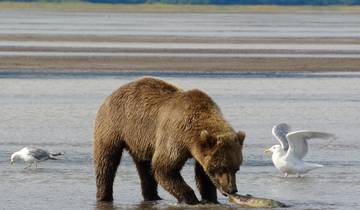
13 days
13-Day Alaskan Highlight Lodging Adventure Tour
- ✓ Comprehensive Alaska tour
- ✓ Expert local guides included
- ✓ All accommodation arranged
- ✓ Transportation provided
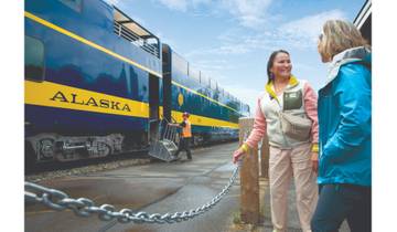
6 days
6-Day Best of Grand Alaska Highlights over 50's Tour
- ✓ Comprehensive Alaska tour
- ✓ Expert local guides included
- ✓ All accommodation arranged
- ✓ Transportation provided
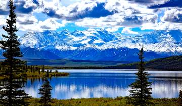
7 days
Nature's Best: Alaska
- ✓ Comprehensive Alaska tour
- ✓ Expert local guides included
- ✓ All accommodation arranged
- ✓ Transportation provided
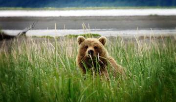
20 days
Alaska Adventure – 20 Days
- ✓ Comprehensive Alaska tour
- ✓ Expert local guides included
- ✓ All accommodation arranged
- ✓ Transportation provided
Multi-day tour packages powered by TourRadar. Prices and availability subject to change.
Introduction: Navigating Denali National Park Tours and Trails in 2026
Denali National Park stands as Alaska’s premier wilderness destination, protecting 6 million acres of pristine tundra, boreal forest, and glaciated peaks surrounding North America’s highest mountain at 20,310 feet. The park’s unique access system has always distinguished it from other American national parks, with a single 92-mile gravel road providing the sole vehicular route into the interior wilderness, private vehicle access restricted to the first 15 miles, and a sophisticated bus system carrying visitors deeper into protected habitat where grizzly bears, wolves, caribou, and moose roam freely across landscapes little changed since the park’s 1917 establishment. This controlled access model preserves wilderness character while enabling hundreds of thousands of annual visitors to experience genuine Alaska backcountry without the crowding and infrastructure that diminishes other heavily-visited parks.
The 2026 season brings a significant temporary modification to this traditional access pattern. The Pretty Rocks Landslide, an ongoing permafrost thaw event at Mile 45.4 of Denali Park Road, has necessitated closure of the road beyond Mile 43 while the National Park Service constructs a 475-foot steel truss bridge to bypass the unstable slope. This construction project, begun in 2024 and continuing through summer 2026, means that all bus tours and transit services terminate at East Fork (Mile 43) rather than traveling the full 92 miles to Kantishna or reaching traditional destinations like Eielson Visitor Center (Mile 66) and Wonder Lake (Mile 85). The road is expected to fully reopen in 2027, potentially by mid-summer but more likely for the complete season that year.
Understanding what remains accessible and how to optimize your 2026 Denali experience within these constraints forms the foundation for successful trip planning. The first 43 miles of park road still traverse spectacular and wildlife-rich terrain, crossing four distinct vegetation zones from dense spruce taiga through moist tundra to alpine areas, providing habitat for all of Alaska’s large mammals, and offering views of Denali (the mountain) on clear days from multiple vantage points. The entrance area contains an exceptional network of maintained trails ranging from gentle lakeside walks to strenuous alpine ascents, comprehensive visitor facilities including the modern Denali Visitor Center with educational exhibits, daily sled dog demonstrations at the historic park kennels, and ranger-led programs interpreting the park’s ecology, geology, and history.
Strategic tour and trail selection in 2026 requires matching your interests, physical abilities, and available time to the accessible options. Narrated bus tours with experienced naturalist guides provide structured wildlife viewing experiences and geological interpretation without requiring hiking fitness, while the trail network enables independent exploration at your own pace with route choices spanning easy family-friendly walks to challenging full-day wilderness treks. The transit bus system bridges these options by transporting hikers to drop-off points along the accessible road where trail-less backcountry beckons those comfortable with off-trail navigation and bear safety protocols. Flightseeing tours supplement ground-based experiences by providing aerial access to areas beyond the road closure including the park’s remote western reaches and unique mountain perspectives impossible to achieve from road level.
Seasonal timing significantly influences tour and trail experiences. The operational window runs from mid-May through mid-September when buses operate, trails are snow-free at lower elevations, and accommodations and services function throughout the park entrance area. Early season (mid-May through early June) offers exceptional wildlife viewing as animals emerge from winter including newborn caribou calves and bear cubs, but trails at higher elevations remain snow-covered and the mountain often hides behind clouds. Peak summer (late June through July) provides 20-plus hours of daily daylight, warm temperatures ideal for hiking, and the highest probability of mountain views on clear days, though mosquitoes peak in forested areas and visitor numbers reach seasonal highs. Late season (August through mid-September) brings fall colors transforming tundra to brilliant reds and golds, reduced crowds and mosquitoes, increased bear activity as animals feed intensively before winter, and earlier sunsets that create dramatic lighting for photography.
The subsequent sections provide comprehensive planning guidance for Denali tours and trails in 2026, beginning with detailed analysis of available bus tour options including pricing, schedules, and what each tour delivers, followed by complete trail descriptions organized by location and difficulty level, strategic multi-day itinerary planning that combines tours and trails effectively, practical tips for maximizing wildlife viewing and mountain visibility, and specialized information on Discovery Hikes, guided experiences, and alternative activities that complement bus tours and independent hiking within the unique constraints of the 2026 access limitations.
Understanding Denali’s 2026 Road Access and Bus System
The Denali Park Road represents one of America’s most iconic wilderness routes, winding 92 miles from the park entrance at Mile 0 through boreal forest, across alpine tundra, and past glaciated peaks to reach the remote Kantishna area at the road’s terminus. Constructed between 1923 and 1938, this narrow gravel road climbs over four mountain passes exceeding 3,800 feet elevation, crosses numerous braided glacial rivers, and clings to steep mountainsides where permafrost and unstable geology create ongoing maintenance challenges. The road’s design philosophy prioritized minimal environmental impact and preservation of wilderness character, resulting in a single-lane track with frequent pullouts rather than a modern two-lane highway, and strict limitations on private vehicle access to protect wildlife and prevent the traffic congestion that would destroy the park’s essential wildness.
Private vehicles access only the first 15 miles of Denali Park Road year-round, terminating at Savage River. This restriction has existed since 1972 and serves multiple conservation purposes including reducing vehicle-wildlife conflicts, preventing traffic jams during wildlife viewing opportunities, minimizing road dust and noise pollution in prime habitat areas, and maintaining the sense of remoteness that defines the Denali backcountry experience. Beyond Mile 15, the National Park Service operates two distinct bus systems serving different visitor needs: narrated tour buses driven by naturalist guides who provide interpretation and wildlife spotting expertise, and transit buses functioning as hop-on hop-off transportation for hikers and campers accessing backcountry areas.
In 2026, the Pretty Rocks Landslide fundamentally alters this access pattern. The landslide zone at Mile 45.4 involves permafrost thaw accelerating slope movement to rates reaching two feet per day during summer months, creating conditions unsafe for vehicle traffic as the roadbed shifts and cracks. Park geologists determined that temporary repairs could not maintain long-term stability, necessitating construction of a permanent bridge solution to bypass the unstable hillside entirely. The bridge project requires significant excavation on both sides of the landslide zone, installation of deep foundation pilings and soil stabilization systems, and placement of thermosiphons (heat-dissipating devices) to prevent further permafrost degradation beneath the bridge structure. This complex engineering work continues through the 2026 summer season, restricting all bus traffic to Mile 43 (East Fork) where buses turn around in a designated area.
The Mile 43 terminus point sits approximately 2.3 miles before the landslide zone, chosen for safety buffers and adequate space for bus turnaround operations. East Fork represents the convergence of multiple tributary streams in a broad valley framed by tundra-covered slopes, providing excellent wildlife habitat and mountain views on clear days. While significantly shorter than the traditional 92-mile road length, the accessible first 43 miles still encompass diverse ecosystems and wildlife viewing opportunities that form the core Denali experience for most visitors. The inaccessible section beyond Mile 43 includes Polychrome Pass (Mile 46) with its colorful volcanic geology, the Toklat River area (Mile 53), Eielson Visitor Center (Mile 66) with close-range views of Denali, and Wonder Lake (Mile 85) famous for mirror reflections of the mountain on calm mornings.
Understanding what the accessible road section provides helps set realistic expectations for 2026 visits. From the entrance at Mile 0, the road climbs Government Hill offering initial views of the Alaska Range, then descends into the Hines Creek drainage where moose frequent willow thickets. Savage River at Mile 15 marks the transition from private vehicle access to bus-only road, with the valley here providing excellent bear habitat and the river crossing showcasing braided channel dynamics. Beyond Savage River, the road enters Sanctuary River drainage and climbs toward Primrose Ridge (Mile 17) where the Natural History Tour terminates. Continuing past Primrose, the road traverses Igloo Creek valley and approaches Sable Pass, designated critical grizzly bear habitat permanently closed to hiking but excellent for wildlife observation from buses. The East Fork area at Mile 43 encompasses multiple drainages with diverse habitat attracting bears, caribou, and occasionally wolves, with the Murie Cabin visible from the road serving as a historical landmark.
The bus system in 2026 maintains core operational patterns despite the shortened accessible distance. Reservations remain essential for both tour and transit buses, bookable up to 90 days in advance through the official National Park Service reservation system. Peak summer dates (late June through early August) typically sell out weeks or months ahead, making early booking critical for preferred departure times. Morning departures generally between 4:30 AM and 11:50 AM offer optimal wildlife viewing as animals remain active in cooler temperatures, while afternoon departures between 12:10 PM and 4:50 PM provide different lighting conditions and the possibility of encountering wildlife that moves into new areas as the day progresses. Specific departure times are assigned 48 hours before the tour date based on availability and operational needs.
All buses depart from the Denali Bus Depot at Mile 1 of the park road, accessible by park shuttle or short walk from most entrance area accommodations. Passengers must check in 30 minutes before departure to confirm reservations and receive seat assignments. Seating follows a first-come first-served basis within each bus, with window seats particularly valuable for wildlife viewing and photography. Buses stop for wildlife sightings throughout the trip, with all passengers able to view animals from windows or designated pullouts where brief exits are permitted. Restroom facilities exist only at the departure point and turnaround location, with no facilities along the accessible road section, making pre-departure preparation important for the 5-7 hour round-trip tours.
Tundra Wilderness Tour 2026: Comprehensive Analysis
The Tundra Wilderness Tour represents Denali’s signature bus experience in 2026, modified from its traditional Mile 56 destination to terminate at Mile 43 but retaining the essential elements that have made this tour the park’s most popular option for over five decades. This fully narrated journey departs the Denali Bus Depot and travels the accessible 43 miles through progressively wilder terrain, with a trained naturalist driver providing continuous interpretation of wildlife behavior, geological features, ecosystem relationships, and park history while maintaining vigilant watch for animal sightings that trigger stops for viewing and photography. The tour operates daily from May 20 through September 17, 2026, with multiple departures ranging from early morning (starting as early as 4:30 AM) through late afternoon (last departures around 4:50 PM).
Tour pricing for 2026 reflects the reduced distance compared to previous years when the Tundra Wilderness Tour reached Mile 56 (Stony Hill). Adult tickets cost $145 including the $15 park entrance fee, while children 15 and younger pay $65 (check official National Park Service website for current rates as pricing may vary). Visitors holding valid annual or lifetime National Park Service passes can request a $15 refund per adult at the Denali Bus Depot when collecting tickets, processed on an in-person basis only. Each ticket includes a snack pack and bottled water provided to passengers, though travelers should bring additional food as no concessions operate along the park road. The tour duration runs approximately 5.5 hours round-trip including multiple stops for wildlife viewing, geological interpretation, and the turnaround period at East Fork.
The Tundra Wilderness Tour follows a carefully structured route progression designed to maximize wildlife encounters and landscape diversity. Departure from the Bus Depot begins the ascent of Government Hill, where initial views across the entrance valley establish orientation toward the Alaska Range. The road descends into spruce taiga forest along Hines Creek, where moose browse in willow thickets particularly during early morning hours when they feed actively before daytime heat. Naturalist guides begin interpretation immediately, explaining boreal forest ecology, identifying vegetation including dwarf birch and Labrador tea, and describing the park’s geological formation through tectonic plate collision and glaciation. Passengers receive instruction in wildlife identification and behavior patterns that will aid their viewing throughout the day.
Savage River at Mile 15 marks a critical transition zone where spruce forest gives way to more open tundra habitats. The river itself showcases braided channel dynamics typical of glacial meltwater streams, with multiple shifting channels separating and rejoining across a broad gravel floodplain. Wildlife activity increases in the Savage River valley as habitat opens up, providing long sight lines for spotting bears on distant slopes, caribou crossing tundra expanses, and Dall sheep bedded on rocky ridges above the road. Naturalist guides stop buses frequently in this section for extended wildlife observation, using binoculars and spotting scopes to locate animals and sharing the scopes with passengers for close-up views. Interpretation shifts to animal behavior, explaining grizzly feeding strategies, caribou migration patterns, and the ecological relationships that sustain Alaska’s large mammal populations.
Beyond Savage River, the road enters progressively wilder terrain with decreasing evidence of human presence. Primrose Ridge at Mile 17 offers panoramic views across multiple valleys and toward distant peaks, weather permitting. Igloo Creek drainage provides additional bear habitat with berry-rich slopes where grizzlies feed throughout summer. Sable Pass, designated critical grizzly habitat where all hiking is permanently prohibited, often yields bear sightings as animals traverse the open tundra visible from the road corridor. Naturalist guides explain the Sable Pass closure rationale, describing how preventing human-bear encounters in this concentrated feeding area protects both wildlife and visitors while allowing unrestricted animal movement patterns.
The East Fork area at Mile 43 represents the tour’s terminus and turnaround point in 2026. Multiple tributary streams converge here in a broad valley system offering diverse wildlife habitat from willow thickets in drainages to open tundra on surrounding slopes. The historic Murie Cabin, visible from a roadside pullout, commemorates pioneering wildlife biologist Adolph Murie whose 1930s-1940s research established foundational understanding of Denali’s wolf-prey dynamics and influenced National Park Service predator protection policies. Tour groups exit buses at East Fork for a 15-20 minute stop allowing restroom access, brief walking around designated areas, and photographic opportunities of the surrounding landscape. Naturalist guides use this stop to discuss the road closure circumstances, explain ongoing bridge construction, and provide context for what lies beyond the accessible area.
Return journey from East Fork to the entrance follows the same route but offers different perspectives and lighting conditions. Wildlife viewing opportunities continue as animals move through the landscape and daylight angle changes shadow patterns and visibility. Naturalists typically vary their return commentary to cover topics not addressed during the outbound leg, discussing subjects like permafrost dynamics, climate change effects on Alaska ecosystems, park management policies, or historical gold rush activities that preceded park establishment. Passengers often spot different wildlife species on the return as animal activity patterns shift through the day and previous bus passage alerts observers to productive viewing areas.
Maximizing Tundra Wilderness Tour value requires strategic preparation and participation. Early morning departures (between 4:30 AM and 7:00 AM) generally provide the best wildlife viewing as bears, moose, and caribou remain active in cooler temperatures before seeking shade or rest during midday heat. Late afternoon departures (after 2:00 PM) offer different lighting angles favorable for photography and often encounter animals emerging from midday inactivity as temperatures cool toward evening. Booking window seats increases wildlife spotting success and photographic opportunities, though all seats provide reasonable views and buses stop for significant sightings allowing passengers to shift positions.
Essential gear for the Tundra Wilderness Tour includes layered clothing to accommodate temperature variations from potentially cool morning departures through warmer midday periods, rain gear regardless of departure weather as conditions change rapidly in mountain environments, binoculars for wildlife observation at distances too great for naked-eye detail, camera with telephoto capability for wildlife photography (200mm minimum focal length recommended, 400mm or longer preferable), and additional food and water beyond the provided snack as the 5.5-hour duration combined with early departures or physical exertion from excitement can increase appetite beyond the basic snack provision. Alaska state law requires children under age 8 and below 65 pounds to use appropriate car seats on buses, with parents responsible for providing and installing seats.
Natural History Tour 2026: Cultural and Interpretive Focus
The Natural History Tour provides an alternative to the longer Tundra Wilderness Tour, emphasizing Denali’s cultural history and human connections to the landscape through focused interpretation and shorter duration appropriate for travelers with time constraints or less interest in extended wilderness immersion. This narrated tour travels from the Denali Bus Depot to Mile 17 (Primrose Ridge) in approximately 4.5-5 hours round-trip, operating daily from May 20 through September 17, 2026, with multiple departure times throughout the day. Adult tickets cost $116 including the $15 park entrance fee, while children 15 and younger pay $51 (check official website for current rates). Visitors with valid National Park Service passes can request the $15 adult entrance fee refund at the Bus Depot upon ticket pickup.
The tour structure incorporates two major interpretive stops where passengers exit the bus for guided presentations and enhanced learning experiences not offered on other tour types. The first stop occurs at the historic Savage Cabin at Mile 15, where naturalist guides present the cabin’s history and role in park operations during the early decades after Denali’s 1917 establishment as Mount McKinley National Park. The cabin served various functions including ranger patrols, trail crew quarters, and wildlife observation posts, representing the basic infrastructure that enabled park administration when resources were minimal and accessibility extremely limited. Guides discuss early park management challenges, the evolution of visitor services, and preservation philosophy that has shaped Denali’s modern character.
The second interpretive stop takes place at Primrose Ridge (Mile 17) where an Alaska Native presentation explores indigenous relationships with the Denali region spanning thousands of years before park designation. Athabascan peoples utilized these lands seasonally for hunting caribou and Dall sheep, harvesting berries and medicinal plants, and traveling between winter and summer territories. The presentation addresses traditional ecological knowledge, subsistence practices that sustained indigenous communities in harsh subarctic environments, and contemporary Alaska Native perspectives on conservation and cultural preservation within national park boundaries. This cultural component distinguishes the Natural History Tour from wildlife-focused options, providing depth on human dimensions of the landscape that complement natural history interpretation.
Between the formal interpretive stops, the Natural History Tour follows the same route as the Tundra Wilderness Tour through its initial 17 miles, offering identical wildlife viewing opportunities in the Savage River valley where bears, moose, caribou, and Dall sheep frequent accessible habitats. Naturalist drivers maintain the same wildlife spotting vigilance and stop for animal sightings, though the shorter distance and cultural emphasis mean slightly less total wildlife viewing time compared to the longer tour. The reduced duration makes this tour particularly suitable for families with young children who may struggle with the extended sitting required for the 5.5-hour Tundra Wilderness Tour, older adults preferring shorter experiences, travelers on tight schedules who want Denali bus experience without committing a full day, or visitors primarily interested in cultural and historical perspectives rather than maximum wilderness penetration.
The Natural History Tour includes approximately one hour of off-bus experiences combining the two interpretive presentations and brief walking opportunities at designated stops, providing more physical activity and interactive engagement than the Tundra Wilderness Tour’s primarily seated experience with short turnaround stop. This format creates a more immersive connection to specific locations rather than continuous travel through changing landscapes. Passengers can photograph the historic cabin, examine construction details and period furnishings, walk around immediate surroundings observing vegetation and minor terrain features, and engage in question-and-answer dialogue with both the driver-guide and specialized cultural presenters at Primrose Ridge.
Tour pricing reflects the shorter distance and duration compared to the Tundra Wilderness Tour, though the specialized interpretive programming and multiple presenter involvement add value beyond simple mileage reduction. The $116 adult cost positions this tour as a moderate investment offering substantial park experience and learning opportunities within a manageable timeframe. Families particularly benefit from children’s pricing at $51, making a family of four’s total cost approximately $335 compared to $420 for the Tundra Wilderness Tour, representing nearly 20 percent savings while still accessing narrated interpretation, wildlife viewing, and unique cultural programming unavailable on transit buses or independent hiking.
Optimal departure timing for the Natural History Tour depends less on wildlife patterns compared to the Tundra Wilderness Tour since the shorter route reduces total animal encounter probability regardless of time. Midday departures work well for this tour, fitting into itineraries alongside morning entrance area hiking or afternoon ranger programs. Travelers can structure days combining a Natural History Tour with other activities more easily than with the longer tour that consumes most of a day. Weather conditions affect the tour less than extended wilderness trips since the Primrose Ridge turnaround point sits lower and closer to the entrance than East Fork, reducing exposure to the unpredictable mountain weather that can obscure views and complicate wildlife spotting in more remote sections.
Transit Bus System 2026: Independent Backcountry Access
Transit buses represent Denali’s hop-on hop-off transportation system designed for hikers, backpackers, and independent travelers seeking flexibility to explore trail-less wilderness on their own schedules without naturalist guide narration. The East Fork Transit Bus operates in 2026 as the sole transit option, traveling to Mile 43 and back with the ability for passengers to disembark anywhere along the accessible road section, spend hours hiking or exploring off-trail terrain, then catch a subsequent bus back toward the entrance as long as seats remain available on passing vehicles. Transit tickets cost $33 per adult and $15 per child, with these prices NOT including the separate $15 park entrance fee required for all visitors, making the total cost $48 for adults using transit buses compared to the all-inclusive pricing of narrated tours.
The transit bus system operates fundamentally differently from tour buses in both purpose and passenger experience. Transit buses run on flexible schedules with multiple daily departures creating opportunities to catch rides at various times. Drivers do not provide formal narration or actively spot wildlife, though they will stop if passengers request wildlife viewing opportunities or if animals appear directly on or beside the road requiring cautious passage. The atmosphere remains quieter and less structured than tour buses, with passengers typically consisting of serious hikers focused on backcountry destinations rather than casual wildlife viewers. This self-directed approach suits experienced wilderness travelers comfortable with Alaska backcountry conditions, navigation without marked trails, bear safety protocols, and self-sufficiency for multi-hour or full-day hiking expeditions.
Using the transit system strategically requires understanding Denali’s unique permission for off-trail hiking. Unlike most national parks where visitors must remain on designated trails, Denali actively encourages responsible off-trail exploration as part of its wilderness preservation philosophy. The absence of formal trail networks in the backcountry prevents erosion damage and social trailing while distributing human impact across the landscape rather than concentrating wear on fixed routes. Hikers can disembark transit buses anywhere along the accessible road (except in permanently closed areas like Sable Pass), strike out across tundra in any direction, and create their own routes following natural features like river bars, ridgelines, and game trails. This freedom comes with significant responsibility requiring competent navigation skills, bear awareness, Leave No Trace practices, and realistic assessment of personal abilities given Alaska’s challenging terrain and unpredictable weather.
Popular transit bus strategies in 2026 include morning drop-off at East Fork with plans to hike back toward the entrance, allowing the return journey on foot to cover new terrain while following the road corridor for navigation reference. Hikers might walk 5-10 miles back from East Fork, then catch a late afternoon or evening transit bus to complete the return to the entrance. Another approach involves intermediate drop-offs at productive hiking areas like Savage River or locations approaching Sable Pass, with several hours exploring surrounding ridges and valleys before flagging down a return bus. River bar hiking along streams like Igloo Creek, Tattler Creek, or Sanctuary River provides relatively easy walking on gravel surfaces with wildlife viewing opportunities in riparian vegetation zones bordering the water.
Transit bus reservations follow the same 90-day advance booking window as tour buses through the official National Park Service system. However, transit buses typically maintain better seat availability than sold-out tour buses since demand comes primarily from experienced hikers representing a smaller percentage of park visitors compared to casual tourists preferring narrated tour structure. Last-minute transit reservations often remain possible even during peak season, though early booking still ensures preferred departure times. Passengers should board the earliest practical transit bus to maximize daylight hours for hiking, particularly important given that round-trip travel consumes 2-3 hours leaving only 4-6 hours for actual hiking during a typical day trip.
Essential preparation for transit bus-based hiking includes all wilderness backpacking fundamentals: topographic map and compass or GPS device for navigation since most routes lack any marked trails, bear-resistant food storage or bear canister if carrying food beyond simple day snacks, pepper spray readily accessible on hip belt for bear encounters, the 10 essentials including first aid kit, emergency shelter, fire starting capability, extra food and water, navigation tools, sun protection, insulation layers, and illumination for unexpected delays past sunset. Weather protection becomes critical as mountain conditions change rapidly, requiring rain gear, warm layers including insulated jacket even in summer, and wind protection. Hikers venturing beyond sight of the road should inform bus drivers of intended routes and expected return timing, creating informal trip plans that help search efforts if someone fails to return.
Transit bus use demands realistic self-assessment of abilities and conditions. Denali’s tundra terrain, particularly at lower elevations in moist zones, presents unique hiking challenges including tussock fields resembling walking on irregular basketballs, thick willow thickets requiring bushwhacking and impeding progress, boggy areas with standing water and mud, and creek crossings without bridges where hikers must wade through cold glacial streams. Higher elevation ridges and alpine zones offer easier walking on drier tundra but require significant elevation gain to access and expose hikers to weather extremes including high winds, reduced visibility in clouds, and potential snow even during summer months. Inexperienced hikers should consider guided Discovery Hikes with park rangers before attempting independent off-trail exploration, ensuring adequate skill development in a supervised setting.
Entrance Area Trails: Complete Guide to Accessible Hiking
Denali’s entrance area trail network encompasses over 20 miles of maintained paths within the first 1.5 miles of the park, accessible by foot from the Denali Visitor Center and requiring no bus transportation or advance reservations. These trails provide immediate wilderness immersion ranging from gentle lakeside loops suitable for families with young children to strenuous mountain ascents challenging experienced hikers, with diverse ecosystems spanning boreal spruce forest, riparian willow zones, alpine tundra, and rocky ridgelines. The entrance area’s accessibility makes these trails ideal for arrival day orientation hikes, morning or evening walks complementing midday bus tours, weather backup activities when mountain visibility prevents productive deeper park excursions, or comprehensive hiking experiences for visitors choosing to skip bus tours entirely and focus on independent trail exploration.
Horseshoe Lake Trail: Easy Lakeside Loop with Wildlife Viewing
Horseshoe Lake Trail ranks as Denali’s most popular entrance area hike, combining easy accessibility, moderate length, beautiful scenery, and excellent wildlife viewing potential in a 2.1-mile loop requiring 45 minutes to 1.5 hours depending on pace and wildlife encounter duration. The trailhead sits near the Denali Visitor Center with ample parking and clear signage, making navigation straightforward for first-time park visitors. Trail infrastructure includes well-maintained surface, wooden steps managing elevation changes during descent and ascent phases, multiple bridges crossing creeks and wetland areas, and benches at scenic viewpoints allowing rest while absorbing surroundings.
The trail descends approximately 200 feet from the trailhead through mature spruce forest, where Sitka spruce and white spruce create dense canopy filtering summer sunlight and maintaining cooler microclimate conditions. Ground vegetation includes extensive moss coverage, Labrador tea with aromatic leaves, blueberry and cranberry bushes producing edible berries in late summer, and various wildflowers blooming through the short growing season. The descent moderates via switchbacks and constructed steps preventing erosion and easing the downhill journey, with the return climb manageable for most fitness levels though potentially challenging for visitors with knee or cardiovascular limitations.
Horseshoe Lake itself emerges suddenly at the bottom of the descent, a glacially-carved basin filled with remarkably clear blue-green water reflecting surrounding mountains and forest. The lake perimeter spans approximately one mile, with the trail following the shoreline closely enough to provide continuous water views while maintaining enough elevation to avoid muddy conditions. Beaver activity dominates the lake ecosystem, with multiple lodges visible from the trail and fresh cuttings demonstrating ongoing construction and maintenance of these impressive structures. Beavers themselves appear most commonly during early morning or evening hours when they emerge to feed and work, though lodges and dam structures provide fascinating observation subjects throughout the day even without animal sightings.
Wildlife extends well beyond beavers at Horseshoe Lake. Moose frequent the area particularly during summer mornings and evenings when they feed in willow thickets and wade into shallow water to escape heat and insects. Bears occasionally pass through, particularly during berry season when fruiting shrubs provide concentrated food sources. Bird diversity exceeds most entrance area trails, with waterfowl including mallards and mergansers on the lake surface, songbirds in forest canopy, and occasional raptors soaring overhead. Wildlife viewing etiquette requires maintaining distance (minimum 300 yards for bears, 25 yards for other wildlife), never feeding animals, making noise while hiking to prevent surprising bears at close range, and carrying bear spray readily accessible.
Photographic opportunities abound on Horseshoe Lake Trail with mountain reflections on calm morning water surfaces, beaver lodge details, forest light filtering through spruce canopy, and wildlife subjects when encountered. Early morning light (6:00-9:00 AM in summer) creates the best conditions for reflection photography before wind disturbs water surfaces, while late afternoon and evening (8:00-11:00 PM during June’s long daylight) provide warm directional lighting highlighting landscape features. Serious photographers should bring telephoto lenses for wildlife (300mm minimum, 400-600mm preferable), wide-angle lenses for landscape and reflection compositions, and tripods for low-light conditions in forest understory.
Triple Lakes Trail: Denali’s Longest Maintained Route
Triple Lakes Trail extends 9.5 miles one-way from the Denali Visitor Center area to the Denali Park Village/Denali Cabins area near Mile 231 of the Parks Highway, representing the park’s longest continuous maintained trail and offering the most substantial day hiking or potential overnight backpacking experience available without bus transportation. The trail traverses varied terrain including boreal forest, riparian zones, wetland areas, and sections of open tundra, gaining and losing elevation repeatedly while connecting the three namesake lakes (First, Second, and Third Lakes) plus McKinley River crossing. Total elevation change cumulative across multiple ups and downs approaches 1,500 feet, though no single climb exceeds 400 feet.
Most hikers approach Triple Lakes as an out-and-back day hike from the north trailhead behind the Denali Visitor Center, choosing to reach the first or second lake and return rather than committing to the full 19-mile round-trip distance. The first lake sits approximately 3 miles from the north trailhead with modest elevation gain, providing a reasonable 6-mile round-trip suitable for moderately fit hikers seeking several hours of exercise and wilderness experience. The second lake adds another 1.5-2 miles creating a more challenging 9-10 mile round-trip requiring 5-7 hours with breaks. Only highly experienced, fit hikers should attempt reaching the third lake or completing the full one-way traverse in a single day, as the 9.5-mile point-to-point distance combined with terrain challenges typically requires 6-8 hours one direction.
Trail characteristics change significantly through different sections. Initial miles from the visitor center cross rolling forested terrain with moderate elevation changes, multiple creek crossings on bridges or stepping stones, and periodic wet areas where trail can be muddy particularly after rain. As the trail progresses southward, forest opens into more meadow-like areas with views toward surrounding mountains when clouds permit. Each lake area provides different character: First Lake relatively small and forested, Second Lake larger with more open surroundings, and Third Lake the most remote with extensive wetlands and superior mountain vistas on clear days. The McKinley River crossing near Third Lake requires wading through glacial meltwater, cold and sometimes knee-deep depending on recent rainfall and snowmelt, presenting the trail’s most challenging obstacle.
Wildlife potential on Triple Lakes exceeds shorter entrance area trails due to the route’s length and habitat diversity. Moose tracks and scat appear frequently, with actual animal encounters possible anywhere along the trail particularly near willow-dense areas and lake margins. Black bears utilize the corridor, evidenced by claw marks on trees, torn-up vegetation where bears fed on roots, and berry-rich patches showing feeding activity. Bird diversity spans forest species, waterbirds on lakes, and occasional raptors. The trail’s remoteness from visitor center crowds and road noise increases wildlife encounter probability compared to more heavily used short loops, though this same remoteness demands heightened bear awareness and safety protocols.
Strategic planning for Triple Lakes hiking begins with realistic distance assessment. The trail presents more sustained challenge than its moderate difficulty rating suggests, with cumulative elevation change, trail surface conditions including mud and rocks, route finding requirements where trail becomes less distinct in open areas, and mental fatigue over many hours affecting even fit hikers. Turnaround timing should conservatively allow equal time for return as outbound journey required, with additional buffer for fatigue factors and unexpected delays. Early starts (7:00-8:00 AM) maximize daylight buffer and wildlife activity periods while avoiding afternoon heat.
Essential gear for Triple Lakes includes sturdy hiking boots with ankle support for uneven terrain and creek crossings, trekking poles for stability and reduced knee stress particularly on return climbs, adequate water carrying capacity (2-3 liters minimum for full-day hikes), substantial food beyond casual snacks as extended exertion increases caloric needs, first aid supplies, rain gear, warm layer for emergencies or weather changes, map and compass or GPS device particularly for less distinct trail sections, and bear spray accessible on belt or shoulder strap. Hikers planning McKinley River crossing should bring water shoes or sandals for wading and dry socks for post-crossing comfort, plus consider gaiters or waterproof pants if water levels run high.
Mount Healy Overlook Trail: Challenging Ascent to Panoramic Views
Mount Healy Overlook Trail delivers the entrance area’s most spectacular mountain and valley vistas from a high vantage point above tree line, requiring significant physical effort with 4.5 miles round-trip distance and 1,700 feet elevation gain to reach the overlook proper, though experienced hikers can continue beyond on unmaintained routes gaining another 1,000+ feet to Mount Healy’s ridge and summit areas. The trailhead begins near the Denali Visitor Center parking area with the same starting point as Rock Creek Trail before branching upward toward the mountain. Most hikers require 3.5-5 hours round-trip to the overlook depending on fitness, acclimatization, and rest break duration, with extended ridge hiking adding 2-4 additional hours.
Trail character divides into distinct sections with varying difficulty and scenery. Initial miles climb steadily through mature spruce forest on well-maintained path with occasional switchbacks moderating the grade. Forest hiking provides limited views but showcases boreal ecosystem elements including moss-covered ground, mushrooms and fungi in decomposing wood, wildflowers in sunny clearings, and diverse birdlife in the canopy. As elevation increases, forest begins thinning with more openings revealing glimpses of surrounding terrain and motivating continued effort toward superior views above.
Tree line typically occurs around 3,000 feet elevation in this section of the Alaska Range, with the trail emerging from forest into alpine tundra zone characterized by low-growing vegetation including dwarf willows, alpine wildflowers, lichens, and mosses adapted to harsh wind, cold, and short growing seasons. The transformation from forest to alpine provides dramatic landscape change within short distance, with expanding views as tree obstruction disappears. Once above tree line, trail becomes steeper with less formal construction, following natural terrain features and marked by cairns (stacked stone markers) rather than defined tread. Footing requires attention with loose rocks, variable surfaces, and exposure to wind.
Mount Healy Overlook sits approximately 2.2 miles from the trailhead at 3,425 feet elevation, providing 360-degree panoramic views encompassing the Nenana River valley, park entrance area development, surrounding mountain ranges, and on exceptionally clear days, Denali itself visible on the distant southern horizon approximately 70 miles away. Denali visibility remains rare from this location due to atmospheric conditions, distance, and the mountain’s tendency to generate its own cloud cover, but when visible creates unforgettable vista combining the tallest peak in North America with the wild landscape radiating outward from its base. More reliably visible features include the Alaska Range crest with multiple peaks between 8,000-10,000 feet, glacial valleys carving through the mountains, and the contrast between developed entrance area and vast wilderness extending in all directions.
Experienced hikers can continue beyond the overlook following unmaintained routes along Mount Healy’s ridge system. This extension requires comfort with off-trail navigation, scrambling over rocks, and exposure to steep terrain where falls could cause serious injury. The ridge offers even more spectacular views and solitude away from the crowds concentrating at the overlook, with routes eventually reaching Mount Healy’s summit at 5,716 feet after gaining approximately 3,200 feet total from the trailhead. Ridge hiking remains feasible throughout summer with minimal technical climbing requirements, though snow lingers in sheltered areas into late June and can return during August storms making conditions variable and potentially hazardous without proper preparation.
Weather considerations dominate Mount Healy Overlook planning. Alpine exposure means direct wind and weather impacts without forest protection, with temperatures dropping approximately 3.5 degrees Fahrenheit per 1,000 feet elevation gain making the overlook consistently 6-8 degrees cooler than the trailhead even before wind chill factors. Clouds frequently obscure the overlook area even when valley conditions seem favorable, reducing visibility to zero in dense fog and eliminating view rewards that justify the strenuous climb. Afternoon builds clouds more reliably than mornings, suggesting early starts (7:00-9:00 AM departures) offer best probability of clear summit conditions, though mountain weather defies prediction and any timing might encounter clouds or rain.
Essential gear differs from easier entrance area trails due to elevation, exposure, and duration. Hikers must carry substantial water (2+ liters), significant food including emergency reserves, multiple insulation layers providing warmth in high-alpine wind even during summer, full rain gear with waterproof jacket and pants, sun protection including hat, sunglasses, and sunscreen since alpine sun intensity increases with elevation, first aid supplies, emergency shelter like space blanket, and bear spray though bear encounters decrease with elevation above prime feeding habitat. Navigation tools including map, compass, or GPS device become important for ridge extensions where routes become less distinct. Trekking poles significantly ease knee stress during steep descent and improve balance on loose surfaces.
Savage River Loop and Savage Alpine Trail: Accessible Wilderness
Savage River area trails at Mile 15 of the park road provide the deepest wilderness access available to private vehicles in 2026, with the parking area marking the transition from car-accessible to bus-only road sections. Two distinct trails serve different abilities and objectives: Savage River Loop offering easy 2.1-mile valley walk suitable for families and casual hikers, and Savage Alpine Trail providing challenging 4.1-mile point-to-point route gaining 1,400 feet to spectacular alpine vistas for experienced hikers. Both trails showcase Denali’s characteristic landscape elements including braided glacial rivers, tundra vegetation, mountain panoramas, and excellent wildlife viewing potential particularly for caribou and bears.
Savage River Loop follows the river valley downstream from the parking area, maintaining relatively flat profile with only 413 feet total elevation change spread across gentle grades. The trail crosses Savage River on a sturdy bridge, then parallels the opposite bank before looping back to the starting point. River dynamics provide constant interest with braided channels shifting patterns across the wide gravel floodplain, glacial meltwater creating distinctive gray color from suspended rock particles, and the powerful sound of moving water providing audio backdrop throughout the hike. Most hikers complete the loop in 1-2 hours, with frequent stops to observe river features, scan surrounding slopes for wildlife, and photograph mountain views when weather permits.
Wildlife viewing probability exceeds most maintained trails due to the valley’s open character allowing long sight lines across tundra slopes. Caribou cross the area frequently during seasonal movements, sometimes in groups of 10-30 animals creating dramatic wildlife spectacles. Grizzly bears feed on tundra plants, dig for roots and ground squirrels, and graze on berry patches during late summer, often visible at distances safe for viewing from the trail corridor. Dall sheep bed on rocky outcrops and ridges above the valley, appearing as white dots through binoculars against dark rock backgrounds. Ground squirrels excavate extensive burrow systems near the parking area, habituated to human presence and providing close-range observation and photography opportunities.
Savage Alpine Trail begins at the same parking area but immediately diverges upward, gaining elevation steadily through the first 2 miles to reach alpine tundra and continuing to a high point overlooking the river valley and surrounding mountains. The route follows cairn markers rather than formal tread in upper sections, requiring attention to navigation and route finding. Trail surface varies from established path in lower sections to loose rock, tundra vegetation, and occasional snow patches in upper reaches particularly during early season. The climb demands cardiovascular fitness and generates significant exertion, with most hikers requiring 3-4 hours round-trip for the full 4.1-mile point-to-point section ending near Savage River Campground, though many choose to reach a satisfying viewpoint and return rather than completing the entire route.
Alpine views from upper Savage Alpine Trail justify the climbing effort, with expanding panoramas revealing the Teklanika River drainage, multiple Alaska Range peaks, and on rare clear days, distant views toward Denali itself though the mountain remains far enough that viewing requires exceptional atmospheric clarity. The sensation of vast wilderness extending in all directions creates the quintessential Alaska experience, with human presence limited to the thin road corridor and no development visible in any other direction. This high vantage provides perspective on Denali’s scale and the reality that the accessible first 15 miles represent merely the edge of 6 million acres of protected wilderness.
Shuttle arrangements simplify Savage Alpine Trail logistics for hikers not wanting to retrace their steps. The point-to-point route ends near Savage River Campground, roughly 1 mile from the parking area via the road, creating a loop option for those willing to walk the road connection. Alternatively, park shuttles run between the visitor center and Savage River regularly during summer, allowing hikers to leave vehicles at the visitor center, ride a shuttle to Savage River, hike the alpine trail, and catch a return shuttle from the campground area. This approach works particularly well combined with other entrance area trails, creating full-day itineraries sampling multiple locations without repetitive backtracking.
Off-Trail Hiking and Backcountry Exploration in 2026
Denali’s distinctive permission and encouragement of off-trail hiking sets it apart from most American national parks where visitors must remain on designated trails. This policy reflects wilderness preservation philosophy recognizing that concentrated traffic on fixed trails creates erosion damage, social trailing as hikers seek to avoid crowded paths, and dramatic visible impacts incompatible with pristine landscape character. By allowing hikers to disperse across the tundra, Denali distributes human impact so thinly that vegetation recovers quickly and no permanent trails form in most areas, maintaining the appearance and ecological function of genuinely wild country. This freedom comes with significant responsibilities requiring proper skills, judgment, and respect for both the landscape and wildlife.
The 2026 road closure to Mile 43 affects backcountry access primarily for overnight backpackers who traditionally penetrated deep into remote wilderness areas beyond Eielson and Wonder Lake. Day hikers using transit buses can still access extensive off-trail terrain within the first 43 miles, with numerous productive hiking areas offering diverse landscape types and wildlife viewing potential. Understanding Denali’s terrain types and how to navigate them safely enables independent hikers to create rewarding wilderness experiences within the accessible zone.
River bars provide the easiest off-trail hiking surfaces, with broad gravel floodplains deposited by glacial meltwater streams offering flat, relatively dry walking compared to tundra vegetation zones. Major streams accessible from the road corridor include Savage River, Sanctuary River, Teklanika River, Igloo Creek, and Tattler Creek, each featuring extensive braided channel systems with multiple arms separated by gravel bars ranging from narrow strips to expanses hundreds of yards wide. River bar hiking allows rapid distance coverage, clear views up and down valleys for wildlife spotting, and minimal vegetation obstacles. Hazards include unstable channel edges that can collapse into flowing water, need to cross between bars requiring wading through cold streams, and exposure to weather without tree shelter.
Alpine tundra above tree line (approximately 3,000 feet elevation in this region) offers moderate hiking difficulty with low-growing vegetation creating relatively firm footing compared to lower elevation moist tundra. Vegetation consists of dwarf shrubs, lichens, mosses, and alpine wildflowers adapted to harsh conditions including persistent winds, short growing seasons, and temperature extremes. Dry tundra on ridges and well-drained slopes provides the best walking surfaces, with expansive views rewarding the effort required to reach alpine elevations. Routes typically follow natural terrain features including ridgelines, game trails created by caribou and sheep, and drainage divides. Navigation becomes critical as alpine environments lack distinct landmarks, with similar-appearing terrain in all directions potentially disorienting hikers without map and compass skills.
Moist tundra at lower elevations presents Denali’s most challenging hiking surface, particularly in valley bottoms and poorly drained areas where permafrost prevents water percolation creating perpetually saturated soils. Vegetation forms distinctive tussock structure with sedges and grasses growing in elevated mounds separated by water-filled depressions, creating a surface compared to walking on irregular basketballs. Each step requires careful foot placement, with ankles twisting on tussock sides and boots often sinking into wet areas between mounds. Progress slows dramatically in tussock fields, with hikers covering perhaps 1 mile per hour compared to 2-3 miles per hour on dry surfaces. Avoiding moist tundra by choosing ridge routes and well-drained areas improves efficiency dramatically.
Willow thickets in riparian zones and avalanche chutes create dense vegetation requiring bushwhacking where branches scrape against clothing and pack, visibility reduces to arm’s length, and progress slows to frustrating crawls. Wildlife including bears and moose frequent willow areas making surprise encounters more likely, elevating safety concerns. Experienced Denali hikers minimize willow exposure by planning routes around rather than through these zones, accepting longer distances on open terrain over shorter bushwhacking routes. When willow passage becomes necessary, making loud noise alerts wildlife to human presence reducing surprise encounter probability.
Navigation skills become paramount for off-trail hiking success and safety. Topographic maps at appropriate scale (1:63,360 or 1:25,000) show terrain features including elevation contours, drainages, ridges, and vegetation zones enabling route planning and real-time position determination. Compass bearings provide direction maintenance when following straight-line routes across featureless terrain or when clouds obscure distant landmarks. GPS devices supplement traditional navigation, providing precise coordinates and route tracking, though battery dependence and potential malfunction require backup navigation capability. Map reading skills including terrain association (matching visible landscape features to map symbols) and dead reckoning (tracking position through distance and bearing estimates) allow confident movement through trail-less wilderness.
Weather monitoring affects off-trail safety more dramatically than maintained trail hiking where clear routes allow navigation even in reduced visibility. Clouds descending to ground level create whiteout conditions where hikers cannot see beyond 50-100 feet, making navigation extremely difficult and disorientation likely. Rain transforms tundra surfaces from firm to muddy, increases creek flows requiring wider detours or riskier crossings, and creates hypothermia risk through wet clothing and wind chill. Afternoon thunderstorms occur occasionally during summer with lightning posing particular danger on exposed ridges and alpine areas. Conservative weather planning means turning back or seeking shelter when conditions deteriorate rather than pushing forward hoping for improvement.
Bear safety protocols intensify importance for off-trail hikers who by definition venture into areas where bears live without the moderate deterrent effect of regular human traffic on maintained trails. All off-trail hikers must carry bear spray in immediately accessible location, not buried in pack where it cannot be deployed rapidly during surprise encounters. Making noise while hiking alerts bears to human presence allowing them to move away before close-range meetings occur, with strategies including talking loudly, clapping hands periodically, or attaching bells to pack. Group hiking (minimum three people) reduces bear encounter risk compared to solo travel. Understanding bear behavior including recognizing defensive versus predatory encounters, proper response protocols ranging from standing ground while speaking calmly to fighting back during rare predatory attacks, and food storage preventing habituation keeps both hikers and bears safe.
Discovery Hikes with Park Rangers: Guided Wilderness Experiences
Discovery Hikes represent Denali’s premier ranger-guided wilderness experiences, offering opportunities to explore trail-less backcountry with expert National Park Service naturalists who provide interpretation, navigation, wildlife identification, and safety oversight. These free programs operate throughout summer on varied schedules depending on ranger availability and weather conditions, with reservations required and typically opening 3-5 days before each hike date. Discovery Hikes range from moderate half-day excursions to strenuous full-day adventures, accessing areas difficult or inadvisable for inexperienced hikers to reach independently while teaching wilderness skills and ecological knowledge that enhance future independent explorations.
Program philosophy emphasizes small group sizes (typically 8-12 participants maximum) enabling meaningful interaction between rangers and hikers, individualized instruction in wilderness skills, and minimal environmental impact from concentrated hiking groups. Rangers select routes based on current conditions, recent wildlife activity reports, weather forecasts, and group capabilities assessed during pre-hike briefings. Routes deliberately avoid fixed patterns, preventing social trailing and distributing impact across broad areas rather than creating worn paths. This approach maintains the trail-less character central to Denali’s backcountry management while providing supervised access for visitors lacking confidence or skills to venture off-trail alone.
Hike difficulty levels range across spectrum from Discovery Hikes rated moderate suitable for hikers in reasonable physical condition without extensive wilderness experience, to strenuous ratings requiring strong fitness, comfort with steep terrain, and ability to hike 6-8 miles over rough surfaces with significant elevation gain. Pre-hike descriptions provided during reservation process detail specific difficulty expectations, distance estimates, elevation change, terrain types, and required gear, allowing participants to self-select appropriate programs matching their abilities. Rangers maintain flexibility to adjust routes during hikes based on actual group capabilities, weather changes, or wildlife encounters requiring detours.
Typical Discovery Hike structure begins with group meeting at designated location (usually the Denali Visitor Center or specific trailhead) at scheduled departure time, where rangers conduct orientation covering the day’s route plan, safety protocols, wildlife behavior expectations, Leave No Trace principles, and questions. Transportation to starting points uses park vehicles or transit buses depending on destination accessibility. Once in the field, rangers lead groups cross-country following routes determined in real-time based on terrain assessment, setting sustainable pace accommodating the slowest member while still achieving route objectives within available time.
Educational interpretation forms Discovery Hike’s primary value beyond simple transportation to interesting locations. Rangers explain ecosystem relationships including predator-prey dynamics, plant adaptations to harsh climate, evidence of past glaciation visible in landscape features, and ongoing climate change effects manifesting in permafrost thaw, vegetation shifts, and altered wildlife patterns. Wildlife tracking skills emerge through examination of scat, tracks, browse signs, and other evidence revealing animal presence and behavior. Geological interpretation covers rock types, mountain building through tectonic forces, erosion processes shaping current topography, and the interplay between glaciers and landscape evolution. Cultural history includes Alaska Native traditional land use, early explorers and gold rush prospectors, and national park establishment history.
Wildlife encounters during Discovery Hikes receive expert management from rangers trained in safe wildlife viewing protocols and animal behavior assessment. When groups encounter bears, moose, caribou, or other animals, rangers determine appropriate response ranging from quiet observation at safe distances to active evasion if animals show stress or defensive behavior. This guided experience teaches participants how to read wildlife body language, assess risk levels, and respond appropriately to encounters, skills directly transferable to independent hiking. Rangers carry communication devices enabling contact with park dispatch for emergencies or significant wildlife activity requiring reporting.
Gear requirements vary by specific Discovery Hike but typically include sturdy hiking boots with ankle support and good tread, day pack with adequate capacity for required items, 2-3 liters water, substantial lunch and snacks, rain jacket and pants regardless of departure weather, warm insulation layer, sun protection including hat and sunscreen, personal first aid supplies, and bear spray (rangers carry spray but recommend participants bring their own for learning and emergency backup). Optional but valuable items include trekking poles for stability on rough terrain, binoculars for wildlife and landscape observation, camera for documenting experiences, and extra clothing allowing comfortable temperature regulation during varied activity levels and elevation changes.
Reservation strategy for Discovery Hikes requires vigilance given popularity and limited space. Reservations typically open 3-5 days before each hike through the park’s recreation.gov system or by phone contact with the visitor center. Popular dates including weekends and peak summer weeks fill rapidly, sometimes within hours of reservation opening. Flexibility with dates and willingness to attempt less popular (but equally valuable) weekday programs increases success probability. Waitlist options sometimes exist allowing hopeful participants to claim cancelled slots, though relying on waitlist involves uncertainty incompatible with rigid itineraries.
Flightseeing Tours: Aerial Access Beyond the Road Closure
Flightseeing tours gain particular value in 2026 as the road closure to Mile 43 limits ground access to Denali’s most remote and visually spectacular areas including Wonder Lake, the Kantishna region, Eielson Visitor Center vicinity, and close-range views of Denali itself and surrounding glaciated peaks. Small aircraft including wheel planes operating from local airstrips and helicopters (where permitted) provide aerial perspectives revealing landscape features, wildlife patterns, and mountain vistas impossible to achieve from ground level even when the full road operates. Flight-based experiences range from 60-90 minute tours focusing on mountain flybys and glacier viewing to multi-hour expeditions including glacier landings where passengers stand on ancient ice far from any road access.
Multiple operators conduct flightseeing from the park entrance area, with competitive pricing and program variety creating options spanning budget constraints and interest priorities. Basic flightseeing tours without landings typically cost $300-450 per person for 60-90 minute flights, while glacier landing programs adding 30-60 minutes on ice surfaces increase prices to $500-650 (check operator websites for current 2026 rates). Premium experiences including extended flight time, remote lodge visits, or combination programs with other activities exceed $750 per person. Helicopter tours where available command price premiums over fixed-wing aircraft but offer advantages including slower speed enabling better observation, ability to hover for photography, and access to smaller landing zones unavailable to planes.
Tour routing depends on weather conditions, air traffic management around the mountain, and specific operator programs. Most flights depart from Healy (10 miles north of park entrance) or the Denali Park area, climbing toward the Alaska Range and approaching the mountain from northeast or north aspects. Flight paths typically overfly the inaccessible section of park road beyond Mile 43, providing aerial views of Polychrome Pass’s colorful volcanic geology, the Toklat River drainage, and Eielson area terrain. Continuing toward Denali, aircraft pass the Muldrow Glacier (which experienced a rare surge event in 2021), cross above Wickersham Wall’s 14,000-foot north face, and circle the mountain providing views of multiple aspects and surrounding peaks including Foraker (17,400 feet), Hunter (14,573 feet), and the dramatic spires of the Ruth Gorge area.
Glacier landings typically occur on Ruth Glacier, the Great Gorge, or other accessible ice surfaces in the Alaska Range’s south side approaches. Pilots select landing sites based on current ice conditions, weather, and crevasse hazard assessment. Passengers disembark for 30-60 minutes of glacier exploration, walking on ancient ice thousands of feet thick, examining crevasses from safe distances, observing ice formations including seracs and moulins, and experiencing the profound silence and scale of high-mountain environments. Guides provide safety briefings, glacier formation explanations, and ensure groups remain within safe zones avoiding hazards. The combination of flight experience and glacier walking creates one of Alaska’s signature adventure activities, accessible without mountaineering skills or multi-day expeditions.
Photography from flightseeing tours challenges even experienced photographers due to aircraft vibration, window reflections, rapid scene changes, and inability to control aircraft position or timing. Success strategies include fast shutter speeds (minimum 1/500 second, preferably 1/1000 or faster) to freeze vibration, high ISO settings accepting grain to achieve necessary shutter speeds in variable light, shooting through open windows when pilots allow eliminating glass reflection and distortion, polarizing filters reducing glare on snow and ice, and continuous shooting modes capturing multiple frames during brief optimal moments. Window seats on the correct side of the aircraft matter significantly, with pilots usually briefing which side provides better mountain views for specific route segments.
Weather dependencies make flightseeing the most variable activity in Denali trip planning. Mountain flying requires visual flight rules (VFR) conditions with adequate ceiling (cloud base height) and visibility, conditions that fluctuate dramatically over hours or even minutes. Denali generates its own weather patterns through orographic lifting of moist air masses creating clouds even when surrounding areas remain clear. Operators cancel flights for safety when conditions deteriorate, with cancellation decisions sometimes occurring after passengers arrive at departure points. Flexible scheduling improves success probability, with recommendations to book flightseeing for middle days of multi-day visits rather than first or last days, allowing rebooking opportunities if weather forces cancellation. Morning flights (8:00-11:00 AM) generally encounter better weather than afternoon departures when solar heating increases cloud formation.
Multi-Day Itinerary Planning for Denali 2026
Structuring multi-day Denali visits requires balancing bus tours, entrance area hiking, ranger programs, weather flexibility, and rest to create satisfying experiences without exhaustion or schedule pressure. The 2026 road limitations actually simplify planning by reducing options from multiple tour lengths to two primary choices (Tundra Wilderness or Natural History), focusing hiking on accessible entrance and Savage River areas, and eliminating the decision complexity around Wonder Lake access and deep backcountry camping. Three to four days emerges as the optimal duration for comprehensive Denali experience combining tour participation, extensive trail exploration, attendance at ranger-led activities, and buffer time for weather disruptions.
Three-Day Denali Itinerary: Comprehensive Overview
A three-day visit provides sufficient time for one major bus tour, multiple entrance area hikes ranging from easy to challenging, participation in signature ranger programs, and modest weather flexibility if clouds obscure mountain views or rain affects preferred outdoor activities. This duration works well for visitors incorporating Denali into larger Alaska itineraries including Anchorage, Fairbanks, and other regions, offering substantial park experience without the week-long commitment that fewer travelers can accommodate.
Day 1 focuses on arrival, orientation, and entrance area exploration establishing familiarity with park geography and facilities while avoiding major exertion after travel. Arriving by early afternoon via train, bus, or rental car allows check-in at park entrance area accommodations followed by visit to the Denali Visitor Center for orientation film, exhibits explaining park ecology and history, ranger staff consultation about current conditions and activity recommendations, and trip planning for subsequent days. Early evening activities include attendance at the sled dog demonstration at park kennels (offered multiple times daily during summer, free admission), where rangers present the historic role of sled dogs in park operations, demonstrate harness fitting and sledding techniques using wheeled carts during snow-free months, and discuss contemporary dog care practices. Following the demonstration, hiking Horseshoe Lake Trail provides gentle exercise, wildlife viewing opportunities particularly for beavers and moose active during evening hours, and beautiful lighting for photography as low-angle sun creates warm tones on landscape features.
Day 2 centers on the Tundra Wilderness Tour, the signature Denali bus experience providing narrated wildlife viewing, geological interpretation, and travel to Mile 43 of the park road. Early morning departure (between 5:00-7:00 AM depending on assigned time) maximizes wildlife activity periods when animals feed before daytime heat. The 5.5-hour tour including turnaround time at East Fork consumes most of the day, with return to the park entrance typically between 11:00 AM and 1:00 PM depending on departure timing. Afternoon activities accommodate the tour’s physical and mental demands, which though not strenuous involve hours of sitting, constant alertness for wildlife, and intense engagement with guide narration. Rest at accommodations, casual exploration of the park entrance commercial area, or gentle walking on Taiga Trail (easy 0.9-mile forest loop) provide recovery while maintaining outdoor engagement. Evening attendance at a ranger-led campfire program or other interpretive presentation adds educational depth without significant exertion.
Day 3 tackles challenging entrance area hiking demonstrating full range of trail options beyond easy loops. Mt. Healy Overlook Trail with its 1,700-foot elevation gain and 4.5-mile round-trip distance provides strenuous workout, spectacular alpine views, and sense of accomplishment reaching the high viewpoint above tree line. Early start (7:00-8:00 AM) provides optimal probability of clear conditions at the overlook before afternoon clouds develop, with 3.5-5 hour duration allowing completion before midday heat peaks. Afternoon options include driving to Savage River area (Mile 15, the furthest point accessible by private vehicle) for Savage River Loop (easy 2.1-mile valley walk) showcasing different landscape character than entrance area forests, or visiting Riley Creek Campground area trails for additional gentle walking if energy permits. Final evening in Denali might include dinner at park entrance restaurants, packing for departure, and reflection on accumulated experiences before next destination.
Four-Day Denali Itinerary: Enhanced Depth and Flexibility
Extending to four days adds substantial value through additional bus tour opportunities, comprehensive trail coverage spanning easy to strenuous options, participation in Discovery Hikes if reservations succeed, and critical weather buffer allowing schedule adjustments when conditions affect visibility or comfort. This duration suits visitors prioritizing Denali as primary Alaska destination rather than brief stop within longer circuit, enabling deeper engagement with park ecosystems, wildlife patterns, and wilderness character.
Day 1 maintains similar structure to the three-day itinerary with afternoon arrival, visitor center orientation, sled dog demonstration attendance, and Horseshoe Lake Trail hiking. However, knowing three additional days remain reduces pressure to accomplish multiple activities immediately, allowing more relaxed pace and extended time at the visitor center absorbing exhibits and consulting rangers about personalized recommendations based on specific interests and abilities.
Day 2 includes the Tundra Wilderness Tour following identical early morning departure and 5.5-hour duration. The critical difference lies in afternoon activity selection taking advantage of four-day duration. Rather than rest and gentle walking, afternoon might include moderate hiking on Triple Lakes Trail to the first lake (6-mile round-trip requiring 3-4 hours), providing substantial trail mileage and wilderness immersion complementing the morning’s bus-based experience. Alternatively, if Discovery Hike reservations succeeded for this day, afternoon participation in ranger-guided off-trail exploration adds expert interpretation and skill development beyond bus tour narration. Evening remains flexible for rest, ranger programs, or commercial area dining.
Day 3 focuses exclusively on challenging hiking without bus tour commitments. Mt. Healy Overlook Trail receives full attention with early start and no time pressure for return, allowing extended ridge hiking beyond the standard overlook for experienced hikers comfortable with off-trail terrain. Alternatively, this day could include a Natural History Tour for visitors wanting comparison between the two tour options or seeking additional narrated bus experience with cultural/historical emphasis. The flexibility to assign major activities to separate days without compression into single rushed days elevates the four-day itinerary above three-day plans where scheduling conflicts force suboptimal compromises.
Day 4 provides weather buffer and additional trail coverage. If previous days encountered clouds obscuring mountain views or rain affecting hiking comfort, this day allows repeated bus tour on different schedule seeking better conditions, or revisiting trails during improved weather. If weather cooperated throughout, Day 4 enables hiking trails not yet experienced such as Rock Creek Trail, McKinley Station Trail, or Savage Alpine Trail at the Savage River area. Morning departure flexibility works well for this final day, accommodating checkout timing from accommodations and transition toward next destination without early alarm requirements that dominated previous days.
Practical Tips for Tours and Trails 2026
Booking Strategy and Timing
Reservation windows open 90 days in advance for both narrated tours and transit buses through the official National Park Service system, accessed via recreation.gov or telephone contact with Denali reservation services. Peak summer dates (late June through early August) typically sell out within days or weeks of becoming available, making early booking essential for securing preferred tour times and dates. Flexibility with dates improves availability, with weekday tours maintaining better inventory than weekends, and shoulder season periods (late May, early September) offering last-minute options when peak summer sells out completely.
Strategic booking prioritizes early morning tour departures (5:00-7:00 AM range) for optimal wildlife viewing when animals remain active before daytime heat reduces movement. However, these popular times sell fastest requiring immediate action when reservation windows open. Afternoon departures maintain better availability while still providing wildlife opportunities and different lighting conditions favoring photography in some circumstances. Booking multiple tour dates when itinerary allows creates insurance against weather forcing cancellation of a single critical tour day, with National Park Service refund policies (subject to nominal fees) enabling cancellation of duplicate reservations once weather patterns clarify.
What to Bring on Bus Tours
Essential gear for narrated bus tours includes layered clothing accommodating temperature variations from potentially cold early morning departures (temperatures can drop to 40s Fahrenheit even in summer) through warmer midday periods, with the ability to add or remove layers as conditions change during the 5-7 hour tour. Rain gear proves necessary regardless of departure weather as mountain conditions change rapidly and buses lack climate control providing comfort during precipitation. Binoculars dramatically enhance wildlife viewing, allowing detailed observation of animals at distances where naked-eye viewing reveals only general shapes and movement patterns. Quality binoculars (8×42 or 10×42 configurations work well for bus touring) costing $200-500 provide vastly superior viewing compared to budget models under $100, though even inexpensive binoculars exceed no binoculars for most viewers.
Photography equipment ideally includes telephoto capability with 300mm minimum focal length on full-frame cameras or equivalent field of view on crop-sensor bodies, enabling wildlife photography when buses stop for viewing opportunities. Serious wildlife photographers benefit from 400-600mm lenses though these longer focal lengths require image stabilization or very fast shutter speeds compensating for vibration and movement. Camera settings should emphasize fast shutter speeds (1/500 second minimum, 1/1000 preferable) to freeze animal motion and mitigate bus vibration, with high ISO values accepted as necessary to achieve adequate shutter speeds in variable light conditions. Window seats provide better wildlife photography angles than aisle positions, though all passengers receive reasonable viewing during extended wildlife stops when buses position for optimal group observation.
Food and water supplementation proves important despite provided snacks and bottled water. Tours departing at 5:00-6:00 AM occur before normal breakfast timing, requiring passengers to either eat breakfast before departure or bring substantial food for consumption during early tour hours. The single provided snack pack inadequately sustains energy through 5-7 hour duration for most people, making additional food critical for maintaining blood sugar and avoiding hunger-induced discomfort. Water needs vary individually but 1-2 liters beyond the single provided bottle accommodates most people’s hydration requirements, with particular importance during warm weather when tour bus internal temperatures can become uncomfortable.
Bear Safety and Wildlife Viewing Ethics
Bear spray represents essential safety equipment for all hiking whether on maintained trails or in off-trail backcountry, with minimum 7.9-ounce canister capacity (smaller personal defense sprays lack adequate volume for bear deterrence). Proper carrying positions include hip belt holsters on backpack waist straps or chest harness systems keeping spray immediately accessible rather than buried in pack where deployment requires critical seconds during surprise encounters. Familiarity with safety mechanism removal and trigger deployment before field use prevents fumbling during high-stress actual encounters. Expiration dates matter as propellant degrades over time reducing spray distance and effectiveness, requiring replacement of old canisters.
Making noise while hiking alerts bears to human presence allowing them to avoid encounters before close-range confrontations develop. Effective noise strategies include talking loudly, clapping hands periodically, or attaching bear bells to pack creating continuous sound. Solo hiking increases encounter risk compared to groups where multiple people generate more noise and present larger deterrent to curious bears. Trail selection affects risk with maintained trails receiving regular traffic providing moderate deterrent compared to remote off-trail routes where bears expect no human presence and react more defensively to surprises.
Wildlife viewing distance standards protect both animals and visitors by preventing stress to wildlife and reducing human injury risk. National Park Service regulations require 300-yard minimum distance from bears and wolves, 25 yards from all other wildlife including moose, caribou, and Dall sheep. Distance estimation improves with practice and reference objects, though erring toward excessive caution prevents violations. When animals approach hikers (wildlife controls encounter distance, not humans), appropriate response involves stopping movement, speaking calmly, and if necessary backing away slowly to restore adequate separation. Never approach, feed, or otherwise harass wildlife regardless of photographic opportunities or apparent animal habituation.
Frequently Asked Questions About Denali Tours and Trails 2026
Is Denali worth visiting in 2026 with the road closure to Mile 43?
Denali remains absolutely worth visiting in 2026 despite the road closure to Mile 43 because the accessible first 43 miles traverse prime wildlife habitat containing all of Alaska’s large mammals including grizzly bears, wolves, moose, caribou, and Dall sheep, the entrance area provides over 35 miles of excellent maintained trails ranging from easy lakeside walks to challenging alpine ascents, bus tours with naturalist guides continue operating with same high-quality interpretation covering ecosystem relationships and wildlife behavior, and the essential Denali elements that attract visitors including vast wilderness character, spectacular mountain vistas, and genuine Alaska backcountry experiences remain fully available within the accessible zone. Visitors who specifically prioritize reaching Wonder Lake or Eielson Visitor Center might consider delaying visits until 2027 road reopening, but comprehensive Denali experiences combining bus tours, entrance area hiking, ranger programs, and potentially flightseeing tours create fulfilling Alaska wilderness adventures in 2026.
What wildlife can you see from Denali bus tours in 2026?
The first 43 accessible miles of Denali Park Road in 2026 provide excellent opportunities to view Alaska’s iconic wildlife including grizzly bears feeding on tundra vegetation and berries throughout summer, moose browsing in willow thickets near waterways particularly during early morning and evening hours, caribou crossing open tundra in small groups or occasional larger aggregations during migration movements, Dall sheep resting on rocky ridges and outcrops visible as white forms against dark backgrounds, wolves hunting or traveling across their territories though sightings remain less common than other species, red foxes, arctic ground squirrels, snowshoe hares, and diverse birdlife including golden eagles, ravens, ptarmigan, and various songbird species. Wildlife viewing success depends on factors including departure timing (early morning generally produces more sightings), weather conditions (rain reduces animal activity), season (different species peak visibility at different times), and simple luck as wild animals move unpredictably across vast territories. Most Tundra Wilderness Tour participants see multiple mammal species during their 5.5-hour journey, with bears, moose, and caribou representing the most reliably observed large mammals.
How difficult are Denali’s entrance area hiking trails?
Denali entrance area trails span complete difficulty spectrum from easy walks suitable for families with young children and seniors with limited mobility to strenuous mountain ascents challenging experienced hikers. Horseshoe Lake Trail (2.1 miles, 200 feet elevation gain) and Taiga Trail (0.9 miles, minimal elevation change) represent the easiest options with well-maintained surfaces, modest distances, and gentle terrain. Savage River Loop (2.1 miles, 413 feet elevation gain) falls into easy-moderate category with longer flat sections but few steep segments. Triple Lakes Trail difficulty varies by distance hiked, with the first 3 miles to First Lake rated moderate (rolling terrain, 6 miles round-trip) but the full 9.5 one-way distance representing strenuous effort requiring strong fitness and full-day commitment. Mt. Healy Overlook Trail (4.5 miles round-trip, 1,700 feet elevation gain) and Savage Alpine Trail (4.1 miles point-to-point, 1,400 feet elevation gain) receive strenuous ratings requiring cardiovascular fitness, comfort with sustained climbing, and ability to navigate steep rocky terrain particularly in upper sections above tree line. Trail difficulty assessment should consider not just official ratings but personal fitness level, acclimatization to elevation and exertion after recent travel, weather conditions affecting surface traction and visibility, and cumulative fatigue if attempting multiple hikes over consecutive days.
Can you see Denali (the mountain) from entrance area trails or bus tours in 2026?
Denali (the mountain) visibility from both entrance area trails and bus tours depends entirely on weather conditions as the 20,310-foot peak sits approximately 70 miles southwest from the park entrance area, creating the mountain often generates its own weather system producing clouds even when surrounding areas remain clear. On exceptional clear days, Denali becomes visible from Mt. Healy Overlook Trail and occasionally from certain vantage points along the park road accessible to bus tours, though the distance makes the mountain appear smaller than many visitors expect based on its actual massive scale. Statistics suggest Denali achieves full visibility only about 30 percent of summer days, with partial views (lower slopes visible but summit obscured) occurring another 20 percent of days, meaning roughly half of visitors never see the mountain clearly despite multiple days in the park. Early morning hours generally provide better visibility probability than afternoon when solar heating increases cloud formation, and late August through mid-September offers slightly higher clear-day percentages than June-July though fewer total days exist in that season. Rather than prioritizing mountain viewing as essential experience, visitors should appreciate Denali sightings as bonus rewards when weather cooperates while focusing on the guaranteed wildlife, landscape, and wilderness character that make the park remarkable regardless of whether the namesake peak emerges from clouds.
How early should you book Denali bus tours for summer 2026?
Bus tour reservations open 90 days before each tour date through the National Park Service system, with peak summer dates (late June through early August) typically selling out within days or weeks of becoming available particularly for preferred early morning departure times. Travelers with fixed itineraries should book immediately when their target dates become available, setting calendar reminders for exactly 90 days before desired tour dates to access reservations the moment they open. Flexible travelers maintaining open date ranges can wait longer and accept less popular departure times or dates, with afternoon tours and shoulder season periods (late May, early September) maintaining availability closer to travel dates. Mid-summer weekend tours represent the fastest-selling inventory requiring aggressive early booking, while midweek tours even during peak season often retain availability for several weeks after reservation windows open. The 2026 season features reduced bus capacity compared to normal years due to shorter accessible road length, potentially increasing competition for limited seats and making early booking more critical than typical seasons when full 92-mile road operates with more tour departures and larger passenger capacity.
What is the best time of day for Denali bus tours to see wildlife?
Early morning departures between 5:00-7:00 AM generally produce the best wildlife viewing success as bears, moose, and caribou remain active during cooler morning temperatures before seeking shade or rest during midday heat. Bears feed intensively during morning hours building fat reserves, moose browse in willow areas before temperatures drive them into shade, and caribou move across tundra following feeding patterns optimized for cooler conditions. However, afternoon departures between 1:00-4:00 PM offer different advantages including animals emerging from midday inactivity as temperatures cool toward evening, different lighting angles creating better photography conditions for some subjects, and often better availability when morning tours sell out. Wildlife behavior varies seasonally with extended summer daylight (20+ hours in June-July) reducing the distinct dawn/dusk activity peaks seen at lower latitudes, meaning animal sightings occur throughout the day though with moderate probability variations. Tour success also depends heavily on factors beyond time control including weather (rain reduces activity), recent wildlife movements tracked by previous buses creating real-time intelligence about productive viewing areas, and simple luck as wild animals move unpredictably. Visitors booking multiple tours might diversify with one early morning and one afternoon departure comparing different conditions, while single-tour visitors should prioritize early departures for marginally better wildlife probability while accepting that any departure time can produce excellent or disappointing results depending on circumstances beyond prediction.
Are there any guided hiking options in Denali besides bus tours?
Denali offers several guided hiking options beyond bus tours providing different expertise levels and experience types. Discovery Hikes with park rangers represent the premier option, offering free ranger-led off-trail wilderness exploration with expert interpretation covering ecology, geology, wildlife behavior, and wilderness skills, though these popular programs require advance reservations that typically open only 3-5 days before each hike and fill rapidly particularly for weekend dates. Several commercial operators permitted to guide within the park offer private or small-group guided hikes ranging from gentle entrance area walks to challenging full-day backcountry excursions, with pricing typically $150-300 per person depending on duration, group size, and difficulty. These commercial options provide guaranteed availability without the reservation competition affecting Discovery Hikes, professional guides with extensive local knowledge, and customization to group interests and abilities. The Denali Park Interpretive Hike and Denali Walking Tour represent specific commercial offerings combining maintained trail hiking with natural history interpretation, operating regularly throughout summer with walk-up availability in many cases. Visitors can also arrange private guides through services in the park entrance area, enabling completely customized experiences matching specific fitness levels, interests, and schedules though at premium pricing reflecting the one-on-one attention.
Can you camp in Denali National Park in 2026?
Denali maintains several developed campgrounds within the park despite the 2026 road closure, though accessibility limitations affect which facilities operate. Riley Creek Campground at the park entrance (Mile 0.5) operates throughout the summer season offering 142 sites with amenities including restrooms, running water, shuttle access to visitor center and trails, and proximity to park entrance commercial services. Savage River Campground at Mile 15 operates with fewer sites in more wilderness-like setting, accessible by private vehicle at the end of the publicly-accessible road section. Campgrounds beyond Mile 43 including Igloo Creek (Mile 34) and Wonder Lake (Mile 85) remain closed in 2026 due to road access limitations. Backcountry camping continues for experienced backpackers willing to access wilderness areas within the first 43 miles via transit buses, requiring free backcountry permits obtained from the Backcountry Information Center detailing planned routes and unit zones. Backcountry camping involves off-trail travel, bear-resistant food container requirements, Leave No Trace practices, and self-sufficiency expectations suitable for experienced wilderness campers rather than casual car-camping visitors. Riley Creek Campground reservations open through recreation.gov with advance booking recommended for peak summer dates, while Savage River operates first-come first-served creating uncertainty for travelers unable to secure guaranteed sites before arrival.
What should you do if you see a bear while hiking in Denali?
Bear encounters while hiking require calm assessment and appropriate response depending on encounter circumstances and bear behavior. If you see a bear at distance (more than 100 yards away) and the bear has not noticed you, quietly leave the area giving the bear space, detouring widely to maintain separation while moving away from the encounter. If a bear notices you at distance, identify yourself as human by speaking calmly and waving arms slowly, then back away slowly while continuing to face the bear, never running as this can trigger chase response. If a bear approaches closer than 100 yards and appears curious or investigative rather than aggressive, continue speaking calmly, make yourself appear larger by raising arms or standing on elevated terrain, and back away slowly while maintaining visual contact, with bear spray readily accessible but not yet deployed. If a bear shows defensive behavior including huffing, jaw popping, or bluff charges (particularly common with sow bears protecting cubs), stop moving, stand your ground while speaking calmly, and prepare to deploy bear spray if the bear approaches within 30-40 feet, though many bluff charges stop before reaching spray deployment range. If a bear makes contact in defensive encounter (very rare), play dead by lying face down with hands protecting neck, remaining still until the bear leaves. If a bear stalks you deliberately or attacks in non-defensive manner at night or after long following (extremely rare predatory behavior), fight back aggressively using any available tools including bear spray, rocks, sticks, or fists targeting the bear’s face and snout. After any bear encounter, report details to park rangers providing location, time, bear description, and circumstances to aid park management and inform other visitors.
Is cell phone service available in Denali for navigation or emergencies?
Cell phone service in Denali National Park operates unreliably with coverage limited to the immediate park entrance area and commercial development zone, with essentially no service beyond the first few miles of park road or on hiking trails even close to the entrance. The park entrance commercial area including hotels, restaurants, and the visitor center receives intermittent service from commercial carriers depending on specific location, device, and atmospheric conditions, though signal strength fluctuates and data speeds remain slow. Once departing on bus tours or hiking beyond immediate entrance vicinity, hikers and tour participants should expect complete absence of cellular connectivity, making phones unusable for navigation, communication, or emergency contact. This reality requires proper preparation including carrying physical maps rather than relying on phone-based navigation apps, informing friends or family of trip plans before departure when no communication will be possible, and understanding that emergency situations on trails or backcountry areas cannot summon help via phone calls or texts. Emergency communication in true backcountry situations requires activation of park emergency protocols through ranger contact after returning to served areas, though serious medical emergencies might warrant sending able members of a group back to contact help while others provide care. Satellite communication devices including satellite phones or emergency beacons (SPOT, InReach) provide reliable emergency communication capabilities but require separate rental or purchase beyond normal cell service.