
Cappadocia Underground Cities: Complete Historical Guide to Derinkuyu & Kaymaklı
Beneath Cappadocia’s fairy chimney landscape lies an invisible world where entire civilizations carved multi-level cities into volcanic rock, descending 85 meters through eight subterranean floors housing 20,000 people complete with churches, wine cellars, ventilation shafts reaching the surface, rolling stone doors weighing tons protecting against invaders, and interconnected tunnel systems linking settlements across kilometers creating the ancient world’s most sophisticated underground refuge network. These engineering marvels spanning millennia from Hittite foundations through Byzantine expansions demonstrate humanity’s capacity for survival innovation when facing persecution, invasion, and existential threats, with Derinkuyu and Kaymaklı representing Cappadocia’s most accessible and impressive examples where modern visitors descend through narrow passages past stables, communal kitchens, missionary schools, and worship spaces imagining life sustained entirely below ground for weeks or months at a time.
Key Takeaways
- Derinkuyu’s Vertical Depth Supremacy: Derinkuyu extends 85 meters underground across 18 total levels with 8 accessible to visitors, making it Cappadocia’s deepest excavated underground city capable of sheltering 20,000 inhabitants plus livestock through sophisticated vertical organization where upper levels housed stables and storage while lower depths contained churches, missionary schools, and defensive positions connected by narrow staircases and passages
- Kaymaklı’s Horizontal Spread Advantage: Kaymaklı emphasizes width over depth, extending approximately 40 meters down through 8 total levels with 4 publicly accessible, compensating for lesser vertical extent through sprawling horizontal chambers creating more spacious room networks, wider tunnels reducing claustrophobia concerns, and gentler sloped passageways making navigation easier for visitors with mobility limitations or anxiety about confined spaces
- Rolling Stone Door Defense Systems: Both cities feature massive circular stone doors (1-1.5 meters diameter, 200-500 kilograms weight) carved from single andesite blocks rolling across tunnel entrances to seal sections during attacks, with central holes allowing defenders to observe invaders, spear through gaps, or communicate between blocked zones, representing ancient Cappadocia’s most iconic defensive innovation requiring coordinated group effort to deploy
- Ventilation Shaft Engineering Excellence: Derinkuyu’s 52 ventilation shafts descend the city’s full 85-meter depth ensuring fresh air circulation to lowest levels while simultaneously functioning as water wells, with the deepest shaft measuring 55 meters providing dual life support through ingenious design where air naturally circulates while water remains accessible, demonstrating engineering sophistication rivaling modern underground construction
- Byzantine Christian Expansion and Usage: Though Hittite origins date to 2000-1200 BCE providing foundational excavation, major expansion occurred during Byzantine period (4th-11th centuries CE) when early Christians fleeing Roman persecution and later Arab invasions carved churches with apses, missionary schools, meeting halls, and extensive living quarters transforming defensive shelters into functioning underground communities capable of sustaining religious and communal life
- Comparative Visiting Decision Framework: Choose Derinkuyu for maximum depth experience, inclusion on popular Green Tour itineraries, wider passage comfort despite greater vertical extent, and comprehensive eight-level exploration showcasing underground city complexity; select Kaymaklı for less crowded visits avoiding tour group peaks, better claustrophobia management through horizontal spread and superior lighting, and more intimate four-level exploration emphasizing residential life details over monumental scale
People Also Ask About Cappadocia Underground Cities
How deep do Cappadocia’s underground cities actually go?
Derinkuyu Underground City descends 85 meters (approximately 280 feet) below ground level, making it Cappadocia’s deepest excavated underground settlement with 18 total levels though only 8 levels remain accessible to modern visitors for safety and preservation reasons. Archaeological evidence suggests the deepest unopened levels may extend even further, with exploration limited by structural stability concerns, accumulated debris from millennia of use and abandonment, and groundwater infiltration at extreme depths. Kaymaklı reaches approximately 40 meters (130 feet) depth across 8 total levels with 4 publicly accessible, emphasizing horizontal sprawl over vertical descent through its architectural design philosophy prioritizing distributed living spaces versus concentrated vertical stacking. The depth achievements astound when considering construction occurred entirely through manual excavation using primitive tools to carve soft volcanic tuff, with workers removing millions of cubic meters of rock over centuries to create the interconnected chamber networks, narrow connecting passages, and sophisticated infrastructure systems including ventilation shafts, water wells, and drainage channels all functioning at depths where modern construction would require extensive engineering and mechanized equipment. Comparison to modern structures provides scale perspective – Derinkuyu’s 85-meter depth exceeds typical 20-story building height, meaning inhabitants descending to the lowest levels traveled underground distances equivalent to climbing down from the roof of a modern high-rise, all while navigating narrow steep staircases in near-darkness using only oil lamps or torches for illumination creating psychological and physical challenges modern visitors experience briefly but ancient residents endured for extended siege periods.
Why were Cappadocia’s underground cities built?
Underground cities served primarily as defensive refuges where local populations could hide from invading armies, religious persecutors, and hostile raiders during Cappadocia’s turbulent history spanning over 3,000 years of continuous conflict and occupation. The earliest Hittite excavations (2000-1200 BCE) created initial cave networks and storage chambers exploiting Cappadocia’s soft volcanic tuff geology, which allowed relatively easy excavation using bronze tools while providing structural integrity through the rock’s compressed ash composition. Subsequent civilizations including Phrygians (8th-7th centuries BCE), Persians (6th-4th centuries BCE), and Hellenistic Greeks (4th-1st centuries BCE) expanded these underground spaces, though major development occurred during the Byzantine Christian period (4th-11th centuries CE) when early Christians fleeing Roman persecution found Cappadocia’s remote location and existing cave systems ideal for hiding communities of believers targeted for arrest, torture, and execution by imperial authorities. The rolling stone doors, ventilation systems, multiple entrance points scattered across villages allowing rapid descent from surface homes, and interconnecting tunnels between cities all reflect defensive priorities where populations needed to disappear quickly when lookouts spotted approaching armies, remain concealed for weeks or months during prolonged sieges, and potentially evacuate through secret tunnels to neighboring underground cities if one location became compromised. Arab raids during the 7th-10th centuries drove further expansion as Muslim armies repeatedly invaded Byzantine Anatolia, with Christians retreating underground during each incursion and emerging when raiders departed with captured slaves and plunder, creating cycles of surface life interrupted by underground shelter that lasted centuries. The cities weren’t permanent residences but emergency refuges – archaeological evidence shows surface villages and cave houses served as normal habitation with underground levels reserved for crisis periods, though extended sieges sometimes forced months-long underground stays where entire communities including children, elderly, and livestock endured confined dark conditions waiting for safety to return above ground.
Can you visit both Derinkuyu and Kaymaklı in one day?
Visiting both underground cities in a single day remains entirely feasible given their 9-kilometer separation (approximately 15 minutes driving), individual visit durations of 1-1.5 hours each, and locations along the same southern route from Göreme making combined visits logistically straightforward for travelers with rental cars or private transportation. The recommended sequence starts with Derinkuyu during early morning (arriving at 8:00-9:00 AM opening) when cool underground temperatures feel refreshing, fewer tour groups create less crowded narrow passages, and physical energy levels remain high for navigating Derinkuyu’s steeper stairs and deeper vertical descent requiring more exertion than Kaymaklı’s gentler slopes. After completing Derinkuyu’s 1-1.5 hour exploration, drive the 9 kilometers to Kaymaklı arriving mid-morning (10:30-11:30 AM) when the second underground city’s wider tunnels, better lighting, and less intensive vertical climbing provide contrasting experience without excessive physical demand, allowing appreciation for architectural differences between the two sites’ design philosophies. This morning-focused double visit frees afternoon hours for combining underground cities with nearby attractions including Ihlara Valley (25 kilometers from Derinkuyu), Selime Monastery (60 kilometers), or returning to Göreme via Uçhisar Castle creating comprehensive southern Cappadocia exploration matching popular Green Tour routes without group tour constraints. Independent travelers benefit from flexible timing avoiding midday tour bus peaks (11:00 AM – 2:00 PM) when both underground cities experience maximum crowding as multiple organized groups converge simultaneously creating bottlenecks in narrow passages, wait times for stone door photo opportunities, and diminished contemplative atmosphere as guides’ competing narratives echo through chambers. The combined experience requires 4-5 hours total including driving, entrance procedures, actual underground exploration, and transition time between sites, though travelers should budget 6 hours accounting for photo stops, rest breaks, potential gift shop browsing, and meal timing if incorporating lunch at Derinkuyu town or between locations. Visitors limited to single underground city selection face legitimate dilemma as both offer distinct advantages – Derinkuyu provides depth, scale, and comprehensive eight-level complexity while Kaymaklı delivers comfort, intimacy, and detailed residential life appreciation without extreme vertical descent, making the “both in one day” approach ideal for avoiding difficult exclusion choices while experiencing Cappadocia’s underground world from complementary perspectives.
Are the underground cities safe for visitors with claustrophobia?
Claustrophobia concerns represent legitimate considerations as both underground cities feature genuinely confined spaces including passages narrowing to 80-100 centimeters width, ceiling heights dropping to 1.5-1.6 meters requiring tall visitors to stoop continuously, steep staircases with 50-70 centimeter treads climbing between levels in darkness broken only by periodic electric lighting installed for modern tourism, and the psychological weight of descending 20-85 meters underground knowing millions of tons of rock separate you from surface air and natural light. Kaymaklı proves significantly better for claustrophobia management through architectural differences emphasizing horizontal spread over vertical concentration, creating wider average passage widths (1.2-1.5 meters versus Derinkuyu’s 0.8-1.2 meters), gentler sloped connections between levels reducing staircase steepness, superior modern lighting installation making spaces feel less oppressively dark, and the four-level limitation preventing the extreme depth psychological impact occurring in Derinkuyu’s eight-level descent where visitors acutely feel the vertical distance from surface safety. The ability to turn back exists theoretically but proves complicated practically as both sites operate one-way routes during busy periods to manage foot traffic flow, meaning once you descend to the third or fourth level, reversing course against incoming visitor streams becomes socially awkward and physically challenging requiring squeezing past groups in narrow passages creating the very confined-space exposure claustrophobics fear. Critical self-assessment before purchasing tickets prevents wasted money and unpleasant experiences – individuals who avoid elevators, feel uncomfortable in windowless interior rooms, experience panic in crowded subway cars, or dislike basement environments should honestly evaluate whether underground city visits suit their comfort levels, as these reactions in ordinary surface buildings intensify dramatically when surrounded by volcanic rock 40-85 meters underground with limited escape routes and constant awareness of the massive weight above. That said, many visitors with mild claustrophobia successfully complete underground city tours through preparation strategies including visiting during low-crowd periods (early morning, late afternoon, winter months) when empty passages feel less confining than tour-group packed tunnels, moving at comfortable personal pace rather than rushed group schedules, pausing in larger chamber areas when feeling overwhelmed before continuing, focusing attention on architectural details and historical imagination rather than dwelling on spatial confinement, and selecting Kaymaklı over Derinkuyu for its objectively less intense claustrophobic challenges. Children under 10 sometimes react poorly to underground cities regardless of claustrophobia, becoming frightened by darkness, bored by historical context beyond their comprehension, or physically tired from stair climbing and passage ducking, making family visits with young children situations requiring careful consideration of individual child temperament, physical stamina, and interest in historical exploration versus outdoor activities better matching typical childhood preferences.
Extended multi-day tours – 5+ days
Featured Cappadocia Multi-Day Tour Packages

3 days
Cappadocia 3-Day Discovery Tour
- ✓ Comprehensive Cappadocia experience
- ✓ Expert local guides included
- ✓ All accommodation included
- ✓ Transportation provided
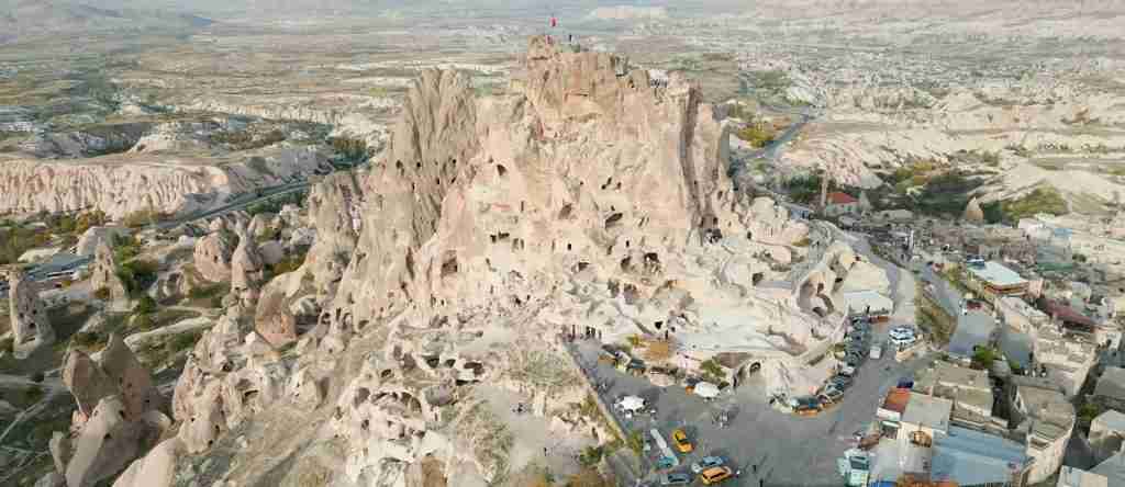
5 days
Cappadocia 5-Day Highlights Experience
- ✓ Comprehensive Cappadocia experience
- ✓ Expert local guides included
- ✓ All accommodation included
- ✓ Transportation provided
7 days
Cappadocia 7-Day Cultural Journey
- ✓ Comprehensive Cappadocia experience
- ✓ Expert local guides included
- ✓ All accommodation included
- ✓ Transportation provided
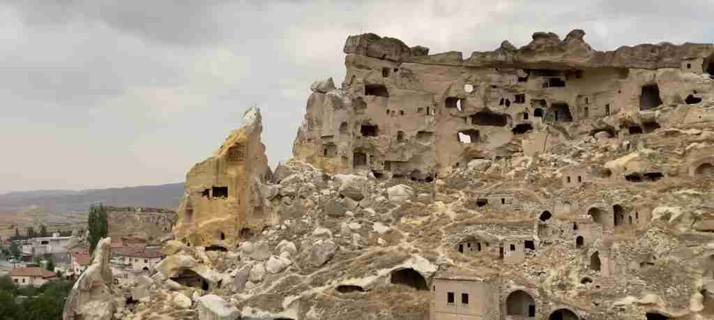
10 days
Cappadocia 10-Day Complete Adventure
- ✓ Comprehensive Cappadocia experience
- ✓ Expert local guides included
- ✓ All accommodation included
- ✓ Transportation provided
Multi-day tour packages powered by TourRadar. Prices and availability subject to change.
Introduction
Cappadocia’s underground cities represent humanity’s most extensive and sophisticated subterranean settlements, with 36 known underground cities scattered across the region though archaeological surveys suggest 200+ may exist beneath villages, agricultural fields, and rocky hillsides where modern inhabitants remain unaware of the massive carved chambers lying directly beneath their homes and businesses. The most famous and accessible sites, Derinkuyu and Kaymaklı, achieved UNESCO World Heritage recognition in 1985 as part of the Göreme National Park and Rock Sites of Cappadocia listing, acknowledging their exceptional universal value demonstrating “unique artistic achievement and creative genius” through architectural innovation, engineering sophistication, and historical significance spanning millennia of continuous occupation, expansion, and functional evolution from simple storage caves to complete underground municipalities.
Modern discovery occurred remarkably recently despite the sites’ antiquity and scale. Derinkuyu’s existence became known to the wider world only in 1963 when a local resident renovating his basement home knocked through a wall and discovered a mysterious chamber leading to passages descending into darkness, with subsequent investigation revealing the enormous multi-level city hidden beneath the unremarkable town. Kaymaklı followed in 1964 when similar basement discoveries during home renovations exposed underground chambers that upon exploration connected to vast tunnel networks honeycomb beneath the village. Both sites opened to tourism within two years of discovery (Kaymaklı 1964, Derinkuyu 1965), receiving minimal archaeological documentation before tourist infrastructure installation prioritized rapid income generation over comprehensive scientific study creating ongoing scholarly debates about exact construction chronology, original purposes of specific chambers, and full extent of unexplored deeper levels.
The geological conditions enabling underground city construction arose from volcanic activity 30 million years ago when Mount Erciyes, Mount Hasan, and other Anatolian volcanoes erupted repeatedly, blanketing central Turkey in thick layers of ash that compressed over millennia into soft volcanic tuff. This tuff’s unique properties – soft enough to excavate using bronze or iron hand tools yet structurally stable when carved into arches and pillars supporting massive overlying weight – made Cappadocia ideal for subterranean excavation as builders could carve rooms, passages, and elaborate infrastructure without requiring modern engineering calculations or support frameworks. The same geological advantages explaining Cappadocia’s surface fairy chimneys, cave churches, and rock-cut monasteries enabled underground cities on scales impossible in harder granites, limestones, or sandstones requiring mechanized drilling and extensive support beams for safe deep excavation.
Historical occupation spans over 3,000 years with construction beginning during Hittite civilization (2000-1200 BCE) creating foundational cave networks and storage chambers that subsequent cultures expanded and elaborated. Phrygians (8th-7th centuries BCE), Persians (6th-4th centuries BCE), Hellenistic Greeks (4th-1st centuries BCE), Romans (1st-4th centuries CE), and Byzantines (4th-11th centuries CE) all contributed to the underground cities’ development, though the most significant expansion occurred during the Byzantine Christian period when religious persecution drove believers underground creating the churches, schools, meeting halls, and residential quarters defining the cities’ current layouts. Arab raids during the 7th-10th centuries prompted further defensive enhancements including the iconic rolling stone doors, improved ventilation systems, and interconnecting tunnels between cities allowing evacuation if one site became compromised. The cities saw intermittent use through Ottoman and modern Republican periods, with local populations occasionally sheltering underground during conflicts as recently as World War I, before complete abandonment mid-20th century when population exchanges between Greece and Turkey removed the Christian communities maintaining underground knowledge and temporary usage traditions.
Visiting underground cities today requires understanding their dual nature as both archaeological sites preserving ancient architecture and tourism attractions balancing preservation against access. Only fractions of the total excavated spaces remain open to visitors – Derinkuyu’s 8 accessible levels represent less than half the 18 total known levels, while Kaymaklı’s 4 public levels similarly exclude deeper sections closed for safety, ongoing archaeological research, or excessive deterioration making stabilization impractical. The tourist routes installed through both cities follow artificial paths created by modern infrastructure including electric lighting, metal handrails, directional signage, and designated one-way circuits managing foot traffic flow, meaning the contemporary visitor experience diverges significantly from how ancient inhabitants navigated their cities using oil lamps, memorized layouts, and two-way passages now blocked or restricted for safety and crowd management purposes.
Derinkuyu Underground City Architecture and Features
Derinkuyu’s 85-meter vertical extent distributed across 18 levels makes it Cappadocia’s deepest excavated underground city, with the accessible 8 levels revealing complex organization where functional spaces distribute by depth based on usage patterns, security requirements, and environmental conditions. The upper levels (floors 1-3) concentrated communal activities and services requiring frequent surface access including stables where livestock descended through ramps into carved chambers with feeding troughs, tie rings, and waste channels draining to collection areas, communal kitchens with blackened ceilings from centuries of cooking fires showing smoke damage and soot accumulation, and food storage rooms maintaining cool stable temperatures preserving grain, dried fruits, and other provisions needed during extended underground stays.
The middle levels (floors 4-6) transitioned to residential and educational functions with sleeping chambers carved in standard patterns suggesting family units, missionary schools where Christian children received religious instruction away from Roman authorities’ view, and meeting halls where community decisions occurred during sieges requiring consensus on rationing, defensive strategies, and eventual emergence timing. These levels feature more elaborate architectural details including carved niches for oil lamps, ventilation shaft branches ensuring air circulation to residential areas, and decorative elements like false columns and arched doorways demonstrating aesthetic concerns beyond pure functionality. The deepest accessible levels (floors 7-8) housed the most sacred and secure spaces including the primary church with cross-shaped floor plan, carved altar, and baptismal font indicating early Christian ritual practice occurred underground when surface worship risked detection and persecution, plus defensive positions where defenders could observe and attack invaders attempting to penetrate the city’s depths through narrow chokepoint passages.
Rolling Stone Door Defense Mechanisms
Derinkuyu features dozens of circular stone doors measuring 1-1.5 meters diameter and weighing 200-500 kilograms each, carved from single andesite blocks harder than the surrounding tuff and designed to roll across passages sealing sections when attacks threatened. The doors’ engineering demonstrates sophisticated understanding of leverage and weight distribution – carved circular shapes allowed small groups (3-5 people) to roll massive weights using grooved tracks carved into passage floors, while central holes measuring 10-15 centimeters diameter served multiple defensive purposes including observing approaching invaders, thrusting spears through gaps to injure attackers attempting to move doors, and passing messages or supplies between sealed sections if defenders needed coordination during prolonged sieges.
Each stone door could only be operated from the interior side, preventing invaders from breaching the barriers even if they reached blocked passages, as exterior surfaces remained smooth without handholds or manipulation points while interior faces featured carved grip notches and lever slots allowing defenders to position, roll, and secure doors precisely. The strategic placement of doors throughout Derinkuyu created layered defense where invaders penetrating the first level’s doors faced second-level barriers, then third-level blocks, creating exhausting progression through increasingly narrow defended passages where defenders enjoyed overwhelming advantage through position, local knowledge, and prepared defensive measures including stored weapons and projectile stockpiles.
Ventilation Shaft Engineering Systems
Derinkuyu’s 52 ventilation shafts represent the underground city’s most critical infrastructure, ensuring fresh air circulation to the deepest 85-meter levels where natural airflow alone would create suffocating conditions without engineered systems moving oxygen down and carbon dioxide up through the volcanic rock separating underground chambers from surface atmosphere. The shafts measure 50-80 centimeters diameter, descending vertically through multiple levels with branches connecting to chambers at each floor creating distribution networks similar to modern HVAC duct systems, though operating purely through natural convection where temperature and density differences between deep stale air and surface fresh air drove continuous circulation without mechanical assistance.
The deepest shaft extends 55 meters serving dual function as both ventilation system and water well, with the shaft’s lower section penetrating the water table allowing residents to draw fresh water from depths while air circulated through the upper section’s open passage. This engineering integration solved two critical life support challenges through a single excavation demonstrating remarkable technical efficiency given the primitive tools available for precise vertical shaft cutting through volcanic rock. Modern visitors walking through Derinkuyu notice periodic grated openings in passage walls and ceilings revealing shaft sections, with cool air movement sometimes perceptible near major shaft junctions demonstrating the ventilation system’s continued passive functionality despite millennia since active occupation.
Kaymaklı Underground City Layout and Characteristics
Kaymaklı’s architectural philosophy emphasizes horizontal distribution over vertical concentration, creating an underground city that spreads approximately 40 meters deep across 8 total levels with 4 publicly accessible, compensating for lesser depth through extensive lateral chamber networks extending under much of the modern village. The upper accessible level (floor 1) functioned primarily as stable areas similar to Derinkuyu, with animal holding chambers positioned for easy surface access allowing livestock to descend daily for shelter while grazing above ground during peaceful periods, creating flexible usage matching pastoral agricultural patterns of ancient Cappadocia where herding and farming sustained local economies.
The second level introduces residential spaces with more spacious chambers than Derinkuyu’s compressed vertical stacking, featuring carved sleeping platforms, storage niches, and communal areas suggesting extended family units occupying dedicated chamber complexes. A church on the second level includes two apses (semicircular altar areas) carved into rock walls with nave (central worship space) accommodating congregation gathering, demonstrating Christian religious practice integrated into daily underground life rather than isolated in deepest defensive levels as Derinkuyu’s layout suggests. The third and fourth accessible levels continue residential patterns with wine cellars showing fermentation vats carved into floors, oil press chambers where olive or seed pressing occurred, and additional storage rooms maintaining food preservation through cool stable underground temperatures averaging 13-15°C year-round regardless of surface heat or cold.
Tunnel Width and Navigation Advantages
Kaymaklı’s passages average 1.2-1.5 meters width compared to Derinkuyu’s 0.8-1.2 meter average, creating noticeably more spacious movement corridors reducing claustrophobic sensations and allowing easier two-way traffic when visitor flows reverse against designated one-way routes during off-peak periods. The wider tunnels reflect architectural choices prioritizing comfortable circulation over maximum defensive constriction, suggesting Kaymaklı’s builders valued daily livability during extended underground stays over creating most defensible chokepoints, though rolling stone doors still appear at strategic positions demonstrating security remained important if secondary to residential comfort.
Ceiling heights in Kaymaklı similarly exceed Derinkuyu’s minimums, averaging 1.8-2.0 meters in main passages versus 1.5-1.8 meters, allowing most visitors to walk upright without continuous stooping creating neck strain and back fatigue common in Derinkuyu’s lower passages. The sloped connections between levels follow gentler gradients (typically 15-25 degree inclines) versus Derinkuyu’s steeper stairs (30-45 degree angles), making Kaymaklı more accessible for elderly visitors, those with knee problems, or families with young children who struggle with steep sustained stair climbing in dark conditions. These comfort advantages explain why claustrophobia-prone visitors consistently report better Kaymaklı experiences despite the underground city’s equivalent conceptual challenge of being 40 meters underground surrounded by volcanic rock.
Superior Lighting and Photographic Conditions
Kaymaklı received more extensive modern lighting installation than Derinkuyu, with electric lights positioned more densely through passages creating better overall illumination making architectural details, carved inscriptions, and spatial layouts more visible without requiring flashlights or phone lights supplementing official lighting. The improved visibility benefits photography as chambers receive sufficient ambient light for reasonable exposures without flash, though the soft tuff’s tan-brown coloration still creates challenges for compelling images as the monochromatic stone lacks the visual drama of more colorful geological formations.
The lighting enhancement partially compensates for Kaymaklı’s less monumental scale – where Derinkuyu’s sheer depth creates architectural drama through vertical descent into darkness, Kaymaklı substitutes detailed observation of daily life features including cooking hearths with blackened stone, wine fermentation equipment showing ancient production methods, and residential chamber arrangements revealing how families organized living spaces underground. The better illumination allows appreciating these smaller-scale details that disappear in Derinkuyu’s dimmer passages where visitors focus on navigating steep stairs and avoiding head bumps on low ceilings rather than examining architectural refinements.
Construction Techniques and Archaeological Timeline
Underground city excavation proceeded using simple bronze (earliest periods) or iron (later construction) hand tools including picks for breaking tuff, chisels for detail carving, and baskets for removing debris through passages to surface disposal areas. The soft volcanic tuff allowed relatively rapid excavation as workers could carve meter-deep chambers in days rather than weeks required for harder stone, though the cumulative volume removed from Derinkuyu (estimated 750,000+ cubic meters) and Kaymaklı (estimated 400,000+ cubic meters) represents decades or centuries of sustained labor by communities working incrementally across generations.
Archaeological evidence including pottery fragments, tool marks, and construction sequencing suggests multiple distinct building phases rather than single comprehensive excavation campaigns. Hittite-era sections (2000-1200 BCE) show cruder carving techniques with irregular chamber shapes and primitive ventilation, while Byzantine additions (4th-11th centuries CE) demonstrate refined methods creating uniform passage widths, precisely carved decorative elements, and sophisticated ventilation integration. This chronological layering creates archaeological puzzles where earlier sections extend beneath later construction, with some passages appearing to connect structures from different eras suggesting builders discovered and incorporated ancient excavations when expanding underground cities during subsequent historical periods.
Structural Engineering and Collapse Prevention
Preventing collapse in multi-level underground excavations requires understanding stress distribution through volcanic tuff overlying carved chambers, with builders empirically developing safe pillar spacing, ceiling arch curves, and chamber dimension ratios without modern engineering calculations yet achieving millennia of structural stability. The pillar systems appearing throughout both cities show consistent 3-4 meter spacing creating regular grid patterns supporting overburden weight, with thicker pillars at deeper levels bearing greater compressive loads from increased rock mass above. Arched ceilings distribute weight laterally into pillar supports rather than concentrating stress on ceiling centers, preventing the sagging and cracking that would occur in flat ceilings under equivalent loads.
Chamber dimensions follow general patterns suggesting rules of thumb developed through trial, error, and occasional collapse – rooms exceeding 6-8 meters width appear rarely, presumably because tuff’s structural properties create ceiling failure risk beyond this span without intermediate support pillars. The few large chambers appearing in both cities (churches, meeting halls) feature careful arch construction and multiple support columns demonstrating builders recognized exceptional structural requirements for wide-span spaces. Modern engineering analysis confirms the ancient builders’ empirical methods produced genuinely stable structures, with collapse events occurring primarily in areas where water infiltration weakened tuff over centuries or where modern tourist traffic concentrated wear on passage floors and staircase edges creating dangerous deterioration requiring repair or closure.
Daily Underground Life and Historical Usage
Life underground during siege periods followed organized patterns balancing survival necessities against psychological and physical challenges of extended darkness, confinement, and separation from normal surface routines. The population divisions between chambers suggest family units maintained some privacy through dedicated residential spaces rather than communal dormitory arrangements, with evidence of personal belongings, cooking facilities, and sanitation provisions indicating people brought essential household items when descending from surface homes to underground refuge.
Daily rhythms underground adapted to the timeless dark environment where natural day-night cycles disappeared, though communities probably maintained artificial schedules matching surface patterns to preserve normalcy for children and maintain social order during stress of siege conditions. The communal kitchens’ blackened ceilings and hearth arrangements suggest regular cooking occurred underground rather than relying entirely on preserved food, with ventilation shafts carrying smoke to surface dispersal points less visible than individual home chimneys that would reveal occupied underground positions to besieging forces. Water access through well shafts penetrating the water table ensured drinking supplies, though bathing and laundry likely occurred minimally during siege periods creating hygiene challenges in confined spaces housing thousands of people.
Religious Practice and Community Cohesion
The churches carved into both underground cities’ deeper levels indicate religious practice formed central community cohesion mechanism during siege stress, providing familiar ritual comfort, moral authority for maintaining social order, and spiritual meaning for suffering endured during attacks. Byzantine Christian communities fleeing persecution found particular significance in underground worship as early church traditions emphasized catacombs and hidden gathering places where believers practiced forbidden faith away from Roman authorities, creating cultural continuity between early Roman persecution and later Arab invasion threats requiring similar underground refuge.
The missionary schools appearing on middle levels of Derinkuyu suggest communities prioritized children’s religious education even during siege conditions, maintaining cultural transmission of Christian doctrine, liturgy, and texts despite physical constraints of underground life. These educational spaces feature stone benches arranged in rows facing teaching positions and storage niches presumably holding manuscripts or teaching materials, demonstrating systematic instruction rather than informal family-based religious transmission. The commitment to continuing education underground reveals communities expected potentially extended siege durations requiring multi-week or month-long underground stays where children’s development couldn’t simply pause until surface normalcy returned.
Derinkuyu and Kaymaklı Comparative Analysis
Derinkuyu surpasses Kaymaklı in vertical extent, total excavated volume, population capacity (20,000 versus 3,000-5,000), and architectural monumentality creating strong impressions through sheer scale and depth. The eight accessible levels create genuine sense of descent into earth’s depths as visitors navigate steep passages, squeeze through narrow sections, and emerge multiple floors below surface entry experiencing the psychological weight of massive overburden separating them from daylight and open air. Derinkuyu’s inclusion on popular Green Tour itineraries ensures consistent visitor traffic, guide availability, and tourism infrastructure, though this popularity creates midday crowding reducing contemplative atmosphere as multiple tour groups converge simultaneously filling passages with competing guide narratives echoing through stone chambers.
Kaymaklı compensates for lesser scale through superior visitor comfort via wider passages, gentler slopes, better lighting, and more distributed horizontal layout creating less intense claustrophobia triggers. The four accessible levels provide sufficient underground city experience for most visitors without requiring extreme vertical descent, making Kaymaklı appropriate for elderly travelers, families with children, or anyone with mild claustrophobia concerns preferring manageable underground exposure over Derinkuyu’s more demanding eight-level descent. Kaymaklı’s exclusion from major group tour routes results in quieter visits with fewer crowds, allowing more relaxed exploration at personal pace without rush from tour schedules or congestion from competing visitor groups, though independent guides may be less readily available than at Derinkuyu where multiple guides await tour employment at the entrance.
Architectural Philosophy Differences
Derinkuyu prioritizes defensive depth through vertical concentration, creating a city where invaders faced exhausting progression through descending levels with defenders holding overwhelming advantage through position and local knowledge. The narrow passages, steep stairs, and chokepoint defense positions reflect military engineering emphasizing security over comfort, with rolling stone doors appearing frequently to seal sections during retreat to deeper defensive layers. This vertical strategy allowed relatively small defender numbers to control access through superior tactical positions, as invaders attacking upward through narrow stairs faced defenders above throwing rocks, pouring hot liquids, or thrusting spears downward while protected by stone door barriers.
Kaymaklı emphasizes livable distribution through horizontal spread, suggesting its builders expected longer occupation durations requiring comfortable residential spaces over maximum defensive constriction. The wider passages facilitating two-way traffic, spacious chamber layouts supporting extended family living, and gentler connections between levels reducing daily climbing fatigue all indicate a community designed for sustained underground life rather than purely emergency refuge. This doesn’t mean Kaymaklı lacked defenses – rolling stone doors and secure storage areas appear throughout the city – but the architectural priorities balanced security against daily livability differently than Derinkuyu’s more militaristic defensive focus.
Planning Underground City Visits
Both underground cities charge €13 entrance fees (approximately 600 Turkish Lira at current exchange rates) with identical opening hours typically 8:00 AM – 5:00 PM though seasonal variations extend summer closings to 6:00-7:00 PM while winter shortens hours matching reduced daylight. The Museum Pass Turkey (€65 for 15 days) covers both underground cities plus Göreme Open Air Museum, Zelve, Ihlara Valley, and other Cappadocia attractions, providing value for visitors planning comprehensive regional exploration beyond single underground city visits. Individual entrance fees at ticket windows accept Turkish Lira cash or credit cards, though bringing cash remains advisable as occasional card reader malfunctions create delays while technical issues resolve.
Visit duration averages 1-1.5 hours per underground city including entrance procedures, actual underground exploration, photo stops, and emergence time, though enthusiasts spending extra time examining architectural details or reading all informational plaques may extend to 2 hours. The one-way route systems installed through both cities for crowd management mean committed visitors cannot abort mid-tour without awkwardly reversing against incoming traffic – careful self-assessment of claustrophobia tolerance, physical stamina for sustained stair climbing, and genuine interest in underground archaeology versus tourist obligation checking boxes proves essential before purchasing non-refundable tickets and descending into confined dark passages.
Guided Tours Versus Independent Visits
Organized tours including underground cities as itinerary components provide transportation convenience, guide commentary explaining historical context and architectural features, skip-the-line benefits avoiding ticket queue waits, and fixed scheduling preventing indecision about timing and duration. The Cappadocia Green Tour includes Derinkuyu along with Ihlara Valley, Selime Monastery, and Pigeon Valley as comprehensive southern Cappadocia exploration costing €44-85 per person with lunch, entrance fees, and hotel pickup included, making organized tours cost-competitive against independent visits when accounting for entrance fees, transportation costs, and meal expenses totaling similar amounts without group tour discounts.
Independent visits allow flexible timing avoiding tour group midday peaks when both underground cities experience maximum crowding (11:00 AM – 2:00 PM), personal exploration pace without rushed group schedules moving to next stops, ability to visit both Derinkuyu and Kaymaklı in single day creating direct comparison impossible on tours visiting only one site, and freedom to spend extra time in fascinating sections while quickly passing less interesting areas matching individual priorities rather than guide’s fixed narrative covering all chambers equally. The trade-off involves reduced historical context without guide explanation, though the informational plaques appearing throughout both cities provide basic architectural identification and historical framing sufficient for general understanding if not matching professional guide expertise.
Seasonal Timing and Crowd Avoidance Strategies
Summer months (June-August) bring peak tourism creating maximum crowding in underground cities’ narrow passages where groups of 15-20 tourists plus guides attempt simultaneous navigation through corridors accommodating 2-3 people comfortably, creating bottlenecks, wait times for photo opportunities at rolling stone doors, and diminished contemplative experience as multiple competing guide narratives echo through chambers. The underground temperature advantage during summer surface heat (30-38°C/86-100°F above ground versus constant 13-15°C/55-59°F underground) makes underground cities attractive midday escapes from scorching sunshine, though this same logic drives tour operators to schedule underground visits during hottest hours creating the crowding paradox where underground refuge becomes suffocatingly packed with escaping tourists.
Winter visits (November-March) offer near-solitude as tourism drops dramatically reducing crowds to occasional small groups or individual visitors wandering empty passages experiencing underground cities’ scale and atmosphere without distraction of jostling tour groups, though the temperature reversal occurs where underground cities’ warmth relative to freezing surface conditions (below 5°C/41°F typical winter days versus stable 13-15°C/55-59°F underground) creates different comfort appeal. Early morning visits year-round (arriving at 8:00-9:00 AM opening) provide best crowd avoidance as tour groups typically arrive late morning after breakfast pickup routines, while late afternoon visits (4:00-5:00 PM) similarly avoid midday peaks though risk closing time pressures if exploration extends beyond official hours.
Safety Considerations and Physical Requirements
Underground city visits demand moderate physical capability including sustained stair climbing navigating between levels with stairs featuring 25-35 centimeter treads and 15-20 centimeter rises creating steeper angles than modern building codes allow, continuous stooping through low passages where ceiling heights drop to 1.5-1.6 meters challenging tall visitors who must bend or crouch for extended walking creating neck and back fatigue, and sure-footed balance on uneven carved floors worn smooth and slippery from millennia of foot traffic plus modern tourist wear creating genuine fall risks especially on descending stairs.
Cardiac fitness requirements shouldn’t be underestimated as the multi-level descents and ascents combined with reduced oxygen concentrations in underground environments create cardiovascular demands similar to hiking moderate mountain trails, with visitors experiencing breathlessness, elevated heart rates, and fatigue particularly during the exit ascents returning to surface levels. People with serious heart conditions, respiratory problems including asthma or COPD, or mobility limitations including knee problems, hip replacements, or balance disorders should honestly assess whether underground city exploration suits their capabilities, as medical emergencies occurring deep underground face significant response delays evacuating patients through narrow passages and steep stairs impossible for stretchers requiring rescue personnel to carry or assist injured visitors to surface manually.
Claustrophobia Self-Assessment Guidelines
Genuine claustrophobia manifests as anxiety, rapid heartbeat, sweating, difficulty breathing, and panic feelings when in confined spaces, differing from general dislike of tight areas that creates mild discomfort without physiological panic response. Individuals with diagnosed claustrophobia or who experience panic in elevators, MRI machines, caves, or windowless interior rooms should carefully consider whether underground cities match their comfort threshold, as the combination of confined passages, 40-85 meter depths, lack of natural light, knowledge of massive rock weight overhead, and one-way routes preventing quick exit creates intense claustrophobic triggers potentially overwhelming coping strategies successful in less extreme environments.
Self-assessment tests before committing to underground city visits include evaluating comfort in similar environments like basement parking garages (confined but not as deep), hiking through slot canyons (narrow but outdoor), or interior shopping mall corridors during crowding (people density but not underground depth), with honest acknowledgment of anxiety responses in these lesser situations predicting likely reactions to more intense underground city conditions. Starting with Kaymaklı’s easier four-level exploration proves wiser than immediately attempting Derinkuyu’s eight-level deep descent, as successfully completing the less demanding experience builds confidence while discovering comfort limits in Kaymaklı prevents wasted entrance fees and distressing experiences in Derinkuyu’s more challenging environment.
Frequently Asked Questions About Underground Cities
How were the underground cities discovered if they were hidden for so long?
Derinkuyu’s discovery in 1963 occurred when a local resident renovating his basement home knocked through a cave wall and found a mysterious chamber leading to dark passages descending into unknown depths, with the homeowner reporting the find to authorities who conducted initial exploration revealing the enormous multi-level city extending beneath the entire town. Kaymaklı followed similar pattern in 1964 when basement renovation work exposed underground chambers that upon investigation connected to vast tunnel networks honeycomb beneath the village, demonstrating both sites remained partially known to local residents using upper-level chambers for storage but without awareness of the full extent and complexity of deeper levels abandoned and forgotten over centuries. The population exchange between Greece and Turkey in 1923 removed the Christian communities maintaining oral traditions about underground cities’ existence and historical usage, creating knowledge gap where Muslim Turkish families settling in vacated Christian homes lacked cultural memory of the underground networks’ purposes, extents, or historical significance beyond recognizing some basement chambers suitable for cool storage. Prior to 1960s rediscovery, occasional reports of villagers finding underground passages or chambers appeared in local records but received no systematic archaeological investigation until the dramatic basement discoveries prompted official exploration, mapping, and eventual tourism development opening both sites to visitors within 1-2 years of initial discovery without comprehensive archaeological documentation that would occur today before tourist infrastructure installation.
Were people born and raised entirely underground or was it only temporary refuge?
Archaeological and historical evidence conclusively demonstrates underground cities served as temporary emergency refuges during invasion, persecution, or conflict periods rather than permanent subterranean residences where populations lived continuously without surface contact. The chamber designs, ventilation systems, and provision storage suggest short-term occupation measured in weeks or months during active threats with return to normal surface village life occurring when dangers passed, creating cyclical patterns of descent during crisis and emergence during peace that characterized Cappadocia’s tumultuous history over three millennia. Surface villages and cave houses carved into cliff faces served as primary residences where families maintained agricultural activities, social interactions, and daily routines necessary for functional community life, with underground cities representing backup infrastructure activated only when lookout warnings of approaching armies or religious persecutors necessitated rapid population evacuation from exposed surface settlements to concealed underground positions. Extended siege situations sometimes forced multi-month underground stays as Byzantine Christians hiding from Arab raiders waited for invading armies to move on after exhausting local plunder opportunities, though even these prolonged occupations ended with return to surface normalcy rather than permanent underground living. The psychological and physical challenges of sustained darkness, confined spaces, limited fresh air despite ventilation systems, and separation from agricultural work made long-term underground life unsustainable economically and socially, with communities developing sophisticated surface-underground integration where normal life occurred above ground while refuge capability remained ready below ground representing insurance against unpredictable threats rather than chosen lifestyle preference.
Can you get lost in the underground cities?
Modern visitors following designated tourist routes with directional signage, handrails, and electric lighting through one-way circuits face minimal getting-lost risk as the managed pathways prevent wrong turns and guide flows toward exits automatically, though the maze-like passages extending beyond tourist zones into closed sections create theoretical lost possibilities if visitors ignore barriers and explore unauthorized areas. Ancient residents navigating underground cities without modern lighting used memorized mental maps developed through daily familiarity, likely supplemented by carved symbols, colored markings, or other navigation aids helping residents find specific chambers in darkness using oil lamps providing minimal illumination, with the confined nature of underground passages actually reducing getting-lost risk versus surface urban environments as limited passages options create simpler navigation versus multiple street intersections and building choices in cities where getting lost occurs easily. The interconnection tunnel allegedly linking Derinkuyu and Kaymaklı across 9 kilometers would represent genuine navigation challenge if accessible, as the kilometer-long dark passage without distinctive landmarks could disorient travelers losing track of distance traveled or direction changes during the subterranean journey, though this tunnel remains closed to visitors with only its entry points visible in both cities creating tantalizing mystery about the alleged underground highway connecting major settlements. Modern smartphone compass apps and GPS (which function underground using motion sensors even without satellite signals) provide emergency navigation tools if visitors somehow separated from tourist routes, though the practical reality of installed lighting, regular guard patrols, and one-way systems makes getting genuinely lost in underground cities opened for tourism essentially impossible barring deliberate exploration of restricted areas violating posted boundaries and common safety sense.
Why did people stop using the underground cities?
Underground city abandonment occurred gradually rather than through single decisive event, with usage declining as historical threats diminished following Ottoman Empire’s consolidation of Anatolia creating more stable governance, reduced invasion frequency, and protection for Christian minorities under millet system allowing religious communities autonomy. The final extensive underground refuge usage likely occurred during Greco-Turkish conflicts culminating in the 1923 population exchange when Christian Orthodox populations departed Cappadocia for Greece while Muslim populations from Greece resettled in vacated Anatolian villages, with the departing Christians taking underground cities’ cultural memory, usage traditions, and practical knowledge of passage navigation creating information gap among replacement Muslim populations who lacked historical connection to the sites. Modern 20th century life rendered underground refuge obsolete as mechanized warfare, aerial bombardment, and administrative control structures made hiding entire village populations underground ineffective against contemporary military threats unlike ancient sword-and-spear armies that could be evaded through concealment. The upper-level chambers saw continued usage for storage, wine cellars, and livestock shelter into the 1950s according to local oral histories, with gradual cessation occurring as modern construction, refrigeration, and agricultural methods eliminated practical needs for underground storage spaces previously maintaining cool temperatures essential for food preservation. The rediscovery and subsequent tourism development beginning mid-1960s transformed underground cities from abandoned curiosities to major archaeological sites and income-generating tourist attractions, creating new purpose as cultural heritage showcasing ancient ingenuity and survival adaptation rather than functioning defensive refuges serving original protective purposes for which communities carved the elaborate multi-level complexes over millennia of continuous expansion and refinement.
Are there other underground cities beyond Derinkuyu and Kaymaklı?
Approximately 36 underground cities have been identified across Cappadocia region with several open to tourism beyond the famous Derinkuyu and Kaymaklı, including Özkonak Underground City (10 levels, closer to Avanos than other sites, features communication holes between levels unique among Cappadocia underground settlements), Mazi Underground City (smaller than major sites but well-preserved with elaborate defensive systems), and Gaziemir Underground City (positioned near Güzelyurt offering alternative to crowded major sites). Archaeological surveys suggest 200+ potential underground cities exist beneath Cappadocia’s villages, agricultural fields, and hillsides based on geological analysis, surface indications like ventilation shaft openings, and occasional accidental discoveries during construction, though most remain unexcavated lacking funding, academic interest, or practical access through current property ownership preventing systematic exploration. The identified 36 sites vary dramatically in size, preservation state, and accessibility, with many requiring permission to visit as they remain on private property, lack tourist infrastructure including lighting and safety features, or suffer structural deterioration making entry dangerous without archaeological expertise and proper equipment. Some villages maintain local knowledge of underground chambers beneath homes used for storage or livestock shelter without recognizing connections to larger city networks, while other sites remain completely unknown awaiting future accidental discovery similar to the Derinkuyu homeowner’s 1963 basement renovation breakthrough that revealed the region’s most impressive underground city. The total extent of Cappadocia’s underground architecture likely exceeds current knowledge significantly, with interconnection tunnels linking supposedly separate cities, deeper levels below excavated floors in known sites, and entirely undiscovered complexes creating ongoing archaeological mysteries that future investigation may eventually resolve through systematic survey, ground-penetrating radar, or continued accidental discoveries during modern development.
Did the underground cities have any natural lighting or was it completely dark?
Ancient underground cities operated in near-complete darkness illuminated only by oil lamps, torches, or other primitive flame-based lighting providing minimal flickering illumination vastly inferior to modern electric lighting installations serving contemporary tourists. No natural lighting penetrated below the first underground level as ventilation shafts measuring 50-80 centimeters diameter brought air circulation but insufficient light for illumination, while the shafts’ vertical extent prevented direct sunlight from reaching depths where refraction through narrow passages would dissipate any weak surface light before illuminating living spaces. Archaeological evidence including soot deposits on chamber ceilings, carved lamp niches in wall surfaces, and oil residue in storage areas confirms flame-based lighting supplied whatever illumination residents required during underground occupation periods, though the lamp technology’s limitations meant most activities occurred in dim shadowy conditions with only critical tasks like cooking, religious services, or defensive preparations receiving concentrated lighting from multiple lamps while general movement through passages relied on minimal carried lighting or memorized navigation in near-darkness. The constant darkness during extended underground stays created profound psychological and physiological impacts including disrupted circadian rhythms without natural day-night cycles, vitamin D deficiency from absence of sunlight exposure, and the psychological toll of confinement in perpetual darkness that ancient texts describe as spiritually oppressive despite the physical safety underground refuge provided. Modern visitors touring underground cities with installed electric lighting creating near-daylight illumination throughout passages cannot fully appreciate the darkness ancient residents endured, though occasionally experiencing lighting failures or entering closed sections without illumination provides visceral understanding of the profound blackness enveloping ancient inhabitants navigating their underground world by flickering oil lamps casting dancing shadows across carved walls creating eerie atmosphere mixing safety refuge with darkness imprisonment during weeks or months of underground survival.
What did people do with human waste and garbage in underground cities?
Sanitation systems in underground cities featured designated latrine chambers positioned near ventilation shafts allowing waste gases to vent toward surface while gravity drainage channels carved into floors directed liquids toward collection areas or deeper chambers functioning as primitive septic systems where waste accumulated until eventual surface removal during emergence periods or intermediate cleaning when siege situations allowed temporary surface access for maintenance. The ventilation shafts serving dual sanitation purposes explain their strategic importance beyond simple air circulation, as functional waste removal prevented disease outbreak risks that would devastate crowded underground populations lacking modern sewage treatment, antibiotics, or medical intervention for dysentery and other sanitation-related illnesses. Solid waste including food scraps, broken pottery, and other garbage likely accumulated in designated chambers for later surface disposal rather than being carried through living areas creating hygiene hazards, though archaeological excavations finding limited organic debris suggest most waste removal occurred before final abandonment leaving primarily durable artifacts like pottery fragments, metal tools, and architectural features for modern investigators to study. The challenges of maintaining sanitation during extended underground occupation periods with thousands of residents, limited water for cleaning, and confined spaces where waste smells couldn’t dissipate into open air created genuine public health risks requiring strict community discipline around designated latrine usage, waste disposal protocols, and hygiene practices preventing disease outbreak that could kill more residents than the external enemies forcing underground refuge. Modern sewage engineering recognizes ancient underground cities’ solutions as remarkably functional given available technology, with gravity drainage, ventilation integration, and designated waste areas representing sound public health practices comparable to contemporary solutions albeit executed through carved rock infrastructure rather than manufactured pipes, treatment facilities, and mechanical systems characterizing modern sanitation engineering.
How accurate are the population capacity estimates like 20,000 for Derinkuyu?
Population capacity estimates derive from chamber volume calculations, sleeping space area measurements, and historical comparisons with other refugee settlements producing educated projections rather than documented historical records of actual occupation levels during siege periods. The 20,000 Derinkuyu capacity figure assumes crowded conditions where individuals occupied approximately 2-3 square meters personal space including sleeping areas, circulation passages, and proportional shares of communal spaces like kitchens and churches, matching refugee camp densities observed in modern displacement crises where temporary crowding accommodates larger populations than comfortable living standards would allow. Archaeological evidence provides limited direct documentation of maximum occupation as ancient cities lacked census records, population registers, or other written documentation surviving millennia of abandonment, forcing researchers to extrapolate from physical evidence including chamber dimensions, sleeping platform numbers, cooking facility capacities suggesting meal preparation for specific population ranges, and storage room volumes indicating provision quantities needed to sustain populations of particular sizes during typical siege durations. The estimates represent maximum emergency capacity rather than comfortable sustainable occupancy, with actual populations during typical refuge periods potentially numbering considerably less than theoretical maximums as communities evacuated underground when threats appeared serious but often emerged before reaching capacity limits if invasion forces bypassed their region or threats dissipated through diplomatic resolution. Comparison with Kaymaklı’s 3,000-5,000 capacity estimate shows proportional relationship to excavated volume and chamber numbers suggesting researchers apply consistent methodology across different sites, lending credibility to relative comparisons even if absolute numbers remain somewhat speculative given absent historical records and unknowable variables like how tightly populations actually packed during genuine emergencies versus theoretical maximum crowding calculations.
Were underground cities used during World War I or more recent conflicts?
Oral histories from elderly Cappadocia residents and fragmentary historical records suggest limited underground city usage occurred during World War I (1914-1918) when Anatolian populations faced Ottoman military conscription, requisition of agricultural resources, and regional instability as the empire collapsed, though documentation remains scarce making specific usage details uncertain beyond general knowledge that populations familiar with underground cities’ existence utilized available refuge infrastructure during periods of crisis and uncertainty. The Greco-Turkish War (1919-1922) and subsequent population exchange (1923) likely marked the final significant underground refuge usage as Christian Orthodox populations hiding from advancing Turkish forces or awaiting forced departure to Greece potentially sheltered underground during the chaotic transition period, with departing Christians taking whatever underground city knowledge their families maintained across generations. The physical evidence supporting recent usage includes relatively modern artifacts like early 20th-century pottery, metal tools, and fabric fragments found in upper-level chambers during initial 1960s excavations, though distinguishing temporary refuge use from routine storage utilization proves difficult as communities commonly used accessible upper levels for wine cellars, root vegetable storage, and livestock shelter into the 1950s creating ambiguity about whether modern artifacts represent emergency refuge or mundane storage activities. Turkish Republican period (1923-present) saw rapid modernization, improved governance stability, and elimination of the invasion threats and religious persecution driving underground refuge necessity, with the last generation maintaining practical underground city knowledge passing away by mid-20th century creating information gap where even local residents remained largely unaware of the extensive multi-level complexes beneath their villages until accidental rediscovery during 1960s basement renovations exposed forgotten passages prompting official archaeological investigation and eventual tourism development.
How do underground cities compare to other ancient underground structures worldwide?
Cappadocia’s underground cities represent the world’s most extensive and sophisticated ancient subterranean settlements, surpassing other underground architectural achievements in scale, depth, population capacity, and infrastructure complexity through unique combination of favorable volcanic tuff geology allowing large-scale excavation, sustained historical threats driving millennia-long underground development, and cultural continuity maintaining usage traditions across multiple civilizations expanding earlier excavations. Comparative sites include Roman catacombs beneath cities like Rome and Paris serving primarily as burial chambers with limited living space versus Cappadocia’s functioning underground municipalities housing thousands of living residents, the Cu Chi tunnels of Vietnam created during modern warfare providing military hiding spaces but lacking the churches, schools, and domestic infrastructure characterizing Cappadocia’s residential design, and various monastery cave systems like those at Vardzia (Georgia) or Petra (Jordan) featuring impressive rock-cut architecture but without Cappadocia’s multi-level vertical depth and comprehensive defensive integration. The underground cities of Matmata (Tunisia) where Berber populations carved subterranean homes remain occupied today creating living cultural connection versus Cappadocia’s abandoned archaeological sites, though Matmata’s structures emphasize individual family compounds rather than the interconnected city-scale planning distinguishing Derinkuyu and Kaymaklı. China’s Yaodong cave dwellings carved into loess plateaus house millions of residents in cliff-face horizontal excavations comparable to Cappadocia’s surface cave homes but lacking equivalent vertical underground city development descending multiple levels below surface, while Scotland’s Dunmore Park underground cave system and Turkey’s other underground settlements including those at Gaziantep demonstrate regional variations on underground architecture without matching Cappadocia’s UNESCO-recognized exceptional universal value combining geological uniqueness, architectural sophistication, historical significance, and preservation state creating world heritage designation recognizing underground cities as irreplaceable cultural treasures representing pinnacle achievement of ancient subterranean engineering and urban planning.