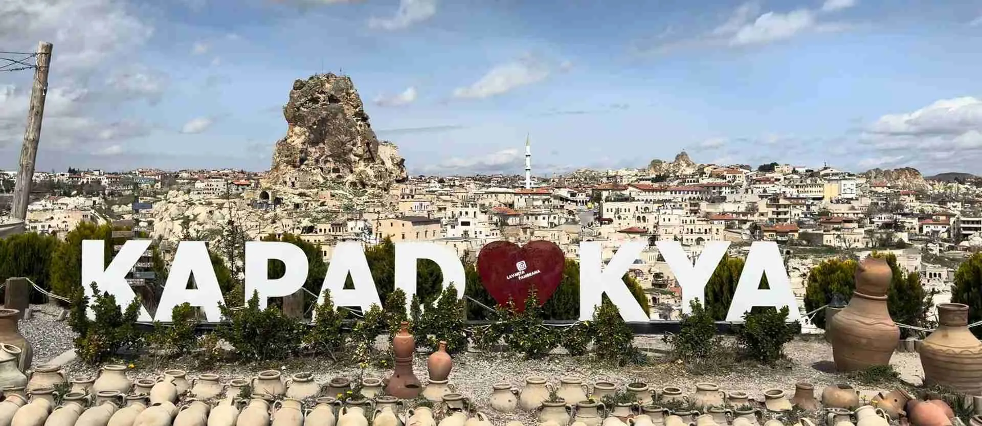
Göreme National Park UNESCO Guide: Byzantine Heritage & Fairy Chimneys
Göreme National Park and the Rock Sites of Cappadocia stands among UNESCO’s most remarkable World Heritage Sites, where millions of years of volcanic geology intersect with Byzantine Christian civilization to create one of Earth’s most extraordinary cultural landscapes. Inscribed in 1985 under both natural and cultural criteria, this central Anatolian wonderland encompasses 9,884 hectares of fairy chimney formations, rock-hewn monastic complexes containing post-Iconoclastic Byzantine frescoes, troglodyte villages carved into volcanic tuff, and multi-level underground cities that sheltered thousands during periods of invasion, representing an unparalleled fusion of natural phenomenon and human architectural ingenuity spanning nearly 4,000 years.
Key Takeaways
- UNESCO designated Göreme National Park and the Rock Sites of Cappadocia as World Heritage Site in 1985 under Natural criterion (vii) and Cultural criteria (i), (iii), and (v), recognizing exceptional geological formations and irreplaceable Byzantine artistic heritage
- Volcanic eruptions 10-14 million years ago deposited thick ash layers that solidified into soft volcanic tuff, later capped with harder basalt lava, creating conditions for erosion to sculpt thousands of distinctive fairy chimney hoodoos rising up to 40 meters
- Byzantine monastic communities carved 30+ rock-hewn churches and chapels into Göreme valley between 10th-13th centuries, creating unique examples of post-Iconoclastic sacred art with brilliantly preserved frescoes depicting biblical narratives in vivid blues, reds, and earth tones
- Underground cities including Derinkuyu and Kaymaklı descend 60-85 meters through multiple levels containing living quarters, chapels, storage chambers, wineries, and sophisticated ventilation systems, accommodating up to 20,000 people during invasions
- Rock-cut architecture demonstrates remarkable human adaptation to geological conditions, with soft tuff enabling excavation using simple tools while maintaining structural stability for centuries in dry climate conditions
- The site faces ongoing conservation challenges from natural erosion accelerated by tourism pressure, requiring balanced management protecting cultural values while accommodating millions of annual visitors drawn to this geological and historical marvel
People Also Ask About Göreme National Park UNESCO Heritage
Why is Göreme National Park a UNESCO World Heritage Site?
Göreme National Park achieved UNESCO World Heritage designation in 1985 based on both exceptional natural phenomena and outstanding cultural significance. The site meets Natural criterion (vii) for containing superlative natural phenomena in its spectacular fairy chimney landscape entirely sculpted by erosion from volcanic tuff, creating one of Earth’s most striking geological formations. It satisfies Cultural criterion (i) as the rock-hewn sanctuaries constitute unique artistic achievement offering irreplaceable testimony to post-Iconoclastic Byzantine art, with fresco quality and density unmatched elsewhere. The site meets Cultural criterion (iii) by preserving fossilized images of Byzantine Empire provincial life between 4th century and Seljuk Turkish arrival through rupestral dwellings, villages, convents, and churches. Finally, it fulfills Cultural criterion (v) as traditional human habitat carved into geological formations represents outstanding example of human interaction with dramatic natural environment, though increasingly vulnerable to irreversible change from erosion and development pressures.
How were the fairy chimneys in Göreme formed?
Fairy chimneys formed through geological processes beginning 10-14 million years ago when massive volcanic eruptions from Mount Erciyes, Mount Hasan, and Güllüdağ blanketed central Anatolia with thick layers of volcanic ash that solidified into soft, porous tuff rock. Subsequent lava flows covered the tuff with harder basalt creating protective caps. Over millions of years, wind and water erosion gradually wore away the softer underlying tuff while the resistant basalt caps eroded more slowly, leaving tall pillars protected beneath mushroom-shaped capstones. Different erosion patterns created varied formations including conical chimneys without caps in Göreme valley, mushroom-shaped pillars with large basalt boulders in Paşabağ valley, twin and triple towers where multiple caps merged, and densely packed pinnacle clusters in Devrent valley. The soft tuff’s porosity and workability made it ideal for human excavation while maintaining surprising structural stability in Cappadocia’s dry climate.
What makes Göreme’s Byzantine churches historically significant?
Göreme valley’s rock-cut churches represent the finest surviving examples of post-Iconoclastic Byzantine sacred art from the period following 842 CE when the Byzantine Empire lifted prohibitions against religious imagery. The churches contain brilliantly preserved frescoes depicting biblical narratives, saints, and theological scenes in vivid mineral pigments that retained their colors across centuries due to protection within carved rock chambers. Major churches including Tokalı Kilise (10th century), El Nazar Kilise (10th century), St. Barbara Kilise (11th century), Saklı Kilise (11th century), Elmalı Kilise (late 12th century), and the Dark Church Karanlık Kilise (early 13th century) demonstrate evolving Byzantine artistic styles and theological emphases. The density of artistic achievement within the compact Göreme valley creates unique concentration of Byzantine religious art unavailable elsewhere, providing irreplaceable historical evidence of monastic life, artistic techniques, and spiritual practices during Byzantine Christianity’s flourishing period in Cappadocia.
Can you visit the underground cities in Göreme National Park?
Visitors can explore two major underground cities within the UNESCO World Heritage property boundaries—Derinkuyu and Kaymaklı—both open to tourists with developed pathways, lighting, and interpretive signage explaining the multi-level complexes carved entirely from volcanic tuff. Derinkuyu descends approximately 60-85 meters through eight accessible levels containing living quarters, food storage chambers, wineries, chapels, wells accessing groundwater, and sophisticated ventilation shafts that circulated air throughout the complex, originally accommodating up to 20,000 people during extended sieges. Kaymaklı offers similar underground exploration through slightly wider passages and less claustrophobic spaces compared to Derinkuyu’s deeper levels. Both sites require navigating steep narrow staircases, low ceilings demanding frequent ducking, and confined passages that challenge claustrophobic visitors, with typical exploration requiring 60-90 minutes. The sites demonstrate remarkable engineering understanding among early Christian communities who created these massive refuges using only hand tools to excavate hundreds of thousands of cubic meters of rock.
Extended multi-day tours – 5+ days
Featured Cappadocia Multi-Day Tour Packages

3 days
Enchanting Cappadocia Getaway – 3 Days Cave Hotel Experience & Optional Balloon
- ✓ Comprehensive Cappadocia tour
- ✓ Expert local guides included
- ✓ All accommodation arranged
- ✓ Transportation provided
4 days
Enchanting Cappadocia Experience! 4 Days Cave Hotel, Optional Balloon
- ✓ Comprehensive Cappadocia tour
- ✓ Expert local guides included
- ✓ All accommodation arranged
- ✓ Transportation provided
5 days
Romantic Views in Cappadocia
- ✓ Booking needs min. 2 travelers
3 days
3 Days Cappadocia Highlights
- ✓ Comprehensive Cappadocia tour
- ✓ Expert local guides included
- ✓ All accommodation arranged
- ✓ Transportation provided
Multi-day tour packages powered by TourRadar. Prices and availability subject to change.
Understanding Göreme’s UNESCO World Heritage Status
The 1985 UNESCO inscription of Göreme National Park and the Rock Sites of Cappadocia recognized exceptional universal value in both natural and cultural dimensions, a dual designation achieved by fewer than 40 properties worldwide. The inscription encompasses not only the compact Göreme valley itself but extends across approximately 100 square kilometers including surrounding rock sites at Karain, Karlık, Yeşilöz, Soğanlı valleys, and the underground cities of Kaymaklı and Derinkuyu, bounded by extinct volcanic ranges with Mount Erciyes rising 3,916 meters to the east and Mount Hasan reaching 3,253 meters to the west.
Natural criterion (vii) acknowledges the property as containing superlative natural phenomena of exceptional natural beauty and aesthetic importance. The fairy chimney landscape represents one of Earth’s most dramatic examples of erosional sculpture, where geological forces transformed volcanic deposits into artistic formations that inspire wonder and imagination. The succession of mountain ridges, valleys, and pinnacles creates visual spectacle unmatched in scale and diversity elsewhere, with pastel-colored rock layers in rose, gold, cream, and gray creating painterly effects as sunlight shifts across the terrain throughout the day.
Cultural criterion (i) recognizes the rock-hewn churches’ artistic achievement as unique masterpieces of human creative genius. The post-Iconoclastic Byzantine frescoes demonstrate sophisticated artistic techniques, theological symbolism, and aesthetic sensibilities that influenced Orthodox Christian art traditions for centuries. The concentration of high-quality sacred art within relatively compact geographic area creates density of achievement found nowhere else, with Göreme valley alone containing more significant Byzantine fresco cycles than entire regions of the former Byzantine Empire.
Cultural criterion (iii) acknowledges how the rupestral dwellings, villages, convents, and churches preserve tangible evidence of Byzantine provincial life between the 4th century when early Christian communities first carved shelters into the tuff and the 13th century when Seljuk Turkish conquest transformed Cappadocia’s cultural landscape. The rock-cut architecture fossilizes social organization, monastic practices, defensive strategies, and daily life patterns across nine centuries of continuous habitation and modification.
Cultural criterion (v) recognizes Göreme as outstanding example of traditional human settlement that demonstrates human interaction with natural environment through rock-cut architecture adapted perfectly to geological conditions. However, UNESCO noted this settlement type has become vulnerable to irreversible change from natural erosion processes, tourism development pressures, and abandonment of traditional land use practices that maintained the cultural landscape for centuries. This vulnerability designation emphasizes conservation urgency while acknowledging threats to the property’s integrity.
Geological Formation and Volcanic Origins
Cappadocia’s dramatic landscape originates from violent geological processes that commenced approximately 10-14 million years ago during the Miocene epoch when intense volcanic activity characterized central Anatolia’s geological evolution. The Central Anatolian Volcanic Province, dominated by three major stratovolcanoes—Mount Erciyes, Mount Hasan, and Güllüdağ—experienced repeated explosive eruptions that ejected enormous quantities of volcanic ash, pumice, and pyroclastic material across the surrounding plateau.
These massive eruptions deposited ash layers tens of meters thick that gradually consolidated under pressure and chemical processes into ignimbrite and tuff, soft volcanic rocks composed of compressed volcanic ash mixed with pumice fragments, volcanic glass, and mineral crystals. The tuff’s composition varies across different layers reflecting individual eruption characteristics, creating stratification visible in cliff faces where horizontal bands of cream, pink, gold, and gray tuff layers stack like geological layer cakes. This multi-colored stratification results from varying mineral content, oxidation states, and compaction degrees in different ash deposits.
Following the major ash-producing eruptions, subsequent volcanic episodes produced lava flows that spread across portions of the consolidated tuff, creating harder basaltic and andesitic caps. These resistant volcanic rocks cooled into dense, durable layers significantly harder than the underlying tuff, establishing the fundamental geological conditions that would later enable fairy chimney formation. The contrast between soft tuff bases and hard lava caps created differential erosion vulnerability essential to the region’s distinctive geomorphology.
Erosion commenced its slow sculptural work over millions of years as wind, water, and temperature fluctuations attacked the volcanic deposits. The Kızılırmak River (Red River) and its tributaries carved deep valleys through the plateau, with seasonal floods and persistent streams exploiting weaknesses in the tuff to create drainage networks. Winter freezing and summer heating caused thermal expansion and contraction that fractured rock surfaces, while wind-driven sand acted as natural sandpaper gradually abrading exposed tuff faces.
Differential erosion rates between hard basalt caps and soft tuff bases created the fairy chimney formations that define Göreme’s landscape. As erosion removed surrounding material, isolated pillars remained standing where protective basalt capstones shielded underlying tuff from rapid degradation. The cap rocks’ irregular shapes and distributions created varied chimney morphologies—some chimneys developed classic mushroom profiles with narrow tuff stems supporting broader basalt caps, while others formed conical spires where caps eroded completely, and still others created multi-capped towers where several resistant layers protected the same pillar.
Specific valley locations developed characteristic fairy chimney styles based on local geological variations. Paşabağ valley features spectacular mushroom formations with massive spherical caps balanced on slender pillars, sometimes with multiple caps stacked vertically creating three-story chimneys. Devrent valley displays more whimsical formations where erosion sculpted tuff into animal-like shapes without significant cap rock protection. Göreme valley itself contains dense concentrations of conical chimneys where basalt caps eroded away leaving pointed peaks, creating the ideal canvas for Byzantine rock-cut architecture.
The tuff’s physical properties proved perfectly suited for human excavation while maintaining structural integrity. With Mohs hardness of only 3-4 (similar to limestone), the rock could be carved using simple iron tools available to ancient populations, yet its porosity and internal cohesion prevented catastrophic collapse when large chambers were hollowed within. The rock’s vertical fracture patterns guided excavation techniques, allowing builders to remove material along natural planes of weakness while leaving supporting pillars and arches where the rock structure remained strong.
Byzantine Monastic Heritage and Rock-Cut Churches
Christian communities established presence in Cappadocia during the 1st century CE, with Saint Paul’s missionary journeys documented in biblical Acts of the Apostles passing through the region. However, intensive rock-cut church construction commenced during the Byzantine period, particularly accelerating after the Iconoclastic controversy’s resolution in 842 CE when restored acceptance of religious imagery unleashed creative energy among monastic communities seeking to decorate their sanctuaries with sacred art.
The Göreme valley emerged as major monastic center during the 10th-13th centuries, with religious communities carving elaborate church complexes into fairy chimneys and cliff faces. Unlike conventional architecture that assembles buildings from quarried stone, rock-cut construction removes material to create negative space—walls, domes, columns, and arches all carved from living rock by subtraction rather than addition. This technique required architects and builders to visualize finished structures while surrounding rock remained solid, then carefully excavate around envisioned spaces without structural errors that could compromise integrity.
The Göreme Open Air Museum complex preserves the densest concentration of significant rock-cut churches within the UNESCO property, with more than 30 churches, chapels, and monastic structures clustered across a single hillside. This monastic community functioned as self-sufficient religious settlement with churches for worship, refectories for communal dining, kitchens for food preparation, storage chambers for provisions, and individual cells for hermitic contemplation, all interconnected through carved passages and courtyards.
Tokalı Kilise (Buckle Church) represents Göreme’s largest and most elaborate church complex, comprising multiple interconnected chambers carved at different periods and decorated with extensive fresco cycles depicting Christ’s life, ministry, miracles, and passion. The Old Church section dates to the early 10th century with tempera-painted decoration, while the New Church added in the mid-10th century demonstrates more sophisticated architectural planning with barrel vaults, side aisles, and comprehensive fresco programs covering every surface. The Tokalı frescoes employ rich blue pigments derived from expensive lapis lazuli alongside earth-tone reds, ochres, and greens, creating visually stunning narratives that instructed illiterate congregations in biblical stories and theological concepts.
Karanlık Kilise (Dark Church) earned its name from minimal natural light penetration through a single small window, a limitation that paradoxically contributed to exceptional fresco preservation by reducing light-induced pigment degradation over centuries. Constructed in the 11th century, the church features sophisticated architectural planning with cross-in-square floor plan, four columns supporting central dome, side apses, and narthex creating ceremonial progression from entrance to sacred altar space. The frescoes demonstrate Byzantine artistic mastery at its peak, with delicate facial expressions, naturalistic drapery folds, dynamic compositions, and brilliant color harmonies depicting Christological cycles, saints, and archangels with theological precision and aesthetic excellence.
Elmalı Kilise (Apple Church) takes its name either from apple orchards once surrounding the site or from a red orb held by Archangel Michael in the dome frescoes. Dating to the late 12th or early 13th century, the church represents late Byzantine artistic developments with increasingly stylized figures, elaborate architectural backgrounds, and sophisticated iconographic programs. The extensive fresco cycles include rare narrative scenes and unusual iconographic details providing valuable insights into late Byzantine theological emphases and artistic conventions.
St. Barbara Kilise demonstrates simpler decoration style with red ochre geometric and symbolic patterns rather than figural frescoes, possibly dating to the Iconoclastic period or representing monastic preference for non-representational decoration. The chapel’s intimate scale and austere ornamentation create meditative atmosphere contrasting with the visual richness of fully painted churches like Karanlık or Tokalı.
The artistic techniques employed in Göreme’s churches reveal sophisticated understanding of fresco methodology. Artists applied pigments to fresh lime plaster in true fresco (buon fresco) technique, allowing mineral colors to bond chemically with plaster as it dried, creating permanent integration resistant to flaking or fading. The limited working time before plaster dried required meticulous planning and rapid execution, with master artists sketching compositions then delegating execution to workshop assistants under close supervision. Color palettes relied on locally available minerals—iron oxides for reds and yellows, copper compounds for greens, lime white for highlights—supplemented by expensive imported pigments like lapis lazuli blue for prestigious commissions.
Underground Cities: Engineering Marvels in Stone
Cappadocia’s underground cities represent extraordinary achievements of subterranean architecture, with major complexes at Derinkuyu, Kaymaklı, Özkonak, and Mazıköy extending 60-85 meters below ground through multiple levels carved entirely from volcanic tuff using hand tools. These vast refuges served defensive functions during invasions, religious persecution, and warfare that repeatedly swept across central Anatolia throughout antiquity and medieval periods, providing secure shelter for thousands of inhabitants during extended sieges.
Derinkuyu stands as the deepest and largest discovered underground city, with eight levels open to visitors representing only portion of the complex that extends through at least 13 identifiable floors. Archaeologists estimate the city could accommodate 20,000 people along with livestock, food stores, and essential resources for months-long occupation. The complex includes residential quarters with bedded alcoves carved into chamber walls, communal gathering spaces, chapels with altars and baptismal fonts, wineries with pressing chambers and fermentation rooms, storage cellars maintaining cool temperatures ideal for food preservation, and wells descending to underground aquifers providing reliable water sources independent of surface access.
Sophisticated engineering solutions addressed ventilation, water distribution, security, and communication throughout the multilevel complexes. Vertical ventilation shafts reaching from deepest levels to surface drew fresh air downward through convection currents created by temperature differentials between cool underground chambers and warmer surface air. These shafts, typically 70-85 meters deep and carefully positioned to avoid penetrating occupied chambers, ensured oxygen supply and removed carbon dioxide even when thousands of residents and animals occupied the underground spaces simultaneously.
Water systems demonstrated advanced hydraulic understanding, with wells drilled through multiple levels to access deep aquifers while preventing contamination from upper levels. Carved channels distributed water horizontally across each floor, with settling pools allowing sediment to precipitate before water reached residential areas. Drainage systems removed wastewater and seepage through carefully graded channels that prevented standing water accumulation and maintained sanitary conditions essential during prolonged occupation.
Security features included massive circular stone doors—some weighing over one ton and measuring 1.5 meters in diameter—that could be rolled into position to seal corridor access from inside, preventing invaders from penetrating deeper into the complex even if they discovered entrance tunnels. These doors, carved from single blocks of hard stone with central pivot holes, could be maneuvered by a single person using wooden beams as levers yet proved nearly impossible to force from outside once secured. Additional defensive elements included narrow passages that forced attackers to proceed single-file making them vulnerable to defenders, sharp turns preventing visual surveillance of interior layout, and trap mechanisms including concealed pits and ambush points.
Communication between levels occurred through speaking tubes carved at angles through the rock, allowing residents on different floors to coordinate activities, warn of threats, and maintain social cohesion during siege conditions. These acoustic channels, sometimes exceeding 50 meters in length, transmitted voices clearly despite traversing multiple stories, demonstrating sophisticated understanding of sound propagation and acoustic engineering.
The underground cities’ origins remain debated among archaeologists, with construction possibly commencing as early as the Hittite period (1800-1200 BCE) based on bronze implements discovered in some complexes. However, most visible construction appears to date from Byzantine period when Christian communities expanded existing caves into comprehensive refuges during Arab raids of the 7th-9th centuries. Subsequent populations continued modifying and expanding the cities through Seljuk and Ottoman periods, creating palimpsest architecture where different eras’ excavations intermingle.
Troglodyte Villages and Rock-Cut Dwellings
Beyond monastic churches and defensive underground cities, Cappadocia developed extensive troglodyte villages where entire communities lived in rock-cut homes carved into fairy chimneys and cliff faces. These settlements demonstrated sustainable architecture perfectly adapted to environmental conditions, with carved dwellings providing natural insulation maintaining comfortable temperatures despite harsh seasonal extremes—staying cool during summer heat exceeding 35°C and warm during winter cold dropping below freezing.
Typical rock-cut houses contained multiple chambers serving different domestic functions, with living rooms featuring carved benches, sleeping alcoves elevated above floor level for warmth and pest protection, storage niches for provisions and possessions, and ventilation holes ensuring air circulation. Kitchens incorporated carved hearths with smoke channels venting through chimney passages to exterior, ovens for bread baking, and water storage vessels set into carved niches. Some elaborate dwellings included carved staircases connecting multiple floors, windows providing natural light and views, and decorative elements like arched doorways and pilasters demonstrating pride in craftsmanship despite subterranean location.
Pigeon houses represent distinctive architectural category unique to Cappadocia, with hundreds of dovecotes carved into cliff faces throughout the region. These specialized structures served economic functions, with pigeons raised for meat and eggs while their droppings provided valuable fertilizer for Cappadocia’s vineyards and orchards cultivated in valley floors. The dovecotes featured numerous small entry holes creating honeycomb patterns on rock faces, interior perching ledges for birds, and collection chambers for guano that farmers harvested periodically. Some elaborate pigeon houses displayed decorative façades with geometric patterns and false architectural elements suggesting pride in these economically vital structures.
Agricultural installations carved into rock included wine cellars with pressing platforms, fermentation vats, and storage chambers maintaining constant cool temperatures ideal for wine production. Cappadocia’s viticultural traditions date to ancient periods, with volcanic soils producing distinctive wine characteristics appreciated throughout Byzantine and later periods. The region continues producing wine using some of the same carved cellars that served winemakers centuries ago, maintaining cultural continuity through agricultural practices.
The transition from cave dwellings to modern housing occurred gradually through the 20th century as improved transportation connected Cappadocia to wider Turkish economy and new building materials became accessible. However, many cave dwellings remained occupied until 1950s-1960s, with final residents abandoning traditional troglodyte lifestyle only when modern infrastructure including electricity, running water, and telephone service became available in purpose-built houses. This recent abandonment means living memory and documented practices preserve knowledge of cave dwelling techniques, domestic organization, and daily routines that informed the lifestyle for millennia.
Conservation Challenges and Management Strategies
Göreme National Park faces complex conservation challenges balancing natural heritage protection, cultural monument preservation, tourism management, and local community livelihoods. Natural erosion processes that created the fairy chimneys continue operating, with wind, rain, freeze-thaw cycles, and chemical weathering gradually degrading tuff formations at rates estimated between 0.5-2.0 millimeters annually depending on exposure and rock composition. While geological timescales suggest new chimneys form as old ones erode, individual cultural monuments face permanent loss when erosion destroys carved churches or undermines structural stability.
Several significant churches including El Nazar, Elmalı, and Meryemana (Virgin Mary) appear on priority conservation lists due to accelerated erosion threatening fresco preservation and structural integrity. Water infiltration poses particular danger, with precipitation seeping through porous tuff, dissolving binding minerals, and weakening rock structure while salt crystallization during evaporation cycles creates pressure that spalls surface layers carrying painted decoration. Conservation teams employ various interventions including drainage systems diverting water away from vulnerable monuments, consolidation treatments strengthening deteriorated tuff, and protective shelters reducing direct weather exposure while maintaining visual access.
Tourism impacts create pressures requiring careful management to prevent overuse degradation while maintaining economic benefits supporting local communities and conservation funding. The Göreme Open Air Museum receives hundreds of thousands of annual visitors, with human traffic abrading carved stairs and floors, body heat and humidity affecting interior microclimates, and touching wearing away fresco surfaces despite protective barriers and prohibitions. Visitor management strategies include timed entry systems preventing overcrowding, designated pathways concentrating traffic on reinforced routes while protecting vulnerable areas, viewing platforms maintaining distance from decorated surfaces, and seasonal closures allowing conservation work.
Development pressures from hotel construction, infrastructure expansion, and tourism facility proliferation threaten the cultural landscape’s visual integrity and authenticity. Cave hotel conversions transformed hundreds of abandoned dwellings into boutique accommodations, providing economic incentive for building preservation while raising concerns about authentic character maintenance and cumulative visual impact. Regulatory frameworks established by Ministry of Culture and Tourism implement zoning criteria, architectural guidelines, and approval processes intended to ensure compatible development respecting traditional character, though enforcement challenges persist given economic interests and local autonomy.
Conservation area plans for Göreme, Ortahisar, and Uçhisar establish protection zones, building restrictions, and restoration standards applicable to both registered monuments and unregistered structures within historic districts. These plans attempt to preserve not only individual monuments but also broader cultural landscape character including traditional agricultural terraces, vineyard cultivation, and stone walls that create visual context for the spectacular geological formations.
Community engagement proves essential for sustainable conservation, with local populations’ traditional knowledge, cultural practices, and economic participation critical for long-term heritage protection. Educational programs introducing residents to UNESCO values, conservation principles, and sustainable tourism practices aim to build local constituency supporting heritage protection while demonstrating economic benefits from responsible management. However, tensions persist between conservation restrictions limiting development opportunities and community aspirations for improved infrastructure, economic growth, and modern amenities.
Visiting Göreme National Park’s Major Sites
The Göreme Open Air Museum functions as the UNESCO property’s primary visitor destination, providing accessible introduction to Byzantine rock-cut architecture and fresco art through well-maintained pathways, informative signage, and concentrated monument density. Located 1.5 kilometers uphill from Göreme town center, the museum opens daily 8:00 AM to 5:00 PM (extended to 6:00 PM during summer) with entrance fees of €20 for main museum grounds. The Dark Church requires additional €6 entry due to its exceptional fresco preservation and limited visitor capacity implemented to reduce humidity and deterioration impacts.
Visiting the museum requires 90-120 minutes for thorough exploration including major churches, monastic structures, and interpretive exhibits. Arriving at 8:00 AM opening allows quiet appreciation before tour groups arrive around 9:30-10:00 AM, while late afternoon after 3:30 PM sees reduced crowds though diminished natural lighting affects interior fresco viewing. Comfortable walking shoes prove essential given extensive stairs connecting churches at different elevations across the hillside complex, and modest clothing covering shoulders and knees shows respect for religious monuments while meeting site regulations.
Derinkuyu and Kaymaklı underground cities offer complementary experiences to the Open Air Museum’s above-ground churches, with both complexes accessible via clearly marked pathways, electric lighting, and interpretive panels explaining chamber functions and engineering features. Each underground city charges €10 entrance fee with exploration requiring 60-90 minutes navigating steep narrow stairs, low ceilings demanding frequent ducking, and confined passages challenging for claustrophobic or mobility-limited visitors. Kaymaklı features slightly wider passages and less severe claustrophobia than Derinkuyu’s deeper levels, though both provide authentic underground city experiences showcasing engineering sophistication and defensive capabilities.
Valley hiking provides free access to spectacular geological formations, smaller churches and chapels unreachable by vehicles, and intimate encounters with fairy chimney landscapes away from major tourist concentrations. Well-marked trails traverse Rose Valley, Love Valley, Red Valley, and Pigeon Valley with routes ranging 3-10 kilometers requiring 1-3 hours depending on chosen paths and photography stops. These valleys showcase varied fairy chimney morphologies, colorful tuff stratification, and troglodyte dwelling remains while providing physical exercise and natural beauty appreciation complementing the cultural monuments.
Scientific Research and Archaeological Discoveries
Göreme National Park serves as living laboratory for multiple scientific disciplines including geology, archaeology, art history, conservation science, and cultural heritage management. Ongoing geological research analyzes erosion rates, weathering mechanisms, and landscape evolution processes to predict future changes and inform conservation strategies. Drone photogrammetry and LiDAR scanning create detailed three-dimensional models documenting current monument conditions while establishing baseline data for monitoring deterioration rates and assessing intervention effectiveness.
Archaeological excavations continue revealing new information about settlement patterns, construction techniques, and daily life practices across different historical periods. Recent investigations identified earlier occupation phases predating visible Byzantine structures, with pottery fragments, tool marks, and structural features suggesting Hittite, Phrygian, and Hellenistic populations modified natural caves creating foundations later communities expanded. These discoveries push human presence in the region back several millennia beyond previously recognized Byzantine monasticism, demonstrating long continuity of rock-cut architecture traditions in Cappadocia.
Art historical analyses employ non-invasive techniques including multispectral imaging, X-ray fluorescence spectroscopy, and digital enhancement to study fresco composition, pigment sources, artistic hands, and restoration histories. These investigations identified multiple painting campaigns in several churches where frescoes overlay earlier decoration, revealed preliminary sketches beneath finished paintings showing artistic planning processes, and detected pigment degradation invisible to naked eye allowing targeted conservation interventions before damage becomes irreversible.
Conservation science research develops and tests treatments addressing tuff deterioration, fresco consolidation, and structural stabilization while ensuring interventions remain reversible and compatible with original materials. Traditional techniques using lime-based mortars, natural consolidants, and mechanical support systems receive preference over synthetic materials that may create long-term compatibility problems despite short-term effectiveness. Monitoring programs track temperature, humidity, air quality, and visitor impacts within churches to optimize environmental conditions and inform management decisions.
Cultural Significance Beyond Tourism
Göreme National Park’s significance extends far beyond tourism statistics and visitor numbers to encompass profound cultural, spiritual, and symbolic meanings for diverse constituencies. For Orthodox Christians worldwide, the Byzantine churches represent sacred heritage connecting contemporary faith communities to early Christian monasticism, theological developments, and artistic traditions that shaped Orthodox Christianity’s character. Pilgrimage visits allow believers to pray in spaces sanctified by centuries of devotion, view iconographic programs instructing in theological truths, and connect spiritually with communities who created these monuments during periods of religious persecution and cultural flourishing.
For Turkey, Göreme exemplifies the nation’s rich multicultural heritage encompassing pre-Turkish civilizations including Hittites, Greeks, Romans, and Byzantines whose monuments and traditions contribute to Turkish cultural identity despite predating Turkish presence in Anatolia. Recognition of this diverse heritage demonstrates sophisticated understanding of cultural continuity and historical complexity transcending simple nationalist narratives, positioning Turkey as guardian of world heritage with responsibilities extending beyond national interests to global stewardship.
For scholars and artists, Göreme provides inspiration and study material informing understanding of Byzantine art, rock-cut architecture, monastic life, defensive engineering, and human adaptation to challenging environments. The monument density and preservation quality create research opportunities unavailable elsewhere, with new discoveries and interpretations continuing to emerge from ongoing study of this exceptionally rich cultural landscape.
For humanity generally, Göreme demonstrates human creativity’s capacity to transform natural limitations into artistic opportunities, environmental challenges into architectural solutions, and geological accidents into cultural achievements of enduring beauty and significance. The site exemplifies how human ingenuity and natural processes can collaborate creating landscapes of extraordinary aesthetic power and historical meaning that transcend their specific time and place to speak to universal human experiences.
Frequently Asked Questions About Göreme UNESCO Heritage
How old are the fairy chimneys in Göreme?
The fairy chimneys began forming 10-14 million years ago following volcanic eruptions that deposited ash layers consolidating into tuff, though the distinctive pillar shapes emerged over millions of subsequent years as erosion gradually removed surrounding material while harder basalt capstones protected underlying columns. The geological processes creating fairy chimneys continue operating today at estimated rates of 0.5-2.0 millimeters annual erosion, meaning the landscape remains dynamic with new formations emerging as old ones gradually disappear, though individual chimneys visible today formed over timeframes spanning hundreds of thousands to millions of years depending on their size, capstone protection, and environmental exposure.
Were people living in fairy chimneys during Byzantine period?
Byzantine populations extensively modified natural fairy chimneys and carved new dwellings into both free-standing formations and cliff faces, creating comprehensive troglodyte villages where families lived in multi-chamber homes carved into the soft tuff. These rock-cut dwellings provided natural climate control maintaining comfortable temperatures year-round while requiring minimal construction materials and offering defensive advantages during periods of invasion and conflict. Monastic communities particularly favored fairy chimney dwellings for hermitic cells and small chapels, with some formations containing multiple levels of carved chambers connected by interior staircases. The tradition of cave dwelling continued through Ottoman period into mid-20th century when final residents transitioned to modern houses, though some carved spaces now function as boutique hotels maintaining residential use in contemporary context.
What techniques did Byzantine artists use to create the frescoes?
Byzantine fresco painters employed buon fresco technique applying mineral pigments mixed with water directly onto fresh lime plaster, allowing colors to bond chemically with plaster substrate as it dried creating permanent integration resistant to deterioration. Artists first prepared wall surfaces by smoothing carved tuff and applying initial plaster layers, then sketched compositions using red ochre or charcoal before applying final plaster layer. Working rapidly within the limited time before plaster dried (typically 8-12 hours), master artists painted crucial elements including faces and key figures while assistants completed backgrounds, drapery, and decorative elements under supervision. Pigments derived from locally available minerals including iron oxides (reds, yellows, oranges), copper compounds (greens), carbon black, and lime white, supplemented by expensive imported materials like lapis lazuli for prestigious commissions requiring brilliant blue pigments. Final details and corrections utilized secco technique applying pigments to dried plaster, though these additions proved less durable than true fresco often degrading over time.
Are there still undiscovered underground cities in Cappadocia?
Archaeological evidence suggests numerous additional underground complexes remain undiscovered throughout Cappadocia beyond the major known cities at Derinkuyu, Kaymaklı, Özkonak, and others already documented. Local residents occasionally discover new passages when excavating basements or constructing buildings, with some findings revealing extensive tunnels connecting previously known complexes or entirely new refuges. Ground-penetrating radar surveys and geological studies indicate subsurface voids and structural anomalies suggesting additional carved spaces await systematic exploration. However, comprehensive archaeological investigation of potential underground sites faces challenges including private property restrictions, excavation costs, and limited resources for exploration versus ongoing conservation needs at known monuments. Periodic discoveries continue confirming that full extent of Cappadocia’s subterranean architecture remains incompletely documented despite decades of archaeological research.
How does UNESCO protect Göreme National Park?
UNESCO World Heritage designation does not provide direct legal protection but creates international recognition obligating Turkey to implement conservation measures protecting the site’s Outstanding Universal Value under national law and World Heritage Convention requirements. Turkey’s Ministry of Culture and Tourism and Ministry of Agriculture, Forestry and Rural Affairs jointly manage the property through legal frameworks including Protection of Cultural and Natural Property Law establishing conservation zones, building restrictions, and archaeological oversight. UNESCO monitors site condition through periodic reporting requirements and reactive monitoring when threats emerge, providing technical assistance, conservation expertise, and international cooperation facilitating preservation. World Heritage status attracts international funding, conservation partnerships, and expert collaboration supporting preservation initiatives while raising global awareness generating tourism revenue that theoretically funds conservation though also creates pressure requiring careful management. However, actual on-ground protection depends entirely on Turkish authorities’ commitment, funding allocation, enforcement capacity, and political will to prioritize heritage conservation over development interests.
Can you stay overnight in Göreme’s cave hotels?
Hundreds of cave hotels operate throughout Göreme valley and surrounding towns, converting abandoned troglodyte dwellings into tourist accommodation ranging from budget guesthouses to luxury boutique properties. These hotels preserve authentic rock-cut architecture including carved alcoves, stone walls, and vaulted chambers while installing modern amenities including plumbing, electricity, heating, and WiFi creating comfortable accommodation within historic structures. Staying in cave hotels provides immersive heritage experience allowing visitors to appreciate rock-cut dwelling practicalities including natural temperature regulation, acoustic properties, and spatial organization while supporting economic incentives for building preservation. However, conservation concerns arise regarding cumulative impacts from plumbing installation, structural modifications, and intensive use potentially accelerating deterioration of culturally significant structures, prompting regulatory oversight attempting to balance tourism development with heritage protection.
What makes Göreme’s tuff suitable for carving?
Volcanic tuff possesses ideal physical properties for rock-cut architecture, with relatively low hardness (Mohs 3-4) allowing excavation using simple iron tools available to ancient populations while maintaining sufficient strength to support carved chambers and prevent catastrophic collapse. The rock’s porosity and internal cohesion create workability permitting detailed carving of architectural elements including columns, arches, and decorative details while the vertical fracture patterns guide excavation along natural planes of weakness. Tuff’s composition of compressed volcanic ash with binding minerals creates consistency throughout large volumes unlike sedimentary rocks with problematic layers, bedding planes, or inclusions that complicate carving. The material’s tendency to harden slightly upon atmospheric exposure through chemical changes strengthens carved surfaces over time, while the dry climate prevents water-induced deterioration that would affect carved structures in humid environments. These combined properties explain why Cappadocia developed one of Earth’s most extensive rock-cut architectural traditions.
What happened to the Christian communities who built these churches?
Byzantine Christian populations dominated Cappadocia through the 11th century but faced gradual displacement following Seljuk Turkish conquest after the Battle of Manzikert in 1071 CE. Many Christians converted to Islam over subsequent centuries while others maintained Orthodox faith under Ottoman rule with minority status, though Turkish Muslim populations increasingly dominated the region demographically and politically. The 1923 population exchange between Turkey and Greece following World War I forced remaining Orthodox Christians to relocate to Greece regardless of Turkish residence duration, effectively ending Christian presence in Cappadocia after nearly two millennia of continuous habitation. This forced migration abandoned churches, monasteries, and villages that subsequently deteriorated until tourism development and UNESCO recognition motivated conservation efforts. Small numbers of Orthodox Christians now return as tourists and pilgrims visiting ancestral heritage sites, though permanent Christian communities no longer exist in the region.
How many churches exist in Göreme valley?
The Göreme Open Air Museum complex alone contains over 30 documented churches and chapels with significant architectural or artistic merit warranting preservation and visitor access, while the broader Göreme valley and surrounding Cappadocia region includes hundreds of additional rock-cut churches ranging from elaborate monastic complexes to simple single-chamber chapels. Many smaller churches remain inaccessible to tourists due to structural instability, remote locations, or private property situations, though archaeologists continue documenting these monuments through survey projects. The total number of religious structures carved into Cappadocia’s volcanic tuff likely exceeds several hundred when including all documented and undocumented churches, chapels, hermitages, and monastic cells across the entire region, demonstrating the extraordinary density of Byzantine religious architecture concentrated in this volcanic landscape.
What conservation efforts protect the frescoes?
Fresco conservation employs multiple strategies addressing deterioration mechanisms including environmental control, structural stabilization, chemical consolidation, and visitor management. Climate monitoring systems track temperature, humidity, and air quality within churches allowing optimization of conditions preventing salt crystallization, biological growth, and chemical degradation. Drainage improvements divert water away from painted surfaces while consolidation treatments using lime-based materials stabilize flaking paint and deteriorating plaster. Some particularly vulnerable churches restrict visitor access or implement timed entry preventing excessive humidity from breath and body heat affecting delicate painted surfaces. Protective barriers maintain distance between visitors and frescoes preventing physical contact while lighting systems minimize harmful UV exposure. Conservation teams conduct regular condition assessments documenting changes and prioritizing interventions, with major restoration projects addressing severe deterioration through careful cleaning, consolidation, and in some cases reattachment of detached plaster fragments using traditional materials and reversible techniques ensuring future conservation options remain available.