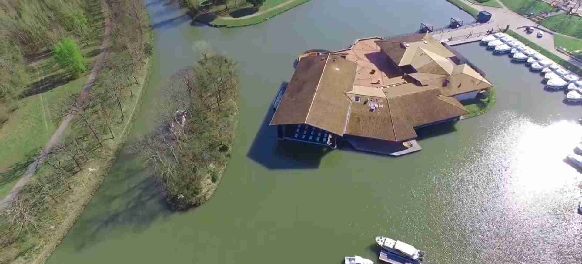
Canal du Midi Guide: UNESCO Waterway
Key Takeaways
- Engineering Marvel: The Canal du Midi represents one of the greatest civil engineering achievements of the 17th century, connecting the Atlantic Ocean to the Mediterranean Sea through 328 kilometers of artificial waterway across southern France.
- Pierre-Paul Riquet’s Vision: Constructed between 1667-1681 under the direction of engineer Pierre-Paul Riquet, the canal solved centuries of technical challenges through innovative water management systems and revolutionary lock designs.
- Architectural Heritage: The waterway features 328 structures including 63 locks, 126 bridges, 7 canal bridges, and 6 dams, each representing masterful Baroque engineering adapted to diverse landscapes.
- UNESCO Recognition: Designated a World Heritage Site in 1996, the Canal du Midi embodies exceptional universal value as testimony to human ingenuity, technical innovation, and landscape transformation.
- Living Monument: Beyond historical significance, the canal functions as active navigation route, ecological corridor, and cultural landscape integrating engineering works, Mediterranean vegetation, and agricultural traditions.
- Plane Tree Heritage: The iconic alignment of 42,000 plane trees planted in the 19th century creates a distinctive visual identity, though ongoing conservation efforts address disease challenges affecting this historic vegetation.
Introduction: Southern France’s Water Highway
The Canal du Midi stands as one of Europe’s most ambitious infrastructure projects, a 328-kilometer artificial waterway that fundamentally transformed trade, agriculture, and regional development across southern France. Conceived during the reign of Louis XIV and realized through the genius of Pierre-Paul Riquet, this monumental canal connects Toulouse on the Garonne River to the Mediterranean port of Sète, creating a navigable route from the Atlantic to the Mediterranean that bypasses the treacherous Strait of Gibraltar and the Iberian Peninsula.
What distinguishes the Canal du Midi from other historic waterways is not merely its length or economic impact, but the revolutionary engineering solutions developed to overcome extraordinary natural obstacles. Riquet and his team confronted challenges that had defeated engineers for millennia: crossing watersheds, maintaining consistent water supply through seasonal variations, and managing dramatic elevation changes across diverse terrain. The solutions they devised—including the groundbreaking Malpas Tunnel (the world’s first navigable canal tunnel), the ingenious water feeding system from the Montagne Noire, and the innovative staircase locks—established engineering principles that influenced canal construction worldwide for centuries.
The canal’s designation as a UNESCO World Heritage Site in 1996 recognized not only its technical achievements but also its cultural landscape significance. The waterway exists as a living monument where engineering structures, agricultural practices, Mediterranean vegetation, and human settlement patterns have evolved together over three and a half centuries. The iconic plane tree allées lining the banks, the lock keeper houses maintaining architectural continuity, the bridges reflecting regional construction traditions, and the surrounding vineyards and agricultural lands create a harmonious cultural landscape that embodies the relationship between human ambition and natural environment.
From the engineering perspective, the Canal du Midi represents a watershed moment in hydraulic technology. Before its construction, no comparable project had successfully crossed multiple watersheds, managed such complex water supply systems, or maintained navigation across such varied topography. The canal’s completion proved that human engineering could fundamentally alter geography, a demonstration that inspired subsequent canal-building efforts across Europe and North America. The technical documentation, construction methods, and problem-solving approaches developed during the Canal du Midi’s creation formed the foundation of modern civil engineering education.
People Also Ask About Canal du Midi
What makes Canal du Midi historically significant?
Canal du Midi’s historical significance extends across multiple dimensions of European development. As the oldest functioning canal in Europe, it represents a pivotal moment when engineering capability reached the level necessary to reshape geography for economic purposes. The canal’s construction demonstrated that major infrastructure projects could be successfully completed through systematic planning, innovative financing, and coordinated labor management—lessons that influenced subsequent industrial revolution developments.
The economic impact transformed southern France from an isolated agricultural region into an integrated commercial zone. Before the canal, transporting goods from the Atlantic to the Mediterranean required either dangerous sea voyages around Spain and through pirate-infested waters, or costly overland transport across difficult terrain. The Canal du Midi reduced transportation costs by 80-90%, making previously uneconomical trade routes viable and stimulating agricultural specialization in wheat, wine, and other bulk commodities that could now reach distant markets profitably.
Beyond commerce, the canal influenced political geography by strengthening connections between France’s Mediterranean provinces and the central government in Paris. The improved transportation network facilitated administrative control, military logistics, and cultural exchange. The canal became an instrument of state power, demonstrating the monarchy’s ability to marshal resources and reshape the landscape according to national strategic interests. This model of state-directed infrastructure investment influenced subsequent French development policy and contributed to the centralized planning traditions that characterize French governance.
The Canal du Midi also advanced scientific knowledge in multiple fields. Surveying techniques developed for the canal’s construction improved precision in cartography and geodesy. Hydraulic calculations refined understanding of water pressure, flow rates, and structural requirements for managing large water volumes. The massive earthworks and stone construction projects developed new approaches to labor organization, material logistics, and quality control that influenced construction practices across Europe. In this sense, the canal functioned as a laboratory for testing and refining engineering methods that would prove essential during the industrial revolution.
Who designed and built Canal du Midi?
Pierre-Paul Riquet (1609-1680) stands as the visionary engineer whose technical genius and administrative determination brought the Canal du Midi from conception to reality. Born into a wealthy Béziers family, Riquet initially worked as a salt tax collector, a position that provided both financial resources and intimate knowledge of southern France’s geography and water systems. His professional travels revealed the economic constraints imposed by inadequate transportation, inspiring his lifelong obsession with creating a navigable waterway to the Mediterranean.
Riquet’s genius lay not in inventing entirely new technologies but in synthesizing existing knowledge into innovative solutions for unprecedented challenges. His watershed moment came in recognizing that the Montagne Noire mountains contained sufficient water resources to supply a canal crossing the watershed between Atlantic and Mediterranean drainage basins. Previous engineers had focused on using the Aude River, which proved inadequate for reliable year-round navigation. Riquet’s bold proposal to capture mountain streams, create reservoir systems, and channel water through elevated aqueducts to the canal’s summit level solved the fundamental problem that had defeated earlier attempts.
The technical team Riquet assembled combined military engineering expertise, local construction knowledge, and innovative problem-solving. François Andreossy, a military engineer, contributed crucial expertise in fortification and large-scale earthworks. Pierre Campmas managed the complex water feeding system design. Local master masons, stonecutters, and hydraulic specialists brought regional construction traditions that adapted engineering concepts to local materials and conditions. This collaborative approach, combining theoretical engineering with practical construction knowledge, created solutions that balanced ideal design with practical implementation constraints.
The construction workforce reflected 17th-century labor practices, with estimates suggesting 12,000 workers engaged simultaneously during peak construction periods. The labor force included skilled artisans—stonemasons, carpenters, blacksmiths—who created the locks, bridges, and specialized structures requiring precision craftsmanship. Supporting this skilled workforce, thousands of laborers excavated the canal bed, moved earth and stone, and performed the massive earthworks necessary to create a level navigation channel across rolling terrain. Women constituted a significant portion of the workforce, particularly in earth-moving operations where they typically earned half the wages paid to men for equivalent work.
Riquet invested his entire personal fortune into the project, supplementing royal funding when government payments lagged behind construction expenses. His financial commitment demonstrated extraordinary confidence in the project’s eventual success, but also left him impoverished. He died in October 1680, seven months before the canal’s official completion, having witnessed his vision realized but having exhausted his wealth in the process. His sons completed the final sections, ensuring his legacy as one of history’s greatest civil engineers.
What engineering innovations distinguish Canal du Midi?
The Canal du Midi introduced multiple engineering innovations that revolutionized hydraulic construction and influenced canal building worldwide. The water feeding system represents perhaps the most sophisticated innovation, solving the fundamental challenge of maintaining consistent water supply to a canal crossing a major watershed. Riquet designed an elaborate network capturing mountain streams from the Montagne Noire through a series of dams, reservoirs, and aqueducts. The system included the Bassin de Saint-Ferréol, then the largest reservoir in Europe at 780,000 cubic meters capacity, which regulated water flow throughout seasons and supplied the canal’s summit level through a 45-kilometer supply channel called the Rigole de la Montagne.
The lock systems advanced beyond contemporary designs through several innovations. While traditional locks required filling and emptying through sluices cut into the lock walls, Riquet’s engineers developed more efficient valve systems that accelerated the locking process. The oval lock chambers, wider in the center than at the gates, reduced water turbulence during filling and emptying, protecting canal boats from damage. The staircase lock configurations, particularly the famous Fonsérannes locks near Béziers, demonstrated how to manage dramatic elevation changes efficiently by placing multiple locks in immediate sequence, sharing water between chambers and reducing the total time required for vessels to navigate significant height differences.
The Malpas Tunnel breakthrough solved a problem that had seemed insurmountable. When authorities insisted the canal avoid a long detour around Ensérune Hill, Riquet proposed tunneling directly through the hill despite near-universal skepticism that such a tunnel could maintain structural integrity. The 165-meter tunnel, excavated through unstable ground in just eight days using gunpowder blasting techniques adapted from military mining, became the world’s first navigable canal tunnel. Its success demonstrated that underground canal routes were feasible, inspiring similar tunneling projects on subsequent canals across Europe.
The canal bridges introduced innovative designs adapted to specific site conditions. The Pont Canal de l’Orb, for instance, represented early mastery of creating waterproof canal beds suspended above natural rivers, allowing canal traffic to cross valleys without descending to river level and then climbing back up. These aqueduct bridges required precise calculations of water weight, structural support requirements, and waterproofing techniques that pushed contemporary engineering knowledge. Each major structure became a case study in adapting general principles to specific site challenges, creating a diverse architectural vocabulary that subsequent engineers studied and emulated.
How does Canal du Midi UNESCO status impact conservation?
UNESCO World Heritage designation fundamentally transformed Canal du Midi conservation by establishing international recognition of its universal value and creating frameworks for coordinated preservation efforts. The designation brought increased funding from national, regional, and European sources specifically allocated to heritage conservation. More significantly, World Heritage status required developing comprehensive management plans addressing the canal’s multiple conservation challenges while maintaining its functioning as active waterway, recreational resource, and agricultural landscape.
The designation established rigorous standards for any modifications to the canal or its immediate environment. New construction, restoration projects, and landscape alterations must respect the canal’s historic character and maintain the cultural landscape integrity. These protections prevent inappropriate development that might compromise visual coherence or alter the relationships between canal structures, vegetation, and surrounding agricultural lands. Buffer zones extending beyond the canal’s immediate banks ensure that development in surrounding areas respects the historic landscape character.
One significant conservation challenge involves the plane tree allées that line much of the canal. These trees, planted primarily in the 19th century for shade and bank stabilization, have become iconic elements of the Canal du Midi’s identity. However, canker stain disease (Ceratocystis platani) has infected significant numbers of trees, requiring removal to prevent spread. UNESCO status has facilitated international scientific collaboration on disease management, tree replacement strategies, and research into disease-resistant varieties. The conservation approach balances historical authenticity (replacing with plane trees) against practical concerns (exploring alternative species that provide similar functions while resisting disease).
The World Heritage designation also enhanced public awareness and appreciation, transforming the canal from infrastructure into cultural monument. Increased tourism brings both benefits (economic support for conservation, public constituency for preservation) and challenges (managing visitor impact, balancing navigation with recreational use, maintaining the canal’s character despite commercialization pressures). UNESCO recognition provides frameworks for sustainable tourism development that generates resources for conservation while protecting the values that justify heritage designation.
Extended multi-day tours – 5+ days
Featured Southern France Toulouse Multi-Day Tour Packages
9 days
In the South – West of France From Toulouse to Bordeaux
- ✓ Flights included
4 days
Canal du Midi – From Toulouse to Carcassonne 4 Days
- ✓ Comprehensive Southern France Toulouse tour
- ✓ Expert local guides included
- ✓ All accommodation arranged
- ✓ Transportation provided

7 days
Canal du Midi – from Toulouse to Sète (7 days)
- ✓ Comprehensive Southern France Toulouse tour
- ✓ Expert local guides included
- ✓ All accommodation arranged
- ✓ Transportation provided

8 days
Cycling in France – Canals and Castles of the Midi
- ✓ Comprehensive Southern France Toulouse tour
- ✓ Expert local guides included
- ✓ All accommodation arranged
- ✓ Transportation provided
Multi-day tour packages powered by TourRadar. Prices and availability subject to change.
Historical Background: Vision and Construction
The concept of connecting Atlantic and Mediterranean waters through an artificial waterway dates to antiquity. Roman engineers considered such a project but concluded the technical challenges exceeded their capabilities. Medieval discussions revived periodically, particularly during periods of commercial expansion when merchants sought alternatives to dangerous sea routes around the Iberian Peninsula. However, no serious engineering studies emerged until the 16th century, when François I commissioned surveys that concluded the project remained impractical given existing technology and resources.
Pierre-Paul Riquet’s breakthrough came from systematic observation and measurement during his travels as salt tax collector. Unlike earlier theorists who proposed routes following existing rivers, Riquet recognized that the Montagne Noire mountains contained sufficient water resources to supply an artificial channel maintained at elevated levels across the watershed divide. Between 1662-1665, he conducted detailed surveys, measured water flows, calculated elevation changes, and developed the theoretical framework demonstrating feasibility. His calculations showed that a canal elevated to approximately 189 meters above sea level at the watershed crossing could maintain sufficient depth for navigation while using gravity to supply water from mountain sources.
Convincing authorities required both technical demonstration and political maneuvering. Riquet began by constructing an experimental water supply system at his own expense, proving he could capture, store, and channel mountain water according to his calculations. He then enlisted Baron Pierre-Paul de Bonrepos, a influential courtier, to present the proposal to Jean-Baptiste Colbert, Louis XIV’s powerful finance minister. Colbert, focused on strengthening French commercial power, recognized the strategic and economic potential. The king approved the project in October 1666, establishing a funding mechanism combining royal treasury contributions, private investment, and revenues from the Languedoc province.
Construction began in January 1667 with clearing and excavation work proceeding from both Toulouse and the Mediterranean simultaneously. The workforce organization reflected contemporary construction practices, with labor recruited from surrounding provinces through a combination of wage incentives, compulsory service obligations, and contracts with labor contractors who supplied workers for specific sections. Skilled trades—stonemasons, carpenters, blacksmiths—formed a permanent workforce, while seasonal agricultural laborers supplemented during winter months when farming demanded less attention.
The construction methodology divided the canal into sections, each managed by independent contractors responsible for excavation, stone supply, and basic construction. This decentralized approach allowed multiple sections to progress simultaneously but created coordination challenges. Riquet maintained overall technical direction through personal inspection tours, detailed written specifications, and a system of supervisors who ensured contractors met quality standards. The technical specifications mandated minimum depth (2 meters), width (10 meters at water surface), and bank slopes (typically 1:1.5 ratio) designed to prevent erosion while minimizing excavation volumes.
Major structures required more centralized management. Lock construction proceeded sequentially under direct supervision of master masons who understood the precise requirements for watertight chambers, robust gate mechanisms, and durable masonry capable of withstanding constant water pressure and boat impacts. Each lock became a construction project involving stone quarrying, foundation preparation (often requiring driving wooden piles into soft ground), masonry construction, metalwork for gates and mechanisms, and woodworking for gates and sluices. The largest locks required two years from excavation to completion.
Water supply system construction paralleled main canal work. The Rigole de la Montagne, channeling water from mountain streams to the summit level, required precise gradient control to maintain steady flow without excessive velocity that might cause erosion. Dam construction for the Bassin de Saint-Ferréol pushed engineering limits, creating Europe’s largest earth dam with careful attention to water pressure management, overflow systems, and foundation stability in potentially unstable ground. The reservoir’s completion in 1672 provided the water security necessary to guarantee year-round navigation regardless of seasonal precipitation variations.
The Malpas Tunnel excavation in 1679 demonstrated both the project’s ambition and its technical flexibility. When the Archbishop of Narbonne insisted the canal avoid crossing church lands through surface routes, Riquet proposed tunneling beneath the obstacle. Critics predicted catastrophic collapse, but Riquet’s confidence in calculations of rock stability, arch support principles, and gunpowder excavation techniques proved justified. Workers completed the tunnel in eight days of intensive excavation, removing approximately 10,000 cubic meters of rock and earth. The tunnel’s interior dimensions—8 meters wide, 8.5 meters high—provided adequate clearance for canal boats while minimizing excavation volume. The success validated tunneling as viable canal engineering technique, directly inspiring similar projects on subsequent British and American canals.
Financial pressures mounted as construction progressed. Initial cost estimates of 3 million livres proved wildly optimistic, with actual costs approaching 15 million livres by completion. Royal funding, though generous by contemporary standards, consistently lagged behind construction expenses. Riquet covered shortfalls from personal wealth, eventually exhausting his fortune. He mortgaged properties, borrowed extensively, and diverted revenues from his salt tax collection responsibilities to maintain construction momentum. His financial commitment demonstrated absolute confidence in eventual commercial success, though he would not live to benefit personally.
Canal du Midi opened to navigation in May 1681, seven months after Riquet’s death. Initial commercial traffic proved modest, requiring decades to develop the trade patterns and commercial relationships necessary to fully utilize the waterway’s capacity. However, the engineering achievement was immediately apparent. The canal functioned reliably, maintaining navigation throughout seasons and demonstrating that properly designed and constructed waterways could create permanent transportation infrastructure transforming regional economic geography.
Architectural Significance: Structures and Design
The Canal du Midi’s architectural significance extends beyond individual structures to encompass a comprehensive system where engineering requirements, aesthetic considerations, and practical functionality converged to create distinctive architectural vocabulary. The 328 structures along the canal’s length represent diverse solutions to specific site challenges while maintaining overall design coherence that reflects both Baroque architectural principles and southern French building traditions.
Lock architecture demonstrates the most sophisticated structural design, combining hydraulic engineering requirements with architectural expression. The typical canal lock consists of two sets of mitered gates enclosing a rectangular chamber with sloping walls. The gates themselves represent masterworks of carpentry and hydraulic calculation, typically constructed from oak or elm with careful attention to wood grain orientation, joint design, and metal reinforcement. Each gate leaf weighs several tons but must swing open easily using human-powered mechanisms. The balance between structural strength (resisting water pressure when closed) and operational efficiency (minimal friction when opening) required precise calculation and expert craftsmanship.
The lock chamber masonry varies according to local stone availability and subsurface conditions. In areas with stable bedrock, builders excavated directly into stone, lining chambers with dressed masonry set in hydraulic mortar (lime mortar incorporating volcanic ash that hardens underwater). Where soft ground prevailed, builders drove wooden piles to create stable foundations, then constructed masonry chambers with thick walls designed to resist lateral earth pressure. The interior chamber surfaces received careful attention to achieve smooth faces that minimize water turbulence and prevent damage to passing boats. Coping stones, the finished surfaces at water level and lock chamber tops, display particular craftsmanship with beveled edges, precise joints, and sometimes decorative moldings.
The Fonsérannes Locks near Béziers exemplify the monumental scale achieved in canal architecture. This staircase of eight locks (originally nine before 1984 modifications) descends 21.5 meters over 300 meters, creating dramatic terraced architecture that demonstrates technical mastery while projecting visual power. The locks function as single integrated structure rather than independent chambers, with shared walls between adjacent locks reducing construction costs and enabling efficient water transfer between chambers. The sight of multiple boats ascending or descending this liquid staircase creates spectacular visual effect that attracted admirers from the canal’s earliest years.
Bridge architecture reflects regional building traditions adapted to canal crossing requirements. The typical canal bridge consists of single semicircular stone arch spanning the waterway, with approaches graded to match surrounding road levels. Bridges display varying degrees of architectural elaboration depending on location and importance. Urban bridges might feature decorative elements—carved keystones, cornices, inscriptions commemorating construction dates or royal patronage. Rural bridges maintain simpler profiles, though even the most utilitarian structures show careful stonework and proportional refinement characteristic of French classical architecture.
Canal bridges over the waterway (pont-canaux or aqueduct bridges) represent engineering and architectural tours de force. The Pont Canal de l’Orb, carrying the canal over the Orb River on seven stone arches, required solving unprecedented structural challenges. The structure must support not only its own weight but also the weight of water in the canal (approximately 1,000 kilograms per cubic meter) plus canal boats and any ice formation. The canal bed itself required watertight construction using hydraulic mortar and carefully fitted stones. The resulting structure combines engineering efficiency with architectural grace, its rhythmic arches and careful proportions creating structures that enhance rather than dominate the landscape.
The reservoir dam at Saint-Ferréol demonstrates early mastery of large-scale earth dam construction. The dam stands 30 meters high and 750 meters long, creating a reservoir covering 67 hectares. The dam’s cross-section employs sophisticated engineering: a central clay core provides water barrier, supported by earthen shoulders providing mass and stability. The downstream face slopes at carefully calculated angles preventing erosion and structural failure. The overflow system, critical for managing excess water during heavy rainfall, consists of stone-lined channels directing water safely past the dam structure. The dam’s architecture extends beyond functional engineering to include decorative elements at key points—the main discharge structure features classical architectural detailing that frames the powerful water flow with refined stonework.
Lock keeper houses represent vernacular architecture standardized across the canal system. These structures, providing residence for the personnel operating locks and maintaining canal infrastructure, display consistent design principles while adapting to regional building traditions. Typical lock keeper houses feature thick stone walls, tile roofs (Roman tiles in Mediterranean sections, flat tiles further north), shuttered windows, and attached gardens. The houses maintain visual connection to canal infrastructure through careful siting and architectural character that complements lock architecture without competing for visual attention.
The canal’s urban architecture, particularly at port facilities in Toulouse, Castelnaudary, and Sète, displays more elaborate architectural treatment reflecting commercial importance. Warehouses feature massive stone construction with large openings for cargo handling, internal timber framing supporting upper floors, and sometimes arcaded ground floors creating covered loading areas. Office buildings for canal administration adopt more refined classical architecture with symmetrical facades, ornamental details, and sometimes ceremonial elements like carved pediments or inscriptions. These urban structures create architectural ensembles that function as ceremonial gateways marking transition between canal navigation and urban commerce.
The comprehensive architectural system extends to smaller structures that collectively create the canal’s visual character. Milestone markers at kilometer intervals establish rhythm along the towpath. Mooring bollards display utilitarian elegance in their cast iron or stone construction. Distance markers, depth gauges, and regulatory signs employ consistent graphic design that facilitates navigation while contributing to visual coherence. Even functional elements like drainage culverts, overflow weirs, and channel transitions receive architectural attention that elevates infrastructure to cultural landscape.
Engineering Systems: Water Management and Navigation
The Canal du Midi’s water management system represents its most innovative engineering achievement, solving challenges that had defeated previous attempts to create waterways crossing major watersheds. The fundamental problem involved maintaining sufficient water depth in a canal elevated significantly above surrounding terrain, requiring water sources capable of supplying the canal against gravitational drainage. Riquet’s solution involved creating an elaborate water capture, storage, and distribution system that harvests precipitation from the Montagne Noire mountains and channels it to the canal through carefully engineered infrastructure.
The system begins with stream capture devices (prises d’eau) collecting water from multiple mountain streams. These intake structures incorporate settling basins that allow sediment to drop out before water enters the supply channels, preventing siltation in the main distribution system. The Rigole de la Montagne, the primary supply channel, maintains precise gradient (approximately 1 meter per kilometer) over 45 kilometers from the mountains to the canal’s summit level. This gradient provides sufficient velocity to prevent siltation while avoiding erosion that might damage the channel. The rigole itself required extensive engineering: crossing valleys via aqueducts, tunneling through ridges, and managing flows across varying terrain types.
The Bassin de Saint-Ferréol reservoir functions as the system’s keystone, storing winter and spring precipitation for release during summer when natural flows diminish. The reservoir’s 780,000 cubic meter capacity provided substantial margin ensuring reliable navigation regardless of seasonal variations. The dam’s overflow system incorporates multiple discharge channels managing different flow rates: normal overflow channels handle typical excess water, while emergency spillways accommodate extreme flood conditions. The discharge system leading from reservoir to canal employs multiple control structures regulating water flow according to canal requirements, increasing supply during high traffic periods and reducing flow during maintenance.
Water distribution along the canal employs sophisticated control mechanisms balancing multiple demands. The summit level, elevated above both Atlantic and Mediterranean drainage basins, requires continuous water input replacing losses to lockage (water used each time boats pass through locks), evaporation, seepage, and controlled releases for irrigation or downstream ecological requirements. The canal maintains minimum depth of 2 meters through careful management of these competing demands, with lock keepers monitoring water levels and adjusting supply accordingly.
Lock operations consume substantial water volumes, creating management challenges Riquet’s engineers addressed through multiple innovations. Each time a boat ascends through a lock, the chamber must be filled from the upper level, effectively transferring water from higher elevation to lower. Conversely, descending boats require emptying the chamber to the lower level. Traditional locks simply released this water downstream, creating cumulative water loss as boats moved through multiple locks. Riquet’s staircase lock configurations reduced water consumption by allowing adjacent chambers to share water, minimizing total water required for boats traversing multiple elevation changes.
The épanchoirs (overflow weirs) system provides secondary water management, releasing excess water during periods of high supply while maintaining canal levels within operational ranges. These structures, strategically located along the canal’s length, incorporate adjustable gates allowing precise control of water release rates. During winter months when precipitation exceeds canal requirements, épanchoirs prevent flooding by directing excess water to natural drainage courses. During irrigation season, controlled releases through épanchoirs can supply water to agricultural users without compromising navigation depths.
Maintenance systems address the inevitable accumulation of sediment in canal sections where flow velocity decreases. The canal’s design incorporates multiple chômages (maintenance sections) that can be isolated and drained for cleaning, repairs, and structural inspection. The drainage system employs gravity flow to empty these sections into nearby streams, though pumping systems supplement gravity drainage in sections where topography limits natural drainage. The ability to isolate and drain specific sections without shutting the entire canal enables ongoing maintenance while minimizing disruption to navigation.
Navigation systems provide boats with information and facilities enabling safe passage through the canal’s varying conditions. Channel markers indicate navigable depth, warn of shallow areas, and mark the center line in sections where banks create navigation challenges. Lock approach areas receive particular attention, with guide walls and mooring facilities allowing boats to wait safely while locks cycle. The towpath, originally essential for horse-drawn navigation, maintains consistent width and surface condition enabling efficient towing or walking along the entire canal length.
Modern navigation incorporates updated systems addressing contemporary requirements while respecting historical character. Electronic depth sounders and GPS navigation supplement visual navigation, though traditional navigation remains possible using only visual references and paper charts. Lock operations have been partially automated at some facilities, though many locks retain manual operation requiring lock keepers or boaters to operate gates and sluices using traditional mechanisms. Speed restrictions (typically 8 km/h) protect banks from erosion caused by boat wakes while maintaining the canal’s contemplative pace.
Cultural Impact: Commerce, Agriculture, and Society
The Canal du Midi fundamentally transformed southern France’s economic geography, converting isolated agricultural regions into integrated commercial zones connected to national and international trade networks. Before the canal, transporting bulk commodities—wheat, wine, olive oil, textiles—from the Mediterranean coast to Atlantic ports required either dangerous sea voyages or expensive overland transport. Transportation costs often exceeded commodity values, making many potential trades economically infeasible. The canal reduced transportation costs by 80-90%, suddenly making profitable numerous trading relationships previously impossible.
Wheat cultivation in the Lauragais region illustrates the canal’s agricultural impact. This fertile plateau between Toulouse and Castelnaudary had produced surplus wheat for centuries, but limited transportation capacity restricted market access primarily to nearby towns. Canal transportation enabled Lauragais farmers to ship wheat profitably to Mediterranean ports, opening export markets in Italy and North Africa. The reliable transportation stimulated agricultural intensification: farmers increased acreage, improved cultivation techniques, and invested in storage infrastructure knowing they could reach profitable markets. The region developed specialized identity as the “wheat granary” of the Midi, with the canal functioning as essential infrastructure enabling agricultural specialization.
Viticulture transformed similarly, with wine producers in the Minervois, Corbières, and other inland regions gaining access to maritime shipping. Previously, wine production concentrated near ports or in regions with river access to trading centers. The canal democratized wine commerce, allowing inland producers to compete in distant markets based on quality rather than geographic advantage. This transportation access stimulated the Languedoc wine industry’s expansion, eventually making the region France’s largest wine producing area. The canal ports at Agde and Sète developed as major wine trading centers, with specialized facilities for wine storage, blending, and shipment.
Industrial development followed commercial agriculture, with manufacturers choosing canal-side locations for access to raw materials and markets. Textile mills processing wool from mountain sheep settlements established along the canal, utilizing water power from canal-fed channels while shipping finished goods via canal transportation. Stone quarries opened to supply building materials to growing cities, using canal barges to transport heavy stone loads impractical for road transport. Lime production, essential for construction and agriculture, concentrated near canal ports where limestone could be quarried, burned, and shipped efficiently.
Urban development reflected the canal’s economic impact. Toulouse expanded significantly, its role as canal terminus stimulating commercial growth and population increase. Port facilities, warehouses, and commercial establishments multiplied along the canal basin. The city’s elite built townhouses reflecting newfound prosperity, while working populations grew to support expanded commerce. Castelnaudary, a medieval market town, transformed into a major canal port with extensive facilities for grain storage, wine trading, and general commerce. New settlements emerged at strategic canal locations, particularly around locks and major junctions where commercial activity created demand for services and accommodation.
Social structures adapted to the canal’s presence. Lock keeper families formed distinctive communities, often working the same lock for multiple generations, developing intimate knowledge of navigation conditions, water management, and local boat traffic. Barge families lived aboard their vessels, creating mobile communities connected by shared occupation rather than geographic proximity. Canal port communities developed mixed economies combining agriculture, commerce, and canal-related services. These occupational identities persist today, though recreational navigation has replaced commercial traffic as the canal’s primary activity.
The canal influenced regional identity, becoming emblematic of southern French cultural landscape. The plane tree allées created distinctive visual character, their shade transforming the towpath into pleasant promenade encouraging leisure walking and cycling. The locks and bridges became familiar landmarks orienting local geography. Canal-related vocabulary entered regional dialect, with terms for boat types, lock operations, and water management becoming part of everyday language. The canal embodied regional pride in engineering achievement and economic progress, a monument to human capacity to reshape geography according to collective needs.
Cultural practices evolved around the canal. Sunday promenades along the towpath became regional tradition, families strolling beneath plane trees, watching boats pass through locks, picnicking along the banks. Annual festivals celebrated canal history and culture, particularly in towns closely identified with canal commerce. Restaurants and cafés located along the canal developed cuisine featuring regional products traditionally transported by canal—wheat-based dishes in Castelnaudary (notably cassoulet), wine-focused dining in the Minervois, seafood in Mediterranean sections. These culinary traditions maintain the cultural connection between landscape, agriculture, and canal commerce.
The canal’s cultural impact extended beyond immediate economic effects to influence art, literature, and intellectual life. Artists depicted canal landscapes, capturing the interplay of water, architecture, and vegetation. Writers employed the canal as literary setting, its locks and boats providing metaphors for life’s passages and transformations. Engineers studied the canal as exemplary model of successful infrastructure development, analyzing its technical innovations and management systems. The Canal du Midi became subject of scholarly inquiry across multiple disciplines—civil engineering, economic history, cultural geography—each finding distinctive insights into human capacity to shape environment.
Photography Guide: Capturing the Waterway
Photographing the Canal du Midi requires understanding how to capture both its grand architectural achievements and intimate landscape details. The canal presents photographers with diverse subjects: monumental lock staircases, serene tree-lined straights, intimate bridge crossings, and the interplay of water, stone, and vegetation that defines its character. Successful canal photography balances technical proficiency with aesthetic sensitivity to the landscape’s unique qualities.
Light conditions profoundly affect canal photography. Early morning light provides optimal conditions for many subjects: soft, directional illumination enhances architectural texture on lock masonry, water surfaces reflect surrounding vegetation and sky with minimal glare, and atmospheric perspective creates depth in long canal views. Morning mist, particularly common in spring and autumn, adds ethereal quality to tree-lined sections, the vapor diffusing light and creating separation between foreground and background elements. The warm morning light complements the honey-colored limestone prevalent in canal structures, enhancing material qualities that appear flat under midday illumination.
Midday light presents challenges but also opportunities. The harsh overhead illumination creates strong shadows that can emphasize architectural details—lock chamber depth, stone surface texture, the geometric forms of lock gates and mechanisms. Water surfaces become more challenging under direct sunlight, reflecting sky glare that can overwhelm cameras’ dynamic range. However, this same glare creates dramatic contrast in images incorporating reflections, where the bright water surface separates darker architectural elements. Polarizing filters prove essential during midday shooting, reducing water surface reflections to reveal underwater details or enhancing reflections while darkening skies.
Late afternoon and evening light returns to optimal conditions, with low-angle illumination creating long shadows and warm color temperatures. The plane tree allées become particularly photogenic as raking light defines individual tree trunks against shadowed backgrounds. Lock structures catch golden light on west-facing surfaces while east faces fall into shadow, creating dramatic chiaroscuro that emphasizes architectural form. Evening light also enhances the canal’s relationship to surrounding landscape, with agricultural fields, vineyards, and distant mountains receiving the same warm illumination that transforms ordinary scenes into memorable images.
Compositional approaches vary according to subject and photographic intent. Wide-angle lenses (16-35mm on full-frame cameras) excel at capturing the canal’s spatial relationships: lock chambers seen in plan view from elevated viewpoints, long tree-lined perspectives emphasizing linear geometry, and architectural contexts showing how structures integrate with landscape. These wide perspectives require careful attention to foreground elements—ideally including boats, figures, or architectural details that provide scale and anchor composition. The wide-angle distortion can enhance architectural drama when used thoughtfully but creates problems when architectural lines converge awkwardly or when foreground elements become disproportionately large.
Medium focal lengths (35-70mm) provide more natural perspective while allowing selective focus on specific subjects. These focal lengths work well for capturing lock operations, documenting boat passages through architectural spaces, and photographing the relationship between canal infrastructure and human activity. The moderate perspective maintains architectural proportions while allowing photographers to include contextual elements that situate subjects within broader landscape. This focal length range proves most versatile for general canal photography, handling diverse subjects without requiring lens changes that might miss fleeting moments.
Telephoto lenses (100mm and longer) enable photographers to isolate specific details, compress perspective to emphasize linear elements, and separate subjects from busy backgrounds. The compression effect creates striking images of tree allées, where telephoto perspective stacks trees into dense walls of trunks and foliage. Lock details—gate mechanisms, stone textures, water flowing through sluices—benefit from telephoto isolation that eliminates distracting elements. Boats navigating canal sections can be followed at distance, creating sequences showing progression through distinctive sections. The shallow depth of field available with longer lenses enables selective focus emphasizing specific details against softened backgrounds.
The Fonsérannes Locks demand special photographic consideration. The staircase configuration creates extraordinary three-dimensional composition opportunities, with multiple lock chambers visible simultaneously. Elevated viewpoints from the adjacent park or road enable plan views showing the complete lock sequence, boats at various levels creating dynamic composition within the geometric framework. Lower viewpoints emphasize vertical drama, with lock chambers stacked in perspective creating powerful architectural images. Timing photographs to coincide with boat movements adds narrative interest—boats ascending or descending the staircase provide scale, motion, and human interest transforming architectural documentation into storytelling.
Reflection photography exploits the canal’s mirror-smooth water surfaces in calm conditions. Early morning before breeze disturbs water provides optimal reflection conditions. Perfect reflections of plane trees, bridges, or lock structures transform into abstract geometric patterns when composed to exclude surrounding context. Partial reflections, where architectural elements above water dialogue with their mirror images, create visual complexity rewarding careful composition. Reflection photography benefits from precise horizontal leveling ensuring horizon lines and reflection junctions maintain compositional harmony.
Boat traffic provides both subject matter and challenges. Photographing moving boats requires anticipating position, selecting viewpoints providing clear sightlines, and timing shots to capture boats in compositionally strong positions. Boats entering or exiting locks create decisive moments—the emergence of a boat from a lock chamber creates visual drama as the vessel rises into view or descends from sight. Panning techniques can blur backgrounds while keeping moving boats sharp, creating dynamic images suggesting motion. Alternatively, faster shutter speeds freeze boat details while maintaining sharpness throughout the frame.
Architectural detail photography rewards close observation of craftsmanship and material qualities. Lock gate metalwork—hinges, latches, balance beams—displays functional beauty in its precision engineering. Stone surfaces show weathering patterns, tool marks from 17th-century construction, and color variations revealing geological character. The joints between stones reveal construction techniques, while wear patterns show three centuries of use. These details, when photographed with attention to light and composition, communicate the human craftsmanship underlying engineering achievement.
Seasonal photography captures the canal’s changing character through the year. Spring brings fresh plane tree foliage, wildflowers along banks, and increased water flows. Summer presents mature foliage creating tunnel-like shade, peak boat traffic, and Mediterranean light quality. Autumn foliage transforms tree allées into golden tunnels, fallen leaves texture the water surface, and lower sun angles create extended golden hours. Winter reveals structural elements hidden by summer foliage, bare tree architecture creates graphic patterns, and occasional snow or frost transforms the landscape into monochromatic abstraction.
Conservation Efforts: Preserving Heritage for Future Generations
Canal du Midi conservation addresses multiple challenges inherent in maintaining a 17th-century transportation infrastructure functioning in contemporary contexts while preserving historical character and cultural landscape integrity. The canal exists simultaneously as historical monument, active navigation route, ecological corridor, and regional economic asset. Conservation strategies must balance these sometimes conflicting roles, maintaining historical authenticity while ensuring continued functionality and preventing deterioration.
Structural conservation focuses on maintaining the masonry, metalwork, and wooden elements forming the canal’s physical infrastructure. Lock chambers require ongoing maintenance addressing mortar deterioration, stone weathering, and structural movement. Traditional lime mortars used in original construction deteriorate gradually through water exposure and freeze-thaw cycling. Conservation interventions prioritize using compatible materials—lime mortars rather than modern cement—that maintain breathability and flexibility matching original construction. Stone replacement follows careful documentation procedures, with deteriorated stones replaced using matching geological materials and traditional cutting techniques that replicate original craftsmanship.
Lock gate maintenance presents particular challenges. The wooden gates, traditionally constructed from durable hardwoods like oak, require periodic replacement as wood deteriorates through constant water immersion and mechanical stress. Modern conservation replaces gates using traditional construction methods—careful wood selection, traditional joinery, hand-applied finishes—that maintain historical authenticity. However, some concessions to modernity prove necessary: metal components increasingly use stainless steel rather than wrought iron to extend service life, and modern sealants supplement traditional oakum caulking to improve watertightness. These pragmatic modifications maintain functionality while preserving overall historical character.
The plane tree crisis represents the canal’s most visible conservation challenge. Canker stain disease, first identified along the canal in the 1940s, has infected substantial portions of the tree population. The disease spreads through root grafts and contaminated cutting tools, making containment difficult once infection establishes in tree populations. Infected trees must be removed and destroyed to prevent further spread, creating gaps in the iconic tree allées that define the canal’s landscape character. Conservation authorities face difficult choices: replace trees with plane trees (maintaining historical authenticity but risking continued disease spread), plant alternative species (changing landscape character but providing disease resistance), or leave gaps (preserving existing trees but accepting incomplete allées).
Current conservation strategy employs multiple approaches. New plane tree plantings use disease-resistant varieties developed through selective breeding, accepting that these modern cultivars differ somewhat from historical trees. Alternative species including elms, oaks, and ashes supplement plane trees in some sections, providing diversity that reduces disease vulnerability while maintaining shade and visual character. Some sections maintain historical plane trees without replacement, documenting the natural aging process and accepting that future generations will experience different landscape character. This flexible strategy acknowledges that perfect historical replication may be unattainable while working toward sustainable long-term landscape management.
Water quality management addresses modern pollution sources affecting the canal’s ecological health and navigation quality. Agricultural runoff introduces pesticides, fertilizers, and sediment that degrade water quality and stimulate algae growth. Urban areas contribute sewage, stormwater runoff, and industrial pollutants. Conservation efforts promote buffer zones along canal banks reducing agricultural pollution, improved sewage treatment in canal-adjacent communities, and monitoring programs detecting pollution sources. These environmental protections maintain the canal as viable ecological corridor supporting aquatic plants, fish, and waterfowl populations while ensuring water quality adequate for recreational use.
Bank stabilization prevents erosion that threatens canal infrastructure and water quality. Boat wakes, particularly from excessive speed or large vessels, erode banks removing soil and destabilizing tree roots. Traditional bank protection used stone riprap and willow plantings, creating naturalistic edge treatments that absorbed wave energy while maintaining flexible response to water level changes. Modern conservation continues these traditional techniques while incorporating geotextiles and erosion control matting that provide temporary stabilization while vegetation establishes. Speed restrictions and boat size limitations reduce erosion pressure, though enforcement challenges persist given the canal’s 328-kilometer length and multiple access points.
Archaeological conservation addresses the canal’s buried heritage. Historical construction yards, settlement sites, and earlier infrastructure elements lie buried along the canal corridor. Development pressures or maintenance excavations that disturb these buried resources require archaeological investigation documenting discoveries and recovering artifacts. These investigations have revealed valuable information about construction techniques, worker settlements, and earlier landscape uses. Archaeological conservation protocols ensure that necessary modifications or repairs incorporate proper investigation procedures protecting buried heritage resources.
Documentation programs create comprehensive records of the canal’s current condition, historical evolution, and conservation interventions. Laser scanning and photogrammetry create three-dimensional digital models of lock structures, bridges, and other architectural elements. These models serve multiple purposes: providing baseline conditions for monitoring deterioration, enabling virtual reconstruction of damaged elements, supporting engineering analysis of structural behavior, and creating educational resources allowing public access to detailed documentation. Historical research compiles construction records, maintenance logs, and commercial traffic data creating comprehensive understanding of the canal’s evolution. This documentation proves invaluable for guiding conservation decisions with accurate historical information.
UNESCO Recognition: World Heritage Significance
The Canal du Midi’s 1996 inscription as UNESCO World Heritage Site recognized its “outstanding universal value” under multiple criteria, acknowledging the canal as exceptional testimony to human creative genius, representing significant stage in human history, and constituting outstanding example of technological ensemble illustrating significant stage in human development. The designation validated what engineers and historians had long understood: the Canal du Midi represents a watershed moment in civil engineering capability, demonstrating that systematic planning, innovative problem-solving, and sustained effort could reshape geography according to human purposes.
The UNESCO inscription specifically cited Criterion (i): “representing a masterpiece of human creative genius.” The canal embodied this criterion through its revolutionary solutions to engineering challenges that had defeated previous attempts. Riquet’s water feeding system, the Malpas Tunnel, the lock innovations, and the comprehensive approach integrating multiple engineering disciplines into cohesive functional system all demonstrated creative genius applied to practical purposes. The inscription recognized that the canal’s significance extended beyond mere functionality to represent human intellectual achievement at the highest level.
Criterion (ii) recognition—”exhibiting an important interchange of human values over a span of time or within a cultural area”—acknowledged the canal’s influence on subsequent engineering developments. The technical solutions pioneered at the Canal du Midi directly influenced canal construction across Europe and North America during the 18th and 19th centuries. British canal engineers studied Riquet’s work, adapting his techniques to British conditions. American canal builders employed principles developed at the Canal du Midi, particularly regarding lock design and water supply management. The canal functioned as educational model, its innovations analyzed, adapted, and improved upon by successive generations of engineers.
Criterion (iv) designation—”outstanding example of a type of building, architectural, or technological ensemble or landscape which illustrates a significant stage in human history”—recognized the canal’s role in demonstrating that major infrastructure could be successfully planned and executed through systematic engineering. Before the Canal du Midi, large-scale infrastructure projects often failed through inadequate planning, technical limitations, or financial exhaustion. Riquet’s success proved that comprehensive planning, innovative engineering, and adequate financing could complete projects reshaping economic geography. This demonstration encouraged subsequent infrastructure investments that transformed 18th and 19th-century Europe through canal networks, improved roads, and eventually railways.
The World Heritage designation extended beyond the canal itself to encompass associated structures, landscapes, and cultural practices forming the complete canal system. The inscription protects the waterway, locks, bridges, dams, water supply system, port facilities, lock keeper houses, and surrounding landscapes maintaining visual and cultural connections to the canal. This comprehensive protection ensures that the canal’s significance—rooted in the interaction of engineering, landscape, and human activity—remains intact rather than fragmenting into isolated elements.
UNESCO status established international obligations for canal conservation and management. The French government, regional authorities, and VNF (Voies navigables de France, the agency managing French waterways) must maintain the canal according to international heritage conservation standards. This obligation requires balancing continued use as navigation route against preservation of historical character, managing development pressures in surrounding areas, and maintaining the cultural landscape integrity that justifies World Heritage status. The designation brought increased scrutiny but also enhanced resources—national and European Union funding specifically allocated to World Heritage site conservation supplemented traditional maintenance budgets.
The designation enhanced public awareness and appreciation, transforming the canal from familiar regional infrastructure into internationally recognized cultural treasure. Tourism increased significantly following UNESCO inscription, with heritage tourism becoming major economic activity along the canal. This tourism brings economic benefits supporting regional development but also creates management challenges: balancing visitor access against conservation requirements, preventing commercialization from compromising authenticity, and ensuring tourism development respects the cultural landscape character. The management challenge involves allowing appropriate access while protecting the values that justify heritage designation.
Educational programs expanded following World Heritage designation, with interpretive centers, guided tours, and educational materials explaining the canal’s significance to diverse audiences. These programs serve multiple purposes: building public constituency for conservation, generating economic activity supporting regional development, and fulfilling UNESCO’s mandate that World Heritage sites contribute to international understanding and peace. The canal’s accessibility—visitors can walk or cycle along much of its length, observe boats passing through locks, and experience the landscape intimately—makes it particularly effective educational resource, where heritage education occurs through direct experience rather than passive observation.
The World Heritage designation positions the Canal du Midi within global heritage network, connecting it to other outstanding examples of human achievement worldwide. This international context helps visitors understand the canal’s universal significance while appreciating its distinctive regional character. The UNESCO recognition validates what local communities always knew: the Canal du Midi represents human achievement of the highest order, worthy of preservation and celebration for its contributions to human history, engineering knowledge, and cultural landscape evolution.
Frequently Asked Questions
What is the total length and route of Canal du Midi?
The Canal du Midi extends 240 kilometers from Toulouse on the Garonne River to the Mediterranean port of Sète (originally to the Étang de Thau at Marseillan). This distance represents the original canal constructed under Pierre-Paul Riquet’s direction between 1667-1681. The complete navigation route connecting Atlantic to Mediterranean measures 328 kilometers when including the Canal de Garonne (formerly called Canal Latéral à la Garonne), which extends from Toulouse to Bordeaux. These two canals together form the Canal des Deux Mers (Canal of the Two Seas), creating the complete cross-France waterway that Riquet envisioned. The canal crosses the Lauragais plain, the Minervois region, and the coastal plain approaching the Mediterranean, encountering significant elevation changes managed through the sophisticated lock system.
How many locks does Canal du Midi contain?
The Canal du Midi proper contains 63 locks managing elevation changes totaling 189 meters between Toulouse and the Mediterranean. These locks include single chamber locks, double chamber locks (functioning as staircases), and the famous Fonsérannes eight-chamber staircase (reduced to seven functioning chambers in 1984 when modifications replaced the lowest chamber with a lock bypass). The complete Canal des Deux Mers system incorporates 109 locks when including the Canal de Garonne’s locks between Toulouse and Bordeaux. Lock spacing varies according to terrain, with some sections containing dense lock sequences managing steep elevation changes, while other sections maintain relatively constant elevation requiring few locks. The locks represent diverse construction dates and styles, as some original 17th-century locks were replaced or modified during subsequent centuries, though many retain original masonry and architectural character.
What engineering challenges did Riquet overcome?
Riquet confronted multiple unprecedented engineering challenges. The fundamental problem involved maintaining sufficient water depth in a canal elevated above natural drainage patterns. Earlier proposals relied on rivers like the Aude, but these proved unreliable due to seasonal flow variations—excessive flow during winter floods, inadequate flow during summer droughts. Riquet’s breakthrough involved capturing mountain streams from the Montagne Noire, storing water in reservoirs (particularly the revolutionary Bassin de Saint-Ferréol), and channeling this water through precisely graded supply channels to the canal’s summit level. This system provided reliable year-round water supply independent of seasonal variations. The Malpas Tunnel presented another challenge when authorities demanded the canal avoid surface routes around Ensérune Hill. Riquet’s successful tunnel excavation through unstable ground demonstrated that underground canal passages were feasible. The lock systems required innovations in chamber design, gate construction, and water management to handle the dramatic elevation changes while maintaining operational efficiency. Each major challenge stimulated technical innovation that advanced civil engineering knowledge.
Why are plane trees planted along the canal?
The plane tree allées serve multiple practical and aesthetic functions. The trees were planted primarily during the 19th century (not part of Riquet’s original design) to stabilize canal banks through their root systems, which bind soil and reduce erosion. The shade provided by mature plane trees became equally important: it reduces water evaporation during hot Mediterranean summers (conserving precious water supplies), cools the towpath making it more comfortable for horses hauling barges and later for recreational users, and moderates water temperature benefiting aquatic ecology. The trees also provide visual identity, creating distinctive landscape character that differentiates the Canal du Midi from other waterways. The plane trees’ resistance to regular pruning (maintaining uniform size despite periodic cutting) and tolerance of varying soil conditions made them ideal for linear plantings along the canal’s length. The current disease challenges affecting plane tree populations have stimulated debate about replacement strategies, balancing historical authenticity against practical considerations of disease resistance and long-term landscape sustainability.
How long did Canal du Midi take to construct?
The main construction period extended from January 1667 to May 1681, approximately 14 years. However, this timeline encompasses only the primary canal construction from Toulouse to the Étang de Thau. Preparation work including surveys, water supply system development, and securing approvals occurred during 1662-1666. Some elements, particularly the complete water feeding system including the Bassin de Saint-Ferréol reservoir, required several years of preliminary construction before main canal excavation could proceed. Extensions and improvements continued after 1681, with the connection to Sète port completed in 1684 and various structural improvements implemented throughout subsequent decades. The construction timeline proved remarkably compressed considering the project’s scale and technical challenges, reflecting both Riquet’s driving ambition and the effective organization of workforce and materials. The rapid construction did create some problems—certain sections required later reconstruction addressing inadequate initial construction—but overall the timeline demonstrated that well-planned, adequately funded infrastructure projects could meet aggressive schedules.
What role did women play in canal construction?
Women constituted significant portion of the canal construction workforce, though contemporary records provide limited detailed information about their specific contributions. Women primarily performed earth-moving work, excavating canal sections and transporting soil using baskets and wheelbarrows. This physically demanding work earned women roughly half the wages paid to men for equivalent labor, reflecting widespread wage discrimination in 17th-century labor markets. The total number of women employed fluctuated according to agricultural seasons, with more women available during winter months when farming demanded less attention. Some accounts suggest that certain sections were excavated predominantly by women workers, though verification of such claims remains difficult given the sparse documentation. Women’s contributions extended beyond physical labor: camp followers, laundresses, cooks, and other service providers supported the construction camps housing workers. While historical records focused primarily on male engineers, contractors, and skilled artisans, the canal’s construction relied substantially on women’s physical labor in the massive earthworks forming the canal bed.
How does Canal du Midi compare to contemporary canals?
The Canal du Midi predated most European canal systems, making contemporary comparisons limited. When Riquet began construction in 1667, European canal technology remained relatively primitive, with most canals being short connections between nearby water bodies rather than long-distance artificial waterways crossing watersheds. The few comparable projects—like the Briare Canal connecting the Loire and Seine (completed 1642)—were significantly shorter and encountered less dramatic topographical challenges. The Canal du Midi’s innovations—particularly the comprehensive water supply system and sophisticated lock designs—established new standards that subsequent canal builders studied and emulated. When Britain’s Canal Age began in the 1760s, engineers explicitly referenced Canal du Midi technical solutions, adapting Riquet’s innovations to British conditions. The Erie Canal (1817-1825), America’s breakthrough canal project, employed lock designs directly influenced by Canal du Midi principles. In this sense, contemporary comparison proves difficult because the Canal du Midi established the technical benchmarks against which later canals were measured.
What commercial goods traditionally traveled the canal?
Wheat dominated westbound traffic from the Mediterranean regions, with the fertile Lauragais plain producing substantial surpluses shipped to Toulouse and onward to Atlantic ports. Wine traveled in both directions but primarily westbound from Mediterranean vineyards to Atlantic markets and colonial shipping. Olive oil from Provence moved westward, while Atlantic fish (particularly cod) traveled eastward. Industrial materials became increasingly important: stone from Pyrenean quarries, timber from mountain forests, iron from Catalan forges, and textiles from various manufacturing centers. Coal traffic increased significantly during the 19th century as industrialization created demand for fuel. Construction materials—lime, cement, bricks, tiles—utilized canal transportation, with canal-side production facilities shipping finished products throughout the region. Agricultural products beyond grain and wine included wool, leather, and various processed foods. The canal’s capacity to handle bulk commodities at low cost stimulated agricultural specialization and industrial development throughout southern France.
How has canal usage changed over time?
Commercial traffic peaked during the 19th century before railway competition began diverting freight during the late 1800s. Railways offered faster transportation that proved advantageous for high-value or time-sensitive goods, gradually capturing market share despite higher costs. By the mid-20th century, commercial traffic had declined dramatically, with few commercial barges continuing operation. The canal’s economic role shifted from transportation infrastructure to tourism and recreation. Pleasure boat navigation emerged as primary use, with thousands of recreational boats traversing the canal annually. This transformation required adapting canal management from commercial operation focused on efficient freight movement to tourism service emphasizing visitor experience, environmental quality, and heritage preservation. Lock operation shifted from continuous service during navigation season to scheduled operations accommodating recreational boat traffic. Port facilities converted from cargo handling to recreational boat services. The surrounding towpath evolved from functional horse path to popular walking and cycling route. This transformation preserved the canal’s physical infrastructure while fundamentally changing its social and economic functions.
What conservation challenges face the canal today?
The plane tree disease represents the most visible challenge, requiring removal of infected trees and difficult decisions about replacement strategies. Structural aging affects locks, bridges, and other masonry elements, requiring ongoing maintenance using compatible materials and traditional techniques that maintain historical character while ensuring safety and functionality. Water quality concerns arise from agricultural runoff, urban pollution, and algae growth stimulated by nutrient loads. Climate change creates new challenges through altered precipitation patterns (affecting water supply reliability), increased temperature extremes (stressing vegetation and infrastructure), and changed flood risks requiring adaptive management strategies. Tourism pressures create challenges balancing visitor access against conservation requirements, managing boat traffic volumes, and preventing commercialization that might compromise authentic character. Funding constraints limit conservation work despite UNESCO obligations, requiring prioritization of interventions and sometimes accepting managed deterioration rather than comprehensive restoration. Modern navigation requirements sometimes conflict with historical character preservation, creating tensions between maintaining functional waterway and protecting heritage values. These multiple challenges require integrated management strategies that balance competing demands while maintaining the canal’s outstanding universal value.