
Canada UNESCO World Heritage Sites: Complete Guide
Canada’s 22 UNESCO World Heritage Sites span from Viking settlements on Newfoundland’s northern tip to remote wilderness parks in the Northwest Territories, representing humanity’s most outstanding cultural achievements and nature’s most inspiring creations. These protected places tell stories of ancient Indigenous traditions, early European exploration, geological wonders spanning hundreds of millions of years, and ecosystems found nowhere else on Earth. This comprehensive guide explores every designated site across the country, revealing what makes each location worthy of international recognition and how these treasures connect Canada’s past to its present.
Key Takeaways: Canada’s UNESCO World Heritage Portfolio
- 22 Designated Sites Across Nine Provinces and Territories: Canada’s UNESCO portfolio comprises 10 cultural sites celebrating human achievement, 11 natural sites protecting geological and ecological wonders, and 1 mixed site combining both designations. Two transnational sites are shared with the United States along the border.
- First Sites Inscribed in 1978: L’Anse aux Meadows and Nahanni National Park Reserve were among the inaugural 12 UNESCO World Heritage Sites designated worldwide, establishing Canada’s commitment to heritage preservation from the convention’s earliest days.
- Most Recent Additions in 2023: Tr’ondëk-Klondike in Yukon and Anticosti in Quebec represent the latest inscriptions, recognizing Indigenous cultural landscapes and exceptional fossil records respectively.
- Diverse Geographic Distribution: Sites stretch across more than 5,000 kilometers from the Atlantic to Pacific coasts and north into the Arctic, though three jurisdictions—Saskatchewan, Prince Edward Island, and Nunavut—currently have no designated sites.
- Protection Through International Cooperation: Canada ratified the UNESCO World Heritage Convention on July 23, 1976, agreeing to protect designated properties within its boundaries and contribute to the World Heritage Fund supporting endangered sites globally.
- Outstanding Universal Value: Each site meets strict criteria demonstrating exceptional cultural, natural, or scientific significance beyond national importance, representing irreplaceable treasures belonging to all humanity regardless of their geographic location.
People Also Ask About Canada UNESCO World Heritage Sites
How many UNESCO World Heritage Sites are in Canada?
Canada has 22 UNESCO World Heritage Sites inscribed on the international list. This total includes 10 cultural sites recognizing human achievement and historical significance, 11 natural sites protecting exceptional landscapes and ecosystems, and 1 mixed site combining both cultural and natural values. Two of these sites are transnational properties shared with the United States: Kluane / Wrangell-St. Elias / Glacier Bay / Tatshenshini-Alsek and Waterton-Glacier International Peace Park. An additional 10 sites appear on Canada’s tentative list for potential future nomination, representing locations under consideration for World Heritage designation.
What was Canada’s first UNESCO World Heritage Site?
L’Anse aux Meadows National Historic Site in Newfoundland and Nahanni National Park Reserve in the Northwest Territories were Canada’s first two UNESCO World Heritage Sites, both inscribed in 1978 during the Second Session of the World Heritage Committee. These sites were among the inaugural 12 World Heritage Sites designated globally when the UNESCO program began recognizing exceptional places. L’Anse aux Meadows represents the only confirmed Viking settlement in North America, while Nahanni showcases one of the continent’s most spectacular wilderness river systems with Virginia Falls twice the height of Niagara Falls.
Which Canadian provinces have the most UNESCO sites?
Alberta leads with 5 UNESCO World Heritage Sites: Head-Smashed-In Buffalo Jump, Dinosaur Provincial Park, Wood Buffalo National Park, the Canadian Rocky Mountain Parks, and Waterton-Glacier International Peace Park. Quebec follows with 4 sites: Historic District of Old Québec, Miguasha National Park, Landscape of Grand Pré (extending into Nova Scotia), and Anticosti. Newfoundland and Labrador holds 4 sites: L’Anse aux Meadows, Gros Morne National Park, Red Bay Basque Whaling Station, and Mistaken Point. British Columbia participates in 3 sites including the transnational Kluane property and SGang Gwaay. Three jurisdictions currently have no designated sites: Saskatchewan, Prince Edward Island, and Nunavut.
Can you visit all of Canada’s UNESCO World Heritage Sites?
All 22 Canadian UNESCO World Heritage Sites are physically accessible to visitors, though access difficulty varies dramatically. Urban cultural sites like Historic District of Old Québec, Old Town Lunenburg, and Rideau Canal offer straightforward access with developed tourism infrastructure. Popular national parks including Canadian Rocky Mountain Parks, Gros Morne, and Dinosaur Provincial Park provide roads, trails, and visitor facilities. However, remote wilderness sites like Nahanni National Park Reserve and Wood Buffalo National Park require chartered floatplanes, multi-day expeditions, and advance planning, receiving only hundreds of visitors annually compared to millions at accessible locations. Pimachiowin Aki requires special permission to visit as it encompasses active Indigenous territories with restricted access protecting cultural integrity.
Extended multi-day tours – 5+ days
Featured Canada Multi-Day Tour Packages

3 days
Canada 3-Day Discovery Tour
- ✓ Comprehensive Canada experience
- ✓ Expert local guides included
- ✓ All accommodation included
- ✓ Transportation provided
5 days
Canada 5-Day Highlights Experience
- ✓ Comprehensive Canada experience
- ✓ Expert local guides included
- ✓ All accommodation included
- ✓ Transportation provided

7 days
Canada 7-Day Cultural Journey
- ✓ Comprehensive Canada experience
- ✓ Expert local guides included
- ✓ All accommodation included
- ✓ Transportation provided

10 days
Canada 10-Day Complete Adventure
- ✓ Comprehensive Canada experience
- ✓ Expert local guides included
- ✓ All accommodation included
- ✓ Transportation provided
Multi-day tour packages powered by TourRadar. Prices and availability subject to change.
Introduction: Canada’s Heritage Treasures on the World Stage
UNESCO World Heritage Sites represent places of such exceptional cultural or natural significance that their protection becomes a matter of international concern, transcending national boundaries to become treasures belonging to all humanity. Established through the 1972 UNESCO World Heritage Convention, this designation recognizes locations that embody outstanding universal value—places that would represent an irreplaceable loss to the human story if destroyed or degraded. Canada’s participation in this global heritage protection framework began in 1976 when the country ratified the convention, committing to safeguard designated sites within its borders and contribute to international preservation efforts.
Canada’s 22 UNESCO World Heritage Sites reflect the nation’s extraordinary diversity, spanning cultural achievements from Viking exploration to Indigenous traditions maintained across millennia, and natural wonders ranging from dinosaur fossil beds to the world’s largest non-polar ice fields. These sites occupy territories traditionally stewarded by First Nations, Inuit, and Métis peoples, whose ongoing relationships with these lands inform contemporary conservation approaches. Many designations explicitly recognize Indigenous cultural significance alongside natural or historical values, acknowledging that human and environmental heritage cannot be separated in places where people have lived in relationship with the land for thousands of years.
The geographic distribution of Canada’s World Heritage Sites reveals patterns in both natural endowment and historical development. The Rocky Mountains corridor through Alberta and British Columbia contains multiple natural sites protecting alpine ecosystems and geological formations. The Atlantic provinces hold several sites documenting early European contact, from Norse settlements to Basque whaling stations. Northern territories preserve vast wilderness landscapes largely unaltered by human development. Quebec’s sites range from urban colonial architecture to paleontological treasures. This distribution across nine provinces and territories creates a national network of protected places, though three jurisdictions—Saskatchewan, Prince Edward Island, and Nunavut—currently have no designated sites, with Nunavut holding several locations on the tentative list for future consideration.
Understanding the UNESCO designation process illuminates why certain places achieve World Heritage status while others of national importance do not. Sites must first appear on a country’s tentative list before formal nomination. Nominations undergo rigorous evaluation by advisory bodies—ICOMOS for cultural sites and IUCN for natural sites—examining whether the site meets at least one of ten criteria defining outstanding universal value. Cultural criteria address human creativity, interchange of values, unique testimony to civilizations, and associations with significant events or traditions. Natural criteria recognize exceptional beauty, major geological processes, biological diversity, and conservation significance. The World Heritage Committee, comprising representatives from 21 countries, makes final inscription decisions during annual meetings. This demanding process ensures that World Heritage designation represents genuine international recognition, not merely national pride.
The practical implications of World Heritage designation extend beyond symbolic recognition. Listed sites receive enhanced protection through federal, provincial, and territorial legislation, though UNESCO itself holds no enforcement authority and respects national sovereignty. Countries commit to maintaining the “outstanding universal value” that warranted inscription, with periodic reporting requirements and potential monitoring missions if threats emerge. Sites facing serious deterioration may be listed as “in danger,” a designation that mobilizes international technical and financial assistance but also signals conservation failure. Canada has never had a site listed as endangered, though Wood Buffalo National Park has faced scrutiny over environmental pressures including upstream development and disease transmission affecting wood bison populations.
This guide presents Canada’s 22 UNESCO World Heritage Sites organized by geographic region, moving from the Atlantic provinces westward to British Columbia and northward to the territories. Each site description addresses its UNESCO criteria, the specific qualities that earned designation, visitor access information, and the ongoing conservation challenges facing these protected places. Understanding these sites collectively reveals not just isolated treasures but a connected narrative of Canada’s natural formation and human history, from ancient marine ecosystems fossilized in cliff faces to contemporary efforts balancing heritage protection with Indigenous rights and public access.
Atlantic Canada: Maritime Heritage and Ancient Geology
The Atlantic provinces hold seven UNESCO World Heritage Sites concentrated in Newfoundland and Labrador and Nova Scotia, documenting both the earliest European contact with North America and geological records spanning hundreds of millions of years. These sites range from meticulously preserved colonial towns to remote coastal locations requiring expedition-level planning, unified by themes of maritime culture, paleontological significance, and the meeting of European and Indigenous worlds.
L’Anse aux Meadows National Historic Site, Newfoundland (1978)
L’Anse aux Meadows stands as the only confirmed Norse settlement in North America and the earliest evidence of European presence on the continent, predating Columbus by nearly 500 years. Located at the northern tip of Newfoundland’s Great Northern Peninsula, this site preserves the remains of an 11th-century Viking settlement where timber-framed turf buildings once housed Norse explorers who sailed from Greenland around 1000 CE. Archaeological investigations beginning in the 1960s uncovered eight structures including dwellings, workshops, and a forge, along with artifacts definitively linking the site to Norse culture: iron boat rivets, a bronze cloak pin, a spindle whorl for textile production, and evidence of ironworking unknown to Indigenous peoples of the period.
The site’s UNESCO inscription in 1978 recognized its exceptional testimony to Norse exploration and the first known encounter between European and Indigenous North American peoples. Criteria met include representing a masterpiece of human creative genius in navigation and settlement, and bearing unique testimony to a significant stage in human history. The settlement’s brief occupation—likely only a few decades—and its location far beyond established Norse territories in Greenland demonstrate the remarkable maritime capabilities of Viking Age seafarers. Parks Canada has reconstructed three turf buildings based on archaeological evidence, staffed during summer months by interpreters in period clothing who demonstrate Norse technologies and daily life. The landscape surrounding the site, with its coastal meadows and distant mountains, evokes the Norse descriptions of “Vinland” recorded in Icelandic sagas.
Visitor access to L’Anse aux Meadows requires traveling to one of Canada’s most remote designated sites. The nearest community, St. Anthony, lies 40 kilometers south, with the site accessible via Route 430, the Viking Trail. Most visitors incorporate L’Anse aux Meadows into a Newfoundland road trip combining Gros Morne National Park, located 313 kilometers to the south. The visitor center presents a 17-minute introductory film and exhibits contextualizing the Norse arrival within broader patterns of human migration and cultural contact. Guided tours run throughout the summer season, while self-guided exploration follows boardwalk trails to the reconstructed buildings and archaeological sites. Coastal hiking routes extend beyond the historic site along dramatic headlands where Norse sailors first sighted the North American coast.
Red Bay Basque Whaling Station, Labrador (2013)
Red Bay preserves the most complete and best-preserved archaeological remains of 16th-century European whaling industry, representing a crucial chapter in transatlantic commercial expansion and resource exploitation. Between 1530 and 1600, Basque mariners from northern Spain and southern France established seasonal whaling operations along the Strait of Belle Isle, hunting right whales and bowhead whales that migrated through these waters. Red Bay emerged as the industry’s principal station, where crews rendered whale blubber into oil—a valuable commodity for lighting and lubrication in European markets. At its peak, Red Bay’s operations produced thousands of barrels of whale oil annually, requiring massive investment in ships, equipment, and seasonal labor forces numbering in the hundreds.
The site’s exceptional preservation stems from the combination of underwater and terrestrial remains protected by cold waters and relatively undisturbed land use. Marine archaeologists have located multiple whaling vessels in the harbor, including the San Juan, a Basque galleon that sank in 1565 and now represents one of the oldest extensively documented shipwrecks in the Americas. Onshore archaeological features include tryworks for rendering blubber, cooperages for barrel production, living quarters, and burial grounds. Whale bone deposits scattered across the site testify to the scale of operations that ultimately depleted local whale populations, leading to the station’s abandonment by 1600. UNESCO inscription in 2013 recognized Red Bay’s outstanding testimony to early industrial whaling traditions and the emergence of transatlantic commercial networks that shaped the modern global economy.
Visitors to Red Bay, located on Labrador’s southern coast, can access the site via ferry from Newfoundland to Blanc-Sablon, Quebec, followed by a short drive eastward into Labrador. The Red Bay National Historic Site visitor center presents extensive archaeological collections including whale bones, ship timbers, and artifacts from daily life. Interpretive programs explain whaling technologies, shipbuilding methods, and the seasonal rhythms of these dangerous operations. Boat tours provide views of Saddle Island, where archaeological excavations uncovered living quarters and grave sites, offering perspective on the harbor where whaling vessels anchored. The surrounding landscape of rocky coastlines and cold waters unchanged since the 16th century helps visitors grasp why this location proved ideal for intercepting migrating whales while offering sheltered anchorage for the large crews and equipment required for these operations.
Gros Morne National Park, Newfoundland (1987)
Gros Morne National Park protects 1,805 square kilometers of exceptional geological diversity along Newfoundland’s west coast, offering a rare surface exposure of the Earth’s mantle and spectacular evidence of continental drift and plate tectonics. The park’s name derives from Gros Morne Mountain, whose 806-meter summit provides sweeping views across a landscape shaped by tectonic forces, glaciation, and marine processes. The most geologically significant feature, the Tablelands, presents an otherworldly landscape where the Earth’s mantle thrust upward during ancient continental collisions, exposing orange-brown peridotite rock that normally lies deep beneath the crust. This ultramafic rock contains minerals toxic to most plant life, creating a barren Mars-like terrain crossed by a single interpretive trail.
UNESCO inscription in 1987 recognized Gros Morne under natural criteria for representing major stages of Earth’s geological history and containing exceptional natural beauty. The park’s rock formations span nearly 500 million years, documenting the assembly and breakup of ancient supercontinents. The Long Range Mountains represent the northernmost extension of the Appalachian chain, preserving evidence of mountain-building episodes. Glacially carved valleys, including Western Brook Pond—actually a landlocked fjord 165 meters deep—demonstrate the power of ice-age glaciation. Coastal lowlands preserve ancient marine environments, while boreal forests and arctic-alpine vegetation create diverse ecological zones within a compact area. This concentration of geological and ecological features in an accessible location makes Gros Morne invaluable for scientific research and education.
Visitor infrastructure at Gros Morne supports multiple exploration approaches from casual day trips to multi-day wilderness expeditions. The Trans-Canada Highway (Route 1) provides access to the park’s southern boundary, with Route 430 extending north along the coast through the main visitor areas. The Discovery Centre near Woody Point offers interpretive exhibits explaining plate tectonics and glacial processes. Boat tours on Western Brook Pond navigate the landlocked fjord beneath 600-meter cliffs, providing perspectives on glacial erosion impossible to appreciate from land. The Tablelands trail offers guided hikes across the exposed mantle, while Gros Morne Mountain’s strenuous 16-kilometer round-trip summit trail rewards hikers with panoramic views. More than 20 maintained trails range from short boardwalk nature walks to challenging multi-day backcountry routes. Parks Canada campgrounds and the nearby communities of Rocky Harbour and Norris Point provide accommodations and services supporting stays of multiple days, necessary to appreciate the park’s geological diversity.
Mistaken Point, Newfoundland (2016)
Mistaken Point preserves the most ancient and diverse assemblage of large fossils from the Ediacaran Period, documenting the emergence of complex multicellular life more than 560 million years ago. Located on the Avalon Peninsula’s southeastern coast, this site presents fossilized remains of soft-bodied organisms that thrived in deep ocean environments before the evolution of shells, bones, or hard parts. These impressions of ancient life forms, preserved in exquisite detail on exposed bedding planes, represent a critical window into biological evolution during the period immediately preceding the Cambrian Explosion when modern animal groups first appeared. The fossil assemblages include rangeomorphs—organisms unlike anything alive today—alongside early representatives of groups that would diversify into modern animal phyla.
The site’s name derives from maritime history: the rocky headland proved hazardous to ships navigating the foggy coast, leading to numerous wrecks. Scientific discovery came in 1967 when a graduate student stumbled upon the remarkable fossil-bearing surfaces. Subsequent research revealed an extraordinary concentration of specimens, with some bedding planes containing thousands of individual fossils representing dozens of species. Volcanic ash falls that buried these ancient sea-floor communities enabled exceptional preservation, capturing organisms in life position and providing precise dates for the assemblages through radiometric analysis. UNESCO inscription in 2016 recognized Mistaken Point’s outstanding contribution to understanding the evolution of complex life, making it Canada’s most recent natural site designation before 2023.
Access to Mistaken Point requires participation in guided tours led by trained interpreters, as the fragile fossil surfaces demand protection from damage and collecting. The site is located within Mistaken Point Ecological Reserve, accessed via Route 10 south from St. John’s to Portugal Cove South, then following gravel roads to the reserve boundary. Reservations are required for all visits. Tours depart from the Edge of Avalon Interpretive Centre, where exhibits provide context on Ediacaran life and the site’s global scientific significance. The guided walk covers approximately 2 kilometers to reach the main fossil-bearing surfaces, where visitors observe specimens in situ while interpreters explain what makes these 560-million-year-old organisms significant for understanding life’s evolution. The exposed coastal setting creates challenging viewing conditions, with tours dependent on weather and sometimes canceled due to high winds or heavy seas. This necessary protection balances public access with conservation of irreplaceable paleontological resources.
Old Town Lunenburg, Nova Scotia (1995)
Old Town Lunenburg represents the best-surviving example of planned British colonial settlement in North America, preserving an intact 18th-century urban layout and architectural ensemble spanning more than 250 years of continuous occupation. Founded in 1753 by the British government to strengthen Protestant presence in Nova Scotia, Lunenburg received a carefully designed rectangular street grid that has remained unchanged since its initial survey. The town’s architecture demonstrates the evolution of wooden building traditions brought by German, Swiss, and French Protestant settlers known as “Foreign Protestants,” who developed distinctive local variations on British Georgian and Victorian styles using materials and techniques suited to maritime conditions. This concentration of well-preserved historic buildings, many in their original locations and functions, creates an exceptional townscape where human scale and maritime character remain dominant despite modernization.
UNESCO inscription in 1995 recognized Lunenburg under cultural criteria for exhibiting an important interchange of human values in North Atlantic settlement patterns and representing an outstanding example of distinctive colonial town planning. The designation specifically noted the town’s survival as a living community rather than a museum, maintaining residential, commercial, and religious functions within historic buildings that date primarily from the 19th century. Architectural highlights include the Lunenburg Academy, a prominent Second Empire style building dominating the hillside, and numerous examples of the “Lunenburg bump”—a distinctive five-sided dormer window unique to the town. The waterfront preserves the Fisheries Museum of the Atlantic and historic vessels including the schooner Bluenose II, a replica of the famous racing schooner that became a Canadian icon. This combination of intact urban fabric, architectural heritage, and continuing maritime identity distinguishes Lunenburg among colonial-era settlements.
Visitors can explore Old Town Lunenburg through self-guided walking tours following the original 1753 street grid, where most points of interest lie within a compact area navigable on foot. The town is located 90 kilometers southwest of Halifax via Route 103, making it accessible as a day trip or overnight destination. Designated National Historic Sites within the UNESCO zone include the Lunenburg Academy and several prominent churches. Historic inns, restaurants in converted 19th-century buildings, and shops along main commercial streets support tourism while maintaining the town’s functioning community character. Guided heritage walking tours offered by local historians provide deeper insight into architectural details, settlement history, and the maritime economy that sustained the town for generations. The waterfront Fisheries Museum interprets Lunenburg’s fishing heritage through vessels, exhibits, and demonstrations. Summer festivals and events utilize historic public spaces, demonstrating how heritage designation supports both conservation and community vitality.
Joggins Fossil Cliffs, Nova Scotia (2008)
Joggins Fossil Cliffs preserve the world’s most complete record of terrestrial life during the Pennsylvanian Period of the Carboniferous, documenting ecosystems that existed 310 million years ago when the area comprised tropical coal swamps near the equator. The 689-hectare site along the Bay of Fundy coast presents continuously exposed vertical cliff faces reaching 30 meters high, where tidal erosion perpetually reveals new fossils from sedimentary rock layers. This natural “museum” contains fossilized tree trunks standing upright, footprints and trackways of early reptiles and amphibians, fossilized rain drops, and the earliest known reptile remains—the small lizard-like Hylonomus lyelli discovered inside a fossilized tree stump. The site’s nickname, the “Coal Age Galápagos,” reflects its exceptional contribution to understanding how life transitioned from water to land and how tropical forests eventually transformed into coal deposits.
The cliffs document a critical interval in Earth’s history when atmospheric oxygen levels reached their highest point, enabling the evolution of large arthropods and early amniotes that could reproduce without returning to water. Fossilized remains of giant dragonflies, millipedes more than a meter long, and early relatives of dinosaurs appear alongside fossilized plants from ancient forests. The vertical stratification provides a chronological sequence of environmental changes, showing how sea level fluctuations repeatedly flooded and exposed the coastal plain, creating the conditions for coal formation. UNESCO inscription in 2008 recognized Joggins under natural criteria for representing a major stage in Earth’s history and containing exceptional fossil assemblages. The site’s accessibility and continuous exposure through natural erosion make it uniquely valuable for both scientific research and public education about deep time and evolutionary processes.
Access to Joggins Fossil Cliffs requires visiting during low tide when the beach becomes passable, as high tides inundate the fossil-bearing zones against the cliff base. The Joggins Fossil Cliffs UNESCO World Heritage Site and Interpretive Centre, located in the village of Joggins off Route 242, provides essential orientation through exhibits explaining Carboniferous ecosystems and the site’s global significance. Guided beach walks led by trained interpreters depart based on tidal schedules, with advance reservations recommended during peak season. These walks cover approximately 2 kilometers along the beach beneath the cliffs, where visitors observe fossils in situ while learning to identify different specimen types. Collecting fossils is prohibited within the protected zone to preserve the resource, though interpretive programs include handling specimens from the center’s collections. The Bay of Fundy setting creates dramatic viewing conditions, with the world’s highest tides exposing and covering the beach twice daily on a 12-hour cycle. This tidal dependency requires trip planning around published tide schedules available from the interpretive center.
Landscape of Grand Pré, Nova Scotia (2012)
The Landscape of Grand Pré memorializes the agricultural achievements and cultural identity of the Acadian people who transformed tidal marshlands into productive farmland through innovative dyking systems beginning in the early 17th century. This 1,323-hectare cultural landscape in the Annapolis Valley represents an exceptional example of human adaptation to challenging environmental conditions, where Acadian settlers developed sophisticated wooden dykes called “aboiteaux” that prevented saltwater intrusion while allowing freshwater to drain from reclaimed marshlands. The resulting farmland supported a thriving agricultural society until the traumatic deportation of Acadians during the Great Upheaval of 1755-1763, when British authorities forcibly removed thousands of French-speaking inhabitants from Nova Scotia. The landscape therefore embodies both remarkable agricultural innovation and profound collective trauma, commemorated through memorial gardens, archaeological remains of Acadian settlements, and continuing agricultural use of the reclaimed marshlands.
UNESCO inscription in 2012 recognized Grand Pré under cultural criteria for representing an outstanding example of traditional agricultural settlement and bearing witness to significant events in human history—specifically the Acadian deportation that scattered communities throughout North America and created the Cajun diaspora in Louisiana. The site preserves the dyking system’s essential features, with some dykes continuously maintained since the 17th century. Archaeological investigations have uncovered foundations of Acadian homes, churches, and farm buildings buried beneath subsequent development. The Grand Pré National Historic Site includes memorial gardens designed by landscape architects to evoke Acadian heritage, a statue of Evangeline—the fictional heroine of Longfellow’s epic poem about the deportation—and a memorial church built in 1922. This combination of working agricultural landscape, archaeological resources, and commemorative elements creates a complex site where productive land use, historical interpretation, and memorial functions coexist.
Visitors to Grand Pré, located in the heart of Nova Scotia’s Annapolis Valley 90 kilometers northwest of Halifax, can explore both the National Historic Site and the surrounding agricultural landscape that demonstrates continuing use of Acadian dyking techniques. The site’s visitor center presents exhibits on Acadian agricultural methods, the deportation’s historical context, and the lasting cultural impact of this diaspora on communities from Louisiana to eastern Canada. Walking trails cross the dyked marshlands where interpretive panels explain aboiteau construction and function. The nearby Covenanter Church, dating to 1804, stands on the approximate site of the original Acadian church. The UNESCO designation extends beyond the National Historic Site to encompass the broader cultural landscape, including working farms, archaeological zones, and viewscapes that together illustrate the transformation of tidal marshes into productive agricultural land. This landscape designation represents UNESCO’s evolving approach to heritage protection, recognizing that cultural significance often extends across large areas encompassing multiple land uses rather than residing in isolated monuments.
Quebec: Colonial Heritage and Paleontological Treasures
Quebec holds four UNESCO World Heritage Sites spanning from urban colonial architecture in the provincial capital to remote fossil-bearing rock formations documenting the evolution of vertebrate life. These sites illustrate Quebec’s complex heritage as both a French colonial heartland and a location of exceptional geological significance, combining protection of historic streetscapes with preservation of paleontological resources that transformed scientific understanding of evolutionary transitions.
Historic District of Old Québec (1985)
The Historic District of Old Québec comprises the only fortified city north of Mexico that maintains its defensive ramparts, bastions, gates, and defensive works, creating an exceptional ensemble of colonial military architecture and urban fabric spanning more than 400 years. Founded in 1608 by Samuel de Champlain, Quebec City evolved from a fur trading post into the capital of New France, strategic military stronghold, and administrative center of French colonial North America. The Upper Town preserves the Citadel—a star-shaped fortress completed by the British in 1850—along with governmental, religious, and residential quarters surrounded by nearly complete stone fortifications. The Lower Town, clustered along the St. Lawrence River at the base of the cliff, contains the original settlement area with narrow streets, stone buildings, and the historic Place Royale where Champlain established his habitation.
UNESCO inscription in 1985 recognized Old Québec under cultural criteria for representing an outstanding example of fortified colonial city and bearing unique testimony to an important stage in human history—the establishment of French colonial empire in North America. The designation noted Quebec City’s exceptional state of preservation and its role in documenting military architecture evolution through defensive works constructed successively by French colonial authorities, British military engineers, and later Canadian forces. Architectural highlights include the Château Frontenac hotel dominating the skyline, numerous 17th and 18th-century stone houses with characteristic steep roofs and dormer windows, religious institutions including the Notre-Dame de Québec Basilica-Cathedral, and the distinctive narrow streets following medieval European urban patterns. This concentration of heritage buildings maintaining their original urban context distinguishes Quebec City from North American cities where colonial fabric was largely replaced during industrial development.
Visitors explore Old Québec through one of Canada’s most walkable historic districts, where pedestrian streets, public squares, and rampart walks create an environment dominated by heritage architecture rather than modern development. The Historic District encompasses both Upper and Lower Towns, connected by steep staircases and the funicular railway. The fortification walls, accessible via a 4.6-kilometer walkway, provide elevated views across the St. Lawrence River and surrounding cityscape. Interpretive sites include the Citadel, still serving as an active military installation housing the Royal 22nd Regiment, where summer ceremonies include the Changing of the Guard. Museums throughout the district interpret different aspects of Quebec’s history, from early colonial settlement to the British conquest to the preservation movement that protected the historic fabric. The concentration of restaurants, shops, hotels, and cultural institutions within historic buildings demonstrates how UNESCO designation supports both heritage conservation and vibrant urban life, with the historic district remaining the city’s economic and cultural heart rather than a preserved museum district.
Miguasha National Park, Quebec (1999)
Miguasha National Park protects the world’s most outstanding fossil record of the Devonian Period, particularly the transition of vertebrate life from water to land approximately 380 million years ago. This 87-hectare park along the Gaspé Peninsula’s southern shore preserves sedimentary rock formations containing exceptional concentrations of fossil fish representing every major group from that era, including the earliest and best-preserved examples of lobe-finned fishes—the ancestors of all land-dwelling vertebrates including humans. The site’s fossil assemblages include more than 20 species of fish and numerous invertebrate and plant specimens preserved in remarkable detail, with complete skeletons showing internal anatomy, scale patterns, and even fossilized muscle tissue. These specimens revolutionized scientific understanding of how vertebrates adapted from aquatic to terrestrial environments, documenting the evolution of skeletal features including lungs, limb-like fins, and modifications enabling movement on land.
The fossil-bearing rock layers at Miguasha represent ancient estuarine environments where rivers met the sea, creating conditions that both supported diverse fish populations and enabled exceptional fossil preservation. The cliffs expose more than 8 meters of strata containing concentrated fossil assemblages, with erosion continuously revealing new specimens. Scientific research at Miguasha, beginning with intensive collection in the late 19th century, established many foundational concepts in evolutionary paleontology and comparative anatomy. UNESCO inscription in 1999 recognized the site under natural criteria for representing a major stage in Earth’s history—specifically the “Age of Fishes” when vertebrates first transitioned toward terrestrial life. The site’s exceptional scientific value stems not just from fossil abundance but from specimen quality, with preservation detail sufficient to resolve evolutionary relationships and functional anatomy impossible to study in less complete remains.
Visitors to Miguasha National Park, located near the town of Nouvelle on Route 132 along the Gaspé coast, explore one of the world’s premier paleontological sites through the onsite Natural History Museum. This interpretive center houses extensive fossil collections with more than 9,000 catalogued specimens, including some of the most important evolutionary transitional forms known to science. Exhibits explain Devonian ecosystems, fossilization processes, and the site’s contribution to understanding vertebrate evolution. The museum’s centerpiece specimens include Eusthenopteron foordi, a lobe-finned fish showing tetrapod-like skeletal features, and Elpistostege watsoni, considered among the closest fish relatives to land-dwelling vertebrates. Guided tours lead visitors to the fossil cliffs where paleontologists continue active research, demonstrating how erosion exposes new specimens requiring documentation and collection before they weather away. The combination of world-class museum collections, active research, and accessible field sites makes Miguasha exceptional among paleontological heritage locations for public education about evolutionary processes and deep time.
Landscape of Grand Pré (Extends into Quebec)
While the primary Landscape of Grand Pré UNESCO site is located in Nova Scotia as described in the Atlantic section, the cultural landscape designation recognizes that Acadian agricultural practices and memorial significance extend across the Maritimes. After the 1755 deportation, Acadian refugees who returned to the region or maintained connections across generations established communities in multiple provinces including Quebec, where descendants of expelled families preserved cultural identity through language, religious practice, and agricultural traditions. The UNESCO designation acknowledges this distributed heritage, though the core protected landscape remains in Nova Scotia’s Annapolis Valley. Quebec’s role in Acadian heritage appears most prominently in the cultural maintenance of French language and Catholic traditions that defined Acadian identity, with contemporary Acadian communities in both Quebec’s Gaspé region and the Magdalen Islands maintaining connections to the Grand Pré diaspora.
Anticosti, Quebec (2023)
Anticosti, Canada’s most recent natural World Heritage Site inscribed in 2023, preserves exceptional fossil assemblages documenting marine life during the Ordovician Period approximately 450 million years ago. This large island in the Gulf of St. Lawrence contains extensive exposures of limestone and shale formations where spectacular concentrations of fossilized invertebrates record the first major extinction event in animal history, followed by the diversification that repopulated ancient seas. The fossil-bearing rocks at Anticosti present nearly continuous sequences spanning millions of years, enabling precise documentation of how ecosystems collapsed and recovered during this critical interval in life’s evolution. Exceptional preservation includes soft-bodied organisms rarely fossilized, providing insights into ancient food webs and ecological relationships impossible to study from shells and hard parts alone.
The island’s remote location and limited development preserved fossil resources that would have been degraded or destroyed by industrial activity in more accessible locations. Scientific research at Anticosti contributed foundational knowledge about how Earth’s climate system and ocean chemistry interact with biological evolution, demonstrating that ancient extinction events followed predictable patterns linked to environmental change. UNESCO inscription recognized Anticosti under natural criteria for representing major stages in Earth’s history and containing exceptional fossil assemblages. The designation specifically noted the site’s contribution to understanding mass extinction dynamics and ecosystem recovery processes relevant to contemporary biodiversity challenges. Anticosti’s inscription alongside Tr’ondëk-Klondike in 2023 expanded Canada’s World Heritage portfolio for the first time in seven years, demonstrating continuing discovery of locations meeting UNESCO’s rigorous standards for outstanding universal value.
Access to Anticosti requires ferry service from the Gaspé Peninsula or air charter, with the island maintaining limited tourism infrastructure focused primarily on hunting and fishing lodges. The fossil-rich cliffs concentrate along the island’s southern and eastern shores, accessible through guided expeditions or chartered boat tours. The remote setting and challenging logistics mean Anticosti receives far fewer visitors than accessible World Heritage Sites despite its recent designation, though Quebec’s provincial authorities are developing interpretive facilities and access protocols balancing heritage protection with controlled public visitation. The island’s designation as UNESCO World Heritage Site creates opportunities for scientific tourism combining paleontology, wilderness experience, and education about Earth’s deep history, though infrastructure development must proceed carefully to avoid damaging the fossil resources that warranted international recognition.
Ontario: Mixed Heritage and Engineering Marvels
Ontario contains two UNESCO World Heritage Sites representing different approaches to heritage designation: a canal system exemplifying 19th-century engineering achievement and a vast wilderness landscape combining natural features with Indigenous cultural values. These sites demonstrate UNESCO’s evolution from focusing exclusively on cultural or natural qualities toward recognizing places where human and environmental heritage intertwine.
Rideau Canal, Ontario (2007)
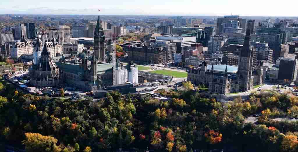
The Rideau Canal represents the best-preserved example of a slackwater canal in North America and the only canal from the early 19th-century construction era that remains operational along its original line with most structures intact. Completed in 1832, this 202-kilometer waterway connects Ottawa on the Ottawa River with Kingston on Lake Ontario, utilizing a combination of natural waterways, constructed channels, and 47 hand-operated locks overcoming 83 meters of elevation change. Built under military engineer Lieutenant Colonel John By following the War of 1812, the canal served strategic purposes as a secure military supply route avoiding the vulnerable St. Lawrence River border with the United States. The canal’s construction represented an extraordinary engineering achievement for its era, accomplished through manual labor in wilderness conditions where diseases including malaria killed significant numbers of workers.
UNESCO inscription in 2007 recognized the Rideau Canal under cultural criteria for representing a masterpiece of human creative genius and providing outstanding testimony to early industrial technology. The designation specifically noted the canal’s demonstration of European slackwater technology adapted to North American conditions, using lakes and rivers as part of the navigation system rather than constructing continuous artificial channels. The 47 locks remain hand-operated using original mechanisms, with 24 lockstations preserving their initial configuration and stone architecture. Lockmaster houses, many still occupied by Parks Canada staff, maintain the distinctive military architecture specified in By’s plans. The canal’s survival as a recreational waterway rather than being abandoned or replaced demonstrates adaptive reuse preserving heritage assets while serving contemporary functions. This operational continuity distinguishes the Rideau from canal systems preserved as industrial monuments but no longer navigable.
Visitors experience the Rideau Canal through recreational boating during the May-October navigation season or skating on the Ottawa portion during winter months when a 7.8-kilometer section through downtown becomes the world’s largest naturally frozen skating rink. More than 25,000 recreational vessels transit the canal annually, including rental houseboats, private pleasure craft, and tour vessels. Lockstations along the route welcome visitors with interpretive panels explaining construction techniques, military history, and lockmaster functions. The Parks Canada Visitor Centre in downtown Ottawa provides comprehensive orientation to the canal’s history and operation. Several lockstations offer particularly scenic settings: Jones Falls features a 108-meter stone arch dam, the highest in North America when completed; Merrickville preserves an intact lockmaster’s house and stone blockhouse; Ottawa Locks near Parliament Hill provide urban canal experience within sight of national landmarks. The canal corridor’s Parks Canada designation protects not just the waterway and locks but also adjacent heritage buildings, industrial sites, and cultural landscapes documenting 19th-century settlement patterns along this strategic transportation route.
Pimachiowin Aki, Ontario-Manitoba (2018)
Pimachiowin Aki represents Canada’s only mixed UNESCO World Heritage Site, recognized for both natural qualities as boreal forest wilderness and cultural significance as an Indigenous landscape where Anishinaabe peoples continue traditional stewardship practices. Spanning 29,040 square kilometers across Ontario-Manitoba border, this vast territory encompasses interconnected waterways, boreal forests, wetlands, and river systems under the jurisdiction of four Anishinaabe First Nations: Bloodvein River, Little Grand Rapids, Pauingassi, and Poplar River. The site’s name means “the land that gives life” in Anishinaabemowin, reflecting the fundamental relationship between people and environment sustained across generations through activities including hunting, fishing, gathering, and seasonal movement across traditional territories. This living cultural landscape demonstrates how Indigenous stewardship creates conservation outcomes while maintaining cultural practices, offering alternative models to wilderness preservation based on human exclusion.
UNESCO inscription in 2018 recognized Pimachiowin Aki under both natural and cultural criteria—specifically for containing superlative natural phenomena and areas of exceptional beauty, and for bearing exceptional testimony to cultural traditions demonstrating sustainable relationships with the environment. The designation resulted from more than 15 years of collaborative effort by the four First Nations developing the nomination and management frameworks ensuring Indigenous authority over the territory. The boreal forest ecosystem contains pristine watersheds, untouched by industrial logging or mining, supporting caribou, black bears, wolves, and migratory birds. The cultural landscape preserves traditional travel routes marked by culturally modified trees, seasonal camps, sacred sites, and evidence of occupation spanning millennia. The integration of natural and cultural values in a single designation reflects UNESCO’s evolving recognition that categories separating nature from culture fail to represent Indigenous worldviews where land, resources, and cultural identity form inseparable relationships.
Public access to Pimachiowin Aki requires advance permission from the First Nations authorities who govern the territory and strictly control visitation to protect both environmental integrity and cultural sensitivity. The site does not function as a conventional park with public infrastructure, but rather as protected Indigenous territory where limited cultural tourism may develop under community-controlled frameworks respecting privacy and sacred places. Interested visitors must contact the Pimachiowin Aki Corporation, the management entity representing the four First Nations, to inquire about access possibilities. This restricted approach distinguishes Pimachiowin Aki from other World Heritage Sites emphasizing public visitation, reflecting the site’s primary functions: maintaining Indigenous stewardship, protecting pristine ecosystems, and demonstrating that heritage protection can occur through Indigenous governance rather than conventional park management. The designation creates international recognition of Indigenous conservation success while respecting communities’ authority to determine if, when, and how outsiders may visit their territory.
Western Canada: Natural Wonders and Indigenous Cultural Sites
Western Canada from the Prairies through British Columbia contains eight UNESCO World Heritage Sites dominated by natural designations protecting exceptional mountain, prairie, and coastal ecosystems alongside cultural sites documenting Indigenous heritage spanning thousands of years. This region includes some of Canada’s most celebrated landscapes and most remote protected areas, from heavily visited Rocky Mountain parks to wilderness locations requiring expedition-level access.
Head-Smashed-In Buffalo Jump, Alberta (1981)
Head-Smashed-In Buffalo Jump preserves one of the oldest, largest, and best-preserved buffalo jump complexes in North America, documenting sophisticated hunting techniques practiced by Plains Indigenous peoples for nearly 6,000 years. Located at the edge of the Porcupine Hills in southern Alberta, this site comprises a sandstone cliff where hunters drove buffalo herds to their deaths, along with an extensive processing area below containing drive lanes, gathering basins, camping areas, and meat processing locations. The jump’s name derives from Blackfoot oral tradition describing a young man who watched from beneath the cliff as buffalo fell around him, ultimately being crushed against the rock face. The exceptional preservation includes bone beds more than 10 meters deep at the cliff base, drive lane cairns extending across the prairie uplands, and extensive archaeological deposits documenting millennia of seasonal use.
The hunting technique demonstrated at Head-Smashed-In required sophisticated ecological knowledge, community coordination, and landscape engineering. Hunters constructed drive lanes using stone cairns that channeled buffalo from gathering grounds toward the cliff edge, with runners wearing buffalo robes and wolf skins directing the herd. Timing coincided with seasonal buffalo migrations when large herds moved through the region. Processing the hundreds of animals killed in successful jumps required butchering stations, drying racks for meat preservation, pounding areas for making pemmican, and hide processing areas, with evidence suggesting these activities occurred primarily during late summer and fall. UNESCO inscription in 1981 recognized Head-Smashed-In under cultural criteria for representing an outstanding example of a traditional land use system and bearing unique testimony to a now-vanished cultural tradition. The site’s scientific value includes not just archaeological remains but also the broader landscape revealing how Indigenous peoples engineered environments to support their economies.
Visitors explore Head-Smashed-In through an interpretive center built into the hillside near the jump cliff, approximately 18 kilometers northwest of Fort Macleod and a two-hour drive south of Calgary. The award-winning center contains five levels of exhibits explaining plains ecology, buffalo biology, hunting techniques, and Blackfoot culture. Displays incorporate archaeological artifacts, life-size dioramas, and multimedia presentations. Guided and self-guided trails lead to the cliff edge where visitors observe the topography that made the jump effective, and extend across the uplands where drive lanes remain visible as linear arrangements of stone cairns. The site’s interpretive approach emphasizes Indigenous perspectives through exhibits developed collaboratively with Blackfoot elders and historians, presenting buffalo hunting not as primitive resource exploitation but as sophisticated ecological management requiring deep environmental knowledge. Views from the cliff extend across the Alberta prairie and eastward to the Rocky Mountain foothills, providing context for understanding how buffalo movements between summer and winter ranges created predictable hunting opportunities at topographic features like Head-Smashed-In.
Dinosaur Provincial Park, Alberta (1979)
Dinosaur Provincial Park contains exceptional concentrations of fossils from the Late Cretaceous Period approximately 75 million years ago, when the area comprised subtropical coastal plains inhabited by diverse dinosaur species. The park’s badlands terrain, characterized by deeply eroded hills, ravines, and hoodoos carved from soft sedimentary rock, creates both spectacular landscapes and exceptional fossil exposure. More than 40 dinosaur species have been identified from park specimens, including complete skeletons of ceratopsians like Centrosaurus, hadrosaurs like Corythosaurus, and tyrannosaurs including Albertosaurus. Beyond dinosaurs, fossil assemblages document ancient crocodiles, turtles, fish, amphibians, plants, and marine organisms from when the Western Interior Seaway flooded central North America. The exceptional preservation includes rare finds of fossilized dinosaur skin impressions, eggs, and possible trace fossils of dinosaur behavior.
UNESCO inscription in 1979 recognized Dinosaur Provincial Park under natural criteria for representing a major stage in Earth’s history and containing superlative natural phenomena. The designation noted the park’s unparalleled significance for understanding dinosaur evolution and Late Cretaceous ecosystems, with more than 300 specimens from park excavations now housed in museums worldwide, including over 150 complete skeletons. The vertical stratigraphy documents millions of years of environmental change as sea levels fluctuated and landscapes shifted between marine and terrestrial conditions. Ongoing research continues producing discoveries, with new species regularly identified from unstudied collections and fresh exposures created by erosion. The park’s value extends beyond individual specimens to assemblages showing complete community structure: which species coexisted, what they ate, how predator-prey relationships functioned, and how ecosystems responded to environmental changes.
Visitor access to Dinosaur Provincial Park centers on a 27-kilometer scenic drive through the badlands and guided programs revealing fossils in protected areas. The park is located 48 kilometers northeast of Brooks via Highway 544, approximately 200 kilometers southeast of Calgary. The park’s visitor center provides exhibits contextualizing the fossil record and explaining paleontological research methods. Public trails including the 1.5-kilometer Badlands Trail and 1.3-kilometer Cottonwoods Trail enable self-guided exploration of the unique landscape. However, the most significant fossil beds lie within restricted Natural Preserve areas accessible only through guided programs. These include bus tours to fossil-bearing exposures where guides demonstrate in-situ specimens, and specialized programs like the Centrosaurus Bone Bed Hike where visitors observe concentrations of bones from mass death assemblages. The Royal Tyrrell Museum of Palaeontology in nearby Drumheller houses extensive Dinosaur Provincial Park collections, providing comprehensive interpretation of discoveries from the World Heritage Site and broader Alberta badlands.
Canadian Rocky Mountain Parks, Alberta-British Columbia (1984, 1990)
The Canadian Rocky Mountain Parks comprise a contiguous protected area encompassing 23,000 square kilometers of exceptional mountain scenery across four national parks—Banff, Jasper, Kootenay, and Yoho—along with three British Columbia provincial parks: Mount Robson, Mount Assiniboine, and Hamber. This designation represents one of the world’s most significant protected mountain ecosystems, containing classic examples of glaciated mountain landscapes with high peaks, icefields, limestone caves, canyons, waterfalls, and alpine lakes. The parks protect major headwater regions of North America’s river systems, with waters flowing to three oceans: the Pacific via the Columbia River system, the Atlantic via the Nelson River and Hudson Bay, and the Arctic Ocean via the Athabasca-Mackenzie system. This tri-ocean hydrological divide creates exceptional ecological diversity, with distinct plant and animal communities adapted to moisture gradients and microclimates within the broader alpine environment.
UNESCO inscription began in 1984 with Banff, Jasper, Kootenay, and Yoho national parks recognized for exceptional natural beauty and ongoing geological processes. The designation expanded in 1990 to include the three British Columbia provincial parks, acknowledging that ecological and geological features transcended administrative boundaries. The parks contain more than 100 peaks exceeding 3,000 meters, 1,600 square kilometers of ice in the Columbia Icefield, and exceptional examples of overthrust mountain-building where ancient rock layers were thrust eastward over younger formations. The Burgess Shale deposits in Yoho National Park preserve exceptionally detailed fossils from the Cambrian Explosion 505 million years ago, when most modern animal groups first appeared—a paleontological treasure of global significance enclosed within the larger natural heritage designation. Wildlife populations include grizzly bears, black bears, wolves, wolverines, mountain goats, bighorn sheep, and caribou utilizing extensive wilderness habitats.
Visitor infrastructure varies dramatically across the four national parks and three provincial parks comprising this UNESCO site. Banff and Jasper national parks, accessible via the Trans-Canada Highway and Icefields Parkway, attract millions of annual visitors with developed townsites, extensive trail networks, and iconic attractions including Lake Louise, Moraine Lake, Maligne Lake, and the Columbia Icefield Glacier Adventure. Kootenay National Park, straddling the Continental Divide along Highway 93 South, offers hot springs, painted pots mineral formations, and wilderness access from highway trailheads. Yoho National Park features Takakkaw Falls, Emerald Lake, and the restricted-access Burgess Shale guided hikes. The three provincial parks receive far fewer visitors, with Mount Robson accessible via Highway 16 offering views of the highest peak in the Canadian Rockies at 3,954 meters, while Mount Assiniboine and Hamber Provincial Parks function as wilderness areas requiring multi-day backcountry trips. This range from heavily developed to wilderness protection demonstrates landscape-scale conservation encompassing both accessible tourism zones and protected core areas where ecological processes continue with minimal human intervention.
Waterton-Glacier International Peace Park, Alberta-Montana (1995)
Waterton-Glacier International Peace Park unites Waterton Lakes National Park in Alberta with Glacier National Park in Montana, creating the world’s first International Peace Park when established in 1932. This transnational designation symbolizes peaceful coexistence between Canada and the United States while protecting an exceptional mountain ecosystem spanning the Continental Divide. The 457,614-hectare combined area encompasses dramatic mountain-prairie interface, where Rocky Mountain peaks rise abruptly from the Great Plains without foothills transition, creating exceptional ecological diversity within a compact area. The parks protect watersheds flowing to three oceans via the tri-ocean hydrological divide, support diverse wildlife including grizzly bears and mountain goats, and preserve glacially carved landscapes including the U-shaped valleys, cirques, and over 50 glaciers and permanent snowfields remaining from thousands that covered the region during past ice ages.
UNESCO inscription in 1995 recognized Waterton-Glacier under natural criteria for representing outstanding examples of ongoing geological processes, containing superlative natural phenomena, and providing significant natural habitats for biological diversity conservation. The designation specifically noted the parks’ demonstration of mountain-building through overthrust geology, where ancient Precambrian rock formations were thrust eastward over younger Cretaceous layers. This dramatic geology creates colorful rock formations visible throughout both parks, with red and green argillites, white limestone, and dark mudstones creating distinctive striped mountain slopes. The ecological significance stems from the parks’ position at the intersection of different climatic zones and their protection of complete elevational gradients from prairie grasslands at 1,100 meters to alpine zones exceeding 3,000 meters. This gradient supports more than 1,000 vascular plant species, exceptional for a northern latitude mountain region.
Access to the Canadian portion requires traveling to Waterton Lakes National Park at Alberta’s southwestern corner, reached via Highway 5 south from Highway 2 or via Chief Mountain Highway (summer only) from Montana. The historic Prince of Wales Hotel, constructed in 1927 on a bluff overlooking Upper Waterton Lake, provides iconic views across the international boundary. The townsite of Waterton offers services, accommodations, and trailhead access. Popular activities include the boat tour to Goat Haunt in Montana via Upper Waterton Lake—the only regular cross-border passenger service in the parks—and hiking trails including Crypt Lake Trail, consistently rated among North America’s best day hikes despite requiring boat access and scrambling through a narrow tunnel. The Going-to-the-Sun Road on the Montana side, one of America’s most scenic mountain highways, provides vehicle access across the Continental Divide with multiple viewpoints and trailheads. The International Peace Park designation creates symbolic rather than administrative unity, as each country manages its portion independently, though research, wildlife management, and fire management involve cross-border cooperation recognizing that ecological processes ignore international boundaries.
Wood Buffalo National Park, Alberta-Northwest Territories (1983)
Wood Buffalo National Park encompasses 44,807 square kilometers of boreal forest, freshwater delta, and prairie environments protecting the world’s largest population of free-roaming wood bison and the only natural nesting habitat of the endangered whooping crane. This vast park straddling the Alberta-Northwest Territories boundary represents one of the largest protected areas in North America, preserving intact ecosystems rarely found at this scale in developed countries. The Peace-Athabasca Delta within the park constitutes one of the world’s largest inland deltas, supporting exceptional wetland biodiversity and serving as critical habitat for millions of migratory birds along the Central and Mississippi Flyways. The park also contains outstanding karst landscapes with extensive salt plains, sinkholes, and underground dissolution features created by groundwater erosion of subsurface gypsum and limestone deposits.
UNESCO inscription in 1983 recognized Wood Buffalo under natural criteria for containing superlative natural phenomena and providing significant natural habitats for threatened species conservation. The wood bison population, numbering approximately 5,000 animals, represents the species’ recovery from near-extinction in the early 20th century, though disease management challenges persist. The whooping crane nesting grounds remained undiscovered until 1954, and the park’s remote wetlands protect the only natural breeding population of these critically endangered birds. Seasonal bird migrations bring hundreds of thousands of waterfowl to the Peace-Athabasca Delta, creating concentrations supporting significant Indigenous subsistence harvests. The salt plains and karst features represent unique geological phenomena shaped by dissolution of ancient marine evaporite deposits, creating landscapes unlike typical boreal environments.
Access to Wood Buffalo National Park presents significant challenges given its vast size, remote location, and limited infrastructure. The park headquarters in Fort Smith, Northwest Territories, provides visitor information and interpretive exhibits, but most of the park’s area lies far from roads or communities. Highway 5 crosses the park’s eastern section connecting Fort Smith to Fort Chipewyan, Alberta, providing access to some features including the salt plains viewpoint. Experienced wilderness travelers can undertake multi-day expeditions by canoe along the Peace, Athabasca, and Slave river systems, though these require serious backcountry skills and bear safety knowledge. Flightseeing tours from Fort Smith or Fort Chipewyan offer aerial perspectives on the delta, bison herds, and karst landscapes impossible to appreciate from ground level. The park’s remoteness and harsh climate—with winter temperatures reaching -50°C—mean visitor numbers remain extremely low compared to accessible World Heritage Sites, with most visitation concentrated in summer months when roads are passable and insects tolerable. This limited access protects the wilderness values and wildlife populations that warranted UNESCO designation while creating one of Canada’s least-visited World Heritage Sites despite its exceptional significance.
SGang Gwaay, British Columbia (1981)
SGang Gwaay, also known as Ninstints or Anthony Island, preserves the remains of a Haida village on a small island in Haida Gwaii archipelago off British Columbia’s north coast. The site contains monumental mortuary and memorial poles, house remains, and archaeological deposits documenting intensive occupation by the Kunghit Haida until the late 19th century when smallpox epidemics decimated the community, forcing survivors to relocate. The 10 remaining standing poles and numerous fallen poles represent exceptional examples of Haida artistic traditions and memorial practices, where carved cedar poles commemorated chiefs, recorded family lineages, and marked significant events. The isolated setting preserved these poles from removal to museums—the fate of many Haida poles from more accessible villages—creating a rare opportunity to experience monumental Haida art in its original cultural landscape rather than as museum specimens.
UNESCO inscription in 1981 recognized SGang Gwaay under cultural criteria for representing a unique artistic achievement and bearing testimony to a significant cultural tradition. The designation specifically noted how the remaining poles, house platforms, and surrounding coastal rainforest together create a visual key to Haida oral traditions and demonstrate relationships between people, art, and landscape. The site forms part of Gwaii Haanas National Park Reserve, National Marine Conservation Area Reserve, and Haida Heritage Site, managed collaboratively by Parks Canada and the Council of the Haida Nation under a unique cooperative management agreement. This arrangement ensures Haida authority over their ancestral territory while maintaining federal protection. The poles continue to deteriorate naturally, with fallen poles left where they lie in accordance with Haida philosophical acceptance of natural cycles rather than European preservation approaches emphasizing indefinite material conservation.
Access to SGang Gwaay requires advance reservations, chartered boat or floatplane transportation from the nearest communities on Haida Gwaii, and participation in mandatory orientation programs respecting the site’s cultural significance. The island lies in the southern portion of Gwaii Haanas, approximately 90 kilometers south of Skidegate. Haida Watchmen—community members trained in site protection and interpretation—maintain seasonal presence on the island, guiding visitors through the village remains while explaining pole meanings, Haida artistic conventions, and the village’s tragic abandonment. The experience emphasizes cultural protocols including observing restrictions on touching poles or removing any materials, maintaining respectful behavior in what remains a sacred place for Haida people, and understanding that the site represents both extraordinary artistic achievement and profound loss. Weather and sea conditions frequently disrupt access to the exposed island, requiring flexible scheduling and willingness to accept cancellations. This challenging access protects the fragile poles from excessive visitation while ensuring that those who make the effort understand the site’s deep cultural significance rather than treating it as a mere scenic attraction.
Kluane / Wrangell-St. Elias / Glacier Bay / Tatshenshini-Alsek, Yukon-Alaska (1979, 1992, 1994)
This transnational World Heritage Site protects an exceptional mountain wilderness spanning the Canada-Alaska border, encompassing Kluane National Park and Reserve in Yukon alongside Wrangell-St. Elias National Park, Glacier Bay National Park, and Tatshenshini-Alsek Provincial Park in Alaska and British Columbia. Together these protected areas cover 98,391 square kilometers—an area larger than Ireland—containing the world’s largest non-polar ice fields, extensive glacier systems including more than 100 major glaciers, and North America’s highest coastal mountains. Mount Logan in Kluane, Canada’s highest peak at 5,959 meters, rises in a landscape where massive ice sheets feed valley glaciers extending dozens of kilometers. The region supports populations of grizzly bears, wolves, Dall sheep, mountain goats, and caribou in wilderness habitats experiencing minimal human impact despite proximity to coastal population centers.
UNESCO inscription began in 1979 with Kluane and Wrangell-St. Elias, expanded in 1992 to add Glacier Bay, and reached its current extent in 1994 with Tatshenshini-Alsek inclusion. The designation recognizes exceptional natural beauty, ongoing geological processes including active tectonics and glaciation, and biological diversity. The site demonstrates dramatic mountain-building from the collision of the Pacific and North American tectonic plates, creating the massive St. Elias and Wrangell mountain ranges. The extensive glaciation represents ice age conditions persisting into the present, with glaciers exhibiting the full range of glacial features from icefall to terminal moraine. The Alsek River, one of few rivers cutting completely through the coastal mountains from interior to ocean, created a major route for plant and animal dispersal following the last ice age, producing exceptional biodiversity as species from different regions converged and adapted to steep environmental gradients.
Access to the Canadian portions of this transnational site varies from relatively straightforward to expedition-level challenging. Kluane National Park headquarters in Haines Junction provides visitor services and interpretive exhibits, with the Alaska Highway providing access to several trailheads and viewpoints along the park’s eastern boundary. However, the vast majority of the park, including Mount Logan and the ice fields, lies in designated wilderness accessible only by air charter or multi-day wilderness expeditions. The Alsek River offers one of North America’s premier wilderness rafting experiences, though its technical difficulty and remoteness require guided expeditions costing thousands of dollars per person. Flightseeing tours from Haines Junction provide the most accessible way to appreciate the ice fields, glaciers, and high peaks that define this World Heritage Site, as ground-level views from highway locations see only the park’s margins while the spectacular core requires aerial perspective. The Alaska portions offer different access patterns, with Glacier Bay National Park accessible by boat or floatplane from Juneau, while Wrangell-St. Elias provides limited road access to mining ghost towns on the park’s periphery.
Writing-on-Stone / Áísínai’pi, Alberta (2019)
Writing-on-Stone preserves the largest concentration of rock art on the North American Great Plains, documenting Indigenous spiritual and historical narratives spanning at least 3,000 years of continuous cultural occupation. Located along the Milk River in southern Alberta near the Montana border, this site encompasses sandstone hoodoos and cliff faces bearing thousands of petroglyphs (images carved into rock) and pictographs (images painted on rock) created by Blackfoot peoples and their ancestors. The imagery depicts ceremonial scenes, hunting expeditions, warfare, spiritual visions, and astronomical observations, with some images relating directly to Blackfoot oral histories transmitted across generations. The surrounding prairie landscape remains largely unchanged from the precontact period, maintaining the spiritual and cultural context essential for understanding why this particular location became sacred and how the rock art relates to broader belief systems about the relationship between the physical and spiritual worlds.
UNESCO inscription in 2019 recognized Writing-on-Stone / Áísínai’pi under cultural criteria for bearing exceptional testimony to a cultural tradition and providing an outstanding example of a traditional human settlement demonstrating interaction with the environment. The Blackfoot name Áísínai’pi translates roughly as “it is pictured” or “it is written,” reflecting the site’s role as a place where spiritual power enables communication between worlds. The sandstone formations themselves hold spiritual significance, believed to house powerful beings and serve as locations for vision quests and ceremonies. The concentration and diversity of rock art at Writing-on-Stone exceeds other Plains sites, with continuing addition of new imagery by contemporary Blackfoot artists maintaining living cultural traditions rather than treating rock art as archaeological relics. Collaborative management between Parks Canada and Blackfoot communities ensures that interpretation respects cultural protocols while enabling public appreciation of this exceptional artistic and spiritual landscape.
Visitor access to Writing-on-Stone / Áísínai’pi through the provincial park surrounding the UNESCO core area provides opportunities to experience the landscape and see selected rock art panels while protecting sensitive spiritual areas from unrestricted access. The park is located 100 kilometers southeast of Lethbridge via Highway 4 and secondary roads. An interpretive center provides context on Blackfoot culture, rock art significance, and the site’s geological formation. Self-guided trails reach some pictograph and petroglyph panels visible from designated viewpoints, while the most significant rock art concentrations remain in restricted areas accessible only through guided tours offered during summer months. These mandatory guided programs ensure visitor understanding of cultural protocols, protect fragile rock surfaces from touching or vandalism, and maintain respect for continuing spiritual significance. The hoodoo formations and prairie landscape create striking settings even without viewing rock art, demonstrating the powerful spiritual atmosphere that drew people to this location across millennia. Camping facilities in the provincial park enable multi-day visits combining rock art appreciation, hiking, and evening programs exploring Blackfoot astronomy and oral traditions.
Northern Canada: Wilderness and Indigenous Heritage
Canada’s territories hold two UNESCO World Heritage Sites representing exceptional wilderness values and Indigenous cultural landscapes in regions experiencing minimal human impact outside Indigenous communities. These sites encompass vast areas accessed primarily by air or multi-day river expeditions, preserving ecological and cultural qualities increasingly rare in the developed world.
Nahanni National Park Reserve, Northwest Territories (1978)
Nahanni National Park Reserve protects 30,000 square kilometers of spectacular wilderness surrounding the South Nahanni River, one of North America’s premier wild rivers flowing through the Mackenzie Mountains. The park contains exceptional natural features including Virginia Falls—a waterfall 90 meters high, twice the height of Niagara Falls—four major canyons with walls exceeding 1,000 meters, extensive karst terrain with massive cave systems, and hot springs creating unique thermal microenvironments. The landscape results from complex interactions between tectonic uplift, river erosion, glaciation, and limestone dissolution, creating varied terrain from sharp peaks of the Ragged Range to flat-bottomed canyons where the river has cut through uplifted plateaus. The pristine watersheds support healthy populations of grizzly bears, wolves, Dall sheep, mountain goats, and woodland caribou in habitats largely unaffected by industrial development.
Nahanni was among the inaugural 12 UNESCO World Heritage Sites designated in 1978, recognized under natural criteria for representing outstanding natural beauty and significant natural phenomena. This early recognition reflects the park’s exceptional qualities and Canada’s commitment to protect such places before industrial pressures threatened their integrity. The original designation covered a smaller core area around the South Nahanni River, expanded in 2009 to protect complete watersheds and wildlife habitat, though the UNESCO designation boundary has not been updated to reflect the expanded park. Indigenous peoples, primarily Dene, have used these lands for thousands of years, with cultural sites including hunting camps, tool-making locations, and spiritual sites scattered throughout the park. Contemporary Dene communities maintain connections to Nahanni, participating in park management and exercising treaty rights for subsistence harvesting.
Access to Nahanni National Park Reserve requires chartered floatplane or helicopter, as no roads reach the park and surrounding wilderness extends hundreds of kilometers in all directions. The park’s remoteness and undeveloped character mean most visitors experience Nahanni through multi-day river expeditions on the South Nahanni, typically 10-14 day trips starting from points accessible by floatplane and ending at Nahanni Butte village. These trips require advanced whitewater paddling skills or hiring outfitters providing guided raft expeditions. Virginia Falls serves as the signature destination, with trails enabling portage around the spectacular drop and viewpoints revealing the famous Mason Rock spire dividing the falls. Several specialized outfitters based in Yellowknife, Fort Simpson, and other regional centers offer Nahanni expeditions, though limited permits and high costs—typically exceeding $5,000 per person—mean fewer than 1,000 people visit annually. This low visitation protects wilderness values while ensuring Nahanni remains among the most exclusive wilderness experiences accessible to adventurous travelers willing to invest the time, skill, and resources required to reach this remote World Heritage Site.
Tr’ondëk-Klondike, Yukon (2023)
Tr’ondëk-Klondike, inscribed in 2023 as Canada’s most recent World Heritage Site, recognizes the exceptional confluence of Indigenous cultural landscapes and Klondike Gold Rush history where the Tr’ondëk Hwëch’in First Nation’s traditional territory witnessed one of history’s most dramatic resource rushes. Located near Dawson City in Yukon, this site encompasses subarctic river valleys, fishing camps, trails, and cultural sites documenting continuous Tr’ondëk Hwëch’in occupation spanning thousands of years, alongside the remarkably preserved remains of the 1896-1899 gold rush that brought tens of thousands of prospectors to the region and transformed both Indigenous communities and global economic patterns. The dual designation recognizes both Indigenous heritage demonstrating sophisticated subarctic adaptation and the Gold Rush as a globally significant historical event with lasting cultural impacts, from creating Yukon Territory to influencing the development of Alaska and shaping worldwide perceptions of northern frontiers.
UNESCO inscription recognized Tr’ondëk-Klondike under cultural criteria for bearing exceptional testimony to a cultural tradition (Tr’ondëk Hwëch’in subarctic lifeway), providing outstanding examples of human settlement and land use (both Indigenous fishing camps and Gold Rush mining operations), and representing a significant stage in human history (the Klondike Gold Rush as global phenomenon). The site encompasses multiple component areas including Tr’ochëk, the principal Tr’ondëk Hwëch’in gathering place at the confluence of the Klondike and Yukon rivers where families congregated annually for salmon fishing, and Dawson City, where many buildings from the gold rush era survive in excellent condition due to permafrost preservation and subarctic climate limiting decay. The designation explicitly acknowledges how the gold rush both disrupted Indigenous communities and created the contemporary mixed society where Tr’ondëk Hwëch’in people continue asserting cultural identity alongside descendants of gold rush participants.
Visitors to Tr’ondëk-Klondike access the site primarily through Dawson City, reached via the Klondike Highway from Whitehorse or summer-only Top of the World Highway from Alaska. Dawson preserves its late 19th-century character with wooden boardwalks, historic buildings including dance halls and hotels, and Klondike National Historic Sites interpreting the gold rush. The Tr’ondëk Hwëch’in Heritage Department offers guided tours to Tr’ochëk and other cultural sites, providing Indigenous perspectives on how the gold rush affected communities and how contemporary Tr’ondëk Hwëch’in maintain connections to traditional lands. Restored gold rush-era buildings include the Commissioner’s Residence, SS Keno sternwheeler, and various commercial structures. Visitors can pan for gold, tour historic dredges, explore nearby mining claims via backcountry roads, and attend the Dawson City Music Festival and other cultural events celebrating the region’s complex heritage. This World Heritage Site demonstrates UNESCO’s evolving approach to recognizing places where multiple cultural narratives intersect, acknowledging both Indigenous heritage predating European contact and the transformative impacts of resource extraction economies that redefined northern landscapes and communities.
Understanding UNESCO World Heritage Designation
The UNESCO World Heritage Convention represents one of the most successful international heritage protection frameworks, with 195 countries ratifying the treaty and more than 1,150 sites designated worldwide. Understanding how sites achieve World Heritage status illuminates why certain locations receive this recognition while others of national importance do not, and clarifies the practical implications of designation for heritage protection, management, and public access. This process balances expert assessment of heritage values against political considerations, funding availability, and each country’s strategic priorities for promoting its cultural and natural treasures to global audiences.
The Ten Criteria for Outstanding Universal Value
Sites nominated for World Heritage status must meet at least one of ten criteria defining “outstanding universal value”—qualities so exceptional that their protection transcends national interest to become a matter of concern for all humanity. Criteria i through vi address cultural heritage, while vii through x apply to natural heritage. Cultural criteria recognize masterpieces of human creative genius, interchange of human values across regions or periods, unique testimony to civilizations, outstanding examples of architectural ensembles or settlement types, traditional land use demonstrating sustainable interaction with environment, and direct associations with ideas or beliefs of outstanding universal significance. Natural criteria address superlative natural phenomena or exceptional beauty, major stages in Earth’s history, ongoing ecological or biological processes, and significant natural habitats for in-situ conservation of biological diversity.
Sites may meet multiple criteria, strengthening nominations by demonstrating various forms of exceptional value. For example, the Canadian Rocky Mountain Parks meet criteria for both exceptional natural beauty and ongoing geological processes, while the Historic District of Old Québec satisfies criteria for fortified town planning and testimony to colonial settlement patterns. Mixed sites like Pimachiowin Aki must satisfy both cultural and natural criteria, demonstrating inseparable relationships between cultural practices and environmental qualities. The criteria framework evolved over decades to become more inclusive of non-European heritage, traditional landscapes, and Indigenous cultural expressions that earlier definitions emphasizing monuments and formal architecture undervalued. Contemporary nominations increasingly emphasize cultural landscapes, sustainable land use traditions, and serial sites linking multiple locations that together demonstrate outstanding universal value no single component possesses individually.
From Tentative List to Inscription
The path to World Heritage designation begins with each country’s tentative list—an inventory of properties the country may nominate in future years. Sites must appear on the tentative list at least one year before formal nomination, enabling preliminary review of whether properties might satisfy UNESCO criteria. Canada’s current tentative list includes 10 locations ranging from Vancouver Island’s Gwaii Haanas to Inuit hunting grounds in Nunavut to the Transatlantic Cable ensemble connecting European and North American communication. The tentative list process enables countries to develop comprehensive heritage protection strategies rather than nominating sites opportunistically, though political considerations and regional equity often influence which tentative list sites advance to formal nomination.
Formal nominations undergo rigorous evaluation by advisory bodies: ICOMOS for cultural sites, IUCN for natural sites, and ICCROM for conservation standards. These organizations conduct detailed research, site visits, and technical assessments producing recommendations to the World Heritage Committee. Evaluations examine whether sites genuinely meet claimed criteria, possess adequate legal protection and management systems, maintain integrity and authenticity, and demonstrate how designation will enhance rather than threaten their conservation. The World Heritage Committee, comprising representatives from 21 countries elected for rotating terms, makes final decisions during annual meetings held in different member countries. The Committee may inscribe sites as proposed, defer decisions requesting additional information, refer nominations for substantial revision, or decline inscription. Sites successfully inscribed join the World Heritage List receiving formal recognition, though UNESCO provides no direct funding for site management or conservation—these responsibilities remain with the designating country.
Management Requirements and Periodic Reporting
Countries with designated World Heritage Sites commit to maintaining the outstanding universal value that warranted inscription, submitting periodic reports documenting site conditions, management effectiveness, and emerging threats. Canada participates in periodic reporting cycles every six years for North American sites, producing detailed assessments of each site’s conservation status, visitor management approaches, community engagement, and responses to challenges including climate change, development pressure, and resource extraction conflicts. These reports enable UNESCO to identify sites requiring technical assistance or facing serious deterioration that might warrant “in danger” listing—a designation mobilizing international support but also indicating conservation failures.
Management plans for each site must balance heritage protection with sustainable use, Indigenous rights, public access, scientific research, and community needs. Parks Canada manages most Canadian World Heritage Sites as national parks or historic sites, though several involve provincial jurisdiction, Indigenous governance, or collaborative management arrangements. Pimachiowin Aki’s Indigenous-controlled management represents an innovative model where First Nations authorities lead site governance, while urban sites like Old Québec require coordination among municipal governments, property owners, heritage organizations, and residents whose daily lives occur within the protected zone. This management complexity distinguishes World Heritage Sites from conventional museums where a single institution controls access and conservation decisions.
Visiting Canada’s UNESCO World Heritage Sites: Practical Considerations
Canada’s 22 UNESCO World Heritage Sites vary dramatically in accessibility, from urban historic districts welcoming millions of annual visitors to remote wilderness areas reached only by chartered aircraft and accommodating hundreds of visitors maximum. This disparity reflects both the geographic diversity of Canada’s heritage and the differing conservation philosophies applied to accessible cultural sites versus fragile wilderness ecosystems where controlled visitation protects both environmental integrity and visitor safety. Understanding these access patterns enables realistic trip planning and appropriate expectations for what each site offers.
Most Accessible Sites: Urban and Highway-Adjacent Locations
Five World Heritage Sites offer straightforward access requiring no special permits, wilderness skills, or significant expense beyond normal travel costs. The Historic District of Old Québec and Old Town Lunenburg function as living communities where heritage protection coexists with urban life, enabling unlimited access via public streets, commercial areas, and public spaces. Visitors walk freely through these sites experiencing heritage architecture as the backdrop for contemporary activities. The Rideau Canal operates as public infrastructure, with recreational boating requiring only standard vessel operation skills and seasonal passes. The Canadian Rocky Mountain Parks, despite their wilderness scale, provide highway access along the Trans-Canada Highway and Icefields Parkway, with developed townsites, campgrounds, and trail networks accommodating millions of visitors annually without wilderness travel skills. Writing-on-Stone / Áísínai’pi surrounds a provincial park with campgrounds, interpretive facilities, and guided programs during summer months, making it the most accessible Plains Indigenous cultural site despite restrictions on some areas.
These accessible sites enable UNESCO World Heritage tourism as a component of broader Canadian travel rather than specialized expeditions. Families, casual tourists, and international visitors can experience these places within normal travel budgets and timeframes, though peak season crowding at Banff and Jasper requires advance planning for accommodations and popular attractions. The accessibility supports both tourism economies and heritage protection by creating constituencies valuing these sites’ preservation and generating revenue supporting conservation programs. However, accessibility creates management challenges balancing visitation with heritage protection, particularly at natural sites where trampled vegetation, wildlife disturbance, and infrastructure demands can degrade the qualities warranting World Heritage designation.
Intermediate Access: Seasonal and Permit-Restricted Sites
Eight World Heritage Sites require more planning but remain accessible to reasonably fit visitors willing to travel to remote locations or participate in guided programs. Gros Morne National Park, Dinosaur Provincial Park, Head-Smashed-In Buffalo Jump, Landscape of Grand Pré, Joggins Fossil Cliffs, Red Bay Basque Whaling Station, Miguasha National Park, and Mistaken Point fall into this category, offering visitor facilities, interpretive programs, and trail systems but requiring specific travel to reach them. These sites generally lie outside major urban areas, necessitating rental vehicles or tour group participation. Mistaken Point and several fossil sites mandate participation in guided tours protecting fragile resources from uncontrolled access, requiring reservations and flexibility for weather cancellations.
Intermediate access sites reward dedicated heritage tourists willing to venture beyond the most-visited destinations. The fossil sites—Joggins, Miguasha, Mistaken Point, and Dinosaur Provincial Park—create a paleontological tourism circuit for visitors fascinated by Earth’s deep history, though their dispersed locations across five provinces prevent visiting multiple sites in a single trip. The Acadian heritage sites—Landscape of Grand Pré and Red Bay—appeal to visitors tracing cultural diaspora stories across the Maritimes. These sites typically receive tens of thousands of annual visitors rather than the millions visiting Banff or Quebec City, creating more intimate experiences but also limiting visitor services, seasonal operations, and tour departure frequencies. Success visiting these sites requires advance research on seasonal access, tour schedules, and nearby accommodations, transforming heritage tourism from casual sightseeing into purposeful travel focused on specific heritage themes.
Challenging Access: Wilderness Expeditions and Restricted Territory
Nine World Heritage Sites require significant resources, specialized skills, or special permissions, limiting visitation to hundreds or low thousands annually. Nahanni National Park Reserve, Wood Buffalo National Park, the remote portions of Kluane / Wrangell-St. Elias / Glacier Bay / Tatshenshini-Alsek, and SGang Gwaay demand chartered aircraft, multi-day wilderness expeditions, or expedition guide services costing thousands of dollars per person. These sites protect wilderness values through remoteness and limited infrastructure rather than through visitation restrictions, though practical access barriers effectively limit visitor numbers to levels causing minimal environmental impact. L’Anse aux Meadows, Waterton-Glacier International Peace Park, and Anticosti lie at Canada’s geographic extremities requiring dedicated travel to reach, though facilities exist once visitors arrive.
Pimachiowin Aki represents a distinct access model where Indigenous authorities control visitation to protect cultural integrity and resident privacy, requiring advance permission from First Nations governments who may decline access requests. This restricted approach reflects UNESCO’s evolving recognition that heritage protection sometimes requires limiting public access, particularly for living cultural landscapes where Indigenous communities maintain traditional practices incompatible with unrestricted tourism. The wilderness sites create premium experiences for adventure travelers willing to invest significant time and money accessing exceptional landscapes rarely experienced by casual tourists, generating economic benefits for small specialized outfitters and northern communities while maintaining the pristine conditions that warranted World Heritage recognition. However, the high costs and skill requirements create equity concerns, raising questions about whether elite access models conflict with UNESCO’s ideals of heritage belonging to all humanity.
Seasonal Considerations and Climate Challenges
Most Canadian World Heritage Sites experience dramatic seasonal variations affecting both access and visitor experience. The northern and mountain sites face weather extremes limiting operational seasons, with many parks and historic sites closing entirely from October through May when snow cover, extreme cold, and reduced daylight create hazardous conditions or prevent cost-effective operations. The Rideau Canal transforms from summer boating waterway to winter skating surface, creating distinct seasonal experiences. The tidal sites—Joggins Fossil Cliffs and coastal areas of other Maritime locations—depend on daily tidal cycles determining when fossil-bearing zones become accessible, requiring trip timing around published tide tables.
Climate change increasingly impacts visitation patterns and heritage conservation. Glacial recession in the Rocky Mountain Parks and Kluane alters landscapes faster than natural processes would suggest, creating urgency around visiting threatened features before they disappear. Warmer temperatures extend hiking seasons but also increase wildfire risks, occasionally closing parks or creating hazardous air quality. Permafrost thaw threatens historic buildings in northern sites like Dawson City. Sea level rise and coastal erosion accelerate natural deterioration of fossil-bearing cliffs at Mistaken Point and Joggins, creating conservation dilemmas about whether to let natural processes continue or intervene protecting irreplaceable resources. These climate pressures transform heritage tourism from documenting unchanging treasures to witnessing dynamic systems responding to global environmental change, adding poignancy to visits as travelers recognize they may be among the last generations experiencing certain landscapes in their current state.
Conservation Challenges Facing Canada’s World Heritage Sites
UNESCO World Heritage designation provides international recognition and moral authority supporting conservation efforts, but does not guarantee protection from the multiple pressures threatening heritage sites in the 21st century. Canada’s sites face challenges ranging from climate change impacts to development conflicts to questions about how Indigenous rights and heritage protection interact. Understanding these pressures reveals that World Heritage designation represents a beginning rather than endpoint in heritage conservation, requiring ongoing management, adequate funding, community engagement, and political will to maintain the outstanding universal value that warranted inscription.
Climate Change: The Universal Threat
Climate change affects every Canadian World Heritage Site, though impacts vary by location and heritage type. The mountain and northern sites face the most dramatic transformations, with glacial recession, permafrost thaw, and shifting vegetation zones fundamentally altering landscapes. The Columbia Icefield in the Canadian Rocky Mountain Parks has lost significant ice mass since the 1980s, with projections suggesting most glaciers will disappear by century’s end. Nahanni’s glaciers similarly retreat, altering river flows and aquatic ecosystems dependent on glacial meltwater. Wood Buffalo National Park experiences permafrost degradation threatening both wildlife habitat and archaeological sites preserved by frozen ground. Coastal sites face accelerating erosion and storm surge damage, with Mistaken Point’s fossil surfaces experiencing increased weathering rates that may destroy specimens before documentation.
Cultural sites face different but equally serious climate pressures. Historic buildings in Quebec City and Lunenburg confront more frequent freeze-thaw cycles degrading stone and mortar, increased precipitation causing water infiltration, and changing snow loads stressing heritage roof structures. The Rideau Canal faces challenges maintaining ice thickness for winter skating as temperatures warm. Indigenous cultural sites including rock art at Writing-on-Stone and traditional structures face accelerated deterioration as climate patterns change. These impacts force difficult decisions about intervention levels, as aggressive conservation measures may preserve physical fabric but alter authentic historic materials and construction methods. Climate adaptation planning now forms a required element of World Heritage site management, though adequate funding for necessary measures often lags behind identified needs.
Resource Extraction and Development Pressures
Several World Heritage Sites face threats from resource extraction activities in surrounding areas, creating conflicts between heritage protection and economic development. Wood Buffalo National Park confronts pressures from upstream oil sands development altering water flows and quality in the Peace-Athabasca Delta, and from hydroelectric development potentially flooding important habitats. The park’s status on the Reactive Monitoring list reflects UNESCO concerns about cumulative impacts from these activities threatening the site’s outstanding universal value. The mountain parks face periodic proposals for expanded ski area development, telecommunications infrastructure, and transportation corridors through protected areas. Northern sites including Nahanni exist within regions experiencing renewed mining exploration as commodity prices and remote area access improve, requiring vigilant monitoring that proposed activities outside park boundaries do not impact protected values.
Urban World Heritage Sites navigate constant pressure from property owners seeking to modify historic buildings or construct new development within protected zones. Old Quebec and Old Town Lunenburg must balance heritage conservation against property rights and economic development supporting community vitality. Overly restrictive regulations can create heritage districts as museums rather than living communities, while lax enforcement allows incremental degradation eroding heritage character. The Rideau Canal faces development pressure along its shorelines as waterfront property values increase, requiring complex negotiations between Parks Canada’s canal management authority and multiple municipal governments overseeing land use. These conflicts have no perfect solutions, requiring ongoing negotiation balancing heritage protection against legitimate development needs while maintaining the qualities that warranted World Heritage recognition.
Visitation Management and Tourism Impacts
The most accessible World Heritage Sites struggle with overcrowding during peak seasons, particularly Banff and Jasper national parks where summer visitor numbers sometimes exceed infrastructure capacity. Popular locations including Lake Louise, Moraine Lake, and Maligne Lake experience severe congestion requiring vehicle access restrictions, advance reservation systems, and shuttle bus mandates during peak periods. Overuse impacts include trampled vegetation, wildlife displacement from high-traffic areas, trail erosion requiring constant maintenance, and degraded visitor experiences as natural settings become dominated by crowds. The COVID-19 pandemic temporarily reduced visitation but subsequent rebound exceeded pre-pandemic levels as domestic tourism surged. This pressure forces Parks Canada to implement increasingly restrictive management approaches balancing public access against ecological protection.
Less-visited sites face different challenges: insufficient visitation to generate revenue supporting conservation and education programs, difficulty maintaining specialized interpretive staff for limited visitor numbers, and infrastructure deterioration when use levels cannot justify maintenance investments. Sites like Miguasha, Joggins, and Red Bay provide exceptional heritage experiences but struggle with financial sustainability outside brief summer seasons. The disparity between heavily visited and neglected sites creates equity questions about which heritages receive public support and which become forgotten despite UNESCO recognition. Ideal visitation levels sufficient to support conservation without causing damage differ by site, requiring tailored management approaches rather than universal policies.
Indigenous Rights and Collaborative Management
Many Canadian World Heritage Sites occupy traditional Indigenous territories where contemporary First Nations exercise treaty rights, maintain cultural connections, and increasingly assert governance authority. Reconciling World Heritage frameworks developed under Western heritage paradigms with Indigenous worldviews, rights, and decision-making approaches creates both challenges and opportunities for more effective conservation. Pimachiowin Aki’s Indigenous-controlled management demonstrates one model where First Nations authorities lead site governance, while SGang Gwaay operates under cooperative management between Parks Canada and the Council of the Haida Nation. These arrangements recognize that effective heritage protection requires Indigenous participation as rights-holders rather than stakeholders, shifting power dynamics in site management.
However, tensions persist where Parks Canada’s conservation mandates conflict with Indigenous harvesting rights, ceremonial practices, or territorial governance claims. Writing-on-Stone’s designation as World Heritage Site required extensive negotiation ensuring Blackfoot communities maintain access for spiritual practices and contemporary rock art creation despite restrictions on public access. The Tr’ondëk-Klondike designation emerged from Tr’ondëk Hwëch’in First Nation leadership recognizing World Heritage status as tool for asserting cultural presence and protecting heritage from development pressures. Moving forward, successful World Heritage conservation in Canada requires genuine power-sharing, adequate resourcing for Indigenous management capacity, and willingness to adapt UNESCO frameworks accommodating Indigenous governance structures and knowledge systems alongside Western conservation science.
The Future of Canada’s World Heritage Portfolio
Canada’s tentative list contains 10 sites under consideration for future World Heritage nomination, representing diverse heritage types from Inuit cultural landscapes in the Arctic to historic communication infrastructure to additional natural wonders. These potential additions would address geographic and cultural gaps in Canada’s current portfolio, particularly the absence of designated sites in Saskatchewan, Prince Edward Island, and Nunavut, and limited representation of certain Indigenous cultural traditions and industrial heritage. However, the path from tentative list to inscription requires substantial investment in nomination preparation, with costs exceeding hundreds of thousands of dollars per nomination for research, documentation, management plan development, and stakeholder consultation.
Emerging Heritage Concepts and Evolving Criteria
UNESCO’s approach to World Heritage continues evolving, with recent designations emphasizing cultural landscapes, industrial heritage, and places where natural and cultural values intertwine. This evolution creates opportunities for sites previously considered marginal candidates, particularly landscapes lacking monumental architecture but demonstrating sustainable land use or significant cultural associations. The mixed category enabling Pimachiowin Aki’s designation may apply to other Indigenous territories where cultural practices and ecological conservation remain inseparable. Serial nominations linking multiple related locations may enable recognition of phenomena like Canada’s fur trade history or Great Lakes maritime heritage that no single location could demonstrate adequately. These evolving approaches make World Heritage designation accessible to broader heritage types beyond traditional monuments and pristine wilderness.
Climate heritage represents an emerging concept potentially relevant to Canadian sites. As climate change transforms landscapes and threatens cultural sites, some heritage professionals advocate recognizing places documenting climate impacts or demonstrating adaptation responses as heritage worthy of protection. This could include glacier monitoring sites showing long-term environmental change, coastal areas experiencing accelerated erosion, or communities implementing innovative climate adaptation. Such designations would transform World Heritage from commemorating past achievements to documenting ongoing environmental transformations and human responses. However, climate heritage concepts remain controversial, with concerns about politicizing UNESCO processes and whether dynamic, changing places fit frameworks designed for protecting stable heritage values.
Balancing Addition with Stewardship
Canada faces strategic decisions about whether to pursue additional World Heritage nominations or focus resources on maintaining existing sites. Each designation brings prestige and tourism potential but also creates perpetual management obligations, reporting requirements, and vulnerability to “in danger” listing if conservation standards slip. Countries with large World Heritage portfolios face criticism for nomination-focused strategies while neglecting site management, though Canada’s record managing its 22 sites remains strong with no sites listed as in danger. The balance between expanding recognition and deepening commitment to existing sites becomes more pressing as climate change, funding constraints, and complex Indigenous rights negotiations increase management costs.
Some heritage advocates argue Canada should prioritize advancing nominations from underrepresented regions and cultural groups, particularly Indigenous cultural landscapes and industrial sites documenting Canada’s development. Others suggest focusing on cooperative management improvements, particularly increasing Indigenous authority over sites within traditional territories. Financial realities constrain both approaches, as Parks Canada budgets face pressure from aging infrastructure, climate adaptation costs, and increasing visitor management needs. Federal elections and changing government priorities affect resource allocation, creating uncertainty about long-term commitments to both new nominations and existing site management. These constraints suggest Canada’s World Heritage portfolio may grow slowly in coming decades, with careful selection of nominations representing truly exceptional values rather than expanding the list for completeness or regional representation.
Frequently Asked Questions
What makes a site eligible for UNESCO World Heritage designation?
Sites must demonstrate outstanding universal value by meeting at least one of ten specific criteria spanning cultural achievements, natural wonders, and mixed qualities. Cultural criteria address human creativity, value interchange, unique testimony to civilizations, architectural achievements, traditional land use, and associations with significant ideas or events. Natural criteria recognize exceptional beauty, geological processes, ecological importance, and biodiversity conservation. Beyond meeting criteria, sites require adequate legal protection, effective management systems, and demonstrated commitment to long-term conservation. The site must possess integrity (completeness and wholeness of heritage values) and authenticity (truthfulness and credibility of attributes). These demanding standards ensure World Heritage designation represents genuine international significance rather than national pride, with most nominated sites rejected or deferred for additional work before achieving inscription.
Can anyone visit UNESCO World Heritage Sites in Canada?
Most Canadian World Heritage Sites welcome public visitation, though access conditions vary dramatically. Urban sites like Old Quebec and Old Town Lunenburg offer unrestricted access via public streets. National parks including Banff, Jasper, Gros Morne, and Dinosaur Provincial Park maintain developed visitor infrastructure with trails, campgrounds, and interpretive facilities accessible to general tourists. However, several sites require special arrangements: Mistaken Point mandates guided tours to protect fragile fossils, SGang Gwaay requires chartered boat transportation and advance reservations with Haida Watchmen, and Pimachiowin Aki restricts access requiring permission from First Nations authorities. Remote wilderness sites including Nahanni and portions of Wood Buffalo demand specialized wilderness skills, chartered aircraft, and expedition-level planning. While UNESCO ideals emphasize heritage belonging to all humanity, practical access barriers including distance, cost, required skills, and protective restrictions mean experiencing some sites remains beyond most visitors’ capabilities and budgets.
Does UNESCO provide funding for Canadian World Heritage Sites?
UNESCO does not provide operational funding for World Heritage Sites, which remain the financial responsibility of the countries that nominated them. The World Heritage Fund, supported by member country contributions, assists with emergency conservation, technical training, and promotional activities, but focuses primarily on developing countries lacking resources for adequate site management. Canadian sites receive funding through federal budgets supporting Parks Canada operations, provincial park systems, and heritage conservation programs, supplemented by admission fees, concession revenues, and partnerships with tourism operators and non-profit organizations. The World Heritage designation itself generates indirect economic benefits through enhanced tourism appeal and international recognition supporting fundraising efforts, but does not include direct financial support. Sites facing serious threats may access World Heritage Fund emergency assistance, though Canada has never required such intervention given its strong domestic conservation capacity and adequate funding by international standards.
How does climate change affect Canadian World Heritage Sites?
Climate change impacts every Canadian World Heritage Site through various mechanisms depending on location and heritage type. Mountain and northern natural sites experience glacial recession, permafrost thaw, shifting vegetation zones, altered wildlife patterns, and changing fire regimes. The Columbia Icefield in Banff and Jasper has lost substantial ice mass with most glaciers projected to disappear within decades. Coastal sites face accelerated erosion threatening both fossil-bearing cliffs at Joggins and Mistaken Point and historic structures. Heritage buildings in Quebec City and Lunenburg confront increased freeze-thaw cycles, changing precipitation patterns, and structural stresses from altered snow loads and temperature extremes. Cultural sites including rock art experience accelerated deterioration. These impacts require extensive adaptation planning, increased monitoring, and difficult decisions about intervention levels balancing physical preservation against maintaining heritage authenticity. Climate change has emerged as the most pervasive long-term threat to World Heritage values, requiring significant increases in conservation investment and potentially fundamental reconsideration of what heritage protection means when the conditions that created heritage qualities no longer exist.
What is the difference between natural, cultural, and mixed World Heritage Sites?
Natural World Heritage Sites meet criteria emphasizing exceptional ecosystems, geological features, natural beauty, or biodiversity conservation, protecting places valued primarily for environmental qualities shaped by non-human processes. Canada’s 11 natural sites include mountain parks, fossil beds, and wilderness areas. Cultural World Heritage Sites meet criteria addressing human achievement including architecture, settlement patterns, artistic traditions, and historical significance, protecting places valued for what humans created or how people interacted with landscapes. Canada’s 10 cultural sites range from fortified colonial towns to Indigenous cultural landscapes to engineering marvels. Mixed sites must satisfy both natural and cultural criteria, representing places where environmental qualities and human activities remain inseparable. Canada has one mixed site, Pimachiowin Aki, where Indigenous stewardship practices and boreal forest ecosystems form integrated heritage warranting protection of both cultural traditions and natural habitats. These categories reflect UNESCO’s organizational structure with separate advisory bodies evaluating natural versus cultural nominations, though contemporary heritage thinking increasingly questions whether rigid separation makes sense for places where nature and culture always intertwined.
Can World Heritage Sites lose their designation?
UNESCO can remove sites from the World Heritage List if the qualities that warranted inscription deteriorate or disappear, though this occurs rarely with only three sites ever delisted. Sites facing serious threats may be listed as “in danger,” mobilizing international attention and potential technical assistance while signaling conservation failures. The “in danger” listing serves as warning that delisting may follow if conditions do not improve, though UNESCO generally works cooperatively with countries to address problems rather than pursuing punitive delisting. Periodic reporting requirements enable UNESCO to monitor site conditions and identify emerging threats before they become crises. Canada has never had a site listed as in danger, reflecting strong domestic heritage protection frameworks and adequate management funding. However, ongoing concerns about upstream development impacts on Wood Buffalo National Park demonstrate that even well-managed sites face pressures potentially compromising outstanding universal value if not addressed through sustained conservation efforts and regulation of activities outside park boundaries that nonetheless impact protected heritage.
How do Indigenous communities participate in managing World Heritage Sites?
Indigenous participation in World Heritage Site management ranges from consultation to cooperative governance to full Indigenous control depending on site history, jurisdiction, and relationships between Indigenous nations and government authorities. Pimachiowin Aki operates under full Indigenous governance, with four Anishinaabe First Nations controlling access and management decisions through the Pimachiowin Aki Corporation. SGang Gwaay functions under cooperative management between Parks Canada and the Council of the Haida Nation, with Haida Watchmen providing on-site interpretation and protection. Writing-on-Stone involves Blackfoot communities in interpretive programs and management planning. Tr’ondëk-Klondike emerged from Tr’ondëk Hwëch’in First Nation leadership as tool for asserting cultural presence and heritage protection. These collaborative approaches recognize that many World Heritage Sites occupy traditional territories where Indigenous peoples maintain rights, knowledge, and cultural connections essential for effective heritage protection. However, significant work remains increasing Indigenous authority over sites within their territories, with ongoing tensions where conservation frameworks developed under Western paradigms conflict with Indigenous governance structures, knowledge systems, and priorities for balancing heritage protection with economic development and community needs.
What role does public access play in World Heritage conservation?
Public access serves multiple conservation purposes including building constituencies supporting heritage protection, generating revenue through tourism supporting site management, and fulfilling UNESCO ideals that heritage belongs to all humanity. However, uncontrolled visitation threatens heritage values through physical impacts including erosion, wildlife disturbance, and facility damage, requiring careful management balancing access against protection. Different site types demand different approaches: urban heritage districts must remain accessible as functioning communities, national parks can implement visitor limits and seasonal closures, and fragile sites may require mandatory guided tours restricting independent exploration. Contemporary heritage management increasingly employs reservation systems, timed entry, shuttle buses, and designated trails concentrating impacts in resilient zones while protecting sensitive areas. Some sites including Pimachiowin Aki prioritize heritage protection and Indigenous privacy over public access, reflecting growing recognition that UNESCO designation does not automatically require unrestricted visitation. The ideal balance varies by site and evolves over time as visitation pressure, climate impacts, and management capacity change.
How long does the World Heritage nomination process take?
World Heritage nomination typically requires five to ten years from initial concept through UNESCO inscription, though timelines vary based on site complexity, stakeholder agreements, and resource availability. The process begins with tentative list inclusion requiring basic research demonstrating potential outstanding universal value. Sites must remain on the tentative list at least one year before formal nomination. Developing the nomination dossier demands extensive documentation proving outstanding universal value, demonstrating adequate protection and management systems, securing agreements from all stakeholders including Indigenous communities and property owners, completing comparative analyses showing the site’s global significance, and preparing detailed management plans. Complex sites involving multiple jurisdictions, contested boundaries, or Indigenous rights negotiations extend timelines significantly. Once submitted, nominations undergo evaluation by advisory bodies requiring one to two years before World Heritage Committee decisions. Nominations often receive deferral requests for additional information or referrals for substantial revision, adding years to the process. The substantial time and cost investment—often hundreds of thousands of dollars for research, consultation, and documentation—means countries carefully select which tentative list sites to advance toward formal nomination.
Are there entrance fees for Canadian World Heritage Sites?
Entrance fee policies vary based on managing authority and site type. Parks Canada national parks including Banff, Jasper, Gros Morne, and others charge entrance fees through daily passes or Discovery Passes providing annual access to all Parks Canada properties. Provincial parks including Dinosaur Provincial Park and Writing-on-Stone charge provincial park fees. Urban sites like Old Quebec and Old Town Lunenburg have no entrance fees as they comprise public streets, though individual attractions within these districts charge admission. Site-specific fees apply at several locations: Rideau Canal charges boating lockage fees, guided programs at Mistaken Point and SGang Gwaay include program fees, and interpretation centers at various sites charge modest admission. Remote wilderness sites including Nahanni typically require no entrance fees but demand expedition costs of thousands of dollars for aircraft charters and outfitter services making fee policies irrelevant compared to access costs. The fee structures reflect broader Canadian approach to heritage funding where operational costs come primarily from public budgets supplemented by user fees rather than relying on entrance charges as primary revenue source.
Conclusion: Heritage as Living Legacy
Canada’s 22 UNESCO World Heritage Sites represent far more than tourist attractions or conservation success stories. They embody ongoing relationships between people and places, contests over how heritage should be protected and who holds authority over protected landscapes, and windows into Earth’s deep history and humanity’s diverse accomplishments across cultures and time periods. From Viking settlements predating Columbus to Indigenous cultural landscapes maintained across millennia to fossil assemblages documenting life’s evolution hundreds of millions of years ago, these sites collectively tell stories of resilience, adaptation, creativity, and connection to land. Their protection reflects values transcending narrow nationalism, asserting that certain places matter to all humanity regardless of location or jurisdiction.
The designation process creating World Heritage Sites reveals heritage as constructed rather than inherent—places become heritage through deliberate choices about what to remember, protect, and celebrate. The evolution from emphasizing European monuments toward recognizing Indigenous landscapes, traditional land use, and industrial heritage demonstrates changing ideas about what heritage means and whose stories deserve international recognition. Canada’s portfolio spanning natural wonders and cultural achievements, accessible urban districts and remote wilderness, reflects the nation’s geographic diversity and the complex histories of Indigenous peoples, European colonization, and contemporary multiculturalism. Yet gaps remain: absent sites in some provinces, limited industrial heritage representation, and ongoing questions about how Indigenous governance and UNESCO frameworks can align.
Looking forward, the greatest challenge facing these sites comes not from neglect but from forces beyond immediate control: climate change transforming landscapes faster than natural processes would suggest, resource extraction pressures testing conservation commitments against economic demands, and difficult questions about balancing heritage protection with contemporary needs including Indigenous self-determination, sustainable development, and public access. World Heritage designation provides tools for addressing these challenges through international recognition, technical guidance, and moral authority supporting conservation. But designation alone cannot preserve sites whose existence depends on glacier-fed rivers that may soon flow only seasonally, permafrost that will thaw, or coastal cliffs eroding into the sea. Heritage protection in the 21st century requires not just defending places from immediate threats but confronting uncomfortable questions about what heritage means when the conditions creating heritage values no longer exist.
For visitors, these World Heritage Sites offer opportunities to witness exceptional places, learn from expert interpretation, and participate in the ongoing project of heritage conservation through mindful tourism, advocacy, and support for protection policies. Whether experiencing urban colonial architecture in Quebec City, marveling at dinosaur fossils in Alberta badlands, paddling wilderness rivers in the Northwest Territories, or learning about Indigenous cultural practices sustained across generations, engagement with these sites connects contemporary travelers to deep time, diverse cultures, and remarkable natural processes. The privilege of access carries responsibilities: treating fragile resources with care, respecting Indigenous cultural protocols, supporting adequate funding for conservation, and advocating for policies prioritizing heritage protection over short-term economic gains. These sites belong to future generations as much as to us, making their protection a measure of our commitment to preserving what we value for those who follow.