
Canada Road Trips Guide: Scenic Drives & Routes
Canada’s vast landscapes stretch across 9.98 million square kilometers, creating some of the world’s most spectacular driving routes through mountain ranges, coastal regions, prairies, and northern wilderness. From the glacier-lined Icefields Parkway through the Canadian Rockies to the coastal curves of Nova Scotia’s Cabot Trail, the country offers road trips that showcase dramatic geological formations, abundant wildlife, and diverse ecosystems accessible by paved and gravel highways.
Key Takeaways
- Icefields Parkway Excellence: The 232-kilometer route between Banff and Jasper ranks among the world’s most scenic highways, passing more than 100 glaciers including the Athabasca Glacier, turquoise lakes like Peyto Lake, and abundant mountain wildlife along the Continental Divide.
- Coastal Diversity: Maritime routes including the 298-kilometer Cabot Trail loop, 489-kilometer Viking Trail, and Pacific Rim Highway showcase Canada’s three ocean coastlines through fishing villages, dramatic cliffs, temperate rainforests, and lighthouse-dotted shores.
- Arctic Adventure: The Dempster Highway extends 736 kilometers from Dawson City to Inuvik, crossing the Arctic Circle and providing the only all-season public road access to Canada’s far north through tundra landscapes and the Richardson Mountains.
- Distance Reality: The Trans-Canada Highway spans approximately 7,800 kilometers from St. John’s, Newfoundland to Victoria, British Columbia, requiring 7-10 days of driving to cross the country, with vast stretches between services in remote regions.
- Seasonal Considerations: Northern routes like the Dempster experience 24-hour midnight sun in summer, while mountain passes face winter closures and spring avalanche risks, making timing crucial for safe travel and optimal viewing conditions.
- Wildlife Encounters: Canadian highways traverse prime habitat for moose, bears, caribou, elk, mountain goats, whales, and migratory birds, requiring vigilant driving and safe distance protocols, particularly at dawn and dusk when animal activity peaks.
People Also Ask About Canada Road Trips
What is the most scenic drive in Canada?
The Icefields Parkway between Jasper and Banff National Parks consistently ranks as Canada’s most scenic drive and one of the world’s most beautiful highways. This 232-kilometer mountain corridor passes more than 100 ancient glaciers, massive waterfalls including Athabasca Falls and Sunwapta Falls, and turquoise lakes such as Peyto Lake and Bow Lake. The route climbs to 2,088 meters at Bow Summit, offering panoramic views of the Continental Divide, while designated pullouts provide opportunities to photograph mountain goats, bighorn sheep, black bears, and grizzly bears. The Cabot Trail in Nova Scotia and Sea-to-Sky Highway in British Columbia also rank highly for coastal and mountain scenery.
How long does it take to drive across Canada?
Driving across Canada from coast to coast along the Trans-Canada Highway requires 7-10 days of continuous travel, covering approximately 7,800 kilometers. The journey from Vancouver, British Columbia to St. John’s, Newfoundland involves roughly 80-100 hours of actual driving time, not including stops for fuel, meals, accommodation, and sightseeing. Northern Ontario presents particularly long stretches between services, with 400-kilometer sections of forest and lakes along Lake Superior’s northern shore. Most travelers add several weeks to explore national parks, mountain towns, and coastal regions rather than completing a straight cross-country sprint.
What are the best road trips for wildlife viewing?
The Icefields Parkway offers exceptional wildlife viewing with frequent sightings of elk, bighorn sheep, mountain goats, black bears, and grizzly bears, particularly in early morning and evening hours. The Dempster Highway through Yukon and Northwest Territories provides opportunities to see caribou, moose, Arctic foxes, golden eagles, and occasional grizzlies in sub-arctic tundra habitat. Coastal routes including the Cabot Trail and Viking Trail excel for whale watching, with humpback, minke, and pilot whales visible from clifftop viewpoints, while the Pacific Rim Highway passes through temperate rainforest habitat supporting Roosevelt elk, black bears, and bald eagles. All wildlife viewing requires maintaining safe distances and never feeding animals.
Which Canadian road trips are suitable for RVs and campers?
The Icefields Parkway accommodates RVs and campers of all sizes with well-maintained paved surfaces and numerous designated pullouts for safe stopping, though steep grades at Bow Summit require attention to vehicle capacity. The Trans-Canada Highway system maintains RV-friendly standards across the country, with established campgrounds in national and provincial parks. The Sea-to-Sky Highway and Cabot Trail handle recreational vehicles well, offering campground options and manageable road conditions. The Dempster Highway requires more rugged preparation with gravel surfaces, limited services at 369-kilometer intervals, and mandatory two spare tires recommended for remote conditions. Most coastal routes and southern highways provide ample RV facilities, fuel access, and campground networks.
Extended multi-day tours – 5+ days
Featured Canada Multi-Day Tour Packages
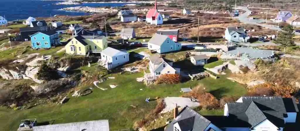
3 days
Canada 3-Day Discovery Tour
- ✓ Comprehensive Canada experience
- ✓ Expert local guides included
- ✓ All accommodation included
- ✓ Transportation provided

5 days
Canada 5-Day Highlights Experience
- ✓ Comprehensive Canada experience
- ✓ Expert local guides included
- ✓ All accommodation included
- ✓ Transportation provided
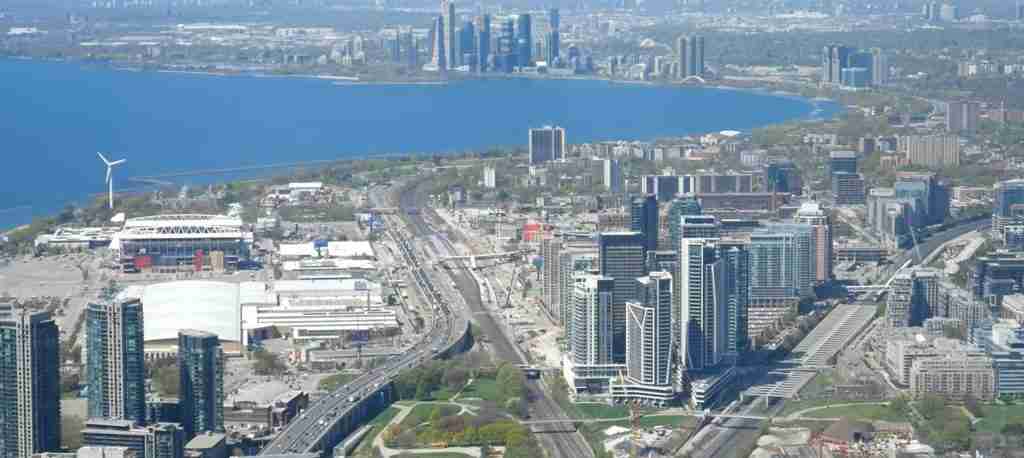
7 days
Canada 7-Day Cultural Journey
- ✓ Comprehensive Canada experience
- ✓ Expert local guides included
- ✓ All accommodation included
- ✓ Transportation provided
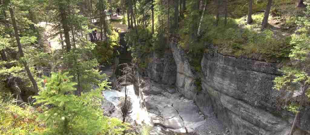
10 days
Canada 10-Day Complete Adventure
- ✓ Comprehensive Canada experience
- ✓ Expert local guides included
- ✓ All accommodation included
- ✓ Transportation provided
Multi-day tour packages powered by TourRadar. Prices and availability subject to change.
Introduction
Canada’s road trip culture reflects the country’s vast geography, sparse population density, and dramatic landscape diversity. The second-largest country by land area offers driving routes that traverse six distinct geographic regions: the Arctic tundra, northern boreal forest, western cordillera mountain ranges, interior prairies, eastern Canadian Shield, and Atlantic coastal lowlands. Each region presents unique driving conditions, wildlife populations, and scenic characteristics that reward extended exploration.
The country’s highway infrastructure spans from the 7,800-kilometer Trans-Canada Highway system connecting all ten provinces to remote gravel roads like the Dempster Highway crossing the Arctic Circle. Mountain passes wind through the Rocky Mountains and Coast Mountains at elevations exceeding 2,000 meters, while coastal highways follow three ocean shorelines along the Pacific, Arctic, and Atlantic coasts. Prairie routes cross 1,300 kilometers of flat agricultural lands, and boreal forest highways penetrate wilderness regions where services appear at 100-200 kilometer intervals.
Canadian road trips accommodate diverse traveler preferences, from luxury highway touring with frequent town stops to wilderness adventures requiring self-sufficiency and remote camping. The country’s 47 national parks, hundreds of provincial parks, and numerous UNESCO World Heritage Sites anchor road trip itineraries, while small towns, fishing villages, and mountain resorts provide cultural encounters and practical services. Summer months from June through September offer the most reliable weather and full facility operations, though shoulder seasons provide fewer crowds and dramatic autumn foliage, while winter driving presents specialized challenges requiring winter tires and avalanche awareness.
Mountain Highways Through the Canadian Rockies
The Canadian Rockies contain the country’s most dramatic mountain scenery, with several world-class driving routes penetrating valleys carved by ancient glaciers. These highways climb through montane forests, alpine meadows, and high mountain passes where snow persists year-round. The region’s sedimentary rock layers, thrust upward 80 million years ago during the Laramide Orogeny, create the distinctive jagged peaks and layered cliffs visible from roadside pullouts.
Icefields Parkway: Banff to Jasper
The Icefields Parkway extends 232 kilometers along Highway 93 between Lake Louise in Banff National Park and Jasper townsite in Jasper National Park, following the Continental Divide through the heart of the Canadian Rockies. This high-elevation route passes more than 100 ancient glaciers, numerous waterfalls, and turquoise lakes fed by glacial meltwater rich in rock flour that creates their distinctive color.
Beginning near Lake Louise, the highway climbs steadily through forested valleys, reaching Bow Summit at 2,088 meters elevation, the highest paved road crossing in Canada. From the summit, a short trail leads to Peyto Lake viewpoint, overlooking the fox-head-shaped glacial lake framed by mountain peaks. The route continues past Bow Lake, where Num-Ti-Jah Lodge has served travelers since the 1940s, before descending toward the Saskatchewan River Crossing, a historic meeting point of Indigenous trading routes.
North of the crossing, the highway enters the Columbia Icefield region, where the massive icefield covers 325 square kilometers and feeds eight major glaciers. The Athabasca Glacier descends toward the highway, with the Columbia Icefield Discovery Centre providing interpretation, facilities, and access to glacier tours aboard specially designed Ice Explorer vehicles. The adjacent Glacier Skywalk extends 280 meters from the clifftop, including a glass-floored observation platform 918 meters above the Sunwapta Valley.
Beyond the icefield, the parkway passes Sunwapta Falls and Athabasca Falls, two powerful waterfalls where glacial rivers have carved deep canyons through limestone bedrock. The final section descends through increasingly dense forest toward Jasper, with frequent wildlife viewing opportunities. Elk commonly graze in roadside meadows, bighorn sheep congregate at mineral licks near pullouts, and black bears and grizzly bears appear in berry patches during late summer and autumn.
The Icefields Parkway operates year-round, though winter driving requires winter tires, reduced speeds, and awareness of avalanche risks. Summer months see heavy traffic, with recreational vehicles and tour buses filling parking areas at major attractions. Spring snowmelt from May through June creates the most powerful waterfall displays, while September brings autumn colors and bugling elk during the rut season. Wildlife viewing peaks in early morning and evening hours when animals feed most actively.
Sea-to-Sky Highway: Vancouver to Whistler
Highway 99, known as the Sea-to-Sky Highway, climbs 154 kilometers from sea level at Horseshoe Bay near Vancouver to the alpine resort village of Whistler, continuing another 60 kilometers to Pemberton. This dramatic route transitions from coastal fjord scenery to mountain peaks, passing through several distinct ecological zones and offering numerous recreational opportunities.
The highway follows the eastern shore of Howe Sound, North America’s southernmost fjord, with granite cliffs rising directly from tidal waters. Shannon Falls Provincial Park preserves British Columbia’s third-highest waterfall, where Shannon Creek plunges 335 meters down a granite cliff face. The nearby Sea-to-Sky Gondola climbs 885 meters to the Summit Lodge, providing panoramic views of Howe Sound and surrounding peaks, with suspension bridges and hiking trails accessing alpine terrain.
Squamish, situated midway along the route, serves as a hub for rock climbing, mountain biking, and windsurfing. The Stawamus Chief, a massive granite monolith rising 702 meters above the town, attracts climbers from around the world, while hiking trails reach three distinct summit plateaus offering increasingly expansive views. Beyond Squamish, the highway climbs more steeply through the Cheakamus Canyon before emerging into the Whistler Valley.
Whistler village, host of alpine skiing events during the 2010 Winter Olympics, operates year-round with hiking, mountain biking, and alpine activities replacing winter sports during summer months. The Peak 2 Peak Gondola connects Whistler and Blackcomb mountains, spanning 4.4 kilometers at heights reaching 436 meters above the valley floor. From Whistler, the highway continues through agricultural valleys to Pemberton, gateway to backcountry areas and the start of gravel forest roads leading deeper into Coast Mountains wilderness.
The Sea-to-Sky Highway remains open year-round, with winter conditions requiring winter tires or chains between October and March. Weekends see heavy traffic, particularly during winter ski season and summer holidays. Several provincial parks and recreation sites provide camping and day-use facilities, while the towns of Squamish and Whistler offer full services and accommodation ranging from campgrounds to luxury resorts.
Crowsnest Highway: Southern Rockies Alternative
Highway 3, the Crowsnest Highway, traverses southern British Columbia and Alberta through the Rocky Mountains via less-traveled passes, offering an alternative to the busy Trans-Canada Highway. This 1,200-kilometer route from Hope, British Columbia to Medicine Hat, Alberta passes through historic mining towns, mountain valleys, and diverse ecosystems while avoiding the commercial tourism centers of Banff and Jasper.
West of the Continental Divide, the highway penetrates the Okanagan Valley wine region before climbing through Manning Provincial Park and the Cascade Mountains. The route crosses Allison Pass and Kootenay Pass, both exceeding 1,700 meters elevation, with steep grades and tight switchbacks requiring attention from drivers of larger vehicles. The Kootenay region contains numerous alpine lakes, hot springs, and small mountain communities preserving heritage architecture from the early mining era.
East of the divide in Alberta, the highway passes through Crowsnest Pass, site of the 1903 Frank Slide where 110 million tons of limestone collapsed from Turtle Mountain, burying part of the mining town of Frank and killing 90 residents. The Frank Slide Interpretive Centre documents this disaster and the region’s coal mining history. Waterton Lakes National Park, accessed via Highway 6 south of the Crowsnest Highway, protects where prairie landscapes meet mountain peaks, with shorter hiking trails and fewer crowds than Banff or Jasper.
The Crowsnest Highway operates year-round, though winter conditions affect the high passes, with potential closures during severe storms. This route suits travelers seeking quieter mountain scenery, historic sites, and less developed areas away from major tourist corridors.
Coastal Drives Along Three Oceans
Canada’s 243,042-kilometer coastline includes shoreline on three oceans: the Pacific, Arctic, and Atlantic. Coastal highways follow cliffs, beaches, and fjords, passing through fishing villages, providing wildlife viewing opportunities, and showcasing maritime cultural heritage.
Cabot Trail: Cape Breton Highland Loop
The Cabot Trail forms a 298-kilometer loop around the northern tip of Cape Breton Island in Nova Scotia, traversing Cape Breton Highlands National Park and offering dramatic views where mountains meet the Atlantic Ocean. This route combines coastal scenery, highland plateaus, Acadian cultural experiences, and Celtic heritage in one of Atlantic Canada’s most celebrated drives.
The trail passes through diverse ecosystems, from coastal barrens and boreal forests to alpine tundra on the highland plateaus. Twenty-six hiking trails branch from the highway, ranging from short interpretive walks to challenging full-day mountain climbs. The Skyline Trail, the park’s most popular hike, follows cliff edges to a viewpoint 300 meters above the ocean, with sunset viewing attracting crowds during summer evenings.
Traveling counterclockwise from Baddeck, the traditional starting point, the route follows the Margaree River valley, renowned for Atlantic salmon fishing, before climbing into the highlands. The western coastal section between Chéticamp and Pleasant Bay clings to steep mountainsides high above the Gulf of St. Lawrence, with hairpin turns and dramatic elevation changes. Pleasant Bay serves as a premier whale-watching location, with boat tours accessing waters frequented by pilot whales, minke whales, humpback whales, and occasional fin whales.
The eastern section descends from the highlands past Ingonish Beach and Cape Smokey before returning to Baddeck along the inland route. The trail passes through Acadian communities preserving French language and culture, with traditional music venues, craft shops, and restaurants serving local seafood specialties. Celtic heritage remains strong in Scottish-settled communities, with fiddle music, Gaelic language preservation efforts, and Highland dancing traditions continuing.
The Cabot Trail operates year-round, though autumn from late September through mid-October attracts the heaviest visitation for fall foliage displays, when mixed hardwood forests transform into vibrant reds, oranges, and yellows. Spring and early summer bring fewer crowds but cooler temperatures and more frequent fog. Winter driving requires winter tires and caution on steep grades, with some facilities and campgrounds closed.
Viking Trail: Newfoundland’s Northern Peninsula
Route 430, known as the Viking Trail, extends 489 kilometers along Newfoundland’s Great Northern Peninsula from Deer Lake to St. Anthony, providing the only road access to Gros Morne National Park and L’Anse aux Meadows National Historic Site, North America’s only authenticated Viking settlement. This route showcases Newfoundland’s dramatic geology, maritime culture, and Norse archaeological significance.
Gros Morne National Park, a UNESCO World Heritage Site, contains exceptional examples of plate tectonics and continental drift visible in surface geology. The Tablelands, an exposed section of Earth’s mantle pushed above sea level, presents an otherworldly orange-brown landscape of peridotite rock where few plants grow due to high heavy metal concentrations. Fjords carved by glaciers penetrate deep into the Long Range Mountains, with Western Brook Pond extending 16 kilometers inland, surrounded by cliffs rising 600 meters from the water.
Beyond Gros Morne, the highway passes through fishing communities where traditional wooden boats and fish-drying stages remain in use. Port au Choix National Historic Site preserves 6,000 years of human occupation, with archaeological sites documenting Maritime Archaic, Groswater Paleoeskimo, Dorset Paleoeskimo, and Recent Indian cultures, plus Basque whaling operations. Extensive coastal trails explore headlands where caribou sometimes appear.
L’Anse aux Meadows, at the northern tip of the peninsula, contains remains of a Norse settlement established around 1000 CE, predating Columbus’s arrival by nearly 500 years. Reconstructed sod buildings demonstrate Viking construction techniques, while interpretation explains Norse exploration and the site’s archaeological significance. The exposed coastal location experiences frequent wind and fog, with stark beauty contrasting with sheltered inland regions.
The Viking Trail operates year-round, though many tourism facilities close between October and May. Icebergs drift past the northern coast from April through July, sometimes visible from highway viewpoints and offering spectacular photography opportunities. Whale watching peaks from June through August. The region experiences cool summers and significant precipitation, with fog common along coastal sections.
Pacific Rim Highway: Vancouver Island’s West Coast
Highway 4, the Pacific Rim Highway, crosses Vancouver Island from Parksville on the Strait of Georgia to the Pacific coast at Ucluelet and Tofino, covering 127 kilometers through temperate rainforest and mountainous terrain. This route provides access to Pacific Rim National Park Reserve, ancient forests, and dramatic coastal scenery where powerful Pacific storms shape rocky shorelines.
The highway climbs through MacMillan Provincial Park, home to Cathedral Grove, where ancient Douglas-fir and western red cedar trees reach 800 years old and 9 meters in circumference. The route continues through Port Alberni before ascending over a steep mountain pass with tight switchbacks and limited shoulders, requiring cautious driving. The road conditions improve west of the summit, though logging truck traffic remains common on this working resource road.
Pacific Rim National Park Reserve protects three distinct units along the west coast. The Long Beach Unit contains 16 kilometers of sandy beach where powerful surf attracts surfers year-round, while storm-watching from October through March draws visitors to witness massive Pacific storms with waves reaching 10 meters. Temperate rainforest trails penetrate dense coastal forests of Sitka spruce, western hemlock, and red cedar, with thick undergrowth of salal, sword fern, and salmonberry.
Tofino and Ucluelet, former fishing and logging towns, now serve as tourism centers for surfing, kayaking, whale watching, and coastal exploration. Both communities offer accommodation, dining, and ocean-based activities, with Tofino developing a reputation for culinary excellence using local seafood, wild mushrooms, and foraged ingredients. The Wild Pacific Trail in Ucluelet provides accessible coastal hiking with views of rocky headlands, small islands, and the Amphitrite Lighthouse.
The Pacific Rim Highway operates year-round, with winter storm-watching becoming increasingly popular despite challenging weather. Summer brings the most stable conditions, though morning fog remains common. The narrow mountain pass requires cautious driving, particularly in rain or when sharing the road with large trucks.
Fundy Coastal Drive: New Brunswick’s Bay of Fundy
The Fundy Coastal Drive follows New Brunswick’s southern coast along the Bay of Fundy, where the world’s highest tides create dramatic tidal ranges exceeding 16 meters. This route connects Saint John to the Nova Scotia border, passing through coastal villages, Fundy National Park, and natural attractions shaped by extreme tidal action.
The Hopewell Rocks, located near Hopewell Cape, demonstrate Fundy’s tidal power most dramatically. Flowerpot rock formations, carved by wave action and erosion, stand 12-20 meters tall on the ocean floor at low tide, accessible by walking trails. Six hours later at high tide, these same formations appear as small islands with only their tops visible above water, accessed by kayak. Interpretive programs explain tidal dynamics, local ecology, and geological processes.
Fundy National Park protects 207 square kilometers of Acadian forest, coastal cliffs, and tidal mudflats. Hiking trails explore inland valleys, waterfalls, and coastal headlands, while the park’s campground and facilities provide a base for exploring the region. The Fundy Footpath, a challenging 41-kilometer wilderness trail along coastal cliffs east of the park, attracts experienced backpackers seeking rugged coastal wilderness.
Fishing villages along the route preserve maritime traditions, with fish weirs, lobster boats, and small harbors defining community life. The town of St. Andrews, founded by Loyalists in 1783, maintains exceptional heritage architecture and serves as a center for whale watching, with minke, humpback, finback, and right whales feeding in Fundy waters during summer months.
The Fundy Coastal Drive operates year-round, with summer offering the warmest temperatures and most reliable weather. Autumn brings vibrant foliage displays and smaller crowds, while winter driving requires caution on coastal roads subject to freezing spray and ice formation.
Northern and Arctic Routes
Canada’s northern highways penetrate wilderness regions where services appear at intervals exceeding 100 kilometers, requiring self-sufficiency, vehicle preparation, and respect for extreme conditions. These routes provide access to landscapes and experiences unavailable in southern regions.
Dempster Highway: To the Arctic Ocean
The Dempster Highway extends 736 kilometers from its junction with the Klondike Highway near Dawson City, Yukon, to Inuvik in the Northwest Territories, with an additional 138-kilometer extension to Tuktoyaktuk on the Arctic Ocean. This is Canada’s only all-season public highway crossing the Arctic Circle, traversing some of the most remote and spectacular terrain on the continent.
The highway begins approximately 40 kilometers east of Dawson City, climbing quickly into Tombstone Territorial Park, where jagged granite peaks rise from tundra valleys. The Tombstone Interpretive Centre provides information, interpretive programs, and trail condition updates. The park’s unique landscape results from glacial erosion carving the Ogilvie Mountains into distinctive shapes, with Tombstone Mountain resembling a grave marker when viewed from the roadside.
North Fork Pass Summit, at 1,289 meters elevation, marks the Dempster’s highest point, with expansive tundra vistas and abundant wildlife. Arctic ground squirrels, pikas, and ptarmigan inhabit the alpine zone, while grizzly bears dig for ground squirrels on tundra slopes. Golden eagles and peregrine falcons hunt from rocky outcrops, and caribou from the Porcupine caribou herd may appear during their annual migrations.
Eagle Plains, located 369 kilometers north of the Klondike Highway junction, provides the only services between Dawson City and Inuvik, with the Eagle Plains Hotel offering accommodation, fuel, vehicle repairs, and a restaurant. This halfway point serves as a turnaround for travelers not continuing to Inuvik. Beyond Eagle Plains, the highway crosses the Arctic Circle at latitude 66°33’N, marked by a sign and pullout where summer solstice visitors experience 24-hour sunlight.
The Richardson Mountains section features dramatic elevation changes and sweeping views before the highway descends to the Peel River crossing, where a free ferry operates during summer months, with an ice bridge replacing it during winter. Fort McPherson, a Gwich’in community, offers services and the Lost Patrol Gravesite, commemorating Northwest Mounted Police members who died attempting to reach Dawson City during winter 1910-1911. The search party was led by Corporal W.J.D. Dempster, for whom the highway is named.
A second ferry crossing spans the mighty Mackenzie River before the final stretch to Inuvik. The town provides full services, the Western Arctic Visitor Information Centre, the distinctive Igloo Church, and the Inuvialuit Cultural Centre. The Inuvik-Tuktoyaktuk Highway, opened in 2017, extends to the Arctic Ocean, allowing travelers to reach Canada’s northernmost road-accessible point.
The Dempster presents unique challenges requiring preparation. The gravel surface, though generally well-maintained, can cause tire punctures, making two full-size spare tires essential. Dust in summer and flying rocks behind passing vehicles require defensive driving. Services at Eagle Plains and Fort McPherson require advance booking during peak season. Weather changes rapidly, with summer temperatures ranging from freezing to 25°C, and mosquitoes appearing in massive swarms during calm conditions. The highway closes temporarily twice yearly during freeze-up and breakup when rivers cannot support either ice bridges or ferries.
Summer midnight sun from late May through July provides 24-hour daylight for exploration, while winter’s polar night creates ideal aurora viewing conditions. Late summer brings tundra vegetation turning brilliant red and gold, creating spectacular autumn colors absent from most Arctic regions. Wildlife viewing requires patience and binoculars, as animals often remain distant from the road corridor.
Alaska Highway: Yukon and Northern British Columbia
The Alaska Highway extends 2,288 kilometers from Dawson Creek, British Columbia, to Delta Junction, Alaska, passing through northern British Columbia and Yukon Territory. Built in 1942 during World War II as a military supply route, this historic highway now serves as the primary overland connection to Alaska and gateway to Yukon’s wilderness.
The southern section crosses boreal forest and passes Stone Mountain Provincial Park and Muncho Lake Provincial Park in British Columbia’s Northern Rockies. Muncho Lake, stretching 12 kilometers through a mountain valley, displays vibrant jade-green color from copper oxide dissolved in glacial meltwater. The highway follows the lake’s western shore with numerous pullouts offering photography opportunities and wildlife viewing, particularly for Stone’s sheep grazing on mineral licks near the road.
Watson Lake, the first Yukon community on the route, features the Sign Post Forest, where travelers have added directional signs since 1942, now numbering over 90,000 posts from around the world. Beyond Watson Lake, the highway crosses relatively flat terrain before reaching Whitehorse, Yukon’s capital and largest community, offering full services and access to the scenic Klondike Highway north to Dawson City.
The section between Whitehorse and the Alaska border passes Kluane National Park and Reserve, a UNESCO World Heritage Site protecting Canada’s highest peaks, including Mount Logan at 5,959 meters. The highway skirts the park’s eastern boundary, with side roads providing access to day-use areas and hiking trails, though the massive icefields and mountain interior remain accessible only by aircraft or extended backcountry expeditions.
The Alaska Highway operates year-round, with services available at regular intervals, though winter driving requires extreme preparation for temperatures dropping below -40°C. Summer brings long daylight hours and the most reliable weather, though road construction projects cause delays. Wildlife hazards include moose, bison, black bears, and grizzly bears, with collisions causing significant vehicle damage and often proving fatal to both animals and occupants.
Eastern and Maritime Routes
Eastern Canada’s highways traverse agricultural lands, historic towns, and coastal regions where European settlement dates back four centuries. These routes connect UNESCO World Heritage Sites, preserved historic districts, and landscapes that inspired Canadian artists.
Thousand Islands Parkway: St. Lawrence Scenic Route
The Thousand Islands Parkway extends 40 kilometers along the St. Lawrence River’s northern shore between Gananoque and Brockville in Ontario, providing scenic views of the 1,864 islands dotting this section of the river. The route offers a peaceful alternative to Highway 401, with frequent pullouts, parks, and access points to Thousand Islands National Park.
The Frontenac Arch, a granite ridge connecting the Canadian Shield with the Adirondack Mountains in New York State, creates the geological foundation for the Thousand Islands region. This exposed bedrock, visible in countless small islands, cliffs, and outcrops, represents some of North America’s oldest rock formations. The parkway passes several sections of Thousand Islands National Park, including Landon Bay with its Lookout Trail providing panoramic views from granite cliffs.
The Thousand Islands Bridge, accessed via Highway 137 at the parkway’s midpoint, connects Canada and the United States, with the 1000 Islands Tower on Hill Island offering 130-meter-high observation decks overlooking the river and its islands. Gananoque and Rockport serve as departure points for boat cruises through the islands, visiting Boldt Castle on Heart Island and other attractions.
The parkway operates year-round as a scenic alternative to Highway 401, with summer bringing the heaviest tourism traffic and autumn offering vibrant foliage displays. Several campgrounds and day-use areas provide facilities, while the towns of Gananoque and Brockville offer accommodation, dining, and services.
Route du Fleuve: St. Lawrence River in Quebec
Route 132 follows the south shore of the St. Lawrence River through Quebec’s Bas-Saint-Laurent and Gaspésie regions, passing historic villages, agricultural lands, and dramatic coastal scenery where the river widens toward the Gulf of St. Lawrence. This route connects Quebec City with the Gaspé Peninsula and maritime provinces.
The Charlevoix region, northeast of Quebec City, contains rolling hills, the St. Lawrence Marine Park protecting beluga whales, and charming villages preserving Quebec heritage architecture. Forillon National Park, at the Gaspé Peninsula’s eastern tip, protects limestone cliffs, coastal forests, and important seabird colonies, with hiking trails exploring headlands and inland valleys.
Percé Rock, a massive limestone formation with a natural arch, rises from the Gulf of St. Lawrence near the town of Percé, creating one of eastern Canada’s most photographed landmarks. Boat tours approach the rock and nearby Bonaventure Island, home to North America’s largest northern gannet colony with 110,000 birds nesting on sheer cliffs during summer months.
Route 132 operates year-round, connecting communities and providing access to maritime attractions, whale watching opportunities, and French-Canadian cultural experiences. Summer brings the most reliable weather and full tourism operations, while autumn offers spectacular foliage and migrating shorebirds along coastal sections.
Trans-Canada Highway System
The Trans-Canada Highway system spans 7,800 kilometers from Victoria, British Columbia, to St. John’s, Newfoundland, crossing all ten provinces and connecting most major cities. This network, designated as Highway 1 across most of its length, provides the primary east-west route across the country, though several alternate routes offer different experiences.
Main Route Through the Provinces
The main Trans-Canada route begins in Victoria, crosses to Vancouver via ferry, then follows the Fraser Canyon through British Columbia’s interior, climbing through Rogers Pass in Glacier National Park at 1,330 meters elevation. The route passes through Revelstoke, Golden, and Lake Louise before descending to Calgary, entering the prairies where the highway crosses flat agricultural lands for 1,300 kilometers through Alberta, Saskatchewan, and Manitoba.
Northern Ontario presents the longest section without major cities, with approximately 2,000 kilometers of boreal forest, exposed Canadian Shield bedrock, and numerous lakes between Kenora and Ottawa. This section includes lengthy stretches between services, particularly along Lake Superior’s northern shore where 400 kilometers separate Sault Ste. Marie and Thunder Bay. The highway passes through Wawa, Marathon, and other small communities immortalized in Gordon Lightfoot’s “Canadian Railroad Trilogy.”
The eastern section crosses southern Ontario’s more densely populated regions before continuing through Quebec, following the St. Lawrence River valley past Montreal and Quebec City. New Brunswick’s section passes through Fredericton and Moncton, with ferry connections to Prince Edward Island. Nova Scotia’s Trans-Canada route crosses the province to Cape Breton Island, where another ferry links to Newfoundland’s western terminus, with the highway continuing across the island to St. John’s.
Yellowhead Highway: Northern Alternative
The Yellowhead Highway, designated Highway 16, provides a northern alternative to the Trans-Canada’s main route, extending from the Pacific coast near Prince Rupert, British Columbia, through Jasper National Park, Edmonton, and Saskatoon, to the Manitoba border. This route offers less traffic than the Trans-Canada, passing through different landscapes and communities.
The western section follows the Skeena River valley through northern British Columbia, where the Coast Mountains create dramatic scenery and numerous opportunities for backcountry exploration. Prince Rupert serves as a major ferry terminus connecting to Haida Gwaii and Alaska. The route continues through Prince George before reaching Jasper National Park’s northern entrance.
East of Jasper, the Yellowhead crosses Alberta’s parkland and prairie regions, passing through Edmonton before entering Saskatchewan’s agricultural heartland. The route serves as an important commercial corridor and provides access to numerous provincial parks and smaller communities away from the Trans-Canada’s main tourist traffic.
Planning and Preparation for Canadian Road Trips
Canadian road trips require different preparation levels depending on route remoteness, season, and vehicle type. All journeys benefit from advance planning addressing vehicle maintenance, emergency supplies, accommodation, and route-specific challenges.
Vehicle Preparation and Maintenance
Pre-trip vehicle inspection should verify tire condition and pressure, including spare tire functionality, brake system operation, fluid levels, battery condition, and cooling system integrity. Remote routes like the Dempster Highway require additional preparation: two full-size spare tires mounted on rims, tire repair kit with plugs and patches, comprehensive tool kit, extra engine oil and coolant, fuel filters, and fan belts. A functioning jack and lug wrench appropriate for your vehicle weight prove essential when changing tires on gravel shoulders.
Northern and mountain routes experience rapid weather changes, making winter emergency supplies advisable even during summer: blankets or sleeping bags, extra clothing, non-perishable food, water, flashlight with extra batteries, first aid kit, basic toolkit, and jumper cables. A fully charged cell phone, portable battery pack, and paper maps supplement electronic navigation, particularly in areas with limited cell coverage.
Fuel range calculations matter significantly on remote routes where gas stations appear at 200-300 kilometer intervals. Fill tanks whenever possible, even if half-full, rather than assuming the next station remains operational. Northern fuel prices typically exceed southern costs by 20-40 percent due to transportation expenses.
Seasonal Considerations
Summer from June through September provides the most reliable weather across most of Canada, with all facilities operating, though this also brings peak tourist crowds and higher accommodation costs. Mountain routes experience afternoon thunderstorms during summer, with lightning risks on exposed ridges and passes. Mosquitoes and biting flies appear in massive numbers during calm conditions in northern and boreal forest regions, particularly from mid-June through July.
Autumn from September through October offers spectacular foliage displays across eastern Canada and Cape Breton Island, with significantly fewer crowds and lower prices. Weather becomes less predictable, with potential for early snowfalls in mountain regions after mid-September. Northern routes see rapid seasonal transition, with autumn colors appearing by late August and snow possible by mid-September.
Winter driving from November through March requires winter tires, reduced speeds, emergency supplies, and acceptance that many attractions close. Mountain highways face avalanche risks, with potential closures at Rogers Pass, the Coquihalla Highway, and other high passes. The Dempster Highway closes temporarily during freeze-up and breakup when rivers cannot support either ferries or ice bridges. Winter does offer unique opportunities: reduced prices, northern lights viewing, and ice roads opening temporary routes to otherwise inaccessible areas.
Spring from April through May sees unpredictable conditions, with mountain passes potentially snow-covered while prairie regions thaw into mud. Waterfalls reach maximum power during snowmelt, creating spectacular displays at Athabasca Falls, Shannon Falls, and other locations. This shoulder season offers the best value for budget travelers, with lower prices and smaller crowds offsetting weather uncertainties.
Wildlife Safety and Viewing
Canadian highways traverse prime wildlife habitat, creating both viewing opportunities and collision risks. Moose, elk, deer, caribou, bison, and bears frequently cross roads, particularly during dawn and dusk hours when animal activity peaks. Moose present the greatest collision danger due to their size, dark color, and tendency to stand motionless on roads. Their long legs position their massive bodies at windshield height, causing catastrophic impacts even at moderate speeds.
Safe wildlife viewing requires remaining in vehicles or maintaining minimum distances when outside: 100 meters from bears, 30 meters from large ungulates like moose and elk, greater distances if animals show agitation. Never feed wildlife or leave food accessible, as habituated animals become dangerous and often require destruction by park wardens. Store all food, scented items, and garbage in vehicles or bear-proof containers when camping.
Mountain highways implement seasonal wildlife corridors and reduced speed zones where collisions occur frequently. Scan roadsides continuously, particularly in vegetated areas near water sources. Reduce speed at dawn and dusk, use high beams when safe, and avoid driving at night in areas with heavy wildlife populations. If animals appear on or near the road, slow gradually without swerving dangerously, as collisions with large animals often prove fatal to both animals and vehicle occupants.
Accommodation Options
Canadian road trips accommodate various budgets and travel styles through diverse lodging options. National and provincial park campgrounds provide the most affordable accommodation, with electrical hookups for RVs at developed campgrounds and primitive tent sites in backcountry areas. Reservations become essential for popular parks during summer, with booking systems opening several months in advance. Many campgrounds close from October through May.
Private campgrounds and RV parks offer more amenities than public facilities, with full hookups, shower buildings, laundry facilities, and wifi. These typically remain open longer into autumn, with some providing year-round service. Costs range from budget to premium depending on facilities and location.
Motels and hotels appear in most communities along major highways, with chains like Best Western, Days Inn, and Super 8 providing consistent quality and amenities. Mountain towns, resort communities, and tourist destinations command premium prices during peak season. Northern communities often have limited accommodation requiring advance booking, particularly Inuvik, Dawson City, and Whitehorse.
Alternative accommodation includes hostels in major tourist towns, bed-and-breakfast establishments in smaller communities, and farm stays in rural areas. Historic hotels operate in several locations, preserving heritage buildings while providing modern amenities. Cabin rentals and lodge accommodation suit longer stays and provide kitchen facilities for meal preparation.
Navigation and Communications
GPS navigation systems and smartphone apps provide reliable route guidance on major highways, though cell coverage remains limited or absent across large sections of northern and remote routes. Paper maps serve as essential backups, with provincial highway maps available free from tourism information centers and detailed topographic maps available from outdoor retailers for backcountry travel.
Cell phone coverage follows population centers and major highways, with reliable service in southern regions but extensive dead zones in northern British Columbia, northern Ontario, and all three territories. Satellite phones or satellite-based emergency communicators provide backup communication options for remote travel, allowing emergency contact when cell service fails.
Highway information services provide current road conditions, construction updates, and weather warnings. These services operate provincially: DriveBC for British Columbia, 511 Alberta, Saskatchewan Highway Hotline, Ontario 511, Quebec 511, and similar services in other provinces. Check these services before departure and during travel to avoid closures, construction delays, and dangerous conditions.
Regional Route Combinations
Many travelers combine multiple scenic routes into extended road trips exploring specific regions. These regional combinations provide coherent itineraries visiting related attractions and landscapes.
British Columbia Mountain Loop
A comprehensive British Columbia mountain loop combines the Sea-to-Sky Highway, Duffey Lake Road, Lillooet, Highway 99 north to Highway 97, the Cariboo region, Highway 16 west through Prince George, and return via Highway 97 south through the Okanagan Valley. This circuit covers approximately 2,000 kilometers, visiting mountain ranges, interior plateaus, wine country, and numerous provincial parks. The route requires 7-10 days with adequate time for hiking, wine tasting, and attraction visits.
Maritime Provinces Circuit
The Maritime Provinces circuit connects the Cabot Trail, Bay of Fundy coast, Prince Edward Island, and coastal Nova Scotia into a comprehensive eastern Canada road trip. Beginning in Halifax, the route visits the South Shore’s lighthouse coast, crosses to Saint John, New Brunswick, follows the Fundy coast to Hopewell Rocks and Fundy National Park, continues to Prince Edward Island via Confederation Bridge, returns to Nova Scotia, and completes with the Cabot Trail on Cape Breton Island. This journey covers approximately 2,500 kilometers requiring 10-14 days for thorough exploration.
Alberta Rockies and Badlands
Alberta’s mountain and prairie combination links the Icefields Parkway, Banff and Jasper National Parks, with the Canadian Badlands of Drumheller and Dinosaur Provincial Park. Starting in Calgary, the route enters Banff National Park, follows the Icefields Parkway to Jasper, returns via Highway 93A and the Bow Valley, then heads east to Drumheller’s hoodoo formations and the Royal Tyrrell Museum, one of the world’s premier paleontology museums. Dinosaur Provincial Park, a UNESCO World Heritage Site, preserves the richest dinosaur fossil beds on Earth. This circuit covers approximately 1,200 kilometers requiring 5-7 days.
Photography and Landscape Documentation
Canadian road trips offer exceptional photography opportunities across diverse landscapes and lighting conditions. Successful landscape photography requires planning around golden hour lighting, weather conditions, and seasonal factors.
Mountain Photography
Mountain landscapes benefit from early morning light when alpenglow colors peaks pink and orange before sunrise. The Icefields Parkway’s numerous pullouts provide foreground elements like streams, lakes, and trees to anchor compositions with distant peaks. Cloudy conditions often produce more dramatic mountain photos than clear blue skies, with storm clouds, fog, and fresh snow adding atmosphere.
Wide-angle lenses capture expansive vistas, while telephoto lenses isolate distant peaks and compress mountain ranges. Polarizing filters reduce haze and enhance blue skies without oversaturating colors. Tripods enable long exposures smoothing water movement and capturing sharp landscapes at optimal apertures.
Coastal Photography
Coastal routes like the Cabot Trail and Pacific Rim Highway offer dramatic cliff-edge compositions, with waves crashing against rocks providing motion and energy. Tidal areas like the Hopewell Rocks require timing visits for optimal tide levels, with low tide exposing formations and high tide creating different compositions. Long exposures of 1-30 seconds blur wave motion into misty abstractions, while fast shutter speeds freeze wave action.
Sunset and sunrise on coasts create spectacular lighting conditions, with reflections on wet sand and dramatic sky colors. Fog and mist add atmosphere to coastal scenes, though protection for camera equipment becomes essential in salt spray environments.
Northern Lights Photography
The Dempster Highway, Alaska Highway, and Yukon routes offer excellent aurora viewing opportunities from late August through April, with peak activity occurring during equinox periods in March and September. Aurora photography requires tripods, wide-angle lenses, and manual exposure control. Settings typically involve 3-15 second exposures at f/2.8 or wider apertures, with ISO 1600-3200, though actual settings vary with aurora brightness.
Scout locations during daylight to find interesting foreground elements like trees, mountains, or buildings silhouetted against the aurora display. Light pollution from towns interferes with aurora photography, making remote highway pullouts ideal. Bring extra batteries as cold temperatures reduce battery life significantly, and use headlamps with red light modes to preserve night vision while adjusting camera settings.
Frequently Asked Questions
Do I need an International Driving Permit to drive in Canada?
Visitors driving in Canada with licenses issued in languages other than English or French require an International Driving Permit as a translated supplement to their valid home country license. Licenses already in English or French typically do not require an IDP, though regulations vary by province. United States driver’s licenses remain valid in Canada without additional documentation. An IDP does not replace your home country license but serves as an official translation recognized by Canadian authorities. Obtain IDPs before departure through automobile associations in your home country, as they cannot be issued in Canada.
What is the speed limit on Canadian highways?
Speed limits on Canadian highways typically range from 80 to 110 kilometers per hour depending on province and road classification. Most provincial highways outside urban areas post limits of 80-90 km/h, while major divided highways like portions of the Trans-Canada Highway allow 100-110 km/h. British Columbia and Alberta post higher limits of 110 km/h on some rural highways, while Quebec uses 100 km/h on most autoroutes. Speed limits drop to 50 km/h in urban areas and 30-40 km/h in residential neighborhoods and school zones. Reduced limits apply in construction zones, with fines doubled for violations. All speed limits use metric measurements in kilometers per hour, not miles per hour as in the United States.
Are gas stations readily available on remote routes?
Gas station availability varies dramatically between southern highways and remote northern routes. Major highways through populated regions offer fuel at 20-50 kilometer intervals, while remote routes like the Dempster Highway, Alaska Highway northern section, and northern Ontario stretches present stations at 200-400 kilometer intervals. The Dempster Highway’s longest gap spans 369 kilometers between services at Dawson City area and Eagle Plains Hotel, making fuel range calculations critical. Always fill tanks when encountering stations on remote routes rather than assuming continued availability. Northern fuel prices typically exceed southern costs by 20-40 percent. Several remote highways experience seasonal station closures, with only summer operations in some communities.
Can I see northern lights on Canadian road trips?
Northern lights appear regularly from September through April across Canada’s northern regions, with the Dempster Highway, Alaska Highway, and routes through Yukon and Northwest Territories offering exceptional viewing opportunities. The aurora zone, where northern lights appear most frequently, extends across northern Canada above latitude 60°N, though displays occasionally reach southern regions during strong geomagnetic activity. Peak aurora viewing occurs during equinox periods in March and September when solar activity increases. Clear dark skies away from light pollution provide optimal conditions, making remote highway pullouts ideal viewing locations. Check aurora forecasts through the Canadian Space Weather Forecast Centre or aurora apps providing real-time activity predictions. Summer’s extended daylight hours in northern regions prevent aurora viewing despite continued activity.
What wildlife hazards should drivers watch for?
Moose present the greatest collision danger on Canadian highways due to their size, dark color, unpredictable behavior, and tendency to stand on roads. Their long legs position their 400-600 kilogram bodies at windshield height, causing catastrophic impacts even at moderate speeds. Collisions with moose prove fatal to vehicle occupants more frequently than with any other wildlife species. Elk, deer, caribou, and bison also create collision risks, particularly during dawn and dusk when animals move most actively. Bears occasionally cross highways but typically avoid vehicles. Scan roadsides continuously in vegetated areas near water sources, reduce speed during low-light conditions, and avoid night driving in areas with heavy wildlife populations. If animals appear on roadways, slow gradually without swerving dangerously, as losing control often causes worse outcomes than controlled collisions with wildlife.
Are camping facilities available along major routes?
National and provincial parks along major scenic routes maintain campgrounds with varying facility levels from primitive tent sites to full-service RV campgrounds with electrical hookups, shower buildings, and interpretive programs. Popular parks like Banff, Jasper, Cape Breton Highlands, and Gros Morne require reservations during summer months, with booking systems opening several months in advance. Many public campgrounds close from October through May. Private campgrounds and RV parks offer more amenities and remain open longer into autumn, with some providing year-round service. Remote routes like the Dempster Highway offer basic territorial park campgrounds with minimal facilities but spectacular locations. Free random camping occurs on Crown land in some provinces following specific regulations, though this requires self-sufficiency and Leave No Trace practices. Research specific routes and make reservations well in advance for summer travel in popular destinations.
How long should I allocate for major scenic drives?
The Icefields Parkway requires minimum 3-4 hours of driving time between Lake Louise and Jasper without stops, though travelers should allocate a full day or two days to visit glaciers, waterfalls, and viewpoints properly. The Cabot Trail loop takes approximately 5 hours of continuous driving but benefits from 2-3 days for hiking, whale watching, and exploring coastal communities. The Dempster Highway to Inuvik requires 10-14 hours of driving one way, with most travelers allocating 4-7 days for the round trip including exploration time. The Trans-Canada Highway crossing the entire country requires minimum 7-10 days of driving, with 3-4 weeks more realistic for meaningful stops and experiences. The Sea-to-Sky Highway between Vancouver and Whistler takes 2 hours without stops, though a full day allows for waterfall visits, gondola rides, and activity participation. Always add significant buffer time beyond minimum driving hours to account for wildlife stops, photography, meals, and unexpected attractions or delays.
What driving conditions should I expect on gravel highways?
Gravel highways like the Dempster Highway, portions of the Alaska Highway’s side routes, and northern access roads require reduced speeds, increased following distances, and defensive driving techniques. Loose gravel reduces traction for braking and cornering, with vehicles requiring 50-100 percent more stopping distance than on paved surfaces. Dust clouds behind vehicles obscure visibility, making passing dangerous and requiring slowing or stopping when encountering oncoming traffic. Sharp rocks and roadway debris cause tire punctures and windshield damage, making spare tires essential and comprehensive vehicle insurance advisable. Washboard surfaces develop on well-traveled gravel roads, creating uncomfortable vibrations at certain speeds. Most drivers find smooth travel either below 30 km/h or above 60 km/h, with middle speeds amplifying washboard resonance. Heavy rain transforms gravel roads into slippery mud, while dry conditions create choking dust. Vehicle underbody protection, engine air filter checks, and two spare tires represent minimum preparation for extended gravel highway travel.
Can I cross into the United States on Canadian road trips?
Multiple border crossings connect Canadian highways with United States routes, allowing combined road trips through both countries. Major crossings include the Peace Arch between Vancouver and Seattle, Detroit-Windsor tunnel and Ambassador Bridge between Ontario and Michigan, Thousand Islands Bridge between Ontario and New York, and numerous crossings from Manitoba, Saskatchewan, Alberta, and British Columbia into adjacent states. United States citizens require valid passports or NEXUS cards for returning home, while Canadian citizens need passports or enhanced driver’s licenses. Third-country nationals must verify visa requirements for both countries before attempting border crossings. Vehicle insurance must meet requirements for both countries, with Canadian insurance policies typically covering United States travel and vice versa, though verification with insurance providers proves essential. Prohibited items including firearms, certain foods, and excessive duty-free allowances cause delays or denial of entry. Expect wait times from minutes to several hours depending on crossing, time of day, and season.
What emergency services operate on remote highways?
Emergency services dial 911 throughout Canada for police, fire, and ambulance response, though response times on remote highways vary from 30 minutes in accessible areas to several hours in far northern regions. Cell phone coverage determines whether 911 calls connect, with extensive dead zones on northern routes requiring satellite phones or satellite-based emergency communicators. Some provinces operate highway-specific emergency numbers providing road condition information and connecting drivers with assistance. RCMP (Royal Canadian Mounted Police) patrol most rural and remote highways, though officers may be stationed hundreds of kilometers from incident locations. Many northern communities maintain volunteer firefighting and search-and-rescue capabilities with varying response capabilities and equipment. Travel insurance including medical evacuation coverage provides critical backup for serious emergencies requiring air ambulance transport from remote locations, as these flights cost $10,000-$50,000 without insurance coverage. Carry comprehensive first aid supplies, emergency shelter, food, and water on remote routes, as self-sufficiency proves essential when help remains hours away.