
Canadian Rocky Mountain Parks UNESCO World Heritage Guide: Complete Natural & Cultural Heritage
The Canadian Rocky Mountain Parks represent one of the most spectacular mountain landscapes on Earth, encompassing seven contiguous protected areas that span 23,600 square kilometers along the Alberta-British Columbia border. Designated as a UNESCO World Heritage Site in 1984, this extraordinary ensemble includes four national parks—Banff, Jasper, Kootenay, and Yoho—alongside three British Columbia provincial parks—Mount Robson, Mount Assiniboine, and Hamber. These parks protect dramatic snow-capped peaks, ancient glaciers, turquoise lakes, thundering waterfalls, and the world-renowned Burgess Shale fossil site, offering visitors an unparalleled journey through both natural beauty and deep geological time.
Key Takeaways About Canadian Rocky Mountain Parks
- Seven-Park UNESCO Ensemble: The World Heritage Site comprises four Canadian national parks (Banff, Jasper, Kootenay, Yoho) and three British Columbia provincial parks (Mount Robson, Mount Assiniboine, Hamber), forming a contiguous protected area of 23,600 square kilometers that straddles the Continental Divide at the highest point of the central Rocky Mountains.
- Dual UNESCO Criteria Recognition: The site earned designation under both natural beauty criterion (vii) for its striking mountain landscapes featuring rugged peaks, icefields, glaciers, alpine meadows, lakes, waterfalls, and extensive karst cave systems, and geological significance criterion (viii) for the Burgess Shale fossil site containing exquisitely preserved soft-bodied marine organisms from 540 million years ago.
- Birthplace of Canadian National Parks: Banff National Park, established in 1885 following the discovery of Cave and Basin Hot Springs by Canadian Pacific Railway workers, became Canada’s first national park and the birthplace of the nation’s park system, predating the UNESCO designation by nearly a century and establishing conservation principles that shaped protected area management across the country.
- Continental Water Tower: The parks protect the headwaters of major North American river systems including the North Saskatchewan, Athabasca, Columbia, and Fraser rivers, with Snow Dome in the Columbia Icefield serving as a hydrological apex where water flows to three different oceans—the Atlantic, Pacific, and Arctic.
- Rich Biodiversity Across Three Life Zones: The parks encompass montane valley forests with the highest biodiversity, subalpine coniferous forests extending through middle elevations, and alpine tundra above treeline, supporting 56 mammal species including grizzly bears, wolves, caribou, and wolverines, plus over 300 bird species across dramatically varied elevations and ecosystems.
- Climate Change Indicator: Glaciers within the parks have experienced dramatic retreat, with glacier cover decreasing by 40 percent between 1919 and 2012, seventeen glaciers disappearing entirely, and 124 fragmenting into multiple ice masses, making these icefields critical indicators of global climate change while remaining among the most accessible and studied glacial systems in North America.
People Also Ask About Canadian Rocky Mountain Parks UNESCO Heritage
What parks are included in the Canadian Rocky Mountain Parks UNESCO World Heritage Site?
The Canadian Rocky Mountain Parks UNESCO World Heritage Site consists of seven contiguous parks: four national parks managed by Parks Canada (Banff, Jasper, Kootenay, and Yoho) and three provincial parks managed by British Columbia (Mount Robson, Mount Assiniboine, and Hamber). The four national parks account for the majority of the site’s 23,600 square kilometers. Banff National Park encompasses 6,641 square kilometers and includes famous landmarks like Lake Louise and the Columbia Icefield. Jasper National Park covers over 11,000 square kilometers as the largest park in the ensemble. Yoho National Park spans 1,313 square kilometers and contains the Burgess Shale fossil site. Kootenay National Park protects 1,406 square kilometers along the Banff-Windermere Highway corridor. The three provincial parks—Mount Robson protecting the Fraser River headwaters and British Columbia’s highest peak, Mount Assiniboine preserving alpine meadows and lakes, and Hamber conserving remote glacier systems—were added to the World Heritage boundaries in 1990 to extend the protected landscape and enhance ecological connectivity across the Continental Divide.
Why are the Canadian Rocky Mountain Parks a UNESCO World Heritage Site?
The Canadian Rocky Mountain Parks earned UNESCO World Heritage designation under two natural criteria reflecting both exceptional beauty and geological significance. Criterion (vii) recognizes the seven parks as forming a striking mountain landscape with rugged peaks, icefields and glaciers, alpine meadows, lakes, waterfalls, extensive karst cave systems including Castleguard Caves, thermal springs, and deeply incised canyons that possess exceptional natural beauty attracting millions of visitors annually. Criterion (viii) acknowledges the Burgess Shale in Yoho National Park as one of the most significant fossil areas in the world, with exquisitely preserved fossils recording a diverse marine community dominated by soft-bodied organisms. Originating soon after the rapid unfolding of animal life about 540 million years ago, the Burgess Shale fossils provide key evidence of the history and early evolution of most animal groups known today. The parks also exemplify ongoing glacial geological processes including icefields, remnant valley glaciers, canyons, and exceptional examples of erosion and deposition throughout the Rocky Mountain Biogeographical Province.
What is the Burgess Shale and why is it significant?
The Burgess Shale is a fossil-bearing rock formation in Yoho National Park containing one of the world’s most important paleontological discoveries—exquisitely preserved remains of soft-bodied marine animals from the Middle Cambrian period, approximately 508 million years ago. Unlike most fossil sites that preserve only hard parts like shells and bones, the Burgess Shale contains about 150 species of soft-bodied organisms including creatures bearing no resemblance to any known animals, providing a complete view of life in ancient seas. These fossils formed when organisms were rapidly buried in fine mud slides, creating exceptional preservation conditions that captured delicate structures like eyes, guts, and appendages. The site was discovered by railway workers and formally identified by geologist Charles Doolittle Walcott in the early 1900s. The Burgess Shale was originally designated as a separate UNESCO World Heritage Site in 1980, then incorporated into the larger Canadian Rocky Mountain Parks designation in 1984. Access to the main fossil sites is strictly controlled through guided hikes to protect these irreplaceable scientific resources, with camera surveillance, alarms, and enforcement staff ensuring preservation of fossils that revolutionized understanding of early animal evolution.
When was Banff National Park established and how did it lead to the UNESCO designation?
Banff National Park was established in 1885 as Canada’s first national park, originally called Banff Hot Springs Reserve, following the discovery of Cave and Basin Hot Springs by Canadian Pacific Railway workers building the transcontinental railway in 1883. The federal government initially reserved 26 square kilometers around the hot springs on June 25, 1885. The Rocky Mountains Park Act of 1887 expanded the protected area to 674 square kilometers and formalized its status as Rocky Mountains Park, emphasizing preservation for public benefit amid pressures from logging and mining interests. This pioneering conservation effort became the birthplace of Canada’s national park system and North America’s third national park after Yellowstone and Mackinac. The park expanded significantly over subsequent decades to encompass jagged peaks, conifer-clad slopes, glacial streams, turquoise lakes, the Columbia Icefield, and Castleguard Caves. In 1983, Canada nominated the four contiguous national parks—Banff, Jasper, Kootenay, and Yoho—for UNESCO World Heritage listing. UNESCO accepted the nomination in 1984 based on recommendations from the International Union for Conservation of Nature, recognizing the area’s exceptional natural beauty, rare species habitats, and unique geological features. The three British Columbia provincial parks were added to the World Heritage boundaries in 1990, expanding the designation to its current configuration.
Extended multi-day tours – 5+ days
Featured Park Banff National Park Multi-Day Tour Packages

3 days
Park Banff National Park 3-Day Discovery Tour
- ✓ Comprehensive Park Banff National Park experience
- ✓ Expert local guides included
- ✓ All accommodation included
- ✓ Transportation provided

5 days
Park Banff National Park 5-Day Highlights Experience
- ✓ Comprehensive Park Banff National Park experience
- ✓ Expert local guides included
- ✓ All accommodation included
- ✓ Transportation provided
7 days
Park Banff National Park 7-Day Cultural Journey
- ✓ Comprehensive Park Banff National Park experience
- ✓ Expert local guides included
- ✓ All accommodation included
- ✓ Transportation provided

10 days
Park Banff National Park 10-Day Complete Adventure
- ✓ Comprehensive Park Banff National Park experience
- ✓ Expert local guides included
- ✓ All accommodation included
- ✓ Transportation provided
Multi-day tour packages powered by TourRadar. Prices and availability subject to change.
Introduction: Understanding the Canadian Rocky Mountain Parks Heritage
The Canadian Rocky Mountain Parks stand as a testament to the power of conservation vision and the enduring splendor of mountain wilderness. This UNESCO World Heritage Site, inscribed in 1984 and expanded in 1990, protects one of the most accessible and extensively studied mountain ecosystems in the world, where visitors can witness the same dramatic landscapes that inspired the creation of Canada’s national park system in the 1880s. The seven parks—Banff, Jasper, Kootenay, Yoho, Mount Robson, Mount Assiniboine, and Hamber—form an interconnected wilderness corridor stretching 400 kilometers along the Continental Divide, where the spine of the Rocky Mountains reaches its highest elevations and most spectacular expression.
What distinguishes the Canadian Rocky Mountain Parks from other protected mountain regions is the remarkable combination of features that justify dual UNESCO criteria recognition. The site exemplifies natural beauty through landscapes of almost overwhelming grandeur: rugged peaks soaring above 3,000 meters including Mount Robson at 3,954 meters (British Columbia’s highest summit), massive icefields feeding valley glaciers that calve into turquoise lakes, alpine meadows exploding with wildflowers during brief mountain summers, and thundering waterfalls plunging through limestone canyons. Yet beyond scenic splendor, these parks preserve ongoing geological processes—active glaciation, karst cave formation, thermal spring emergence—that allow scientists and visitors to observe Earth-shaping forces in action.
The Burgess Shale fossil site adds profound temporal depth to the parks’ significance. While visitors walk through landscapes shaped by glaciers during the past two million years, the Burgess Shale preserves a snapshot of marine life from 508 million years ago, when these mountains lay beneath an ancient tropical sea. The fossils captured in fine-grained shale—including soft-bodied organisms that normally decay without trace—provide paleontologists with insights into the Cambrian Explosion, the rapid diversification of complex life that established the basic body plans of modern animal groups. This juxtaposition of ancient past and dynamic present makes the Canadian Rocky Mountain Parks a living laboratory for understanding both biological evolution and geological transformation.
The parks also represent a remarkable conservation success story. Beginning with the preservation of Banff’s hot springs in 1885, a vision emerged that mountain landscapes possessed value beyond resource extraction. Railway workers’ chance discovery of thermal springs led to Canada’s first national park, establishing precedents for wilderness protection that spread across the nation and influenced global conservation movements. The Canadian Pacific Railway, initially seen as a threat to pristine wilderness, became a partner in preservation, recognizing that scenery itself held economic value through tourism. The iconic Banff Springs Hotel and Château Lake Louise, built by the railway in the 1880s and 1890s, demonstrated that protection and public enjoyment could coexist, though modern management continues balancing conservation with the nine million annual visitors these parks attract.
Today, the Canadian Rocky Mountain Parks face challenges that reflect broader environmental pressures. Glaciers that once dominated entire valleys have retreated dramatically—glacier cover decreased 40 percent between 1919 and 2012, with projections suggesting 95 percent loss by 2100 under current climate trends. Wildlife corridors critical for species like grizzly bears, wolves, and caribou experience fragmentation from highways, railways, and development within park boundaries. Invasive non-native plant and animal species alter ecosystems evolved over millennia. Yet despite these pressures, the parks remain among the best-protected mountain ecosystems globally, with management frameworks that incorporate Indigenous knowledge from over 40 First Nations groups who maintain traditional connections to these lands, scientific research that informs conservation strategies, and restoration efforts that repair historical damage.
Understanding the Canadian Rocky Mountain Parks requires appreciating multiple dimensions of significance. For ecologists, these parks protect one of North America’s most intact mountain ecosystems, with predator-prey relationships and migration corridors still functioning across vast landscapes. For geologists, the exposed sedimentary rock sequences record hundreds of millions of years of Earth history, while active glaciation demonstrates processes that shaped continents during ice ages. For paleontologists, the Burgess Shale offers an unparalleled window into early animal evolution. For hydrologists, the parks function as a continental water tower, with snowmelt and glacial meltwater feeding rivers that flow to three different oceans. For cultural historians, these landscapes represent the birthplace of Canadian national parks and embody shifting relationships between humans and wilderness. And for millions of visitors, the parks provide direct experience of mountain grandeur, offering trails through alpine meadows, viewpoints overlooking massive icefields, and encounters with wildlife in natural habitats.
This guide explores the Canadian Rocky Mountain Parks’ multifaceted heritage, examining the geological forces that built these mountains, the ecological communities that inhabit three distinct life zones, the paleontological treasures that reveal ancient seas, the human history of conservation and use, and the natural wonders that make these parks essential destinations for anyone seeking to understand the power and beauty of mountain wilderness.
Geological Formation and Mountain Building Processes
The Canadian Rocky Mountains result from immense tectonic forces that transformed horizontal layers of sedimentary rock into the vertical peaks and folded ridges visible today. Between 80 and 55 million years ago, during the Laramide Orogeny, the collision of tectonic plates caused ancient seabed sediments to be thrust eastward over younger rock strata. This process, known as thrust faulting, pushed older Paleozoic and Mesozoic rock layers—some dating back over 500 million years—dozens of kilometers from their original positions, stacking them in great sheets that eventually eroded into the dramatic topography of peaks, valleys, and ridges.
The sedimentary rocks forming the Canadian Rockies accumulated over hundreds of millions of years in shallow tropical seas that covered western North America. Limestone and dolomite formed from countless marine organisms whose shells and skeletons settled on ancient seafloors. Shale accumulated from fine mud particles carried by rivers into these seas. Sandstone developed from coastal and river sediments. These horizontal layers, stacked in predictable sequences, now stand nearly vertical in many locations, their tilted strata clearly visible in mountain faces throughout the parks. The Main Ranges, forming the highest peaks along the Continental Divide, consist primarily of these durable limestone, dolomite, sandstone, and shale formations from the Precambrian through Cretaceous periods.
Glaciation has profoundly shaped the modern landscape of the Canadian Rocky Mountain Parks. During the Pleistocene epoch, massive ice sheets repeatedly advanced and retreated across North America, with mountain glaciers filling valleys and carving distinctive landforms. Valley glaciers sculpted U-shaped valleys with steep sides and flat floors, contrasting with the V-shaped profiles of river-carved valleys. Glaciers plucked rock from cirque headwalls, creating amphitheater-like basins that now contain alpine lakes. Where glaciers flowed from opposite sides of a ridge, they carved sharp, knife-edge arêtes. Pyramidal horn peaks like Mount Assiniboine formed where multiple glaciers eroded a mountain from several directions. As glaciers retreated, they deposited enormous quantities of sediment—moraines that now dam glacial lakes and till that blankets valley floors.
Active glaciation continues throughout the parks, though at dramatically reduced scales compared to ice age maxima. The Columbia Icefield, spanning the boundary between Banff and Jasper national parks and extending into British Columbia, represents the largest icefield in the Rocky Mountains, covering approximately 325 square kilometers. This massive ice accumulation feeds outlet glaciers including the Athabasca, Saskatchewan, and Columbia glaciers. Snow Dome, a mountain within the Columbia Icefield, serves as a triple hydrological divide—meltwater from this single summit flows via different outlet glaciers to three separate oceans. Glacial ice hundreds of meters thick flows under its own weight, with surface ice moving faster than ice pressed against bedrock, creating the distinctive crevasse patterns visible from glacier viewpoints.
Modern glacial retreat provides visible evidence of climate change. Saskatchewan Glacier retreated 1,364 meters between 1893 and 1953, with retreat rates reaching 55 meters annually during the late 1940s and early 1950s. Peyto Glacier, one of the most extensively studied glaciers globally with records extending to the 1970s, has lost 70 percent of its volume and retreated approximately one kilometer between 1999 and 2021, with projections suggesting 80-90 percent mass loss by 2100 under current warming trends. Across Banff National Park, 29 glaciers disappeared entirely between 1985 and 2005, while total glaciated area dropped from 625 to 500 square kilometers. Throughout the entire Canadian Rockies region, glacier cover decreased 40 percent between 1919 and 2012, with 17 glaciers disappearing completely and 124 fragmenting into multiple smaller ice masses. These changes affect not only scenic beauty but also water supplies, as glacial meltwater contributes significantly to river flows during summer months.
Karst processes create another distinctive geological feature within the parks. Limestone, the predominant rock type in many areas, slowly dissolves when exposed to slightly acidic water percolating through the rock. Over millennia, this dissolution creates extensive cave systems including Castleguard Cave in Banff National Park, Canada’s longest cave system with over 20 kilometers of mapped passages. The cave extends beneath the Columbia Icefield, connecting surface landscapes with subterranean drainage systems. Water entering the cave through cracks and fissures slowly enlarges passages, forming chambers, underground streams, and spectacular speleothems—stalactites, stalagmites, and flowstone formations created by mineral precipitation.
Thermal springs represent yet another geological phenomenon within the parks. Cave and Basin Hot Springs in Banff, the feature that inspired creation of Canada’s first national park, emerge where deeply circulating groundwater is heated by geothermal gradients and then rises back to the surface through faults and fractures. The water, slightly mineralized from its journey through limestone and other rocks, reaches the surface at temperatures around 47 degrees Celsius. While not as dramatically hot as geysers in Yellowstone, these thermal springs provided evidence of active geological processes that fascinated 19th-century visitors and continue attracting scientific interest today.
The exposed rock sequences throughout the parks function as a geological textbook. Hikers walking valley trails pass through millions of years of Earth history recorded in sedimentary layers. The Burgess Shale itself represents a specific moment frozen in stone—a submarine mudslide 508 million years ago that buried a thriving marine community, preserving details normally lost to decomposition. Above and below the Burgess Shale horizon lie other rock units documenting the rise and fall of ancient seas, the migration of coastlines, and the gradual accumulation of sediments that would eventually be thrust upward to form mountains. Understanding this deep time perspective—where mountains are temporary features in the planet’s four-billion-year history—provides essential context for appreciating both the Burgess Shale fossils and the landscape they now inhabit.
Ecological Diversity Across Mountain Life Zones
The Canadian Rocky Mountain Parks encompass three distinct life zones or ecoregions defined by elevation, each supporting characteristic plant and animal communities adapted to specific environmental conditions. The montane zone occupies major river valleys at the lowest elevations, the subalpine zone extends through middle elevations where most visitors recreate, and the alpine zone rises above treeline into harsh environments dominated by rock, ice, and hardy low-growing vegetation. Understanding these zones reveals how dramatic elevation changes compress climate gradients that would span thousands of kilometers of latitude into vertical distances hikers can traverse in a single day.
The montane zone, occurring in valley floors and lower slopes typically below 1,500 meters elevation, supports the highest biodiversity of the three ecoregions despite occupying the smallest total area. Sheltered valleys create relatively mild conditions with longer growing seasons, less snow accumulation, and protection from the harshest winds. Mixed forests of Douglas fir, lodgepole pine, white spruce, and aspen thrive in montane valleys, with deciduous trees like aspen creating golden displays each autumn. Wetlands and meadows interspersed through montane forests provide critical habitat for numerous species. Elk concentrate in montane valleys year-round, with large herds once numbering in the thousands grazing meadows near Banff and Jasper townsites. Mule deer and white-tailed deer browse montane shrublands. Beavers construct dams that create wetland habitat supporting amphibians, waterfowl, and fish. Montane valleys also serve as crucial winter range for species like bighorn sheep that migrate to lower elevations when deep snow buries high-elevation forage.
The subalpine zone extends from approximately 1,500 to 2,200 meters elevation and represents the most extensive ecoregion throughout the Rocky Mountain Parks. Coniferous forests of Engelmann spruce and subalpine fir dominate subalpine landscapes, with trees gradually becoming smaller and more wind-sculpted as elevation increases toward treeline. Lodgepole pine, named for its historical use in Indigenous tipi construction, often forms dense stands in subalpine areas, particularly in sites affected by wildfire. Subalpine meadows burst into color during brief summer seasons, with wildflowers including Indian paintbrush, lupine, and glacier lily creating displays that attract both visitors and pollinators. Subalpine forests provide essential habitat for wide-ranging carnivores including grizzly bears, black bears, wolves, cougars, and wolverines. American martens hunt small mammals in mature spruce-fir forests. Moose browse willow and aquatic vegetation in subalpine wetlands and lakeshores. The distinctive hoary marmot, a large ground squirrel whose piercing whistles echo across rocky slopes, hibernates through brutal subalpine winters in burrows beneath boulder fields.
The alpine zone begins where tree growth becomes impossible, typically above 2,200 meters elevation, though treeline elevation varies with latitude, slope aspect, and exposure. Alpine environments challenge survival with intense solar radiation, extreme temperature fluctuations, hurricane-force winds, thin soils, short growing seasons, and winter conditions that persist eight or more months annually. Vegetation consists of low-growing cushion plants, dwarf willows barely centimeters high, hardy grasses, sedges, lichens, and mosses that can photosynthesize during brief periods when snow melts and temperatures rise above freezing. Despite harsh conditions, alpine zones support specialized wildlife. Mountain goats, supremely adapted to precipitous terrain with specialized hooves and dense insulating coats, inhabit alpine cliffs and meadows year-round. Bighorn sheep migrate between lower elevation winter ranges and high alpine summer pastures. Pikas, small lagomorphs related to rabbits, harvest alpine vegetation during summer and store it in “haypiles” beneath rock to sustain them through winter. Golden eagles patrol alpine ridges hunting marmots and ground squirrels. Clark’s nutcrackers, corvid birds specialized for extracting and caching pine seeds, range across alpine areas harvesting whitebark pine nuts that sustain them through harsh winters.
The parks’ wildlife inventory documents remarkable diversity: 56 mammal species ranging from tiny shrews to massive grizzly bears, over 300 bird species including both year-round residents and seasonal migrants, five amphibian species, and two snake species. This diversity reflects the varied habitats protected across 23,600 square kilometers of contiguous wilderness. Large carnivores—grizzly bears, black bears, wolves, cougars, and wolverines—maintain populations that have disappeared from much of their historical range across North America. Elk and mule deer populations support these predators while also facing hunting pressure from humans outside park boundaries. Caribou, listed as threatened in Canada, persist in small herds in remote areas of Jasper National Park, requiring vast tracts of undisturbed habitat for survival. The presence of complete predator-prey systems, from apex carnivores down through herbivores to small mammals and insects, demonstrates the ecological integrity that World Heritage designation aims to preserve.
Seasonal changes drive dramatic wildlife movements and adaptations. Many species migrate vertically rather than horizontally, moving to lower elevations as winter snow buries high-elevation forage. Elk congregate in montane valleys where wind-swept slopes and thermal areas keep some grasslands snow-free. Bighorn sheep winter on south-facing slopes where solar radiation melts or prevents snow accumulation. Grizzly bears enter dens in fall, with pregnant females giving birth to tiny cubs during winter dormancy and emerging in spring to begin the cycle of foraging that will sustain them through another year. Black bears similarly hibernate, though less deeply than their grizzly relatives. Ground squirrels and marmots hibernate through winter in underground burrows where temperatures remain above freezing despite surface conditions of 40 degrees below zero. Pikas remain active beneath the snowpack, accessing cached vegetation stores. Mountain goats and caribou endure winter conditions on alpine ridges where winds prevent deep snow accumulation, surviving on exposed vegetation and lichens.
Climate change increasingly affects ecological communities throughout the parks. Earlier snowmelt alters the timing of plant flowering, potentially creating mismatches between peak flower production and pollinator emergence. Whitebark pine, a keystone alpine species whose large nutritious seeds sustain numerous animals including grizzly bears before hibernation, faces dual threats from warming temperatures that allow mountain pine beetles to survive at higher elevations and from an invasive fungus called white pine blister rust. Glacier retreat affects aquatic ecosystems dependent on cold, glacially fed streams. Species adapted to alpine conditions may have nowhere cooler to retreat as their habitat literally rises in elevation with warming temperatures. Protected area managers monitor these changes, implement restoration projects, and adjust management strategies to support ecosystem resilience in the face of environmental changes occurring faster than many species can adapt through evolution.
Burgess Shale Paleontological Significance and Fossil Preservation
The Burgess Shale represents one of the most important paleontological discoveries in scientific history, preserving exquisitely detailed fossils of soft-bodied marine organisms from 508 million years ago. Located on Mount Field and Mount Stephen in Yoho National Park, these fossil beds capture a critical period in the history of life on Earth—the Middle Cambrian, shortly after the Cambrian Explosion when complex animal life rapidly diversified into the major body plans that persist today. Unlike typical fossil sites that preserve only hard parts like shells, bones, and teeth, the Burgess Shale contains impressions of soft tissues including muscles, digestive systems, eyes, gills, and appendages, providing paleontologists with a remarkably complete view of ancient ecosystems.
The exceptional preservation in the Burgess Shale resulted from specific and rare geological circumstances. During the Middle Cambrian period, the future Canadian Rockies lay beneath a tropical sea near the equator, far from their current northern latitude. The fossil sites formed along the base of a submarine cliff called the Cathedral Escarpment, where the shallow continental shelf dropped steeply into deeper water. Marine organisms living on or near the seafloor were periodically buried by underwater mudslides—fine-grained sediment flows that raced down the escarpment, instantly entombing entire communities. The fine mud particles surrounded organisms before decomposition began, and the resulting sediments became oxygen-depleted, preventing bacteria and scavengers from destroying the bodies. Over millions of years, burial, heat, and pressure transformed the mud into fine-grained shale while minerals replaced organic tissues, creating fossils that preserve details down to individual muscle fibers and eye lenses.
The Burgess Shale contains approximately 150 described species representing incredible diversity of body plans. Many organisms resemble modern arthropods—the phylum that includes insects, spiders, crustaceans, and other animals with jointed legs and external skeletons. Marrella splendens, the most abundant Burgess Shale fossil, possesses head shields and numerous jointed appendages unlike any living arthropod. Anomalocaris, reaching up to 60 centimeters length and making it one of the largest Cambrian animals, represents an apex predator with grasping appendages and a circular mouth lined with plates that could crush prey. Opabinia, a bizarre creature with five eyes and a flexible trunk-like appendage ending in a grasping claw, defies placement in any modern animal group. Hallucigenia, initially reconstructed upside-down by paleontologists due to its strange anatomy, possesses spines along its back and paired legs underneath—a body plan so unusual that scientists debated which end represented the head.
Beyond arthropods, the Burgess Shale preserves representatives of other major animal groups. Pikaia gracilens, a small swimming organism with a notochord—a flexible rod running along its back—may represent an early relative of vertebrates, the group that ultimately gave rise to fish, amphibians, reptiles, birds, and mammals including humans. Wiwaxia, covered in scales and spines, shows characteristics intermediate between several modern phyla. Numerous sponges, worms, and organisms difficult to classify using modern taxonomy demonstrate that early animal evolution experimented with body plans that left no living descendants. This mixture of familiar and utterly alien organisms suggests that the Cambrian period produced far more morphological variety than currently exists, with many evolutionary experiments ending in extinction while a relative few body plans diversified into the millions of species alive today.
The scientific importance of the Burgess Shale extends beyond the fossils themselves to what they reveal about evolutionary processes. The Cambrian Explosion, beginning approximately 540 million years ago, saw the rapid appearance of complex animals with hard parts, eyes, predatory adaptations, and diverse ecological roles. Explanations for this sudden diversification include rising oxygen levels that supported larger, more active bodies; evolution of predation, which drove arms races between hunters and prey; genetic innovations that allowed animals to build complex organs and body structures; and possibly the recovery of life following global glaciations that may have covered the entire planet in ice. The Burgess Shale captures a snapshot of marine ecosystems roughly 30 million years into this explosion, showing both the innovation and ecological complexity that characterized this transformative period.
Discovery and study of the Burgess Shale began in 1886 when railway workers and geologists found fossils on Mount Stephen. Charles Doolittle Walcott, an American paleontologist who would become secretary of the Smithsonian Institution, conducted systematic excavations beginning in 1909, collecting over 65,000 specimens during summers spent working the shale quarries. Walcott’s initial interpretations attempted to fit Burgess Shale organisms into known animal groups, underestimating the strangeness of many creatures. Detailed reanalysis in the 1960s and 1970s by paleontologists including Harry Whittington, Derek Briggs, and Simon Conway Morris revealed that many Burgess Shale animals represented extinct phyla or body plans impossible to classify using modern taxonomy. This reassessment transformed understanding of early animal evolution, demonstrating that the Cambrian period generated far more morphological experimentation than previously recognized.
The Burgess Shale was originally designated a UNESCO World Heritage Site in its own right in 1980, recognizing the paleontological significance of these fossil beds. In 1984, when the broader Canadian Rocky Mountain Parks received World Heritage designation, the Burgess Shale was incorporated into the larger site rather than maintaining separate status. Access to the main fossil quarries is strictly controlled through Parks Canada to protect these irreplaceable scientific resources. Guided hikes led by trained interpreters take visitors to the original Walcott Quarry on Mount Field and the Mount Stephen fossil beds during summer months. No collecting is permitted, and the sites are monitored with cameras, alarms, and regular patrols. Scientific research continues with permits granted for carefully controlled excavations that add to collections housed in museums worldwide. These protections ensure that future generations of scientists can study fossils that continue yielding insights into early animal evolution.
Historical Development of Canadian National Parks System
The creation of Canada’s national parks system began with a chance discovery and evolved into a conservation movement that influenced protected area management worldwide. In November 1883, three Canadian Pacific Railway workers—Frank McCabe, Tom McCardell, and William McCardell—exploring near the railway construction site on the east slope of the Rocky Mountains discovered thermal springs emerging from the base of Sulphur Mountain near the current town of Banff. The workers recognized potential commercial value in these hot springs, which they hoped to develop as a tourist attraction. News of the discovery spread, triggering competing claims over ownership and development rights.
Rather than allowing private exploitation, the Canadian federal government moved decisively to protect the hot springs and surrounding landscape. On June 25, 1885, Prime Minister John A. Macdonald’s government set aside 26 square kilometers around Cave and Basin Hot Springs as the Banff Hot Springs Reserve, creating Canada’s first protected natural area. The Rocky Mountains Park Act, passed by Parliament on June 23, 1887, formalized and expanded this protection to 674 square kilometers, establishing Rocky Mountains Park “as a public park and pleasure ground for the benefit, advantage and enjoyment of the people of Canada.” This legislative language established principles that would guide Canadian national parks for over a century: public lands held in trust for all citizens, protected from exploitation, and dedicated to visitor enjoyment within a framework that maintained natural values.
The Canadian Pacific Railway played a complex but ultimately supportive role in early park development. The railway company recognized that mountain scenery could attract passengers for its transcontinental line, generating revenue from tourism rather than only freight and settler transportation. CPR built grand resort hotels including the Banff Springs Hotel, opened in 1888, and Château Lake Louise, opened in 1890, establishing an upscale mountain resort tourism model that persists today. The railway promoted the Canadian Rockies through advertising campaigns featuring dramatic mountain photography and artwork, creating an international image of Canada as a wilderness destination. While this development brought environmental impacts—hotels, golf courses, roads, and visitor facilities—the economic value of tourism arguably strengthened arguments for landscape protection against more destructive industries like mining and logging.
Expansion of the national parks system proceeded rapidly in the decades following Banff’s creation. Yoho National Park was established in 1886, initially protecting just 26 square kilometers around Mount Stephen but expanding through subsequent additions. Glacier National Park and Waterton Lakes National Park, both recognized for dramatic mountain scenery, followed in 1886 and 1895 respectively, though Waterton Lakes lies outside the Canadian Rocky Mountain Parks UNESCO site. Jasper Forest Park received designation in 1907, protecting over 12,000 square kilometers and renamed Jasper National Park in 1930. Kootenay National Park was established in 1920 through a federal-provincial agreement that saw British Columbia transfer lands along the proposed Banff-Windermere Highway route to federal control in exchange for road construction, creating a protected corridor linking the Alberta parks with British Columbia’s interior.
Provincial parks complemented federal national park protection in British Columbia. Mount Robson Provincial Park, established in 1913, protects the headwaters of the Fraser River and Mount Robson—at 3,954 meters the highest peak in the Canadian Rockies. Mount Assiniboine Provincial Park, created in 1922, preserves alpine meadows and lakes surrounding the distinctive pyramidal peak of Mount Assiniboine. Hamber Provincial Park, designated in 1941, conserves remote glacier systems and pristine wilderness areas. While these provincial parks operated under different management frameworks than federal national parks, they complemented ecosystem protection by extending the protected area across jurisdictional boundaries.
The pathway to UNESCO World Heritage designation began in 1983 when Parks Canada prepared and submitted a nomination dossier for the four contiguous national parks—Banff, Jasper, Kootenay, and Yoho. The nomination emphasized the exceptional natural beauty of the Rocky Mountain landscapes, the significance of ongoing geological processes including active glaciation, and the paleontological importance of the Burgess Shale fossil site. The International Union for Conservation of Nature conducted evaluation of the nomination, reviewing documentation and conducting site visits. In 1984, the UNESCO World Heritage Committee accepted the nomination, inscribing the Canadian Rocky Mountain Parks on the World Heritage List under natural criteria (vii) for exceptional natural beauty and (viii) for geological and paleontological significance. The Committee recommended that Canadian authorities consider adding adjacent provincial parks to strengthen ecosystem protection.
Canada acted on this recommendation, and in 1990 the World Heritage boundaries were extended to include Mount Robson, Hamber, and Mount Assiniboine provincial parks. This expansion increased the total protected area to 23,069 square kilometers and enhanced ecological connectivity across the Continental Divide. The UNESCO designation brought international recognition and established the Canadian Rocky Mountain Parks as one of the premier natural World Heritage sites globally, compared favorably with other outstanding mountain landscapes like the Swiss Alps Jungfrau-Aletsch, the Dolomites in Italy, and Te Wahipounamu in New Zealand.
Management of the parks has evolved significantly since their creation. Early park management focused heavily on visitor accommodation and wildlife as tourist attractions, with predator control programs attempting to increase populations of “desirable” species like elk while eliminating wolves, cougars, and other carnivores perceived as threatening. Fire suppression prevented natural wildfire cycles that maintained ecosystem health. These early management approaches, typical of their era, were eventually recognized as harmful to ecological integrity. Modern management emphasizes ecological principles, maintaining natural processes including wildfire, protecting complete predator-prey systems, and managing human use to minimize environmental impact. The challenge of balancing conservation with the nine million annual visitors these parks receive remains ongoing, with solutions including visitor quotas for sensitive areas, required bus shuttles to reduce road traffic, trail restrictions during wildlife denning and nesting seasons, and substantial investment in visitor education.
Indigenous Connections and Traditional Territory
The landscape encompassed by the Canadian Rocky Mountain Parks represents traditional territory for over 40 Indigenous groups who have maintained relationships with these mountains for thousands of years before European contact and the establishment of national parks. These connections predate the glacial valleys, archaeological evidence, and oral histories demonstrating that Indigenous peoples have inhabited and traveled through the Rockies since at least the end of the last ice age approximately 12,000 years ago. Understanding this deep history provides essential context for recognizing that current park boundaries overlay a cultural landscape shaped by millennia of Indigenous presence, knowledge, and stewardship.
The mountain and foothill regions within and surrounding the parks formed part of territories used by numerous First Nations groups. The Blackfoot Confederacy, including the Siksika, Kainai, and Piikani nations, traditionally occupied the eastern slopes and prairies. The Stoney Nakoda (Îyârhe Nakoda) peoples, including the Bearspaw, Chiniki, and Wesley First Nations, used mountain valleys and foothill areas for hunting, gathering, and spiritual practices. The Ktunaxa Nation’s traditional territory extends through the southern portions of the parks, particularly in areas around Kootenay National Park. Secwépemc (Shuswap) territory reaches into western portions of the parks. Numerous other Indigenous groups including Cree, Métis, and Interior Salish peoples also traveled through and used resources within the mountain regions for seasonal hunting, trading, and ceremonial purposes.
Mountains held and continue to hold profound spiritual and cultural significance for Indigenous peoples. Certain peaks, valleys, hot springs, and other landscape features serve as sacred sites for ceremonies, vision quests, and spiritual practices. Oral histories passed through generations encode knowledge of the landscape, including place names that describe features, resources, or events. Traditional ecological knowledge developed over millennia includes understanding of plant and animal seasonal patterns, location of resources, travel routes through mountain passes, and relationships between different ecosystem components. This knowledge allowed Indigenous peoples to thrive in environments that European newcomers initially considered hostile wilderness.
Indigenous peoples used the mountains as part of seasonal rounds that took advantage of resources available at different elevations and seasons. Summer hunting in high alpine meadows targeted bighorn sheep and mountain goats, whose meat, hides, and horns provided food, clothing, and tools. Lower elevation valleys offered berries, roots, and plants used for food, medicine, and materials. Obsidian and chert from specific quarry sites provided stone for tool making, with these materials traded across long distances. Mountain passes served as travel corridors connecting peoples living on opposite sides of the Continental Divide, facilitating trade, intermarriage, and cultural exchange. Thermal springs, including those at Banff, held spiritual significance and therapeutic uses long before European discovery.
The establishment of national parks in the late 19th and early 20th centuries occurred without consultation with or consent from Indigenous peoples whose traditional territories were being converted into protected areas. Federal policies of the era actively worked to confine Indigenous peoples to reserves and restrict traditional practices including hunting and gathering. Park boundaries divided traditional territories, and park regulations criminalized activities like hunting that Indigenous peoples had practiced for millennia. This dispossession of traditional lands and restriction of cultural practices represents a painful history that continues affecting relationships between Indigenous communities and parks management today.
In recent decades, Parks Canada and provincial parks agencies have begun working toward reconciliation and meaningful engagement with Indigenous communities. Treaty agreements recognize Indigenous rights and interests in traditional territories. Consultation processes now involve Indigenous communities in management decisions affecting parks. Traditional knowledge contributes to understanding ecosystem processes and informing conservation strategies. Some parks have developed programs allowing traditional harvesting activities under specific conditions. Indigenous interpretation and cultural programs help visitors understand the deeper history of these landscapes beyond the parks’ post-1885 narrative. Place names are being revised to reflect Indigenous languages and perspectives, recognizing that features like Mount Robson carry Indigenous names and stories predating European exploration.
Moving forward, meaningful reconciliation requires acknowledging that national parks overlay Indigenous traditional territories and that conservation goals can align with Indigenous stewardship values that sustained these landscapes for millennia. Parks management increasingly recognizes that Indigenous knowledge offers insights into ecosystem processes, species relationships, and sustainable practices developed through thousands of years of observation and adaptation. Collaborative management models that include Indigenous communities as partners rather than stakeholders represent important steps toward healing historical harms while strengthening conservation outcomes. For visitors, understanding that these parks protect not just natural features but also cultural landscapes with deep Indigenous connections adds layers of meaning to mountain experiences.
Major Natural Features and Visitor Highlights
The Canadian Rocky Mountain Parks contain countless natural wonders distributed across 23,600 square kilometers of protected wilderness. While comprehensive coverage of every remarkable feature would fill volumes, certain landmarks stand out for exceptional beauty, geological significance, or iconic status that attracts visitors from around the world. These features range from turquoise glacial lakes and massive icefields to thundering waterfalls and limestone canyons, each illustrating different aspects of the geological and ecological processes that define the Rockies.
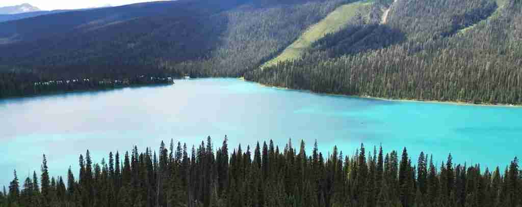
Lake Louise ranks among the most photographed locations in the Canadian Rockies, and for good reason. This glacial lake in Banff National Park displays an extraordinary turquoise color created by suspended particles of rock flour—fine sediment ground by glaciers and carried into the lake by meltwater. The tiny particles remain suspended in the water column, scattering light in the blue-green wavelengths while absorbing other colors. Victoria Glacier descends dramatic peaks forming the lake’s backdrop, completing a composition that has adorned countless postcards, calendars, and travel advertisements. The Château Lake Louise, successor to the original 1890 hotel, occupies the lakeshore, continuing the tradition of grand railway hotels in spectacular settings. Trails from the lakeshore climb to Lake Agnes and the Plain of Six Glaciers, offering close encounters with alpine environments and glacier viewpoints.
Moraine Lake, located in the Valley of the Ten Peaks in Banff National Park, rivals Lake Louise for stunning beauty. This smaller glacial lake exhibits even more intense blue coloration due to high concentrations of rock flour. The valley name comes from ten peaks visible from the lakeshore, though actually more than ten summits surround the valley. The lake formed behind a rockslide deposit that dammed the valley, creating the deep pool now filled with glacial meltwater. The scene from Moraine Lake appeared on the Canadian $20 bill between 1969 and 1979, cementing its status as an iconic Canadian landscape. Access to Moraine Lake is now managed through a shuttle system during peak summer months to reduce congestion on the narrow access road and protect the fragile alpine environment from overuse.
The Columbia Icefield represents the largest icefield in the Rocky Mountains and one of the most accessible large icefields in the world. Covering approximately 325 square kilometers along the Continental Divide at the boundary between Banff and Jasper national parks, this massive ice accumulation reaches depths of 365 meters in places. Multiple outlet glaciers flow from the icefield, including the Athabasca Glacier that descends nearly to the Icefields Parkway roadside. The Athabasca Glacier has become a dramatic illustration of climate change—markers along the approach trail show how far the glacier extended in previous decades, revealing hundreds of meters of retreat easily visible within a human lifetime. Specialized vehicles take visitors onto the glacier surface during summer months, providing direct experience of walking on centuries-old ice.
Peyto Lake in Banff National Park displays perhaps the most intense turquoise color of any lake in the Rockies, with rock flour concentrations creating almost unnatural-looking brightness. A short walk from the Icefields Parkway leads to an overlook showing the lake’s distinctive wolf-head shape, with bays and peninsulas creating an outline suggesting a canine profile. Peyto Glacier feeds the lake, though like most Rocky Mountain glaciers, it has retreated significantly from historical positions. The lake is named for Bill Peyto, a legendary park guide and warden whose knowledge of the backcountry made him invaluable during early park development.
Athabasca Falls in Jasper National Park demonstrates the erosive power of glacial meltwater. The Athabasca River, carrying sediment-laden water from the Columbia Icefield, plunges through a narrow gorge where turbulent water has carved smooth channels, potholes, and undercut walls in the limestone bedrock. While not particularly high as waterfalls go—the drop measures only 23 meters—the volume of water and the dramatic gorge create impressive displays of hydraulic force. Walkways and viewpoints allow close observation of the geological processes sculpting the canyon.
Takakkaw Falls in Yoho National Park ranks among the highest waterfalls in Canada, with water plunging 373 meters from the lip of the Daly Glacier down to the Yoho River valley below. The Cree word “Takakkaw” translates to “magnificent” or “wonderful,” an apt description for this dramatic cascade. Glacial meltwater volume varies seasonally and daily, with the falls at their most powerful during hot summer afternoons when maximum glacier melting occurs. The approach road to Takakkaw Falls, one of the highest paved roads in Canada, switchbacks up the valley wall through forest that transitions from montane to subalpine vegetation zones.
Maligne Lake in Jasper National Park extends 22 kilometers through mountain valleys, making it the longest lake in the Canadian Rockies and the second-largest glacial lake in the world. Spirit Island, a small rocky outcrop with a few wind-sculpted trees, has become one of the most photographed locations in the Rockies, appearing in countless images that capture the essence of mountain wilderness. Boat tours transport visitors to Spirit Island, as the site lies far from the lakeshore road terminus. The lake’s name, meaning “wicked” in French, comes from early explorers’ difficulties crossing the swift Maligne River that drains the lake.
The Icefields Parkway (Highway 93) itself functions as a natural feature showcase, connecting Jasper and Banff through 232 kilometers of spectacular mountain scenery. Completed in 1940, the road parallels the Continental Divide, passing glaciers, waterfalls, lakes, and wildlife habitat. Viewpoints, pullouts, and trailheads provide access to features along the route. Wildlife including bears, elk, moose, and mountain goats are frequently observed from the roadway. The Parkway’s northern approach to the Columbia Icefield offers some of the most expansive mountain views in the parks, with massive peaks visible in all directions.
Mount Robson, at 3,954 meters the highest peak in the Canadian Rockies, dominates the landscape of Mount Robson Provincial Park. The distinctive pyramidal summit rises 3,000 vertical meters above the valley floor in less than eight kilometers horizontal distance, creating some of the most dramatic topographic relief in the parks. Mount Robson generates its own weather systems, with the summit often obscured by clouds even when surrounding peaks remain clear. The Berg Lake Trail, considered one of the finest multi-day hikes in the Canadian Rockies, leads to alpine lakes beneath Mount Robson’s north face, where massive ice avalanches thunderously cascade down 2,000-meter walls.
Marble Canyon in Kootenay National Park showcases the erosive power of water cutting through limestone. A suspension footbridge crosses the canyon’s narrowest section, where the stream has carved a slot less than two meters wide but over 30 meters deep. The limestone’s gray and white banding creates marble-like patterns that give the canyon its name. Interpretation panels explain the geological processes—dissolving limestone, vertical cutting by sediment-laden water, and differential erosion along rock joints—that created this dramatic gorge.
Wildlife Viewing Opportunities and Ecological Interactions
The Canadian Rocky Mountain Parks provide exceptional opportunities for observing wildlife in natural habitats, with the size and ecological integrity of protected areas supporting complete predator-prey systems increasingly rare in North America. Understanding when, where, and how to observe wildlife enhances visitor experiences while minimizing impacts on animals that must balance feeding, reproduction, predator avoidance, and human disturbance in ecosystems where boundaries between wild spaces and visitor infrastructure often blur.
Elk represent the most frequently observed large mammals in the Rocky Mountain Parks, with herds numbering in the hundreds concentrating in montane valleys. The town of Banff itself hosts elk that have become habituated to human presence, grazing on manicured lawns and golf courses where nutritious grass and absence of major predators creates artificial paradise. Bull elk grow impressive antlers each summer, which they shed after the autumn breeding season. During the rut in September and October, bull elk produce haunting bugling calls that echo through valleys as they compete for mating opportunities. Dominant bulls gather harems of females, defending them aggressively against rival males. Observing rutting elk requires caution—bulls in breeding condition may charge humans who approach too closely, and hundreds-of-kilograms of muscle and antler can inflict serious injury.
Grizzly bears and black bears inhabit the parks in healthy populations, though seeing bears requires luck, proper timing, and knowledge of bear ecology. Spring emergence from hibernation brings bears to low-elevation avalanche slopes and south-facing exposures where early vegetation provides crucial nutrition after months without food. Summer finds bears foraging across diverse habitats—grizzlies digging for ground squirrels in alpine meadows, black bears climbing trees for ant colonies, both species grazing sedge meadows and wetlands. Late summer and autumn become critical as bears enter hyperphagia, consuming up to 20,000 calories daily to build fat reserves for hibernation. Berry crops—huckleberries, blueberries, buffaloberries, and others—determine bear distribution, with animals concentrating in productive patches. Years of poor berry production can bring bears into closer contact with humans as they search desperately for alternative foods before denning.
Mountain goats inhabit the highest, most precipitous terrain in the parks, their white coats making them visible against dark rock faces even at great distances. These remarkable animals possess specialized hooves with hard outer rims and soft, grippy pads that allow them to navigate cliffs where falls would kill other ungulates. Mountain goats tolerate extreme cold and wind, remaining active on alpine ridges through winter when lowland areas lie buried in meters of snow. Observation requires hiking to high elevations or scanning cliffsides with binoculars from valley viewpoints. The Columbia Icefield area, Sulphur Mountain near Banff, and the Mount Robson region provide reliable mountain goat viewing opportunities.
Bighorn sheep populations in the parks concentrate in specific ranges where geology provides suitable terrain—steep escape terrain combined with nearby grazing areas. The largest and most accessible bighorn sheep population inhabits the area around Radium Hot Springs at the southern end of Kootenay National Park, where hundreds of sheep winter on south-facing slopes. Rams grow large curved horns throughout their lives, with horn size indicating age and determining dominance rank. During November and December rutting season, rams engage in spectacular head-clashing battles, running at each other and smashing horns together with impacts that echo across valleys. Ewes give birth to lambs in late May and early June on steep cliffs where predators cannot easily reach them.
Wolf sightings, while less common than other large mammals, occasionally occur in the parks. Wolves travel extensive territories hunting elk, deer, moose, and caribou. The Bow Valley wolf pack in Banff National Park attracted international attention during the 1990s and early 2000s, with researchers documenting pack dynamics and hunting behavior. However, wolves living in areas with highway corridors face high mortality from vehicle collisions, and maintaining viable wolf populations requires protecting corridor habitats that allow movement between different areas. Winter tracking often reveals wolf presence even when the animals themselves remain unseen, with paw prints in snow and distinctive gait patterns showing where packs have traveled.
Moose, the largest members of the deer family in North America, inhabit wetlands, lakeshores, and willow-dominated habitats throughout the parks. Bulls grow massive palmate antlers that can span 150 centimeters or more. Despite their ungainly appearance, moose swim powerfully and can run 55 kilometers per hour. Cows with calves in spring and early summer display extreme aggression toward anything perceived as threatening their offspring, making them potentially more dangerous than bears in certain circumstances. Winter finds moose browsing willow and aspen in valley bottoms, while summer allows them to feed on aquatic vegetation and terrestrial plants at higher elevations.
Bird diversity in the parks reflects the varied habitats present across elevation zones. Golden eagles patrol alpine ridges, their huge wingspan and powerful build adapted for hunting marmots and ground squirrels. Clark’s nutcrackers, corvid relatives of jays and crows, specialize in harvesting whitebark pine seeds, which they cache in thousands of hiding spots for later retrieval. The birds’ spatial memory allows them to relocate caches months later, even beneath snow. American dippers, remarkable songbirds that dive underwater to hunt aquatic insects, inhabit fast-flowing streams throughout the parks. Harlequin ducks nest along whitewater rivers, requiring specific habitat combinations of fast current and nearby loafing areas. Over 300 bird species have been documented in the parks, from tiny warblers migrating through during spring and fall to year-round residents like gray jays and boreal chickadees.
Smaller mammals often escape visitor notice despite their importance in park ecosystems. Pikas, small relatives of rabbits, inhabit boulder fields and talus slopes at high elevations. Their distinctive calls—sharp “eep” sounds that carry across rocky terrain—alert observers to their presence. Hoary marmots, large ground squirrels weighing up to seven kilograms, sun themselves on rocks near their burrow systems, posting sentries that whistle piercingly when predators approach. Ground squirrels including golden-mantled ground squirrels and Columbian ground squirrels create towns of interconnected burrows in meadows and forest openings. Beavers, though often nocturnal, create visible impacts through dams that alter stream hydrology and wetland formation.
Responsible wildlife viewing requires understanding several key principles. Maintaining proper distances protects both animals and observers—Parks Canada recommends staying at least 100 meters from bears and at least 30 meters from other large mammals. Animals displaying stress behaviors—stopping feeding, moving away, vocalizing, or making aggressive displays—indicate that observers are too close. Wildlife jams, where numerous vehicles stop to observe animals near roads, create dangerous conditions and increase stress on wildlife. Never feeding wildlife, even unintentionally through leaving food or garbage accessible, prevents habituation that can lead to aggressive behavior and ultimately removal or destruction of animals. Observing seasonal closures and restrictions in sensitive areas protects denning bears, nesting birds, and caribou calving grounds during critical life history periods. Properly conducted wildlife viewing becomes both a highlight of park visits and a contribution to conservation by generating appreciation for species and their habitat needs.
Recreation and Visitor Activities Across Four Seasons
The Canadian Rocky Mountain Parks offer year-round recreation opportunities, with each season providing distinct experiences in dramatically different environments. Summer transforms the mountains into a hiking and outdoor recreation paradise, autumn brings spectacular foliage colors and wildlife activity, winter converts the parks into snowy wonderlands for skiing and other cold-weather pursuits, and spring offers renewal as snow melts and wildlife emerges from winter dormancy. Understanding seasonal patterns helps visitors choose optimal times and activities while respecting natural cycles that govern park ecosystems.
Summer represents the peak visitor season, with July and August bringing warm temperatures, long daylight hours, and access to high-elevation areas as snowpack melts. Hiking dominates summer recreation, with over 3,000 kilometers of maintained trails ranging from short interpretive walks to multi-day wilderness treks. Popular day hikes include the Plain of Six Glaciers trail from Lake Louise, climbing 370 meters over 5.5 kilometers to viewpoints overlooking Victoria Glacier and surrounding peaks. The Iceline Trail in Yoho National Park traverses alpine terrain with close views of multiple glaciers, requiring 12-14 kilometers of hiking with 690 meters of elevation gain. Johnston Canyon in Banff offers easily accessed views of waterfalls and limestone canyon walls via metal catwalks bolted to cliff faces. Backcountry camping requires permits and allows multi-day journeys into remote areas, with classic routes including the 53-kilometer Skyline Trail in Jasper and the 85-kilometer Berg Lake Trail below Mount Robson’s north face.
Mountain biking opportunities have expanded significantly in recent decades, with dedicated trails and sections of the extensive fire road network open to cyclists. The Legacy Trail connects Banff town to Canmore, providing 26 kilometers of paved pathway through montane valleys with regular wildlife sightings. Mountain bikers tackle challenging single-track trails in designated areas, though most alpine trails remain closed to bikes to prevent erosion and conflicts with hikers. Road cycling draws enthusiasts to the Icefields Parkway, where challenging climbs and descents connect spectacular viewpoints, though narrow shoulders and heavy traffic require caution.
Canoeing and kayaking opportunities abound on the numerous lakes scattered through the parks. Lake Louise, Moraine Lake, Maligne Lake, Emerald Lake in Yoho, and dozens of smaller bodies of water allow paddlers to experience mountain scenery from water level. Canoe and kayak rentals operate at major lakes during summer months. River paddling, restricted to specific streams and requiring advanced skills, attracts whitewater enthusiasts to challenging runs. Fishing is permitted in many lakes and streams with appropriate licenses, though numerous waters are closed to protect sensitive native fish populations.
Rock climbing in the Canadian Rockies offers thousands of routes ranging from beginner-friendly sport climbs to serious alpine mountaineering objectives. The limestone forming many peaks provides generally solid rock with abundant cracks, edges, and features. Ice climbing attracts specialists to frozen waterfalls and ice gullies during winter and early spring, with the Lake Louise and Icefields Parkway areas renowned for accessible ice routes. Mountaineering expeditions target major peaks including Mount Robson, whose challenging north face sees only a small percentage of attempts succeed due to technical difficulty, objective hazards, and frequently poor weather.
Autumn transforms the parks with golden aspens and larches contrasting against evergreen conifers and snow-dusted peaks. September and early October provide excellent hiking conditions with fewer crowds than summer, though snowfall can occur at high elevations. Wildlife viewing peaks during autumn as animals prepare for winter—elk rutting activity, bears feeding frantically to build hibernation reserves, and bighorn sheep beginning their courtship activities. Larch trees, deciduous conifers that turn brilliant gold before shedding their needles, create spectacles at specific high-elevation sites including Larch Valley near Moraine Lake and the Opabin Plateau in Yoho.
Winter opens the parks to skiing and snowboarding at several major resorts. Lake Louise Ski Resort and Sunshine Village near Banff, along with Marmot Basin near Jasper, operate extensive lift-served terrain with hundreds of ski runs ranging from gentle beginner slopes to extreme expert chutes. The combination of reliable snowfall—often exceeding 5-7 meters annually at high elevations—and dramatic mountain scenery makes these resorts popular destinations. Ski season typically extends from November through May at the highest elevations.
Cross-country skiing and snowshoeing provide non-mechanized winter recreation on groomed trails and in backcountry areas. The Lake Louise area maintains groomed cross-country trail systems, while numerous other locations offer ungroomed skiing through snowy forests and frozen lakes. Ice skating is possible on cleared sections of Lake Louise and other locations where ice thickness and weather conditions permit. Backcountry skiing in winter and spring attracts advanced skiers seeking untracked powder and high alpine terrain, though avalanche hazard requires expertise in route selection and safety practices.
Spring brings dramatic changes as snowmelt swells rivers, waterfalls reach maximum flow, and wildlife emerges from winter dormancy. Bears leaving dens appear on avalanche slopes and low-elevation areas, making spring excellent for bear viewing though requiring extra caution. Higher elevations remain snow-covered well into June, limiting access to alpine areas but creating spectacular waterfall displays fed by melting snow. Wildflower blooming follows snowmelt in elevation waves, with lower valleys flowering in May, subalpine meadows peaking in July, and highest alpine areas finally blooming in late July and August. Spring weather varies dramatically—warm sunshine can shift to snowfall within hours, and overnight freezes remain common through May.
Photography opportunities exist year-round, with each season offering distinct lighting and landscape conditions. Summer’s long daylight hours allow golden hour lighting twice daily, though midday contrast can challenge photography. Autumn’s clear skies and brilliant colors create ideal conditions for landscape work. Winter’s snow-covered scenes and low sun angles produce dramatic lighting. Spring’s dynamic weather produces dramatic cloud formations and occasional rainbows. Wildlife photography requires long lenses—typically 400mm or longer—to maintain safe distances while capturing detailed images.
Conservation Challenges and Management Approaches
Protecting the Canadian Rocky Mountain Parks’ natural and cultural values requires addressing multiple interconnected challenges that reflect broader environmental pressures affecting protected areas globally. Climate change, human use impacts, invasive species, wildlife-human conflicts, and habitat fragmentation all demand active management responses that balance conservation goals with visitor access and enjoyment. Understanding these challenges provides context for management decisions that sometimes restrict activities or require visitor cooperation.
Climate change represents the most pervasive and difficult challenge facing park ecosystems. Rising temperatures drive glacier retreat visible on timescales of years to decades rather than geological eons. Projections suggest that glaciers in the Canadian Rockies could lose 95 percent of their current mass by 2100 under current emission scenarios, fundamentally transforming landscapes that define the parks’ character. Glacier loss affects more than scenery—glacial meltwater contributes significantly to late-summer stream flows, supporting aquatic ecosystems and downstream water supplies. As glaciers shrink, streams become warmer and flow patterns shift toward earlier spring peaks with reduced summer flows.
Changing climate alters ecological communities in ways that cascade through entire ecosystems. Whitebark pine, a keystone species in subalpine and alpine zones, faces dual threats from warming temperatures that allow mountain pine beetles to survive at higher elevations and from white pine blister rust, an invasive fungus that kills infected trees. Whitebark pine produces large, nutritious seeds that sustain numerous species including grizzly bears, which feed heavily on whitebark pine nuts during fall to build fat reserves for hibernation. Loss of this food source may force bears into more conflict with humans as they search for alternative foods. Parks Canada implements restoration programs including planting rust-resistant whitebark pine seedlings and protecting seed-producing trees, though success ultimately depends on climate trajectories.
Wildfires, natural disturbances that maintain ecosystem health by recycling nutrients and creating diverse age classes of forest, are becoming larger and more intense as climate warms and forests dry. While fire suppression was standard practice for decades, current management recognizes fire’s ecological role and allows lightning-caused fires to burn under specific conditions when they pose no threat to human life or infrastructure. Prescribed burns, intentionally set under controlled conditions, reduce fuel loads and restore fire-adapted ecosystems. The challenge lies in managing fire near developed areas where smoke affects visitor experience and flames threaten buildings while still allowing enough fire on the landscape to maintain ecosystem function.
Human use impacts intensify as visitor numbers grow. The Canadian Rocky Mountain Parks receive over nine million visits annually, with numbers increasing particularly in easily accessed areas like Lake Louise, Moraine Lake, and Johnston Canyon. Concentrated use creates multiple problems: trails erode from countless footsteps, vegetation trampling expands informal paths, wildlife avoids areas during peak visitation, and parking exceeds capacity. Management responses include shuttle systems that reduce vehicle traffic, reservation requirements limiting daily visitor numbers, trail hardening that concentrates use on durable surfaces, restoration of damaged areas, and visitor education emphasizing Leave No Trace principles. Some areas implement seasonal closures during wildlife denning and nesting seasons or when bears concentrate on productive food sources.
Highway corridors through the parks create barriers to wildlife movement while causing direct mortality from vehicle collisions. The Trans-Canada Highway through Banff National Park represents one of the busiest transportation corridors in Canada, with over 25,000 vehicles daily during peak season. Collisions kill dozens of large mammals annually including elk, deer, bears, and occasionally wolves and cougars. Beginning in the 1980s, Parks Canada pioneered wildlife crossing structures—overpasses and underpasses designed specifically for animal movement—combined with highway fencing that funnels wildlife toward crossings. Monitoring demonstrates that crossing structures effectively maintain connectivity, with thousands of successful wildlife crossings documented annually. Species from grizzly bears to mice use the structures, allowing genetic exchange and seasonal movements across otherwise impassable barriers. This approach has been adopted globally as a model for mitigating transportation infrastructure impacts on wildlife.
Wildlife-human conflicts arise when animals and people compete for space or when animals become habituated to human food sources. Bears that obtain human food—garbage, coolers, improperly stored backpacker rations—often become aggressive in seeking more, creating dangerous situations. The adage “a fed bear is a dead bear” reflects the reality that bears conditioned to human food typically must be relocated or destroyed when they pose unacceptable risks. Management responses include bear-proof garbage containers throughout developed areas, mandatory bear-proof food storage for backcountry campers, aggressive enforcement of food storage regulations, and education programs teaching visitors how to prevent wildlife encounters and respond appropriately when they occur. All parks require backpackers to carry bear-resistant food canisters or use provided storage in backcountry campsites.
Invasive non-native species affect ecosystems throughout the parks. Aquatic invasive species including whirling disease, which affects trout, and invasive aquatic plants threaten native fish populations and aquatic ecosystems. Mandatory watercraft inspections at park entrances aim to prevent introduction of zebra mussels and other aquatic invaders that could fundamentally alter lake ecosystems. Terrestrial invasive plants including spotted knapweed, dalmatian toadflax, and numerous others spread along roadsides and disturbed areas, displacing native vegetation. Manual removal, herbicide application under carefully controlled conditions, and revegetation with native species form the response toolkit, though eradication remains impossible once invasive species become established.
Habitat fragmentation within and adjacent to parks affects wide-ranging species that require large territories. Wolves, grizzly bears, wolverines, and caribou particularly need connected landscapes allowing movement between different areas. Development outside park boundaries reduces habitat quality and creates barriers, while linear features like roads and pipelines fragment habitat even in protected areas. Maintaining functional ecosystems requires landscape-scale conservation extending beyond park boundaries, necessitating cooperation with provincial governments, Indigenous communities, private landowners, and other stakeholders. Wildlife corridors identified through research and monitoring receive enhanced protection, development guidelines minimize impacts in sensitive areas, and restoration programs reestablish connectivity where it has been lost.
Indigenous reconciliation represents both a conservation challenge and an opportunity to enhance protection through partnership. Acknowledging that parks overlay traditional territories and incorporating Indigenous knowledge into management improves both ecological outcomes and relationships with communities whose connections to these landscapes predate parks by millennia. Collaborative management arrangements, traditional use agreements allowing culturally important activities, and employment programs creating opportunities for Indigenous people in parks all contribute to reconciliation while strengthening conservation.
Funding remains a perpetual challenge, with aging infrastructure, growing visitor numbers, and increasing management complexity requiring resources that sometimes exceed available budgets. The Canadian Rocky Mountain Parks generate substantial economic activity through tourism, yet most of these benefits accrue outside park boundaries while costs of protection and management fall to park agencies. Entrance fees, commercial use licenses, and other revenue sources help fund operations, though much work depends on limited government appropriations. Partnerships with non-governmental organizations, volunteers, and donors supplement government funding for specific projects.
Scientific Research and Monitoring Programs
The Canadian Rocky Mountain Parks function as living laboratories where long-term research and monitoring programs advance understanding of mountain ecosystems, geological processes, climate change impacts, and effective conservation strategies. The combination of protected status, diverse habitats, long-term data sets, and relatively minimal human modification compared to surrounding areas makes the parks invaluable for scientific study. Research conducted here informs not only local management decisions but also contributes to global understanding of environmental change and ecosystem function.
Glacier monitoring represents one of the longest-running and most visible research programs in the parks. Peyto Glacier has been studied continuously since the 1960s, with researchers measuring mass balance—the difference between snow accumulation and ice melt—annually. Stakes drilled into the ice record surface elevation changes, while snow depth measurements track winter accumulation. These detailed records document dramatic changes: Peyto Glacier has lost 70 percent of its volume and retreated approximately one kilometer since systematic measurements began. Similar monitoring on other glaciers throughout the parks contributes to global datasets that inform climate models and projections. The Columbia Icefield receives particular attention given its size and accessibility, with regular surveys mapping ice thickness and flow rates.
Wildlife population monitoring employs multiple techniques depending on species and management questions. Grizzly bear populations are tracked through DNA analysis of hair samples collected at baited hair-snag stations distributed throughout the parks. Bears rubbing against wire snares leave hair samples that yield individual DNA profiles, allowing researchers to estimate population size, track movements, and assess reproduction rates without capturing animals. Wolf populations are monitored through track surveys, howl surveys, and in some cases GPS collars that record fine-scale movements and habitat use. Elk, bighorn sheep, and other ungulates are counted through aerial surveys, ground observations, and camera trap networks. These monitoring programs detect population trends, identify factors affecting survival and reproduction, and inform management decisions about habitat protection and human use restrictions.
Aquatic ecosystems receive attention through water quality monitoring, stream flow measurements, and fish population assessments. Bull trout, a native species declining throughout much of its range, is monitored closely to detect population trends and identify threats. The effects of climate change on stream temperatures, flow regimes, and aquatic community composition are documented through long-term datasets spanning decades. Research on glacial meltwater contributions to summer stream flows becomes increasingly important as glaciers shrink and the sustainability of current flow patterns comes into question.
Vegetation monitoring tracks changes in plant communities related to climate change, fire patterns, and human use. Permanent vegetation plots established decades ago are revisited regularly to document shifts in species composition, density, and distribution. Treeline positions are mapped to detect upward movement as climate warms. Whitebark pine health assessments quantify mortality from mountain pine beetles and white pine blister rust while evaluating effectiveness of restoration plantings. Phenology studies—tracking the timing of seasonal events like leaf emergence, flowering, and seed production—reveal how climate change affects the synchronization between plants and their pollinators.
Archaeological and paleontological research continues in the parks, with new discoveries regularly adding to knowledge of human history and ancient life. The Burgess Shale remains an active research site, with permitted excavations by qualified paleontologists continuing to uncover new species and refine understanding of Cambrian ecosystems. Proper scientific excavation and description of fossils requires years of careful work in laboratories far from the quarry sites, with specimens cleaned grain by grain under microscopes and anatomical details photographed from multiple angles to reconstruct three-dimensional structures of creatures that lived over 500 million years ago.
Archaeological investigations document Indigenous presence stretching back thousands of years. High-elevation ice patches, where animals historically congregated to escape summer heat and insects, now yield artifacts as ice melts with warming climate. Wooden atlatl dart shafts, caribou dung, and other organic materials preserved in ice for millennia provide insights into hunting practices, diet, and environmental conditions. These discoveries, made possible by the same climate change threatening park ecosystems, must be documented quickly before exposure to air causes rapid deterioration of fragile materials.
Climate change monitoring extends beyond glaciers to encompass multiple ecosystem components. Weather stations throughout the parks record temperature, precipitation, wind, and other variables, contributing to long-term datasets that document warming trends. Snow depth and duration measurements track changes in snowpack that affect everything from wildflower timing to ski season length. Permafrost monitoring assesses the stability of permanently frozen ground at high elevations, important for understanding landscape stability and ecosystem changes. These integrated monitoring programs provide comprehensive assessments of how climate change affects mountain environments.
Invasive species monitoring and research informs control efforts. Surveys document the distribution and spread of invasive plants, allowing early detection of new introductions when eradication may still be possible. Experimental treatments test different control methods, comparing effectiveness and ecosystem impacts. Aquatic invasive species monitoring at park boundaries intercepts potentially contaminated watercraft, with inspection protocols developed through research on pathogen and invertebrate survival during transport. This proactive approach aims to prevent invasive species establishment rather than attempting control after invasions become established.
Visitor use research examines how people experience parks and how human use affects ecosystems. Studies track visitor numbers, activities, and spatial distribution to identify areas experiencing heavy use. Trail impact assessments quantify erosion, vegetation damage, and soil compaction, informing decisions about trail hardening, rerouting, or closures. Wildlife response to human presence is studied through observation of behavior changes, habitat selection, and reproduction success in areas with varying visitor densities. This research base informs management strategies that balance visitor access with resource protection.
Research partnerships extend beyond Parks Canada to include universities, government agencies, non-governmental organizations, and international collaborators. The Mountain Legacy Project, for example, systematically rephotographs historical images of mountain landscapes, creating matched pairs spanning decades that reveal vegetation changes, glacier retreat, and other transformations. Graduate students conduct thesis research on topics ranging from grizzly bear genetics to alpine plant responses to warming. International research networks use data from the Canadian Rockies in comparative studies of mountain ecosystems worldwide.
Visiting the Parks: Practical Information and Access
The Canadian Rocky Mountain Parks straddle the Alberta-British Columbia border in western Canada, with primary access from Calgary, Alberta, and Edmonton, Alberta, on the eastern approach, and from Vancouver, British Columbia, via multiple routes on the western side. The Trans-Canada Highway provides the main transportation corridor through the southern parks, while the Yellowhead Highway serves the northern areas. Understanding access points, transportation options, and basic logistical information helps visitors plan effective trips that match available time with desired experiences.
Calgary International Airport serves as the primary air gateway for most visitors, located approximately 125 kilometers east of Banff townsite. Shuttle services and car rentals connect the airport to mountain destinations. The drive from Calgary to Banff takes 90 minutes under normal conditions via the Trans-Canada Highway through increasingly dramatic mountain scenery. Edmonton International Airport provides access to the northern parks, with Jasper townsite approximately 365 kilometers west via the Yellowhead Highway, a drive of roughly four hours. Vancouver offers an alternative western entry point, though reaching the parks requires traversing considerable distance through British Columbia’s interior, with Banff approximately 850 kilometers from Vancouver via multiple route options.
Entrance fees are required for all four national parks—Banff, Jasper, Kootenay, and Yoho—with daily and annual pass options available. The British Columbia provincial parks—Mount Robson, Mount Assiniboine, and Hamber—have different fee structures and entry requirements. Day passes allow single-day entry, while annual Discovery Passes provide unlimited entry to all Canadian national parks for twelve months from purchase date. Entry stations at park boundaries collect fees and provide basic information, though not all entry points are staffed around the clock. Purchasing passes in advance online can save time at entry stations during peak season.
Accommodation options range from luxury resort hotels to campgrounds and backcountry camping. The iconic railway hotels—Fairmont Banff Springs, Fairmont Château Lake Louise, and Fairmont Jasper Park Lodge—offer upscale lodging in spectacular settings with rates reflecting their historic status and amenities. Numerous other hotels, lodges, and motels operate in Banff, Lake Louise, Jasper, and smaller communities within and adjacent to the parks. Booking well in advance becomes essential for summer visits, with many properties fully reserved months ahead for July and August dates. Shoulder seasons—late May to mid-June and September to early October—offer easier booking and lower rates while still providing excellent weather and fewer crowds.
Campgrounds throughout the parks provide tent and RV camping, with facilities ranging from full-service sites with hookups to basic backcountry sites accessible only on foot or by canoe. Popular campgrounds like Tunnel Mountain in Banff and Whistlers in Jasper offer numerous sites but still fill during peak season, with reservation systems allowing advance booking. First-come, first-served campgrounds provide alternatives but require arriving early for site availability during busy periods. Backcountry camping requires permits obtained through Parks Canada’s reservation system, with quotas limiting overnight use in backcountry areas to prevent overuse and maintain wilderness character.
Seasonal timing significantly affects visitor experience. Summer, particularly July and August, brings warmest temperatures and longest daylight hours, along with peak crowds at popular locations. Wildflowers peak from mid-July through August depending on elevation. September and early October offer excellent conditions with fewer visitors, spectacular autumn colors as aspens turn golden, and active wildlife preparing for winter. Late October through April brings winter conditions with snow covering most roads and trails, though winter sports enthusiasts embrace the season for skiing and snowboarding. Spring from mid-April through June sees variable weather, with valley snow melting while high elevations remain snow-covered, waterfalls reaching maximum flow, and wildlife emerging from winter dormancy.
Weather in the Canadian Rockies varies dramatically with elevation, season, and rapidly changing conditions. Summer temperatures in valley locations typically reach 15-25 degrees Celsius during daytime, cooling to 5-10 degrees overnight, but high-elevation areas remain much colder with freezing temperatures possible any day of the year. Afternoon thunderstorms frequently develop during summer, bringing rain, lightning, and sometimes hail to exposed areas. Layered clothing—base layer, insulating layer, and waterproof shell—allows adaptation to changing conditions. Winter brings temperatures often falling to -20 degrees Celsius or colder in valleys, with even more extreme cold at higher elevations, though dry conditions and sunshine can make cold temperatures more tolerable than statistics suggest.
Wildlife safety represents a critical consideration for all visitors. Black bears and grizzly bears inhabit the parks, with encounters possible anywhere outside developed areas and occasionally within townsites. Carrying bear spray—a specialized pepper spray proven effective at deterring charging bears—is strongly recommended for hiking. Making noise while hiking, particularly in areas with limited visibility or when near running water that masks sound, reduces surprise encounters. Traveling in groups further decreases bear encounter risks. Proper food storage prevents attracting bears and other wildlife to campsites and vehicles. If a bear encounter occurs, remaining calm, speaking to the bear in calm tones, slowly backing away without running, and using bear spray if the bear charges provides the best chance of peaceful resolution. Parks Canada provides detailed safety information and current wildlife activity reports at visitor centers and online.
Transportation within the parks relies primarily on private vehicles, though shuttle services connect major destinations during summer months. The Roam public transit system operates in Banff National Park, connecting Banff townsite with Lake Louise, Canmore, and some trailheads. Commercial tour operators offer guided excursions to major attractions, convenient for visitors without vehicles or preferring interpretation. Cycling provides an alternative for accessing some locations, with the Legacy Trail offering paved cycling between Banff and Canmore. The Icefields Parkway between Lake Louise and Jasper townsite, while spectacularly scenic, requires careful driving with attention to wildlife, cyclists, and numerous viewpoint pullouts where vehicles frequently slow or stop.
Visitor centers operated by Parks Canada provide information, maps, interpretive displays, and permit services. Major centers are located in Banff townsite, Lake Louise, Jasper townsite, and at the Columbia Icefield. Staff members answer questions, provide current trail conditions and wildlife activity reports, and help visitors plan activities appropriate to their interests and abilities. Interpretive programs including guided walks, evening presentations, and special events operate during summer months, offering structured opportunities to learn about geology, wildlife, ecology, and cultural history from knowledgeable guides.
UNESCO World Heritage Significance and Global Context
The Canadian Rocky Mountain Parks’ designation as a UNESCO World Heritage Site recognizes these protected areas as possessing outstanding universal value—characteristics significant enough to transcend national boundaries and be considered important to all of humanity. This status places the Canadian Rockies among approximately 1,200 World Heritage Sites globally, with only a small fraction designated for natural rather than cultural values. Understanding what distinguishes these parks in a global context reveals both their remarkable attributes and their role in worldwide efforts to preserve the planet’s most significant natural and cultural treasures.
UNESCO’s World Heritage Convention, adopted in 1972, established the framework for identifying and protecting sites of outstanding universal value. The Convention recognizes that certain places possess such exceptional qualities that their preservation becomes a shared international responsibility rather than solely a national concern. Natural World Heritage Sites must meet one or more of four criteria: containing superlative natural phenomena or areas of exceptional natural beauty and aesthetic importance; representing major stages of Earth’s evolutionary history; representing ongoing geological processes, biological evolution, or ecological processes; or containing significant natural habitats for in-situ conservation of biological diversity. The Canadian Rocky Mountain Parks qualified under criteria (vii) for exceptional natural beauty and (viii) for geological significance, particularly the Burgess Shale fossil site.
Criterion (vii) recognition acknowledges the Canadian Rockies as exemplifying superlative natural beauty. The UNESCO evaluation noted that the seven parks form a striking mountain landscape with rugged peaks, icefields, glaciers, alpine meadows, lakes, waterfalls, extensive karst cave systems, and deeply incised canyons possessing exceptional natural beauty that attracts millions of visitors annually. While many mountain ranges display dramatic scenery, the combination of accessible grandeur, diversity of features, and the scale of protection—23,600 square kilometers of contiguous wilderness—distinguishes the Canadian Rockies. Comparable natural World Heritage Sites include the Swiss Alps Jungfrau-Aletsch, the Dolomites in Italy, Te Wahipounamu in New Zealand, and Los Glaciares National Park in Argentina, each recognized for outstanding mountain landscapes.
Criterion (viii) recognition emphasizes the Burgess Shale as one of the most significant fossil areas in the world. The UNESCO evaluation specifically highlighted that exquisitely preserved fossils record a diverse marine community dominated by soft-bodied organisms, originating soon after the rapid unfolding of animal life about 540 million years ago. The Burgess Shale fossils provide key evidence of the history and early evolution of most animal groups known today, yielding a more complete view of life in the sea than any other site for that time period. Only a handful of other localities globally preserve similar quality and diversity of soft-bodied fossils from this critical period in evolutionary history, making the Burgess Shale’s protection under World Heritage status particularly important for paleontological science.
The inscription process for the Canadian Rocky Mountain Parks demonstrates how World Heritage designation evolves through careful evaluation and sometimes expansion. In 1980, the Burgess Shale itself received designation as a separate World Heritage Site based solely on its paleontological significance. When Canada nominated the four contiguous national parks in 1983, UNESCO combined these designations in 1984, recognizing that the Burgess Shale formed an integral part of the broader Rocky Mountain landscape rather than an isolated site. The 1990 addition of three provincial parks responded to UNESCO’s recommendation to extend protection across jurisdictional boundaries, demonstrating that World Heritage status can encourage expanded conservation.
World Heritage designation carries both benefits and responsibilities. Recognition enhances international awareness, often increasing tourism and its economic benefits while also creating expectations for high conservation standards. Sites must demonstrate effective management frameworks that protect the values for which they received designation. Periodic reporting requirements ensure that host countries inform UNESCO of conservation status, management effectiveness, and any threats affecting the site. In cases where significant deterioration occurs or threats intensify without adequate response, UNESCO can place sites on the List of World Heritage in Danger, creating international pressure for improved protection, though the Canadian Rocky Mountain Parks have never faced this designation.
Within Canada, the Rocky Mountain Parks were the second natural site to receive World Heritage recognition after Nahanni National Park Reserve in 1978. Subsequently, additional Canadian natural sites have been designated including Wood Buffalo National Park, the Dinosaur Provincial Park, and Miguasha National Park for paleontological significance, and Gros Morne National Park for geological processes. These designations collectively showcase Canada’s natural heritage diversity while establishing networks of internationally recognized protected areas.
The Canadian Rocky Mountain Parks connect to broader conservation initiatives extending beyond protected area boundaries. The Yellowstone to Yukon Conservation Initiative, a collaborative effort spanning from Wyoming to Canada’s Yukon Territory, recognizes that many wide-ranging species require connectivity across vast landscapes far exceeding any single park or protected area. The Rocky Mountain Parks form a critical anchor in this broader conservation vision, providing secure core habitat from which wildlife movements can extend through surrounding landscapes. World Heritage designation strengthens arguments for maintaining connectivity and resisting developments that would fragment habitats.
Climate change represents perhaps the greatest long-term threat to maintaining the outstanding universal value that justified World Heritage designation. Glacier retreat fundamentally transforms landscapes that define the parks’ scenic character while affecting hydrological systems supporting both park ecosystems and downstream communities. Species distributions shift as temperature zones move upslope, potentially leaving alpine species with nowhere cooler to retreat. Managing for resilience in the face of these changes requires both local actions—restoring degraded habitats, protecting climate refugia, reducing non-climate stressors—and global efforts to mitigate climate change through greenhouse gas emission reductions.
The Canadian Rocky Mountain Parks’ World Heritage designation ultimately serves multiple purposes. It recognizes exceptional natural values worthy of preservation for all humanity. It generates international attention and tourism that creates economic incentives for conservation. It establishes expectations for management that balance use and protection. And it connects these specific protected areas to global networks of outstanding sites, creating communities of practice where managers share experiences and learn from successes and failures across different contexts. For visitors, understanding World Heritage significance adds dimension to mountain experiences—these peaks, glaciers, and fossil beds represent treasures considered important not just locally or nationally but to all of humanity, places we collectively agree merit special protection.
Frequently Asked Questions
Do I need separate entrance passes for each park in the Canadian Rocky Mountain Parks?
A single Parks Canada Discovery Pass provides entry to all four national parks (Banff, Jasper, Kootenay, and Yoho) within the Canadian Rocky Mountain Parks UNESCO World Heritage Site. Daily and annual passes are available, with annual passes providing unlimited entry to all Canadian national parks and national historic sites for twelve months from purchase date. The three British Columbia provincial parks (Mount Robson, Mount Assiniboine, and Hamber) have separate fee structures administered by BC Parks. Most visitors primarily explore the four national parks, which contain the majority of accessible attractions, infrastructure, and recreational facilities. Passes can be purchased online in advance, at entry gates when entering the parks, or at visitor centers in Banff, Lake Louise, and Jasper. During peak summer season, purchasing passes online before arrival saves time at busy entry stations.
What is the best time of year to visit the Canadian Rocky Mountain Parks?
The optimal visiting time depends on desired activities and tolerance for crowds. July and August offer warmest temperatures, longest daylight hours, and fullest access to high-elevation areas including alpine meadows at peak wildflower bloom, but these months also bring the largest crowds and highest accommodation costs. September and early October provide excellent conditions with fewer visitors, spectacular golden aspen and larch foliage, and active wildlife preparing for winter, though high-elevation areas may experience early snowfall. Late May through June offers spring conditions with waterfalls at maximum flow from snowmelt, bears and other wildlife active at lower elevations, and significantly fewer visitors than peak summer, though high-elevation trails remain snow-covered and weather can be variable. Winter from December through March attracts skiing and snowboarding enthusiasts to world-class resorts, with opportunities for snowshoeing, cross-country skiing, and ice skating, though most hiking trails are inaccessible and extremely cold temperatures require specialized preparation. Late October through mid-December and April represent shoulder seasons with reduced services, unpredictable conditions, and lower visitor numbers—best avoided unless specifically seeking solitude.
Can I see the Burgess Shale fossils when visiting the parks?
The Burgess Shale fossil quarries in Yoho National Park are protected research sites with strictly controlled access. Guided hikes led by Parks Canada-approved guides operate during summer months (typically July through September), taking visitors to either the Walcott Quarry on Mount Field or the Mount Stephen fossil beds. These hikes range from moderately difficult to strenuous, requiring good fitness levels, with the Walcott Quarry hike covering approximately 20 kilometers round trip with 820 meters elevation gain over 8-10 hours. Reservations are required and should be made months in advance as spaces are extremely limited to protect the fragile fossil sites. No fossil collecting is permitted—visitors observe fossils in place while guides explain their significance. Display fossils can be viewed without hiking at visitor centers including the Yoho National Park Visitor Centre in Field, British Columbia, and at the Burgess Shale Geoscience Foundation visitor facility. These interpretive displays include real Burgess Shale specimens and detailed explanations of Cambrian life and fossil preservation processes, providing educational experiences without the physical demands of high-elevation hiking.
Is it safe to hike alone in the Canadian Rocky Mountain Parks?
Hiking alone is permitted in the parks but carries increased risks compared to group hiking, particularly regarding wildlife encounters and injury response. Bears (both grizzly and black bears) inhabit the parks, and solo hikers face higher encounter risks because they make less noise than groups, reducing natural warning that alerts bears to human presence. Parks Canada strongly recommends hiking in groups of four or more, as larger groups virtually eliminate serious bear encounters. Solo hikers should carry bear spray, make noise regularly (talking, clapping, calling out around blind corners), and avoid hiking during dawn, dusk, or darkness when bears are most active. Beyond wildlife concerns, solo hiking means no immediate assistance if injury, illness, or navigation errors occur in backcountry areas where cell phone coverage is unreliable or non-existent. Telling someone your specific hiking plans including expected return time provides safety backup if you fail to return. Carrying the Ten Essentials (navigation, sun protection, insulation, illumination, first-aid supplies, fire starter, repair tools, nutrition, hydration, emergency shelter) becomes especially important when hiking alone. Many popular trails with moderate difficulty and heavy use present lower risks for solo hikers than remote backcountry routes with minimal traffic.
How much time should I plan to visit the Canadian Rocky Mountain Parks?
The ideal visit duration depends on interests and desired depth of exploration. A minimum three-day visit allows seeing major highlights in one or two parks, typically Banff (including Lake Louise) or Jasper. This compressed itinerary might include Lake Louise, Moraine Lake, Johnston Canyon, and the Icefields Parkway’s southern section, or Jasper townsite, Maligne Lake, and Athabasca Falls. Five to seven days enables visiting both Banff and Jasper with time for day hikes, wildlife viewing, and traveling the complete Icefields Parkway between the two parks, plus exploring Yoho’s highlights including Emerald Lake and Takakkaw Falls. Ten days to two weeks allows thorough exploration including multiple day hikes, potentially a backcountry overnight trip, visiting all four national parks (Banff, Jasper, Kootenay, and Yoho), and incorporating rest days rather than constant driving. Longer stays of three weeks or more permit serious backcountry trips, extensive photography, visiting Mount Robson Provincial Park, and experiencing the parks at a relaxed pace rather than rushing between destinations. Many visitors return multiple times, recognizing that the parks’ scale and diversity reward repeated visits across different seasons. Consider that popular locations like Moraine Lake now require reservations or shuttle access during peak season, potentially adding logistical complexity to compressed itineraries.
What wildlife might I see in the Canadian Rocky Mountain Parks?
The parks support diverse wildlife including 56 mammal species and over 300 bird species, though what you observe depends on season, elevation, habitat, and luck. Elk are the most frequently observed large mammals, particularly around Banff and Jasper townsites where they graze on manicured lawns. Bighorn sheep concentrate in specific areas including Radium Hot Springs and along the Icefields Parkway, often visible from roadways. Mountain goats inhabit high cliffs and alpine areas—look for white animals on rocky slopes using binoculars from valley viewpoints. Black bears and grizzly bears are present throughout the parks, most active during spring on low-elevation slopes and in summer/fall in berry-producing areas, though encounters remain relatively uncommon on busy trails. Moose inhabit wetlands, lakeshores, and willow-dominated areas, though their shy nature makes them less frequently observed than elk. Deer (both mule deer and white-tailed deer) appear in valley forests and meadows. Wolves, cougars, lynx, and wolverines live in the parks but remain elusive, with sightings rare despite healthy populations. Smaller mammals including ground squirrels, pikas, and hoary marmots are common at appropriate elevations, often approaching humans too closely in popular areas. Bird diversity includes golden eagles soaring over alpine ridges, Clark’s nutcrackers harvesting pine seeds, American dippers feeding in rushing streams, and numerous species of warblers, sparrows, and finches. Seasonal timing affects wildlife viewing—spring brings bears to avalanche slopes, autumn features elk rutting activity and bears feeding intensively before hibernation, winter concentrates ungulates at lower elevations, and summer disperses animals across broader areas as high-elevation habitats become accessible.
Are there restrictions on where I can hike due to wildlife?
Parks Canada implements seasonal and sometimes emergency restrictions on hiking in specific areas to protect both wildlife and human safety. Spring restrictions commonly close trails or require groups of four or more hikers in areas where bears concentrate on early vegetation or recently emerged from hibernation dens. These restrictions typically affect avalanche slopes and low-elevation south-facing areas from late March through June. Summer and fall restrictions may close trails or portions of trails where bears are feeding on berry crops, with closures announced when bear activity intensifies in specific locations. Caribou calving areas receive seasonal closures protecting these threatened animals during their most vulnerable period. Bird nesting season brings restrictions in areas containing sensitive raptor or waterfowl nests, typically from March through July depending on species. Trail condition restrictions close routes when snow, stream crossings, or avalanche hazard create unsafe conditions, often affecting high-elevation trails until July or later. Current restrictions are posted at trailheads, visitor centers, and online through Parks Canada’s website and social media channels. Violating closures can result in significant fines and endangers both the violator and wildlife, as habituating bears to human presence in important feeding areas may ultimately lead to bear destruction when animals become aggressive. Planning flexibility allows adapting itineraries to accommodate restrictions rather than hiking closed trails.
What facilities are available for visitors with mobility limitations?
The Canadian Rocky Mountain Parks provide accessible facilities and experiences, though the mountainous terrain inherently limits access compared to flatter environments. Visitor centers in Banff, Lake Louise, and Jasper feature accessible parking, entrances, and exhibit spaces. The Banff Park Museum, Cave and Basin National Historic Site, and other interpretive facilities offer wheelchair-accessible routes. Accessible accommodation is available in park communities, though booking well in advance is essential as adapted rooms represent a small fraction of total inventory. Designated accessible parking spaces are provided at major attractions, trailheads, and developed areas. Several trails offer paved or hardened surfaces suitable for wheelchairs and walkers, including portions of the Bow River Trail in Banff, the Lake Louise Lakeshore Trail providing views of the famous lake and Victoria Glacier, the Athabasca Falls lower loop in Jasper, and the Shoreline Trail at Maligne Lake. These accessible trails range from several hundred meters to a few kilometers in length. Boat tours on Maligne Lake and commercial tour operations can often accommodate passengers with mobility limitations, though specific accessibility varies by operator and should be confirmed when booking. The Lake Minnewanka boat cruise near Banff offers accessible boarding. Scenic drives including the Icefields Parkway and Bow Valley Parkway provide outstanding wildlife and landscape viewing accessible to all visitors. Columbia Icefield tours utilizing specialized vehicles offer glacier access for those unable to hike. Winter facilities at ski resorts include adaptive skiing programs for individuals with various physical disabilities. Parks Canada’s accessibility information online and at visitor centers provides detailed descriptions of accessible facilities and experiences.
Can I bring my dog hiking in the Canadian Rocky Mountain Parks?
Dogs are permitted on leash in developed areas and on specific trails within the national parks, but restrictions apply to protect both wildlife and domestic animals. Leashes must not exceed three meters in length, and dogs must remain under control at all times. Many trails prohibit dogs entirely, particularly in sensitive wildlife areas, backcountry zones, and locations with heavy bear activity. Trails where dogs are permitted are clearly marked at trailheads, with trail restrictions also listed in park information materials and online. Dogs are prohibited from all backcountry campsites in Banff, Jasper, and Yoho national parks, eliminating overnight backpacking options for dog owners. This policy reflects concerns about dogs attracting predators into campsites, disturbing wildlife, and creating bear encounters. Dogs left unattended at campsites or in vehicles create disturbances and safety concerns. Front-country campgrounds in national parks permit dogs in campsites but not in comfort camping units or on beaches. Provincial parks (Mount Robson, Mount Assiniboine, Hamber) have separate regulations that should be confirmed before visiting. Alternatives for visitors traveling with dogs include dog-friendly trails in provincial forests and recreation areas surrounding the national parks, where regulations are generally less restrictive. Pet-sitting services operate in Banff and Jasper for visitors who want to access dog-prohibited trails or backcountry areas during their stay. Consider that even on dog-permitted trails, encounters with wildlife create risks for dogs—off-leash dogs that approach bears or other large mammals may lead the animal back toward their owner when fleeing, creating dangerous situations.
What permits and reservations do I need for visiting the Canadian Rocky Mountain Parks?
Basic park entry requires a Parks Canada pass (day pass or annual Discovery Pass) for the four national parks, purchased at entry gates, visitor centers, or online before arrival. Backcountry camping requires backcountry permits and campsite reservations obtained through Parks Canada’s reservation system, with bookings opening in January for the upcoming season. Popular backcountry areas like the Skyline Trail in Jasper and Berg Lake Trail below Mount Robson fill quickly, requiring reservation attempts when booking opens. Fishing requires appropriate licenses—national park fishing permits for waters within Banff, Jasper, Kootenay, and Yoho, or provincial licenses for waters in provincial parks. Front-country campground sites are reserved through Parks Canada’s reservation system, with popular campgrounds near Banff and Jasper filling months ahead for summer weekends. Some high-use areas including Moraine Lake require either parking reservations or mandatory shuttle use during peak season (typically late May through mid-October), with reservation systems opening in spring for the summer season. Guided Burgess Shale fossil hikes require advance booking through authorized operators, with availability extremely limited. Commercial filming and photography permits are required for professional work but not for personal photography regardless of equipment used. Drone operation requires permits and is prohibited in most park areas. Special event permits are needed for organized group activities, commercial operations, or events beyond normal recreation. Winter activities including backcountry skiing in avalanche terrain do not require permits but demand proper training, equipment, and decision-making skills. Parks Canada’s website provides comprehensive permit information, online reservation systems, and current requirements which can change seasonally or in response to management needs.