
Bay of Kotor UNESCO Heritage Guide: Complete Fjord-Like Bay Walking Guide
The Bay of Kotor in southwestern Montenegro presents Europe’s most dramatic ria formation—a drowned river valley often mistaken for a fjord—where medieval fortified towns cascade down limestone cliffs into sheltered Adriatic waters. Inscribed on the UNESCO World Heritage List in 1979 under four cultural criteria, this natural and culturo-historical region encompasses winding fortification walls, ancient caravan trails, Venetian palaces, and Orthodox monasteries harmoniously integrated into terraced mountainsides rising 1,500 meters above sea level. Walking these coastal settlements and mountain paths reveals centuries of Mediterranean maritime heritage preserved in stone.
Key Takeaways: Bay of Kotor UNESCO Heritage Walking Experience
- UNESCO Recognition Since 1979: The Natural and Culturo-Historical Region of Kotor achieved World Heritage status based on criteria i, ii, iii, and iv for its exceptional fortified architecture, cultural landscape integration, and role spreading Mediterranean civilization into the Balkans, encompassing the walled city of Kotor, historic Perast, ancient Risan, and surrounding settlements across 14,600 hectares with a 36,491-hectare buffer zone.
- Ria Formation, Not Glacial Fjord: The bay formed when rising sea levels drowned the ancient Bokelj River valley through tectonic subsidence and karst dissolution processes rather than glacial carving, creating a branching 28-kilometer inlet with four interconnected bays separated by the 340-meter-wide Verige Strait, producing fjord-like scenery without Scandinavian geological origins.
- Kotor Fortress Walk: 1,350 Stone Steps to 260 Meters Elevation: The fortification system ascending San Giovanni Hill requires 45-60 minutes climbing medieval defensive walls starting from Kotor Old Town, passing the 16th-century Church of Our Lady of Remedy at the halfway point, reaching fortress ruins with panoramic views across terraced settlements and the bay’s four arms converging below.
- Ladder of Kotor: Historic 940-Meter Mountain Trail: This ancient caravan route connecting coastal Kotor with inland Cetinje climbs through 70 switchbacks over 6.4 kilometers one-way, historically serving as the primary mountain passage for centuries before road construction, offering unobstructed bay perspectives and access to the abandoned village of Špiljari along its eastern slopes.
- Maritime Heritage Walking Circuit: Multiple Historic Settlements: The bay’s coastal promenade links Kotor’s walled medieval core with Baroque Perast’s 16 churches and palaces, Roman-era Risan with 2nd-century mosaics, and smaller settlements like Dobrota, Prčanj, and Orahovac, each preserving distinct architectural traditions developed during Byzantine, Venetian, Austro-Hungarian, and Ottoman periods spanning two millennia.
- Free Walking Alternatives to Fortress Admission: While the official fortress entrance requires payment, the fortification system includes free-access northern and western ramparts following the Scurda River and bay perimeter, plus the traditional Ladder of Kotor trail providing wilderness access to fortress grounds through mountain terrain rather than constructed stairways.
People Also Ask About Bay of Kotor UNESCO Heritage Walking
Why is the Bay of Kotor a UNESCO World Heritage Site?
The Bay of Kotor achieved UNESCO World Heritage designation in 1979 under cultural criteria i, ii, iii, and iv, recognizing the outstanding universal value embodied in its fortified medieval architecture, harmonious integration of human settlements with dramatic karst landscape, exceptional testimony to Mediterranean cultural exchange with the Balkans, and preservation of multiple architectural periods from Romanesque through Baroque. The site encompasses not merely Kotor’s walled city but the entire inner bay system with historic towns of Perast, Risan, and surrounding settlements, their defensive walls and towers, religious monuments including Orthodox monasteries and Catholic churches, Venetian palaces, and cultivated terraced hillsides forming a unified cultural landscape. The inscription initially included placement on the Danger List following the devastating April 1979 earthquake that struck immediately before the UNESCO session, requiring extensive reconstruction efforts. The property was removed from the Danger List in 2003 after successful restoration demonstrated Montenegro’s commitment to preserving this Mediterranean heritage complex. The site later gained additional recognition in 2017 when Kotor Fortress joined five other locations as part of the transnational Venetian Works of Defence serial nomination, acknowledging the fortification system’s role in 16th-17th century Venetian maritime defense architecture.
Is the Bay of Kotor actually a fjord?
The Bay of Kotor is not a true fjord but rather a ria—a drowned river valley—despite its striking visual resemblance to Norwegian fjords. True fjords form through glacial carving where advancing ice masses gouge U-shaped valleys later flooded by rising seas, leaving characteristic steep parallel walls, hanging valleys, and glacial deposits. The Bay of Kotor instead originated as the Bokelj River valley flowing from Mount Orjen’s high plateaus. Tectonic subsidence from ongoing Adriatic-Eurasian plate collision combined with intensive karst dissolution processes disintegrated this river system, and subsequent sea-level rise flooded the collapsed valley network to create the current bay configuration. The distinction matters geologically but changes nothing about the dramatic scenery—limestone mountains rising 1,500 meters directly from sea level, narrow winding channels connecting broader basins, and enclosed waters providing natural harbor protection match fjord aesthetics. The bay’s branching structure actually confirms its ria origin, as true fjords typically extend linearly inland along single glacial troughs, while rias follow dendritic drainage patterns of former river networks. The UNESCO designation acknowledges this formation by titling the property “Natural and Culturo-Historical Region” despite inscription solely under cultural criteria, recognizing that the dramatic natural setting forms integral context for human settlement patterns developed over two millennia.
How long does it take to walk up to Kotor Fortress?
Climbing from Kotor Old Town to San Giovanni Fortress at 260 meters elevation requires 45-60 minutes ascending 1,350 stone steps along medieval defensive walls, with fit walkers completing the ascent in 40 minutes while those taking frequent photo stops typically spend 60-75 minutes reaching the summit. The halfway point at Church of Our Lady of Remedy offers natural rest opportunity around 650 steps elevation, and many visitors stop here to appreciate already-impressive bay views before deciding whether to continue the remaining 700 steps to fortress ruins. Complete round-trip walking time including summit exploration spans 2-2.5 hours for most visitors, accounting for descent time and pauses to examine fortification architecture, bastions, and viewpoint terraces. The alternative Ladder of Kotor mountain trail requires significantly longer commitment—3-6 hours total for the 12.8-kilometer round-trip to Krstac Pass at 940 meters—though the gentler switchback gradient reduces cardiovascular intensity compared to fortress stair climbing. Timing recommendations favor early morning starts around 8 AM to avoid midday heat and cruise ship crowds, particularly during summer when temperatures exceed 30 degrees Celsius and exposed stone steps intensify sun exposure throughout the climb.
What historic towns should I walk to around the Bay of Kotor?
Kotor Old Town anchors walking exploration as the UNESCO site’s primary fortified settlement, its 12th-century walls enclosing maze-like cobblestone streets, Cathedral of Saint Tryphon dating from 1166, and multiple Venetian-era palaces forming the heritage core. Perast lies 14 kilometers northwest along the coastal road, a Baroque jewel with 16 churches and palaces compressed into 1.5-kilometer waterfront, featuring St. Nicholas Church’s 55-meter bell tower and serving as departure point for boat access to Our Lady of the Rocks island church. Risan occupies the bay’s northwestern terminus as the region’s oldest continuously inhabited settlement, preserving Roman villa mosaics from the 2nd century, ruins of medieval merchant palaces, and relatively tourist-free atmosphere compared to Kotor and Perast. The coastal settlements between these anchors—Dobrota extending north from Kotor for several kilometers, Orahovac with beach clubs midway to Perast, Prčanj housing historic captain villas, Muo with waterfront promenade, and smaller villages of Strp, Lipci, and Morinj—create continuous walking possibilities along bay-hugging roads. Each settlement developed distinct maritime traditions under various rulers including Byzantines, Venetians, Austro-Hungarians, and Ottomans, with architecture reflecting these changing influences. The abandoned mountain village of Špiljari above Kotor offers alternative walking destination accessible via Ladder of Kotor trail, preserving stone ruins from when this settlement served as rest stop on the historic caravan route connecting coast to inland Montenegro.
Extended multi-day tours – 5+ days
Featured Kotor Multi-Day Tour Packages
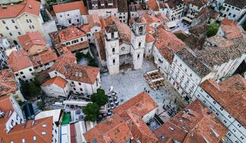
2 days
From Tirana, 2 Days: Budva – Kotor
- ✓ Comprehensive Kotor tour
- ✓ Expert local guides included
- ✓ All accommodation arranged
- ✓ Transportation provided
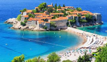
1 days
From Tirana/Durres/Golem -> Montenegro: Budva & Kotor day tour
- ✓ Comprehensive Kotor tour
- ✓ Expert local guides included
- ✓ All accommodation arranged
- ✓ Transportation provided
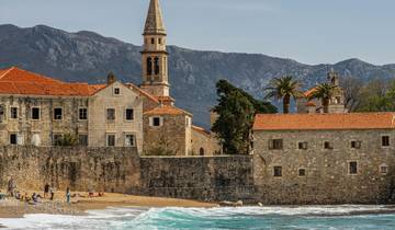
2 days
Tour of Montenegro and Kosovo in 2 days from Tirana or Durres
- ✓ Comprehensive Kotor tour
- ✓ Expert local guides included
- ✓ All accommodation arranged
- ✓ Transportation provided
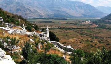
3 days
All seasons 3 days micro tour to Montenegro and Bosnia from Dubrovnik. Visit Venetians towns, monasteries, taste Herzegovina wines. Gorgeous scenery!
- ✓ Comprehensive Kotor tour
- ✓ Expert local guides included
- ✓ All accommodation arranged
- ✓ Transportation provided
Multi-day tour packages powered by TourRadar. Prices and availability subject to change.
Introduction: Walking Europe’s Mediterranean Ria UNESCO Heritage Landscape
Montenegro’s Bay of Kotor occupies exceptional position where Adriatic Mediterranean climate meets Dinaric Alps alpine topography, creating Europe’s southernmost fjord-like landscape—though geologically classified as ria rather than glacial fjord. This distinction matters little to walkers traversing medieval fortification walls climbing 260 meters above sea level or exploring coastal settlements where Venetian palaces face sheltered waters reflecting limestone peaks rising 1,500 meters behind. The UNESCO World Heritage designation awarded in 1979 recognizes not singular monument but entire cultural landscape: the harmonious integration of human architectural achievement with dramatic natural setting across 14,600 hectares of inner bay territory.
The walking experience spans multiple dimensions—vertical ascents through fortification systems defending Kotor since Illyrian times, horizontal coastal promenades linking historic settlements from ancient Risan through Baroque Perast to contemporary Dobrota, and mountain wilderness trails like the legendary Ladder of Kotor that once represented sole passage between maritime and highland Montenegro. Each route reveals different aspects of the bay’s 2,000-year settlement history, from Roman villa mosaics to Orthodox monastery complexes, Catholic church treasures to Venetian maritime arsenals.
The bay’s formation as drowned river valley rather than glacial carving produced branching configuration unique in Mediterranean context. Four interconnected bays—Herceg Novi and Tivat forming outer sections, Risan and Kotor comprising inner basins—join through narrow channels including the Verige Strait at only 340 meters width. Tectonic processes associated with African-Eurasian plate collision created initial valley system, while intensive karst dissolution in limestone bedrock disintegrated the ancient Bokelj River, and subsequent sea-level rise flooded the collapsed network to produce current sheltered harbor configuration that attracted settlement since antiquity.
Walking reveals this heritage layer by layer: Byzantine foundations beneath Venetian construction, Ottoman influences alongside Austro-Hungarian fortifications, Orthodox domes sharing skylines with Catholic bell towers, and everywhere the terraced hillsides where centuries of agricultural labor created landscape now recognized for outstanding universal value alongside architectural monuments.
UNESCO World Heritage Recognition and Inscription History
The Natural and Culturo-Historical Region of Kotor joined the UNESCO World Heritage List on October 26, 1979, during the third session of the World Heritage Committee held in Cairo and Luxor, Egypt, becoming among the first 60 properties inscribed worldwide and the sole Montenegrin site at that time. The inscription recognized outstanding universal value under four cultural criteria out of six total criteria existing before the 1994 revision that created current ten-criteria system. Criterion i acknowledged representation of a masterpiece of human creative genius in the fortification systems and architectural ensembles. Criterion ii recognized important interchange of human values evident in cultural exchange between Mediterranean maritime powers and Balkan hinterland. Criterion iii identified unique testimony to cultural tradition, specifically the bay’s role as trading and cultural crossroads. Criterion iv recognized the property as outstanding example of architectural ensemble and landscape illustrating significant stage in human history—the medieval fortified settlement tradition adapted to dramatic terrain.
The inscription carried unusual circumstance: the devastating Montenegro earthquake struck April 15, 1979, measuring 6.9 on the Richter scale, causing severe damage throughout Kotor Old Town and surrounding settlements mere months before the UNESCO session. The World Heritage Committee simultaneously inscribed the property and placed it on the List of World Heritage in Danger, acknowledging both exceptional value and immediate threat requiring international conservation support. The earthquake destroyed or severely damaged numerous historic buildings, with Kotor’s Cathedral of Saint Tryphon losing portions of its Renaissance façade, defensive walls suffering structural failures, and residential structures throughout the medieval core requiring emergency stabilization.
International conservation efforts commenced immediately following inscription, coordinated initially by Montenegro’s Republic Institute for the Protection of Cultural Monuments working with United Nations Development Programme support. The Southern Adriatic Development Plan established comprehensive framework for reconstruction, preservation, and management across the entire bay region. Conservation work emphasized authentic restoration using traditional materials and techniques, with particular attention to Kotor’s cathedral, fortification walls, and residential palaces displaying Venetian, Byzantine, and Renaissance architectural elements. Industrial facilities incompatible with heritage character—four factories operating within or adjacent to historic zones—were relocated during this period to restore visual and functional integrity.
The property’s removal from the Danger List occurred in 2003 following 24 years of sustained conservation demonstrating successful post-earthquake rehabilitation and establishment of effective management systems. The Municipal Institute for Protection of Cultural Heritage, established in 1980 with headquarters in Kotor Old Town, evolved into the Regional Institute covering municipalities of Kotor, Tivat, and Herceg Novi. Current management operates through Montenegro’s Directorate for Protection of Cultural Heritage and Centre for Conservation and Archaeology, maintaining local offices in Kotor for ongoing monitoring, conservation guidance, and regulatory oversight of development pressures.
Additional recognition arrived in 2017 when Kotor Fortress joined the transnational serial property “Venetian Works of Defence between the 16th and 17th Centuries: Stato da Terra – Western Stato da Mar,” inscribed at the 41st World Heritage Committee session in Krakow. This nomination linked Kotor’s fortifications with five other sites—three in Italy including Bergamo, Peschiera del Garda, and Palmanova, plus Zadar and Šibenik in Croatia—recognizing the integrated defensive network Venice constructed across its maritime empire. Kotor thus holds distinction as twice-inscribed UNESCO property, first for its comprehensive cultural landscape and subsequently for specific fortification engineering.
Bay Formation: Understanding the Ria Geology Behind Fjord-Like Appearance
The Bay of Kotor’s dramatic scenery stems from specific geological processes distinct from the glacial carving that created Scandinavian and Patagonian fjords, despite visual similarities that earned the bay designation as “Europe’s southernmost fjord” in popular literature. The feature geomorphologists classify as ria—a drowned river valley submerged by rising sea levels—results from tectonic subsidence and karst dissolution rather than ice sheet advance. Understanding this formation illuminates why the bay’s branching configuration, steep limestone walls, and sheltered deep waters developed in Mediterranean climate zone far from any glacial influence.
The geological foundation dates to Late Triassic period approximately 200 million years ago when supercontinent Pangaea rifted, separating African and European plates and forming the Tethys Ocean basin between them. Sedimentary layers accumulated in this seaway, predominantly limestones and dolomites derived from eroded continental materials plus marine organism remains, establishing carbonate bedrock that characterizes the region today. During Cenozoic Era beginning 66 million years ago, northward subduction of African plate beneath European plate closed the Tethys, compressing and uplifting accumulated sediments into mountain chains including the Dinaric Alps that surround the bay, rising over 1,500 meters elevation with Mount Lovćen reaching 1,749 meters and Mount Orjen ascending to 1,894 meters.
This orogenic activity fractured limestone bedrock extensively, creating weakness zones where water infiltration could commence karst dissolution processes. Karst topography develops when slightly acidic water—rainwater naturally carbonated through atmospheric carbon dioxide absorption plus organic acids from vegetation—percolates through fractures and bedding planes in soluble carbonate rock. Chemical reaction between acidic water and limestone gradually dissolves rock, enlarging fractures into conduits and eventually creating underground drainage networks with caves, sinkholes, and subsurface rivers replacing surface drainage patterns. The Bay of Kotor region underwent intensive karstification as fracture systems widened, allowing the ancient Bokelj River that once flowed from Mount Orjen’s high plateaus to disintegrate into underground channels.
Tectonic subsidence accompanying ongoing plate collision caused the collapsed river valley to drop below sea level. Adriatic microplate rotation and compression within the Alpine-Himalayan collision zone continues today, evidenced by seismic activity including the 1979 earthquake that damaged Kotor. As the former river valley subsided and karst processes destabilized surface drainage, rising Adriatic sea levels following last glacial maximum flooded the network of interconnected valleys, creating the current bay configuration with four broad basins—Herceg Novi Bay, Tivat Bay, Risan Bay, and Kotor Bay—linked by narrow channels where valley tributaries once converged.
The branching dendritic pattern confirms ria origin rather than fjord formation, as glacial fjords typically extend linearly inland following single ice-carved trough, while rias preserve the tree-like branching of original river drainage systems. The Verige Strait at only 340 meters width represents the former main river channel, now the narrowest section separating inner bays from outer sections. The bay’s maximum depth reaches 60 meters in places, deeper than surrounding Adriatic shelf but shallow compared to glacial fjords exceeding 300 meters depth where ice excavated below sea level.
Karst hydrology continues shaping the bay environment. The Sopot spring at Risan demonstrates seasonal variation characteristic of karst systems, appearing as spectacular waterfall following heavy rainfall with discharge reaching 200 cubic meters per second, then disappearing entirely during summer dry periods as underground reservoirs deplete. The Škurda spring flows year-round through canyon descending from Mount Lovćen, but multiple other springs exhibit seasonal flow reflecting complex underground drainage networks. These karst characteristics create water supply challenges for bay settlements, as surface runoff rapidly infiltrates underground leaving limited surface water sources, while underground flows can carry surface contamination directly to springs without filtration through soil.
The climate interaction with topography intensifies the dramatic scenery. Mediterranean moisture-laden winds encounter the Dinaric Alps rising abruptly from sea level, forcing orographic uplift that produces extreme precipitation—the bay ranks among Europe’s wettest inhabited regions north of the Himalayas, with some nearby locations receiving over 5,000 millimeters annually. This precipitation feeds the karst dissolution continuing to reshape bedrock, while the same steep mountains create rain shadow effects leaving August frequently completely dry with forest fire risk. The contrast between extreme seasonal precipitation and dramatic topography maintains the conditions that originally formed the ria and continues modifying it today, though at geological timescales invisible during human lifespans.
Kotor Old Town Walking Experience and Medieval Core Architecture
Kotor Old Town occupies the bay’s southeastern terminus where the Škurda River descends from Mount Lovćen through limestone canyon, meeting Adriatic waters in a naturally defensive corner sheltered from open sea by the bay’s winding configuration. The medieval core remains enclosed by fortification walls dating primarily to Venetian period 15th-18th centuries, though incorporating earlier Byzantine and Serbian foundations, creating roughly triangular urban space of approximately 60 hectares compressed between bay waters and mountain slopes. Walking the narrow limestone-paved streets reveals labyrinthine urban fabric where buildings press together along irregular routes determined by topography and incremental medieval growth rather than planned geometry.
Three gates pierce the defensive perimeter, each serving distinct historical functions. The Main Gate or Sea Gate faces the waterfront, bearing the 1555 inscription commemorating Kotor’s successful defense against Ottoman siege, flanked by relief sculptures including the winged lion of Saint Mark symbolizing Venetian sovereignty and coat of arms representing city’s privileges. The South Gate or Gurdić Gate provides access from southern approaches, positioned where fortification walls curve upward beginning their ascent of San Giovanni Hill. The North Gate or River Gate spans the Škurda channel where water exits the Old Town, offering direct connection to northern suburbs of Dobrota and traditional starting point for Ladder of Kotor trail beyond city walls.
Cathedral of Saint Tryphon anchors the religious architecture, its Romanesque core constructed 1166 replacing earlier 9th-century church destroyed by earthquake, with subsequent modifications adding Gothic and Renaissance elements through various reconstructions following seismic damage over centuries. The cathedral preserves relics of Kotor’s patron saint, a 3rd-century Christian martyr whose remains arrived from Constantinople in 809 aboard Venetian ship seeking refuge during storm, establishing Kotor’s maritime religious identity. The twin bell towers flanking western façade demonstrate architectural adaptations to earthquake vulnerability—one tower rebuilt higher than its companion following damage but never achieving identical height due to structural concerns, creating distinctive asymmetric silhouette. Interior frescoes span multiple periods, with 14th-century paintings surviving alongside Baroque additions, while treasury houses goldsmith work including processional crosses, chalices, and reliquaries demonstrating the medieval craftsmanship that earned Kotor reputation for metalwork excellence.
St. Luke’s Church represents Orthodox architectural presence within predominantly Catholic medieval core, initially constructed 1195 as Catholic church before conversion to Orthodox use in 1657 reflecting population changes during Ottoman pressure periods when many Catholic families departed for Venetian territories. The small single-nave structure preserves Byzantine fresco fragments and iconostasis demonstrating Orthodox liturgical traditions transplanted to Adriatic context, while dual-use history reflects religious tolerance that characterized bay’s merchant society where commercial pragmatism often superseded sectarian divisions.
St. Nicholas Orthodox Church, constructed 1909, towers over the Old Town from its position on northern perimeter, its five domes and Neo-Byzantine design contrasting with medieval architecture dominating the core. The church represents late Ottoman-era and early 20th-century Orthodox community’s assertion of presence within urban landscape, its monumental scale and conspicuous domes visible across the bay signaling religious identity in visual dialogue with Catholic cathedral’s bell towers.
Pima Palace exemplifies Venetian secular architecture, the late-Gothic structure with characteristic pointed-arch windows and stone balconies serving as residence for wealthy merchant family, later housing Napoleon’s military hospital, and eventually adapted for municipal offices demonstrating continual reuse maintaining building functionality through political regime changes. Numerous similar palaces line the main squares—Arms Square, Flour Square, Wood Square—each demonstrating variations on Venetian Gothic and Renaissance themes with ground-floor commercial spaces opening to street, noble residential floors above featuring elaborate window tracery and carved stone decoration, and utilitarian upper stories originally housing servants and storage.
The maritime arsenal district occupies waterfront section where Venetian-era shipbuilding and repair facilities operated, supporting the naval fleet that made Kotor significant Adriatic power during 14th-18th centuries when the bay produced majority of sea captains for Venice’s Dalmatian possessions. Stone warehouses, covered boat slips, and fortified arsenal buildings now host restaurants and galleries, their massive stone walls and barrel-vaulted interiors preserved while functions adapted to contemporary tourism uses maintaining architectural fabric.
Squares punctuate the dense urban fabric, providing breathing space and social gathering points within compressed medieval plan. Arms Square (Trg od Oružja) forms principal public space, its pavement stones polished smooth by centuries of foot traffic, surrounded by Venetian clock tower, Prince’s Palace with loggia, and baroque palaces creating enclosed room-like character. Wood Square contains Bembo Fountain, the baroque monument supplying drinking water since installation, and serves as unofficial cat sanctuary where Kotor’s famous feline population congregates. These cats achieved semi-official status in local culture, descended from ship’s cats introduced by maritime traders and now protected by residents who maintain feeding stations and advocate for street cat welfare.
Walking the Old Town requires alertness to elevation changes—streets climb and descend via stone staircases accommodating the sloping terrain between bay level and mountain base, creating three-dimensional urban network where routes stack vertically as well as spreading horizontally. Passageways tunnel beneath buildings, creating covered connections maintaining neighborhood coherence while allowing upper-story construction to bridge streets, a common medieval solution to maximizing building area within constrained defensive perimeter. These architectural elements survived the 1979 earthquake though many required extensive stabilization, and subsequent management plans restrict building heights, mandate traditional material use for repairs, and limit intrusive modern interventions to preserve the medieval character that earned UNESCO recognition.
Kotor Fortress Walk: Ascending the San Giovanni Fortification System
The fortification system ascending San Giovanni Hill from Kotor Old Town to fortress ruins at 260 meters elevation represents nine centuries of defensive construction, incorporating Illyrian foundations, Byzantine walls, medieval Serbian masonry, and extensive Venetian modifications creating the integrated rampart network visible today. The walking route climbing 1,350 stone steps spans 4.5 kilometers of walls winding up steep limestone slopes, passing bastions, watchtowers, and military installations positioned to defend the bay’s strategic entrance against Ottoman, pirate, and competing naval powers threatening Venetian commercial interests from 9th through 18th centuries.
Two official starting points exist within Old Town boundaries, both converging at central payment booth positioned approximately 300 steps up the initial ascent. The southern entrance near Gurdić Bastion at the Old Town’s South Gate provides most direct access from waterfront hotels and cruise ship port, commencing immediately as steep stone staircase carved into mountainside. The northern entrance opposite Church of St. Mary Collegiate near the River Gate offers alternative starting point, initially following walls bordering the Škurda River channel before turning upward to join main fortress route. Both paths require entrance fee collected at the payment booth, where ticket window operates 8 AM to 8 PM daily throughout peak season, though operating hours may contract during winter months when visitation decreases.
The initial ascent section from Old Town to Church of Our Lady of Remedy encompasses roughly 650 steps over 30-40 minutes climbing for typical walkers, the path zigzagging up limestone face via switchbacks engineered to reduce grade where straight stairways would prove excessively steep. The stone steps vary in height and depth, reflecting construction during multiple periods when different engineering standards prevailed, requiring careful foot placement particularly during descent when worn smooth stones become slippery if wet. Fortification walls range 2-16 meters thickness depending on strategic importance of sections, with bastions projecting at intervals providing flanking fire positions where defenders could target attackers approaching walls below.
Church of Our Lady of Remedy marks the natural halfway rest point, the small 16th-century chapel integrated directly into fortification walls, built by town residents in thanksgiving following deliverance from plague epidemic. The church terrace provides first comprehensive bay views, with Old Town’s terracotta rooftops directly below, Perast visible along northwestern shoreline, and four interconnected bays spreading westward toward Adriatic entrance. Stone benches surrounding the church allow climbers to recover before tackling remaining 700 steps to fortress summit, and many visitors conclude their climb here, considering the elevated perspective sufficient reward without additional exertion to reach higher ruins.
The upper section from Church to fortress summit continues steeper ascent, walls narrowing as defensive requirements focused on controlling mountain approach routes rather than withstanding sustained siege. Watchtowers punctuate the ramparts at strategic intervals, their firing positions commanding views over both bay approaches from seaward side and mountain trails descending from inland Montenegro. These upper fortifications particularly reflect Venetian engineering from 15th-17th centuries when Ottoman expansion threatened from inland territories, requiring defensible high ground controlling mountain passes that might otherwise allow Ottoman forces to descend upon bay settlements.
San Giovanni Fortress ruins crown the hill at 260 meters, the rectangular structure reduced to foundation walls and partial towers following abandonment after military significance declined with advent of long-range artillery rendering medieval fortifications obsolete by 19th century. The fortress served as command post, garrison barracks, ammunition storage, and signal station communicating with coastal watchtowers and Perast naval positions via fire beacons visible across bay waters after dark. Archaeological investigations documented multiple construction phases reflecting changing military technology, with earlier stonework showing arrow slits appropriate for archer defense, while later additions incorporated cannon embrasures accommodating artillery introduced during Venetian period.
The summit panorama justifies the climb—the entire UNESCO World Heritage property spreads below, with inner bays of Kotor and Risan enclosed by mountains, the Verige Strait’s narrow passage visible connecting to outer Tivat Bay, and on clear days the Adriatic horizon marking the open sea beyond bay entrance. The terraced hillsides of olive groves and vineyards demonstrate the agricultural landscape component of UNESCO recognition, human cultivation harmoniously integrated with natural topography creating the “cultural landscape” cited in Outstanding Universal Value statement. Photography opportunities multiply during golden hour before sunset when angled light illuminates building façades, mountain ridges cast shadows across bay waters, and cruise ships in port appear miniaturized by elevated perspective.
Alternative descent options exist beyond reversing the ascent route. The eastern path exits through opening in walls accessing the abandoned village of Špiljari, stone ruins of former settlement that once housed fortress garrison and supplied fortification defenders. This route connects with Ladder of Kotor trail system, allowing ambitious walkers to extend their fortress visit into full mountain hiking expedition to Krstac Pass. The standard descent following original ascent path typically requires 30-45 minutes, moving faster than upward climb but demanding careful footing on worn stones where accumulated foot traffic over centuries polished surfaces smooth, particularly treacherous following rain when limestone becomes slick.
Physical fitness requirements prove manageable for most visitors maintaining reasonable health, though cardiovascular demands increase significantly in summer heat when midday temperatures exceed 30 degrees Celsius and exposed stone steps amplify solar radiation. Early morning starts around 8 AM take advantage of cooler temperatures, fewer crowds before cruise ships disembark passengers, and better photography light with sun angle illuminating bay waters rather than creating harsh overhead shadows. Late afternoon departures beginning around 5 PM offer similar benefits, with sunset views from fortress providing spectacular golden-hour lighting though requiring headlamp for descent after dark as fortress paths lack artificial lighting.
Free walking access exists along fortification walls bordering Old Town’s northern and western perimeter—the sections following Škurda River and bay waterfront remain open without entrance fee, allowing limited wall-walking experience without climbing to fortress. These lower ramparts reach Gurdić Bastion viewpoint near South Gate, providing elevated bay perspectives without the full fortress ascent commitment, suitable for visitors with mobility limitations precluding extensive stair climbing.
Ladder of Kotor Trail: Historic Mountain Caravan Route to Wilderness Perspectives
The Ladder of Kotor (Ladder of Cattaro in Italian references) represents centuries-old caravan trail connecting coastal Kotor with inland Montenegro, specifically the former capital Cetinje located on mountain plateau 940 meters above sea level. Before road construction rendered the route obsolete for commercial transport in early 20th century, this zigzagging mountain path served as primary passage for goods, livestock, and travelers moving between maritime trade centers and highland agricultural regions, with pack trains ascending daily carrying olive oil, salt, and imported merchandise inland while returning with cheese, produce, and mountain products for coastal markets.
The trail commences just outside Old Town’s North Gate, accessible by crossing the Škurda River bridges and walking west along the road flanking the dry riverbed during summer months or active channel during winter rains. The trailhead coordinates 42.427211, 18.773356 mark where cobblestone road transitions to rocky mountain path, easily identified by red and white trail blazes painted on rocks and the obvious zigzag switchbacks visible ascending the mountainside ahead. The initial elevation gain begins immediately without gradual warm-up section, the trail waste no time establishing the pattern of switchbacks that earned the route its ladder designation—over 70 hairpin turns climbing the mountainside through rocky limestone terrain.
Distance measurements depend on destination selection—the full historic caravan route continues 6.4 kilometers one-way to Krstac Pass at 940 meters elevation, requiring 3-6 hours round-trip for the complete 12.8-kilometer journey. Most contemporary walkers treat the trail as alternative access to San Giovanni Fortress, hiking approximately 40-60 minutes to reach the elevation where trail intersects fortification walls at roughly 260 meters, matching fortress height. This shorter route historically served as unofficial free access to fortress grounds, with traditional opening in the walls—the “window” or “hole”—allowing hikers to enter fortification system without paying entrance fee collected at official Old Town gates.
The trail’s geological character reflects karst limestone composition—rocky, uneven surface where weathering exposed bedrock, creating irregular footing requiring constant attention to step placement. Loose stones, exposed roots where vegetation finds purchase in cracks, and smooth limestone worn by countless feet and hooves create variable traction demanding appropriate footwear. Trail runners or hiking boots provide ankle support and grip lacking in casual walking shoes, particularly important during descent when momentum and fatigue increase ankle-twist risk on uneven surfaces.
Views commence within 10 minutes of starting, the elevation gain rapidly providing perspectives over Old Town rooftops to bay waters beyond. Each switchback reveals progressively broader panorama—Perast appearing along northwestern shore, the four bay arms spreading westward, cruise ships in Kotor port diminishing to toy scale, and terraced olive groves covering hillsides demonstrating the agricultural landscape integral to UNESCO cultural landscape designation. These views explain the trail’s popularity despite physical demands, offering unobstructed bay perspectives impossible from valley floor or even from forest-enclosed trails lacking exposure.
The intersection with fortress fortifications occurs where walls ascend San Giovanni Hill’s eastern slope, traditionally accessed through opening in masonry allowing hikers to enter fortification grounds near summit elevation. Recent reports indicate this access point has been sealed to redirect visitors toward official paid entrance at Old Town gates, though the trail continues providing wilderness hiking experience and bay views without requiring fortress access. Hikers determined to reach fortress ruins can continue on established trail to official Old Town entrance points, treating Ladder of Kotor as scenic approach rather than fortress access bypass.
Beyond fortress elevation, the trail continues ascending through increasingly wild terrain toward Krstac Pass. The abandoned village of Špiljari appears at intermediate elevation, stone ruins of former settlement that once served as rest stop on caravan route, providing shelter, water, and forage for pack animals during multi-day journeys. The ruins demonstrate traditional mountain architecture—thick stone walls without mortar, slate roofs now collapsed, doorways opening to single-room dwellings, and terraced fields surrounding habitation where residents cultivated crops and pastured livestock. Chapel ruins mark the village center, evidence that even this remote mountain settlement maintained religious facilities serving residents and passing travelers.
Higher elevations transition from Mediterranean vegetation to alpine flora as elevation and exposure create harsher growing conditions. Oak and pine forests give way to scrub vegetation, exposed limestone pavement, and seasonal wildflower meadows. Mountain goats frequent these upper slopes, descendants of domestic herds gone feral after agricultural abandonment, now cautious of human presence but occasionally visible at distance grazing on sparse vegetation. The increased wildlife encounters plus solitude contrasting with busy Old Town streets attract hikers seeking wilderness experience alongside cultural heritage exploration.
Weather considerations intensify with elevation gain—while bay-level temperatures remain comfortable, mountain exposure creates wind chill, rapid weather changes when clouds descend from peaks, and increased precipitation. Summer thunderstorms develop rapidly over mountains, producing lightning danger on exposed ridges and creating flash flood risk in drainage channels. Spring and autumn offer optimal hiking conditions, with moderate temperatures, wildflower displays in spring, and autumn foliage coloring vegetation without summer heat intensity or winter precipitation extremes.
The trail’s historical significance extends beyond transportation function. During World War I, the Austro-Hungarian military improved sections with cobblestone surfacing to facilitate troop and supply movement, traces of this engineering work remaining visible where modern trail follows historic route alignment. During medieval periods, the route served as escape path when bay settlements faced siege, allowing residents and valuable goods to evacuate inland toward Montenegrin highland strongholds less vulnerable to naval attack. The cultural connection between coast and interior this trail maintained helped integrate maritime and mountain populations, creating unified regional identity despite geographic barriers that might otherwise have separated communities into isolated enclaves.
Perast Walking Experience and Baroque Maritime Architecture
Perast occupies strategic cape 14 kilometers northwest of Kotor where St. Elijah Hill rising 873 meters creates peninsula dividing Bay of Risan from Bay of Kotor, positioning the settlement at Verige Strait’s narrowest point—340 meters between shores—where geographic chokepoint commanded maritime traffic entering inner bays. This location enabled small town with peak population barely exceeding 1,500 residents to wield outsized naval influence during Venetian period when Perast’s fleet defended against Ottoman incursions and pirate raids threatening commercial shipping. The town’s golden age spanning late 17th through early 18th centuries generated wealth funding construction of 16 churches and 17 palaces compressed into 1.5-kilometer waterfront, creating Baroque architectural concentration unique in Bay of Kotor’s UNESCO heritage landscape.
The settlement stretches linearly along single coastal road connecting Kotor to Risan, vehicle access restricted to residents and hotel shuttles with gated barriers at town entrances directing visitors to parking areas at settlement edges. This pedestrianization preserves ambient character and protects historic building façades from vehicle damage, creating walking environment where footsteps echo off stone walls and conversation carries across narrow streets unobscured by traffic noise. The linear organization simplifies navigation—walking from one end to other requires 20 minutes at leisurely pace, with every church, palace, and viewpoint accessible from single coastal promenade.
St. Nicholas Church dominates Perast’s skyline, the 55-meter bell tower rising above waterfront as visual landmark visible across bay waters from multiple vantage points including Kotor Fortress. Construction commenced 1616 on foundations of smaller 1564 church, with major expansion in 1691 establishing Baroque architectural character and bell tower completion in 1713 installing what were then Europe’s largest bells, casting weighing thousands of pounds and audible for kilometers across water when rung for major religious festivals. The tower’s construction cost 50,000 ducats, demonstrating Perast’s maritime wealth during peak prosperity when town’s sea captains commanded Venetian merchant fleet throughout Mediterranean. Interior frescoes by Tripo Kokolja, Montenegro’s celebrated Baroque painter, cover vaulted ceilings and walls with Biblical scenes, his work appearing in multiple bay churches establishing regional Baroque artistic tradition.
Climbing St. Nicholas bell tower rewards visitors willing to negotiate narrow stone staircases spiraling upward through progressively constricting passages, emerging at observation platform providing 360-degree panorama encompassing entire inner bay, Our Lady of the Rocks and St. George islands floating offshore, and mountain ranges enclosing the seascape. The climb requires small entrance fee collected at church office, and limited capacity restricts simultaneous climbers to prevent overcrowding on narrow stairs. Photography opportunities multiply from elevated perspective, particularly during golden hour when angled sunlight illuminates Baroque façades and mountain shadows pattern bay waters.
Our Lady of the Rocks island lies 300 meters offshore, the artificial islet created through centuries of maritime tradition where Perast sailors deposited stones and scuttled captured pirate ships to construct foundation supporting Catholic church. Legend dates the practice to 1452 when local fishermen discovered miraculous icon of Madonna on rock outcropping, interpreting the discovery as divine sign mandating church construction. The gradual accretion of stones, ship hulls, and construction debris expanded original rock into current 3,000-square-meter island supporting church building, museum, and circumferential promenade. Regular boat shuttles operate from Perast waterfront, the journey requiring five minutes crossing sheltered waters, and visitors typically spend 45-60 minutes exploring church interior with ex-voto offerings, treasury displaying maritime artifacts, and small museum documenting island construction history.
St. George Island sits adjacent to Our Lady of the Rocks, the natural islet supporting Benedictine monastery since 6th century, cypress trees creating distinctive silhouette against mountain backdrop. Unlike artificial neighbor, St. George remains largely inaccessible to general visitors, with monastery grounds closed to public except during special religious observances requiring bishop permission for entry. The island’s primary value for walkers lies in photographic composition—the paired islands framed by mountain backdrop create iconic Bay of Kotor image reproduced countless times in tourism promotion materials and sunset photography.
Bujovic Palace houses Perast Museum, the Baroque structure typical of merchant captain villas constructed during town’s maritime prosperity, now hosting collection documenting naval history including ship models, navigation instruments, maritime paintings, and archival documents recording Perast’s contribution to Venetian Adriatic defense. The museum contextualizes town’s outsized influence—Perast’s Naval Academy graduated sea captains commanding vessels throughout Venetian territories, the town’s maritime knowledge and seamanship earning reputation attracting students from across Dalmatian coast. Original palace architecture remains intact, demonstrating typical wealthy residence with ground-floor commercial space, noble residential floor with elaborate window tracery and painted ceilings, and utilitarian upper stories for household staff and storage.
Additional palaces line the waterfront—Smekja Palace, Balović Palace, Viskovic Palace—each demonstrating variations on Baroque themes with stone façades, projecting balconies, coat-of-arms reliefs identifying original families, and architectural details reflecting international influences as sea captain owners incorporated design elements observed during Mediterranean voyages. Many palaces now operate as boutique hotels, restaurants, or galleries, their interior adaptations maintaining architectural fabric while accommodating contemporary uses supporting tourism economy. Original frescoed ceilings, stone fireplaces, and period furniture pieces preserved in converted spaces allow visitors to experience aristocratic maritime lifestyle approximation while staying in heritage structures rather than modern constructions.
Defensive towers ringed Perast despite absence of complete fortification walls enclosing settlement, nine towers positioned at strategic points providing overlapping fields of fire protecting waterfront from pirate raids and Ottoman naval attacks. Fortress of St. Cross (Sv. Križ) occupies hillside above town, the 1570 construction defending land approaches after Ottoman capture of nearby Risan in 1482 created permanent threat requiring fortified high ground controlling mountain routes. The fortress walk requires 20-30 minutes climbing from waterfront, well-maintained trail ascending through olive groves and cypress stands to fortress terrace providing elevated Perast views complementing those from St. Nicholas bell tower.
Waterfront promenade allows continuous walking along stone embankment where Baroque palaces directly meet bay waters, their foundations built into shoreline without intervening road separating architecture from maritime element. Small boats moored at palace quays maintain maritime connection, descendants of vessel types that once transported Perast captains to commands on Venetian merchant ships. Swimming opportunities exist despite absence of traditional sand beaches—stone platforms along waterfront provide water access, and several restaurants maintain sunbed areas where patrons can alternate dining with bay swimming during summer months when water temperatures reach comfortable 24-26 degrees Celsius.
Risan Walking Experience and Ancient Roman Heritage
Risan occupies the Bay of Kotor’s northwestern terminus where Bay of Risan meets mountain slopes descending from Mount Orjen’s 1,894-meter massif, positioning settlement as oldest continuously inhabited location in the bay region with archaeological evidence documenting Illyrian settlement beginning 4th century BC. The town served as capital of Illyrian Kingdom under Queen Teuta before Roman conquest 168 BC incorporated the territory into expanding empire, transforming the settlement into Roman administrative center named Rhizinium. This ancient foundation distinguishes Risan from medieval settlements dominating UNESCO heritage recognition, offering archaeological layers predating Kotor’s establishment as Byzantine fortress and Perast’s emergence as Venetian naval outpost.
Roman villa mosaics represent Risan’s primary archaeological attraction, preserved floor decorations discovered 1930 during construction work, subsequently excavated revealing multiple villa structures with elaborate tessellated floors depicting mythological scenes, geometric patterns, and marine themes appropriate to coastal location. The most significant mosaics date to 2nd century AD during Roman Empire’s peak prosperity, demonstrating wealth and sophistication that characterized provincial elite lifestyle. Hypnos mosaic portrays Greek god of sleep in reclining pose, the figure executed in colored stone tesserae forming image still vibrant after 1,900 years burial beneath accumulated soil layers. Sea creature mosaics showing dolphins, fish, and mythological marine beings reflect villa owners’ maritime orientation and economic dependence on Mediterranean trade networks Rome controlled.
The villa complex occupied waterfront position similar to later Venetian palaces in Perast and Kotor, demonstrating continuity in site selection where wealthy residents positioned residences maximizing bay views and maritime access. Archaeological evidence indicates larger Roman settlement extended inland from excavated villa areas, though much remains buried beneath contemporary town construction. Ongoing excavations occasionally expose additional structures when modern development projects disturb soil, prompting rescue archaeology documenting finds before construction proceeds, gradually expanding understanding of Risan’s Roman-era extent and organization.
Church of Peter and Paul anchors Risan’s medieval Christian architecture, the stone basilica construction demonstrating Romanesque influences filtered through local building traditions, its position near waterfront marking religious continuity on site likely occupied by earlier Byzantine church. The church preserves medieval frescoes partially visible despite damage from humidity and neglect during periods when maintenance ceased following population declines, the artwork demonstrating artistic traditions connecting Risan to broader Adriatic and Balkan medieval painting developments.
Gabela Street preserves cobblestone paving and traditional architecture demonstrating pre-modern urban character, narrow passages between stone buildings creating shaded walking environment where temperature remains noticeably cooler than waterfront exposure, traditional urban planning technique maximizing comfort in Mediterranean summer heat. Building façades show accumulation of architectural periods—medieval stone foundations supporting Ottoman-era modifications beneath Austro-Hungarian updates, creating palimpsest architecture where each regime’s construction traditions overlay earlier work without complete replacement, resulting in hybrid structures embodying the bay’s complex political history.
Ruins of Ivelychiv Captain’s Palace demonstrate residential architecture from maritime prosperity period, the structure deteriorated following abandonment but retaining sufficient architectural elements to convey original grandeur. The palace belonged to wealthy sea captain family similar to those dominating Perast, evidence that Risan participated in bay-wide maritime economy despite less prominent role than Kotor and Perast. Walking through roofless interior spaces reveals vaulted stone ceilings, carved window frames, and palazzo organization with ground-floor commercial spaces opening to street, residential floors above featuring larger windows and elaborate decoration, and service areas occupying upper stories and basement levels.
The waterfront promenade extends several kilometers along bay shore, pebble beaches alternating with stone embankments where local residents and visitors swim during summer months. Beach clubs operate seasonal sunbed and refreshment services, the facilities modest compared to resort developments in Budva and Bar but adequate for comfortable bay swimming. Water quality remains high due to limited industrial development and strong tidal flushing from Adriatic exchange, though seasonal algae blooms occasionally affect water clarity during hottest summer weeks when nutrient levels and water temperatures peak.
Oyster farms visible offshore represent contemporary economic activity connecting to maritime traditions, the suspended rope systems supporting growing oysters harvested for local restaurants and regional markets. The bay’s sheltered waters, consistent temperatures, and favorable salinity create ideal oyster cultivation conditions, reviving aquaculture traditions dating to Roman period when bay settlements exported salted fish and garum fish sauce throughout empire. Boat tours occasionally visit oyster farms allowing visitors to observe cultivation process and sample fresh oysters directly from harvest, connecting agricultural tourism to maritime heritage themes.
Sunday market occupies Risan’s central square, farmers from surrounding villages bringing produce, cheese, cured meats, olives, olive oil, honey, and traditional handicrafts for sale to local residents and visitors. The market maintains weekly schedule year-round though expanded vendor participation during summer tourist season increases variety and quantity available. The agricultural products reflect terraced hillside cultivation visible throughout UNESCO property, the tangible harvest demonstrating that landscape recognized for outstanding universal value remains functionally productive agricultural territory rather than preserved museum landscape, maintaining living connection between contemporary residents and landscape their ancestors shaped over two millennia.
Mountain trails ascending from Risan toward Mount Orjen provide hiking alternatives to coastal walking, routes climbing through mixed forest toward higher elevations where views expand beyond bay confines to Adriatic horizon and inland mountain ranges. These trails historically connected coastal settlements with highland villages, maintaining economic and social links between maritime and agricultural communities, though modern road construction has rendered walking routes obsolete for practical transport purposes. Contemporary use focuses on recreation and nature observation, the trails accessing limestone karst formations, caves, and seasonal wildflower displays unavailable in coastal environments.
Bay Coastal Walking Routes Linking Historic Settlements
The Bay of Kotor’s coastal road M2.3 traces waterfront connecting Herceg Novi at western entrance through Tivat, Kotor, and Risan spanning approximately 50 kilometers around inner bay perimeter, creating continuous walking route linking all UNESCO heritage settlements though distance requires multi-day commitment or vehicle support for section hiking. The road follows shoreline closely, frequently within meters of water, providing continuous bay views and access to settlements strung along coast like architectural pearls on maritime necklace. Walking the full circuit remains uncommon due to distance and limited accommodations in smaller settlements, though popular sections between major towns attract significant pedestrian traffic.
The Kotor to Perast section represents most walked coastal route, 14 kilometers of shoreline road where shoulder width and traffic volumes vary but generally allow comfortable walking when timed to avoid peak traffic hours. Departing Kotor Old Town through North Gate, the route passes through Dobrota, sprawling settlement extending several kilometers northward along waterfront, historically functioning as Kotor’s maritime suburb where shipbuilding, sail-making, and maritime services located outside defensive walls. Dobrota lacks concentrated historic core but preserves individual captain villas and stone houses demonstrating traditional architecture scattered along shoreline road, the linear settlement organization creating village character despite merging administratively with Kotor.
Continuing beyond Dobrota, coastal walking passes through Orahovac, smaller settlement known for beach clubs and waterfront restaurants, its position midway between Kotor and Perast making it convenient lunch stop for walkers covering full distance. Pomegranate orchards and oak forests visible on hillsides behind settlement demonstrate agricultural landscape persisting amid tourism development, these cultivated terraces representing the same land-use patterns earning UNESCO recognition as harmonious integration of human activity with natural topography.
Approaching Perast, views across Verige Strait reveal narrowest bay section at 340 meters width, the geographic chokepoint explaining Perast’s historical strategic importance despite small size. From this perspective, the bay’s branching ria structure becomes visually apparent—Bay of Risan extending northwest, Bay of Kotor reaching southeast, both inner basins connected through Verige Strait to outer Bay of Tivat and ultimately Adriatic entrance at Herceg Novi, the geographic configuration demonstrating how drowned river valley morphology created sheltered harbor complex naturally defensible against naval attack.
The Perast to Risan continuation covers approximately 8 kilometers, coastal road hugging shoreline beneath St. Elijah Hill’s limestone slopes, terrain becoming progressively steeper as mountains rise more abruptly from water. Smaller settlements punctuate the route—Strp, Lipci, Morinj—each preserving stone architecture and agricultural terraces though lacking monumental buildings distinguishing Kotor and Perast. These villages maintain quieter character, residents engaged in olive cultivation, small-scale fishing, and tourism services rather than concentrated historic core attracting major visitor attention. Walking through these settlements provides glimpses of bay life beyond major tourist centers, traditional rhythms of agricultural and maritime activity continuing despite surrounding heritage recognition.
Risan represents terminus for most walkers, the town marking transition from inner bay settlements included in UNESCO designation to outer bay areas of Tivat and Herceg Novi developing more contemporary character with modern marina facilities and resort construction. Continuing the full bay circuit requires additional 25 kilometers reaching Tivat then curving southward toward Kotor through Prčanj and Muo, settlements on bay’s eastern shore between Verige Strait and Kotor. This section receives less walking traffic due to greater distances between attractions and terrain alternating between waterfront road and inland detours where cliffs descend directly to water preventing continuous shoreline passage.
Prčanj distinguished itself as maritime settlement producing sea captains and skilled sailors, the village’s concentrated nautical academy graduating officers for Venetian and later Austro-Hungarian fleets. The settlement stretches linearly along waterfront similar to Perast though without comparable Baroque palace density, stone captain villas scattered among simpler residential structures demonstrating wealth stratification within maritime community. Church of Birth of Our Lady towers over village, its disproportionately large scale reflecting maritime prosperity and community ambition, construction spanning 120 years from 1789 to 1909 as funding allowed gradual completion of monumental project.
Muo occupies shoreline immediately adjacent to Kotor’s northern edge, functioning as residential suburb where traditional fishing families maintained homes outside city walls, their boats moored along pebble beach shoreline still used for small-scale fishing supplying local markets. The settlement preserves medieval chapel and stone residential architecture though lacks defensive walls or monumental buildings, its character representing vernacular maritime settlement patterns typical of bay villages lacking political autonomy or concentrated wealth differentiating major towns.
Walking infrastructure varies along coastal sections—some segments provide dedicated pedestrian paths separated from vehicle traffic, while others require walking road shoulder where visibility and caution become essential safety considerations. Traffic intensity peaks during summer months when tour buses, rental cars, and local traffic create congestion along two-lane road, making early morning or evening walking preferable when vehicle volumes decrease. The route lacks comprehensive long-distance trail markings or wayfinding signage, navigation relying on following single coastal road connecting settlements, though local knowledge regarding shortcuts, viewpoints, and facilities proves valuable for comfortable multi-hour walks.
Hidden Mountain Villages and Abandoned Settlement Walking Routes
The mountains surrounding the Bay of Kotor preserve abandoned and semi-abandoned villages testifying to pre-20th century population distribution patterns when highland settlements supported agricultural communities exploiting mountain pastures and forests inaccessible from coastal locations. Twentieth-century rural depopulation as residents migrated toward coastal urban centers seeking industrial and tourism employment left these mountain villages increasingly deserted, stone houses falling into ruin as roofs collapsed and vegetation reclaimed terraced fields. Walking these abandoned settlements provides alternative heritage experience beyond monumental architecture dominating UNESCO core properties, revealing vernacular mountain building traditions and subsistence agricultural landscape integrated with but distinct from maritime cultural patterns.
Špiljari occupies eastern slope of San Giovanni Hill above Kotor at approximately 300-400 meters elevation, accessible via Ladder of Kotor trail or through opening in fortress fortification walls, the village strategically positioned controlling mountain approach routes and providing refuge for Kotor residents during siege periods. Stone house ruins demonstrate traditional mountain construction—thick walls built from locally quarried limestone without mortar, relying on careful stone fitting for structural stability, narrow window openings minimizing heat loss during winter mountain conditions, and slate or stone roofs weatherproofing interiors. Chapel ruins mark village center, evidence that even small mountain settlements maintained religious facilities serving residents and travelers passing along historic caravan routes.
The village served multiple functions beyond agricultural production—fortress garrison housing, transit stop for caravans traveling Ladder of Kotor route, and seasonal refuge when coastal settlements faced plague outbreaks or military threats. Depopulation commenced late 19th century as improved security reduced need for mountain refuges and economic opportunities concentrated in expanding coastal towns, accelerating after road construction rendered traditional caravan routes obsolete for commercial transport. Final residents departed mid-20th century, leaving structures to gradual deterioration though some walls and building footprints remain sufficiently intact to convey original settlement layout and architecture.
Walking through Špiljari requires careful navigation over uneven terrain where collapsed building rubble, overgrown vegetation, and lack of maintained paths create obstacles, appropriate footwear and caution essential for safety. The site lacks interpretive signage or preservation management, abandoned character contributing to atmospheric quality but also meaning visitors explore at own risk without guides or facilities. Photography opportunities abound—ruined stone walls framing bay views, vegetation colonizing building interiors creating picturesque decay, mountain wildflowers blooming around foundations, and architectural details like carved lintels and stone corbels demonstrating craftsmanship applied to vernacular structures.
Krstac Pass at 940 meters elevation represents terminus for historic Ladder of Kotor caravan route, the mountain saddle connecting bay drainage toward Adriatic with inland plateau draining toward Montenegrin interior. Restaurant near pass serves hikers reaching this point, its position capitalizing on spectacular views and trail traffic, the facility maintaining tradition of pass-top hospitality dating centuries when caravans required rest stops during multi-day mountain crossings. The restaurant offers local specialties including mountain cheese, honey, rakija fruit brandy, and simple meals, modest menu compensated by extraordinary setting and authentic mountain hospitality.
Goat herds ranging mountain slopes above pass maintain livestock traditions older than historic settlements, semi-feral animals descended from domestic herds released or escaped following agricultural abandonment adapting to wilderness existence. The goats demonstrate remarkable climbing ability on steep limestone faces, their presence adding wildlife dimension to walking experience and connecting contemporary landscape to pastoral traditions that shaped mountain territories for millennia. Encounters remain unpredictable—goats typically avoid human proximity but occasionally curiosity or territorial behavior brings them closer to trails where photography opportunities emerge.
Lovćen National Park borders the UNESCO property’s inland boundary, the protected area encompassing Mount Lovćen’s 1,749-meter peak and surrounding mountain terrain, offering extensive trail networks beyond World Heritage site boundaries for ambitious walkers seeking multi-day mountain expeditions. Trails connecting bay settlements with Lovćen summit traverse alpine environments dramatically different from coastal Mediterranean zones, elevation gain creating climate zones supporting distinct vegetation communities and seasonal snow accumulation transforming landscape character between winter and summer.
The national park’s primary attraction, Njegoš Mausoleum crowning Lovćen summit, honors Montenegro’s beloved poet-prince Petar II Petrović Njegoš, the monument accessed via 461 steps climbing from parking area to summit platform where mausoleum’s dramatic architecture frames mountain and bay panoramas. Combining bay coastal walking with Lovćen summit ascent creates compelling multi-day itinerary integrating maritime heritage with mountain wilderness and national cultural shrine, demonstrating geographic and cultural connections linking coastal and highland Montenegro despite topographic barriers separating them.
Maritime Heritage and Traditional Boka Navy Cultural Practices
The Bay of Kotor’s designation as Natural and Culturo-Historical Region acknowledges not merely architectural monuments but living cultural traditions maintaining centuries-old practices connecting contemporary residents with maritime heritage. The Boka Navy (Bokeljska Mornarica) represents most significant intangible heritage element, the traditional maritime organization founded in Kotor in 809 AD following arrival of relics of St. Tryphon, patron saint whose veneration unified bay settlements under shared religious and maritime identity. The organization persists today as civilian ceremonial institution preserving naval traditions, uniforms, and rituals despite military function ceasing following dissolution of Venetian Republic and subsequent rule changes transferring defense responsibilities to national governments.
UNESCO inscribed Boka Navy on the Representative List of Intangible Cultural Heritage of Humanity in 2021, recognizing the organization’s exceptional continuity spanning 1,200 years and its role preserving maritime knowledge, ceremonies, and community identity across political regime changes. The Boka Navy maintained active role during Venetian period providing trained sailors and officers for Adriatic fleet defense, members drilling regularly in seamanship, navigation, and naval tactics while preserving traditional vessels and maritime equipment. Contemporary organization focuses on ceremonial functions including leading religious processions during feast days, participating in St. Tryphon celebrations, and maintaining historical vessels demonstrating traditional Adriatic maritime technology.
St. Tryphon’s Day celebrated February 3 represents most significant maritime ceremony, the festival combining religious procession with traditional Kolo chain dance inscribed separately on UNESCO intangible heritage list in 2022. The celebration commemorates arrival of saint’s relics in 809 when storm forced Venetian merchants carrying relics to seek shelter in Kotor Bay, the town purchasing relics and constructing cathedral housing them, establishing patron saint veneration that unified bay settlements under shared religious identity transcending political divisions between Orthodox and Catholic populations. The procession winds through Kotor Old Town streets, Boka Navy members wearing historical naval uniforms escorting reliquary containing saint’s remains, while thousands of participants and spectators fill squares and streets in demonstration of cultural continuity linking contemporary population with medieval ancestors who first established these traditions.
The Kolo dance performed during celebrations demonstrates traditional Balkan choreography, participants forming linked chain that winds through streets following complex patterns, the communal dance fostering social cohesion and transmitting cultural practices across generations. UNESCO recognition emphasizes intangible heritage element complementing architectural monuments, acknowledging that bay’s outstanding universal value encompasses living traditions maintained by contemporary communities rather than merely preserved buildings and fortifications.
Traditional boat building preserves construction techniques for wooden vessels that dominated Adriatic maritime commerce before steam and diesel power rendered sailing craft obsolete for commercial purposes. Several boat yards in Dobrota and Kotor maintain skills constructing gajeta, guc, and other traditional Adriatic vessel types, the boats now serving recreational sailing and heritage demonstration purposes rather than fishing or cargo transport. These wooden boats appear during festivals and ceremonial occasions, their distinctive Mediterranean lateen rigging and hull forms demonstrating maritime technology connecting bay traditions with broader Adriatic and Mediterranean sailing cultures developed over millennia of seaborne trade and communication.
Maritime museums in Kotor, Perast, and Tivat preserve artifacts documenting bay’s naval history—ship models demonstrating vessel evolution from medieval galleys through age-of-sail warships to early steamships, navigation instruments including sextants and chronometers enabling oceanic voyages, maritime paintings depicting bay views and naval engagements, and archival documents recording ship registries, captain licenses, and commercial transactions documenting the economic networks linking bay ports with Mediterranean and global trade routes. These collections contextualize architectural heritage, demonstrating that palaces and churches constructed from maritime wealth represented built expressions of economic activities centered on seafaring and international commerce.
Contemporary sailing culture continues maritime traditions adapted to recreational purposes, yacht marinas in Tivat, Kotor, and smaller harbors providing berths for pleasure craft exploring Adriatic coastlines. The Porto Montenegro development in Tivat transformed former Yugoslav naval shipyard into luxury yacht marina accommodating vessels up to 180 meters length, the facility positioning bay as major Mediterranean yachting destination while generating controversy regarding development impacts on UNESCO heritage values. The tension between heritage preservation and contemporary economic development represents ongoing challenge for bay management, requiring balance between tourism infrastructure attracting visitors supporting local economy and protecting architectural and landscape values that earned World Heritage designation.
Climate Patterns, Best Walking Conditions, and Seasonal Considerations
The Bay of Kotor’s climate combines Mediterranean and humid subtropical characteristics modified by dramatic topography where mountains rising 1,500 meters within 5 kilometers of shoreline create microclimates varying dramatically across short distances. Coastal elevations experience typical Mediterranean patterns—hot dry summers with temperatures frequently exceeding 30 degrees Celsius, mild winters rarely seeing frost at sea level, and concentrated precipitation during autumn and winter months when Atlantic weather systems penetrate Adriatic basin bringing prolonged rainfall. The mountain slopes experience progressively cooler temperatures with elevation gain, transitioning through climate zones until upper elevations support alpine conditions with winter snow accumulation and significantly reduced growing season compared to coastal areas.
The region ranks among Europe’s wettest inhabited areas north of the Himalayas, certain locations receiving over 5,000 millimeters annual precipitation, though distribution varies dramatically by season and aspect. The orographic effect causes this extreme precipitation—moisture-laden winds encounter mountains rising abruptly from sea, forcing air masses upward where cooling triggers condensation releasing moisture as rainfall or snow depending on temperature. November thunderstorms sometimes deliver extraordinary precipitation totals within hours, the intense rainfall creating flash flood risk in steep mountain drainages and overwhelming drainage systems in coastal settlements where karst geology allows rapid water infiltration preventing gradual runoff absorption.
Summer months July and August present challenging walking conditions despite excellent weather reliability—temperatures regularly exceed 32 degrees Celsius at sea level with minimal shade along exposed coastal roads and fortress stairways, the stone surfaces absorbing and radiating solar heat intensifying perceived temperatures. Fortress climbing during midday summer hours proves physically demanding, and dehydration risk increases when visitors underestimate water requirements for sustained exercise in heat. Early morning starts before 9 AM or late afternoon departures after 5 PM take advantage of cooler temperatures and angled sunlight improving photography while reducing heat stress, though summer days extend until 9 PM sunset allowing lengthy walking window despite midday heat avoidance.
Spring months April through early June offer optimal walking conditions, temperatures moderate in 18-25 degree Celsius range providing comfortable exertion without excessive heat, precipitation decreasing from winter peaks though occasional rain systems still affecting weather, and wildflower displays coloring hillsides and abandoned settlements with seasonal blooms. Tourist crowds remain modest compared to summer peak season, allowing more intimate heritage site experiences without cruise ship crowds overwhelming Old Town streets and fortress stairways. Spring timing does carry rain risk requiring flexibility to adjust walking plans when weather deteriorates, and mountain trails may retain snow or mud from winter precipitation limiting access to highest elevations until late May.
Autumn months September through October provide second optimal walking window, the sea retaining summer warmth allowing comfortable swimming through early October while air temperatures moderate into comfortable range for exertion. September particularly combines ideal conditions—reduced tourist crowds following school reopenings, stable weather before autumn storm systems intensify, water temperatures around 24 degrees Celsius comfortable for bay swimming, and golden-hour lighting favorable for photography. October introduces increasing rain probability and shorter daylight hours as European winter approaches, though compensating advantages include lowest accommodation costs outside peak season and autumn foliage coloring hillside vegetation.
Winter months November through March see minimal tourist activity, most accommodation and many restaurants closing for off-season, though weather patterns allow walking when precipitation systems pass. Temperatures rarely threaten freeze at coastal elevations, typical winter days reaching 10-15 degrees Celsius with overnight lows around 5 degrees Celsius, though mountain elevations experience snow accumulation closing high trails. Rain dominates winter precipitation, the season’s Atlantic storm systems bringing prolonged wet periods occasionally lasting multiple consecutive days. The reduced tourist presence appeals to visitors seeking quiet heritage site exploration, and winter storm systems create dramatic cloudscapes and atmospheric lighting enhancing photography when weather permits.
Microclimate variations significantly affect walking conditions across short distances. Perast and western bay sections receive more direct afternoon sun and reduced wind protection compared to Kotor’s corner position, creating warmer conditions during summer and cooler exposure during winter. Mountain trails experience temperature drops approximately 6 degrees Celsius per 1,000 meters elevation gain, meaning fortress summit at 260 meters feels noticeably cooler than Old Town base, while Ladder of Kotor trail ascending to 940 meters encounters significantly colder and windier conditions requiring additional clothing layers. The Verige Strait’s narrow passage sometimes funnels strong winds creating uncomfortable conditions for coastal walking when broader bay sections remain calm.
Storm watching provides alternative attraction during poor weather periods, the dramatic topography creating spectacular atmospheric displays when weather systems move through bay. Lightning illuminates mountain ridges during thunderstorms, rain curtains sweep across bay waters creating visible precipitation walls, and clearing storm fronts produce rainbow displays arcing between mountains. These dynamic weather patterns demonstrate the same atmospheric processes that created region’s exceptional precipitation totals, the intersection of Mediterranean moisture sources with mountain barriers generating continuous cycle of weather drama that shaped both natural landscape and human settlement patterns adapting to moisture abundance.
Practical Walking Information: Routes, Access, and Visitor Facilities
Kotor Old Town serves as primary access point and accommodation base for walking the UNESCO World Heritage property, the walled city offering hotels, apartments, restaurants, and services concentrated in compact medieval core while providing immediate access to fortress walks, coastal promenades, and mountain trail departures. Parking proves challenging during summer peak season when Old Town lots fill early morning—large municipal lot at waterfront near cruise terminal charges hourly rates and fills rapidly, while smaller lots scattered around Old Town perimeter offer alternatives though also experiencing high demand. Street parking in residential areas outside walls presents free option where available, though requires walking additional distance to reach Old Town gates.
Public transportation connects bay settlements via bus services operating regular schedules between Herceg Novi and Kotor with stops in Perast, Risan, and intermediate villages. The Blue Line bus company provides most frequent service, buses departing approximately hourly during peak season with reduced frequency during winter months and Sundays. Tickets purchased from driver cost modest fares for short segments between neighboring towns, allowing walkers to cover long coastal distances via bus then walk return journey along waterfront. The hop-on-hop-off tourist bus circles between Kotor, Perast, and Risan during summer season, 24-hour passes allowing unlimited boarding though pricing substantially exceeds public bus fares. Taxis operate from stands at town squares though lack metered fares requiring price negotiation before departure, typical rates between Kotor and Perast ranging 10-20 EUR for 20-minute journey.
Accommodation options span budget through luxury categories concentrated in Kotor Old Town and Perast, with additional choices in Dobrota, Risan, and smaller settlements offering lower prices away from prime heritage locations. Kotor Old Town apartments occupy historic palaces and traditional stone houses adapted for tourist rental, their atmospheric medieval interiors compensated by noise from waterfront restaurants and bars operating late into evening plus crowds congesting narrow streets during summer. Perast accommodation emphasizes boutique hotels in converted palaces, the limited property supply and high demand generating premium pricing compared to equivalent facilities in less prominent locations. Dobrota and Risan offer apartment and small hotel options at moderate costs, their waterfront positions providing bay access while avoiding Old Town congestion.
Restaurant concentrations follow accommodation patterns—Kotor Old Town contains dozens of establishments ranging from pizza and casual fare to upscale seafood restaurants, most occupying historic buildings with outdoor seating in atmospheric squares though prices reflect captive tourist market. Perast dining similarly emphasizes waterfront terraces with bay views, fresh seafood preparations, and Montenegrin specialties including octopus salad, black risotto, and grilled fish, prices moderate to high reflecting limited supply and tourist demand. Risan and smaller settlements offer simpler konoba-style traditional restaurants serving grilled meats, pasta, and local preparations at lower prices appealing to budget-conscious visitors, these establishments maintaining more authentic local character compared to tourist-oriented Old Town venues.
Water supply represents practical concern for extended walking—the karst geology creates natural scarcity with limited public fountains and seasonal spring flow variations. Walkers should carry adequate water for planned routes, particularly fortress and mountain trail ascents where no facilities exist along paths. The Church of Our Lady of Remedy at fortress halfway point lacks water source, and Ladder of Kotor trail provides no reliable springs until reaching Krstac Pass restaurant. Coastal settlements offer cafés and markets for water purchases, though prices increase in tourist areas during peak season.
Toilet facilities prove sparse outside settled areas—Old Town public toilets operate near main squares charging small fees, Perast facilities concentrate near waterfront restaurants and boat departure areas, and mountain trails provide no facilities requiring advance planning. Restaurants and cafés generally permit toilet use by customers though may restrict access during peak crowding, and some establishments post signs discouraging non-customer use. This infrastructure limitation affects route planning, particularly for families with children or visitors with medical conditions requiring reliable facility access.
Medical services concentrate in Kotor and Risan where regional hospitals provide emergency care and basic treatment, smaller settlements relying on local clinics or pharmacies for non-emergency needs. Emergency number 112 provides access to ambulance services throughout bay region, though response times vary with location remoteness and time required for vehicle access to mountain trails. Travel insurance covering medical evacuation proves prudent for visitors attempting challenging mountain routes where injury might require helicopter extraction from locations inaccessible to road ambulances.
Mobile phone coverage extends throughout coastal settlements and lower fortress elevations though weakens on mountain trails above approximately 500 meters where line-of-sight to cell towers becomes obstructed. The coverage limitation reduces safety margin for solo hikers on remote trails where inability to summon help following injury creates serious risk. Walking groups or at minimum informing accommodation operators of planned routes and expected return times provides basic safety protocol for mountain walking when electronic communication proves unreliable.
Guided walking tours operate from Kotor offering various route options including Old Town walking tours focusing on architecture and history, fortress wall climbs with historical interpretation, and day hikes on Ladder of Kotor with mountain guide services. These guided options suit visitors preferring expert interpretation over independent exploration and provide safety enhancement for mountain routes where guide knowledge of terrain, weather patterns, and emergency procedures reduces risk. Tour prices vary with duration and group size, private guide services commanding premium rates compared to scheduled group departures accommodating multiple participants.
Photography Opportunities and Optimal Viewpoint Locations
The Bay of Kotor’s dramatic topography where mountains plunge directly to sheltered waters creates exceptional photography opportunities across multiple scales—grand panoramas from elevated fortress and mountain viewpoints, intimate architectural details in medieval Old Town streets, maritime scenes of traditional boats framed by palace façades, and natural landscape compositions integrating terraced agriculture with limestone peaks. Understanding optimal viewpoint locations and lighting conditions allows photographers to maximize UNESCO property’s visual potential across varied walking routes.
San Giovanni Fortress summit at 260 meters elevation provides the iconic Bay of Kotor panorama reproduced in countless travel publications and promotional materials, the elevated perspective revealing four interconnected bays, winding coastal settlements, and mountain ridges enclosing the seascape. Early morning light illuminates bay waters from eastern angle creating sparkle on wave surfaces while morning haze softens mountain contours, producing ethereal atmospheric quality. Late afternoon and evening golden hour provides warm directional lighting enhancing building façade textures, mountain relief shadows, and water color saturation, making sunset timing prime photography window despite requiring headlamp-equipped descent after darkness. Midday overhead light flattens relief and creates harsh shadows less favorable for landscape photography, though cloudier conditions diffusing sunlight improve midday results compared to clear sky glare.
The fortress walk’s intermediate elevations provide varied compositions—looking downward over Old Town’s terracotta rooftops patterns, sideways views along fortification walls snaking up mountain slopes, and outward perspectives where individual settlements like Perast become identifiable along distant shoreline. The Church of Our Lady of Remedy terrace at fortress halfway point offers compositional foreground interest with chapel architecture framing bay views, the structure’s position allowing photographer to include both architectural element and landscape vista in single balanced composition. The eastern fortress opening accessing Špiljari village provides alternative perspective with ruined stone buildings creating atmospheric foreground leading viewer’s eye toward bay beyond.
Ladder of Kotor trail delivers continuously changing mountain perspectives, the switchback design meaning each hairpin turn reveals different composition as elevation and angle shift. Early ascent photographs capture Old Town and immediate bay section with increasing elevation progressively revealing broader geographic context—Perast appearing, Verige Strait becoming visible, outer bays expanding into view. Upper trail elevations approaching Krstac Pass provide wilderness foreground with bay appearing as background element rather than primary subject, the compositional shift creating variety from purely maritime-focused fortress views. Dawn timing proves challenging given trail distance requiring pre-dawn departure for summit sunrise photography, though determined photographers willing to hike with headlamps experience dramatic lighting on bay waters as sun rises over Adriatic horizon.
Perast waterfront provides classic Adriatic maritime compositions—Our Lady of the Rocks and St. George islands floating offshore with mountain backdrop, traditional wooden boats moored at palace quays, St. Nicholas Church bell tower rising above Baroque façades, and waterfront cafés with bay-view terraces. Late afternoon westward-facing light illuminates palace façades while mountains behind remain shadowed, creating depth separation through lighting contrast. The boat access to Our Lady of the Rocks island offers reverse perspective photographing Perast town from water, the elevated chapel position providing bay overview with Perast’s linear settlement stretching along shore and mountains rising behind.
Kotor Old Town’s narrow streets create intimate architectural photography opportunities despite challenging lighting from high surrounding walls limiting direct sunlight penetration. Squares like Arms Square and Flour Square open sufficient space for façade photography including St. Tryphon Cathedral’s Romanesque frontage, though midday timing proves essential for adequate illumination in these enclosed spaces. Passageways and arched tunnels create atmospheric compositions playing shadow against light, while upward-angled shots emphasize vertical elements like bell towers and fortification walls climbing mountain slopes visible between buildings. Evening blue-hour lighting when artificial illumination activates but ambient sky light remains produces balanced exposure between lit buildings and surrounding context.
The coastal road between Kotor and Perast provides roadside pullout opportunities for bay panoramas, though vehicle traffic and limited safe parking restrict photography windows. Several wider shoulder sections allow brief stops capturing bay reflections, boat traffic, and settlement views across water. Early morning and evening timing reduces traffic volumes improving safety for roadside photography stops, while calm water conditions before daily wind patterns develop create mirror-like bay surface ideal for reflection photography.
Mountain wildflower meadows during spring bloom present seasonal photography subjects, the colorful displays appearing April through June depending on elevation and aspect. Abandoned stone buildings in Špiljari and other mountain settlements provide atmospheric ruins photography, weathered limestone walls and collapsed roof timbers creating picturesque decay while wildflowers colonizing interiors add color accent. These compositions require respect for structural stability—entering unstable buildings risks collapse, and photographers should avoid climbing on weakened walls that might shift under weight.
Conservation Challenges and UNESCO Heritage Management
Managing the Bay of Kotor UNESCO World Heritage property balances competing pressures from tourism development, residential population needs, infrastructure modernization, and heritage preservation requirements, challenges intensified by the property’s 14,600-hectare extent encompassing multiple municipalities with differing economic priorities and development pressures. The 2011 Management Plan adopted by Montenegro’s national government establishes comprehensive framework coordinating conservation, urban planning, tourism management, and sustainable development across property boundaries and 36,491-hectare buffer zone, though implementation faces ongoing challenges from limited enforcement capacity, funding constraints, and development momentum in profitable tourism sector.
Cruise ship tourism represents most visible management challenge, with vessels up to 350 meters length docking at Kotor port discharging thousands of passengers into Old Town’s confined medieval streets during brief port calls. Peak days see multiple ships simultaneously in port, total passenger numbers exceeding 10,000 overwhelming heritage site capacity designed for resident population of approximately 13,000 across entire municipality. The concentrated visitor pressure creates crowding affecting authentic heritage experience, generates waste management challenges, accelerates building fabric deterioration from foot traffic and physical contact, and transforms Old Town retail character toward cruise passenger-oriented souvenir shops displacing traditional commerce serving resident population needs.
The international debate regarding cruise ship impacts intensified following UNESCO World Heritage Centre monitoring missions identifying tourism carrying capacity as threat requiring management intervention. Montenegro responded implementing daily cruise passenger limits and scheduling restrictions preventing multiple mega-ship arrivals on single days, though enforcement proves inconsistent and economic pressure from cruise industry and dependent local businesses resists stricter limitations. The management tension exemplifies broader challenge balancing tourism economic benefits supporting local employment and municipal budgets against heritage preservation requiring visitor experience quality maintenance and physical impact mitigation.
Urban development pressure concentrates in coastal settlements where tourism-driven real estate demand encourages property conversions from residential to accommodation use, new construction on available lots, and building modifications adding floors, terraces, and modern amenities changing architectural character. The Management Plan restricts building heights, mandates traditional material use for visible façade work, and requires heritage authority approval for modifications within property boundaries, though enforcement capacity limitations allow unauthorized changes proceeding until discovered. The 1979 earthquake reconstruction established precedent for authentic restoration using traditional techniques and materials, contemporary challenges involve maintaining those standards when economic incentives favor cost-reducing shortcuts and style preferences deviating from historic character.
Infrastructure modernization requirements conflict with heritage preservation priorities—installing underground utilities, upgrading wastewater treatment systems, improving stormwater drainage, and providing adequate parking facilities all require invasive construction potentially damaging archaeological deposits and disrupting historic urban fabric. The karst geology complicates infrastructure work, underground voids and unstable bedrock requiring specialized foundation engineering, while archaeological significance means excavation work requires monitoring and potential rescue archaeology delaying construction schedules and increasing costs. These technical challenges create tension between legitimate infrastructure improvement needs serving resident populations and heritage protection requiring minimizing physical interventions and preserving buried archaeological evidence.
Climate change introduces emerging threats through sea-level rise, increased storm intensity, and shifting precipitation patterns affecting heritage property. Projected Adriatic sea-level increase threatens waterfront buildings constructed at elevations assuming historical storm surge maximums, potential inundation risk requiring adaptation strategies including flood barriers, building elevation, or managed retreat from most vulnerable shoreline locations. Increased precipitation intensity predicted for Mediterranean region may exceed existing drainage system capacity designed for historical rainfall patterns, creating flash flood risk damaging buildings and threatening life safety. These climate adaptation requirements demand proactive planning addressing uncertainties inherent in climate projection models while avoiding maladaptive responses causing worse outcomes than impacts being addressed.
The buffer zone management presents ongoing challenge, the extensive 36,491-hectare territory surrounding core property boundaries requiring development controls preventing visual intrusion and functional degradation of heritage setting. Contemporary construction outside core property boundaries but within buffer zone appears prominently in viewsheds from elevated fortress and mountain viewpoints, new buildings potentially disrupting the harmonious landscape integration cited as Outstanding Universal Value component. Buffer zone regulations restrict building heights, densities, and architectural character though municipalities face pressure approving developments generating tax revenue and addressing housing supply constraints, creating regulatory tensions requiring negotiation between heritage protection authorities and local development interests.
Community engagement represents essential but challenging management component—heritage site regulations affect resident populations whose cooperation and support prove critical for successful long-term conservation. Restrictions on building modifications, commercial uses, and property rights generate resistance when residents perceive heritage designation imposing burdens without corresponding benefits. Management strategies addressing this tension include heritage interpretation programs explaining Outstanding Universal Value to residents, economic development initiatives supporting traditional crafts and sustainable tourism enterprises providing alternative livelihoods, and inclusive decision-making processes incorporating resident voices in management planning. The success of these engagement efforts determines whether local populations become heritage stewards or develop oppositional relationships undermining conservation objectives.
Frequently Asked Questions
Do I need to pay to walk on Kotor’s city walls?
Walking the complete fortress system climbing San Giovanni Hill to 260-meter summit requires entrance fee collected at payment booth positioned approximately 300 steps above Old Town starting points, the charge varying seasonally but typically around 15 EUR per person for adults during peak summer period. However, significant free walking access exists along fortification walls bordering Old Town’s northern and western perimeter following the Škurda River and bay waterfront, these sections open without charge allowing elevated perspectives over bay waters and Old Town rooftops without fortress ascent commitment. The free walls extend from North Gate along river channel to Gurdić Bastion near South Gate, creating continuous rampart walk requiring 30-45 minutes covering available sections at leisurely pace. Additionally, the Ladder of Kotor mountain trail provides alternative wilderness route accessing similar elevations as fortress without entrance fee, though this approach requires significantly greater physical effort climbing switchback trail through mountain terrain rather than constructed fortification stairways.
How difficult is the walk up to Kotor Fortress?
The fortress walk presents moderate physical challenge suitable for most visitors maintaining reasonable fitness though demanding sustained cardiovascular effort climbing 1,350 stone steps ascending 260 meters vertical elevation over 45-60 minutes typical ascent time. The primary difficulty stems from continuous upward climbing without flat rest sections until reaching Church of Our Lady of Remedy halfway point at approximately 650 steps, the unrelenting vertical gain creating leg muscle fatigue and elevated heart rate particularly for visitors unaccustomed to sustained stair climbing exercise. Individual steps vary in height from 10-30 centimeters reflecting construction during multiple historical periods when different standards prevailed, the irregular step dimensions requiring constant attention preventing rhythm development possible on uniform modern staircases. Summer heat intensifies physical demands when midday temperatures exceed 30 degrees Celsius and stone steps absorb solar radiation creating surface temperatures significantly hotter than ambient air, the combination of exercise heat generation plus environmental heat creating dehydration risk if inadequate water carried. The descent proves less cardiovascular demanding but increases joint stress particularly on knees and ankles where each downward step creates impact forces, plus worn smooth stones become slippery requiring careful foot placement preventing trips. Visitors with knee problems, balance issues, or cardiovascular conditions should consult physicians before attempting fortress walk, and all climbers should carry sufficient water, wear appropriate footwear providing ankle support and traction, and time ascents avoiding midday summer heat when conditions prove most challenging.
Can I swim in the Bay of Kotor while walking between towns?
Swimming opportunities exist throughout the bay though locations vary in water quality, access convenience, and facilities availability depending on specific settlement and shoreline characteristics. Perast offers several beach bars and restaurants maintaining waterfront sunbed areas where patrons access bay waters directly from stone platforms and small pebble beaches, the sheltered location and relatively pristine water quality creating pleasant swimming conditions during summer months when temperatures reach comfortable 24-26 degrees Celsius. Risan provides more extensive pebble beach stretches along waterfront promenade where public access allows swimming without restaurant patronage requirements, though facilities remain basic compared to developed resort areas and seasonal beach clubs operating limited services. Kotor Old Town lacks convenient swimming access due to urban waterfront development and port operations, though walking north through Dobrota neighborhood reveals scattered access points along 3-kilometer coastal stretch where residents and visitors swim from small beaches and stone embankments. The bay’s enclosed configuration and limited tidal flushing compared to open coast creates occasional water quality concerns particularly during summer heat when algae blooms may affect water clarity, though generally water quality exceeds minimum standards and poses no health threats for healthy swimmers. Public beaches lack shower facilities, changing rooms, or lifeguard services, visitors swimming at own risk in waters where depths increase rapidly offshore due to bay’s ria geology creating steep underwater slopes. Traditional dress code remains modest with swimwear appropriate only at designated swimming areas, not acceptable attire for walking through settlement streets or entering churches and shops, requiring cover-up clothing for transitions between swimming and sightseeing activities.
What walking distance separates Kotor from Perast?
The coastal road connecting Kotor Old Town to Perast measures approximately 14 kilometers following shoreline route through Dobrota and intermediate settlements, requiring 3-4 hours walking time at standard pace without significant stops though extending considerably when including rest breaks, photography pauses, and settlement exploration along route. The path follows paved road with variable shoulder width and traffic volumes creating mixed pedestrian comfort conditions, some sections providing adequate walking space separated from vehicle lanes while others force pedestrians onto narrow shoulders requiring caution when trucks and buses pass. The relatively flat coastal elevation profile presents minimal climbing challenges compared to fortress and mountain trails, the primary physical demand stemming from sustained distance rather than cardiovascular exertion, making route suitable for walkers uncomfortable with fortress stair climbing but capable of multi-hour continuous walking. Intermediate settlements including Dobrota, Orahovac, and Prčanj provide rest opportunities, cafés for refreshments, and possible accommodation if extending walk into multi-day coastal exploration rather than single continuous trek. Public bus service operating between Kotor and Perast allows one-way walking with bus return trip avoiding need to reverse complete route, typical approach involves morning bus to Perast followed by leisurely afternoon walk back to Kotor with bay views progressively approaching throughout return journey. Traffic timing considerations favor early morning or evening walking hours when vehicle volumes decrease, while midday heat during summer months makes sustained road walking increasingly uncomfortable despite shade from occasional trees along sections. Winter walking proves more pleasant temperature-wise though increased rain probability affects route appeal and puddles accumulating on road shoulders where drainage proves inadequate create unpleasant conditions.
Are the walking routes suitable for families with children?
Walking suitability for families depends entirely on children’s ages, fitness levels, and parents’ willingness to adjust routes accommodating younger participants’ capabilities and interest limitations. The Kotor fortress walk proves challenging for young children under approximately 8 years given sustained 1,350-step climb requiring 45-60 minutes ascending without breaks, though fit older children frequently complete the route successfully when properly motivated and paced, many families climbing to Church of Our Lady of Remedy halfway point then descending rather than attempting complete fortress ascent. The Ladder of Kotor mountain trail exceeds most children’s capabilities given 3-6 hour total commitment, rough terrain requiring constant attention to footing, and wilderness remoteness where retreat options prove limited once committed to upper trail sections, making this route appropriate only for teenagers with substantial hiking experience and demonstrated endurance. Coastal walking between settlements provides most family-friendly option, the relatively flat terrain, frequent rest opportunities, swimming access, and easily reversible route allowing families to extend or shorten distance based on children’s energy levels, though sustained multi-hour walking still demands more from children than typical urban sightseeing where attractions appear at frequent intervals maintaining interest. Kotor Old Town’s confined medieval streets and squares prove excellently suited for families, the pedestrian-only environment eliminating traffic dangers, concentrated attractions including cathedral, maritime museum, and cat-spotting maintaining children’s engagement, and compact scale allowing young children to explore without parents fearing they’ll wander too far. Perast similarly provides safe compact walking environment where children explore waterfront promenade, church squares, and boat departures to Our Lady of the Rocks island, the small-town scale preventing children from becoming dangerously separated. Parents should realistically assess children’s capabilities, carry adequate snacks and water, plan frequent breaks preventing exhaustion, and prepare to adjust routes when children’s interest or energy flags, remembering that successful family walking prioritizes enjoyment over distance achievements.
What should I wear for walking the Bay of Kotor heritage sites?
Footwear represents most critical clothing consideration given varied terrain from smooth medieval cobblestones through uneven fortress steps to rocky mountain trails, appropriate shoe selection preventing ankle injuries, blisters, and slips that transform pleasant walking into painful endurance tests. Coastal walking between settlements on paved roads accommodates quality walking shoes or trail runners providing cushioning for sustained distance, though elevation gain on fortress and mountain routes demands hiking boots offering ankle support and aggressive tread for traction on worn limestone steps and loose rocky surfaces. Sandals and flip-flops prove entirely inappropriate for fortress and mountain walking despite frequent sightings of tourists attempting climbs in inadequate footwear, the lack of ankle support and traction creating injury risk particularly during descent when momentum and fatigue increase accident probability. Lightweight hiking boots or trail shoes with ankle support represent ideal compromise handling all terrain types visitors encounter, the minor additional weight compared to walking shoes justified by injury prevention and traction improvement. Clothing layers accommodate temperature variations between sea-level coastal areas, elevated fortress positions where wind and reduced ambient temperature create cooler conditions, and potential weather changes when cloud cover or precipitation systems alter conditions during multi-hour walking excursions. Quick-dry synthetic fabrics prove superior to cotton which retains moisture from perspiration creating discomfort, particularly problematic during summer heat when sweat-soaked cotton clothes remain damp throughout walks. Sun protection through wide-brimmed hats, sunglasses, and high-SPF sunscreen prevents sunburn during exposed fortress climbs and coastal walking where minimal shade exists, the Mediterranean sun intensity during summer months causing rapid burning particularly for visitors from northern latitudes unaccustomed to southern European solar radiation. Church visits require modest clothing covering shoulders and knees, restrictions enforced variably but potentially denying entry to visitors wearing tank tops, short shorts, or revealing attire, creating need for lightweight cover-up garments if planning church visits following beach or swimming activities. Backpacks or daypacks prove essential carrying water bottles, snacks, cameras, extra clothing layers, and rain gear, the hands-free convenience vastly superior to attempting fortress climbs while juggling handheld items creating balance and safety issues on steep narrow stairways.
When is the best time of day to walk to Kotor Fortress?
Early morning departures around 8 AM when fortress gates open provide optimal conditions for fortress walking, the cooler temperatures before summer heat intensifies reducing cardiovascular stress and dehydration risk, fewer crowds before cruise ships disembark passengers creating congested stairways where ascending and descending traffic conflicts, and favorable photography lighting with angled sun illuminating bay waters and mountain ridges rather than harsh overhead midday glare creating washed-out images. Dawn ascents before 8 AM official opening remain possible via Ladder of Kotor free access route, determined photographers willing to hike mountain trail in darkness with headlamps reaching fortress summit for sunrise views over Adriatic horizon as dawn light progressively illuminates bay settlements and mountain ridges. Late afternoon and evening ascents beginning around 5 PM offer second-best timing window, temperatures moderating from midday peak while sufficient daylight remains for safe climbing and summit exploration, the golden hour before sunset providing warm directional lighting enhancing landscape photography though requiring headlamp-equipped descent after darkness when fortress paths lack artificial illumination. Midday fortress walking during summer months proves physically demanding when temperatures exceed 30 degrees Celsius and exposed stone steps radiate accumulated solar heat creating surface temperatures significantly hotter than ambient air, the combination testing heat tolerance and creating dehydration risk for inadequately prepared visitors, though cloudy conditions moderating sun intensity improve midday walking comfort compared to clear-sky glare. Seasonal variations affect optimal timing—spring and autumn moderate temperatures make midday walking acceptable, winter’s cooler conditions and reduced daylight hours compress viable walking windows, while summer’s extreme heat and extended daylight allow very early or very late departures avoiding worst temperature extremes. Cruise ship schedules influence crowd patterns, multiple ships docking mid-morning creating concentrated visitor surge continuing through early afternoon before ship departures clear crowds by late afternoon, checking published ship schedules allows timing fortress walks avoiding peak congestion periods. Individual fitness and heat tolerance vary considerably affecting optimal personal timing, visitors should honestly assess their capabilities and environmental comfort selecting departure times matching their physical condition rather than forcing schedules creating unpleasant or dangerous conditions.
Can I walk the entire Bay of Kotor in one day?
Walking the complete bay circuit covering approximately 50 kilometers around inner bay perimeter connecting Herceg Novi through Tivat, Kotor, Perast, and Risan proves impractical in single day given distance, terrain, and time requirements exceeding typical walker capabilities even without pausing for meals, rest breaks, or heritage site exploration. Ultra-endurance athletes completing multi-day hiking distances might theoretically cover the circuit in 10-12 hours continuous walking, though such rapid transit defeats heritage exploration purposes and creates injury risk from sustained exertion on varied terrain. More realistic approach segments bay walking into multi-day itinerary covering manageable daily distances while allocating time for settlement exploration, fortress climbing, museum visits, and meal breaks creating balanced experience integrating walking exercise with cultural heritage engagement. Popular three-day itinerary dedicates Day 1 to Kotor Old Town exploration plus fortress ascent, Day 2 to coastal walk from Kotor to Perast with afternoon exploring Perast and boat visit to Our Lady of the Rocks, and Day 3 to Perast-Risan walk plus Risan Roman mosaics before bus return to Kotor. This pacing covers approximately 25 kilometers total walking distance distributed across three days at comfortable 8-10 kilometer daily segments, allowing unhurried heritage site visits and photography without exhausting schedules. Alternative five-day itinerary adds mountain walking including complete Ladder of Kotor ascent to Krstac Pass, extended time in individual settlements rather than rapid transit between them, and flexibility for rest days or weather-contingency alternatives when conditions prove unsuitable for exposed coastal or mountain routes. The comprehensive bay circuit including outer bay areas of Tivat and Herceg Novi extends beyond walking practical distance, these sections better covered via bus or rental car with walking reserved for pedestrian-friendly historic cores. Attempting excessive daily distances risks transforming heritage walking into endurance exercise where appreciation for Outstanding Universal Value landscapes and architecture becomes secondary to completing arbitrary distance goals, prioritizing mileage achievements over meaningful engagement with cultural and natural heritage the UNESCO designation recognizes.
Is it possible to walk the Bay of Kotor during winter months?
Winter walking remains feasible throughout bay’s coastal elevations where temperatures rarely threaten freezing and snow accumulation proves exceptional rather than routine, though reduced tourist infrastructure, increased precipitation, shorter daylight hours, and seasonal business closures create challenges requiring advance planning and flexibility accommodating weather variability. Coastal settlements remain accessible year-round via paved roads unaffected by winter conditions, though many accommodation properties, restaurants, and tourist services close December through March when visitor numbers decline to minimal levels, limited open establishments concentrating in Kotor Old Town and major settlements rather than dispersing throughout smaller villages. Temperature considerations generally favor winter walking over summer heat extremes—typical winter days reach 10-15 degrees Celsius allowing comfortable walking exercise without excessive perspiration or heat stress, though overnight lows around 5 degrees Celsius plus wind chill on exposed fortress and mountain routes require warm clothing layers inappropriate during summer months. Precipitation represents winter’s primary challenge, the season’s Atlantic storm systems bringing prolonged wet periods occasionally lasting multiple consecutive days, rain gear and waterproof footwear becoming essential equipment when outdoor activities proceed during unsettled weather rather than sheltering indoors waiting for clearing. The reduced daylight window compresses viable walking schedules compared to summer’s extended evening light, December winter solstice providing only 9-10 hours potential daylight between sunrise and sunset though mid-winter positioning at Mediterranean latitude means daylight quality remains adequate throughout short days without extreme high-latitude winter darkness affecting Scandinavian regions. Mountain trails above approximately 500 meters elevation accumulate snow during winter storms, the higher sections of Ladder of Kotor trail becoming impassable without winter mountaineering equipment including crampons, ice axes, and avalanche safety gear, effectively closing wilderness hiking opportunities to casual walkers limiting winter activities to coastal and low-elevation routes. Winter atmosphere provides compensation for reduced services and weather challenges—dramatic cloudscapes and storm systems create dynamic lighting for photography, negligible crowds allow intimate heritage site exploration without tourist congestion, and local life continues unhurried pace contrasting with summer’s tourism-dominated rhythms, providing authentic experience of bay communities beyond their seasonal tourist industry roles.
What walking routes connect to Lovćen National Park from the bay?
The historic Ladder of Kotor caravan trail provides traditional walking connection from Kotor at sea level to Lovćen’s mountain plateau at approximately 940 meters elevation via Krstac Pass, the 6.4-kilometer one-way route climbing through 70 switchbacks before continuing on maintained trails and eventually roads reaching Cetinje and Lovćen National Park boundaries. This route represents most direct pedestrian connection maintaining centuries-old function as primary passage between maritime and highland Montenegro, though completing full bay-to-national-park traverse requires multi-day commitment given 25-kilometer total distance from Kotor to Lovćen peak plus 1,500-meter cumulative elevation gain exceeding single-day recreational hiking for most walkers. Contemporary approach typically involves driving serpentine road from coastal elevation to Cetinje then continuing to Lovćen entrance, the dramatic highway climbing through 25 hairpin bends carved into mountainside during Yugoslav period, providing vehicular access that historical caravan traffic accomplished only through sustained multi-day walking and pack animal transport. Alternative walking connection exists from Perast through mountain trails ascending toward St. Elijah Hill before linking with ridge routes progressing toward Lovćen massif, though this route lacks established trail markings and requires mountain navigation skills plus wilderness experience, making guided hiking essential for visitors unfamiliar with Montenegrin mountain terrain. The national park maintains extensive trail network once reaching park boundaries, including the famous 461-step stairway climbing from parking area to Njegoš Mausoleum crowning Lovćen’s 1,749-meter summit, the monument honoring Montenegro’s beloved poet-prince providing focal destination for bay-to-mountains walking expeditions. Combining coastal UNESCO heritage walking with Lovćen mountain exploration creates compelling multi-day itinerary demonstrating geographic and cultural connections between maritime and highland Montenegro despite dramatic topographic barriers separating them, the contrasting environments—Mediterranean coastal climate transitioning through elevation zones to alpine conditions supporting entirely different vegetation and wildlife communities—revealing Montenegro’s exceptional ecological and landscape diversity compressed within remarkably compact territory. Logistical planning proves essential for bay-to-mountains walking expeditions, accommodation locations, food supply, weather monitoring, and bailout options requiring advance arrangement given mountain terrain’s remoteness and limited services once departing coastal settlement infrastructure.