
Banff National Park Wildlife & Natural Features Guide
Understanding Banff’s natural features and wildlife requires appreciating the interconnection between geology, hydrology, climate, and biology. The park’s sedimentary rock formations, sculpted by ice age glaciers, created the valleys and cirques where grizzly bears dig for roots, elk graze in meadows, and bighorn sheep navigate cliff faces. The same glacial processes that carved these landscapes continue today, with over 1,000 glaciers still actively shaping the terrain and feeding the park’s iconic turquoise lakes.
Key Takeaways:
- Banff hosts 53 mammal species including grizzly bears, black bears, elk, moose, bighorn sheep, and mountain goats across diverse mountain ecosystems
- The park’s geology showcases 600-million-year-old sedimentary rocks, carved by glaciers into dramatic peaks, valleys, and turquoise lakes fed by glacial meltwater
- Three distinct ecological zones support varied wildlife: montane valleys (1,400-1,800m), subalpine forests (1,800-2,300m), and alpine tundra (above 2,300m)
- Banff’s natural hot springs result from ancient geological processes, with thermal waters rising through fault lines in the Rocky Mountains
- The park protects critical wildlife corridors enabling animal movement between protected areas, essential for species survival and genetic diversity
- Lake Louise and Moraine Lake’s distinctive turquoise color comes from glacial rock flour suspended in meltwater, creating one of nature’s most photographed phenomena
Introduction: Canada’s Wildlife Sanctuary
Banff National Park represents one of the world’s most spectacular examples of mountain wilderness, where geological forces spanning hundreds of millions of years have created landscapes of extraordinary beauty. As Canada’s first national park and a cornerstone of the Canadian Rocky Mountain Parks UNESCO World Heritage Site, Banff protects 6,641 square kilometers of pristine mountain ecosystems where wildlife roams freely through valleys carved by ancient glaciers.
The park’s natural features tell a story of continental collision, glacial sculpting, and ecological adaptation. From the turquoise waters of glacier-fed lakes to thermal hot springs bubbling from deep within the earth, Banff showcases geological processes that continue shaping the landscape. The Canadian Rockies here rise dramatically from montane valleys to alpine peaks exceeding 3,000 meters, creating habitat zones that support an astonishing diversity of wildlife adapted to mountain conditions.
People Also Ask About Banff Wildlife & Natural Features
What wildlife can you see in Banff National Park?
Banff National Park protects 53 mammal species, over 260 bird species, and diverse reptiles, amphibians, and fish. Large mammals include grizzly bears, black bears, elk, moose, mule deer, white-tailed deer, bighorn sheep, mountain goats, wolves, cougars, lynx, and wolverines. The park’s diverse elevation zones create habitats supporting everything from valley-dwelling elk herds to alpine-adapted pikas living among rock fields above treeline.
Bear populations thrive throughout the park, with approximately 60 grizzly bears and a similar number of black bears ranging across Banff’s wilderness. Elk represent the park’s most visible large mammals, with herds often seen in the Bow Valley and around Banff townsite. The Cascade Valley supports significant wolf pack territories, while bighorn sheep congregate near mineral licks along the Bow Valley Parkway. Mountain goats inhabit the highest elevations, navigating cliff faces with remarkable agility.
Bird diversity peaks during summer months, when species like Clark’s nutcrackers, gray jays, mountain bluebirds, and various raptors including golden eagles and bald eagles nest throughout the park. The Vermilion Lakes attract waterfowl including common loons, osprey, and various duck species. White-tailed ptarmigan, perfectly camouflaged against alpine rocks and snow, inhabit areas above treeline year-round.
Why are Banff’s lakes turquoise?
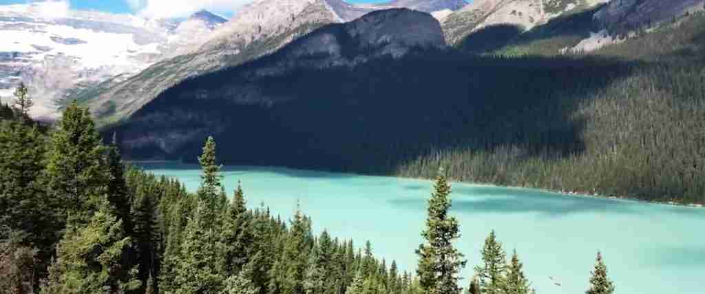
Banff’s distinctive turquoise lakes result from glacial rock flour, fine particles of silt created when glaciers grind bedrock into powder. As glaciers melt during summer months, meltwater carries this rock flour into lakes like Lake Louise, Moraine Lake, and Peyto Lake. The suspended particles reflect sunlight in specific wavelengths, producing the vibrant turquoise and emerald colors that make these lakes world-famous.
The intensity of lake colors varies seasonally and daily based on glacial melt rates. Peak turquoise brilliance occurs during July and August when glacial melt reaches maximum flow. Morning light often produces the most vivid colors as the angle of sunlight optimally reflects off suspended particles. During winter and early spring, reduced glacial melt means less rock flour in suspension, causing lakes to appear darker blue or gray-green.
Different lakes display varying shades based on their glacial sources and local geology. Moraine Lake’s deep turquoise comes from meltwater from the Wenkchemna Glacier, while Peyto Lake’s bright turquoise results from the Peyto Glacier’s distinctive rock flour composition. The process represents a dynamic interaction between ice, rock, water, and light, creating colors found nowhere else on earth.
What geological processes created Banff’s mountains?
Banff’s mountains formed through three major geological processes spanning 600 million years. First, sedimentary rocks accumulated in ancient seas, creating layers of limestone, shale, and sandstone thousands of meters thick. Second, tectonic plate collision between 180 and 55 million years ago thrust these layers upward and eastward, creating the Rocky Mountains through enormous compressional forces. Third, repeated glaciation during the past two million years carved the sharp peaks, U-shaped valleys, and cirques visible today.
The sedimentary layers visible in Banff’s mountains preserve evidence of ancient marine environments. Fossils embedded in limestone cliffs show trilobites, brachiopods, and other marine organisms that lived when this region lay beneath tropical seas. The distinctive layered appearance of peaks like Mount Rundle and Cascade Mountain reflects different sedimentary deposits, with harder limestone layers forming prominent cliff bands separated by softer shale slopes.
Glacial sculpting continues shaping Banff’s landscape today, though at slower rates than during ice age maximums. The Columbia Icefield feeds glaciers that flow into Banff’s northern regions, while smaller glaciers perch on north-facing slopes throughout the park. Freeze-thaw cycles continually weather exposed rock faces, causing rockfalls that gradually erode peaks and accumulate talus slopes at mountain bases.
How do Banff’s hot springs work?
Banff’s natural hot springs result from groundwater circulation deep beneath the Rocky Mountains. Rainwater and snowmelt seep through fractures in sedimentary rock layers, descending thousands of meters into the earth’s crust. Geothermal heat from the earth’s interior warms this water to temperatures exceeding 45°C. The heated water, being less dense than surrounding cold groundwater, rises back toward the surface through fault lines and fractures, emerging as hot springs.
The Upper Hot Springs, located on Sulphur Mountain, produce approximately 1,000 liters of thermal water per minute at temperatures around 46°C. The water’s journey from surface to depth and back takes decades or centuries, during which dissolved minerals accumulate, giving the springs their distinctive composition. High concentrations of sulphates, calcium, bicarbonate, and magnesium create the slightly milky appearance and mineral-rich properties sought by visitors.
Cave and Basin, where Banff National Park originated, features springs emerging through a natural cave system. The thermal waters here maintain constant temperatures year-round, creating a microclimate that supports unique ecosystems. Sulphur Mountain’s geology facilitates multiple spring outlets, with thermal water emerging at various points along fault lines. These springs represent rare geological features where specific combinations of fracture patterns, water circulation, and heat sources create accessible thermal waters.
Extended multi-day tours – 5+ days
Featured Park Banff National Park Multi-Day Tour Packages
3 days
Park Banff National Park 3-Day Discovery Tour
- ✓ Comprehensive Park Banff National Park experience
- ✓ Expert local guides included
- ✓ All accommodation included
- ✓ Transportation provided

5 days
Park Banff National Park 5-Day Highlights Experience
- ✓ Comprehensive Park Banff National Park experience
- ✓ Expert local guides included
- ✓ All accommodation included
- ✓ Transportation provided

7 days
Park Banff National Park 7-Day Cultural Journey
- ✓ Comprehensive Park Banff National Park experience
- ✓ Expert local guides included
- ✓ All accommodation included
- ✓ Transportation provided

10 days
Park Banff National Park 10-Day Complete Adventure
- ✓ Comprehensive Park Banff National Park experience
- ✓ Expert local guides included
- ✓ All accommodation included
- ✓ Transportation provided
Multi-day tour packages powered by TourRadar. Prices and availability subject to change.
The Geological Foundation: Building the Rockies
Banff National Park’s dramatic landscape rests upon a geological foundation spanning over 600 million years of Earth’s history. The rocks exposed in Banff’s mountains preserve evidence of ancient oceans, continental collisions, and ice age glaciations that collectively created one of the world’s most spectacular mountain ranges. Understanding this geological heritage reveals how time, pressure, and natural forces transformed marine sediments into peaks that tower over 3,000 meters above sea level.
The story begins during the Precambrian and Paleozoic eras, when the region that would become Banff lay beneath a shallow tropical sea. Over hundreds of millions of years, sediments accumulated on this ancient seafloor, layer upon layer building up limestone, shale, dolomite, and sandstone deposits thousands of meters thick. These sedimentary rocks, visible today in mountain faces throughout the park, contain fossils of marine organisms including trilobites, brachiopods, corals, and stromatolites that flourished in warm, shallow waters.
The transformation from horizontal seabed sediments to vertical mountain peaks began approximately 180 million years ago during the Mesozoic era. Tectonic forces associated with the breakup of the supercontinent Pangaea caused the Pacific tectonic plate to collide with and slide beneath the North American plate. This collision generated enormous compressional forces that buckled and thrust the sedimentary layers upward and eastward, creating the Rocky Mountain chain through a process called overthrust faulting.
The distinctive layered appearance of Banff’s mountains reflects this tectonic history. Mount Rundle, one of Banff’s most recognizable peaks, displays a classic example of tilted sedimentary layers. The mountain’s steep southwestern face formed where thrust faults pushed older rock layers up and over younger deposits, creating the dramatic angular profile visible from the Bow Valley. Similar thrust fault structures appear throughout the park, with older Cambrian rocks sitting atop younger Devonian and Mississippian formations.
The final major phase of geological transformation came during the Quaternary period, beginning approximately 2 million years ago. A series of ice ages saw massive continental ice sheets and mountain glaciers repeatedly advance and retreat across Banff’s landscape. These glaciers, some reaching thicknesses exceeding 1,000 meters, acted as enormous bulldozers and carving tools, fundamentally reshaping the mountains that tectonic forces had created.
Glacial erosion transformed V-shaped river valleys into broad U-shaped troughs like the Bow Valley. Glaciers quarried rock from mountain sides, creating steep-walled cirques like those surrounding Lake Louise and Moraine Lake. Where multiple cirques eroded a peak from different sides, sharp arêtes and pyramidal horns formed, creating the dramatic spires and ridges that define the Canadian Rockies’ skyline. Hanging valleys appeared where tributary glaciers met main valley glaciers at different elevations, later becoming spectacular waterfall sites.
The last major glacial maximum peaked approximately 18,000 years ago, when ice covered all but the highest peaks. As the climate warmed and glaciers retreated, they deposited enormous quantities of sediment carried within and beneath the ice. These glacial deposits, called moraines, created natural dams that impounded lakes throughout the park. Moraine Lake takes its name from the massive rockpile deposited by retreating glaciers, though research later determined the “moraine” actually consists of rockfall debris.
Today’s landscape preserves evidence of ongoing geological processes. Over 1,000 glaciers remain in the Canadian Rockies, including numerous active glaciers within Banff’s boundaries. Though much smaller than their ice age predecessors, these glaciers continue carving bedrock, transporting sediment, and feeding the turquoise lakes that attract millions of visitors. Annual melt-freeze cycles weather exposed rock faces, causing rockfalls and talus accumulation that gradually lower mountain peaks over geological timescales.
Specific geological formations throughout the park showcase different aspects of this complex history. The Fairholme Range displays distinctive banded limestone and dolomite formations from the Devonian period, approximately 380 million years old. Castle Mountain exhibits dramatic cliff bands of resistant Eldon Formation limestone alternating with recessive Stephen Formation shale. The Sawback Range features spectacular folded and faulted structures where compressional forces during mountain building created wave-like patterns in rock layers.
Fossil discoveries throughout Banff provide windows into ancient ecosystems. The Burgess Shale, though primarily located just outside the park boundary in Yoho National Park, represents one of the world’s most important fossil sites. Cambrian-age fossils found in similar rock formations within Banff preserve soft-bodied organisms rarely fossilized elsewhere, offering insights into early complex life forms. More recent Devonian reef formations contain abundant marine fossils including corals, stromatoporoids, and brachiopods that built extensive reef systems in ancient tropical seas.
Glaciers and Glacial Features: Ice Sculptors of the Rockies
Banff National Park’s most distinctive landscapes result from glacial processes that continue shaping the region today. Though current glaciers represent only small remnants of the massive ice sheets that covered the region during ice age maximums, these frozen rivers of ice maintain significant influence over the park’s ecosystems, hydrology, and visual character. Understanding glacial processes reveals how ice transforms mountains and creates the features that define Banff’s wilderness.
The park contains over 300 named glaciers and countless smaller permanent snowfields. These glaciers cluster primarily in the park’s northern and western regions, where higher elevations and north-facing aspects preserve snow accumulation year-round. The Saskatchewan Glacier, Banff’s largest glacier, flows from the Columbia Icefield and extends approximately 13 kilometers, making it one of the Canadian Rockies’ major glacial systems. Other significant glaciers include the Hector Glacier, Vulture Glacier, and numerous smaller cirque glaciers perched on north-facing mountain walls.
Glaciers form where annual snowfall exceeds annual melt, allowing snow to accumulate and compress into dense ice over decades and centuries. Fresh snow falling in the accumulation zone gradually transforms through compression and repeated melt-freeze cycles into granular firn, then eventually into solid glacial ice. The weight of accumulated snow and ice creates pressure that causes the frozen mass to flow downslope, behaving like a very slow-moving river. This flow rate varies from a few centimeters to several meters per year, depending on glacier size, slope, and temperature.
As glaciers flow, they carve landscapes through several erosion processes. Plucking occurs when ice freezes to bedrock, then pulls away rock fragments as the glacier moves. Abrasion happens when rock debris frozen into the glacier base acts like sandpaper, grinding and polishing bedrock surfaces. These processes working over thousands of years carved the broad U-shaped valleys characteristic of Banff’s main valleys, including the Bow Valley, North Saskatchewan Valley, and Mistaya Valley.
Cirques represent one of glaciation’s most distinctive features. These bowl-shaped depressions carved into mountain sides form where snow accumulates and transforms into ice, creating small glaciers that erode backward into peaks. The process begins with snow collecting in sheltered areas, often on north-facing slopes where reduced solar exposure allows snow to persist through summer. As snow compresses into ice and begins moving, it plucks rock from the back wall and base of the depression, gradually enlarging the cirque.
Lake Louise occupies a spectacular glacial cirque backed by Mount Victoria and the Victoria Glacier. The lake’s emerald-turquoise waters fill a depression carved by glacial action, while the Victoria Glacier continues modifying the cirque’s back wall. Moraine Lake similarly occupies a glacially-carved valley, though the lake itself forms behind a massive deposit of rockfall debris rather than a glacial moraine. These cirque lakes rank among the Canadian Rockies’ most photographed features, their vivid colors resulting from glacial rock flour suspended in meltwater.
When multiple cirques erode a mountain from different directions, they create sharp ridges called arêtes and pyramidal peaks called horns. Mount Temple, standing 3,543 meters as Banff’s third-highest peak, displays classic horn mountain morphology with steep faces radiating from a central summit. The knife-edge ridge between Mount Whyte and Mount Niblock exemplifies arête formation, where glacial erosion from both sides sharpened the mountain crest into a narrow, dramatic spine.
Glacial deposits, called moraines, accumulate where glaciers drop sediment carried within, upon, or beneath the ice. Lateral moraines form along glacier edges, marking former ice margins with linear ridges of unsorted rock debris. Terminal moraines accumulate at glacier fronts, creating natural dams that often impound lakes when glaciers retreat. Ground moraines consist of till deposited beneath moving ice, creating irregular landscapes of hills and depressions characteristic of areas once covered by glacial ice.
The turquoise color of Banff’s most famous lakes results directly from glacial processes. As glaciers flow across bedrock, they grind rock into extremely fine powder called glacial flour or rock flour. During summer melt, glacial streams carry this flour into downstream lakes. The suspended particles scatter sunlight, reflecting specific wavelengths that produce the distinctive turquoise and emerald colors. The color intensity varies seasonally, peaking in mid to late summer when glacial melt reaches maximum volume.
Peyto Lake provides one of the most striking examples of glacial flour’s visual effects. Fed by the Peyto Glacier, the lake displays an extraordinarily bright turquoise color visible from the Icefields Parkway viewpoint. The lake’s shape, resembling a wolf’s head from above, formed through a combination of glacial carving and sediment deposition. Similar processes created the vivid colors of Bow Lake, fed by the Bow Glacier, and numerous smaller tarns scattered throughout the park’s alpine regions.
Modern glacial retreat provides dramatic evidence of climate change. Historical photographs and surveys document significant shrinkage of Banff’s glaciers over the past century. The Victoria Glacier, prominently visible from Lake Louise’s shore, has retreated several hundred meters since the park’s establishment in 1885. The Bow Glacier, once extending nearly to the shore of Bow Lake, has withdrawn substantially upslope, leaving barren rock and newly exposed terrain in its wake.
This retreat exposes landscapes unseen for thousands of years. Vegetation slowly colonizes recently deglaciated terrain, with hardy pioneer species like saxifrages and cushion plants establishing footholds in cracks and depressions. Streams and waterfalls appear where glacial melt now flows across bedrock previously buried beneath ice. These newly exposed areas offer scientists opportunities to study primary succession, the process by which life colonizes barren landscapes.
Glacial meltwater plays crucial roles in Banff’s ecosystems. The park’s major rivers, including the Bow River and North Saskatchewan River, receive substantial flows from glacial melt, particularly during summer months. This cold, sediment-laden water creates distinctive aquatic habitats supporting specialized fish and invertebrate species. The consistent flow from glacial sources maintains river levels through hot, dry periods when rainfall alone might not sustain ecosystems dependent on cold, flowing water.
Mountain Ecology: Life in Vertical Zones
Banff National Park’s dramatic elevation changes, from valley floors at approximately 1,400 meters to peaks exceeding 3,400 meters, create a stacked series of ecological zones comparable to traveling from temperate forests to Arctic tundra. Each zone supports distinct plant and animal communities adapted to specific temperature, moisture, and growing season conditions. This vertical zonation concentrates remarkable biodiversity within a relatively compact geographic area, making Banff a natural laboratory for studying ecological adaptation and species distribution.
The montane zone, occupying valley bottoms and lower slopes between 1,400 and 1,800 meters elevation, experiences the warmest temperatures and longest growing seasons in the park. Open forests of Douglas fir, white spruce, and aspen characterize this zone, with grasslands and shrublands occupying drier exposures. These relatively mild conditions attract the highest concentration of wildlife, with elk, deer, bighorn sheep, and numerous bird species utilizing montane habitats year-round.
The Bow Valley exemplifies montane ecology, with extensive grasslands interspersed among forest stands. These grasslands result from a combination of factors including rain shadow effects, frequent winter chinook winds that melt snow and desiccate vegetation, and historical fire regimes that prevented forest encroachment. Native grasses like rough fescue once dominated these openings, supporting bison and other grazers before European settlement. Today, elk herds concentrate in these montane valleys, particularly during winter when deep snow makes higher elevations inaccessible.
Montane forests provide critical wildlife habitat despite covering only about 5% of the park’s area. Douglas fir forests with their open understory offer ideal conditions for large mammal movement and foraging. White spruce stands support diverse bird communities, including cavity-nesting species like northern flickers and pileated woodpeckers. Aspen groves attract species seeking the deciduous foliage and cavities that form in older trees, creating biodiversity hotspots within the predominantly coniferous landscape.
The subalpine zone, stretching from approximately 1,800 to 2,300 meters elevation, covers the largest portion of Banff’s forested landscape. This zone supports extensive stands of lodgepole pine, Engelmann spruce, and subalpine fir that blanket mountain slopes across the park. The subalpine’s cooler temperatures, deeper snowpack, and shorter growing seasons create conditions distinct from lower montane forests, supporting specialized plant and animal communities adapted to these harsher conditions.
Lodgepole pine dominates large areas of Banff’s subalpine forests, particularly on drier exposures and areas recovering from historical fires. This species adapted to fire-prone landscapes by developing serotinous cones that require heat to release their seeds, allowing rapid colonization of burned areas. Many subalpine pine forests show even age structures resulting from establishment after major fires, with dense stands of similar-aged trees covering entire mountainsides.
Subalpine forests support significant wildlife populations including black bears, grizzly bears, moose, and woodland caribou. Bears utilize subalpine meadows and forest openings where berries, roots, and other foods concentrate. Moose browse on willow and shrubs along subalpine streams and wetlands. The subalpine’s extensive forests provide crucial habitat for species requiring large, undisturbed territories, making this zone essential for maintaining viable populations of wide-ranging carnivores like wolves and cougars.
The treeline, where continuous forest gives way to scattered tree islands and alpine tundra, marks one of ecology’s most visible transitions. Treeline elevation varies based on aspect, moisture, and local conditions, ranging from approximately 2,200 meters on harsh, wind-exposed slopes to 2,400 meters in sheltered locations. The transition zone features distinctive krummholz, stunted and wind-sculpted trees shaped by severe winter conditions and ice crystal abrasion. These gnarled, often prostrate trees demonstrate remarkable resilience, with some individuals exceeding 200 years in age despite heights of less than two meters.
The alpine zone above treeline covers approximately 25% of Banff’s area, creating landscapes resembling Arctic tundra with specialized communities adapted to extreme conditions. Alpine plants contend with intense solar radiation, frequent freeze-thaw cycles, high winds, minimal soil development, and growing seasons as short as 8-10 weeks. Only the hardiest species survive these conditions, creating low-growing communities of cushion plants, sedges, and hardy perennials.
Alpine wildflowers create spectacular displays during brief summer growing seasons. Species like alpine forget-me-nots, mountain avens, moss campion, and western anemone bloom prolifically once snowmelt releases them from winter dormancy. These plants complete their entire reproductive cycles within weeks, racing to flower, produce seed, and store energy before winter returns. Many alpine species grow in tight cushions or mats that trap warmth, conserve moisture, and protect delicate tissues from wind damage.
Alpine wildlife species show remarkable adaptations to harsh mountain conditions. Bighorn sheep thrive in alpine environments, using cliff faces as escape terrain from predators while foraging on alpine vegetation. Mountain goats venture even higher onto the most precipitous terrain, their specialized hooves providing traction on steep rock faces. Pikas, small rabbit relatives, inhabit alpine rockfields where they harvest vegetation during summer to create hay piles that sustain them through winter months spent beneath the snowpack.
Birds utilize alpine habitats during summer breeding seasons. White-tailed ptarmigan, perfectly camouflaged with plumage that changes from brown summer to white winter, remain in alpine zones year-round. Horned larks nest on open alpine tundra, while rosy-finches forage for insects along permanent snowfields. Golden eagles hunt marmots and ground squirrels across alpine slopes, their exceptional vision allowing them to spot prey from great distances.
Glacial and periglacial features create specialized alpine habitats. Rock glaciers, masses of ice and rock debris that flow slowly downslope, support unique microclimates and communities. Permanent snowfields provide water sources throughout summer while harboring cold-adapted insects that serve as food for birds and small mammals. Talus slopes accumulate beneath cliff faces, creating boulder fields where hoary marmots and pikas establish territories among the rocks.
Climate change impacts different zones at different rates. The treeline advances upslope as warming temperatures allow trees to colonize areas previously too cold for survival. Alpine species face pressure as their habitat literally shrinks with upward migration of treeline and loss of permanent snowfields. Montane valleys experience earlier spring green-up and extended growing seasons, altering timing of ecological events like migration, breeding, and hibernation.
Grizzly Bears and Black Bears: Banff’s Apex Predators
Banff National Park protects critical habitat for both grizzly bears and black bears, with populations of each species numbering approximately 60 individuals within park boundaries. These apex predators play crucial ecological roles as consumers of vegetation, scavengers, and occasional predators, while their presence indicates healthy ecosystem function. Understanding bear ecology, behavior, and habitat requirements proves essential for both wildlife conservation and visitor safety in Banff’s wilderness.
Grizzly bears occupy wide-ranging territories throughout Banff, from montane valleys to alpine meadows. These omnivorous bears consume diverse foods depending on season and availability, with plant matter comprising approximately 80-90% of their diet. During spring emergence from winter dens, grizzlies seek out protein-rich foods including winter-killed elk and deer carcasses, roots, and emerging vegetation in avalanche slopes. Summer diets shift toward berries, particularly buffalo berries and soap berries, which help bears accumulate fat reserves for winter denning.
Adult male grizzlies may roam territories exceeding 1,000 square kilometers, while females with cubs occupy smaller but still extensive home ranges. These large spatial requirements make habitat connectivity crucial for population viability. Bears utilize the park’s valleys as movement corridors between mountain ranges, accessing different food sources as they become available throughout the season. The Bow Valley represents a critical corridor, though human development and transportation infrastructure create conflict points where bears must navigate through areas of concentrated human activity.
Grizzly bears demonstrate remarkable intelligence and learning ability, with individuals developing specialized foraging techniques and remembering productive food locations across years. Bears learn to dig for glacier lily and spring beauty corms in alpine meadows, turn over logs and rocks seeking insects and grubs, and raid ground squirrel colonies for protein-rich prey. Some individuals become skilled at hunting elk calves during spring calving periods, while others focus almost entirely on plant-based foods.
Black bears inhabit similar areas as grizzlies but show somewhat different habitat preferences and behaviors. Black bears adapt more readily to forested environments and demonstrate greater climbing ability, often escaping danger by ascending trees. Their diet overlaps significantly with grizzlies, though black bears show greater preference for ants, tree sap, and nuts when available. Both species face similar challenges regarding food scarcity during drought years when berry crops fail, forcing bears to range more widely in search of sustenance.
Den site selection represents a critical behavior for winter survival. Bears seek out locations offering insulation, stability, and drainage, often excavating dens beneath tree roots or rock overhangs. Den entrances face north or east to maintain snow cover that insulates the bear during winter dormancy. Females with cubs require particularly secure den sites, as newborn cubs weigh only 300-400 grams at birth and need protected conditions during their first months of life.
Winter denning begins in October or November, with bears entering a state of torpor characterized by reduced heart rate, respiration, and metabolism. Unlike true hibernators, bears can rouse quickly if disturbed, though they preferentially remain dormant throughout winter. Pregnant females give birth during denning, with cubs born in January or February while the mother continues her dormant state. Cubs nurse and grow within the den, emerging in spring weighing 5-7 kilograms when they follow their mother into the world.
Bear reproduction proceeds slowly, with females not breeding until 5-7 years of age and producing cubs only every 3-4 years. Females typically give birth to 2-3 cubs, though litter sizes range from 1-4. Cubs remain with their mother for 2-3 years, learning essential survival skills including food identification, den construction, and hazard avoidance. This extended maternal care means adult females may produce only 5-8 litters across their lifetime, making each reproductive event crucial for population maintenance.
Human-bear conflicts represent the primary threat to bear survival in Banff. Bears that access human food or garbage often become habituated, losing their natural wariness of people and returning repeatedly to developed areas. Park management employs comprehensive strategies to prevent habituation, including mandatory use of bear-proof garbage containers, strict food storage regulations in campgrounds and backcountry sites, and temporary area closures during critical feeding periods.
Wildlife corridors receive particular management attention as essential features allowing bears to move safely across the landscape. Highway crossing structures including wildlife overpasses and underpasses enable bears to traverse the Trans-Canada Highway without fatal vehicle collisions. Monitoring data shows both grizzlies and black bears use these structures regularly, with thousands of successful crossings documented since installation. These passages maintain connectivity between habitats on opposite sides of the highway, enabling bears to access diverse food sources and find mates across their extensive ranges.
Bear viewing opportunities exist throughout Banff, with sightings possible anywhere within the park. Spring offers excellent chances to observe bears in valley bottoms and avalanche slopes, where they feed on emerging vegetation and winter-killed ungulates. Summer finds bears at various elevations depending on food availability, often in berry patches or subalpine meadows. Fall concentrations occur at sites with abundant food sources, as bears engage in hyperphagia, consuming up to 20,000 calories daily to build fat reserves for winter.
Visitors should maintain strict safety protocols when traveling in bear country. Make noise on trails to avoid surprising bears, carry bear spray and know how to use it effectively, travel in groups, and leave dogs at home or keep them leashed and under control. Never approach bears regardless of perceived behavior, maintain minimum distances of 100 meters, and report all bear sightings to park staff. These precautions protect both human safety and bear welfare, allowing these magnificent animals to persist in their mountain wilderness home.
Elk, Deer, and Ungulates: Grazers of the Mountain Valleys
Banff National Park supports diverse populations of elk, deer, moose, bighorn sheep, and mountain goats, each species adapted to specific habitats and ecological niches within the mountain ecosystem. These ungulates, or hoofed mammals, play crucial roles as herbivores consuming vegetation and serving as prey for carnivores, while their seasonal movements and feeding behaviors shape plant communities throughout the park. Understanding ungulate ecology reveals complex interactions between climate, vegetation, predation, and human activity that determine population dynamics in Banff’s wilderness.
Elk represent Banff’s most visible and abundant large herbivores, with populations numbering several thousand individuals throughout the park. These impressive animals, with bulls weighing up to 450 kilograms and carrying antlers spanning 1.5 meters, inhabit montane and subalpine environments from valley floors to alpine meadows. Elk exhibit strong seasonal movement patterns, gathering in valley bottoms during winter when deep snow makes higher elevations inaccessible, then dispersing to subalpine meadows and alpine areas during summer to exploit abundant vegetation while avoiding heat and insects.
The Bow Valley hosts significant elk populations year-round, with herds concentrated around Banff townsite, Lake Minnewanka, and the Cascade Valley during winter months. These concentrations reflect the valley’s relatively mild climate, chinook winds that periodically clear snow, and grassland habitats offering accessible forage. Historical management practices that removed predators allowed elk populations to expand substantially, sometimes causing vegetation impacts in concentrated winter range areas.
Elk calving occurs in late May and early June, with females seeking isolated areas away from predators to give birth. Newborn calves remain hidden and motionless for their first days of life, protected from detection by their spotted coat pattern and lack of scent. Mother elk return periodically to nurse, gradually leading calves into open areas to join other females and young in nursery groups. Calf survival depends heavily on timing of birth relative to vegetation green-up and predator activity, with later-born calves facing higher mortality.
Bull elk engage in spectacular breeding behaviors during fall rut, beginning in mid-September and continuing through October. Males establish and defend territories, bugling to advertise their presence to females and challenge rival males. These haunting vocalizations echo through mountain valleys, creating one of Banff’s most evocative wilderness sounds. Bulls compete for breeding access through displays, vocalizations, and occasional combat, with mature bulls often gathering harems of multiple females while younger males wait for opportunities to breed.
Mule deer and white-tailed deer occupy different niches within Banff’s ecosystem. Mule deer, identified by their large ears and rope-like tail, prefer rocky terrain and shrubby habitats from valley bottoms to subalpine zones. White-tailed deer, with their characteristic flag-like tail, concentrate in valley bottoms where they utilize riparian areas and forest edges. Both species show more solitary tendencies than elk, though they occasionally gather in small groups, particularly during winter when food becomes scarce.
Moose inhabit wetland and riparian areas throughout the park, where they browse on willows, aquatic plants, and shrubs. These largest members of the deer family reach massive sizes, with adult bulls weighing 400-600 kilograms and carrying palmated antlers spanning 1.5 meters. Moose show strong habitat preferences for areas offering both dense cover and productive feeding sites, making them somewhat less visible than elk despite their imposing size.
Summer finds moose wading in shallow lakes and ponds, where they submerge their heads to feed on aquatic vegetation while cooling their bodies and escaping biting insects. This distinctive behavior occurs during morning and evening hours when moose activity peaks. Winter concentrates moose in willow-dominated drainages where they browse on woody stems that protrude above snow. Individual moose establish winter territories defending productive feeding areas against intruders.
Bighorn sheep inhabit alpine and subalpine areas throughout the park, with populations concentrated along the Bow Valley Parkway, near Goat Creek, and in the Brazeau Valley. These agile mountaineers demonstrate remarkable rock-climbing ability, using cliffs as escape terrain from predators while accessing mineral licks and feeding sites on steep slopes. Rams develop massive curved horns that continue growing throughout their lives, reaching impressive proportions in older individuals.
Sheep populations show strong seasonal patterns in habitat use and social structure. Winter finds mixed groups of rams, ewes, and young animals concentrated on south-facing slopes where wind and sun exposure clear snow from forage. Spring triggers separation as pregnant ewes seek isolated lambing areas away from potential threats, while rams form bachelor groups in higher elevation terrain. Summer disperses animals across extensive alpine ranges where abundant forage and water support population needs.
Mountain goats occupy the most precipitous terrain in Banff, venturing onto cliff faces and ledges that other ungulates cannot access. Their specialized hooves with rough, grippy pads and spreading toes provide traction on rock surfaces, allowing goats to navigate terrain that appears impossibly steep. Both sexes grow short, black horns and develop thick white coats that provide insulation during winter months spent in harsh alpine environments.
Goat populations concentrate in areas offering combinations of mineral licks, abundant forage, and escape terrain. Sulphur Mountain, the Goat Range, and various alpine areas throughout the park support resident goat populations. Kids, born in late May and early June on ledges inaccessible to predators, show remarkable climbing ability within hours of birth, following mothers across seemingly vertical rock faces.
Predation shapes ungulate populations through direct mortality and behavioral responses that alter habitat use and movement patterns. Wolves, cougars, grizzly bears, and black bears all prey on elk, deer, and occasionally moose, targeting calves, elderly animals, and individuals weakened by winter or disease. Predation risk influences where ungulates feed, rest, and travel, creating landscapes of fear where prey species balance food acquisition against mortality risk.
Winter represents the most challenging season for ungulates, when deep snow restricts movement, limits food access, and increases energy demands for thermoregulation. Animals enter winter with fat reserves accumulated during summer and fall, relying on these energy stores when forage quality and availability decline. Severe winters with deep snow and cold temperatures can cause significant mortality, particularly among young animals experiencing their first winter and elderly individuals with limited fat reserves.
Visitors encounter ungulates throughout the park, with some animals becoming habituated to human presence. Elk in particular often remain near roadways and developed areas where they’ve learned that predators avoid high-traffic zones. While these close encounters provide excellent viewing opportunities, visitors should maintain respectful distances and never approach animals, particularly during sensitive periods like calving and rutting seasons when animals may respond defensively to perceived threats.
Carnivores: Wolves, Cougars, and Wild Cats
Banff National Park protects populations of wolves, cougars, Canada lynx, wolverines, and smaller carnivores including coyotes, red foxes, and various weasel family members. These predators play essential ecological roles regulating prey populations, scavenging carcasses, and influencing prey behavior through predation risk. The presence of these carnivores, particularly wide-ranging species like wolves and cougars, indicates intact ecosystem function and provides visitors with opportunities to experience wilderness where natural predator-prey dynamics persist.
Wolves roam throughout Banff in packs occupying territories spanning hundreds of square kilometers. Pack sizes vary from 3-8 individuals, with core members including an alpha pair, their offspring from previous years, and occasionally unrelated adults. Wolf packs function as family units, cooperating in hunting, pup-rearing, and territory defense. Pack territories center on denning sites where pups are born in spring, with adults ranging widely from these core areas while hunting elk, deer, moose, and smaller prey.
The Cascade Valley and surrounding mountains support one of Banff’s most studied wolf packs, with researchers monitoring population dynamics, prey selection, and pack movements through radio telemetry and trail cameras. Studies reveal that elk comprise 80-90% of winter diet, with deer, moose, bighorn sheep, and small mammals making up the remainder. Wolves show strong preference for calves and elderly elk, though healthy adult elk also fall prey when deep snow impedes their escape abilities.
Pack hunting employs sophisticated strategies involving coordinated movement and role specialization. Some wolves drive prey toward ambush sites, while others wait to intercept fleeing animals. Wolves communicate through vocalizations, body postures, and scent marking, maintaining pack cohesion and defending territories against neighboring packs. Howling serves multiple functions including pack coordination, territory advertisement, and social bonding, with choruses often heard during dawn and dusk periods.
Cougars inhabit mountainous terrain throughout Banff, though their solitary, secretive nature makes them among the park’s least observed large mammals despite healthy populations. These large cats, also called mountain lions or pumas, demonstrate remarkable adaptability, hunting prey ranging from deer and elk to bighorn sheep and smaller mammals. Adult cougars establish territories of 100-300 square kilometers for females and 300-600 square kilometers for males, defending these areas against intruders through scent marking and occasional aggressive encounters.
Cougar hunting relies on stealth and ambush rather than pursuit. Cats stalk prey to close range, using terrain and vegetation for concealment, before launching powerful attacks that quickly overwhelm victims. Cougars target deer more often than elk, finding the smaller ungulates easier to kill and consume. After making a kill, cougars drag carcasses to secluded locations where they feed over several days, covering remains with debris between feeding sessions to hide them from scavengers.
Female cougars give birth to litters of 2-4 kittens in dens located in rock caves, dense thickets, or similar protected sites. Kittens remain with their mother for 15-18 months, learning hunting techniques and territorial behaviors essential for survival. Juvenile cougars dispersing from natal ranges face significant mortality risks as they seek vacant territories, often crossing highways or entering areas with higher human activity where conflicts increase.
Canada lynx inhabit boreal forests in Banff’s northern regions, though their populations fluctuate in response to snowshoe hare cycles. These medium-sized cats, with distinctive ear tufts and oversized paws adapted for traveling in deep snow, specialize in hunting snowshoe hares which comprise up to 90% of their diet. When hare populations peak, lynx populations increase due to abundant food and high kitten survival. When hare populations crash every 8-11 years, lynx numbers decline as starvation and reduced reproduction take their toll.
Lynx hunting techniques focus on patient waiting near hare trails, then short explosive pursuits when prey appears. Their large feet provide flotation on soft snow, giving lynx advantages when pursuing hares through deep winter conditions. Lynx remain active throughout winter, hunting in conditions that challenge most predators, their thick fur and specialized paws enabling them to thrive in environments where temperatures plunge far below freezing.
Wolverines, though rarely observed, inhabit remote areas of Banff’s backcountry. These powerful mustelids demonstrate remarkable strength relative to their size, taking down prey as large as caribou when opportunities arise. Wolverines show omnivorous feeding habits, consuming vegetation, carrion, small mammals, and occasional larger prey. They range widely across extensive territories, sometimes covering 20-30 kilometers in a single day while searching for food.
Smaller carnivores including coyotes, red foxes, martens, fishers, short-tailed weasels, long-tailed weasels, and least weasels occupy various niches throughout the park. Coyotes inhabit valley bottoms and open terrain where they hunt rodents, rabbits, and occasionally deer fawns. Red foxes prefer forest edges and grasslands where they pounce on voles and mice detected beneath snow. Martens and fishers hunt in forested areas, with fishers specializing in porcupine predation while martens focus on squirrels and small rodents.
Predator-prey relationships create cascading effects throughout Banff’s ecosystems. Wolves reduce elk populations and alter elk distribution patterns, decreasing browsing pressure on riparian willows and allowing willow communities to recover. This vegetation recovery benefits beavers, songbirds, and other species dependent on healthy riparian habitats. Such trophic cascades demonstrate how apex predators influence ecosystems beyond their direct effects on prey populations.
Conflict between carnivores and humans occurs when animals access attractants like garbage, livestock, or pet food. Park management emphasizes prevention through education, bear-proof containers, and area closures during critical periods. Wildlife corridors and highway crossing structures reduce vehicle-wildlife collisions while maintaining habitat connectivity for wide-ranging carnivores. These measures help sustain carnivore populations while enhancing visitor safety and experience.
Observing carnivores in wild Banff remains challenging due to their secretive nature and low population densities. Wolf howls heard at dawn or dusk offer acoustic evidence of their presence. Fresh tracks in snow reveal where cougars, lynx, or wolverines traveled recently. Occasionally, visitors witness predation events or encounter carnivores hunting or traveling. These rare sightings remind us that Banff functions as true wilderness where natural predator-prey relationships continue shaping the landscape.
Banff’s Turquoise Lakes: Geology Meets Hydrology
Banff National Park’s collection of vivid turquoise and emerald lakes ranks among the world’s most photographed and recognizable natural features. Lake Louise, Moraine Lake, Peyto Lake, Bow Lake, and dozens of smaller tarns showcase colors found nowhere else on earth, resulting from unique combinations of glacial processes, water chemistry, and light physics. Understanding these lake systems requires exploring glaciology, geology, and hydrology to appreciate how ice, rock, and water create one of nature’s most stunning visual phenomena.
The turquoise color originates from glacial rock flour, extremely fine particles of silt created when glaciers grind bedrock into powder. Glaciers function as enormous mills, with rock debris frozen into basal ice acting as grinding surfaces against underlying bedrock. The immense pressure of glacial ice combined with movement creates friction that pulverizes rock into particles measuring only 0.002-0.02 millimeters in diameter, about the consistency of talcum powder.
During summer months, glacial meltwater carries this rock flour in suspension from glaciers into downstream lakes. The suspended particles remain afloat in the water column due to their extremely small size and light weight, creating a colloidal suspension that persists for extended periods. These suspended particles interact with sunlight in specific ways, reflecting and scattering light wavelengths that produce the distinctive turquoise and emerald colors visible to human eyes.
The physics of light interaction explains color generation. Sunlight contains all visible wavelengths, appearing white when combined. When sunlight penetrates lake water containing suspended rock flour, the particles preferentially scatter blue and green wavelengths while absorbing red and yellow wavelengths. Water molecules themselves absorb red light, enhancing the blue-green effect. The specific size range of glacial flour particles optimizes this selective scattering, producing the brilliant turquoise color that distinguishes glacial lakes from other water bodies.
Lake Louise exemplifies glacial lake dynamics, with its vivid colors and dramatic setting making it one of Canada’s most iconic landscapes. The lake occupies a glacially-carved valley backed by Mount Victoria and the Victoria Glacier, which continues feeding rock flour into the lake system. During peak melt in July and August, the lake displays its most intense turquoise color as glacial meltwater carries maximum rock flour concentrations. Winter and early spring bring darker blue-gray tones when reduced melt limits rock flour input.
Moraine Lake, despite its name, occupies a valley blocked by rockfall debris rather than a glacial moraine. Nevertheless, its waters display spectacular turquoise resulting from glacial flour carried by meltwater from the Wenkchemna Glacier and surrounding peaks. The lake’s setting in the Valley of the Ten Peaks creates one of the Canadian Rockies’ most photographed scenes, particularly during morning hours when calm conditions produce mirror-like reflections of surrounding mountains.
Peyto Lake demonstrates perhaps the most vivid turquoise color in the park, fed by meltwater from the Peyto Glacier. The lake’s unusual wolf-head shape visible from above results from a combination of glacial carving and sediment deposition at inlet streams. An overlook along the Icefields Parkway provides spectacular views of the lake’s color, particularly during July and August when glacial melt peaks and rock flour concentrations reach maximum levels.
Bow Lake sits at the base of the Bow Glacier, receiving meltwater that carries distinctive rock flour creating emerald-turquoise tones. The glacier itself has retreated substantially from the lake shore, with historical photographs showing ice extending nearly to the water’s edge in the late 1800s. This retreat exposed barren terrain that vegetation gradually colonizes, documenting ongoing climate change impacts on glacial systems.
Smaller alpine lakes scattered throughout the park display varying shades of turquoise, blue, and green depending on their glacial connections and local geology. Some tarns in cirques and hanging valleys receive direct glacial meltwater, showing vivid colors during summer months. Others fill primarily with snowmelt and rainfall, displaying clearer blue tones without the distinctive turquoise of glacial flour suspension.
Color intensity varies throughout the season following predictable patterns. Spring snowmelt begins diluting winter’s clear lake water, gradually introducing rock flour as temperatures rise. June brings increasing turquoise as glaciers begin serious melting. July and August show peak color intensity when high temperatures drive maximum glacial melt and rock flour transport. September sees colors begin fading as temperatures drop and glacial melt decreases. Winter freezing ends rock flour input, with lakes displaying darker tones beneath ice cover.
Daily variations in color intensity result from changing light angles and weather conditions. Morning light often produces the most vivid turquoise as low-angle sunlight optimally interacts with suspended particles. Overcast conditions can mute colors by diffusing light, while bright midday sun sometimes washes out subtle tones. The interplay between light, water, and suspended particles creates ever-changing colors that shift throughout the day.
Photography of these lakes benefits from understanding optimal timing and conditions. Peak color occurs during July and August when rock flour concentrations reach maximum. Morning and evening light provide warm tones that complement turquoise water colors. Calm conditions create reflections doubling visual impact. Elevated viewpoints offer perspectives that showcase lake colors most effectively, with examples including the Peyto Lake overlook and various trails accessing higher vantage points above Lake Louise and Moraine Lake.
Climate change impacts on glacier-fed lakes follow concerning trajectories. Accelerated glacial retreat reduces rock flour production over time as glaciers shrink and eventually disappear. Some projections suggest that many Rocky Mountain glaciers could largely vanish within decades, ending the rock flour supply that creates turquoise colors. Lake colors may shift toward darker blues characteristic of non-glacial lakes, representing a visible manifestation of climate change impacts on mountain ecosystems.
Natural Hot Springs: Thermal Windows to Earth’s Interior
Banff National Park’s natural hot springs represent rare geological features where thermal groundwater from deep within the earth reaches the surface. These springs, including the Upper Hot Springs, Cave and Basin, and several undeveloped thermal outlets, result from specific combinations of geological structures, groundwater circulation patterns, and heat sources that make thermal springs exceptionally uncommon features. Understanding hot spring formation reveals connections between surface landscapes and deep geological processes occurring kilometers beneath our feet.
Hot spring formation begins with water infiltration. Rain and snowmelt seep into fractures and porous rock layers, descending deep into the earth’s crust through interconnected pathways. This groundwater circulation follows pressure gradients and permeability patterns, with water sometimes traveling kilometers vertically and horizontally through subsurface rock formations. The descent can take decades or centuries, with water gradually penetrating to depths exceeding 2-3 kilometers beneath the surface.
At these depths, the earth’s geothermal gradient heats the water. Temperature increases approximately 25-30°C per kilometer of depth in stable continental crust, meaning water descending 2,000 meters encounters temperatures exceeding 50-60°C. The heated water dissolves minerals from surrounding rocks, acquiring distinctive chemical signatures that include elevated concentrations of sulphates, calcium, magnesium, and bicarbonates. These dissolved minerals give thermal waters their characteristic properties and slight cloudiness.
The heated water, being less dense than surrounding cold groundwater, becomes buoyant and begins ascending back toward the surface. This ascent requires specific geological conditions, particularly vertical fractures or fault zones that provide pathways through otherwise impermeable rock layers. The Rocky Mountain thrust faults that created Banff’s mountains also created fracture systems enabling thermal water circulation, making hot springs common in areas of complex geological structure.
Sulphur Mountain hosts Banff’s most prominent hot springs system, with thermal water emerging at multiple points along the mountain’s lower slopes. The Upper Hot Springs, developed for public bathing, discharges approximately 1,000 liters per minute at temperatures around 46°C. The spring’s location along a thrust fault provides the vertical pathway allowing heated water to reach the surface after its long subsurface journey.
Cave and Basin holds special significance as the spring whose discovery led to Banff National Park’s creation. In 1883, railway workers exploring Sulphur Mountain discovered the thermal spring emerging into a natural cave system. The cave’s relatively constant 30°C temperature and steamy atmosphere created by the thermal pool attracted immediate attention, leading to conflicting ownership claims that prompted government intervention and eventual park establishment in 1885.
The Cave and Basin system features unique ecological characteristics. Thermal waters maintain temperatures that support tropical organisms found nowhere else at this latitude. Snails originally from the Pacific Northwest colonized these springs, surviving in the warm water while cold Canadian winters rage outside. Rare algae and cyanobacteria create orange and green bacterial mats in warm, mineral-rich waters, producing ecosystems found in few other locations.
Chemical analysis of Banff’s thermal springs reveals their deep circulation history. High sulphate concentrations result from water interaction with gypsum and anhydrite deposits in sedimentary rock formations. Elevated calcium and magnesium reflect dissolution of limestone and dolomite during underground transit. Trace elements and isotopic signatures allow scientists to estimate groundwater ages, confirming that thermal waters spent decades to centuries in subsurface circulation before emerging at springs.
The springs maintain remarkably constant temperatures year-round, reflecting their isolation from surface temperature fluctuations during deep circulation. While surface water temperatures in Banff range from near 0°C in winter to 20°C in summer, thermal spring temperatures remain within narrow ranges dictated by circulation depth and geothermal gradient. This thermal constancy creates distinctive microhabitats supporting organisms intolerant of temperature fluctuation.
Historical photographs document changes in spring outlets and flows. Some springs that produced substantial flows in the late 1800s now discharge reduced volumes, possibly due to fracture sealing by mineral deposition or changes in subsurface flow patterns. Other springs maintain consistent output, suggesting stable circulation pathways. Monitoring spring temperatures and chemistry provides insights into subsurface conditions and potential climate change impacts on groundwater systems.
Hot springs played significant roles in Indigenous culture long before European contact. First Nations peoples visited thermal springs for bathing, ceremonies, and therapeutic purposes, recognizing the special properties of heated, mineral-rich waters. The springs represented sacred places where earth’s power manifested, creating places of spiritual significance that attracted peoples from distant areas seeking healing and renewal.
Modern use of thermal springs balances recreation with conservation. The Upper Hot Springs facility offers public bathing in a pool filled with thermal water, providing accessible experiences of this natural phenomenon. Cave and Basin, now operating as a historic site and interpretive center, preserves the location where park history began while protecting sensitive thermal ecosystems. Undeveloped springs throughout the park remain in natural condition, supporting unique biological communities adapted to thermal conditions.
Conservation Efforts and Ecosystem Management
Banff National Park implements comprehensive conservation programs protecting its natural features and wildlife populations while accommodating millions of annual visitors. These management strategies address challenges including wildlife-human conflicts, habitat fragmentation, climate change impacts, and maintaining ecological integrity in one of the world’s most visited national parks. Success requires balancing preservation goals with visitor access, employing science-based approaches that adapt to changing conditions and evolving understanding of complex ecosystem dynamics.
Wildlife corridor conservation represents a cornerstone of Banff’s management strategy. Highway infrastructure, particularly the Trans-Canada Highway bisecting the park, creates significant barriers to animal movement. Wildlife overpasses and underpasses, numbering over 40 structures, enable animals to cross safely beneath or over the highway. Extensive monitoring through remote cameras documents regular use by grizzly bears, black bears, elk, deer, wolves, cougars, and other species, confirming these structures’ effectiveness in maintaining habitat connectivity.
The Bow Valley corridor receives intensive management attention due to concentrated human use and development. Banff townsite, Lake Louise hamlet, numerous campgrounds, and resort facilities create human use zones within critical wildlife habitat. Seasonal area closures protect important foraging sites and movement corridors during sensitive periods like bear spring feeding and elk calving. Wildlife-proof garbage containers, food storage regulations, and visitor education programs minimize human-wildlife conflicts by eliminating attractants that habituate animals to human presence.
Prescribed fire programs restore natural fire regimes disrupted by decades of fire suppression. Fire historically maintained open grasslands, renewed forest stands, and created diverse age-class mosaics supporting varied wildlife. Modern fire management carefully reintroduces this natural process through controlled burns that reduce fuel loads, stimulate vegetation renewal, and restore ecosystem processes while protecting infrastructure and public safety. These programs require extensive planning, favorable weather conditions, and coordination with neighboring jurisdictions.
Aquatic ecosystem restoration addresses historical impacts including fish stocking, introduction of non-native species, and habitat degradation. Bull trout, a native species requiring cold, clean water, suffered population declines due to competition with introduced species and habitat loss. Restoration efforts remove non-native fish from critical bull trout lakes, restore stream connectivity by removing or modifying barriers, and protect remaining populations in pristine headwaters. These intensive programs aim to recover this iconic species throughout its historical range.
Vegetation management addresses browse pressure from elk populations in areas where predator removal historically allowed ungulate populations to exceed carrying capacity. Willow and aspen communities suffered severe impacts from concentrated elk browsing in valley bottoms, particularly around Banff townsite. Wolf recolonization and hunting pressure changes helped redistribute elk, allowing vegetation recovery in some areas. Active management including fencing, transplanting, and monitoring tracks recovery of these critical riparian plant communities.
Climate change adaptation represents an emerging focus as warming temperatures alter ecosystems. Treeline advances upslope as warming enables tree establishment in former tundra zones. Glaciers retreat dramatically, reducing summer stream flows and eventually eliminating iconic turquoise lakes dependent on glacial rock flour. Wildlife species shift ranges in response to changing conditions, with some alpine-adapted species facing habitat loss as suitable climates contract upward and eventually disappear.
Monitoring programs track ecosystem health through indicator species, vegetation plots, water quality sampling, and wildlife population surveys. Long-term datasets reveal trends including population changes, range shifts, and phenological changes in timing of ecological events. This information guides adaptive management, allowing parks staff to adjust strategies based on observed outcomes and changing conditions.
Visitor management strategies balance access with conservation. Permit systems limit backcountry use, preventing overuse of sensitive areas. Designated camping zones concentrate impact in specific sites while protecting surrounding wilderness. Trail systems direct foot traffic away from critical wildlife habitat while providing access to spectacular viewpoints and natural features. Shuttle systems reduce vehicle congestion in high-use areas like Moraine Lake, where parking limitations previously created traffic and overcrowding problems.
Education programs engage visitors in conservation efforts, explaining park values, wildlife behavior, and proper wilderness ethics. Information centers, trail signage, social media, and ranger programs communicate safety information, park regulations, and conservation messages to diverse audiences. Research suggests that informed visitors demonstrate better compliance with regulations and greater appreciation for conservation needs.
Collaboration with First Nations partners recognizes Indigenous connections to these lands and incorporates traditional knowledge into management decisions. The Stoney Nakoda, Ktunaxa, Blackfoot, and other First Nations maintain cultural and spiritual connections to Banff’s landscapes. Park management increasingly consults with Indigenous communities on decisions affecting areas of cultural significance, incorporating traditional ecological knowledge that spans generations of observation and interaction with these ecosystems.
UNESCO World Heritage Significance
Banff National Park forms a cornerstone of the Canadian Rocky Mountain Parks UNESCO World Heritage Site, designated in 1984 and expanded in 1990 to encompass 22,990 square kilometers across four national parks and three British Columbia provincial parks. This recognition acknowledges exceptional natural beauty, geological significance, and ecological importance of the mountain ecosystems protected within these boundaries. Understanding the UNESCO designation reveals why the international community considers these mountains among earth’s most important protected landscapes.
The World Heritage designation recognizes outstanding universal value in two categories: natural beauty and geological phenomena. The Canadian Rockies display spectacular mountain scenery characterized by dramatic peaks, turquoise glacier-fed lakes, extensive glaciers and icefields, and pristine wilderness. Few mountain regions worldwide match the scale, accessibility, and pristine condition of these landscapes, making them iconic representations of mountain wilderness.
Geological significance stems from exceptional exposures of sedimentary rock formations recording over 600 million years of earth history. The Rocky Mountain thrust and fold belt showcases plate tectonic processes that built these mountains, with thrust faults pushing older rocks over younger deposits in dramatic displays of crustal deformation. Fossils preserved in limestone formations, including the nearby Burgess Shale, provide crucial insights into the evolution of complex life during the Cambrian period.
Glacial features throughout the parks demonstrate ice age processes at spectacular scales. The Columbia Icefield represents the largest ice mass in the Canadian Rockies, feeding glaciers flowing in all directions and serving as a natural laboratory for studying glacial processes. Moraines, erratics, U-shaped valleys, hanging valleys, and other glacial landforms provide textbook examples of glacial geomorphology accessible to visitors and researchers alike.
Ecological values recognized in the designation include intact ecosystems supporting full complements of native species. Large mammal populations including grizzly bears, wolves, and caribou persist in habitats protected from most human alteration. The parks protect watersheds flowing to three oceans, with streams beginning in these mountains eventually reaching the Pacific Ocean, Atlantic Ocean, and Arctic Ocean. This triple divide represents a unique hydrological feature of global significance.
The designation carries responsibilities for Canada to protect these values for future generations. Management must maintain ecological integrity, preserve natural beauty, and ensure that development occurs only when consistent with conservation goals. Regular monitoring and reporting to UNESCO document the state of conservation and any threats to World Heritage values.
Threats to the site include climate change impacts on glaciers and ecosystems, development pressure along transportation corridors, wildlife-human conflicts, and potential industrial activities in surrounding areas. Park management works to address these challenges through conservation programs, habitat restoration, wildlife corridors, and collaboration with stakeholders. The UNESCO designation raises international awareness and provides additional impetus for strong protection measures.
Tourism represents both an opportunity and a challenge for World Heritage sites. Millions of visitors experience these spectacular landscapes annually, generating economic benefits and fostering appreciation for conservation. However, visitor pressure creates impacts including trail erosion, wildlife disturbance, and infrastructure demands. Sustainable tourism strategies aim to provide access while protecting the very values that attract visitors to these remarkable mountains.
Frequently Asked Questions
What is the best time to see wildlife in Banff National Park?
Spring (May-June) and fall (September-October) offer excellent wildlife viewing as animals concentrate in accessible areas. Bears feed in valley bottoms and avalanche slopes during spring, elk gather for fall rutting season, and reduced visitor numbers mean animals show less wariness. Early morning and evening hours produce the most sightings year-round.
Why do Banff’s lakes look turquoise?
Glacial rock flour, fine silt created when glaciers grind bedrock, suspends in lake water and reflects sunlight in specific wavelengths, producing turquoise and emerald colors. Peak colors occur during July-August when glacial melt carries maximum rock flour into lakes. The phenomenon requires specific particle sizes and light angles found only in glacial lake systems.
How many grizzly bears live in Banff?
Approximately 60 grizzly bears inhabit Banff National Park, with similar numbers of black bears also present. Bears range widely across territories spanning hundreds of square kilometers, making population estimates challenging. Both species face pressures from human activity in the Bow Valley corridor, requiring careful management to ensure long-term survival.
What geological processes created Banff’s mountains?
Three major processes shaped Banff’s landscape: sedimentary deposition in ancient seas 600+ million years ago created rock layers; tectonic collision 180-55 million years ago thrust these layers upward forming the Rocky Mountains; glaciation over the past 2 million years carved peaks, valleys, and cirques visible today. These processes continue shaping the landscape.
Are Banff’s glaciers shrinking?
Yes, Banff’s glaciers show significant retreat due to warming temperatures. Historical records document substantial shrinkage over the past century, with glaciers like the Victoria Glacier and Bow Glacier retreating hundreds of meters from their former positions. Climate change projections suggest many glaciers could largely disappear within decades, eliminating their influence on lake colors and stream flows.
What makes Banff a UNESCO World Heritage Site?
UNESCO recognizes the Canadian Rocky Mountain Parks for exceptional natural beauty, geological significance, and ecological integrity. The designation acknowledges spectacular mountain scenery, exceptional geological exposures recording earth history, extensive glacial features, and intact ecosystems supporting full complements of native wildlife including grizzly bears and wolves.
How do hot springs in Banff work?
Groundwater descends through fractures to depths exceeding 2 kilometers, where geothermal heat warms it to 45-50°C. The heated water rises through fault lines back to the surface, emerging as thermal springs. The journey takes decades to centuries, during which water dissolves minerals creating distinctive chemistry. Specific geological structures enable this circulation.
What is the largest glacier in Banff National Park?
The Saskatchewan Glacier represents Banff’s largest glacier, flowing approximately 13 kilometers from the Columbia Icefield. This glacier feeds the North Saskatchewan River system, contributing significant water to prairie river systems far downstream. Like other Rockies glaciers, it shows substantial retreat from its maximum extent during the Little Ice Age.
How high do animals live in Banff?
Mountain goats inhabit the highest elevations, regularly ranging above 2,800 meters on cliff faces and alpine tundra. Bighorn sheep utilize alpine zones up to 2,600 meters. Pikas live in rockfields between 2,200-3,000 meters elevation. Grizzly bears and elk range from valley floors at 1,400 meters to alpine meadows exceeding 2,500 meters during summer months.
What is treeline in Banff?
Treeline, where continuous forest gives way to scattered trees and alpine tundra, occurs between 2,200-2,400 meters elevation depending on exposure and local conditions. Harsh winds, short growing seasons, and extreme temperatures prevent tree growth above this elevation. Treeline is advancing upslope as warming temperatures enable tree establishment in former tundra zones.