
Zagori Cultural Landscape Guide: Stone Villages & Deepest Gorge
Hidden in the rugged Pindus Mountains of northwestern Greece, Zagori Cultural Landscape represents one of Europe’s most authentic mountain regions, where 46 traditional stone villages cluster around the world’s deepest gorge relative to its width. Inscribed as a UNESCO World Heritage Site in September 2023, this remote corner of Epirus preserves centuries of harmonious interaction between human settlement and dramatic Alpine landscape through vernacular architecture, arched stone bridges, and cobbled pathways connecting isolated communities.
Key Takeaways
- Greece’s First Cultural Landscape: Zagori became Greece’s inaugural UNESCO World Heritage cultural landscape in 2023, recognized under Criterion v for representing traditional human settlement adapted to mountain environments.
- World’s Deepest Proportional Gorge: Vikos Gorge holds the Guinness World Record as the deepest canyon relative to its width, plunging 1,350 meters while narrowing to just a few meters at certain points along its 32-kilometer length.
- 46 Stone Villages: The Zagorochoria (Zagori villages) showcase distinctive vernacular architecture using local grey limestone, with 20 villages forming the UNESCO core zone and traditional settlements dating primarily to the 14th-18th centuries.
- Architectural Engineering Heritage: The landscape features over 60 arched stone bridges built during the 18th-19th centuries, cobbled kalderimi pathways, and monumental stone staircases including the famous 1,100-step Vradeto Steps connecting mountain communities.
- Sacred Forests Tradition: Village squares center around protected plane trees and community-maintained sacred forests, representing intangible cultural heritage practices that have shaped the landscape for centuries.
- Active Hiking Destination: The region offers extensive trail networks through Vikos-Aoos National Park, from challenging multi-day treks across high alpine plateaus to accessible gorge viewpoint walks.
People Also Ask About Zagori Cultural Landscape
What makes Zagori a UNESCO World Heritage cultural landscape?
Zagori achieved UNESCO World Heritage inscription in September 2023 as an outstanding example of traditional human settlement adapted to challenging mountain topography, recognized under Criterion v. The cultural landscape demonstrates how small stone villages evolved through centuries of agro-pastoral activities, creating a distinctive relationship between built environment and dramatic Alpine setting. The inscription recognizes the traditional architecture of limestone masonry houses adapted to mountain conditions, the extensive network of arched stone bridges connecting isolated communities, cobbled pathways and monumental staircases carved into steep terrain, and the cultural traditions including transhumance, sacred forests, and drystone construction techniques. The landscape represents the transformation that occurred during the 18th-19th centuries when Zagori expatriates sent remittances funding construction of bridges, schools, churches, and public buildings, creating the architectural ensemble that survives today. The nomination initially proposed mixed natural-cultural recognition, but UNESCO inscribed only the cultural values after evaluation.
How deep is Vikos Gorge and why is it famous?
Vikos Gorge holds the Guinness World Record as the deepest gorge in the world relative to its width, achieving exceptional depth-to-width proportions that distinguish it from larger canyons like the Grand Canyon. The gorge extends 32 kilometers through the Pindus Mountains, with walls ranging from 120 to 1,350 meters in height. At its deepest section between Monodendri and Vikos villages, the gorge plunges 1,350 meters while the width varies from 2,500 meters at wider sections to just a few meters at the narrowest passages. This extraordinary proportional depth creates dramatic vertical limestone cliffs, unique microclimates supporting diverse flora and fauna, and spectacular hiking experiences along the gorge floor where hikers walk beneath towering walls. The name “Vikos” derives from a Slavic word meaning echo, reflecting the acoustic properties of the narrow canyon. The gorge forms the centerpiece of Vikos-Aoos National Park and provides habitat for endangered species including Eurasian brown bears, wolves, and rare endemic plants.
How many villages are in Zagori and which should I visit?
Zagori encompasses 46 traditional stone villages collectively known as Zagorochoria, with 20 villages forming the UNESCO World Heritage core zone within three municipal units: Central Zagori, Tymphi, and Papingo. Each village developed distinctive character while sharing vernacular architectural traditions adapted to mountain conditions. The most significant villages for visitors include Megalo and Mikro Papingo, twin settlements at 950-1,050 meters elevation beneath the dramatic Towers of Astraka, offering access to alpine hiking and serving as basecamp for Drakolimni (Dragon Lake) expeditions. Monodendri functions as the primary gateway to Vikos Gorge, positioned on the canyon’s eastern rim with multiple viewpoints and the famous cliffside Monastery of Agia Paraskevi. Kipi gained renown for its concentration of arched stone bridges including the photogenic Kalogeriko triple-arch bridge. Vitsa preserves particularly intact traditional architecture and central square arrangement. Aristi provides access to the Monastery of Panagia Spiliotissa and Voidomatis River springs. Vikos village, with only 35 permanent residents, offers intimate experience of mountain settlement at the gorge’s northern terminus.
Can you hike Vikos Gorge and what experience level is required?
Vikos Gorge offers hiking experiences ranging from challenging full-day gorge traverses to moderate viewpoint walks accessible to most fitness levels. The classic gorge hike covers 12.5 kilometers along the canyon floor from Monodendri to Vikos village, following the seasonal Voidomatis River through dramatic landscapes beneath towering limestone walls. This route requires 5-7 hours walking time, involves boulder hopping over rocky sections, includes steep descents and ascents at both ends, and demands good fitness levels and proper hiking boots. The trail follows kalderimi cobblestone paths, forest tracks, and streambed sections, with wooden ladders assisting navigation through challenging passages. Moderate alternatives include the Monodendri to Kipi route avoiding the deep gorge traverse, viewpoint walks to Oxya belvedere requiring 2-3 hours roundtrip, and the famous Vradeto Steps climbing 1,100 stone steps between Kapesovo and Vradeto villages. Multi-day expeditions combine gorge hiking with alpine crossings to Drakolimni, Astraka plateau, and connections to neighboring valleys. Spring and autumn provide optimal hiking conditions, while summer heat can make gorge hiking strenuous and winter snow renders high trails impassable.
Extended multi-day tours – 5+ days
Featured Zagori Multi-Day Tour Packages
3 days
Zagori 3-Day Discovery Tour
- ✓ Comprehensive Zagori experience
- ✓ Expert local guides included
- ✓ All accommodation included
- ✓ Transportation provided

5 days
Zagori 5-Day Highlights Experience
- ✓ Comprehensive Zagori experience
- ✓ Expert local guides included
- ✓ All accommodation included
- ✓ Transportation provided
7 days
Zagori 7-Day Cultural Journey
- ✓ Comprehensive Zagori experience
- ✓ Expert local guides included
- ✓ All accommodation included
- ✓ Transportation provided

10 days
Zagori 10-Day Complete Adventure
- ✓ Comprehensive Zagori experience
- ✓ Expert local guides included
- ✓ All accommodation included
- ✓ Transportation provided
Multi-day tour packages powered by TourRadar. Prices and availability subject to change.
Introduction
The Zagori region occupies a remote corner of northwestern Greece where the Pindus Mountains create formidable barriers isolating traditional communities from modern development. This geographical isolation, which historically limited economic opportunities and prompted waves of emigration, paradoxically preserved cultural landscapes that have vanished elsewhere in Greece. The 46 stone villages known collectively as Zagorochoria cluster on mountain ridges, valley floors, and steep slopes, connected by arched bridges spanning turquoise rivers and cobbled pathways winding through forests. At the landscape’s heart lies Vikos Gorge, a geological marvel plunging over 1,300 meters through limestone formations that took millions of years to carve.
Zagori’s cultural landscape emerged through centuries of human adaptation to challenging mountain environments. Archaeological evidence documents human presence from the Upper Paleolithic period, but permanent settlements gained historical documentation beginning in the 14th century when Byzantine sources first mention Zagori villages. The region developed distinctive character during Ottoman rule from the 15th century onward, when some villages negotiated favorable autonomy agreements allowing self-governance, tax advantages, and cultural preservation. This relative freedom, combined with widespread emigration to commercial centers across the Ottoman Empire and Europe, created unusual prosperity that financed the architectural flowering visible today.
The 18th-19th centuries witnessed Zagori’s transformation from subsistence mountain communities to architecturally sophisticated settlements. Expatriate merchants, craftsmen, and professionals sent remittances funding construction of elaborate stone mansions, schools, libraries, churches adorned with fine woodcarving and metalwork, and the iconic arched bridges that became Zagori’s architectural signature. Master stonemasons developed specialized techniques for working the local grey limestone, creating structures that harmonized with mountain landscapes while demonstrating engineering sophistication. The drystone construction traditions, cobbled pathway networks, and settlement patterns adapted to steep topography represent accumulated knowledge refined over generations.
The 20th century brought dramatic population decline as political upheavals, wars, and economic changes emptied mountain villages. The Greek Civil War particularly devastated Zagori, with many communities abandoned entirely by the 1950s-1960s. For decades, the region represented rural poverty and isolation, with crumbling stone houses symbolizing Greece’s depopulating mountain areas. However, this abandonment ironically preserved architectural heritage that might otherwise have been demolished for modern construction. Beginning in the 1980s-1990s, cultural heritage recognition, tourism development, and restoration initiatives reversed decline, transforming Zagori into a model for sustainable mountain tourism balancing preservation with economic development.
UNESCO World Heritage inscription in September 2023 represented the culmination of years of nomination preparation, recognizing Zagori as Greece’s first cultural landscape World Heritage Site. The inscription under Criterion v acknowledges the landscape as an outstanding example of traditional human settlement representing interaction between people and mountain environment. The recognition encompasses not only physical architecture but also intangible heritage including transhumance practices, sacred forest traditions, drystone construction knowledge, and community governance systems. The designation brings international attention, supports conservation funding, and validates local communities’ efforts to maintain cultural heritage while adapting to contemporary economic realities.
This guide explores Zagori Cultural Landscape through multiple perspectives: its dramatic geography and geological formation, the stone villages with their distinctive architecture, the engineering achievement of arched bridges and pathway networks, the natural wonders of Vikos Gorge and alpine environments, the historical evolution from Byzantine settlements through Ottoman autonomy to modern heritage tourism, practical information for visiting including hiking routes and accommodations, and the ongoing challenges of balancing preservation with sustainable development. Understanding Zagori requires appreciating both its tangible architectural heritage and the intangible cultural traditions that shaped—and continue shaping—this remarkable mountain landscape.
Geography and Geological Formation
Zagori occupies approximately 1,000 square kilometers in the Pindus mountain range of Epirus region in northwestern Greece, roughly 30 kilometers north of the regional capital Ioannina and 24 kilometers from the Albanian border. The landscape spans elevations from 450 meters in valley floors to 2,497 meters at the summit of Mount Tymfi (also called Gamila), creating dramatic vertical relief over short horizontal distances. This extreme topography results from the Pindus range’s position as the southern extension of the Dinaric Alps, formed through tectonic collision between the African and Eurasian plates.
The geological foundation consists primarily of limestone formations deposited during the Mesozoic era, particularly thick sequences of marine carbonates accumulated in warm shallow seas 200-65 million years ago. These limestone beds underwent intense folding and faulting during the Alpine orogeny, creating the complex mountain structures visible today. Limestone’s susceptibility to chemical weathering by slightly acidic water has carved the region’s most dramatic features including Vikos Gorge, numerous caves, sinkholes, underground river systems, and the characteristic karst topography of vertical cliffs, natural arches, and rocky pinnacles.
Vikos Gorge represents the landscape’s most spectacular geological feature, carved primarily during Pleistocene glacial periods when increased water flow from melting ice sheets enhanced erosion. The Voidomatis River, now a modest stream during summer months, transformed into a powerful torrent during glacial melt periods, cutting through limestone with remarkable efficiency. The gorge’s depth-to-width ratio results from vertical limestone bedding that fractured along parallel joints, allowing the river to exploit structural weaknesses and carve a narrow, deep canyon. The limestone walls display distinct stratification reflecting changing marine conditions during deposition, with fossil-bearing layers documenting ancient reef ecosystems.
The Voidomatis River emerges from springs near Vikos village, fed by water percolating through Mount Tymfi’s limestone massif. This natural filtration through porous rock creates exceptionally pure water that has inspired both spiritual reverence and commercial bottling operations. The river maintains relatively constant cool temperatures year-round, supporting specialized aquatic ecosystems including endemic fish and invertebrate species. During spring snowmelt, the river swells dramatically, making gorge hiking dangerous until water levels subside, typically by late May or early June.
Mount Tymfi dominates the landscape’s northern section, its limestone summit reaching 2,497 meters and featuring alpine karst landscapes including extensive boulder fields, natural rock amphitheaters, and the famous Drakolimni (Dragon Lake). This alpine lake occupies a glacial cirque at 2,050 meters elevation, its waters supporting populations of alpine newts traditionally associated with dragon legends. The summit plateau preserves evidence of Pleistocene glaciation including moraines, erratic boulders, and U-shaped valleys carved by ice that once covered the higher elevations. Small glaciers persisted on Tymfi until relatively recent times, with permanent snowfields still accumulating in shaded north-facing cirques during heavy winter snowfall years.
The landscape’s hydrological system demonstrates classic karst characteristics with surface water rapidly disappearing into underground networks. Numerous sinkholes and dolines punctuate meadows and forest clearings, swallowing streams that reemerge kilometers away as springs. The Aoos River, which parallels Vikos Gorge to the north before carving its own spectacular canyon, similarly exploits limestone weaknesses to create vertical-walled gorges. These underground water systems remain incompletely explored, with caves extending for kilometers through the mountains and occasional dramatic sinkholes revealing previously unknown passages.
Climate patterns reflect Zagori’s position at the transition between Mediterranean lowlands and continental mountain zones. Valley floors and lower elevations experience Mediterranean influences with hot dry summers and mild wet winters, while higher elevations endure Alpine conditions with heavy winter snowfall, cool summers, and precipitation throughout the year. Annual rainfall exceeds 1,500 millimeters at higher elevations, supporting dense forests and lush vegetation. Temperature inversions frequently occur, creating the phenomenon where valley floors remain shrouded in morning fog while mountain ridges bask in sunshine—a microclimate pattern that influenced settlement patterns as villages sought sunny ridge locations above cold valley air.
Ecological diversity results from the dramatic elevation gradients, varied topography, and position at the biogeographical crossroads between Mediterranean, Central European, and Balkan floristic zones. Forests covering lower and middle elevations include oak, beech, hornbeam, and fir species, while higher elevations transition to alpine meadows and rocky terrain supporting specialized plants. The region harbors over 1,700 plant species including numerous endemic taxa found nowhere else. Fauna includes large mammals rare elsewhere in Greece such as brown bears, wolves, wild boars, and roe deer, plus exceptional diversity of birds, reptiles, and invertebrates. This biodiversity initially prompted the nomination as a mixed natural-cultural World Heritage Site, though UNESCO ultimately inscribed only cultural values.
The Stone Villages of Zagorochoria
The 46 villages comprising Zagorochoria developed distinctive settlement patterns adapted to mountain topography while sharing architectural traditions that create visual unity across the region. Villages typically occupy ridge crests, hillside terraces, or valley locations selected for defensive advantages, water access, agricultural potential, and avoidance of valley-floor cold air. Settlement sizes range from tiny hamlets with fewer than 50 permanent residents to larger villages that historically supported several hundred families. The 20 villages forming the UNESCO core zone represent the best-preserved examples within the three municipal units of Central Zagori, Tymphi, and Papingo.
Traditional village layout follows consistent organizational principles despite topographical variations. The central square (plateia) functions as social, political, and religious focus, typically featuring a massive plane tree providing summer shade, a stone fountain or spring providing communal water, the principal church establishing religious authority, and stone benches where elders gathered for discussion. Narrow cobbled lanes radiate from the square, winding between stone houses positioned to maximize sun exposure, capture summer breezes, and provide privacy. Garden terraces, maintained through drystone retaining walls, surround houses growing vegetables, fruit trees, and ornamental plants. Communal facilities including schools, libraries, meeting halls, and defensive towers occupied prominent positions demonstrating civic pride.
Zagori vernacular architecture employs local grey limestone as primary building material, quarried from nearby sources and shaped using traditional techniques passed through generations of master masons. Houses feature thick stone walls (60-80 centimeters) providing thermal mass that moderates indoor temperatures, remaining cool during summer heat and retaining warmth during winter cold. Two or three-story structures accommodate different functions: ground floors traditionally housed livestock and storage, upper floors provided family living quarters, and top floors often included storage lofts or sleeping spaces. Roofs utilize thin limestone slabs called “plakes” laid in overlapping courses creating waterproof coverings that harmonize with stone walls. These slate-like stones weather to silver-grey patinas that blend with mountain landscapes.
Architectural details demonstrate sophisticated craft traditions. Windows employ wooden frames with distinctive proportions, often featuring decorative shutters and occasional metal grilles. Stone door frames display carved decorative elements including dates, monograms, and ornamental patterns. Interiors feature elaborate wooden ceilings with geometric patterns carved in relief, built-in wooden storage units demonstrating joinery expertise, and stone fireplaces serving both heating and cooking functions. Wealthier houses incorporated reception halls (ontas) with particularly fine woodwork, wall paintings, and ornamental furnishings showcasing family status. These architectural refinements distinguish Zagori houses from simple peasant dwellings found in other mountain regions.
The villages of Megalo and Mikro Papingo exemplify classic Zagori settlements occupying dramatic settings beneath the Towers of Astraka—vertical limestone pinnacles rising above the villages. Megalo Papingo (Big Papingo) at 950 meters elevation serves as hiking base for Mount Tymfi expeditions, with traditional stone houses converted to guesthouses, tavernas, and small hotels. Mikro Papingo (Little Papingo) at 1,050 meters maintains more intimate village character with narrower lanes and less tourist development. Both villages preserve architectural integrity despite tourism growth, with strict preservation regulations ensuring new construction matches traditional forms and materials.
Monodendri occupies strategic position on Vikos Gorge’s eastern rim, its name meaning “single tree” though the village now features extensive plane tree groves. The settlement developed as market and administrative center for eastern Zagori villages, evidenced by larger houses, multiple churches, and substantial communal buildings. The village’s proximity to gorge viewpoints and position as primary trailhead for canyon hiking makes it Zagori’s most-visited settlement. Traditional architecture remains well-preserved in the historic core, while peripheral areas accommodate tourist facilities including hotels, restaurants, and shops selling local products.
Kipi gained fame for its concentration of arched stone bridges within short distance of the village. The most photographed structure, the Kalogeriko (Monk’s Bridge), features three graceful arches spanning the Voidomatis River, its grey limestone construction harmonizing with wooded surroundings. The village itself preserves typical Zagori character with stone houses surrounding a central square shaded by ancient plane trees. Traditional water mills utilizing river power for grinding grain survive near the bridges, demonstrating the integration of architecture with landscape resources.
Vitsa represents particularly intact traditional village with exceptional architectural preservation and active restoration efforts. The settlement occupies hillside terrace offering panoramic mountain views, its stone houses cascading down slopes in picturesque arrangement. The central square maintains traditional character with massive plane trees, stone fountain, and Church of Agios Georgios featuring Byzantine-style frescoes. Vitsa demonstrates how villages can maintain authenticity while accommodating tourism through sensitive adaptive reuse of traditional buildings for guesthouses and cultural facilities.
Smaller villages including Dilofo, Koukouli, Tsepelovo, Kapesovo, and Aristi each developed distinctive identities while sharing regional architectural traditions. Dilofo achieved recognition as officially protected traditional settlement, its stone houses and cobbled lanes preserved as architectural museum. Vradeto holds distinction as Zagori’s highest village, accessible via the famous 1,100-step stone staircase—a monument to 19th-century engineering ambition. These smaller settlements offer authentic experiences of mountain village life with minimal tourist infrastructure, appealing to visitors seeking quieter alternatives to Papingo and Monodendri.
Arched Stone Bridges: Engineering and Symbolism
Zagori’s arched stone bridges represent the region’s most iconic architectural achievement, combining structural engineering sophistication with aesthetic beauty that has made them symbols of the cultural landscape. Over 60 bridges survive across the region, primarily constructed during the 18th-19th centuries when expatriate remittances funded public works projects. These structures served essential transportation functions connecting isolated villages across rivers and gorges that became impassable during spring snowmelt and autumn rains. The bridges simultaneously demonstrated community wealth, engineering expertise, and civic pride, with many funded by individual benefactors whose names remain associated with particular bridges.
Construction techniques employed specialized knowledge developed by master bridge-builders (mastori) who traveled across Epirus and Albania executing commissions. Bridges feature single or multiple stone arches rising high above rivers to avoid flood damage, with arch spans ranging from a few meters for small streams to over 20 meters for major crossings. The structural principle relies on precisely cut limestone voussoirs (wedge-shaped stones) forming arches that transmit weight laterally to massive stone abutments anchored in bedrock or riverbanks. The central keystone locks the arch in compression, creating structures of remarkable strength and longevity. Many bridges have survived 200+ years of floods, earthquakes, and seasonal temperature extremes with minimal maintenance.
Bridge building involved complex engineering calculations performed without modern surveying instruments or structural analysis. Master builders relied on empirical knowledge, geometric rules of thumb, and experience assessing site conditions. Foundation preparation required diverting rivers during construction, excavating to bedrock for abutment placement, and often constructing cofferdams allowing work in dry conditions. Skilled stonemasons shaped limestone blocks to precise dimensions using hand tools, creating tight joints that distributed loads evenly. The arch’s rise-to-span ratio, typically around 1:2 to 1:3, balanced structural efficiency against construction economy and functional requirements for crossing clearance.
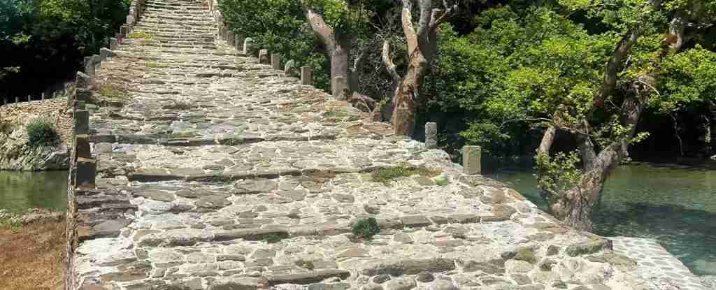
The Kalogeriko Bridge near Kipi exemplifies Zagori bridge architecture at its finest. This triple-arched structure spans the Voidomatis River in three graceful leaps, its grey limestone construction creating sculptural presence amid forested valley setting. The name translates as “Monk’s Bridge,” referencing either monastic funding or monks’ use of the crossing. Built in 1814, the bridge measures approximately 40 meters in length with the central arch spanning roughly 15 meters. The structure demonstrates refined proportions, expert stonework, and harmonious integration with natural surroundings that typify the finest Zagori bridges. The bridge remains in active use, carrying foot traffic and occasional vehicles despite its two-century age.
The Kokoris Bridge, also near Kipi, represents another architectural masterpiece with distinctive single arch rising steeply above the Voidomatis River. Built in 1750 with later 19th-century reconstruction following flood damage, the bridge achieves height allowing passage of spring floodwaters while maintaining graceful proportions. The approach paths climb steeply to the arch crown, creating dramatic experience as travelers ascend, cross, and descend. Local legends associate the bridge with tragic romance involving a master builder and ill-fated love, stories that add mythic dimension to architectural heritage.
The Konitsa Bridge, while located beyond the core Zagori zone, represents the region’s largest and most ambitious bridge project. Constructed 1870-1871, this single-arch structure spans the Aoos River with an arch measuring approximately 40 meters—among the largest stone-arch spans in the Balkans. The bridge rises 20 meters above the river, its soaring proportions creating breathtaking presence enhanced by the dramatic gorge setting. The construction employed approximately 200 workers over 18 months, using scaffolding that remained in place until the keystone locked the arch. The bridge demonstrates the culmination of Zagori bridge-building traditions, pushing engineering limits while maintaining structural principles refined over centuries.
Many bridges incorporated small chapels at approach ends, fulfilling religious functions and providing shelter for travelers. These chapel-bridges created sacred character, with icons, candles, and ex-voto offerings marking the crossing as protected space. Bridges functioned as gathering places for festivals, markets, and social interactions, becoming landmarks organizing mental maps of landscape. The practice of naming bridges after builders, funders, saints, or local features created cultural narratives embedded in landscape, transforming functional infrastructure into heritage monuments.
Bridge maintenance traditionally fell to local communities through collective labor obligations. Annual inspections identified needed repairs, cleared vegetation threatening stonework, and addressed minor damage before it progressed. However, 20th-century depopulation left many bridges neglected, with several collapsing or suffering serious deterioration. UNESCO inscription has supported restoration initiatives, with European Union funding, Greek government programs, and heritage organizations cooperating to stabilize endangered structures. Restoration philosophy emphasizes using traditional materials and techniques, training craftsmen in historical methods, and maintaining bridges as functional infrastructure rather than purely museum pieces.
Cobbled Pathways and Stone Staircases
The network of cobbled pathways and monumental stone staircases connecting Zagori villages represents infrastructure achievement comparable to the famous bridges. These kalderimi (cobblestone paths) created transportation system enabling movement of people, pack animals, and goods across challenging mountain terrain before modern road construction. The pathways demonstrate sophisticated engineering adapting to topography through switchbacks, retaining walls, drainage systems, and strategic routing that minimized grades while maintaining directness. Many paths served commercial functions connecting Zagori to regional trade centers, others linked villages within the region, and some provided access to high pastures, forests, and natural resources.
Construction techniques varied according to terrain and traffic intensity. Major routes received elaborate paving using carefully fitted limestone blocks creating smooth walking surfaces, substantial retaining walls supporting paths across steep slopes, and drainage channels directing water away from path beds. Secondary paths employed simpler construction with loosely arranged stones or bare earth surfaces. The finest examples demonstrate exceptional craftsmanship with precisely fitted pavement stones, decorative edging patterns, and integrated benches providing rest stops. Path width typically ranged from 1.5 to 2.5 meters, allowing pack animals to pass while maintaining compact footprint minimizing landscape disturbance.
The Vradeto Steps represent Zagori’s most famous monumental staircase, climbing 1,100 stone steps from Kapesovo village at approximately 1,100 meters elevation to Vradeto at 1,340 meters. Constructed in the mid-19th century, this engineering marvel zigzags up steep mountainside, its steps carved from limestone slabs or built using stacked stones. The gradient averages around 15-20 degrees though steeper sections reach 30 degrees, creating challenging ascent requiring good fitness and endurance. The staircase provided Vradeto’s only wheeled vehicle access until the 1970s when the first road reached the village. Today the steps function as popular hiking route, attracting visitors who climb for exercise, scenery, and connection with historical transportation infrastructure.
Path networks incorporated sophisticated wayfinding systems including cairns marking routes across open terrain, carved directional symbols on prominent rocks, and regularly spaced rest stops with benches and sometimes small chapels. At key junctions, stone markers indicated distances and destinations, helping travelers plan journeys. The paths integrated with bridges, creating comprehensive transportation system that enabled economic and social connections across the region. Market days saw streams of travelers converging on larger villages, carrying agricultural products, crafts, and trade goods.
Seasonal migration patterns (transhumance) relied heavily on pathway infrastructure. Shepherds moved livestock between winter lowland pastures and summer high-altitude meadows following established routes optimized for animal movement. These pastoral paths often differed from village-connecting routes, prioritizing access to water sources, grazing areas, and shelter. The annual migrations created cultural rhythms shaping village life, with celebrations marking departure and return of flocks, temporary settlements in high pastures, and economic activities based on cheese production and wool.
Sacred paths connected villages to monasteries, chapels, and pilgrimage sites scattered across the landscape. These devotional routes saw processions during religious festivals, individual pilgrimages seeking divine intervention, and regular journeys for worship and sacraments. The paths often incorporated stations with icons, crosses, or small shrines where pilgrims paused for prayer. The integration of sacred and secular functions in pathway systems reflected the deep entanglement of religious practice with daily life in traditional Zagori culture.
Modern road construction beginning in the 1960s rendered many traditional paths obsolete for transportation, leading to abandonment and deterioration. Vegetation reclaimed unused routes, stone pavements disappeared under soil and leaf litter, and retaining walls collapsed. However, recognition of pathways as cultural heritage and their value for hiking tourism has motivated restoration efforts. Local communities, environmental organizations, and heritage agencies cooperate to clear, repair, and waymark historical paths. The European Rambler’s Association designated certain Zagori routes as certified European Long Distance Paths, raising international awareness and supporting conservation funding.
Hiking the kalderimi provides intimate experience of landscape that vehicular travel cannot match. The paths’ careful routing reveals vista points, leads through diverse ecosystems, and creates rhythm of ascent and descent connecting travelers to terrain. Historical associations add depth to physical experience—imagining merchants transporting goods, shepherds driving flocks, or villagers journeying to festivals enriches modern hiking with cultural layers. Well-preserved sections demonstrate original construction quality, while deteriorated segments remind visitors of ongoing conservation challenges.
Vikos Gorge: Geological Wonder and Natural Laboratory
Vikos Gorge achieves distinction as one of Earth’s most dramatic geological features, holding the Guinness World Record for the deepest gorge relative to its width. The canyon extends approximately 32 kilometers through the Pindus Mountains, carved primarily by the Voidomatis River through thick sequences of limestone deposited during Mesozoic marine environments. The gorge’s depth varies from 120 meters in shallower sections to 1,350 meters at the deepest point between Monodendri and Vikos villages. Width measurements range from 2,500 meters at the broadest sections to mere meters at the narrowest constrictions, creating the exceptional depth-to-width ratio that earned the record designation.
The geological processes creating Vikos Gorge operated over millions of years through combination of tectonic uplift, river erosion, and karst weathering. The Pindus limestone experienced significant uplift during Alpine mountain building, elevating marine sediments to current positions over 2,000 meters above sea level. As the land rose, rivers including the Voidomatis cut downward maintaining their courses, creating deep incisions through uplifting rock. The limestone’s susceptibility to chemical weathering by slightly acidic water accelerated erosion, with water dissolving calcium carbonate and enlarging fractures. During Pleistocene glacial periods, increased water flow from melting ice enhanced erosion rates, rapidly deepening the canyon.
The vertical limestone walls display distinct layering reflecting depositional environments and fossil content. Certain beds contain abundant marine fossils including corals, mollusks, and microscopic organisms that once inhabited shallow tropical seas. Geologists study these fossil assemblages to reconstruct ancient ecosystems, sea level changes, and climate patterns from over 100 million years ago. The limestone’s purity varies between layers, with some beds containing clay or sand creating differential weathering patterns that produce the characteristic banded appearance of gorge walls. Faults cutting through the sequence create zones of weakness that erosion exploits, forming notches, caves, and alcoves.
Karst features throughout the gorge demonstrate active dissolution processes continuing today. Caves pock the walls at various elevations, some extending deep into the mountains as parts of complex underground drainage systems. Sinkholes and dolines in the plateau areas above the gorge channel surface water into subterranean passages that emerge as springs within the canyon. The Voidomatis springs near Vikos village represent one such emergence, where underground water filtered through kilometers of limestone resurfaces as crystal-clear pools feeding the river’s upper reaches. The water maintains constant cool temperature year-round, supporting specialized aquatic ecosystems adapted to these stable conditions.
Biodiversity within Vikos Gorge reflects the varied microclimates, elevation gradients, and protected conditions within the deep canyon. The gorge floor remains shaded much of the day with humid conditions supporting lush vegetation including ancient plane trees, hornbeams, and diverse understory plants. Vertical walls create distinct ecological zones from valley floor forests through cliff-face communities to rim plateau vegetation. Over 1,700 plant species occur in the broader Vikos-Aoos National Park, with many endemic taxa restricted to the Pindus Mountains. Spring wildflower displays transform gorge meadows into botanical gardens showcasing rare orchids, endemic campanulas, and colorful annuals.
Fauna includes impressive diversity for a European mountain region. Large mammals including Eurasian brown bears utilize the gorge as movement corridor and foraging habitat, with estimated population of 20-30 bears in the broader North Pindus National Park. Grey wolves maintain small packs hunting wild boars, roe deer, and smaller prey. The gorge’s relative inaccessibility provides refuge for species pressured elsewhere. Avian diversity includes raptors such as golden eagles, griffon vultures, and peregrine falcons nesting on cliff faces, plus numerous forest birds, alpine species, and seasonal migrants. Herpetofauna includes several endemic salamander and lizard species found nowhere else globally.
The gorge’s ecological importance led to protection within Vikos-Aoos National Park, established 1973 and subsequently expanded. The park encompasses approximately 12,600 hectares protecting both natural ecosystems and cultural landscapes. Management objectives balance nature conservation with sustainable tourism, traditional land uses including grazing and forestry, and local community needs. The park’s designation as UNESCO Global Geopark in 2015 recognized geological heritage, predating the 2023 UNESCO World Heritage cultural landscape inscription. This dual recognition reflects the integration of natural and cultural values that characterizes Zagori.
Vikos Gorge holds cultural significance beyond its geological and ecological importance. Local folklore associates the canyon with dragons, heroes, and supernatural events. The name “Drakolimni” (Dragon Lake) for the alpine lake on Mount Tymfi references legends of dragons inhabiting high mountain waters. Springs, caves, and unusual rock formations inspired stories explaining their origins through mythological narratives. These intangible cultural associations enrich the gorge’s significance, demonstrating how natural features become embedded in cultural identity and worldview.
Historical Evolution: From Byzantine Villages to Modern Heritage
Archaeological evidence documents human presence in Zagori from the Upper Paleolithic period, with stone tools and temporary shelters indicating seasonal use by hunter-gatherers exploiting mountain resources. Late Bronze Age burials demonstrate more sustained occupation, though permanent settlement remained limited. The historical record becomes clearer during the Byzantine period when the first written references to Zagori villages appear in 14th-century documents. These early settlements occupied defensible positions adapted to political instability and periodic invasions affecting the region. Village names, many of Slavic origin, reflect the complex ethnic history of Epirus with successive waves of migration and settlement.
The Ottoman conquest of Epirus in the 15th century initiated the period most significant for shaping Zagori’s cultural landscape. Rather than imposing harsh direct control, Ottoman authorities granted certain Zagori villages “autonomy agreements” (sultanic firmans) providing self-governance privileges, tax exemptions or reductions, and permission to maintain Christian religious practices. These agreements likely reflected recognition that the remote mountain region offered limited economic value while requiring significant military effort to control directly. The villages in return provided symbolic submission and occasional military service when required. This arrangement created unusual freedom allowing cultural preservation and economic development.
The period of greatest prosperity and architectural flowering occurred during the 18th-19th centuries driven by widespread emigration and remittance flows. Zagori men traveled throughout the Ottoman Empire and beyond working as merchants, craftsmen, administrators, and professionals. Successful emigrants sent money to families maintaining village ties, funding not only household needs but also public works projects. The construction of elaborate stone bridges, schools, libraries, churches, and mansions demonstrated both individual wealth and collective civic pride. Villages competed to erect the most impressive structures, creating architectural ensembles that transformed simple mountain settlements into sophisticated communities.
Education emerged as particular focus of investment. Zagori villages established Greek-language schools, libraries, and cultural institutions during periods when Ottoman authorities restricted education in conquered territories. These schools preserved Greek language and Orthodox religious traditions while providing education that enabled social mobility. Many prominent Greek scholars, clergy, and political figures emerged from Zagori villages, their success reinforcing cultural emphasis on education. The stone school buildings survive today as monuments to this educational heritage, often featuring inscribed dates, benefactor names, and carved decorative elements.
The 19th century witnessed growing Greek nationalist consciousness that would culminate in independence movements. Zagori’s villages participated in the broader struggle, with many Zagoriots joining secret societies, providing supplies to fighters, and serving in revolutionary organizations. The region’s position near the Ottoman-Greek border after southern Greece achieved independence in the 1820s-1830s created ambiguous political status, with northern Epirus including Zagori remaining under Ottoman control until the Balkan Wars of 1912-1913. This prolonged Ottoman period paradoxically allowed continued cultural autonomy and economic connections that might have been disrupted by earlier incorporation into the Greek state.
The 20th century brought dramatic changes beginning with incorporation into Greece in 1913 following the Balkan Wars. World War I, the Asia Minor catastrophe and population exchanges of the 1920s, World War II with brutal occupation and resistance activities, and especially the devastating Greek Civil War (1946-1949) destroyed Zagori’s traditional economy and society. The Civil War saw fierce fighting between communist and royalist forces, with villages suffering executions, reprisals, and destruction. The aftermath brought mass emigration as surviving populations fled rural poverty and political repression, seeking opportunities in Athens, abroad, or anywhere offering better prospects than devastated mountain villages.
The period 1950-1980 represented Zagori’s nadir, with populations declining by over 80% in many villages. Stone houses crumbled from abandonment, agricultural terraces reverted to forest, and cultural traditions eroded as elderly residents passed away without successors. The depopulation mirrored broader patterns across Greek mountains, reflecting economic modernization concentrating opportunities in cities while leaving rural areas behind. Development focused on lowland plains and coastal zones, ignoring mountain regions dismissed as backwards obstacles to progress. This neglect ironically preserved architectural heritage that might otherwise have been demolished for modern construction.
Cultural heritage recognition beginning in the 1970s-1980s initiated reversal of decline. The Presidential Decree for Zagori (1979, amended 1995) provided legal protection for traditional architecture, restricting demolition and mandating preservation standards for renovations. Tourism development accelerated in the 1990s-2000s as improved roads made Zagori accessible for weekend visitors from Ioannina and beyond. Hikers, nature enthusiasts, and cultural tourists discovered the region’s attractions, creating markets for guesthouses, tavernas, and guided tours. Stone houses renovated as boutique accommodations demonstrated that traditional architecture could meet modern comfort expectations while maintaining historical character.
The UNESCO World Heritage nomination process beginning in 2014 mobilized extensive research, documentation, and community engagement. Preparation of the nomination dossier required collaboration between the Ministry of Culture, Epirus Region, Zagori Municipality, universities, and local communities. The nomination initially proposed mixed natural-cultural recognition, but evaluation determined that while cultural values met Outstanding Universal Value criteria, natural values, though significant, did not rise to the exceptional level required for World Heritage natural sites. The final inscription in September 2023 recognized only cultural landscape values under Criterion v, representing traditional human settlement adapted to mountain environments.
Sacred Forests and Intangible Cultural Heritage
Zagori’s cultural landscape encompasses not only tangible architectural heritage but also intangible traditions and practices that shaped—and continue shaping—human relationships with the mountain environment. Among the most distinctive traditions is the sacred forest system, where village communities maintain protected groves associated with religious beliefs, social customs, and environmental conservation. These sacred forests represent living cultural heritage demonstrating continuity between traditional practices and contemporary environmental stewardship.
Sacred forests typically surround village squares where massive plane trees provide shade, define communal space, and hold symbolic significance as village guardians. These trees often exceed 500 years in age, with some specimens predating current village settlements. Beyond the village cores, designated forest areas receive protection through customary law enforced by community consensus and sometimes formal regulations. Cutting trees, collecting firewood, or disturbing sacred forest areas traditionally incurred severe social sanctions including fines, public shaming, or supernatural retribution believed to follow violation of sacred spaces.
The religious dimension of sacred forests links Orthodox Christian practice with older folk beliefs possibly predating Christianity. Small chapels often stand within or near protected groves, with festivals celebrated under the trees combining religious liturgy with social gathering. Saints’ feast days bring villagers to these spaces for services, communal meals, dancing, and renewal of community bonds. The trees themselves receive blessings, decorations, and offerings, their survival seen as blessing upon the village while their damage portends misfortune. This integration of Christian and folk traditions created syncretic belief systems that persisted despite official Church attempts to eliminate “pagan” elements.
Environmental conservation resulted from these cultural-religious protections, creating biodiversity refuges within working landscapes where logging, grazing, and cultivation occurred. Protected groves harbor old-growth trees, diverse understory vegetation, and wildlife populations that might not survive in exploited areas. Scientific studies document higher species richness in sacred forests compared to surrounding managed woodlands, demonstrating how cultural traditions can produce conservation outcomes. The sacred forest system represents traditional ecological knowledge encoded in religious practice rather than scientific management frameworks.
Transhumance—seasonal livestock migration between lowland winter pastures and mountain summer grazing—represents another intangible heritage practice deeply embedded in Zagori culture. Shepherds moved flocks along established routes following pathways specifically suited for animal movement. Summer settlements (stani) in high pastures provided temporary shelter while shepherds produced cheese and other dairy products. The autumn return to winter lowlands followed different routes adapted to changing seasonal conditions. This mobility required intimate knowledge of landscapes, weather patterns, forage availability, and animal behavior accumulated through generations of practice.
Drystone construction knowledge represents technical heritage transmitted through apprenticeship from master masons to younger workers. Building stone walls, houses, bridges, and terraces without mortar demands specialized skills selecting appropriate stones, shaping them to fit precisely, and arranging them to create stable structures. The techniques varied according to function—retaining walls required different strategies than free-standing walls, and bridge construction demanded understanding of arch mechanics and foundation engineering. Master builders (mastori) achieved regional fame, their expertise sought for prestigious commissions across Epirus and beyond.
Traditional governance systems organized village life through customary law, elected councils, and communal decision-making assemblies. These democratic practices predated modern Greek democracy, allowing villages substantial autonomy in managing internal affairs. Community assemblies made decisions about land use, resource allocation, dispute resolution, and public works projects. The survival of archival records documenting these governance systems provides insights into how small mountain communities maintained order, allocated resources, and adapted to changing circumstances through collective action.
Textile production including wool processing, spinning, weaving, and embroidery represented important domestic craft tradition. Women developed specialized skills creating functional textiles for household use and decorative pieces demonstrating artistic expression. Regional styles distinguished Zagori textiles from neighboring areas through distinctive patterns, colors, and techniques. While industrial textiles largely displaced domestic production during the 20th century, recent cultural heritage initiatives have revived interest in traditional techniques, with artisans teaching workshops and producing contemporary pieces informed by historical practices.
Culinary traditions adapted to mountain environments and seasonal rhythms, creating distinctive Zagori cuisine. Preservation techniques including drying, smoking, salting, and pickling enabled storage of summer abundance for winter consumption. Cheese production utilized sheep and goat milk from transhumant flocks, creating aged varieties with complex flavors. Wild food gathering supplemented cultivated crops with mushrooms, greens, nuts, and fruits from forests and meadows. Traditional pies (pites) incorporating wild greens, cheese, and house-made phyllo represent iconic Zagori dishes still prepared in homes and served in tavernas.
Music and dance traditions marked festivals, celebrations, and social gatherings with distinctive regional styles. Instruments including clarinet, violin, and percussion provided accompaniment for circle dances performed in village squares. Song repertoires preserved historical memories, moral teachings, and entertainment across generations through oral transmission. While recorded media and popular music have eroded traditional musical knowledge, cultural associations and folklore groups work to document, perform, and teach traditional music, ensuring its survival for future generations.
UNESCO World Heritage Inscription and Management
The Zagori Cultural Landscape’s UNESCO World Heritage inscription on September 19, 2023, during the 45th session of the World Heritage Committee in Riyadh, represented the culmination of nearly a decade of preparation work. The nomination process began in 2014 when Greece added “Zagorochoria – North Pindos National Park” to its Tentative List of potential World Heritage nominations. Extensive research, documentation, community consultation, and technical studies occurred between 2014 and the formal nomination submission in January 2021. The evaluation period extended beyond typical timelines due to COVID-19 pandemic disruptions affecting expert missions and committee meetings.
The nomination proposed mixed natural-cultural recognition, arguing that Zagori possessed Outstanding Universal Value in both categories. The cultural values focused on the distinctive vernacular architecture, traditional settlement patterns, and living cultural landscape demonstrating human adaptation to challenging mountain environments. The natural values emphasized biodiversity, geological features including Vikos Gorge, and ecosystem integrity. However, advisory body evaluations reached different conclusions. ICOMOS (International Council on Monuments and Sites) recommended inscription based on cultural values under Criterion v, finding that the landscape represented an outstanding example of traditional human settlement. IUCN (International Union for Conservation of Nature) recommended deferral, determining that while natural values were significant, they did not meet the “outstanding” threshold required for World Heritage natural sites.
The World Heritage Committee’s decision to inscribe Zagori Cultural Landscape under Criterion v only reflected ICOMOS’s evaluation and IUCN’s concerns. Criterion v recognizes properties as “an outstanding example of a traditional human settlement, land-use, or sea-use which is representative of a culture (or cultures), or human interaction with the environment especially when it has become vulnerable under the impact of irreversible change.” The inscription specifically acknowledged Zagori’s stone villages, arched bridges, cobbled pathways, sacred forests, and integrated cultural landscape shaped by transhumance and agro-pastoral activities. The recognition of cultural values only, rather than mixed status, disappointed some local stakeholders who emphasized natural heritage, but the inscription nevertheless achieved Greece’s primary objective of securing World Heritage protection.
The inscribed property encompasses the 20 villages within the three municipal units of Central Zagori, Tymphi, and Papingo, covering a core zone with additional buffer zones protecting the broader landscape context. The boundaries include traditional settlement cores, connecting pathway networks, arched bridges, and surrounding agricultural landscapes that provide setting for the cultural elements. Approximately 93% of Zagori Municipality lies within North Pindus National Park, creating integrated protection framework combining cultural heritage laws with environmental regulations. This overlap requires coordination between cultural heritage agencies and nature conservation authorities to ensure compatible management approaches.
Legal protection derives from multiple instruments including Law 3028/2002 “On the Protection of Antiquities and Cultural Heritage in General,” which provides primary legal framework for cultural heritage protection in Greece. The Ephorate of Antiquities of Ioannina exercises local responsibility through specialized departments for different periods and monument types. The Presidential Decree for Zagori (1979, amended 1995) designates traditional architecture built before 1923 as protected, dividing the municipality into Zone A (highest protection and authenticity) and Zone B (significant but less pristine character). Additional environmental laws protect North Pindus National Park including forests, biodiversity, natural habitats, and wildlife.
Management responsibilities are shared among multiple institutions reflecting the complexity of cultural landscape governance. The Ministry of Culture and Sports provides national oversight, the Epirus Region contributes regional planning and coordination, and Zagori Municipality exercises local authority over land use and development. The Natural Environment and Climate Change Agency manages North Pindus National Park, coordinating nature conservation with cultural heritage protection. This multi-institutional arrangement requires extensive consultation, coordination, and compromise to develop coherent management approaches respecting both cultural and natural values while supporting local community needs.
A comprehensive Management Plan was developed specifically for the World Heritage property, integrating UNESCO cultural heritage policies, European Union nature directives, Greek national legislation, and Sustainable Development Goals from Agenda 2030. The plan addresses monument conservation, traditional architecture preservation, pathway and bridge restoration, sustainable tourism development, community engagement, and monitoring systems tracking changes to heritage values. Implementation requires securing adequate funding, technical expertise, and local cooperation—challenges that persist given limited resources and competing priorities.
Tourism management represents particular challenge balancing economic benefits against heritage conservation and community wellbeing. Visitor numbers have increased substantially following UNESCO inscription, creating pressures on infrastructure, monument conservation, and local quality of life. The introduction of a €0.75 culture fee charged on all tourist accommodations within Zagori Municipality (implemented 2025) generates dedicated revenue for heritage conservation, infrastructure maintenance, and cultural programs. This innovative financing mechanism follows examples from other heritage destinations attempting to ensure tourism contributes to rather than detracts from heritage values.
Community engagement is central to management philosophy, recognizing that local populations must benefit from and support heritage protection for it to succeed. Consultation processes involve residents in decision-making about conservation priorities, tourism development, and resource management. Educational programs build awareness among younger generations about heritage values and conservation needs. Economic development initiatives support traditional crafts, agricultural products, and heritage-based enterprises providing alternatives to mass tourism. The challenge remains balancing external visitors’ expectations with residents’ needs for modern amenities and economic opportunities.
Hiking and Outdoor Activities
Vikos Gorge offers Greece’s premier mountain hiking experience, with the classic gorge traverse from Monodendri to Vikos village attracting thousands of hikers annually. The 12.5-kilometer trail descends from Monodendri at approximately 1,060 meters elevation, drops to the gorge floor at around 600 meters, follows the seasonal Voidomatis River through the canyon, and ascends to Vikos village at 955 meters. Total elevation change involves roughly 700 meters descent and 400 meters ascent, though numerous minor ups and downs add to cumulative elevation gain. Typical hiking time ranges from 5 to 7 hours depending on fitness, rest stops, and photography pauses, making this a full-day commitment requiring early starts during summer heat.
The trail begins near Monodendri’s main square at the old church of Agios Georgios, marked by trail signage. The initial descent follows kalderimi cobblestone pathway constructed in traditional style, winding steeply through forest with stone steps and switchbacks easing the grade. Loose stones, fallen leaves, and occasional muddy sections require careful footing, making hiking poles valuable for stability and knee protection. The descent emerges on the Voidomatis riverbed approximately one hour after starting, elevation approximately 600-650 meters depending on seasonal water levels.
The gorge floor section follows the river course through diverse landscapes including oak and hornbeam forests, open meadows with wildflowers, and rocky sections requiring boulder-hopping when the river flows. During late summer and autumn, the Voidomatis often runs completely dry in upper sections, with isolated pools supporting aquatic life until autumn rains restore flow. Spring snowmelt transforms the placid stream into powerful torrent, making gorge hiking dangerous or impossible until water levels subside in late May or June. Hikers must check current conditions and avoid the gorge during high water when river crossings become hazardous.
The trail passes several landmarks including the confluence with Mezaria tributary arriving from Kapesovo, chapels and small monasteries in side valleys, the Voidomatis springs near Vikos village where crystal-clear water emerges from limestone karst system, and continuously changing perspectives of the massive limestone walls rising overhead. The final section ascends steeply via cobbled path to Vikos village, emerging at the village square where several tavernas provide refreshment and meal opportunities. Most hikers arrange return transportation via taxi to Monodendri rather than attempting the strenuous return hike on the same day.
Alternative hiking routes provide options for different fitness levels and interests. The Monodendri to Kipi route (approximately 8 kilometers, 3-4 hours) offers moderate difficulty accessing stone bridges without the full gorge traverse. Multiple viewpoint walks from Monodendri including the Oxya belvedere require 2-3 hours roundtrip, providing spectacular canyon vistas with limited elevation change. The Vradeto Steps climb 1,100 stone stairs from Kapesovo to Vradeto, creating challenging workout with historical interest and high-elevation access. Multi-day treks combine gorge hiking with alpine routes crossing Mount Tymfi to Drakolimni and Papingo, requiring camping or refuge accommodations.
The Drakolimni (Dragon Lake) hike from Mikro Papingo represents the region’s premier alpine excursion, ascending approximately 1,100 vertical meters over 7-8 kilometers to reach the glacial lake at 2,050 meters elevation. The trail climbs through forests initially before emerging onto rocky alpine terrain with increasingly dramatic views. The final approaches traverse boulder fields and steep scree requiring scrambling. The turquoise alpine lake occupies a spectacular cirque setting surrounded by limestone peaks, with populations of alpine newts visible in clear waters. Round-trip requires 8-10 hours hiking for strong hikers, though overnight stays at Astraka mountain refuge enable spreading the effort across two days while accessing additional summit routes.
Rock climbing attracts specialists to Vikos Gorge and Mount Tymfi limestone walls. Routes range from moderate multi-pitch traditional climbs to difficult sport climbing on overhanging limestone. The Towers of Astraka near Papingo provide particularly striking climbing destinations with approaches from village bases. Climbing remains relatively undeveloped compared to major Alpine destinations, offering adventure climbing character with route-finding challenges and minimal fixed protection on many routes. Climbers should bring comprehensive rack, possess strong traditional climbing skills, and ideally hire local guides familiar with the area.
Mountain biking has developed on forest roads and certain trail sections, though narrow kalderimi pathways generally prohibit cycling to protect historical surfaces. Designated mountain bike routes utilize dirt roads connecting villages, forestry tracks through woodland areas, and specifically authorized trail sections. The variable terrain challenges riders with steep climbs, technical descents, and rocky surfaces demanding skills and appropriate equipment. Bike rentals exist in Papingo and other villages, though serious mountain bikers typically bring own equipment.
Winter activities focus on snowshoeing and cross-country skiing when snow covers higher elevations, typically December through March. The Mount Tymfi plateau transforms into winter landscape suitable for Nordic skiing, though no developed facilities or groomed trails exist. Snowshoeing provides access to winter scenery with equipment rentable in villages. The Vradeto Steps make spectacular winter ascent when snow and ice coat the stones, though crampons and extreme caution become essential. Avalanche danger exists in certain areas after heavy snowfall, requiring appropriate assessment and safety equipment for winter mountain travel.
Visiting Zagori Cultural Landscape: Practical Information
Ioannina serves as the principal gateway to Zagori, located approximately 30 kilometers south of the Zagori villages. This regional capital of Epirus offers airport connections to Athens, Thessaloniki, and seasonal international flights, plus bus services from major Greek cities. The historic lakeside city merits visiting in its own right with Ottoman-era castle quarter, lake island monastery, and cultural museums providing context for understanding Epirus regional history. Most visitors rent cars in Ioannina for Zagori exploration, as public transportation between villages remains limited despite KTEL bus services to major settlements including Papingo, Monodendri, and Konitsa.
Road access throughout Zagori has improved dramatically since the 1990s with paved roads now reaching all villages. The primary access route from Ioannina heads north through the town of Karies where the Asprageli Information Centre provides maps, trail information, and natural-cultural heritage orientation. From this junction, roads branch to different village clusters with Eastern Zagori villages including Monodendri, Vitsa, and Kipi accessed via one route, while Western Zagori including the Papingo villages requires different approach. Road conditions range from wide well-maintained highways to narrow mountain roads with hairpin curves, requiring confident driving and allowing extra time beyond simple distance calculations.
No entrance fees apply for visiting villages or hiking gorge trails, representing significant distinction from many heritage sites charging admission. The €0.75 culture fee charged on accommodations provides dedicated heritage conservation funding without direct visitor fees. This policy reflects philosophy encouraging free access to cultural landscapes while generating revenue through accommodation taxes. Certain specific monuments including churches and museums may charge modest admission fees, typically €2-3 when staffed and open.
Accommodation options span wide range from basic guesthouses to luxury boutique hotels, primarily located in larger villages including Papingo, Monodendri, Kipi, Vitsa, and Aristi. Traditional stone houses renovated as guesthouses provide authentic architectural experience with modern comfort amenities. Many properties feature fireplaces, wood-beam ceilings, stone walls, and traditional furnishings creating atmospheric settings. Prices vary seasonally with peak rates during summer months, autumn foliage season, and winter ski periods, while spring and late autumn offer value for budget-conscious travelers. Advance reservations prove essential during popular periods as room inventory remains limited in smaller villages.
Dining focuses on tavernas serving traditional Epirus cuisine emphasizing local ingredients, grilled meats, wild greens, handmade pies, and regional cheese varieties. Many establishments source ingredients from village gardens, nearby farms, and wild foraging, creating farm-to-table character before this became trendy marketing language. Zagori pies (pites) featuring combinations of wild greens, cheese, and handmade phyllo represent iconic regional specialty. Kontosouvli (slowly spit-roasted pork) appears on weekend menus when villages fill with Greek domestic tourists. Wine selections emphasize northern Greek varieties from Epirus and Macedonia regions. Meal prices remain moderate compared to tourist areas, with generous portions reflecting mountain hospitality traditions.
Shopping opportunities focus on local products including honey, herbs, cheese, traditional textiles, and handicrafts. Several villages maintain small shops selling regional specialties, though extensive shopping requires visiting Ioannina. The limited commercialization appeals to visitors seeking authentic experiences over souvenir stands, though it means planning ahead for specific supplies including hiking provisions, camera equipment, or specialized gear unavailable locally.
Mobile phone coverage has expanded substantially with most villages now receiving signal from major Greek providers, though mountain terrain creates dead zones in gorges and remote areas. WiFi availability varies by accommodation with many guesthouses providing internet access. However, visitors should prepare for occasional disconnection as mountain terrain and aging infrastructure create limitations compared to urban connectivity. This partial disconnection appeals to some visitors seeking digital detox experiences.
Optimal visiting seasons balance weather conditions, crowd levels, and natural displays. Late spring (May-June) offers wildflower blooms, moderate temperatures, flowing rivers, and relatively uncrowded trails, though spring snowmelt may delay high-altitude access until June. Autumn (September-October) provides ideal hiking weather with cooler temperatures, autumn colors transforming forests, stable conditions, and harvest season featuring fresh local products. Summer (July-August) attracts peak visitation with hot weather making lowland areas uncomfortable though mountain elevations remain pleasant. Winter (December-March) appeals to snow enthusiasts and solitude seekers willing to accept limited accommodation availability, challenging access, and shorter daylight.
Safety considerations include realistic fitness assessment before attempting strenuous hikes, appropriate gear including sturdy hiking boots and layered clothing for changing mountain weather, adequate water and food for full-day excursions, trail maps and GPS devices for route-finding, and awareness of weather forecasts checking for storms or extreme conditions. Wildlife awareness includes understanding that bears, wolves, and wild boars inhabit the region though encounters remain rare. Hikers should make noise on trails, avoid surprising animals, and understand appropriate responses to wildlife encounters. The seasonal Voidomatis River can transform from dry streambed to dangerous torrent following storms, making gorge hiking hazardous during uncertain weather.
Conservation Challenges and Future Prospects
UNESCO World Heritage inscription brings both opportunities and challenges for Zagori Cultural Landscape’s future. The international recognition raises awareness, attracts visitors and investment, facilitates conservation funding access, and validates local heritage values. However, the designation also creates pressures including increased tourism potentially overwhelming infrastructure and community capacity, development pressures as property values rise and commercialization increases, authenticity concerns as traditional practices adapt to tourist expectations, and governance complexity balancing multiple stakeholder interests. Successfully navigating these tensions will determine whether UNESCO status enhances or undermines the heritage values it aims to protect.
Population dynamics represent fundamental challenge. While some villages have experienced modest population recovery through tourism-related return migration, overall demographic trends continue concerning directions. Year-round permanent residents remain predominantly elderly, with younger generations pursuing education and careers in cities. Without viable livelihoods supporting families, villages risk becoming heritage theme parks rather than living communities. The challenge lies in developing economic opportunities that attract and retain younger populations while maintaining cultural authenticity and heritage values.
Climate change poses increasing threats to both natural and cultural heritage elements. Temperature increases, altered precipitation patterns, more frequent extreme weather events, and changing snow cover patterns will affect mountain ecosystems, water availability, agricultural viability, and monument conservation. Limestone weathering may accelerate under changing moisture regimes, wooden architectural elements face new deterioration pressures, and traditional agricultural practices adapted to historical climate patterns may become less viable. Adaptation strategies require integrating climate projections into heritage management planning.
Tourism sustainability remains critical concern. Current visitor numbers, while substantial, remain well below levels that could generate serious overcrowding concerns. However, UNESCO inscription typically triggers visitor growth, as destinations leverage World Heritage status for marketing. Without proactive management, Zagori could experience the degradation affecting other heritage destinations where visitor volumes exceed carrying capacity. The €0.75 culture fee represents one management tool, though comprehensive strategies require visitor dispersal across multiple villages and seasons, infrastructure investment supporting higher visitor volumes without heritage damage, interpretation programs educating visitors about conservation needs, and potentially visitor caps during peak periods if growth proves unsustainable.
Authenticity maintenance challenges arise from tension between heritage preservation requirements and modern living standards expectations. Residents understandably desire contemporary amenities including updated plumbing, heating, electrical systems, internet connectivity, and accessibility features. Integrating these modern systems into traditional buildings without compromising architectural integrity requires sensitive design, appropriate materials, and skilled craftsmen increasingly difficult to find. The balance between museum-piece preservation and living heritage allowing evolution poses philosophical and practical dilemmas without simple solutions.
Economic development pathways beyond tourism merit exploration to avoid over-dependence on single sector vulnerable to disruption. Agricultural revival focusing on quality local products marketed under Zagori geographic indications could provide income while maintaining landscape character. Artisan crafts including traditional textile production, woodworking, and stone masonry could support specialized producers. Remote work opportunities enabled by improved digital connectivity might attract residents seeking mountain lifestyles while maintaining professional careers. Diversified economic base would strengthen community resilience while supporting heritage values.
Infrastructure maintenance represents ongoing challenge requiring sustained investment. The extensive network of stone bridges, cobbled pathways, and traditional buildings demands regular upkeep preventing minor problems from escalating to major damage. However, municipalities struggle to fund comprehensive maintenance given limited budgets and competing priorities. European Union structural funds, UNESCO World Heritage Fund, and Greek government heritage programs provide important support, though bureaucratic complexity and matching fund requirements can limit accessibility. Innovative financing mechanisms including heritage impact fees, conservation easements, and public-private partnerships merit exploration.
Knowledge transmission to younger generations ensures continuity of intangible heritage including traditional crafts, agricultural practices, and cultural traditions. Formal education through workshops, apprenticeships, and cultural programs helps maintain technical knowledge, while informal transmission through family and community participation preserves customs and stories. Documentation projects recording elder knowledge before it disappears with aging populations create archives for future reference. Digital technologies enable new transmission modes complementing traditional oral and practical instruction.
Regional cooperation linking Zagori with neighboring heritage areas including Albanian UNESCO sites, wider Pindus mountain communities, and Epirus regional initiatives creates networks for knowledge sharing, joint marketing, and coordinated management. Transboundary cooperation particularly matters given that cultural and natural heritage extends beyond political boundaries. European heritage networks and programs facilitate such cooperation while providing funding and technical support. These partnerships strengthen individual sites while building broader heritage landscapes transcending jurisdictional divisions.
Frequently Asked Questions
How many days should I spend in Zagori to experience the cultural landscape properly?
A minimum of three full days allows meaningful engagement with Zagori Cultural Landscape, covering the essential experiences without excessive rushing. This duration permits one day hiking Vikos Gorge or exploring viewpoints and villages in the Eastern Zagori cluster, a second day visiting Western Zagori including Papingo villages and potentially ascending toward Drakolimni, and a third day for stone bridge tours, additional village exploration, and flexibility for weather or personal interests. More ambitious visitors planning multi-day treks, alpine hiking to Drakolimni and Astraka plateau, or comprehensive village coverage should allocate five to seven days. Weekend visitors can sample Zagori in two days focusing on highlights including gorge viewpoints, one or two villages, and perhaps the Vradeto Steps, though this abbreviated visit provides only introduction to the landscape’s richness. Optimal strategies base in a single village minimizing accommodation changes while making day trips, or alternatively move between two bases experiencing Eastern and Western Zagori separately. The dispersed nature of attractions across the broader landscape and the time required for mountain driving between villages makes multi-day stays more rewarding than rushed single-day excursions from Ioannina.
What is the best village to stay in for first-time visitors to Zagori?
Monodendri represents the most practical base for first-time visitors to Zagori Cultural Landscape, balancing accessibility, accommodation availability, proximity to major attractions, and traditional village character. The village offers the largest selection of guesthouses, tavernas, and small hotels among Eastern Zagori settlements, providing options across price ranges and accommodation styles. Monodendri’s position on the eastern rim of Vikos Gorge provides immediate access to multiple gorge viewpoints including the spectacular Oxya belvedere reachable via moderate 2-3 hour roundtrip hike, and serves as the primary trailhead for the classic gorge traverse to Vikos village. The village itself preserves traditional architecture with stone houses, cobbled lanes, and historic churches creating authentic atmosphere, while the cliff-edge Monastery of Agia Paraskevi offers dramatic gorge views and cultural interest within ten minutes’ walk from the village center. Monodendri’s central location within the Zagori road network facilitates day trips to stone bridges near Kipi, other Eastern Zagori villages including Vitsa and Dilofo, and reasonable driving distance to Western Zagori including Papingo. Alternative considerations include Papingo villages for visitors prioritizing alpine hiking and Drakolimni access, Kipi for bridge enthusiasts and somewhat quieter atmosphere, or Vitsa for particularly well-preserved traditional character with slightly fewer tourists than Monodendri.
Is hiking Vikos Gorge dangerous and what level of fitness is required?
Vikos Gorge hiking from Monodendri to Vikos village presents moderate difficulty suitable for reasonably fit hikers with some mountain walking experience, though specific hazards require awareness and appropriate precautions. The trail itself follows well-established paths with the most challenging sections the steep rocky descent from Monodendri to the gorge floor and the final steep ascent to Vikos village, both requiring careful footing on loose stones and using hiking poles for stability. The gorge floor section through the canyon bottom involves boulder-hopping across rocky sections and multiple river crossings that become hazardous during high water periods in spring or following heavy rains. The primary dangers include attempting the hike during spring snowmelt when the Voidomatis River transforms from gentle stream to powerful torrent making crossings dangerous or impossible, underestimating the 5-7 hour duration and starting too late resulting in finishing after dark without adequate lighting, inadequate water carrying during summer heat when temperatures on the gorge floor can exceed 35°C with limited shade, getting lost on poorly marked sections particularly near Monodendri and Vikos village where multiple trail options create confusion, and rare but serious wildlife encounters including brown bears utilizing the gorge as movement corridor. Fitness requirements include ability to walk 12-13 kilometers with significant elevation change totaling approximately 1,100 meters cumulative gain and loss, maintaining steady pace for 5-7 hours including rest stops but without excessive breaks, negotiating rocky uneven terrain requiring balance and ankle stability, and carrying adequate supplies including 2-3 liters of water per person. Hikers with knee problems should particularly consider using poles and potentially descending support wraps given the steep rocky descents. The hike becomes significantly more challenging during extreme weather including summer temperatures exceeding 35°C or spring conditions with high river flow, and should be avoided entirely during storms or when weather forecasts indicate precipitation.
Can Zagori be visited year-round or are certain seasons better for cultural landscape experiences?
Zagori Cultural Landscape offers distinct seasonal experiences with all seasons providing rewards though late spring and autumn emerge as optimal for most visitors balancing weather, accessibility, natural displays, and tourist volumes. Late spring from mid-May through June presents ideal conditions combining wildflower blooms transforming meadows and forests into botanical gardens, moderate temperatures making hiking comfortable without summer heat extremes, flowing rivers and waterfalls at their most impressive following snowmelt, and relatively uncrowded conditions before peak summer visitation. Autumn from September through October rivals spring with perfect hiking weather featuring cool comfortable temperatures and stable atmospheric conditions, dramatic autumn foliage coloring beech and oak forests, harvest season showcasing fresh local products in village tavernas, and thinning crowds after summer peak creating more intimate village experiences. Summer July-August attracts maximum visitation with family vacations and Greek domestic tourism filling accommodations, though mountain elevations remain pleasantly cool despite lowland heat, and longer daylight hours permit extended hiking days. Winter December-March appeals to visitors seeking solitude, snow-covered mountain scenery, and authentic village life, though many accommodations close, some roads become impassable requiring chains or four-wheel drive, hiking options reduce dramatically as trails become snow-covered or avalanche-prone, and shorter daylight limits activities. Each season provides authentic cultural landscape experience as villages and natural environments cycle through traditional rhythms—spring planting and wildflower festivals, summer highland pasture use and outdoor celebrations, autumn harvest and preparation for winter, winter indoor crafts and wood gathering maintaining centuries-old patterns.
How accessible is Zagori for visitors with limited mobility or disabilities?
Zagori Cultural Landscape presents significant accessibility challenges for visitors with limited mobility, reflecting the authentic mountain topography and historical architecture not designed for modern accessibility standards. The traditional villages feature steep cobbled lanes often with irregular stone steps, narrow pathways between closely-spaced buildings, and historic structures including churches and museums rarely equipped with ramps, elevators, or accessible restrooms. Most guesthouses occupy traditional multi-story stone houses with stairs between floors and no elevator access, though a few modern or recently renovated properties offer ground-floor rooms with accessible bathrooms. Vehicle access reaches all villages via paved roads allowing visitors with mobility limitations to experience village settings from cars and accessible points including main squares and viewpoints reachable without extensive walking. Certain experiences remain accessible including the Asprageli Information Centre near Karies designed with modern accessibility features, driving tours visiting multiple villages and stone bridges viewable from roadside parking, several gorge viewpoints accessible via short walks from parking areas including platforms at Oxya belvedere, and taverna dining at establishments with ground-level or ramped entrances. However, hiking the Vikos Gorge, exploring village interiors and narrow lanes, visiting most churches and monuments, and experiencing traditional guesthouses remain effectively inaccessible for wheelchair users or visitors with significant mobility limitations. Visitors with moderate mobility limitations who can manage some walking on uneven surfaces will find Zagori more accessible than those requiring full wheelchair access, particularly if traveling with companions who can provide assistance and if planning itineraries emphasizing vehicle-accessible sites. Prospective visitors with accessibility concerns should contact specific accommodations and attractions in advance to discuss individual capabilities and determine feasibility rather than assuming accessibility based on modern tourism site standards.
What is the culture fee charged in Zagori and how is it used?
Zagori Municipality implemented a €0.75 culture fee charged per room per night on all tourist accommodations within the municipality boundaries, established in 2025 following UNESCO World Heritage inscription. This modest fee applies universally to hotels, guesthouses, vacation rentals, and all other paid lodging regardless of property type or price category, charged in addition to standard accommodation rates and Greek national tourism taxes. Accommodation providers collect the fee from guests at checkout and remit payments quarterly to the Zagori Municipal treasury through standardized declaration forms, with late payments incurring 2% monthly interest charges potentially increasing to 100% penalty for extended non-compliance. The dedicated revenue generated through the culture fee funds heritage conservation and preservation activities including restoration and maintenance of stone bridges, traditional buildings, cobbled pathways, and other architectural monuments, ongoing archaeological research and documentation projects, cultural programming and educational initiatives promoting heritage awareness, infrastructure improvements supporting heritage tourism without damaging cultural values, and monitoring systems tracking heritage condition and visitor impacts. The culture fee represents innovative sustainable tourism financing mechanism ensuring that tourism growth directly funds the conservation of the heritage values attracting visitors, following models implemented at other World Heritage Sites worldwide where visitor-generated revenue supports preservation. The fee applies to all visitors regardless of nationality or age, with no exemptions for children or seniors, though the minimal €0.75 amount creates negligible financial burden while generating substantial aggregate revenue given Zagori’s growing visitor numbers. Visitors should expect this fee as standard component of accommodation costs similar to tourism taxes, with reputable establishments clearly communicating the fee during booking and checkout processes.
Are there guided tours available for Zagori or is independent travel better?
Both guided tours and independent travel offer advantages for experiencing Zagori Cultural Landscape, with optimal choice depending on visitor interests, hiking experience, time constraints, and preferences regarding structure versus flexibility. Guided hiking tours led by certified mountain guides provide significant benefits including expert knowledge of trails, landscape features, flora and fauna identification, cultural-historical context enriching the experience, safety management particularly important for challenging routes like the full Vikos Gorge traverse or alpine Drakolimni ascent, and logistical support handling transportation, meals, and accommodation arrangements. Multi-day guided trekking packages combine gorge hiking with village visits, bridge tours, and alpine routes, eliminating planning complexity while ensuring comprehensive coverage of highlights. Local guide services based in villages including Papingo, Monodendri, and Ioannina offer both group tours and private guiding arrangements, with prices varying by group size, tour duration, and route difficulty. Cultural tours emphasizing architecture, history, and traditions rather than hiking provide alternative guided experiences led by heritage specialists or anthropologists, offering deeper understanding of traditional practices, architectural significance, and community life than self-guided exploration typically achieves. However, independent travel provides maximum flexibility to adjust itineraries based on weather, personal energy levels, and evolving interests, allows spontaneous village exploration and interaction with local residents without group schedule constraints, reduces costs substantially compared to guided tour pricing, and creates more intimate experiences particularly for visitors who prefer solitary nature immersion or small-group travel with companions. Independent hikers should possess strong navigation skills using maps, GPS devices, and trail-finding abilities, understand mountain safety and weather assessment, and invest time researching routes, villages, and cultural sites before arrival. The optimal approach for many visitors combines elements of both—hiring guides for the most challenging or culturally complex experiences like the full gorge traverse or specialized bridge architecture tours, while exploring villages, shorter trails, and general area independently. Several Ioannina-based tour operators offer day trips to Zagori combining transportation from the regional capital with guided village visits and gorge viewpoints, providing introduction for visitors with limited time or those preferring not to drive mountain roads.
What makes Zagori’s stone bridges architecturally and culturally significant?
Zagori’s arched stone bridges achieve architectural and cultural significance through their exceptional engineering achievement, aesthetic beauty, and role in shaping the region’s historical economic and social development. The bridges demonstrate sophisticated structural understanding by 18th-19th century master builders who calculated arch proportions, foundation requirements, and load distributions without modern engineering tools or mathematical analysis, relying instead on empirical knowledge accumulated through generations of practice. The single or multi-arched designs employ precisely cut limestone voussoirs forming compression arches that distribute weight to massive abutments anchored in bedrock, creating structures of remarkable strength supporting heavy loads and resisting floods, earthquakes, and centuries of weathering. The bridges’ high arches rising well above normal river levels reflect understanding of flood dynamics and the need for clearance during spring snowmelt when modest streams transform into powerful torrents, with some bridges featuring arches spanning 15-20 meters and rising 10-15 meters above water level. Aesthetically, the bridges achieve harmonious proportions and integration with natural settings through careful site selection, use of local grey limestone matching mountain geology, and graceful arch curves creating sculptural presence in forested valleys. Culturally, the bridges enabled economic development by providing reliable year-round transportation across rivers that otherwise isolated communities during high water periods, facilitating trade, market access, and social connections essential for mountain village survival. The construction financing through individual benefactors whose names remain associated with specific bridges demonstrates the practice of diaspora philanthropy where successful emigrants invested in home community infrastructure, creating permanent monuments to individual generosity and civic pride. The bridges functioned as social gathering spaces for festivals, markets, and daily interactions, often incorporating small chapels that added religious significance to functional infrastructure and transformed crossings into sacred spaces under divine protection. The engineering knowledge embodied in bridge construction represents technical heritage transmitted through master-apprentice relationships, with specialized skills in stone selection, shaping, arch construction, and foundation engineering creating professional identity and regional building traditions. UNESCO recognition of drystone construction knowledge as Intangible Cultural Heritage (inscribed 2024) acknowledges these traditional techniques continuing to inform contemporary heritage conservation and restoration work.
How does Zagori Cultural Landscape compare to other Greek mountain regions?
Zagori Cultural Landscape distinguishes itself from other Greek mountain regions including Pelion, Metsovo, Mani, and Arcadia through its unique combination of architectural heritage density, landscape drama, preservation authenticity, and comprehensive UNESCO World Heritage recognition. The architectural concentration of 46 traditional villages maintaining vernacular stone building traditions across relatively compact area exceeds most comparable regions, with Zagori preserving architectural integrity better than more developed mountain areas where modern construction has diluted traditional character. The Vikos Gorge’s world-record depth-to-width ratio and the broader Pindus mountain landscape’s dramatic vertical relief create geological spectacle unmatched in southern Greece’s generally lower and gentler mountains. Zagori’s relative isolation until recent decades paradoxically preserved cultural landscape elements lost elsewhere through earlier tourism development, modern road construction, and architectural modernization, making Zagori’s villages appear more authentically frozen in traditional form despite recent tourism growth. The integration of tangible architectural heritage with intangible cultural traditions including sacred forests, transhumance practices, and traditional governance systems creates living cultural landscape rather than architectural museum, distinguishing Zagori from regions where traditional practices have disappeared despite building preservation. However, Pelion offers more accessible location near Thessaloniki and more developed tourism infrastructure with greater accommodation and dining variety, Metsovo provides more compact single-village experience requiring less driving between dispersed attractions, Mani presents dramatically different architecture with distinctive tower house traditions and coastal mountain setting, and Arcadia’s Lousios Gorge offers comparable though smaller-scale canyon landscape with important monasteries and ancient sites. Zagori’s 2023 UNESCO World Heritage inscription as cultural landscape represents unique recognition among Greek mountain regions, with the designation validating outstanding universal value distinguishing Zagori from other significant but not world-heritage-class mountain landscapes. For visitors prioritizing hiking and natural landscapes, Zagori’s Vikos Gorge and Mount Tymfi alpine terrain provide Greece’s finest mainland mountain walking rivaling islands like Crete’s Samaria Gorge or Cycladic island hiking. The combination of architectural heritage, natural spectacle, authentic traditional character, and increasing but still manageable tourism development creates distinctive Zagori experience balancing cultural immersion with outdoor adventure in proportions difficult to match elsewhere in Greek mountains.
What wildlife might visitors encounter in Zagori and Vikos Gorge?
Zagori Cultural Landscape and Vikos Gorge support exceptional wildlife diversity for European mountain regions, though the primarily secretive and nocturnal nature of large mammals means most visitors experience the landscape’s ecological richness through signs, sounds, and occasional glimpses rather than close encounters. The Eurasian brown bear population in the broader North Pindus National Park numbers an estimated 20-30 individuals utilizing the gorge and surrounding forests as movement corridors and foraging habitat, though bear encounters remain extremely rare as the animals typically avoid humans and restrict activity to dawn, dusk, and nighttime hours. Visitors hiking early morning or late afternoon in remote sections might observe tracks, scat, or scratch marks on trees, and very occasionally glimpse bears at distance, though close encounters requiring defensive responses occur perhaps once in thousands of visitor-days. Grey wolves maintain small pack territories across the Pindus range, preying on wild boars, roe deer, and livestock, though their extreme wariness of humans makes sightings extraordinarily rare despite the healthy regional population. Wild boars are more commonly encountered, particularly when hiking through oak forests where the animals forage for acorns, with groups sometimes crossing trails or feeding in meadows during morning and evening hours. Roe deer inhabit forest edges and open woodland, occasionally visible grazing in meadows at dawn or dusk. Smaller mammals include red foxes frequently spotted around villages, badgers active at night, beech martens, stone martens, and various rodent species. The bird life provides more easily observable wildlife with diverse raptor populations including golden eagles soaring above gorge rims hunting for prey, griffon vultures riding thermals along cliff faces, peregrine falcons nesting on vertical limestone walls, and common buzzards, kestrels, and honey buzzards. Forest birds include great spotted and Syrian woodpeckers drumming on trees, nutcrackers caching pine seeds, numerous warbler species migrating through in spring and autumn, and common resident species like jays, tits, and finches. Alpine areas above treeline support rock partridges, alpine accentors, and shore larks. Reptiles and amphibians thrive in the varied habitats with Hermann’s tortoise in lower scrubland, several lizard species basking on rocks, Balkan green lizards reaching impressive sizes, grass snakes and dice snakes in wetland areas, and the potentially dangerous nose-horned viper requiring caution when hiking through rocky terrain. Alpine newts inhabit Drakolimni and other high-elevation pools, with several endemic salamander species restricted to Pindus streams. Butterflies create spectacular displays during spring and summer with over 100 species recorded including swallowtails, fritillaries, blues, and numerous endemic taxa. While wildlife encounters add excitement to Zagori visits, the primary wildlife experience involves appreciating the intact ecosystems, hearing forest birdsong and insect choruses, and understanding that the landscape functions as habitat supporting biodiversity increasingly rare in developed European regions.