
Yellowstone Hidden Gems Guide: Secret Wonders & Off-the-Beaten-Path Treasures
While millions of visitors flock to Old Faithful, Grand Prismatic Spring, and the Grand Canyon of the Yellowstone each year, the world’s first national park conceals extraordinary treasures in its vast wilderness. Yellowstone encompasses 2.2 million acres of protected landscape, yet 95% of visitors experience only a fraction of this remarkable ecosystem, remaining within developed areas along the park’s 466 miles of roads. The remaining wilderness holds secrets that few discover: pristine geothermal basins untouched by boardwalks, waterfalls cascading through remote canyons, and wildlife corridors where nature operates without human interference.
Key Takeaways
- Yellowstone’s backcountry contains over 300 undiscovered geothermal features away from developed areas, including pristine hot springs, mud pots, and fumaroles accessible only by hiking trails
- The Bechler region in the park’s southwest corner features dozens of spectacular waterfalls and cascades, earning it the nickname “Cascade Corner” with minimal visitor traffic compared to popular areas
- Remote thermal areas like Heart Lake Geyser Basin and Shoshone Geyser Basin offer solitary encounters with significant geothermal activity without the crowds of Upper Geyser Basin
- Wildlife viewing opportunities in Lamar Valley’s remote eastern sections and Hayden Valley’s quieter zones provide exceptional chances to observe wolves, grizzly bears, and bison herds away from roadside congestion
- Historical structures including patrol cabins, old ranger stations, and pioneer-era buildings scattered throughout the backcountry reveal the park’s human history beyond the major tourist centers
- Undiscovered fossil forests, petrified tree deposits, and geological formations throughout the northern ranges showcase the park’s ancient volcanic history in pristine settings
Introduction: Beyond Yellowstone’s Famous Landmarks
These hidden gems represent the authentic Yellowstone experience that existed before mass tourism, where thermal features bubble and steam in solitude, where wildlife behaves according to natural patterns undisturbed by camera-wielding crowds, and where the raw power of one of Earth’s largest active volcanic systems reveals itself to those willing to venture beyond the pavement. Understanding where to find these treasures requires knowledge of the park’s geography, awareness of access requirements, and respect for the wilderness ethics that protect these pristine areas for future generations.
The hidden wonders of Yellowstone span every aspect of the park’s natural diversity. Remote geothermal areas contain features rivaling the famous attractions in beauty and geological significance. Backcountry waterfalls exceed the height and volume of popular cascades like Lower Falls, yet receive a handful of visitors annually. Wildlife congregates in remote valleys and meadows where predator-prey dynamics unfold without human observation. Historical sites document early exploration, park management, and indigenous use of the landscape long before Yellowstone became a tourist destination. These hidden gems reward patient explorers with experiences of wilderness authenticity that define the true character of America’s first national park.
People Also Ask About Yellowstone Hidden Gems
What are the most spectacular hidden geothermal features in Yellowstone?
Heart Lake Geyser Basin stands as one of Yellowstone’s most significant undiscovered thermal areas, containing over 300 geothermal features including multiple large geysers, colorful hot springs, and extensive mud pot fields. Located in the remote southeastern portion of the park, this basin requires an 8-mile hike to reach, ensuring solitude even during peak season. The basin features Rustic Geyser, which erupts to heights of 30-40 feet, and Columbia Pool, a stunning azure hot spring measuring over 100 feet across with temperatures exceeding 180°F. The thermal activity rivals Upper Geyser Basin in intensity and diversity, yet visitors encounter these wonders in complete wilderness settings without boardwalks, signs, or crowds.
Shoshone Geyser Basin in the park’s southwest backcountry contains approximately 110 thermal features along the shore of Shoshone Lake, the park’s second-largest lake. Accessible via an 8-mile trail from Lone Star Geyser or by boat across Shoshone Lake, this basin showcases major geysers including Union Geyser, which erupts from three vents simultaneously reaching combined heights of 100 feet. The basin’s setting along the lakeshore creates dramatic visual contrasts between steaming thermal features and pristine alpine waters. Morning Mist Springs produces one of the park’s most vibrant blue pools, while Minute Man Geyser erupts with remarkable regularity every 60-65 minutes to heights of 25 feet.
Where can you find Yellowstone’s hidden waterfalls?
The Bechler region in Yellowstone’s remote southwest corner contains the highest concentration of waterfalls in the park, with over 40 significant cascades accessible via backcountry trails. Dunanda Falls plunges 150 feet in a single dramatic drop, exceeding the 109-foot height of Lower Falls in the Grand Canyon of the Yellowstone. Union Falls, formed where two streams merge at the brink, drops 250 feet in multiple stages, making it one of Yellowstone’s tallest waterfalls. The Bechler River creates a series of cascades including Colonnade Falls, Iris Falls, and Ragged Falls, each offering unique characteristics and pristine viewing opportunities without development or crowds.
Silver Cord Cascade in the Grand Canyon of the Yellowstone drops 1,200 feet from the canyon rim to the Yellowstone River below, making it the park’s tallest waterfall. This ribbon-like cascade remains hidden from popular canyon viewpoints, visible only from the remote Clear Lake Trail or from specific backcountry vantage points along the North Rim. The waterfall flows from Surface Creek, draining alpine meadows above the canyon, and creates spectacular displays during spring runoff when volume increases dramatically. Terraced Falls on the northeast side of the park drops 140 feet in a wide curtain over travertine terraces, accessible via a 3-mile trail from Tower Junction that receives minimal use compared to nearby Tower Fall.
What hidden wildlife viewing areas exist in Yellowstone?
The eastern sections of Lamar Valley beyond Slough Creek provide exceptional wildlife viewing opportunities with fraction of the crowds found at traditional roadside pullouts. The Slough Creek drainage contains active wolf den sites, with the Junction Butte pack frequently hunting elk and bison in meadows several miles from vehicle access. Grizzly bears concentrate in this region during spring, feeding on winter-killed ungulates and newly emerged vegetation in wet meadows. The remote valley sections require hiking 2-4 miles from trailheads, ensuring encounters with wildlife behaving naturally without the human presence that influences animal behavior near roads.
The Pelican Creek watershed in the remote eastern portion of Hayden Valley supports one of Yellowstone’s densest grizzly bear populations, particularly during the cutthroat trout spawning run in spring. Access requires knowledge of seasonal closures and bear management areas, but patient observers witness bears fishing, digging for roots, and raising cubs in pristine habitat. The area also hosts wolf packs, coyotes, and abundant elk herds. The Thorofare region in Yellowstone’s southeast corner represents the most remote wilderness in the lower 48 states, located 30 miles from the nearest road. This pristine landscape supports all of Yellowstone’s native species in an ecosystem functioning without human development or regular human presence.
What historical hidden gems reveal Yellowstone’s past?
The Thorofare Ranger Station, built in 1915, stands as one of Yellowstone’s most remote historical structures, accessible only by a 32-mile trail or by boat across Yellowstone Lake. This log cabin served as a backcountry patrol station for rangers monitoring poaching, illegal fishing, and wilderness conditions in the park’s most isolated corner. The station remains in use today, maintaining its role in wilderness management while preserving early 20th-century construction techniques and materials. The structure’s location embodies the philosophy of wilderness protection that defined early park management, placing rangers in the heart of wild country rather than on its edges.
The Specimen Ridge fossil forests contain one of Earth’s most significant petrified tree deposits, with 27 distinct fossilized forest levels representing sequential volcanic eruptions over thousands of years. While petrified specimens along roads receive heavy visitation, the main fossil forests on Specimen Ridge require a strenuous 5-mile hike gaining 1,400 feet of elevation. These forests preserve Eocene-era vegetation from 45-50 million years ago, including redwood, magnolia, and walnut trees that grew in subtropical conditions before volcanic activity buried them in ash. The ridge contains hundreds of standing fossilized tree trunks, some measuring over 10 feet in diameter, documenting ancient ecosystems and geological processes that shaped the Yellowstone region.
Extended multi-day tours – 5+ days
Featured Park Yellowstone National Park Multi-Day Tour Packages
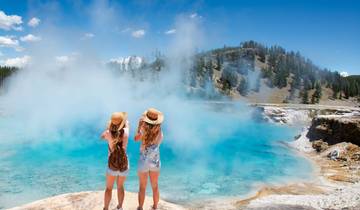
4 days
Yellowstone & Grand Teton 4 Day / 3 Night Wildlife Adventure
- ✓ Comprehensive Park Yellowstone National Park tour
- ✓ Expert local guides included
- ✓ All accommodation arranged
- ✓ Transportation provided
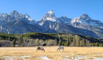
5 days
5 Day- Yellowstone and Grand Teton National Park in Depth- Hotel Based
- ✓ Comprehensive Park Yellowstone National Park tour
- ✓ Expert local guides included
- ✓ All accommodation arranged
- ✓ Transportation provided
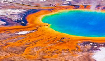
4 days
4 day Yellowstone and Tetons in depth tour from Salt Lake City Small Groups Tour
- ✓ Comprehensive Park Yellowstone National Park tour
- ✓ Expert local guides included
- ✓ All accommodation arranged
- ✓ Transportation provided
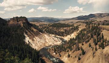
6 days
Yellowstone Camping Explorer
- ✓ Comprehensive Park Yellowstone National Park tour
- ✓ Expert local guides included
- ✓ All accommodation arranged
- ✓ Transportation provided
Multi-day tour packages powered by TourRadar. Prices and availability subject to change.
Remote Geothermal Wonders: Thermal Features Beyond the Boardwalks
Yellowstone’s fame rests on its geothermal features, yet the majority of the park’s 10,000+ thermal features exist in wilderness settings without development, boardwalks, or easy access. These remote thermal areas showcase the same geological processes that created famous attractions, often with greater pristinity and drama. Understanding their locations, characteristics, and access requirements opens opportunities for experiencing Yellowstone’s volcanic power in settings resembling what early explorers encountered.
The Heart Lake Geyser Basin ranks among Yellowstone’s largest and most active thermal areas, containing over 300 features spread across several square miles of wilderness. The basin occupies a caldera within the larger Yellowstone caldera, creating concentrated thermal activity fed by magma chambers at relatively shallow depths. Rustic Geyser dominates the landscape with eruptions reaching 30-40 feet occurring every 8-12 hours, sending steaming plumes visible across Heart Lake. The geyser’s cone has built up over centuries, creating a distinctive structure in the wilderness setting.
Columbia Pool measures over 100 feet in diameter with depths exceeding 20 feet, its crystal-clear blue waters reaching temperatures of 180-190°F. The pool’s color comes from thermophilic microorganisms thriving in the extreme heat, creating brilliant turquoise and azure hues that shift with changing light conditions. Unlike developed hot springs with boardwalks and barriers, Columbia Pool exists in natural wilderness, surrounded by lodgepole pine forest and wildflower meadows, accessible only after an 8-mile hike carrying camping equipment for overnight stays required by the distance.
Fissure Spring creates a dramatic linear feature extending over 200 feet through the landscape, with superheated water emerging from a crack in the Earth’s crust. The spring’s alignment follows structural features in the underlying geology, demonstrating how thermal water finds pathways to the surface through fault lines and fractures. The water emerges at near-boiling temperatures, creating steam clouds that drift through the forest on cool mornings. The spring’s remote location means it receives visits only from backpackers committed to multi-day wilderness trips, preserving its pristine condition.
The Shoshone Geyser Basin along the shore of Shoshone Lake provides a unique combination of alpine lake scenery and intense thermal activity. Union Geyser stands as the basin’s most powerful feature, erupting from three separate vents that combine their force in spectacular displays reaching 80-100 feet. The geyser’s eruptions last 10-20 minutes, shooting water high above the shoreline and creating rainbows in the spray when sunlight illuminates the plume. The eruption cycle follows irregular patterns, with quiet periods lasting 3-8 hours between displays.
Minute Man Geyser earned its name from remarkably regular eruption intervals averaging 60-65 minutes. This predictability makes it a favorite among backcountry visitors who can time their activities around eruption schedules. The geyser shoots water 20-30 feet high for 3-4 minutes, with enough regularity that experienced visitors can predict eruptions within minutes. The consistency demonstrates the stable underground plumbing system feeding the geyser, unchanged by seasonal variations or external factors.
Morning Mist Springs produces one of Yellowstone’s most intensely colored blue pools, rivaling Grand Prismatic Spring in color saturation though much smaller in size. The pool measures 30 feet across with depths reaching 15 feet, filled with water so clear that bottom details remain visible despite the depth. The blue color comes from light scattering in pure water combined with mineral content and thermophilic bacteria creating the optimal conditions for brilliant hues. The pool’s setting in dense forest creates dramatic contrasts between the bright blue water and surrounding greenery.
The Imperial Geyser Basin north of Fairy Falls receives some visitation due to its proximity to developed areas, yet most visitors stop at the more accessible Fairy Falls without continuing to the thermal features. Imperial Geyser itself erupts from a large pool, shooting water 30-50 feet high during active periods. The surrounding area contains numerous hot springs, fumaroles, and mud pots spread across meadows and forest openings. Spray Geyser creates a continuous fountain reaching 10-15 feet, maintained constantly by underground pressure rather than following eruption cycles like other geysers.
Hidden Waterfalls: Cascades in Remote Canyons
Yellowstone’s waterfall inventory extends far beyond the famous Lower Falls and Tower Fall, encompassing over 100 significant cascades throughout the park’s watersheds. The most spectacular remain hidden in remote canyons and backcountry drainages, accessible only through multi-mile hikes that deter casual visitors. These waterfalls demonstrate the power of water carving through volcanic rock, creating dramatic drops, multiple tiers, and pristine pools in wilderness settings.
Union Falls combines two streams merging at the edge of a 250-foot cliff, creating one of Yellowstone’s most dramatic waterfalls. Mountain Ash Creek and Falls River join forces just before plunging over the precipice, with the combined flow dropping in multiple stages through a narrow canyon. The waterfall’s remote location in the Bechler region requires a 16-mile round-trip hike through varied terrain, including meadows, forests, and stream crossings. The trail gains minimal elevation, making the distance the primary challenge rather than steep grades. Visitors who make the journey discover a powerful cascade flowing through pristine wilderness, with viewing opportunities from both above and below the falls.
The falls demonstrate peak flow during June when snowmelt combines with spring rains, sending massive volumes of water over the cliff. By late summer, the flow diminishes but remains substantial enough to create impressive displays. The canyon walls surrounding the falls contain layers of volcanic rock representing multiple eruption periods, with basalt columns and rhyolite deposits creating textured surfaces that enhance the visual drama. The pool at the base extends 40 feet deep, creating a turquoise basin that mirrors the surrounding forest.
Dunanda Falls drops 150 feet in a single unbroken plunge, exceeding the height of many celebrated waterfalls in other national parks. Boundary Creek creates the falls as it descends from high meadows toward its junction with the Bechler River. The waterfall’s name comes from early explorers’ descriptions of the thundering sound produced by tons of water hitting the rocks below. Access requires a 17-mile backpacking trip from the Cave Falls trailhead, passing through the heart of Cascade Corner’s waterfall-rich landscape.
The falls achieves maximum drama during peak runoff when the creek swells to several times its late-summer volume. The increased flow widens the curtain of water and generates massive spray clouds that create rainbows throughout the day. The setting includes towering conifers, wildflower meadows, and views toward the Pitchstone Plateau, one of Yellowstone’s most recent volcanic features. The falls’ isolation ensures that overnight backpackers experience the cascade in solitude, with the sound of falling water providing a constant backdrop to wilderness camping.
Silver Cord Cascade’s 1,200-foot drop makes it Yellowstone’s tallest waterfall, though its ribbon-like flow and remote location keep it off most visitors’ itineraries. Surface Creek creates the cascade as it flows from alpine meadows above the Grand Canyon of the Yellowstone, then plunges over the canyon’s north rim in a spectacular free-fall. The creek flows over multiple ledges before making the final vertical drop, creating a multi-tiered cascade visible from only a few locations. The Clear Lake Trail provides the best access, requiring a 6-mile hike to viewpoints overlooking the cascade.
The waterfall demonstrates dramatic seasonal variations in flow, with spring runoff producing substantial cascades while late summer reduces the flow to a thread of water making the full drop. Even in low-flow conditions, the sheer height creates impressive displays as water falls through space before hitting rocks hundreds of feet below. The canyon setting provides context for understanding the geological forces that carved this massive chasm, with the waterfall representing ongoing erosion processes shaping the landscape.
Terraced Falls drops 140 feet over travertine deposits that create a stepped appearance, with water flowing over multiple mineral terraces. The falls occupy a side canyon feeding into Tower Creek, requiring a 3-mile hike from Tower Junction through forest and meadow terrain. The travertine terraces form from dissolved minerals in the water precipitating as the water cools and flows over the cliff edge, building up layers over centuries. These deposits create unusual colors and textures compared to waterfalls flowing over basalt or rhyolite, with cream and tan shades contrasting against the forest greens.
Ouzel Falls in the Bechler region plunges 230 feet in two distinct drops, with a pool separating the upper and lower sections. The falls receive their name from water ouzels (American dippers) that nest in the spray zone, feeding on aquatic insects in the turbulent waters. The remote location requires a 13-mile hike through Cascade Corner’s waterfall district, passing numerous other cascades en route. The falls achieve impressive power during spring runoff, sending spray hundreds of feet from the base and creating constant rainbows in favorable light conditions.
Wildlife Sanctuaries: Remote Habitats and Migration Corridors
Yellowstone’s wildlife populations extend throughout the park’s 2.2 million acres, but the most significant concentrations and natural behaviors occur in remote areas away from roads and developed zones. These hidden wildlife sanctuaries provide critical habitat for grizzly bears, wolves, elk, and other species, supporting the ecological processes that make Yellowstone a functioning wilderness ecosystem. Understanding where these areas exist and how to access them responsibly allows observant visitors to witness wildlife behaving according to evolutionary patterns rather than human-influenced routines.
The Pelican Valley in the remote eastern section of the park supports one of North America’s densest grizzly bear populations. This broad valley contains extensive wetlands, meadows, and streams that provide diverse food sources throughout the active season. Spring brings bears to Pelican Creek where cutthroat trout spawn, offering high-protein meals after winter hibernation. The bears catch fish in shallow water, demonstrating hunting techniques developed over thousands of years. Summer shifts bear activity to meadows where roots, tubers, and insects provide nutrition, while fall concentrates bears in whitebark pine zones seeking pine nuts stored by squirrels.
The valley experiences complete closure to human entry during late spring and early summer, protecting denning bears and mothers with cubs during vulnerable periods. When open, the area requires groups of four or more hikers traveling together for safety, acknowledging the significant bear presence. The regulations preserve the area’s function as primary grizzly habitat while allowing limited human observation under conditions minimizing bear-human conflicts. Wildlife photographers working from designated areas capture remarkable images of bears engaged in natural behaviors including fishing, grazing, and family interactions.
The Lamar Valley’s eastern extensions beyond Slough Creek provide some of Yellowstone’s best wolf watching opportunities, with multiple packs maintaining territories in this remote landscape. The Junction Butte pack frequently hunts in meadows several miles from road access, pursuing elk and bison in coordinated pack hunts demonstrating sophisticated social behavior. Winter provides optimal viewing as wolves concentrate on winter-killed animals and vulnerable prey in snow-covered terrain. The open landscape allows observation from distances respecting wolf territories while providing clear views of hunting, playing, and pack interactions.
Buffalo Fork and its tributaries support the Prospect Peak pack and other wolf groups hunting in areas receiving minimal human presence. The remote location requires commitment to multi-hour hikes accessing high ridges and valley bottoms where wolves travel and hunt. Patient observers position themselves at dawn and dusk when wolf activity peaks, using optics to scan vast landscapes for movement and activity. The experience differs dramatically from roadside wolf watching, offering insights into how wolves operate when not influenced by human presence and vehicle traffic.
The Thorofare region represents Yellowstone’s most remote wilderness, located over 30 miles from the nearest road in any direction. This pristine landscape supports all of the park’s native wildlife species in an ecosystem functioning without human infrastructure or regular human presence. Grizzly bears, wolves, mountain lions, wolverines, and numerous other predators hunt across this vast territory, interacting with elk, moose, deer, and bison herds in predator-prey relationships unchanged by human influence.
The Yellowstone River headwaters flow through the Thorofare, creating extensive wetlands and meadows that support waterfowl, sandhill cranes, and numerous other bird species. Moose concentrate in willow thickets along streams, feeding on aquatic vegetation and tree bark. Elk herds migrate through the Thorofare seasonally, moving between summer ranges in high meadows and winter ranges at lower elevations. The region functions as a wildlife migration corridor connecting Yellowstone with adjacent wilderness areas, ensuring genetic exchange and population health across the Greater Yellowstone Ecosystem.
The Hayden Valley’s northeastern sections beyond Alum Creek provide exceptional wildlife habitat with less visitor pressure than roadside viewing areas. Bison herds numbering hundreds of animals graze across these meadows, following seasonal patterns of movement between grazing areas and water sources. Grizzly bears hunt in the area during spring, targeting newborn elk calves and bison calves, demonstrating predation’s role in shaping ungulate populations. The valley’s wetlands support breeding waterfowl, wading birds, and raptors hunting small mammals in the grasslands.
Historical Treasures: Pioneer Structures and Cultural Sites
Yellowstone’s human history extends back thousands of years through indigenous use and continues through early exploration, park establishment, and development of management infrastructure. While popular historic sites like Old Faithful Inn and Mammoth Hot Springs receive significant attention, numerous historical structures and cultural sites exist throughout the backcountry, documenting human interaction with this landscape across centuries.
The Snake River Ranger Station in the remote Harebell patrol cabin area served wilderness rangers monitoring the park’s southeastern sections during the early 20th century. Built in 1923, the log structure exemplifies utilitarian construction using local materials and traditional building techniques. The cabin provided shelter for rangers conducting multi-day patrols, enforcing regulations against poaching, monitoring wildlife populations, and maintaining trails. The structure remains standing today, maintained by the National Park Service as a historic resource and functional backcountry facility.
The cabin’s interior preserves period furnishings and equipment including woodstoves, bunks, and storage facilities that sustained rangers during long wilderness assignments. The location demonstrates the commitment to backcountry presence that characterized early park management, placing rangers in remote areas to protect resources rather than concentrating staff in developed zones. The cabin’s log construction showcases craftsmanship adapted to harsh mountain conditions, with techniques ensuring structural stability through decades of heavy snow loads, temperature extremes, and minimal maintenance.
The Thorofare Ranger Station represents one of Yellowstone’s most isolated historical structures, accessible only by a 32-mile trail from the eastern entrance or by boat across Yellowstone Lake. Built in 1915, this patrol cabin served rangers monitoring the most remote section of the park, where poaching threatened wildlife populations and illegal activities challenged early management efforts. The station’s extreme isolation required rangers to possess wilderness skills, self-sufficiency, and determination to work weeks at a time in country days away from assistance or resupply.
The structure remains in use today, continuing its original function as a wilderness patrol station while serving as a living historical resource. Modern rangers occupying the cabin work in conditions similar to their predecessors, though with improved communications and equipment. The station demonstrates the continuity of wilderness protection philosophy across decades, maintaining human presence in remote country to ensure resource protection through direct observation and patrol activities.
The Specimen Ridge fossil forests contain not only paleontological treasures but also evidence of early scientific expeditions that documented these remarkable deposits. Rock cairns marking survey points, inscriptions recording scientific observations, and remnants of early scientific camps document the exploration and study of these petrified forests. These features provide insights into late 19th and early 20th century scientific methods, when researchers conducted fieldwork in remote wilderness areas without modern equipment or transportation.
The Hoodoo Basin ranger station near the park’s northern boundary served as a patrol cabin monitoring backcountry use and wildlife populations in the Absaroka Range. The remote location required rangers to travel extensive distances on horseback, maintaining trails, monitoring wildlife, and enforcing regulations across vast territories. The cabin exemplifies the rustic construction typical of early park infrastructure, using logs harvested locally and fitted using hand tools. The structure preserves elements of early ranger life including tack rooms for horse equipment, root cellars for food storage, and simple living quarters designed for functionality rather than comfort.
Prehistoric archaeological sites throughout the park document indigenous use extending back over 11,000 years. These sites include hunting blinds, campsites, wickiups, and obsidian quarries where native peoples obtained volcanic glass for tool making. The obsidian sources in the park provided high-quality material traded across North America, with Yellowstone obsidian found at archaeological sites hundreds of miles away. These cultural sites remain protected by law and park policy, requiring special permits for scientific study and remaining closed to general visitation to preserve their integrity.
Geological Secrets: Volcanic Features and Fossil Deposits
Yellowstone’s geology extends beyond its famous geothermal features to encompass volcanic landscapes, fossil deposits, and unique mineral formations throughout the backcountry. These geological treasures reveal the park’s volcanic history, ancient ecosystems, and ongoing geological processes shaping the landscape. Understanding these features provides context for Yellowstone’s role as Earth’s largest active volcanic system and its paleontological significance.
The Specimen Ridge fossil forests preserve 27 distinct fossilized forest levels representing sequential periods of volcanic activity and forest growth over thousands of years. Each layer represents a complete forest buried by volcanic ash, then succeeded by new forest growth on the ash deposits until another eruption repeated the process. The petrified trees include species now extinct in the region including redwood, magnolia, walnut, and chestnut, indicating subtropical conditions during the Eocene period 45-50 million years ago.
The fossilized trees stand in growth position, with roots penetrating ancient soil layers and trunks extending upward through volcanic deposits. Some specimens measure over 10 feet in diameter, indicating mature forests of significant age before burial. The petrification process replaced original organic material with silica dissolved from volcanic ash, creating stone replicas preserving cellular structure, growth rings, and bark texture. The preservation quality allows scientists to identify species, determine age at death, and reconstruct ancient climate conditions.
The ridge contains hundreds of standing petrified trees, with countless fallen specimens scattered across slopes and drainages. The fossil forests demonstrate the cyclical nature of volcanic activity in the region, with extended quiet periods allowing forest development interrupted by catastrophic eruptions. The deposits provide a record of environmental change spanning millions of years, documenting shifts in climate, vegetation, and geological activity that shaped the Yellowstone landscape.
The Pitchstone Plateau in the southwest corner of the park represents Yellowstone’s most recent volcanic eruption, occurring 70,000 years ago. This rhyolite flow covers 100 square miles, creating a relatively flat elevated plateau covered by lodgepole pine forest. The volcanic glass (obsidian) contains tiny crystals creating the pitchstone texture that gives the plateau its name. The plateau’s remote location and difficult access mean few visitors explore this geologically young landscape representing ongoing volcanic activity in the Yellowstone system.
The Absaroka Range forming Yellowstone’s eastern boundary contains some of the park’s oldest exposed rocks, including volcanic deposits from 50 million years ago. These ancient volcanic layers represent an earlier period of intense activity predating the current Yellowstone hotspot volcanic system. The mountains contain dramatic cliffs, pinnacles, and spires carved from volcanic breccia and ash deposits, with layers of different colors indicating varying mineral composition and eruption characteristics. The rugged terrain provides habitat for bighorn sheep, mountain goats, and other species adapted to steep rocky environments.
The Washburn Hot Springs Overlook trail passes through extensive obsidian deposits, with volcanic glass scattered across ridges and slopes. The obsidian formed from rhyolite lava cooling too rapidly for crystals to form, creating natural glass that indigenous peoples prized for tool making. The deposits include several colors and textures of obsidian, from jet black glass to mahogany and rainbow varieties showing iridescent colors. The overlook itself provides views of the Grand Canyon of the Yellowstone and extensive thermal features in Washburn Hot Springs basin below.
The Solfatara Plateau north of Norris Geyser Basin contains extensive areas of hydrothermally altered rock where acidic thermal waters dissolved original minerals and deposited new compounds. The resulting landscape shows white, yellow, and orange colors from sulfur and iron compounds, with few plants surviving in the chemically harsh soils. The plateau demonstrates the power of geothermal activity to transform landscapes, with entire hillsides converted from volcanic rock to clay minerals and sulfur deposits through chemical weathering processes.
Remote Lakes and Pristine Watersheds
Yellowstone contains over 290 lakes and approximately 1,000 miles of streams, with many water bodies remaining undeveloped and receiving minimal visitation. These remote lakes and pristine watersheds provide critical aquatic habitat, support unique ecosystems, and offer wilderness experiences centered on water-based activities including fishing, photography, and observation of aquatic wildlife.
Shoshone Lake ranks as Yellowstone’s second-largest lake at 8,050 acres, yet it receives a fraction of the visitation that Yellowstone Lake attracts. The lake has no road access, requiring either an 8-mile hike or a boat trip across Lewis Lake followed by a portage over the Lewis Channel. The remote access ensures relative solitude even during peak season, with most visitors being backpackers on multi-day trips or anglers seeking trophy lake trout and brown trout populations. The lake’s shoreline contains the Shoshone Geyser Basin, creating unique juxtapositions of alpine lake scenery and intense geothermal activity.
The lake supports breeding populations of common loons, one of the park’s more unusual bird species. These diving birds require large, pristine lakes with abundant fish populations, making Shoshone Lake ideal habitat. The haunting calls of loons echo across the water during summer evenings, creating memorable wilderness soundscapes. The lake also supports populations of river otters, ospreys, and bald eagles that feed on fish populations. The undeveloped shoreline maintains natural conditions supporting aquatic and terrestrial wildlife without the impacts of development found at accessible lakes.
Heart Lake in the remote southeastern backcountry covers 2,160 acres and reaches depths over 180 feet. The lake occupies a caldera within the larger Yellowstone caldera, creating a circular basin surrounded by mountain peaks. The Heart Lake Geyser Basin along the northwestern shore produces constant steam clouds visible across the water, while hot springs entering the lake create thermal areas in shallow bays. The lake supports native Yellowstone cutthroat trout populations and provides critical grizzly bear habitat, with bears fishing in inlet streams during spawning runs.
Mount Sheridan rises directly from the lake’s southern shore, its 10,308-foot summit providing spectacular views across the Yellowstone backcountry. The mountain’s fire lookout tower, built in 1920, served as a crucial wildfire detection point for decades and remains one of the few operational lookout towers in the national park system. The tower requires a strenuous 3-mile climb gaining 2,700 feet in elevation from the Heart Lake trail, but rewards visitors with 360-degree views encompassing the entire southeastern portion of the park.
Grebe Lake, Cascade Lake, and several smaller lakes in the Canyon area provide excellent examples of subalpine lake ecosystems. These water bodies formed in depressions created by glacial activity and volcanic processes, with no inlet or outlet streams in some cases. The lakes support unique populations of Arctic grayling, a fish species rare in Yellowstone and throughout its historical range. The grayling require cold, clear water and undisturbed spawning habitat, conditions maintained in these remote lakes. The fishery attracts dedicated anglers willing to hike 3-4 miles for opportunities to catch these distinctive fish.
The Lamar River headwaters flow through pristine wilderness in the park’s northeastern corner, creating extensive meadows, wetlands, and riparian habitat. The upper river sections receive minimal human presence, maintaining natural channel dynamics, beaver populations, and riparian vegetation undisturbed by development. The watershed supports all of Yellowstone’s native fish species in their original habitat conditions, providing reference systems for understanding how these species functioned before habitat modifications elsewhere in the park.
The Bechler River watershed in the park’s southwest corner drains Cascade Corner’s waterfall-rich landscape, flowing through meadows, marshes, and forests before exiting the park into Idaho. The river maintains natural flow regimes, supporting native fish populations and providing critical habitat for moose, bears, and waterfowl. The watershed receives minimal human impact, with only a few trails accessing its extensive drainage. The remote character preserves ecological processes including seasonal flooding, channel migration, and beaver activity that shape riparian ecosystems.
Alpine Meadows and High Country Secrets
Yellowstone’s high country above treeline contains extensive alpine meadows, rocky peaks, and unique ecosystems adapted to harsh mountain conditions. These remote areas require significant hiking effort to reach but reward visitors with spectacular wildflower displays, commanding views, and opportunities to observe wildlife in settings resembling the park’s conditions before human development.
The Gallatin Range along Yellowstone’s northwest boundary contains multiple peaks exceeding 10,000 feet in elevation, with alpine zones extending across ridges and upper slopes. Electric Peak, at 10,969 feet, stands as the range’s highest summit, named for electrical phenomena experienced by early surveyors during thunderstorms. The peak’s summit provides panoramic views across the park and into Montana’s Paradise Valley. The approach requires a strenuous 10-mile round-trip hike gaining 3,000 feet, passing through multiple life zones from forest to alpine tundra.
The alpine meadows below the summit explode with wildflowers during July and August, with lupine, paintbrush, alpine forget-me-nots, and dozens of other species creating colorful displays. The thin soils and harsh conditions limit plant growth to compact species adapted to severe weather, short growing seasons, and intense solar radiation at high altitude. Bighorn sheep and mountain goats frequent these areas, feeding on alpine vegetation and using rocky cliffs for escape terrain. The animals show little fear of humans in these remote areas, allowing observations of natural behaviors.
The Absaroka Range peaks along Yellowstone’s eastern boundary contain extensive alpine zones with meadows, cirques, and rocky summits offering wilderness experiences. Eagle Peak at 11,358 feet ranks as the park’s highest point, though its remote location and difficult access mean few visitors reach the summit. The peak requires multi-day backpacking trips accessing the Thorofare region, followed by off-trail scrambling through rugged terrain. The summit provides views across the entire southeastern portion of the park and into the Teton Wilderness.
Mount Washburn at 10,243 feet offers more accessible alpine experiences, with maintained trails reaching the summit from both north and south approaches. Despite easier access, the summit environment demonstrates harsh mountain conditions with fierce winds, rapid weather changes, and exposure to lightning during summer thunderstorms. The old fire lookout building provides shelter and houses interpretive displays explaining the park’s fire ecology and natural history. The meadows surrounding the summit support bighorn sheep populations that have adapted to human presence along the trails while maintaining natural behaviors away from developed areas.
The Two Ocean Plateau in the park’s southeastern corner contains unique hydrological features where North Two Ocean Creek divides at Parting of the Waters, sending water to both the Pacific Ocean via the Snake River and the Atlantic Ocean via the Yellowstone and Missouri Rivers. This continental divide crossing creates one of North America’s most unusual geographical features. The plateau contains extensive meadows, small lakes, and streams flowing through pristine wilderness. The area requires multi-day backpacking trips to reach, ensuring solitude and wilderness conditions.
The Pitchstone Plateau’s 8,500-foot elevation creates a high-altitude landscape dominated by lodgepole pine forest punctuated by meadows and wetlands. The plateau’s relatively flat surface contrasts with surrounding mountains, creating distinctive landscapes shaped by its volcanic origins. The remote location and difficult access mean the plateau receives minimal visitation, preserving wilderness character and supporting wildlife populations including grizzly bears, elk, and moose. The plateau provides important habitat for species requiring large territories and undisturbed conditions.
Conservation Significance and Protection
Yellowstone’s hidden gems require protection to maintain their pristine character and ecological function. Understanding the conservation significance of these remote areas and the regulations protecting them ensures their preservation for future generations while allowing appropriate public access and enjoyment.
The park’s backcountry zoning system designates areas according to appropriate use levels and management strategies. Primitive zones receive minimal development with trails maintained at basic levels and campsites limited to preserve wilderness character. These zones encompass most of the hidden gems described throughout this guide, requiring visitors to accept wilderness conditions including limited facilities, navigation challenges, and remoteness from assistance. The primitive designation ensures these areas maintain characteristics essential to their value: solitude, pristine conditions, and natural processes functioning without human interference.
Bear management areas establish seasonal closures and use restrictions protecting critical grizzly bear habitat during vulnerable periods. Spring closures protect bears emerging from dens and mothers with cubs during early months when disturbance poses greatest risks. These closures apply to extensive portions of the backcountry including Pelican Valley, Hayden Valley sections, and areas throughout the park where bear activity concentrates. Summer restrictions require minimum group sizes and designated travel routes through areas with significant bear presence, reducing encounter risks while allowing limited public access.
The thermal area protection regulations prohibit approaching, touching, or entering thermal features except on designated trails and boardwalks. These rules apply throughout the park including remote thermal areas where no development exists. The regulations protect both visitor safety and feature integrity, preventing injuries from scalding water and acidic conditions while preserving the delicate mineral deposits, microbial mats, and structures that form around thermal features. Violation of thermal regulations results in citations, fines, and potential criminal prosecution.
Wilderness camping regulations establish carrying capacity limits, designated campsites in heavily used areas, and dispersed camping zones in more remote sections. The backcountry permit system tracks use levels, distributes visitors across available sites, and ensures groups receive appropriate information about conditions, hazards, and regulations. The system balances public access with resource protection, allowing wilderness recreation while preventing overuse that would degrade the experiences and environments visitors seek.
Wildlife viewing ethics emphasize maintaining appropriate distances, avoiding behaviors that alter wildlife activity, and prioritizing animal welfare over photo opportunities. The park establishes minimum distance requirements of 100 yards for bears and wolves, 25 yards for other wildlife, enforced through citations and visitor education. These distances protect both visitors and wildlife, reducing stress on animals while preventing dangerous encounters. Remote areas require additional vigilance as wildlife in these settings may not be habituated to human presence and may react unpredictably.
Cultural and archaeological site protection prohibits collecting artifacts, disturbing features, or entering sites without proper permits. These regulations preserve the scientific value of sites documenting human history in the Yellowstone region, ensuring future researchers can study these resources using evolving techniques and approaches. The protection extends to historical structures, requiring visitors to observe without touching or entering buildings, preserving structural integrity and historical character.
Planning Your Hidden Gems Exploration
Discovering Yellowstone’s hidden gems requires appropriate planning, wilderness skills, and commitment to Leave No Trace principles. Understanding access requirements, necessary equipment, and wilderness ethics ensures safe, rewarding experiences while protecting the resources that make these areas special.
Backcountry permit requirements apply to all overnight trips in Yellowstone’s wilderness, with permits obtained at ranger stations and visitor centers. The permit system allows park managers to track use levels, provide current information about trail conditions and wildlife activity, and ensure visitors understand regulations and safety considerations. Permits specify approved campsites or camping zones, travel routes, and group size requirements. Obtaining permits early in the planning process ensures availability, especially for popular areas and times.
Physical fitness and wilderness experience requirements increase with trip difficulty and remoteness. Routes to hidden gems often involve long distances, significant elevation gain, stream crossings, and off-trail navigation. Assessing personal capabilities honestly and choosing objectives matching experience levels prevents problems and ensures enjoyable trips. Building experience through shorter trips in developed areas before attempting remote destinations develops skills and confidence needed for challenging wilderness travel.
Equipment considerations for backcountry trips include bear-resistant food storage, navigation tools, first aid supplies, emergency communication devices, and appropriate clothing for rapidly changing mountain weather. The park requires approved bear-resistant containers or hanging food properly to prevent wildlife access. Navigation requires topographic maps and compass skills, as trails in remote areas may be less maintained than popular routes. Weather preparedness includes layers for temperature variations from hot afternoons to freezing nights, rain gear for sudden storms, and sun protection for high-altitude exposure.
Route planning involves studying maps, reviewing trip reports, and contacting ranger stations for current conditions. Understanding water availability, stream crossing locations, and terrain characteristics helps plan realistic daily mileages and identify potential challenges. Flexibility in planning allows adjusting routes based on conditions, weather, and personal pace. Building extra days into itineraries provides buffers for weather delays or slower-than-planned progress without creating pressure to continue in unsafe conditions.
Leave No Trace principles guide all backcountry travel, minimizing impacts on the wilderness environments visitors seek to experience. These principles include proper waste disposal, camping on durable surfaces, minimizing campfire impacts, respecting wildlife, and leaving natural and cultural features undisturbed. Following these guidelines preserves the pristine character of hidden gems for future visitors while protecting ecological integrity and allowing natural processes to function without human interference.
FAQ: Yellowstone Hidden Gems
What backcountry permits are required for exploring hidden gems?
All overnight backcountry trips require permits obtained at ranger stations, visitor centers, or online through advance reservation systems. Day hiking does not require permits unless entering bear management areas with specific restrictions. Permits cost $3 per person per night with $25 reservation fees for advance bookings. The permit system tracks use levels, provides current information, and ensures appropriate group sizes meet safety requirements. Permits specify approved campsites and camping zones, with some areas operating on first-come, first-served basis while popular zones require advance reservations. Contact backcountry offices early in planning processes to discuss trip plans and permit availability.
What level of physical fitness is needed for accessing remote areas?
Physical requirements vary dramatically based on destination choices. Some hidden gems like Imperial Geyser require moderate 3-mile hikes accessible to most fit hikers. Remote destinations including Heart Lake Geyser Basin demand strenuous 8+ mile approaches carrying overnight gear, requiring solid cardiovascular fitness and leg strength. The most remote areas like the Thorofare region involve 30+ mile approaches with multi-day backpacking, requiring excellent fitness and wilderness experience. Training should match trip objectives, building endurance through progressively longer hikes with loaded packs. Elevation impacts fitness at Yellowstone’s 7,000-11,000 foot range, requiring acclimatization for optimal performance.
When is the best season for exploring Yellowstone’s backcountry?
Late July through mid-September provides optimal conditions for most backcountry travel, with snow melted from trails, streams at fordable levels, and stable weather patterns. July offers peak wildflower displays in alpine areas though some high passes retain snow. August provides the most stable weather with warm days and cool nights. Early September brings fall colors and reduced crowds before seasonal closures begin. Spring conditions (June-early July) include high water, snow on high-elevation trails, and bear management restrictions in many areas. Winter backcountry travel requires specialized equipment and skills for snow travel and extreme cold conditions.
Are there guided trips to these hidden areas?
Licensed guide services operating in Yellowstone offer custom backcountry trips to remote areas including Bechler waterfalls, Heart Lake, and alpine peaks. These services provide equipment, food, permits, and experienced leadership allowing visitors to access challenging areas without independent wilderness skills. Guide services range from day hikes to week-long expeditions, with private and semi-private options available. Several companies specialize in backcountry photography trips, wildlife viewing expeditions, and fishing-focused adventures. Hiring guides benefits visitors lacking wilderness experience while supporting businesses operating under park regulations and conservation guidelines.
What wildlife dangers exist in remote areas?
Grizzly bears represent the primary wildlife concern in Yellowstone’s backcountry, with highest concentrations in areas described in this guide. Carrying bear spray, traveling in groups of three or more, making noise on trails, and storing food properly dramatically reduce encounter risks. Bears in remote areas may be less habituated to humans than bears near roads, requiring extra vigilance and immediate response to bear presence. Other hazards include bison in meadows, moose in willow thickets, and occasional mountain lion encounters. Understanding animal behavior, maintaining appropriate distances, and responding correctly to wildlife encounters prevents most problems.
How do you navigate to areas without maintained trails?
Off-trail navigation requires topographic map and compass skills combined with ability to identify terrain features and maintain directional awareness. GPS devices provide additional tools but should not replace map and compass proficiency as technology fails. Route planning identifies landmarks, drainage patterns, and terrain features guiding travel. Traveling on durable surfaces including rock, dry grass, and snow minimizes vegetation damage. Moving slowly and deliberately prevents navigation errors requiring extensive backtracking. Starting with short off-trail ventures from established trails builds skills before attempting longer cross-country routes. Consider joining orienteering clubs or taking navigation courses to develop these essential skills.
What emergency resources exist in the backcountry?
Yellowstone’s backcountry lacks immediate emergency response resources, with rescue operations potentially taking hours to days depending on location and conditions. Carrying personal locator beacons or satellite communication devices enables emergency communication from areas without cell coverage. Basic first aid skills and comprehensive first aid kits allow treating injuries until evacuation occurs. Trip planning should include emergency protocols, leaving detailed itineraries with responsible parties, and understanding park emergency procedures. Backcountry ranger stations provide limited assistance but operate intermittently. Self-sufficiency and conservative decision-making prevent most emergencies while preparation ensures appropriate responses when problems occur.
Can you swim in remote hot springs?
The National Park Service prohibits swimming in thermal features throughout Yellowstone, including remote hot springs, to protect both visitor safety and feature integrity. Water temperatures often exceed 140°F, causing severe burns, while acidic conditions damage skin and eyes. Many thermal features contain invisible hazards including thin crusts covering boiling water and unstable ground near features. The regulation protects delicate microbial mats and mineral deposits easily damaged by human contact. The Boiling River and Firehole Swimming Area provide legal swimming opportunities in thermally influenced waters mixed with cold rivers, creating safe temperatures while maintaining thermal experience.
How do you photograph thermal features without boardwalks?
Photographing backcountry thermal features requires telephoto lenses allowing capture from safe distances beyond thermal areas. Wide-angle shots utilize natural elevation differences providing overlook positions. Morning light creates dramatic steam effects while afternoon light illuminates features’ colors and details. Including surrounding wilderness context differentiates backcountry thermal photography from developed area images. Respecting established viewing areas and thermal regulations while photographing remote features ensures both photographer safety and resource protection. Weather conditions dramatically affect thermal feature appearance, with cold temperatures amplifying steam production and calm conditions allowing pools to reflect surroundings clearly.
What historical research opportunities exist regarding hidden sites?
Yellowstone’s historical records, housed at Heritage and Research Center in Gardiner, Montana, contain extensive documentation of backcountry patrol cabins, early trails, and historical land use. Researchers access documents, photographs, and maps documenting park development and management history. Archaeological and anthropological research requires permits and professional credentials, protecting cultural resources while allowing scientific study. Oral histories from retired rangers, early concession employees, and longtime park associates provide valuable perspectives on backcountry history. The Yellowstone Association Institute offers research-focused programs connecting public participants with ongoing scientific and historical projects throughout the park.