Where Three Worlds Meet: An Off-The-Beaten-Path Route Through the Tarvisio Borderlands
In the extreme northeastern corner of Italy, where the Julian and Carnic Alps funnel into a single glacial corridor, the nations of Italy, Austria, and Slovenia press so close together that a short morning walk can pass through all three. The Val Canale — known as Kanaltal in German and Kanalska dolina in Slovenian — is one of Europe’s most quietly extraordinary border zones: a narrow Alpine valley where Latin, Germanic, and Slavic cultures have coexisted, collided, and fused for centuries, leaving behind a landscape that is architecturally Austrian, linguistically plural, spiritually shared, and culinarily unclassifiable.
- Geographic convergence: Tarvisio is one of only four Italian municipalities that borders two foreign states simultaneously — Austria to the north and Slovenia to the east — placing the entire route within a compact 40-kilometer corridor.
- Cultural layering: The valley’s three distinct cultural worlds — Friulian Italian, Carinthian German, and Slovenian Slavic — are not historical relics but living presences, audible in local dialects, visible in architecture, and tasted in the food.
- Natural spectacle: The route passes the Laghi di Fusine, two glacial lakes of extraordinary clarity set against Julian Alps peaks; Lago del Predil, a turquoise lake above an abandoned mining town; and the Foresta di Tarvisio, the largest state forest in Italy.
- Low tourist density: Despite the scenery and cultural depth, the Val Canale receives a fraction of the visitors drawn to the Dolomites just to the west, making it one of northeastern Italy’s most rewarding routes for independent travelers.
- All-season interest: Summer brings hiking and lake swimming; autumn brings foliage that turns the forest copper and gold; winter transforms the area into a functional ski destination; spring offers snowmelt streams and wild meadows in bloom.
- Logistical simplicity: All seven stops on this route are accessible by car along a single valley corridor, with public transport connecting the main villages for car-free travelers.
People Also Ask About the Tarvisio Borderlands
Where exactly do Italy, Austria, and Slovenia meet?
The official tripoint — known as the Dreiländereck in German, Tromeja in Slovenian, and Tre Confini in Italian — sits near the Austrian town of Arnoldstein and the Slovenian village of Rateče, at an elevation of approximately 561 meters on the slopes of Monte Forno. A monument marks the spot, accessible via hiking trails or a chairlift on the Austrian side. The meeting point lies roughly 10 kilometers north of Tarvisio, making it a straightforward excursion from the valley’s main hub.
What language do people speak in Tarvisio and the Val Canale?
The Val Canale carries three official or recognized languages. Italian is the administrative language and the primary tongue in Tarvisio and most commercial contexts. A German-speaking Carinthian minority has deep historical roots in the valley, particularly in Malborghetto-Valbruna, where Germanic place names and architectural traditions survive. A Slovenian-speaking minority is present near the eastern end of the valley. In practice, most locals are multilingual and signs in the area frequently appear in two or three languages simultaneously.
Is the Tarvisio borderlands route suitable for hikers without a car?
The main corridor — Tarvisio to Malborghetto and Cave del Predil — is accessible by regional bus services. The Laghi di Fusine require either a car or a taxi from Fusine in Valromana village. The Alpe-Adria Trail, a long-distance walking and cycling route that passes directly through the valley, connects Valbruna to Tarvisio on foot and links the entire corridor from Austrian Carinthia through Friuli to the Adriatic. Hikers comfortable with 15-to-25-kilometer daily stages can walk significant portions of the route without any motorized transport.
What is the Monte Lussari sanctuary and why is it called the sanctuary of three peoples?
Monte Lussari is a 1,790-meter summit above Tarvisio topped by a Marian shrine first documented in the 14th century. The sanctuary earned the designation “sanctuary of three peoples” because it has historically been a pilgrimage destination for Catholic communities from all three bordering nations — Italian, Austrian, and Slovenian — who each approach it via their own traditional routes. The summit village surrounding the shrine contains a cable car station, mountain restaurants, and a small cluster of wooden chapels; it offers panoramic views that on clear days extend across three countries simultaneously.
Extended multi-day tours – 5+ days
Featured Northern Italy Multi-Day Tour Packages
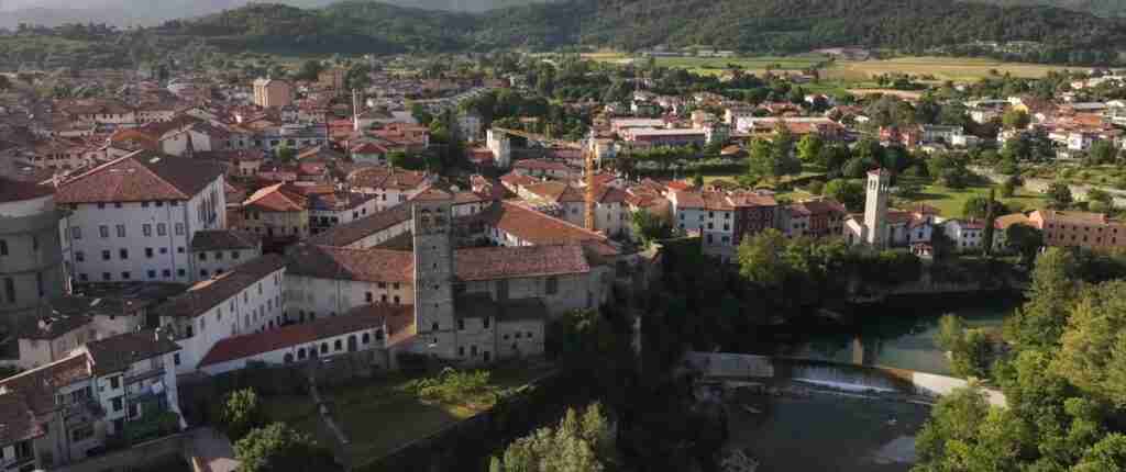
3 days
Northern Italy 3-Day Discovery Tour
- ✓ Comprehensive Northern Italy experience
- ✓ Expert local guides included
- ✓ All accommodation included
- ✓ Transportation provided
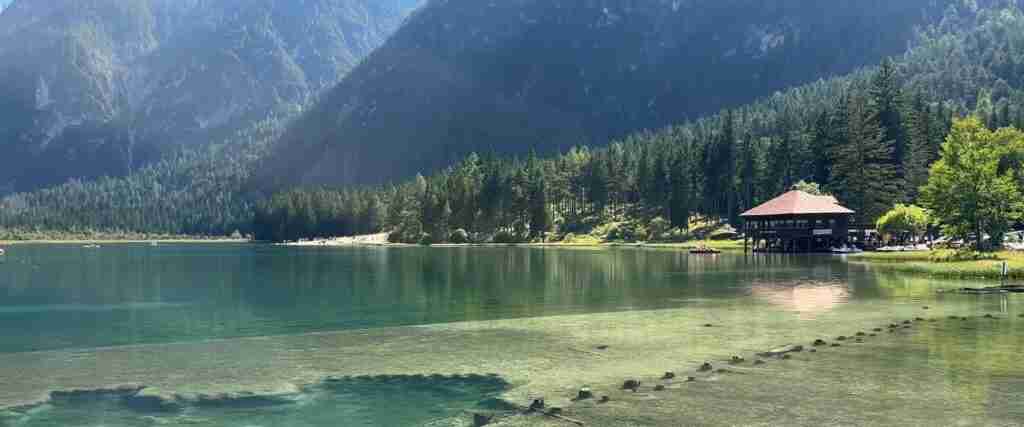
5 days
Northern Italy 5-Day Highlights Experience
- ✓ Comprehensive Northern Italy experience
- ✓ Expert local guides included
- ✓ All accommodation included
- ✓ Transportation provided
7 days
Northern Italy 7-Day Cultural Journey
- ✓ Comprehensive Northern Italy experience
- ✓ Expert local guides included
- ✓ All accommodation included
- ✓ Transportation provided
10 days
Northern Italy 10-Day Complete Adventure
- ✓ Comprehensive Northern Italy experience
- ✓ Expert local guides included
- ✓ All accommodation included
- ✓ Transportation provided
Multi-day tour packages powered by TourRadar. Prices and availability subject to change.
Introduction: A Valley That History Forgot to Simplify
Most European border zones become simplified over time. One language wins, one architectural tradition dominates, one cuisine absorbs the others. The Val Canale never underwent that simplification. Hemmed in by high mountains on three sides, it was too narrow to absorb large populations and too strategically positioned to be ignored by any of the powers that successively controlled it — the Bishops of Bamberg, the Habsburgs, the Venetian Republic, the Kingdom of Italy, and finally the democratic republics of Italy, Austria, and Slovenia that emerged from the wreckage of the 20th century.
The result is a valley where Baroque Austrian architecture stands next to Friulian farmhouses, where a church bulletin might be written in three languages, where the same dish appears on menus under three different names, and where locals switch languages mid-sentence as naturally as they switch sides of the road on a hairpin bend. It is not a theme-park multiculturalism, but the genuine, slightly complicated product of centuries of coexistence.
Geographically, the route described here follows the Val Canale from west to east — from Tarvisio toward the Slovenian border — before looping south to the Laghi di Fusine and Cave del Predil, and finally ascending north toward the Austrian tripoint. It can be driven in a single long day, but two days allows a far more satisfying immersion. Three days permits hiking, lake swimming, and extended cultural exploration. The route’s total distance covers roughly 80 kilometers of road, but the real journey is measured in cultural layers rather than kilometers.
Understanding the Three Worlds of the Val Canale
The “three worlds” of the title are not metaphorical. They are historical and linguistic realities that shaped every building, every recipe, and every name on this route.
The first world is Italian and Friulian. Friuli is not simply northeastern Italy — it is a region with its own Romance language (Friulian, or Furlan), its own architectural traditions, its own culinary identity centered on cured meats, polenta, and the distinctive pasta dishes of the mountains. Tarvisio sits at the outermost reach of this Friulian world, the point where Italian administrative and cultural influence meets its Alpine limits. The food at the westernmost end of the route is most strongly Friulian — rye bread, smoked meats, mountain cheeses, and the sweetly stuffed pasta called cjarsons.
The second world is Germanic and Carinthian. For much of the valley’s recorded history, it lay within the ecclesiastical domain of the Bishops of Bamberg in Bavaria, and later under Habsburg Austrian control. Until 1919, the entire Val Canale was Austrian territory; Tarvisio was Tarvis, Malborghetto was Malborghet, Cave del Predil was Raibl. This Austrian century and a half left its mark everywhere: in the steep-roofed painted houses with carved wooden balconies, in the church interiors decorated in Austrian Baroque style, in the tradition of the Krampus festivals that survive to this day, and in the architectural grammar of the valley’s smallest hamlets. The German language persists as a living minority tongue, not an archaeological curiosity.
The third world is Slavic and Slovenian. As the route moves east toward the border at Rateče, Slovenian cultural and linguistic influence increases. Place names shift their phonology, the Julian Alps visible on the skyline are the same mountains that define the Slovenian landscape, and the food begins to reflect Slovenian mountain traditions — honey, wild herbs, dishes that share DNA with Balkan and Central European cuisines rather than with the Italian Mediterranean. The Slovenian community of the Val Canale has its own cultural associations and traditions, maintaining a minority presence that predates the modern national borders by centuries.
Understanding these three layers is not merely intellectual preparation for the route — it is the route’s central subject. Every stop on this journey illuminates a different facet of the same complex cultural inheritance.
The Route at a Glance: Seven Stops Along the Three-Border Corridor
The full route runs east from Tarvisio through the central valley, loops south to the lakes and the mining history of Cave del Predil, then arcs north to the tripoint where three countries share a single mountain ridge. Distances between stops range from 5 to 20 kilometers.
- Stop 1 — Tarvisio: The hub and base town, 754 meters elevation, 15 km from the Austrian border.
- Stop 2 — Monte Santo di Lussari: The cable-car summit sanctuary, accessible from Camporosso in Valcanale, 6 km from Tarvisio.
- Stop 3 — Malborghetto: The most historically intact village on the route, with the Palazzo Veneziano Ethnographic Museum, 12 km from Tarvisio.
- Stop 4 — Valbruna: A hamlet of extraordinary Alpine quietness, starting point for Val Saisera, adjacent to Malborghetto.
- Stop 5 — Cave del Predil: The former silver-mining village with military history museum, 14 km south of Tarvisio via the SP76.
- Stop 6 — Laghi di Fusine: Two glacial lakes at the edge of the Slovenian border, 20 km from Tarvisio.
- Stop 7 — The Dreiländereck: The Austria-Italy-Slovenia tripoint, 10 km north of Tarvisio.
Stop One — Tarvisio: Gateway to the Borderlands
Tarvisio announces its border-zone identity before any single building does — it is in the air, in the mix of cars with Italian, Austrian, and Slovenian plates, in the shop windows offering products from three culinary traditions, in the frequency with which conversations in the central piazza shift between languages mid-sentence. The town sits at 754 meters in a natural basin where three Alpine valleys converge, surrounded by the Foresta di Tarvisio, the largest state forest in Italy at over 22,000 hectares of protected mountain woodland.
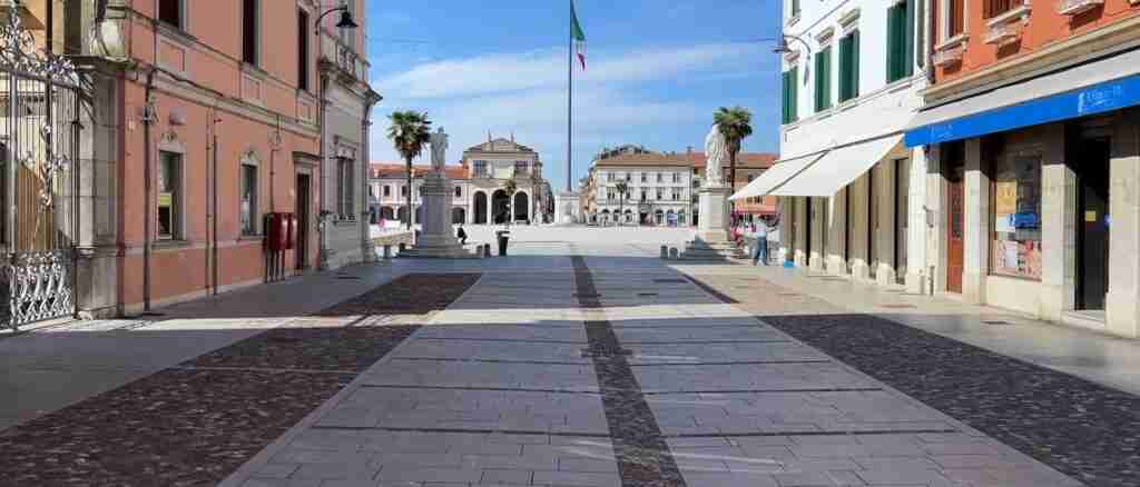
The town center is compact and walkable. Piazza Unità, the main square, is anchored by the Chiesa dei Santi Pietro e Paolo, a 15th-century church whose interior contains a cycle of Gothic frescoes that represent the most important medieval artistic heritage in the valley. Beside the church, the remains of a medieval tower — the Torre Medievale — preserve traces of earlier frescoes on its inner walls. Neither building is grand by Italian urban standards, but both carry the particular atmospheric weight of structures that have served communities through centuries of political upheaval and cultural transition.
The Tarvisio market is a phenomenon in its own right. Operating on specified market days throughout the year, it draws shoppers from all three bordering countries to a cross-border commercial tradition that predates the modern nations surrounding it. Austrian and Slovenian products appear alongside Italian goods on the same stalls, and the bargaining atmosphere reflects a long history of practical trans-national exchange. For visitors, it is less a shopping event than an anthropological spectacle — a visible demonstration of the economic interdependence that has always made the valley function.
The Foresta di Tarvisio deserves at least a short walk even from travelers who are not dedicated hikers. The forest is ancient, dense, and genuinely wild in character, with centuries-old conifers creating a cathedral-like atmosphere on even the shortest trail. Several marked paths leave directly from the town’s outskirts. The Sentiero del Pellegrino — the Pilgrim’s Path — follows a historic route through the forest toward Monte Lussari, used for centuries by pilgrims of all three national traditions before the cable car made the summit accessible to everyone.
Stop Two — Monte Santo di Lussari: The Sanctuary of Three Peoples
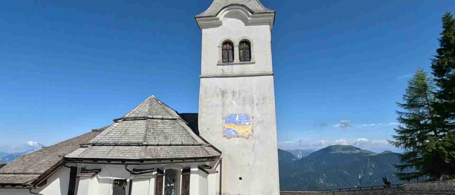
At 1,790 meters, Monte Lussari wears a small village on its summit like a crown. The cable car departing from Camporosso in Valcanale, roughly 6 kilometers from Tarvisio, reaches the top in a journey of approximately 12 minutes, delivering passengers into one of the most atmospheric mountain sanctuaries in the eastern Alps. The cable car operates daily; check current schedules with local tourist offices as hours vary by season.
The Santuario di Monte Lussari — the Sanctuary of the Holy Mount of Lussari — traces its founding to a miraculous apparition first recorded in written sources in 1360, though local tradition places the origins earlier. The church that stands today reflects multiple rebuilding phases across the centuries, but the essence of the place transcends its architecture: this is a summit that three different national Catholic communities have climbed, separately and together, for over six hundred years. The designation “sanctuary of three peoples” is not a marketing tagline but a theological and historical statement — it acknowledges that the Austrian, Slovenian, and Italian faithful each approach the same sacred site from their own direction, via their own traditional pilgrimage routes, with their own liturgical customs.
The effect of standing at the summit is difficult to articulate in purely descriptive terms. On a clear day, the panorama encompasses the peaks of three countries simultaneously. The Julian Alps stretch east toward Slovenia’s Triglav National Park; the Carnic Alps extend west into Italian Friuli; the Austrian Carinthian plateau opens to the north. The three worlds visible below are the same three worlds whose cultural inheritance this entire route explores. From this elevation, the artificial nature of the borders is unmistakably clear — the mountains follow their own logic, indifferent to the flags planted at their feet.
The summit village contains several mountain restaurants serving food that blends all three culinary traditions — Austrian-style dumplings alongside Friulian polenta, Slovenian honey-based desserts beside Italian coffee. In winter, the northern slopes of Monte Lussari become a ski resort whose international pedigree includes World Cup competition on the Prampero run, a demanding descent that has challenged elite racers for decades.
For hikers, the descent on foot via the Sentiero del Pellegrino through the Foresta di Tarvisio is the preferred way to return to the valley — a route of roughly 2.5 hours that passes through old-growth forest and delivers a physical understanding of the landscape that no cable car can provide.
Stop Three — Malborghetto and the Palazzo Veneziano
Twelve kilometers east of Tarvisio, the village of Malborghetto presents the most architecturally coherent historic center on the route. Its old town — a single main street of painted houses with carved wooden galleries, steep slate roofs, and stone portals bearing the carved dates of their construction — is the kind of place that appears to have changed very little since the valley was Austrian territory. The appearance is not accidental: Malborghetto was a flourishing market town and iron-processing center under the Bishopric of Bamberg, and its prosperity during that period produced the building stock that survives today.
The Palazzo Veneziano is Malborghetto’s most significant structure and the home of the Museo Etnografico del Canal del Ferro — Val Canale, the essential starting point for understanding the valley’s history and culture. Built in 1569 by Giorgio Paul, a wealthy iron industrialist from Gemona del Friuli, the palace took its name from the Canal family of Villach who inherited it in 1646 — the “Veneziani” (Venetians) of local tradition, reflecting the Adriatic origins of the family’s commercial network. Its Italian-inflected architecture stood apart from the Germanic style of its neighbors from the moment of its construction, and the name has stuck for four centuries.
The museum organized within its walls is one of the most intelligently curated small ethnographic collections in northeastern Italy. The ground floor moves through geology, paleontology, and the prehistoric human presence in the valley, before examining the mining history of the Raibl silver and lead mines at Cave del Predil — contextualizing the next stop on the route before you reach it. The first floor traces 400 years of the Palazzo’s own history, functioning as a house museum and a chronicle of Val Canale economic and social life. The second floor dedicates itself to the Tarvisio Forest and the industrial traditions of the 19th and early 20th centuries, with sections on forestry, iron-working, and the seasonal rhythms of mountain life. A newer pavilion examines the Christmas and Easter traditions of the valley, including the famous Krampus processions that remain a living cultural practice. Admission is modest; exhibitions are labeled in Italian, German, Slovenian, and English.
In the garden outside the palace, a centuries-old lime tree — a natural monument of considerable age — grows beside the building’s stone walls. Its canopy has shaded this courtyard through the entire historical arc that the museum documents within.
The Chiesa dei Santi Filippo e Giacomo opposite the palace is worth a brief visit for its well-preserved Gothic interior, which carries decorative elements reflecting the Austrian Baroque period without abandoning the earlier structural character of the building. Malborghetto’s main street, Via Bamberga — named for the Bavarian bishopric that governed the valley for centuries — rewards slow walking; the carved balconies and painted facades carry dates ranging from the 16th to the 18th century, and the village has preserved its visual integrity with evident civic pride.
Stop Four — Valbruna and the Wild Val Saisera
Adjacent to Malborghetto, the hamlet of Valbruna is where the Alpe-Adria Trail deposits long-distance walkers coming from Austrian Carinthia. It is a place of almost theatrical Alpine quietness — a scattering of farmhouses and guesthouses beneath peaks that drop steeply into the valley floor, with the Val Saisera opening behind it as one of the region’s most unspoiled wild valleys.
Val Saisera is not a destination in the conventional sense — there is no monument to visit, no cable car to take, no attraction at its end. It is instead a place to be present in, a glacially carved corridor of meadows, forest, and rock walls that extends several kilometers from the valley floor before reaching the high alpine terrain below the Austrian border ridge. The path that follows the valley floor — the Saisera Wild Track — is straightforward enough for most walkers in appropriate footwear, requiring no technical skill but rewarding extended attention.
The experience of Val Saisera operates on a register that differs from the cultural and historical richness of the route’s other stops. Here the three worlds of the borderlands are reduced to a single world — mountain wilderness that predates all three cultures and will outlast them. The peaks visible at the valley’s head form part of the same ridge as the Dreiländereck tripoint; walking toward them is walking toward the border in its most literal, pre-political sense.
Valbruna also serves as one of the better overnight bases for travelers wanting to explore the route slowly. Several small guesthouses and agriturismo properties offer the combination of mountain quietness and proximity to all the route’s main stops within a short drive. The absence of a large tourist infrastructure is part of the point.
Stop Five — Cave del Predil: A Ghost Town Reborn
The road south from Tarvisio along the SP76 climbs through forest before descending into the bowl containing Cave del Predil — in German, Raibl — a village whose existence was entirely predicated on the mineral wealth beneath its foundations. Silver, lead, and zinc were extracted from these mountains from at least the medieval period until the closure of the mines in 1991, and for five centuries the village was an industrial settlement in an Alpine setting, its population’s livelihood entirely dependent on what could be pulled from the rock.
The mine closure left Cave del Predil in a condition common to resource-extraction communities across Europe — a physical infrastructure designed for a purpose that no longer existed, inhabited by a reduced population that had to reinvent the village’s relationship to its landscape. The reinvention has been partial but genuine. The Museo Storico Militare (Military History Museum) has established itself in the village as one of the more substantial collections in the region, dedicating multiple rooms to the Napoleonic campaigns in this corridor, to the First World War fighting that raged through the Julian Alps just kilometers from here, and to the Second World War period when the Val Canale’s position made it repeatedly significant to military planners of successive regimes. The collection has an immediacy that derives from geography — these are not battles fought elsewhere, but battles fought on the specific mountains visible through the museum windows.
The mining heritage itself remains present in the village’s built fabric. Old industrial structures, workers’ housing blocks, and the remnants of mining infrastructure create an architectural landscape different from every other stop on the route — this is not picturesque Alpine village heritage but the heritage of labor and extraction, functional and undecorated. For travelers interested in industrial history, the contrast with Malborghetto’s patrician Palazzo Veneziano is eloquent.
A few kilometers from the village center, the Lago del Predil (Lago di Raibl) demonstrates that nature can produce beauty that industrial history cannot diminish. The lake’s water is a cold, clear turquoise-green of unusual intensity, fed by Alpine snowmelt and contained between mountain walls that drop directly into its surface. A path circumnavigates the lake, and the surrounding rock faces attract climbers throughout the warmer months. Swimming is possible in summer, though the water remains cold. The lake’s visual character — the juxtaposition of industrial village history directly above and natural splendor directly below — encapsulates something essential about the Val Canale’s layered complexity.
Stop Six — The Laghi di Fusine: Alpine Jewels at the Edge of Slovenia
The Laghi di Fusine — two glacial lakes set within the Parco Naturale dei Laghi di Fusine, roughly 20 kilometers from Tarvisio near the village of Fusine in Valromana — represent the route’s most photographed and emotionally immediate destination. Lago Inferiore (the lower lake) and Lago Superiore (the upper lake) sit in a glacially carved basin at approximately 900 and 924 meters respectively, enclosed on three sides by the peaks of the Julian Alps and connected by a short trail through mixed conifer forest.
The lakes’ visual quality shifts continuously with season and light. In early summer, when snowmelt feeds them at maximum volume, they carry a vivid jade-green color that borders on surreal — an effect produced by the combination of glacial mineral content, depth, and the angle of mountain light. In autumn, the larch trees surrounding the basin turn gold, and the reflection in the lake surface doubles the color. In winter, partial freezing creates ice patterns at the shoreline while the water beneath retains its green-blue luminosity. Each season presents a recognizably different version of the same extraordinary place.
The Sentiero dei Laghi — the Lakes Trail — connects the two lakes in a circuit of roughly 2 to 3 hours at a gentle pace suitable for families with children. The path passes through old-growth forest where conifers of considerable age create a high canopy, the forest floor covered in typical alpine understory plants. Wildlife is genuinely present — this is not a managed landscape but a functioning natural ecosystem where deer, chamois, and occasional evidence of brown bear and wolf territory are found by those who pay attention.
The Laghi di Fusine sit within a few hundred meters of the Slovenian border. Looking east from the upper lake toward the peaks on the horizon is looking into Triglav National Park, Slovenia’s only national park and the natural landscape that defines the Slovenian national identity as completely as any political symbol. The border here is invisible and bureaucratically irrelevant within the Schengen zone, but the visual transition — the same Alpine landscape continuing seamlessly into another country — makes the arbitrariness of national divisions more vivid than any map.
The nearby Rifugio Zacchi, a mountain hut accessible from the lakes on a hiking trail, offers one of the route’s best opportunities for a meal at altitude with views that justify the short climb. It also serves as a staging point for longer hikes into the Julian Alps toward the Slovenian side. Booking ahead is strongly recommended during summer weekends.
Stop Seven — The Dreiländereck: Standing in Three Countries at Once
The Dreiländereck — the Three Countries Corner — is the point on the Austrian-Italian-Slovenian border where all three national territories share a single geographic coordinate. Located near the Austrian town of Arnoldstein and the Slovenian village of Rateče, the tripoint sits at approximately 561 meters on the slopes of Monte Forno (Ofen in German, Peč in Slovenian), accessible from the Italian side via Tarvisio and from the Austrian side via Arnoldstein.
The practical reality of the tripoint is straightforward: a monument marks the spot, multiple hiking trails converge on it, and the surrounding landscape offers panoramic views across all three countries. Within the Schengen Zone, crossing the borders involves nothing more than stepping from one side of a stone marker to another — no passport checks, no formal procedures, just the slightly vertiginous experience of occupying a single square meter of ground that belongs simultaneously to three different legal systems.
From the Austrian side, a chairlift (the Dreiländereck Bergbahnen) ascends to a summit complex with a restaurant and viewing platform, making the tripoint accessible to visitors who prefer not to hike. The walking routes from the Italian side are clearly marked and generally take 1 to 3 hours depending on starting point and fitness level; the trail from Tarvisio through the forest is one of the more rewarding approaches.
What elevates the Dreiländereck beyond a geographical curiosity is the historical and political significance of this particular meeting point. The current borders were drawn after World War One, when the Treaty of Saint-Germain transferred the entire Val Canale from Austria to Italy in 1920. For half a century that followed, the borders were heavily fortified, the crossing points monitored, and movement between the three countries regulated and often restricted. The Cold War divided Austria (neutral) from Yugoslavia (communist) while Italy (NATO) sat between them. What is today a pleasant half-day hike to a monument was, within living memory, a militarized frontier zone where the political geography of the 20th century made itself physically felt.
The old border infrastructure — watch towers, redundant customs buildings, marked crossing points now converted to cycling paths — survives in various states of preservation along the route, particularly at the Rateče-Tarvisio crossing where the former border architecture on both sides remains visible from the road. For travelers interested in how Europe’s 20th century political geography is written into its physical landscape, these remnants are as eloquent as any museum.
Flavors of the Borderlands: A Cuisine Shaped by Three Cultures
The culinary identity of the Val Canale is not Italian in any recognizable Mediterranean sense. It is an Alpine borderlands cuisine shaped by the same three cultural traditions that shaped the architecture and the language — and, like the architecture and the language, it is richer for the complexity.
From the Friulian tradition, the valley inherits its most distinctive pasta. Cjarsons (also spelled cjarçons in Friulian orthography) are a sweet-and-savory stuffed pasta unique to the Carnic Alps, typically filled with a combination of ricotta, herbs, dried fruit, raisins, cinnamon, and bitter chocolate, then served with browned butter and smoked ricotta. No single recipe exists — every household and every restaurant in the valley maintains its own closely guarded variant, and the debate over which filling combination is authentic is a perennial feature of regional gastronomy. Blecs are another Friulian mountain pasta, irregular flat pieces made from a buckwheat-and-flour mix that give them an earthy, slightly nutty flavor; they are typically served with mushroom sauce, game ragù, or smoked ham. The valley’s smoked meats and cured products reflect the mountain preservation traditions common across the Alpine arc, but with the particular character of Friulian smoking techniques applied to local game and pork.
From the Austrian and Germanic tradition, the valley takes its appetite for hearty stewed meats, dumpling-based dishes, and pastry techniques. Gulasch appears on every menu, here with a slight alpine inflection that distinguishes it from its Hungarian ancestor. Canederli — the Italian name for Knödel, bread dumplings that may contain speck, liver, or herbs — are made throughout the valley in forms that reflect both Tyrolean and Carinthian recipes. Strudel, in both apple and savory variants, is as present on the valley’s dessert menus as it is in Vienna. The tradition of Strucchi — small fried or baked pastries filled with walnuts, dried figs, and honey — bridges the Austrian pastry tradition and the Friulian sweet-making heritage, claimed by both and belonging to neither exclusively.
From the Slovenian tradition, the valley absorbs a preference for wild herbs, forest products, and honey-based preparations that reflect the Julian Alps landscape immediately across the border. Potica — a rolled pastry with walnut filling — appears at celebrations and in bakeries near the eastern end of the valley. Honey from mountain apiaries, particularly varieties flavored with linden blossom and forest flora, is produced locally and sold at markets throughout the area. Freshwater fish from the clear mountain streams — trout above all — is prepared in ways that show Slovenian influence in the herb and spice combinations used.
The practical result of this culinary convergence is that the best restaurants in the valley serve menus that would be impossible to place in any single national tradition. A meal at one of Malborghetto’s better establishments might move from Friulian cjarsons through Austrian-style braised venison to a Slovenian honey dessert, accompanied by wine from the nearby Collio DOC or local beer from Carinthian-influenced craft producers. This is not fusion cuisine in the contemporary sense — it is the organic product of centuries of neighboring kitchens borrowing from and adapting each other’s techniques.
Local wines are worth noting. While the Val Canale itself is too high and cold for viticulture, the nearby Collio DOC and Friuli Colli Orientali DOC wine regions lie within 60 to 80 kilometers to the southwest, producing some of Italy’s finest white wines from varieties including Friulano, Ribolla Gialla, and Pinot Grigio. Restaurants in Tarvisio and Malborghetto maintain good selections of these wines, and the short drive to the wine country itself is a natural extension of the borderlands route for travelers with time to spare.
Practical Planning for the Tarvisio Borderlands Route
The Val Canale is served by the A23 motorway (Autostrada Alpe Adria) connecting Udine to Villach in Austria, making the corridor easily accessible by car from both Italian and Austrian directions. Tarvisio has a railway station with connections to Udine (approximately 90 minutes) and Villach (approximately 30 minutes), though train frequency is moderate and does not serve all route stops directly.
By car: A rental car from Udine, Trieste, or Venice gives maximum flexibility and is the most practical option for covering all seven route stops in two or three days. Parking in Tarvisio and Malborghetto is straightforward and inexpensive. The Laghi di Fusine car park charges a modest entry fee during peak summer season; arrive before 9:00 AM on summer weekends to secure a space without queuing.
By public transport: Regional bus services operated by SAF connect Tarvisio to Malborghetto, Cave del Predil, and several other valley villages. Schedules thin considerably outside summer months; the tourist office in Tarvisio maintains current timetables. The Laghi di Fusine are reachable by bus to Fusine in Valromana followed by a short walk or taxi. The Alpe-Adria cycle path, which runs the length of the valley on a converted railway bed, provides a car-free alternative for cyclists and is fully paved and gentle in gradient.
Accommodation: Tarvisio offers the widest range of accommodation including several hotels, B&Bs, and holiday apartments suitable as a base for the entire route. Malborghetto-Valbruna has several smaller guesthouses and agriturismo properties that offer a more intimate stay in the valley’s quietest and most atmospheric corner. Cave del Predil and Fusine in Valromana provide limited options suited primarily to hikers. Booking in advance is essential during August and the Christmas-New Year ski period.
Border crossing practicalities: All three countries (Italy, Austria, Slovenia) are members of the Schengen Area, meaning no passport controls exist at any crossing point within the route. EU and Schengen-area citizens need only a national identity document; non-EU visitors should carry their passport. Currency is euro throughout, with some establishments near the Austrian border accepting occasional cash transactions in Austrian contexts — but euro is universally accepted on all three sides.
Language: English is understood in hotels and the main tourist infrastructure of Tarvisio. In smaller villages and off-route establishments, Italian is the primary working language, with German often more useful than English in interactions with older local residents. A few basic words in each of the three local languages is received warmly and communicates genuine interest in the valley’s cultural complexity.
Mobile and connectivity: Coverage in the valley is generally good along the main road corridor, though it becomes patchy in Val Saisera and on higher trails. Download offline maps before leaving Tarvisio for any hiking excursion. The Alpe-Adria Trail app provides useful navigation support for the long-distance route.
When to Walk This Route
The Tarvisio borderlands offer a distinct character in every season, and no single period is objectively superior — the choice depends on what the traveler is seeking.
Summer (June to August) is the high season, bringing the clearest lake conditions, the full operation of all cable cars and mountain facilities, and the widest availability of accommodation and restaurant services. The Laghi di Fusine reach their most dramatic visual intensity in late June when snowmelt is still active, and the long daylight hours allow extended hiking days. The trade-off is that weekends in July and August bring significant crowds to the lakes and to Monte Lussari. Arriving midweek, or before 8:00 AM on summer weekends, sidesteps the worst of the crowds at both lake destinations.
Autumn (September to November) is the period favored by most independent travelers who know the valley. September combines summer-like temperatures, reduced crowds, and the beginning of the larch-and-deciduous foliage color shift that transforms the forest from green to copper and gold across October. The Laghi di Fusine in October, with fallen larch needles carpeting the shoreline and the surrounding forest luminous with autumn color, is among the most visually spectacular scenes in the eastern Alps. Mushroom season runs through October, and local restaurants build seasonal menus around porcini, chanterelles, and other forest fungi. November brings the first snow to higher elevations and the beginning of the Christmas preparation season, including Krampus processions in late November that are among the valley’s most distinctive cultural events.
Winter (December to March) activates the skiing infrastructure on Monte Lussari and the Austrian Nassfeld slopes accessible from Pontebba. The valley itself takes on a different character under snow — the painted facades of Malborghetto gain an additional layer of visual drama against white backgrounds, the forests are navigable on snowshoes, and the cross-border skiing circuit (the Three Countries Ring) allows skiers to cover terrain in all three nations on a single pass. The lakes freeze partially, creating compositions of ice and deep-water color that photographers travel considerable distances to capture.
Spring (April to May) is the quietest and in some ways most rewarding season for cultural exploration. Snow retreats from the valley floor while remaining on the peaks, wildflower meadows emerge below the treeline, and the valley’s accommodation and restaurant infrastructure operates without the pressure of peak season. The pilgrimage season to Monte Lussari traditionally begins in spring, and the atmosphere of the sanctuary in this shoulder period — visited by genuine pilgrims rather than primarily by tourists — carries a different emotional character than the busy summer crowds suggest.
Frequently Asked Questions
How long does the Tarvisio borderlands route take to complete?
A minimum of two full days allows meaningful engagement with all seven stops on the route, though without extensive hiking time at any individual location. Three days permits a more unhurried pace — including a hike in Val Saisera, a summit walk on Monte Lussari, and a full lake circuit at the Laghi di Fusine. Travelers adding the Dreiländereck on foot rather than by chairlift should budget an additional 3 to 4 hours for the walking excursion from Tarvisio.
What is the best base for exploring the borderlands?
Tarvisio is the most practical base, with the widest accommodation choice, direct motorway access, and a railway station. It places all seven route stops within 20 kilometers. Malborghetto-Valbruna offers a quieter and more atmospheric alternative for travelers who prioritize village character over logistics — it sits centrally in the corridor and is within 20 minutes’ drive of all other stops. Cave del Predil and Fusine in Valromana have very limited accommodation and function better as day excursions than as bases.
Is the Alpe-Adria Trail suitable for non-expert cyclists?
Yes. The Alpe-Adria Radweg through the Val Canale section follows a converted railway track — the former Pontebbana line — on a paved surface with very gentle gradients. It requires no technical cycling skill and is suitable for standard touring bikes. The full Alpe-Adria trail connects Salzburg in Austria to Grado on the Adriatic; the Val Canale section is a self-contained segment that can be ridden in a single day between Tarvisio and the Austrian border at Arnoldstein, or extended into Slovenia toward Kranjska Gora via the Rateče crossing.
When does the Monte Lussari cable car operate?
The cable car at Camporosso operates year-round with seasonal variations in schedule. In general terms, it runs from approximately 9:00 AM to 5:15 PM on weekdays and from 8:30 AM to 6:15 PM on Sundays during the main tourist seasons, with modified winter hours. Schedules change between summer and winter operation; check directly with the Tarvisio tourist office or the cable car operator for current timetables before planning your visit, as days and hours vary by month.
Are the Laghi di Fusine accessible without a car?
The lakes sit approximately 4 kilometers from the village of Fusine in Valromana, which is served by regional bus from Tarvisio. From the village, the car park and lake entrance are reachable on foot in under 30 minutes via a flat forest road. Alternatively, local taxi services in Tarvisio cover the trip to the lakes at reasonable rates for small groups. During summer, it is also possible to hire bicycles in Tarvisio and reach the lakes via the secondary valley road.
What wildlife might I encounter on the route?
The Foresta di Tarvisio and the surrounding Alpine terrain support a complete mountain wildlife community. Roe deer, red deer, and chamois are commonly seen in the forest margins and on higher trails. The forest also provides territory for brown bear and wolf, both present in the wider Julian-Carnic Alps ecosystem, though sightings require significant luck and are more likely at dusk and dawn in remote sections. Golden eagles nest on the cliff faces above Val Saisera. The lakes host various waterfowl and raptors. Marmots are visible on rocky terrain above the treeline from spring through early autumn.
Is the Museo Etnografico in Malborghetto worth visiting for non-Italian speakers?
Yes. The museum’s exhibitions include labels in Italian, German, Slovenian, and English, making it accessible to international visitors. The collection’s physical objects — mining tools, agricultural implements, traditional costumes, geological specimens, dioramas of historical activities — communicate much of their meaning independently of language. The sections on Krampus traditions and on the Tarvisio Forest are particularly well-presented. Guided tours are available on request for groups with advance booking; the tourist office in Malborghetto can arrange multilingual guides for independent travelers.
Can I cross into Austria or Slovenia easily from this route?
Crossing is completely straightforward. All three countries are in the Schengen Zone, meaning no border controls exist at crossing points. The road crossing at Rateče connects directly to the Slovenian town of Kranjska Gora, the gateway to Triglav National Park, in under 10 minutes from the Italian side. The crossing at Coccau connects to Arnoldstein and Austrian Carinthia in approximately the same time. Both crossings are open 24 hours and require no documentation beyond a standard ID or passport. Kranjska Gora, the Jasna Lakes, and the Vrsic Pass in Slovenia make natural half-day extensions from the Fusine end of the route.
What is the Saisera Wild Track and how difficult is it?
The Saisera Wild Track is a marked trail following the Val Saisera from Valbruna into the wild valley behind the village. It follows the valley floor on a well-defined path through mixed forest and alpine meadows, gaining relatively modest elevation in its lower sections. The trail is rated as easy-to-moderate for its main accessible portion and requires standard hiking footwear but no technical alpine experience. Extended versions of the route climb toward the Austrian border ridge at higher grades. The lower valley section can be completed as a comfortable 3-to-4-hour out-and-back walk for most fit travelers.
Is the Tarvisio borderlands route suitable for families with young children?
The route is well-suited to family travel. The cable car to Monte Lussari is safe and exciting for children; the summit has a playground alongside the restaurant facilities. The Laghi di Fusine Sentiero dei Laghi trail is flat, short, and explicitly recommended for families. The Malborghetto museum engages younger visitors with its geological specimens and dioramas. Cave del Predil’s military history museum holds significant interest for children with curiosity about historical objects and machinery. Val Saisera’s lower sections are straightforward for older children and present genuine wilderness in an accessible format. The main road through the valley carries moderate traffic but has pedestrian infrastructure in all villages.