
Vancouver History Guide: From Indigenous Peoples to Modern Metropolis
Vancouver’s transformation from ancient Coast Salish territories into one of North America’s most dynamic cities spans thousands of years of human history. The land now occupied by the modern metropolis has supported thriving Indigenous communities since time immemorial, witnessed dramatic colonial expansion in the late 19th century, and evolved into a global city that continues to grapple with its complex past while building toward its future. This guide explores the deep Indigenous roots, tumultuous colonial encounters, and rapid urbanization that shaped Vancouver into the city recognized today.
Key Takeaways About Vancouver’s Historical Development
- Unceded Indigenous Territory: Vancouver occupies the traditional, ancestral, and unceded territories of three Coast Salish nations—the xʷməθkʷəy̓əm (Musqueam), Sḵwx̱wú7mesh (Squamish), and səlilwətaɬ (Tsleil-Waututh) peoples who have stewarded these lands for millennia without ever surrendering them through treaty
- Archaeological Continuity: Sites like the Marpole Midden demonstrate continuous Indigenous occupation spanning at least 4,000 years, with oral histories indicating populations of up to 10,000 people in the region before European contact disrupted established social and economic systems
- Catastrophic Early Development: The newly incorporated City of Vancouver burned completely to the ground on June 13, 1886—just two months after incorporation—destroying 600 to 1,000 buildings and killing at least 21 people in a fire that lasted approximately 25 minutes
- Railway-Driven Transformation: The Canadian Pacific Railway’s decision to establish its western terminus at Granville in 1885 transformed a small sawmill settlement of approximately 900 people into a major city, with the population reaching 14,000 by 1891 and 120,000 by 1911
- Strategic Pacific Gateway: Vancouver’s development as the western terminus of Canada’s transcontinental railway and a major Pacific port positioned the city as a crucial node in global trade networks, particularly the British Empire’s All-Red Route connecting Asia to Europe
- Ongoing Reconciliation: Contemporary Vancouver continues to address the legacy of colonization, residential schools, and displacement of Indigenous peoples, with formal land acknowledgments and partnership initiatives representing initial steps in a longer reconciliation process
People Also Ask About Vancouver History
Which Indigenous Nations Originally Inhabited Vancouver?
Vancouver is located on the unceded traditional territories of three Coast Salish nations: the xʷməθkʷəy̓əm (Musqueam), Sḵwx̱wú7mesh (Squamish), and səlilwətaɬ (Tsleil-Waututh) peoples. These hən̓q̓əmin̓əm̓ and Sḵwx̱wú7mesh sníchim speaking peoples have maintained continuous occupation of these lands since time immemorial—a term conveying that their presence extends beyond living memory. The territory was never ceded or given up to the Crown through treaty, meaning these nations retain inherent rights and jurisdiction over their ancestral lands. The Musqueam people’s connection to the Fraser River Estuary spans at least 4,000 years based on archaeological evidence from the Marpole Midden, while Tsleil-Waututh oral history indicates their great nation was approximately 10,000 strong before European contact. The Squamish saw Point Grey as their southern territorial boundary, with their lands extending north along the coast and into the mountains.
When Was Vancouver Founded as a City?
The City of Vancouver was officially incorporated on April 6, 1886, when the township of Granville was renamed following the Canadian Pacific Railway’s selection of the location as its western terminus. The name change from Granville to Vancouver was insisted upon by CPR president William Van Horne, who believed the association with Vancouver Island would be more recognizable to eastern Canadians than the existing name. However, this incorporation date represents only the formal colonial establishment of the city—the area had been home to thriving Indigenous communities for thousands of years before European settlement began in the 1860s. The first European settlement in the area was the Hastings sawmill, founded in 1867 on what is now the site of the container port. The informal settlement that grew around early saloons and services became known as Gastown, named after John “Gassy Jack” Deighton who established a saloon in 1867 to serve mill workers.
What Caused the Great Vancouver Fire?
The Great Vancouver Fire of June 13, 1886 was caused by land-clearing fires set by the Canadian Pacific Railway to prepare land for urban development and railway infrastructure. Two separate clearing fires were burning that day—one clearing land for the CPR roundhouse to the southwest of the city, and another near Cambie and Cordova streets to expand the city westward. The spring of 1886 had been exceptionally dry and hot, creating tinder-dry conditions throughout the heavily forested area. When a sudden windstorm arose from the west on that Sunday afternoon, the flames quickly spread beyond the workers’ control, whipped into a firestorm by gale-force winds. The fire raced through the predominantly wooden structures of the two-month-old city faster than people could run, consuming the entire settlement in approximately 25 minutes. Between 600 and 1,000 buildings were destroyed, at least 21 people died (though the exact toll remains unknown due to the transient population), and survivors fled to the shores of Burrard Inlet or False Creek to escape the flames.
How Quickly Did Vancouver Grow After the Railway Arrived?
Vancouver experienced explosive population growth following the Canadian Pacific Railway’s arrival, transforming from a frontier settlement into a major city within two decades. The population jumped from approximately 900 people in 1885 (before the CPR terminus was announced) to several thousand within months of incorporation in 1886. Despite the devastating fire in June 1886, the city’s population reached 1,000 by the end of that year, surged to 14,000 by 1891, and hit 26,000 by 1901. By 1911, just 25 years after incorporation, Vancouver’s population had exploded to 120,000 people. This dramatic growth was directly tied to the city’s strategic position as the western terminus of Canada’s transcontinental railway and its development as a major Pacific port. The completion of the railway link to eastern Canada in 1887, combined with Vancouver’s natural deep-water harbor, positioned the city as a crucial node in global trade networks, particularly the British Empire’s All-Red Route that dramatically shortened shipping times between Asia and London.
Extended multi-day tours – 5+ days
Featured Vancouver Multi-Day Tour Packages
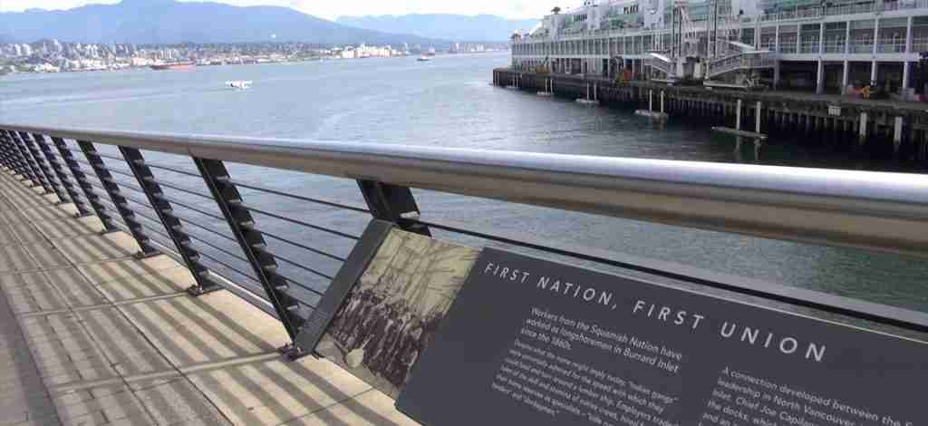
3 days
Vancouver 3-Day Discovery Tour
- ✓ Comprehensive Vancouver experience
- ✓ Expert local guides included
- ✓ All accommodation included
- ✓ Transportation provided
5 days
Vancouver 5-Day Highlights Experience
- ✓ Comprehensive Vancouver experience
- ✓ Expert local guides included
- ✓ All accommodation included
- ✓ Transportation provided
7 days
Vancouver 7-Day Cultural Journey
- ✓ Comprehensive Vancouver experience
- ✓ Expert local guides included
- ✓ All accommodation included
- ✓ Transportation provided
10 days
Vancouver 10-Day Complete Adventure
- ✓ Comprehensive Vancouver experience
- ✓ Expert local guides included
- ✓ All accommodation included
- ✓ Transportation provided
Multi-day tour packages powered by TourRadar. Prices and availability subject to change.
Introduction: Understanding Vancouver’s Layered History
The history of Vancouver represents a complex narrative of continuity and disruption, of ancient Indigenous civilizations and rapid colonial transformation, of catastrophic setbacks and remarkable resilience. Long before European explorers mapped the Pacific Northwest coastline, the lands now known as Vancouver supported sophisticated Coast Salish societies with deep cultural traditions, extensive trade networks, and sustainable resource management practices refined over millennia. These Indigenous nations built permanent villages, developed complex social structures, and maintained spiritual and practical relationships with the land that shaped every aspect of their existence.
The arrival of European explorers in the late 18th century initiated a period of devastating change. Diseases to which Indigenous peoples had no immunity decimated populations that had thrived for thousands of years. Colonial systems displaced communities from their ancestral lands, suppressed cultural practices, and imposed foreign governance structures that disregarded existing Indigenous sovereignty. The late 19th century saw the rapid transformation of a small sawmill settlement into a major city, driven by the transcontinental railway’s appetite for land and labor. The newly incorporated City of Vancouver literally burned to the ground within weeks of its founding, yet rebuilt with remarkable speed to become one of Canada’s most significant urban centers.
Understanding Vancouver’s history requires acknowledging both the deep Indigenous roots that pre-date colonization by thousands of years and the dramatic changes wrought by European settlement in a remarkably compressed timeframe. The archaeological record, oral histories, colonial documents, and contemporary Indigenous voices together reveal a place where ancient patterns of habitation intersect with modern urban development, where unresolved questions about land rights and sovereignty persist alongside twenty-first-century global connections. This history continues to unfold as Vancouver grapples with reconciliation, acknowledges its colonial past, and seeks to honor the Indigenous peoples whose unceded territories it occupies.
Indigenous Foundations: Coast Salish Territories and Cultures
The xʷməθkʷəy̓əm (Musqueam), Sḵwx̱wú7mesh (Squamish), and səlilwətaɬ (Tsleil-Waututh) nations are the original inhabitants of the lands now known as Vancouver, with a presence that extends back thousands of years before European contact. These Coast Salish peoples developed sophisticated societies adapted to the abundant resources of the Pacific Northwest—dense forests of towering cedars and firs, rivers teeming with five species of salmon, sheltered marine waters rich with shellfish, seals, and whales, and diverse terrestrial environments supporting deer, elk, and numerous plant species used for food, medicine, and materials. The mild climate and resource abundance allowed these communities to establish permanent villages rather than following a purely nomadic existence, creating the foundation for complex social structures, artistic traditions, and specialized knowledge systems.
The Tsleil-Waututh people’s oral history indicates their nation numbered approximately 10,000 members before European contact, living throughout their traditional territory centered on səlilwət (Burrard Inlet) and the watersheds draining into it. Their name translates to “people of the inlet,” reflecting the deep connection between identity and place that characterizes Indigenous relationships with land. The Musqueam people, whose name xʷməθkʷəy̓əm refers to the məθkʷəy̓ plant (a type of grass that grows in their territory), established villages throughout the Fraser River delta and along the river’s north arm. Archaeological evidence from the Marpole Midden site—an ancient village and burial ground in what is now the Marpole neighborhood—demonstrates continuous Musqueam occupation for at least 4,000 years, making them the oldest documented residents of the Vancouver area. The Squamish people’s territory extended from Point Grey northward along the coast and inland through the mountains, encompassing areas now known as West Vancouver, North Vancouver, and Squamish.
Coast Salish societies organized their annual activities around a sophisticated “seasonal round”—a complex cycle of food gathering, processing, preservation, and spiritual practices that formed the heart of their culture. During winter months, community members congregated in large permanent villages located in sheltered bays and river mouths. These winter villages featured impressive longhouses—shed-roofed cedar structures that could extend several hundred feet in length, divided into individual family apartments with central hearths for heat and cooking. Families subsisted largely on foods gathered, hunted, fished, and processed throughout the rest of the year, their survival dependent on meticulous planning and sophisticated preservation techniques including smoking, drying, and fermenting.
As spring arrived, families dispersed to seasonal camps for specific harvesting activities. Root vegetables like camas bulbs were gathered and processed. Herring spawning events drew communities to specific beaches where the fish could be harvested in enormous quantities. The most important event in the seasonal calendar was the Fraser River salmon run in mid-July through early August, when most Coast Salish peoples, including the Tsleil-Waututh, traveled to the river to catch and dry sockeye salmon—the most prized of the five salmon species. These gathering periods served crucial social functions beyond food procurement—families reconnected with relatives, young people met potential marriage partners, news and stories were exchanged, trade relationships were negotiated, and political alliances were formed or reinforced. The abundance of the salmon runs created surplus wealth that supported artistic production, ceremonial life, and trade with other Indigenous nations.
Following the Fraser River runs, families moved to other river systems—the Indian River, Capilano River, Seymour River, and numerous smaller watersheds—to harvest pink and chum salmon during fall runs. Most of this catch was dried for winter consumption or trade. Berry harvesting occurred throughout the summer, with families gathering and drying vast quantities of salmonberries, blackberries, huckleberries, and soapberries. By December, families returned to their winter villages with the provisions collected throughout the year, and the cycle began again. This pattern had sustained Coast Salish peoples for thousands of years, creating a deep knowledge of environmental patterns, species behavior, and resource management that modern ecologists increasingly recognize as sophisticated and effective.
Coast Salish cultures were characterized by rich artistic traditions expressed through carved cedar work (including canoes, house posts, and ceremonial masks), intricate basket weaving, distinctive wool textiles woven from mountain goat wool and dog hair, and elaborate ceremonial practices including the potlatch—a complex ceremony involving gift-giving, feasting, and the witnessing of important events such as marriages, namings, and the transfer of hereditary privileges. Spiritual beliefs centered on respectful relationships with the natural world, the importance of maintaining balance, and complex protocols for interacting with the spirit beings who inhabited the landscape. Each watershed, mountain, and significant geographical feature held stories, names, and spiritual significance passed down through oral traditions that encoded both cultural values and practical ecological knowledge.
The political organization of Coast Salish societies differed fundamentally from European models. No centralized authority or formal political offices existed in the European sense. Instead, social organization centered on extended family groups and larger kinship networks, with respected leaders gaining influence through demonstrated wisdom, generosity, speaking ability, and spiritual power rather than through formal titles or institutional positions. Property rights, resource access, and spiritual privileges were held by family lines and regulated through complex protocols that European observers often failed to understand, leading to conflicts when colonial systems attempted to impose foreign concepts of land ownership and governance.
Archaeological Evidence of Ancient Occupation
Archaeological sites throughout the Vancouver area provide physical evidence of Indigenous occupation spanning thousands of years, corroborating oral histories that describe a presence extending back to “time immemorial.” The Marpole Midden, located in the modern Marpole neighborhood at the confluence of the Fraser River’s north and south arms, stands as the most significant archaeological site documenting ancient habitation. This massive shell midden—an accumulation of discarded shellfish remains, broken tools, and other refuse that forms a distinctive stratified deposit—demonstrates continuous Musqueam occupation from approximately 2000 BCE until the late 1800s, a span of nearly 4,000 years. The site also served as an important burial ground, containing the remains of ancestors whose presence consecrates the location.
Shell middens like the Marpole site are not merely garbage heaps but complex archaeological archives recording changes in diet, technology, climate, and social organization over millennia. The layered deposits contain evidence of fishing technologies including harpoons, net weights, and specialized salmon processing tools; hunting implements for both terrestrial and marine mammals; woodworking tools made from stone and later metal obtained through trade; personal ornaments revealing artistic preferences and social distinctions; and the remains of thousands of meals that document which species were harvested during different time periods. Analysis of these deposits reveals sophisticated resource management strategies that maintained fish populations and other resources for thousands of years—a stark contrast to the resource depletion that often accompanied European industrial exploitation.
Other significant archaeological sites document the extent and distribution of Indigenous occupation. X̱á:ytem (Hatzic Rock) near Mission, British Columbia, shows established settlement dating to approximately 3000 BCE. The stratified deposits reveal technological innovations, dietary changes, and trade connections with other Indigenous nations throughout the Pacific Northwest. Sites along the Duwamish River estuary in what is now Seattle document continuous Coast Salish occupation from the 6th century CE, demonstrating the cultural continuity across the broader Salish Sea region. Beach sites along Burrard Inlet and throughout the Gulf Islands preserve evidence of seasonal camps, resource processing stations, and travel routes connecting winter villages to seasonal harvesting locations.
Archaeological evidence also reveals extensive trade networks connecting Coast Salish peoples with other Indigenous nations throughout the Pacific Northwest and into the interior plateau regions. Obsidian (volcanic glass used for cutting tools) sourced from interior volcanic regions appears in coastal sites, while dentalia shells (prized as currency and ornament) from the outer coast traveled inland. Copper objects demonstrate connections with nations to the north who had access to native copper deposits. These trade relationships were not purely economic but represented complex social and political connections reinforced through marriages, ceremonial exchanges, and shared protocols.
The archaeological record also documents responses to environmental changes including fluctuations in sea level, shifts in salmon run timing, and variations in shellfish abundance. The adaptability demonstrated in these deposits challenges simplistic notions of “primitive” societies unable to respond to environmental challenges. Instead, the evidence reveals sophisticated societies with deep ecological knowledge, flexible subsistence strategies, and the social organization necessary to mobilize labor for major undertakings like the construction of defensive structures, fish weirs spanning entire river channels, and the massive canoes capable of ocean-going travel.
First European Contact and Colonial Encounters
The arrival of European explorers in the late 18th century marked a turning point in the history of the Pacific Northwest, initiating a cascade of changes that would devastate Indigenous populations and fundamentally transform the region. The first documented European contact with Coast Salish peoples in the Vancouver area occurred in 1791 when Spanish explorers José María Narváez and Juan Carrasco navigated the Strait of Georgia, mapping coastlines and making brief contacts with Indigenous communities. The following year, 1792, Captain George Vancouver of the British Royal Navy led an expedition that made more extensive contact with Squamish people during his survey of the inland waters he named Burrard Inlet after one of his officers.
These initial encounters were brief and relatively benign, characterized by cautious curiosity on both sides and limited direct conflict. European explorers depended on Indigenous knowledge for navigation, obtained provisions from Indigenous communities, and often found themselves vastly outnumbered by populations that could have easily overwhelmed small exploring parties. However, these contacts initiated the transmission of epidemic diseases that would prove catastrophic for Indigenous populations. Smallpox, influenza, measles, and other diseases to which Indigenous peoples had no immunity spread through communities with devastating effect, sometimes arriving ahead of direct European contact as trade networks carried pathogens faster than explorers could travel.
During the 1770s, a smallpox epidemic devastated Indigenous populations inhabiting the Northwest coastline of North America—the first of several waves that would reduce some communities by 80 to 90 percent. The impacts extended far beyond mortality statistics. The loss of elders meant the loss of irreplaceable cultural knowledge, ceremonial protocols, and historical narratives maintained through oral tradition. The social disruption undermined established governance structures, disrupted family relationships that formed the foundation of Coast Salish society, and created conditions of chaos that made resistance to subsequent colonial incursions more difficult. Entire villages were abandoned, resource management systems collapsed, and the balance of power between Indigenous nations shifted as epidemics affected different communities unevenly.
The establishment of fur trading operations brought more sustained European presence to the region. In 1808, Simon Fraser of the North West Company became the first European to traverse the Fraser Canyon and reach tidewater on the Fraser River’s north arm. His expedition encountered Musqueam warriors who attacked and repelled the European party, demonstrating both Indigenous military capability and resistance to intrusion. Throughout the 1810s and 1820s, coastal fur trade extended into Coast Salish territories, with Hudson’s Bay Company posts established at strategic locations including Fort Vancouver (in present-day Washington State) in 1824 and Fort Langley on the Fraser River in 1827.
The fur trade created complex relationships between Indigenous peoples and European traders. Coast Salish communities initially held significant power in these interactions, possessing exclusive knowledge of trapping locations, kinship networks that facilitated trade over vast territories, and the ability to withdraw cooperation if terms proved unfavorable. Indigenous peoples quickly adapted European metal tools, firearms, and other trade goods into their existing technologies and economies. However, the fur trade also introduced alcohol, intensified inter-tribal conflicts as competition for furs increased, and gradually drew Indigenous peoples into dependency on European trade goods. The Hudson’s Bay Company’s establishment of permanent posts created year-round European presence in Indigenous territories, presaging the more intensive colonization that would follow.
The discovery of gold in the Fraser Canyon in 1858 triggered a massive influx of prospectors—the Fraser Canyon Gold Rush brought approximately 30,000 people, predominantly American miners, flooding into the region within months. This sudden demographic shift overwhelmed Indigenous communities, destroyed salmon runs as hydraulic mining operations tore through river systems, and brought violence as miners disregarded Indigenous territorial rights and assaulted community members. The colonial government’s response to this influx was to assert greater control over the territory, declaring British Columbia a crown colony and initiating a more systematic process of settlement and land alienation.
Colonial Land Policies and Indigenous Displacement
The implementation of colonial land policies in the mid-19th century formalized the dispossession of Indigenous peoples from their ancestral territories, establishing legal frameworks that legitimized European settlement while systematically eroding Indigenous rights. British Columbia’s colonial approach to Indigenous land differed from practices in other parts of Canada, creating unique complications that persist into the present. While many regions of Canada negotiated formal treaties with Indigenous nations (however unequal those negotiations might have been), most of British Columbia—including the Vancouver area—was never subject to treaty processes. The colonial government simply assumed sovereignty over Indigenous territories without Indigenous consent, legal justification, or compensation.
The Douglas Treaties, negotiated by James Douglas (then Governor of the Colony of Vancouver Island) with some Vancouver Island nations in the 1850s, represent the only significant treaty negotiations in the region. However, these treaties excluded most Coast Salish nations, including the Musqueam, Squamish, and Tsleil-Waututh. The absence of treaties in the Vancouver area meant that Indigenous title was never extinguished through even the flawed processes used elsewhere. This legal reality—that Coast Salish nations never surrendered their territories—underpins contemporary land rights claims and the description of Vancouver as located on “unceded” Indigenous lands.
The Indian Act, first passed by the Canadian government in 1876, imposed a comprehensive system of colonial control over Indigenous peoples. This legislation designated specific small parcels of land as “Indian Reserves” where Indigenous bands would reside under the authority of government-appointed Indian Agents. The reserve system confined communities to tiny fractions of their original territories—areas often deliberately chosen for their poor agricultural potential or distance from resources that had sustained communities for generations. The Musqueam, Squamish, and Tsleil-Waututh were each assigned multiple small reserves scattered across their territories, fragmenting communities and making traditional seasonal rounds impossible.
The Indian Act also asserted federal control over virtually every aspect of Indigenous life, including governance structures, resource use, movement off-reserve, economic activities, and cultural practices. Indigenous peoples were prohibited from hiring lawyers to challenge land claims, effectively barring legal recourse against the theft of their territories. The potlatch—a fundamental Coast Salish ceremony involving feasting, gift-giving, and the witnessing of marriages, namings, and other significant events—was explicitly banned under an 1884 amendment to the Indian Act. This prohibition was not merely about suppressing a ceremony but represented an attack on the entire social, economic, and spiritual system that organized Coast Salish society. The potlatch ban remained in effect until 1951, seven decades during which the transmission of cultural knowledge, artistic traditions, and social protocols was severely disrupted.
The imposition of the reserve system coincided with aggressive settlement promotion policies that brought waves of European and Asian immigrants to the region. The colonial government granted massive land parcels to the Canadian Pacific Railway and other corporate entities, distributed homestead lands to settlers, and actively marketed British Columbia as a destination for immigration. Indigenous peoples found themselves surrounded by settlements on lands they had never surrendered, with their own mobility restricted and traditional resource harvesting increasingly criminalized as settlers asserted exclusive property rights.
Residential Schools and Cultural Suppression
The residential school system represents one of the darkest chapters in Canadian history, deliberately designed to forcibly assimilate Indigenous children by removing them from their families, communities, and cultures. The system operated on the principle that Indigenous cultures were inferior and should be eliminated, with children viewed as the most efficient targets for cultural destruction. The phrase attributed to Duncan Campbell Scott, Deputy Superintendent of Indian Affairs, encapsulates the system’s goal: “to kill the Indian in the child.”
St. Paul’s Residential School, operated by the Catholic Church in North Vancouver, directly affected over 2,000 children from the Squamish, Tsleil-Waututh, Musqueam, and Sechelt nations. Children as young as five or six were forcibly taken from their families and communities, often by Indian Agents who had the legal authority to apprehend children and prosecute parents who resisted. At the schools, children were forbidden from speaking their languages, practicing their spiritual traditions, or maintaining connections to their cultures. Punishments for speaking Indigenous languages ranged from public humiliation to physical abuse. The goal was complete cultural erasure—replacing Indigenous identities with Christian beliefs, English language, and European cultural norms.
The conditions in residential schools were frequently horrific. Children suffered from inadequate nutrition, inadequate heating, overcrowding, and lack of medical care. Physical abuse was common, with children beaten for minor infractions or speaking their languages. Sexual abuse was widespread and systematic, with predatory staff members exploiting the complete power imbalance and isolation of children from protective family and community members. Emotional abuse was inherent in the system itself—children were taught that their cultures, their families, and their very identities were shameful and inferior. Many children died in residential schools from disease, malnutrition, accidents, and suicide, with some schools operating their own cemeteries.
While attendance was no longer compulsory after 1948, residential schools continued operating until 1996, with some Indigenous children still being forcibly removed from their families in the 1970s and 1980s. The intergenerational trauma of the residential school system continues to affect Indigenous communities profoundly. Survivors who returned to their communities often struggled with addictions, mental health issues, and difficulty forming healthy relationships, having been deprived of normal family interactions and cultural support during their formative years. Many lost their ability to speak their languages fluently, disrupting the transmission of cultural knowledge that traditionally passed from grandparents to grandchildren. The parenting skills and cultural practices that would normally be learned through observation and participation in family and community life were replaced by the institutional regimentation and abuse experienced in schools.
The residential school system was part of a broader pattern of cultural suppression that included the prohibition of potlatches and other ceremonies, restrictions on traditional governance systems, and aggressive promotion of Christianity and European values. Together, these policies constituted what contemporary legal scholars recognize as cultural genocide—a systematic attempt to destroy Indigenous cultures and assimilate Indigenous peoples into the dominant society. The Truth and Reconciliation Commission of Canada, established in 2008 to document residential school experiences and impacts, concluded that the system amounted to cultural genocide and issued 94 Calls to Action addressing Indigenous rights, education, justice, and reconciliation.
Early European Settlement: Gastown and Granville
European settlement in what would become Vancouver began modestly in the 1860s, centered initially on resource extraction rather than urban development. The Hastings Sawmill, established in 1867 on the shores of Burrard Inlet at what is now the site of Vancouver’s container port, represented the first significant European industrial operation in the area. The mill capitalized on the region’s old-growth forests—trees hundreds of years old and hundreds of feet tall that provided premium lumber for export to markets throughout the Pacific Rim and beyond. The mill employed both European workers and Indigenous laborers, the latter bringing sophisticated logging and woodworking knowledge developed over generations.
The mill’s establishment created demand for services to support the workforce. In 1867, John “Gassy Jack” Deighton—a loquacious Yorkshire steamboat captain turned saloon keeper—arrived with his Indigenous wife, her relatives, a few barrels of whiskey, and entrepreneurial ambitions. He established a saloon near the mill to serve workers who previously had to travel to New Westminster for entertainment and alcohol. According to local lore, Deighton convinced mill workers to help him build the establishment in exchange for free drinks, and his verbose nature (hence “Gassy” Jack) made him a memorable character. The informal settlement that grew up around his and subsequent saloons and services became known as Gastown, a name that fell into disuse after the city’s incorporation as Vancouver but was revived during heritage preservation efforts in the 1960s.
Local Coast Salish people had known this area as a portage route between Burrard Inlet and False Creek—at high tide, a canoe could be paddled between the two bodies of water along what is now Carrall Street. A landmark called Lekleki, meaning “grove of beautiful trees,” stood between Abbott and Carrall streets, including a large maple tree that served as a gathering place for early settlers until it burned in the Great Fire of 1886. This geography—connecting the deep-water harbor of Burrard Inlet with the sheltered waters of False Creek—would prove strategically significant when the site was selected for urban development.
By the early 1870s, the settlement that grew around the mill and Gastown was formally surveyed and incorporated as the township of Granville. The population remained small—a few hundred people in scattered wooden buildings housing saloons, general stores, a hotel, and residences. The community maintained a rough frontier character, with most residents involved in logging, sawmill operations, or the service economy supporting those industries. Travel to other settlements required either a nine-mile journey through dense forest to New Westminster or a 30-mile boat journey along the Fraser River from Fort Langley. The isolation and small scale of Granville gave little indication of the dramatic transformation about to occur.
The settlement’s fortunes changed dramatically in 1885 when the Canadian Pacific Railway announced that Granville would serve as the western terminus of Canada’s transcontinental railway. This decision was partially driven by Granville’s superior natural harbor compared to the initially favored Port Moody, but also involved extensive lobbying by local landholders and speculative interests who recognized the enormous value that a railway terminus would bring. The Canadian Pacific Railway received over 6,000 acres of land grants just west of Gastown as inducement to extend the line from Port Moody to Granville—land that would become some of the most valuable urban real estate in Canada.
City Incorporation and Rapid Growth
The announcement that Granville would serve as the CPR terminus triggered immediate transformation. The population jumped from approximately 900 residents in 1885 to several thousand within months as speculators, merchants, laborers, and entrepreneurs flooded into the settlement anticipating the economic opportunities that a major railway terminus would create. Sixteen real estate offices opened to manage the buying, selling, and speculation in land parcels. Wooden buildings sprouted rapidly as businesses established operations to serve the growing population and the anticipated influx of settlers, goods, and capital that the railway would bring.
CPR president William Cornelius Van Horne insisted that the settlement’s name be changed from Granville to Vancouver, believing that association with Vancouver Island—already familiar to eastern Canadians—would have more marketing appeal than Granville, which had no name recognition and associations with the rough frontier town of Gastown. On April 6, 1886, the township of Granville was officially incorporated as the City of Vancouver, becoming British Columbia’s fourth incorporated city. Malcolm MacLean became the city’s first mayor on May 6, 1886, elected by a small electorate of property-holding men. The first city council meeting made a surprising priority decision that would shape the city’s future character—requesting that the federal government transfer the 1,000-acre military reserve for use as a public park, an action that eventually created Stanley Park.
The young city began planning for expansion, surveying and designating land for future development in areas that would become the West End, Kitsilano, and beyond. However, this planning occurred without any consideration of Indigenous land rights or the fact that Coast Salish peoples still occupied the territories. Areas designated for parks and development included Indigenous village sites, resource harvesting locations, and sacred areas. The push to clear land and begin construction proceeded with urgency, driven by the anticipation of the railway’s arrival and the desire to establish Vancouver as a major Pacific port before competing cities could seize opportunities.
The Great Vancouver Fire
On June 13, 1886—just two months and seven days after Vancouver’s incorporation—the newly established city was completely destroyed by fire in one of the most dramatic catastrophes in Canadian urban history. The conflagration that became known as the Great Vancouver Fire consumed the city in approximately 25 minutes, reducing 600 to 1,000 wooden buildings to ash, killing at least 21 people (though the exact toll remains unknown due to the transient population), and leaving approximately 1,000 residents homeless and without food or supplies. The speed and totality of the destruction shocked observers—a functioning city vanished in less than half an hour.
The fire originated from land-clearing operations being conducted to prepare for urban expansion and railway infrastructure. Two separate clearing fires were burning that Sunday: one clearing land for the CPR roundhouse and terminus facilities to the southwest of the city, and another near the intersection of Cambie and Cordova streets clearing land for westward expansion. Land clearing typically involved burning slash—the stumps, branches, and accumulated debris left after logging operations—a common practice but one that required careful attention to weather conditions and fire control. Unfortunately, the spring of 1886 had been exceptionally dry and hot, leaving forests and the cleared areas covered in tinder-dry fuel.
Throughout the morning and early afternoon of June 13, crews worked to manage the clearing fires while volunteers from the town assisted with buckets, wet blankets, and shovels. Water for fighting the first fire came from False Creek, while the second fire used water from the hand-pump well at the recently constructed Regina Hotel. The men believed they had the fires under control until, in the early afternoon, the prevailing westerly breeze strengthened into gale-force winds. The sudden wind whipped the flames beyond the workers’ control, and the fire exploded through the dry timber, widening as it rushed eastward toward the densely packed wooden structures of Vancouver.
As the fire approached, the bell of St. James’ Church at Powell and Westminster Road (now Main Street) rang frantically, providing the first warning for many residents. Men ran ahead of the flames shouting warnings, but the fire moved faster than they could run, leaping from treetop to treetop and descending onto the defenseless town with a roar. The newly formed fire brigade, established only on May 28, possessed no fire engine and was still awaiting equipment from Ontario. Armed only with axes and shovels, firefighters could do nothing against a firestorm driven by gale-force winds through a city built entirely of wood.
Residents fled toward the shores of Burrard Inlet and False Creek, the only refuge from the advancing flames. Some reached the water in time and survived by immersing themselves while the fire passed overhead. Others were overcome by the heat and smoke before reaching safety. The wooden sidewalk along Hastings Road (now Hastings Street) acted like a fuse, carrying flames faster than people could run. Contemporary accounts describe scenes of chaos and terror as families separated, possessions were abandoned, and people made desperate decisions about which direction offered the best chance of survival. Squamish first responders played crucial roles in the rescue efforts, using their canoes to save people who had fled to the water and providing assistance that the city formally acknowledged in 2017.
When the fire finally burned itself out, having consumed everything combustible in its path, the destruction was nearly total. Only a handful of buildings survived—the Bridge Hotel, built of heavier timbers and situated in a location that escaped the worst of the flames, remained standing and was converted into a makeshift morgue. Bodies recovered from the ruins were often unrecognizable, making identification impossible. The exact death toll remains unknown because many residents were recent arrivals whose names were not recorded, and some bodies may have been completely consumed by the intense heat. Contemporary newspaper reports varied widely in their casualty estimates, reflecting the confusion and lack of reliable information in the fire’s immediate aftermath.
Recovery and Reconstruction
Despite the catastrophic destruction, Vancouver’s recovery was remarkably rapid, driven by the economic incentives that had attracted settlers in the first place and the determination to establish the city as Canada’s Pacific gateway before competitors could seize the opportunity. Within days of the fire, residents erected white canvas tents and simple shelters among the ruins, searching through wreckage for anything salvageable. The CPR Hotel—later the Hotel Vancouver—became the first building to be completely rebuilt, symbolizing the railway company’s commitment to the city and its terminus. Within two weeks, businesses along Cordova Street between Carrall and Abbott streets had reopened in basic structures, resuming commerce even as reconstruction continued around them.
The fire’s aftermath prompted crucial decisions about the city’s rebuilding. The city council organized the main streets to be planked, creating proper thoroughfares rather than the muddy paths that had characterized the frontier settlement. More significantly, building codes were revised to require brick or stone construction for major buildings in the downtown core, reducing fire risk and creating the foundation for a more substantial, permanent city. Within six months of the fire, 500 buildings had been constructed, many built from brick brought from New Westminster and Victoria. These new buildings reflected Victorian architectural styles popular in the British Empire, with ornate facades, substantial construction, and designs appropriate for a city with metropolitan aspirations rather than a frontier settlement.
Communication about the disaster relied on Vancouver’s single telephone—a relatively new technology in 1886, with Alexander Graham Bell’s patent dating only to 1876. Hugh Keefer, who had been contracted to build a road from Port Moody to Coal Harbour, used this telephone to alert the outside world. Word reached New Westminster quickly, and the larger town immediately organized relief efforts. Horsemen galloped through New Westminster streets shouting that Vancouver had burned and people were without food. Housewives hurriedly prepared supplies—hard-boiled eggs in baking powder tins, fried bacon between thick slices of bread, and other preserved foods that could travel. This prompt assistance from neighboring communities provided crucial support during the initial recovery period.
The Canadian Pacific Railway played a central role in reconstruction, both because of its massive land holdings in the city and its vested interest in establishing Vancouver as a functioning terminus. The CPR provided employment for thousands through construction projects, imported building materials on favorable terms, and promoted the city to potential settlers and investors. The company’s influence extended beyond economics into civic planning, with CPR preferences shaping decisions about street layouts, neighborhood development patterns, and the location of major institutions.
By the end of 1886, Vancouver’s population had reached 1,000 people—returning to pre-fire levels and continuing to grow. The first regular transcontinental train from Montreal arrived at a temporary terminus at Port Moody in July 1886, and service extended to Vancouver itself in May 1887. This connection to eastern Canada transformed Vancouver from an isolated western settlement into an integrated component of the national economy and the global trade networks accessible through the transcontinental railway. Goods could now flow from Asian ports through Vancouver to eastern Canadian markets and onward to Europe via Atlantic shipping, with the railway dramatically reducing transit times compared to sailing around Cape Horn or using the narrow and dangerous Strait of Magellan.
Railway Era Expansion and the Port Development
The completion of the transcontinental railway connection in 1887 catalyzed explosive growth that transformed Vancouver from a frontier town into a major city within two decades. The railway provided reliable year-round transportation linking British Columbia to the rest of Canada for the first time, ending the isolation that had characterized the province since its entry into Confederation in 1871. More significantly, the railway positioned Vancouver as the western anchor of what became known as the All-Red Route—a shipping and rail network spanning the British Empire that connected Asian ports through Vancouver to London via the Canadian railway and Atlantic steamships.
The Port of Vancouver developed rapidly to handle the commerce flowing through this transcontinental-transoceanic connection. The city’s natural deep-water harbor at Burrard Inlet provided an ideal location for port facilities, requiring minimal dredging or improvement compared to other potential Pacific ports. Wharves extended into the inlet, warehouses multiplied along the waterfront, and specialized facilities developed to handle different types of cargo—lumber exports, grain from the Prairie provinces, manufactured goods from eastern Canada and Europe, and diverse imports from Asia including silk, tea, and other commodities. By 1900, Vancouver had become one of North America’s busiest ports, with tonnage increasing each year as trade volumes grew.
The railway brought waves of immigration that dramatically diversified Vancouver’s population. British and European immigrants arrived seeking economic opportunities in a growing city. Chinese workers who had labored on railway construction during the 1880s settled in Vancouver despite facing severe discrimination, establishing what became one of North America’s largest Chinatown communities. Japanese immigrants established fishing, logging, and commercial operations. South Asian immigrants, primarily Sikhs from Punjab, arrived in the early 20th century despite restrictive immigration policies designed to maintain British Columbia’s white majority. Each community faced distinct forms of discrimination and exclusion, but collectively they contributed essential labor and entrepreneurship that fueled the city’s economic expansion.
The city’s population growth trajectory was dramatic: 1,000 residents in 1886, 14,000 by 1891, 26,000 by 1901, and 120,000 by 1911. This 25-year period saw Vancouver transform from a small frontier settlement into the third-largest city in Canada, trailing only Montreal and Toronto. The rate of growth exceeded most North American cities and reflected both natural increase and massive immigration flows. This rapid expansion created constant pressure for new housing, infrastructure expansion, and service provision, with city boundaries extending steadily outward to encompass areas that had been forest or farmland just years earlier.
Urban development during this period followed patterns common to North American cities of the era but adapted to Vancouver’s specific geography and social composition. The downtown core, rebuilt after the fire with substantial brick and stone buildings, housed commercial operations, offices, banks, and the institutions of civic administration. The West End, designated early as an upscale residential neighborhood by CPR-connected speculators, developed with large single-family homes occupied by the city’s economic elite. Working-class neighborhoods emerged closer to industrial employment—near the port facilities, sawmills, and factories that provided jobs for the majority of residents. Ethnic enclaves formed partly by choice and partly through exclusionary practices that restricted where non-white residents could purchase property or rent housing.
Stanley Park, the 1,000-acre military reserve that the city council had requested be transferred for park use at their very first meeting, was formally established in 1888 and named after Lord Stanley, Canada’s Governor General who dedicated the park during an 1889 visit. However, the creation of this “pristine wilderness” park required the eviction of Indigenous residents and other inhabitants who lived throughout the area. Coast Salish peoples had multiple villages and seasonal camps in what became Stanley Park, using the area for resource harvesting, spiritual practices, and as part of their seasonal rounds. Through the 1880s and into the 1920s, Indigenous residents were progressively evicted as “squatters”—a term that ignored their thousands of years of occupation and unceded rights to the territory. Other long-term residents, including Portuguese fishermen and mixed-race families, were similarly displaced. By the 1920s, the park had been cleared of most human habitation, creating the illusion of untouched nature that has characterized Stanley Park’s presentation ever since.
Immigration, Diversity, and Exclusion
Vancouver’s growth was inextricably linked to immigration, with waves of newcomers from diverse origins seeking opportunities in the rapidly expanding city. However, this immigration occurred within the context of explicitly racist policies at both federal and provincial levels, creating a city where economic integration occurred alongside severe legal and social discrimination. Understanding this period requires acknowledging both the contributions of diverse communities and the systematic exclusions they faced.
Chinese immigration to British Columbia began during the Fraser Canyon Gold Rush in the 1850s and increased dramatically during railway construction in the 1880s. Chinese laborers performed some of the most dangerous work on the Canadian Pacific Railway, including blasting through mountains and working in conditions that killed hundreds. Despite these contributions, Chinese immigrants faced intense hostility from white settlers who viewed them as economic competition and racial inferiors. Following the railway’s completion, the federal government imposed a head tax on Chinese immigrants in 1885—initially $50, increasing to $100 in 1900 and $500 in 1903 (equivalent to approximately two years’ wages for most workers). The tax effectively prevented Chinese laborers from bringing family members to Canada, creating a severely imbalanced population of predominantly male workers unable to establish families. In 1923, the Chinese Immigration Act (informally known as the Chinese Exclusion Act) virtually banned Chinese immigration until its repeal in 1947.
Despite these barriers, Vancouver’s Chinatown became one of the largest in North America, centered on Pender and Main streets. Chinese merchants, herbalists, restaurants, grocers, and service providers created a self-sufficient community that served both Chinese residents and the broader city. Chinatown’s development occurred on land that had been part of Indigenous territories and included the site of the Lekleki grove—the “grove of beautiful trees” that had been an Indigenous gathering place. The concentration of Chinese residents in Chinatown reflected both voluntary community formation and restrictive covenants that prohibited Chinese people from purchasing property in most areas of the city.
Japanese immigration to British Columbia began in the 1880s and increased significantly after 1900. Japanese immigrants established themselves in fishing (where they owned substantial portions of the fishing fleet), logging, shipbuilding, small business, and agriculture. The Japanese Canadian community developed its own neighborhood, known as Japantown or Little Tokyo, adjacent to Chinatown. Cultural organizations, Japanese-language schools, Buddhist temples, and commercial establishments created a vibrant community with strong ties to Japan while simultaneously building roots in Canada. However, anti-Asian sentiment frequently targeted Japanese Canadians along with Chinese residents. The 1907 Vancouver anti-Asian riots saw white mobs attacking Chinatown and Japantown businesses, destroying property and assaulting residents. While no one was killed, the riots demonstrated the violent racism that Asian communities faced.
South Asian immigration, primarily Sikh men from Punjab, began arriving in significant numbers in the early 20th century. Many found employment in the lumber industry, working in sawmills and logging camps. The Sikh community established Canada’s first gurdwara (Sikh temple) in Vancouver in 1908, creating a religious and community center that served the growing population. However, the Canadian government implemented increasingly restrictive immigration policies targeting South Asian immigration, including the continuous journey regulation of 1908 that effectively banned Indian immigration by requiring immigrants to travel to Canada via continuous journey from their country of origin—impossible given that no shipping lines offered such service from India to Canada. The Komagata Maru incident of 1914, where a ship carrying predominantly Sikh passengers was refused entry to Vancouver harbor and forced to return to India after a two-month standoff, exemplified the explicit racism of Canadian immigration policy.
European immigrants faced fewer formal barriers but experienced their own forms of discrimination based on ethnicity and class. British immigrants were generally viewed most favorably, benefiting from cultural affinity with Canadian institutions modeled on British patterns. Other European groups—Italians, Greeks, Eastern Europeans, Scandinavians—occupied intermediate positions in Vancouver’s racial hierarchy, generally able to access employment and housing denied to Asian and Indigenous residents but sometimes facing prejudice and restricted opportunities. The city’s social geography reflected these hierarchies, with neighborhoods developing distinct ethnic characters and residential patterns revealing which groups could access desirable locations.
This complex pattern of immigration, contribution, and exclusion shaped Vancouver’s development profoundly. The city’s economic growth depended on the labor of diverse immigrant communities, yet provincial and federal policies systematically denied these communities full participation in economic and civic life. The legacy of these exclusions—including the Chinese head tax, the Chinese Exclusion Act, the continuous journey regulation, anti-Asian riots, and the internment of Japanese Canadians during World War II—continues to affect Vancouver’s contemporary social landscape and has become the subject of formal government apologies and reconciliation efforts.
Early 20th Century Development
The period from 1900 to the First World War represented Vancouver’s emergence as a mature city with established institutions, substantial infrastructure, and a self-conscious urban identity distinct from its frontier origins. The city’s population growth continued at a remarkable pace, reaching 120,000 by 1911 and making Vancouver the third-largest city in Canada. This growth was accompanied by significant infrastructure development, the establishment of major civic institutions, and the consolidation of economic patterns that would characterize the city for decades.
The streetcar system expanded throughout the city, with electric trams replacing horse-drawn vehicles and providing affordable transportation that allowed residential development to extend beyond walking distance from employment centers. The British Columbia Electric Railway Company operated extensive streetcar lines radiating from downtown to newly developing neighborhoods, effectively shaping urban growth patterns by making certain areas accessible while leaving others isolated. The streetcar suburbs that developed along these lines featured different housing types than the dense downtown core—detached single-family homes with yards, reflecting middle-class aspirations and the abundance of available land.
Major civic buildings constructed during this period reflected Vancouver’s ambitions and growing prosperity. The second Hotel Vancouver, opened in 1916, represented world-class hospitality architecture. The Carnegie Centre, built in 1903 with funding from philanthropist Andrew Carnegie, provided library services and meeting spaces. The Dominion Building, completed in 1910, was briefly the tallest building in the British Empire, symbolizing Vancouver’s economic significance. The Marine Building, completed in 1930 in Art Deco style, represented the aesthetic sophistication and confidence of a city that had moved far beyond its frontier origins. These buildings were constructed using the brick, stone, and later concrete and steel that had replaced wood after the Great Fire, creating a substantial urban landscape built to last.
The Port of Vancouver continued expanding to handle increasing trade volumes. Specialized facilities developed for different commodities—grain terminals for Prairie wheat, lumber facilities for British Columbia’s forestry products, coal handling for Vancouver Island coal, and general cargo facilities for manufactured goods and diverse imports. By the 1920s, Vancouver was handling more tonnage than any other Canadian port, surpassing even Montreal despite the latter’s longer history and central Canadian location. This port activity generated thousands of jobs in stevedoring, warehousing, transportation, and port administration, making the waterfront a crucial source of working-class employment.
Labor organizing became increasingly significant as working-class residents sought to improve wages and conditions through collective action. Longshoremen, sawmill workers, and construction laborers formed unions and periodically struck for better terms. The Winnipeg General Strike of 1919, while centered in Manitoba, inspired sympathy strikes in Vancouver and contributed to growing labor militancy throughout the 1920s and 1930s. The city’s political landscape reflected these class tensions, with conservative business interests dominating city council while working-class neighborhoods developed more radical political cultures. The Depression years of the 1930s intensified these tensions as unemployment soared, relief programs proved inadequate, and Vancouver became a gathering point for unemployed men from across the country.
Chinatown and the Downtown Eastside
The development of Chinatown represents one of the most significant chapters in Vancouver’s multicultural history, illustrating both the resilience of immigrant communities and the impacts of systematic racism. As noted earlier, Chinese immigration began during the gold rush era and increased during railway construction, but it was after the CPR’s completion that a substantial Chinese community established permanent roots in Vancouver. The head tax and eventual exclusion policies created a predominantly male community unable to bring wives and children from China, fundamentally shaping Chinatown’s character and demographics.
Vancouver’s Chinatown developed centered on Pender Street and Main Street, becoming the largest Chinese community in Canada and one of the largest in North America. The neighborhood featured distinctive architecture blending Chinese design elements with Canadian building codes—buildings with recessed balconies, ornate facades incorporating Chinese motifs, and signage in Chinese characters. Narrow streets and alleyways created a dense urban fabric quite different from the more spacious character of other Vancouver neighborhoods. This density reflected both Chinese cultural preferences for urban living and the economic pressures facing a community that was largely working-class and restricted in where they could purchase property.
Within Chinatown, Chinese merchants and service providers created a comprehensive economic and social infrastructure. Restaurants, groceries, herbalists, import-export firms, clan associations, temples, and benevolent societies provided services, maintained cultural connections to China, and created mutual support networks crucial for a community facing external hostility. Chinese opera, traditional celebrations of Lunar New Year and other festivals, and maintenance of Cantonese language and culture allowed Chinese Canadians to preserve their heritage while adapting to life in Vancouver. Clan associations and hometown associations provided new immigrants with initial assistance, employment connections, and social networks based on family name or region of origin in China.
The Chinatown that developed in the early 20th century was simultaneously a vibrant ethnic neighborhood and a product of exclusionary housing policies and racism. Restrictive covenants in property deeds throughout much of Vancouver explicitly prohibited sale or rental to Chinese, Japanese, South Asian, and sometimes Jewish buyers or tenants. These restrictions, combined with limited financial resources and systematic discrimination in employment and lending, meant that Chinese residents concentrated in the few areas where they could establish businesses and secure housing. The result was a neighborhood that served community needs but also reflected the marginalization of its residents.
The area around Chinatown that became known as the Downtown Eastside developed as Vancouver’s most economically challenged neighborhood, housing transient workers from resource industries, the elderly and disabled without family support, and people struggling with mental health issues and addictions. The Gastown area, which had been Vancouver’s commercial heart in the 1880s and 1890s, declined as the city’s commercial center shifted westward along Granville Street. By the early 20th century, Gastown and the surrounding Downtown Eastside were characterized by cheap hotels, second-hand stores, and services catering to migrant workers who spent only part of the year in the city, working in logging camps, canneries, mines, and farms during working seasons and returning to Vancouver during off-seasons.
World War II and Japanese Canadian Internment
World War II brought dramatic changes to Vancouver and particularly affected the Japanese Canadian community in ways that remain one of the most shameful chapters in Canadian history. Following Japan’s attack on Pearl Harbor in December 1941, anti-Japanese sentiment on the West Coast of North America intensified dramatically. The Canadian government, under pressure from British Columbia politicians and succumbing to racist fears, implemented policies that fundamentally violated the rights of Japanese Canadians regardless of their citizenship status.
In February 1942, the federal government ordered the removal of all persons of Japanese ancestry from a 100-mile “protected zone” along the Pacific coast. This order affected approximately 22,000 Japanese Canadians, about 75 percent of whom were Canadian citizens by birth. Families were given extremely short notice to settle their affairs, with authorities forbidding them from taking most possessions. Fishing boats owned by Japanese Canadians were immediately impounded—destroying livelihoods and a substantial economic asset. Properties were sold by government custodians at fire-sale prices, with owners having no ability to negotiate or refuse. Businesses, homes, and personal property were liquidated with proceeds supposedly held in trust, though many Japanese Canadians received only a fraction of their properties’ value.
Japanese Canadians from Vancouver and coastal communities were sent to internment camps in British Columbia’s interior—essentially prisoner-of-war camps despite the fact that these were Canadian citizens who had committed no crimes. Families were separated, with men often sent to different locations than women and children. The camps consisted of crude facilities, often without proper heating, running water, or adequate shelter. Internees were required to work in the camps or in agriculture, with minimal compensation. Children’s education was disrupted, businesses and careers were destroyed, and the psychological trauma of being declared enemy aliens in their own country was profound.
Unlike in the United States, where Japanese American internment ended with the war, Canada maintained restrictions on Japanese Canadians’ movement and rights until 1949. Many were not allowed to return to the coast until years after the war ended. Vancouver’s thriving Japantown, centered on Powell Street with hundreds of businesses, homes, cultural organizations, and community institutions, was effectively destroyed. When Japanese Canadians were finally allowed to return, they found their former properties occupied by others, their community infrastructure dispersed, and a generation of younger Japanese Canadians who had grown up in the interior or who had been deported to Japan. The neighborhood that had been Little Tokyo became absorbed into the Downtown Eastside and Chinatown, its Japanese character largely erased.
The internment represented both explicit racism and opportunistic property seizure, with many white British Columbians benefiting economically from acquiring Japanese Canadian properties and businesses at far below market value. The Canadian government did not formally apologize for the internment until 1988, and even then the compensation provided to survivors and their families represented only a fraction of the economic losses suffered, to say nothing of the psychological and cultural damage. The Japanese Canadian community never fully recovered its pre-war economic position or community cohesion, and Vancouver’s Japantown exists today only as a designation and a memory rather than as a functioning ethnic enclave comparable to Chinatown.
Post-War Suburbanization and Metropolitan Expansion
The decades following World War II brought transformative changes to Vancouver’s urban form, economy, and demographic composition. Post-war prosperity, population growth, and the automobile’s increasing dominance reshaped Greater Vancouver from a relatively compact city centered on downtown and connected by streetcars into a sprawling metropolitan region of independent municipalities connected by highways and characterized by suburban development patterns.
Veterans returning from war and benefiting from federal housing programs created enormous demand for new housing. Rather than expanding existing neighborhoods with apartments or row houses, development patterns favored detached single-family homes on large lots in newly created subdivisions. Burnaby, Coquitlam, Surrey, Richmond, and other municipalities surrounding Vancouver proper saw explosive growth as developers purchased farmland and built tract housing. These suburbs followed the automobile-oriented patterns becoming standard throughout North America—wide streets, large lots, minimal sidewalks, and separation of residential areas from commercial districts. Residents commuted to downtown Vancouver or to industrial employment in separate districts, requiring automobile ownership and contributing to the decline of public transit.
The destruction of Vancouver’s extensive streetcar system between 1940 and 1955 exemplified the shift toward automobile dependency. Electric streetcar lines that had shaped urban development for decades were dismantled and replaced with buses—a change that transit advocates later identified as a catastrophic mistake that prioritized short-term cost savings over long-term transit quality. Vancouver would not regain rapid transit until the opening of the SkyTrain system in 1985, three decades after the last streetcar ran. The loss of streetcars coincided with massive investments in highway infrastructure, including the construction of bridges connecting Vancouver to the North Shore and suburbs to the south and east.
Downtown Vancouver underwent significant changes during this period, not all positive. Urban renewal projects demolished entire neighborhoods deemed “blighted” without adequate consideration of the communities being displaced or the architectural heritage being destroyed. Strathcona, a working-class neighborhood east of Chinatown with substantial Chinese and Italian populations, faced demolition plans for a freeway that would have destroyed the neighborhood entirely. Community organizing and protest in the late 1960s and early 1970s succeeded in stopping the freeway, preserving Strathcona but highlighting the tensions between planning officials’ modernist visions and existing community interests.
Gastown, which had declined into skid row status by the 1960s, underwent controversial revitalization beginning in the late 1960s. Developers recognized the potential value of the neighborhood’s Victorian architecture and historical associations. Buildings were renovated rather than demolished, streets were redesigned with period-appropriate paving and furnishings, and the area was rebranded as a heritage district emphasizing its role as Vancouver’s birthplace. The famous Gastown steam clock, installed in 1977, became an iconic tourist attraction despite being a modern creation designed to cover a steam vent. However, this gentrification displaced low-income residents who had lived in the area’s cheap hotels and rooming houses, contributing to tensions that persist between heritage tourism and social service provision in the broader Downtown Eastside.
Immigration Reform and Multicultural Vancouver
The liberalization of Canadian immigration policy in the 1960s and 1970s fundamentally transformed Vancouver’s demographic composition, economy, and cultural character. The elimination of explicitly racist provisions in immigration law—the head tax had been formally apologized for and rescinded, the Chinese Exclusion Act had been repealed, and a points-based immigration system replaced policies designed to maintain white Anglo-Saxon dominance—opened Canada to immigrants from Asia, Africa, Latin America, and other regions previously excluded.
Vancouver, with its Pacific location and historical Asian community presence, became a primary destination for Asian immigrants. Significant Chinese immigration resumed after decades of restriction, with immigrants arriving from Hong Kong, Taiwan, and eventually mainland China. These post-1967 Chinese immigrants differed significantly from the earlier working-class Cantonese-speaking population—many arrived with substantial capital, university education, and professional qualifications. This created tensions within the Chinese Canadian community as newcomers and long-established residents had different priorities, resources, and relationships with Chinese culture. Hong Kong immigration increased dramatically in the years before the 1997 handover to China, with thousands of families seeking to establish Canadian residence as insurance against political uncertainty.
South Asian immigration, primarily from India’s Punjab region but also from other parts of the subcontinent, transformed the ethnic composition of suburbs like Surrey and Richmond. Sikh temples (gurdwaras), Hindu temples, and South Asian businesses became prominent features of these communities. South Asian Canadians established themselves across multiple economic sectors—from transportation and construction to technology and professional services—contributing to both the mainstream economy and ethnic economy serving community needs.
Filipino, Vietnamese, Korean, and immigrants from other Asian countries arrived in increasing numbers from the 1970s onward, each establishing community organizations, religious institutions, and commercial districts that reflected their cultures while adapting to Canadian life. Vietnamese refugees fleeing after the fall of Saigon in 1975 and subsequent boat people arrivals created a significant Vietnamese Canadian community in Greater Vancouver. Korean immigration increased dramatically in the 1980s and 1990s, with many families investing in businesses or real estate.
This demographic transformation made Greater Vancouver one of North America’s most ethnically diverse metropolitan regions. By the 1990s and 2000s, no single ethnic group constituted a majority in several municipalities, and visible minorities collectively approached or exceeded 50 percent of the population in areas like Richmond. This diversity became both a source of civic pride and a source of tension, as debates about multiculturalism, integration, housing affordability, and language use reflected different visions of what Vancouver should be.
The transformation of formerly white working-class suburbs into multiethnic communities changed everything from retail patterns to school programming to electoral politics. Richmond’s malls featured predominantly Chinese-language signage and businesses catering to Asian customers. Surrey’s Punjabi population made it one of the largest concentrations of South Asians outside India. These changes sometimes generated backlash from long-established residents uncomfortable with rapid demographic shifts, while simultaneously creating vibrant, cosmopolitan communities that challenged earlier assumptions about Canadian identity requiring cultural assimilation.
Indigenous Urban Presence and Rights Movements
While Vancouver’s history is often narrated as a story of European settlement and subsequent immigration, Indigenous peoples never left the city—they adapted to urban environments while maintaining distinct identities and asserting rights to their unceded territories. Understanding contemporary Vancouver requires acknowledging the ongoing Indigenous presence and the rights movements that have challenged the city’s colonial foundations.
The Musqueam, Squamish, and Tsleil-Waututh nations maintained their reserves despite displacement and colonial pressure, with these territories becoming increasingly valuable as urban development surrounded them. The reserves—initially designated as marginal lands distant from settlement centers—found themselves adjacent to or within the expanding metropolis. This geography created both opportunities and challenges, as reserve lands became prime real estate even while residents often lacked infrastructure, services, and economic opportunities comparable to surrounding non-Indigenous neighborhoods.
Indigenous people from across British Columbia and Canada migrated to Vancouver for employment, education, and services unavailable in remote reserve communities or northern regions. This created a substantial urban Indigenous population distinct from the reserve-based communities, with different needs and challenges. The Vancouver Aboriginal Friendship Centre, established in 1963 as the second such center in Canada (after Toronto), provided services supporting urban Indigenous peoples’ transition to city life while maintaining cultural connections. The Friendship Centre offered employment assistance, cultural programming, social services, and community gathering spaces that became crucial for people navigating between Indigenous cultures and urban Canadian society.
The rights movement that gained momentum in the 1960s and 1970s saw Indigenous peoples across Canada organizing to assert land rights, protest the impacts of colonialism, and demand recognition of treaties and Aboriginal title. In British Columbia, where most Indigenous nations had never signed treaties, land claims became particularly significant. The Musqueam, Squamish, and Tsleil-Waututh nations began asserting rights to their unceded territories, including lands occupied by Vancouver itself. These claims were not merely historical grievances but assertions of ongoing sovereignty and jurisdiction over territories that had never been legally surrendered.
Key court cases advanced Indigenous rights, including the Calder case (1973) which established that Aboriginal title had existed in law before European colonization and might still exist. The 1982 constitutional recognition of Aboriginal and treaty rights provided additional legal framework for asserting claims. The Musqueam nation’s 1984 court victory establishing their right to determine lease rates on reserve land leased to a golf course demonstrated the potential for economic benefits from asserting jurisdiction, though the case also generated significant backlash from non-Indigenous residents who had built homes on leased Musqueam land without fully understanding the lease terms.
The British Columbia treaty process, initiated in the 1990s, aimed to negotiate modern treaties with Indigenous nations that had never signed historic treaties. The Musqueam, Squamish, and Tsleil-Waututh nations entered this process, though progress has been slow and contentious. Negotiations involve complex questions about territory boundaries, resource rights, governance jurisdiction, and financial compensation—issues made more complicated because the territories being claimed include some of the most valuable real estate in Canada, occupied by hundreds of thousands of non-Indigenous residents whose interests must somehow be addressed.
Vancouver’s Modern Transformation
The final decades of the 20th century and opening decades of the 21st century saw Vancouver’s transformation into a globally connected city with a knowledge-based economy, international reputation, and distinctive urban character. Several factors contributed to this transformation: immigration bringing capital and entrepreneurship, development of technology and creative industries, growth of tourism, and successful city branding that positioned Vancouver as a model of urban livability.
The 1986 World Exposition (Expo 86) marked a turning point in Vancouver’s self-presentation and development trajectory. The exposition, themed around transportation and communication, attracted over 22 million visitors and showcased Vancouver to international audiences. The event required massive infrastructure investment including the SkyTrain rapid transit system connecting downtown to suburban municipalities, development of the former industrial Expo site (which became False Creek South with mixed residential and commercial uses), and construction of facilities that became permanent civic assets. Expo 86 announced Vancouver’s arrival as a world-class city capable of hosting major international events.
The redevelopment of False Creek epitomized planning approaches that prioritized density, mixed-use development, public transit access, and waterfront amenities. The high-rise residential towers surrounding False Creek became a model copied in other waterfront locations throughout the city, creating the distinctive skyline of residential towers that characterizes modern Vancouver. This “Vancouverism” approach to urban planning—emphasizing density, view corridors, public realm quality, and integration of residential and commercial uses—gained international recognition and influenced urban development in cities worldwide.
The knowledge economy and creative industries became increasingly important to Vancouver’s economic base as traditional resource industries declined in relative significance. The technology sector, film and television production, digital media, video game development, and related industries created high-wage employment for educated workers. Vancouver became known as “Hollywood North” due to the substantial film and television production attracted by tax incentives, favorable exchange rates, diverse filming locations, and skilled crews. This creative economy complemented Vancouver’s role as a corporate headquarters location, financial center, and gateway for Canada-Asia trade and investment.
Vancouver’s hosting of the 2010 Winter Olympics represented another major international showcase and catalyst for infrastructure development. The games required investment in transit (the Canada Line connecting downtown to the airport and Richmond), venue construction, and accommodation expansion. Significantly, the 2010 Olympics became the first Olympics to formally include Indigenous peoples as co-hosts. The Musqueam, Squamish, Tsleil-Waututh, and Lil’wat nations formed the Four Host First Nations Society, participating in opening ceremonies, cultural programming, and governance structures. This represented unprecedented recognition of Indigenous presence and rights, though critics noted that Olympic infrastructure and development proceeded on unceded Indigenous territories without resolving underlying questions of sovereignty and consent.
Contemporary Challenges: Housing, Reconciliation, and Inequality
Modern Vancouver faces significant challenges that reflect both its success as a globally connected city and unresolved issues from its colonial history. Housing affordability has become the most prominent public concern, with real estate prices rising to levels that make homeownership impossible for most residents and rental costs consuming enormous portions of household income. Multiple factors drive this crisis: Vancouver’s geographic constraints (surrounded by water and mountains, limiting expansion), desirability as a place to live, investment by wealthy immigrants, speculation, and a slow development approval process that restricts housing supply.
The housing crisis has particular impacts on working-class residents, young people, and Indigenous peoples. Neighborhoods that were historically affordable working-class areas have gentrified dramatically, displacing long-term residents as property values and rents soar. The Downtown Eastside, despite being one of Canada’s poorest urban neighborhoods, faces development pressure as its location adjacent to Gastown and downtown becomes increasingly valuable. Balancing heritage conservation, social service provision for vulnerable populations, and economic development pressures represents an ongoing challenge that pits different legitimate interests against each other.
Reconciliation with Indigenous peoples remains incomplete despite increased recognition of Indigenous presence and rights. Land acknowledgments—formal statements recognizing that events are occurring on unceded Indigenous territories—have become standard at public events and official functions. While some critics dismiss these as performative gestures without substantive change, supporters view them as necessary first steps in acknowledging historical injustices and ongoing Indigenous sovereignty. More substantive reconciliation efforts include: treaties in negotiation addressing land rights and governance; economic partnerships between Indigenous nations and developers; co-management of natural resources; and incorporation of Indigenous placenames alongside English names.
The Truth and Reconciliation Commission’s 94 Calls to Action, released in 2015, established a framework for addressing the legacy of residential schools and broader colonialism. Implementation of these calls—ranging from education curriculum reform to Indigenous child welfare to commemorative justice—requires sustained commitment and resources. Vancouver has taken some steps including renaming streets and parks to honor Indigenous history, supporting Indigenous-led cultural events and institutions, and establishing Indigenous liaison positions in civic administration. However, fundamental questions about Indigenous jurisdiction over unceded territories, resource rights, and self-determination remain unresolved.
The opioid crisis has affected Vancouver’s Downtown Eastside with particular severity, with open drug use, mental health crises, and street disorder creating humanitarian emergencies that the city struggles to address. The district contains numerous single-room occupancy hotels (SROs) providing minimal housing for vulnerable people, along with social services, safe consumption sites, and outreach programs. Finding solutions that address addiction and mental health issues while respecting the dignity and rights of affected individuals remains a significant challenge. This crisis disproportionately affects Indigenous peoples, who are overrepresented among Vancouver’s homeless and drug-using populations—a direct consequence of colonial displacement, residential school trauma, and systemic discrimination.
Climate change presents new challenges for a city built on the assumption of stable climate conditions. Rising sea levels threaten coastal areas and False Creek. Increased wildfire risk in surrounding forests brings smoke pollution events that affect air quality. Extreme heat events, previously rare in Vancouver’s mild maritime climate, cause health impacts particularly for vulnerable populations without air conditioning. The city has committed to ambitious greenhouse gas reduction targets and climate adaptation planning, but implementation requires coordination across multiple jurisdictions and substantial investment in infrastructure and building retrofits.
Frequently Asked Questions About Vancouver’s History
Why is Vancouver considered to be on unceded territory?
Vancouver is described as being on unceded Indigenous territory because the Coast Salish nations who have occupied these lands for thousands of years—specifically the xʷməθkʷəy̓əm (Musqueam), Sḵwx̱wú7mesh (Squamish), and səlilwətaɬ (Tsleil-Waututh) peoples—never signed treaties surrendering their lands to the Crown or Canadian government. Unlike in many other parts of Canada where Indigenous nations signed treaties (however unequal those treaties were), most of British Columbia proceeded with colonization without any treaty process. Colonial governments simply assumed sovereignty and began allocating land to settlers without Indigenous consent or legal justification. The term “unceded” acknowledges this historical reality and recognizes that Indigenous peoples retain inherent rights and jurisdiction over their ancestral territories, even though they have been dispossessed in practice. This lack of treaties means that fundamental questions about land ownership, governance authority, and Indigenous rights remain legally unresolved, forming the basis for ongoing negotiations and land claims that seek to address this colonial injustice.
What happened to Vancouver’s original Chinatown and Japantown?
Vancouver’s Chinatown, established in the late 19th century, survived and remains one of North America’s largest Chinese enclaves, though it has faced significant challenges including urban renewal pressures, gentrification, and demographic changes as many second and third-generation Chinese Canadians moved to suburbs while new immigrants from mainland China often settled directly in Richmond or other municipalities. The neighborhood’s historic architecture and cultural institutions are now protected through heritage designation, though balancing preservation, social services for vulnerable populations (as Chinatown overlaps with the Downtown Eastside), and economic vitality remains challenging. In contrast, Japantown was effectively destroyed through a combination of World War II internment and subsequent urban development. When Japanese Canadians were forcibly removed in 1942, their properties were seized and sold. After the war, when Japanese Canadians were finally allowed to return to the coast, they found their former neighborhood occupied by others and their community infrastructure dispersed. What had been a thriving ethnic enclave with hundreds of businesses, cultural organizations, and residences centered on Powell Street was absorbed into the broader Downtown Eastside, with only historical markers and a few remaining organizations indicating the area’s former character. Japanese Canadians who returned to Vancouver generally scattered throughout the metropolitan region rather than reconstituting the concentrated ethnic neighborhood that had existed before internment.
How did the Canadian Pacific Railway shape Vancouver’s development?
The Canadian Pacific Railway was the single most important factor in Vancouver’s transformation from a small frontier settlement into a major city. The railway’s decision in 1885 to locate its western terminus at Granville triggered immediate explosive growth, with population surging from approximately 900 to several thousand within months. The railway’s influence extended far beyond transportation: the CPR received massive land grants totaling over 6,000 acres of what became downtown Vancouver, making the company the city’s largest landowner and giving it enormous influence over development patterns, street layouts, and neighborhood character. CPR preferences shaped decisions about where residential versus commercial districts would develop, which areas would be designated for industrial use, and how the city’s grid would be organized. The railway’s arrival connected Vancouver to eastern Canada for the first time, enabling year-round goods movement and integrating the city into national and international trade networks. The rail connection to shipping facilities at Burrard Inlet positioned Vancouver as a crucial link in the British Empire’s All-Red Route connecting Asia to Europe, making the city a globally significant port despite its youth. The railway brought waves of immigration, as workers and entrepreneurs arrived seeking opportunities in a booming city. It also drove Indigenous displacement, as CPR land clearing and railway infrastructure occupied Indigenous territories without compensation or consultation. The Great Vancouver Fire of 1886 was directly caused by CPR land-clearing fires, yet the railway also financed reconstruction and actively promoted the rebuilt city. Throughout the late 19th and early 20th centuries, Vancouver’s fortunes remained closely tied to railway operations, port activity dependent on rail connections, and development opportunities created by CPR land speculation.
What role did Indigenous peoples play in Vancouver’s early development?
Indigenous peoples were not merely passive victims of colonization but active participants in Vancouver’s early development, though their contributions have been systematically underrecognized and unrewarded. Coast Salish peoples provided crucial knowledge that enabled European settlement—guiding explorers through unfamiliar territories, sharing information about seasonal patterns and resource locations, and trading food and materials that early settlers depended on for survival. Indigenous workers provided essential labor in the earliest industries including logging, sawmilling, fishing, and portage services. The Squamish nation’s first responders played crucial roles during the 1886 Great Vancouver Fire, using their canoes to rescue people who had fled to Burrard Inlet—an action the city finally formally acknowledged in 2017, over 130 years after the event. Indigenous peoples also engaged in trade relationships with settlers, selling fish, game, baskets, and other goods that supported both communities. However, this economic integration occurred simultaneously with systematic dispossession of Indigenous lands, suppression of Indigenous cultures, and denial of Indigenous rights. Indigenous peoples were progressively marginalized in the city built on their territories, confined to reserves, subjected to residential school policies, and excluded from many economic opportunities. This pattern of simultaneous economic dependence on Indigenous peoples and political marginalization reflects the broader contradictions of Canadian colonialism—benefiting from Indigenous labor and knowledge while denying Indigenous peoples full participation in political and economic life.
Why did Vancouver recover so quickly from the Great Fire of 1886?
Vancouver’s remarkably rapid recovery from the catastrophic fire that destroyed the city in June 1886 reflected powerful economic incentives, external support, and the determination of residents who had invested heavily in the city’s future. The fundamental driver was the Canadian Pacific Railway’s commitment to establishing Vancouver as its western terminus—this guaranteed that substantial capital, infrastructure investment, and economic activity would flow to the location regardless of setbacks. The CPR had too much invested to abandon the site and actively promoted reconstruction, providing employment, importing building materials, and reassuring investors that the railway’s plans remained unchanged. Immediate assistance from neighboring communities, particularly New Westminster, provided crucial food and supplies during the initial crisis, allowing survivors to focus on rebuilding rather than basic survival. The fire occurred at an early stage in the city’s development, before extensive infrastructure had been built or enormous amounts of capital accumulated in fixed assets—paradoxically, having relatively little to lose made reconstruction less daunting than it would have been for a more established city. The population consisted largely of recent arrivals who were young, mobile, and entrepreneurial—people who had already demonstrated risk tolerance by moving to a frontier settlement and who had alternatives if Vancouver’s prospects seemed poor. Yet most chose to stay and rebuild rather than relocate elsewhere. Learning from the fire, reconstruction emphasized brick and stone construction rather than wood, creating a more substantial, permanent city than what had existed before. Within six months, 500 buildings had been erected and the city’s population had returned to pre-fire levels. By 1887, when the first transcontinental train reached Vancouver, the city had largely recovered and was positioned to capitalize on the railway connection that had driven settlement in the first place.
What was the seasonal round and how did it structure Coast Salish life?
The seasonal round was the sophisticated annual cycle of resource harvesting, processing, and cultural activities that structured Coast Salish societies for thousands of years. This pattern was not random wandering but a carefully organized system that exploited the Pacific Northwest’s seasonal resource abundance while maintaining sustainable yields through traditional management practices. Winter months were spent in permanent villages located in sheltered bays, where extended families lived in massive cedar longhouses that could extend hundreds of feet in length. These winter villages served as the social center where ceremonies occurred, stories were told, and cultural transmission happened from elders to younger generations. Families relied on foods preserved during the rest of the year—dried salmon, smoked fish, rendered oils, dried berries, and root vegetables stored in cedar containers. As spring arrived, families dispersed to temporary camps for specific harvesting activities: gathering camas bulbs and other root vegetables, harvesting herring during spawning runs, collecting bird eggs, and hunting returning waterfowl. The most crucial event in the seasonal calendar was the Fraser River salmon run in mid-July through early August, when sockeye salmon—the most prized of five salmon species—moved upstream in enormous numbers. Most Coast Salish peoples traveled to fishing stations along the Fraser River, where they used sophisticated technologies including weirs, fish traps, dip nets, and harpoons to catch thousands of salmon. Women processed the catch by cleaning, filleting, and smoking or drying the fish for winter storage and trade. These gathering periods were also important social events where families from different communities met, young people formed relationships, political alliances were negotiated, and goods were traded. Following the Fraser runs, families moved to other watersheds to harvest pink and chum salmon during fall runs on the Indian River, Capilano River, Seymour River, and other systems. Berry harvesting occurred throughout summer, with families gathering and drying salmonberries, blackberries, huckleberries, and soapberries. Hunting for deer, elk, mountain goats, and marine mammals occurred opportunistically throughout the year. By December, families returned to winter villages with provisions collected throughout the year, and the cycle began again. This seasonal round represented sophisticated environmental knowledge, complex social coordination, and sustainable resource management refined over millennia.
How has Vancouver’s relationship with its Indigenous history changed over time?
Vancouver’s official relationship with its Indigenous history has evolved dramatically from active suppression and denial to formal acknowledgment and tentative reconciliation, though significant gaps remain between rhetoric and substantive action. During the late 19th and early 20th centuries, colonial policy aimed at cultural erasure through residential schools, potlatch bans, reserve confinement, and denial of Indigenous rights. Indigenous peoples were expected to assimilate and disappear as distinct cultures, with their history relevant only as a colorful prelude to “real” development. Stanley Park was created by evicting Indigenous residents and presenting the area as pristine wilderness, erasing evidence of thousands of years of habitation. Urban planning and development proceeded as if Indigenous peoples were historical footnotes rather than contemporary communities with ongoing rights. This approach persisted through much of the 20th century, with Indigenous peoples remaining largely invisible in official city narratives despite substantial urban Indigenous populations. Change began in the 1970s and 1980s as Indigenous rights movements gained momentum, court cases established legal recognition of Aboriginal title, and calls for reconciliation grew louder. The 1982 constitutional recognition of Aboriginal and treaty rights provided legal frameworks for asserting claims. The 2010 Olympics marked a turning point with the Four Host First Nations formally included as co-hosts—the first Olympics to recognize Indigenous peoples in this way. Today, land acknowledgments recognizing Coast Salish territories have become standard practice at public events, official functions, and institutional ceremonies. Plaques, public art, and educational materials increasingly acknowledge Indigenous history. Some streets and parks have been renamed to honor Indigenous people and places. Economic partnerships between Indigenous nations and developers occur with increasing frequency. However, fundamental issues remain unresolved: treaties addressing land claims are still being negotiated decades after beginning; Indigenous poverty and homelessness rates remain disproportionately high; affordable housing on and near reserves is inadequate; and questions of jurisdiction, sovereignty, and meaningful reconciliation remain contentious. The gap between symbolic recognition (land acknowledgments, ceremonial inclusion) and substantive change (addressing systemic inequalities, resolving land claims, implementing Indigenous governance) represents the ongoing challenge in Vancouver’s relationship with its Indigenous history.
What factors contributed to Vancouver’s rapid population growth in its first decades?
Several interconnected factors drove Vancouver’s explosive population growth from approximately 900 people in 1885 to 120,000 by 1911. The Canadian Pacific Railway’s selection of Vancouver as its western terminus was the fundamental catalyst—this guaranteed that the city would become a major transportation hub connecting Canada to Asia-Pacific trade. The railway connection to eastern Canada, completed in 1887, ended Vancouver’s isolation and enabled year-round movement of goods and people, integrating the city into national and international economies. The development of port facilities at Burrard Inlet, combined with the railway connection, positioned Vancouver as a crucial link in global shipping networks, particularly the British Empire’s All-Red Route connecting Asian ports to London via Canadian rail and Atlantic shipping. This strategic position attracted investment, corporate headquarters, and trading operations. Economic opportunity drew waves of immigration including British and European settlers seeking farmland or urban employment, Chinese laborers and merchants establishing Chinatown after railway construction ended, Japanese immigrants developing fishing and logging enterprises, and American entrepreneurs recognizing business opportunities in a booming city. Resource industries—logging, sawmilling, fishing, mining—provided working-class employment for thousands, while the service economy supporting these industries created additional jobs. British Columbia’s promotion of immigration to populate the province brought settlers specifically to Vancouver as the region’s dominant city. Natural advantages including Vancouver’s deep-water harbor requiring minimal improvement, mild climate making year-round construction possible, and abundant surrounding resources (timber, fish, minerals) supported continued growth. Speculative investment in real estate created a self-reinforcing cycle where rising property values attracted more capital, which financed more development, which attracted more population. The rebuilding after the 1886 fire, while initially a catastrophe, resulted in a more substantial city with brick and stone buildings that projected permanence and prosperity. Government infrastructure investment in port facilities, streets, utilities, and civic institutions supported continued expansion. Collectively, these factors created conditions where population growth became self-sustaining—each wave of newcomers created demand for more housing, services, and employment, which attracted more immigrants in a positive feedback loop that continued for decades.
How did World War II affect Vancouver beyond Japanese Canadian internment?
World War II transformed Vancouver in multiple ways beyond the Japanese Canadian internment tragedy. The war economy created massive employment in shipbuilding, aircraft manufacturing, and other defense industries, ending Depression-era unemployment and bringing prosperity to working-class neighborhoods. Women entered the workforce in unprecedented numbers, taking positions in factories, offices, and services traditionally reserved for men, fundamentally shifting gender roles and economic participation patterns. The Burrard Dry Dock and other shipyards employed thousands building cargo vessels, naval ships, and submarines. Boeing of Canada established operations manufacturing aircraft components. These industries required housing for workers, straining accommodation and leading to rapid construction of workers’ housing. Military facilities expanded throughout the region, with training bases, naval facilities, and support infrastructure bringing military personnel and their families to the area. The Port of Vancouver became crucial for shipping war materials to Asia-Pacific theaters, dramatically increasing port activity and employment. Rationing of consumer goods, including gasoline, food items, and manufactured goods, affected daily life for all residents. War bonds and fundraising campaigns mobilized civilian support for the war effort. The end of the war brought thousands of veterans returning to civilian life, many choosing to settle in Vancouver rather than returning to their pre-war homes, contributing to post-war population growth. Federal programs supporting veterans’ housing, education, and employment created demand for suburban development and fueled the construction boom of the late 1940s and 1950s. The war also altered Vancouver’s ethnic composition beyond Japanese Canadian displacement—European refugees and displaced persons arrived after the war, adding to ethnic diversity. The war economy’s momentum continued into the post-war period with manufacturing capacity established during wartime converting to civilian production, infrastructure improvements made for military purposes serving civilian needs, and capital accumulated during war years financing post-war development. The war fundamentally accelerated Vancouver’s transformation from a resource-dependent regional city to a diversified metropolitan center with industrial, commercial, and service sectors.
What makes Vancouver’s approach to urban planning distinctive?
Vancouver has developed a distinctive approach to urban planning, often termed “Vancouverism,” that has influenced cities worldwide while generating both admiration and criticism. This approach emerged from specific local circumstances including geographic constraints (the city peninsula is bounded by water and mountains, limiting sprawl), a reaction against North American auto-oriented suburban patterns, and political leadership that prioritized livability over purely economic considerations. Key elements include high residential density achieved through tall, slender towers rather than mid-rise buildings, preserving view corridors to mountains and water by regulating building placement and heights, creating a strong pedestrian realm with wide sidewalks, street trees, and active ground-floor uses, mixing residential and commercial uses within neighborhoods rather than segregating functions, preserving and expanding public access to waterfronts through continuous seawall paths and waterfront parks, requiring developers to provide community amenities as conditions of approval, and protecting single-family neighborhoods from densification while concentrating growth along transit corridors and in designated centers. The redevelopment of False Creek epitomized these principles, replacing industrial waterfront with high-density mixed-use neighborhoods featuring residential towers, ground-floor retail, extensive parks, and public waterfront access. This created an urban form quite different from typical North American downtowns dominated by office towers or the mid-rise residential buildings common in European cities. Vancouverism prioritizes livability metrics—walkability, transit access, green space, public realm quality—over traditional metrics like building coverage ratios or parking requirements. However, this approach has limitations and critics: the focus on tower development has created neighborhoods dominated by small rental units and investor-owned condos unsuitable for families, contributing to low downtown school enrollment; heritage preservation has often taken back seat to development, with many historic buildings demolished; the system of development incentives and amenity contributions has generated accusations of ad-hoc negotiation rather than principled planning; housing affordability has become a crisis partly because planning processes slow development approval and limit supply; and gentrification has displaced working-class residents from neighborhoods being “improved” according to Vancouverism principles. Nevertheless, Vancouver’s planning approach has influenced cities including Seattle, Melbourne, and others seeking to create high-density but livable urban environments, and the city continues to refine these principles in response to changing challenges.