Uluru Base Walk & Kata Tjuta 2026: Complete Hiking Guide
Key Takeaways
- Uluru Base Walk offers 10.6 km of accessible trails around the sacred monolith with multiple shorter walk options for varied fitness levels
- Kata Tjuta’s Valley of the Winds provides challenging 7.4 km hiking through ancient rock formations, while Walpa Gorge offers easier 2.6 km family-friendly alternative
- Optimal hiking conditions occur April-September with morning temperatures 10-25°C; summer hiking (October-March) requires pre-dawn starts due to extreme heat
- National park entry costs $38 per adult for three-day access in 2026, covering both Uluru and Kata Tjuta with unlimited trail access
- Early morning departures (before 6 AM) provide cooler temperatures, superior photography light, and opportunities to witness sunrise transformations on both formations
- Comprehensive safety preparation includes 3-4 liters water per person, sun protection rated SPF 50+, closed-toe hiking shoes, and emergency communication devices for remote trails
Introduction to Uluru and Kata Tjuta Hiking in 2026
Uluru-Kata Tjuta National Park presents two of Australia’s most spectacular natural wonders through exceptional hiking experiences across the Red Centre landscape. Uluru, rising 348 meters above the surrounding plain with a circumference exceeding 10 kilometers, offers intimate encounters with ancient rock art, sacred waterholes, and geological formations spanning 550 million years. The monolith’s surface reveals intricate textures, caves, and cultural sites accessible only through ground-level exploration along carefully maintained walking trails.
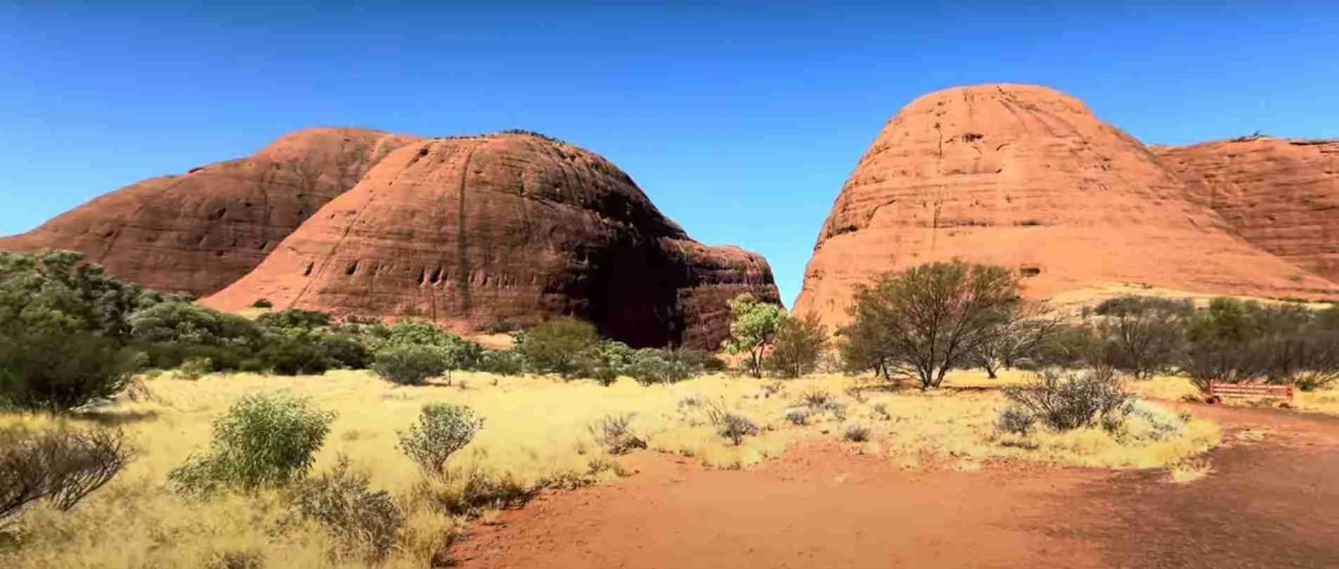
Kata Tjuta, located 50 kilometers west of Uluru, comprises 36 dome-shaped rock formations spread across 21.68 square kilometers, with the tallest peak Mount Olga reaching 546 meters—nearly 200 meters higher than Uluru itself. The formations create dramatic valleys and gorges where hiking trails wind through ancient landscapes shaped by erosion over 500 million years. The name Kata Tjuta translates to “many heads” in the local Pitjantjatjara language, reflecting the distinctive silhouette visible from distances exceeding 100 kilometers across the desert plains.
Hiking these formations provides immersive cultural education alongside physical adventure. The Anangu people have maintained spiritual connections to this landscape for over 30,000 years, with walking trails following traditional song lines and passing sites of profound cultural significance. Trail markers and interpretive signage throughout the park explain geological processes, ecological adaptations, and cultural protocols, transforming each walk into comprehensive learning experiences about one of Earth’s oldest continuously inhabited landscapes.
The 2026 hiking season benefits from enhanced trail infrastructure including upgraded viewing platforms at key locations, improved shade structures at rest points, and expanded interpretive signage explaining both natural and cultural features. Park authorities have refined walking trail maintenance schedules to ensure optimal conditions during peak visitor months from May through September, while implementing heat-closure protocols protecting hikers during extreme summer temperatures when trails close if forecast temperatures exceed 36°C.
People Also Ask About Uluru & Kata Tjuta Hiking 2026
How long does the Uluru Base Walk take in 2026?
The complete Uluru Base Walk spans 10.6 kilometers with typical completion times ranging 3-4 hours depending on fitness levels, photography stops, and time spent exploring cultural sites along the route. The trail follows flat, well-maintained paths with minimal elevation change, making it accessible for moderate fitness levels. Hikers moving at steady pace without extensive stops complete the circuit in approximately 3 hours, while those pausing for photography, reading interpretive signage, and exploring rock art sites extend their journey to 4-5 hours. The trail remains open sunrise to sunset throughout 2026, with most hikers beginning 30-60 minutes before sunrise to experience dawn lighting on the rock face.
Shorter walk options provide alternatives for limited time or energy: the Mala Walk covers 2 kilometers return in 1 hour, leading to the culturally significant Kantju Gorge; the Mutitjulu Waterhole walk extends 1 kilometer return in 30 minutes, featuring permanent water sources and ancient rock art; and the Kuniya Walk spans 1 kilometer return in 30 minutes, offering wheelchair accessibility to Mutitjulu Waterhole. These shorter trails concentrate high-quality experiences into manageable distances, with each featuring interpretive signage explaining geological formations and cultural significance of specific sites.
Trail difficulty remains classified as easy to moderate throughout the circuit, with the path consisting of packed red earth, occasional sandy sections, and short rock-slab crossings equipped with safety railings. The flatness eliminates cardiovascular challenge, shifting focus to distance endurance and heat management. Hikers should allocate additional time for sunrise viewing before starting the walk, as the 30-60 minutes watching light transform the rock surface creates memorable experiences worth extended morning schedules.
Which Kata Tjuta walk is better for experienced hikers in 2026?
The Valley of the Winds walk at Kata Tjuta delivers challenging hiking for experienced adventurers through 7.4 kilometers of steep ascents, rocky terrain, and dramatic valley crossings requiring 3-4 hours completion time. This trail climbs approximately 300 meters elevation through two major viewing platforms offering panoramic perspectives across the dome formations, with the first lookout reached after 2.2 kilometers and 45-60 minutes hiking. The trail continues beyond this point into the valley system, navigating between towering rock walls before ascending to the second viewpoint providing 360-degree desert panoramas.
Trail conditions challenge hikers with steep rock staircases, loose gravel sections requiring careful foot placement, and exposed ridge-walking where wind speeds reach 40-50 km/h during afternoon periods. The path follows natural contours through valleys where temperatures drop 5-10 degrees below surrounding desert, creating microclimates supporting unique vegetation including rare ferns surviving in sheltered gorges. Experienced hikers appreciate technical elements including rock scrambling sections, narrow passages between formations, and sustained uphill grades testing cardiovascular fitness.
The walk closes when forecast temperatures exceed 36°C, with heat-closure periods typically occurring November through March during afternoon hours. Summer hiking requires pre-dawn starts with headlamps, as the trail opens at sunrise but closes by 11 AM on hot days. Winter conditions (June-August) provide ideal hiking temperatures ranging 15-25°C with clear skies, though early morning starts still deliver cooler comfort and superior photography lighting. The Valley of the Winds surpasses Walpa Gorge in both physical challenge and scenic variety, making it the definitive Kata Tjuta hiking experience for capable adventurers seeking immersion in ancient geological landscapes.
Can you hike Uluru and Kata Tjuta in one day in 2026?
Combining both locations in a single day creates ambitious but achievable itineraries for fit hikers prepared for 6-8 hours of walking plus 100 kilometers driving time. The standard one-day approach begins with pre-dawn departure from Ayers Rock Resort, arriving at Kata Tjuta sunrise viewing area by 5:30-6:00 AM to witness dawn lighting on the domes. Hikers then complete either Valley of the Winds (7.4 km, 3-4 hours) or Walpa Gorge (2.6 km, 1 hour) before driving 50 kilometers to Uluru for afternoon exploration of Base Walk sections or shorter cultural trails.
This schedule requires strategic timing to avoid midday heat, with most successful one-day hikers completing their primary Kata Tjuta walk by 10-11 AM, then resting during peak heat hours (11 AM-3 PM) before afternoon Uluru walks beginning around 3-4 PM. The inverse itinerary—Uluru sunrise followed by Kata Tjuta hiking—works equally well, though afternoon temperatures at Kata Tjuta typically exceed Uluru levels due to valley heat retention and reduced air circulation between rock formations.
Energy management becomes critical for one-day combinations, as the full Valley of the Winds plus complete Uluru Base Walk totals 18 kilometers with significant heat exposure even during cooler months. Most visitors opt for selective approaches: Valley of the Winds at Kata Tjuta paired with 3-4 kilometer Uluru segments (Mala Walk, Mutitjulu Waterhole) rather than attempting complete circuits at both locations. This balanced approach maintains hiking quality while preventing exhaustion that diminishes enjoyment of cultural interpretation and photography opportunities central to both experiences.
What are the main differences between Uluru and Kata Tjuta hiking experiences in 2026?
Uluru hiking emphasizes cultural immersion and intimate rock interaction through flat, accessible trails passing sacred sites, rock art galleries, and waterholes where ancient ceremonies occurred over millennia. The Base Walk circles the monolith at ground level, revealing surface details invisible from distant viewpoints: caves carved by erosion, parallel grooves created by water flow, iron-oxide staining producing color variations, and vegetation clusters surviving in moisture-collection zones. Cultural interpretation dominates the experience through signage explaining Tjukurpa (creation law), seasonal ceremonies, and traditional resource management practices maintained by Anangu custodians.
Kata Tjuta hiking delivers wilderness adventure through challenging terrain requiring navigation skills, fitness, and heat management across exposed ridges and sheltered valleys. The landscape creates dramatic elevation changes absent from Uluru, with Valley of the Winds climbing 300 meters through steep sections demanding careful footing and sustained cardiovascular effort. The hiking rewards physical exertion with geological spectacle: weathered rock domes rising 200-300 meters overhead, narrow canyons channeling wind into natural tunnels, and lookout platforms providing perspectives impossible to achieve at flat-terrain Uluru.
Trail infrastructure reflects these differences—Uluru features wheelchair-accessible sections, multiple entry/exit points allowing flexible distances, frequent shade shelters, and water stations at trailhead. Kata Tjuta offers minimal facilities beyond trailhead amenities, requires commitment to full loop distances once departed, and provides natural shade only within valley sections leaving ridge-walks fully exposed. Uluru accommodates all fitness levels and ages through short walk options, while Kata Tjuta caters specifically to capable hikers seeking challenging terrain and remote wilderness atmosphere despite proximity to tourist infrastructure.
Extended multi-day tours – 5+ days
Featured Uluru Multi-Day Tour Packages

3 days
Uluru 3-Day Discovery Tour
- ✓ Comprehensive Uluru experience
- ✓ Expert local guides included
- ✓ All accommodation included
- ✓ Transportation provided

5 days
Uluru 5-Day Highlights Experience
- ✓ Comprehensive Uluru experience
- ✓ Expert local guides included
- ✓ All accommodation included
- ✓ Transportation provided

7 days
Uluru 7-Day Cultural Journey
- ✓ Comprehensive Uluru experience
- ✓ Expert local guides included
- ✓ All accommodation included
- ✓ Transportation provided

10 days
Uluru 10-Day Complete Adventure
- ✓ Comprehensive Uluru experience
- ✓ Expert local guides included
- ✓ All accommodation included
- ✓ Transportation provided
Multi-day tour packages powered by TourRadar. Prices and availability subject to change.
Essential Planning Information for 2026 Hiking
National Park Entry and Access Costs 2026
The Uluru-Kata Tjuta National Park entry pass costs $38 per adult for three consecutive days in 2026, providing unlimited access to all trails, viewing areas, and cultural centers at both Uluru and Kata Tjuta (check parksaustralia.gov.au/uluru for current official rates as pricing may vary). Children under 18 enter free when accompanied by paying adults, making family visits economical. The pass activates upon first entry and covers 72 hours from that timestamp, allowing visitors to explore across multiple days without repurchase. Entry stations operate 5 AM to 9 PM daily, with automated payment systems accepting credit cards when staffed booths close.
The pass includes parking at all designated lots, access to Cultural Centre facilities with free exhibitions explaining Anangu culture and park ecology, ranger-led walks during peak season (May-September), and sunrise/sunset viewing area access at both formations. Annual passes cost $150 per person, benefiting repeat visitors or those spending extended periods in the region. Park entry fees fund conservation efforts, trail maintenance, cultural programs, and Anangu ranger employment, directly supporting traditional landowner communities managing the landscape.
No additional fees apply for hiking trails themselves—the $38 entry covers unlimited walking on all maintained paths including Base Walk, Valley of the Winds, Walpa Gorge, and shorter cultural walks. Guided tours operated by commercial providers cost extra, with ranger-led cultural walks priced $95-150 per person and Valley of the Winds guided hikes costing $180-220 including transportation from resort. Self-guided hiking with purchased park pass offers maximum flexibility and value for independent travelers comfortable with trail navigation and safety preparation.
Seasonal Conditions and Trail Closures 2026
April through September constitutes the optimal hiking season with daytime temperatures ranging 20-28°C, clear skies exceeding 85% probability, and minimal rainfall averaging less than 20mm per month. These winter months provide comfortable walking conditions throughout the day, though morning starts before sunrise require layered clothing as temperatures drop to 5-10°C overnight. May through August represent peak visitation when advanced bookings become essential for accommodation and guided tours, with daily visitor numbers reaching 2,500-3,000 during this period.
October through March brings summer conditions with daytime temperatures frequently exceeding 35-40°C, creating significant heat hazards for hikers unprepared for desert environments. Park authorities implement mandatory trail closures when forecast temperatures reach 36°C, typically affecting afternoon hours (11 AM-5 PM) during hot days. Summer hiking requires pre-dawn starts with headlamps, as most trails open at sunrise (5:30-6:00 AM) but close before midday heat intensifies. December through February experiences occasional thunderstorms producing brief but intense rainfall that temporarily closes trails due to flash flood risk in valleys and gorges.
Valley of the Winds closes entirely during hot weather forecasts, with the trail remaining shut all day when temperatures exceed 36°C at 8 AM. Walpa Gorge sometimes remains open during partial closures as its sheltered valley provides more shade and cooler microclimates. Uluru Base Walk rarely closes completely but discourages afternoon walking during extreme heat, with ranger recommendations directing visitors toward sunrise and sunset walking times. Real-time trail status updates appear on digital noticeboards at park entry stations, Cultural Centre, and Ayers Rock Resort, with weather forecasts posted 7 days ahead for planning purposes.
Safety Requirements and Equipment 2026
Water requirements for desert hiking demand 3-4 liters per person for Valley of the Winds, 2-3 liters for Uluru Base Walk, and minimum 1 liter for shorter walks even during winter months when temperatures remain moderate. Dehydration symptoms including dizziness, headache, and reduced coordination develop rapidly in dry desert air where humidity levels often drop below 20%. Hikers should drink 250ml every 15-20 minutes regardless of thirst sensation, as thirst indicators lag behind actual hydration needs in low-humidity environments.
Sun protection rated SPF 50+ becomes mandatory equipment for all hiking periods, with reapplication every 90-120 minutes maintaining effectiveness as sweat and friction remove initial coverage. Broad-brimmed hats with 7-10cm brims provide face and neck protection superior to caps, while lightweight long-sleeve shirts offer better heat management than short sleeves with sunscreen application. Sunglasses with UV400 protection prevent eye damage from intense reflected light off red rock surfaces and bleached sand, where brightness levels exceed urban environments by 300-400%.
Footwear requirements specify closed-toe hiking shoes or trail runners with aggressive tread patterns gripping sandy and rocky surfaces, as the combination of loose sand, rock slabs, and occasional wet sections after rain create slipping hazards. Ankle support helps on Valley of the Winds where uneven surfaces and steep descents stress ankle stability. Cotton socks cause blistering through moisture retention—synthetic or merino wool blends manage sweat effectively during multi-hour walks. Sandals and open-toe footwear significantly increase injury risk from rock stubs, cactus spines, and heat exposure on sun-heated sand reaching 60-70°C during summer.
Emergency equipment includes fully charged mobile phones (though coverage remains limited at Kata Tjuta), personal locator beacons available for rent at Cultural Centre for $20 per day, basic first aid supplies treating blisters and minor cuts, and emergency shelter options like space blankets weighing 60 grams. Trail emergency phones exist at major trailheads, but remote sections require self-sufficiency for 2-3 hours until ranger response. Hiking in groups of 2+ people provides crucial safety backup, as solo hikers face higher risks if injuries occur in areas with limited foot traffic during off-peak hours.
Uluru Base Walk 2026: Complete Circuit Guide
Full Base Walk Overview and Timing
The 10.6-kilometer Uluru Base Walk circumnavigates the monolith at ground level, providing intimate exploration of the rock’s base where caves, waterholes, and rock art sites concentrate. The trail follows a well-maintained path of packed earth and occasional rock-slab sections, classified as flat terrain with less than 50 meters total elevation change. Completion times range 3-4 hours at moderate pace with brief stops, extending to 5-6 hours for those spending extended time at cultural sites, photography locations, and interpretive signage reading.
The walk divides into distinct zones based on cultural significance and viewing restrictions. The southern face from Mutitjulu Waterhole to Kuniya Piti features open photography opportunities and detailed interpretive signage explaining Tjukurpa stories associated with specific rock formations. The western and northern faces include sections where photography is restricted out of respect for sacred sites, with clear signage marking these zones. The eastern face near Talinguru Nyakunytjaku (sunset viewing area) offers spectacular afternoon light but requires adherence to designated viewing platforms rather than free-range exploration.
Optimal starting points vary by objective: cultural education benefits from beginning at Cultural Centre and following clockwise direction toward Mala Walk and Kantju Gorge; photography prioritizes counterclockwise direction from Kuniya car park to capture morning light on the southern face; complete circumnavigation works equally well in either direction as the trail forms a continuous loop with multiple entry/exit points allowing flexible distances. Most hikers complete either the full circuit or select 3-5 kilometer segments focusing on specific features rather than attempting partial walks that miss signature sites.
Key Sites and Cultural Stops Along Base Walk
The Mala Walk leads to Kantju Gorge, a massive amphitheater-shaped cave where traditional ceremonies occurred and rock art depicts creation stories central to Anangu spirituality. The gorge provides natural shade and cooler temperatures 5-10 degrees below surrounding desert, creating refuge during hot weather. Water seepage from the rock face creates permanent moisture supporting vegetation unusual for desert environments, with ferns and mosses growing in sheltered corners. The walk extends 2 kilometers return from Mala car park, requiring 60-75 minutes including time for ranger talks offered twice daily at 8 AM and 10 AM during peak season.
Mutitjulu Waterhole represents one of few permanent water sources around Uluru, explaining its profound significance in traditional survival strategies and ceremony. The waterhole sits within a sheltered alcove where rock art dating back thousands of years covers walls and ceiling sections accessible behind safety barriers protecting the fragile pigments. The site interprets the Kuniya and Liru Tjukurpa—creation story explaining the formation of Uluru itself through battles between ancestral snake beings. The waterhole walk extends 1 kilometer return from Kuniya car park, with wheelchair accessibility enabling universal access to this culturally central location.
The northwestern sections include caves and overhangs where traditional shelters and food preparation sites existed, marked by smoke staining on rock ceilings and grinding grooves in flat rock surfaces where seeds were processed into flour. These areas demonstrate sophisticated resource management allowing sustainable habitation in extreme environments with minimal rainfall. Photography restrictions apply to many northern face sections protecting ceremonial sites still used by Anangu community members, requiring visitors to store cameras and rely on mental impressions and written notes rather than visual documentation.
Base Walk Logistics and Practical Considerations
Water stations exist only at major trailheads (Mala car park, Kuniya car park) rather than along the walking trail, requiring hikers to carry sufficient supplies for entire circuit duration. The Cultural Centre between these car parks provides refill stations, toilets, and shade shelters, serving as logical midpoint rest stop during full circumnavigation. Rangers recommend clockwise direction from Mala car park for first-time hikers, as this route encounters major cultural sites early in the walk when energy and attention remain high.
Trail markings consist of numbered posts every 200-300 meters referencing information in Cultural Centre brochures, plus interpretive panels at significant locations explaining geological formations and cultural stories. The path itself remains obvious through worn earth, occasional rock cairns, and the physical presence of Uluru itself serving as constant orientation reference impossible to lose. Navigation challenges essentially don’t exist on this trail, making it suitable for children and inexperienced hikers confident in their physical fitness for 10-kilometer distances.
Emergency shelters and shade structures appear approximately every 1-2 kilometers, designed as simple roof covers providing sun protection during rest stops but not equipped with seating or water. Mobile phone coverage remains reliable throughout most of the circuit except brief blackout zones on the northeastern face, where rocky terrain blocks signals from the cell tower at Ayers Rock Resort 20 kilometers distant. Emergency call boxes exist at main trailheads, connecting directly to park rangers for medical assistance or information requests.
Sunrise and sunset walks attract concentrated visitor numbers creating crowded conditions at popular viewing points like Kuniya Piti (sunset viewing area) and Talinguru Nyakunytjaku (sunrise/sunset platform). Walking during mid-morning or mid-afternoon (outside 7-9 AM and 5-7 PM windows) provides solitary experiences where encounters with other hikers occur every 15-30 minutes rather than continuous streams. The cultural richness and photography opportunities remain equivalent throughout the day—sunset crowds gather specifically for light shows rather than trail quality differences.
Kata Tjuta Walks 2026: Valley of the Winds & Walpa Gorge
Valley of the Winds: Advanced Trail Details
The Valley of the Winds trail covers 7.4 kilometers through challenging terrain requiring 3-4 hours for completion, climbing approximately 300 meters elevation through two major lookout destinations offering panoramic views across the dome formations. The trail begins at Kata Tjuta car park, immediately ascending through rocky switchbacks over the first kilometer before reaching a junction at 1.1 kilometers where hikers choose between the full loop or truncated 2.2-kilometer walk to Karu Lookout only.
The full loop continues beyond Karu Lookout, descending into the valley system between domes where temperatures drop 5-10 degrees and vegetation increases due to moisture concentration in sheltered gorges. The path navigates narrow passages between towering rock walls rising 200 meters overhead, creating dramatic perspectives impossible from external viewpoints. Rock scrambling sections require careful hand placement and balance, with metal railings installed on the most technical segments but absent from moderate difficulty areas.
The second major ascent begins around the 4-kilometer mark, climbing through loose gravel and rocky staircases to reach the second lookout platform at 5 kilometers. This viewpoint provides 360-degree panoramas encompassing the full dome field, distant desert horizons, and weather patterns visible approaching from hundreds of kilometers away. The descent from this point follows different valleys back to the trailhead, completing the loop without retracing earlier segments—a design advantage maintaining interest throughout the full distance.
Wind conditions intensify on exposed ridge sections where the trail crosses saddles between domes, with speeds regularly reaching 30-40 km/h and occasional gusts exceeding 60 km/h during afternoon periods. These winds provide cooling relief during hot weather but create challenges for balance and photography, particularly at the second lookout where the platform sits fully exposed on a ridgeline. Morning starts experience calmer conditions as thermal heating hasn’t yet generated the convection currents producing afternoon wind acceleration through valley funnels.
Walpa Gorge: Family-Friendly Alternative
Walpa Gorge offers a 2.6-kilometer return walk requiring 45-60 minutes completion time, following a gentle grade up a gorge floor between two of Kata Tjuta’s largest domes. The trail provides accessible introduction to the formations without technical challenges or significant elevation gain, making it appropriate for families with children, older hikers, and visitors seeking shorter time commitments. The path consists of well-maintained gravel and sand surfaces, with a few rocky sections navigable by careful walkers wearing proper footwear.
The gorge creates a natural amphitheater where sound echoes and temperatures remain 5-10 degrees cooler than surrounding desert through shade provided by 200-meter rock walls. Vegetation concentrates along the gorge bottom where seasonal water flow creates moisture availability supporting river red gums, native grasses, and flowering plants absent from exposed desert surfaces. The trail terminates at a natural rock platform offering views back down the gorge toward the entrance, serving as a turnaround point and rest area before returning via the same route.
Morning visits to Walpa Gorge deliver optimal lighting conditions as sun illuminates the gorge walls from above, highlighting the orange and red iron-oxide colors characteristic of the formation. Afternoon light penetrates less deeply into the gorge due to angle changes, creating darker shadows and reducing color saturation in photographs. The walk remains open during hot weather more reliably than Valley of the Winds, as the gorge’s natural shade and sheltered position provide cooler microclimates even when surrounding desert reaches 38-40°C.
Wildlife encounters occur more frequently in Walpa Gorge than on exposed trails, with rock wallabies inhabiting the gorge slopes and various bird species including zebra finches and crimson chats utilizing permanent water sources in sheltered corners. Early morning walks (6-8 AM) provide best wildlife viewing opportunities before daytime heat drives animals into shaded retreats. The gorge also showcases geological features including weathering patterns, joint systems creating the characteristic dome shapes, and erosion processes visible in rock fall debris accumulated at the trail terminus.
Choosing Between Valley of the Winds and Walpa Gorge
Physical fitness requirements separate these trails into distinct categories—Valley of the Winds demands cardiovascular endurance for sustained climbs, sure footing on uneven surfaces, and tolerance for 3-4 hours continuous exertion. Hikers unable to manage 300-meter elevation gain over rocky terrain should select Walpa Gorge, which eliminates technical challenges while still providing immersive dome formation experience. Age considerations matter less than fitness levels: capable 12-year-olds complete Valley of the Winds successfully, while less active adults may struggle with the sustained effort required.
Time constraints often determine trail selection, as Valley of the Winds requires minimum half-day commitment including driving time from Uluru, while Walpa Gorge fits comfortably within 90-minute windows including parking and basic rest stops. Visitors with single half-day availability at Kata Tjuta benefit more from Walpa Gorge’s accessible experience than attempting rushed Valley of the Winds walks that sacrifice appreciation for pace. Those allocating full day to Kata Tjuta can complete both trails with strategic timing: Valley of the Winds at sunrise (5:30 AM start), mid-morning rest, then Walpa Gorge during cooler afternoon hours (3-5 PM).
Photography objectives favor Valley of the Winds for dramatic elevation-based perspectives impossible from valley floors, capturing the full scale and distribution of the 36 dome formations across the landscape. Walpa Gorge provides intimate close-range compositions emphasizing texture, light/shadow contrasts, and vegetation detail rather than broad landscapes. Serious photographers often complete both trails on separate days to optimize lighting conditions—Valley of the Winds at sunrise for eastern face lighting, Walpa Gorge during afternoon when angled light penetrates the gorge more dramatically.
Cultural interpretation differs between trails, with Valley of the Winds emphasizing geological processes and ecological adaptations through interpretive signage explaining dome formation and weathering patterns. Walpa Gorge includes more detailed Anangu cultural information about traditional uses of gorge resources, seasonal ceremonies, and the Tjukurpa stories associated with specific rock formations visible from the trail. Both provide cultural education, but Walpa Gorge’s shorter distance allows more thorough reading of interpretive materials without time pressure affecting longer Valley of the Winds circuit.
Best Time for Hiking Uluru and Kata Tjuta in 2026
Seasonal Weather Patterns and Trail Conditions
May through September represents the premium hiking season when daytime temperatures range 20-28°C, overnight lows drop to 5-10°C, and rainfall averages less than 15mm per month across the season. Clear skies dominate with cloud cover below 15% on typical days, creating ideal photography conditions and consistent trail availability without weather-related closures. These winter months attract peak visitation with 2,500-3,000 daily park entries, creating busy trails during sunrise and sunset periods but manageable crowds during mid-morning and mid-afternoon walks.
April and October serve as shoulder months offering excellent conditions with fewer crowds and lower accommodation prices than peak winter. April temperatures average 22-30°C with warm days and cool nights, while October ranges 25-33°C as summer approaches. Both months provide 90%+ trail availability without heat closures, though October afternoon temperatures occasionally trigger partial closures of Valley of the Winds when forecasts exceed 36°C. These months suit budget-conscious hikers willing to accept slightly warmer conditions in exchange for 20-30% lower accommodation costs than June-August peaks.
November through March brings summer heat with daytime temperatures regularly exceeding 35-40°C, creating significant hiking challenges and frequent afternoon trail closures. Pre-dawn starts become essential, with serious hikers departing 5:30-6:00 AM to complete major trails before 10-11 AM heat intensification forces closures. Summer hiking suits experienced desert travelers comfortable with extreme conditions and early wake times, while first-time visitors benefit more from winter season comfort and full-day trail access. Summer does offer advantages: accommodation prices drop 30-40% below peak rates, crowds thin dramatically with daily visitor numbers below 1,000, and dramatic storm systems provide spectacular photography opportunities despite brief rain disruptions.
Daily Timing Strategies for 2026 Hiking
Sunrise walks beginning 30-60 minutes before first light deliver optimal conditions across seasons, with cooler temperatures, stunning light transformations on rock surfaces, and virtually empty trails during the 5:30-7:00 AM window. Summer sunrise occurs 6:00-6:30 AM, requiring 5:30 AM trailhead arrival for positioning before color develops. Winter sunrise arrives 7:00-7:30 AM, allowing slightly later 6:30 AM starts while still capturing dawn lighting. Sunrise hiking provides psychological advantages beyond physical comfort—the sense of experiencing the landscape in pristine dawn silence enhances the profound atmosphere characteristic of these ancient formations.
Mid-morning walking (8:00-11:00 AM) works well during April-September when temperatures remain moderate, though trails grow busier as day-trippers from the resort arrive following breakfast. This timing suits hikers prioritizing sleep over dawn experiences, as arriving at trailheads 8:00-8:30 AM provides comfortable walking without pre-dawn darkness. Light quality during these hours emphasizes harsh overhead sun better for shadowed gorge walks (Walpa Gorge) than broad landscape photography (Valley of the Winds lookouts).
Afternoon hiking (3:00-6:00 PM) concentrates on sunset viewing rather than trail completion, with most visitors positioning themselves at designated viewing platforms rather than attempting full circuit walks. This timing creates the busiest trail conditions of the day, particularly at Uluru’s western face viewing areas and Kata Tjuta sunset platform. Hikers seeking quieter experiences avoid these peak hours, instead completing major walks earlier and returning for sunset viewing without hiking component. Afternoon temperatures remain elevated into evening during summer (still 35°C at 5 PM), while winter afternoons cool rapidly after 4 PM as sun angle drops.
Midday rest periods (11:00 AM-3:00 PM) become mandatory during hot months, with rangers actively discouraging hiking during these hours even when trails remain officially open. This timing suits returning to accommodation for swimming, indoor cultural center visits, or rest before afternoon activities. Winter midday hiking faces no temperature restrictions, though the 11 AM-1 PM period produces harsh overhead lighting least favorable for photography—functional for walking but suboptimal for capturing the landscape’s dramatic color and texture.
Crowd Management and Quiet Experience Timing
Peak season weekends (June-August) see daily visitor numbers reaching 3,000+ creating substantial congestion at major trailheads, viewing platforms, and along the most popular walks like Mala Walk and Walpa Gorge. Midweek visits (Tuesday-Thursday) reduce crowds by approximately 30%, as most Australian domestic tourists visit on weekends while international visitors distribute more evenly across the week. This pattern creates opportunity for quieter midweek experiences even during peak months, with midweek sunrise walks encountering 50-70% fewer people than weekend equivalents.
Shoulder months (April, October) provide the ideal crowd-comfort balance, maintaining good weather while reducing visitor numbers 40-50% below peak winter levels. These months suit hikers valuing solitude and unobstructed photography over perfect temperature conditions. Early shoulder (April) generally exceeds late shoulder (October) for comfortable hiking, as April brings cooler conditions after summer while October builds toward summer heat creating more afternoon trail closures.
Off-peak summer months (December-February) deliver genuine wilderness solitude with daily visitor counts sometimes below 500 on weekdays, creating nearly private experiences on less popular trails. Summer hiking requires extreme weather preparation and pre-dawn commitments, but rewards dedicated hikers with unmatched tranquility. The Base Walk might see 5-10 other hikers during a full 3-hour circuit, compared to 200-300 encounters during peak winter weekends. This level of isolation enhances cultural and spiritual connection to the landscape, though safety considerations demand careful preparation given reduced ranger presence and trail traffic during extreme weather periods.
Safety and Preparation for 2026 Desert Hiking
Hydration and Heat Management Protocols
Water consumption rates for desert hiking require 1 liter per hour during moderate activity in temperatures above 25°C, increasing to 1.5 liters per hour when temperatures exceed 30°C or trails involve significant elevation gain like Valley of the Winds. A typical 4-hour hike demands 4-6 liters per person, distributed in multiple bottles or hydration bladders allowing regular small drinks rather than infrequent large consumption. Dehydration onset occurs rapidly in 10-20% humidity environments where sweat evaporates before creating skin wetness—the absence of visible perspiration doesn’t indicate adequate hydration.
Electrolyte replacement becomes critical during multi-hour hikes where salt loss through perspiration depletes sodium, potassium, and magnesium levels essential for muscle function and temperature regulation. Sports drinks, electrolyte tablets dissolved in water, or high-salt snacks (trail mix, pretzels, jerky) prevent electrolyte imbalance causing cramping, nausea, and coordination loss. Rangers recommend consuming 200-300mg sodium per hour during extended hot weather hiking, equivalent to one electrolyte tablet or 30-40 grams of salted snacks.
Heat stress symptoms require immediate response—hikers experiencing dizziness, severe headache, nausea, confusion, or cessation of sweating should seek shade immediately, consume water and electrolytes, and call for medical assistance if symptoms persist after 30 minutes rest. The progression from heat exhaustion to life-threatening heat stroke occurs within 20-30 minutes once core temperature exceeds 40°C, making early symptom recognition critical. Trail partners should monitor each other for behavioral changes indicating heat stress, as victims often fail to recognize their own compromised condition.
Clothing selection influences heat management substantially—lightweight, light-colored, loose-fitting long-sleeve shirts and pants provide better protection than shorts and t-shirts by preventing direct sun exposure while allowing air circulation. Synthetic or merino wool fabrics transport moisture away from skin more effectively than cotton, which becomes heavy when wet and loses insulating properties. Wide-brimmed hats with chin straps prevent loss during windy ridge walks, while neck scarves soaked in water provide evaporative cooling when draped under hat brims.
Sun Protection and UV Management
The Red Centre experiences extreme UV radiation due to southern hemisphere ozone depletion, clear skies, high altitude (Uluru sits 863 meters above sea level), and reflective red sand amplifying exposure. UV index ratings routinely reach 12-14 during summer (“extreme” category) and 8-10 during winter (“very high”), requiring aggressive sun protection beyond typical outdoor recreation standards. Sunburn develops in 10-15 minutes of unprotected exposure during peak UV hours (10 AM-3 PM), progressing to second-degree burns causing blistering and skin damage within 30-45 minutes continuous exposure.
SPF 50+ broad-spectrum sunscreen applied 20-30 minutes before sun exposure provides baseline protection, with reapplication every 90-120 minutes maintaining effectiveness as sweat, friction, and UV degradation reduce initial coverage. Apply 2mg per square centimeter of skin (about 7 teaspoons for full body) to achieve rated SPF protection—most people apply half this amount, effectively reducing SPF 50 to SPF 25. Critical areas include ears, back of neck, tops of hands, and any skin exposed when bending or reaching during hiking movements.
Eye protection rated UV400 blocks both UVA and UVB radiation preventing cataracts and retinal damage from prolonged exposure to intense desert light. Wraparound styles prevent side exposure from reflected light off sand and rock surfaces, while polarized lenses reduce glare improving visibility of trail surfaces and distant features. Budget sunglasses claiming “UV protection” often lack verified ratings—purchase from optical retailers or outdoor specialty stores ensuring legitimate UV filtration rather than cheap fashion eyewear providing no actual protection.
Lip protection through SPF 30+ lip balm prevents painful cracking and burning in the extremely dry desert air where humidity often drops below 15%. Reapply every 60-90 minutes, particularly after drinking water. Severe lip burns significantly impact eating comfort and can become infected if cracking occurs, creating complications beyond the initial sun damage. Some hikers also apply sunscreen to parted hairlines and scalp areas where thin or light-colored hair provides inadequate natural protection.
Wildlife Awareness and Environmental Hazards
Snake encounters remain rare but possible during warm weather when reptiles emerge to thermoregulate on sun-warmed rock surfaces and trail sections. The desert region hosts several venomous species including mulga snakes and desert death adders, though their cryptic coloration and generally retiring behavior means most hikers complete multiple visits without seeing snakes. Preventive measures include wearing closed-toe boots covering ankles, watching foot placement particularly around rock piles and shaded areas where snakes rest, and avoiding off-trail exploration through dense vegetation where visibility drops.
Insect hazards during summer months include native bees attracted to sweat and moisture, flies that persistently hover around faces and exposed skin, and occasional ant species with painful stings. Head nets weighing 20-30 grams provide relief from fly harassment during worst periods (November-February), when bush flies reach plague densities making outdoor activity genuinely unpleasant without protection. Insect repellent containing DEET or picaridin reduces but doesn’t eliminate fly attraction, as these insects seek moisture rather than blood so traditional repellents show limited effectiveness.
Plant hazards consist primarily of spinifex grass covering large areas around trail margins, with needle-sharp leaves causing painful scratches and occasional infections if dirt enters puncture wounds. Stay on marked trails avoiding contact with spinifex, and wear long pants providing physical barrier protection. The plant’s hazard increases after rain when new growth produces particularly sharp leaf tips. Prickly vegetation also includes occasional cacti and thorny shrubs best avoided through trail adherence rather than cross-country shortcuts.
Flash flood risk during summer thunderstorms demands awareness particularly when hiking in gorges and valleys where water channels. The Walpa Gorge trail closes immediately when rainfall occurs within the catchment area, as water flow develops within 15-30 minutes after distant rain invisible from the gorge bottom. Rangers monitor weather radar and close valley trails preemptively when storm cells approach within 30 kilometers. Never enter closed gorges, and evacuate immediately if water begins flowing while you’re in narrow valley sections—flash floods reach heights of 2-3 meters within minutes, moving at speeds preventing escape if caught in narrow channels.
Emergency Preparedness and Communication
Mobile phone coverage from the Telstra cell tower at Ayers Rock Resort reaches most of Uluru Base Walk and sections of Kata Tjuta trails, though dead zones exist in valleys and on the remote northeastern sections of Valley of the Winds. Hikers should test signal strength at trailheads before departing, and understand that emergency calls to 000 might require moving to higher ground or open areas for signal acquisition. Download offline maps before hiking, as data service remains limited even where voice coverage exists.
Personal locator beacons (PLBs) available for rent at Cultural Centre for $20 per day provide satellite-based emergency communication independent of cell coverage, transmitting distress signals directly to emergency services with GPS coordinates. These devices suit hikers with medical conditions, solo travelers, or those planning off-trail exploration where rescue response times increase substantially. PLB activation triggers automatic search-and-rescue deployment, so only activate when genuine emergency exists—false alarms waste resources and incur potential fines.
First aid preparation should include blister treatment supplies (moleskin, antibiotic ointment, adhesive bandages), pain relievers for headache and muscle soreness, antihistamines for insect stings, and basic wound cleaning supplies. Blisters develop frequently during long walks in hot weather, particularly for hikers wearing new boots or inadequate sock systems. Treat hot spots immediately when friction sensation develops, rather than waiting for full blisters requiring more complex treatment and potentially ending your hike.
Emergency shelter options include lightweight space blankets providing wind protection and thermal reflection if injuries or exhaustion force unplanned stops. The desert experiences rapid temperature drops after sunset—30°C daytime temperatures can fall to 10-15°C within two hours of darkness during winter, creating hypothermia risk for stranded hikers wearing only daytime hiking clothes. Carry at least one extra layer beyond what seems necessary during daylight hiking, as evening rescue operations sometimes take 3-4 hours depending on location and available ranger resources.
Sample Hiking Itineraries 2026
Two-Day Hiking Focus Itinerary
This intensive hiking schedule prioritizes trail experience over other park activities, suitable for fit hikers seeking comprehensive exposure to both formations across two full days.
Day 1: Kata Tjuta Full Experience
Depart Ayers Rock Resort 5:15 AM in darkness, arriving Kata Tjuta sunrise viewing area 5:45 AM to witness dawn lighting on the domes. Begin Valley of the Winds trail 6:15 AM, completing the full 7.4-kilometer loop by 9:45-10:15 AM before heat intensifies. Return to resort for midday rest, swimming, and lunch. Depart for Walpa Gorge 3:30 PM, completing the 2.6-kilometer return walk 4:00-5:00 PM in afternoon light. Position at Kata Tjuta sunset viewing area 5:30 PM, watching evening color develop across the formations. Return to resort by 7:00 PM.
Costs: Park entry $38, fuel $12-15 (100km round trip from resort), packed lunch $15-20, snacks and water $10-15. Total day cost: $75-88 per person (excluding accommodation).
Day 2: Uluru Complete Base Walk
Depart resort 5:45 AM, arriving Mala car park by 6:00 AM for Base Walk commencement at sunrise. Complete the full 10.6-kilometer circuit clockwise direction, reaching Mutitjulu Waterhole around 8:30 AM, Cultural Centre by 9:30 AM for extended interpretive exhibition visit, and returning to Mala car park by 10:30-11:00 AM. Drive to Uluru sunset viewing area (Talinguru Nyakunytjaku) 4:30 PM, watching evening light transform the western face through golden hour and twilight. Return to resort by 7:30 PM.
Costs: Fuel $8-10 (40km), Cultural Centre donation $5 suggested, lunch at Cultural Centre $18-25, drinks and snacks $12-18. Total day cost: $43-58 per person (excluding accommodation).
Two-Day Itinerary Assessment
This schedule covers approximately 20 kilometers of hiking plus 140 kilometers driving, demanding high fitness and early wake times but delivering comprehensive trail experiences at both major formations. The itinerary works best May-September when temperatures remain moderate throughout morning hours. Summer implementation requires even earlier starts (4:45-5:00 AM) and eliminates afternoon walks due to heat. Budget-conscious hikers can reduce costs by bringing all food from supermarkets rather than purchasing at resort restaurants, cutting meal costs by 40-50%.
Four-Day Comprehensive Exploration Itinerary
This relaxed schedule spreads hiking across four days, allowing recovery time between major walks and incorporating cultural activities beyond trail experiences.
Day 1: Uluru Introduction and Short Walks
Arrive at park 2:00 PM, purchasing three-day pass at entry station. Visit Cultural Centre for 90-minute introduction to Anangu culture and park ecology. Complete Mala Walk to Kantju Gorge (2km return, 1 hour) 4:00-5:00 PM, attending optional ranger talk if available. Watch sunset from Talinguru Nyakunytjaku viewing platform. Return to resort by 7:00 PM.
Costs: Park entry $38, Cultural Centre visit free, drinks $8-12. Total day cost: $46-50 per person (excluding accommodation).
Day 2: Kata Tjuta Valley of the Winds
Pre-dawn departure 5:15 AM, arriving Kata Tjuta sunrise viewing area 5:45 AM. Begin Valley of the Winds 6:15 AM, completing full loop by 10:00 AM. Return to resort for midday rest and pool time. Afternoon cultural workshop at resort or rest/preparation for next day. Evening at resort restaurants or sunset picnic with takeaway food.
Costs: Fuel $12-15, breakfast at resort $25-35, picnic supplies $20-30, drinks $10-15. Total day cost: $67-95 per person (excluding accommodation).
Day 3: Uluru Base Walk Complete Circuit
Sunrise departure 5:45 AM to Kuniya car park, beginning Base Walk counterclockwise to capture morning light on southern face. Complete full 10.6km circuit with extended Cultural Centre visit mid-walk, finishing by 11:30 AM. Afternoon rest at resort. Optional sunset viewing at western face, or rest evening preparing for Kata Tjuta return.
Costs: Fuel $8-10, packed breakfast $15-20, lunch at Cultural Centre $18-25, snacks $10-15. Total day cost: $51-70 per person (excluding accommodation).
Day 4: Walpa Gorge and Departure Activities
Morning Walpa Gorge walk 7:00-8:30 AM (2.6km return), followed by breakfast at Kata Tjuta sunrise viewing area. Final Uluru viewing from different perspective, or completion of any missed short walks (Kuniya Walk, Lungkata Walk). Depart park by early afternoon.
Costs: Fuel $12-15, breakfast supplies $15-20, final drinks and snacks $10-15. Total day cost: $37-50 per person (excluding accommodation).
Four-Day Itinerary Assessment
This schedule provides sustainable pacing for varied fitness levels, allowing recovery between major hiking efforts while still covering all significant trails across both formations. The spread reduces physical demand per day, making it suitable for older hikers, families with teenagers, or anyone preferring relaxed exploration over intensive athletic challenge. Total hiking distance reaches approximately 23 kilometers distributed across four days—averaging 6 kilometers per day versus 10 kilometers per day in the two-day intensive schedule.
Single-Day Maximum Experience Itinerary
This ambitious schedule attempts both formations in one day, requiring high fitness, early commitment, and acceptance of rushed experiences prioritizing coverage over depth.
Single Day: Combined Kata Tjuta and Uluru
Ultra-early departure 4:45 AM to reach Kata Tjuta by 5:15 AM. Begin Valley of the Winds in darkness with headlamps, reaching Karu Lookout at sunrise 6:30 AM. Complete full 7.4km loop by 9:00 AM. Return to Uluru, arriving Mala car park 10:00 AM. Complete abbreviated Base Walk sections (Mala Walk, Mutitjulu Waterhole, Kuniya Walk—total approximately 4-5 kilometers) by 12:30 PM, avoiding midday heat through selective walk choice. Midday rest at Cultural Centre or resort 12:30-3:30 PM. Optional sunset viewing Uluru western face 5:00-7:00 PM.
Costs: Park entry $38, fuel $20-25 (extended driving), breakfast supplies $15-20, lunch at Cultural Centre $18-25, drinks and snacks $15-20. Total day cost: $106-128 per person (excluding accommodation).
Single-Day Assessment
This itinerary only succeeds during cooler months (April-September) when morning temperatures permit early hiking and afternoon temperatures allow some walking after 3:00 PM. Summer attempts face heat-closure restrictions eliminating afternoon options and requiring even earlier pre-dawn starts (4:00 AM) to complete Valley of the Winds before closure. The schedule demands exceptional fitness—completing Valley of the Winds then immediately driving and walking 4-5 additional kilometers tests endurance significantly. Most hikers attempting this combination report satisfaction with Valley of the Winds experience but rushed, incomplete impressions of Uluru due to time pressure and accumulated fatigue. Better approach: prioritize one formation for quality experience rather than attempting both in compromised fashion.
Booking and Park Access for 2026
National Park Entry and Pass Options
Purchase park entry passes at the entry station on Lasseter Highway 6 kilometers before reaching Ayers Rock Resort, operating 5:00 AM to 9:00 PM daily with 24-hour automated payment machines accepting credit cards when the manned booth closes. The standard three-day pass costs $38 per adult with free entry for children under 18, activating on first scan and valid for 72 consecutive hours. Digital passes purchased online through parksaustralia.gov.au/uluru can be collected at entry station or shown as mobile tickets, though paper backup receipts remain advisable as mobile service drops throughout the park.
Annual passes priced $150 per adult benefit visitors spending 5+ days in the region or returning multiple times within 12 months. Calculate break-even at 4 x $38 = $152, meaning the annual pass saves money on any visit exceeding 4 days or two separate trips. The pass covers unlimited entries to both Uluru and Kata Tjuta for 12 months from purchase date, plus free access to guided ranger walks valued at $95-150 per person if purchased separately through commercial tour operators. Annual passes suit Red Centre residents, repeat photography enthusiasts, and extended stay visitors spending weeks exploring the region.
Pass validation requires keeping the paper ticket or digital receipt accessible throughout your park visit, as rangers conduct random checks at viewing areas and trailheads. Lost passes can be replaced at the entry station with proof of purchase (credit card statement, email receipt), though this process causes delays. Store passes in waterproof holders or photograph them with your phone as backup documentation. The three-day validity period provides sufficient time for comprehensive exploration—most visitors complete major trails and viewing experiences within 48 hours, with the third day offering flexibility for weather delays or additional photography sessions.
Accommodation Booking Strategies for 2026
Ayers Rock Resort represents the only accommodation within 200 kilometers of Uluru-Kata Tjuta National Park, operating five properties ranging from campground to luxury hotel under single management. Peak season (June-August) requires booking 4-6 months ahead for mid-range and budget options, while luxury hotels often sell out 6-8 months before arrival dates. Shoulder months (April-May, September-October) permit shorter 2-3 month advance bookings, and summer (November-March) sometimes allows last-minute reservations due to reduced demand during hot weather.
The resort’s properties span budget to luxury categories: Ayers Rock Campground offers powered and unpowered sites $50-65 per night for two people plus vehicle; Outback Pioneer Hotel and Lodge provides dorm beds $45-65 and basic private rooms $180-240; Desert Gardens Hotel mid-range rooms cost $300-420; Sails in the Desert Hotel upscale rooms range $400-550; and Longitude 131° luxury glamping reaches $2,200-2,800 per night for two people. Price variations depend on season (June-August peak, December-February low) and day of week (Friday-Saturday premiums of 15-20% above weekday rates).
Alternative accommodation strategies include staying in Alice Springs 450 kilometers north, though this requires either two days driving for single-night Uluru visits or accepting 9-hour round-trip drives for day trips—exhausting schedules eliminating dawn and dusk viewing opportunities central to the Uluru experience. Kings Canyon Resort 300 kilometers north offers another option, positioning visitors between Alice Springs and Uluru for multi-destination itineraries but still requiring 3-hour drives to reach the park. Camping in the park itself is prohibited except at designated Ayers Rock Campground within the resort boundary—free camping or unauthorized sites face strict enforcement and substantial fines.
Transportation and Rental Car Considerations
Self-drive visitors from Alice Springs follow sealed highways covering 450 kilometers (4.5-5 hours driving) via Lasseter Highway and Stuart Highway, with fuel available at Erldunda Roadhouse (200km from Alice Springs) and Curtin Springs (90km from Ayers Rock Resort). The drive crosses remote desert with limited services—carry spare water, food supplies, and ensure vehicle has working air conditioning as breakdown assistance response times can exceed 2-3 hours in this region. Most major rental companies (Hertz, Budget, Avis, Europcar) operate from Alice Springs airport and town locations, with standard sedans sufficient for sealed highway driving to Uluru.
Rental costs from Alice Springs average $60-90 per day for compact sedans, $90-130 for SUVs during peak season, with 1,000 kilometer free allowance covering the round trip plus park driving. Additional insurance reducing excess liability from $5,000 to $500-1,000 adds $25-35 per day—worthwhile given isolation and potential for wildlife strikes or gravel damage on highway shoulders. Book rental vehicles 2-3 months ahead during peak season, as Alice Springs fleet availability becomes limited when tour groups and international visitors overwhelm local supply.
Fuel costs for the Alice Springs-Uluru round trip total approximately $100-130 depending on vehicle size, with current prices at remote roadhouses averaging $2.00-2.20 per liter compared to $1.70-1.90 in Alice Springs. Fill tanks in Alice Springs before departure, as roadhouse prices include 10-15% premiums for remote location operations. Within the park, driving between Uluru and Kata Tjuta covers 100 kilometers round trip consuming $12-15 fuel, while multiple sunrise/sunset viewings add 40-60 kilometers daily. Budget $150-180 total fuel costs for 3-day park visits including approach driving from Alice Springs.
Guided Tour Options and Booking
Commercial tour operators offer guided hiking experiences ranging from basic group walks to premium small-group expeditions with cultural interpretation by Anangu guides. Standard group tours (15-20 participants) cost $95-150 per person for half-day Uluru walks or $180-220 for full-day Kata Tjuta hiking including hotel transfers, park entry, and lunch. Premium small-group tours (6-8 participants) charge $280-350 per person for similar itineraries but provide better guide access, flexible pacing, and upgraded catering with quality bush tucker ingredients.
Specialist photography tours led by professional photographers cost $450-650 per person for full-day sessions including sunrise and sunset shoots, technical instruction, and access to optimal locations at ideal times. These tours suit serious photographers wanting expert guidance on lighting, composition, and location selection rather than general tourist experiences. Multi-day hiking packages spanning 2-3 days with camping or luxury glamping options range $1,200-2,500 per person including all meals, accommodation, guides, and equipment—comprehensive but expensive compared to independent exploration.
Book guided tours 2-3 months ahead during peak season, as popular time slots (sunrise Valley of the Winds, sunset Base Walk) fill early. Operator websites including Uluru Tours, SEIT Outback Australia, and Ayers Rock Resort Tours show real-time availability and allow online booking with credit card deposits (typically 20-30% of total cost). Cancellation policies vary but generally permit full refunds for cancellations 14+ days before tour date, reducing to 50% refunds 7-14 days out, and no refunds within 7 days unless tours cancel due to weather or operator issues.
Planning Your Uluru and Kata Tjuta 2026 Hiking Experience
Physical Preparation and Fitness Requirements
Valley of the Winds demands cardiovascular fitness equivalent to regular exercise routines including 30-45 minutes of elevated heart rate activity 3-4 times weekly. The 300-meter elevation gain distributed across 7.4 kilometers creates sustained effort rather than technical climbing, but the combination of loose surfaces, rock scrambling, and continuous uphill/downhill sections challenges leg strength and balance. Preparation hikes on uneven terrain carrying weighted day packs (5-8 kilograms simulating water, food, and gear) build specific conditioning for desert hiking conditions.
Uluru Base Walk requires moderate fitness—the ability to walk 10 kilometers over 3-4 hours without significant cardiovascular strain. The flat terrain eliminates climbing challenges, shifting focus to endurance and heat tolerance. Walkers managing regular 5-kilometer neighborhood walks possess adequate fitness for Base Walk completion, though desert heat and sun exposure create challenges absent from typical urban walking. Training should include extended walks in warm weather wearing hiking boots to condition feet and identify potential blister problems before committing to multi-hour desert trails.
Heat acclimatization significantly impacts hiking comfort and safety, particularly for visitors arriving from cooler climates. Spend 2-3 days in the region engaging in shorter walks and moderate outdoor activity before attempting major trails, allowing your body to adjust sweat response, circulation patterns, and heat dissipation mechanisms to desert conditions. Immediate attempts at Valley of the Winds or full Base Walk upon arrival from temperate climates increase heat stress risk substantially compared to gradual acclimatization approaches.
Age considerations matter less than fitness levels and heat tolerance—capable 12-year-olds complete Valley of the Winds successfully while sedentary 30-year-olds struggle with Base Walk distances. Assess fitness honestly: if walking 5 kilometers takes you 90+ minutes with breaks, the 10.6-kilometer Base Walk will require 4-5 hours and may exceed comfortable limits. If climbing 10 flights of stairs leaves you winded, the sustained climbs on Valley of the Winds will present significant challenges. Select trails matching your current fitness rather than aspirational capabilities, as overextending in remote desert environments creates serious safety risks.
Packing List and Gear Requirements
Water capacity requirements depend on season and trail selection: 3-4 liters for summer Valley of the Winds, 2-3 liters for winter Valley of the Winds or summer Base Walk, 1-2 liters for winter Base Walk or Walpa Gorge. Distribute water across multiple containers (two 1.5-liter bottles or 2-liter hydration bladder plus 1-liter backup bottle) preventing complete loss if a container leaks or gets left behind. Insulated bottles maintain cooler water temperatures for 3-4 hours in hot weather, significantly improving hydration compliance as warm water becomes unpleasant to drink after reaching 30-35°C.
Footwear choices between hiking boots and trail runners depend on ankle stability needs and personal preference. Boots provide better ankle support on Valley of the Winds rocky sections and protect from ankle rolls on uneven surfaces, but trail runners offer lighter weight and better breathability in hot conditions. Both require breaking in during training walks to identify pressure points before committing to multi-hour desert hikes. Avoid brand-new footwear on hiking days—even well-fitted new boots cause blisters during extended walking as materials haven’t molded to your specific foot shape.
Sun protection ensemble includes SPF 50+ sunscreen (100ml tube sufficient for 2-3 applications across full body), wide-brimmed hat with chin strap preventing loss during wind gusts, UV400-rated sunglasses with wraparound design, SPF 30+ lip balm, and lightweight long-sleeve shirt plus pants. This comprehensive approach prevents the 95%+ of sun-related discomfort and damage reported by hikers attempting desert trails in shorts and t-shirts with minimal sun protection. Budget $80-120 for quality sun protection items if purchasing new gear specifically for this trip.
Additional essential items: small first aid kit emphasizing blister treatment (moleskin, bandages, antibiotic ointment), high-energy snacks providing 200-300 calories per hour hiking (trail mix, energy bars, dried fruit), fully charged mobile phone in waterproof case, basic emergency supplies (space blanket, whistle, LED headlamp or flashlight), and camera/photography equipment if desired. Non-essential but valuable items include trekking poles reducing knee stress on Valley of the Winds descents, lightweight rain jacket for afternoon summer storms, and binoculars for wildlife and distant geological feature observation.
Cultural Sensitivity and Visitor Protocols
Photography restrictions apply to specific locations around Uluru’s northern face and within certain ceremonial sites, clearly marked with signage requesting camera storage. These restrictions protect sacred sites still used in contemporary Anangu ceremonies and religious practices, requiring visitor respect regardless of personal understanding or agreement with the restrictions. Violating photography restrictions represents cultural disrespect equivalent to photographing inside churches during religious services—the significance to traditional owners outweighs tourist photography desires.
Climbing Uluru closed permanently in October 2019 following decades of Anangu requests, as the climb path follows a sacred Dreamtime track of deep spiritual significance. The closure generated initial controversy but represents appropriate deference to traditional owners whose 30,000-year connection to the landscape far exceeds the 60-year period during which climbing was permitted by non-Indigenous park management. Hikers occasionally ask about climbing access—the answer remains firmly negative, with substantial fines and potential criminal charges for those attempting to violate the closure.
Staying on marked trails protects both fragile desert vegetation and hidden cultural sites that aren’t obvious to untrained eyes. Many seemingly empty areas contain ceremonial grounds, tool-making sites, or ecologically sensitive plant communities where foot traffic causes damage requiring decades for recovery. The visible trail system provides comprehensive access to major features while protecting the 99% of park area where visitor traffic would damage cultural or natural values. Off-trail exploration isn’t adventure—it’s disrespectful destruction of irreplaceable heritage.
Interpretive signage and cultural center exhibitions explain Tjukurpa (traditional law and culture) sufficiently for basic understanding, but recognize that deeper spiritual meanings remain private to Anangu community members. Visitors witnessing ceremonies or cultural activities should observe quietly from designated areas, avoid photography without explicit permission, and understand that many practices aren’t performed for tourist entertainment but represent genuine religious observance. This respectful distance allows Anangu to maintain living culture while sharing selected aspects with visitors seeking education rather than commodified spectacle.
2026 Updates and Current Trail Information
Recent Trail Infrastructure Improvements
The 2025-2026 park improvement program invested $2.8 million in trail upgrades including resurfaced sections of Base Walk eliminating previous sandy areas that became difficult for wheelchair users and visitors with mobility limitations. The Mala Walk received new interpretive signage with QR codes linking to audio content in six languages (English, Japanese, Mandarin, German, French, Italian), allowing visitors to access detailed cultural stories through their smartphones while walking. Valley of the Winds viewing platforms underwent structural reinforcement to support increased visitor loads during peak season, with expanded platform areas reducing crowding at sunrise and sunset.
New shade structures appeared at 1-kilometer intervals along Base Walk, providing rest stops with bench seating and interpretive panels explaining geological features visible from each location. These additions particularly benefit summer hikers when shade becomes critical for heat management during the brief windows when trails remain open. The Cultural Centre expansion completed in late 2025 added 300 square meters of exhibition space featuring interactive displays about Anangu seasonal calendars, traditional hunting and gathering techniques, and contemporary land management partnerships between traditional owners and park authorities.
Digital infrastructure improvements include expanded mobile phone coverage from a new cell tower installation at the resort boundary, providing reliable service across approximately 70% of Uluru Base Walk and main Kata Tjuta viewing areas. The remaining 30% coverage gaps occur in valleys and remote eastern sections where topography blocks signals—hikers should still prepare for communication blackouts in these areas. Free WiFi now operates at all major car parks and the Cultural Centre, allowing visitors to access trail maps, weather updates, and emergency information without consuming mobile data.
Seasonal Programming and Special Events 2026
The winter peak season (June-August 2026) features expanded ranger programs including daily guided walks departing the Cultural Centre at 8:00 AM and 3:00 PM, covering 2-3 kilometers of Base Walk with detailed cultural interpretation and Q&A sessions. These free programs (included in park entry fee) last 90-120 minutes and require no advance booking—simply arrive at the Cultural Centre 15 minutes before departure. Topics rotate weekly covering subjects including traditional plant use, rock art interpretation, geological formation processes, and contemporary conservation challenges.
Full moon walks operate monthly from April through October 2026, timed to coincide with full moon periods when overnight illumination creates magical viewing conditions for sunset-to-moonrise transitions. These special evening access programs (standard park entry fee applies, no additional charges) allow hiking on normally closed nighttime trails, with rangers leading small groups along selected Base Walk sections. The experience combines astronomy discussions with cultural stories about moon phases and traditional lunar calendars guiding seasonal activities. Book these popular events 4-6 weeks ahead through the Cultural Centre as group sizes limit to 20 participants for safety and educational quality.
Photography workshops scheduled quarterly throughout 2026 bring professional landscape photographers for weekend intensives covering technical skills, composition strategies, and optimal location timing. These paid programs ($450-500 per person for two-day sessions) include sunrise and sunset shoots at both Uluru and Kata Tjuta, editing demonstrations, and one-on-one portfolio reviews. Participants gain insider knowledge about lesser-known viewpoints, seasonal light variations, and weather patterns affecting photography planning. Registration opens 3 months before each session through Ayers Rock Resort Tours website.
Weather and Climate Considerations for 2026
Long-range forecasts for 2026 predict neutral ENSO conditions (neither El Niño nor La Niña) creating typical seasonal patterns without the extreme drought or above-average rainfall associated with climate oscillations. This suggests reliable winter conditions from May-September with minimal rainfall, stable temperatures, and consistent trail access. Summer months (December-February) will likely experience normal hot weather with occasional thunderstorm activity, requiring standard heat precautions but not extreme drought conditions limiting water availability.
Detailed 14-day weather forecasts become available through Bureau of Meteorology (bom.gov.au) providing temperature predictions, rainfall probability, and wind forecasts essential for planning trail timing. The park noticeboard posts 7-day summaries including trail closure forecasts based on temperature predictions—trails showing potential closure dates allow hikers to adjust schedules proactively. Weather patterns in the Red Centre show high day-to-day consistency during winter (stable high-pressure systems) but significant variability during summer (thunderstorm development), affecting planning reliability across seasons.
Climate change impacts increasingly affect summer hiking windows, with heat closure periods expanding approximately 5-7 additional days per year based on the last decade’s trends. Summer hiking becomes progressively more challenging, shifting emphasis toward April-October seasons for comfortable conditions. Winter temperatures remain stable without significant warming trends affecting that period—June-August continue offering ideal hiking conditions comparable to past decades. These patterns suggest future visitors may need to increasingly avoid November-March for hiking-focused trips, concentrating visits during expanding shoulder seasons.
Frequently Asked Questions
Do I need a guide to hike Uluru and Kata Tjuta?
Self-guided hiking on all maintained trails requires no guide, as paths feature clear markings, regular signage, and straightforward navigation. The Uluru Base Walk and both Kata Tjuta trails (Valley of the Winds, Walpa Gorge) provide sufficient wayfinding for independent exploration by hikers comfortable with basic trail following. Rangers patrol regularly during peak hours, and emergency assistance remains available through park communication systems. Most visitors complete these trails successfully without guides, maintaining flexibility for personal pacing and photography stops.
Guided walks add value through cultural interpretation and Anangu perspectives unavailable from signage alone. Rangers and Indigenous guides explain Tjukurpa stories, demonstrate traditional plant uses, interpret rock art beyond surface descriptions, and answer specific questions about Anangu culture and contemporary park management. These cultural dimensions significantly enhance understanding beyond the physical hiking experience, particularly for visitors interested in Indigenous Australian heritage and land management philosophies. Consider guided options for first-time visitors seeking comprehensive introduction to the region’s cultural significance.
Can children and families hike these trails?
The Uluru Base Walk accommodates families with children aged 8+ who walk regularly, though the 10.6-kilometer distance challenges younger children’s endurance more than technical difficulty. Break the circuit into shorter sections (Mala Walk, Mutitjulu Waterhole, Kuniya Walk) for younger ages or less experienced hikers, providing quality experiences without full-distance commitments. These abbreviated walks range 1-2 kilometers allowing completion in 30-60 minutes, suitable for children 5+ years. Strollers and wheelchairs access Mutitjulu Waterhole via paved trail, making this the most family-accessible option.
Valley of the Winds challenges families due to sustained elevation gain and rocky terrain requiring careful footing—children should be 12+ years and regularly active in hiking or sports. The trail’s 3-4 hour duration and technical elements exceed most younger children’s capabilities and attention spans. Walpa Gorge provides better family option at Kata Tjuta, with 2.6-kilometer distance and moderate terrain manageable for children 8+ years. The gorge’s natural amphitheater creates engagement through echoing sounds and visible rock features maintaining interest throughout the walk.
What happens if I need help during a hike?
Emergency assistance through mobile phone calls to 000 (Australia’s emergency number) works across most of Uluru Base Walk and major Kata Tjuta viewpoints, though coverage gaps exist in remote valley sections. Call immediately for serious injuries, severe heat illness, snake bites, or any condition preventing safe trail completion. Rangers deploy from the Cultural Centre base, typically reaching emergencies within 30-60 minutes depending on location. Emergency protocols prioritize stabilization over rapid evacuation—expect on-site treatment and assessment before transport decisions.
Trail emergency phones at major trailheads (Mala car park, Kuniya car park, Valley of the Winds car park, Walpa Gorge car park) connect directly to ranger stations for non-emergency assistance including directions, trail condition questions, and minor medical support. These phones operate 24/7 through solar power and satellite links, functioning even during main system outages. Personal locator beacons (PLBs) rented from the Cultural Centre provide satellite emergency communication for areas without mobile coverage, transmitting GPS coordinates directly to emergency services.
How early do I need to start for sunrise hikes?
Sunrise timing varies seasonally: summer (December-February) sunrise occurs 6:00-6:30 AM requiring 5:30 AM trailhead arrival for positioning before color develops; winter (June-August) sunrise arrives 7:00-7:30 AM allowing 6:30 AM starts. Arrive at viewing areas or trailheads 30-45 minutes before sunrise to secure positions at popular locations and begin walking before full light develops. The 30 minutes of pre-dawn twilight often provides more dramatic color than sunrise itself, as the rock faces glow with reflected light before direct sun exposure washes out the subtle hues.
Valley of the Winds sunrise hikes require extra preparation due to initial trail sections navigated in darkness with headlamps until reaching the first viewpoint around sunrise time. Start walking 60-75 minutes before sunrise to position at Karu Lookout for dawn viewing—this means 4:45-5:15 AM departures during summer, 6:00-6:30 AM during winter. The pre-dawn walk through darkness adds adventure but requires good headlamps, careful footing, and awareness that trail markers are harder to spot in darkness. Most hikers find this effort worthwhile for experiencing sunrise from within the formation rather than distant viewing platforms.
Are there restrooms and water along the trails?
Restrooms exist at all major trailheads (Mala car park, Kuniya car park, Cultural Centre, Valley of the Winds car park, Walpa Gorge car park) but not along the trails themselves. Plan restroom stops before beginning walks, and understand that 3-4 hour trail commitments occur without facilities. The Uluru Base Walk passes the Cultural Centre at approximately the midpoint, providing facilities halfway through full circuit. Emergency situations requiring off-trail restroom use should occur minimum 100 meters from the trail and any water sources, with waste buried 15-20 centimeters deep and toilet paper packed out in sealed bags—desert environment offers no privacy screens, so plan ahead.
Water refill stations operate at Cultural Centre and major car park facilities, but not along the trails. Carry all required water from the trailhead—do not depend on finding refill opportunities during walks. The waterholes visible along Base Walk (Mutitjulu, Kantju) contain cultural significance preventing drinking or disturbance, and the water itself would require purification before consumption. Summer temperatures evaporate water quickly from partially full bottles—start with full capacity knowing you’ll use more than expected in hot, dry conditions.
What’s the best camera equipment for hiking and photography?
Landscape photography at Uluru and Kata Tjuta prioritizes wide-angle lenses (16-35mm full frame equivalent) capturing the massive scale of rock formations in relation to surrounding desert. Telephoto lenses (70-200mm) isolate details of surface textures, erosion patterns, and distant rock features invisible to naked eye observation. Prime lenses provide superior image quality, but zoom lenses offer flexibility valuable when hiking limits gear-carrying capacity. The choice between heavy professional equipment producing marginally better images versus lightweight systems maintaining hiking comfort depends on whether photography or hiking experience takes priority.
Tripods significantly improve image quality during low-light sunrise and sunset periods, when longer exposures require stabilization. Lightweight carbon fiber models (1-1.5 kilograms) balance stability with hiking portability, though budget aluminum versions (2-2.5 kilograms) function adequately for less weight-conscious photographers. Valley of the Winds hiking with tripods adds significant pack weight and awkward handling through narrow passages—consider whether tripod benefits justify the carrying burden, or whether higher ISO settings and image stabilization suffice for handheld shooting.
Smartphone cameras produce excellent results for social media and casual documentation, with recent flagship models approaching dedicated camera quality for well-lit landscape scenes. Phones excel at convenient operation, HDR processing managing high-contrast scenes automatically, and panoramic stitching capturing formations too large for single-frame composition. Serious photographers wanting large prints or professional publication still benefit from dedicated camera systems, but smartphones eliminate most technical barriers allowing focus on composition and timing rather than equipment management.
How much time should I allocate to Uluru-Kata Tjuta National Park?
Minimum two full days provides adequate time for major trails at both formations without excessive rushing: Day 1 covers Kata Tjuta (Valley of the Winds or Walpa Gorge) plus sunset viewing; Day 2 includes Uluru Base Walk or selected shorter trails plus Cultural Centre visit. This schedule allows sunrise experiences at both formations, incorporates rest periods during midday heat, and provides flexibility for weather delays or extended photography sessions. Most first-time visitors find two days sufficient for comprehensive introduction covering signature experiences.
Three to four days enables relaxed exploration including all major trails, cultural programs, and repeated sunrise/sunset viewings from different locations. This extended schedule suits photography enthusiasts wanting multiple opportunities at both formations under varied light conditions, families with children requiring slower pacing, and visitors interested in ranger programs and cultural center exhibitions beyond trail hiking. The additional days remove time pressure, allowing enjoyment of the landscape’s subtle changes rather than rushing between predetermined stops.
Single-day visits achieve surface-level exposure but sacrifice depth and quality—attempting both formations in one day creates rushed experiences missing the cultural interpretation and landscape immersion central to meaningful visits. Day-trippers from Alice Springs spend 9 hours driving for 4-5 hours at the park, arriving after sunrise and departing before sunset while missing the light transformations that create Uluru’s famous visual impact. This approach suits travelers with extremely limited time, but anyone able to stay overnight should do so for dramatically improved experiences justifying the 450-kilometer journey from regional centers.
Can I hike during summer months in the Red Centre?
Summer hiking (November-March) remains possible but requires significant commitment to pre-dawn starts, aggressive heat management, and acceptance of afternoon trail closures when temperatures exceed 36°C. Serious hikers complete Valley of the Winds by departing 5:00-5:30 AM, finishing before 9:00-9:30 AM trail closures. This schedule demands early wake times (4:00-4:30 AM), sacrifices sleep comfort, and operates in darkness requiring headlamps for initial trail sections. The reward comes through dramatically reduced crowds—summer trails often feel nearly private compared to winter’s busy conditions.
Summer afternoon hiking becomes impossible during hot periods when mandatory closures protect visitor safety. Plan summer visits around understanding that hiking concentrates in a 4-hour morning window (5:30-9:30 AM) with afternoons spent at resort pools, in air-conditioned cultural centers, or resting for evening sunset viewing. This pattern suits visitors comfortable with adjusted schedules and limited walking windows, but frustrates those expecting full-day hiking access comparable to winter seasons. Check heat closure forecasts during trip planning—if multiple closure days appear likely, consider rescheduling to shoulder seasons (April, October) maintaining hiking access with more moderate temperatures.
Are there any age or fitness restrictions for the trails?
No official age minimums or fitness requirements exist for any trails—park authorities allow visitors to self-assess capabilities and choose appropriate walks. This freedom requires honest evaluation of your physical condition and realistic recognition of desert environment challenges. Uluru Base Walk’s 10.6-kilometer flat distance eliminates cardiovascular intensity but demands endurance for 3-4 hours continuous walking in heat. Walpa Gorge’s 2.6-kilometer moderate terrain suits most fitness levels including families and older adults maintaining regular activity. Valley of the Winds’ technical elements and sustained elevation gain require fitness equivalent to regular exercise routines including hiking or active sports.
Medical conditions affecting heat tolerance, cardiovascular capacity, or mobility need careful consideration before committing to remote desert trails. Consult with physicians familiar with your health status about desert hiking plans, particularly if you have heart conditions, respiratory limitations, or take medications affecting heat regulation. The combination of remote location, extreme conditions, and delayed emergency response times means medical incidents become more serious than equivalent situations in urban environments with immediate hospital access. Err conservatively when assessing capability—overestimating fitness in desert conditions creates dangerous situations far from medical assistance.
FAQ Section
How difficult is the Uluru Base Walk?
The Uluru Base Walk rates as easy to moderate difficulty due to its flat terrain but 10.6-kilometer distance requiring 3-4 hours completion time. The path consists of well-maintained packed earth with minimal elevation change, making it physically accessible for most fitness levels. The primary challenges come from distance endurance rather than technical hiking skills, plus heat and sun exposure management during warmer months. Hikers who regularly walk 5 kilometers comfortably can complete the Base Walk with appropriate preparation and pacing.
Which is better – Uluru or Kata Tjuta for hiking?
Both destinations offer distinct experiences rather than one being objectively better. Uluru provides cultural immersion through sacred sites, rock art, and traditional stories along flat, accessible trails perfect for all fitness levels. Kata Tjuta delivers wilderness adventure through challenging terrain, dramatic valleys, and remote atmosphere requiring higher fitness. Most comprehensive visits include both formations: Uluru for cultural education and intimate rock interaction, Kata Tjuta for physical challenge and spectacular geological scenery.
What should I bring for desert hiking?
Essential items include 2-4 liters water per person depending on trail length and season, SPF 50+ sunscreen, wide-brimmed hat, UV400 sunglasses, closed-toe hiking shoes with aggressive tread, lightweight long-sleeve clothing, high-energy snacks, fully charged mobile phone, basic first aid kit emphasizing blister treatment, and emergency supplies including space blanket and headlamp. Additional valuable items include trekking poles for Valley of the Winds, insulated water bottles maintaining cooler temperatures, and personal locator beacon for areas without mobile coverage.
When do trails close due to heat?
Trails close when forecast temperatures reach 36°C, typically affecting October-March afternoon periods. Valley of the Winds closes entirely on hot days, often by 11 AM when morning temperatures already indicate extreme afternoon heat. Uluru Base Walk rarely closes completely but discourages afternoon walking during extreme heat, with ranger recommendations directing visitors toward sunrise and sunset times. Real-time trail status appears on digital noticeboards at park entry stations, Cultural Centre, and resort locations, updated based on Bureau of Meteorology forecasts.
How much does it cost to visit Uluru-Kata Tjuta National Park?
Park entry costs $38 per adult for three consecutive days in 2026, covering unlimited access to all trails, viewing areas, and facilities at both Uluru and Kata Tjuta. Children under 18 enter free with paying adults. Annual passes cost $150 per person, breaking even at 4+ day visits or multiple trips within 12 months. Entry fees include parking, Cultural Centre access, and ranger-led programs during peak season—no additional charges apply for self-guided trail hiking.
Can you climb Uluru?
Climbing Uluru closed permanently in October 2019 following decades of requests by Anangu traditional owners, as the climb path follows a sacred Dreamtime track of profound spiritual significance. The closure represents appropriate respect for traditional owners whose 30,000-year connection to the landscape far exceeds the brief period when climbing was permitted by non-Indigenous park management. Substantial fines and potential criminal charges apply to those attempting to violate the closure—climbing is permanently prohibited with no exceptions.
Is Valley of the Winds worth the extra effort?
Valley of the Winds delivers the most spectacular hiking experience in the park, with dramatic elevation-based perspectives impossible from valley floors and intimate passage through ancient geological formations. The challenging 7.4-kilometer trail rewards physical effort with unparalleled scenery, wilderness atmosphere, and comprehensive engagement with Kata Tjuta’s geological complexity. Fit hikers considering this trail should attempt it despite the extra challenge—the experience significantly exceeds easier alternatives like Walpa Gorge, though both trails offer value for different objectives and fitness levels.
What’s the best season for photography?
May through September provides optimal photography conditions with clear skies, minimal haze, comfortable temperatures allowing all-day shooting, and low-angle winter sun creating dramatic shadows and color saturation. April and October shoulder months offer similar conditions with fewer crowds competing for popular viewpoint positions. Summer (November-March) delivers stunning storm photography opportunities and dramatic cloud formations, though heat restricts shooting to dawn/dusk periods. Winter remains the most reliable season for comprehensive photography across multiple days without weather interruptions.
Do I need hiking experience for these trails?
Uluru Base Walk and Walpa Gorge require no previous hiking experience—the well-maintained paths, clear signage, and moderate terrain make them accessible for first-time trail hikers with reasonable fitness. Valley of the Winds benefits from hiking experience due to uneven surfaces, sustained elevation gain, and loose footing requiring confident balance and foot placement. Previous desert hiking experience helps with heat management and sun protection strategies, though the extensive safety information provided by park materials allows inexperienced hikers to prepare adequately through careful reading and following ranger recommendations.
How do I respect Anangu culture while hiking?
Respect Anangu culture by staying on marked trails protecting hidden cultural sites, adhering to photography restrictions at sacred locations clearly marked with signage, reading interpretive materials explaining cultural significance of specific features, avoiding off-trail exploration damaging sensitive areas, and recognizing that deeper spiritual meanings remain private to Anangu community members. Approach the landscape with understanding that you’re visiting someone else’s cathedral—the profound spiritual significance for traditional owners deserves the same respect you’d show entering any sacred space regardless of your personal beliefs.