Toronto History Guide: From Indigenous Presence to Modern Era
Toronto’s transformation from Indigenous meeting ground to Canada’s largest metropolis spans over 12,000 years of continuous human presence. The city’s evolution reflects broader patterns of North American urbanization while maintaining distinctive characteristics shaped by Indigenous heritage, British colonial influence, and waves of international immigration that created one of the world’s most multicultural urban centers.
Key Takeaways
- Ancient Indigenous Heritage: The Toronto region served as home to Indigenous peoples for over 12,000 years, with the Haudenosaunee and Anishinaabe peoples establishing the area as a crucial portage route and meeting place long before European contact
- Strategic Geographic Position: Toronto’s location at the intersection of Lake Ontario and key portage routes to the upper Great Lakes determined its historical importance, driving settlement patterns from Indigenous trade networks through colonial military strategy to modern commercial dominance
- Multiple Founding Moments: The city experienced several transformative periods including the 1750 French Fort Rouillé, the 1793 British establishment of York, the 1834 incorporation as Toronto, and the 1998 amalgamation creating modern Metropolitan Toronto
- Immigration Waves Shaped Identity: Successive immigration waves from British Loyalists through Irish famine refugees to late 20th-century arrivals from Asia, the Caribbean, and beyond fundamentally transformed Toronto from a British colonial outpost to one of North America’s most diverse cities
- Economic Evolution: Toronto’s economy shifted from fur trade hub through 19th-century manufacturing center to 20th-century financial capital, with each transformation leaving lasting architectural and cultural imprints on the urban landscape
- Confederat ion and National Role: Though never serving as permanent national capital, Toronto emerged as Canada’s economic engine and cultural center following Confederation in 1867, a position it solidified throughout the 20th century
People Also Ask About Toronto History
What Indigenous Peoples Originally Inhabited Toronto?
The Toronto region was home to Indigenous peoples for over 12,000 years before European contact, with the Haudenosaunee (Iroquois) and Anishinaabe peoples, including the Mississaugas of the Credit, having the most significant historical presence. The Huron-Wendat also inhabited the region before Haudenosaunee expansion in the 17th century displaced them northward. The name “Toronto” itself derives from the Mohawk word “tkaronto,” meaning “where there are trees standing in the water,” referring to the fishing weirs Indigenous peoples constructed in the region. These communities established sophisticated trade networks and seasonal settlement patterns that recognized Toronto’s strategic position at the intersection of Lake Ontario and the portage route to Lake Simcoe and the upper Great Lakes. The meeting ground nature of this location made it a gathering place for multiple Indigenous nations throughout pre-contact history.
Why Was Toronto Originally Called York?
British Lieutenant Governor John Graves Simcoe renamed the settlement “York” in 1793 to honor Prince Frederick, Duke of York and Albany, King George III’s second son. Simcoe chose this name as part of his broader strategy to establish British nomenclature throughout Upper Canada, replacing French and Indigenous place names with English ones that reinforced colonial authority. The name York also connected the new settlement to the historic city of York in England, establishing cultural and political ties to British heritage. This naming choice reflected the settlement’s role as Upper Canada’s capital and military garrison, emphasizing its British imperial character. The settlement retained the name York for 41 years until incorporation as a city in 1834, when residents voted to restore the name Toronto, reconnecting with the region’s Indigenous heritage and distinguishing the growing city from numerous other “York” place names across British North America.
When Did Toronto Become Canada’s Largest City?
Toronto surpassed Montreal as Canada’s most populous city in the 1970s, completing a demographic shift that had been building throughout the 20th century. The 1976 census definitively confirmed Toronto’s population dominance, though the transition involved complex factors including Quebec’s political uncertainty during the 1970s sovereignty debates, which prompted some anglophone businesses and residents to relocate westward. Toronto’s growth accelerated through the post-World War II immigration boom, with the city receiving disproportionate numbers of international immigrants compared to Montreal. The 1998 amalgamation that created the modern City of Toronto further solidified its statistical dominance by combining six municipalities into a single administrative unit with a population exceeding 2.4 million. Montreal had held the title of Canada’s largest city from the early colonial period through most of the 20th century, making Toronto’s emergence as population leader a relatively recent phenomenon in Canadian urban history.
How Did Immigration Shape Toronto’s Development?
Immigration fundamentally transformed Toronto from a British colonial garrison town into one of the world’s most multicultural cities through distinct waves spanning two centuries. The first major wave brought British Loyalists fleeing the American Revolution in the 1780s and 1790s, establishing the settlement’s English-speaking Protestant character. Mid-19th-century Irish immigration during the Great Famine added the city’s first major Catholic population and working-class communities. Southern and Eastern European immigration in the late 19th and early 20th centuries created ethnic neighborhoods that challenged Toronto’s Anglo-Protestant dominance. The post-World War II period brought displaced Europeans, followed by the transformative changes after Canada’s 1967 points-based immigration system eliminated racist national quotas, opening doors to Asian, Caribbean, African, and Latin American immigration that fundamentally reshaped the city’s demographics. By the early 21st century, over 50 percent of Toronto’s population was foreign-born, making it the most diverse city in North America and creating the multicultural character that defines modern Toronto’s identity, economy, and cultural landscape.
Extended multi-day tours – 5+ days
Featured Toronto Multi-Day Tour Packages

7 days
Eastern Canada City Stay: Toronto and Montreal
- ✓ Comprehensive Toronto tour
- ✓ Expert local guides included
- ✓ All accommodation arranged
- ✓ Transportation provided
7 days
Toronto, Niagara and Chicago (6 destinations)
- ✓ Comprehensive Toronto tour
- ✓ Expert local guides included
- ✓ All accommodation arranged
- ✓ Transportation provided

5 days
Ultimate Niagara & East Coast Highlights – 5 days
- ✓ Comprehensive Toronto tour
- ✓ Expert local guides included
- ✓ All accommodation arranged
- ✓ Transportation provided

6 days
Toronto to New York City and Nature Adventure – 6 days
- ✓ Comprehensive Toronto tour
- ✓ Expert local guides included
- ✓ All accommodation arranged
- ✓ Transportation provided
Multi-day tour packages powered by TourRadar. Prices and availability subject to change.
Introduction: Toronto’s Historical Significance
Toronto’s history represents the compressed evolution of North American urbanization, transforming from Indigenous meeting ground to global metropolis in less than three centuries of European settlement. The city’s story encompasses Indigenous presence spanning millennia, French and British colonial competition, Loyalist refugee settlement, Victorian industrial expansion, waves of international immigration, and late 20th-century emergence as a financial and cultural capital. Understanding Toronto’s development requires recognizing how geography shaped human activity in the region, from ancient portage routes to modern international trade networks.
The Toronto region’s geographic advantages attracted human settlement for over 12,000 years, with archaeological evidence confirming continuous Indigenous presence since the retreat of the last glaciers. Lake Ontario’s shoreline provided abundant fisheries, while the Toronto Carrying Place portage route connected the lower Great Lakes to the upper lakes system via Lake Simcoe and the Severn River, making the area a crucial junction in continental trade networks. This geographic logic of connectivity determined settlement patterns throughout history, from Indigenous seasonal gatherings through French military outposts to British colonial capitals to modern commercial dominance.
Toronto’s historical narrative divides into distinct periods, each leaving lasting imprints on the urban landscape. The Indigenous era established fundamental geographic patterns and place names. The French colonial period introduced European settlement and military infrastructure. British colonial rule created the urban framework and governance structures. Victorian and Edwardian expansion transformed a frontier town into an industrial city. The 20th century brought waves of immigration that diversified the population, while economic growth established Toronto’s position as Canada’s financial capital. Understanding these overlapping historical layers reveals how past decisions shaped present realities in urban form, ethnic composition, economic structure, and cultural character.
Indigenous Toronto: 12,000 Years of Pre-Contact History
Archaeological evidence confirms human presence in the Toronto region dates to approximately 11,000 BCE, following the retreat of the Laurentide Ice Sheet that covered the region during the last glacial maximum. Paleo-Indigenous peoples inhabited the shorelines of glacial Lake Iroquois, the predecessor to modern Lake Ontario, hunting caribou and mastodon in a tundra-like environment. As the climate warmed and forests expanded, Archaic period cultures developed more sophisticated tools and seasonal migration patterns adapted to the emerging Great Lakes ecosystem. The establishment of the modern Lake Ontario shoreline around 5,000 years ago created the geographic conditions that would make Toronto strategically significant for the next seven millennia.
The Iroquoian-speaking peoples, including the Huron-Wendat and later the Haudenosaunee, established agricultural communities in the Toronto region during the Woodland period beginning around 1000 CE. These communities cultivated the “Three Sisters” crops of corn, beans, and squash while maintaining sophisticated hunting, fishing, and trade networks. Archaeological sites throughout the Greater Toronto Area reveal large villages surrounded by defensive palisades, indicating both population density and inter-group conflict. The Haudenosaunee expansion northward during the 17th century Beaver Wars displaced the Huron-Wendat from the region, establishing Seneca and Mohawk presence that would later interact with French and British colonial powers.
The Anishinaabe peoples, specifically the Mississaugas of the Credit, emerged as the dominant Indigenous nation in the Toronto region during the 18th century. The Mississaugas, an Ojibwe people originally from the north shore of Lake Huron, moved southward as Haudenosaunee power declined following conflicts with French forces and other Indigenous nations. By the time of sustained European contact in the mid-18th century, the Mississaugas controlled the north shore of Lake Ontario from the Trent River to the Niagara region, including the entire Toronto area. Their seasonal settlement patterns recognized Toronto’s strategic position, with major encampments at the mouth of the Humber River and along the Toronto Carrying Place portage route.
The Toronto Carrying Place represented the region’s most significant geographic feature in Indigenous trade networks. This 30-kilometer portage route connected Lake Ontario at the mouth of the Humber River to Lake Simcoe via the Humber River, the trail to Lake Simcoe, and the Severn River flowing into Georgian Bay. The portage provided the shortest route between the lower and upper Great Lakes, avoiding the long journey through Lakes Erie and Huron. Indigenous peoples used this route for centuries, moving furs, trade goods, and war parties between different regions of the Great Lakes system. The trail’s geographic logic would later determine French military strategy, British settlement patterns, and modern transportation infrastructure including Highway 400.
European Contact and French Colonial Period: 1615-1763
French explorer Étienne Brûlé likely became the first European to visit the Toronto region in 1615 while traveling with the Huron-Wendat, though no contemporary documentation confirms his exact route. The French, focused on the fur trade and missionary work among Indigenous nations, showed little initial interest in permanent settlement in the Toronto area, instead establishing major posts at Quebec, Montreal, and Detroit. The strategic importance of the Toronto Carrying Place portage route gradually became apparent during the 17th century as French traders and missionaries traveled between the lower Great Lakes and Huron territory in the upper lakes region.
The French established their first permanent presence in the Toronto region with Fort Rouillé in 1750, constructed on the present site of Exhibition Place near the mouth of what became known as Garrison Creek. Named after Antoine Louis Rouillé, French Minister of Marine and Colonies, the fort served as a trading post and military outpost during the final phase of French colonial competition with Britain for control of North America. The fort’s location capitalized on the Toronto Carrying Place portage route, aiming to intercept Indigenous fur traders heading to British posts on Hudson Bay. Fort Rouillé remained a modest outpost with never more than a dozen French soldiers and traders in residence, reflecting the area’s peripheral importance in French colonial strategy focused primarily on the St. Lawrence Valley and Mississippi Basin.
The Seven Years’ War between France and Britain fundamentally altered the Toronto region’s future. As British forces captured key French positions including Fort Frontenac on Lake Ontario in 1758, the French abandoned and burned Fort Rouillé to prevent its capture. The 1763 Treaty of Paris transferred all French territory east of the Mississippi River to British control, including the Toronto region. This transition ended 150 years of French influence in the area, though French geographical knowledge including maps and place names influenced subsequent British exploration and settlement. The French had recognized the Toronto region’s strategic geography without establishing substantial settlement, leaving the area largely under Indigenous Mississauga control as British colonial authority expanded northward from the established colonies along the Atlantic seaboard.
British Colonial Establishment: 1763-1793
British acquisition of French North American territory following the Seven Years’ War placed the Toronto region under nominal British control, though Indigenous Mississauga peoples maintained practical sovereignty over the area for another three decades. The Royal Proclamation of 1763 established the Proclamation Line along the Appalachian Mountains, theoretically reserving lands west of the line including the Toronto region for Indigenous peoples and prohibiting colonial settlement without treaty agreements. This policy aimed to prevent conflicts between colonists and Indigenous nations while giving the British Crown monopoly control over land purchases, though enforcement proved difficult and the policy lasted only until the American Revolution disrupted British colonial administration.
The American Revolution fundamentally reshaped settlement patterns in British North America and directly led to Toronto’s establishment as a colonial settlement. The British defeat in 1783 created a massive refugee crisis as tens of thousands of Loyalists—colonists who had remained faithful to the British Crown—fled the newly independent United States. Britain settled many Loyalist refugees in the remaining North American colonies including Nova Scotia, New Brunswick, and Quebec. The Constitutional Act of 1791 divided the Province of Quebec into Lower Canada (modern Quebec) and Upper Canada (modern Ontario), creating a separate jurisdiction for the predominantly English-speaking Loyalist population settling west of the Ottawa River.
Lieutenant Governor John Graves Simcoe arrived in Upper Canada in 1792 with instructions to establish colonial administration and promote settlement. Simcoe, a former British army officer who had commanded Loyalist forces during the American Revolution, brought strong views about proper colonial governance and deep hostility toward the United States. He immediately determined that Newark (modern Niagara-on-the-Lake), the temporary Upper Canadian capital, stood too close to the American border for security. Simcoe identified the Toronto Carrying Place as the ideal location for a new capital, recognizing the same strategic advantages that had attracted Indigenous peoples and French traders: the harbor on Lake Ontario provided naval access while the portage route offered communication with the upper Great Lakes.
The Toronto Purchase of 1787 nominally transferred land from the Mississaugas to British Crown control, though the treaty’s terms and boundaries remained disputed for over two centuries. British officials claimed to have purchased approximately 250,800 acres for trade goods valued at £1,700, though Mississauga oral history and subsequent research revealed fundamental misunderstandings about what land was transferred and whether the agreement constituted a sale or temporary use arrangement. The Mississaugas maintained they had agreed to share the land, not surrender it permanently, and that the territory covered only a small area around the harbor, not the vast tract claimed by British authorities. This flawed treaty exemplified the problematic land acquisition process throughout colonial North America, where vastly different understandings of land ownership, treaty obligations, and territorial sovereignty created lasting conflicts.
Foundation of York: 1793-1812
John Graves Simcoe officially established York on August 27, 1793, when the British military began clearing land for the new settlement. Simcoe renamed the location from Toronto to York, honoring Prince Frederick, Duke of York and Albany, King George III’s second son. The name change reflected Simcoe’s determination to impose British nomenclature throughout Upper Canada, replacing Indigenous and French place names with English ones that reinforced colonial authority. The initial settlement consisted of a military garrison, government buildings, and a small civilian population centered on the harbor at the mouth of the Don River. Simcoe’s ambitious vision for York as a major military and commercial center contrasted sharply with the reality of a modest frontier outpost carved from wilderness.
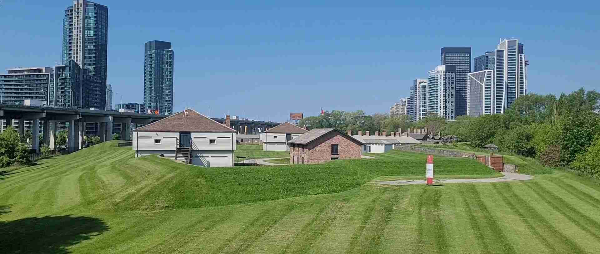
York’s first decade involved arduous work establishing basic infrastructure in challenging conditions. The military garrison, later known as Fort York, occupied a strategic position guarding the harbor entrance on the western side of Garrison Creek. The garrison’s earth and wood fortifications housed British regular troops and Loyalist militia responsible for defending the capital. Civilians settled primarily on the area now known as the St. Lawrence neighborhood east of the garrison, with the provincial government buildings occupying the space between. Early York struggled with muddy unpaved streets, irregular lot layouts, and lack of basic services. The settlement’s population remained under 300 residents throughout the 1790s, consisting primarily of government officials, military personnel and their families, and merchants supplying the garrison and government.
Simcoe’s strategic vision for York emphasized the Toronto Carrying Place portage route as crucial for military communication with the upper Great Lakes. He ordered construction of Yonge Street, named after Sir George Yonge, British Secretary at War, as a military road extending north from York harbor to Holland Landing on Lake Simcoe. The road followed the approximate route of the Indigenous portage trail, allowing rapid troop and supply movement between York and British posts on the upper lakes. Construction began in 1794, with the first rough road reaching Lake Simcoe by 1796. Yonge Street eventually became one of the world’s longest streets, extending over 1,800 kilometers to the Ontario-Minnesota border, though its original military purpose proved less important than its role in opening agricultural settlement in the lands north of York.
The land grant system established settlement patterns that shaped York’s development for decades. The Crown granted large parcels to favored individuals including military officers, government officials, and well-connected merchants, creating an elite landholding class. These substantial grants, often measuring hundreds of acres, were carved from land recently purchased from Indigenous peoples through treaties of disputed validity. The concentration of prime land near York in relatively few hands created both landed gentry who dominated early colonial society and a property speculation market that influenced urban development patterns. Many original grantees never settled their lands, instead holding them for speculative appreciation, a practice that delayed urban growth and frustrated subsequent settlers.
War of 1812 and American Occupation
The War of 1812 between the United States and Britain brought direct military conflict to York, with the town experiencing American occupation twice during the war. York’s strategic importance as Upper Canada’s capital and military supply depot made it a target for American forces seeking to disrupt British military operations in the Great Lakes region. The war years tested York’s small population and demonstrated the settlement’s vulnerability despite Simcoe’s strategic vision of establishing a secure capital far from the American border.
American forces launched their first attack on York on April 27, 1813, landing approximately 1,700 troops west of the town near present-day Sunnyside Beach. The attackers outnumbered York’s garrison of about 700 British regulars, militia, and Indigenous allies, led by Major General Sir Roger Hale Sheaffe. British forces retreated from their initial defensive positions at the waterfront, falling back toward the main fort. During the retreat, British forces detonated the garrison’s gunpowder magazine to prevent its capture, killing an estimated 250 American soldiers including Brigadier General Zebulon Pike, the American commander for whom Colorado’s Pike’s Peak is named. The massive explosion shaped the battle’s aftermath, as enraged American troops burned the provincial parliament buildings, government house, and other public structures in retaliation, though they largely spared private property.
The American occupation of York lasted six days, during which forces removed military supplies and public property before withdrawing. The burning of York’s public buildings had consequences extending beyond Upper Canada, as British forces cited the York destruction as justification for burning Washington, D.C., including the White House and Capitol, in August 1814. This cycle of retaliation exemplified the War of 1812’s character as a bitter conflict marked by limited major battles but extensive raids, occupations, and destruction of property on both sides. York residents who had fled the town before the American arrival gradually returned to find their public buildings destroyed but most private property intact.
American forces briefly reoccupied York in July 1813, landing without opposition and seizing additional military supplies before withdrawing after two days. This second occupation proved less destructive than the first, with American forces focused on supply seizure rather than retaliation. The dual occupations traumatized York’s small population and demonstrated Upper Canada’s vulnerability to American attack, though the war’s overall outcome maintained the Canadian-American border essentially unchanged. York’s experience during the War of 1812 entered local mythology as a formative moment in Canadian identity, though the war’s importance in creating distinct Canadian consciousness from British colonial identity is debated by historians.
Post-War Recovery and Growth: 1815-1834
York’s recovery from the War of 1812 destruction coincided with accelerated immigration and economic growth throughout Upper Canada. The British government encouraged settlement in the colony to strengthen its defenses against potential future American aggression, offering land grants to British immigrants and disbanding soldiers willing to settle in Upper Canada. York’s population grew from approximately 700 residents at war’s end to over 9,000 by 1834, transforming the frontier outpost into a substantial town. The rebuilt parliament buildings and government offices reestablished York’s role as colonial capital, though the buildings’ modest scale reflected Upper Canada’s limited resources and population.
Irish immigration increased dramatically during the 1820s and early 1830s, bringing thousands of predominantly Protestant settlers from Ulster fleeing economic hardship. These immigrants found work in York’s expanding construction trades, domestic service, and waterfront commerce. The Irish presence grew sufficiently large to support distinct neighborhoods and cultural institutions including churches, fraternal organizations, and newspapers. Tensions between Orange Order Protestants and Catholic Irish occasionally erupted in street violence, particularly around July 12 commemorations of the Battle of the Boyne. These religious and ethnic conflicts imported from Ireland shaped York’s social landscape and contributed to sectarian divisions that influenced municipal politics for generations.
York’s economic base expanded beyond government administration to include manufacturing, commerce, and finance during the post-war decades. The town’s harbor attracted shipping connecting Upper Canada to Lower Canada and international markets via the St. Lawrence River system. Local manufacturers produced goods for the growing agricultural hinterland north of the town along Yonge Street and in newly settled areas to the west. York’s first banks opened in the 1820s, providing capital for commercial expansion and beginning the financial sector concentration that would define Toronto’s later economic role. The town’s business elite accumulated wealth through diverse enterprises including land speculation, merchant trading, banking, and government contracts, creating the economic foundation for the Family Compact’s political dominance.
The Family Compact, an informal network of conservative, Anglican, British-born elite families, dominated Upper Canada’s politics and economy during York’s final decades. This group controlled government appointments, land grants, banking charters, and commercial licenses through personal connections and influence with the lieutenant governor. The Family Compact’s monopoly on power and privilege generated growing opposition from reform-minded politicians and newspapers who advocated for responsible government, separation of church and state, and more democratic political institutions. These political tensions, evident in York’s contentious municipal affairs and vitriolic newspaper debates, would erupt in armed conflict during the 1837 Upper Canada Rebellion.
Incorporation as Toronto: 1834
York’s incorporation as the City of Toronto on March 6, 1834, marked a significant transition from colonial outpost to self-governing municipality. The provincial legislature granted the incorporation charter following years of local agitation for municipal autonomy and improved services. The charter established Toronto as the first incorporated city in Upper Canada, creating a mayor-council government structure replacing the previous magistrate system that combined judicial and administrative functions. Toronto residents voted in the name change from York to Toronto, reconnecting with the region’s Indigenous heritage while distinguishing the growing city from numerous other “York” place names across British North America.
William Lyon Mackenzie, a Scottish-born radical reformer and newspaper publisher, won election as Toronto’s first mayor in a contentious campaign reflecting the city’s political divisions. Mackenzie’s election represented a temporary victory for reform forces over the Family Compact establishment, though his single-year term proved tumultuous and ended with his defeat in the 1835 election. Mackenzie’s confrontational style and calls for sweeping political reforms alienated moderate reformers while energizing both his core supporters and conservative opponents. His brief mayoralty foreshadowed his leadership of the 1837 Upper Canada Rebellion, which would temporarily threaten British authority in the colony.
Toronto’s incorporation charter divided the city into five wards based on the medieval ward system common in British municipal governance: St. Lawrence, St. David’s, St. Patrick’s, St. Andrew’s, and St. George’s. Each ward elected two aldermen and two councilmen to Toronto City Council, which in turn elected one of the aldermen as mayor. This indirect election system for mayor continued until 1859, when Toronto adopted direct mayoral elections. The ward system created neighborhood-based representation that influenced municipal politics for over a century, though ward boundaries and names changed repeatedly as the city expanded.
The newly incorporated city faced substantial challenges including inadequate sanitation, unpaved streets, limited clean water supply, and frequent fires that destroyed wooden buildings in the densely packed downtown. Toronto’s first city council addressed these issues with varying success, establishing rudimentary water and sewage systems, fire protection services, and public health regulations. The transition from informal frontier governance to formal municipal administration required building institutional capacity and raising revenue through property taxes, a perennial source of conflict between residents demanding improved services and others resisting taxation. These tensions, evident from Toronto’s first days as an incorporated city, have remained central to municipal politics throughout the city’s history.
The 1837 Rebellion and Its Aftermath
Political tensions between reformers demanding responsible government and the Family Compact defending the existing colonial system erupted in armed rebellion on December 5, 1837. William Lyon Mackenzie led approximately 1,000 poorly armed and disorganized rebels in a march down Yonge Street toward Toronto, intending to seize the provincial government and establish democratic reforms. The rebellion collapsed within two days when loyalist militia and British regulars dispersed the rebel forces at Montgomery’s Tavern north of Toronto, suffering minimal casualties. Mackenzie fled to the United States, where he briefly established a rebel government-in-exile on Navy Island in the Niagara River before American authorities forcibly removed him.
The rebellion’s immediate military failure obscured its longer-term political significance in reshaping British colonial governance. The British government dispatched Lord Durham to investigate the rebellions in Upper and Lower Canada, and his subsequent Durham Report recommended uniting the two colonies and establishing responsible government where the executive would be responsible to the elected assembly rather than appointed by the Crown. These recommendations, implemented gradually over the 1840s and 1850s, fundamentally altered the relationship between colonial governments and British authorities, moving toward the self-governing dominion status Canada would achieve in 1867.
Toronto experienced significant political instability in the rebellion’s immediate aftermath, with conservative forces temporarily dominant but reform sentiment gradually rebuilding strength. The provincial government, relocated temporarily to Kingston for security reasons, returned to Toronto in 1849 after a new parliament building was constructed. The rebellion’s failure discredited violent political action, channeling opposition to the Family Compact into electoral politics and reform movements working within the existing constitutional structure. The gradual achievement of responsible government during the 1840s addressed many reform demands without the revolutionary upheaval Mackenzie had sought, creating a model of peaceful constitutional evolution that became central to Canadian political mythology.
Victorian Toronto: 1840s-1880s
Toronto’s transformation from a provincial town of 15,000 residents in 1840 to a major industrial city of over 86,000 by 1881 reflected broader patterns of Victorian urbanization throughout the British Empire. The railway age revolutionized Toronto’s economy and physical form, connecting the city to expanding agricultural regions in southwestern Ontario and providing connections to American markets. The Great Western Railway, opened in 1853, linked Toronto to Hamilton and the Niagara region, while the Grand Trunk Railway connected the city eastward to Montreal and the Atlantic ports. The Northern Railway, completed to Collingwood on Georgian Bay in 1855, finally realized Simcoe’s strategic vision of connecting Toronto to the upper Great Lakes, though for commercial rather than military purposes.
Industrial development accelerated during the mid-Victorian decades as Toronto’s manufacturers expanded from artisanal production to factory-scale operations. The city’s industries processed agricultural products from the growing Ontario hinterland, including flour milling, meat packing, and leather tanning. Manufacturing districts emerged along the waterfront and near railway lines, where factories could easily receive raw materials and ship finished goods. Working-class neighborhoods developed adjacent to industrial areas, creating the spatial segregation between wealthy residential areas and working-class districts that characterized Victorian cities. This industrial expansion made Toronto Upper Canada’s leading manufacturing center by the 1860s, surpassing earlier rivals including Kingston and Hamilton.
The Confederation of Canada in 1867 created a new national political structure uniting the Province of Canada, Nova Scotia, and New Brunswick into the Dominion of Canada. While Ottawa became the national capital following Queen Victoria’s 1857 selection, Toronto emerged as capital of the new Province of Ontario, one of four original provinces in Confederation. This provincial capital status enhanced Toronto’s political importance while leaving it subordinate to Ottawa in national affairs. The British North America Act established Canada’s federal system, dividing powers between federal and provincial governments, though the precise balance of authority remained subject to decades of constitutional interpretation and political negotiation.
Toronto’s population became increasingly diverse during the Victorian era as immigration patterns shifted beyond the earlier British and Irish dominance. Small numbers of Germans, Italians, Jews, and other European groups established communities in the city, though Toronto maintained a strongly British and Protestant character throughout the 19th century. The Orange Order held significant influence in municipal politics, while the Church of England maintained established church privileges until the 1850s. This Anglo-Protestant dominance created barriers for Catholic Irish, who faced discrimination in employment and social institutions, and for other ethnic and religious minorities who encountered a largely unwelcoming host society.
Late Victorian Expansion: 1880s-1900
Toronto’s population doubled from approximately 86,000 in 1881 to over 208,000 by 1901, requiring massive expansion of the city’s physical boundaries and infrastructure. The introduction of horse-drawn streetcars in the 1860s, replaced by electric streetcars in the 1890s, allowed middle-class residents to live farther from downtown workplaces, spurring suburban development. Streetcar suburbs including the Annex, Parkdale, and the Beaches emerged as fashionable residential districts characterized by substantial Victorian and Edwardian homes on tree-lined streets. This residential expansion beyond the old city center created the spatial patterns that would define Toronto’s urban form into the 20th century, with a downtown commercial core surrounded by residential neighborhoods organized along streetcar lines.
Municipal services expanded dramatically to meet growing population demands. Toronto constructed comprehensive water and sewage systems during the 1870s and 1880s, dramatically improving public health by reducing waterborne diseases that had plagued the city. The city replaced gas streetlights with electric lighting in the 1880s, and telephone service arrived by the 1880s as well. These infrastructure investments required substantial public spending funded through property taxation and borrowing, creating debates about appropriate levels of municipal services and taxation that paralleled similar discussions in other rapidly growing North American cities.
The 1886 Great Fire of Toronto destroyed a substantial portion of the downtown commercial district, leveling buildings between Front, King, Bay, and Yonge Streets. The fire, which burned for approximately 12 hours on April 19, caused an estimated $10 million in damage but remarkably resulted in no deaths. The disaster prompted stricter building codes requiring fireproof construction in the commercial core, leading to the replacement of wooden structures with brick and stone buildings. This reconstruction coincided with the late Victorian commercial building boom, transforming downtown Toronto’s appearance with substantial Victorian commercial architecture that characterized the city’s core for decades.
Labor organization grew during the late Victorian period as industrial workers sought better wages and working conditions through collective action. The Toronto Trades Assembly, formed in 1871, coordinated union activities across multiple trades, while individual unions organized workers in printing, construction, metalworking, and other industries. The 1872 Toronto Printers’ Strike became a landmark in Canadian labor history when workers struck for the nine-hour workday and were arrested for conspiracy under existing law. Prime Minister John A. Macdonald’s government responded by passing the Trade Unions Act, legalizing unions and protecting strike activity, a significant advance in Canadian labor law directly prompted by Toronto labor activism.
Edwardian Toronto: 1900-1914
Toronto’s Edwardian era witnessed continued industrial expansion and population growth, with the city’s population reaching 376,000 by 1911. Immigration from Britain and continental Europe surged during the decade before World War I, bringing unprecedented ethnic diversity to a city that had maintained strong Anglo-Protestant homogeneity. Jewish immigrants from Eastern Europe established communities in the Ward, the working-class immigrant neighborhood centered on present-day Nathan Phillips Square. Italian immigrants concentrated in neighborhoods near College Street, while smaller groups of Ukrainians, Poles, and other European ethnicities created ethnic enclaves throughout the city.
The Toronto Street Railway Company’s expansion of the electric streetcar system shaped residential development patterns, with new neighborhoods emerging along streetcar lines extending in all directions from downtown. Developers purchased farmland along proposed streetcar routes, subdividing properties and marketing lots to middle-class buyers seeking single-family homes away from downtown congestion. This streetcar suburb development pattern, replicated in cities across North America, created the characteristic early 20th-century residential neighborhoods of detached and semi-detached homes that still define much of Toronto’s inner suburbs.
Downtown Toronto underwent transformation during the Edwardian years as office towers replaced Victorian commercial blocks. The 15-story Traders Bank Building, completed in 1906, represented the new scale of commercial construction, towering over its neighbors and signaling Toronto’s aspirations as a major financial center. Department stores including Eaton’s and Simpson’s constructed elaborate emporiums along Yonge Street, establishing the downtown retail district that would dominate Toronto shopping for decades. These commercial developments reflected Toronto’s growing economic power within Canada, as the city’s financial and commercial sectors expanded to serve Ontario’s industrial economy and western Canada’s agricultural expansion.
Social reform movements gained strength during the Edwardian period as middle-class reformers addressed urban poverty, public health, and moral issues. The settlement house movement established facilities including University Settlement House and St. Christopher House providing social services in working-class neighborhoods. Temperance advocates campaigned for alcohol prohibition, achieving local option bylaws in various Toronto wards. Public health advocates promoted sanitation improvements, pasteurized milk, and medical inspections in schools. These Progressive Era reform movements reflected growing middle-class concern about urban social problems and belief in government’s capacity to improve social conditions through regulation and social programs.
World War I and the 1920s
World War I mobilized Toronto’s economy and society for the war effort from 1914 to 1918. Over 70,000 Toronto residents enlisted in Canadian forces, and the city’s factories converted to war production manufacturing munitions, uniforms, and equipment. The war created employment opportunities for women in manufacturing and clerical work previously dominated by men, though most women returned to domestic roles or traditional female occupations after the war. War enthusiasm initially ran high in Toronto’s strongly British population, though opposition grew as casualties mounted and conscription divided English and French Canadians nationally. The war’s end brought economic disruption as factories converted back to peacetime production and thousands of veterans returned seeking employment in a contracting economy.
The 1920s brought renewed economic growth and cultural transformation to Toronto. The advent of radio broadcasting, motion pictures, automobile ownership, and consumer culture reshaped daily life for Toronto’s middle class. The city’s first radio station, CFCA, began broadcasting in 1922, followed by additional stations throughout the decade. Movie palaces including the Imperial Theatre and Loew’s Uptown provided entertainment for mass audiences, while jazz music and dance halls introduced new forms of popular culture. Automobile ownership expanded dramatically during the 1920s, prompting road improvements and suburban expansion beyond streetcar lines. These technological and cultural changes created the distinctly modern urban lifestyle that characterized interwar Toronto.
Toronto’s territorial expansion accelerated during the 1920s as the city annexed surrounding municipalities including North Toronto, East Toronto, and the Town of York. These annexations increased the city’s population to over 521,000 by 1931 and substantially expanded Toronto’s geographic area. The annexed territories brought diverse residential neighborhoods into the city limits, including established middle-class suburbs and newer working-class areas. Annexation also transferred municipal infrastructure and debts to the City of Toronto, creating administrative challenges as the city integrated different service levels and tax rates across the expanded territory.
Prohibition came to Ontario in 1916 through wartime temperance legislation, continuing until 1927 when the provincial government established government-controlled alcohol sales through the Liquor Control Board of Ontario. The prohibition years created a substantial illegal alcohol trade, with bootleggers smuggling liquor from Quebec where prohibition never took effect and from the United States during American prohibition. Toronto developed a reputation for speakeasies and blind pigs serving illegal alcohol despite police enforcement efforts. The end of prohibition brought government monopoly control over alcohol sales, a system that remained largely unchanged for decades despite periodic reform attempts.
The Great Depression: 1929-1939
The October 1929 stock market crash plunged Toronto into a decade-long economic depression that devastated employment, closed businesses, and strained social services. Unemployment reached approximately 30 percent of Toronto’s workforce by 1933, with industrial workers, construction trades, and recent immigrants suffering disproportionately. The city’s private charities and limited public welfare programs proved inadequate for the scale of need, leading to calls for expanded government responsibility for unemployment relief. Unemployed workers organized demonstrations demanding relief, including the 1933 Christie Pits riot that revealed tensions between different ethnic and political groups in the desperate economic circumstances.
Municipal and provincial governments established relief programs providing direct assistance to unemployed workers and their families, though benefits remained minimal and eligibility requirements strict. Single unemployed men received particularly harsh treatment, being sent to remote relief camps where they worked for minimal pay under military supervision. These camps, intended to prevent unemployed men from organizing politically in cities, became centers of radical political activity as workers protested conditions and demanded improved treatment. The relief camp protests, including the 1935 On-to-Ottawa Trek that began with camps in British Columbia, demonstrated growing working-class militancy and criticism of government responses to the Depression.
Despite economic hardship, Toronto underwent significant construction during the Depression as government make-work projects provided employment while building infrastructure. The city constructed the Prince Edward Viaduct connecting downtown to the eastern neighborhoods in 1935, the Malton Airport in 1937 which would become Toronto Pearson International Airport, and various public buildings, parks, and facilities. These Depression-era projects employed thousands of workers while creating lasting infrastructure that shaped Toronto’s subsequent development. The projects reflected both genuine need for public works and government attempts to provide employment relief, combining social welfare goals with infrastructure development.
Political radicalization increased during the Depression as workers and intellectuals questioned capitalism’s viability and explored socialist and communist alternatives. The Co-operative Commonwealth Federation, a democratic socialist party formed in 1932, gained support in Toronto and Ontario, though never achieving the electoral success it experienced in western Canada. The Communist Party of Canada, though illegal from 1931 to 1936, organized unemployed workers and led protests against relief cuts and evictions. These left-wing movements frightened Toronto’s conservative establishment while articulating working-class demands for economic security and expanded social programs that would influence post-World War II welfare state development.
World War II: 1939-1945
World War II mobilized Toronto’s industrial capacity and workforce more completely than World War I, transforming the city into a major center of war production. Factories manufactured military equipment including aircraft, vehicles, munitions, and ships for Canadian, British, and Commonwealth forces. The John Inglis Company factory on Dufferin Street employed thousands of workers producing Bren light machine guns, while Victory Aircraft manufactured Lancaster bombers in Malton. Approximately 84,000 Toronto residents served in Canadian armed forces during the war, though unlike World War I, conscription proved less divisive as Canadians generally supported the war effort against Nazi Germany.
Women’s employment expanded dramatically during the war as labor shortages drew women into manufacturing, transportation, clerical work, and other occupations previously dominated by men. Female workers assembled munitions, drove streetcars, worked as office administrators, and performed numerous other jobs essential to the war effort. The federal government encouraged women’s war work through propaganda campaigns while providing childcare services for working mothers. This wartime expansion of female employment challenged traditional gender roles, though most women faced pressure to return to domestic roles after the war as returning veterans reclaimed civilian jobs. Nevertheless, wartime work experience influenced postwar women’s expectations about employment opportunities and economic participation.
The war prompted Japanese Canadian internment, removing Canadian citizens and residents of Japanese ancestry from the West Coast to interior British Columbia and other provinces including Ontario. Approximately 4,000 Japanese Canadians relocated to Toronto during and after the war, though they faced discrimination and restrictions on property ownership. The internment policy, motivated by wartime hysteria and anti-Asian racism rather than legitimate security concerns, represented one of the darkest chapters in Canadian civil liberties history. The Canadian government formally apologized for the internment in 1988 and provided compensation to survivors, acknowledging the fundamental injustice of the policy.
Toronto’s economy boomed during the war years as full employment and rising wages reversed Depression-era hardship. The wartime economic surge created labor shortages rather than unemployment, raising workers’ bargaining power and strengthening union organization. War industries operated at full capacity, and rationing of consumer goods created forced savings as workers earned wages with limited opportunities for consumption. This accumulated savings, released after the war, fueled the postwar consumer boom and contributed to the economic expansion of the late 1940s and 1950s. The war definitively ended the Depression, creating the economic conditions for postwar prosperity that would transform Toronto and Canada over subsequent decades.
Postwar Boom: 1945-1960
Toronto experienced unprecedented growth and transformation during the postwar years as prosperity, immigration, and suburban expansion reshaped the city. Population growth accelerated with the arrival of European displaced persons, war brides, and immigrants from Britain, Italy, Greece, and other European countries. Toronto’s metropolitan population grew from approximately 667,000 in 1941 to over 1.8 million by 1961, with much of this growth occurring in suburban municipalities surrounding the old city boundaries. This explosive growth strained existing infrastructure and required massive investment in housing, transportation, schools, and services.
Suburban development transformed the landscape surrounding Toronto as developers created vast residential subdivisions in former farmland. Don Mills, planned and developed beginning in 1952, represented a model planned suburban community featuring modernist residential architecture, shopping plazas, industrial parks, and greenspace in a comprehensively designed layout. Other suburbs including Scarborough, North York, and Etobicoke experienced rapid growth as developers built thousands of single-family homes marketed to young families seeking modern housing and yard space. The suburban boom, facilitated by federal mortgage insurance programs and rising automobile ownership, fundamentally altered Greater Toronto’s spatial structure as the region’s population center shifted away from the old city core.
Downtown Toronto underwent transformation as well, with the construction of the city’s first skyscrapers in the modernist International Style. The Bank of Commerce headquarters, completed in 1931, lost its status as the British Empire’s tallest building to the 34-story Canadian Bank of Commerce Building in 1931 and subsequent towers. The Toronto-Dominion Centre, designed by Mies van der Rohe and completed in stages from 1967, established a new scale of downtown development with its black steel and glass towers. These postwar developments signaled Toronto’s evolution into a major financial center with corporate headquarters requiring substantial office space in prestigious downtown locations.
The construction of the Yonge subway line, opened in 1954 as Canada’s first subway, represented Toronto’s most significant transportation infrastructure project. The subway replaced surface streetcar service on Yonge Street with faster underground rapid transit, reducing travel times and increasing capacity on the city’s busiest corridor. The Bloor-Danforth line, opened in 1966, provided east-west rapid transit across the city’s midtown. These subway lines became the backbone of Toronto’s public transit system, though the city’s relatively limited subway network compared to other major cities reflected postwar automobile-oriented planning that prioritized highway construction over transit expansion.
Immigration and Multiculturalism: 1960s-1980s
Canada’s 1967 introduction of a points-based immigration system eliminating national origin quotas fundamentally transformed Toronto’s demographic composition. The new system, which evaluated applicants based on education, skills, and language ability rather than race or nationality, opened Canadian immigration to applicants from Asia, Africa, the Caribbean, and Latin America who had been effectively excluded under previous policies favoring European immigrants. Toronto received disproportionate numbers of these new immigrants, with arrivals from India, China, Hong Kong, Pakistan, the Philippines, Jamaica, Trinidad, and other formerly underrepresented source countries creating unprecedented ethnic diversity.
Portuguese and Italian immigration, already substantial in the 1950s, continued through the 1960s and 1970s, establishing these communities as significant presences in Toronto’s demographic landscape. Portuguese immigrants concentrated in neighborhoods including the Ossington Avenue corridor and Kensington Market, while Italian communities expanded beyond the original College Street area into North York and suburban municipalities. Greek immigration during the 1960s created the Danforth Avenue Greek community, which became one of North America’s largest Greek neighborhoods outside Greece. These Southern European communities established ethnic institutions including churches, social clubs, ethnic media, and businesses that maintained cultural traditions while contributing to Toronto’s evolving multicultural character.
Caribbean immigration, particularly from Jamaica and Trinidad and Tobago, increased substantially after 1967, establishing significant Black communities in Toronto for the first time. Earlier Black presence in Toronto had been limited to small communities descended from escaped enslaved people who reached Canada via the Underground Railroad before the American Civil War. The postwar Caribbean immigration created larger, more visible Black communities facing discrimination in housing, employment, and police relations. Caribbean cultural influences including reggae music, carnival celebrations, and Caribbean cuisine became integral to Toronto’s cultural landscape, though the community’s experiences with racism and inequality generated ongoing tensions with police and other institutions.
Chinese immigration shifted dramatically after 1967, with Hong Kong becoming the largest source of Chinese immigrants to Toronto through the 1980s and 1990s. These arrivals, often well-educated and with financial resources, differed substantially from earlier Chinese immigrants who had faced racist exclusion laws until 1947. Hong Kong immigrants established themselves in professional occupations and business, creating prosperous Chinese suburban communities in Markham, Richmond Hill, and Mississauga. Chinatown itself expanded beyond its original downtown location, with new Chinatowns developing in the eastern suburbs. Chinese became Toronto’s third most common language after English and French, reflecting the community’s size and continued immigration.
Economic Transformation: 1960s-1990s
Toronto’s economy shifted from manufacturing to services during the late 20th century, mirroring broader deindustrialization trends affecting North American cities. Manufacturing employment peaked in the 1950s and declined substantially through subsequent decades as factories closed, relocated to lower-cost jurisdictions, or automated production. Waterfront industrial districts that had been employment centers for generations transformed into mixed-use areas combining office, residential, and recreational uses. This deindustrialization devastated working-class communities reliant on factory employment while spurring economic diversification toward service industries including finance, business services, healthcare, education, and technology.
Financial services became Toronto’s dominant economic sector as the city consolidated its position as Canada’s financial capital. The Toronto Stock Exchange grew to become Canada’s primary securities market and one of the world’s largest stock exchanges. Canadian banks headquartered in Toronto, including Royal Bank, Toronto-Dominion, and Bank of Nova Scotia, expanded domestically and internationally. Insurance companies, investment firms, pension funds, and financial service providers concentrated in Toronto’s downtown financial district. This financial sector concentration created high-wage professional employment for accountants, lawyers, analysts, and managers, though it also contributed to growing economic inequality as financial sector wages pulled away from other industries.
Quebec’s political instability during the 1970s sovereignty debates accelerated Toronto’s emergence as Canada’s unquestioned economic center. The election of the separatist Parti Québécois government in Quebec in 1976 prompted some anglophone businesses and head offices to relocate from Montreal to Toronto, consolidating economic power in Ontario’s capital. This shift reversed historical patterns where Montreal had been Canada’s commercial capital from the colonial period into the mid-20th century. Toronto’s economic ascendance over Montreal reflected multiple factors beyond Quebec politics, including western Canada’s economic growth creating natural connections to Toronto, Ontario’s larger population base, and Toronto’s earlier development of modernist office infrastructure attracting corporate headquarters.
The late 20th century also saw Toronto develop significant technology, media, and creative industries. Film and television production increased substantially from the 1980s onward, with Toronto often serving as a substitute location for American cities due to lower Canadian production costs and favorable exchange rates. The city’s technology sector, while never achieving the scale of Silicon Valley or Boston, developed strength in telecommunications, software, and financial technology. Universities including the University of Toronto and Ryerson University (now Toronto Metropolitan University) contributed to research and development while producing skilled graduates supporting knowledge-intensive industries. These diversified economic activities supplemented the financial sector, creating a more resilient economy than cities dependent on single industries.
The 1998 Amalgamation
The creation of the megacity on January 1, 1998, merged six municipalities—Toronto, North York, Scarborough, York, East York, and Etobicoke—plus the Metropolitan Toronto regional government into a single City of Toronto. The Progressive Conservative provincial government of Premier Mike Harris imposed the amalgamation over substantial local opposition, including referendum results in all six municipalities showing majority opposition to merger. The provincial government argued that amalgamation would reduce costs, eliminate duplication, improve service delivery, and create a stronger, more competitive city. Critics contended that amalgamation would reduce local representation, eliminate distinctive community identities, and increase rather than decrease costs as services across the new city were standardized to higher levels.
The amalgamation created Canada’s fifth-largest government measured by budget, responsible for services for a population of 2.4 million across 630 square kilometers. The new city council structure combined representatives from all former municipalities, though with reduced overall council size compared to the aggregate of previous councils. Former municipal boundaries disappeared administratively, though they persisted in popular consciousness as residents continued identifying with former municipalities and neighborhoods. The transition required integrating different service levels, labor contracts, tax rates, and administrative systems, a complex process that extended over several years and generated ongoing controversies about service quality, tax rates, and municipal management.
Amalgamation’s promised cost savings failed to materialize, with studies indicating that costs actually increased as services across the city standardized to higher levels. The elimination of the two-tier metropolitan structure did reduce some duplication in administration, though the scale savings anticipated by amalgamation proponents proved elusive. Service rationalization meant some neighborhoods experienced service reductions when former municipalities’ higher service levels could not be maintained city-wide within available budgets. The amalgamation remains controversial decades later, with critics arguing it degraded local democracy and representation while defenders contend it created necessary administrative capacity for a major city competing in the global economy.
The amalgamation coincided with broader provincial downloading of responsibilities and costs to municipalities, as the Harris government transferred social services, public health, and social housing responsibilities from the province to municipalities while reducing provincial transfers. This downloading substantially increased municipal expenditures at the same time amalgamation was occurring, making it difficult to isolate amalgamation’s fiscal impact from broader provincial policy changes. The combination of amalgamation and downloading created sustained pressure on Toronto’s finances, contributing to ongoing debates about adequate municipal revenue sources, service levels, and the appropriate balance of responsibilities between provincial and municipal governments.
21st Century Toronto: 2000-Present
Toronto entered the 21st century as a major global city characterized by cultural diversity, economic dynamism, and ongoing challenges of inequality, housing affordability, and transportation. The city’s population growth continued, surpassing 2.7 million within city limits and over 6 million in the Greater Toronto Area by 2020. Immigration remained the primary driver of population growth, with Toronto consistently receiving the highest number of immigrants among Canadian cities. The city’s visible minority population, measured in census data, increased to over 50 percent, making Toronto one of the world’s most diverse cities and creating a distinctive multicultural character evident in neighborhoods, businesses, cultural institutions, and public life.
A residential construction boom transformed Toronto’s skyline and urban fabric during the 21st century, with hundreds of condominium towers constructed downtown and along subway lines. This vertical growth reflected developer responses to housing demand from immigration and domestic migration, changing demographic preferences favoring downtown living, and municipal planning policies promoting intensification along transit corridors. The condominium boom reshaped Toronto’s downtown from a primarily commercial district to a mixed-use area with substantial residential population. Waterfront redevelopment transformed former industrial lands into residential and recreational spaces, creating new neighborhoods including the West Donlands, Liberty Village, and Cityplace.
Housing affordability emerged as Toronto’s most pressing social and economic challenge, with housing costs rising far faster than incomes throughout the 21st century. Average home prices increased from approximately $250,000 in 2000 to over $1 million by 2020, placing homeownership beyond reach for many middle-income households. Rental housing costs increased similarly, with vacancy rates consistently under 2 percent creating intense competition for limited rental units. This housing crisis affected younger generations disproportionately, as those entering the housing market faced prices unthinkable to previous generations. The crisis generated ongoing political debates about housing policy, development regulation, foreign investment, and government intervention in housing markets.
Transportation challenges intensified as Toronto’s population growth outpaced transit expansion. Despite some subway extensions and the construction of new Light Rail Transit lines in Scarborough and along Eglinton Avenue, Toronto’s transit system struggled to meet demand from growing ridership. Roadway congestion worsened as increasing vehicle numbers overwhelmed existing highway and arterial capacity. These transportation challenges affected economic productivity, quality of life, and greenhouse gas emissions, generating sustained pressure for expanded transit investment. Debates over transit expansion, funding models, technology choices, and route priorities became central to municipal politics, though translating plans into actual construction remained difficult given limited municipal revenue sources and changing provincial priorities.
Contemporary Challenges and Future Directions
Toronto’s contemporary challenges reflect its position as a major global city facing issues common to large urban areas worldwide while dealing with specific Canadian and local circumstances. Income inequality increased substantially over recent decades, with Toronto showing among the highest levels of income inequality among Canadian cities. The gap between wealthy neighborhoods concentrated in the central city and older inner suburbs with concentrated poverty created a geography of inequality evident in income statistics, educational outcomes, health indicators, and access to services. This inequality, often correlated with racialized identity and immigration status, represented a significant challenge to Toronto’s self-image as an inclusive, opportunity-rich city.
Gun violence and gang activity increased in some Toronto neighborhoods during the 21st century, challenging the city’s reputation for safety. High-profile shootings including the 2005 Boxing Day shooting on Yonge Street and subsequent violence in priority neighborhoods prompted debates about policing, community investment, and social programs addressing root causes of violence. The relationship between Toronto Police and racialized communities, particularly Black and Indigenous populations, remained tense, with concerns about racial profiling, use of force, and discriminatory practices generating calls for police reform and reimagining public safety approaches. These debates, intensified by broader North American discussions following high-profile police killings, continued to shape municipal politics and policy.
Climate change emerged as an existential challenge requiring substantial policy responses from municipal government. Toronto established greenhouse gas reduction targets and climate action plans, though achieving emissions reductions while accommodating population growth proved challenging. Extreme weather events including the 2013 ice storm that left hundreds of thousands without power for days demonstrated the city’s vulnerability to climate impacts. Adaptation measures including expanded green infrastructure, flood protection, and emergency response capacity required substantial investment, competing with other municipal priorities for limited resources. Toronto’s climate policy efforts reflected growing recognition that cities would play crucial roles in climate mitigation and adaptation, even as federal and provincial climate policies proved inconsistent.
Toronto’s relationship with upper levels of government remained contentious, with persistent debates about adequate funding for municipal services, provincial interference in local affairs, and the appropriate division of responsibilities between government levels. The City of Toronto Act, granted by the province in 2006, provided Toronto with enhanced legislative authority compared to other Ontario municipalities, though it fell short of the broad autonomy some urban advocates sought. Transit funding, housing policy, social services, and infrastructure investment all required provincial and federal cooperation and funding, creating complex intergovernmental relationships where Toronto’s priorities did not always align with provincial or federal agendas. These tensions reflected broader questions about municipal government’s role in Canada’s federal system and cities’ capacity to address complex urban challenges with limited fiscal tools.
Frequently Asked Questions
Who Were the Original Inhabitants of Toronto?
Indigenous peoples inhabited the Toronto region for over 12,000 years before European contact, with the Haudenosaunee and Anishinaabe peoples having the most significant historical presence. The Huron-Wendat people lived in the area during the late pre-contact period before Haudenosaunee expansion during the 17th-century Beaver Wars displaced them northward. The Mississaugas of the Credit, an Anishinaabe (Ojibwe) people, became the dominant Indigenous nation in the Toronto region during the 18th century, controlling the north shore of Lake Ontario when sustained European settlement began. These Indigenous communities established the Toronto area as a significant meeting ground and trade center, recognizing the strategic importance of the location at the convergence of Lake Ontario and the portage route to the upper Great Lakes. The name “Toronto” itself derives from the Mohawk word “tkaronto,” meaning “where there are trees standing in the water,” referring to Indigenous fishing weirs. The land on which modern Toronto stands remains subject to ongoing treaty discussions, as the original treaties between the British Crown and Indigenous peoples contained fundamental ambiguities about territorial extent and the nature of land transfer that have never been fully resolved.
What Role Did Toronto Play in the Underground Railroad?
Toronto served as a destination for escaped enslaved people fleeing the United States via the Underground Railroad during the decades before the American Civil War, though its role was smaller than some other Canadian cities including Chatham and Windsor which were closer to major crossing points. Canada West (later Ontario) had abolished slavery in 1793, making it a destination for freedom seekers, though discrimination and economic hardship meant life in Canada often proved difficult for Black refugees. Toronto’s small Black community before the Civil War, numbering several hundred people, established churches, mutual aid societies, and schools while facing substantial racism from the white majority population. Some prominent refugees including Thornton and Lucie Blackburn, who escaped slavery in Kentucky, settled in Toronto and established successful lives, with Thornton founding Toronto’s first taxi company. The Underground Railroad’s importance in Toronto’s history has been both celebrated as evidence of Canada’s role as a refuge from slavery and critically examined as a more complex story involving racial discrimination and limited economic opportunities for Black refugees in their supposed land of freedom. The abolitionist movement in Toronto remained active through the 1850s and early 1860s, though it never achieved the scale of American abolitionist activity in nearby New York State or Pennsylvania.
Why Did Toronto Surpass Montreal as Canada’s Largest City?
Toronto surpassed Montreal as Canada’s most populous city during the 1970s, culminating a long demographic transition reflecting multiple economic, political, and geographic factors. Montreal had been Canada’s largest city and commercial capital from the colonial period into the mid-20th century, controlling the St. Lawrence River trade route and serving as the financial center for Canadian business. Toronto’s growth accelerated through the 20th century as western Canada’s development created natural east-west connections through Toronto rather than Montreal, while the St. Lawrence Seaway’s 1959 opening reduced Montreal’s monopoly on Great Lakes shipping. Ontario’s larger and faster-growing population base provided Toronto with a bigger local market than Montreal’s Quebec hinterland. The election of the separatist Parti Québécois government in Quebec in 1976 prompted some businesses to relocate head offices from Montreal to Toronto, accelerating the economic transition. Toronto’s earlier development of modern office infrastructure and its position as provincial capital also contributed to attracting corporate headquarters. The demographic shift represented a fundamental realignment of Canadian urban hierarchy, with Toronto assuming the economic and cultural centrality Montreal had held since the French colonial period, though Montreal maintained distinctive characteristics and remained Canada’s second-largest city with significant cultural influence particularly in French-speaking Canada.
What Was the Family Compact?
The Family Compact was an informal network of conservative, Anglican, British-born elite families who dominated Upper Canada’s politics, economy, and society from the 1810s through the 1840s. This group controlled government appointments, land grants, banking charters, and commercial privileges through personal connections to the lieutenant governor and influence over the appointed legislative council that formed Upper Canada’s unelected upper house. Prominent Family Compact members included John Strachan, an Anglican bishop who exercised enormous political influence, John Beverley Robinson, chief justice and political leader, and various members of the Jarvis, Boulton, and Robinson families who intermarried and accumulated economic and political power. The Family Compact’s monopoly on power and privilege generated growing opposition from reform politicians including William Lyon Mackenzie who advocated for responsible government, separation of church and state, and democratic reforms to break elite control over colonial institutions. The political tensions between reformers and the Family Compact culminated in the 1837 Upper Canada Rebellion, which, though a military failure, prompted British reassessment of colonial governance and contributed to the gradual implementation of responsible government during the 1840s. The Family Compact’s legacy included both the physical infrastructure they built as colonial administrators and the political culture of elite privilege and resistance to democratic reforms that shaped Upper Canada’s political development.
How Did the Great Fire of 1849 Affect Toronto?
Toronto experienced its most destructive fire on April 7, 1849, when flames consumed approximately 10 acres of the downtown core between King, Church, Front, and George Streets. The fire, which started in a cabinet-making shop, spread rapidly through wooden buildings in the densely packed commercial district, destroying over 100 structures including shops, warehouses, homes, and the landmark St. James Cathedral. The fire caused an estimated $500,000 in damage, a substantial sum equivalent to approximately one-sixth of Toronto’s annual property assessment. The disaster prompted Toronto City Council to strengthen building regulations, requiring fireproof construction materials including brick and stone in the commercial core and establishing wider streets to serve as firebreaks. The fire also demonstrated the inadequacy of Toronto’s volunteer fire brigades and limited water supply systems, spurring investment in professional fire services and improved water infrastructure. The affected area rebuilt quickly with more substantial structures, contributing to the transformation of Toronto’s commercial architecture from wood to brick and stone construction that characterized Victorian downtown development. While significant, the 1849 fire was less destructive than the Great Fire of 1886, which burned an even larger area of the downtown, though both fires played important roles in shaping Toronto’s building regulations and urban development patterns by demonstrating the vulnerability of wooden construction in densely built urban areas.
What Impact Did the World Wars Have on Toronto?
The World Wars transformed Toronto’s economy, society, and physical form in ways that shaped 20th-century development. World War I mobilized over 70,000 Toronto residents for military service while converting the city’s factories to war production, creating employment opportunities for women in previously male-dominated industries. The war reinforced Toronto’s British identity and imperial loyalty, though it also exposed class tensions as working-class families bore disproportionate casualty rates compared to middle-class volunteers. World War II had even greater impact, transforming Toronto into a major center of war production manufacturing aircraft, vehicles, munitions, and equipment for Canadian and Allied forces. Factories operated at full capacity, ending Depression-era unemployment and creating labor shortages that drew women into manufacturing on a scale unprecedented in earlier conflicts. The wars accelerated social changes including women’s employment outside the home, though most women faced pressure to return to domestic roles after each war. War production’s economic stimulus helped end the Great Depression, while postwar prosperity funded suburban expansion and infrastructure development. Immigration patterns changed significantly after World War II as the federal government admitted displaced persons from Europe and relaxed some racist immigration restrictions, contributing to Toronto’s increasing ethnic diversity. The wars also consolidated Toronto’s position as Canada’s industrial and financial center, with wartime production demonstrating the city’s manufacturing capacity while postwar prosperity allowed the financial sector to expand.
How Did Streetcars Shape Toronto’s Development?
Streetcars fundamentally shaped Toronto’s spatial development from their introduction as horse-drawn vehicles in the 1860s through the electric streetcar era beginning in the 1890s, creating the spatial patterns that define much of the city’s residential neighborhoods. Before streetcars, residents needed to live within walking distance of downtown workplaces, concentrating population in a compact urban core. Streetcars allowed middle-class workers to commute from residential neighborhoods several kilometers from downtown, spurring suburban development along streetcar routes. Real estate developers recognized that property values increased along streetcar lines, prompting them to lobby for route extensions while subdividing farmland along proposed lines for residential development. This created the distinctive early 20th-century streetcar suburbs including the Annex, Parkdale, the Beaches, and Riverdale, characterized by substantial Victorian and Edwardian homes on tree-lined residential streets. The radial pattern of streetcar routes extending in all directions from downtown determined the basic geography of residential development, with neighborhoods organized along major arterial streets served by streetcar lines. When the Toronto Transit Commission replaced some streetcar routes with buses or subways, the spatial logic of development along these corridors persisted, as commercial strips along former streetcar routes remained neighborhood centers. Toronto’s retention of a substantial streetcar network into the 21st century, unlike most North American cities that completely eliminated streetcars mid-century, preserves direct connections to this transportation history and maintains the distinctive character of streetcar-oriented neighborhoods.
What Was the Spadina Expressway Controversy?
The Spadina Expressway controversy represented a pivotal moment in Toronto urban planning, pitting highway proponents advocating automobile-oriented development against community activists defending neighborhoods and public transit alternatives. Provincial and municipal planners proposed the Spadina Expressway in the 1960s as part of a comprehensive highway network that would have built elevated expressways through downtown Toronto, connecting to the existing Don Valley Parkway and Gardiner Expressway. The proposed expressway would have run along the Spadina Road corridor, requiring demolition of homes and dividing established neighborhoods. Community opposition organized during the late 1960s, with residents, urban planners, and civic activists arguing that the expressway would destroy neighborhoods, induce additional automobile traffic, and represent poor urban planning inconsistent with livable city principles. The provincial government under Premier William Davis cancelled the expressway in 1971 following sustained opposition, declaring “cities are for people, not cars” in a decision that became symbolic of a broader shift away from highway-oriented planning toward greater emphasis on public transit and neighborhood preservation. The cancellation influenced subsequent Toronto planning, contributing to greater investment in subway and streetcar expansion rather than highways, and established precedents for community participation in planning decisions. The controversy remains referenced in contemporary Toronto planning debates as an example of successful community mobilization against automobile-oriented mega-projects, though the decision also contributed to Toronto’s limited highway network compared to other North American cities, a factor that critics argue contributes to traffic congestion.
How Has Immigration Changed Toronto’s Character?
Immigration fundamentally transformed Toronto from a predominantly British and Irish Protestant city into one of the world’s most multicultural metropolises over the course of the 20th and early 21st centuries. Early Toronto maintained strong Anglo-Protestant cultural dominance despite Irish Catholic and smaller Jewish and Italian minorities, with the Orange Order exercising significant political influence and Protestant churches dominating social life. Post-World War II European immigration from Italy, Greece, Portugal, and other countries began diversifying Toronto’s ethnic composition, establishing ethnic neighborhoods, businesses, and cultural institutions that challenged Anglo-Protestant dominance. The watershed moment came with Canada’s 1967 elimination of racist national origin quotas in immigration policy, replacing them with a points-based system evaluating education, skills, and language ability regardless of race or country of origin. This policy change opened Canadian immigration to applicants from Asia, Africa, the Caribbean, and Latin America who had been effectively excluded previously. Toronto received disproportionate numbers of these new immigrants, with arrivals from India, China, Hong Kong, Pakistan, the Philippines, Jamaica, Trinidad, and dozens of other countries creating unprecedented diversity. By the early 21st century, over 50 percent of Toronto’s population was foreign-born, with over 200 distinct ethnic origins reported in census data and more than 160 languages spoken. This diversity transformed virtually every aspect of city life including food, entertainment, religious institutions, business communities, and cultural celebrations, creating the multicultural character that defines contemporary Toronto’s identity and distinguishes it from more ethnically homogeneous Canadian cities and many American metropolitan areas.
What Factors Led to the 1998 Amalgamation?
The 1998 amalgamation merging six municipalities and the Metropolitan Toronto government into a single City of Toronto reflected provincial political priorities under the Progressive Conservative government of Premier Mike Harris rather than strong local demand for municipal restructuring. The provincial government argued that amalgamation would reduce costs through eliminating duplication, improve service delivery through standardization, and create a stronger, more competitive city capable of competing in the global economy. These efficiency arguments gained traction during the 1990s recession when concerns about government spending and deficits dominated political discourse. The Harris government’s “Common Sense Revolution” platform emphasized reducing government size and costs, making municipal amalgamation consistent with broader conservative political objectives. However, evidence for cost savings from amalgamation remained contested, with critics arguing that merging municipalities would increase rather than decrease costs as services standardized to higher levels across the new city. All six municipalities held referendums on amalgamation, with residents in each municipality voting against the merger, though the non-binding referendums did not deter the provincial government from proceeding with legislation mandating amalgamation. The provincial government’s willingness to override local opposition reflected Ontario’s constitutional structure where municipalities exist as “creatures of the province” with only powers delegated by provincial legislation, leaving them vulnerable to unilateral provincial action regardless of local preferences. The amalgamation’s timing also coincided with substantial provincial downloading of social services, public health, and housing responsibilities to municipalities, making it difficult to isolate amalgamation’s fiscal impact from these broader policy changes that substantially increased municipal expenditures.