The Sacred Geometry of Prehistory: A Cultural Journey to the Megaliths of Carnac and Locmariaquer
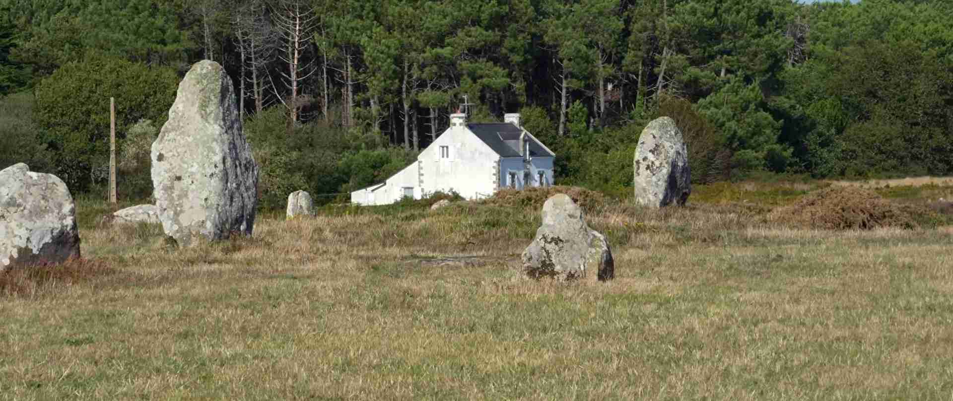
Along the Atlantic coast of Brittany, where granite headlands meet tidal estuaries and the salt air carries an ancient weight, thousands of standing stones have endured for more than six millennia. The megalithic landscapes of Carnac and Locmariaquer constitute the densest and most architecturally sophisticated concentration of Neolithic monuments in the world — a vast ceremonial territory where the builders of prehistory organized stone, earth, and sky into patterns that still challenge our understanding. This guide explores the cultural, spiritual, and archaeological dimensions of these extraordinary sites, examining what they reveal about the people who raised them and the civilization they represent.
Key Takeaways
- Scale without parallel: The Carnac alignments comprise more than 3,000 standing stones arranged in parallel rows extending across roughly four kilometres — no comparable monument complex exists anywhere else on Earth.
- Neolithic origins: The primary megalithic monuments of the Carnac-Locmariaquer region date broadly to between 4500 BCE and 3300 BCE, with some structures potentially earlier, placing their construction before Stonehenge, the Egyptian pyramids, and the Bronze Age civilisations of the Near East.
- Locmariaquer’s colossal stone: The Grand Menhir Brisé at Locmariaquer originally stood as the largest known worked standing stone in the world — a single granite monolith weighing approximately 280 tonnes that was transported and erected by Neolithic communities using only human and animal labour.
- Funerary and ritual complexity: The region contains an exceptional variety of monument types — dolmens, passage graves, tumuli, cromlechs, and alignment systems — indicating a sophisticated ceremonial landscape used across multiple generations for burial, ritual, and communal gathering.
- Astronomical orientation: Systematic studies demonstrate that multiple monuments are oriented toward significant solar and lunar events, particularly solstices and major lunar standstills, suggesting the builders possessed refined observational astronomy integrated into their religious practice.
- Ongoing UNESCO candidacy: The megalithic sites of Carnac and their Breton counterparts have been on France’s tentative list for UNESCO World Heritage inscription, reflecting international recognition of their outstanding universal value.
People Also Ask About the Megaliths of Carnac and Locmariaquer
What are the megaliths of Carnac and how old are they?
The megaliths of Carnac are a vast complex of Neolithic stone monuments located in the Morbihan department of Brittany, northwestern France. They encompass thousands of standing stones arranged in long parallel rows (alignments), single upright menhirs, burial chambers (dolmens and passage graves), and earthen mounds (tumuli). The primary monuments date to the Neolithic period, roughly between 4500 BCE and 3300 BCE, though radiocarbon dating of associated deposits suggests some activity began as early as 5000 BCE. This makes them contemporaneous with or older than many of the world’s most celebrated prehistoric monuments, predating Stonehenge by several centuries and the construction of the Egyptian pyramids by more than a millennium. The nearby Locmariaquer ensemble, intimately connected to Carnac by landscape and cultural tradition, contains some monuments that may be even earlier.
Why were the Carnac stones erected — what was their purpose?
No written records survive from the Neolithic builders, so the purpose of the Carnac stones is reconstructed through archaeological evidence, spatial analysis, and comparison with other prehistoric traditions. The most widely supported interpretation sees the monument landscape as a multifunctional ceremonial territory serving funerary, ritual, and communal functions. The passage graves and dolmens unambiguously served as collective burial chambers, used across generations. The alignments are more enigmatic: their precise astronomical orientations toward solstice and lunar standstill events suggest a ritual or calendrical role, possibly related to the agricultural cycle and the tracking of seasons essential to farming communities. Some researchers propose the alignments functioned as processional routes for large gatherings, transforming the landscape into a theatre for communal ceremony. The territory as a whole appears to have served as a sacred landscape — a region set apart from everyday habitation and dedicated to interactions between the living, the dead, and the forces governing the cosmos.
What is the Grand Menhir Brisé at Locmariaquer and why is it significant?
The Grand Menhir Brisé — the “Great Broken Menhir” — is a fallen and fractured monolith located at the Er Grah site near Locmariaquer, at the mouth of the Gulf of Morbihan. Originally erected as a single standing stone, it measured approximately 20 metres in height and weighed around 280 tonnes, making it the largest known worked and transported megalith in the world. It now lies broken into four fragments. Its significance is multiple: as an engineering achievement it represents a logistical and social feat of staggering proportions, requiring the organisation of a substantial labour force over an extended period without metal tools or wheeled transport. As an astronomical marker it appears to have been positioned with deliberate precision relative to key solar and lunar alignments, functioning as a focal point for the wider ceremonial landscape. Its destruction — whether by human hands, seismic activity, or structural failure — remains debated, but the scale of what was created and then lost makes it one of the most compelling objects of Neolithic archaeology anywhere in the world.
How do Carnac and Locmariaquer compare to Stonehenge and other megalithic sites?
Carnac and Locmariaquer predate Stonehenge by several centuries and surpass it in sheer scale and density of monuments. While Stonehenge is the more internationally recognised site, the Carnac-Locmariaquer territory represents a more complex and varied megalithic landscape, encompassing hundreds of individual monuments across dozens of kilometres rather than a single ceremonial circle. Where Stonehenge represents a concentrated, intensively engineered focal point, the Breton landscape reflects a dispersed, multigenerational ceremonial territory in which different monument types served different functions across a unified sacred geography. Carnac’s alignments have no direct parallel anywhere in the world — no other culture produced stone rows of comparable length, density, and geometric organisation. In terms of monument variety, chronological depth, and the density of Neolithic construction, the Gulf of Morbihan region arguably represents the most important megalithic landscape in Europe, and possibly on Earth.
Extended multi-day tours – 5+ days
Featured Brittany Multi-Day Tour Packages

3 days
Brittany and Normandy
- ✓ Comprehensive Brittany tour
- ✓ Expert local guides included
- ✓ All accommodation arranged
- ✓ Transportation provided
10 days
The Best of Brittany, France
- ✓ Booking needs min. 2 travelers

9 days
Brittany – 9 Days adventure Tour
- ✓ Booking needs min. 2 travelers
- ✓ Flights included

5 days
Hiking on the pink granite coast of Brittany (5 days)
- ✓ Comprehensive Brittany tour
- ✓ Expert local guides included
- ✓ All accommodation arranged
- ✓ Transportation provided
Multi-day tour packages powered by TourRadar. Prices and availability subject to change.
Introduction: A Landscape Shaped by Sacred Intent
To walk the alignments of Carnac at dawn, when the low Atlantic light rakes across the stones at a shallow angle and throws their shadows long across the heathland, is to experience something that exceeds purely intellectual appreciation. These are not ruins in the conventional sense — they have not collapsed from a former grandeur, they have not been obscured by later construction, they have not been repurposed or reinterpreted beyond recognition. They stand, as they were raised, in their original spatial relationships, expressing whatever geometry their builders intended with a directness that bypasses centuries of intermediary culture and speaks with uncommon immediacy.
The region around Carnac and Locmariaquer, centred on the Gulf of Morbihan in southern Brittany, constitutes the heartland of European megalithic civilisation. This is not a marginal or peripheral claim. The density, variety, and chronological depth of the monuments concentrated here are unmatched anywhere. Within a territory of roughly 200 square kilometres, archaeologists have identified and recorded hundreds of megalithic structures: menhirs standing alone in farmers’ fields, passage graves embedded in grassy mounds, alignment systems extending across kilometres of moorland, and great tumuli that command the estuarine landscape with the authority of deliberate, monumental ambition.
Understanding this landscape requires a deliberate unlearning of modern assumptions about what prehistory was. The people who built these monuments were not primitive wanderers scratching an uncertain existence at the margins of subsistence. They were sedentary farmers who had colonised the Atlantic façade of Europe over several generations, developing agricultural surpluses that freed significant portions of the population for organised collective labour. They had a sophisticated cosmological understanding of celestial cycles. They had social structures capable of coordinating the quarrying, transport, and erection of stones weighing tens or hundreds of tonnes. They had religious traditions — concerning death, rebirth, the movement of the sun and moon, the fertility of the earth — that were sophisticated enough to demand architectural expression on a massive scale.
Carnac itself is a small town today, its modest streets and seaside character belying its position at the centre of one of the world’s most extraordinary archaeological landscapes. Locmariaquer, a few kilometres to the southeast at the entrance to the Gulf of Morbihan, forms with Carnac a kind of ceremonial axis within the wider megalithic territory. Between them, and spreading across the surrounding countryside into the communities of Erdeven, Plouharnel, La Trinité-sur-Mer, and beyond, the monuments of the Morbihan Neolithic constitute a living archive of human ambition and spiritual intelligence that archaeology has barely begun to fully decipher.
This guide approaches the megaliths not as curiosities or tourist attractions but as cultural achievements of the first order — monuments that deserve to be understood in the fullness of what they represent: the material expression of a sophisticated civilisation whose values, beliefs, and knowledge shaped the landscape of Atlantic Europe for more than a millennium.
Origins: The Neolithic Communities of Atlantic Brittany
The builders of the Carnac megaliths were part of a broader Neolithic cultural complex that spread along the Atlantic coast of Europe from approximately 5000 BCE onward, following the adoption of agriculture in the western Mediterranean and its progressive diffusion northward. In Brittany, the transition from Mesolithic hunter-gathering to Neolithic farming occurred gradually over several generations, with the earliest agricultural communities establishing themselves in the region by around 5500 to 5000 BCE.
These communities — known to archaeologists through their characteristic pottery, polished stone tools, and, most conspicuously, their monuments — were part of what scholars designate the Western Neolithic or Atlantic Neolithic cultural sphere. This sphere extended from Portugal and Atlantic Spain northward through Brittany, Ireland, Scotland, and Scandinavia, linked not by political organisation but by shared traditions of monument building, shared cosmological frameworks, and likely by networks of exchange and kinship that crossed considerable distances of sea and land.
In Brittany specifically, the earliest megalithic activity appears to predate the main Carnac alignments. Some of the passage graves in the region — particularly those associated with the Kercado tumulus at Carnac, which has been dated to around 4700 BCE — represent early examples of a tradition that would intensify and elaborate across subsequent centuries. The period of maximum megalithic building activity in the Carnac-Locmariaquer area appears to fall between approximately 4500 and 3500 BCE, though the precise chronology remains the subject of ongoing research, complicated by the limited organic material recoverable from individual monuments and the long periods over which many sites were used and modified.
The society that produced these monuments was not politically centralised in any modern sense, but it was far from egalitarian or disorganised. Archaeological evidence from burial contexts within the dolmens and passage graves suggests a stratified society in which certain individuals — likely ritual specialists, community leaders, or hereditary elites — received more elaborate burial treatment. The ability to mobilise the labour required for major construction projects implies authority structures capable of coordinating hundreds or thousands of workers, and the geographic coherence of the monument landscape suggests territorial organisation and shared identity over a substantial area.
The economy underpinning this monumental activity was agricultural, supplemented by fishing, hunting, and herding. The fertile soils of southern Brittany, the rich estuarine and coastal fisheries of the Gulf of Morbihan, and the productive pastures of the interior together supported a population sufficiently large and sufficiently prosperous to divert substantial labour from food production to monument construction — an allocation that, by any measure, represents a significant cultural priority.
The Carnac Alignments: Architecture at Landscape Scale
The most immediately overwhelming feature of the Carnac megalithic complex is the alignments — the great rows of standing stones that march across the heathland in parallel columns, extending for kilometres in an organisation that is unmistakably intentional and yet resists easy explanation. Three main alignment systems survive in recognisable form: those of Le Ménec, Kermario, and Kerlescan, running roughly west to east with slight angular variations between them. A fourth, smaller group at Le Petit Ménec lies to the east of Kerlescan and may originally have connected to it. Taken together, these alignments once comprised somewhere between 3,000 and 4,000 menhirs — modern counts of the surviving stones typically record around 2,800 to 3,000, with losses due to agricultural clearance, construction, and collapse occurring over many centuries.
The geological character of the stones immediately impresses. The menhirs are not all of uniform size: at the western ends of the alignments, closest to the Atlantic, the stones tend to be largest — massive, irregular blocks of local granite and schist rising several metres above the ground. Moving eastward, the stones progressively diminish in height, creating a graduated sequence that suggests deliberate design rather than expedient placement. At Le Ménec, the westernmost alignment system, the largest stones reach four metres or more in height; by the eastern terminus the same rows contain stones of under a metre. This systematic diminution has been interpreted as encoding directional significance, perhaps relating to the movement of the sun or other cosmological reference points, though no consensus interpretation has emerged.
Le Ménec: The Western Alignments
Le Ménec is both the longest and the most visited of the three main alignment complexes. Extending for approximately 1,165 metres, its eleven parallel rows contain around 1,099 surviving menhirs — a count that represents only a fraction of the original installation, since agricultural activity and stone extraction in the historic period removed substantial numbers. At the western end of Le Ménec, the alignment terminates at a cromlech — an enclosed oval arrangement of stones — partially preserved beneath later houses at the hamlet of Le Ménec itself. A second cromlech, less well preserved, anchors the eastern terminus. These terminal structures, recurring at the ends of all the main alignment systems, suggest that the rows did not simply extend indefinitely but were bounded and defined, creating a processional corridor between two enclosing structures.
Walking the Le Ménec alignments offers an experience difficult to convey in description. The rows are wide enough — roughly 100 metres across the full width of all eleven rows — that the stones on either side recede into peripheral vision, and the sense of being channelled or guided along a determined direction is powerful. Whether this was the experiential intention of the builders is impossible to confirm, but the spatial psychology of the alignments — the combination of enclosure and directionality, the repetition of similar forms at slightly varying intervals, the gradual change of scale over the kilometre of walking — suggests a design oriented toward collective experience, toward the movement of groups of people through a defined ceremonial territory.
Kermario: The Central Complex
Kermario, lying roughly a kilometre east of Le Ménec, is perhaps the most photogenic of the alignment complexes, its ten rows of approximately 1,029 stones crossing varied terrain that includes gentle undulations affording broad views across the alignment field. At the eastern end of Kermario, a well-preserved dolmen — the Kermario dolmen, also known as the Table des Marchands in some local nomenclature, though that name more properly belongs to the Locmariaquer monument — stands adjacent to the alignment, suggesting that the rows were laid out in deliberate spatial relationship to pre-existing funerary structures, or that the funerary and processional functions of the landscape were conceived as an integrated whole.
Kermario also contains some of the finest individual menhirs in the Carnac complex. Several stones near the western end of the system rise to four metres or more, their forms individually irregular — shaped by the geology of the original boulders rather than by systematic dressing — but collectively expressing the character of the Carnac stones: massive, weathered, deeply present in the landscape in a way that transcends mere geological incident. The patterning of lichen on granite, orange and grey and pale silver, registers centuries of exposure in a visual record that is itself a kind of material history.
Kerlescan: The Eastern Alignments
Kerlescan is the smallest and easternmost of the three main systems, with thirteen rows containing approximately 555 surviving menhirs. It is also the best preserved in terms of the condition of its terminal cromlech: the western enclosure at Kerlescan survives as a substantial quadrilateral arrangement of stones, partially intact, that provides the clearest sense anywhere in the complex of how these bounding structures originally looked. The Kerlescan alignments differ from Le Ménec and Kermario in their directional orientation, deviating several degrees from the broadly westward-facing direction of the other systems, which has generated considerable scholarly discussion about whether the systems were laid out simultaneously as a unified plan or sequentially by communities with slightly different orientations of reference.
Archaeological excavation in and around Kerlescan has produced some of the most significant finds associated with the alignments, including traces of earlier activity predating the standing stones and evidence suggesting that the alignment field was used as a burial ground as well as for the erection of menhirs. The relationship between the alignment tradition and the funerary tradition — always implicit in the landscape — is here demonstrated by direct physical association.
The Locmariaquer Ensemble: Monuments of the Estuary
Where Carnac offers the spectacle of organised multiplicity — the repetition of hundreds or thousands of individual stones in systematic spatial arrangements — Locmariaquer presents a different kind of megalithic ambition: the colossal singular statement, the deliberate act of creating a single object so large that its presence restructures the landscape around it. The three main monuments of the Locmariaquer ensemble — the Grand Menhir Brisé, the Table des Marchands passage grave, and the Er Grah tumulus — are now enclosed within a single archaeological site managed by the Centre des monuments nationaux, and together they constitute one of the most intellectually rich and archaeologically complex megalithic assemblages in the world.
The Grand Menhir Brisé: A Colossus Fallen
The Grand Menhir Brisé lies where it fell, broken into four substantial pieces, its original magnificence now apprehensible only through imagination and the technical reports of those who have studied it. In its original standing state, it would have risen to approximately 20 metres above ground level, tapering from a broad base to a pointed summit, its total weight estimated at around 280 tonnes. The stone itself is a specific type of orthogneiss, a metamorphic granite found not in the immediate vicinity of Locmariaquer but at a quarry site several kilometres distant — its transport over that distance by Neolithic communities using wooden sledges, rollers, and the organised effort of hundreds of workers represents one of the most impressive logistical achievements of prehistoric humanity.
The date of its erection is not precisely established, but archaeological context suggests it was raised sometime around 4700 to 4200 BCE — among the earliest of the major Locmariaquer monuments. The date of its fall is similarly uncertain: it lay broken on the ground when the earliest modern investigators examined the site, and the cause of its collapse — whether deliberate destruction by a later cultural group, structural failure over time, seismic activity, or some combination — remains debated. What is known is that fragments of the broken menhir were subsequently reused as building material in other megalithic monuments of the region, including in the construction of the Table des Marchands passage grave and in the tumulus of Er Grah, demonstrating that even in its fallen state the Grand Menhir retained powerful cultural significance for the communities that continued to inhabit the landscape.
The menhir’s cosmological role has been the subject of significant scholarly attention. The archaeoastronomer Alexander Thom proposed in the 1970s that the Grand Menhir Brisé functioned as a universal foresight marker, visible from multiple other megalithic sites across the Gulf of Morbihan, and used to track the extreme positions of the moon during the 18.6-year lunar cycle. While aspects of this specific hypothesis have been challenged, the basic observation that the menhir was precisely positioned relative to major celestial events has not been substantially disputed. Its height — making it visible across considerable distances in the relatively flat coastal landscape — supports the interpretation of a marker designed to be seen from afar, integrated into a network of observation points across the wider megalithic territory.
The Table des Marchands: Passage Grave and Gallery
The Table des Marchands — “the merchants’ table,” a name reflecting the fanciful imagination of early local historians rather than any genuine historical connection — is a passage grave of exceptional quality located a few metres from the fallen Grand Menhir. The monument consists of a long stone corridor leading into a large rectangular burial chamber, the whole originally covered by a substantial earthen mound. The chamber’s capstone — the great flat stone forming the “table” of the popular name — is one of the recycled fragments of the Grand Menhir Brisé, its underside bearing carved decorations that were cut before the menhir fell and that are now preserved upside down within the chamber.
The decorated stones of the Table des Marchands are among the most important examples of Neolithic art in Europe. The chamber walls and floor slabs bear carved motifs including curved lines, geometric forms, and the distinctive “shield idol” or “crosse” (crook) motif — an abstract curvilinear form that recurs across megalithic monuments throughout Brittany and further afield in Iberia and the Channel Islands. The roof stone at the back of the chamber, shared with the adjacent monument of Gavrinis several kilometres across the Gulf of Morbihan, bears a decorated surface whose partial forms correspond precisely when the two monuments are considered together — evidence that both were constructed using fragments of the same original slab, likely another piece of the Grand Menhir Brisé complex, establishing a physical and symbolic connection between monuments separated by water.
The burial function of the Table des Marchands is attested by the recovery of human remains from the chamber floor during excavation, though the density and articulation of these remains suggests collective interment — the accumulation of many individuals’ bones over an extended period of use rather than a single burial event. This collective funerary practice, characteristic of passage grave traditions across Atlantic Europe, implies a conception of death and ancestral identity that was communal rather than individual: the dead of a lineage or community were gathered together in a shared house, the megalithic chamber, that perpetuated their presence and their connection to the living.
Er Grah Tumulus: Platform of the Ancestors
The Er Grah tumulus is a long, trapezoidal earthen mound adjacent to the Grand Menhir Brisé, its form characteristic of the elongated “long mound” tradition found across Brittany, Normandy, and into the British Isles. At approximately 140 metres in length, it is one of the larger examples of this monument type in the region. Excavation has revealed a complex internal structure, including stone settings and chambers, as well as evidence of earlier pits and postholes beneath the mound that predate the menhir itself, suggesting prolonged ceremonial activity at this location before the construction of the visible standing monuments.
The reuse of Grand Menhir fragments in the construction of the Er Grah mound’s internal structure confirms the stratigraphic relationship between the two monuments: the great menhir was already broken before Er Grah reached its final form, and its stones were deliberately incorporated, presumably carrying with them whatever symbolic or spiritual potency the menhir had accumulated. The spatial relationship between the menhir’s original position, the Table des Marchands, and the Er Grah mound — all within a few metres of each other — creates a tightly organised ritual precinct, an architectural concentration of sacred significance that expressed itself not through the multiplication of stones, as at Carnac, but through the accumulation of overlapping meanings at a single powerful location.
Ritual Meaning and Symbolic Language
Any attempt to reconstruct the ritual life of the Carnac-Locmariaquer Neolithic communities must proceed with appropriate intellectual humility — these people left no written records, and even the material evidence is interpreted through frameworks of thought shaped by cultures profoundly different from their own. Nevertheless, archaeology and comparative anthropology provide a basis for reasoned interpretation that goes beyond mere speculation, and the patterns that emerge from the evidence are coherent and illuminating.
The Cult of the Ancestors
The most clearly attested ritual dimension of the megalithic tradition is the veneration of ancestors. The passage graves and dolmens of the Carnac-Locmariaquer region were not simply cemeteries — places where the dead were deposited and forgotten — but monuments designed for repeated access and continued interaction with the remains of the deceased. The passage form of the classic megalithic grave is functionally significant: it allows the interior chamber to be entered and exited, enabling the living to bring offerings, deposit new remains, retrieve bones for use in ceremonies, or conduct rituals in the physical presence of accumulated ancestral remains.
Skeletal analysis of bones recovered from passage graves across Brittany reveals that the treatment of the dead was far from passive. Bones were often disarticulated and rearranged, with certain skeletal elements — particularly skulls and long bones — selected for specific placement or for removal from the tomb entirely, presumably for ritual use in ceremonial contexts outside the monument. This manipulation of the dead speaks to a ritual engagement with ancestral remains that was active, purposeful, and governed by recognised protocols. The ancestors were not simply honoured through memory — they were physically present in the community’s ceremonial life through their bones.
The carved motifs that decorate the walls of passage graves across the Morbihan — the abstract curvilinear forms, the shield idols, the pairs of circular indentations, the axe-head carvings — likely encoded religious content whose precise meaning is lost, but whose systematic recurrence across geographically dispersed monuments testifies to a shared symbolic vocabulary. The same or closely related motifs appear on passage graves in Normandy, Ireland, and Wales, indicating that the Neolithic communities of Atlantic Europe shared not only architectural traditions but a common iconographic language expressing shared beliefs.
Cosmological Orientation and Sacred Geometry
The consistent orientation of megalithic monuments toward significant celestial events is one of the most rigorously documented aspects of the Breton Neolithic, and one of the most revealing. Passage graves throughout the Morbihan are oriented so that their entrances face the rising sun at particular points in the solar calendar: winter solstice sunrise, summer solstice sunrise, or the solar equinoxes predominate, though orientations toward other astronomically significant dates are also recorded. This orientation was not accidental — the construction of a passage grave requires the deliberate determination of an axial direction, and the consistent preference for solar alignments across scores of individually constructed monuments testifies to a culturally embedded astronomical orientation, a cosmological framework in which the movement of celestial bodies through the sky structured the ritual calendar and defined the sacred significance of particular times and directions.
The alignments at Carnac participate in this astronomical dimension, though their orientations are more complex and contested. The most broadly accepted observation is that the alignments as a whole are oriented broadly toward the west-northwest, loosely corresponding to the position of the setting sun at or near the winter solstice — a relationship that would make the alignments serve as a directional reference toward the most symbolically significant event in the annual solar cycle: the shortest day, the point of maximum darkness, and the beginning of the sun’s return. The graduation of stone heights from west (tallest) to east (shortest) within the alignments reinforces the sense of directional significance, marking the western orientation as the principal reference point.
At Locmariaquer, the astronomical dimension reaches its most sophisticated expression in the proposed role of the Grand Menhir Brisé as a sighting marker for the lunar cycle. The 18.6-year cycle of major lunar standstills — the points at which the moon reaches its maximum and minimum northerly and southerly positions on the horizon — is a subtler and more demanding object of astronomical observation than the solar solstices, requiring multi-year records and a conceptual framework capable of identifying long-period patterns in celestial movement. If the Grand Menhir did function as a universal lunar foresight, its builders possessed astronomical knowledge of a sophistication that commands genuine respect.
Landscape as Sacred Territory
Beyond individual monuments, the entire Carnac-Locmariaquer region can be understood as a deliberately constructed sacred landscape — a territory transformed by human intention into a ceremonially meaningful space. The placement of monuments is not random: alignments, tumuli, passage graves, and menhirs are distributed across the landscape in patterns that suggest deliberate spatial planning, with monuments positioned relative to natural topographic features, to each other, and to the visible celestial horizon.
The Gulf of Morbihan itself — the “little sea” enclosed by the mainland and a fringe of offshore islands — played a central role in this sacred geography. Its sheltered waters, tidal rhythms, and islanded character made it a natural focus for communities whose identity was bound up with the sea and with the movements of water and light across the estuary. Several of the most significant monuments — Gavrinis, most strikingly, on its own small island in the gulf — are positioned on or near the water, exploiting the visual and experiential properties of the tidal landscape. The gulf as a whole may have been conceived as a threshold space, a liminal zone between the worlds of the living and the dead, between the terrestrial and the celestial, whose inherent ambiguity made it an appropriate location for the most charged of ceremonial activities.
The Builders: Society, Labour, and Knowledge
The scale of the Carnac monuments demands serious engagement with the question of social organisation. Building the Le Ménec alignment alone — quarrying the stones, transporting them from source outcrops several kilometres distant, digging the stone-holes, erecting and packing the menhirs — would have required thousands of person-days of organised labour, extended across months or years. Building the Grand Menhir Brisé, transporting a 280-tonne monolith to its final position and erecting it to a height of 20 metres, represents an engineering challenge of a different order entirely — one requiring not only massive labour but specialised technical knowledge of leverage, friction, and the properties of materials.
Labour Mobilisation and Social Authority
The standard modern assumption — that monument construction of this kind implies some form of coercive authority, a ruling class compelling tribute labour from a subordinate population — is not clearly supported by the available archaeological evidence. Comparative ethnographic study of societies engaged in large-scale communal construction in the absence of states or formal hierarchies suggests an alternative model: feasting and ceremonial obligation as the mechanism for labour mobilisation. In this model, the construction of a monument is associated with large communal gatherings at which food, drink, and social solidarity are conspicuously shared, and participation is motivated by religious obligation, social prestige, and community identity rather than compulsion.
The evidence from Breton Neolithic settlement and dietary contexts is consistent with a society that invested in the production of agricultural and livestock surpluses specifically to fund large-scale feasting events associated with monument construction and funerary ceremony. Animal bone assemblages from sites associated with megalithic construction show patterns of meat consumption — large numbers of cattle killed and consumed simultaneously — that suggest exactly this kind of periodic large-scale feasting. The monuments, in this reading, were the physical residue of recurring episodes of communal labour and celebration, their permanence in stone encoding the memory of these gatherings in a form that would outlast the generations that created them.
Technical Knowledge and Craft Tradition
The logistical and technical competence demonstrated by the Carnac-Locmariaquer monuments requires acknowledgement. Transporting multi-tonne stones across several kilometres of varied terrain, erecting them precisely in pre-dug sockets, and arranging hundreds of them in geometrically organised rows demands practical engineering knowledge — knowledge of load-bearing, of leverage systems using timber and rope, of the excavation and stabilisation of stone-holes in varied soil conditions. The consistent use of specific stone types from specific quarry sources indicates geological knowledge and deliberate material selection. The astronomical orientations of the monuments imply systematic observational practice and record-keeping extending across generations.
All of this knowledge was held and transmitted not in writing but in oral tradition, in apprenticeship and embodied craft practice, in ceremonial performance and communal memory. The monuments themselves were likely instruments of this knowledge transmission: their orientations encoded astronomical information in physical form, their spatial relationships preserved geometric knowledge, their decorative programs maintained an iconographic tradition that communicated cosmological content across time. The megalithic landscape was, among its other functions, a storage medium — a means of preserving and transmitting knowledge across generations in a culture without writing.
Women, Men, and Ritual Life
Osteological analysis of skeletal remains from Breton passage graves reveals that both men and women were interred within the monuments, with no clear gender differentiation in burial treatment in the earliest phases. This biological inclusivity in the funerary record is consistent with a community-centred conception of ancestral identity in which lineage membership rather than gender or individual status determined eligibility for collective interment. Later phases of megalithic use sometimes show more differentiated burial practices, potentially reflecting changes in social organisation over time.
The figurative elements of megalithic art — the shield idols, the abstract anthropomorphic forms, the “Neolithic goddess” interpretations that dominated earlier scholarship — have been reconsidered in light of more rigorous iconographic analysis. The most recent interpretations tend toward caution, reading the carved motifs as symbolic forms whose gender associations, if any, are not unambiguously determinable from the visual evidence alone. What is clear is that the symbolic vocabulary of Breton megalithic art was rich, consistent, and widely shared — a visual language expressing shared beliefs whose full content remains to be decoded.
Astronomical Alignments: Reading the Sky in Stone
The astronomical dimension of the Carnac-Locmariaquer monuments deserves extended treatment, both because it is among the most rigorously demonstrated aspects of the Neolithic builders’ knowledge and because it illuminates the cosmological framework within which the monuments were conceived and used. The relationship between megalithic architecture and celestial phenomena is not a matter of speculation or symbolic interpretation — it is measurable, verifiable, and systematic.
Solar Orientations in the Passage Graves
The orientation of passage graves toward sunrise at the winter solstice is the most widely recognised astronomical feature of the Breton megalithic tradition. The winter solstice — the shortest day of the year, when the sun rises at its most southerly point on the eastern horizon — held obvious symbolic significance for agricultural communities, marking the turning point of the annual cycle, the moment after which the days would lengthen and spring would eventually return. Building a monument whose entrance corridor admitted the light of the rising winter solstice sun, illuminating the innermost chamber where the ancestral dead were gathered, would have been a powerful ritual act: the sun of the new year visiting the ancestors, perhaps renewing them, perhaps drawing the living and the dead together in a shared moment of cosmic significance.
The orientation of the Table des Marchands passage grave at Locmariaquer toward the winter solstice sunrise is well documented. At the solstice, the rising sun’s light penetrates the entrance corridor and strikes the decorated back wall of the chamber, illuminating the carved motifs in a shaft of winter sunlight. Whether this illumination event was the primary purpose of the orientation or one aspect of a complex ritual programme cannot be determined from the physical evidence alone, but the precision of the alignment leaves no doubt that it was intentional.
Lunar Cycles and the 18.6-Year Standstill
The proposition that the Grand Menhir Brisé served as a universal lunar foresight, allowing observers at multiple surrounding megalithic sites to determine the extreme positions of the moon during its major standstill cycle, remains the most audacious astronomical hypothesis associated with the Carnac-Locmariaquer landscape. Alexander Thom’s original analysis identified up to eight surrounding sites from which the Grand Menhir would have served as a visible horizon marker for specific lunar positions, and subsequent investigations have confirmed that the geometric relationships he described are substantially correct, even where his specific interpretations have been refined or modified.
The significance of this claim is considerable. Tracking the major lunar standstill — the 18.6-year cycle during which the moon’s maximum rising and setting positions on the horizon shift progressively northward and then southward — requires systematic observation over multiple decades, a conceptual framework capable of recognising long-period patterns in celestial behaviour, and the social continuity to transmit observational records across generations. If the people of the Morbihan Neolithic were engaged in this project, they were practising a form of naked-eye astronomy more sophisticated than that documented in many later pre-literate cultures, and they were doing so in the service of a religious or cosmological purpose that integrated the movements of the moon into the fabric of ceremonial life.
The Broader Astronomical Landscape
Beyond the specific alignments of individual monuments, the wider distribution of megalithic sites across the Gulf of Morbihan region shows patterns consistent with a landscape organised in part by astronomical reference. The positions of major mounds and passage graves on elevated ground, their orientations toward different points of the solar or lunar calendar, and their visual interrelationships within the landscape suggest that the builders conceived the territory as a whole as an astronomical instrument — a means of reading the sky from multiple simultaneously active observation points whose relationships to each other structured the ceremonial calendar.
The island monument of Gavrinis, whose extraordinary passage grave bears more carved decoration per square metre than any other megalithic monument in Europe, is oriented toward the winter solstice sunrise and positioned within the Gulf of Morbihan in a way that relates it visually to Locmariaquer. The shared capstone between Gavrinis and the Table des Marchands — physically separated by several kilometres of water but spiritually connected through the reuse of the same original stone — expresses a conception of the Gulf as a unified ceremonial territory in which individual monuments were nodes in a larger sacred geography.
Key Monuments of the Wider Carnac-Morbihan Territory
Beyond the primary alignments and the Locmariaquer ensemble, the megalithic territory of the Morbihan contains dozens of individual monuments worthy of extended attention. A selection of the most significant follows.
Gavrinis Passage Grave
Gavrinis — the name derives from the Breton for “goat island” — lies on a small island in the inner Gulf of Morbihan, accessible by short ferry crossing from Larmor-Baden. Its passage grave, constructed around 3500 BCE, is covered by a substantial mound and contains a corridor and chamber whose walls are almost entirely covered in elaborate carved decoration. Twenty-three of the twenty-nine surviving orthostats bear carving, in a density and intricacy unmatched anywhere in the megalithic world. The motifs — concentric arcs, spiral lines, curvilinear forms, axes and halberds — are executed with extraordinary technical skill, the lines deeply and precisely incised in the hard granite. The monument is oriented toward winter solstice sunrise. Access requires a ferry ticket and guided tour; advance booking is strongly advised during the summer season.
Kercado Dolmen
The Kercado dolmen, located within the Carnac alignment field south of Kermario, is among the oldest dated megalithic monuments in the region, with charcoal deposits from its construction context producing radiocarbon dates centred around 4700 BCE. It consists of a dolmen chamber covered by a substantial round mound, the chamber’s capstone supported by upright stones. A menhir stands on top of the mound, adding a dimension of vertical presence to the monument’s form. Kercado sits on private land but has historically been accessible to visitors; the monument is often cited as demonstrating the antiquity of the megalithic tradition in the Carnac area and its priority relative to the alignment systems.
Tumulus Saint-Michel
The Tumulus Saint-Michel is the largest burial mound in Brittany: a vast, elongated earthen construction rising approximately twelve metres above the surrounding landscape and extending roughly 125 metres in length. It is located at the eastern edge of the town of Carnac, surmounted by a small chapel that has occupied its summit since the medieval period. The mound was excavated in the nineteenth century, revealing internal stone chambers and cists containing funerary deposits of exceptional quality: polished stone axes of rare stone types, beads of callais (a green stone with strong prestige associations in the Breton Neolithic), and pottery. The presence of these high-status objects in concentrated deposits suggests that the Tumulus Saint-Michel was associated with a social group of particular authority. The internal chambers are not currently accessible to the public; the exterior of the mound can be circumnavigated on foot.
Er Lannic Cromlechs
The Er Lannic cromlechs — two large stone circles partially submerged in the waters of the Gulf of Morbihan — represent one of the most visually striking and archaeologically significant consequences of the postglacial sea level rise that progressively inundated the lower coastal areas of Brittany during and after the Neolithic. The circles were constructed on what was then dry land, their stones originally standing fully above ground in arrangements analogous to the cromlechs that terminate the Carnac alignments. The progressive rise of the gulf’s waters over subsequent millennia has left the lower portions of the circles permanently submerged, visible only at low tide from passing boats. Their current condition vividly illustrates the extent to which the Neolithic coastal landscape has been transformed by sea level change, and reminds visitors that many further monuments may lie entirely beneath the present waters of the gulf.
Megalithic Art: The Visual Language of the Neolithic
The carved decorations found on the orthostats and capstones of Breton passage graves constitute one of the most important bodies of prehistoric art in the world, and one of the least well understood. Unlike Palaeolithic cave art — which depicts recognisable animals, human figures, and hands with an immediacy that crosses the temporal distance — Neolithic megalithic art is predominantly abstract, its forms curvilinear, geometric, and symbolic in ways that resist direct interpretation. This does not make it less significant: it makes it more demanding, requiring the viewer to engage with a visual language whose grammar and vocabulary must be reconstructed from first principles.
Recurring Motifs and Their Distribution
Several motifs recur with sufficient consistency across geographically dispersed monuments to constitute a shared symbolic vocabulary. The “crosse” or crook — an abstract curvilinear form resembling a stylised shepherd’s staff — appears on monuments from Brittany to Ireland, suggesting a widely shared iconographic tradition. The “shield idol” — a roughly rectangular form with internal division suggesting a schematic anthropomorphic figure — recurs on monuments across Atlantic Europe, raising the possibility that it represents a deity, an ancestor figure, or a spirit associated with the passage grave tradition. Axe carvings are widespread and numerous, their association with polished stone axes — prestige objects of the Neolithic social economy — suggesting a connection between the carving and the real objects of social value. Circular or cup-mark motifs, serpentine and spiral forms, and geometric compositions of parallel lines and arcs complete the principal repertoire.
The distribution of carved monuments within the Morbihan region is itself revealing. Not all passage graves are decorated: the concentrations of carving at Gavrinis, at the Table des Marchands, and at a small number of other monuments suggest that these were particularly significant nodes within the ceremonial landscape, distinguished from the wider distribution of undecorated monuments by the application of visual symbolic content that encoded special meaning. The selection of specific stones within a monument for decoration — typically the most visible surfaces of key structural elements — suggests deliberate choices about what to mark and what to leave plain, choices that presumably reflected distinctions of cosmological or ritual importance.
Technical Execution
The carving technique used in Breton passage grave art involved the use of stone picks and chisels to peck, incise, or abrade the surface of the orthostat or capstone. The hardness of Breton granite makes this a labour-intensive process: producing the fine, deep lines of the Gavrinis decoration, for example, would have required sustained effort with appropriate stone tools, and the consistency of the execution across large decorated surfaces suggests skilled specialists rather than casual amateur carving. Whether the decoration was applied before or after the stones were incorporated into the monument — a question with significant implications for the sequence and meaning of the construction process — varies between monuments and remains a subject of investigation.
Some decorated stones show evidence of having been carved in a different context before their incorporation into the monument: the recycled menhir fragments used at the Table des Marchands and Gavrinis bear decoration that continues beyond the edges of the visible portion, demonstrating that the carving predates the cutting and reuse of the stone. This deliberate incorporation of already-significant decorated objects into new monuments is consistent with the broader pattern of Neolithic monument-building as a process of accumulating and layering meaning over time, each generation adding to the symbolic inheritance of the landscape rather than simply replacing it.
Visiting the Megalithic Landscape: Practical Cultural Guidance
The experience of visiting the Carnac-Locmariaquer landscape rewards thoughtful preparation. These are not sites that yield their significance to a quick pass-through; they repay sustained attention, unhurried walking, and a willingness to be present in the landscape rather than simply to document it photographically and move on.
Carnac Alignments: Access and Seasonal Considerations
Access to the Carnac alignments is managed by the Centre des monuments nationaux, which operates a visitor centre at the Maison des Mégalithes opposite the Le Ménec alignment. For much of the year, direct access to the alignment fields is restricted to guided tours in order to protect the ground surface from erosion; free access is typically restored during the winter months when visitor numbers are lower. This policy reflects genuine conservation necessity: the combination of tourist pressure and the sensitive moorland soils has caused measurable damage, and the restriction policy is a reasonable response to that damage.
Guided tours of the alignments depart from the Maison des Mégalithes and cover sections of the Le Ménec, Kermario, and Kerlescan systems with qualified guides whose commentary provides contextual and archaeological information. The tours are available in multiple languages including English. Outside the guided access periods, the alignments can be viewed from their perimeters, and sections of the stone rows are visible from public roads and footpaths surrounding the restricted zones.
The best experiential conditions for the alignments — for visitors interested in the atmospheric and spatial qualities of the monuments as much as their archaeological significance — are early morning in low light or on overcast days, when the stonework takes on particular weight and presence, and in autumn or winter when the heath vegetation is low and the stones emerge from the landscape with unobstructed visibility. Summer mornings before the guided tour traffic begins offer comparable qualities while still permitting direct access.
Locmariaquer: The Enclosed Site
The Locmariaquer megalithic ensemble — comprising the Grand Menhir Brisé, the Table des Marchands, and the Er Grah tumulus — is enclosed within an archaeological site managed by the Centre des monuments nationaux, with a ticket office, visitor facilities, and access provided via the managed site entrance. The interior of the Table des Marchands passage grave is accessible on guided or self-guided tour, and the quality of its decoration rewards close inspection; visitors should allow adequate time for eyes to adjust to the chamber’s low light. The Er Grah tumulus exterior is fully walkable, though the internal chambers are not publicly accessible.
Gavrinis: Island Passage Grave
Access to Gavrinis is by ferry from the port of Larmor-Baden, with guided tours of the passage grave included in the crossing ticket. The monument is open to visitors during the spring and summer season, with tours conducted by guides whose specialist knowledge of the site is exceptional. The number of visitors permitted into the chamber at any one time is limited both by the physical constraints of the space and by conservation policy, and advance booking is essential during peak season. The guided tour provides access to carving of extraordinary quality; it is one of the most intellectually and aesthetically rewarding experiences available within the megalithic landscape and should not be missed by any visitor with serious interest in the tradition.
Other Sites of Significance
The Tumulus Saint-Michel in Carnac town offers an accessible exterior walk and the small Musée de Préhistoire at its base provides an excellent introduction to the regional archaeology. The Carnac Musée de Préhistoire James Miln – Zacharie Le Rouzic is among the best regional prehistory museums in France, housing finds from local monuments and providing the scholarly and historical context for the landscape that the outdoor sites cannot themselves supply. A half-day in the museum before beginning outdoor visits significantly enriches the experience of the monuments.
The nearby Kerzerho alignments at Erdeven — less visited and less well known than the Carnac systems, but substantial and impressive in their own right — offer an experience of the alignment tradition in a less managed and more immediate context. The Moulin de Cojoux alignments at Saint-Just, in the Ille-et-Vilaine department north of Rennes, extend the megalithic tradition across a wider Breton territory for visitors with time to explore beyond the Morbihan heartland.
Heritage Status, Conservation, and Contemporary Challenges
The monuments of the Carnac-Locmariaquer region have benefited from formal protection under French law for more than a century, and the most significant sites are managed with professional care under the direction of the Centre des monuments nationaux and the relevant regional and departmental heritage authorities. France has maintained a tentative list nomination for the megalithic sites of the Carnac and Gulf of Morbihan region at UNESCO, and the international recognition of their outstanding universal value is broadly accepted within the archaeological community. Formal inscription as a UNESCO World Heritage Site would provide additional international visibility and conservation support, though the French state’s existing frameworks are substantial.
The Erosion Challenge
The fundamental conservation challenge facing the Carnac alignments is physical erosion caused by the combination of visitor pressure and the inherent fragility of the heathland ecosystem in which the stones are embedded. The soil around the menhirs is shallow and easily compacted; the destruction of the ground vegetation cover by repeated foot traffic exposes underlying material to wind and water erosion, which in turn destabilises the stone-holes in which the menhirs are set. The restricted access policy introduced at Carnac in the 1990s was a direct response to documented erosion damage, and its continuation reflects genuine conservation necessity rather than administrative conservatism.
The management plan for the Carnac alignments balances visitor access against conservation requirements through a system of rotating access zones, guided tour programmes, and infrastructure — boardwalks, defined paths, interpretation panels — designed to concentrate visitor movement and reduce dispersed pressure on vulnerable areas. The vegetation restoration programme associated with the access restriction has produced measurable recovery of heathland ground cover in the restricted zones over recent decades.
Agricultural and Development Pressures
Beyond the managed monument sites, the wider megalithic landscape faces ongoing pressures from agricultural intensification, rural construction, and landscape change. The protected status of individual monuments does not automatically protect the landscape setting in which they are embedded, and the visual and spatial coherence of the megalithic territory — its character as a landscape rather than merely a collection of individual monuments — is vulnerable to piecemeal change. The expansion of housing in the Carnac and Locmariaquer areas, the management of agricultural land surrounding monument sites, and the development of tourism infrastructure all have implications for the integrity of the wider ceremonial landscape that individual monument protections do not fully address.
Archaeological research in the region continues to refine understanding of the landscape’s extent and complexity, regularly identifying previously unrecorded features — eroded mounds, buried stone settings, traces of Neolithic settlement — that expand the known footprint of the megalithic territory. Each such discovery reinforces the argument for landscape-scale protection rather than site-specific conservation in isolation.
Research and Scholarly Development
The archaeology of the Carnac-Locmariaquer region has been the subject of systematic scholarly investigation since the nineteenth century, but the application of modern dating techniques — high-precision radiocarbon dating, Bayesian statistical modelling of date distributions, optically stimulated luminescence dating of sediment deposits — has transformed understanding of the chronological development of the monument landscape in recent decades. The picture that emerges from this research is of a monument-building tradition more dynamic and more chronologically compressed than earlier interpretations suggested: rather than a slow accumulation of monuments across many centuries, the major building phases appear to have been episodes of concentrated activity, implying social mobilisation events of considerable intensity and suggesting that the landscape achieved much of its present character within specific, relatively brief periods of exceptional communal investment.
The question of the social and cultural processes behind the monument-building tradition — the relationship between monument construction and political authority, between funerary practice and social identity, between astronomical knowledge and religious belief — remains one of the most active areas of research in European prehistoric archaeology, drawing scholars from France, Britain, Ireland, Scandinavia, and beyond into ongoing dialogue about the nature of the Neolithic world.
Frequently Asked Questions
How many standing stones remain at Carnac?
Approximately 2,800 to 3,000 menhirs survive across the three main alignment systems of Le Ménec, Kermario, and Kerlescan, along with the smaller Petit Ménec group to the east. This represents a substantial reduction from the original installation, which archaeological and topographic evidence suggests originally comprised between 3,000 and 4,000 stones. Losses occurred over many centuries through agricultural clearance, stone extraction for construction materials, and structural collapse. Modern conservation and management of the alignment fields has stabilised the surviving monument and substantially arrested further loss.
Can visitors enter the passage grave chambers at Carnac and Locmariaquer?
Access varies by monument. The Table des Marchands passage grave at Locmariaquer is accessible on the managed site visit; visitors enter the chamber through the corridor, allowing direct observation of the decorated stones. The Gavrinis passage grave is accessible on guided tours via ferry from Larmor-Baden, with chamber entry included. The Kercado dolmen near Carnac has historically permitted external viewing. The interior chambers of the Tumulus Saint-Michel in Carnac are not publicly accessible. The alignments themselves are accessible during guided tour periods and freely during winter months.
What is the best time of year to visit Carnac?
The megalithic landscape of Carnac rewards visits in all seasons, though the experiential quality varies considerably. Spring and autumn offer the best combination of manageable crowds, favourable light conditions for photography and observation, and good availability of guided tours. The winter solstice period in December is significant from an astronomical perspective — several passage graves in the wider region are oriented toward winter solstice sunrise — and the low light of winter mornings dramatises the alignments. Summer brings larger crowds and reduced access to the alignment fields, but Gavrinis is fully operational and the wider coastal landscape is at its most accessible. Access to the alignment fields is freely available without guided tours during the winter months.
How were the megaliths transported and erected without modern machinery?
Experimental archaeology and engineering analysis have established that the transportation and erection of the Carnac menhirs was achievable using Neolithic technology, though it demanded substantial organised labour. Quarrying was accomplished using stone and antler tools to exploit natural fracture lines in the granite. Transportation over distances of several kilometres was accomplished by a combination of wooden sledges, rope hauling, rollers made from tree trunks, and levered loading onto carrying frames — techniques confirmed through experimental reconstructions. Erection used timber A-frames and levers to lift the stones into pre-dug sockets, which were then packed with smaller stones and earth to stabilise the menhir upright. The Grand Menhir Brisé at Locmariaquer, weighing approximately 280 tonnes, represents the outer limit of what was achievable by these means, requiring exceptional organisation and an unusually large labour force.
Are the Carnac stones connected to Celtic culture or mythology?
No. This is a common misconception. The Carnac megaliths predate the arrival of Celtic peoples in Brittany by more than two thousand years. Celtic culture in Brittany belongs to the Iron Age, roughly from 800 BCE onward; the Carnac alignments and Locmariaquer monuments were constructed between approximately 4500 and 3300 BCE, during the Neolithic period. The builders were Neolithic farmers of the Atlantic western European tradition, genetically and culturally distinct from the later Celtic populations of the Iron Age. Local folklore in Brittany — including legends that the stones are soldiers petrified by a saint — reflects medieval and early modern attempts to explain the monuments within a culturally familiar framework, not authentic historical memory of their construction.
What is the relationship between the Carnac monuments and those of Stonehenge and the British Isles?
The megalithic traditions of Brittany and the British Isles are related — sharing architectural forms, decorative conventions, and astronomical orientations — but the Breton tradition is generally earlier. The earliest major Breton monuments predate the earliest phases of Stonehenge by several centuries, and there is archaeological evidence for cultural contact and exchange between Neolithic communities across the English Channel and Irish Sea, including shared stone axe types and comparable monument forms. Whether the British megalithic tradition was directly derived from the Breton via cultural diffusion and migration, or whether both traditions drew independently on a shared Atlantic Neolithic cultural substrate, is a question that continues to generate research. The physical scale of the Carnac alignments has no parallel in Britain or Ireland; conversely, the sophisticated trilithon architecture of Stonehenge has no direct equivalent in Brittany.
What happened to the people who built the megaliths?
The Neolithic communities of Brittany were gradually transformed and ultimately largely replaced — biologically as well as culturally — during the late Neolithic and Chalcolithic periods, from approximately 3000 BCE onward, as new cultural traditions and new population movements brought significant change to Atlantic Europe. The arrival of the Beaker culture in the late third millennium BCE, and subsequently of Bronze Age communities, introduced new burial practices, new technologies, and genetic lineages that progressively replaced those of the megalith builders. Ancient DNA studies have confirmed a substantial demographic replacement across western Europe during this period. The megalithic monument tradition gradually declined and eventually ceased, the last monuments probably constructed around 2500 to 2000 BCE. The monuments themselves remained in the landscape, regarded by successor populations with varying combinations of reverence, indifference, and occasional repurposing.
What is the significance of the carved art found inside the passage graves?
The carved decorations within Breton passage graves represent one of the most significant bodies of Neolithic art in Europe, and their significance is multiple. They constitute a shared symbolic vocabulary — recurring motifs distributed across monuments from Brittany to Ireland and Iberia — that testifies to the cultural coherence of the Atlantic Neolithic world. They demonstrate craft specialisation and technical skill inconsistent with a purely subsistence-level society. They encoded cosmological and religious content that integrated the monuments into the belief system of the communities that built and used them, making the carved chamber not merely a container for the dead but a symbolic space charged with meaning. The interpretation of specific motifs remains contested, but the systematic nature of the iconographic programme — its selectivity, its distribution, its relationship to architectural context — leaves no doubt that it was meaningful and intentional.
Is it true that many Neolithic monuments are submerged beneath the Gulf of Morbihan?
It is likely, though the extent of the submerged monument landscape is not fully quantified. Since the construction of the major Neolithic monuments, sea levels along the Atlantic coast of France have risen by several metres, inundating coastal lowlands that were dry land during the Neolithic. The Er Lannic cromlechs — stone circles partially submerged in the gulf, visible only at low tide — are the most visible confirmation of this phenomenon, but survey work suggests that further monuments, settlements, and land surfaces of Neolithic date lie beneath the present waters of the gulf and the adjacent coastline. Marine archaeological survey of the gulf’s floor has identified anomalies consistent with worked stone and structural remains, though detailed investigation is logistically challenging. The full extent of the submerged Neolithic landscape almost certainly exceeds what is currently documented.
How should visitors approach the Carnac monuments respectfully and responsibly?
Responsible visiting begins with respecting the access restrictions in force during the guided tour season, which exist to protect the monument landscape from erosion and physical damage. Visitors should remain on designated paths and within marked areas, and should not climb on or physically contact the standing stones — body oils, hands, and repeated physical pressure all contribute to long-term surface degradation. Photography is unrestricted for personal use, but visitors should be aware that the alignment fields are not appropriate settings for activities — picnicking, ball games, amplified music — that compromise the experience of other visitors or the dignity of a significant monument. The monuments deserve the same quality of attentive respect that one would extend to a cathedral or a great museum — not passive reverence, but thoughtful engagement with what they represent and what they have survived.