
The Architecture of Emptiness: A Cultural Journey Through the Ghost Towns and Calanchi of Basilicata
Basilicata reveals one of southern Italy’s most haunting landscapes where medieval hilltop villages stand frozen in abandonment above a surreal terrain of deeply eroded clay badlands. This remote region stretches across terrain so stark that Carlo Levi famously declared “Christ stopped short of here,” capturing both the physical isolation and profound cultural identity of a land shaped by geological forces and human departure.
Key Takeaways:
- Craco stands as Italy’s most iconic ghost town, abandoned following devastating landslides in 1963 and the 1980 Irpinia earthquake, now protected on the World Monuments Fund watch list and accessible only through guided tours that reveal medieval architecture suspended in time
- The calanchi badlands of southeastern Basilicata represent one of Europe’s most dramatic erosion landscapes, where Plio-Pleistocene clays carved by centuries of water flow create knife-edge ridges and dome-shaped biancane formations that erode 7-19 millimeters annually
- Carlo Levi’s 1945 memoir “Christ Stopped at Eboli” transformed Aliano from an obscure exile destination into a symbol of southern Italian cultural identity, documenting a landscape and people “bypassed by history” while establishing literary permanence for what Levi called the “lunar landscape” of the calanchi
- Campomaggiore Vecchia represents a unique chapter in utopian urban planning, designed in the late 18th century following the socialist theories of Robert Owen and Charles Fourier before earthquake devastation abandoned this “city of utopia” to centuries of silence
- The geological instability underlying these settlements reveals a fundamental paradox of Basilicata architecture: communities built for defensive elevation on clayey summits that eventually destroyed them through landslides, creating a cultural landscape where emptiness itself becomes the primary architectural statement
- Modern conservation efforts navigate between preservation imperatives and safety realities, with ghost towns like Craco requiring helmeted guided access while others remain completely inaccessible, creating a hierarchy of abandonment that ranges from organized tourism to total surrender to natural forces
People Also Ask About Basilicata Ghost Towns and Calanchi
What caused Basilicata’s ghost towns to be abandoned?
Geological instability triggered the abandonment of most Basilicata ghost towns through a catastrophic combination of landslides, earthquakes, and chronic soil movement. Craco suffered repeated landslides beginning in 1963 when unstable Plio-Pleistocene clay foundations saturated with rainwater caused massive ground failure, destroying water and sewage infrastructure and forcing gradual evacuation. The 1980 Irpinia earthquake delivered the final blow, prompting authorities to permanently relocate the remaining residents to Craco Peschiera in the valley below. Campomaggiore Vecchia fell to a destructive earthquake in the late 19th century despite its careful utopian planning, while countless smaller hamlets succumbed to the same geological forces that created the surrounding calanchi badlands. The region’s architecture paradoxically relied on hilltop positions built atop the very clay formations most vulnerable to erosion and seismic activity, ensuring that defensive advantages eventually became fatal structural weaknesses.
What are calanchi and how did they form in Basilicata?
Calanchi represent a distinctive badland landform created through intense water erosion of Plio-Pleistocene clay deposits across southeastern Basilicata, producing steep parallel gullies with knife-edge ridges that dominate the landscape between the Sauro, Agri, and Basento valleys. These formations develop on clayey terrain with discrete sand content where the climate alternates between prolonged drought periods and intense rainfall episodes. When torrential rain strikes south-facing slopes angled at 40-60 degrees, rapid runoff carves parallel channels while removing 7-10 millimeters of material annually from the scarp faces. The surrounding biancane formations, dome-shaped remnants that erode even faster at 9-19 millimeters yearly, demonstrate the ongoing transformation of this landscape. Carlo Levi’s description of the calanchi as a “lunar landscape” captured both their otherworldly appearance and the sense of desolation they convey—bare white clay precipices carved into intricate patterns by water and wind, devoid of vegetation and constantly reshaping under erosional forces that have operated for millennia.
Who was Carlo Levi and why is he connected to Basilicata?
Carlo Levi was a Turin-born Jewish physician, painter, and anti-fascist activist whom Mussolini’s government exiled to Basilicata in 1935 as punishment for political opposition, assigning him to the remote villages of Grassano and Aliano for internal surveillance. This exile, intended as punishment, became the foundation for Levi’s masterwork “Christ Stopped at Eboli,” written during World War II while hiding in Florence and published in 1945 to international acclaim. Levi’s memoir documented a world of profound isolation where peasants lived “imprisoned in their pain and customs, forgotten by history and by the State,” creating literature that transformed Italian consciousness about the abandoned southern interior. The irony emerged when Levi, after establishing himself as one of Italy’s most important writers, chose to represent Basilicata as an independent senator from 1963-1972 and requested burial in Aliano upon his death in 1975. His grave overlooks the same calanchi landscape he immortalized in prose, completing a journey from unwilling exile to permanent resident of the land he helped the world understand.
Can you visit Craco and other Basilicata ghost towns today?
Craco permits controlled access through officially organized guided tours that provide safety helmets and follow designated routes through the stabilized sections of the medieval center, allowing visitors to experience the Church of San Nicola, noble palaces, and collapsed residential quarters under expert supervision. The municipality maintains these tours to balance preservation imperatives with public interest while preventing further structural damage to the fragile ruins. Campomaggiore Vecchia remains accessible as an archaeological site where visitors can explore the geometric street grid and remaining foundations of the utopian settlement without guided restrictions, though infrastructure is minimal and the site receives limited maintenance. Aliano offers a complete contrast as a living village that maintains the Casa Museo Carlo Levi, preserving Levi’s residence and documenting his exile period through photographs, paintings, and personal artifacts. Access to other ghost towns varies considerably—some remain completely off-limits due to structural instability, while others exist in legal limbo where informal exploration occurs without official sanction or safety measures, creating a spectrum of visitation possibilities that reflects the varied states of preservation and abandonment across Basilicata’s abandoned settlements.
Extended multi-day tours – 5+ days
Featured Matera Multi-Day Tour Packages

7 days
7-Day Puglia & Matera Explorer (Age 21 To 41)
- ✓ Comprehensive Matera tour
- ✓ Expert local guides included
- ✓ All accommodation arranged
- ✓ Transportation provided
5 days
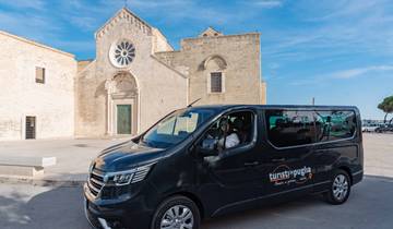
5-Day Puglia & Matera Small-Group Tour from Bari (Max 8)
- ✓ Comprehensive Matera tour
- ✓ Expert local guides included
- ✓ All accommodation arranged
- ✓ Transportation provided
5 days
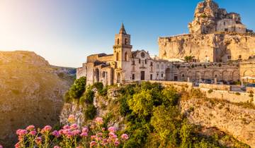
Matera & Apulia Private 5 Day Tour
- ✓ Comprehensive Matera tour
- ✓ Expert local guides included
- ✓ All accommodation arranged
- ✓ Transportation provided
7 days
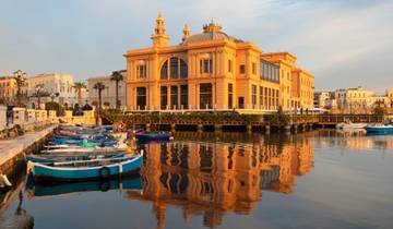
7 Day Highlights of Puglia Tour Package
- ✓ Comprehensive Matera tour
- ✓ Expert local guides included
- ✓ All accommodation arranged
- ✓ Transportation provided
Multi-day tour packages powered by TourRadar. Prices and availability subject to change.
Introduction: Understanding Basilicata’s Landscape of Abandonment
Basilicata presents a landscape where emptiness functions as eloquent architecture, where the absence of human presence articulates profound narratives about geological time, historical marginalization, and the inevitable surrender of human settlement to natural forces. This remote region occupying the instep of Italy’s boot remained so isolated from mainstream Italian development that its very name changed—from the ancient Lucania to the medieval Basilicata—without significantly altering the fundamental relationship between its inhabitants and an unforgiving terrain. The ghost towns scattered across these clay hills represent not simply abandoned buildings but monuments to a specific historical condition where defensive medieval settlement patterns collided with geological instability, where 20th-century infrastructure failed to overcome centuries of marginal existence, and where the decision to abandon became the only rational response to landscapes actively hostile to permanent occupation.
The calanchi badlands that surround and infiltrate these settlements reveal the geological truth underlying Basilicata’s architecture of emptiness. These eroded clay formations, carved by water into patterns of almost mathematical precision, expose the Plio-Pleistocene marine sediments that once formed the seafloor before tectonic uplift raised them to heights where erosion could commence its relentless work. The same clay deposits that provided building material for medieval construction also ensured the eventual destruction of settlements built upon them. When Carlo Levi arrived in internal exile during 1935, he encountered a landscape so alien to northern Italian experience that he struggled to find vocabulary adequate to its strangeness. His solution—describing the calanchi as “lunar”—captured both their extraterrestrial appearance and the sense that this region existed outside normal Italian geography, beyond the reach of Christian mercy or state attention, frozen in a timeless relationship with erosional forces indifferent to human aspiration.
The ghost towns of Basilicata emerged from multiple waves of abandonment spanning centuries, but the most dramatic evacuations occurred during the mid-20th century when modern engineering assessments finally quantified what residents had long suspected: their hilltop settlements occupied fundamentally unstable ground. Craco’s abandonment following the 1963 landslide represented not sudden catastrophe but the culmination of centuries of gradual ground failure accelerated by modern interventions. The addition of asphalt roads and concrete water infrastructure increased ground loading on clay slopes already saturated with subsurface moisture, triggering collapse that earlier generations of lighter timber construction had managed to postpone. When the Irpinia earthquake struck in 1980, it merely confirmed what geologists already knew—that Craco and similar settlements occupied terrain where gravity, water, and seismic forces conspired against permanence.
Understanding this landscape requires recognizing that abandonment here differs fundamentally from the rural depopulation affecting much of inland southern Italy. While emigration certainly contributed to demographic collapse, Basilicata’s ghost towns stand empty primarily because their physical foundations literally moved downslope. Campomaggiore Vecchia’s earthquake destruction, Craco’s landslide evacuation, and the gradual abandonment of countless smaller hamlets all reflect a common geological reality: that Plio-Pleistocene clays, however visually striking in their eroded forms, provide terrible foundations for permanent settlement. The architecture of these ghost towns, frozen at the moment of abandonment, documents both the defensive logic that originally placed communities on exposed hilltops and the inexorable geological processes that eventually reclaimed them.
The cultural significance of Basilicata’s emptiness extends beyond architectural or geological interest to engage fundamental questions about marginalization, memory, and the relationship between literature and landscape. When Levi transformed Aliano into “Gagliano” and Basilicata into a symbol of southern Italian abandonment by history, he established a literary framework that continues to shape how these landscapes are perceived and valued. His assertion that “Christ stopped at Eboli”—that divine grace and civilizational progress halted at the railway junction where the line branched inland from the coast—articulated what locals themselves believed about their exclusion from the benefits of Italian modernity. This sense of abandonment by history now finds physical expression in the literal abandonment of settlements, creating a cultural landscape where emptiness validates and amplifies Levi’s literary themes.
Contemporary engagement with Basilicata’s ghost towns navigates complex tensions between preservation, tourism development, and the pragmatic acceptance that some structures cannot be saved. Craco’s designation to the World Monuments Fund watch list acknowledges both its cultural significance and its fundamental fragility, while the controlled tourism that generates modest revenue also accelerates wear on pathways and structures designed for residential use rather than visitor traffic. The question becomes not whether to preserve but what level of managed decay represents appropriate stewardship for settlements whose very meaning derives from their abandonment. Creating safety infrastructure, installing interpretive signage, and organizing guided tours all risk transforming authentic ruins into theme park simulations, yet allowing total surrender to natural forces eliminates public access to landscapes of genuine historical importance.
The calanchi surrounding these ghost towns complicate preservation questions by demonstrating that the landscape itself remains in constant transformation. Where biancane formations lose 9-19 millimeters of height annually and calanchi scarps retreat 7-10 millimeters per year, any notion of freezing the landscape at a particular moment becomes meaningless. Proposals for a Calanchi Regional Park have foundered on economic realities and local resistance, leaving this extraordinary geological and cultural landscape without formal protection despite recognition of its significance. The failure to establish protected status reflects broader patterns of southern Italian development where immediate economic pressures consistently override long-term conservation goals, ensuring that the same abandonment Levi documented in the 1930s continues to operate in different forms across contemporary Basilicata.
Craco: Icon of Italian Abandonment and Cinematic Ruin
Craco commands a dramatic summit above the Cavone valley in Matera province, its Norman tower and medieval facades visible for miles across eroded clay landscapes that simultaneously explain its strategic importance and guaranteed its eventual destruction. Founded in the 8th century on a steep ridge offering natural defensive advantages, Craco developed through successive periods of Norman, Angevin, and Aragonese control into a prosperous agricultural center of nearly 2,000 inhabitants by the early 20th century. The town’s architecture reflects this layered history—Norman defensive structures anchoring the summit, medieval residential quarters cascading down the slope, Renaissance palaces demonstrating accumulated wealth, and Baroque churches marking Counter-Reformation religious investment. This architectural palimpsest, frozen at the moment of mid-20th-century abandonment, creates a three-dimensional historical document where seven centuries of building traditions remain legible in stone and mortar.
The geological catastrophe that destroyed Craco began not with the famous 1963 landslide but with incremental ground failures that residents had observed for generations. The town’s foundation rests on Plio-Pleistocene marine clays particularly vulnerable to saturation and movement when infiltrated by water. Traditional construction methods using local stone and limited water infrastructure had maintained an equilibrium where buildings adapted to modest ground movement through flexible timber connections and relatively light loading. The introduction of modern infrastructure during the mid-20th century disrupted this equilibrium catastrophically. Paved roads increased surface loading, underground water and sewage pipes leaked into the clay substrate, and the cumulative weight of concrete and asphalt additions exceeded the soil’s bearing capacity. When intense rainfall in 1963 saturated already stressed ground, massive slope failure destroyed water and sewage systems, undermined building foundations, and created fissures that propagated through entire building blocks.
The evacuation proceeded gradually rather than instantly, with authorities initially relocating only the most threatened residents while attempting infrastructure repairs. This partial evacuation created a ghost town in stages—first the lower slopes emptied as ground cracks widened, then the central quarters became untenable as utilities failed completely, finally the upper town surrendered after the 1972 flood further destabilized foundations. The 1980 Irpinia earthquake, though centered far to the northwest, delivered seismic shaking that convinced remaining holdouts to accept permanent relocation to Craco Peschiera, a purpose-built settlement in the valley. By 1981, Craco stood completely abandoned, its streets silent except for the sounds of continuing structural decay and the wind moving through empty window openings.
The cinematic rediscovery of Craco began when filmmakers recognized the town’s potential as a ready-made historical set requiring minimal modification. Mel Gibson’s “The Passion of the Christ” used Craco’s medieval streets for scenes of biblical Jerusalem, while the James Bond film “Quantum of Solace” exploited its dramatic hilltop position for location shots. Francesco Rosi’s 1979 adaptation of “Christ Stopped at Eboli” filmed extensively in Craco and surrounding Basilicata locations, using the authentic landscape to visualize Levi’s literary description of southern Italian marginalization. These film appearances generated international awareness of Craco’s unique preservation state while also establishing its visual identity as a quintessential Italian ghost town—the abandoned medieval settlement on its dramatic summit now functions as a visual shorthand for historical abandonment and the victory of natural forces over human habitation.
The Church of San Nicola, Craco’s mother church, demonstrates the selective preservation that characterizes the entire ghost town. The church occupies bedrock rather than clay, giving it structural advantages that neighboring buildings lacked. Its position at the summit meant less groundwater infiltration and better drainage, while its massive masonry walls and foundations distributed loads more effectively than residential construction. The Majolica dome, though requiring restoration, survived ground movement that destroyed thinner roof structures elsewhere in town. Visiting the church interior reveals both the preservation possibilities when buildings rest on solid foundations and the contrast with surrounding structures whose clay foundations doomed them regardless of construction quality. The church now serves as the most stable element in an otherwise deteriorating urban fabric, a reference point for understanding what Craco once was and a measure of how far the rest of the town has declined.
Contemporary access to Craco operates through a carefully managed system balancing tourism revenue against preservation imperatives and visitor safety. The municipality organizes guided tours following routes that structural engineers have assessed as minimally hazardous, providing safety helmets and restricting access to areas where building collapse poses unacceptable risk. These tours navigate through the upper town’s medieval quarter, entering selected buildings that demonstrate different stages of decay and different original functions. Guides interpret the layers of architectural history visible in exposed construction details while explaining the geological processes that caused abandonment. The controlled access prevents unmonitored exploration that might accelerate structural damage or result in injuries from collapsing masonry, but it also means that much of Craco remains off-limits even to paying visitors, creating a two-tier ghost town where the accessible portions become increasingly tourist-oriented while restricted areas continue their unobserved decay.
The World Monuments Fund’s designation of Craco to its watch list in 2010 acknowledged both the site’s cultural significance and its precarious condition. The designation brought international attention but limited funding, reflecting the broader challenge of preserving ruins whose meaning derives partly from their ruined state. Stabilization interventions that prevent further collapse also alter the aesthetic of abandonment that makes Craco visually compelling. Restoration that makes structures safe for tourism transforms them from authentic ruins into preserved monuments, losing the immediate connection to abandonment that defines their cultural value. The watch list designation thus functions more as documentation of significance than as a guarantee of preservation, marking Craco as worthy of attention while acknowledging that full preservation remains economically and philosophically problematic.
The view from Craco’s summit encompasses the calanchi badlands that simultaneously explain the town’s agricultural poverty and its visual drama. These deeply eroded clay formations created marginal farmland that barely sustained the medieval population, ensuring that Craco remained small and economically precarious despite its strategic position. The same erosional forces that carved the calanchi also undermined Craco’s foundations, linking the town’s abandonment to landscape processes operating across millennia. Standing among the ruins and looking out across these barren clay precipices reveals the fundamental relationship between settlement and terrain—Craco existed despite its landscape rather than because of it, occupying ground that could support human habitation only temporarily before geological time reasserted primacy over human architectural ambition.
The Calanchi Badlands: Geological Processes and Cultural Meanings
The calanchi of southeastern Basilicata represent one of Europe’s most extensive and scientifically studied badland landscapes, where Plio-Pleistocene marine clays deposited between 5.3 and 1.8 million years ago have undergone systematic erosion following their uplift to heights where surface water could carve them into intricate patterns. These formations extend across approximately 40 square miles between the Sauro, Agri, and Basento valleys, creating a zone of extreme erosion where vegetation struggles to establish itself and where rainfall removes measurable quantities of soil during every storm event. The distinctive morphology includes two primary landforms: calanchi proper, consisting of steep parallel gullies with knife-edge ridges between them, and biancane, dome-shaped residual hills that rise above surrounding erosion surfaces. Both forms demonstrate active evolution under contemporary climate conditions, making the calanchi landscape a natural laboratory for studying erosion processes and their interaction with human land use.
The clay substrates supporting calanchi formation possess specific physical and chemical properties that explain both their susceptibility to erosion and their resistance to vegetation colonization. High exchangeable sodium percentages create dispersive behavior where clay particles separate easily under water saturation, while organic matter content below 2 percent provides insufficient binding to stabilize soil aggregates. The clays contain discrete sand fractions that increase permeability just enough to allow water infiltration without providing structural strength, creating conditions where subsurface piping develops along vertical fissures and desiccation cracks. These pipes channel concentrated flow during rainfall events, eroding from within the clay mass and eventually collapsing to create new surface gullies. The process operates cyclically—new vegetation attempts colonization during favorable periods, root penetration creates channels for water infiltration, concentrated flow along root channels initiates piping, pipe collapse removes the vegetation, and bare clay once again dominates the surface.
Erosion measurements conducted through systematic monitoring programs reveal remarkably high rates of surface lowering across the calanchi landscape. Biancane formations lose 9-19 millimeters of height annually, while calanchi scarp faces retreat at somewhat slower rates of 7-10 millimeters per year. These measurements, derived from erosion pin networks and terrestrial laser scanning surveys, demonstrate that the landscape remains in active transformation rather than having achieved some stable configuration. A slope angle of 35 degrees appears to maximize erosion rates, representing an optimal combination of rainsplash impact energy and surface runoff velocity. Steeper slopes generate faster runoff but receive less direct rainsplash impact, while gentler slopes allow greater rainsplash impact but slower runoff, creating a peak erosion rate at intermediate angles that corresponds closely to observed calanchi slope profiles.
The preferential development of calanchi on south-facing slopes reflects the interaction between solar exposure, moisture retention, and vegetation potential. South-facing slopes in the northern hemisphere receive more direct solar radiation, experiencing greater evaporation rates and faster soil desiccation after rainfall. This rapid drying prevents vegetation establishment while also creating more pronounced desiccation cracking that serves as initial channels for piping development. North-facing slopes retain moisture longer, allowing vegetation to colonize and stabilize surfaces before erosional processes can establish dominance. The result appears in the asymmetric development of calanchi systems where south-facing slopes display fully developed badland morphology while north-facing slopes maintain partial vegetation cover and gentler erosional profiles. This solar control on erosion patterns creates landscape asymmetries visible at scales from individual biancane to entire valley systems.
Carlo Levi’s literary description of the calanchi as “lunar landscape” captured both their extraterrestrial appearance and their cultural significance as symbols of southern Italian marginalization. The comparison resonates because calanchi genuinely resemble crater-pocked lunar terrain—bare, sterile, lacking vegetation, carved into patterns that seem more geological than biological. The white and gray tones of exposed clay enhance this otherworldly quality, particularly under the intense Mediterranean sunlight that bleaches colors and sharpens shadows. Levi recognized that this landscape functioned symbolically as well as literally, representing the abandonment and isolation that characterized Basilicata’s relationship to Italian modernity. If Christ stopped at Eboli, it was partly because the calanchi terrain beyond seemed antithetical to Christian notions of fertile abundance and divine providence—these badlands appeared cursed rather than blessed, evidence of nature’s hostility rather than its generosity.
Historical land use patterns both contributed to and resulted from calanchi development. Agricultural expansion during periods of population pressure extended cultivation onto marginal slopes where overgrazing and deforestation accelerated erosion beyond natural background rates. The removal of vegetation cover exposed clay substrates directly to rainsplash impact and runoff erosion, while livestock trampling compacted surfaces and created preferential flow paths. As erosion advanced, agricultural productivity declined, forcing further extensification onto even more marginal land in a destructive feedback loop. By the time agricultural reforms of the mid-20th century attempted to reclaim badland areas for cultivation, the landscape had evolved so far toward barren clay exposure that reclamation efforts frequently failed. Attempts to establish vegetation faced immediate erosional removal during the first significant rainfall, while efforts to terrace or reshape slopes merely created new surfaces vulnerable to the same processes that had carved the original calanchi.
The proposed Calanchi Regional Park represents recognition that this landscape possesses cultural and scientific values requiring formal protection, yet the park remains unestablished due to persistent conflicts between conservation goals and economic development pressures. Local communities view the calanchi as wasteland whose reclamation for agriculture or development represents progress rather than loss, while environmental advocates recognize the landscape’s unique geomorphological significance and its role in documenting southern Italian environmental history. Potential oil and mineral extraction activities threaten to industrialize areas that conservationists argue should receive protected status, while waste disposal proposals see the barren calanchi as suitable repositories for materials that might contaminate more productive landscapes. The failure to establish formal protection reflects broader patterns where marginal landscapes lack constituencies powerful enough to defend them against extractive or disposal activities that more valued landscapes successfully resist.
Contemporary photography of the calanchi has established new appreciation for their aesthetic qualities, with the play of light across eroded surfaces creating almost abstract patterns that appeal to visual artists. The landscape’s constant transformation means that specific formations exist only temporarily before erosion reshapes them, giving calanchi photography an urgency similar to documenting glacial features or other landscapes in active flux. Photographers attracted to the area typically work during the golden hours when low-angle light emphasizes the three-dimensional relief of erosional features, or after rainfall when moisture darkens clay surfaces and creates color variations invisible under dry conditions. These images circulate through tourism promotion and artistic exhibitions, gradually shifting perception of the calanchi from wasteland to landscape worthy of aesthetic contemplation and deliberate visitation.
Carlo Levi, Aliano, and the Literary Geography of Exile
Carlo Levi arrived in Basilicata in August 1935 not as tourist or researcher but as political prisoner, sentenced to internal exile by Mussolini’s fascist government for anti-fascist activism that had landed him briefly in Turin’s Le Nuove prison earlier that year. The regime’s strategy of confino—banishing political opponents to remote southern villages under police surveillance—aimed to isolate dissidents from their northern Italian support networks while humiliating them through forced residence in places northern Italians considered backward and primitive. Levi’s assignment to Grassano and subsequently Aliano, villages so remote that they lacked basic transportation connections to the coast, represented punishment calculated to break his spirit through isolation and boredom. The fascist officials who designed this punishment failed to anticipate that Levi, trained as physician, accomplished as painter, and temperamentally inclined toward observation and documentation, would transform exile into literary material that would eventually make him more famous than his captors.
Levi’s initial posting to Grassano lasted only weeks before authorities transferred him to Aliano, an even more isolated village perched above the calanchi badlands. Aliano’s population of peasant farmers lived lives that seemed to Levi almost medieval in their relationship to land, disease, and social hierarchy. As a trained physician—though one who had never practiced medicine before exile—Levi found himself confronting medical conditions he had encountered only in textbooks: malaria, pellagra, trachoma, and other diseases of poverty and malnutrition that northern Italy had largely eliminated. His medical practice brought him into intimate contact with peasant life, creating relationships of trust that transcended the surveillance system designed to isolate him. These clinical encounters, combined with his painter’s eye for visual detail and his intellectual formation in Turin’s anti-fascist circles, generated the raw material that would become “Christ Stopped at Eboli.”
The transformation of Aliano into the literary “Gagliano” represents Levi’s strategy of minimal fictionalization—changing the name while preserving virtually every other detail of his experience. This thin fictional veneer allowed Levi to claim the protections of the novel form while actually writing memoir, a distinction that became important after publication when individuals described in the book recognized themselves and their village. The name “Gagliano” itself derives from local dialect pronunciation of Aliano, making it simultaneously disguise and revelation, fictional and authentic. This literary strategy extended to Levi’s physical descriptions of place, where his training as painter produced prose remarkable for its visual precision. The calanchi appear in his text not through geological terminology but through evocative description that captures their emotional impact: “at every turn there were steep slopes of white clay, wretched, barren, and colorless, with tumbledown gullies, and not a tree, not a blade of grass to clothe their nakedness.”
Levi’s conceptual framework for understanding Basilicata relied heavily on the notion of abandonment—by the state, by history, by Christian civilization itself. The title phrase “Christ stopped at Eboli” expresses local peasant consciousness that divine grace and civilizational progress halted at the railway junction where the line branched inland from the Salerno coast, never penetrating the interior mountains and clay badlands where traditional patterns persisted untouched by modernity. Levi interpreted this self-conception as expressing accurate perception of objective conditions rather than superstitious belief. The peasants he encountered did live “beyond history” in the sense that Italian unification, industrial development, and democratic politics had failed to reach them in any meaningful form. Their relationship to land, to disease, to political authority, and to each other replicated patterns established centuries earlier, creating a social world that seemed to exist outside the temporal progression that defined modern European experience.
The exile officially ended in May 1936 when Levi received permission to leave Basilicata, but the experience continued to shape his thinking and work throughout his life. He returned to Turin, then fled to France after renewed anti-fascist activity put him at risk of re-arrest. During World War II he returned clandestinely to Italy, working with Resistance networks until the 1943 Armistice. While hiding in Florence in 1944, looking onto the Palazzo Pitti and waiting for Allied liberation, Levi wrote the manuscript that became “Christ Stopped at Eboli,” working from memory without access to notes or documents. The book appeared in 1945 to immediate acclaim, establishing Levi’s literary reputation and focusing Italian and international attention on southern Italian poverty and marginalization. The memoir’s success led to its translation into numerous languages and its 1979 adaptation into a film directed by Francesco Rosi, extending its cultural influence across multiple media and generations.
Levi’s subsequent political career brought him full circle to Basilicata when the Communist Party nominated him to represent the region in the Italian Senate. He served from 1963 to 1972 as senator for Matera province, the same territory where he had been held prisoner three decades earlier. This electoral mandate suggested that Basilicata’s population had embraced Levi’s literary representation of their region, finding in his outsider perspective a validation of their own sense of abandonment by the Italian state. The political work proved less artistically productive than the original exile—Levi published additional books but none achieved the impact of his Basilicata memoir. When he died in January 1975, his will specified burial in Aliano’s cemetery, completing the transformation from unwilling exile to permanent resident. The grave overlooks the same calanchi landscape he had described as “lunar,” creating a final irony where the place intended as punishment became his chosen resting place.
The Casa Museo Carlo Levi in Aliano preserves the house where Levi resided during exile, maintaining it as museum and cultural center dedicated to his life and work. The museum displays Levi’s paintings created during his Basilicata period, documenting peasant faces, village scenes, and calanchi landscapes through visual media that complement his literary descriptions. Photographs, letters, and personal artifacts trace his biography from Turin privilege through exile to literary fame and political service. The museum functions both as shrine to Levi individually and as interpretive center for understanding the broader themes of southern Italian marginalization that his work explored. Visitors approaching Aliano encounter the same dramatic landscape Levi described, finding that the calanchi remain substantially unchanged despite decades of agricultural reform attempts and development pressures. This persistence of landscape allows contemporary readers to verify Levi’s descriptions against present reality, confirming the accuracy of his observation while also recognizing the continuing relevance of the abandonment he documented.
The literary geography Levi established continues to shape how Basilicata is perceived and represented. Subsequent writers engaging with the region must negotiate with Levi’s framework, either confirming his analysis or arguing against it but rarely ignoring it entirely. Tourism marketing exploits the “Christ Stopped at Eboli” association, using Levi’s literary fame to attract visitors who might otherwise never consider Basilicata as destination. This commercialization of exile creates peculiar ironies where punishment becomes tourist attraction and marginalization becomes selling point, transforming Levi’s critical documentation of abandonment into amenity supporting economic development. The question remains whether this literary tourism represents genuine engagement with Levi’s themes or merely appropriates his reputation for purposes antithetical to his critical analysis of southern Italian marginalization.
Campomaggiore Vecchia: The Utopian Settlement and Its Abandonment
Campomaggiore Vecchia occupies a unique position among Basilicata’s ghost towns as a purpose-designed utopian community that embodied Enlightenment ideals of rational urban planning before earthquake destruction relegated it to romantic ruin. Founded in the late 18th century according to designs by architect Giovanni Patturelli, the settlement attempted to implement the socialist theories of Robert Owen and Charles Fourier in southern Italian context, creating a community where rational geometry, agricultural self-sufficiency, and social equality would produce unprecedented prosperity. The plan organized exactly 1,600 residents in a checkerboard street grid where each family received an identical house with attached land for cultivation, olive trees, and vineyard. A central square anchored the community, flanked by church and nobleman’s palace, embodying the tension between egalitarian ideals and persistent feudal hierarchy. This architectural program represented remarkable ambition for late 18th-century Basilicata, attempting to impose utopian rationality on landscape and social relations that had resisted systematic organization for centuries.
The nickname “città dell’utopia”—city of utopia—reflects both the settlement’s founding ideals and the ultimate gap between vision and reality. Owen’s theories of cooperative labor and Fourier’s concepts of phalanstère communities proposed that proper environmental design could transform human nature, eliminating competition and selfishness through rational spatial organization. Patturelli’s application of these theories to Basilicata context reveals both the universalist confidence of Enlightenment thinking and its frequent failure to account for specific local conditions. The checkerboard plan ignored topographic constraints, the agricultural allotments presumed soil fertility that Basilicata’s eroded clays couldn’t provide, and the social equality embedded in identical housing confronted class hierarchies too deeply entrenched for architectural reform. The settlement managed to function for roughly a century, but the gap between utopian design and actual living conditions widened progressively as geological instability, agricultural failures, and social conflicts demonstrated that spatial planning alone couldn’t overcome fundamental environmental and economic constraints.
The earthquake that destroyed Campomaggiore Vecchia in the late 19th century arrived not as isolated catastrophe but as culmination of accumulating structural problems exacerbated by the settlement’s planned design. The checkerboard street pattern, admirable for its geometric purity, created continuous building walls that transmitted seismic stress efficiently through entire blocks, ensuring that localized damage propagated throughout the settlement. The uniform construction using local materials meant that structural weaknesses replicated across all buildings, eliminating the diversity that might have allowed some structures to survive where others failed. When seismic shaking struck, it encountered a settlement engineered for visual order rather than seismic resistance, with predictably catastrophic results. The decision to abandon and rebuild higher on the mountain reflected recognition that the original site’s geological conditions made reconstruction futile—better to start fresh on different ground than to rebuild on the same unstable foundations that had just demonstrated their inadequacy.
The ruins remaining at Campomaggiore Vecchia allow remarkably clear reading of the original urban design despite more than a century of abandonment. The street grid remains legible in the pattern of building foundations and paved surfaces, demonstrating the geometric precision of Patturelli’s plan. Individual house plots reveal standardization in dimensions and orientation, confirming the egalitarian distribution of space that defined the utopian program. The central square’s enlarged scale and the substantial foundations of church and palace demonstrate the hierarchy that persisted despite egalitarian ideals—even in utopia, some buildings occupied more important positions and consumed more resources than others. These ruins function as architectural text documenting both Enlightenment confidence in reason’s power to reshape society and the inevitable reassertion of traditional patterns that utopian planning attempted to eliminate.
The archaeological site status of Campomaggiore Vecchia creates unusual preservation conditions where the settlement exists as ruin available for public access without the guided tour requirements that limit exploration at Craco. Visitors can wander freely through the street grid, examining foundations, entering partial structures, and experiencing the spatial organization that defined the utopian community. This accessibility, rare among Italian ghost towns, allows direct engagement with architectural detail and urban planning that more protected sites mediate through interpretive programs and restricted routes. The tradeoff appears in minimal site maintenance—vegetation encroaches on foundations, erosion continues to degrade structures, and no systematic stabilization prevents progressive collapse. The site exists in managed decay where natural processes gradually return the settlement to landscape while remaining structures provide enough intact fabric to communicate original design intentions.
The contrast between Campomaggiore Vecchia and the replacement settlement of Campomaggiore Nuovo built higher on the mountain demonstrates different approaches to similar landscape challenges. Where the original settlement pursued geometric purity and egalitarian space distribution, the new settlement adapted traditional southern Italian building patterns to topographic constraints, creating an organic street network that followed contours rather than imposing orthogonal geometry. The architectural lessons learned through abandonment shaped the reconstruction—buildings became smaller and more diverse, reducing the continuous structural walls that had transmitted seismic stress so efficiently, while site selection prioritized geological stability over geometric possibility. This pragmatic response to the utopian failure suggests recognition that Basilicata’s landscape demanded accommodation rather than transformation, that successful settlement required working with geological and topographic constraints rather than attempting to overcome them through rational planning.
The cultural memory preserved at Campomaggiore Vecchia extends beyond architectural history to engage broader questions about utopianism, southern Italian development, and the relationship between design ambition and environmental reality. The settlement’s failure validates neither total skepticism about planned communities nor uncritical acceptance of traditional patterns, but rather suggests the importance of environmental knowledge in informing design decisions. Patturelli’s application of northern European theories to Basilicata context failed partly because those theories presumed environmental conditions—stable soils, adequate rainfall, accessible markets—that Basilicata couldn’t provide. A utopian planning program informed by local geological knowledge and agricultural realities might have produced different spatial organization better adapted to survive in this specific landscape. The ruins thus function as monument not to utopianism’s inevitable failure but to the specific consequences when universalist theories ignore local environmental constraints.
Contemporary interest in Campomaggiore Vecchia reflects both romantic attraction to picturesque ruins and scholarly engagement with utopian planning history. Architectural historians study the settlement as rare built example of Enlightenment social theories, while archaeologists investigate construction techniques and daily life patterns through systematic excavation of selected structures. Tourism promotion markets the site as “città dell’utopia,” emphasizing the idealistic origins while downplaying the ultimate failure. This commemorative selectivity creates tension between accurate historical interpretation and marketable narrative—the story of noble experiment and tragic destruction proves more attractive than detailed examination of why the utopian program failed to achieve its objectives. The challenge becomes preserving enough physical fabric to support serious scholarly investigation while allowing public access that generates awareness and appreciation without accelerating decay through visitor impacts.
Architectural Typologies and Construction Techniques in Basilicata Ghost Towns
The ghost towns of Basilicata document centuries of vernacular architecture adapted to specific environmental constraints, social hierarchies, and economic limitations, with building traditions evolving incrementally through trial and error rather than following theoretical programs imposed from outside. Medieval defensive structures anchoring summit positions prioritized military functionality over residential comfort, using massive stone walls to create fortified cores that could withstand siege while commanding visual control over surrounding territory. These Norman towers and castle keeps, often the most intact elements surviving in contemporary ruins, demonstrate sophisticated understanding of structural principles and defensive strategy, incorporating features like relieving arches, buttressed corners, and minimal window openings positioned too high for easy access. The concentration of resources in these defensive structures left surrounding residential quarters comparatively modest, creating settlement hierarchies visible in the contrast between massive masonry towers and humble stone dwellings clustered below.
Residential construction throughout Basilicata’s abandoned settlements relied primarily on locally quarried limestone and the ubiquitous Plio-Pleistocene clays that simultaneously provided building material and guaranteed eventual foundation failure. Load-bearing walls of stacked stone with clay mortar created modest single or double-story structures, typically arranged in continuous rows that shared party walls for structural mutual support and thermal efficiency. Timber floor joists spanning between masonry walls carried upper floors or roof structures, creating points of vulnerability where differential settlement could sever connections and trigger progressive collapse. The persistence of timber construction elements across centuries reflects both material availability—forests that once covered much of Basilicata provided adequate timber resources—and structural flexibility that allowed buildings to accommodate modest ground movement without catastrophic failure. Modern concrete and steel construction, introduced during the 20th century, sacrificed this flexibility for apparent strength, actually increasing vulnerability to the landslides that eventually forced abandonment.
Roof construction demonstrates remarkable continuity across centuries, with clay tile coverings supported on timber frameworks following patterns established during Roman occupation and persisting through medieval, Renaissance, and modern periods. The distinctive terracotta color of these tiles creates the warm orange-red tones that dominate ghost town ruins, particularly striking against white limestone walls and gray clay badlands. Tile construction provided multiple advantages for Basilicata conditions: individual tiles could be replaced easily when damaged, their weight helped stabilize structures in high winds, their thermal mass moderated interior temperatures, and their overlapping installation created rain-shedding surfaces that protected underlying timbers from moisture damage. The collapse of these roof systems often occurred not through tile failure but through decay of supporting timbers, creating the characteristic profiles of ghost town ruins where masonry walls stand to full height while roof structures have disappeared entirely, leaving only weathered beam pockets indicating where joists once connected to walls.
Church architecture within ghost towns typically exhibits significantly higher construction quality than surrounding residential structures, reflecting both the institutional church’s greater financial resources and the symbolic importance of creating permanent sacred space. The churches often occupy bedrock exposures rather than clay slopes, demonstrating either fortunate site selection or deliberate geological assessment that residential construction ignored. Masonry work in churches shows more careful stone selection, tighter jointing, and better-quality mortar than contemporary secular buildings, while architectural elaboration including carved capitals, decorated cornices, and painted interiors distinguished religious buildings from the austere functionality of residential quarters. The relative survival of church structures in ghost towns like Craco reflects these construction advantages—where residential buildings collapsed into rubble, churches often retain structural integrity sufficient to preserve roof systems, interior finishes, and architectural detail that document the aesthetic aspirations underlying their original construction.
The introduction of baroque architectural elements during the 17th and 18th centuries transformed selected buildings in previously medieval settlements, creating stylistic layering visible in contemporary ruins where Renaissance facades incorporate earlier medieval structural cores. Aristocratic families demonstrated wealth and cultural sophistication through architectural patronage, commissioning palazzo facades with classical proportions, decorative stonework, and spatial hierarchies that distinguished noble residences from common dwellings. These baroque interventions concentrated on street-facing elevations while leaving rear and side walls substantially unmodified, creating architectural theater where impressive public facades concealed relatively modest interior volumes and traditional construction techniques. The selective nature of baroque architectural investment—confined to specific buildings and specific elevations—reveals the economic constraints affecting even wealthy families in marginal regions like Basilicata, where maintaining appearances required concentrating limited resources on maximum visual impact rather than comprehensive architectural transformation.
Water management infrastructure, or its absence, contributed significantly to the landslides that forced ghost town abandonment. Traditional construction incorporated minimal formal drainage systems, relying instead on surface grading and building orientation to shed rainwater away from foundations. This approach worked adequately during centuries when timber construction and unpaved streets created relatively permeable surfaces allowing water infiltration into substrate or runoff into natural drainage channels. The 20th-century introduction of concrete roads, underground water and sewage pipes, and increased building density overwhelmed these traditional drainage patterns. Paved surfaces concentrated runoff rather than allowing infiltration, underground pipes leaked directly into foundation zones, and higher building density eliminated the open spaces that had previously allowed water to disperse. The result appeared in progressive ground saturation that lubricated clay substrates and increased pore water pressure until slope failure became inevitable. The irony persists that modern infrastructure improvements intended to increase living standards actually accelerated the geological processes that forced abandonment.
Construction detail visible in partially collapsed structures reveals the sophistication of traditional building techniques and their adaptation to seismic conditions. Timber elements embedded in masonry walls created flexible connections that allowed buildings to deform during earthquakes without immediate collapse, functioning as primitive base isolation systems that absorbed seismic energy through controlled movement. Relieving arches over door and window openings distributed loads around these weak points, preventing crack propagation from openings through surrounding masonry. Party wall construction that bonded neighboring buildings into continuous structural systems created mutual support that stabilized individual units, though it also meant that failure in one building could propagate to neighbors through structural connections. These vernacular seismic design strategies, developed through centuries of trial and error in earthquake-prone southern Italy, proved adequate for modest timber-framed construction but became inadequate when modern concrete additions increased building masses and stiffness beyond levels the traditional details could accommodate.
The current state of preservation in ghost town ruins creates accidental architectural education opportunities where normal concealment of construction details gives way to complete exposure of structural systems, material assemblies, and building techniques. Collapsed floor systems reveal timber joist dimensions and spacing, fallen roof sections display tile installation patterns and supporting framework geometry, breached walls expose stone coursing and mortar composition. This involuntary deconstruction allows architecture students and historians to study construction methods that normally remain hidden behind finished surfaces, creating outdoor architectural laboratories where structural principles and traditional techniques become visible in three dimensions. The educational value depends on sufficient structural remains to demonstrate original systems while enough decay exposes details normally concealed, creating a sweet spot of preservation where ruins remain legible without being either too intact to reveal internal construction or too collapsed to demonstrate original configurations.
The Relationship Between Settlement Patterns and Geological Instability
The defensive hilltop settlement pattern that characterizes abandoned Basilicata towns emerged from medieval military logic that prioritized visual command and defensibility over geological stability or agricultural proximity. Norman conquerors establishing control over southern Italy during the 11th and 12th centuries selected naturally fortified positions—steep summits, ridge crests, isolated hills—where small garrisons could defend against numerically superior forces through tactical advantages of elevation and restricted access. These defensive calculations paid no attention to the geological composition of summit substrates or the long-term stability of slopes subject to erosion and landslide processes. The immediate military advantages of commanding positions outweighed concerns about foundation quality that would only manifest over centuries of occupation. This prioritization of short-term tactical considerations over long-term geological sustainability created settlement patterns essentially guaranteed to produce eventual abandonment when slopes inevitably failed under accumulated stress.
The concentration of settlements on Plio-Pleistocene clay formations reflects both the prevalence of these deposits across southeastern Basilicata and the absence of alternative building sites in a landscape dominated by erodible substrates. Where resistant limestone outcrops existed, they typically occupied lower elevations lacking the defensive advantages that medieval military considerations demanded. The clay hills, though geologically unsuitable for permanent settlement, provided the topographic prominence required for defensive positioning, creating a forced choice between geological stability and tactical advantage. Medieval settlement founders chose tactical advantage, accepting or more likely failing to recognize the eventual price of building on unstable foundations. The fact that these settlements persisted for centuries before catastrophic failure suggests that traditional building techniques using local materials had achieved equilibrium with modest ground movement, an equilibrium destroyed by modern infrastructure interventions that increased loading and altered drainage patterns beyond the substrate’s capacity to accommodate.
Slope stability analysis of ghost town sites reveals systematic relationships between failure patterns and site-specific geological conditions. Craco’s landslide occurred where clay layers dipping toward the valley created natural failure planes, with water infiltration along these bedding surfaces reducing shear strength until gravitational stress exceeded soil resistance. The town’s growth upslope and outward from the original defensive core progressively extended building zones onto steeper and less stable terrain, increasing both the structural loading on vulnerable slopes and the drainage impacts that saturated substrates. Similar patterns appear at other abandoned settlements where incremental growth pushed building density onto increasingly marginal ground, creating conditions where eventual failure became probabilistic rather than possible—not whether slope failure would occur but when accumulated stresses would exceed geological resistance.
The feedback loops between human activity and geological instability operated over centuries to create progressively worsening conditions. Deforestation to create agricultural terraces and provide construction timber reduced slope stability by eliminating root systems that had mechanically reinforced soils and absorbed precipitation that might otherwise infiltrate to lubricate failure planes. Agricultural terracing concentrated water along terrace edges and increased surface loading through retained soil mass, both factors reducing stability. Building construction added weight while building occupancy generated wastewater that typically drained directly into slopes rather than being managed through formal systems. Each human intervention decreased geological stability incrementally, with effects accumulating across generations until critical thresholds were crossed and catastrophic failures occurred. The invisibility of these progressive changes—ground movement too slow to notice year-to-year, water infiltration occurring underground—allowed dangerous conditions to develop without triggering protective responses until failure had already begun.
Climate patterns interact with geological substrates to control the timing and magnitude of landslide events, with seasonal rainfall concentration particularly important for Basilicata’s clay foundations. Mediterranean climate delivers much of annual precipitation during autumn and winter months when evapotranspiration rates are low and soil moisture deficits from summer drought can absorb only limited rainfall before saturation begins. When intense storm events deliver large precipitation volumes to already saturated substrates, pore water pressure increases rapidly, reducing effective stress in clay particles and decreasing shear resistance. The combination of high pore pressure, steep slopes, and weak clay minerals creates ideal conditions for landslide initiation. Historical records of Craco’s abandonment confirm this pattern—the catastrophic 1963 landslide occurred during autumn after prolonged heavy rainfall saturated slopes already stressed by decades of urban growth and infrastructure development.
Seismic activity provides additional triggers for slope failure in regions where geological instability already exists from other causes. The 1980 Irpinia earthquake, though centered northwest of Basilicata, delivered seismic shaking sufficient to trigger landslides across southern Italy’s clay hill zones. The earthquake didn’t create new instability but rather accelerated failure processes already underway, converting slopes approaching critical conditions into active failures. The timing proved crucial for Craco’s final abandonment—residents who had returned after the 1963 landslide, accepting chronic instability as tolerable, recognized after the earthquake that continuing seismic risk combined with progressive slope degradation made permanent residence untenable. Seismic shaking also damaged building structures that had survived initial landslides, creating additional justification for evacuation beyond geological hazards alone.
Alternative settlement patterns that might have avoided these geological failures remained theoretically possible but practically unlikely given medieval settlement logic and economic constraints. Valley floor positions offered greater geological stability but less defensive advantage and higher malaria exposure from stagnant drainage, making them unattractive for medieval founders prioritizing security over health. Limestone outcrops provided stable foundations but occurred in locations lacking the agricultural potential required to support populations. Coastal positions avoided clay substrates but faced maritime raiding that made inland defensive positions preferable during medieval insecurity. The settlement pattern that emerged reflected compromises among multiple constraints, with geological stability ranking low in priority hierarchies dominated by military defensibility, agricultural access, and disease avoidance. Only in hindsight, after centuries of occupation followed by catastrophic abandonment, does geological stability appear as consideration that should have outweighed other factors.
The contemporary landscape preserves this collision between settlement logic and geological reality as monument to human miscalculation and environmental determinism. Ghost towns marking unstable hilltops while active settlements occupy valley floors or relocated positions demonstrate that geological lessons have been learned, though at tremendous cost. The question remains whether these lessons transfer beyond Basilicata to inform settlement decisions in other regions facing similar challenges of defensible positions on unstable substrates. The persistence of hillside development in seismically active Mediterranean regions suggests that the same calculation errors continue—immediate benefits of view, prestige, and perceived safety outweighing long-term geological risks that remain probabilistic until they suddenly become catastrophically real.
Photography and Visual Documentation of Abandonment
The photographic documentation of Basilicata’s ghost towns and calanchi has evolved from simple record-keeping to sophisticated artistic practice that shapes how these landscapes are perceived and valued. Early photographs from the mid-20th century captured abandonment as social documentation, recording the physical conditions that forced evacuation and preserving visual evidence of settlement patterns before complete structural collapse. These documentary images, often shot by regional government officials or academic researchers, emphasized straightforward representation over artistic interpretation, creating archives that now serve historical research by documenting structural conditions and landscape configurations no longer visible in contemporary ruins. The transition from documentary to artistic photography occurred gradually as photographers recognized the visual drama inherent in abandoned architecture against badland landscapes, discovering that these locations offered compositional opportunities unavailable in functioning settlements where human activity and modern interventions complicate clean architectural reading.
The distinctive light conditions in southeastern Basilicata create exceptional opportunities for dramatic landscape photography. The combination of white and gray clay badlands, warm ochre building stones, terracotta roof tiles where they survive, and intensely blue Mediterranean sky generates strong color contrasts that remain visually striking even in black-and-white photography where tonal separation replaces chromatic variety. Low-angle sunlight during morning and evening golden hours rakes across eroded calanchi surfaces, emphasizing three-dimensional relief through shadows that disappear under midday overhead illumination. Storm light, when dark clouds gather above the badlands while gaps allow shafts of sunlight to illuminate specific areas, creates theatrical effects that photographers prize for their rarity and visual impact. These variable light conditions mean that the same location photographed at different times reveals completely different visual characters, encouraging photographers to return repeatedly to capture specific atmospheric conditions.
Compositional strategies for photographing ghost towns typically emphasize either architectural detail or landscape context, creating two distinct visual approaches that serve different interpretive purposes. Close-range architectural photography isolates specific building elements—crumbling facades, empty window openings, collapsed roof structures—using selective focus and tight framing to eliminate distracting context and concentrate attention on texture, material, and decay patterns. This approach produces images that could represent abandonment anywhere, extracting universal themes of transience and material degradation from specific Basilicata contexts. Wide-angle landscape photography takes opposite strategy, pulling back to show entire settlements in their geological settings, emphasizing the relationship between human construction and natural landscape. These contextual images communicate that abandonment here results from specific environmental conditions rather than generic urban decline, connecting architectural emptiness to the calanchi terrain that simultaneously created and destroyed these settlements.
The ethical dimensions of ruin photography emerge in debates about whether glamorizing abandonment through beautiful images trivializes the human suffering that emptied these settlements. Photographs emphasizing picturesque decay, romantic atmosphere, and aesthetic appeal can erase the economic desperation, disease burden, and forced displacement that actually characterized the abandonment process. Beautiful images of crumbling buildings risk transforming tragedy into tourism commodity, creating visual pleasure from circumstances that caused real hardship for actual people. Counter-arguments suggest that aesthetic appreciation doesn’t necessarily erase historical awareness, that beautiful photographs can attract attention leading to deeper engagement with historical realities, and that the landscapes themselves possess visual qualities independent of the human stories embedded in them. The tension remains unresolved, with individual photographers navigating these questions through choices about captioning, contextual information, and the balance between aesthetic ambition and documentary responsibility.
Social media platforms have dramatically expanded the audience for ghost town photography while also creating pressure toward visual spectacle that privileges dramatic imagery over historical accuracy. Instagram in particular rewards images that generate immediate visual impact through strong color, dramatic light, unusual perspectives, or human figures providing scale and emotional content. This platform economy incentivizes photographers to prioritize aesthetic appeal over documentary value, leading to proliferation of images that emphasize gothic atmosphere, romantic decay, and picturesque ruin at the expense of contextualized historical interpretation. The most widely shared images tend to depict ghost towns during optimal light conditions with atmospheric fog or storm clouds, creating impressions that these locations always appear dramatically lit and mysteriously atmospheric rather than acknowledging that most visits occur under ordinary daylight where visual drama is substantially reduced. This selection bias toward exceptional conditions creates expectations that reality frequently disappoints, generating visitor dissatisfaction when actual experience fails to match photographically mediated expectations.
Drone photography has revolutionized ghost town documentation by enabling perspectives previously accessible only through helicopter charter or high vantage points. Aerial views reveal urban patterns invisible from ground level, showing how Craco’s medieval street network adapts to summit topography or how Campomaggiore Vecchia’s checkerboard plan imposed geometric order regardless of slope orientation. Drone imagery also documents the relationship between settlements and surrounding calanchi landscape at scales that communicate geological context more effectively than ground-level photography. The technical accessibility of drone platforms—consumer models costing a few hundred euros produce image quality acceptable for professional publication—has democratized aerial photography while also creating new regulatory challenges as authorities attempt to control drone flights over fragile archaeological sites. Restricted airspace designations around sensitive ghost towns aim to prevent physical damage from drone crashes and to limit disturbance to remaining structures, though enforcement remains inconsistent.
Time-lapse photography and repeat photography documenting the same locations across years or decades reveal the active transformation of ruins through continuing decay processes. Comparing images from different periods shows how vegetation encroachment, weathering, and incremental structural collapse progressively alter ruins over time scales too slow for casual observation to detect. These temporal documents demonstrate that ghost towns don’t remain frozen at abandonment but continue evolving under natural processes, challenging preservation efforts that aim to stabilize ruins at particular states. The documentation also serves conservation purposes by creating baseline records against which future change can be measured, allowing heritage managers to quantify decay rates and prioritize stabilization interventions where they might prevent catastrophic losses. The challenge becomes maintaining photographic documentation programs across decades when funding sources and institutional priorities shift faster than landscape transformation occurs.
Contemporary photographers working in Basilicata navigate between competing pressures: creating images distinctive enough to attract attention in saturated visual markets while respecting historical significance and avoiding exploitation of tragedy for aesthetic purposes. The most successful work achieves balance by combining technical excellence with conceptual depth, producing photographs that function simultaneously as beautiful objects and as interpretive tools engaging viewers with complex historical and environmental narratives. This dual function requires photographers to develop both artistic vision and historical knowledge, understanding the landscapes they document well enough to identify visual moments that communicate meaning beyond simple aesthetic appeal. The resulting images, when successful, attract viewers through visual quality while rewarding sustained attention with deeper understanding of the cultural and geological forces that created these extraordinary landscapes of emptiness.
Tourism, Conservation, and the Future of Basilicata’s Ghost Towns
The development of ghost town tourism in Basilicata represents a complex negotiation between economic development goals, heritage conservation imperatives, and the practical reality that these sites exist in fundamentally unstable conditions requiring ongoing intervention to remain accessible. Tourism generates revenue that can fund conservation work while also creating political constituencies supporting preservation over demolition or total abandonment. The number of visitors to Craco has increased substantially since its appearance in major films, with organized tours now operating regularly during tourist seasons and generating income for guides, local municipalities, and regional tourism authorities. This economic activity creates incentives to maintain access and prevent further deterioration, shifting ghost towns from abandoned liabilities into heritage assets with measurable economic value. The transformation from worthless ruin to tourist attraction fundamentally alters how local communities perceive these sites, replacing embarrassment about abandonment with pride in distinctive heritage unavailable elsewhere.
Conservation philosophy for sites like Craco must address fundamental questions about authenticity, stabilization, and acceptable levels of intervention in ruins whose value derives partly from their ruined state. Aggressive restoration that rebuilds collapsed structures, replaces missing elements, and creates pristine surfaces would destroy the aesthetic of abandonment that makes ghost towns visually compelling and historically significant. Minimal intervention that merely prevents further collapse without attempting restoration preserves authenticity but allows continued deterioration that eventually eliminates the architectural fabric requiring protection. The middle ground—selective stabilization that prevents catastrophic loss while accepting gradual decay—represents current best practice but generates ongoing costs without producing the completion points that define traditional restoration projects. This open-ended commitment to managing decay rather than achieving restoration creates funding challenges, as public and private funders prefer projects with definable endpoints and measurable outcomes over perpetual maintenance obligations.
Safety concerns necessarily limit public access to ghost towns where structural instability poses real risks of injury or death from collapsed masonry, unstable floors, or falling debris. The requirement for helmeted guided tours at Craco reflects liability management as much as conservation strategy—restricting access to supervised groups prevents unauthorized exploration while also creating documentation of who was present should incidents occur. This necessary risk management conflicts with desires for authentic unmediated engagement with ruins, as the presence of guides, mandatory equipment, and restricted routes inevitably mediates the experience and reduces the sense of discovering abandoned spaces independently. The tension between safety and authenticity has no satisfactory resolution, only pragmatic compromises that attempt to maximize accessibility while accepting that liability concerns and genuine danger require some limitations on free exploration that authentic ruin experience might ideally permit.
The designation of sites to international watch lists like the World Monuments Fund roster acknowledges cultural significance while also highlighting vulnerability and need for intervention. These designations bring prestige and international attention that can attract funding and technical expertise, but they also create obligations to maintain standards and implement recommendations that resource-limited local authorities may struggle to fulfill. The gap between recognition of significance and capacity to act on that recognition characterizes heritage conservation challenges throughout southern Italy, where extraordinary concentrations of historically important sites overwhelm available resources regardless of how they’re allocated. The result appears in selective preservation that focuses efforts on highest-priority sites while accepting that many significant locations will receive minimal intervention or continue deteriorating without systematic monitoring. This triage approach to heritage conservation offends preservationist sensibilities but reflects practical realities of limited resources confronting unlimited needs.
Climate change impacts on ghost town preservation remain uncertain but potentially significant as changing precipitation patterns and increased extreme weather events stress structures already compromised by decades of abandonment. More intense rainfall episodes could accelerate erosion of exposed masonry while also triggering additional landslides that undermine surviving structures. Drought conditions promote different degradation mechanisms through desiccation cracking and salt crystallization within masonry pores. The interaction between climate impacts and existing structural weakness creates exponential rather than linear degradation where small environmental changes produce disproportionate structural consequences in buildings lacking maintenance and weather protection. Adaptation strategies must address both immediate structural stabilization and long-term environmental management, creating integrated approaches that recognize buildings and landscape as coupled systems responding to shared environmental drivers.
Local community engagement with ghost town conservation reveals complex attitudes mixing pride in distinctive heritage with resentment about perpetual association with abandonment and poverty. Younger generations may prefer development narratives emphasizing contemporary economic vitality over historical narratives highlighting marginalization and decline, creating generational conflicts about whether ghost towns represent assets to preserve or embarrassments to minimize. The economic benefits of ghost town tourism remain concentrated among tour operators and hospitality providers, with benefits distribution across broader communities often minimal. This creates situations where conservation initiatives face local opposition or indifference despite generating external enthusiasm, as communities prioritize contemporary economic needs over heritage preservation that delivers few tangible local benefits. Successful conservation therefore requires not just technical competence but also community development strategies that ensure heritage preservation contributes to broader goals of economic opportunity and social wellbeing.
The proposed Calanchi Regional Park represents recognition that ghost towns cannot be separated from the badland landscapes that shaped their history and caused their abandonment, requiring integrated conservation approaches addressing settlement and terrain simultaneously. The park proposal aims to protect approximately 40 square miles of calanchi formations from industrial development, waste disposal, and agricultural reclamation while also establishing frameworks for ghost town preservation and sustainable tourism development. The failure to establish the park despite decades of advocacy reveals political and economic obstacles more formidable than technical conservation challenges—competing land use proposals offering immediate revenue outweigh long-term conservation benefits that remain speculative until infrastructure investments create viable tourism economy. Until economic models demonstrate that conservation generates returns competitive with extractive alternatives, proposals for comprehensive protection will struggle to overcome resistance from development interests and skeptical local populations.
The ultimate question confronting Basilicata’s ghost towns involves determining what constitutes success for heritage sites whose significance derives from abandonment. Traditional preservation aims to maintain sites in stable conditions preventing further deterioration, but ghost towns exist as monuments to forces—geological instability, economic marginalization, environmental harshness—that continue operating regardless of heritage designations. Perhaps appropriate conservation accepts that these sites will continue transforming under natural and cultural processes, with success measured not by preventing change but by documenting transformation and maintaining public access to ruins that communicate powerful narratives about human settlement’s temporary nature in landscapes fundamentally hostile to permanent occupation. This acceptance of managed loss rather than preservation as traditionally conceived requires philosophical adjustment acknowledging that some heritage values lie not in material preservation but in witnessing the ongoing processes of decay and return to landscape that abandonment initiates.
Frequently Asked Questions About Basilicata Ghost Towns and Calanchi
How many ghost towns exist in Basilicata?
Basilicata contains numerous abandoned settlements ranging from completely depopulated medieval villages like Craco and Campomaggiore Vecchia to partially abandoned hamlets where a few residents remain among ruined buildings. Comprehensive inventories documenting all abandoned sites across the region do not exist, but estimates suggest dozens of settlements qualify as ghost towns based on substantial depopulation and building abandonment. The definition of “ghost town” complicates counting, as some settlements retain minimal populations maintaining residences among extensive ruins, while others like Craco stand completely empty. Beyond fully abandoned villages, Basilicata contains hundreds of individual abandoned farmhouses, religious structures, and industrial sites scattered across the landscape, creating a broader abandonment geography extending beyond formal settlements. The concentration of abandonment in southeastern Basilicata’s calanchi zones reflects the geological instability affecting that specific terrain, while abandonment elsewhere in the region results from different causes including economic decline, emigration, and isolation from modern infrastructure networks.
What is the best time of year to visit Basilicata’s ghost towns?
Spring months from April through June and autumn months from September through early November provide optimal visiting conditions for Basilicata ghost towns, offering moderate temperatures, clear Mediterranean light, and reduced crowds compared to peak summer season. Spring delivers additional benefits of wildflower blooms softening the austere badland landscapes and green vegetation providing color contrast against white clay formations. Autumn features dramatic storm light as weather systems transition toward winter patterns, creating atmospheric conditions prized by photographers but requiring flexibility to work around rainfall. Summer months from July through August bring intense heat that makes exploring exposed ruins uncomfortable and washes out photographic detail under harsh overhead sunlight, though early morning and evening light remain exceptional. Winter visiting from December through March risks rainfall that makes clay surfaces treacherously slippery and can close guided tour operations at sites like Craco, but also offers solitude and dramatic winter light unavailable during busier seasons. Specific timing should consider individual priorities—photographers might accept winter weather challenges for exceptional light, while general visitors prioritizing comfort should target spring or autumn.
Are Basilicata’s ghost towns safe to visit independently?
Safety varies dramatically among different ghost town sites based on structural condition, official access policies, and specific hazards present at each location. Craco permits access only through organized guided tours providing safety helmets and following designated routes assessed by structural engineers as minimally hazardous, making independent exploration both prohibited and genuinely dangerous due to unstable buildings, hidden ground fissures, and potential for masonry collapse. Campomaggiore Vecchia allows unguided access as archaeological site but still presents hazards from uneven terrain, partial structures lacking warning systems, and vegetation concealing ground irregularities. Aliano functions as living village where the Carlo Levi museum and surrounding town pose no special safety concerns beyond normal urban environments. Completely abandoned sites lacking any official infrastructure or monitoring present maximum risks—no safety assessments, no restricted areas marked, no emergency services nearby—making exploration potentially deadly for visitors unfamiliar with recognizing structural instability or geological hazards. Independent visitors should respect access restrictions where they exist, carry appropriate insurance, inform others of planned routes and expected return times, and recognize that rescue services in remote Basilicata locations may respond slowly to emergency calls.
What films and media have featured Basilicata’s ghost towns?
Craco achieved international recognition through appearances in major film productions including Mel Gibson’s “The Passion of the Christ,” where the medieval ruins portrayed biblical Jerusalem, and the James Bond film “Quantum of Solace,” which used Craco’s dramatic hilltop position for establishing shots. Francesco Rosi’s 1979 adaptation of Carlo Levi’s “Christ Stopped at Eboli” filmed extensively throughout Basilicata including Aliano and surrounding calanchi landscapes, using authentic locations to visualize Levi’s literary descriptions. The Italian comedy “Basilicata Coast to Coast” incorporated Craco and other regional locations while exploring contemporary Basilicata identity. These film appearances generated exposure reaching audiences who might never encounter Basilicata through traditional tourism channels, establishing the region’s ghost towns as recognizable visual symbols even among viewers unfamiliar with their actual location or history. The willingness of production companies to film in these remote locations reflects both their distinctive visual character unavailable elsewhere and the practical advantages of abandoned sites requiring minimal modification to serve as historical sets. Revenue from location fees provides modest income to municipalities managing ghost towns while also creating incentives to maintain access and prevent complete structural collapse that would eliminate suitability for future filming.
How does Carlo Levi’s “Christ Stopped at Eboli” relate to ghost town tourism?
Levi’s memoir created the literary framework through which Basilicata’s abandonment is interpreted and marketed, transforming what might otherwise be perceived simply as economic failure and geological hazard into culturally significant landscape embodying broader themes of southern Italian marginalization. The book’s international success and translation into multiple languages established Basilicata in global consciousness as place of profound isolation existing “beyond history,” where traditional patterns persisted untouched by modernity. This literary identity now supports tourism marketing emphasizing authentic experience of landscapes and communities bypassed by development rather than shameful backwardness requiring concealment. The Casa Museo Carlo Levi in Aliano functions as pilgrimage site for readers seeking to verify Levi’s descriptions against contemporary reality, while the broader landscape of calanchi badlands and abandoned settlements provides physical correlatives to the abandonment Levi documented textually. Tourism authorities recognize Levi’s continuing influence, incorporating quotations from his work into interpretive materials and promoting the “lands where Christ stopped” as distinctive regional brand. This literary tourism creates economic value from historical marginalization, though questions persist about whether commodifying Levi’s critical social analysis ultimately reinforces or undermines his documentation of abandonment and suffering.
What geological processes created the calanchi badlands?
The calanchi formed through water erosion of Plio-Pleistocene marine clays deposited 5.3 to 1.8 million years ago when the region lay beneath ancient seas. Tectonic uplift raised these seafloor sediments to elevations where surface water could commence erosion, carving parallel gullies with knife-edge ridges as runoff concentrated along lines of weakness in the clay substrate. The specific morphology reflects clay properties including high sodium content creating dispersive behavior where particles separate easily under saturation, combined with discrete sand fractions allowing water infiltration that initiates subsurface piping along vertical cracks. Mediterranean climate patterns alternating between prolonged drought and intense rainfall episodes drive the erosion cycle—summer desiccation creates shrinkage cracks that channel concentrated flow when autumn rains arrive, while winter storm events deliver precipitation volumes exceeding infiltration capacity and generating destructive surface runoff. South-facing slopes experience more intensive erosion than north-facing slopes because direct solar exposure accelerates drying and prevents vegetation establishment that might stabilize surfaces. The result appears in asymmetric landscape development where south-facing calanchi display fully developed badland morphology while north-facing slopes maintain partial vegetation cover and gentler profiles.
Can you stay overnight in Basilicata’s ghost towns?
Overnight accommodation within actual ghost towns is not available at sites like Craco where complete abandonment and structural instability make residential occupation impossible and prohibited. Aliano, while historically significant as Levi’s exile location, functions as living village offering conventional accommodation options in guesthouses and small hotels serving visitors to the Carlo Levi museum and surrounding landscapes. The nearest accommodation to Craco appears in Matera, approximately 90 minutes away by car, where the UNESCO World Heritage sassi districts provide dramatically atmospheric lodging in converted cave dwellings and historic buildings. Several agriturismo properties operate in the countryside surrounding ghost towns, offering farmstay experiences that provide proximity to abandoned sites while supporting contemporary agricultural operations. These rural accommodations allow visitors to experience Basilicata’s landscape character outside formal ghost town boundaries, often incorporating traditional architecture and local cuisine into guest experiences. The absence of accommodation within ghost towns themselves actually enhances their authenticity as abandoned spaces rather than theme park recreations, maintaining the emptiness that defines their cultural significance while concentrating commercial tourism infrastructure in living communities where it can be properly managed.
What happened to the residents who abandoned these ghost towns?
Former residents of abandoned Basilicata settlements followed several migration patterns depending on timing and circumstances of departure. Craco’s evacuation relocated most population to Craco Peschiera, a purpose-built settlement in the valley below where municipal authorities provided housing and attempted to recreate community structures despite the trauma of forced displacement. Many younger residents, particularly those departing before final evacuation, emigrated to northern Italian industrial cities during the economic boom of the 1950s-1970s, seeking manufacturing employment unavailable in agricultural Basilicata. International emigration drew substantial populations to Argentina, the United States, Canada, and Australia, where Italian immigrant communities absorbed Basilicata emigrants into existing diaspora networks. These migration patterns emptied ghost towns not through single catastrophic events but through decades of incremental departure as successive generations chose opportunities elsewhere over marginal existence in declining settlements. Contemporary descendants of ghost town populations maintain varying connections to ancestral villages—some return periodically for festivals or genealogical tourism, while others have completely severed ties, leaving ancestral settlements to exist only in family memory and historical documentation. The dispersal of former populations complicates efforts to document ghost town history, as the people who lived these experiences are scattered across continents with knowledge gradually being lost as earlier generations pass away.
How do Basilicata’s ghost towns compare to abandoned settlements elsewhere in Italy?
Basilicata’s ghost towns share certain characteristics with abandoned settlements throughout southern and central Italy while also exhibiting distinctive features reflecting regional geology and history. The geological instability underlying Basilicata abandonment—landslides on clay substrates, earthquake damage to hilltop settlements—parallels processes affecting ghost towns in Calabria, Molise, and inland Sicily where similar terrain creates similar vulnerabilities. The cultural framework of southern Italian abandonment involving emigration, agricultural decline, and state neglect operates across the entire Mezzogiorno, making Basilicata’s experiences representative rather than unique. What distinguishes Basilicata’s ghost towns involves their concentration in calanchi badland landscapes creating visual drama unavailable elsewhere, the literary framework Carlo Levi established for interpreting abandonment as cultural phenomenon rather than simple economic failure, and the particular intensity of isolation that made Basilicata emblematic of southern marginalization even among other marginal regions. Northern Italian ghost towns in Alpine valleys or Apennine mountains typically result from different causes—industrial decline, depopulation of mountain agriculture, avalanche or flood destruction—creating abandonment with different visual character and historical meaning despite superficial similarities of empty buildings and silent streets. The relationship between ghost towns and surrounding landscape appears most distinctive in Basilicata, where the badland terrain functions simultaneously as explanation for abandonment and as dramatic setting amplifying the visual impact of ruined settlements.
What conservation challenges do ghost towns face?
Ghost town conservation confronts multiple technical and philosophical challenges that distinguish it from preservation of occupied historic buildings or formal archaeological sites. Structural instability from foundations built on moving clay substrates means that buildings continue deteriorating regardless of stabilization interventions, requiring perpetual maintenance rather than one-time restoration. Weather exposure without roof systems or window closures allows water infiltration accelerating material decay through freeze-thaw cycling, salt crystallization, and biological growth that traditional occupied buildings prevent through basic weatherproofing. Vegetation encroachment undermines masonry through root penetration and obscures architectural details requiring periodic clearing that consumes resources without achieving permanent solutions. The philosophical challenge emerges in determining appropriate intervention levels—aggressive restoration contradicts the aesthetic and cultural value of ruins, while minimal intervention allows accelerating decay that eventually eliminates the fabric requiring protection. Funding limitations force triage decisions about which structures receive stabilization priority, creating preservation hierarchies that may not reflect historical significance. Visitor access generates both revenue funding conservation and physical wear accelerating decay, requiring balance between public engagement and material preservation. Legal ambiguities about ownership, liability, and regulatory authority over abandoned properties complicate conservation planning even when technical solutions and funding exist. Climate change introduces additional uncertainties as changing precipitation patterns and increased extreme weather events stress structures already compromised by decades of abandonment.