Sweden UNESCO World Heritage Sites: Complete Guide
Sweden preserves 15 UNESCO World Heritage Sites that showcase the nation’s rich cultural heritage, innovative design legacy, and pristine natural landscapes. From Viking Age trading centers to pioneering industrial complexes, from royal palaces to indigenous cultural territories, these sites tell the story of Sweden’s profound contribution to human civilization across millennia.
Key Takeaways
- 15 UNESCO Sites: Sweden ranks among the top 25 countries worldwide with the most World Heritage Sites, featuring 13 cultural sites, 1 natural site, and 1 mixed site
- Viking Heritage: Birka and Hovgården preserve the most significant Viking Age archaeological complex in Scandinavia, revealing crucial evidence of early medieval trade networks
- Industrial Innovation: Sites like Engelsberg Ironworks and the Mining Area of Falun demonstrate Sweden’s pioneering role in metallurgical development during the 17th-19th centuries
- Cultural Diversity: From the indigenous Saami culture in the Laponian Area to Hanseatic trading traditions in Visby, the sites represent Sweden’s multicultural historical tapestry
- Architectural Excellence: The Royal Domain of Drottningholm and Skogskyrkogården showcase Swedish contributions to European Baroque design and modernist landscape architecture
- Transnational Recognition: Two sites extend beyond Swedish borders—the High Coast/Kvarken Archipelago (shared with Finland) and the Struve Geodetic Arc (shared with nine other countries)
People Also Ask About Sweden UNESCO Sites
How many UNESCO World Heritage Sites does Sweden have?
Sweden has 15 UNESCO World Heritage Sites, comprising 13 cultural sites, 1 natural site, and 1 mixed cultural-natural site. This places Sweden among the top 25 countries globally with the most World Heritage designations. The sites range from Viking Age archaeological complexes to industrial heritage sites, royal palaces, indigenous cultural landscapes, and pristine natural areas. Two of Sweden’s sites are transnational properties shared with neighboring countries: the High Coast/Kvarken Archipelago (with Finland) and the Struve Geodetic Arc (with Belarus, Estonia, Finland, Latvia, Lithuania, Moldova, Norway, Russia, and Ukraine).
What was the first UNESCO site designated in Sweden?
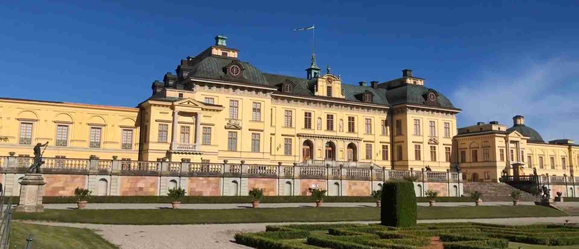
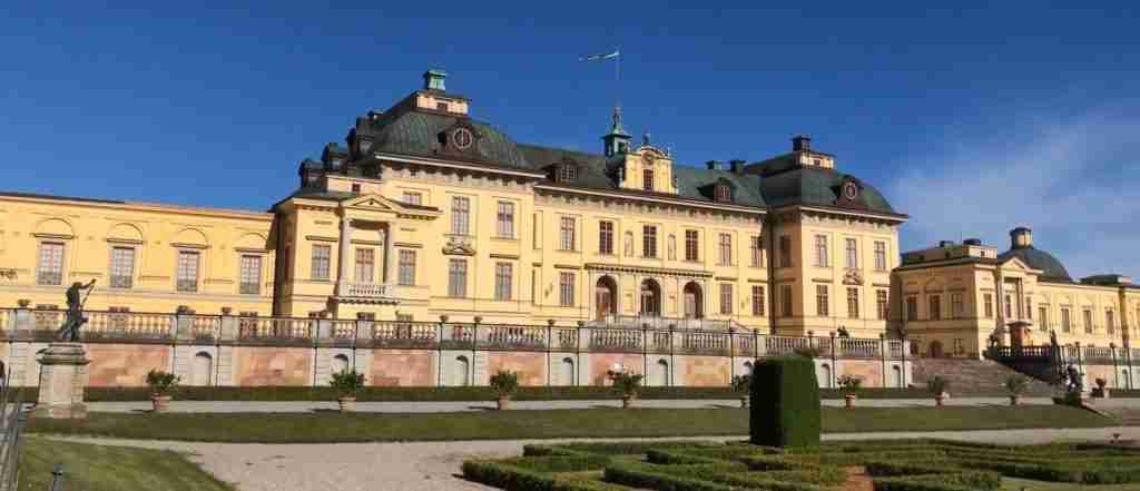
The Royal Domain of Drottningholm became Sweden’s first UNESCO World Heritage Site in 1991, inscribed during the 15th session of the World Heritage Committee in Carthage, Tunisia. This 18th-century royal residence, located on an island in Lake Mälaren near Stockholm, exemplifies the finest European royal architecture and landscape design of its era. The site includes the remarkably preserved palace, the unique Court Theatre from 1766, the Chinese Pavilion, and extensive formal gardens inspired by the Palace of Versailles. Drottningholm remains the private residence of the Swedish Royal Family while maintaining public access to its most significant architectural and cultural treasures.
Which is the most recent UNESCO site added in Sweden?
The Decorated Farmhouses of Hälsingland, inscribed in 2012, represents Sweden’s most recent addition to the UNESCO World Heritage List. This unique cultural site comprises seven timber farmhouses from the 19th century that showcase the remarkable prosperity and artistic ambition of independent farmers in the Hälsingland region. The farmhouses feature extraordinarily elaborate interior decorations—vibrant wall paintings in Baroque and Rococo styles, ornate woodwork, and specially constructed “festival rooms” used exclusively for celebrations. These buildings demonstrate how rural Swedish farmers invested substantial resources in creating spaces of exceptional beauty and cultural significance, challenging conventional assumptions about rural life in 19th-century Scandinavia.
What makes the Laponian Area UNESCO site unique?
The Laponian Area, inscribed in 1996, stands as one of the world’s largest and most intact examples of a cultural landscape still actively shaped by ancestral traditions. This vast territory in northern Sweden encompasses both outstanding natural values—pristine mountain ranges, glaciers, and ongoing geological processes—and the living cultural heritage of the indigenous Saami people. The site represents one of the last remaining areas where traditional transhumance (seasonal movement of livestock) continues according to millennia-old patterns. Saami reindeer herders move their herds through this landscape following ancient migration routes, maintaining cultural practices that demonstrate sustainable interaction between human communities and Arctic environments across countless generations.
Extended multi-day tours – 5+ days
Featured Stockholm Multi-Day Tour Packages
3 days
Stockholm 3-Day Discovery Tour
- ✓ Comprehensive Stockholm experience
- ✓ Expert local guides included
- ✓ All accommodation included
- ✓ Transportation provided
5 days
Stockholm 5-Day Highlights Experience
- ✓ Comprehensive Stockholm experience
- ✓ Expert local guides included
- ✓ All accommodation included
- ✓ Transportation provided
7 days
Stockholm 7-Day Cultural Journey
- ✓ Comprehensive Stockholm experience
- ✓ Expert local guides included
- ✓ All accommodation included
- ✓ Transportation provided
10 days
Stockholm 10-Day Complete Adventure
- ✓ Comprehensive Stockholm experience
- ✓ Expert local guides included
- ✓ All accommodation included
- ✓ Transportation provided
Multi-day tour packages powered by TourRadar. Prices and availability subject to change.
Introduction: Sweden’s UNESCO Heritage Landscape
Sweden accepted the UNESCO World Heritage Convention on January 22, 1985, opening its remarkable cultural and natural treasures to international recognition and protection. Over the following decades, 15 Swedish sites have achieved World Heritage status, each meeting strict criteria for outstanding universal value to humanity. These sites stand alongside the world’s most iconic landmarks—the Pyramids of Giza, the Great Wall of China, and the Acropolis in Athens—as irreplaceable elements of our shared global heritage.
The geographic distribution of Sweden’s World Heritage Sites reflects the nation’s diverse landscapes and rich historical development. Southern Sweden hosts medieval trading centers, agricultural landscapes, and industrial complexes. Central Sweden preserves royal palaces and pioneering architectural achievements. Northern Sweden protects vast indigenous territories and pristine natural environments. Together, these sites chronicle Sweden’s evolution from Viking Age trading networks through medieval Hanseatic commerce, early modern industrial innovation, and into the modern era.
Sweden’s World Heritage Sites demonstrate exceptional diversity across multiple categories. Archaeological sites preserve crucial evidence of Viking civilization. Industrial heritage sites document Sweden’s pivotal role in European metallurgical development. Architectural monuments showcase Swedish contributions to Baroque design, modernist landscape architecture, and vernacular building traditions. Cultural landscapes illustrate sustainable human interaction with challenging environments. Natural sites protect outstanding examples of geological processes and ecosystems.
The significance of Sweden’s UNESCO recognition extends beyond tourism and cultural pride. World Heritage designation brings rigorous conservation standards, international cooperation in preservation efforts, and global awareness of sites’ universal importance. Swedish authorities, in coordination with UNESCO, maintain comprehensive management plans ensuring these irreplaceable cultural and natural treasures remain protected for future generations while remaining accessible for education, research, and respectful visitation.
The 15 UNESCO World Heritage Sites in Sweden
1. Royal Domain of Drottningholm (1991)
The Royal Domain of Drottningholm, Sweden’s first World Heritage Site, represents the finest example of an 18th-century northern European royal residence. Located on Lovön island in Lake Mälaren, approximately 10 kilometers west of Stockholm, this architectural complex combines palace architecture, landscape design, and theatrical heritage in remarkable harmony.
The palace itself, constructed primarily in the late 17th century with 18th-century additions, demonstrates masterful interpretation of French Baroque and Rococo styles adapted to Swedish context. Architect Nicodemus Tessin the Elder designed the original structure beginning in 1662 for Queen Hedvig Eleonora. His son, Nicodemus Tessin the Younger, contributed significant expansions and refinements. The palace interiors showcase exceptional craftsmanship in stucco work, painted ceilings, furniture, and decorative arts.
The Drottningholm Court Theatre, completed in 1766 by architect Carl Fredrik Adelcrantz, stands as the world’s best-preserved 18th-century theater. The original stage machinery, scenery, and theater technology remain intact and functional, providing unprecedented insight into Baroque theatrical production techniques. The theater operates annually during summer months, presenting period opera and ballet performances using original staging methods.
The palace gardens encompass multiple distinct landscape traditions. The Baroque garden, created in the 1680s, follows French formal garden principles with geometric parterres, sculptures, and fountains. The English landscape garden, added in the late 18th century, introduces naturalistic design elements. The Chinese Pavilion (Kina Slott), completed in 1769, represents Rococo chinoiserie at its most elaborate, featuring Asian-inspired architecture and decorative arts.
Drottningholm remains the private residence of the Swedish Royal Family since 1981, creating unique balance between heritage preservation and contemporary use. Public access to significant portions of the palace, theater, gardens, and Chinese Pavilion allows visitors to experience living royal heritage while respecting the site’s ongoing residential function.
2. Birka and Hovgården (1993)
Birka and Hovgården comprise a unique archaeological complex preserving the most complete evidence of Viking Age trading culture in Scandinavia. Located on two separate islands—Björkö and Adelsö—in Lake Mälaren west of Stockholm, these sites reveal crucial information about early medieval commerce, urbanization, religious transformation, and social organization.
Birka, established around 750-790 AD on Björkö island, functioned as one of Scandinavia’s earliest urban centers and most important trading hubs for approximately 200 years before its abandonment around 975 AD. Archaeological evidence reveals a sophisticated settlement with organized street plans, defensive fortifications, harbor facilities, and specialized craft production areas. The town connected Scandinavian trade networks with continental Europe, the Byzantine Empire, and the Islamic world.
The archaeological landscape at Birka includes approximately 4,500-5,000 burial mounds and graves, representing the largest Viking Age cemetery in Scandinavia. These burials have yielded extraordinary artifacts—Arabic silver coins, Byzantine silks, Frankish glass, oriental beads, and weapons—demonstrating Birka’s role in long-distance trade networks. Excavations have also revealed evidence of early Christian activity, including the mission of St. Ansgar in 829-831 AD, marking Sweden’s first encounters with Christianity.
Hovgården, located on nearby Adelsö island, served as a royal residence and power center during the Viking Age. Archaeological investigations have uncovered remains of substantial buildings, a possible thing assembly site, and additional burial monuments. The spatial relationship between Hovgården’s political center and Birka’s commercial hub illustrates the integrated nature of power, trade, and religion in Viking society.
The Birka Museum presents findings from over a century of archaeological research, including reconstructed artifacts, skeletal analysis, and interpretations of daily life. Reconstructed Viking Age buildings provide tangible context for understanding period construction techniques and living conditions. The preserved landscape allows visitors to walk among burial mounds and earthwork fortifications largely unchanged since the Viking Age.
3. Engelsberg Ironworks (1993)
Engelsberg Ironworks represents the best-preserved and most complete example of an influential Swedish iron production complex, documenting the nation’s leadership in metallurgical technology during the 17th-19th centuries. Located in Ängelsberg, Västmanland County, this industrial heritage site demonstrates the integrated systems that made Swedish bar iron the most sought-after product in European and global markets.
Founded in 1681, Engelsberg achieved particular prominence in the 18th century under the Reinhold Rücker Company, becoming one of the world’s most technologically advanced ironworks. The site exemplifies the Swedish “Walloon” method of iron production, which created exceptionally high-quality bar iron through careful ore selection, charcoal fuel production, and skilled forge work. Swedish iron commanded premium prices due to its purity and workability, essential for applications from sword-making to precision instruments.
The site preserves the complete production landscape—ore deposits, charcoal production areas, blast furnace, forge buildings, administrative structures, and workers’ housing. The main forge building, constructed in the early 18th century, contains original equipment including massive water-powered tilt hammers and ancillary tools. The blast furnace, manor house, administrative offices, and workers’ dwellings illustrate the social and economic organization of industrial operations.
Engelsberg’s exceptional state of preservation results from continuous maintenance and the relatively early cessation of production (1919), which prevented modernization that destroyed similar sites. The buildings retain original equipment, tools, and architectural features. The surrounding landscape preserves forest management areas, ore extraction sites, and water management systems crucial to iron production.
The site demonstrates Swedish innovation in industrial organization. The ironworks integrated resource extraction, fuel production, manufacturing, and marketing within a planned landscape. Social infrastructure—housing, administrative buildings, agricultural support—created self-sufficient communities. This model influenced industrial development across Europe and contributed to Sweden’s economic prominence in the early modern period.
4. Rock Carvings in Tanum (1994)
The Rock Carvings in Tanum preserve one of the world’s most outstanding concentrations of Bronze Age petroglyphs, providing unique insights into prehistoric Scandinavian society, cosmology, and daily life. Located in Bohuslän, western Sweden, the site encompasses numerous panels containing approximately 10,000 individual images carved into smooth rock surfaces between 3,800 and 2,500 years ago.
The carvings depict an extraordinary range of subjects—human figures in various poses and activities, domestic and wild animals, boats of different sizes, weapons, tools, symbols, and abstract patterns. The largest and most complex panels, such as those at Vitlycke, Aspeberget, and Litsleby, feature elaborate scenes suggesting ritual activities, social hierarchies, maritime voyages, hunting expeditions, and agricultural practices. The consistent artistic style and thematic unity across multiple locations indicate shared cultural traditions and possibly coordinated creation.
The geographical distribution of carving sites corresponds to the Bronze Age coastline, which lay significantly higher than the present shoreline due to post-glacial isostatic rebound. Many petroglyphs occupy locations that commanded views of the prehistoric sea, suggesting maritime orientation and the fundamental importance of seafaring to Bronze Age communities. The prominence of boat imagery—ranging from simple vessels to elaborate ships with numerous crew members—reinforces this interpretation.
Archaeological research has revealed sophisticated techniques in petroglyph creation. Artists used stone and metal tools to peck designs into hard granite surfaces, achieving remarkable precision and consistency. Later traditions sometimes enhanced visibility by adding red ochre pigment to carved grooves, though most original coloring has weathered away. Modern conservation efforts include periodic applications of red paint to selected panels, helping visitors appreciate the original visual impact.
The Vitlycke Museum serves as the primary interpretation center, offering exhibitions on Bronze Age culture, petroglyph research methodology, and conservation challenges. The museum grounds include Bronze Age house reconstructions, providing context for understanding the society that created these remarkable artworks. Guided tours explain iconographic interpretations and cultural significance while emphasizing ongoing debates about specific meanings and functions.
5. Skogskyrkogården (1994)
Skogskyrkogården (The Woodland Cemetery) stands as a masterpiece of 20th-century landscape architecture and a profound example of modernist design integrated with natural topography. Located in the Enskede district of southern Stockholm, this cemetery demonstrates how functionalist architecture and romantic naturalism could combine to create spaces of deep emotional and spiritual significance.
Architects Gunnar Asplund and Sigurd Lewerentz won the international design competition in 1915, beginning a collaboration that continued until Asplund’s death in 1940. Their design philosophy rejected traditional cemetery monumentality in favor of subtle integration with existing pine forest landscape. The architects preserved natural topography, native vegetation, and existing trees while introducing carefully positioned buildings, paths, and ceremonial spaces that enhance rather than dominate the natural setting.
The cemetery’s architectural elements exemplify Swedish modernism’s evolution. The Woodland Chapel (1920), Asplund’s first major work at the site, combines Nordic vernacular architecture with classical proportions. The Resurrection Chapel (1925) demonstrates increasing abstraction and simplified forms. The monumental Crematorium complex (1940), Asplund’s final masterwork, achieves perfect synthesis of classical monumentality and modernist restraint, featuring the iconic portico overlooking the meditation grove.
Landscape design creates powerful emotional progression through spatial sequences. The entry path leads through dense forest, creating contemplative atmosphere. The Central Hill with its cross provides a focal point for reflection. The Meditation Grove, a grass clearing surrounded by lime trees, offers tranquil space for remembrance. Seasonal changes—spring blossoms, summer greenery, autumn colors, winter snow—create ever-changing relationships between architecture and nature.
Skogskyrkogården’s influence on cemetery design and landscape architecture extended globally throughout the 20th century. The site demonstrated that modern design principles could address fundamental human needs for beauty, dignity, and spiritual contemplation in spaces associated with death and remembrance. The cemetery remains an active burial ground serving Stockholm’s population while functioning as an internationally significant architectural pilgrimage site.
6. Hanseatic Town of Visby (1995)
Visby, the principal town on the island of Gotland in the Baltic Sea, preserves the finest example of a northern European medieval Hanseatic trading center. The remarkably intact townscape, defensive walls, church ruins, and merchant dwellings demonstrate the economic, cultural, and architectural characteristics that defined Baltic trade networks from the 12th through 14th centuries.
Visby’s strategic location in the central Baltic made it the dominant trading hub connecting Scandinavian, German, Russian, and Baltic markets during the High Middle Ages. The town’s prosperity peaked in the 13th century when it served as a principal center of the Hanseatic League, the powerful commercial confederation that controlled Baltic and North Sea trade. Archaeological and architectural evidence reveals connections extending from England and Flanders to Novgorod and beyond.
The medieval town wall, constructed primarily in the 13th-14th centuries, extends 3.4 kilometers and represents one of northern Europe’s best-preserved medieval fortification systems. The wall incorporates 44 towers and defensive positions, though only 27 remain standing. Massive limestone blocks quarried from Gotland’s abundant resources create imposing barriers punctuated by strategically positioned gates. The wall’s excellent preservation results from limestone’s durability and Visby’s relative isolation after the Hanseatic period ended.
The townscape preserves approximately 200 medieval buildings and ruins, including thirteen significant church ruins that demonstrate Visby’s extraordinary wealth during its commercial zenith. St. Maria Cathedral, the only medieval church still in use, combines Romanesque and Gothic elements. The extensive church ruins—St. Nicolai, St. Karin, St. Drotten, and others—attest to the substantial religious architecture that once characterized the town. Merchant houses, warehouses, and narrow medieval streets maintain the historic urban fabric.
The architectural character reflects diverse influences. German Hanseatic merchants brought construction techniques and design elements from Lübeck and other Baltic cities. Local Gotland limestone provided distinctive building material. The resulting synthesis created unique architectural expression combining international commercial culture with regional materials and traditions. Modern Visby carefully preserves this heritage while maintaining function as Gotland’s principal town and a popular tourist destination.
7. Church Town of Gammelstad, Luleå (1996)
The Church Town of Gammelstad represents the finest surviving example of a distinctive northern Scandinavian settlement type. Located near Luleå in Swedish Lapland, this unique community preserves 424 wooden houses arranged around a medieval stone church, demonstrating religious, social, and architectural traditions that once characterized much of northern Sweden and Finland.
Church towns (Swedish: kyrkstäder) developed in response to vast distances, sparse population, and harsh climate conditions in northern Scandinavia. Rural parishioners living far from central churches required temporary accommodation when attending services, particularly for major religious festivals, weddings, funerals, and other important occasions. Church towns provided this accommodation while creating periodic opportunities for social interaction, trade, and community cohesion otherwise impossible in scattered settlements.
The stone church, originally constructed in the 15th century, served as the focal point for the parish of Nederluleå before coastal uplift and harbor silting necessitated relocating the main settlement closer to the sea in 1649 (creating modern Luleå). The church underwent modifications in subsequent centuries but retains its medieval character. The building’s architectural and artistic features—including a carved wooden reredos, medieval frescoes, and baroque additions—document evolving religious art traditions.
The surrounding wooden houses, constructed from the 17th century onward, demonstrate vernacular building techniques adapted to Arctic climate conditions. Single-room cottages with simple furnishings provided basic shelter during religious gatherings. Families maintained individual cottages over generations, creating hereditary connections to specific structures. The architectural consistency—log construction, turf roofs, simple fenestration—reflects both limited resources and functional requirements.
Gammelstad’s exceptional preservation results from its continued use for traditional purposes even after the main settlement relocated. The church town remains active, with parishioners gathering for major religious festivals and using family cottages as during historical periods. This living tradition, combined with careful conservation of the historic building stock, creates rare continuity between past and present. The site demonstrates how UNESCO heritage designation can support cultural sustainability rather than merely preserving static monuments.
8. Laponian Area (1996)
The Laponian Area represents one of the world’s largest and most pristine examples of a cultural landscape actively shaped by indigenous traditions. Located in northern Sweden’s Arctic region, this vast territory encompasses 9,400 square kilometers of mountain ranges, glaciers, river valleys, and forests that remain home to the indigenous Saami people and their traditional reindeer herding culture.
The site’s outstanding universal value derives from both natural and cultural significance, qualifying it as one of UNESCO’s rare “mixed” properties. Natural values include ongoing geological processes—active glaciation, periglacial features, distinctive alpine plant communities—and pristine ecosystems supporting Arctic wildlife. Cultural values encompass millennia of Saami inhabitation and the continuation of traditional transhumance patterns, seasonal movement of reindeer herds following ancient migration routes between summer mountain pastures and winter forest grazing areas.
The Laponian Area incorporates four national parks—Sarek, Stora Sjöfallet, Padjelanta, and Muddus—along with two nature reserves, Sjaunja and Stubba. This protected landscape preserves some of Europe’s last remaining wilderness territories, largely unaffected by modern infrastructure development. The dramatic topography ranges from river deltas and wetlands through boreal forests to alpine tundra and glaciated peaks, supporting extraordinary biodiversity adapted to harsh Arctic conditions.
Archaeological evidence documents Saami presence extending back at least 7,000 years. The landscape preserves ancient settlement sites, sacrificial locations, traditional grazing areas, and other features embedded with cultural significance. Saami place names encode detailed knowledge of terrain, resources, and seasonal patterns. This accumulated wisdom represents sophisticated understanding of sustainable resource management developed over countless generations.
Contemporary Saami communities maintain active reindeer herding operations within the Laponian Area, practicing transhumance systems remarkably similar to those documented in historical sources. The annual cycle involves moving herds from forest winter pastures to mountain summer ranges, requiring intimate knowledge of weather patterns, forage availability, predator management, and herd behavior. This living cultural tradition faces modern challenges—climate change, infrastructure development, tourism pressures—requiring careful balance between heritage preservation and community sustainability.
The site exemplifies UNESCO’s commitment to recognizing indigenous cultural landscapes. Management involves cooperation between Swedish authorities and Saami communities, respecting traditional rights while implementing conservation measures. This collaborative approach acknowledges that cultural sustainability requires supporting living traditions rather than merely preserving historical artifacts. The Laponian Area demonstrates how World Heritage designation can support indigenous peoples’ rights and cultural continuity.
9. Naval Port of Karlskrona (1998)
The Naval Port of Karlskrona represents Europe’s best-preserved example of a planned naval base from the Age of Sail. Founded in 1680 by King Karl XI, this southern Swedish port demonstrates comprehensive urban planning, maritime engineering, and military architecture developed during Sweden’s era as a major Baltic power. The site encompasses the naval dockyard, fortifications, the historic town, and supporting infrastructure extending across the archipelago.
Karlskrona’s establishment addressed Sweden’s strategic requirement for an ice-free naval base with year-round operational capability. The Baltic Sea freezes during winter months, limiting naval operations from Stockholm and other traditional Swedish ports. Karlskrona’s southern location and archipelago protection provided the solution. King Karl XI commissioned engineer Erik Dahlbergh to design an integrated complex combining naval facilities, defensive fortifications, and urban development according to contemporary baroque planning principles.
The dockyard preserves extraordinary continuity of naval architecture and technology. Original 17th-century buildings—rope walks, sail lofts, warehouses, smithies—remain in use or carefully preserved. The admiralty church (Fredrikskyrkan), completed 1744, represents one of Sweden’s finest baroque religious structures. Dry docks cut into bedrock demonstrate remarkable engineering, enabling construction and maintenance of major warships. The continuous operation of naval facilities from 1680 to the present creates living connection to maritime heritage.
The fortification system illustrates sophisticated military engineering adapted to archipelago topography. Drottningskär Citadel, Kungsholms Fort, and numerous smaller batteries created layered defenses protecting the harbor approaches. The fortifications combined permanent stone structures with earthwork batteries, demonstrating evolution in military architecture as cannon technology advanced. Many defensive positions remain remarkably intact, offering insights into 17th-18th century naval warfare strategies.
The town plan exemplifies baroque urban design principles. Straight, wide streets facilitate military movement and create impressive vistas. Central squares anchor civic and religious institutions. Residential districts for officers, craftsmen, and laborers reflect social hierarchies while providing organized housing near workplaces. The Admiralty Church and town hall occupy commanding positions. This planned character distinguishes Karlskrona from organically developed medieval towns.
Karlskrona’s continued function as Sweden’s principal naval base creates unique challenges and opportunities for heritage management. Active military operations require security restrictions while providing authentic context for understanding the site’s original purpose. Conservation efforts balance preservation of historic structures with operational requirements, demonstrating that World Heritage sites can remain living, functional places rather than static monuments.
10. Agricultural Landscape of Southern Öland (2000)
The Agricultural Landscape of Southern Öland preserves a unique cultural landscape demonstrating 5,000 years of continuous human interaction with challenging environmental conditions. Located on Sweden’s second-largest island in the Baltic Sea, this limestone plateau region illustrates how communities developed distinctive agricultural practices, settlement patterns, and land management systems adapted to thin soils, exposure to Baltic winds, and water scarcity.
The Stora Alvaret, a vast limestone pavement covering approximately 260 square kilometers in southern Öland, dominates the landscape. This alvar habitat—characterized by exposed bedrock, extremely thin soils, and specialized plant communities—presents formidable challenges for agriculture. Despite these limitations, archaeological evidence confirms human settlement extending from the Neolithic period through the present, demonstrating remarkable resilience and adaptive capacity.
The prehistoric and medieval landscape remains remarkably visible. Over 400 ancient monuments—burial mounds, stone settings, ring forts—dot the terrain. The most spectacular prehistoric feature, Eketorp ring fort, has undergone partial reconstruction based on archaeological research, illustrating Iron Age settlement and defensive architecture. Medieval village sites, field systems, and thousands of kilometers of stone walls document evolving agricultural organization and land use patterns.
Traditional farming practices developed specifically for Öland’s conditions persist in modified form. Extensive stone walls, constructed over centuries from bedrock cleared during field preparation, create intricate patterns across the landscape. These walls served multiple functions—property boundaries, livestock enclosures, windbreaks, and repositories for stones removed from cultivation areas. The estimated 65,000 kilometers of stone walls represents one of Europe’s most extensive pre-industrial construction achievements.
The agricultural system combined crop cultivation on limited arable land with extensive livestock grazing on the alvaret. Cattle, sheep, and horses grazed communally managed pastures, creating ecological conditions supporting extraordinary botanical diversity. The alvaret hosts numerous endemic and rare plant species adapted to shallow soils and drought conditions, making the area internationally significant for biodiversity conservation. Traditional grazing maintained these plant communities; abandonment would allow scrub invasion and species loss.
Characteristic settlement patterns include villages with radially arranged fields, isolated farmsteads, and distinctive long houses with combined residential and agricultural functions. The traditional architecture—limestone construction, thatched roofs, whitewashed walls—creates visual harmony with the landscape. Many farms preserve historic buildings while adapting to modern agricultural requirements, demonstrating landscape resilience and continuity.
Contemporary challenges include agricultural intensification, tourism development, and depopulation. UNESCO designation supports sustainable management balancing agricultural viability, biodiversity conservation, cultural heritage preservation, and economic development. The landscape demonstrates that cultural heritage sites need not be static museum exhibits but can remain living, productive places adapting to changing conditions while maintaining essential character and values.
11. High Coast / Kvarken Archipelago (2000)
The High Coast / Kvarken Archipelago represents outstanding examples of isostatic rebound—the ongoing rise of land masses following removal of glacial ice weight. This transnational natural heritage site, shared between Sweden (High Coast) and Finland (Kvarken Archipelago), demonstrates geological processes at the world’s most rapid rate of post-glacial land uplift, creating dynamic landscapes of exceptional scientific and aesthetic value.
The High Coast (Höga Kusten) along Sweden’s northeastern Bothnian Sea shoreline features the highest coastline in the world to have emerged since deglaciation. The land rises approximately 285 meters above sea level, representing approximately 800 meters of total uplift since the ice sheet retreated 9,600 years ago. Current uplift rates reach 8-9 millimeters annually, measurably transforming the landscape within human lifespans. Islands become peninsulas, shallow bays evolve into lakes, former seabeds become dry land.
The geological processes create extraordinary landscapes. Steep coastal cliffs, deep fjords, and hundreds of islands demonstrate erosion’s interaction with uplift. Skule Mountain and other prominent peaks represent ancient islands now elevated high above sea level. The coastline preserves clear evidence of former shorelines at various elevations, creating natural laboratories for studying sea level changes, glacial retreat chronology, and climate history.
Geological diversity contributes to exceptional biodiversity. The landscape includes varied habitats—coastal meadows, deciduous forests, coniferous forests, wetlands, alpine vegetation—supporting rich plant and animal communities. The region hosts rare species adapted to specific microhabitats created by ongoing landscape evolution. The dynamic interaction between geological processes and biological communities demonstrates ecosystem responses to environmental change.
Cultural significance complements natural values. Archaeological sites document human adaptation to changing landscapes over millennia. Ancient seal hunting stations, now inland, mark former coastlines. Traditional fishing communities evolved as new islands emerged and harbors transformed. Modern infrastructure requires constant adaptation to land uplift, particularly in harbor facilities and coastal settlements.
The transnational character enhances the site’s significance. The High Coast and Kvarken Archipelago, though separated by water, represent different expressions of the same geological phenomenon. Collaborative management between Sweden and Finland demonstrates international cooperation in heritage preservation. Joint research programs investigate uplift mechanisms, landscape evolution, and ecosystem responses, contributing to scientific understanding with implications extending far beyond the immediate region.
12. Mining Area of the Great Copper Mountain in Falun (2001)
The Mining Area of the Great Copper Mountain in Falun preserves a landscape shaped by nearly a millennium of copper extraction, documenting Sweden’s crucial role in European copper supply and the social, technological, and environmental impacts of pre-industrial mining. Located in Dalarna County, central Sweden, this site demonstrates how mining operations created distinctive cultural landscapes integrating extraction, processing, administration, labor, and environmental transformation.
Copper mining at Falun began in the 13th century, possibly earlier. The mine achieved maximum production during the 17th century when it supplied approximately two-thirds of Europe’s copper requirements, funding Sweden’s ambitions as a great power and supporting essential applications from shipbuilding to coin minting. Production continued until 1992, creating extraordinary archaeological and documentary records spanning technological evolution from medieval hand mining to modern mechanization.
The Great Pit (Stora Stöten), a massive open excavation measuring 400 meters long, 240 meters wide, and 100 meters deep, dominates the landscape. This enormous void resulted from underground mining collapse in 1687, creating spectacular visual evidence of extraction scale. Historical mining galleries, some accessible for tours, extend beneath surrounding areas, demonstrating evolving techniques and equipment. Surface installations—crushing facilities, roasting ovens, storage buildings—illustrate ore processing methods.
The mining operation created distinctive settlement patterns and social organization. Falun town developed specifically to support mining activities, with workers’ housing, administrative buildings, merchant facilities, and churches reflecting mining-based economy. The company manor houses, workers’ cottages, and administrative structures demonstrate social hierarchies while creating architectural unity. The entire urban fabric relates directly to mining, distinguishing Falun from towns with more diverse economic foundations.
Environmental impacts remain clearly visible. Deforestation to supply mine timbers and fuel for ore processing transformed surrounding forests. Tailings and processing waste created distinctive landscapes. Acid mine drainage colored the Falu River, giving it characteristic appearance. These environmental changes, while problematic from modern perspectives, provide crucial evidence of pre-industrial resource extraction’s ecological consequences and lessons for sustainable development.
Cultural traditions associated with mining persist. Falu red paint (Falu rödfärg), a waste product from ore processing, became Sweden’s characteristic architectural coating, protecting wooden buildings while creating distinctive red-painted building landscapes across the nation. Mining terminology, customs, and social organization influenced Swedish society far beyond Falun. The site demonstrates how industrial heritage encompasses not merely physical structures but also intangible cultural expressions extending throughout society.
13. Varberg Radio Station (2004)
Varberg Radio Station represents a pioneering achievement in long-distance wireless communication technology. Located on Sweden’s west coast at Grimeton, this remarkable site preserves the world’s only remaining operable example of a Alexanderson alternator transmitter, the technology that enabled reliable transatlantic wireless telegraphy in the early 20th century.
The station, constructed 1922-1924 and designed by Swedish engineer Ernst Alexanderson working for General Electric, embodied cutting-edge radio technology. The Alexanderson alternator, a massive rotating electrical machine, generated extremely low frequency (VLF) radio waves capable of bridging vast oceanic distances with unprecedented reliability. This innovation overcame limitations of earlier radio systems that suffered interference, signal fading, and unreliable long-distance transmission.
The physical installation demonstrates engineering ambition at monumental scale. Six steel towers, each 127 meters tall, support the antenna system spanning approximately 2 kilometers. The transmitter building houses two Alexanderson alternators, massive rotating machines weighing approximately 50 tons and capable of generating 200 kilowatts of radio frequency power. Supporting equipment—motor generators, control panels, cooling systems—fill additional buildings. The entire complex represents early 20th-century electrical engineering at its most impressive.
Varberg Radio Station’s operational history reflects rapid technological change. The facility maintained regular transatlantic communication service until 1996, though advancing solid-state technology made the alternator system obsolescent by the 1950s. The station continued operation primarily for traditional and backup purposes. Remarkably, the equipment remains functional; annual transmissions on July 2 (Alexanderson Day) commemorate the site’s heritage and demonstrate historical technology to contemporary audiences.
The site’s significance extends beyond technical achievement. Varberg represents the critical transition from telegraph cables to wireless communication, transforming global information exchange. The technology enabled reliable ship-to-shore communication, improving maritime safety. Military applications during interwar and World War II periods demonstrated strategic importance. The station contributed to Sweden’s emergence as a center for telecommunications innovation, heritage continuing in companies like Ericsson.
UNESCO recognition acknowledges Varberg’s unique status as the sole surviving example of Alexanderson transmitter technology. Other similar installations in Germany, Poland, and the United States have been demolished or dismantled. The preservation of complete, operable equipment—transmitters, antennas, supporting infrastructure—creates irreplaceable technological heritage. The site functions as a museum of radio technology while maintaining capacity for actual transmission, bridging past and present in remarkable way.
14. Struve Geodetic Arc (2005)
The Struve Geodetic Arc represents an extraordinary scientific achievement and international collaboration. This chain of survey triangulation points extends approximately 2,820 kilometers from the Arctic Ocean near Hammerfest, Norway, to the Black Sea near the Danube River, traversing ten modern countries. The arc commemorates the first accurate measurement of a long segment of a meridian, contributing fundamentally to determining Earth’s exact size and shape.
Astronomer Friedrich Georg Wilhelm Struve directed the survey between 1816 and 1855, employing the Tartu Observatory’s resources and coordinating efforts across the Russian Empire and Scandinavian countries. The project involved establishing 258 main triangulation points and 60 subsidiary points, creating a geodetic network unprecedented in scope and precision. Surveyors measured baseline distances with extreme accuracy, then extended the network through careful angular observations using the best available telescopes and instruments.
The scientific significance was profound. By measuring a meridian arc extending through substantial latitude range, Struve’s team could calculate Earth’s precise shape—not a perfect sphere but an oblate spheroid flattened at the poles. These measurements refined Newton’s theoretical predictions and provided essential foundation for cartography, navigation, and subsequent geodetic research. The work demonstrated that international scientific collaboration could achieve results impossible for individual nations.
Of the original triangulation points, 34 remain sufficiently preserved for UNESCO recognition and are distributed across Belarus, Estonia, Finland, Latvia, Lithuania, Norway, Moldova, Russia, Sweden, and Ukraine. Sweden’s contribution includes four points—Mästerby Kyrka (Öland), Strömsborg (Gävle), Stuor Oivi (Lapland), and Kilpis (Lapland). These markers, some carved into bedrock, others marked by stone cairns or drill holes, preserve tangible evidence of 19th-century scientific achievement.
The transnational character enhances significance. The arc crosses multiple countries, languages, and administrative systems, demonstrating that scientific heritage transcends political boundaries. International cooperation in preservation requires coordination among ten nations, creating frameworks for collaborative heritage management. The site illustrates how UNESCO designation can unite countries in recognizing shared scientific history.
15. Decorated Farmhouses of Hälsingland (2012)
The Decorated Farmhouses of Hälsingland challenge assumptions about rural architecture and peasant culture. This collection of seven timber farmhouses from the 19th century demonstrates how prosperous independent farmers in the Hälsingland region invested extraordinary resources in creating elaborate interior decorations rivaling aristocratic and urban bourgeois standards. The houses reveal sophisticated artistic traditions, social ambitions, and cultural vitality in rural Swedish society.
The seven properties—Bortom Åa, Fålstanäs, Askesta, Kristoffers, Gästgivars, Jon-Lars, and Pallars—span Hälsingland’s geography and represent slightly different periods and decoration styles, providing comprehensive view of regional building traditions. Each farmhouse includes special festival rooms (feststugor) designed exclusively for celebrations, weddings, religious holidays, and social gatherings. These rooms received elaborate decoration while everyday living spaces remained relatively simple and functional.
The interior decoration demonstrates remarkable artistic sophistication. Walls feature extensive painted decoration—floral motifs, biblical scenes, landscape paintings, trompe-l’oeil architectural elements, decorative borders. Artists employed Baroque and Rococo-inspired techniques, creating effects ranging from delicate floral paintings to bold geometric patterns. Some rooms include marbled effects, gilded details, and ceiling paintings. Furniture—built-in benches, tables, cupboards—received similar decorative treatment.
The social context reveals the farmhouses’ significance. Hälsingland farmers achieved unusual prosperity through flax cultivation and timber trade during the 18th-19th centuries, generating resources for architectural investment. Independent yeoman status, relatively egalitarian social structure, and limited aristocratic presence created conditions where successful farmers could express wealth and cultural ambition through house decoration rather than other status markers. The farmhouses demonstrate cultural confidence and artistic patronage in rural society.
Artists and craftsmen combined professional training with regional traditions. Some painters received academic training in Stockholm or continental centers before returning to work in Hälsingland. Others developed skills through local apprenticeship and folk art traditions. The resulting synthesis blended international artistic styles with regional motifs and techniques, creating distinctive Hälsingland decorative traditions.
Construction techniques demonstrate highly developed timber building expertise. Log construction using massive pine timbers creates substantial structures. Complex joinery, carefully fitted notches, and weather-resistant details ensure durability. The integration of structural elements with decorative programs shows sophisticated design understanding. Many houses preserve original or early furnishings, providing complete context for understanding decoration’s intended effect.
The farmhouses remain in various states of preservation and use. Some function as museums with guided tours demonstrating decoration techniques and social context. Others maintain residential use while preserving historic interiors. This varied approach allows visitors to experience farmhouses both as heritage monuments and as living buildings, understanding how decoration functioned in its original context. Conservation efforts balance preservation with appropriate use, ensuring the buildings remain meaningful rather than merely preserved artifacts.
Cultural vs Natural Sites: Understanding the Classification
UNESCO classifies World Heritage Sites into three categories—cultural, natural, and mixed—each defined by specific criteria and values. Sweden’s 15 sites distribute across these categories, with 13 cultural sites, 1 natural site, and 1 mixed site, reflecting the nation’s rich cultural heritage and environmental treasures.
Cultural sites (criteria i-vi) demonstrate human creative genius, represent significant interchange of human values, bear exceptional testimony to cultural traditions, exemplify outstanding architectural or technological achievements, or represent traditional human settlement or land use. Sweden’s cultural sites encompass remarkable diversity: royal palaces (Drottningholm), archaeological complexes (Birka and Hovgården), industrial heritage (Engelsberg, Falun), religious architecture (Gammelstad church town), urban ensembles (Visby, Karlskrona), prehistoric art (Tanum rock carvings), landscape architecture (Skogskyrkogården), agricultural landscapes (Southern Öland), vernacular architecture (Hälsingland farmhouses), and technological monuments (Varberg Radio Station, Struve Geodetic Arc).
Natural sites (criteria vii-x) contain superlative natural phenomena, represent major stages of Earth’s history, demonstrate ongoing ecological and biological processes, or protect significant natural habitats for biodiversity. The High Coast / Kvarken Archipelago qualifies as Sweden’s sole purely natural World Heritage Site based on its outstanding representation of isostatic rebound—the ongoing rise of land following glacial ice retreat. The site demonstrates geological processes at exceptional rates, creating dynamic landscapes of remarkable scientific and aesthetic value.
Mixed sites meet both cultural and natural criteria, demonstrating interconnection between human culture and natural environment. The Laponian Area qualifies under both sets of criteria: natural values include pristine Arctic wilderness, ongoing geological processes, and exceptional biodiversity; cultural values encompass millennia of indigenous Saami inhabitation and continuing traditional reindeer herding practices. The site illustrates how cultural heritage can emerge from sustainable interaction with natural environments.
This classification system acknowledges that heritage value encompasses diverse dimensions. Some sites preserve exceptional cultural achievements relatively independent of natural setting. Other sites protect natural phenomena of outstanding significance. Mixed sites demonstrate that culture and nature often intertwine inseparably, particularly in landscapes shaped by traditional land use systems. Sweden’s heritage portfolio reflects this spectrum, showcasing the nation’s contributions to human civilization, environmental stewardship, and sustainable cultural landscapes.
Sweden’s Transnational World Heritage Sites
Two of Sweden’s UNESCO sites extend beyond national boundaries, demonstrating that cultural and natural heritage often transcends political borders. Transnational World Heritage Sites recognize that some properties’ significance encompasses multiple countries and requires international cooperation for effective preservation.
The High Coast / Kvarken Archipelago, shared with Finland, represents geological processes affecting both nations equally. Isostatic rebound following deglaciation created remarkable landscapes on both Swedish and Finnish shores of the Bothnian Bay. Scientific understanding requires studying both components together. The transnational designation facilitates coordinated research, management planning, and international tourism development. Sweden and Finland collaborate on monitoring uplift rates, studying ecosystem responses, and implementing compatible conservation strategies.
The Struve Geodetic Arc extends across ten countries: Norway, Sweden, Finland, Russia, Estonia, Latvia, Lithuania, Belarus, Moldova, and Ukraine. This extraordinary geographical distribution reflects the original survey’s scope and the importance of international cooperation in 19th-century scientific achievement. Modern UNESCO recognition required unprecedented coordination among numerous nations with different languages, administrative systems, and heritage preservation approaches. The site demonstrates how World Heritage can unite countries in celebrating shared scientific history while respecting diverse national circumstances.
Transnational sites present unique management challenges. Preservation standards, legal frameworks, funding mechanisms, and tourism strategies may vary significantly among partner countries. Effective management requires establishing communication channels, coordinating policies, sharing research results, and developing compatible approaches while respecting national sovereignty. UNESCO provides frameworks for such cooperation, but success ultimately depends on sustained commitment from all participating nations.
Sweden’s experience with transnational World Heritage Sites demonstrates benefits of international collaboration. Shared sites create diplomatic connections, facilitate scientific exchange, enable coordinated tourism marketing, and promote understanding of common heritage. The collaborative management of the High Coast / Kvarken Archipelago has strengthened Swedish-Finnish cooperation in environmental management. The Struve Geodetic Arc connects nations across northern and eastern Europe in celebrating scientific achievement. These experiences illustrate World Heritage’s potential to build bridges and promote international understanding.
Conservation and Management Challenges
Preserving World Heritage Sites requires addressing multiple challenges: maintaining physical integrity, managing visitor impacts, balancing preservation with accessibility, adapting to climate change, securing sustainable funding, and ensuring local community engagement. Sweden’s approach to these challenges demonstrates commitment to rigorous conservation while recognizing that heritage sites must remain living, accessible places.
Physical conservation varies dramatically across site types. Archaeological sites like Birka require protecting underground deposits from erosion, vegetation encroachment, and unauthorized disturbance while maintaining landscape legibility. Historic buildings demand specialized maintenance using traditional materials and techniques—crucial at sites like Engelsberg Ironworks and the Hälsingland farmhouses where original building fabric and equipment survive. Natural sites face threats from invasive species, pollution, and ecosystem changes requiring active management intervention.
Tourism management presents complex challenges. Popular sites like Drottningholm Palace and Visby attract substantial visitor numbers, generating economic benefits but creating potential degradation through foot traffic, infrastructure requirements, and pressure on fragile resources. Effective management requires visitor monitoring, capacity limits where necessary, strategic infrastructure placement, interpretive programs encouraging responsible behavior, and seasonal distribution of visitation. Less-visited sites face different challenges: inadequate funding, limited interpretation, difficulty attracting sufficient visitors to support preservation.
Climate change impacts affect multiple Swedish World Heritage Sites. The High Coast / Kvarken Archipelago experiences accelerated land uplift rates as climate warming affects bedrock recovery rates. The Laponian Area faces threats from changing Arctic conditions affecting vegetation zones, permafrost stability, and reindeer herding viability. Southern Öland’s agricultural landscape confronts shifting precipitation patterns affecting traditional farming systems. Skogskyrkogården’s carefully designed vegetation responds to temperature and moisture changes. Adaptation strategies require monitoring impacts, implementing mitigation measures, and potentially accepting managed change while preserving essential values.
Funding sustainability remains constant concern. State budgets, tourism revenue, private donations, and international programs all contribute to conservation financing. Economic fluctuations affect available resources. Balancing preservation costs against competing priorities requires demonstrating heritage’s economic, social, and cultural value. Successful sites develop diverse funding sources, efficient management systems, and strong local support ensuring long-term viability regardless of economic conditions.
Community engagement proves essential for sustainable heritage management. Sites cannot survive as isolated monuments but must maintain meaningful connections to surrounding communities. Local residents provide knowledge, support preservation efforts, contribute to interpretation, and benefit economically from heritage tourism. Effective management involves local stakeholders in decision-making, respects traditional uses where appropriate, shares economic benefits equitably, and ensures that heritage designation enhances rather than restricts community life.
Sweden’s National Heritage Board (Riksantikvarieämbetet) and the Swedish Environmental Protection Agency coordinate World Heritage management at national level, providing expertise, policy guidance, and monitoring compliance with UNESCO standards. Individual sites have dedicated management organizations responsible for day-to-day operations, conservation planning, visitor services, and reporting. This multilevel governance structure balances national standards with site-specific needs, enabling effective preservation while maintaining flexibility for local conditions.
Frequently Asked Questions
Which Swedish UNESCO site was inscribed most recently?
The Decorated Farmhouses of Hälsingland, inscribed in 2012, is Sweden’s most recent addition to the UNESCO World Heritage List. This site comprises seven timber farmhouses from the 19th century featuring extraordinarily elaborate interior decorations. The farmhouses demonstrate how prosperous independent farmers in the Hälsingland region invested substantial resources in creating beautiful festival rooms decorated with sophisticated wall paintings, ornate woodwork, and artistic furniture. The site challenges conventional assumptions about rural architecture by revealing that peasant culture could achieve artistic sophistication rivaling aristocratic standards. Since 2012, no additional Swedish sites have been added to the World Heritage List, though Sweden maintains sites on its tentative list for potential future nomination.
Can you visit all of Sweden’s UNESCO World Heritage Sites?
All 15 of Sweden’s UNESCO World Heritage Sites are accessible to visitors, though access conditions vary significantly. Urban sites like Visby, Karlskrona, and portions of Gammelstad function as living towns where visitors can explore freely. Drottningholm Palace offers guided tours of interiors, gardens, and the Court Theatre during operating seasons. Archaeological sites like Birka and the Tanum rock carvings provide interpretive trails and museums. Industrial heritage sites including Engelsberg and Falun offer guided tours of preserved facilities. Natural and cultural landscape sites like the High Coast, Southern Öland, and the Laponian Area allow exploration through hiking trails, though remote locations require planning. Varberg Radio Station operates primarily as a technical museum with seasonal opening hours. The Struve Geodetic Arc points are scattered across vast distances, with some locations remote and others incorporated into accessible sites. Practical considerations—seasonal operation, advance booking requirements, transportation access, and weather conditions—affect visit planning, but determined visitors can experience all Swedish World Heritage Sites with appropriate preparation.
How does Sweden protect its World Heritage Sites?
Sweden implements comprehensive protection through multiple legal frameworks, administrative structures, and management systems. The Heritage Conservation Act (Kulturmiljölagen) provides statutory protection for cultural heritage sites, regulating alterations, development, and land use within designated areas. Environmental legislation protects natural heritage through national park designation, nature reserve status, and ecosystem management requirements. Planning laws ensure that municipal development considers World Heritage values, preventing incompatible construction or activities near sites. Each World Heritage Site has dedicated management organization responsible for conservation, monitoring, visitor management, and UNESCO reporting. The National Heritage Board and Swedish Environmental Protection Agency provide oversight, expertise, and coordination at national level. Sweden’s World Heritage management emphasizes collaboration among government agencies, local authorities, property owners, and communities. Regular monitoring assesses site conditions, identifies threats, and evaluates management effectiveness. Conservation interventions follow international standards, employing specialist expertise and traditional techniques where appropriate. This multilevel approach balances rigorous protection with practical management, ensuring sites remain preserved while remaining accessible and relevant to contemporary society.
What makes Birka and Hovgården archaeologically significant?
Birka and Hovgården preserve the most complete archaeological evidence of Viking Age urban culture and political organization in Scandinavia. Birka functioned as one of Scandinavia’s earliest towns and most important trading centers from approximately 750-975 AD, connecting regional networks with continental Europe, the Byzantine Empire, and the Islamic world. The site’s exceptional significance derives from multiple factors: the approximately 4,500-5,000 burials represent the largest Viking cemetery ever discovered, providing unprecedented data on Viking society, trade connections, religious practices, and social organization. Archaeological excavations have recovered extraordinary artifact assemblages—Arabic silver coins, Byzantine silks, Frankish weapons, oriental beads—demonstrating long-distance trade networks and cultural contacts. The preserved urban layout, defensive fortifications, and harbor facilities reveal sophisticated settlement planning. Evidence of St. Ansgar’s 829-831 AD mission provides crucial documentation of Christianity’s introduction to Sweden. Hovgården’s complementary role as royal residence illustrates the integration of political power and commercial activity. Together, these sites illuminate Viking Age society’s complexity, challenging simplistic stereotypes and providing essential foundation for understanding Scandinavian medieval development. The sites continue yielding new discoveries through ongoing archaeological research employing advancing technologies like DNA analysis, isotope studies, and ground-penetrating radar.
Why is the Laponian Area designated as a mixed cultural and natural site?
The Laponian Area qualifies under both cultural and natural UNESCO criteria because it demonstrates inseparable connection between pristine Arctic wilderness and indigenous Saami cultural traditions. Natural values include outstanding examples of geological processes—active glaciation, periglacial landforms, pristine river systems—and exceptional biodiversity in largely undisturbed Arctic and subarctic ecosystems. The site encompasses dramatic topography from wetlands and boreal forests through alpine tundra to glaciated peaks, supporting specialized plant and animal communities adapted to extreme conditions. Cultural values derive from millennia of Saami inhabitation and the continuation of traditional reindeer herding practices based on seasonal transhumance. The Saami people maintain cultural traditions deeply embedded in the landscape—place names encoding environmental knowledge, traditional grazing areas, sacred sites, seasonal migration patterns unchanged for generations. This integration of cultural and natural heritage demonstrates that in many landscapes, human culture and natural environment cannot be meaningfully separated. The Laponian Area exemplifies sustainable relationship between human communities and demanding environments, showing how traditional knowledge systems enable long-term resource use without ecosystem degradation. UNESCO’s mixed designation acknowledges this holistic reality, recognizing that preserving the site’s natural values requires supporting the Saami cultural practices that have shaped and maintained these ecosystems for thousands of years.
How accessible is the High Coast for outdoor activities?
The High Coast offers extensive opportunities for hiking, kayaking, wildlife observation, and nature photography across well-developed trail networks and coastal access points. The High Coast Trail (Höga Kustenleden), a 130-kilometer long-distance hiking route, traverses the region’s most spectacular landscapes, passing dramatic coastal cliffs, dense forests, and pristine lakes. The trail features designated camping areas, mountain huts, and connection points to shorter day hiking routes suitable for various fitness levels. Several nature reserves within the World Heritage area provide marked trails with interpretive signage explaining geological features and ecosystem characteristics. Coastal kayaking routes explore the archipelago’s islands, inlets, and shoreline, with rental facilities and guided tours available during summer months. Rock climbing enthusiasts find challenging routes on coastal cliffs, though technical skills and equipment are required. Winter activities include cross-country skiing and snowshoeing on maintained trails through snow-covered landscapes. The region’s infrastructure supports outdoor recreation through visitor centers, accommodation ranging from campgrounds to hotels, and transportation connections from major cities. However, visitors should prepare appropriately: weather conditions can change rapidly, some areas remain remote with limited facilities, seasonal access restrictions apply to certain trails, and basic wilderness skills enhance safety and enjoyment. The combination of spectacular scenery, well-maintained facilities, and varied activity options makes the High Coast accessible to both casual visitors and serious outdoor enthusiasts.
What role did Engelsberg Ironworks play in Sweden’s industrial development?
Engelsberg Ironworks exemplified the integrated production systems that established Sweden as Europe’s leading iron producer during the 17th-19th centuries, contributing fundamentally to the nation’s economic development and geopolitical influence. Founded in 1681, Engelsberg represented cutting-edge metallurgical technology, employing the “Walloon” method that produced exceptionally high-quality bar iron through careful ore selection, charcoal fuel production, and skilled forge work. Swedish iron commanded premium prices in European and global markets due to superior purity and workability, essential for applications from sword-making and tool manufacturing to precision instruments and construction. The ironworks’ economic success funded broader Swedish development—infrastructure investment, urban growth, educational institutions, and cultural achievements. The site demonstrated comprehensive industrial organization integrating resource extraction (iron ore and forest products), energy production (charcoal manufacturing and water power), manufacturing (blast furnace operation and forge work), and supporting infrastructure (housing, administration, transportation). This model influenced industrial development across Europe and contributed to Sweden’s emergence as a major power. Engelsberg’s preservation provides tangible evidence of the technological systems, social organization, and environmental impacts that characterized pre-industrial metallurgy. The site’s exceptional completeness—with original buildings, equipment, and landscape intact—creates unique educational resource for understanding industrial revolution foundations and Sweden’s crucial role in early modern European economic development.
How does Skogskyrkogården influence modern cemetery design?
Skogskyrkogården profoundly influenced 20th-century cemetery design and landscape architecture worldwide by demonstrating that modernist principles could create spaces of deep emotional and spiritual significance. Architects Gunnar Asplund and Sigurd Lewerentz pioneered integration of architecture with natural landscape rather than imposing geometric monumentality on terrain. Their approach—preserving existing topography, incorporating native vegetation, designing buildings that enhance rather than dominate setting—challenged traditional cemetery design emphasizing formal axes and elaborate monuments. The Woodland Cemetery showed that simplicity, natural materials, and careful spatial sequences could achieve dignity and contemplative atmosphere without historical pastiche or excessive ornamentation. This philosophy spread globally through publications, professional networks, and visits by architects and planners. Key influences include: emphasis on landscape preservation rather than transformation; integration of architecture and nature through careful siting and material selection; creation of emotional progression through spatial sequences; acceptance of seasonal change and natural processes as design elements; and recognition that modern design could address fundamental human needs for beauty, dignity, and spiritual meaning. Skogskyrkogården demonstrated that cemetery design could be both contemporary and timeless, achieving widespread acceptance that modernist approaches often struggled to gain for other building types. The site’s influence appears in cemetery design across Europe, North America, and beyond, establishing principles that remain relevant for landscape architecture generally, extending far beyond funerary contexts to park design, memorial landscapes, and integration of architecture with natural settings.
What archaeological discoveries have been made at the Tanum rock carvings?
The Tanum rock carvings themselves constitute the primary archaeological discovery, preserving approximately 10,000 Bronze Age images carved into granite outcrops 3,800-2,500 years ago. These petroglyphs provide irreplaceable evidence of Bronze Age Scandinavian culture, cosmology, and daily life, depicting human figures, animals, boats, weapons, symbols, and complex scenes suggesting ritual activities, social hierarchies, and maritime emphasis. Beyond the carvings themselves, archaeological research has yielded important contextual discoveries enhancing interpretation. Excavations near major carving sites have uncovered Bronze Age settlement remains, including post holes, hearths, and artifact deposits, confirming that carved areas were actively inhabited zones rather than isolated ritual locations. Analysis of carving techniques—using stone and metal tools to peck designs into hard granite—reveals sophisticated technical knowledge and suggests organized artistic traditions rather than casual individual expressions. Studies of pigment residues in carved grooves demonstrate that many petroglyphs originally featured red ochre coloring, substantially altering their visual impact and supporting interpretations of ritual significance. Comparative research examining similar rock art traditions across Scandinavia and northern Europe identifies shared iconographic elements, suggesting cultural connections and possible meanings. Recent technologies including 3D scanning and photogrammetric recording reveal previously undetected carvings and details, expanding the known corpus and enabling detailed analysis without physical contact. However, interpretation challenges persist: the carvings’ precise meanings, functions, and creation contexts remain debated among researchers. Different scholarly traditions emphasize cosmological symbolism, territorial markers, narrative documentation, or ritual functions, with evidence supporting multiple interpretations simultaneously rather than single definitive explanations.
How do Sweden’s UNESCO sites contribute to sustainable tourism?
Sweden’s UNESCO World Heritage Sites contribute to sustainable tourism through multiple mechanisms: attracting high-value visitors interested in cultural and natural heritage rather than mass tourism; distributing economic benefits across diverse geographic regions including rural areas with limited alternative development opportunities; encouraging longer visitor stays and deeper engagement through quality experiences rather than superficial attractions; supporting heritage preservation funding through admission fees, donations, and related economic activity; creating employment in conservation, interpretation, hospitality, and related sectors; promoting environmental awareness and conservation values through education about natural and cultural heritage; establishing quality standards that influence broader tourism industry practices toward sustainability; facilitating international cooperation and knowledge exchange in heritage management and sustainable development; and demonstrating that economic development need not sacrifice environmental or cultural values. Specific examples illustrate these contributions: the Laponian Area supports Saami communities through heritage tourism while maintaining traditional reindeer herding; Gammelstad’s church town generates visitor revenue supporting building preservation and community vitality in northern Sweden; the High Coast attracts outdoor recreation enthusiasts who value environmental protection; Engelsberg and Falun convert former industrial sites into educational attractions, providing post-industrial economic alternatives. However, sustainable tourism requires careful management: visitor capacity limits prevent degradation at vulnerable sites; interpretation programs encourage respectful behavior and environmental awareness; infrastructure development balances access with preservation; economic benefits distribution ensures local communities gain rather than merely bearing costs; and continuous monitoring identifies problems before irreversible damage occurs. Sweden’s approach emphasizes quality over quantity—attracting visitors genuinely interested in heritage values, providing excellent interpretation enhancing appreciation, maintaining rigorous preservation standards, and ensuring that tourism supports rather than threatens the sites’ outstanding universal value that justified UNESCO designation.