
Petra Walking Tours & Routes 2026: Self-Guided Walks
Key Takeaways
- Petra’s 15+ documented walking routes range from the easy 2.6-kilometer main circuit to challenging 18-kilometer wilderness trails requiring 8-10 hours and advanced navigation skills
- Self-guided exploration saves 80-150 JD per day compared to private guided tours while providing freedom to adjust pacing, photography priorities, and route modifications based on energy levels
- The essential “Classic Route” (Siq-Treasury-Royal Tombs-Colonnaded Street) takes 3-4 hours at moderate pace covering 5 kilometers with minimal elevation gain, suitable for all fitness levels
- Advanced routes like the Al-Khubtha Trail and Back Way to the Monastery reveal dramatic viewpoints and lesser-known monuments that 95% of Petra visitors never experience
- Free detailed trail maps distributed at the visitor center combined with clear monument signage enable confident independent navigation without GPS devices or guide dependence
- Strategic route planning for 2026 visits emphasizes early morning starts (6:30-7:30 AM) for popular trails and afternoon timing (2:00-4:00 PM) for challenging climbs when crowds dissipate
Introduction to Self-Guided Petra Walking in 2026
Petra’s trail network spans over 45 kilometers of marked and informal paths connecting hundreds of monuments across 264 square kilometers of rose-red sandstone canyons. The Nabataeans carved this extensive route system 2,000+ years ago for ceremonial processions, water management, and defensive purposes, creating infrastructure that modern visitors follow through one of archaeology’s most spectacular settings. Self-guided walking transforms Petra from curated tour stop into personal discovery adventure where individual interests determine pacing, focus areas, and photographic priorities.
Independent exploration proves remarkably accessible thanks to comprehensive signage installed throughout the site, free trail maps available at the visitor center, and well-maintained principal routes that eliminate navigation uncertainty. Unlike many archaeological sites requiring expert interpretation to appreciate significance, Petra’s visual magnificence communicates directly through massive carved facades, dramatic geological formations, and the sheer improbability of a civilization thriving in this desert mountain environment.
The 2026 walking route landscape emphasizes graduated difficulty options allowing visitors to self-assess capability and adjust ambitions accordingly. Beginners start with the flat, paved main route covering essential monuments in 3-4 hours, intermediate hikers add moderate climbs to the Monastery or High Place of Sacrifice (each requiring 2-3 additional hours), and advanced trekkers tackle wilderness routes through peripheral valleys where ancient paths fade into scrambling routes demanding route-finding skills and physical endurance.
This comprehensive self-guided walking guide provides detailed route descriptions with accurate distances, elevation profiles, difficulty ratings, and strategic timing recommendations that enable confident independent exploration. Each route section includes navigation waypoints, rest stop locations, photography opportunities, and connections to other trails for creating customized multi-day exploration strategies.
People Also Ask About Petra Walking Tours 2026
Can I explore Petra without a guide in 2026?
Self-guided exploration works perfectly for Petra visits as the site features excellent signage, clear trail markers, and well-maintained principal routes that eliminate navigation challenges. Free maps distributed at the visitor center show all major trails, monument locations, rest areas, and distance estimates enabling confident independent navigation. The main route from the Siq through the Treasury to the Colonnaded Street follows obvious paths requiring zero navigation skills, while more challenging routes like the Monastery climb feature stone steps and regular direction signs preventing wrong turns. Approximately 60-70% of Petra visitors explore independently without guides, saving 80-150 JD daily in guide fees while gaining flexibility to adjust pacing and priorities. Guides provide valuable historical context and archaeological interpretation, but visual appreciation of Petra’s magnificent facades, geological formations, and engineering achievements requires no expert commentary.
What is the easiest walking route in Petra for 2026?
The “Classic Route” from the visitor center through the Siq to the Treasury, continuing past the Royal Tombs to the Colonnaded Street and Qasr al-Bint represents Petra’s easiest walk. This 5-kilometer route (2.5 kilometers each direction) follows mostly flat, paved paths with minimal elevation change (60 meters total gain), taking 3-4 hours at relaxed pace including photography stops and monument exploration. The path accommodates strollers and wheelchairs for the first 1.8 kilometers to the Treasury, though subsequent sections feature rougher surfaces and occasional steps limiting accessibility. No technical hiking skills, special equipment, or advanced fitness levels prove necessary for this essential route covering Petra’s most iconic monuments. Visitors with mobility limitations complete this circuit comfortably, though the 5-kilometer total distance still requires reasonable walking endurance.
How long does the Monastery climb take in 2026?
The Monastery (Ad-Deir) trail ascends 4 kilometers from the Qasr al-Bint area to the monument through 800 carved stone steps gaining 300 meters elevation. Moderately fit hikers complete the ascent in 45-75 minutes, while descent requires 35-50 minutes for total round-trip time of 80-125 minutes walking. Adding 30-45 minutes for Monastery exploration and photography at the summit creates complete experience lasting 2-2.5 hours. The stepped trail features no technical difficulty beyond endurance demands of continuous uphill climbing. Small Bedouin tea stands at the halfway point (25-30 minutes into ascent) provide rest breaks, refreshments (3-5 JD for tea, soft drinks), and encouragement. Early morning starts (6:30-7:30 AM) capture best lighting on the Monastery facade and avoid midday heat exhaustion, while afternoon climbs (3:00-4:30 PM) benefit from descending temperatures but face harsher photographic lighting.
What walking routes avoid crowds in Petra during 2026?
Peripheral valleys like Wadi Farasa, Wadi Thughra, and Wadi Turkmaniya receive 95% fewer visitors than the main Siq-Treasury corridor despite containing exceptional carved facades and monuments. Wadi Farasa’s 3.5-kilometer circuit accessed from near the theater passes the Lion Triclinium, Garden Temple complex, Roman Soldier Tomb, and Garden Tomb with minimal human congestion even during peak season. The Al-Khubtha Trail climbing to viewpoints above the Treasury from the Royal Tombs area sees fewer than 50 daily visitors versus thousands walking the main route below. Back routes to the Monastery avoiding the standard stepped trail through Wadi Muthlim or approaching from Little Petra direction eliminate 90% of the crowds tackling the popular ascent path. These alternative routes demand better fitness, navigation confidence, and time investment (adding 1-2 hours to standard routes) but reward with solitary exploration experiences rare at major archaeological sites.
Extended multi-day tours – 5+ days
Featured Petra Multi-Day Tour Packages

3 days
Petra Independent Short Break (Original)
- ✓ Comprehensive Petra tour
- ✓ Expert local guides included
- ✓ All accommodation arranged
- ✓ Transportation provided
3 days
Explore The Lost City of Petra & Wadi Rum
- ✓ Comprehensive Petra tour
- ✓ Expert local guides included
- ✓ All accommodation arranged
- ✓ Transportation provided
2 days
Petra and Madaba 2-Day Tour from Jerusalem
- ✓ Comprehensive Petra tour
- ✓ Expert local guides included
- ✓ All accommodation arranged
- ✓ Transportation provided

3 days
On The Go Jordan Tour: 3 days 2 nights (CT-JHT-002)
- ✓ Comprehensive Petra tour
- ✓ Expert local guides included
- ✓ All accommodation arranged
- ✓ Transportation provided
Multi-day tour packages powered by TourRadar. Prices and availability subject to change.
Essential Walking Preparation for 2026 Petra Routes
Footwear Requirements for Self-Guided Petra Walking 2026
Proper footwear proves non-negotiable for safe, comfortable Petra exploration across varied terrain ranging from smooth paved sections to loose gravel trails and worn stone steps. Broken-in hiking boots with ankle support and aggressive tread patterns prevent ankle injuries on uneven surfaces, provide stability during steep descents from the Monastery or High Place of Sacrifice, and protect feet during 10-15 kilometers of daily walking. Trail running shoes work adequately for easy routes (main circuit, Royal Tombs area) but lack ankle support for challenging climbs where a single misstep on loose gravel creates sprain risk.
Boot breaking-in requires 20-30 kilometers of walking before Petra arrival to prevent blisters during intensive multi-day exploration. New boots worn for the first time in Petra guarantee painful blisters that terminate daily walks prematurely and create misery across subsequent days. Pack blister treatment supplies (moleskin, athletic tape, antiseptic cream) regardless of boot familiarity as the combination of heat, dust, and extended daily distances stresses feet beyond normal conditions.
Sandals, casual sneakers, and fashion footwear fail catastrophically on Petra’s trails. The Treasury plaza and immediate vicinity see dozens of twisted ankles weekly from visitors wearing inappropriate footwear attempting walks beyond their shoe capability. Smooth-soled shoes slip dangerously on polished stone steps worn by 2,000 years of foot traffic, while inadequate tread provides zero traction on the loose gravel covering many peripheral valley trails. Investment in quality hiking boots (150-250 JD for reliable models) pays dividends through injury prevention and exploration range expansion.
Water and Nutrition Strategy for Multi-Hour Routes 2026
Petra’s desert mountain environment with minimal shade and intense sun exposure creates severe dehydration risk during extended walking. Each hour of moderate-paced hiking requires 0.5-0.75 liters water consumption, meaning 4-hour morning explorations demand 2-3 liters minimum. Carry sufficient water from accommodation rather than relying on limited, expensive in-site purchases (bottled water 3 JD inside Petra versus 0.80-1.20 JD at Wadi Musa supermarkets). Hydration bladder systems (Camelbak-style) enable continuous sipping during walking, maintaining better hydration than periodic water bottle stops.
Dehydration symptoms (headache, dizziness, reduced urination, dark urine) require immediate response through increased water intake and rest in shaded areas. The nearest medical facility sits in Wadi Musa town 2-3 kilometers from the visitor center, making self-sufficiency essential. Electrolyte tablets or sports drink mixes restore salt balance lost through sweating, preventing cramping and maintaining energy levels during multi-hour routes in hot conditions.
High-energy trail snacks (nuts, dried fruit, energy bars, dates) provide sustained fuel for challenging climbs and extended daily distances. The Monastery ascent and return burns approximately 400-500 calories, while complete daily exploration covering 12-15 kilometers with multiple elevation gains requires 800-1,200 supplementary calories beyond normal meals. Pack trail food in resealable bags protecting against dust infiltration, and consume regularly (every 60-90 minutes) rather than waiting for hunger signals that indicate existing energy depletion.
Navigation Tools and Wayfinding for 2026 Routes
Free paper maps distributed at Petra’s visitor center provide comprehensive trail network overview with monument locations, distance estimates, and difficulty ratings. These maps prove sufficient for standard routes (main circuit, Monastery climb, High Place of Sacrifice) requiring no supplementary navigation aids. Laminating maps or protecting them in waterproof cases preserves usability across multi-day visits when dust, sweat, and handling degrade paper quality.
Smartphone GPS applications (maps.me, Gaia GPS, AllTrails) offer detailed topographic mapping with trail traces, waypoint marking, and real-time position tracking. Download offline maps before arrival as cellular coverage inside Petra proves inconsistent and data roaming costs escalate quickly. GPS devices drain phone batteries rapidly—carry external battery packs (10,000+ mAh capacity) ensuring navigation capability throughout full-day explorations. Airplane mode with WiFi/cellular disabled but GPS active minimizes battery consumption while maintaining position tracking.
Physical compass and basic map-reading skills provide backup navigation for wilderness routes where trail markings fade or disappear. The Al-Madras Trail, Back Way to Monastery, and peripheral valley explorations enter areas with minimal signage where wrong turns lead into dead-end canyons requiring backtracking. Understanding topographic map interpretation (contour lines indicating elevation, terrain features, drainage patterns) enables route-finding when formal trails vanish into scrambling routes over bedrock.
Classic Route: Siq to Colonnaded Street 2026
Route Overview and Key Statistics 2026
Distance: 5 kilometers round-trip (2.5 kilometers each direction)
Elevation Gain: 60 meters total ascent
Difficulty: Easy
Time Required: 3-4 hours including photography and monument exploration
Surface: Paved path Siq to Treasury, packed earth and stone thereafter
Accessibility: Wheelchair/stroller accessible Siq to Treasury (1.8 kilometers), limited accessibility beyond
Best Timing 2026: 6:30-10:00 AM for optimal lighting and minimal crowds
The Classic Route encompasses Petra’s essential monuments in a single manageable circuit suitable for all fitness levels and first-time visitors. This route captures approximately 30% of Petra’s major attractions while requiring only moderate time and energy investment, making it the foundation for all multi-day exploration strategies. Visitors completing only this route due to time constraints or physical limitations still experience Petra’s iconic imagery and archaeological magnificence.
Detailed Route Description: Visitor Center to Treasury
Begin at the visitor center where ticket validation, restroom facilities, and final preparations occur. The route starts on a paved pathway descending gradually 200 meters to the Siq entrance, passing the Djinn Blocks (massive cubic tomb monuments) and Obelisk Tomb on the left side. These initial monuments demonstrate Nabataean funerary architecture evolution but receive minimal visitor attention as anticipation builds for the Siq experience ahead.
The Siq entrance narrows dramatically from 6-meter-wide canyon mouth to 3-4 meters between towering 80-meter-high cliff walls creating cathedral-like atmosphere with filtered sunlight illuminating rose-colored sandstone. The 1.2-kilometer Siq walk follows ancient Nabataean paving stones (partially preserved, partially modern restoration) through the natural geological fault line that provided defensive approach to the city. Early morning timing (6:30-7:30 AM) captures soft directional lighting that reveals subtle color variations (rose, amber, burgundy, cream) invisible in harsh midday conditions.
Pause at intervals to examine carved water channels running along both cliff faces, demonstrating Nabataean hydraulic engineering that diverted flash flood waters around the city while supplying the population with spring water from Moses Spring 7 kilometers distant. Votive niches carved at irregular intervals held religious offerings and marked processional stopping points during ceremonial approaches. The Siq walk requires 25-35 minutes at moderate pace with photography stops before the final bend reveals the Treasury facade through the narrow canyon opening.
Treasury Plaza Exploration and Photography
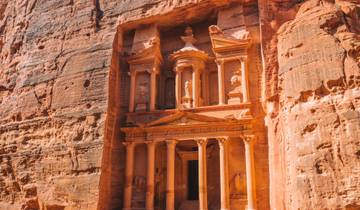
The Treasury (Al-Khazneh) facade measures 40 meters high and 25 meters wide, carved entirely from the living sandstone cliff in the 1st century AD as royal tomb (despite the “treasury” name arising from Bedouin legends about hidden treasure in the summit urn). Early morning light (7:00-8:30 AM) strikes the facade directly, illuminating the intricate Hellenistic columns, carved figures, and architectural details while creating dramatic shadows that emphasize three-dimensional relief work.
Explore multiple viewing positions: the classic frontal view from plaza center, elevated right-side perspectives accessed via informal trails climbing 20-30 meters for overview shots including surrounding cliffs, and close-approach angles examining column capitals and figure details. Organized camel photo opportunities (5-10 JD for tourist photos with handlers positioning camels for Instagram-style shots) cluster in the plaza but avoiding them creates cleaner architectural photography without commercial elements.
The Treasury’s interior contains three empty chambers (forbidden to enter, visible only from the entrance) as tomb robbers cleared contents centuries ago. The facade represents the primary attraction with its blend of Nabataean, Hellenistic, and Egyptian architectural influences creating unique hybrid style found nowhere else. Spend 45-60 minutes exploring different perspectives, observing how changing sunlight angles transform the appearance, and appreciating the technical achievement of carving such monumental architecture from solid rock without modern tools.
Street of Facades and Theater Complex
Continue beyond the Treasury through the widening outer Siq where the canyon opens into Petra’s central valley. The Street of Facades extends 500 meters along the right cliff face, containing dozens of tomb facades in varying sizes demonstrating the range of Nabataean funerary architecture from modest single-chamber tombs to elaborate multi-story designs. This section receives minimal tourist attention as groups rush toward the Royal Tombs, creating uncrowded photography opportunities.
Petra’s Theater sits 800 meters past the Treasury, carved directly into the mountainside around 1 AD to accommodate 3,000 spectators for Roman-style entertainment. The semicircular seating tiers, orchestra pit, and stage area survive partially despite earthquake damage destroying much original structure. Climb into the upper seating rows for elevated perspectives across Petra’s central valley, photographing the Royal Tombs complex on the opposite cliff face. Theater exploration adds 15-20 minutes to the route progression.
Royal Tombs Exploration Circuit
The Royal Tombs cluster 400 meters past the theater on the eastern cliff face, comprising four major monuments: Urn Tomb, Silk Tomb, Corinthian Tomb, and Palace Tomb. Modern stairways provide access to the tomb entrances and interior chambers, creating a 30-45 minute exploration circuit examining each monument’s unique characteristics.
Urn Tomb ranks as the most impressive with its massive 18×20-meter interior chamber featuring natural color striations (burgundy, cream, purple) in ceiling and walls. Byzantine Christians converted this tomb into a church in 446 AD, installing altar and carving Greek inscriptions still visible on interior walls. The tomb’s large courtyard and triple-tiered facade demonstrate Nabataean monumental architecture at peak sophistication. Climb to the interior for panoramic views across Petra’s central valley, capturing theater complex and Colonnaded Street in single photographic frames.
Silk Tomb earns its name from extraordinary swirling color patterns resembling watered silk fabric, requiring close-up photography to capture detail. Corinthian Tomb and Palace Tomb complete the sequence, each showing different approaches to facade design and interior chamber configuration. The complete Royal Tombs circuit covers approximately 600 meters of walking with multiple stairway ascents totaling 40-50 meters elevation gain.
Colonnaded Street to Route Terminus
Descend from the Royal Tombs to Petra’s main Colonnaded Street, the ancient city’s commercial and ceremonial center. Roman reconstruction in 106 AD after Nabataean kingdom annexation created the columned portico (partially re-erected by modern archaeologists) that sheltered shops and businesses. Original paving stones show wheel ruts from ancient carts, while excavated building foundations and terracotta pipe sections reveal water distribution infrastructure.
Qasr al-Bint (“Palace of the Daughter”) stands at the Colonnaded Street’s western terminus, representing Petra’s largest free-standing structure and most important temple. The 23-meter-high building demonstrates massive stone block construction with decorative plaster remnants and interior chamber that held cult statues. Circle the structure examining wall construction techniques and architectural details, spending 20-30 minutes on comprehensive exploration.
The route terminus at Qasr al-Bint provides decision point: return via the Siq retracing the inbound route (2.5 kilometers), or extend exploration with additional side trips (Royal Tombs upper trails, Basin Restaurant lunch stop, small site museum visit). Most Classic Route walkers complete the return journey arriving back at the visitor center 3.5-4.5 hours after initial departure, having covered Petra’s essential monuments in a single manageable circuit.
Monastery Route: Ad-Deir Ascent 2026
Route Overview and Key Statistics 2026
Distance: 8 kilometers round-trip (4 kilometers ascent, 4 kilometers descent)
Elevation Gain: 300 meters from Qasr al-Bint to Monastery summit
Difficulty: Moderate to Challenging
Time Required: 2.5-3.5 hours total (ascent 60-90 minutes, exploration 30-45 minutes, descent 45-60 minutes)
Surface: Carved stone steps (800+ steps) alternating with packed earth switchback sections
Best Timing 2026: 6:30-8:30 AM start for sunrise lighting, or 3:00-4:30 PM for afternoon ascent
The Monastery trail ranks as Petra’s most rewarding moderate-difficulty route, combining challenging sustained climbing with spectacular monument revelation at the summit. This route separates casual visitors from committed explorers—approximately 40% of Petra visitors attempt the Monastery climb, with 85% completing it successfully. The physical demands prove manageable for moderately fit individuals while the monument payoff justifies the effort investment through scale and positioning that exceeds even the Treasury’s magnificence.
Trail Access and Initial Ascent Section
Access the Monastery trail from the Qasr al-Bint area at Petra’s main Colonnaded Street terminus. Clear signage marks the trail beginning, eliminating navigation uncertainty. The initial section follows the broader valley floor for 400-500 meters before arriving at the first switchback turn where carved stone steps begin the sustained climbing sequence.
The lower trail segment (first 1.5 kilometers, 30-40 minutes) ascends through moderately graded stone steps interspersed with flatter sections allowing brief recovery. Carved facades appear sporadically along this segment—small tombs, triclinium chambers, and water cisterns demonstrating Nabataean infrastructure extending far beyond the main central valley. These minor monuments receive minimal attention from climbers focused on reaching the Monastery, creating opportunities for uncrowded exploration on the descent return.
Bedouin tea stand at approximately the halfway point (1.8-2 kilometers, 40-45 minutes into ascent) provides welcome rest break with shade canopies, bench seating, and refreshment sales (fresh mint tea 3-4 JD, cold soft drinks 3-5 JD, bottled water 3 JD). This strategic rest stop allows heart rate recovery and hydration replenishment before tackling the upper trail’s steeper sections. Many hikers pause 10-15 minutes here, converting the Monastery climb into two-segment approach rather than sustained effort requiring greater fitness.
Upper Trail and Summit Approach
The upper trail segment (final 1.5-2 kilometers) increases gradient with longer continuous step sequences and fewer flat recovery sections. Stone steps vary from carefully carved 20-centimeter risers to natural bedrock formations requiring larger step-ups approaching 40 centimeters, demanding attention to foot placement and increased energy expenditure. Trail width narrows in sections to 1-1.5 meters where two-way traffic requires yielding to descending hikers on outside edge positions.
Vegetation changes mark elevation gain as desert scrub gives way to juniper trees and Mediterranean plant species thriving at 1,200+ meter elevations. Views open progressively across Petra’s central valley and surrounding mountain wilderness, providing motivation during difficult climbing sections. Strategic rest breaks at natural viewpoint positions (rock outcrops, trail wide-points) allow photography of the expanding landscape perspective while recovering for subsequent climb sections.
The final approach opens suddenly onto the vast plaza fronting the Monastery where the 45-meter-wide, 50-meter-high facade carved from single rock face creates overwhelming sense of scale exceeding the Treasury despite receiving far fewer visitors. Summit arrival generates powerful achievement satisfaction after sustained physical effort, creating emotional connection to the monument stronger than passive viewing could produce.
Monastery Exploration and Extended Viewpoints
Ad-Deir (the Monastery, named by Byzantine monks who used it as church centuries after Nabataean construction) served as temple or elite tomb around 1st century BC. The massive urn crowning the facade measures 9 meters tall alone, while the doorway stands 8 meters high emphasizing monumental proportions designed to impress approaching visitors. Interior chamber dimensions (12×12 meters with 5-meter ceiling) pale compared to exterior grandeur but wall niches and altar remains indicate ceremonial religious use.
Small Bedouin cafe operates opposite the facade serving refreshments (tea, coffee, soft drinks 3-5 JD) and providing shaded seating for extended appreciation of the monument. Early morning timing (7:30-9:00 AM arrival) captures low-angle sunlight illuminating the facade’s intricate architectural details, while afternoon visits (4:00-5:30 PM) see warmer golden light creating different photographic character. Midday harsh overhead lighting creates flat appearance with minimal shadow definition, making timing strategic for optimal visual experience.
Climb an additional 15-20 minutes beyond the Monastery following informal trails to elevated viewpoints offering perspectives on both the monument and surrounding wilderness. These high vantage points reveal Petra’s spectacular natural setting where ancient carved city meets dramatic desert mountains extending toward Wadi Araba rift valley. The elevated positions provide 360-degree panoramas impossible to achieve from the Monastery plaza level, rewarding the additional effort with comprehensive landscape understanding.
Descent Strategy and Alternative Return Routes
Standard descent reverses the ascent route, requiring 45-60 minutes for the 4-kilometer return to Qasr al-Bint area. Downhill travel stresses knees significantly—trekking poles reduce impact forces by 20-25% making them valuable for descent even if unused during ascent. Conservative pacing prevents the rushed descending that causes most ankle injuries when tired hikers lose concentration on foot placement.
Alternative “Back Way to Monastery” return routes exist for experienced hikers seeking variety and solitude. The Wadi Muthlim route descends eastward through narrow canyon systems emerging near the theater complex, adding 1-1.5 hours to return time but providing completely different landscape experience. This alternative requires confident navigation skills as trail marking proves minimal and route-finding through canyon systems demands attention to terrain features. Attempting this route for the first time on descent after the taxing Monastery climb creates fatigue-related navigation error risk.
High Place of Sacrifice Route 2026
Route Overview and Key Statistics 2026
Distance: 6 kilometers total circuit (2 kilometers ascent from theater, 4 kilometers descent via Wadi Farasa to Qasr al-Bint)
Elevation Gain: 250 meters ascent, 350 meters descent
Difficulty: Moderate
Time Required: 3-4 hours complete circuit including summit exploration
Surface: Stone steps ascent, rough trail descent through Wadi Farasa
Best Timing 2026: 7:00-9:00 AM start for morning light, avoiding midday heat exposure
The High Place of Sacrifice represents Petra’s most important ritual site where Nabataean priests conducted sacrificial ceremonies on the mountain-top altar. This route combines moderate physical challenge with exceptional monuments along the descent circuit through Wadi Farasa, creating comprehensive experience balancing effort with archaeological rewards. The circuit format (ascending one route, descending via different trail) provides varied landscape and prevents monotonous backtracking.
Ascent from Theater to High Place Summit
Access the High Place trail from near Petra’s theater where clear signage indicates the route beginning. The initial 200 meters climb steeply through carved stone stairways before reaching the first carved monument chamber, the Lion Fountain with eroded feline water spouts marking a sacred precinct entrance. This psychological checkpoint (10-15 minutes into climb) provides first rest opportunity before continuing upward.
The ascent continues through approximately 800 carved and natural stone steps gaining 250 meters elevation over 2 kilometers horizontal distance. Trail width varies from generous 2-meter sections allowing two-way traffic to narrow 80-centimeter passages requiring single-file progression. Stone step heights range 15-35 centimeters with occasional larger step-ups over 40 centimeters demanding careful foot placement, particularly during descent when knee impact increases injury risk.
Summit arrival reveals the High Place of Sacrifice complex comprising courtyard, altar platforms, and drainage channels carved into bedrock for collecting sacrificial blood. The 6×6-meter main altar sits elevated on a platform with steps, ramps, and channels demonstrating sophisticated ritual infrastructure. Archaeological evidence indicates animal sacrifices (primarily goats, sheep, cattle) occurred here during major religious festivals and royal ceremonies from 3rd century BC through Roman period annexation.
Panoramic views from the High Place extend across Petra’s entire archaeological zone with the Treasury, Royal Tombs, and Colonnaded Street visible below, plus surrounding mountain wilderness stretching to horizons. Early morning timing (8:00-9:30 AM arrival) provides crystal-clear visibility before afternoon dust haze reduces distant detail. The summit plateau offers shaded rest areas under natural rock overhangs providing welcome relief from sun exposure during summer months.
Descent Circuit Through Wadi Farasa
The descent route through Wadi Farasa provides Petra’s premier “hidden monument” experience with exceptional carved facades receiving minimal visitor traffic despite architectural quality rivaling the main area monuments. This 4-kilometer descent circuit passes the Garden Temple complex, Roman Soldier Tomb, Renaissance Tomb, and climaxes at the spectacular Garden Tomb and Triclinium before emerging at Qasr al-Bint.
Lion Triclinium appears 30 minutes into descent, a banquet hall with carved lion water spouts and elaborate facade decoration. The interior chamber preserves traces of plaster and paint indicating original colorful decoration long since eroded from exposed monuments. Continuing descent passes multiple smaller tomb facades demonstrating the density of Nabataean construction throughout Petra’s valleys, not merely concentrated in the main tourist corridor.
Roman Soldier Tomb and adjacent triclinium show exceptional preservation of architectural details including figures in military dress (hence the name, though probably mythological rather than actual soldiers). The facing triclinium served as funeral banquet hall where families gathered for commemorative meals honoring deceased relatives interred in the tomb opposite. This tomb-triclinium pairing represents standard Nabataean funerary complex design found throughout Petra.
Garden Tomb and Triclinium complex marks the descent circuit climax with perfectly preserved interior reliefs, natural color variations creating abstract patterns, and architectural sophistication equal to main area monuments without the crowds. The interior chamber features carved niches, bench seating, and ceiling details that 90% of Petra visitors never see due to Wadi Farasa’s location away from standard tour routes. Photography lighting proves optimal mid-morning (9:30-11:00 AM) when sun angles illuminate interiors without harsh shadows.
Advanced Routes for Experienced Hikers 2026
Al-Khubtha Trail: Treasury Viewpoint Route
Distance: 5 kilometers round-trip from Royal Tombs
Elevation Gain: 280 meters to upper viewpoints
Difficulty: Challenging
Time Required: 2.5-3 hours total
Best Timing 2026: 3:00-5:00 PM for afternoon light on Treasury facade
The Al-Khubtha Trail ascends from the Royal Tombs area to elevated viewpoints directly above the Treasury, providing the iconic overhead perspective seen in countless Petra photographs. This challenging route receives fewer than 100 daily visitors despite offering Petra’s most dramatic photographic vantage point. The climb demands good fitness and comfort with exposed positions as the upper sections traverse narrow ledges with significant drop-offs requiring sure footing and absence of height anxiety.
Trail access begins behind the Royal Tombs cluster where stone steps climb steeply through multiple switchback sections. The lower trail (first 1.5 kilometers) follows relatively wide paths with secure footing, but upper sections narrow to 60-80 centimeters wide traversing cliff faces where attention to foot placement proves essential. No technical climbing equipment proves necessary but some positions feel exposed enough that hikers uncomfortable with heights should reconsider attempting this route.
The primary viewpoint sits 280 meters above the Treasury plaza, providing direct overhead perspective showing the monument’s roof, surrounding cliffs, and the dramatic Siq entrance canyon. Afternoon light (3:00-5:00 PM) illuminates the Treasury facade optimally from this elevated position, creating the golden lighting conditions impossible to achieve from plaza level. Multiple viewpoint positions allow compositional variations and different perspectives on the monument’s relationship to surrounding landscape.
Back Way to Monastery via Wadi Muthlim
Distance: 12 kilometers complete circuit from visitor center
Elevation Gain: 400 meters total
Difficulty: Advanced
Time Required: 6-8 hours complete circuit
Best Timing 2026: Full-day commitment, 6:30 AM start recommended
The Wadi Muthlim approach to the Monastery provides experienced hikers with wilderness route alternative to the standard stepped trail. This challenging circuit enters Petra through the Al-Madras alternative entrance (requires pre-arrangement with visitor center, same entrance ticket valid), traverses narrow canyon systems with occasional scrambling sections, and emerges at the Monastery from the opposite direction than standard routes.
Trail conditions vary from clear paths to ambiguous routes requiring navigation skills and terrain interpretation. GPS devices or detailed topographic maps prove essential as trail marking appears sporadically or not at all in sections. Canyon passages include narrow slots requiring sideways shuffling and occasional boulder scrambling where hands-and-feet climbing over obstacles proves necessary. This route suits experienced desert hikers comfortable with route-finding and prepared for unexpected challenges.
The rewards justify the difficulties for qualified hikers seeking solitary Petra experiences away from all tourist traffic. Entire sections see fewer than 10 hikers monthly, creating meditative wilderness immersion impossible on popular routes. Canyon geology reveals spectacular color variations, water-carved formations, and geological processes operating over millions of years. Wildlife sightings (ibex, eagles, desert foxes) occur more frequently in these remote areas where human traffic remains minimal.
Jabal Haroun Pilgrimage Route
Distance: 18 kilometers round-trip from Petra center
Elevation Gain: 600 meters to summit at 1,350 meters elevation
Difficulty: Very Challenging
Time Required: 8-10 hours complete circuit
Best Timing 2026: Multi-day permits sometimes required, inquire at visitor center
Jabal Haroun (Aaron’s Mountain) hosts a white-domed shrine marking the traditional burial site of Aaron, Moses’s brother, making it sacred to Muslims, Christians, and Jews. The demanding pilgrimage route climbs from Petra through wilderness trails to the mountain summit, combining physical challenge with religious significance. This route represents Petra’s most challenging standard trail, suitable only for highly fit hikers with wilderness experience and full-day availability.
The route follows ancient pilgrimage paths used for centuries by religious devotees visiting the shrine. Trail conditions range from clear stone-paved sections to barely-visible routes through boulder fields requiring constant navigation attention. Water sources prove non-existent along the route requiring self-sufficiency with 4-5 liters minimum per person. Summer attempts create severe heat exhaustion risk—this route suits spring (March-May) or autumn (September-November) timing exclusively.
Summit views extend across the entire Petra archaeological zone, Wadi Araba rift valley, and distant mountains in Israel/Palestine. The white shrine building provides minimal interior space but represents the pilgrimage objective for many hikers. Bedouin guides sometimes offer services for this route (full-day rates 100-150 JD) providing navigation certainty and cultural interpretation that enhance the experience beyond simple physical achievement.
Route Planning Strategies for 2026 Multi-Day Visits
Three-Day Route Progression Framework
Day One: Classic Route (Siq-Treasury-Royal Tombs-Colonnaded Street) covering essential monuments in 4-5 hours with moderate pacing. This foundation day establishes site geography understanding, acclimatizes to walking distances and surface conditions, and builds physical conditioning for subsequent days’ challenges. Total distance 6-7 kilometers including exploration loops at monuments.
Day Two: Extended peripheral exploration combining Wadi Farasa circuit (via High Place descent) with Little Petra afternoon excursion. This intermediate day adds difficulty through elevation gain and extended distances (10-12 kilometers total) while revealing monuments beyond main tourist corridors. Alternative option substitutes Back Way reconnaissance or Al-Khubtha viewpoint climb for variety.
Day Three: Monastery full ascent in early morning (6:30 AM start for sunrise lighting), followed by afternoon choice between rest/recovery or attempting a second major climb (High Place of Sacrifice if skipped on day two). This final day maximizes physical challenge after two days of conditioning while prioritizing Petra’s most rewarding moderate route. Total distance 8-15 kilometers depending on afternoon choices.
Single-Day Maximum Coverage Route
Visitors limited to one day in Petra optimize coverage through strategic route combination and aggressive pacing. Depart accommodation 6:00 AM for 6:30 AM site opening, proceed directly to the Monastery via standard stepped route (skip Treasury extended photography on outbound leg), complete Monastery ascent and exploration by 9:00-9:30 AM, descend and explore Royal Tombs area 10:00-11:30 AM, lunch break 11:30 AM-12:30 PM, afternoon Treasury photography during optimal light 1:00-2:30 PM, exit site 3:00-4:00 PM. This compressed schedule covers 14-16 kilometers with significant elevation gain demanding excellent fitness but capturing Petra’s essential monuments in available time.
Photography-Optimized Route Timing 2026
Morning Session (6:30-10:30 AM): Siq walk during soft dawn light, Treasury facade with direct morning sun illumination (7:00-8:30 AM optimal), Monastery climb for summit arrival 8:30-9:30 AM capturing facade lighting. This morning priority schedule emphasizes Petra’s two most photogenic monuments during ideal lighting conditions.
Midday Session (10:30 AM-2:30 PM): Explore shaded areas less dependent on lighting quality—interior chambers, museums, peripheral valleys. Alternatively use this period for accommodation return, rest, and meal breaks avoiding harsh overhead light that flattens architectural details.
Afternoon Session (2:30-5:30 PM): Al-Khubtha viewpoint climb for Treasury overhead perspectives in warm afternoon light, Wadi Farasa circuit capturing softer angled illumination on interior chambers, strategic positioning for golden hour lighting (final 60 minutes before sunset) at selected monuments. Return through Siq during final light captures different atmospheric qualities than morning transit.
Safety Considerations for Self-Guided Walking 2026
Environmental Hazards and Risk Management
Flash floods represent Petra’s primary environmental danger, particularly in the narrow Siq where water funnels through the 3-4 meter wide passage during rainstorms. Site management closes the Siq when heavy rain occurs or threatens, directing visitors through alternative Al-Madras entrance routes. Never ignore closure signs or attempt Siq transit during rain warnings—flash floods kill pedestrians trapped in narrow canyons worldwide annually. The broader main valley areas present minimal flash flood risk allowing continued exploration when only the Siq closes.
Heat exhaustion and heat stroke escalate during summer months (June-August) when midday temperatures reach 38-42°C with minimal shade availability. Symptoms include excessive sweating followed by absence of sweating, dizziness, confusion, rapid pulse, and potential loss of consciousness. Prevention requires aggressive hydration (0.5-0.75 liters hourly), regular rest breaks in available shade, and avoiding peak heat hours (11:00 AM-3:00 PM) for strenuous activities. Recognize early warning signs and respond immediately through increased water intake, cooling measures, and route termination if symptoms persist.
Ankle and knee injuries from slips and falls represent the most common medical incidents requiring evacuation or treatment. Worn stone steps polished by 2,000 years of foot traffic become slippery when dusty or damp, particularly during descents when forward momentum increases fall risk. Trekking poles significantly reduce injury rates by providing additional stability points and reducing knee impact forces during long descents. Conservative pacing and attention to foot placement prevent most injuries that aggressive rushing creates.
Emergency Communication and Assistance 2026
Cellular coverage inside Petra proves inconsistent with strong signal at the visitor center and Treasury area degrading to weak or absent signal in peripheral valleys and elevated positions. Download offline maps and essential information before entering the site rather than depending on internet access for navigation or reference. Inform accommodation staff of planned routes and expected return times, particularly for challenging solo routes where assistance delays could prove serious.
Petra Tourism Police maintain presence throughout the site on horseback and in vehicles, providing assistance for emergencies, navigation questions, and safety concerns. They patrol main routes regularly but reach peripheral valleys and wilderness trails infrequently. Emergency contact numbers (posted at visitor center and on entry tickets) connect to police dispatch coordinating evacuation responses when necessary.
Basic first aid capability proves essential for self-sufficient exploration. Pack supplies including blister treatment, wound cleaning materials, elastic bandages for sprains, pain relievers, and emergency energy food in case delays extend routes beyond planned durations. Knowledge of basic first aid treatment for common trail injuries (blisters, sprains, cuts, heat exhaustion) enables self-care for minor issues preventing route termination for treatable conditions.
Frequently Asked Questions: Petra Walking Routes 2026
Do I need special permits for any Petra walking routes in 2026?
Standard Petra entrance tickets grant access to all main walking routes including the Siq, Treasury, Royal Tombs, Monastery, High Place of Sacrifice, and peripheral valley trails without additional permits. Extended wilderness routes like Jabal Haroun pilgrimage sometimes require advance notification to visitor center staff but rarely formal permits for day visits. Multi-day camping expeditions within the archaeological zone require special permits arranged through Petra visitor center (fees vary based on group size and duration), but day hiking on marked and informal trails needs only standard entrance ticket. Alternative entrance routes (Al-Madras access) require coordination with visitor center to ensure guards expect your arrival but use the same entrance ticket as primary Siq entrance.
Can I swim in any water features along Petra walking routes?
No natural water features within Petra suitable for swimming exist and all standing water sources (cisterns, collection pools) contain stagnant water unsuitable for contact due to bacterial contamination risk. The Nabataean water channels carried fresh spring water historically but modern systems no longer function. Wadi Musa town offers no public swimming facilities though some upscale hotels provide pools for guest use. Nearest swimming opportunities sit in Aqaba (2 hours south) at Red Sea beaches or Dead Sea resorts (3 hours north). Petra exploration remains dry hiking without water-based recreation components.
What wildlife might I encounter on Petra walking routes?
Petra’s desert mountain environment supports limited but distinctive wildlife including Nubian ibex (mountain goats with curved horns), rock hyrax (small rodent-like mammals), various lizard species, and occasional desert foxes. Bird species include eagles, falcons, hoopoes, and numerous smaller desert-adapted species. Ibex sightings occur most frequently on wilderness routes and elevated trails (Al-Khubtha viewpoint, Monastery upper viewpoints) where human traffic remains low. Dangerous wildlife proves minimal—scorpions and desert vipers exist but rarely encountered on main trails with proper footwear providing protection. Aggressive camel and horse behavior from poorly managed animals used for tourist rides presents greater hazard than natural wildlife.
Are there restroom facilities along Petra walking routes?
Modern restroom facilities exist at the visitor center (before site entry), near the Treasury plaza (300 meters past Treasury in the outer Siq), at Basin Restaurant area near the Colonnaded Street, and at the Monastery summit cafe area. These facilities provide basic toilets (mix of western and squat styles) with running water for handwashing, though paper supplies prove inconsistent making personal tissue packs advisable. Peripheral valley routes and wilderness trails lack facilities requiring wilderness bathroom practices (dig catholes, pack out toilet paper) following Leave No Trace principles. The 4-kilometer Monastery ascent includes small Bedouin tea stand at halfway point but no formal restroom, creating challenges for those requiring facilities during the 90-minute climb.
Can I bring my dog on Petra walking routes in 2026?
Pets including dogs face prohibition from Petra archaeological zone due to preservation concerns, visitor safety considerations, and conflicts with working animals (horses, camels, donkeys) used for tourist transport. The ban applies uniformly without exceptions for service animals or small dogs. Free-roaming feral dogs populate Wadi Musa town but remain excluded from the archaeological site proper. Travelers with pets must arrange accommodation care during Petra visits, with most hotels offering pet-sitting recommendations or kennel facilities in Wadi Musa. Nearby Wadi Rum desert permits dogs in certain tour operator camps but Petra’s UNESCO World Heritage status imposes stricter regulations.
What’s the best walking route for sunset photography in Petra?
Al-Khubtha Trail viewpoint above the Treasury offers Petra’s premier sunset photography position with western exposure allowing warm evening light to illuminate the Treasury facade from overhead perspective. The challenging 2.5-hour round-trip requires afternoon timing (3:00-3:30 PM start) reaching the viewpoint by 5:00 PM for golden hour lighting lasting until 6:00-6:30 PM depending on season. Alternative sunset position sits at the Monastery where western exposure receives direct final sunlight creating dramatic facade illumination impossible earlier in the day. The Monastery approach requires either morning ascent with full-day summit presence or afternoon climb accepting that return descent happens after sunset necessitating headlamp navigation (site technically closes at 6:00 PM but enforcement proves flexible for Monastery visitors). Most sunset photographers choose the Al-Khubtha route for superior perspectives despite challenging access.
How do walking routes change between summer and winter in 2026?
Summer walking (June-August) demands radical timing adjustments to manage extreme heat, with route starts at 6:00-6:30 AM completion of strenuous climbs before 10:00 AM, extended midday breaks 11:00 AM-3:00 PM, and late afternoon secondary sessions 3:30-6:00 PM during cooling hours. Winter walking (December-February) faces shorter operating hours (site closes 4:00 PM versus 6:00 PM summer closure) requiring compressed schedules and eliminating extended afternoon routes. Cold morning temperatures (0-8°C at 6:00 AM starts) necessitate warm layers shed as day progresses, while summer starts in already warm conditions (20-25°C at 6:00 AM). Rain and snow create slippery conditions on stone steps during winter, sometimes forcing route closures particularly in the narrow Siq where flash flood risk escalates. Spring and autumn shoulder seasons (March-May, September-November) provide most flexible timing without extreme temperature management requirements.
Can I access Petra walking routes with a wheelchair or mobility aid?
Wheelchair and mobility scooter access extends from the visitor center through the Siq to the Treasury (1.8 kilometers one-way, 3.6 kilometers round-trip) on paved paths suitable for wheeled mobility devices. This accessible route covers Petra’s most iconic monument but eliminates access to Royal Tombs, Monastery, High Place, and peripheral valleys requiring steps, rough terrain, or significant elevation changes. Motorized wheelchairs and mobility scooters prove more practical than manual wheelchairs due to the 60-meter gradual elevation gain from visitor center to Treasury. Beyond the Treasury, all routes feature stairs, uneven surfaces, or challenging terrain incompatible with wheeled devices. Visitors with mobility limitations complete the accessible Siq-Treasury circuit (3-4 hours round-trip with exploration time) achieving meaningful Petra experience despite restricted range compared to able-bodied visitors accessing the complete route network.