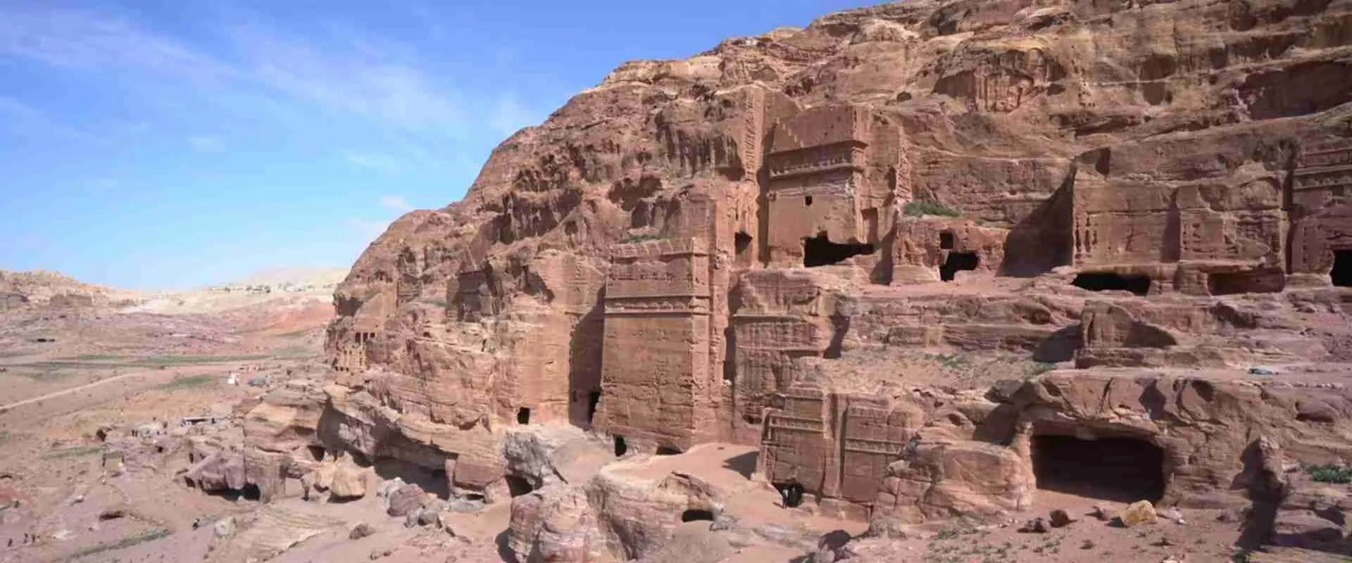
Petra Hidden Gems Guide: Secret Spots & Lesser-Known Treasures
Key Takeaways
- High Place of Sacrifice features two obelisks carved from living rock standing 7 meters tall with ceremonial platforms offering panoramic views across Petra’s mountain valleys
- Colonnaded Street preserves sophisticated urban infrastructure with intact column drums, paving stones showing chariot wheel ruts, and underground water channels demonstrating Nabataean engineering
- Byzantine Church mosaics display intricate geometric patterns and figural representations surviving 1,500 years with colors preserved through protective sediment layers discovered during excavation
- Wadi Farasa trail connects Garden Temple complex, Roman Soldier Tomb, and Renaissance Tomb through scenic canyon requiring 2-3 hours exploration beyond standard tourist routes
- Snake Monument carved on cliff faces marks processional routes ascending to High Place of Sacrifice with symbolic serpent motifs representing healing and rebirth in Nabataean religious practice
- Jabal Haroun summit shrine honors biblical Aaron with white-domed mosque visible from Petra basin requiring 4-hour round-trip hike through mountain wilderness rarely attempted by casual visitors
Introduction to Petra’s Hidden Archaeological Landscape
The ancient Nabataean capital extends far beyond the iconic Treasury facade and Monastery temple, encompassing approximately 264 square kilometers of carved architecture, sacred high places, urban infrastructure, and wilderness sanctuaries that most visitors never explore during brief site visits. While tour groups concentrate on the Siq approach and primary monuments accessible via paved paths, the surrounding sandstone mountains conceal extraordinary archaeological treasures ranging from intact Byzantine mosaics to ceremonial platforms carved at cliff-edge heights offering spiritual significance matched by spectacular panoramic vistas. These lesser-known locations reward adventurous travelers willing to climb steep staircases, navigate unmarked trails, and venture beyond the comfortable tourist circuit into zones where ancient Petra reveals its full complexity as a thriving metropolis rather than merely a collection of photogenic facades.
Understanding Petra’s hidden gems requires recognizing the site’s layered occupation spanning Nabataean foundation around 312 BCE through Byzantine Christian transformation in the 5th-6th centuries CE, with each period contributing distinct architectural and religious elements often overlooked in favor of headline monuments. The Nabataean civilization developed sophisticated urban planning visible in the Colonnaded Street’s commercial district, engineered elaborate water management systems channeling flash floods into controlled cisterns, and created ceremonial high places for religious rituals involving processional ascents to mountain-top sanctuaries. Byzantine occupation transformed several major tombs into churches, added elaborate mosaic floors depicting seasonal activities and exotic animals, and established Christian worship centers that operated until Islamic conquest redirected regional focus away from the abandoned city.
The archaeological landscape’s vastness means that even dedicated multi-day exploration cannot exhaust Petra’s treasures, as hundreds of carved facades, staircases leading to unknown destinations, and inscription-covered rock faces await documentation by researchers still mapping the site’s full extent. Remote locations like Umm al-Biyara summit fortress and Jabal Haroun’s mountain shrine require serious hiking commitment and physical fitness rarely possessed by casual tourists, creating authentic exploration opportunities for travelers seeking genuine discovery rather than simply photographing famous monuments alongside crowds. This comprehensive guide examines Petra’s most rewarding hidden gems, providing historical context, location details, and practical exploration advice enabling independent discovery of the ancient city’s secret spots and lesser-known treasures offering exceptional archaeological, historical, and photographic value beyond the standard tourist experience.
People Also Ask About Petra Hidden Gems
What are the best hidden spots in Petra?
High Place of Sacrifice represents Petra’s premier hidden treasure, accessed via 800 stone steps ascending from Theater area to ceremonial platform at 1,035 meters elevation featuring two massive obelisks carved from bedrock, circular altars with drainage channels for ritual offerings, and 360-degree views across Wadi Musa, Jabal Haroun, and the entire Petra basin. The Colonnaded Street’s northern extension beyond tourist concentration areas reveals intact urban infrastructure including complete column drums awaiting re-erection, original paving stones showing ancient wheel ruts, and underground water channels feeding public fountains throughout the commercial district. Byzantine Church mosaics preserve exceptional artistic quality with intricate geometric borders surrounding figural panels depicting seasons, grape harvesting, and exotic animals including elephants and parrots demonstrating cultural exchange networks connecting Petra to distant Mediterranean and African regions. Wadi Farasa trail combines multiple monuments including Garden Temple complex with its triclinium dining chamber, Roman Soldier Tomb featuring relief sculptures of military figures, and Renaissance Tomb’s classical facade through scenic canyon walk requiring modest physical effort rewarded by solitary exploration rarely interrupted by other visitors.
How do you find secret tombs in Petra?
Petra contains over 600 carved tombs scattered throughout the sandstone mountains, with the vast majority remaining unvisited by tourists concentrating on Royal Tombs and other primary monuments along standard routes. Exploration strategies include examining side wadis branching from main pathways, scanning cliff faces at various elevations for carved openings and architectural details, and following ancient staircases ascending steep slopes toward distant facades visible from valley floors. Many significant tombs hide in plain sight along less-traveled paths like the trail from Qasr al-Bint toward Snake Monument and High Place of Sacrifice, where dozens of carved chambers open onto the processional route used during religious ceremonies. Systematic exploration of the area beyond the Monastery reveals extensive tomb complexes carved into western mountain faces, accessed via scrambling routes and requiring comfort with exposed terrain lacking safety barriers or marked trails. Local Bedouin guides provide invaluable knowledge identifying specific tomb locations, explaining architectural features distinguishing high-status burials from simpler chambers, and sharing oral traditions preserving historical associations with particular monuments whose original purposes remain undocumented in archaeological literature.
What makes Petra’s Byzantine mosaics special?
The Byzantine Church mosaics rank among Jordan’s finest preserved examples of 6th-century CE Christian art, displaying technical sophistication and iconographic richness rivaling famous Mediterranean sites while maintaining exceptional color preservation through protective burial under sediment layers that shielded tesserae from sunlight and weathering for 1,400 years. The church floor encompasses 70 square meters decorated with geometric patterns, acanthus scrolls, animal representations including peacocks and eagles, and personification figures representing seasons and earth’s bounty executed in thousands of colored stone and glass tesserae measuring 5-10 millimeters per piece. Unique features include dedication inscriptions identifying donors and church officials, rare depictions of daily life activities like grape harvesting and grain threshing providing documentary evidence for Byzantine-period economic practices, and sophisticated perspective techniques creating three-dimensional illusions of depth and volume within two-dimensional mosaic medium. The church’s transformation from earlier Nabataean structure demonstrates cultural layering characteristic of Petra’s occupation history, with column bases and architectural fragments from Roman-period predecessors incorporated into Byzantine construction creating palimpsest archaeology where multiple time periods coexist in single monuments.
Which Petra trails avoid tourist crowds?
Wadi Farasa trail departing from Theater area provides extensive monument exploration through scenic canyon landscape attracting minimal tourist traffic compared to main Siq-to-Monastery route. The 2-3 hour circuit includes Garden Temple complex, Roman Soldier Tomb, Renaissance Tomb, and optional High Place of Sacrifice descent, revealing sophisticated Nabataean urban planning and religious architecture far from overcrowded Treasury and Street of Facades areas. Al-Madras trail ascending from Qasr al-Bint temple toward Umm al-Biyara summit passes dozens of carved tombs, ancient staircases, and terraced structures demonstrating residential occupation patterns visible only to hikers willing to climb steep paths beyond comfortable tourist zones. The eastern slopes beyond the Monastery offer unmarked exploration opportunities following Bedouin goat paths to remote high places, isolated tomb complexes, and viewpoints overlooking Wadi Araba desert where solitary contemplation of Petra’s spiritual landscape proceeds undisturbed by the crowds concentrating at famous monuments. Early morning or late afternoon exploration times further reduce encounter rates with other visitors, as most tourists enter Petra mid-morning and concentrate visits during comfortable midday hours, leaving dawn and dusk periods relatively empty for photographers and solitude-seekers.
Extended multi-day tours – 5+ days
Featured Petra Multi-Day Tour Packages

3 days
Petra 3-Day Discovery Tour
- ✓ Comprehensive Petra experience
- ✓ Expert local guides included
- ✓ All accommodation included
- ✓ Transportation provided
5 days
Petra 5-Day Highlights Experience
- ✓ Comprehensive Petra experience
- ✓ Expert local guides included
- ✓ All accommodation included
- ✓ Transportation provided

7 days
Petra 7-Day Cultural Journey
- ✓ Comprehensive Petra experience
- ✓ Expert local guides included
- ✓ All accommodation included
- ✓ Transportation provided
10 days
Petra 10-Day Complete Adventure
- ✓ Comprehensive Petra experience
- ✓ Expert local guides included
- ✓ All accommodation included
- ✓ Transportation provided
Multi-day tour packages powered by TourRadar. Prices and availability subject to change.
High Place of Sacrifice Sacred Mountain Platform
Historical and Religious Significance
The High Place of Sacrifice (Al-Madbah) functioned as Petra’s primary ceremonial center for Nabataean religious rituals involving animal sacrifice, libation offerings, and processions ascending from the urban core through processional ways marked by carved niches, symbolic monuments, and staircase systems facilitating large-group movement to the mountain-top sanctuary. The platform’s construction date remains debated among archaeologists, though stylistic analysis suggests development during Petra’s prosperity peak in the 1st century BCE when the Nabataean kingdom controlled trade routes extending from Arabian Peninsula frankincense sources to Mediterranean ports and accumulated wealth funding ambitious architectural programs. The site’s spiritual importance derived from Nabataean cosmology associating mountain heights with divine proximity, sacred landscapes requiring physical ascent symbolizing spiritual elevation, and open-air platforms enabling celestial observation essential for astronomical calculations governing religious calendar and agricultural timing.
Two massive obelisks carved from living bedrock stand 7 meters tall, representing either Nabataean deities Dushara and Al-Uzza according to traditional interpretations, or serving as symbolic representations of sacred mountains in abstract form according to recent scholarly analysis questioning simplistic deity identification. The obelisks demonstrate extraordinary technical skill as sculptors removed surrounding rock to free-stand the monuments while maintaining structural connection to bedrock foundations, achieving precision geometry and smooth surface finishing using only bronze tools and abrasive sand techniques available to ancient craftsmen. Circular altars positioned near the obelisks feature channels carved into rock surfaces allowing blood and liquid offerings to drain into collecting basins, with geometric patterns surrounding the ceremonial platforms suggesting cosmological symbolism linking earthly ritual spaces to celestial realm order.
Ascending the Processional Staircase
The ascent to High Place of Sacrifice begins near the Theater, following clearly marked staircase carved directly into sandstone cliff faces and ascending approximately 220 meters elevation over 800 steps requiring 45-60 minutes steady climbing for moderately fit visitors. The processional route winds through narrow passages between rock walls, opens onto ledges offering dramatic views across Petra basin toward Royal Tombs and Monastery mountain, and passes carved niches that once housed divine images or offerings marking stations along the sacred journey. Snake Monument appears approximately halfway up the ascent, featuring carved serpent motifs on vertical cliff faces flanking the stairs and representing symbolic protection, healing powers, and regenerative qualities associated with serpents in ancient Near Eastern religious traditions extending from Egyptian to Mesopotamian cultures.
The staircase construction demonstrates sophisticated Nabataean engineering adapting architectural design to challenging topography, with steps varying in height and depth to match natural rock contours, retaining walls preventing erosion on exposed sections, and strategically placed rest platforms allowing procession participants to pause during the demanding ascent. Modern visitors benefit from metal handrails installed along exposed sections, though most of the route follows protected passages between rock walls providing natural safety barriers. Photography opportunities throughout the climb capture intimate canyon perspectives, distant monument views framed by rock openings, and textured sandstone surfaces displaying the full spectrum of colors from deep burgundy to pale cream depending on iron oxide content and weathering patterns.
The Summit Platform and Panoramic Views
Reaching the High Place summit reveals a carefully engineered rectangular platform measuring approximately 47 by 20 meters, leveled from the natural mountain top and containing the obelisks, circular altars, rock-cut benches for ceremony observers, and channels connecting ritual spaces to drainage systems. The platform’s open design enables unobstructed 360-degree views encompassing Jabal Haroun’s white shrine dome 7 kilometers southwest, Wadi Musa town spreading north, the Monastery visible on its own mountain to the west, and Wadi Araba depression extending toward the Dead Sea and Israeli highlands beyond. These panoramic vistas provided spiritual significance for ancient worshippers while offering practical benefits for astronomical observations essential to Nabataean calendar calculations determining seasonal festivals, agricultural timing, and trade caravan scheduling coordinated with predictable weather patterns.
The ritual altar’s circular design measures 3 meters in diameter with a raised central platform surrounded by a channel carved with precision geometry requiring sophisticated surveying techniques to achieve perfect circularity despite working entirely in bedrock with hand tools. Small rectangular basins carved adjacent to the main altar likely received specific offerings or libations distinct from main sacrifice procedures, suggesting complex ceremonial protocols differentiating ritual elements according to religious purposes or seasonal occasions. Archaeological excavation around the platform uncovered pottery fragments, animal bones, and charcoal deposits confirming the site’s long ritual use and providing material evidence supporting historical texts describing Nabataean sacrifice ceremonies witnessed by Greek and Roman travelers visiting Petra during its prosperity period.
Colonnaded Street Urban Infrastructure
Nabataean Commercial District Planning
The Colonnaded Street represents Petra’s primary commercial and civic thoroughfare, extending approximately 300 meters from the Nymphaeum fountain complex past the Temple of the Winged Lions toward Qasr al-Bint temple and forming the city’s processional axis connecting sacred precincts to market districts. Construction occurred during the 1st century CE when Nabataean kingdom reached maximum extent and prosperity, funding ambitious urban renewal programs transforming earlier irregular settlement patterns into orthogonal street grids, porticoed shop fronts, and monumental architecture reflecting Hellenistic and Roman urban planning principles adopted throughout the eastern Mediterranean. The street’s original width exceeded 6 meters between flanking colonnades, accommodating wheeled cart traffic, pedestrian movement, ceremonial processions, and open-air market activities that animated the commercial district with merchants selling frankincense, spices, textiles, and luxury goods transported along trade routes converging on Petra from Arabian, African, and Asian sources.
Column bases lining both street sides once supported portico roofs sheltering shops and public buildings from sun and rain, with approximately 60 column drums still visible in various stages of preservation from complete standing columns to fallen segments awaiting archaeological restoration. The columns exhibit Nabataean architectural style blending Classical orders with local innovations, featuring simplified Corinthian capitals, smooth shaft surfaces finished to high polish, and standardized dimensions facilitating construction efficiency across extensive building programs. Behind the colonnades, foundation walls outline shop structures, residential quarters, and craft workshops where archaeological excavation recovered evidence for glass manufacturing, metalworking, pottery production, and food preparation supporting the urban population estimated at 20,000-30,000 inhabitants during Petra’s peak occupation period.
Engineering and Water Management Systems
Beneath the Colonnaded Street’s paved surface, sophisticated water management infrastructure demonstrates Nabataean engineering prowess developing technologies that enabled urban prosperity in the challenging desert environment receiving only 150-200 millimeters annual rainfall. Terracotta pipe systems channeled water from distant springs and rainwater collection points throughout the city, supplying fountains, public baths, and residential structures through pressurized networks maintaining flow despite Petra’s mountainous topography and elevation changes. The underground channels follow precise gradients ensuring gravity-driven flow while incorporating settling basins removing sediment, overflow mechanisms preventing flood damage during intense winter storms, and distribution junctions allocating water resources among competing uses according to sophisticated hydraulic engineering principles documented in preserved pipe sections and channel systems exposed during archaeological investigation.
Paving stones covering the street surface show wear patterns including deep wheel ruts created by centuries of cart traffic transporting goods through the commercial district, with rut spacing and depth providing evidence for vehicle types, cargo weights, and traffic volumes supporting economic activity estimates. Storm drains positioned at regular intervals along the street collected rainwater runoff and directed flows into underground channels preventing erosion and flooding while capturing water resources for storage in massive cistern systems carved into bedrock beneath the city. The engineering sophistication rivals contemporary Roman urban infrastructure while demonstrating unique Nabataean innovations adapted to local geological conditions, water scarcity challenges, and flash flood hazards characteristic of desert mountain environments where intense storms create dangerous temporary flows through otherwise dry wadis.
Archaeological Discoveries and Continuing Research
Excavation along the Colonnaded Street continues revealing new insights into Nabataean urban life, commercial practices, and cultural exchanges connecting Petra to wider Mediterranean and Asian networks. Recent discoveries include ornately decorated ceiling fragments suggesting portico roofs featured painted plaster decoration with floral motifs and geometric patterns, imported marble fragments indicating luxury trade networks accessing premium building materials from distant quarries, and inscriptions identifying shop owners, guild associations, and commercial regulations governing market activities. The presence of coins from diverse sources including Greek city-states, Roman provinces, and Arabian kingdoms demonstrates Petra’s role as international trade hub where multiple currencies circulated and merchants from different cultural backgrounds conducted transactions according to standardized weights and measures ensuring commercial reliability.
The street’s relationship to the broader Petra urban plan reveals carefully designed sight lines connecting major monuments, aligned axis systems creating visual relationships between sacred and civic architecture, and integration of natural topography into the built environment rather than imposing rigid geometric patterns unsuited to mountainous terrain. The commercial district functioned as social gathering space where political announcements occurred, religious processions assembled, and public ceremonies reinforced community identity while displaying Nabataean wealth and architectural sophistication to visiting foreign delegations. Modern conservation efforts focus on stabilizing fallen column drums, preventing erosion damage to exposed foundations, and developing interpretation strategies enabling visitors to understand the Colonnaded Street’s original appearance and urban function despite its current ruined condition.
Byzantine Church Mosaic Masterpieces
Architectural Transformation and Christian Occupation
The Byzantine Church occupies a prominent position overlooking the Colonnaded Street, constructed during the 5th-6th centuries CE through transformation of an earlier Nabataean structure whose architectural elements including column bases and wall foundations were incorporated into the Christian building program. The church plan follows standard basilica design with central nave flanked by aisles, eastern apse containing altar area, and atrium courtyard providing gathering space before entry into the sacred interior. This architectural conversion represents broader patterns throughout Petra where the Byzantine period witnessed Christianization of pagan monuments, establishment of ecclesiastical hierarchy centered on the Petra bishopric, and construction of multiple churches serving the diminished but still significant urban population occupying the ancient Nabataean capital under Byzantine provincial administration.
The building’s commanding location demonstrates Christian authorities’ strategic selection of prominent sites for church construction, asserting religious dominance over the formerly pagan city through architectural transformation of central urban spaces. Archaeological evidence suggests the church functioned as cathedral headquarters for the Petra bishop, with administrative buildings, residential quarters for clergy, and storage facilities for church property clustered around the main worship space forming an ecclesiastical complex governing Christian communities throughout the surrounding region. Dedication inscriptions preserved in mosaics identify donors including prominent local families and church officials, providing rare documentation for Byzantine-period social structure and economic organization in Petra’s declining but still functioning urban environment.
Mosaic Artistic Technique and Iconography
The church floor mosaics display exceptional artistic quality executed in opus tessellatum technique using stone and glass tesserae measuring 5-10 millimeters per piece, arranged in dense patterns achieving detailed figural representations and complex geometric designs rivaling premier Mediterranean mosaic workshops. The central nave features large panels depicting personifications of seasons represented as human figures surrounded by attributes including agricultural implements, harvested crops, and symbolic animals communicating seasonal characteristics to congregations familiar with visual language systems conveying theological and moral messages through artistic imagery. Border patterns employ intricate geometric interlace, acanthus scrolls, and wave patterns creating elaborate frames separating major panels while demonstrating mathematical sophistication in pattern repetition, color harmonies, and three-dimensional illusion effects achieved within strictly two-dimensional medium constraints.
Figural representations include exotic animals like elephants, parrots, and ostriches demonstrating artists’ familiarity with distant fauna through trade networks or illustrated manuscript sources circulating among educated Christian communities. The presence of these exotic species communicates wealth, cultural sophistication, and connection to wider Christian world extending from Ethiopia to India, where early churches maintained communion despite enormous geographic distances. Inscriptions within the mosaic panels include biblical quotations, donors’ names, dates commemorating church construction phases, and dedicatory formulas invoking divine blessing and protection for the building and its congregation. The Greek language employed in inscriptions reflects Petra’s integration into Byzantine cultural sphere where Greek served as ecclesiastical and administrative language despite local populations likely speaking Arabic dialects in daily life.
Preservation and Discovery Context
The mosaics’ exceptional preservation resulted from protective burial under sediment layers that accumulated following church abandonment during the 7th-8th centuries CE, when Islamic conquest and regional economic decline led to Petra’s depopulation and gradual burial under wind-blown sand and erosion debris from surrounding mountains. Discovery occurred during systematic archaeological excavation in 1990s when American Center of Oriental Research teams investigating Byzantine-period Petra uncovered the church structure and recognized mosaic fragments exposed in initial trenches. Careful excavation techniques lifted sediment layers without damaging fragile tesserae surfaces, revealing colors that had remained protected from sunlight and weathering for over 1,300 years and maintaining intensity approaching original installation appearance.
Conservation treatment involved consolidating loose tesserae, cleaning accumulated deposits using specialized techniques avoiding damage to ancient mortar bedding, and installing protective structures shielding the mosaics from environmental exposure while enabling visitor access through elevated walkways preventing foot traffic on fragile surfaces. Challenges included addressing earthquake damage that had displaced sections of flooring, developing methods for treating glass tesserae suffering from age-related degradation, and creating sustainable long-term maintenance programs preventing deterioration in Petra’s harsh climate with extreme temperature fluctuations and occasional flooding during intense winter storms. The successful conservation project established models for treating other Byzantine churches throughout Jordan while demonstrating possibilities for preserving exceptional archaeological remains in-situ rather than removing mosaics to museums where context and architectural relationships disappear.
Wadi Farasa Archaeological Trail
Garden Temple Complex and Ritual Landscape
Wadi Farasa trail begins near the Theater, ascending through narrow canyon containing sequential monuments demonstrating Nabataean landscape architecture principles integrating carved facades, terraced gardens, and water features into coherent ritual environments. The Garden Temple complex occupies a broad terrace created through artificial leveling and terracing, featuring temple structure with carved facade, adjacent triclinium (ritual dining chamber) accommodating ceremonial feasts, and elaborate water channel systems delivering spring water to decorative pools and plantings creating garden spaces within the carved rock environment. The complex demonstrates Nabataean sophistication in hydraulic engineering, landscape design, and ceremonial architecture combining functional water management with symbolic representations of paradise concepts drawn from Persian and Mesopotamian cultural traditions influencing Nabataean religious thought.
Archaeological investigation revealed sophisticated agricultural terracing supporting olive trees, date palms, and ornamental plantings irrigated through engineered water distribution systems channeling spring flows to planted areas while preventing erosion on steep hillsides. The garden’s symbolic significance extended beyond aesthetics, representing sacred landscape concepts associating water abundance with divine blessing, cultivated greenery with civilized order imposed on wild nature, and terraced construction with hierarchical organization reflecting celestial realm structure. Ritual meals conducted in the triclinium chamber strengthened social bonds among participants while honoring deities through shared consumption of sacrificial foods, wine offerings, and ceremonial protocols distinguishing sacred banquets from ordinary dining activities.
Roman Soldier Tomb Architectural Fusion
Continuing along Wadi Farasa reveals the Roman Soldier Tomb, featuring facade carved in early Roman Imperial style contrasting with traditional Nabataean architectural vocabulary visible in surrounding monuments. The tomb name derives from relief sculptures depicting three human figures wearing Roman military costume, though scholarly debate questions whether these represent actual Roman soldiers, Nabataean nobles adopting Roman dress, or symbolic guardian figures protecting tomb occupants from disturbance. The facade demonstrates cultural exchange between Nabataean builders and Roman architectural traditions following 106 CE provincial annexation, when Petra became capital of Arabia Petraea province and local elites adopted Roman titles, clothing styles, and funerary monument designs signaling integration into the empire’s political and social hierarchies.
The tomb interior contains burial chambers carved into cliff depth with niches (loculi) accommodating multiple interments, suggesting family tomb serving elite lineage over multiple generations. Carved details include pilasters flanking entrance, pediment elements above doorway, and decorative moldings demonstrating skilled stonemasons’ technical abilities translating architectural vocabulary from masonry construction into carved rock medium. The tomb’s position within Wadi Farasa’s monument sequence indicates participation in ceremonial landscape where tombs served not merely as burial locations but as components in processional routes connecting sacred sites, commemorating ancestors, and reinforcing social hierarchies through architectural display visible to all procession participants moving through the canyon system.
Renaissance Tomb and Canyon Continuation
The trail culminates at Renaissance Tomb, named for its facade’s resemblance to Italian Renaissance architecture though constructed centuries before European Renaissance period. The name reflects early Western explorers’ interpretive frameworks applying familiar architectural references to unfamiliar Nabataean monuments, creating nomenclature persisting despite historical inaccuracy. The tomb facade displays classical elements including columns supporting entablature, pediment with central acroterion, and proportional harmonies reflecting Hellenistic design principles adopted throughout the Mediterranean world during late Classical period. The structure demonstrates Nabataean builders’ mastery of architectural proportion, decorative detail, and facade composition creating impressive monumental presence despite limited technological means available to ancient craftsmen working with hand tools and bronze chisels.
Beyond Renaissance Tomb, Wadi Farasa continues toward High Place of Sacrifice, offering descent route providing alternative return to Petra’s central area while revealing additional carved chambers, inscription fragments, and terraced structures documenting intensive occupation throughout the canyon system. This descent option enables loop routes avoiding backtracking while experiencing different perspectives on Petra’s landscape as downhill journey toward urban core reverses the sacred ascent symbolism associated with high place access. The complete Wadi Farasa circuit requires 2-3 hours allowing photograph stops, monument examination, and modest rest periods, making the trail accessible to travelers with moderate fitness levels seeking expanded Petra exploration beyond standard tourist routes concentrated on Treasury and Monastery monuments.
Snake Monument Processional Markers
Symbolic Meaning and Religious Context
The Snake Monument consists of serpent motifs carved on vertical cliff faces flanking staircases ascending to High Place of Sacrifice, representing protective symbols, healing associations, and regenerative qualities attributed to serpents in ancient Near Eastern religious systems extending from Egyptian Wadjet cobra symbolism to Mesopotamian serpent deities associated with wisdom and immortality. Nabataean adoption of serpent imagery reflects cultural synthesis combining Arabian Peninsula traditions, Greek Asklepios healing cult associations, and indigenous beliefs creating hybrid religious iconography communicating multiple meanings to diverse populations within Petra’s cosmopolitan trade center environment. The monuments’ position along processional routes suggests apotropaic functions protecting ritual participants during sacred ascents while marking transitions between profane lower zones and sacred upper spaces where divine presence manifested in ceremonies conducted at mountain-top sanctuaries.
Serpent symbolism connected to water abundance in desert environments, as snakes inhabited cisterns, springs, and water channels creating associations between serpent presence and water availability essential for life in arid landscapes. This connection reinforced serpent imagery as life-giving symbols appropriate for marking sacred routes toward high places where water management infrastructure including catchment basins and channels demonstrated Nabataean engineering prowess transforming inhospitable mountain heights into functioning ceremonial spaces. The carved serpents’ visibility from multiple angles enabled recognition by procession participants ascending stairs, creating visual cues marking progress along ritual routes while communicating protective presences sanctifying the journey toward divine encounter at summit platforms.
Artistic Execution and Carving Techniques
The serpent carvings demonstrate skilled relief sculpture techniques creating three-dimensional forms emerging from two-dimensional cliff face backgrounds through careful modeling, undercutting, and surface finishing producing dramatic shadow effects enhancing visibility from distances appropriate to processional viewing. Carvers positioned serpent forms according to natural rock contours, utilizing existing irregularities in cliff faces while imposing overall design coherence creating recognizable serpent shapes despite working within constraints imposed by sandstone’s variable hardness and fracture patterns. The monuments’ survival through two millennia of weathering testifies to careful site selection choosing rock surfaces with favorable orientation relative to prevailing winds and rain patterns minimizing erosion while maintaining protected positions relative to flash flood potential affecting lower-elevation locations within Petra’s wadi systems.
Technical analysis reveals carving progression from initial outline incision defining serpent contours to interior material removal creating depth and modeling, followed by surface finishing using abrasive techniques achieving smooth textures communicating scaled skin patterns appropriate to serpent representation. The craftsmen adapted carving techniques to sandstone’s specific properties including grain direction, differential hardness in color-banded strata, and fracture tendencies requiring careful tool pressure avoiding unintended rock breakage. Modern examination using photogrammetric documentation creates three-dimensional models enabling detailed study of carving methods, tool marks, and surface finishing techniques demonstrating ancient sculptors’ sophisticated understanding of stone properties and carving technologies producing enduring monuments functioning both as religious symbols and artistic achievements worthy of preservation and scholarly analysis.
Jabal Haroun Summit Shrine
Biblical Associations and Islamic Veneration
Jabal Haroun (Aaron’s Mountain) rises 1,396 meters as Petra’s highest summit, identified in local Islamic tradition as the burial site of Aaron (Harun), Moses’ brother and first high priest of Israel according to biblical narrative. The mountain’s sacred status extends through Jewish, Christian, and Islamic traditions, with medieval pilgrims visiting the site and Ottoman-period construction establishing the white-domed mosque visible from Petra basin as shrine marking the prophet’s tomb. Archaeological investigation suggests earlier Byzantine church occupation of the summit, though Islamic shrine represents the primary surviving structure maintaining continuous religious significance across changing political control and demographic transitions affecting the Petra region from ancient Nabataean period through modern times.
The shrine’s isolation requires demanding 4-hour round-trip hike ascending steep trails from Petra’s central area, creating natural barrier limiting access to devoted pilgrims and serious hikers rather than casual tourists seeking convenient monument photography. This remoteness enhances the location’s spiritual character, as physical challenge and wilderness exposure create contemplative conditions appropriate for sacred encounter distinct from the commercial tourism atmosphere affecting more accessible Petra monuments. The mountain’s visual dominance of Petra’s landscape reinforces sacred associations, as the summit’s height and exposure create dramatic backdrop for sunrises and sunsets observed from the ancient city while marking the boundary between inhabited valley and surrounding wilderness extending toward Arabian desert regions to the east.
Hiking Access and Summit Experience
The trail to Jabal Haroun begins near Qasr al-Bint temple, ascending through rock-cut staircases, scrambling sections requiring use of hands for balance, and exposed ridgeline approaches demanding comfort with heights and unprotected edges lacking safety barriers. The route’s difficulty restricts access to fit hikers with mountain experience, creating authentic wilderness adventure rare in heavily-visited archaeological sites where infrastructure development facilitates mass tourism at the expense of challenge and accomplishment feelings rewarding those who undertake demanding journeys. Local Bedouin families maintain guiding traditions for summit access, providing navigation assistance, trail history interpretation, and emergency support for travelers unfamiliar with the route’s technical sections and navigation challenges in areas lacking clear path markers.
Reaching the summit reveals the white-domed shrine structure, spectacular 360-degree views encompassing Petra basin, Wadi Araba desert depression, and distant mountains marking Jordan-Israel border visible during clear atmospheric conditions. The mosque’s simple architecture reflects traditional Islamic shrine design with plastered surfaces, geometric decoration, and orientation toward Mecca enabling prayer observance at this remote location. Non-Muslim visitors show respect by removing shoes before entering, avoiding photography inside the shrine structure, and maintaining quiet behavior appropriate to the location’s continued religious significance for local Muslim communities who regard Jabal Haroun as sacred site requiring reverent conduct from all visitors regardless of personal faith traditions.
Flora, Fauna, and Ecological Significance
The ascent through Jabal Haroun’s elevation zones reveals changing vegetation communities from lower desert scrub through higher mountain species tolerating cooler temperatures and increased moisture availability on shaded north-facing slopes. Spring months bring wildflower displays including endemic iris species, rock roses, and aromatic herbs creating fragrant carpets along the trail while attracting pollinator insects supporting mountain ecosystem food webs. Hikers encounter Sinai rosefinches, Tristram’s starlings, and fan-tailed ravens exploiting cliff habitats, while Nubian ibex utilize steep rock faces as escape terrain from predators and human disturbance, demonstrating wild mountain ecology persisting despite centuries of human presence in the surrounding Petra valleys.
The mountain’s ecological value extends beyond individual species to habitat connectivity, as Jabal Haroun forms part of the continuous highland system extending through southern Jordan providing corridors for wildlife movement between isolated mountain reserves and enabling genetic exchange sustaining viable populations of threatened species throughout the region. Conservation challenges include overgrazing by domestic goat herds competing with wild ibex for vegetation resources, trail erosion from increasing hiker traffic, and trash accumulation at the summit requiring removal efforts maintaining the shrine’s sacred character and environmental integrity. The mountain’s dual significance as religious site and natural heritage area creates opportunities for integrated conservation approaches combining cultural preservation with ecological protection, supporting both local communities’ spiritual practices and biodiversity conservation goals addressing regional environmental challenges in an increasingly developed landscape.
Umm al-Biyara Summit Fortress
Edomite and Nabataean Occupation Layers
Umm al-Biyara (Mother of Cisterns) occupies an isolated mesa rising 300 meters above Petra’s central area, accessible via a single ancient staircase carved into the cliff face and creating naturally defensible position exploited during multiple occupation periods from Edomite Iron Age through Nabataean prosperity era. Archaeological excavation revealed Edomite pottery, figurines, and domestic structures dating to 8th-7th centuries BCE when the summit served as fortified refuge protecting populations during periods of conflict affecting the region, predating Nabataean settlement in the valleys below by several centuries. The summit’s strategic value derived from commanding views enabling early warning of approaching armies, limited access points facilitating defense with minimal garrison forces, and abundant cistern systems carved into bedrock providing water security during siege conditions.
Nabataean occupation transformed the summit from purely military function to residential and possibly religious purposes, with carved chambers, terrace walls, and water management infrastructure demonstrating permanent settlement rather than temporary refuge use. The site’s remote character and difficult access suggest occupation by elite individuals or religious practitioners seeking isolation from urban activity, sacred mountaintop location for ritual practices, or strategic observation post monitoring trade routes visible from the elevated position. Cistern systems giving the site its name demonstrate sophisticated water engineering with capacity exceeding normal residential requirements, suggesting either surplus storage for emergency conditions or communal water reserves serving broader populations during periods of drought or conflict threatening valley water sources.
Accessing the Summit Archaeological Remains
The approach to Umm al-Biyara begins behind the Crusader fortress near Qasr al-Bint, following wadi floors before ascending steep staircases carved into cliff faces with sections requiring scrambling and comfort with exposure on narrow ledges lacking protective barriers. The route’s technical difficulty and navigation challenges limit visitor numbers to serious hikers with mountain experience, creating authentic exploration conditions where discovery feelings reward those committed to demanding access rather than casual sightseeing. Local Bedouin guides provide essential navigation assistance, safety supervision on exposed sections, and interpretation of archaeological remains distributed across the summit plateau whose extent and features confuse visitors unfamiliar with Edomite and Nabataean architectural vocabularies and settlement patterns.
Summit exploration reveals foundation walls outlining residential structures, cistern openings descending into bedrock storage chambers, pottery sherds documenting occupation periods, and carved architectural elements demonstrating building techniques adapted to mountain-top constraints where construction materials required hauling up cliff faces via the single access staircase. The plateau’s limited area concentrates archaeological remains into compact zone enabling comprehensive examination within 2-3 hours, though understanding structural relationships and occupation chronology benefits from guide interpretation connecting visible remains to broader Petra settlement patterns and regional historical narratives. Views from the summit encompass the complete Petra basin, providing perspective on the ancient city’s scale, monument distribution, and topographic relationships invisible from ground level where canyon walls restrict sightlines and limit understanding of urban planning principles organizing the Nabataean capital.
Photography Strategies for Hidden Locations
Technical Approaches for Archaeological Detail
Photographing Petra’s hidden gems requires different technical strategies than capturing famous monuments, emphasizing intimate detail documentation over grand landscape compositions while adapting to challenging lighting conditions in narrow canyons, deep tombs, and shaded rock faces. Macro and moderate telephoto lenses (85-200mm) isolate architectural details including carved decoration, inscription fragments, and weathering patterns revealing stone characteristics and carving techniques, while wide-angle options (16-35mm) capture complete monument facades and environmental contexts when space permits backing away for comprehensive views. Lighting challenges in canyon environments require understanding how indirect light illuminates shaded surfaces, using reflectors redirecting sunlight into dark areas, and timing visits to coincide with brief direct sun penetration through narrow openings at specific times determined by canyon orientation and sun angle.
High dynamic range techniques address extreme contrast between brilliantly lit cliff faces and deep shadows characteristic of Petra’s topography, either through bracketed exposures combined in post-processing or careful metering balancing highlight and shadow detail within single exposure limitations. Tripods enable long exposures in dim interior spaces including Byzantine Church and tomb chambers, though stability on uneven rock surfaces requires careful setup and potentially sandbag weighting preventing camera movement during multi-second exposures. Graduated neutral density filters manage sky exposure in scenes including both monument details and bright backgrounds, darkening overexposed skies while maintaining proper foreground exposure creating balanced compositions impossible through in-camera exposure settings alone.
Optimal Timing and Light Quality
Hidden locations’ minimal visitor traffic creates scheduling flexibility enabling photographers to wait for perfect light rather than competing with crowds blocking compositions during brief optimal illumination windows. High Place of Sacrifice rewards sunrise visits when eastern light strikes the obelisks and altar platform while Petra basin below remains in shadow, creating dramatic foreground illumination against atmospheric distance views. Wadi Farasa canyon receives favorable light during late morning when sun angle penetrates the canyon depth illuminating tomb facades without harsh overhead contrast, while Byzantine Church mosaics photograph best during midday when even overhead light eliminates directional shadows across intricate surface patterns enabling accurate color documentation.
Seasonal variations affect light quality and angle with winter’s low sun creating extended golden hour periods but shorter overall daylight limiting exploration time, while summer’s high sun produces harsh midday light but enables late afternoon photography continuing past 6 PM when winter shoots terminate by 5 PM due to early sunset. Spring and autumn provide balanced conditions with comfortable temperatures, moderate sun angles creating favorable shadows and textures, and extended pleasant weather periods increasing odds of clear skies during multi-day photography programs. Monitoring weather patterns enables timing visits to coincide with post-storm atmosphere when dust-free air enhances distant view clarity, though desert flash flood risks require careful assessment avoiding canyon exploration during active storm systems or immediate post-rain periods when water flow hazards affect normally dry wadis.
Lesser-Known Tomb Complexes
Street of Facades Upper Chambers
Beyond the famous Street of Facades where tour groups concentrate on easily accessible tomb fronts, upper cliff levels contain dozens of additional carved chambers reached via ancient staircases and requiring scrambling comfort for safe access. These upper tombs demonstrate varied architectural sophistication from simple rectangular openings to elaborate multi-chamber complexes with carved interior benches, loculi niches, and ceiling details indicating high-status burials warranting additional construction effort and architectural embellishment. The upper chambers’ elevated positions provided symbolic significance placing deceased closer to celestial realm while offering practical advantages including protection from flash floods affecting lower valley floors and visibility creating prominent monuments advertising family status and wealth to all valley travelers.
Exploration reveals regional variation in tomb design reflecting different construction periods, patron wealth levels, and possible ethnic distinctions among Petra’s diverse population including native Nabataeans, foreign merchants establishing permanent residence, and client groups affiliated through trade relationships or political alliances. Interior features including carved niches, bench designs, and ceiling treatments demonstrate technical evolution as stone carvers refined methods and architectural vocabularies, with earlier simple chambers giving way to elaborate multi-room complexes displaying Hellenistic influence and Roman period architectural trends. Photography opportunities emphasize detail documentation including tool marks revealing carving techniques, rock coloration showcasing sandstone’s natural beauty, and compositional studies exploring geometric relationships between openings, stairs, and cliff face contexts.
Al-Habis Crusader Fortress and Surroundings
Al-Habis mountain hosts medieval Crusader fortress remains overlooking Qasr al-Bint temple, accessed via steep trail ascending 200 meters from valley floor to summit fortification. The fortress demonstrates European military architecture imposed on Petra’s landscape during 12th-century Crusader occupation when the site briefly served Christian kingdoms controlling trade routes between Mediterranean ports and Arabian interior. Archaeological remains include defensive walls, tower foundations, and cistern systems adapted from earlier Nabataean infrastructure, demonstrating continuity of strategic site use across multiple occupation periods exploiting natural defensive advantages inherent in Petra’s rugged topography.
Surrounding Al-Habis reveals tomb complexes carved into the mountain’s lower slopes, many featuring unusual architectural elements including pyramidal superstructures and carved channels suggesting ritual water features or offering systems. These tombs’ proximity to the fortress area indicates concentration of elite burials in locations offering both monumental visibility and association with sacred landscape features including high places and ceremonial routes. Modern visitors combine fortress exploration with tomb survey creating comprehensive understanding of the mountain’s multi-period use while enjoying panoramic views across Petra basin rivaling perspectives from High Place of Sacrifice but accessible via less strenuous ascent suitable for broader range of fitness levels.
Conservation Challenges and Archaeological Research
Ongoing Threats to Hidden Sites
Petra’s lesser-known monuments face preservation challenges including natural erosion from wind and water, temperature fluctuations creating expansion-contraction cycles fracturing rock surfaces, biological growth including lichens and bacteria degrading carved surfaces, and human impacts from increasing visitor traffic to formerly isolated locations. Sandstone’s sedimentary structure makes it particularly vulnerable to weathering as softer layers erode faster than hard bands creating undercutting and eventual collapse of overhanging sections, while salt crystallization from groundwater wicking into porous stone causes progressive spalling and surface loss. These natural processes accelerated dramatically during the past century as climate change modified precipitation patterns and temperature extremes while tourism development brought unprecedented human activity to previously undisturbed archaeological zones.
Specific threats to hidden gems include graffiti vandalism by irresponsible visitors defacing carved surfaces with scratched names and messages, unauthorized climbing damaging fragile architectural elements, trash accumulation in remote locations lacking regular maintenance access, and unauthorized excavation by treasure hunters seeking antiquities for black market sale. The Byzantine Church mosaics face ongoing challenges from moisture infiltration threatening mortar stability, visitor foot traffic despite protective barriers, and biological attack from microorganisms colonizing tesserae surfaces in humid microenvironments created by protective structures. Conservation approaches balance access enabling scholarly study and public appreciation against preservation requirements limiting disturbance and preventing degradation, creating tensions between tourism development generating income supporting conservation programs and heritage protection requiring visitor restrictions incompatible with mass tourism economic models.
Research Priorities and Future Discoveries
Archaeological research at Petra continues revealing previously unknown monuments and expanding understanding of the ancient city’s extent, organization, and development chronology. Recent surveys using satellite imagery and ground-penetrating radar identified buried structures beneath valley floors, mapped ancient road networks connecting Petra to regional trade routes, and documented over 1,000 previously unrecorded carved features demonstrating the site’s archaeological richness far exceeds tourist-zone monuments. Priority research areas include completing systematic survey and documentation of all carved facades throughout the 264-square-kilometer protected area, excavating residential quarters revealing daily life details absent from monumental architecture, and analyzing water management systems demonstrating engineering capabilities supporting urban populations in challenging desert environments.
Future discoveries likely include additional mosaic pavements buried beneath sediment layers in unexplored Byzantine churches, inscriptions providing historical documentation for Petra’s political and economic development, and intact tomb contents preserving burial practices and material culture currently known primarily through disturbed contexts looted in antiquity or modern times. Digital documentation technologies including 3D laser scanning create permanent records of monument conditions enabling monitoring of erosion rates, virtual reconstruction of damaged features, and public access to detailed models supporting research and education without requiring physical site visits risking further degradation. International collaboration brings together Jordanian archaeologists, foreign research teams, and conservation specialists developing integrated approaches to heritage management, sustainable tourism, and scholarly investigation advancing knowledge while protecting irreplaceable cultural resources for future generations.