
Öland Island: Sweden’s Summer Paradise & UNESCO Heritage
Öland Island represents one of Sweden’s most distinctive landscapes, where 5,000 years of continuous human settlement has shaped a cultural heritage recognized by UNESCO since 2000. This slender Baltic island combines unique limestone plateaus, ancient farming traditions, and pristine summer beauty, creating an agricultural landscape unlike anywhere else in the world.
Key Takeaways
- UNESCO Recognition: Agricultural Landscape of Southern Öland inscribed in 2000 for its outstanding example of human adaptation to challenging environmental conditions spanning five millennia
- Unique Geography: The Great Alvar limestone plateau covering 260 square kilometers represents Europe’s largest alvar landscape with exceptional biodiversity
- Living Heritage: Modern farmers cultivate the same fields worked for thousands of years, maintaining an unbroken agricultural tradition through continuous land use
- Cultural Significance: The landscape preserves Iron Age burial grounds, medieval land division systems, and traditional stone walls marking centuries of human settlement
- Summer Paradise: Beyond UNESCO heritage, Öland attracts visitors with stunning beaches, historic Borgholm Castle, windmills, and the royal summer residence Solliden Palace
- Accessibility: Connected to mainland Sweden via the 6-kilometer Öland Bridge, making this island heritage easily accessible from Kalmar
People Also Ask About Öland Island UNESCO Heritage
What makes Southern Öland a UNESCO World Heritage Site?
Southern Öland earned UNESCO World Heritage status in 2000 under criteria (iv) and (v) for demonstrating an outstanding example of traditional human settlement and land use adapted to challenging environmental conditions. The agricultural landscape illustrates how farming communities adapted to the limestone plateau over 5,000 years, creating a unique cultural landscape where the same fields cultivated in prehistoric times remain in agricultural use today. The site showcases the harmonious relationship between humans and nature, with land division systems, settlement patterns, and farming practices dating back to the Iron Age still visible and functional in the modern landscape.
What is the Great Alvar and why is it significant?
The Great Alvar (Stora Alvaret) is a vast limestone plateau covering 260 square kilometers in southern Öland, representing one of Europe’s largest and most significant alvar landscapes. The word “alvar” refers to exposed limestone bedrock covered by only a thin layer of soil, creating extreme growing conditions that support rare and specialized plant species. The Great Alvar’s significance lies in its unique biodiversity—hosting over 600 plant species including many rare orchids—and its role in preserving traditional grazing practices essential to maintaining this ecosystem. Grazing animals prevent woody vegetation from colonizing the plateau, preserving the open landscape that has existed for thousands of years and supporting plant communities found nowhere else in such concentration.
How have farmers maintained continuous agricultural use for 5,000 years?
Öland farmers maintained continuous agricultural use through sophisticated adaptation to the island’s challenging limestone environment. The traditional land division system separates infields (arable land and meadows close to villages) from outfield grazing areas (the alvar and coastal pastures), maximizing productivity from limited fertile soil while utilizing the entire landscape. Stone walls constructed from cleared agricultural land serve dual purposes—removing rocks from fields while creating boundaries and livestock enclosures. Farmers developed specialized crop varieties and animal breeds adapted to thin soils and harsh coastal conditions. This system proved so effective that modern farmers continue using the same basic land use patterns, with animals grazing the same pastures worked for millennia, representing one of the world’s longest continuous agricultural traditions.
What archaeological remains can visitors see on Öland?
Southern Öland preserves extensive archaeological remains spanning from the Stone Age through medieval periods. The Gettlinge burial ground extends nearly 2 kilometers and contains over 200 burial monuments including distinctive ship-shaped stone settings from the Iron Age. Eketorp Fort represents Sweden’s most comprehensively excavated Iron Age ring fort, with reconstructed buildings allowing visitors to experience life from 300-1300 AD. Numerous other burial cairns, standing stones, and ancient settlement remains dot the landscape, particularly concentrated along the western limestone escarpment. The landscape itself serves as an archaeological monument—the medieval infield-outfield system remains clearly visible, with stone walls marking boundaries established 500-800 years ago. Karl X Gustav’s Wall, a 17th-century stone wall stretching across southern Öland from coast to coast, represents later historical engineering. These archaeological features integrate seamlessly into the living agricultural landscape, where ancient monuments coexist with active farming operations.
Extended multi-day tours – 5+ days
Featured Sweden Multi-Day Tour Packages

3 days
Sweden 3-Day Discovery Tour
- ✓ Comprehensive Sweden experience
- ✓ Expert local guides included
- ✓ All accommodation included
- ✓ Transportation provided
5 days
Sweden 5-Day Highlights Experience
- ✓ Comprehensive Sweden experience
- ✓ Expert local guides included
- ✓ All accommodation included
- ✓ Transportation provided
7 days
Sweden 7-Day Cultural Journey
- ✓ Comprehensive Sweden experience
- ✓ Expert local guides included
- ✓ All accommodation included
- ✓ Transportation provided

10 days
Sweden 10-Day Complete Adventure
- ✓ Comprehensive Sweden experience
- ✓ Expert local guides included
- ✓ All accommodation included
- ✓ Transportation provided
Multi-day tour packages powered by TourRadar. Prices and availability subject to change.
Introduction: Sweden’s Ancient Agricultural Island
Öland Island emerges from the Baltic Sea like a narrow limestone ship, stretching 137 kilometers along Sweden’s southeastern coast. Connected to the mainland city of Kalmar by the elegant 6-kilometer Öland Bridge, this slender island measures only 16 kilometers at its widest point, yet contains a cultural landscape of extraordinary depth and significance. For Swedish families, Öland represents the quintessential summer paradise—golden beaches, charming villages, historic windmills, and the royal family’s summer residence at Solliden Palace. For heritage enthusiasts and cultural travelers, southern Öland offers something far more profound: a UNESCO World Heritage agricultural landscape that tells the story of human adaptation and continuity spanning five millennia.
The Agricultural Landscape of Southern Öland gained UNESCO World Heritage status in 2000, recognized under criteria (iv) and (v) for its outstanding representation of traditional settlement and land use. The designation encompasses the southern portion of the island, roughly 56,000 hectares including the Great Alvar limestone plateau, seaside pastures, villages, and agricultural lands. This living cultural landscape demonstrates an extraordinary continuity of land use—modern Öland farmers cultivate the same fields their ancestors worked in the Iron Age, and livestock graze the same coastal and alvar pastures used for thousands of years. Nowhere else in the world does such an extensive agricultural landscape maintain such unbroken continuity between prehistoric patterns and contemporary farming practice.
What makes Öland’s landscape truly exceptional is the visible presence of multiple historical layers coexisting in the modern agricultural environment. Iron Age burial grounds, medieval land divisions, and 18th-century stone walls all remain functional elements of the working landscape rather than isolated monuments. The farmers themselves are essential to preserving this heritage—their daily work maintains the traditional land use patterns and grazing practices that prevent the landscape from reverting to forest. The Swedish government’s commitment to preserving this agricultural landscape recognizes that Öland’s heritage depends not on freezing the landscape in time, but on supporting the living farming traditions that created and maintain its unique character.
The Great Alvar: Europe’s Limestone Wilderness
The Great Alvar (Stora Alvaret) dominates southern Öland as a vast, otherworldly landscape unlike anywhere else in Europe. This limestone plateau stretches across 260 square kilometers, creating a barren-looking expanse where exposed bedrock and thin soils support specialized plant communities adapted to extreme conditions. The term “alvar” comes from the Swedish word for the exposed limestone bedrock just beneath the topsoil—here, soil depth rarely exceeds 20 centimeters, and in many areas, bare rock lies exposed. These harsh conditions, combined with the island’s maritime climate and thousands of years of grazing, have created one of Europe’s most important biodiversity hotspots.
Walking across the Great Alvar reveals a landscape that transforms dramatically with the seasons. Spring brings an explosion of wildflowers—over 600 vascular plant species thrive here, including 35 different orchid species. Many of these plants exist nowhere else in such density, adapted specifically to the alvar’s unique combination of thin soils, limestone chemistry, and seasonal flooding. The plateau’s micro-topography creates diverse habitats: shallow depressions accumulate water and soil supporting different plant communities than the exposed ridges. Summer sees the landscape dry to a golden brown, the limestone reflecting intense heat. After autumn rains, temporary pools form in rock depressions, creating ephemeral wetlands that support specialized plant species.
The Great Alvar’s biodiversity depends entirely on continued grazing by cattle and sheep. Without grazing pressure, woody vegetation would gradually colonize the plateau, shading out the specialized ground-level plant communities. The grazing animals—modern representatives of livestock that have grazed these pastures for thousands of years—serve as essential ecosystem engineers, maintaining the open character that allows rare plants to flourish. This creates a profound connection between cultural heritage and natural conservation: preserving the alvar’s exceptional biodiversity requires preserving the traditional farming practices that created and maintain this landscape. The Swedish government supports farmers who maintain grazing animals on the alvar specifically to preserve this heritage landscape.
Several nature reserves protect portions of the Great Alvar while maintaining traditional grazing. The Ottenby Nature Reserve at Öland’s southern tip combines alvar habitat with coastal wetlands and ancient oak forests, creating exceptional bird-watching opportunities—over 160 bird species nest here, and the reserve serves as a crucial stopover for migrating birds crossing the Baltic. The reserve includes Karl X Gustav’s Wall, a remarkable 17th-century stone wall stretching 5 kilometers from coast to coast, built to separate the royal hunting grounds from agricultural areas. Visitors can walk for hours across the alvar, experiencing a landscape that remains largely unchanged from how it appeared to Iron Age farmers who first grazed livestock here thousands of years ago.
Agricultural Heritage and Land Use Traditions
The agricultural landscape of southern Öland preserves a sophisticated land use system developed over millennia and refined through medieval agricultural reforms. The traditional distinction between infields and outfields—established in medieval times but reflecting even older patterns—remains clearly visible in the modern landscape. Infields (Swedish: inägor) consist of arable land and hay meadows located close to villages, where deeper soils allow crop cultivation. Outfields (utmarker) comprise the extensive grazing lands of the alvar and coastal pastures, where thin soils preclude cultivation but support livestock grazing. This division maximized productivity from Öland’s challenging environment, using every landscape feature according to its capabilities.
Villages in southern Öland cluster almost exclusively along Västra Landborgen, the western limestone escarpment where deeper soils accumulated. This settlement pattern dates back to the Iron Age and earlier, with modern villages occupying the same locations as prehistoric settlements. The agricultural land radiates from these villages in long strips, a pattern established through medieval and early modern land reforms. The 18th and 19th century land distribution reforms (Swedish: skiften) led to the construction of extensive stone wall systems marking property boundaries. These walls—built from stones cleared from agricultural fields—crisscross the landscape, creating the distinctive patchwork appearance visible from the Öland Bridge. The walls represent centuries of agricultural labor while serving ongoing practical functions as livestock enclosures and field boundaries.
Modern Öland farmers maintain remarkable continuity with traditional practices while adapting to contemporary agricultural economics. Many farms continue raising cattle and sheep specifically for grazing the alvar and coastal pastures, maintaining the open landscape character essential to the UNESCO heritage. The same meadows cut for hay in medieval times often remain in hay production, though modern machinery has replaced hand tools. Crop cultivation focuses on areas with sufficient soil depth, primarily in the western infield zones. Some farmers have diversified into tourism, offering farmstead accommodations or guided tours explaining traditional farming methods, creating economic value from the heritage landscape itself.
The continuity of land use creates a living connection to the past that few agricultural landscapes preserve. When an Öland farmer plows a field, that field has likely been plowed continuously for over 1,000 years. When livestock graze the coastal pastures or alvar, they follow in the hoofprints of animals that have grazed these same areas for millennia. This continuity isn’t merely historical curiosity—it’s essential to preserving the landscape features and biodiversity that earned UNESCO recognition. The Swedish government recognizes this through agricultural support programs that specifically reward farmers for maintaining traditional grazing and land management practices, ensuring that economic incentives align with heritage conservation.
Seaside Pastures and Coastal Landscapes
The seaside pastures (Swedish: strandängar) of eastern Öland represent another distinctive element of the UNESCO heritage landscape. These coastal grazing areas occupy the zone between agricultural fields and the Baltic Sea, creating a unique landscape feature found almost exclusively on Öland. The seaside pastures never transition directly into arable fields—instead, a band of permanent pasture separates cultivated land from the sea. This pattern reflects practical adaptation to coastal conditions: salt spray, sand deposition, and periodic storm flooding make these areas unsuitable for crop cultivation but ideal for grazing livestock that benefit from the mineral-rich coastal vegetation.
These coastal pastures have been continuously grazed for thousands of years, creating specialized plant communities adapted to maritime conditions and grazing pressure. The combination of Baltic influence, limestone bedrock, and grazing creates habitats supporting rare coastal plant species. Many of these seaside pastures also preserve archaeological features—burial cairns, ancient harbors, and settlement remains—demonstrating that coastal areas supported human activity from prehistoric times. The pastures provide essential grazing resources while protecting the coast from erosion, the continuous plant cover and root systems stabilizing soils that might otherwise wash away during Baltic storms.
The eastern coast of Öland, where most seaside pastures occur, presents a dramatically different character from the western coast. While the west faces the mainland across relatively sheltered waters, the east confronts the open Baltic Sea. This creates diverse coastal landscapes: sandy beaches alternate with limestone outcrops, sheltered bays contrast with exposed headlands. The coastal pastures integrate seamlessly into this varied environment, adapting to local conditions while maintaining the consistent pattern of grazing land between fields and sea. Summer visitors appreciate these pastures for their scenic beauty and beach access, while heritage-focused travelers recognize them as essential components of the UNESCO landscape.
Archaeological Treasures and Historical Monuments
Southern Öland functions as an open-air museum of Scandinavian prehistory and history, with archaeological sites integrated throughout the living agricultural landscape. The density and diversity of ancient monuments rivals anywhere in Sweden, yet these sites remain part of the working countryside rather than isolated in archaeological parks. This integration of ancient and modern creates the unique character that UNESCO recognized—a landscape where history isn’t preserved in museums but continues functioning in the agricultural environment.
The Gettlinge burial ground exemplifies Öland’s archaeological wealth. Extending nearly 2 kilometers along the western escarpment, this Iron Age cemetery contains over 200 individual burial monuments including stone settings, cairns, and the distinctive ship-shaped grave monuments characteristic of the period. The ship settings—arrangements of standing stones outlining the form of Viking Age ships—reach up to 40 meters in length, representing some of Sweden’s largest and best-preserved examples. Walking the burial ground provides visceral connection to the Iron Age communities who farmed this landscape 1,500-2,500 years ago. The cemetery likely remained in use for over 1,000 years, with different burial types representing changing funerary practices across that long span.
Eketorp Fort represents the most comprehensively excavated and reconstructed Iron Age ring fort in Sweden. This circular fortification, with its distinctive concentric stone walls, was occupied during three main periods from roughly 300-1300 AD. Archaeological excavations revealed the fort’s complete layout, allowing reconstruction of Iron Age houses and fortifications. Visitors can walk through reconstructed buildings, experiencing the cramped living conditions and sophisticated defensive architecture. The fort demonstrates that Öland’s strategic position in the Baltic made it both prosperous (from trade) and vulnerable (to raids), necessitating defensive structures alongside agricultural settlements. The site includes a museum displaying artifacts excavated during decades of archaeological work.
Numerous other archaeological sites dot the southern Öland landscape. Ismantorp Fort, another Iron Age ring fort, remains unexcavated but clearly visible as concentric stone circles in the landscape. Dozens of smaller burial grounds, standing stones, and settlement remains occupy locations throughout the agricultural land. These monuments aren’t cordoned off or separated from contemporary farming—livestock graze around burial cairns, and stone walls incorporate ancient standing stones. This integration demonstrates the fundamental UNESCO principle that living cultural landscapes preserve heritage through continued use rather than isolation.
Historical monuments from more recent centuries add additional layers to the heritage landscape. Karl X Gustav’s Wall, constructed in the 1650s-1660s, stretches across southern Öland separating the royal hunting grounds from agricultural areas. This engineering project—a 5-kilometer stone wall crossing the island from coast to coast—required enormous labor investment and demonstrates the Swedish crown’s power to command resources. Medieval churches dot the landscape, many incorporating Romanesque elements from the 12th-13th centuries. Traditional windmills, though not ancient, have become iconic Öland symbols—several dozen wooden mills still stand, some still functional, representing 19th-century agricultural technology that remains part of the island’s identity.
Biodiversity and Natural Heritage
The UNESCO designation for southern Öland recognizes cultural heritage—the agricultural landscape shaped by human activity—but this cultural landscape supports exceptional natural heritage and biodiversity. The interaction between human land use and natural ecosystems over thousands of years created habitats supporting species found nowhere else in such density. Preserving the cultural landscape therefore serves dual purposes: maintaining historical continuity and protecting unique ecosystems.
The Great Alvar supports one of northern Europe’s richest plant communities. Over 600 vascular plant species thrive in this seemingly barren landscape, with 35 orchid species representing exceptional diversity. Many plants exhibit specialized adaptations to alvar conditions: succulent leaves reduce water loss, shallow root systems maximize access to thin soils, and dormancy strategies allow survival through summer drought. The alvar’s micro-topography creates diverse microhabitats within small areas—exposed ridges support drought-tolerant species, shallow depressions accumulate enough soil for more demanding plants, and rock crevices provide protected growing conditions. This diversity concentrates remarkable botanical richness in a landscape that appears superficially monotonous.
Bird populations on Öland attract ornithologists from across Europe. The Ottenby Bird Observatory, established in 1946, maintains one of Europe’s longest continuous bird-ringing programs. Over 160 species nest on southern Öland, and hundreds more pass through during spring and fall migrations. The combination of alvar habitats, coastal wetlands, agricultural land, and wooded areas provides diverse nesting and feeding opportunities. Species characteristic of open landscapes—skylarks, meadow pipits, northern wheatears—thrive in the treeless alvar. Coastal areas support wading birds and waterfowl. Agricultural fields provide feeding grounds for finches and buntings. The island’s position in the Baltic makes it a crucial stopover for migrating birds, with hundreds of thousands of birds passing through each spring and fall.
Butterfly and insect diversity benefits from the varied plant communities and traditional farming practices. The alvar supports specialized butterfly species adapted to its unique flora, while traditional hay meadows—cut late in summer after wildflowers set seed—provide habitat for species declining elsewhere in Europe due to intensive agriculture. The absence of pesticides on much of the traditional grazing land maintains insect populations that support the bird communities. This creates ecological networks where cultural heritage practices support biodiversity conservation, demonstrating that traditional agricultural landscapes can maintain higher species diversity than either intensive modern agriculture or completely wild areas.
Öland Beyond UNESCO: Summer Paradise Attractions
While the UNESCO designation focuses on southern Öland’s agricultural landscape, the entire island attracts hundreds of thousands of summer visitors drawn by beaches, cultural attractions, and natural beauty. The island functions as Sweden’s premier domestic summer destination, with Swedish families returning generation after generation to favorite vacation spots. This tourism creates economic vitality supporting the agricultural communities while raising awareness of the heritage landscape.
Borgholm Castle dominates central Öland as Sweden’s largest castle ruin. This Renaissance fortress, built in the 12th-13th centuries and expanded in the 16th-17th centuries, burned in 1806 and remains a romantic ruin. The massive stone walls, towers, and courtyards create an impressive monument visible from the Öland Bridge. Summer concerts and events utilize the castle courtyard, creating a living cultural venue from the historic structure. The royal family’s summer residence, Solliden Palace, sits adjacent to the castle ruins, with formal gardens open to visitors showcasing diverse garden styles and spectacular views across the Baltic.
Northern Öland offers different landscapes and attractions from the UNESCO heritage area to the south. The region contains more forests and agricultural diversity, with numerous charming villages maintaining traditional architecture. The Långe Erik lighthouse marks Öland’s northern tip, while the Böda beaches provide some of Sweden’s finest swimming opportunities with white sand and shallow Baltic waters. The contrast between northern and southern Öland demonstrates the island’s diversity—UNESCO heritage focuses on the unique southern alvar landscape, but the entire island offers distinctive character worth exploring.
Traditional windmills stand as Öland’s most recognizable symbols, with several dozen wooden mills still standing across the island. Many cluster along ridges where wind exposure made them particularly effective for grinding grain. While most no longer function commercially, several have been restored to working condition and open for demonstrations. The windmills represent 19th-century agricultural technology that remained economically viable into the mid-20th century, their continued presence adding vertical elements to the predominantly horizontal landscape.
Visiting the UNESCO Heritage Landscape
Experiencing southern Öland’s UNESCO heritage landscape requires approaching it as a living agricultural environment rather than a traditional museum or monument. The heritage consists of the entire landscape—the pattern of fields and pastures, the stone walls marking ancient boundaries, the integration of archaeological monuments into working farmland. Understanding this landscape involves driving or cycling the small roads that wind through the agricultural areas, walking across the Great Alvar, and visiting the villages that have anchored settlement for millennia.
The Öland Bridge from Kalmar provides the primary access to the island. This 6-kilometer bridge, completed in 1972, dramatically improved Öland’s accessibility and contributed to the island’s development as a summer destination. The bridge offers spectacular views across the Kalmar Sound and provides first impressions of Öland’s distinctive flat landscape. Driving south from the bridge, the transition into the UNESCO heritage area becomes apparent as the Great Alvar opens up and stone walls multiply across the landscape.
Several excellent visitor centers provide context for the UNESCO heritage landscape. The Eketorp Fort visitor center combines the reconstructed Iron Age fort with exhibits explaining Öland’s archaeological heritage. The site demonstrates how archaeological research reveals details of daily life in Iron Age communities while raising questions about social organization, trade networks, and the reasons for fort construction. The Ottenby Nature Reserve visitor center focuses on natural heritage, particularly bird migration and alvar ecology, while also addressing the cultural practices that maintain the landscape. Both centers provide English-language information and walking routes through the heritage landscape.
The Great Alvar itself offers numerous walking opportunities. No designated trails cross much of the plateau—the open landscape allows walking in any direction across the limestone. This freedom to wander creates unique experiences as visitors chart their own routes across this otherworldly landscape. Spring visits (May-June) showcase the wildflower diversity when orchids and other specialized plants bloom. Summer visits reveal the harsh beauty of the sun-baked plateau. The landscape changes character dramatically across the seasons, with each period offering different insights into how this environment shaped and challenged the farming communities who have worked here for millennia.
The Gettlinge burial ground provides accessible introduction to Öland’s Iron Age heritage. A walking loop covers approximately 4 kilometers through the cemetery, passing the major ship-shaped stone settings and explaining the burial practices they represent. The site combines archaeological significance with dramatic landscape setting along the western escarpment, offering views across the agricultural landscape and toward the mainland. Interpretation panels (in Swedish and English) explain the burial monuments and their cultural context, though the evocative power of standing among these ancient stones needs little explanation.
Conservation Challenges and Future Sustainability
Preserving southern Öland’s UNESCO heritage landscape presents unique challenges because the heritage depends on continued agricultural use rather than passive protection. The landscape exists because farmers have continuously worked this land for thousands of years—freezing the landscape or removing it from agricultural production would destroy the living heritage that UNESCO recognized. This creates complex management requirements balancing heritage conservation, agricultural economics, and ecological protection.
The fundamental challenge involves maintaining economically viable farming in an era when agricultural economics favor large-scale intensive production. Öland’s traditional farming—small-scale operations maintaining livestock for alvar and coastal grazing—struggles to compete economically with large grain operations or intensive animal production. Without intervention, economic pressure would drive land abandonment or conversion to more intensive uses incompatible with the heritage landscape. The Swedish government addresses this through agricultural support programs specifically designed to reward farmers for maintaining traditional practices: grazing animals on the alvar and coastal pastures, maintaining stone walls, preserving traditional field patterns, and avoiding intensive practices that would alter the landscape character.
Ecological conservation intersects with cultural heritage in complex ways. The rare plant species and diverse ecosystems of the Great Alvar depend on continued grazing—without livestock pressure, woody vegetation would colonize the plateau within decades, shading out the specialized alvar plants. Maintaining biodiversity therefore requires maintaining the farming practices that created these ecosystems. However, grazing pressure must balance between too little (allowing woody encroachment) and too much (degrading plant communities). Conservation management involves working closely with farmers to maintain grazing levels that preserve both cultural and natural heritage.
Tourism creates both opportunities and challenges. Visitor interest generates economic activity supporting rural communities and raises awareness of the heritage landscape. However, excessive tourism could damage sensitive archaeological sites or alvar plant communities. Management strategies include concentrating visitor facilities in designated areas while encouraging responsible exploration of the wider landscape. The integration of heritage tourism with agricultural operations—farm accommodations, guided tours, local food products—creates economic incentives for maintaining traditional farming while educating visitors about the landscape’s significance.
Climate change presents long-term uncertainties for the heritage landscape. Rising sea levels could affect coastal pastures and archaeological sites in low-lying areas. Changing precipitation patterns might alter the delicate balance of alvar ecosystems adapted to current conditions. Warmer temperatures could allow woody species to colonize the alvar more aggressively, requiring increased grazing pressure to maintain the open landscape. Conservation planning must address these evolving challenges while maintaining the essential character that earned UNESCO recognition.
Cultural Identity and Living Heritage
For Öland residents, the UNESCO designation represents recognition of their ancestors’ achievements and the importance of continuing agricultural traditions. The heritage landscape isn’t an abstract concept preserved in a museum—it’s the fields their families have farmed for generations, the stone walls their great-grandparents built, the grazing lands their livestock use today. This living connection to the past creates profound cultural identity rooted in landscape and agricultural practice.
Traditional knowledge passed through farming families represents intangible heritage as significant as the visible landscape. Understanding which areas provide best grazing at different seasons, how to maintain stone walls using traditional techniques, where water accumulates after rain, when to cut hay meadows for optimal quality—this knowledge accumulated over centuries and transfers from generation to generation. UNESCO recognition of cultural landscapes acknowledges that preserving this intangible knowledge matters as much as protecting physical monuments. Programs documenting traditional farming practices and supporting their continuation help ensure this knowledge doesn’t disappear even as modern technology changes some aspects of agricultural work.
The Öland identity expressed through the heritage landscape influences everything from local food production to craft traditions. Öland farmers increasingly market products—meat from alvar-grazed livestock, traditional cheeses, locally grown vegetables—that emphasize connection to the heritage landscape. Craft traditions including textile work and traditional building methods experience revival as cultural pride combines with tourism demand for authentic local products. Annual cultural events celebrate agricultural heritage through demonstrations of traditional farming methods, local food festivals, and heritage craft exhibitions. These expressions of cultural identity strengthen community connections to the landscape while creating economic value from heritage preservation.
Frequently Asked Questions
How do I get to Öland Island?
Öland connects to mainland Sweden via the Öland Bridge, a 6-kilometer bridge linking the island to the city of Kalmar. From Stockholm, drive approximately 350 kilometers south on the E22 highway to Kalmar, then cross the bridge to Öland. Train service operates to Kalmar from major Swedish cities, followed by bus service to Öland. During summer, direct buses run from Stockholm to various Öland destinations. The bridge allows free passage for all vehicles. Rental cars provide the most flexibility for exploring the island’s dispersed heritage sites, though cycling is popular and feasible given Öland’s flat terrain.
What is the best time to visit Öland for the UNESCO heritage landscape?
Late spring through early summer (May-June) offers optimal conditions for experiencing the Great Alvar’s exceptional wildflower diversity when orchids and specialized plants bloom. The alvar transforms into a botanical wonderland during this period, showcasing the rare plant communities that make this ecosystem unique. July-August brings warm summer weather ideal for combining heritage exploration with beach activities, though the alvar appears drier and more barren. September offers pleasant weather with fewer crowds and the beginning of bird migration season at Ottenby. Winter visits reveal the landscape’s stark beauty but many facilities close and weather can be challenging. The agricultural landscape remains accessible year-round, with each season offering different perspectives on how this environment shaped farming practices.
Can I walk freely across the Great Alvar?
Sweden’s allemansrätten (right of public access) allows walking freely across the Great Alvar as long as you respect the land and avoid damaging crops or disturbing livestock. The open alvar landscape permits walking in any direction rather than following marked trails. Exercise care not to disturb grazing animals, avoid walking through cultivated fields, and stay away from obvious archaeological monuments unless designated paths indicate access. The limestone surface can be rough and uneven—wear sturdy footwear and watch for unexpected holes or depressions. Bring water as no facilities exist in the alvar interior. The freedom to explore independently creates unique experiences, but this freedom comes with responsibility to leave no trace and respect the working agricultural landscape.
Are there guided tours of the UNESCO heritage area?
Several organizations offer guided tours focused on Öland’s UNESCO heritage landscape. The Eketorp Fort provides guided tours explaining Iron Age settlement and the fort’s archaeological significance. During summer, heritage walks led by local guides explore the Gettlinge burial ground and explain the agricultural landscape’s historical development. The Ottenby Nature Reserve offers guided bird-watching tours and ecology walks explaining the alvar ecosystem. Some local farms provide tours demonstrating traditional farming methods and explaining how modern agriculture maintains heritage practices. Contact the Öland tourism office for current schedules. Self-guided exploration works well given good information sources—the UNESCO visitor centers provide maps, interpretation materials, and suggested routes for independent exploration of the heritage landscape.
What makes Öland’s agricultural landscape different from other farming areas?
Öland’s agricultural landscape demonstrates continuous use of the same land for over 5,000 years, with modern farms occupying the same locations and using the same field systems as prehistoric settlements. This unbroken continuity from prehistory to present is exceptional—most agricultural landscapes have experienced multiple phases of abandonment and reorganization. The visible preservation of multiple historical layers—Iron Age burial grounds, medieval land divisions, early modern stone walls—integrated into working farmland rather than isolated as monuments represents another distinctive feature. The adaptation to the challenging limestone environment created unique land use patterns: the infield-outfield system, extensive alvar grazing, and continuous coastal pastures. Finally, the scale and completeness of the heritage landscape—encompassing 56,000 hectares including villages, fields, grazing lands, and archaeological sites—make southern Öland one of Europe’s most extensive and well-preserved agricultural heritage landscapes.
How does farming on Öland today relate to historical practices?
Modern Öland farming maintains remarkable continuity with historical practices while adapting to contemporary conditions. Farmers graze livestock on the same alvar and coastal pastures used for thousands of years, maintaining the landscape patterns essential to UNESCO heritage. The distinction between infield cultivation and outfield grazing continues, following medieval and earlier traditions. Stone walls marking property boundaries—many built in the 18th-19th centuries—remain functional elements of farm operations. However, modern technology has transformed some aspects: tractors replace horse-drawn equipment, modern breeds supplement traditional livestock, and improved crop varieties increase productivity. The essential character remains traditional—extensive grazing systems, maintenance of diverse landscape features, adaptation to the challenging limestone environment—but economic viability requires incorporating modern efficiency. Government support programs specifically reward farmers for maintaining heritage practices, recognizing that economic incentives must align with conservation goals.
What role does grazing play in preserving the heritage landscape?
Grazing serves as the fundamental practice preserving both the cultural and natural heritage of southern Öland. Continuous livestock grazing maintains the open alvar landscape, preventing woody vegetation from colonizing the plateau and transforming the distinctive open character. The rare plant communities of the Great Alvar depend on grazing pressure to prevent competitive species from dominating—without grazing, the exceptional botanical diversity would disappear within a few decades. Coastal pastures require grazing to maintain the specialized plant communities adapted to maritime conditions. From a cultural perspective, continued grazing represents the living link to thousands of years of pastoral farming—modern livestock graze the same lands their ancestors used, maintaining the practices that created the heritage landscape. The Swedish government supports grazing through agricultural subsidies specifically designed to maintain livestock on the alvar and coastal areas, recognizing that this traditional practice is essential to preserving the UNESCO heritage.
Can I visit farms on Öland to learn about traditional agriculture?
Several Öland farms welcome visitors interested in learning about traditional agriculture and the UNESCO heritage landscape. Some offer farm stays where guests experience daily agricultural routines including livestock care and seasonal farming tasks. Others provide guided tours explaining how their operations maintain traditional practices while meeting modern economic requirements. Visitors might see traditional stone wall construction techniques, observe alvar grazing management, or participate in seasonal activities like haymaking. Some farms sell products from heritage-breed livestock or crops grown using traditional methods, creating economic incentive for maintaining heritage practices. Contact individual farms or the Öland tourism office to arrange visits—advance booking is typically necessary. These farm visits provide insights into the challenges and rewards of maintaining the living heritage landscape, demonstrating that UNESCO recognition depends on supporting working farms rather than creating static monuments.
What other Swedish UNESCO sites complement a visit to Öland?
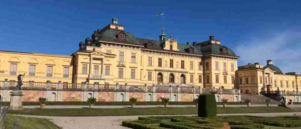
Sweden contains 15 UNESCO World Heritage Sites, with several within reasonable distance of Öland. The Hanseatic Town of Visby on Gotland Island, located north of Öland across the Baltic, preserves medieval urban heritage including intact city walls and numerous church ruins—ferry service connects Visby with the mainland and Öland during summer. The Naval Port of Karlskrona in southern Sweden showcases 17th-18th century naval architecture and urban planning, located approximately 140 kilometers south of Kalmar. For contrast with Öland’s agricultural heritage, the Mining Area of the Great Copper Mountain in Falun (central Sweden) demonstrates industrial heritage from centuries of copper mining. The Royal Domain of Drottningholm near Stockholm combines palace architecture with landscape gardens. A comprehensive Swedish heritage tour could combine Öland’s agricultural landscape with Visby’s medieval townscape, Karlskrona’s naval heritage, and Stockholm’s cultural sites, demonstrating the diversity of Sweden’s UNESCO properties.
How is the UNESCO designation helping preserve Öland’s heritage?
UNESCO designation provides international recognition that strengthens local and national commitment to heritage preservation while attracting heritage-focused tourism that supports the local economy. The designation triggered development of comprehensive management plans coordinating conservation efforts across multiple government levels and stakeholder groups. Swedish government agricultural support programs specifically reward farmers for maintaining practices essential to the heritage landscape—grazing alvar and coastal pastures, maintaining stone walls, preserving traditional field patterns—creating economic incentives aligned with conservation goals. Tourism drawn by UNESCO recognition generates income for rural communities, making heritage preservation economically beneficial rather than purely a cost burden. Educational programs help residents and visitors understand the landscape’s significance, building support for conservation. International attention through UNESCO encourages continued monitoring and research documenting changes in the landscape and evaluating conservation effectiveness. The designation doesn’t protect the landscape through regulation alone but creates a framework where economic, cultural, and conservation interests align in supporting the living heritage.