Møns Klint Day Trip from Copenhagen 2026: Denmark’s Newest UNESCO Site
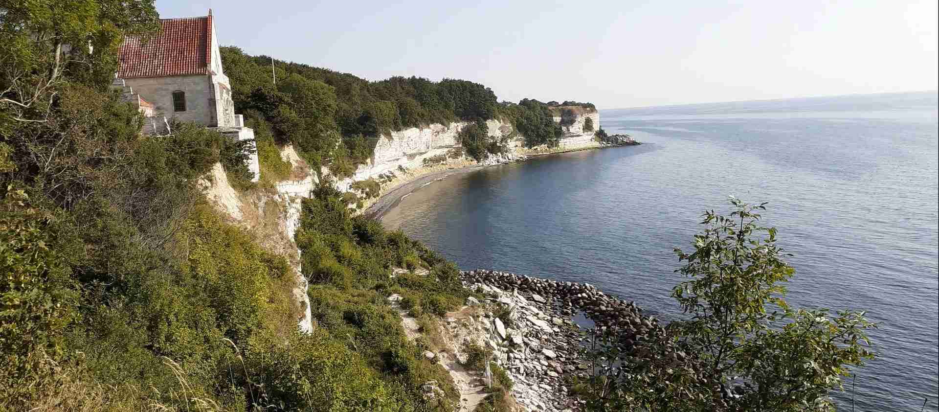
On July 13, 2025, Denmark’s most dramatic white chalk cliffs joined the UNESCO World Heritage List as the country’s ninth and newest site, recognizing Møns Klint as an outstanding example of glacial-tectonic landscape formation. Rising 128 meters above the turquoise Baltic Sea, these spectacular cliffs offer breathtaking natural beauty, rich biodiversity, and fascinating geological heritage, all accessible within a day trip from Copenhagen for 2026 travelers.
Key Takeaways
- Newest UNESCO status: Inscribed July 13, 2025, as Denmark’s 9th UNESCO World Heritage site, making Møns Klint one of Europe’s most recently recognized natural treasures
- Journey planning 2026: 2-3.5 hours from Copenhagen by car or public transport, requiring advance planning due to limited bus connections to the cliffs
- Dramatic scale: At 128 meters high, Møns Klint’s cliffs rise three times taller than Stevns Klint, creating Denmark’s most impressive coastal landscape
- Budget expectations: €60-80 per person for a complete day trip including transport, GeoCenter admission, meals, and parking
- Seasonal access: GeoCenter Møns Klint operates Easter through October 2026; cliffs remain accessible year-round with free entry to the natural area
- Physical demands: Visiting the beach requires descending (and climbing) 497 steps, making this more physically challenging than many Danish attractions
People Also Ask About Møns Klint Trips 2026
How do you get to Møns Klint from Copenhagen in 2026?
Reaching Møns Klint from Copenhagen requires either a car or a combination of train and multiple buses, as Møn island has no railway station. By public transport, take a train from Copenhagen Central Station to Vordingborg (1 hour 10 minutes), then bus 660R to Stege on Møn island (30 minutes), followed by bus 667 to Klintholm Havn, and finally bus 678 to GeoCenter Møns Klint. Total journey time ranges from 3 to 4 hours with connections costing €47-60 round-trip. By car, the journey takes approximately 1 hour 40 minutes via E47 motorway, exit 41, offering significantly more convenience and flexibility.
How much does a Møns Klint day trip cost in 2026?
Total costs range from €60-80 per person for a complete day trip. Major expenses include transport (€20-30 by car including parking, or €47-60 by public transport), GeoCenter Møns Klint admission (€21 for adults, €13.50 for children 3-11, under-3 free, with 10% discount when booking online), parking at GeoCenter (€6), and meals (€15-25 for lunch and snacks). Budget-conscious travelers can reduce costs by bringing packed food and skipping the GeoCenter to focus on the free cliff and beach access, though the museum provides valuable geological context.
Is Møns Klint worth the journey from Copenhagen?
Yes, particularly in 2026 following its brand-new UNESCO inscription. Møns Klint offers Denmark’s most spectacular coastal scenery, with dramatic 128-meter chalk cliffs creating views unlike anything near Copenhagen. The fresh UNESCO recognition highlights its global geological significance, and the well-developed infrastructure—GeoCenter museum, hiking trails, beach access, café facilities—supports a rich day trip experience. The journey is longer and more complex than Stevns Klint, making it better suited for travelers with full days available and strong interest in natural landscapes. Families with young children or those with limited time might find the logistics challenging.
What’s the best time to visit Møns Klint in 2026?
The optimal period extends from late April through September 2026, when GeoCenter Møns Klint operates full hours (Easter to end of October), weather conditions are most favorable, and all facilities function completely. June through August offers warmest temperatures (17-20°C daytime) and longest daylight but brings peak crowds, especially weekends. May and September provide excellent alternatives with moderate visitor numbers, comfortable temperatures, and fully operational facilities. Winter visits (November-March) showcase dramatic coastal beauty under moody skies but involve GeoCenter closure, limited bus connections, strong coastal winds, and significantly shorter daylight hours.
Extended multi-day tours – 5+ days
Featured Copenhagen Multi-Day Tour Packages
3 days
Copenhagen 3-Day Discovery Tour
- ✓ Comprehensive Copenhagen experience
- ✓ Expert local guides included
- ✓ All accommodation included
- ✓ Transportation provided
5 days
Copenhagen 5-Day Highlights Experience
- ✓ Comprehensive Copenhagen experience
- ✓ Expert local guides included
- ✓ All accommodation included
- ✓ Transportation provided
7 days
Copenhagen 7-Day Cultural Journey
- ✓ Comprehensive Copenhagen experience
- ✓ Expert local guides included
- ✓ All accommodation included
- ✓ Transportation provided
10 days
Copenhagen 10-Day Complete Adventure
- ✓ Comprehensive Copenhagen experience
- ✓ Expert local guides included
- ✓ All accommodation included
- ✓ Transportation provided
Multi-day tour packages powered by TourRadar. Prices and availability subject to change.
Introduction: Denmark’s Newest World Heritage Treasure
When the UNESCO World Heritage Committee met in Paris on July 13, 2025, Møns Klint joined the exclusive list of sites deemed to possess “Outstanding Universal Value” to all humanity. This inscription recognizes not just scenic beauty but profound geological significance—Møns Klint preserves one of the world’s most complete and accessible examples of glacial-tectonic landscape formation from the Pleistocene Ice Age.
The dramatic white chalk cliffs stretching 6-7 kilometers along Møn island’s eastern coast rise to 128 meters above the Baltic Sea—the highest coastal cliffs in Denmark and nearly three times taller than the country’s other famous chalk cliffs at Stevns. But height alone doesn’t explain UNESCO’s recognition. Møns Klint’s chalk layers, originally deposited horizontally on ancient sea floors 70 million years ago during the Cretaceous period, were thrust, folded, and deformed by advancing ice sheets during the Weichselian glaciation approximately 15,000 years ago.
The resulting cliff cross-sections reveal these geological processes with exceptional clarity. Layers that should lie horizontally instead stand at dramatic angles, sometimes nearly vertical, creating fold structures visible from both cliff top and beach level. This glacial-tectonic deformation process shaped much of Northern Europe’s landscape, but few locations display the evidence as clearly and completely as Møns Klint.
Beyond geological significance, Møns Klint supports remarkable biodiversity. The nutrient-poor alkaline chalk soil creates specialized habitats hosting rare calcareous grasslands and ancient beech forests. The site records 18 orchid species, including several rare varieties. Peregrine falcons nest on the cliff faces, and the surrounding Høje Møn landscape includes Aborrebjerg—at 143 meters, one of Denmark’s highest natural points.
For 2026 travelers planning day trips from Copenhagen, Møns Klint’s new UNESCO status adds significance to an already compelling destination. The journey requires more effort than easier Copenhagen excursions, but the payoff—Denmark’s most dramatic coastal landscape combined with world-class geological heritage—justifies the investment for nature enthusiasts, geology buffs, families seeking outdoor adventure, and anyone wanting to experience Denmark beyond its famous cities.
Planning Your Møns Klint Day Trip 2026
Best Time to Visit in 2026
GeoCenter Møns Klint operates from Easter (approximately late March or early April in 2026) through the end of October, setting practical boundaries for full-experience visits. Within this window, different seasons offer distinct advantages.
Summer months (June-August) deliver maximum daylight hours (sunrise around 4:30 AM, sunset near 10:00 PM), warmest temperatures (typically 17-20°C daytime, 9-13°C at night), calm seas ideal for beach exploration, and complete facility access including all GeoCenter activities, café service, and guided tours. However, summer also brings peak visitor numbers. Weekends and Danish school holidays (mid-June through mid-August) create the heaviest crowds, particularly at the main beach access stairs and GeoCenter. Parking lots can fill by midday on sunny summer weekends.
May and September represent sweet spots for many visitors. GeoCenter maintains full operations, weather remains generally pleasant (May averages 15-18°C, September 13-17°C), and visitor numbers drop significantly compared to peak summer. May brings spring wildflowers to the cliff-top grasslands and forests, while September offers beautiful autumn light for photography and comfortable hiking temperatures. Both months carry higher rain probability than summer—pack accordingly.
Early season (late March-April) and late season (October) visits work well for those prioritizing solitude and dramatic landscapes over guaranteed weather. The cliffs look spectacular under moody skies, crowds virtually disappear, and you’ll experience Møns Klint in near-pristine quiet. However, expect cooler temperatures (8-14°C), higher wind speeds, frequent rain, and reduced GeoCenter hours as the season winds down in October.
Winter (November-March) presents special challenges. GeoCenter Møns Klint closes completely, significantly reducing shelter and facility options. Public transport becomes extremely limited or nonexistent—reaching the cliffs without a car becomes impractical. However, the cliffs and trails remain accessible 24/7 year-round. Winter visitors experience the dramatic coastal landscape in complete solitude under stark northern light, though proper cold-weather and wind-resistant gear becomes essential.
Weather patterns on Møn follow coastal norms: changeable, often windy, and prone to rapid shifts. Always check forecasts specifically for Møn/Borre area rather than general Copenhagen predictions. The Danish Meteorological Institute (DMI) provides detailed coastal forecasts. Bring layers regardless of season—coastal wind chill significantly affects comfort even on otherwise mild days.
Getting to Møns Klint from Copenhagen 2026
By Car (Recommended): Driving offers by far the most practical transport option for Møns Klint day trips. The journey covers approximately 140 kilometers, taking 1 hour 40 minutes to 2 hours via E47/E55 motorway southbound. Follow E47/E55 from Copenhagen toward Rødbyhavn, exit at junction 41 (if approaching from Zealand) or junction 42 (if coming from Falster), then follow brown UNESCO/Møns Klint signs to the cliffs.
The route passes through scenic South Zealand countryside, crosses the Storstrøm Bridge to Falster island (toll-free), then the Queen Alexandrine Bridge to Møn island. Roads are well-maintained and signposted. GPS coordinates for GeoCenter Møns Klint: 54.9794°N, 12.4965°E.
Parking at GeoCenter Møns Klint costs 45 DKK (approximately €6), paid at the parking machine near the main entrance. The system uses automatic number plate recognition—enter your plate number, pay by card, and the barrier opens automatically on exit. Parking is valid all day. The lot accommodates about 200 vehicles but fills on busy summer weekends—arrive before 11:00 AM on peak days to guarantee spaces.
Car rental in Copenhagen typically costs €45-80 per day for compact cars, varying by season and booking timing. Airport pickup locations often offer better rates than city center offices. Sharing rental costs among 3-4 people makes driving economically competitive with public transport while delivering far superior convenience.
By Public Transport (Challenging): Reaching Møns Klint without a car requires patience and careful planning. The journey involves three separate transport legs with multiple connection points. Use Rejseplanen.dk to plan specific journeys—select “GeoCenter Møns Klint” as your destination for complete routing.
Step 1: Copenhagen Central Station to Vordingborg by train. Regional trains depart approximately hourly, taking 1 hour 10 minutes. This leg runs reliably year-round with good frequency.
Step 2: Vordingborg to Stege by bus 660R. Buses depart from Vordingborg train station area (short walk from platform). Journey takes about 30 minutes. Frequency varies seasonally—summer sees departures every 1-2 hours, while off-season service may be limited.
Step 3: Stege to GeoCenter Møns Klint requires bus 667 to Klintholm Havn, then bus 678 to the cliffs. This final connection presents the main challenge. During summer (approximately June-August), a free tourist bus operates on selected days providing direct service. Outside summer, bus connections exist but may require walking final distances or taking taxis.
Total journey time: 3 to 4 hours minimum, sometimes extending to 5 hours depending on connection wait times. Round-trip cost: approximately 350-450 DKK (€47-60). The complexity and time investment make public transport practical only for non-drivers genuinely unable to access vehicles.
Several tour operators offer organized day trips from Copenhagen combining transport and guided experiences. These typically cost €80-120 and remove logistical complexity while sacrificing exploration flexibility.
Møns Klint in a Day: Complete Itinerary 2026
Departure and Journey (8:00-10:00): Leave Copenhagen by 8:00 AM for optimal day-trip timing. Driving arrives at Møns Klint around 9:40-10:00, while public transport travelers should plan earliest possible connections, likely arriving 11:00-12:00.
GeoCenter Møns Klint (10:00-12:30): Begin at GeoCenter, which opens at 10:00. This world-class visitor center, built partially into the cliff itself, explains the geological processes creating Møns Klint through interactive exhibitions spanning four floors. The journey descends through 70 million years of Earth history, from Cretaceous chalk formation through Ice Age glacial reshaping to today’s active coastal erosion.
Key exhibition areas include “Vettelys World” exploring Cretaceous marine life, the spectacular fossil collection showcasing local discoveries, interactive displays explaining glacial tectonic processes, and the Glacier Cinema providing immersive visualization of ice sheet movements. The 3D cinema (included with admission) shows rotating films about dinosaurs, fossils, and natural history—register at reception upon arrival for preferred showtimes as seating is limited.
Virtual reality experiences offer dramatic first-person perspectives—fly like a peregrine falcon along the cliff faces or explore underwater chalk formations. The biodiversity exhibition “Everything is Connected” highlights Høje Møn’s unique ecosystems and rare species. Budget 2-2.5 hours for thorough GeoCenter exploration.
Lunch and Cliff Viewing (12:30-14:00): Café Møns Klint occupies the GeoCenter’s second floor with large terrace overlooking the cliffs and Baltic Sea. The menu emphasizes local ingredients and seasonal offerings, ranging from substantial lunch plates (€15-20) to lighter options, homemade cakes, and excellent coffee. The terrace provides stunning views—dining outside on pleasant days enhances the experience significantly.
After lunch, walk to the main cliff viewpoint just outside GeoCenter. The overlook platform offers panoramic vistas encompassing the full cliff line, Klinteskoven forest covering the cliff tops, and the turquoise Baltic Sea below. The famous 497-step Maglevandstrappen stairway descends from this area to beach level—you can observe its dramatic zigzag route down the cliff face.
Beach Exploration (14:00-16:30): Descending to the beach represents Møns Klint’s highlight for most visitors. The Maglevandstrappen consists of 497 steps built into the cliff face, descending 128 meters from cliff top to beach. The stairs are well-maintained with regular rest platforms, but the descent (and especially ascent) requires reasonable fitness. Allow 20-25 minutes down, 30-40 minutes climbing back up.
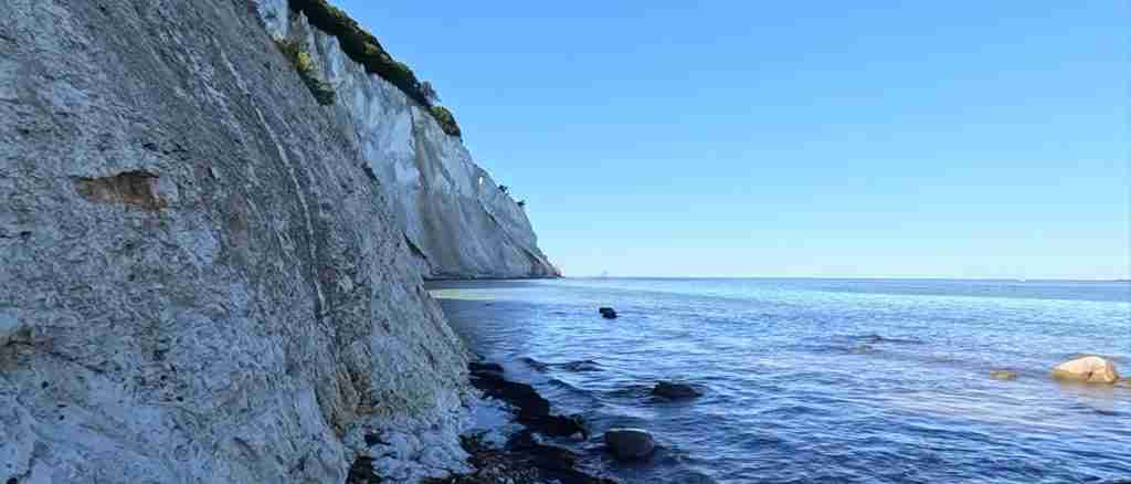
The beach at Møns Klint’s base reveals the cliffs’ full dramatic scale. White chalk walls soar overhead, their layered structure clearly visible. The exposed geological cross-sections show the intense folding created by glacial pressure—layers bent from horizontal to near-vertical positions over relatively short distances. The visual impact of standing beneath these towering cliffs exceeds any view from above.
Walk along the shore exploring different cliff sections. The chalk and limestone create distinctive turquoise-blue water, particularly striking on sunny days. Fossil hunting along the beach yields bryozoans, sea urchins, and occasional more dramatic finds. The chalk surface underfoot can be slippery when wet—proper footwear with good traction is essential.
The beach extends several kilometers in both directions from the main stairway access, offering options for extended walks if time and energy allow. Most visitors focus on the immediate area around the stairs, spending 1-2 hours at beach level before ascending.
Forest and Trails (16:30-17:30): Back at cliff-top level, explore Klinteskoven, the ancient beech forest covering much of the cliff top area. The forest’s twisted, gnarled beech trees—some exceeding 400 years old—create atmospheric walking through this UNESCO-protected landscape. The chalk-enriched soil supports distinctive ground flora including numerous orchid species (blooming primarily May-July).
Several marked trails cross the forest, ranging from short 1-2 kilometer loops to longer routes connecting various cliff viewpoints. The Klintekongens Rige trail, awarded best hiking trail in Europe, extends throughout the area offering varied terrain and frequent Baltic Sea views.
Return Journey (17:30-20:00): Begin the return to Copenhagen by 5:30-6:00 PM. Driving arrivals reach Copenhagen around 7:30-8:00 PM, leaving evening free. Public transport users need earlier departures to catch final connections—check Rejseplanen for last bus timings from the cliffs.
This itinerary provides comprehensive Møns Klint experience while maintaining reasonable pacing. Adjust timing based on priorities—fossil enthusiasts may want 3+ hours at beach level, while others might prefer more forest hiking or additional GeoCenter time. The key constraint is the 497-step beach access—factor physical demands when planning your beach time allocation.
GeoCenter Møns Klint 2026
Admission, Hours, and Practical Information
GeoCenter Møns Klint charges 155 DKK (approximately €21) for adults and 100 DKK (€13.50) for children aged 3-11. Under-3s enter free. Online ticket purchase saves 10% on admission prices—buy through the official moensklint.dk website. Admission includes all permanent and temporary exhibitions, 3D cinema access, and during high season, participation in various guided activities (fossil hunting, mountain biking tours, forest walks) offered on a first-come basis.
The center opens daily from Easter weekend through the end of October. Standard hours during this period are 10:00-17:00, though closing time may reduce to 16:00 during shoulder season (April-May, September-October). Check the official website for exact 2026 seasonal schedules as hours may vary. November through March, GeoCenter Møns Klint closes completely.
Parking at GeoCenter costs 45 DKK (€6) per day, paid at the parking machine near the main entrance. The charge applies regardless of GeoCenter admission—even visitors focusing solely on outdoor cliff access must pay parking if using the lot. Payment accepts cards only (no cash).
The facility provides complete wheelchair accessibility with ramped entrance, wide corridors and doorways, elevators between floors, and accessible toilets. However, beach access via the 497 steps is impossible for wheelchair users or those with significant mobility limitations. Cliff-top views and forest trails offer accessible alternatives, though some paths involve uneven terrain.
Free WiFi covers the GeoCenter. Toilets (including accessible facilities) remain open 6:00-22:00 daily year-round even when GeoCenter is closed, providing essential facilities for off-season cliff visitors. Free luggage lockers allow storing bags and coats during visits.
Exhibitions and Experiences
The permanent exhibition “From Sea to Ice” occupies GeoCenter’s core, taking visitors through 70 million years of geological transformation. Starting with Cretaceous chalk seas populated by mosasaurs and other marine reptiles, the exhibition traces formation of the original chalk deposits, their burial and lithification, uplift during Ice Ages, glacial deformation creating today’s cliff structures, and ongoing erosion processes.
Interactive elements include touchable fossil specimens, 3D models showing glacial movement and pressure, and digital displays explaining tectonic folding. The mosasaur skeleton—a 17-meter marine predator from Cretaceous seas—dominates one exhibition hall, providing scale comparison with modern whales.
Amber exhibits showcase Baltic amber, explaining its formation from ancient tree resin and showing preserved insects and plants from 40-50 million years ago. Flint displays explore how Denmark’s prehistoric peoples utilized this chalk-derived material for tools and weapons.
The Glacier Cinema projects immersive films visualizing ice sheet advance and retreat across northern Europe. Sound and image combine to recreate the overwhelming scale of glacial processes that shaped this landscape.
“Everything is Connected” biodiversity exhibition explores Høje Møn’s unique ecosystems. The chalk soil’s alkaline chemistry creates specialized plant communities, and the exhibition explains ecological relationships between geology, soil, plants, and animals. The 18 orchid species found in the area receive particular attention.
Virtual reality stations offer three experiences: fly as a peregrine falcon along the cliff faces, dive beneath the Baltic to explore underwater chalk formations, or witness glacial advance during the Ice Age. VR sessions last 5-8 minutes and are included with admission on a walk-up basis.
Additional Activities
During summer high season, GeoCenter organizes various guided outdoor activities included with admission (though spaces are limited and allocation is first-come, first-served—register at reception upon arrival):
Guided Fossil Hunts: Rangers lead 1-1.5 hour beach expeditions teaching fossil identification, collection ethics, and geological context. Tours typically depart 2-3 times daily during peak season. These make excellent introductions to fossil hunting before independent beach exploration.
Mountain Bike Tours: Guided rides through Klinteskoven forest explore the cliff-top landscape from different perspectives. Bikes provided (included with admission), though group sizes limited. Tours typically last 1.5-2 hours.
Forest Walks: Naturalist-guided walks through beech forests explain the unique ecology, tree ages, orchids, and relationship between geology and biodiversity. Particularly valuable during orchid blooming season (May-July).
The climbing course and zip line require separate fees beyond standard admission. The course includes multiple levels from beginner to advanced, with instruction and safety equipment provided. Booking in advance recommended for climbing activities.
BMX bikes are available for rental to explore old quarry areas near GeoCenter. This appeals primarily to families with children seeking active outdoor play.
Exploring the Cliffs and Natural Area 2026
The Main Beach Access and Stairway
The Maglevandstrappen—literally “The Store Magleby Water Stairs”—represents Møns Klint’s primary beach access route. These 497 steps zigzag down the cliff face, descending 128 meters from cliff top to Baltic Sea level. The wooden construction attaches directly to the chalk cliff, creating a dramatic stairway experience as you descend the white walls.
Platforms appear every 50-70 steps, providing rest points and viewpoints. Descending typically takes 20-25 minutes at moderate pace with brief photo stops. The climb back up requires 30-40 minutes for most visitors—significantly more challenging than descent. Railings provide security throughout, and the stairs are well-maintained, but they’re fundamentally steep steps requiring reasonable fitness and mobility.
The stairs get slippery when wet. Morning dew, rain, or spray from rough seas creates hazardous conditions—exercise particular caution during and after precipitation. Wear shoes with good traction; flip-flops or smooth-soled footwear increases fall risk significantly.
Physical demands shouldn’t be underestimated, particularly the ascent. If you have knee problems, heart conditions, or poor fitness, consider whether beach access justifies the physical strain. The cliff-top viewpoints and forest trails offer excellent Møns Klint experiences without requiring the stair descent.
For those doing beach access, timing matters. Early morning and late afternoon see fewest people on stairs—midday can create congestion, particularly summer weekends when hundreds of visitors use these single stairs. The narrowness means slower groups can create delays.
Beach and Coastal Exploration
The beach at Møns Klint’s base delivers the full dramatic impact of Denmark’s highest coastal cliffs. Standing beneath the 128-meter chalk walls, looking up at the towering white faces streaked with geological layers, creates perspectives impossible from cliff top. The scale overwhelms—photos capture beauty but not the visceral experience of standing beneath these natural monuments.
The beach extends several kilometers in both directions from the main stairway. Walking south toward Liselund Park (approximately 2 kilometers) passes beneath continuous cliff faces with varying geological exposures. North toward Dronningestolen (Queen’s Chair, the highest cliff point) presents similar distances. The chalk and flint beach surface makes walking more strenuous than sandy beaches, but the constantly changing cliff geology rewards the effort.
Fossil hunting here differs from Stevns Klint. While fossils exist, they’re generally less abundant and harder to identify than at Stevns’ fish clay boundary exposure. You’ll find bryozoans (colonial marine animals creating intricate fossil patterns), echinoids (sea urchins and relatives), occasional bivalves and gastropods, and if very fortunate, belemnites or other cephalopod fossils. The GeoCenter’s guided fossil hunts teach identification skills that significantly improve success rates.
The distinctive turquoise-blue water results from suspended chalk particles. When sunlight penetrates this chalk-laden water, the blue wavelengths scatter more than others, creating the characteristic color. This effect maximizes on sunny days with calm seas—stormy conditions reduce the clarity and color.
Swimming is possible but not ideal. The beach consists of chalk pebbles and flint rather than sand, making entry uncomfortable without water shoes. Baltic Sea temperatures range from 16-19°C even in summer, quite cold for casual swimming. The beach’s exposed position creates frequent waves and sometimes strong currents. Most visitors focus on walking, photography, and geological observation rather than swimming.
Safety considerations include respecting cliff-fall warnings. Møns Klint experiences continuous erosion—sections periodically collapse, sometimes without warning. Never stand directly at cliff base, avoid overhanging sections, and watch for fresh rockfall debris. The Danish Nature Agency posts current safety notices at beach access points.
Cliff-Top Trails and Klinteskoven Forest
Klinteskoven, the ancient beech forest covering much of the cliff-top plateau, ranks among Denmark’s most atmospheric forest landscapes. The combination of chalk-enriched soil, exposed coastal location, and centuries of undisturbed growth created twisted, gnarled beech trees whose sculptural forms seem almost fantastical. Some trees exceed 400 years old, their thick trunks and low-spreading branches evidence of severe weather shaping their growth.
The forest floor supports specialized plant communities adapted to alkaline chalk soil. Spring (April-May) brings woodland flowers including wood anemones carpeting the ground. Summer (May-July) sees the rare orchids for which Høje Møn is famous—18 species including several Danish rarities. Autumn delivers spectacular foliage colors and mushroom growth.
Multiple marked trails traverse Klinteskoven, accommodating different preferences:
Klintekongens Rige: The “Cliff King’s Kingdom” trail earned designation as Europe’s best hiking trail from Deutsches Wanderinstitut (German Hiking Institute). This route connects the major highlights—cliffs, forests, viewpoints, meadows—in a comprehensive loop. Complete circuit runs approximately 10-12 kilometers (3-4 hours), though shorter variations exist using connector paths.
Cliff Edge Path: This trail follows the cliff top edge, providing continuous Baltic Sea views and access to various cliff viewpoints. The path runs from Store Klint in the north to Liselund Park in the south, approximately 6-7 kilometers total. You can walk any section based on time and energy.
Forest Interior Loops: Several shorter trails (1-3 kilometers) explore Klinteskoven’s interior without cliff exposure. These work well for hot days when shade provides relief, or when high winds make cliff-edge walking uncomfortable.
Trail surfaces vary from well-maintained gravel paths to earthen tracks that become muddy after rain. Signage is generally good with trail markers at intersections. Free trail maps are available at GeoCenter reception, and mobile apps like Møn App provide GPS tracking.
Dogs are welcome on all trails but must remain on leads to protect ground-nesting birds and rare plant species. Bicycles are permitted on designated routes—mountain bikes handle the varied terrain better than road bikes.
Other Viewpoints and Features
Dronningestolen (Queen’s Chair): This viewpoint marks Møns Klint’s highest point at 128 meters elevation. The name allegedly derives from Queen Marie Sofie visiting in the early 1800s. The platform offers spectacular panoramic views encompassing the cliff line, forest, and Baltic Sea. Access requires either walking from GeoCenter (approximately 30-40 minutes each way) or driving to a nearby parking area with 10-minute walk.
Liselund Castle Park: Located at the cliffs’ southern end, Liselund represents one of Scandinavia’s finest examples of Romantic English garden design from the 1790s. French nobleman Antoine de Bosc de la Calmette created this aesthetic landscape for his wife Lisa (thus “Lisa’s grove” or Liselund). The park includes exotic buildings, monuments, ponds, and carefully designed vistas. The small castle operates as a museum (separate admission), while the park grounds are freely accessible. Liselund sits about 4 kilometers from GeoCenter—reachable by car, bicycle, or walking along the coastal path.
Aborrebjerg: At 143 meters above sea level, Aborrebjerg (“Perch Mountain”) represents one of Denmark’s highest natural points. The hill sits inland from the main cliffs but forms part of the protected Høje Møn landscape included in the UNESCO designation. The summit provides 360-degree views over the distinctive hilly Møn landscape—rare in Denmark’s predominantly flat terrain.
Practical Information for Your 2026 Visit
What to Bring
Sturdy hiking boots or shoes with excellent traction top the essential items list. The 497-step beach access, potentially slippery chalk surfaces, and varied forest trail conditions all demand proper footwear. Running shoes with good tread work adequately; fashion shoes, flip-flops, or smooth soles create safety hazards.
Layer clothing to accommodate variable conditions. Even summer days can be windy and cool at the exposed cliff edge, while forest walking generates heat. A waterproof outer shell protects against frequent coastal showers—weather changes rapidly on Møn. Sun protection (hat, sunglasses, sunscreen) matters during summer months, as the white chalk reflects intense light.
Water and snacks maintain energy during extensive walking and stair climbing. While GeoCenter café provides refreshments, many visitors spend hours exploring trails and beach where no facilities exist. Bringing provisions enables flexible timing.
Small backpack or day pack carries layers, water, snacks, and any fossil discoveries. Camera or smartphone documents the spectacular scenery. Binoculars enhance birdwatching—peregrine falcons nest on cliff faces, and various seabirds frequent the area. Field guides to fossils, birds, or plants add educational value if you’re interested in natural history details.
For winter visits (November-March), warm, windproof clothing becomes crucial. Coastal winds create significant wind chill. Gloves, scarves, insulated layers, and weather-resistant outer shells make the difference between miserable and enjoyable winter cliff experiences.
Facilities and Services
GeoCenter Møns Klint provides the area’s main facility hub. Café Møns Klint serves full lunch menu, lighter options, coffee, cakes, and drinks. The design shop sells local crafts, fossils, educational materials, jewelry, and souvenirs. Free WiFi covers the building. Luggage lockers allow storage during exploration. Toilets (including accessible facilities) operate 6:00-22:00 daily year-round even when GeoCenter is closed.
Additional facilities are limited. No restaurants, shops, or services exist at the cliffs themselves beyond GeoCenter. The nearest town, Borre, offers limited services. Stege, Møn’s main town (approximately 15 kilometers west), has supermarkets, restaurants, and full services.
Mobile phone reception varies. Cliff-top areas generally have good coverage on major Danish networks. Beach level below the cliffs experiences reduced or no signal—the cliff walls block transmission. Forest interior areas have patchy coverage depending on specific location.
Emergency services access Møn normally, though response times exceed urban areas given the island’s rural character. The nearest hospital is in Vordingborg on Zealand mainland. For serious medical emergencies, air ambulance service provides fastest response.
Safety Considerations
Cliff erosion represents the primary natural hazard. Møns Klint experiences continuous erosion through various mechanisms—freeze-thaw cycles crack the chalk, wave action undercuts cliff bases, and gravity pulls weakened sections down. Major cliff falls occur irregularly but inevitably. Never stand directly beneath cliff overhangs, avoid areas with fresh rockfall debris, and respect all warning signs and barriers.
The Danish Nature Agency monitors cliff stability and posts warnings about dangerous areas. Recent large cliff falls sometimes close beach sections temporarily. Current safety information appears on the GeoCenter website and at beach access points.
Stair safety demands caution. The 497-step descent and ascent require attention, particularly when wet. Use handrails, take breaks at platforms, and don’t rush either direction. Assist children carefully—the stairs are steep and the drop potentially dangerous. If you have physical limitations, honestly assess whether attempting beach access makes sense.
Weather changes rapidly on coastal Møn. Morning sunshine can give way to afternoon storms. Check specific Møn/Borre area forecasts rather than general Copenhagen weather. When storms approach, retreat from exposed cliff edges and beach areas. Lightning during thunderstorms creates serious danger on exposed coastal locations.
Tide and wave conditions generally aren’t dangerous on Møn’s Baltic coast—this isn’t Atlantic surf. However, storm-driven waves can reach surprising heights and create hazardous conditions near the cliff base. Respect the sea’s power, particularly during unsettled weather.
Day Trip Budget Breakdown 2026
Transport costs vary dramatically by method. Driving from Copenhagen costs approximately €20-30 for the round trip covering fuel (140 kilometers each way), plus €6 parking at GeoCenter, totaling €26-36 for vehicle transport. Split among 2-4 passengers, per-person transport cost drops to €7-18. Car rental adds €45-80 per day (divided among occupants), making group travel economically efficient.
Public transport round-trip tickets cost approximately 350-450 DKK (€47-60) per person. This significantly exceeds driving costs for groups but represents the only option for non-drivers. The time investment (6-8 hours total travel versus 3-4 hours driving round-trip) also represents hidden cost in opportunity and fatigue.
GeoCenter Møns Klint admission charges €21 for adults. Children aged 3-11 pay €13.50, under-3s free. Purchasing tickets online saves 10%. Families particularly benefit from the child admission structure. Optional activities like climbing courses involve additional fees (€30-50) beyond basic admission.
Meals depend on choices. GeoCenter café lunch ranges €15-20 for substantial plates, with lighter options and snacks €8-12. Coffee and cake add €5-8. A full café meal day budget would total €20-28 per person. Bringing packed food from Copenhagen reduces this to essentially zero beyond advance grocery shopping.
Sample day budgets:
Budget approach (solo traveler, public transport, packed food): Transport €47-60, museum €21 (or skip for free cliff access), packed meals €0. Total: €47-81.
Mid-range approach (2-4 people, shared car, GeoCenter, café lunch): Transport €7-18 per person, parking €6 (split), museum €21, lunch €15-20. Total per person: €49-65.
Comfortable approach (2-4 people, rental car, full experience): Rental car €15-25 per person (shared €60-80 daily rate), parking €6 (split), museum €21, full café meal €20-25. Total per person: €62-77.
The complete day trip ranges €60-80 per person for full experience including transport, admission, and meals, though budget-conscious solo travelers using public transport and skipping GeoCenter can reduce costs to €47-60. Families benefit from free child admission and transport cost sharing.
Combining Møns Klint with Other Destinations
Møn Island Highlights
Spending additional time on Møn island extends your visit beyond the cliffs to other compelling attractions. The island’s relatively small size (approximately 20 by 10 kilometers) makes multiple sites accessible within a day for visitors with vehicles.
Fanefjord Church: This 13th-century church, dramatically positioned on a hilltop overlooking Fanefjord inlet, preserves exceptional medieval frescoes from the 13th and 16th centuries. The interior paintings depict biblical scenes with remarkable detail and color preservation. Fanefjord Church stands as Møn’s most famous attraction after the cliffs, and its hilltop setting provides beautiful countryside views. The church lies approximately 15 kilometers from GeoCenter Møns Klint (20-minute drive).
Elmelunde Church: Another fresco church featuring medieval wall paintings, Elmelunde complements Fanefjord with different artistic styles and biblical narratives. The paintings date primarily from the 15th century. Located near Fanefjord, the two churches make a logical combination.
Stege: Møn’s largest town preserves medieval character including portions of the old town wall and gate. The town offers shopping, dining, and accommodations, making it a practical base for overnight Møn stays. The local museum documents island history and culture. Stege lies on your route when approaching Møn from Copenhagen.
Liselund Castle and Park: As mentioned earlier, this 18th-century landscape garden demonstrates Romantic aesthetic principles through its designed scenery, exotic buildings, and carefully composed vistas. The small castle museum displays period interiors. Budget 1-2 hours for Liselund exploration.
Camp Møns Klint: This campground near the cliffs offers unique roof-tent Land Rover rentals for those seeking memorable accommodation. Sleep under the stars (literally—Møn is Denmark’s first Dark Sky Park) with panoramic cliff and forest views. Even day visitors might enjoy lunch or coffee at their restaurant.
Multi-Day Zealand Itinerary
Combining Møns Klint and Stevns Klint creates a comprehensive Danish UNESCO chalk cliff experience. Both sites offer world-class geological heritage but tell different stories—Stevns preserves the asteroid impact ending the dinosaur era, while Møns demonstrates Ice Age glacial-tectonic forces. Together they provide exceptional insight into Earth’s dynamic geological history.
Day 1 focuses on Stevns Klint (closer to Copenhagen at 1.5 hours). Explore the K-Pg boundary evidence, visit Stevns Klint Experience Centre, walk the cliffs and beach, and see Højerup Old Church. Return to Copenhagen or overnight in the Stevns area.
Day 2 travels to Møns Klint (2 hours from Copenhagen). Experience GeoCenter Møns Klint, descend the 497-step beach access, explore Klinteskoven forest, and visit additional Møn attractions like Fanefjord Church. Return to Copenhagen evening or overnight on Møn.
This two-day geology tour showcases Denmark’s most significant natural UNESCO sites and provides compelling contrast between southern Zealand’s diverse landscapes and Copenhagen’s urban environment.
Photography Guide 2026
Best Lighting and Conditions
Møns Klint’s dramatic scale creates photographic opportunities throughout the day, though lighting quality varies significantly. The cliffs face east and northeast, meaning morning light illuminates the cliff faces directly while afternoon sun comes from behind. This makes sunrise and early morning (5:00-9:00 AM May-August) the premium time for cliff face photography. The low-angle morning sun emphasizes the geological layers, creates dramatic shadows highlighting cliff texture, and produces the warm golden tones that enhance white chalk’s subtle color variations.
Afternoon and evening light (4:00-8:00 PM) works better for compositions looking toward the Baltic Sea, capturing the turquoise water colors and expansive seascapes. Sunset from cliff-top viewpoints delivers spectacular skies over the sea, though the cliff faces themselves fall into shadow.
Overcast conditions provide advantages for certain photography. Soft, diffused light eliminates the harsh shadows that can create excessive contrast on bright chalk cliffs. Cloud cover also enhances the turquoise water color—bright sun sometimes washes out this distinctive blue. Moody weather with dramatic cloud formations adds atmosphere to cliff landscapes, particularly when combined with waves breaking on the shore.
For beach-level photography looking up at the cliffs, timing matters less since you’re in shadow regardless. Focus instead on how light hits the cliff tops and sky—morning produces clean blue skies, while afternoon sometimes develops interesting clouds.
Key Compositions and Angles
The classic Møns Klint photograph captures the cliff line from elevated viewpoints along the cliff-top path or from Dronningestolen platform. Use wide-angle lenses (16-24mm) to encompass the full cliff sweep, forest, and sea. Include foreground elements—beech trees, coastal vegetation, fence posts—to add depth and scale. The curved cliff line creates natural leading lines drawing the eye through the composition.
Beach-level perspectives deliver dramatic scale. Position yourself looking up at the 128-meter chalk walls, using vertical composition to emphasize height. The layered geology showing intense folding creates strong graphic patterns. Include people for scale reference—the tiny figures emphasize the cliffs’ monumentality. Standard to moderate telephoto lenses (35-70mm) work well here, providing comfortable working distances while maintaining impact.
Close-up cliff detail photographs reveal the geological complexity. Zoom lenses (70-200mm or longer) compress the perspective and isolate interesting fold structures, color variations, or erosion patterns. These detail shots complement the wide landscape images, showing the geology at different scales.
Forest photography in Klinteskoven benefits from wide apertures (f/2.8-f/4) creating selective focus on individual gnarled beech trees while softly blurring background forest. The twisted, sculptural tree forms make compelling subjects. Overcast or rainy conditions suit forest photography better than bright sun—the even light penetrates the canopy better and eliminates harsh shadows.
Equipment and Settings
Wide-angle to standard zoom lenses (16-70mm range) handle most Møns Klint photography. Ultra-wide options (14mm or wider) can create dramatic perspectives but risk distortion. Telephoto lenses (70-200mm) prove valuable for detail photography and compressing distant cliff sections. A versatile two-lens combination would be 16-35mm wide-angle and 70-200mm telephoto, covering the full range from expansive landscapes to compressed geological details.
Polarizing filters reduce glare from the chalk and water surfaces, deepening blue sky tones and enhancing the turquoise Baltic color. They’re particularly valuable during midday when reflections become strongest. Graduated neutral density filters help balance exposure between bright sky and darker foreground elements in landscape shots.
Camera settings depend on conditions and creative intent. For sharp landscape photography throughout the frame, use apertures around f/8-f/11 for maximum depth of field. ISO 100-400 provides clean image quality—the chalk’s bright reflectivity usually provides sufficient light even on overcast days. Shutter speeds vary based on focal length and movement, but 1/125 second or faster prevents blur from hand-holding.
Tripods enable longer exposures for waterfall-effect sea imagery, HDR bracketing for difficult lighting, and precise composition. However, the 497-step beach access makes tripod carrying strenuous. Consider whether images requiring tripod justify the extra weight and effort. Modern cameras’ image stabilization often makes tripods optional except for specific techniques.
Shoot RAW format to maximize post-processing flexibility. The extreme brightness of white chalk against often darker skies creates challenging dynamic range. RAW files’ exposure latitude allows recovering detail from highlights and shadows that would be lost in JPEG compression.
Frequently Asked Questions
Why was Møns Klint designated UNESCO in 2025?
UNESCO’s World Heritage Committee inscribed Møns Klint on July 13, 2025, under criterion (viii), recognizing it as an outstanding example of major stages in Earth’s geological history. Specifically, Møns Klint demonstrates glacial-tectonic landscape formation with exceptional clarity and completeness. The visible cliff cross-sections show how Pleistocene ice sheets thrust, folded, and deformed the original horizontal Cretaceous chalk layers into the complex geological structures visible today. Few locations worldwide display this process so accessibly and comprehensively, making Møns Klint of global scientific significance for understanding Ice Age landscape formation.
What’s the difference between Møns Klint and Stevns Klint?
Both are Danish UNESCO chalk cliff sites, but they tell different geological stories and offer distinct experiences. Stevns Klint (UNESCO 2014) preserves evidence of the Chicxulub asteroid impact that caused the dinosaur extinction 66 million years ago, visible in the famous fish clay layer marking the K-Pg boundary. It’s scientifically significant for mass extinction research and rises to 41 meters. Møns Klint (UNESCO 2025) demonstrates glacial-tectonic processes from the Ice Age, where advancing ice sheets folded and deformed chalk layers into dramatic structures. It reaches 128 meters—three times Stevns’ height—and delivers more dramatic scenery. Both are worth visiting for their unique geological significance and natural beauty, but Møns Klint requires more travel time and physical effort from Copenhagen.
Can you visit Møns Klint in winter?
The cliffs, beaches, and trails remain accessible 24/7 year-round including winter (November-March). However, GeoCenter Møns Klint closes completely during winter months, eliminating indoor facilities, exhibitions, café service, and most amenities. Public transport becomes extremely limited or nonexistent, making car access essential. Winter visits work for hardy outdoor enthusiasts who appreciate dramatic coastal landscapes under stark northern light, don’t mind cold and wind, and can manage without support facilities. The experience is fundamentally different from summer visits—more raw and elemental, but also more challenging. Most visitors should plan April-October visits for full experience access.
How difficult is the beach access at Møns Klint?
The 497-step Maglevandstrappen stairway represents significant physical challenge, particularly the climb back up. Descending takes 20-25 minutes for most visitors, while ascending requires 30-40 minutes and considerable cardiovascular effort. The stairs are steep but well-maintained with regular rest platforms and secure railings. Anyone with reasonable fitness can manage the stairs, but those with knee problems, heart conditions, or poor cardiovascular fitness should carefully consider whether beach access suits their capabilities. The effort is worthwhile for stunning cliff-base perspectives and beach exploration, but it’s genuinely demanding. Cliff-top viewpoints and forest trails offer excellent Møns Klint experiences without requiring beach descent for those who prefer to skip the stairs.
Is Møns Klint suitable for children?
Yes, with appropriate supervision and planning. GeoCenter Møns Klint designs many exhibitions for family engagement with interactive elements specifically appealing to children. The beach exploration and fossil hunting engage young minds effectively. However, the 497-step beach access presents challenges—young children tire on the ascent and may need carrying, which becomes demanding for parents after 497 stairs. Kids must be supervised carefully near cliff edges. The extensive walking and physical demands suit active families with school-age children (6+) better than families with toddlers or very young children. Overall, Møns Klint provides excellent family experience for outdoor-oriented families prepared for the physical demands.
Can you swim at Møns Klint?
Swimming is possible but not ideal. The beach consists of chalk pebbles and flint stones rather than sand, making barefoot entry uncomfortable—water shoes help significantly. Baltic Sea temperatures range 16-19°C even during summer, which many find quite cold for comfortable swimming. The exposed coastal location creates frequent waves and sometimes strong currents, particularly during unsettled weather. Local swimming beaches in nearby towns offer better swimming conditions with sand and facilities. Most Møns Klint visitors focus on walking, photography, and geological observation rather than swimming. If swimming appeals, consider visiting dedicated beaches before or after your cliff exploration.
How long should you spend at Møns Klint?
A thorough visit requires 5-7 hours to experience the main highlights without rushing: 2-2.5 hours at GeoCenter including exhibitions and 3D cinema, 2-2.5 hours for beach descent, exploration, and ascent, plus 1-2 hours for cliff-top viewpoints and forest walking. This doesn’t include travel time from Copenhagen (3-4 hours round-trip). Day-trippers should plan 8-10 total hours from leaving Copenhagen to returning. Those focusing only on outdoor cliffs and skipping GeoCenter can complete a basic visit in 3-4 hours, though this misses valuable geological context. Overnight stays on Møn enable more relaxed pacing and additional island exploration without Copenhagen travel pressure.
What should you wear to Møns Klint?
Essential items include sturdy hiking boots or shoes with excellent traction for the 497-step stairway and potentially slippery chalk surfaces. Layer clothing to handle variable coastal weather—even summer days can be windy and cool. Waterproof jacket protects against frequent coastal showers. During April-May and September-October shoulder seasons, warm layers become more important. Winter visits (if attempted) require windproof, insulated clothing, gloves, and weather-resistant outer shells. Summer sun protection includes hat, sunglasses, and sunscreen—the white chalk reflects intense light. Overall, dress for active outdoor hiking in changeable coastal conditions rather than casual sightseeing.
Are dogs allowed at Møns Klint?
Dogs are welcome throughout Møns Klint outdoor areas but must remain on leads at all times. This protects ground-nesting birds, rare plant species, and the dogs themselves near cliff edges. Dogs aren’t permitted inside GeoCenter Møns Klint, though outdoor water bowls and shaded spots appear near the entrance. The extensive trails and beach access make Møns Klint excellent for dog owners willing to manage the 497-step beach descent and ascent with their pets. Some very large or very small dogs may struggle with the stair challenge. Overall, leashed dogs enjoy Møns Klint’s outdoor hiking opportunities while owners respect wildlife and safety regulations.
What fossils can you find at Møns Klint?
The beach at Møns Klint yields various marine fossils from the Cretaceous chalk, though they’re generally less abundant than at some other chalk cliff sites. Common finds include bryozoans (colonial marine animals creating lace-like stone patterns), echinoids (sea urchins and relatives), bivalve shells, gastropods, and occasionally belemnites (extinct cephalopods resembling pointed bullets). Very rare discoveries might include shark teeth or partial ammonites. Collecting fossils for personal, non-commercial use is permitted below the high-water line. The GeoCenter’s guided fossil hunting tours teach identification skills that significantly improve success. Don’t remove fossils directly from cliff faces—collect only from fallen beach material.