Madeira Levada Walks Guide: Complete Trekking Routes
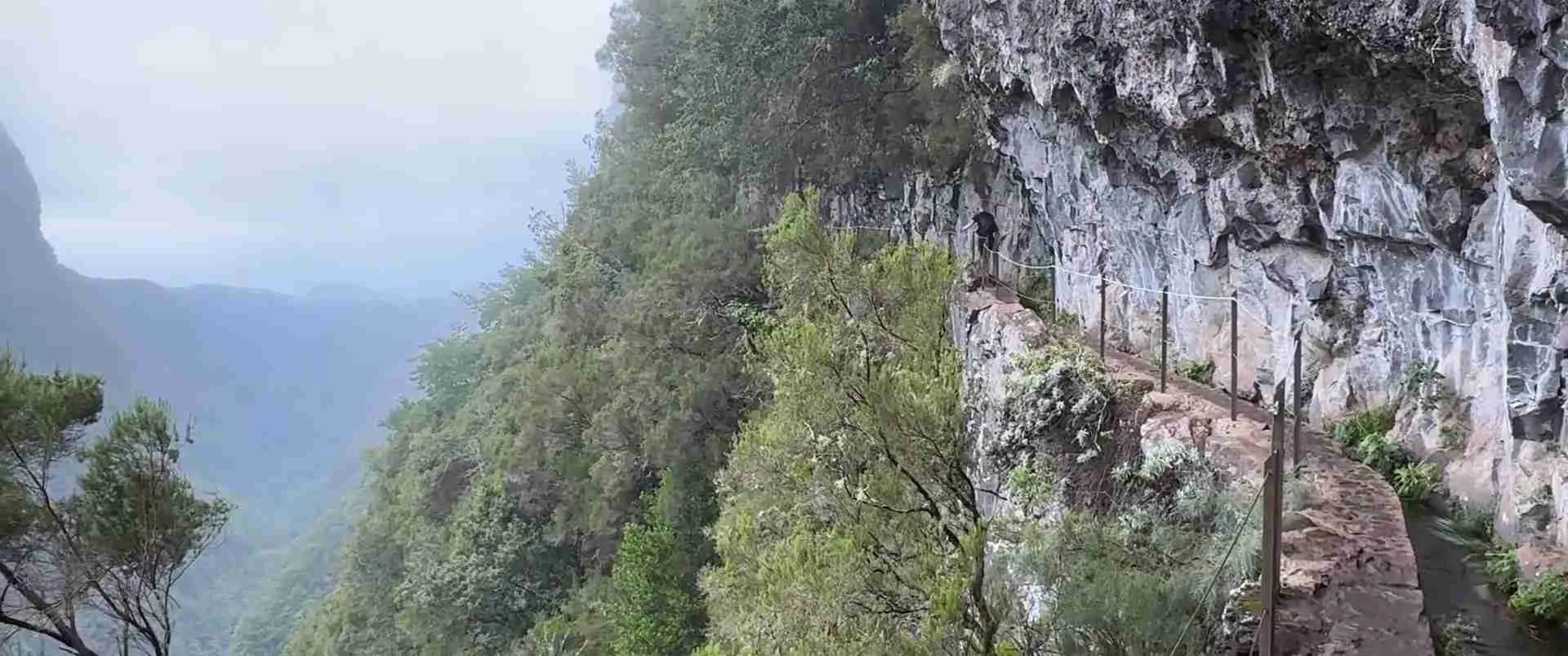
Madeira’s network of irrigation channels creates one of Europe’s most distinctive hiking experiences, weaving through UNESCO-protected Laurissilva forest and carved mountain passages. These levada maintenance paths span approximately 3,000 kilometers across the island, offering routes from gentle forest strolls to challenging mountain traverses that reveal ancient ecosystems, dramatic waterfalls, and engineering marvels dating to the 15th century.
Key Takeaways About Madeira Levada Walks
- Unique Engineering Heritage: Levadas are hand-carved irrigation channels constructed from the 15th century onwards to transport water from Madeira’s rainy northern slopes to agricultural areas in the south, with maintenance paths alongside creating an extensive hiking network through otherwise inaccessible terrain.
- UNESCO Laurissilva Forest Access: Many levada routes traverse the 15,000-hectare Laurissilva of Madeira, a UNESCO World Heritage Site since 1999 representing the largest surviving area of primary laurel forest from the Tertiary period, with 90% ancient growth and unique endemic species including the Madeiran long-toed pigeon.
- Route Classification System: Madeira’s officially classified trails use the PR (Pedestre Recomendado) designation with numbered routes ranging from easy 3-kilometer walks to challenging 18-kilometer mountain traverses, with difficulty ratings based on distance, elevation gain, technical requirements, and exposure to heights.
- Tunnel and Exposure Considerations: Several popular levada walks pass through tunnels ranging from short 50-meter passages to the 1,600-meter Rocha Vermelha tunnel, requiring headlamps and waterproof footwear, while narrow paths with significant drop-offs demand attention to footing and comfort with exposure.
- Seasonal and Trail Status Variations: Laurissilva forest trails remain accessible year-round with optimal conditions during spring and autumn, though individual routes close temporarily after heavy rainfall or landslides, requiring verification of current trail status through official Instituto das Florestas e Conservação da Natureza resources before departure.
- Trail Access Regulations: As of early 2026, classified hiking routes require advance booking through the SIMplifica platform with fees of €4.50 for independent hikers or €3 when accompanied by registered tour operators, though some shorter trails remain free, supporting maintenance and conservation of the extensive path network.
People Also Ask About Madeira Levada Walks
What makes levada walks different from regular hiking trails?
Levada walks follow centuries-old irrigation channels with maintenance paths alongside, creating routes with minimal elevation change that contour around mountainsides at consistent gradients necessary for water flow. Unlike traditional mountain trails that ascend peaks via direct routes, levadas weave horizontally through terrain at steady elevations, accessing valleys, forests, and cliff faces through paths typically 1-2 meters wide carved into rock walls or following channel edges. The water flowing beside hikers creates a distinctive auditory experience while the engineering constraints that shaped levada construction – following contour lines to maintain gentle downward gradients of 1-2% for gravity-fed water transport – result in paths that reach spectacular viewpoints and remote forest areas without the steep climbs typical of mountain hiking. Many levadas pass through hand-carved tunnels that pierce mountain ridges, adding adventure elements while the narrow paths demand attention to footing especially where channels run along cliff edges with exposed drops.
How difficult are Madeira’s levada walks for average hikers?
Madeira’s levada walks span a wide difficulty spectrum from flat 3-kilometer beginner-friendly routes like Vereda dos Balcões to challenging 18-kilometer mountain traverses like Caminho do Pináculo requiring stamina and technical confidence. The majority of popular levada trails fall into the easy-to-moderate category with minimal elevation gain, relatively flat terrain, and well-maintained paths suitable for hikers with basic fitness levels who can walk steadily for 3-5 hours. Difficulty increases not primarily from climbing – most levadas maintain gentle gradients – but from factors including total distance, narrow path sections with exposure to heights, multiple tunnel passages requiring headlamps, potential for slippery conditions after rainfall, and duration requiring sustained concentration on footing. Routes like Caldeirão Verde (PR9) and 25 Fontes (PR6) represent moderate challenges with 12-17 kilometers total distance, several tunnel sections, and 4-6 hour durations but remain accessible to most active adults, while shorter levadas like Levada do Rei offer gentler introductions with broader paths and minimal technical demands.
Can you walk levadas independently or must you join guided tours?
Independent levada walking is both permitted and common on Madeira’s classified PR routes provided hikers purchase required trail access permits through the SIMplifica online platform and verify trail status before departure, as officially maintained routes feature clear waymarking, established parking areas, and documented trail information making self-guided exploration straightforward for prepared hikers. Guided tours offer advantages including expert knowledge of flora, fauna, and forest ecology, transportation logistics eliminating parking concerns at popular trailheads, local insight into optimal timing to avoid peak crowds, safety support on more exposed sections, and handling of access permits as part of tour services. Independent hikers should possess basic navigation skills, carry essential safety equipment including headlamps for tunnel sections, download offline trail maps, check weather forecasts, and inform accommodation providers of planned routes and expected return times. Guided options particularly benefit those unfamiliar with mountain environments, concerned about exposure on narrow paths, interested in natural history interpretation, or tackling more technical routes like those involving multiple long tunnels or significant elevation changes where local expertise enhances both safety and understanding.
What is the UNESCO Laurissilva forest and why is it significant?
The Laurissilva of Madeira represents the largest surviving area of laurel forest that once covered much of Southern Europe during the Tertiary period millions of years ago, with 15,000 hectares of predominantly primary growth forest earning UNESCO World Heritage designation in 1999 for its exceptional biodiversity, ancient ecosystem preservation, and scientific importance as a living remnant of prehistoric vegetation. This subtropical rainforest ecosystem occupies approximately 20% of Madeira’s landmass on humid northern slopes between 300-1,450 meters elevation, characterized by evergreen trees with glossy laurel-like leaves including endemic species from the Lauraceae family creating dense canopy layers that capture moisture from clouds and mist. The forest shelters over 1,200 native plant species including ancient trees estimated at 800+ years old, provides critical habitat for rare endemic fauna including two bat species and the emblematic Madeiran long-toed pigeon, and plays an essential role in the island’s water cycle by capturing atmospheric moisture that feeds the levada system. UNESCO recognized the Laurissilva as approximately 90% primary forest – meaning never logged or significantly disturbed by human activity – making it an invaluable reference ecosystem for understanding pre-glacial European vegetation and studying subtropical forest dynamics in isolation, while its survival through six centuries of human settlement on Madeira demonstrates successful conservation alongside traditional water management practices.
Extended multi-day tours – 5+ days
Featured Madeira Multi-Day Tour Packages
3 days
Madeira 3-Day Discovery Tour
- ✓ Comprehensive Madeira experience
- ✓ Expert local guides included
- ✓ All accommodation included
- ✓ Transportation provided
5 days
Madeira 5-Day Highlights Experience
- ✓ Comprehensive Madeira experience
- ✓ Expert local guides included
- ✓ All accommodation included
- ✓ Transportation provided
7 days
Madeira 7-Day Cultural Journey
- ✓ Comprehensive Madeira experience
- ✓ Expert local guides included
- ✓ All accommodation included
- ✓ Transportation provided
10 days
Madeira 10-Day Complete Adventure
- ✓ Comprehensive Madeira experience
- ✓ Expert local guides included
- ✓ All accommodation included
- ✓ Transportation provided
Multi-day tour packages powered by TourRadar. Prices and availability subject to change.
Introduction: Madeira’s Living Heritage Corridor
The Portuguese island of Madeira rises dramatically from the Atlantic Ocean 970 kilometers southwest of Lisbon, its volcanic peaks reaching 1,861 meters at Pico Ruivo while deep ravines carved by millennia of rainfall create some of Europe’s most rugged terrain. This mountainous geography that makes modern road construction challenging proved equally problematic for Madeira’s 15th-century Portuguese settlers attempting to cultivate sugar cane and vineyards on an island where rainfall concentrates heavily on northern slopes while southern agricultural areas face chronic water scarcity. The ingenious solution that emerged – a network of hand-carved irrigation channels called levadas that transport water across mountainsides – created not only the foundation for Madeira’s agricultural economy but also an unintended hiking paradise that today draws walkers from around the world.
Beginning in 1419 when Portuguese navigator João Gonçalves Zarco claimed Madeira for Portugal, settlers recognized that successful agriculture required moving water from abundant northern rainfall areas to drier southern plantations. Early levada construction employed workers known as Rocheiros who rappelled on ropes to carve channels into cliff faces, chip tunnels through mountain ridges, and construct stone aqueducts across ravines – dangerous work that claimed many lives but gradually extended water transport across the island. The oldest surviving levadas date to the early 15th century, with major expansion during the 16th and 17th centuries supporting Madeira’s emergence as a significant sugar producer, followed by additional construction through the early 20th century as hydroelectric development joined agricultural irrigation as levada functions. Today approximately 3,000 kilometers of channels span the island, ranging from ancient hand-cut stone watercourses to modern concrete constructions, all requiring regular maintenance via narrow paths that transform utilitarian access routes into premier hiking trails.
The maintenance paths alongside levadas typically measure 1-2 meters wide with the water channel itself 80-150 centimeters across, creating corridors through terrain that would otherwise remain virtually impenetrable jungle or precipitous cliff faces. Because water must flow via gravity, levadas maintain remarkably consistent gentle gradients of 1-2% downward slope, resulting in paths that contour around mountains at steady elevations rather than climbing directly up slopes. This engineering constraint produces walking routes with minimal elevation gain that nonetheless access spectacular viewpoints, remote waterfalls, and deep forest valleys by following the contour lines that permitted water flow. The paths’ utilitarian origin means they traverse terrain chosen for engineering efficiency rather than scenic appeal, yet this pragmatic routing frequently leads through Madeira’s most dramatic landscapes where levada builders had no choice but to carve paths along cliff edges, through mountain tunnels, or beside cascading streams.
Madeira’s official hiking trail network includes over 32 classified PR (Pedestre Recomendado) routes managed by the Instituto das Florestas e Conservação da Natureza, combining levada paths with traditional mountain trails called veredas and historic caminho real routes. Levada-based trails range from gentle 3-kilometer forest walks suitable for families to challenging 17-kilometer mountain traverses requiring stamina and confidence with exposure, offering options for every fitness level and hiking ambition. Many routes pass through the UNESCO-protected Laurissilva forest that blankets northern slopes, providing intimate access to ancient subtropical ecosystems while others traverse open ridges, volcanic coastal headlands, or agricultural terraces showcasing the island’s landscape diversity.
Contemporary levada walking combines appreciation for engineering heritage with immersion in Madeira’s natural environments, from the primary laurel forest unchanged since the Tertiary period to dramatic volcanic geology and endemic flora found nowhere else on Earth. The trails offer unique hiking characteristics including tunnel passages requiring headlamps, narrow cliff-edge paths demanding concentration, the constant sound of flowing water, and remarkably consistent gradients that make distance rather than elevation the primary challenge. Understanding levada history, recognizing trail difficulty factors beyond simple mileage, preparing appropriate equipment for tunnel and exposure sections, and selecting routes matching individual fitness and comfort levels transforms levada exploration from casual walks into purposeful engagement with Madeira’s most distinctive landscape feature.
Understanding Levada History and Engineering
Madeira’s levada system represents one of the world’s most extensive pre-industrial hydraulic engineering achievements, combining sophisticated gradient calculations, tunnel construction through mountain ridges, and sustainable maintenance protocols that have kept channels operational for up to six centuries. The network’s origins trace directly to the island’s settlement history and agricultural development imperatives that shaped Portuguese colonial economy from the 15th through 19th centuries.
Portuguese explorers discovered uninhabited Madeira in 1419, finding a densely forested volcanic island with no indigenous population but abundant rainfall, fertile volcanic soils, and a subtropical climate ideal for valuable crops including sugar cane, grapes, and eventually bananas. The island’s mountainous spine running east-west creates dramatic climatic differences between northern slopes that receive heavy orographic rainfall as Atlantic weather systems rise and cool against peaks, and southern leeward areas in relative rain shadow. Northern forests remained perpetually moist while southern coastal areas suitable for agriculture received insufficient rainfall for intensive cultivation, creating the fundamental water distribution challenge that levadas would solve.
Early Portuguese settlers recognized that channeling northern rainfall to southern plantations required gravity-fed water transport systems capable of traversing mountainsides for distances up to 40 kilometers. Levada construction began within decades of settlement, initially as short simple channels but rapidly evolving into complex engineered systems. Workers called Rocheiros specialized in this dangerous construction, rappelling on ropes down cliff faces to chip channels into rock using hand tools, living in temporary camps for months while extending routes through remote terrain. The mortality rate proved horrific with many workers falling to deaths or succumbing to disease and exposure, yet economic pressures from Madeira’s lucrative sugar industry – at its 16th-century peak the island produced significant portions of European sugar supplies – drove continued expansion.
Levada engineering followed consistent principles shaped by gravity-powered water transport requirements. Channels needed gentle downward gradients of approximately 1-2% to maintain water flow without excessive velocity that would erode channel walls – too steep and water rushes destructively, too flat and it stagnates. This constraint meant levadas must follow contour lines around mountains, extending great distances to maintain optimal gradients where direct downhill routes would create excessive slope. When ridges blocked the desired path, workers carved tunnels through solid rock using hand tools and black powder explosives in later periods, with some tunnels extending over a kilometer through mountains. The resulting routes wind around valleys, pierce mountain spines, and traverse cliff faces on carved ledges or stone aqueducts, creating the distinctive levada character that combines spectacular positioning with remarkably consistent elevation.
Construction materials evolved with technology and economic resources. Early levadas used dry-stone construction with carefully fitted rocks creating watertight channels, often lined with clay or mortar where available. Later periods introduced concrete construction that reduced maintenance requirements and water loss through seepage, though many stone levadas survive in active use. Channel dimensions standardized around 80-150 centimeters width and 50-80 centimeters depth, sufficient to carry substantial water volumes while remaining manageable for maintenance workers who must periodically clear vegetation, repair damage, and manage flow controls.
The maintenance path alongside each levada emerged as an essential operational feature rather than recreational infrastructure. Channel workers needed access for cleaning, repair work, and flow monitoring, creating paths typically 1-2 meters wide carved into mountainsides or built on stone platforms where terrain permitted. These paths received minimal development beyond what maintenance required – no railings on cliff sections, rudimentary steps through difficult passages, and simple stone construction. The utilitarian nature created paths that follow terrain pragmatically rather than accommodating recreational hiking, resulting in exposed sections, narrow passages, and abrupt elevation changes where geological features demanded.
Levada functions expanded beyond agricultural irrigation as Madeira developed. Hydroelectric power generation beginning in the early 20th century utilized levada water transported to high-elevation reservoirs that could drive turbines, adding industrial function to the network. Today levadas continue serving both agricultural and hydroelectric purposes while municipal water supplies also draw from the system, making operational levadas essential infrastructure that receives regular maintenance funding. The Instituto das Florestas e Conservação da Natureza manages levadas within Madeira Natural Park while separate agricultural cooperatives maintain channels serving farming areas, ensuring the network remains functional rather than becoming historic monuments.
Understanding levada engineering illuminates hiking experiences on maintenance paths. The consistent gentle gradients mean levada walks rarely involve significant climbing despite accessing mountain terrain – a 10-kilometer levada walk might gain only 200 meters elevation, creating endurance challenges from distance rather than ascent. The paths’ narrow width and lack of safety features reflect utilitarian origins where installation of railings or path widening would be impractical along cliffside routes. Tunnel sections exist because ridge crossings required them for gradient maintenance, not as added attractions, explaining why some passages extend hundreds of meters through complete darkness. Recognition of levadas as working infrastructure rather than recreational trails encourages appropriate behavior including avoiding disruption to water flow, respecting maintenance workers when encountered, and understanding that path conditions prioritize operational access over hiker comfort.
UNESCO Laurissilva Forest Ecosystem
The Laurissilva of Madeira represents a living connection to ancient Earth, preserving forest ecosystems that once covered vast areas of Southern Europe but vanished during glacial periods, surviving in Madeira’s isolated Atlantic location where subtropical conditions and high rainfall maintained the specialized environment these forests require. UNESCO World Heritage designation in 1999 recognized the Laurissilva as the largest surviving laurel forest globally and among the best-preserved examples of primary forest anywhere, making levada walks through these areas journeys through botanical history.
Laurissilva forests originated during the Tertiary period beginning approximately 65 million years ago when subtropical climates extended across much of Europe, with warm temperatures and abundant moisture supporting evergreen broadleaf forests dominated by laurel family trees. As climate cooled during successive ice ages, these forests retreated to Mediterranean and Atlantic coastal refuges before disappearing from continental Europe entirely, surviving only on Atlantic islands – Madeira, Azores, and Canary Islands – where oceanic moderation prevented extreme cold. Madeira’s Laurissilva represents the most extensive surviving example, covering approximately 15,000 hectares primarily on northern and central mountain slopes between 300-1,450 meters elevation where orographic rainfall and persistent cloud cover maintain the humid conditions these forests require.
The forest’s composition centers on evergreen trees with thick glossy leaves characteristic of the Lauraceae family, creating dense multi-layered canopies that intercept fog and cloud moisture. Dominant species include Ocotea foetens and Apollonias barbujana forming upper canopy layers reaching 30 meters height, with Persea indica and Laurus novocanariensis in intermediate layers, supported by understory trees including Clethra arborea and the endemic Pittosporum coriaceum. Ancient specimens estimated at 800+ years demonstrate the forest’s primary nature – meaning never subjected to logging or significant human disturbance – with tree trunks reaching immense girths and twisted branches draped in epiphytic mosses, ferns, and lichens creating otherworldly atmospheric effects particularly when morning mists envelop the forest.
The Laurissilva’s botanical diversity exceeds typical European forests with over 1,200 species recorded including approximately 150 endemic to Madeira or the Macaronesian archipelagos. The forest floor supports specialized flora adapted to low light conditions including ferns like the massive Woodwardia radicans creating prehistoric-looking understories, endemic orchids including Dactylorhiza foliosa and Goodyera macrophylla, and the striking Geranium maderense – a giant crane’s-bill producing spectacular flower spikes. Bryophytes – mosses and liverworts – achieve exceptional diversity and abundance in the constant humidity, covering tree trunks, rocks, and even levada walls with thick green cushions that contribute to the forest’s sound-dampening effect and ethereal appearance.
Endemic fauna populations include species found nowhere else on Earth. The Madeiran long-toed pigeon (Columba trocaz) represents the island’s most emblematic endemic bird, inhabiting primary Laurissilva forest where its populations remain vulnerable despite conservation efforts. Two rare bat species – Madeira pipistrelle and lesser noctule – roost in forest cavities while the Trocaz pigeon’s presence serves as an indicator of forest health. The forest supports numerous endemic invertebrate species including beetles, spiders, and land snails adapted to the humid environment, many restricted to specific elevation bands or valley systems creating localized distributions.
The Laurissilva plays critical roles in Madeira’s water cycle and climate regulation. The forest canopy intercepts fog and low clouds, with moisture condensing on leaves and dripping to the ground in a process called fog drip that can contribute as much water to soils as direct rainfall. This captured moisture feeds streams and springs that supply levada systems, making the forest essential infrastructure for the island’s water supply beyond its ecological value. The dense vegetation also moderates local temperatures, reduces erosion on steep slopes, and stores carbon while providing seed sources for reforestation efforts in degraded areas.
UNESCO designation in 1999 recognized the Laurissilva under natural heritage criteria emphasizing both its representation of ongoing ecological processes and exceptional biodiversity. The inscription noted that Madeira’s laurel forest comprises approximately 90% primary growth – an extraordinarily high percentage considering six centuries of human settlement on the island – demonstrating successful conservation despite proximity to agricultural and residential areas. Buffer zones surrounding core protected areas help shield the forest from invasive species while management plans address threats including forest fires, climate change impacts, and tourism pressure.
Levada walks through Laurissilva areas provide intimate access to this ancient ecosystem. Popular routes like Caldeirão Verde, 25 Fontes, and Levada do Rei traverse extensive forest sections where hikers walk beneath cathedral-like canopies dripping with moisture, surrounded by endemic plants, and immersed in the forest’s distinctive atmosphere combining subtle light filtering through canopy layers, the sound of water flowing in channels and streams, and pervasive greenness created by moss coverage. The experience contrasts sharply with typical European forest walks, offering botanical encounters more reminiscent of tropical rainforests despite Madeira’s subtropical latitude.
Conservation challenges facing the Laurissilva include invasive plant species spreading from lower elevation agricultural areas, climate change potentially altering the moisture regimes these forests require, and tourism impacts where increased visitation creates path erosion and disturbance to wildlife. Management responses include invasive species removal programs, monitoring of forest health indicators, and controlled access to sensitive areas. Hiking permits and fees introduced for popular trails fund both maintenance work and conservation programs, connecting recreation use to forest protection. Walkers contribute to conservation by staying on designated paths, avoiding disturbance to flora and fauna, and supporting fee systems that resource protection efforts.
Trail Classification and Difficulty System
Madeira’s official hiking routes use the PR (Pedestre Recomendado) classification system managed by the Instituto das Florestas e Conservação da Natureza, designating trails that meet established safety and maintenance standards with numbered routes like PR6 or PR9 providing standardized reference points. Understanding the classification system and factors that determine levada walk difficulty beyond simple distance helps hikers select appropriate routes matching their fitness levels, comfort with exposure, and desired challenge.
The PR designation indicates trails that have received official approval after assessment of route viability, safety features, waymarking adequacy, and maintenance commitment. Currently over 32 PR routes span Madeira including both levada-based walks and mountain veredas, each receiving a specific number that persists even as routes occasionally undergo modification. The system provides no inherent difficulty rating within the PR classification – PR1 (Pico do Areeiro to Pico Ruivo) ranks among the island’s most challenging routes while PR11 (Vereda dos Balcões) offers an easy family walk, making individual route research essential rather than assuming low numbers indicate easier trails.
Difficulty assessment for levada walks requires evaluating multiple factors that combine to create overall challenge levels. Distance represents the most obvious factor with routes ranging from 3-kilometer return walks completed in under 90 minutes to 18-kilometer full-day expeditions requiring 6-7 hours. However, distance alone provides incomplete difficulty indication because levadas’ gentle gradients mean a 12-kilometer levada walk may feel easier than a 6-kilometer mountain trail gaining 600 meters elevation. Hikers should assess their sustained walking endurance – can you maintain steady pace for 4-6 hours – rather than simply cardiovascular fitness when evaluating longer levada routes.
Elevation gain on levada walks typically remains modest compared to mountain trails but varies significantly between routes. Easy levadas like Balcões gain only 140 meters over 3 kilometers while moderate routes like Caldeirão Verde accumulate approximately 200 meters across 17 kilometers. More challenging levada-based routes incorporating mountain sections can involve 600-800 meters elevation gain, requiring stamina for sustained gradual climbing. The profile matters as much as total gain – levadas maintain consistent gradients whereas hybrid routes may include steep staircase sections breaking the otherwise gentle character.
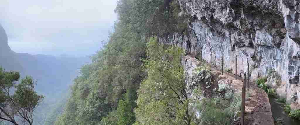
Exposure to heights creates psychological difficulty independent of physical demands. Many levadas traverse narrow paths carved into cliff faces with sheer drops of hundreds of meters and no safety railings, requiring comfort with exposure and careful attention to footing. Routes like Levada do Moinho to Levada Nova and sections of Caldeirão Verde feature exposed passages where the path narrows to single-file width beside vertical drops. Hikers with moderate height sensitivity often adapt after initial sections while those with significant acrophobia should select less exposed routes like Balcões or Levada do Rei where the path remains away from cliff edges.
Tunnel passages add distinctive challenge and adventure to several levada routes. Tunnels range from short 50-meter passages easily navigated with smartphone flashlights to extended sections like the 1,600-meter tunnel on Levada da Rocha Vermelha requiring 20+ minutes walking in complete darkness. Tunnel conditions vary from dry passages with good footing to wet sections where water flows across the path or drips from ceilings, sometimes requiring wading through ankle-deep water. Some tunnels feature low ceilings demanding crouched walking while others maintain comfortable headroom. The psychological factor of extended darkness in confined spaces can challenge even fit hikers unprepared for the experience.
Path surface and technical demands vary considerably between maintained PR routes and older lesser-used levadas. Popular routes like 25 Fontes receive regular maintenance creating relatively smooth surfaces though roots, rocks, and occasional erosion still require attention. Remote levadas may feature more challenging footing with loose rocks, overgrown vegetation, and steeper uneven sections. Technical skills beyond basic hiking fitness remain unnecessary for standard levada routes – no climbing or scrambling required – but surefootedness on uneven narrow paths proves essential.
Weather significantly impacts levada difficulty with conditions changing rapidly in mountain environments. Rain makes already narrow paths slippery, creates runoff that can flood tunnel sections, and obscures footing on rock surfaces. Fog reduces visibility particularly concerning on exposed cliff sections while strong winds at higher elevations create additional challenge. Summer heat affects routes through open terrain whereas winter cold impacts high-altitude levadas. Hikers should check weather forecasts and be prepared to postpone or modify routes when conditions deteriorate.
Crowd levels influence difficulty particularly on Madeira’s most popular levada walks where narrow paths create congestion. Routes like 25 Fontes and Caldeirão Verde experience heavy traffic during peak morning hours when tour groups and independent hikers converge, creating delays on single-file sections as hikers wait for passing opportunities. Starting early or late afternoon reduces crowding though this requires headlamp capability if finishing in darkness on longer routes.
The classification of levada walks into difficulty categories helps route selection. Easy routes suitable for most visitors with basic mobility include walks under 6 kilometers with minimal elevation gain, wider paths, and no significant exposure – examples include Vereda dos Balcões, Levada do Rei, and shorter sections of Levada dos Tornos. Moderate routes requiring good fitness and comfort with narrow paths include 8-14 kilometer walks with some elevation gain, potential exposure, and possible short tunnels – Caldeirão Verde, 25 Fontes, and Levada do Alecrim fall into this category. Challenging routes demand high fitness, significant exposure comfort, extended duration, and possibly multiple long tunnels – examples include Levada da Rocha Vermelha, Levada do Castelejo, and any routes exceeding 15 kilometers with substantial elevation gain.
Assessing personal suitability for specific levada walks requires honest evaluation of fitness, hiking experience, and psychological comfort with exposure and darkness. Beginners should start with easier routes to gauge their response to levada characteristics before progressing to more challenging walks. Experienced mountain hikers may find levadas easier than anticipated in terms of climbing but more demanding in concentration required on exposed narrow paths. Families with children should select routes matching the youngest member’s endurance and comfort levels while groups should plan based on the least experienced participant’s capabilities.
Essential Equipment and Preparation
Levada walking requires specific equipment addressing the unique characteristics of these trails including tunnel passages, wet conditions, narrow exposed paths, and extended duration on remote routes. Proper preparation ensures safety and comfort while inadequate gear can transform straightforward walks into miserable or dangerous experiences.
Footwear represents the most critical equipment decision. Proper hiking boots with ankle support, waterproof construction, and aggressive tread patterns provide optimal performance on wet narrow paths where slipping could result in falls into channels or down cliff faces. The waterproof capability matters particularly for tunnel sections where paths often run through standing water or streams cross the route. Ankle support helps prevent rolling ankles on uneven surfaces while aggressive tread grips wet rock and muddy sections. Trail runners or athletic shoes prove inadequate for levada walking despite their suitability for other hiking, lacking both the ankle support and waterproofing necessary for safe negotiation of wet exposed sections.
Headlamps or flashlights are mandatory equipment for any levada walk involving tunnel passages. Smartphone flashlights provide insufficient illumination for safe navigation through extended dark sections where footing may be uneven and water flows across paths. Headlamps offer hands-free operation essential when using trekking poles or steadying yourself against tunnel walls. Routes like Caldeirão Verde, 25 Fontes, and particularly Rocha Vermelha require reliable bright headlamps with fresh batteries – carrying spare batteries proves prudent on routes with multiple or extended tunnel sections. Even short tunnels demand lighting as eyes cannot adapt sufficiently to complete darkness to navigate safely without artificial light.
Clothing for levada walks must address Madeira’s microclimates and rapid weather changes. Layering systems work best starting with moisture-wicking base layers, insulating mid-layers like fleece or synthetic jackets, and waterproof-breathable outer shells. Temperatures can vary dramatically between sunny exposed sections and shaded forest passages while elevation changes of several hundred meters create noticeable temperature differences. Rain can appear suddenly even when forecasts predict clear weather, making waterproof jacket and pants essential rather than optional. Avoid cotton clothing that retains moisture and loses insulating properties when wet – synthetic or merino wool materials maintain warmth and dry quickly.
Trekking poles provide significant benefits on levada walks particularly for those concerned about exposure or needing additional stability. Poles help with balance on narrow sections, reduce impact on knees during descents, and provide confidence-boosting stability when crossing wet rock surfaces or negotiating uneven terrain. However, poles can prove cumbersome in narrow tunnels where hands may need contact with walls for guidance. Collapsible poles that pack away for tunnel sections offer versatility.
Backpacks for levada day walks should be small-to-medium capacity (20-30 liters) with hip belts distributing weight during extended walks. Essential contents include at least 2 liters water per person for longer routes, high-energy snacks and lunch, first aid kit with blister treatment and basic wound care, emergency space blanket, fully charged mobile phone with offline maps downloaded, whistle for emergency signaling, and sunscreen plus hat for exposed sections. Routes through remote areas benefit from carrying emergency provisions exceeding expected duration – if a 5-hour walk encounters problems, having supplies for 7-8 hours provides buffer.
Navigation equipment should include downloaded offline maps on smartphones or GPS devices plus printed trail descriptions. While popular PR routes feature waymarking, fog can obscure markers and junctions may confuse unfamiliar hikers. GPS coordinates for trailheads and key junctions help verify position particularly when weather reduces visibility. The WalkMe Madeira app provides detailed trail information including offline maps, elevation profiles, and point-of-interest markers valuable for navigation and route planning.
Weather protection extends beyond rain gear to include wind protection on exposed ridges and sun protection on open coastal walks. Madeira’s Atlantic position creates variable conditions with sudden wind gusts particularly concerning on narrow exposed paths. Lightweight windbreaker jackets supplement waterproof shells when rain isn’t forecast. Conversely, routes through open terrain like Ponta de São Lourenço demand sun protection including high-SPF sunscreen, sunglasses, and brimmed hats as shade remains absent throughout these coastal walks.
Emergency equipment appropriate for remote mountain environments should include basic first aid capabilities, emergency shelter, and communication devices. Whistle signals carry farther than shouting for assistance. Mobile phone coverage reaches most popular levada routes though signal can be intermittent in deep valleys – inform accommodation providers of planned routes and expected return times so delayed returns trigger concern. Emergency numbers in Portugal use 112 for all services.
Photography equipment deserves consideration as levada routes offer spectacular photo opportunities. However, heavy camera gear creates fatigue on longer walks and demands careful handling on narrow exposed sections. Waterproof protection for electronics matters in tunnel sections and potential rain. Consider whether spectacular scenery justifies carrying additional weight versus relying on smartphone cameras adequate for most purposes.
Pre-walk preparation includes verifying current trail status through official sources as routes close temporarily after heavy rain, landslides, or maintenance work. The Instituto das Florestas e Conservação da Natureza maintains online trail status maps showing which PR routes are open, closed, or have restrictions. Check weather forecasts for mountain areas rather than coastal Funchal conditions as weather differs significantly. Book required trail access permits through the SIMplifica platform before departure. Arrange transportation to trailheads either via rental car or pre-booked transfers, as limited parking at popular trails can prevent access during peak periods.
Physical preparation for levada walking should include endurance training emphasizing sustained steady-pace walking rather than intense cardio workouts. Practice walking on uneven terrain develops the ankle strength and balance required for narrow rocky paths. If concerned about exposure, gradually build comfort with heights through progressively more exposed trails starting with routes offering escape options before committing to fully exposed multi-hour walks.
Safety Considerations and Risk Management
Levada walks present specific hazards different from typical hiking trails, combining narrow exposed paths, tunnel passages, rapidly changing weather, and remoteness from assistance that require understanding and appropriate precautions. While thousands complete levada walks safely each year, serious accidents do occur most often resulting from inadequate preparation, poor equipment, or underestimating environmental hazards.
Fall risks represent the most significant hazard on levada walks. The combination of narrow paths, cliff-edge positioning, wet slippery surfaces, and absence of safety railings creates fall potential throughout many routes. Fatal accidents have occurred when hikers slip from exposed sections particularly in wet conditions or when wearing inappropriate footwear. Mitigation requires constant attention to footing, appropriate footwear with aggressive tread, avoiding distractions like extensive photography on narrow sections, and turning back rather than continuing when discomfort with exposure creates unsafe tension. Hikers should maintain one-handed contact with cliff walls on particularly exposed sections and avoid rushing particularly when other trail users create pressure to move faster than comfortable.
Tunnel hazards include trips and falls on uneven surfaces in darkness, head strikes on low ceilings or protrusions, and disorientation in extended passages. Some tunnels flood during or after heavy rain creating dangerous conditions where water depth may exceed ankle height and current could sweep people off their feet. Cold water in tunnels can quickly cause hypothermia if clothing becomes thoroughly soaked. Always carry functioning headlamps with spare batteries, move slowly and deliberately through tunnel sections testing footing carefully, and avoid entering tunnels when storm conditions or heavy rain threatens flooding. Some individuals experience claustrophobia or panic in extended dark confined spaces – recognize these limits before committing to routes with multiple or lengthy tunnel passages.
Weather hazards on Madeira’s mountains change rapidly with fog reducing visibility to meters, rain making surfaces treacherously slippery, and wind creating dangerous conditions on exposed ridge sections. Fog particularly threatens safety by obscuring path edges on cliff sections and hiding trail markers at junctions. Afternoon thunderstorms develop suddenly during summer months bringing lightning risk to exposed high routes. Monitor weather forecasts before departure and be prepared to postpone or turn back when conditions deteriorate. Carry proper waterproof clothing and avoid starting walks when deteriorating weather is forecast for mountain areas.
Navigation errors can lead to becoming lost on the extensive levada network where multiple channels interconnect and unmarked junctions present route-finding challenges. While popular PR routes feature regular waymarking, markers may be vandalized, obscured by vegetation, or difficult to spot in fog. GPS devices and offline maps provide backup navigation when visual navigation fails. Always carry route descriptions and verify position at junctions particularly when visibility reduces. If lost, retrace your steps to the last confirmed position rather than continuing into unknown terrain.
Exhaustion from underestimating required time and physical demands leads to accidents when fatigue reduces attention to footing and judgment deteriorates. Levada walks often take longer than anticipated due to narrow sections requiring slow careful movement, crowded conditions forcing frequent stops to allow passing, and photo opportunities extending duration. Allow generous time estimates and start walks early enough to complete routes before darkness unless equipped with adequate lighting. Carry sufficient water and food to maintain energy throughout extended walks.
Isolation on remote levada sections means that assistance may take hours to reach accident sites even after emergency services receive notification. Mobile phone coverage reaches most popular routes though signal remains intermittent in deep valleys. Inform accommodation providers of planned routes and expected return times so overdue returns trigger search and rescue. Carry emergency equipment including first aid supplies, space blanket, and whistle for attracting attention. Basic first aid skills help manage injuries pending professional assistance arrival.
Wildlife hazards on Madeira remain minimal compared to many hiking destinations. No large dangerous mammals inhabit the island and venomous snakes are absent. Stinging insects including wasps and hornets nest along some trails but pose danger primarily to those with allergic sensitivities – carry antihistamine and epinephrine auto-injectors if allergic. The greatest wildlife concern involves respecting the rare endemic species particularly the Trocaz pigeon which flushes from nests if hikers approach too closely or make excessive noise in nesting areas.
Group hiking dynamics require establishing appropriate pace for all members and avoiding separation that leaves individuals isolated if problems arise. Stronger hikers should moderate pace to keep the group together rather than racing ahead, while slower members should communicate honestly about capabilities rather than struggling beyond comfortable limits. Establish reunion points at major junctions where groups inevitably fragment due to different walking speeds or photo stops.
Emergency response procedures should be established before departure. Emergency number 112 connects to all services in Portugal. When reporting emergencies, provide GPS coordinates if possible, trail name and approximate location description, number of people requiring assistance, nature of injuries or problem, and current weather conditions. Injured hikers unable to continue should remain in place with companions while mobile member proceeds to location with phone signal to summon help – moving injured persons risks exacerbating injuries unless immediate danger requires evacuation from accident site.
Specific route hazards deserve advance research with some levada walks requiring special caution. Levada do Moinho to Levada Nova features sections where path narrows to under 50 centimeters width beside sheer drops. Caldeirão Verde includes multiple tunnel passages and exposed cliff sections. Rocha Vermelha demands 20+ minutes in complete darkness through flooded tunnel. Research specific hazards for planned routes and assess honestly whether personal capabilities and comfort levels match requirements.
Responsible levada walking includes respecting private property where paths cross agricultural land, avoiding damage to endemic plants by staying on established trails, not swimming in levada channels or natural pools where prohibited, and properly disposing of waste. These practices protect both the natural environment and maintain positive relationships with local communities whose lands levadas traverse.
Popular Levada Routes: Northern Region
Madeira’s northern region concentrates the island’s finest levada walks, combining extensive Laurissilva forest coverage, dramatic mountain terrain, and some of the oldest most scenic levada routes. These trails access the heart of UNESCO-protected ecosystems while showcasing the engineering achievements that made Madeira’s water distribution system possible.
Levada do Caldeirão Verde (PR9)
Levada do Caldeirão Verde ranks among Madeira’s most popular and rewarding walks, traversing 17.4 kilometers through dense Laurissilva forest to reach a spectacular waterfall dropping 100 meters into an emerald pool. The route begins at Queimadas Forest Park in the municipality of Santana, following a well-maintained path that balances accessibility with authentic mountain forest immersion.
The trail starts from Queimadas parking area at approximately 880 meters elevation, where facilities include restrooms, a small café, and traditional thatched A-frame houses characteristic of northern Madeira. Initial sections pass through managed forest park areas before entering primary Laurissilva where ancient trees draped in mosses and ferns create cathedral-like canopy layers. The path follows Levada do Caldeirão Verde maintaining remarkably consistent elevation around 900 meters, with total elevation gain of only 200 meters across the entire route despite accessing deep mountain terrain.
Four tunnel passages punctuate the route ranging from brief 50-meter sections to one approximately 150 meters length, all requiring headlamps though generally featuring good footing. Between tunnels the path alternates between forest sections where ferns create dense understory and more open passages where views extend across valleys toward central peaks. Several small waterfalls cascade across the levada or tumble down cliff faces beside the path, increasing in frequency as the route penetrates deeper into the mountains.
The path narrows significantly in several sections carved into cliff faces where the ledge may be only 1-2 meters wide with vertical drops below. These exposed passages total perhaps 500 meters cumulative length requiring careful attention to footing, though most hikers with moderate comfort at heights find them manageable. The levada flows constantly beside the path, sometimes as gentle stream and occasionally as more vigorous flow depending on recent rainfall.
Caldeirão Verde waterfall appears suddenly after the fourth tunnel, a dramatic 100-meter cascade dropping from moss-covered cliffs into a large natural amphitheater with emerald-green pool at its base. The scale proves impressive with the waterfall often visible from several hundred meters before arrival allowing anticipation to build. Most hikers spend 20-45 minutes at the waterfall eating lunch, taking photographs, and simply appreciating the scene before returning via the same route.
Strong experienced hikers can extend the route an additional 3.5 kilometers beyond Caldeirão Verde to reach Caldeirão do Inferno, an even larger waterfall in a more remote canyon. This extension adds approximately 2 hours total time and includes two more tunnels plus more challenging terrain, transforming a moderate 5-6 hour walk into a demanding 7-8 hour expedition suitable only for fit experienced hikers. Most visitors find Caldeirão Verde alone provides sufficient satisfaction without the additional commitment.
Caldeirão Verde’s popularity creates crowding issues particularly during mid-morning when tour groups and independent hikers converge. The trail’s narrow single-file sections force frequent stops to allow passing, with large groups creating delays that extend walking time significantly. Starting before 8:30 AM or after 1:00 PM substantially reduces crowding though later starts risk finishing in darkness. Parking at Queimadas fills by 9:00 AM on popular days so early arrival proves essential for independent drivers.
Trail access requires advance booking through the SIMplifica platform with fees of €4.50 for independent hikers. The route remains open year-round though winter rainfall can increase waterfall flow dramatically while summer drought may reduce flows to disappointing trickles. Spring and autumn provide optimal conditions with reliable water flow, comfortable temperatures, and reduced crowds compared to summer peak season.
Levada das 25 Fontes (PR6)
The 25 Fontes levada walk delivers Madeira’s most iconic levada destination, a natural amphitheater where 25 springs emerge from moss-covered cliffs creating a multi-tiered waterfall cascading into a serene lagoon. Located in the Rabaçal area of Madeira Natural Park, this 11-kilometer return route combines forest walking, tunnel passages, and spectacular scenery in a package accessible to most moderately fit hikers.
Access begins from parking areas along the ER 105 road above Rabaçal at approximately 1,300 meters elevation. From here hikers face choice of walking 2.5 kilometers down paved access road to Rabaçal casa or paying for shuttle bus service that operates from 10:00 AM onward. Most hikers walk down allowing early trail access before buses begin service, then either walk up at finish or catch shuttle if still operating – the 300-meter elevation gain on return proves challenging after completing the levada walk.
From Rabaçal casa at 1,050 meters, the trail descends through mixed forest to reach the levada at approximately 960 meters where the actual route begins. The levada follows Ribeira da Janela valley contouring around slopes with spectacular views when vegetation allows glimpses. Primary Laurissilva forest dominates with massive trees creating dense canopy, extensive bryophyte coverage, and atmospheric conditions particularly when morning mists permeate the forest.
Several short tunnels punctuate the route including one approximately 800 meters into the walk that passes behind a waterfall – hikers often get sprayed depending on water flow and wind direction. The tunnels remain short enough that smartphone lights suffice though headlamps provide better illumination. Path width varies from comfortable 2-meter sections to narrow single-file passages requiring care, with exposure to heights moderate compared to routes like Caldeirão Verde.
The 25 Fontes lagoon appears after approximately 4.5 kilometers from Rabaçal casa, nestled in a natural rock amphitheater where multiple springs emerge from the cliff face creating the named “25 fountains” though actual spring count varies with season and rainfall. The main waterfall drops approximately 30 meters while smaller cascades contribute to the pool creating an ethereal scene enhanced by the surrounding forest and often present mist. The lagoon’s green coloration comes from algae and mineral content rather than depth – the pool is actually relatively shallow throughout most of its extent.
This destination attracts enormous crowds particularly from 10:00 AM through 2:00 PM when tour groups arrive via shuttle buses. During peak periods the lagoon area can host 50+ people simultaneously creating carnival atmosphere far removed from wilderness experience. Photography challenges increase with constant movement in frame and difficulty finding unoccupied viewpoints. Starting before 8:00 AM allows experiencing the site in relative solitude before crowds arrive, though this requires walking the access road which adds 5 kilometers and significant elevation to the total effort.
Many hikers combine 25 Fontes with the Risco waterfall via PR6.1, a short 1.5-kilometer side route that splits from the main path approximately 1 kilometer from Rabaçal casa. Risco waterfall drops approximately 100 meters in a single tier, considered by some more impressive than 25 Fontes though less unique. Adding both destinations creates approximately 14-kilometer total distance requiring 5-6 hours including stops. The Risco spur features wider paths with less exposure making it easier terrain than the main 25 Fontes route.
Trail access requires the €4.50 booking fee through SIMplifica. The route remains open year-round though winter storms occasionally force temporary closures due to landslide risk or extreme weather. Summer heat proves less concerning as forest cover provides shade, though waterfalls may diminish during extended dry periods. Spring delivers optimal conditions with maximum water flow, lush green vegetation, and comfortable temperatures before summer crowds arrive.
Vereda dos Balcões (PR11)
Vereda dos Balcões provides Madeira’s easiest official PR route, a gentle 3-kilometer return walk through forest to reach an exceptional viewpoint overlooking central peaks. The minimal elevation gain, wide paths, and family-friendly character make this ideal for first levada experiences, elderly hikers, or those wanting spectacular scenery without significant physical challenge.
The trailhead at Ribeiro Frio on the ER 103 road offers ample parking, restroom facilities, and a café serving refreshments – amenities unusual for Madeira trail starts. Ribeiro Frio itself deserves exploration with trout hatchery, botanical garden, and picnic areas making the location attractive beyond the trail. Elevation at the start point sits around 860 meters with the trail gaining only 140 meters to reach the Balcões viewpoint at 1,000 meters.
The path follows Levada da Serra through mixed forest combining endemic Laurissilva species with introduced vegetation including eucalyptus. While not as pristine as deeper forest routes, the woodland remains attractive with good opportunities for bird watching including possible sightings of endemic species. The wide well-maintained path permits comfortable side-by-side walking unusual for levada routes, making this suitable for conversation and less demanding of concentration on footing.
No tunnels interrupt the route and exposure remains minimal throughout, creating psychologically comfortable walking even for those anxious about heights. The levada channel flows gently beside the path providing the characteristic water sound without concerns about slipping into deeper faster flow. Seasonal wildflowers including hydrangeas and agapanthus add color particularly during spring and early summer blooming periods.
The Balcões viewpoint terminates the route with interpretive panels identifying surrounding peaks visible on clear days. The panorama encompasses Pico Ruivo, Pico do Areeiro, Pico das Torres, and the distinctive jagged ridges of the central massif creating one of Madeira’s finest mountain vistas. Deep valleys including Metade and Fajã da Nogueira drop away below the viewpoint platform demonstrating the island’s dramatic topography. Morning light provides optimal photography conditions before clouds commonly build around peaks during afternoon hours.
Crowds concentrate at this accessible viewpoint particularly mid-morning through mid-afternoon when tour buses stop. Independent hikers arriving before 9:00 AM or after 3:00 PM find quieter conditions though any time remains suitable given the short duration allowing flexibility around crowd patterns. The trail’s popularity means encountering other hikers throughout though the wide path prevents congestion except at the viewpoint platform.
Families with young children complete this walk successfully provided children can sustain 90 minutes total walking time. The minimal elevation gain and lack of dangerous sections make this among the safest family options, though supervision near the viewpoint platform edge remains essential. Some visitors combine Balcões with other nearby activities in the Ribeiro Frio area creating half-day itineraries suitable for less adventurous travelers or those wanting levada experience without committing to longer more challenging routes.
No advance booking or fees apply to this trail currently, making it accessible without planning beyond basic preparation. The route remains open year-round though winter cold at 1,000 meters elevation may require warm layers. Weather can change rapidly with fog rolling in to obscure views even when valleys remain clear, though the short duration allows attempting the walk and returning if viewpoint proves socked in without major time investment.
Levada do Rei (PR18)
Levada do Rei provides a longer alternative to Balcões for those wanting more extensive easy levada walking without the technical challenges of routes like Caldeirão Verde. The 10.5-kilometer return route follows a broad well-maintained path through varied terrain including Laurissilva forest, open valleys, and agricultural areas, with minimal elevation gain and no significant exposure making it suitable for families and less experienced hikers desiring half-day adventures.
The trail begins from parking areas near Quebradas on the north coast highway, starting at relatively low elevation around 580 meters. Initial sections pass through agricultural terraces and partially cleared areas before entering forest, providing landscape variety unusual on levada walks that typically remain within single vegetation zones. The path width remains comfortable throughout most sections allowing relaxed walking without constant attention to cliff-edge positioning.
Laurissilva forest sections feature good examples of endemic trees including mature specimens of Ocotea and Laurus species, though the forest composition here includes more secondary growth than pristine routes like Caldeirão Verde. Bird watching opportunities exceed some other levadas due to the mix of forest and open habitats attracting varied species. The Trocaz pigeon – Madeira’s endemic symbol – inhabits these forests though sightings require patience and quiet approach as the species remains shy around humans.
The levada channel carries substantial water flow creating constant sound accompaniment throughout the walk. At several points small waterfalls cross the path or cascade beside the levada creating photo opportunities and rest stops. The route culminates at Ribeiro Bonito, a secluded forest area where streams create small pools and waterfalls within the forest setting providing a peaceful terminus despite lacking the dramatic destinations of routes like 25 Fontes.
Return via the same route completes approximately 10.5 kilometers total with elevation gain under 250 meters, achievable in 3-4 hours at moderate pace including stops. The gentle gradients and good path conditions make this suitable for building endurance for more challenging levada routes – hikers comfortable completing Levada do Rei possess the basic fitness for tackling moderate routes like 25 Fontes or Caldeirão Verde.
Crowds remain lighter than the most popular routes as Levada do Rei requires more commitment than short walks like Balcões while offering less dramatic destinations than waterfall routes. This creates pleasant conditions with regular encounters with other hikers without the congestion that plagues 25 Fontes during peak hours. The trail’s length and relatively remote forest setting provide more authentic immersion in Madeira’s natural environment than heavily trafficked alternatives.
Trail access requires the €4.50 booking fee. The route remains open year-round though winter rainfall may make some sections muddy requiring appropriate footwear. No tunnels interrupt the path eliminating headlamp requirements. The combination of accessibility, scenic variety, and manageable challenge makes Levada do Rei excellent for those wanting to experience authentic levada walking without confronting the exposure, crowds, or technical demands of the most famous routes.
Popular Levada Routes: Central and Western Regions
Central and western Madeira offer levada walks accessing the highest elevation forests, remote valleys, and some of the island’s most challenging and rewarding routes. These areas receive fewer visitors than northern classics but provide opportunities for more solitary experiences and access to pristine wilderness areas.
Levada do Alecrim (PR6.2)
Levada do Alecrim provides a quieter alternative to the crowded 25 Fontes route while accessing similar Rabaçal area landscapes from higher elevation. The 7.4-kilometer route operates at approximately 1,300 meters elevation traversing Paul da Serra plateau forest before descending to meet the 25 Fontes route, creating opportunities for loop hikes or simply experiencing this less-visited levada as a separate destination.
Access begins from Paul da Serra plateau parking along the ER 209 road where the stark high-altitude landscape contrasts dramatically with lush northern forests. The levada begins at the plateau’s edge descending gradually into Ribeira da Janela valley through transition zones where stunted windswept vegetation gives way to taller forest as protection from exposure increases. This elevation range showcases different Laurissilva forest characteristics with high-altitude species adapted to cooler temperatures and stronger winds dominating compared to lower elevation forests.
The path follows relatively wide sections for levada routes with good maintenance and waymarking though exposure increases in several sections where cliff edges drop away beside the narrow channel. Cloud and fog frequently envelope Paul da Serra particularly during afternoon hours, creating atmospheric conditions when mist drifts through forest but also reducing visibility and obscuring path edges. The fog can transform this route into either magical experience or disorienting challenge depending on hikers’ comfort with limited visibility navigation.
Connecting to the 25 Fontes route allows creating loops though this requires shuttle transport between distant trailheads or lengthy road walking. Most hikers treat Alecrim as out-and-back walk from Paul da Serra, completing approximately 7-8 kilometers with minimal elevation change over 2.5-3 hours. The reduced crowds and peaceful high-elevation forest provide different character than more famous routes while the moderate difficulty and good path conditions make this accessible to most hikers with basic fitness.
Levada da Rocha Vermelha
Levada da Rocha Vermelha ranks among Madeira’s most adventurous levada walks, featuring one of the island’s longest tunnel passages combined with spectacular ridge valley scenery in the remote Rabaçal area. The 15-kilometer route demands technical preparation for extended darkness, wet conditions, and exposed cliff sections, rewarding bold hikers with solitary wilderness experience and dramatic landscapes.
The route’s defining feature – a 1,600-meter tunnel requiring approximately 20 minutes of walking in complete darkness – begins shortly after the trailhead. The tunnel follows the levada channel through the mountain with water flowing beside or sometimes over the path creating wet conditions throughout. Hikers wade through ankle-deep water in sections while the confined space, complete darkness, and sound of rushing water create challenging psychological conditions for those with claustrophobia concerns. Strong reliable headlamps prove absolutely essential, with spare batteries prudent given the extended duration. Some hikers find the tunnel experience thrilling adventure while others discover it exceeds their comfort limits – honest self-assessment before committing to this route prevents unpleasant experiences requiring retreat through the darkness.
Emerging from the tunnel, the route enters the spectacular Rabaçal valley where dramatic ridges rise hundreds of meters on both sides and multiple waterfalls cascade down cliff faces. The levada contours along valley walls with significant exposure where the narrow path runs along cliff edges with vertical drops. The scenery compensates for the challenging access with views that rank among Madeira’s finest including perspectives of ridges, waterfalls, and valley depths impossible to reach via easier routes.
Several smaller waterfalls cross the levada along the valley section providing rest stops and photo opportunities, though the continuous need for careful footing on narrow exposed sections prevents fully relaxed enjoyment. The route eventually connects to other Rabaçal area levadas allowing various loop options for those with appropriate fitness and time. Most hikers complete the tunnel section and main valley traverse before returning the same way, creating approximately 5-6 hour total duration for the full 15-kilometer distance.
This route attracts adventurous experienced hikers seeking challenges beyond Madeira’s more accessible levadas. The combination of extended tunnel, significant exposure, wet conditions, and remote location means that problems or injuries could create serious rescue difficulties. Hikers should possess solid experience on exposed mountain terrain, comfort with extended darkness, and proven ability to maintain concentration during extended challenging sections before attempting this route. Going with local guides provides safety advantages and local knowledge of current conditions that change seasonally and after weather events.
Levada dos Cedros (PR14)
Levada dos Cedros traverses some of Madeira’s most pristine Laurissilva forest in the remote Fanal area, known for ancient twisted trees creating otherworldly landscapes especially when morning mists envelop the forest. The 8.8-kilometer route combines good path conditions with spectacular forest immersion, moderate challenge, and lighter crowds than northern classics.
Fanal Forest occupies the northwestern corner of Paul da Serra plateau where exposure to Atlantic weather creates unique growing conditions. The region’s iconic trees – centuries-old Ocotea foetens specimens with massive contorted trunks and branches – grow in relatively open stands allowing unusual understory light penetration. When fog rolls through Fanal, the gnarled trees emerging from mist create scenes resembling fantasy illustrations, attracting photographers seeking this distinctive Madeiran landscape character.
The levada walk begins from Fanal parking areas at approximately 1,150 meters elevation, following the channel through mixed forest that alternates between dense Laurissilva and more open sections dominated by the ancient twisted trees. The path width remains comfortable for levada routes with good maintenance though some sections require attention to footing on uneven surfaces. Elevation change remains minimal with gentle contour following around valley slopes providing steady walking without significant climbing.
The route passes through two short tunnels requiring headlamps though neither extends more than 100 meters creating manageable darkness sections. Between tunnels the path reveals valley views when vegetation permits and traverses sections with impressive endemic plant diversity including ferns, mosses, and flowering species particularly abundant during spring months. The combination of ancient forest, atmospheric mists common at this elevation, and relative solitude creates experience distinct from busier lower-elevation routes.
Duration for the full route out-and-back typically requires 3-4 hours at moderate pace with time for photography stops. The moderate difficulty makes this accessible to most hikers comfortable with 8-10 kilometer distances on uneven terrain. Fanal’s remote northwestern location means fewer casual tourists attempt this route, creating more wilderness-like conditions with greater likelihood of experiencing sections in complete solitude – rare on Madeira’s popular levadas.
Weather at Fanal proves highly variable with fog common particularly during afternoon hours and winter months. While fog enhances the mystical forest atmosphere, it also reduces visibility and can make navigation challenging at trail junctions. Summer tends to bring clearer conditions though afternoon clouds still build frequently. Winter cold at 1,150 meters elevation requires warm layers particularly when combined with damp fog conditions that increase chill factor significantly.
Coastal and Low-Elevation Routes
While most famous levada walks traverse high-elevation forests, Madeira’s coastal and low-elevation routes offer different character combining agricultural landscapes, coastal views, and easier access from southern tourist centers. These routes experience warmer temperatures, less rainfall, and often clearer weather than mountain alternatives while providing unique perspectives on levada system integration with Madeira’s historical agricultural development.
Levada do Moinho to Levada Nova
This southern coast levada combination near Ponta do Sol creates a circular 9-kilometer route linking two channels at different elevations while passing behind a spectacular waterfall – one of the few such walk-behind opportunities on Madeira. The moderate 4-5 hour walk accesses dramatic valley scenery with significant exposure sections requiring careful attention but rewards bold hikers with unique waterfall perspectives and attractive coastal valley landscapes.
The route traditionally starts from Igreja da Lombada in Ponta do Sol at approximately 350 meters elevation, following Levada do Moinho upward through agricultural terraces and forest sections. The path narrows significantly in several sections including famous passages where the levada channel must be crossed on narrow stones while cliff edges drop hundreds of meters – these sections demand surefootedness and comfort with considerable exposure. The path width in most exposed sections provides only 40-50 centimeters between channel edge and cliff drop, creating psychological challenge exceeding most other levada routes.
The route’s highlight appears approximately midway where a waterfall cascades across the path requiring passage through the falling water on a carved path behind the flow. During high water periods hikers get thoroughly drenched making waterproof gear essential. In drier months the flow reduces to manageable spray. The experience of walking behind falling water with the cliff face on one side and water curtain on the other creates memorable adventure though those avoiding water hazards should check current flow conditions before committing to this route.
After the waterfall section, the route transitions to Levada Nova which generally offers wider paths with somewhat less extreme exposure though still requiring attention. The return descent along Levada Nova back toward Ponta do Sol completes the loop through progressively more agricultural landscapes as elevation decreases. The circular nature eliminates the return-by-same-route characteristic of most levada walks creating variety throughout the duration.
This route suits experienced hikers comfortable with significant exposure and narrow technical sections. The combination of cliff-edge paths, waterfall passage, and extended duration with several hours of required concentration make this inappropriate for beginners or those anxious about heights. However, hikers with solid mountain experience find the challenge manageable and rewarded by unique perspectives and quieter conditions than mass-tourism routes like 25 Fontes.
Levada dos Tornos
Levada dos Tornos represents one of Madeira’s longest levada systems, with various sections accessible for walking though the complete channel extends over 100 kilometers. The most popular section near Camacha and Romeiros offers relatively easy walking through mixed landscapes combining forest, agricultural areas, and residential zones with good access from Funchal making this suitable for those seeking convenient half-day levada experiences without committing to remote mountain routes.
This eastern section operates at moderate elevations around 700-900 meters, following gentle contours through terrain more densely populated than northern wilderness routes. The path alternates between native forest remnants and cultivated areas including terraced gardens, orchards, and small farms providing insights into how levadas integrate with agricultural practices. In several sections the levada passes through residential areas where maintaining quiet and respecting private property proves important for preserving trail access.
The walking proves straightforward with wide paths, minimal exposure, and no significant technical challenges making this suitable for beginners wanting first levada experiences or families with children. The proximity to Funchal means starting the walk involves only 20-30 minutes driving rather than the hour-plus required for northern routes, with the tradeoff being less dramatic scenery and more frequent evidence of human activity.
Various access points allow different route lengths from short 4-kilometer sections to extended 12-15 kilometer walks. The flexibility accommodates different fitness levels and available time while the generally good weather on eastern slopes provides reliable conditions when northern mountains remain cloud-covered or experiencing rain.
Specialized Equipment and Seasonal Considerations
Beyond basic hiking equipment, certain levada routes demand specialized gear while seasonal variations significantly impact both trail conditions and hiking experience. Understanding these factors helps optimize preparation for specific routes and timing.
Tunnel Navigation Equipment
Routes featuring tunnel passages require not just headlamps but specific models with sufficient brightness and beam characteristics for extended underground walking. Minimum recommended output approaches 200 lumens providing adequate illumination for footing assessment, with 300+ lumens preferred for extended tunnels. The beam pattern matters as much as total output – focused spot beams illuminate greater distances but fail to light peripheral areas where tunnel walls provide orientation cues. Combination beam patterns with both focused center spots and broader flood areas work best for tunnel navigation.
Battery life becomes critical on routes like Rocha Vermelha where 20+ minutes continuous use drains conventional batteries significantly. Lithium battery powered headlamps maintain brightness better than alkaline as batteries deplete while rechargeable LED models provide best long-term economics for frequent users. Regardless of power source, carrying spare batteries or backup lights proves essential – smartphone flashlights suffice as emergency backup though inadequate as primary lights for extended tunnels. Some guides recommend waterproof headlamps for tunnel sections where water drips heavily though waterproof housings protecting non-waterproof lights work adequately for most conditions.
Waterproof Gear Requirements
Tunnel sections often involve walking through flowing water, under drips, or adjacent to rushing channels where spray creates wet conditions. Waterproof hiking boots rated for submersion rather than just water-resistant leather prove necessary for maintaining dry feet through extended wet sections – wet boots and socks create blister risks and comfort issues lasting the entire walk. Gaiters covering boot tops prevent water entering from above during deep puddle or stream crossings. Some hikers carry lightweight sandals or water shoes for planned water crossings allowing boot removal, though this proves impractical for unexpected water or extended wet sections where changing footwear wastes time.
Waterproof jackets and pants protect against both rainfall and tunnel drips with full rain suits recommended for routes like Moinho where waterfall passage guarantees soaking without proper coverage. Breathable waterproof membranes like Gore-Tex balance protection with moisture management preventing overheating during extended wear. Packing electronics including cameras and phones in waterproof dry bags within backpacks prevents damage from rain or tunnel water, with clear waterproof phone cases allowing photography and navigation access while maintaining protection.
Spring Hiking Conditions (March-May)
Spring represents optimal timing for Madeira levada walking combining reliable rainfall supporting waterfall flows with comfortable temperatures before summer heat peaks. The Laurissilva forest reaches peak greenness during spring months when winter moisture sustains lush growth before summer drying begins. Endemic wildflowers including orchids and the spectacular Geranium maderense bloom during March-May creating color highlights throughout forest understories.
Weather variability increases during spring transition periods with occasional unstable fronts bringing heavy rainfall events that temporarily close trails or create hazardous conditions in tunnels. Daily weather typically follows patterns of morning clarity deteriorating into afternoon cloud cover and possible showers. Starting walks early maximizes chances of clear conditions at viewpoints before clouds build. Spring temperatures at typical levada walking elevations (800-1,200 meters) range approximately 12-18°C requiring layering systems but remaining comfortable for sustained physical activity.
Spring crowds remain moderate as European Easter holidays bring temporary increases followed by quieter May periods before summer vacation season intensifies. This creates opportunity for popular routes like 25 Fontes without peak summer congestion levels.
Summer Hiking Conditions (June-August)
Summer delivers Madeira’s peak tourist season with maximum crowds on popular levada routes particularly during July-August school vacation periods. Routes like Caldeirão Verde and 25 Fontes experience heavy traffic from mid-morning through early afternoon creating congestion on narrow single-file sections. Early morning starts before 8:00 AM or late afternoon departures after 2:00 PM reduce crowd encounters substantially though later starts risk finishing walks in darkness requiring headlamp capability.
Summer weather generally brings more stable conditions with reduced rainfall though afternoon clouds still commonly form around peaks obscuring mountain views. Lower rainfall means waterfall flows diminish compared to winter and spring, with some minor cascades reducing to trickles by August – hikers prioritizing waterfall experiences should favor spring timing. Temperatures prove comfortable at levada elevations where coastal heat moderates with altitude, though sun protection becomes critical on exposed routes without forest shade.
Summer advantages include longer daylight hours allowing extended walks and flexible timing, relatively dry trail conditions reducing mud and slippery sections, and generally clear morning weather supporting photography and viewpoint appreciation. The combination of stable weather and peak season services including tour availability and shuttle bus operations makes summer suitable for less experienced hikers despite crowd disadvantages.
Autumn Hiking Conditions (September-November)
Autumn provides Madeira’s second optimal window for levada walking with diminishing crowds after summer peak, refreshed vegetation from increasing rainfall, and comfortable temperatures. September extends summer-like conditions before October transitions toward wetter winter patterns. Late autumn brings heavier rainfall events refreshing waterfalls and streams after summer dryness.
Weather stability decreases as autumn progresses with more frequent frontal systems bringing rain and wind particularly during November. Trail closures increase during this period as heavy rainfall triggers landslides or erosion requiring temporary access restrictions. Checking trail status becomes particularly important before autumn hikes. Morning fog becomes more common at higher elevations as temperature differences between air and land increase during autumn transition.
Autumn crowds decrease substantially compared to summer particularly after mid-September when European school terms resume. This creates pleasant conditions on previously congested routes with opportunities for quieter more contemplative experiences in the Laurissilva forest. Wildlife activity increases during autumn including bird migrations and endemic species preparing for winter creating enhanced fauna observation opportunities.
Winter Hiking Conditions (December-February)
Winter presents Madeira’s most challenging but potentially most rewarding levada walking season. Increased rainfall creates maximum waterfall flows and lush green vegetation while cooler temperatures make physical exertion more comfortable. However, weather instability, trail closures, and challenging conditions demand experience and flexibility.
Rainfall increases dramatically during winter months with storms bringing heavy precipitation that makes trails slippery, causes temporary flooding in tunnels, and triggers landslides closing routes for days or weeks pending repairs. The official trail status maps become essential tools during winter requiring daily checking before planned hikes. Routes that remain open often feature muddy sections, flooded passages, and increased water flow in channels making crossing points more challenging.
Winter temperatures at levada elevations range approximately 8-14°C requiring warm layers particularly combined with dampness that increases chill factor. Higher elevation routes above 1,200 meters can experience near-freezing temperatures particularly during clear nights followed by crisp mornings. Despite cooler temperatures, physical exertion during hiking maintains comfort with proper layering though rest stops require adding insulation as body heat dissipates quickly.
Winter advantages for experienced hikers include dramatic waterfall displays at peak flow, pristine forest conditions with maximum greenness and moss coverage, minimal crowds creating solitary wilderness experiences, and dynamic weather creating dramatic atmospheric effects when storms clear revealing mountains emerging from clouds. The challenging conditions and reduced tourist infrastructure make winter suitable primarily for experienced well-equipped hikers comfortable with uncertainty and capable of making sound weather-based decisions.
Guided Tours Versus Independent Hiking
The decision between joining guided levada tours or hiking independently involves tradeoffs between convenience, cost, expertise access, and flexibility. Understanding the advantages and limitations of each approach helps optimize levada experiences based on individual priorities, experience levels, and travel styles.
Guided Tour Advantages
Professional guides provide expertise that significantly enhances both safety and educational value particularly on technical routes or for those unfamiliar with mountain environments. Local guides know current trail conditions including recent landslides, tunnel flooding status, and seasonal hazards that online resources may not reflect. They possess detailed knowledge of flora and fauna enabling identification of endemic species and explanation of Laurissilva ecology that independent hikers typically miss without specialized botanical and zoological training.
Transportation logistics prove substantially easier with guided tours that include pickup from accommodations and return transfers eliminating rental car requirements, navigation challenges, and parking competition at popular trailheads. The guides handle trail access permits as part of tour services removing booking requirements. Tours typically time departures to avoid peak crowds – starting before mass arrivals or taking less-traveled routes – improving hiking experiences through reduced congestion.
Safety advantages include group support if problems arise, professional assessment of dangerous conditions recommending route changes when necessary, and guides’ training in first aid and emergency response. The psychological comfort of having experienced leadership proves valuable particularly for those anxious about exposure sections or tunnel passages. Groups also provide social aspects attractive to solo travelers wanting hiking companions without commitment to multi-day partnerships.
Guided tours typically operate small group sizes of 8-12 participants maintaining reasonable pace and avoiding the congestion created by large bus tour groups of 30+ people. Quality operators match routes to advertised difficulty levels and maintain professional standards including appropriate emergency equipment, communication devices, and insurance coverage. The premium tour pricing reflects these services with full-day levada walks typically costing €50-80 per person including transportation.
Independent Hiking Advantages
Independent hiking provides maximum flexibility in timing, pace, and route selection allowing spontaneous decisions based on weather, personal interests, and physical condition. Self-guided hikers start walks at preferred times avoiding tour group schedules, take extended photo stops without group pressure, and adjust pace to personal comfort rather than group dynamics. The ability to turn back if conditions deteriorate or fatigue develops provides reassurance that committed tour participation lacks.
Cost advantages prove substantial with independent hiking requiring only trail access fees (€4.50) compared to guided tour rates of €50-80. Over multiple walks the savings become significant particularly for those planning extensive levada exploration. Equipment rental requirements remain minimal beyond standard hiking gear most active travelers already possess.
The solitary or small personal group experience creates different psychological character than structured tours. Independent hikers engage more directly with the environment without guide commentary creating space for contemplation, photography, or simple immersion in the forest atmosphere. Some find this self-reliance and direct engagement more rewarding than guided interpretation.
Route selection flexibility allows combining sections of different walks, extending routes beyond standard tour durations for stronger hikers, or abbreviating walks when fatigue develops. Popular routes like Caldeirão Verde lend themselves well to independent exploration with clear waymarking, established paths, and sufficient fellow hikers that complete isolation never develops despite walking without guide support.
Hybrid Approaches
Many hikers combine both approaches, taking guided tours for most technical or remote routes like Rocha Vermelha while hiking independently on established popular trails like Balcões or 25 Fontes. This balances expertise access for challenging routes with cost savings and flexibility on straightforward walks. First-time visitors might begin with guided walks learning about levada characteristics and Madeiran environment before transitioning to independent hiking for subsequent routes.
Private guides hired for specific routes or days provide expertise without group tour constraints. Costs range €150-200 per day but split among 2-4 people become reasonable while maintaining flexibility for custom itineraries, specific interests like photography or endemic species, and personalized pacing. Private guides prove particularly valuable for photographers wanting early starts at prime locations or naturalists seeking focused wildlife observation.
Decision Factors
Choosing between guided and independent approaches should consider hiking experience on mountain terrain, comfort with route finding and navigation, physical fitness confidence for sustained walking, anxiety levels regarding exposure to heights, interest in natural history interpretation, budget constraints, available time for pre-trip research and planning, and desire for social interaction versus solitary experience. First-time Madeira visitors without significant mountain hiking experience typically benefit from starting with guided walks on moderate routes before attempting independent exploration of challenging terrain.
Conservation and Environmental Responsibility
The increasing popularity of Madeira’s levada walks creates environmental pressures on fragile Laurissilva ecosystems requiring conscious efforts by visitors to minimize impacts and support conservation. Understanding threats facing these ancient forests and practicing responsible hiking behaviors helps preserve levada walking opportunities for future generations while protecting irreplaceable natural heritage.
Primary Threats to Laurissilva Forest
Invasive plant species represent the most serious immediate threat to Madeira’s native forest ecosystems. Non-native species introduced for ornamental purposes, forestry, or accidentally through agricultural activities spread aggressively into natural areas outcompeting endemic plants and degrading habitat quality. Particularly problematic invasives include various eucalyptus species that suppress native understory growth, aggressive vines that smother trees, and introduced shrubs that form dense monocultures replacing diverse endemic communities. Invasive species concentrate at forest edges along roads and in disturbed areas but gradually penetrate deeper into protected zones.
Climate change threatens the moisture-dependent Laurissilva through potential alterations to cloud formation patterns, rainfall distribution, and temperature regimes. The forest depends on consistent high humidity and regular fog drip to maintain soil moisture during summer months when direct rainfall decreases. Changes to Atlantic weather patterns could reduce fog frequency or alter elevation bands where condensation occurs, stressing tree species adapted to current conditions. Rising temperatures may allow competitor species currently restricted to lower elevations to invade higher forest zones.
Tourism impacts from increasing visitor numbers create localized habitat degradation through trail erosion, off-trail trampling damaging understory plants, litter accumulation, and disturbance to sensitive wildlife. Popular routes like 25 Fontes experience soil compaction along paths, informal trail widening where hikers avoid muddy sections, and vegetation damage where visitors step off trails for photography or rest stops. The cumulative effect of thousands of annual visitors concentrates impact in specific corridors even as the broader forest remains protected.
Forest fires pose episodic catastrophic threats particularly during summer drought periods when accumulated dry vegetation in accessible areas ignites from human activities or lightning strikes. While the primary Laurissilva’s high humidity naturally suppresses fire spread, forest edges and drier high-elevation areas remain vulnerable. Climate change increasing drought frequency and intensity exacerbates fire risk.
Conservation Response Measures
The Instituto das Florestas e Conservação da Natureza manages Madeira Natural Park including the UNESCO World Heritage Laurissilva zones through comprehensive management plans addressing identified threats. Invasive species removal programs actively target priority areas including forest borders and high-value endemic species habitats, though the scale of invasive spread requires sustained long-term commitment exceeding current resources. Monitoring programs track forest health indicators including endemic species populations, invasive species distribution, and climate-related changes guiding adaptive management responses.
Trail management and visitor infrastructure developments aim to concentrate human impacts on durable designated paths reducing off-trail exploration that damages sensitive vegetation. The introduction of trail access fees generates revenue supporting maintenance work, monitoring programs, and conservation activities directly linking visitor use to protection funding. Fee structures differentiate between free routes requiring minimal management and premium trails demanding extensive maintenance and monitoring resources.
Educational programs target both visitors and local communities building understanding of Laurissilva significance and conservation needs. Interpretive materials at popular trailheads explain endemic species, forest ecology, and appropriate visitor behaviors. School programs engage Madeiran youth with their natural heritage fostering local conservation constituencies. Tourism operator training promotes responsible guiding practices and environmental messaging.
Responsible Visitor Behaviors
Hikers contribute to conservation through conscious adherence to established guidelines and environmental ethics. Staying on designated trails prevents understory vegetation trampling and soil erosion while reducing encounter probability with sensitive fauna. The compacted trail surface designed for human traffic withstands use far better than adjacent forest floor where even single off-trail excursions can damage moss coverage, crush seedlings, and compact soils.
Leave No Trace principles apply fully to levada hiking including packing out all trash, avoiding disturbing wildlife, leaving natural and cultural features undisturbed, and minimizing campfire impacts – though fires remain prohibited throughout Madeira Natural Park. The zero-litter standard requires carrying out everything brought in including organic waste like fruit peels that decompose slowly in high-elevation forests and attract opportunistic animals like rats that predate endemic bird nests.
Water quality protection demands avoiding contamination of levada channels or streams. Human waste must be disposed properly in facilities at trailheads rather than along trails where soil contamination spreads through runoff. Washing in levada water introduces soaps and contaminants into drinking water supplies while bathing in streams disturbs aquatic ecosystems. The levadas transport water to communities making pollution particularly problematic beyond local environmental impacts.
Wildlife disturbance minimization requires maintaining quiet on trails particularly in dense forest sections where endemic bird species including the Trocaz pigeon nest. Approaching wildlife for photography or observation stresses animals expending energy on fleeing and potentially abandoning nests. Feeding wildlife creates dependence on human food, spreads disease, and habituates animals to humans making them vulnerable to less conscientious visitors. The rare endemic species surviving in Madeira’s forests face enough challenges without added human disturbance.
Supporting legitimate conservation and trail maintenance through payment of access fees, choosing operators with demonstrated environmental commitments, and avoiding freeloading by evading payment systems contributes directly to protection funding. The modest fees charged barely cover actual trail maintenance and monitoring costs with broader conservation programs requiring additional funding from other sources. Visitors benefiting from access to these extraordinary forests bear responsibility for supporting their protection.
Respecting local communities and private property crossed by levada paths maintains the social license for continued trail access. Many levadas traverse agricultural land or pass near residences where maintaining quiet, avoiding trespassing beyond marked paths, and respecting privacy preserves positive relationships. Property disputes or community opposition could result in access restrictions impacting future hiking opportunities. Recognition that levada access represents a privilege granted by landowners rather than an inherent right encourages appropriate behavior.
Photography on Levada Walks
Madeira’s levada routes provide exceptional photography opportunities combining atmospheric forest scenes, dramatic waterfalls, unique tunnel passages, and sweeping valley perspectives. However, photography on these trails presents technical challenges from lighting extremes, weather variability, and practical constraints of carrying equipment on narrow paths requiring specialized approaches.
The Laurissilva forest’s dense canopy creates extreme lighting contrasts between bright openings where sunlight penetrates and deep shadows beneath heavy vegetation coverage. This high dynamic range exceeds most cameras’ ability to capture detail simultaneously in highlights and shadows requiring either bracketed exposures for later HDR processing or acceptance of clipped highlights or blocked shadows in single exposures. Morning and late afternoon side lighting provides more manageable contrast than overhead midday sun while overcast conditions flatten lighting reducing dynamic range to more easily captured levels.
Tunnel photography demands either high ISO capabilities for handheld shooting or tripods for long exposures capturing ambient light beyond what human vision perceives. The complete darkness in extended tunnels eliminates natural light requiring either powerful continuous lighting rarely practical for hiking photography or creative use of headlamps to light subjects during long exposures. Waterfall tunnel passages combine low light with moving water creating technical challenges requiring either very high ISO for motion freezing or ND filters allowing long exposures in the limited available light.
Waterfall photography benefits from classic slow-shutter techniques creating silky water flow effects, requiring neutral density filters reducing light transmission to enable long exposures even in relatively bright conditions. Polarizing filters reduce water surface glare and deepen colors particularly valuable for the green moss-covered rocks surrounding many cascades. However, carrying tripods on levada walks proves cumbersome on narrow paths where space constraints and exposure hazards make setup difficult. Monopods provide compromise stability while remaining more portable and usable on confined ledges.
Weather protection for camera equipment proves essential with rain, fog, and tunnel spray threatening electronic damage. Weather-sealed camera bodies and lenses provide primary protection while rain covers offer additional backup. Waterproof camera bags or dry bags containing equipment between shooting locations prevent inadvertent soaking from rain or accidental water immersion. Lens cleaning materials require constant availability as moisture condensation and water droplets accumulate on lens front elements particularly during fog or through tunnel spray sections.
Equipment selection involves tradeoffs between image quality, versatility, and portability. Full-frame cameras with fast lenses provide optimal low-light performance valuable in forest interiors but add significant weight. Crop-sensor cameras or high-end compact systems deliver very good results with substantial weight savings. Wide-angle lenses capture forest atmosphere and waterfall scenes while moderate telephotos compress valley perspectives and isolate details. Many photographers carry 16-35mm and 24-70mm or similar ranges covering most levada situations. Macro lenses reveal moss, fern, and endemic flower details but require additional weight commitment for specialized opportunities.
Smartphone cameras increasingly deliver quality approaching dedicated cameras particularly in good light. Modern flagship phones excel at computational HDR handling high-contrast forest scenes better than many dedicated cameras. The convenience of integrated device allowing immediate sharing and minimal additional weight makes phones attractive primary cameras for those prioritizing hiking experience over maximum image quality. Waterproof phone cases provide protection during tunnel passages and rain while maintaining touchscreen functionality.
Composition in levada photography should emphasize the unique characteristics distinguishing these routes from standard forest trails. Including levada channels in frames provides immediate identification of location while creating leading lines drawing viewers into scenes. The flowing water beside paths adds both visual interest and subtle motion when captured at appropriate shutter speeds. Tunnel entrances and exits create natural framing devices while moss-draped trees, endemic ferns, and atmospheric fog effects capture the Laurissilva’s distinctive character.
Early morning light provides optimal conditions for levada photography with low-angle illumination creating dimensional modeling on forest features, mist frequently present creating atmospheric effects, and minimal crowds allowing compositions without human intrusions. The tradeoff involves arriving at trailheads in pre-dawn darkness requiring headlamp hiking to reach shooting locations before optimal light. Late afternoon light offers secondary opportunity windows though shorter duration before darkness arrives.
Crowd management in photography proves particularly challenging on popular routes during peak hours when constant foot traffic through frame ruins compositions. Patient photographers wait for momentary gaps in hiker streams while pragmatic shooters either accept human elements or shift to wide perspectives where individual hikers become insignificant environmental scale indicators. Alternatively, focusing on intimate details rather than grand vistas creates compositions where background foot traffic becomes irrelevant.
Ethical photography on levada trails requires respecting other hikers’ experiences by avoiding blocking paths for extended periods during equipment setup, yielding right-of-way to uphill hikers or groups needing passage, and maintaining reasonable hiking pace rather than constant stops disrupting group flow. The narrow paths mean photography stops create congestion requiring courteous behavior balancing personal photographic goals with community trail use. Off-trail excursions for unique angles damage vegetation and model inappropriate behavior for others – compositions should work within trail constraints rather than trampling understory plants for better perspectives.
Family Hiking and Children on Levada Trails
Levada walks offer excellent family hiking opportunities introducing children to mountain environments, forest ecosystems, and physical challenges in relatively safe structured settings. However, appropriate route selection, realistic preparation, and safety awareness prove essential for positive family experiences given hazards including narrow paths, exposure to heights, and extended durations challenging children’s endurance and attention spans.
Age-appropriate route selection starts with understanding children’s capabilities at different developmental stages. Children 4-6 years typically manage 3-4 kilometer return walks on wide paths without significant exposure – routes like Vereda dos Balcões provide ideal introductions with interesting destinations, minimal risk sections, and short duration preventing fatigue-induced behavior problems. Ages 7-10 expand capability to 6-8 kilometer walks including gentle terrain with modest exposure provided parents maintain close supervision – Levada do Rei or Levada dos Tornos sections suit this age range. Teenagers with hiking experience can tackle moderate routes like 25 Fontes or easier sections of Caldeirão Verde though parents should assess individual fitness, maturity for exposure management, and sustained concentration capability rather than assuming age alone determines readiness.
Motivation strategies help maintain children’s engagement during extended walks. Framing routes as adventures to discover waterfalls, explore tunnels, or spot endemic birds creates anticipation more effective than emphasizing distance or duration. Regular small breaks rather than lengthy stops suit children’s needs for activity variety. Snack rewards at intervals provide both energy and motivation – children walk remarkably well toward promised treats. Allowing children to lead on safe sections gives them ownership of the experience building confidence though parents must remain vigilant at exposure points where momentary inattention creates danger.
Safety considerations multiply when hiking with children given their less developed risk assessment, shorter attention spans, and impulsive behavior. Routes with significant exposure require constant supervision as children can impulsively approach cliff edges, attempt unsafe shortcuts, or simply fail to recognize danger. Harnesses or safety leashes prove controversial but parents of particularly active or distractible children may judge them prudent on exposed sections – a tethered child may feel restricted but remains alive versus the alternative. Teaching appropriate trail behavior before departure including staying on paths, announcing approach of other hikers requiring passing, and stopping at junctions pending parent decisions establishes behavioral expectations.
Tunnel passages create mixed reactions in children with some finding them exciting adventures while others experience fear of darkness even with headlamp illumination. Testing children’s comfort with darkness before committing to multiple-tunnel routes prevents mid-hike crises where frightened children refuse to continue but retreat proves equally problematic. Starting with very short tunnels like those on Balcões builds confidence before attempting extended passages. Multiple headlamps ensure redundancy if primary lights fail creating backup against complete darkness triggering panic.
Clothing and equipment for children should emphasize safety and comfort over weight savings. Proper hiking boots with ankle support and waterproofing prevent the rolled ankles and soaked feet that end family hikes prematurely. Children’s smaller body mass makes them more susceptible to hypothermia in wet conditions requiring extra layers particularly waterproof shells. Each child should carry their own small backpack with personal water, snacks, and extra layer even on short walks building responsibility and self-sufficiency while distributing weight.
Pacing for family groups must accommodate the slowest walker without creating frustration. Children’s shorter legs require more steps covering identical distance while their less efficient hiking gait expends more energy. Allow at least 50% more time than adult-only groups would require for the same route accounting for slower pace, more frequent breaks, and inevitable delays from distraction or exploration. Starting walks earlier in the day provides time buffer before darkness arrival and avoids afternoon heat in summer months.
Educational opportunities abound on levada walks with the unique environment stimulating children’s natural curiosity. Endemic plants including spectacular ferns and ancient trees, possible wildlife sightings, the levada engineering explaining water transport history, and forest ecology concepts become engaging when presented at age-appropriate levels. Bringing field guides to endemic species or downloading identification apps adds scavenger hunt elements encouraging attentive observation. However, balance education with allowing children to simply experience the forest without constant instruction – sometimes silent absorption proves more valuable than continuous commentary.
Emergency preparedness with children requires extra first aid capability for inevitable minor injuries, adequate sun protection and hydration particularly for children less attuned to thirst signals, and contingency plans for behavioral meltdowns or premature exhaustion. The understanding that retreat remains an acceptable option prevents dangerous commitment to completing routes when children reach their limits. Many levada routes’ out-and-back character facilitates turning around at any point unlike loop hikes where retreat distances match continuation distances.
Family-friendly accommodation locations near popular levada trailheads reduce driving time and provides fallback options for rest days when weather turns poor or fatigue requires recovery. The northern area near Santana accesses Caldeirão Verde, Balcões, and various other routes while western Ponta do Sol suits coastal levada access. Funchal-based families face longer drives to prime levada areas though the expanded accommodation options and resort amenities balance driving inconvenience for some families.
Frequently Asked Questions About Madeira Levada Walks
What level of fitness is required for levada walking?
Fitness requirements vary dramatically between routes ranging from easy 3-kilometer walks requiring only basic mobility to challenging 17-kilometer mountain traverses demanding high endurance and sustained concentration. Most popular levada walks fall into the moderate category requiring ability to walk steadily for 4-6 hours on uneven terrain with minimal elevation gain. Unlike vertical mountain climbing that stresses cardiovascular systems, levada walks emphasize sustained endurance at moderate intensity levels – hikers capable of comfortably walking 8-10 kilometers on relatively flat terrain possess adequate base fitness for routes like Caldeirão Verde or 25 Fontes. However, the narrow exposed paths demand surefootedness and balance exceeding requirements of typical trail walking even when cardiovascular demands remain moderate. Beginners should start with easier routes like Vereda dos Balcões to assess their response to levada characteristics including narrow paths, tunnel passages, and duration before progressing to more challenging walks. Age alone proves less important than actual fitness and mobility – many elderly hikers complete moderate levada walks successfully while some younger but sedentary individuals struggle on easy routes.
Can levada walks be done year-round or only during certain seasons?
Levada walking remains possible throughout the year though optimal conditions occur during spring (March-May) and autumn (September-November) when weather proves more stable than winter while temperatures remain comfortable and waterfalls flow reliably. Winter months (December-February) bring heavy rainfall creating spectacular waterfall displays and lush green conditions but also increased trail closures due to landslides, flooding, and dangerous conditions particularly in tunnel sections. Summer (June-August) provides most stable weather with minimal rainfall but also peak crowds that create congestion on popular trails, reduced waterfall flows in drier months, and higher temperatures though altitude moderates heat at typical levada elevations. Individual route accessibility varies seasonally with some trails remaining open year-round while others close temporarily after storms requiring verification of current status before departure. Winter hiking demands experience with mountain weather assessment and preparedness for challenging conditions including potential retreat if situations deteriorate, making this season more suitable for experienced hikers. Summer’s stable conditions and extended daylight hours suit less experienced visitors despite crowd disadvantages. The year-round feasibility with seasonal variation in character allows matching hiking timing to personal priorities whether emphasizing solitude, optimal waterfall flows, stable weather, or specific temperature preferences.
Are levada walks safe for solo female hikers?
Solo female hikers complete Madeira levada walks successfully with the island generally providing safe hiking environments compared to many destinations. The physical hazards of narrow paths, exposure, and tunnel passages present identical risks regardless of gender requiring appropriate preparation, suitable equipment, and honest assessment of personal capabilities. The primary safety distinction for solo women involves human interaction risks which remain low on Madeira’s trails given the islands’ low crime rates and established hiking culture emphasizing mutual respect and assistance. Popular levada routes see sufficient foot traffic that complete isolation rarely occurs – even solo hikers encounter other trail users regularly throughout the day providing implicit safety of numbers. Solo hikers should inform accommodation providers of planned routes and expected return times ensuring someone knows their whereabouts if problems develop. Carrying charged mobile phones with downloaded offline maps and emergency contact numbers provides communication capability on trails where signal typically remains available though occasionally intermittent. Joining group tours represents alternative for those preferring structured group settings over independent solo exploration, with many tours attracting solo travelers creating opportunities for social connections without advance commitment to travel partnerships. The decision to hike solo involves assessing personal comfort with physical challenges, navigation confidence, and tolerance for solitude balanced against rewards of self-paced exploration and direct engagement with environment without group dynamics. Thousands of solo female hikers explore Madeira’s levadas annually with positive experiences far exceeding negative incidents when appropriate precautions ensure safety.
How do I access levada trailheads without a rental car?
Accessing levada trailheads without private vehicles requires combining public transportation, organized tours, or private taxi/transfer services with varying tradeoffs between cost, convenience, and schedule flexibility. Madeira’s public bus system operated by Horários do Funchal and other regional companies reaches many popular trail areas though services remain infrequent with limited Sunday and holiday schedules – routes to Santana area (Caldeirão Verde, Balcões access) operate several times daily while more remote areas like Rabaçal receive minimal or no public service. Bus schedules often create awkward timing requiring very early or quite late returns that may conflict with comfortable hiking pacing. Taxi transfers to trailheads cost €40-80 depending on distance from Funchal accommodations with return pickup adding similar costs – economical for groups of 3-4 splitting expenses but expensive for solo travelers. Many tour operators offer transfer-only services separate from guided walks providing transportation to and from trailheads at intermediate prices between public bus and private taxi, with scheduled departure and return times creating structure while allowing independent hiking. Organized tours combining transportation and guiding eliminate vehicle concerns entirely though reduce flexibility regarding pace, duration, and spontaneous route modifications. Some popular trail areas near coastal towns like Ponta do Sol allow walking to trailheads from centrally-located accommodations though this remains unusual as most prime levadas access remote mountain areas requiring vehicular transport. Strategic accommodation location near desired trails minimizes transportation challenges with properties in Santana, Ribeiro Frio, or Rabaçal areas providing walking access to multiple routes eliminating daily driving though reducing evening dining and entertainment options compared to Funchal base. The lack of private vehicle creates legitimate constraints requiring advance planning, schedule flexibility, and potentially higher costs but numerous visitors successfully complete extensive levada hiking using various non-car solutions.
What should I do if I encounter bad weather during a levada walk?
Weather deterioration during levada walks demands immediate assessment of conditions, route characteristics, and safe response options as conditions can change from comfortable to dangerous within minutes in Madeira’s mountain environment. Rain itself proves manageable with proper waterproof gear though creates slippery surfaces demanding increased attention to footing particularly on narrow exposed sections where falls carry serious consequences. However, heavy downpours trigger concerns beyond simple wetness including rapidly rising water in levada channels potentially creating crossing hazards, tunnel flooding that can render passages impassable or dangerous, reduced visibility from fog obscuring path edges and trail markers creating navigation challenges and height perception loss on exposed sections, and lightning risk on open ridges or high routes. The appropriate response depends on specific conditions, current location along route, and safe retreat options. If weather deteriorates early in walk before reaching remote sections, immediate retreat proves prudent returning to trailhead before conditions worsen further. Mid-route deterioration requires assessing whether continuing to destination then returning proves safer than immediate reversal – sometimes pressing forward to shelter or completing shorter remaining distance proves superior to long retreat through worsening conditions. In tunnel-heavy routes, avoiding entering extended dark passages during heavy rainfall prevents being caught mid-tunnel if flooding develops blocking safe exit. Seeking shelter under rock overhangs or in huts occasionally present along routes provides temporary protection while assessing whether conditions will improve or continue deteriorating. Never shelter under isolated trees due to lightning strike risk. If visibility drops severely in fog particularly on exposed cliff sections, slowing pace dramatically and staying against cliff walls away from edges prevents disorientation-caused accidents. When conditions clearly exceed safe continuation capacity – approaching thunderstorm, visibility below comfortable margins, increasing fatigue combining with worsening weather – retreat proves appropriate regardless of distance to destination. Experienced mountain hikers understand that summits, waterfalls, and viewpoints remain permanently available while lives lost to summit fever cannot be recovered. Mobile phone signal usually allows checking weather radar for storm progression patterns informing decisions about whether to shelter briefly waiting for system passage or commit to full retreat.
Can I swim in the levada channels or natural pools along routes?
Swimming in levada channels and natural pools requires understanding both practical constraints and regulatory restrictions that govern water use in these irrigation and drinking water systems. The levada channels themselves typically prohibit swimming as they transport water for agricultural use and municipal drinking supplies making human contact an contamination concern – additionally the channels generally flow too rapidly, remain too shallow, or feature rough stone/concrete construction making actual swimming impractical and uncomfortable. However, natural pools formed where streams create calm deep water along routes or at destinations like 25 Fontes present different situations with some permitting swimming while others prohibit it for conservation or safety reasons. The lagoon at 25 Fontes technically prohibits swimming to protect the fragile ecosystem though enforcement proves inconsistent with many visitors wading or briefly entering water despite posted restrictions – responsible visitors should respect prohibitions recognizing that popular destination pools cannot sustain intensive swimming use without degradation. Remote natural pools along less-visited routes occasionally permit swimming where no specific prohibitions exist though caution remains essential assessing water depth, current strength, submerged rocks or obstacles, and temperature as Madeira’s mountain streams run quite cold year-round risking hypothermia during extended immersion. Waterfall pools particularly require extreme caution as falling water creates downdrafts that can trap swimmers underwater while current flows can sweep people into downstream obstacles. The safety principle of never swimming alone applies doubly to remote mountain pools where assistance remains distant and cold water can quickly incapacitate even strong swimmers. Practical considerations include that most levada walks prioritize forest walking and destination viewing over swimming activities making bringing swimwear and towels additional weight rarely justified by actual swimming opportunities. Those specifically wanting swimming combined with levada walking should research routes in advance confirming both permission to swim and actual suitable pool availability rather than hoping to discover swimming opportunities during hikes.
How are levadas maintained and who owns them?
Levada maintenance and ownership involves complex arrangements combining historical traditions, contemporary agricultural needs, and modern governmental oversight responsibilities. The levada network developed over centuries through varied construction mechanisms including individual property owners building channels to serve their lands, agricultural cooperatives jointly funding larger systems serving member farms, and governmental projects particularly during the 20th century when hydroelectric development expanded the network. This diverse construction history created equally diverse ownership patterns with some levadas remaining privately owned by agricultural cooperatives that maintain channels serving member farms, others owned by municipal water companies supplying drinking water to towns, and significant portions owned by the regional government through Instituto das Florestas e Conservação da Natureza particularly channels within Madeira Natural Park boundaries. Regardless of formal ownership, maintenance traditionally fell to those benefiting from water transport with farming cooperatives organizing maintenance work parties where member farmers contributed labor clearing vegetation, repairing erosion damage, and replacing deteriorated channel sections. These traditional systems continue functioning for agricultural levadas outside park areas. Within protected areas the IFCN assumes maintenance responsibility both for the water channels themselves as functioning infrastructure and for associated footpaths that receive heavy recreational use. The trail access fees instituted recently generate funding specifically designated for path maintenance including erosion repair, tunnel safety improvements, waymarking installation, and vegetation management keeping routes passable. However, maintenance funding remains chronically insufficient for the extensive network’s needs with many lesser-used levadas receiving minimal attention creating occasionally challenging or overgrown conditions. The channels themselves require continuous maintenance as vegetation grows rapidly in Madeira’s climate threatening to clog channels while seasonal rainfall erodes channel walls and storm events can destroy sections through landslides or flooding. Professional maintenance crews supplement traditional cooperative labor particularly for major repairs requiring specialized equipment or technical expertise. The traditional maintenance huts visible along remote levada sections provided temporary shelter for workers spending extended periods in mountains performing channel cleaning and repair work though most now stand abandoned as modern road access and transportation allow daily commuting rather than requiring multi-day remote work camps.
What endemic species might I see on levada walks?
Madeira’s levada walks provide excellent opportunities for observing endemic species found nowhere else on Earth particularly within the UNESCO Laurissilva forest that shelters the greatest concentrations of unique flora and fauna. The Madeiran long-toed pigeon (Columba trocaz) represents the island’s most emblematic endemic bird species inhabiting primary laurel forest particularly on northern slopes – this large grey-brown pigeon with distinctive white neck patches flushes suddenly from forest understory when disturbed creating dramatic close encounters, though the species’ shyness means patient observation from distance yields better extended views. Bird watchers also seek the Madeira firecrest, Europe’s smallest bird, distinguished by its black-and-white crown stripe and high-pitched calls frequently heard in forest canopy though the tiny size makes visual observation challenging. The Madeiran chaffinch, larger and more conspicuous than the firecrest, shows distinctive blue-grey coloration and commonly appears in clearings and forest edges particularly near Balcões viewpoint. Endemic flora proves easier to observe than skittish birds with the massive ancient Ocotea foetens trees in Fanal Forest creating otherworldly landscapes of twisted trunks draped in epiphytic mosses and ferns. The endemic Madeira mahogany (Persea indica) dominates mid-elevation forests with distinctive reddish bark and glossy leaves. Ground-level endemic plants include the spectacular Geranium maderense producing 1-meter flower spikes covered in pink-purple blooms during spring months – this giant crane’s-bill grows along forest edges and disturbed areas becoming common along some levada routes. The endemic Madeiran orchid (Dactylorhiza foliosa) blooms during April-June with purple flower spikes appearing in forest clearings and damp areas though populations remain relatively scarce requiring attentive searching. Massive tree ferns including Woodwardia radicans create prehistoric understories particularly in damp ravines along routes like Caldeirão Verde. Endemic mosses and liverworts cover every surface in humid forest zones creating the characteristic thick green coverage on rocks, tree trunks, and even levada walls though identifying individual species requires botanical expertise beyond most hikers’ capabilities. Invertebrate endemics include numerous land snails species restricted to specific valleys or elevation bands, endemic beetles, and endemic spiders though again identification demands specialist knowledge. The Laurissilva’s greatest endemic diversity occurs in cryptic species – fungi, soil organisms, and invertebrates – invisible to casual observers but representing significant components of ecosystem uniqueness. Hikers wanting to maximize endemic species observations should walk quietly, observe patiently rather than rushing, carry binoculars for bird watching, and consider hiring naturalist guides who can identify species and explain ecological relationships that independent observers would miss despite species presence.
Are dogs allowed on levada trails?
Dogs accompany their owners on Madeira levada walks with varying suitability depending on specific route characteristics, individual dog capabilities and training, and owner responsibility in managing animals appropriately in mountain environments. Official regulations for trails within Madeira Natural Park generally permit dogs though specific restricted areas may prohibit them for wildlife protection – verifying current regulations for planned routes prevents issues. However, regulatory permission differs from practical suitability with several levada characteristics creating challenges or dangers for canine companions. The narrow paths with significant exposure particularly problematic for dogs lacking height perception whose investigating instincts might lead to cliff edge approaches resulting in fatal falls – owners must maintain close leash control throughout exposed sections rather than allowing typical off-leash hiking that works on wider mountain trails. Tunnel passages create disorientation for dogs uncomfortable in complete darkness while the wet conditions in many tunnels combine slippery footing with inability to see creating scenarios where panicked dogs might bolt creating danger to themselves and other hikers. Dogs’ inability to climb metal ladders or navigate occasional chains/cables on technical sections makes some routes completely unsuitable regardless of the dog’s general hiking capability. Smaller dogs tire on longer routes requiring carrying which proves impractical on narrow paths requiring hands for balance, while larger dogs’ shoulder height creates passing difficulties on single-file sections where other hikers must squeeze past. The environmental impact includes dogs startling endemic bird species whose populations remain vulnerable, defecation requiring proper disposal that proves challenging on narrow mountain paths, and potential conflicts with other hikers including those fearful of or allergic to dogs. Well-trained athletic dogs owned by experienced mountain hikers who maintain close control successfully complete easier levada walks on routes without extreme exposure, long tunnels, or highly technical sections – routes like Levada dos Tornos or easier sections of Levada do Rei prove suitable with appropriate management. However, challenging routes like Caldeirão Verde with multiple long tunnels or Rocha Vermelha with extreme exposure should be avoided with dogs regardless of owners’ confidence in their pets. Owners must honestly assess their specific dog’s capabilities, temperament, and training rather than assuming general hiking experience translates to levada suitability given the unique characteristics of these trails creating challenges even well-behaved dogs find difficult.
What happens if I get injured or need rescue on a levada trail?
Emergency rescue on Madeira’s levada trails involves coordinated response from multiple agencies though assistance arrival may require considerable time given remote mountainous terrain and limited helicopter landing zones necessitating ground evacuation in many situations. Portugal’s emergency number 112 connects to dispatch coordinating police, medical, and mountain rescue resources with English-speaking operators typically available though Portuguese language capability helps in emergencies. When reporting emergencies, provide precise location information using GPS coordinates if available from smartphone mapping applications, trail name and approximate distance from trailhead or known landmarks, number of people requiring assistance and nature of injuries, current weather conditions, and contact number for rescue coordination. If the injured party possesses mobility, supported self-evacuation toward the trailhead shortens rescue response time and simplifies logistics though moving seriously injured persons risks exacerbating injuries unless immediate danger requires evacuation from the accident site. Mobile phone coverage reaches most popular levada routes though signal can be intermittent in deep valleys – if unable to establish connection from injury location, a mobile companion should proceed to higher ground or continue toward trailhead until signal allows emergency call. Madeira’s mountain rescue services combine volunteer groups with professional emergency responders possessing extensive local knowledge and experience with levada-specific rescue scenarios including cliff evacuation and tunnel extractions. Response time varies from 1-2 hours for readily accessible injuries near popular trailheads to 4-6 hours for remote locations requiring extended approach by ground rescue teams. Helicopter evacuation proves possible from some locations though weather conditions, terrain characteristics, and darkness limit aviation operations to optimal daylight conditions in many cases. The primary rescue challenges on levada trails include accessing injured parties via narrow paths permitting only single-file passage complicating stretcher carrying, limited helicopter landing zones requiring long-line rescue techniques where available, and tunnel locations blocking all aerial access requiring manual evacuation through confined passages. Travel insurance covering mountain rescue and medical evacuation proves essential as rescue operations can incur substantial costs particularly if helicopter resources deploy. Prevention through appropriate preparation, honest capability assessment, suitable equipment, and willingness to turn back when conditions deteriorate proves infinitely preferable to requiring rescue services. However, when genuine emergencies occur, Madeira’s rescue system typically responds professionally and effectively within limitations imposed by terrain and weather while fellow trail users commonly provide immediate assistance until professional help arrives creating community support during crisis situations.