Laguna de los Tres Hike 2026: Mount Fitz Roy Day Trek
Key Takeaways
- Laguna de los Tres is El Chaltén’s most iconic day hike – a 20-kilometer round trip climbing 800 meters to a glacial lagoon at Mount Fitz Roy’s base
- The hike requires 8-10 hours total including time at the lagoon, with the final kilometer being a brutal 400-meter scree scramble testing even fit hikers
- Dawn starts (5:30-6:30 AM) capture the best light on Fitz Roy and avoid the 200-400 daily hikers who crowd the trail during summer 2026 peak season
- Trail access is completely free with no permits required – daily costs range €15-30 per person for food, water, and optional gear rentals
- Weather at the lagoon can be severe even when El Chaltén is calm – sustained winds of 80-100 km/h are common with temperatures 5-10°C colder than the village
- The morning hours (6-10 AM) offer the highest probability of clear Fitz Roy views, with afternoon cloud buildup obscuring the peaks on most days
Introduction to Laguna de los Tres Trek in 2026
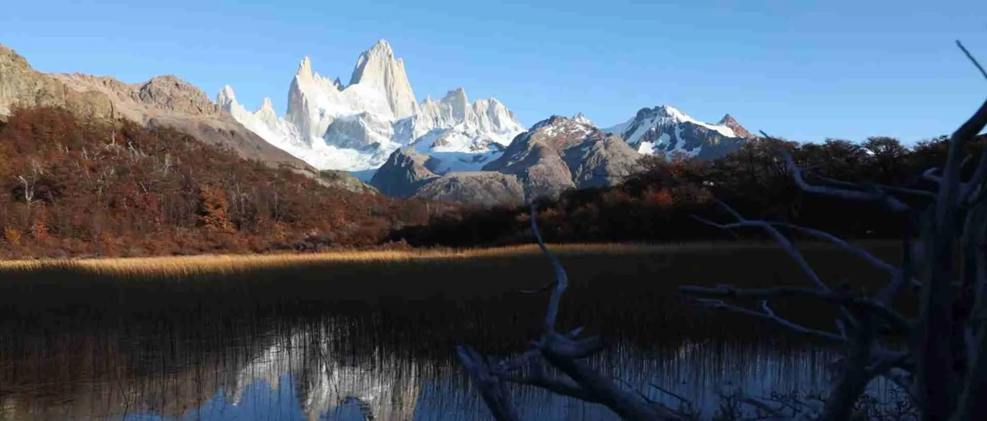
The hike to Laguna de los Tres ranks among South America’s most spectacular day treks, delivering hikers to the base of Mount Fitz Roy – a 3,405-meter granite spire that dominates Patagonia’s mountain landscape. This glacial lagoon sits in a dramatic cirque directly beneath Fitz Roy’s eastern face, offering the iconic view that appears on countless Patagonia photographs and travel posters. The trek has become El Chaltén’s signature hike, attracting thousands of hikers annually who make the pilgrimage to witness one of the world’s most beautiful mountains from its most impressive vantage point.
What makes Laguna de los Tres particularly special is the accessibility – this world-class mountain viewpoint requires no technical climbing skills, no expensive guides or porters, and no permit reservations. The trail is free, well-maintained, and starts directly from El Chaltén village (or nearby Hostería El Pilar). Any reasonably fit hiker with proper preparation can stand at Fitz Roy’s base and experience the mountain’s overwhelming presence towering above the turquoise glacial waters.
For 2026 hikers, this guide provides everything needed to successfully complete the Laguna de los Tres trek. We cover the complete route with kilometer-by-kilometer descriptions, seasonal timing strategies for optimal conditions, detailed cost breakdowns including all expenses, practical logistics from trailhead access to photography equipment, and comprehensive advice on the challenging final ascent that separates this hike from easier Patagonian trails. Whether this is your first mountain trek or you’re an experienced hiker adding another iconic trail to your resume, understanding what awaits on the path to Laguna de los Tres ensures a safe, successful, and memorable 2026 adventure.
People Also Ask About Laguna de los Tres 2026
How difficult is the Laguna de los Tres hike in 2026?
Laguna de los Tres is rated moderate to challenging, requiring good fitness for the 20-kilometer round trip with 800 meters total elevation gain. The first 9 kilometers to the base of the final ascent are moderate difficulty – steady but manageable climbing through forest and alpine terrain. The final kilometer to the lagoon is genuinely difficult, climbing 400 meters over loose scree and boulders at gradients reaching 40-50%. This brutal final push tests even experienced hikers, taking 45-60 minutes to complete. The full hike demands 8-10 hours including time at the lagoon, with most hikers rating this as one of Patagonia’s most physically demanding single-day treks due primarily to that punishing final ascent.
Do I need to book in advance for Laguna de los Tres in 2026?
No advance booking or permits are required for Laguna de los Tres. Los Glaciares National Park maintains free access to all trails without capacity limits or reservation systems. You must register at the Parque Nacional office in El Chaltén before your first hike – this free registration takes 5-10 minutes and provides essential safety information. The only advance planning needed is accommodation booking in El Chaltén and potential taxi reservation to Hostería El Pilar trailhead if you prefer starting from the higher access point (€25-35 for taxi, book 1 day ahead during peak season).
When is the best time to hike Laguna de los Tres in 2026?
The optimal hiking window runs November through March, with December-February offering the most stable weather and longest daylight (16-17 hours). Within each day, morning hours (6 AM – 11 AM) provide the highest probability of clear Fitz Roy views and calm winds. Afternoon conditions deteriorate with cloud buildup and increased wind speeds. For the best 2026 experience, plan your hike for summer months and start before sunrise – arriving at the lagoon by 7:30-8:30 AM guarantees optimal light, minimal crowds, and highest chance of unobstructed mountain views before the legendary afternoon clouds engulf the peaks.
What does the Laguna de los Tres hike cost in 2026?
Daily costs for Laguna de los Tres range €15-30 per person for a complete day. Trail access is completely free with no park entrance fees. Budget breakdown: packed lunch and trail snacks €8-15, water and energy drinks €3-5, optional gear rentals (trekking poles strongly recommended) €4-8. Check El Chaltén outdoor shops for current rental rates. Transportation to Hostería El Pilar trailhead (optional) adds €25-35 for taxi or €0 if you walk the approach. Most hikers complete this as a day hike from El Chaltén accommodation, returning to town for hot showers and celebratory dinners (€15-25) after the demanding trek.
Extended multi-day tours – 5+ days
Featured Park Los Glaciares National Park Multi-Day Tour Packages
3 days
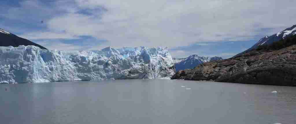
Park Los Glaciares National Park 3-Day Discovery Tour
- ✓ Comprehensive Park Los Glaciares National Park experience
- ✓ Expert local guides included
- ✓ All accommodation included
- ✓ Transportation provided
5 days
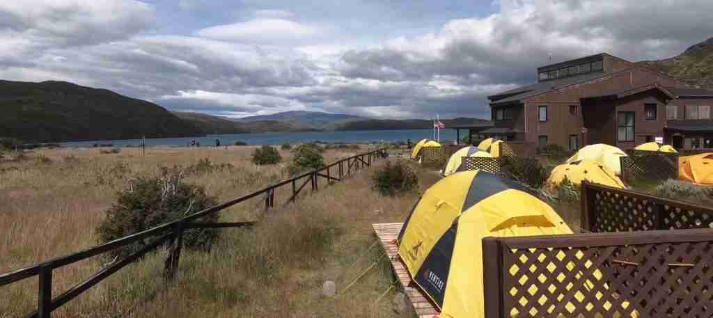
Park Los Glaciares National Park 5-Day Highlights Experience
- ✓ Comprehensive Park Los Glaciares National Park experience
- ✓ Expert local guides included
- ✓ All accommodation included
- ✓ Transportation provided

7 days
Park Los Glaciares National Park 7-Day Cultural Journey
- ✓ Comprehensive Park Los Glaciares National Park experience
- ✓ Expert local guides included
- ✓ All accommodation included
- ✓ Transportation provided
10 days
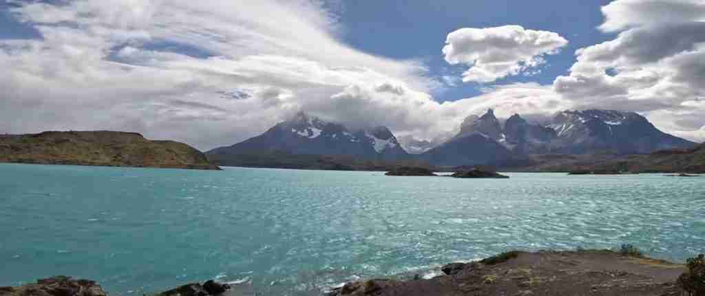
Park Los Glaciares National Park 10-Day Complete Adventure
- ✓ Comprehensive Park Los Glaciares National Park experience
- ✓ Expert local guides included
- ✓ All accommodation included
- ✓ Transportation provided
Multi-day tour packages powered by TourRadar. Prices and availability subject to change.
Complete Route Description for 2026
Trailhead Access and Starting Points
Laguna de los Tres has two primary access points serving different hiking strategies. The most popular start is Hostería El Pilar, located 17 kilometers north of El Chaltén at 450 meters elevation. This trailhead saves approximately 2 hours and 3.5 kilometers each way compared to starting from El Chaltén, making it the preferred choice for hikers prioritizing time at the lagoon over additional trail distance. Taxis from El Chaltén to Hostería El Pilar cost €25-35 and take 25-30 minutes on the dirt road – book through your accommodation the day before your hike.
The alternative approach begins at El Chaltén’s northern edge near the cemetery, following a scenic riverside path along the Río de las Vueltas. This adds 7 kilometers round trip to your total distance but provides beautiful forest walking and reduces the initial road section. Many hikers walk this approach on day one when energy levels are high, then take taxis back from Hostería El Pilar after completing the demanding ascent to the lagoon. The riverside trail is well-marked, mostly flat, and takes 1.5-2 hours each way at moderate pace.
A third option involves hiking the road from El Chaltén to Hostería El Pilar – this 17-kilometer dirt road has minimal traffic, steady views toward Fitz Roy, and climbs 150 meters gradually. The road walk takes approximately 3.5-4 hours at brisk pace, adding significant time to an already long day. Few hikers choose this approach as it trades scenic forest and river trails for exposed road walking, though it remains viable for those wanting maximum distance or unable to secure taxi services.
Kilometer 0-7: Hostería El Pilar to Laguna Capri
From Hostería El Pilar (assuming taxi access), the trail immediately enters mature lenga beech forest, following a well-constructed path that climbs gently for the first 3 kilometers. This section gains 150 meters elevation through dense forest where filtered light creates atmospheric conditions perfect for forest photography. The trail surface is excellent – maintained dirt path with minimal rocks or roots, allowing steady hiking rhythm as you warm up for the longer climbs ahead.
Río Blanco appears on your right around kilometer 2, its glacier-fed waters providing constant companionship through the forest. The milky turquoise color comes from glacial silt – fine rock particles ground by glacier movement and suspended in the water. Multiple viewpoints provide access to the river for photographs or water collection (treat before drinking). The river’s sound creates peaceful hiking ambiance, though the steep valley walls mean limited mountain views during this forested approach.
The trail breaks treeline around kilometer 5, transitioning into scattered forest with increasing open areas. Mount Fitz Roy becomes visible for the first time, its granite spires rising dramatically above the valley’s head. This section sees steady climbing – approximately 250 meters elevation gain over 2 kilometers as the trail switchbacks up the valley wall. The gradient is manageable at 10-15% average, though several steeper sections require brief efforts.
Laguna Capri appears at kilometer 7 (approximately 1.5-2 hours from Hostería El Pilar) – this beautiful glacial lake provides the first major viewpoint and rest opportunity. The lagoon sits at 650 meters elevation in an open basin with Mount Fitz Roy dominating the western skyline. This is the ideal location for your first extended break – refill water bottles (treat water from the lagoon’s inlet stream), eat energy bars, and photograph Fitz Roy reflected in the calm morning water. A small campground operates here with basic facilities (toilets, tent sites), though most Laguna de los Tres hikers continue onward.
Kilometer 7-9: Laguna Capri to Base of Final Ascent
Beyond Laguna Capri, the trail’s character shifts dramatically. The forest thins as you climb above 700 meters, with scattered lenga trees giving way to alpine shrubs and grasses. This 2-kilometer section climbs 300 meters to approximately 950 meters elevation, steepening noticeably compared to the earlier forest walking. The path winds through rocky outcrops and crosses occasional scree sections where careful footing prevents turned ankles.
Views open spectacularly as you gain elevation. Looking back (east) provides panoramas across the forested valley toward Lago Viedma and the Patagonian steppe stretching to the horizon. Forward (west) reveals Mount Fitz Roy growing more impressive with each switchback, the granite faces showing intricate details invisible from lower elevations. Satellite peaks of Poincenot, Saint-Exupéry, and Rafael Juárez frame Fitz Roy, creating a dramatic sierra of technical climbing objectives.
Campamento Poincenot appears at kilometer 9 (approximately 3-3.5 hours from Hostería El Pilar), sitting at 950 meters in scattered forest near Río Blanco. This free backcountry campground accommodates multi-day hikers completing the Fitz Roy-Torre circuit, with vault toilets, water access, and designated camping areas. For day hikers, Poincenot marks the last flat ground before the final ascent – take your last comfortable break here, adjust layers for the wind exposure ahead, and mentally prepare for the brutal final kilometer that separates you from the lagoon.
Kilometer 9-10: The Final Ascent to Laguna de los Tres
The final kilometer from Campamento Poincenot to Laguna de los Tres is legendary among Patagonian hikers as one of South America’s cruelest trail sections. This single kilometer climbs 400 meters – an average gradient of 40% with sections exceeding 50% on loose scree and boulder fields. What took 3 hours to climb 550 meters from Hostería El Pilar now takes 45-60 minutes to climb 400 meters over unstable terrain that provides minimal traction.
The ascent begins deceptively, climbing moderate switchbacks through the last scattered trees before breaking into completely open terrain. The trail surface transforms into loose volcanic scree – fist-sized rocks that slide underfoot with each step, forcing you to gain 1.5-2 meters for every meter of actual progress. Trekking poles become invaluable here, providing points of stability as your boots struggle for purchase on the shifting surface.
As you climb higher, the gradient steepens and the scree gives way to larger boulders requiring occasional hand use for balance. This isn’t technical scrambling requiring climbing skills, but it’s far more demanding than typical hiking trail where feet alone suffice. The route is obvious – hundreds of hikers daily create a beaten path through the boulder field – but the physical effort is relentless. Most hikers stop 4-8 times during this section, gasping for breath in the thin air while their quadriceps burn from the sustained vertical effort.
Weather conditions worsen dramatically during this final ascent. The mountain cirque creates a wind funnel effect, with sustained gusts of 60-80 km/h common even on calm days in the valley. Temperature drops 5-10°C compared to Campamento Poincenot, and the wind chill makes effective temperature feel another 5-10°C colder. Full windproof layers become essential – shell jacket, warm hat, and gloves prevent the hypothermia that can develop surprisingly quickly in exposed conditions.
The final 100 meters ease slightly as you top out on the moraine ridge above the lagoon. Suddenly, the grinding upward effort ends and Laguna de los Tres appears below – a brilliant turquoise pool cradled in the mountain cirque with Mount Fitz Roy rising 2,000 vertical meters directly above the far shore. The view is overwhelming, the scale difficult to comprehend, and the effort instantly forgiven. You’ve arrived at one of mountain photography’s most iconic viewpoints.
Laguna de los Tres – The Viewpoint
Laguna de los Tres sits at 1,350 meters elevation in a glacial cirque carved by the Río Blanco Glacier that clings to Fitz Roy’s eastern face. The lagoon itself spans approximately 400 meters east-west and 200 meters north-south, with milky turquoise water fed by glacial meltwater. Small icebergs occasionally float in the lagoon during warm weather when increased melting calves ice from the hanging glacier above.
The viewpoint area occupies the moraine crest east of the lagoon, providing space for 50-80 hikers though morning arrivals often find complete solitude. Multiple vantage points line the ridge – walk 100-200 meters in either direction from the main arrival point to find quieter photography spots and slightly different mountain compositions. The south side of the lagoon offers closer water access, though scrambling down to the shore requires careful navigation of loose rocks.
Photography opportunities are exceptional throughout the morning hours. Sunrise light (around 5:30-6:30 AM depending on month) catches Fitz Roy’s eastern face in brilliant orange alpenglow as the granite reflects the first direct sunlight. This display lasts 15-30 minutes before the light shifts to normal daylight tones. Morning light (7-10 AM) provides the clearest, most dramatic views with deep shadows emphasizing the mountain’s three-dimensional form. Afternoon light flattens perspective and by 1-3 PM clouds typically obscure the upper peaks completely.
Wind and weather at the lagoon can be extreme. Sustained winds of 80-100 km/h are routine, with gusts exceeding 120 km/h during storm systems. These winds create literal difficulty standing upright – brace yourself, keep your center of gravity low, and consider sitting rather than standing during photography sessions. Temperature at the lagoon averages 5-10°C on summer days, with wind chill pushing effective temperature to -5°C or lower. Even if El Chaltén was warm and calm at your dawn departure, expect freezing, windy conditions at the lagoon.
Most hikers spend 45-90 minutes at the lagoon depending on weather conditions and photography goals. In favorable conditions with clear peaks and moderate winds, extended stays allow photographing the changing light and exploring different vantage points. When clouds engulf the mountains or wind becomes dangerous, brief visits suffice – you’ve made the effort to reach this iconic spot, but survival and safe descent take priority over extended viewing time. Begin your descent by 10:30-11 AM to ensure plenty of daylight for the return journey.
Seasonal Planning and Timing Strategies for 2026
Best Months for Laguna de los Tres in 2026
The optimal hiking season for Laguna de los Tres runs November through March, with distinct characteristics across these months. November marks the season’s beginning – trails are accessible but lingering snow persists above 1,000 meters, requiring occasional use of microspikes or light crampons for safe travel on the final ascent. Temperatures run cool with daily highs of 10-15°C in the valley and frequent freezing conditions at the lagoon. The advantage is minimal crowds – you can have Laguna de los Tres nearly to yourself on weekday November mornings.
December through February constitutes peak season with the most stable weather patterns, longest daylight hours (16-17 hours), and minimal snow cover on the trail. December sees daily high temperatures of 15-20°C in El Chaltén, though the lagoon remains cold with morning temperatures near freezing. January and February are warmest with occasional valley temperatures reaching 25°C, though mountain temperatures stay cool. These months also bring the highest visitor numbers – expect 200-400 daily hikers during peak periods, with trail congestion on the final ascent where the narrow path forces single-file climbing.
March offers excellent shoulder season conditions – weather remains generally stable, trails are still fully accessible, and crowds thin significantly as the summer holiday season ends. Temperatures begin dropping with valley highs of 10-15°C and increasing probability of fresh snow above 1,200 meters. Early March (first two weeks) provides the sweet spot of decent weather without crowds, while late March sees transitioning conditions as autumn arrives.
April marks the season’s end with shortening days, increasing storm frequency, and growing snow accumulation at higher elevations. Some hikers still complete Laguna de los Tres in April, but the combination of uncertain weather, shorter daylight (12-13 hours), and snow-covered final ascent makes this month suitable only for experienced hikers comfortable with winter conditions.
Daily Timing and Dawn Start Strategies
Starting before sunrise is the single most important timing decision for Laguna de los Tres. The combination of optimal light, minimal crowds, and highest probability of clear peaks makes dawn departures vastly superior to mid-morning starts. Plan to leave El Chaltén or Hostería El Pilar 1.5-2 hours before sunrise, arriving at the lagoon as the first light illuminates Fitz Roy’s granite face.
Sunrise times vary significantly across the season. In November, sunrise occurs around 5:45-6:00 AM, requiring 4:00-4:30 AM departure from El Chaltén (or 5:00-5:30 AM from Hostería El Pilar). December and January see the earliest sunrise around 5:15-5:30 AM, while February and March push gradually later to 6:00-6:30 AM. These predawn starts are challenging – setting alarms for 3:30-4:30 AM tests your commitment – but the rewards justify the effort.
Hiking in darkness requires headlamp with fresh batteries plus spare. The trail to Laguna de los Tres is well-marked and heavily used, making navigation straightforward even in complete darkness. The forest section from Hostería El Pilar to Laguna Capri is particularly pleasant in predawn hours – the headlamp creates a tunnel of light through the ancient lenga forest while birdcalls announce the approaching day. Breaking treeline as dawn light begins illuminating the eastern sky provides one of hiking’s magical transitions.
The timing strategy delivers concrete benefits beyond atmospheric predawn hiking. Arriving at Laguna de los Tres by 7:30-8:30 AM means you’re photographing in perfect morning light while afternoon starters are still climbing through the forest. You’ll have the viewpoint to yourself or share it with 5-20 other dedicated early risers, rather than the 50-100 hikers who arrive during mid-morning hours. Most critically, morning hours provide 60-70% probability of clear Fitz Roy views compared to 20-30% probability during afternoon hours when orographic cloud formation obscures the peaks.
The descent from an early start means you’re heading down as most hikers are ascending, providing clear trails rather than congested single-file downclimbing on the steep final section. You’re back in El Chaltén by noon or 1 PM with the full afternoon for recovery, exploration, or celebratory dining rather than limping into town at 6-7 PM exhausted from a full-day effort.
Weather Windows and Forecast Interpretation for 2026
Patagonian weather forecasting has improved dramatically with modern technology, but surprises remain common. Check detailed mountain forecasts at mountain-forecast.com, which provides hour-by-hour predictions specifically for Mount Fitz Roy at multiple elevations. Compare these forecasts with general El Chaltén weather from standard services – often conditions at 1,400 meters differ substantially from valley predictions.
The critical forecast elements are wind speed, precipitation probability, and cloud cover. Wind speeds above 60 km/h make the final ascent unpleasant, while sustained winds exceeding 80 km/h create genuinely dangerous conditions where strong gusts can knock hikers off balance on steep terrain. Precipitation probability above 40% suggests you’ll likely encounter rain or snow during your hike. Cloud cover predictions help assess Fitz Roy visibility probability – forecasts showing 30-50% cloud cover often mean clear mornings with afternoon buildup, while 70%+ cloud cover suggests obscured peaks all day.
Multi-day visitors to El Chaltén should build flexibility into their schedules for weather windows. Monitor forecasts daily and be prepared to adjust your Laguna de los Tres attempt to the best available weather day. The difference between hiking in 30 km/h winds with scattered clouds versus 80 km/h winds with complete overcast is transformative – the former provides an outstanding experience while the latter delivers suffering with zero views.
Local knowledge supplements forecasts. Talk with park rangers at the Parque Nacional office, who conduct daily trail patrols and provide honest current condition reports. Chat with hikers returning from Laguna de los Tres – they can describe actual wind speeds, visibility, trail conditions, and whether the forecast matched reality. Hostel and hotel staff typically know weather patterns intimately and provide valuable timing advice for maximizing your summit probability.
Physical Difficulty and Training for 2026
Honest Difficulty Assessment
Laguna de los Tres pushes many hikers beyond their comfort zones, particularly during the final ascent. The 20-kilometer total distance isn’t extreme, but the 800-meter elevation gain concentrated heavily in the final 3 kilometers makes this significantly more challenging than flat trails or even steady mountain climbs. The combination of distance, elevation, unstable trail surface, and potential weather severity requires good fitness and mental determination.
Average completion times range 8-10 hours including 45-90 minutes at the lagoon. Fit hikers completing dawn starts finish in 7-8 hours, while less experienced hikers or those starting mid-morning often need 10-12 hours total. The uphill sections demand 4-5 hours from Hostería El Pilar to the lagoon, with the descent requiring 3-4 hours as the loose scree forces slow, careful downclimbing to prevent knee strain and falls.
The steepest sections test cardiovascular fitness and leg strength simultaneously. On the final ascent’s steepest pitches, you’re climbing at 40-50% gradient over unstable terrain, with your heart rate climbing to 150-170 beats per minute as you gasp for breath at 1,300+ meters elevation. This intensity is sustainable only in short bursts – most hikers take the final kilometer in 6-10 distinct efforts separated by 1-2 minute recovery stops.
Weather adds unpredictable difficulty multipliers. Hiking to Laguna de los Tres on a calm, clear day is challenging but straightforward for fit hikers. The same trail in 80 km/h winds, horizontal rain, and near-freezing temperatures becomes genuinely difficult regardless of fitness level. You’re fighting the wind for balance while cold and wet, with visibility potentially dropping to 50-100 meters if clouds engulf the upper mountain. These conditions transform a challenging day hike into a survival exercise.
Training Recommendations for 2026 Preparation
Begin training 8-12 weeks before your Laguna de los Tres hike with progressive workload building. Start with 2-3 hour hikes on moderate terrain (200-300 meter elevation gain), building to 6-8 hour efforts with 600-800 meter climbing by trip departure. The goal is developing both cardiovascular endurance for sustained effort and muscular endurance for repeated climbing and descending.
Hill and stair training specifically prepare your legs for the sustained steep climbing. Find local hills, stadium stairs, or office building staircases and complete 60-90 minute sessions climbing at moderate pace. This develops the quad and calf strength needed for steep ascents and the eccentric strength preventing knee pain during long descents. Aim for total vertical gain of 500-800 meters per training session to match the demands of Laguna de los Tres.
Weighted pack training builds specific strength for loaded hiking. Progress from light day pack (5-8 kilograms) to full hiking weight (10-15 kilograms) during training hikes. The additional weight stresses muscles and joints similarly to trail conditions, allowing your body to adapt before the actual challenge. Hiking with poles during training builds the upper body engagement and coordination needed for their effective use on loose terrain.
Don’t neglect descent training – the downhill from Laguna de los Tres causes more injuries than the ascent. Practice steep descents on loose trails or stairs to develop the controlled downclimbing technique that prevents face-plants and preserves knees. Eccentric quad strength (the muscle lengthening during descent) requires specific training as it’s not developed by normal walking or climbing.
Managing Common Physical Challenges
Knee pain during descent ranks as the most common complaint among Laguna de los Tres hikers. The steep downhill on loose scree forces high-impact loading with each step, stressing knee joints for 3-4 hours continuously. Trekking poles are essential – they transfer 20-30% of body weight to your arms, significantly reducing knee loading. Proper descent technique involves small steps, slightly bent knees, and avoiding long striding that increases impact forces.
Blisters develop when feet slide forward in boots during steep descents, creating friction hotspots on toes and heels. Prevention starts with properly fitted boots (toes should not touch boot fronts during descents) and good lacing technique that heel-locks your foot preventing forward slide. Apply preventive tape to known problem areas before the hike, and stop immediately at the first sensation of hot spots to apply blister bandages before actual blisters form.
Altitude effects are minimal given Laguna de los Tres’s moderate 1,350-meter elevation, but some hikers experience mild headaches or increased breathlessness during the final ascent. The rapid climb from 950 to 1,350 meters over just 1 kilometer doesn’t allow gradual acclimatization. Steady pacing rather than aggressive climbing helps, as does proper hydration – dehydration significantly worsens altitude symptoms. If headache develops, pain relievers (ibuprofen, aspirin) provide relief without impairing performance.
Energy management through proper fueling prevents the bonk – the sudden complete energy depletion that can happen during long hikes. Eat breakfast 1-2 hours before starting (oatmeal, bread with eggs, substantial fuel), then consume 200-300 calories per hour during the hike through energy bars, trail mix, chocolate, and dried fruit. Don’t wait until you’re hungry – by then you’re already depleted. The physical demands of Laguna de los Tres require 2,500-3,000 calories for the full day, with significant front-loading during the ascent when energy demands peak.
Costs and Budget Planning for 2026
Complete Cost Breakdown for Laguna de los Tres Day
Hiking Laguna de los Tres costs €15-30 per person for a complete day depending on choices around transportation, food, and gear rental. Trail access is completely free with no park entrance fees or permit costs – Los Glaciares National Park maintains free entry to all hiking trails as a core principle.
Transportation costs depend on your trailhead choice. Walking from El Chaltén to Hostería El Pilar costs €0 but adds 3.5 kilometers and 2 hours each way. Taxi to Hostería El Pilar costs €25-35, typically split among 2-4 hikers (€6-18 per person). Return taxis from Hostería El Pilar to El Chaltén after your hike cost the same amount. Most budget hikers walk one direction and take taxi the other – the most common pattern is hiking out and taking taxi back when exhausted from the climb.
Food and water expenses range €8-15 for a self-catered hiking day. Pack lunch from hostel breakfast or supermarket supplies (sandwiches, energy bars, chocolate, fruit, nuts) costs €6-10. Additional trail snacks and electrolyte drinks add €2-5. Some hikers splurge on prepared packed lunches from El Chaltén cafes (€8-12) if they prefer not bothering with food assembly at dawn. Water is available from Río Blanco along the trail – bring purification tablets or filter (€5-12 one-time purchase) or carry your full water requirement (2-3 liters, heavy but simple).
Gear rental costs €4-8 for items you might need. Trekking poles rent for €5 per day and are strongly recommended for the final ascent and particularly the descent. Rental backpacks (if you don’t have suitable daypack) cost €6-8. Waterproof layers rental is possible but not recommended – sizing issues and comfort concerns make bringing your own rain gear preferable. Most hikers arrive in El Chaltén with adequate gear needing only pole rentals.
Post-hike celebration expenses are variable but typical. After completing Laguna de los Tres, most hikers treat themselves to restaurant dinner (€15-25) rather than cooking at hostels. Add craft beer or bottle of wine (€6-12) and maybe ice cream or dessert (€4-8). These aren’t mandatory costs but are near-universal expenditures as hikers celebrate their achievement.
Sample Budget Day for Laguna de los Tres 2026
Budget Hiker Scenario: Walk to Hostería El Pilar €0, packed lunch from hostel breakfast €6-10, water purification tablets €0 (already owned), trekking pole rental €5, snacks and drinks €3-5, return taxi €8-12 (split with others). Simple dinner in El Chaltén €10-15. Total day cost: €32-47 per person (excluding accommodation).
Mid-Range Hiker Scenario: Taxi to Hostería El Pilar €8-12 per person (split), prepared packed lunch from café €8-12, bottled water €3-4, trekking pole rental €5, energy bars and trail snacks €6-8, return taxi €8-12 (split). Restaurant dinner with wine €20-30. Total day cost: €58-83 per person (excluding accommodation).
Comfort Hiker Scenario: Private taxi to/from Hostería El Pilar €25-35 per person (not shared), premium packed lunch €12-15, all food and drinks from convenience €8-12, any needed gear rentals €10-15, upscale restaurant celebration dinner €30-40, craft beers €8-12. Total day cost: €93-129 per person (excluding accommodation).
Accommodation in El Chaltén ranges €20-35 for hostel dormitory beds, €60-90 for private hostel rooms, and €120-180 for hotel doubles during the 2026 season. Check booking platforms for current rates. Most hikers plan 2-3 nights in El Chaltén allowing flexibility for weather, completing Laguna de los Tres on the best forecast day. Total trip cost for Laguna de los Tres plus El Chaltén accommodation runs €142-244 per person for a 3-day visit including two nights accommodation, the hike itself, and other meals.
Money-Saving Strategies for 2026
The biggest savings come from walking rather than taking taxis, though this requires good fitness and early starts. Walking from El Chaltén adds 7 kilometers and 2 hours round trip but saves €16-24 in taxi costs. For groups of 3-4, taxi costs per person become negligible (€6-9 each way) making this less impactful savings.
Self-catering all food from supermarkets rather than buying prepared lunches saves €5-10 per day. El Chaltén has excellent supermarkets with fresh bread, quality cheese and meats, energy bars, chocolate, and fresh fruit at reasonable prices. Assembling sandwiches and trail mix the night before your hike requires minimal time and substantially reduces costs compared to cafe-prepared options.
Bring your own gear from home rather than renting in El Chaltén. Quality trekking poles, proper rain gear, and suitable backpack are investments that serve multiple hiking trips. Rental costs add up – €5-10 per day over a week-long visit reaches €35-70, approaching the cost of purchasing budget gear. If you plan multiple Patagonian hikes, buying beats renting.
Timing visits during shoulder season (November, March) provides identical hiking experiences at 20-30% lower accommodation costs compared to peak season (December-February). Weather is slightly less predictable but trails are less crowded and your overall trip budget decreases noticeably. For the Laguna de los Tres hike specifically, shoulder season works excellently as this trail remains accessible and beautiful throughout the extended season.
Essential Gear and Equipment for 2026
Critical Clothing and Layering
Weather at Laguna de los Tres can be severe even when El Chaltén is calm and warm. Temperature at the lagoon runs 5-10°C colder than the village, with wind chill often pushing effective temperature to -5 to -10°C. Start your hike in lightweight layers suitable for forest walking, carrying all additional insulation needed for the lagoon’s brutal conditions.
Base layer should be moisture-wicking synthetic or merino wool top and bottom. You’ll sweat during the steep climbing, and cotton or inadequate synthetics leave you damp and cold during rest stops. Mid-layer fleece (200-weight) provides active insulation for cool sections while hiking, plus warmth during brief breaks. The critical layer is your insulated jacket – down or synthetic insulation rated for -5 to -10°C is mandatory for the lagoon. The wind and temperature there require proper mountain insulation even during summer.
Outer shell protection is absolutely essential. Waterproof-breathable rain jacket (rated 15,000mm+ waterproofing minimum) should be in your pack even if the forecast shows 0% rain probability – Patagonian weather changes within minutes, and afternoon storms develop with minimal warning. Waterproof pants protect against rain and dramatically increase warmth in windy conditions by blocking wind penetration through your base and mid-layers.
Extremity protection includes warm winter hat, neck gaiter or buff, and insulated gloves. The combination of wind and temperature at the lagoon makes hat and gloves non-negotiable – frostbite isn’t a concern, but painful cold fingers and ears that ruin photography and enjoyment are real possibilities. Sun protection is equally critical – sun hat or cap with neck protection, plus SPF 50+ sunscreen. The combination of altitude, latitude, and reflection from snow creates severe sunburn risk even on overcast days.
Footwear and Foot Care
Proper hiking boots with ankle support are essential for Laguna de los Tres. The final ascent and particularly the descent involve loose scree and unstable boulders where twisted ankles are common. Waterproofing is critical as trail sections can be muddy and stream crossings are unavoidable. Your boots must be well broken-in – attempting this hike in new boots leads to blisters that can end your trek prematurely.
Bring comprehensive blister prevention supplies. Tape known problem areas (heels, toes, ball of foot) before starting the hike – this simple prevention eliminates 90% of blister formation. Carry moleskin and blister bandages in your pack for emergency application at first signs of hot spots. Pack extra pair of hiking socks for changing mid-hike if your feet get wet or sweaty – dry socks dramatically reduce blister risk.
Gaiters provide valuable protection against water, mud, and small rocks entering boots. The trail crosses boggy sections and multiple stream areas where gaiters keep feet dry and comfortable. During early season (November) or late season (March) when snow persists on the final ascent, gaiters become essential equipment preventing snow from entering boot tops during the steep climbing.
Backpack Contents and Essentials
Trekking poles transform the Laguna de los Tres experience, particularly on the steep final ascent and especially during descent. Poles reduce knee loading by 20-30%, provide stability on loose scree, and help maintain rhythm during sustained climbing. Adjustable poles work better than fixed-length – shorten for ascents, lengthen for descents. If you don’t own poles, the €5 rental cost is the single best investment you can make for this hike.
Water carrying capacity should total 2-3 liters for the full day. The combination of exertion, altitude, and Patagonia’s drying wind increases fluid requirements above normal hiking needs. Río Blanco provides water refill opportunities at multiple points along the trail – bring purification tablets (€5-10 for trip supply) or water filter to safely treat river water. Alternatively, carry your complete water requirement though 3 liters weighs 3 kilograms affecting pack comfort.
Navigation tools include phone with downloaded offline maps (Maps.me, Gaia GPS work without cell signal), plus portable power bank to recharge phone given cold-weather battery drain. Physical trail map from El Chaltén outdoor shops or Parque Nacional office (€5-8) provides valuable backup and better overview understanding of the trail system. Compass is optional but prudent if you have experience using it.
First aid kit should include blister treatment (moleskin, blister bandages), pain relievers (ibuprofen or aspirin for headaches and inflammation), elastic bandage (for ankle/knee support if minor injury occurs), and any personal medications. Include sun screen (SPF 50+) and lip balm (SPF 30+) as critical preventive medicine against severe sunburn. Basic supplies weigh minimal but provide crucial capabilities if problems develop.
Food totaling 2,500-3,000 calories covers the full day’s demands. Pack substantial breakfast eaten 1-2 hours before starting, then bring trail lunch (sandwiches, energy bars, chocolate, nuts, dried fruit) totaling 1,500-2,000 calories. Additional emergency food (extra energy bars, chocolate) provides insurance if the hike takes longer than planned or you need to wait out weather at the lagoon longer than anticipated.
Photography Guide for Laguna de los Tres 2026
Optimal Shooting Times and Light Conditions
Sunrise provides Laguna de los Tres’s most dramatic light – the first rays hitting Fitz Roy’s eastern face create brilliant orange alpenglow that transforms the grey granite into warm tones lasting 15-30 minutes. Arriving at the lagoon 15-20 minutes before sunrise allows setting up compositions, checking exposure settings, and being ready when the show begins. Sunrise times vary by month: November around 5:45 AM, December-January 5:15-5:30 AM, February-March 5:45-6:15 AM.
Morning light (7-10 AM) after the alpenglow fades remains excellent for photography. Direct sunlight illuminates Fitz Roy’s eastern face while shadows emphasize the three-dimensional relief of the granite spires. This is the classic “postcard light” producing crisp, high-contrast images with deep blue skies and brilliantly lit peaks. Cloud formation begins around 10 AM most days, with increasing probability of obscured summits after 11 AM.
Midday and afternoon light (11 AM – 5 PM) is generally poor for Fitz Roy photography. The overhead sun flattens the mountain’s relief, clouds typically obscure the upper peaks completely, and the magic of morning conditions has vanished. Photographers who arrive at the lagoon after 11 AM frequently encounter completely cloud-covered mountains despite perfect weather forecasts – this is the orographic cloud formation that plagues Patagonian peaks during afternoon hours.
Evening light can be spectacular but is logistically challenging. Sunset alpenglow on Fitz Roy’s western face occurs well after typical hiking descent times, requiring overnight camping at Campamento Poincenot to access evening photography. Multi-day hikers completing the Fitz Roy-Torre circuit can time their stay at Poincenot for evening Laguna de los Tres photography, but day hikers sacrifice this opportunity in favor of completing their descent during daylight hours.
Camera Equipment and Settings
Lens selection should include wide-angle (16-35mm equivalent) for capturing the full mountain massif and lagoon together, plus telephoto zoom (70-200mm or 100-400mm) for isolating Fitz Roy’s granite spires. The lagoon sits approximately 2 kilometers from the mountain’s base – wide-angle shots alone make Fitz Roy seem disappointingly distant and small in the frame. Telephoto compression brings the peak forward, creating the dramatic impact matching your visual impression.
Tripod use at the lagoon is challenging due to sustained high winds but valuable for long exposures smoothing the lagoon’s surface and creating silky water effects. Lightweight carbon fiber tripods provide best portability for the steep carry, though even the most stable tripods struggle in 80 km/h wind gusts. Many photographers shoot handheld at higher ISOs (800-1600) rather than fighting tripod stability issues in extreme wind.
Camera settings for alpine photography require balancing the high dynamic range between bright snow/ice and dark granite. Shoot RAW format for maximum editing flexibility recovering highlights and shadows. Exposure compensation of -0.3 to -0.7 stops prevents blowing out highlights on the glacier and snow patches. Bracket exposures when in doubt – the scene’s contrast often exceeds camera sensor capability, making HDR processing or manual blending valuable.
Circular polarizing filter cuts glare from the lagoon surface and deepens blue sky intensity, though it reduces light by 1-2 stops requiring slower shutter speeds or higher ISO. Neutral density filters enable long exposures during bright conditions if you want silky water effects in the lagoon. Lens cleaning supplies are mandatory – wind-blown dust and moisture constantly attack front elements, requiring frequent cleaning for sharp images.
Composition and Creative Approaches
Classic compositions place the lagoon in the foreground with Fitz Roy dominating the background – this is the iconic Patagonia image appearing on countless book covers and posters. Use wide-angle lens (20-24mm) to include substantial lagoon foreground, positioning yourself 20-30 meters back from the water’s edge to balance lagoon and mountain in frame. Small icebergs, when present, make excellent foreground elements adding scale and interest.
Alternative perspectives come from exploring the ridge crest east and south of the main viewpoint. Walking 100-200 meters in either direction finds quieter vantage points with slightly different mountain compositions and varied foreground options. The south side approaches closer to the lagoon shore, allowing water-level compositions though scrambling down requires care on loose rocks.
Detail shots using telephoto lenses isolate Fitz Roy’s granite spires, the hanging glacier, and technical climbing routes visible on the vertical faces. These compressed images emphasize the mountain’s dramatic relief and create powerful graphic compositions. Include human figures on the moraine ridge for scale – showing tiny hikers against the massive mountain face conveys the overwhelming size invisible in pure landscape shots.
Changing conditions create diverse photography opportunities even during single visits. Morning clouds streaming past the summit add drama and motion to static mountain scenes. Storm systems rolling in make dramatic images with dark skies and wind-whipped lagoon water contrasting with the grey granite. Don’t assume clear skies are required for great photographs – Patagonian weather’s moody character often produces more compelling images than perfect blue-sky conditions.
Sample Laguna de los Tres Itinerary for 2026
Complete Day Timeline from El Chaltén
4:00 AM – Wake and Breakfast: Early alarm for dawn start. Quick breakfast at hostel or hotel – most accommodations serving hikers provide 4:30-5:00 AM breakfast service during season, or you can prep the night before for grab-and-go departure. Eat substantial meal (oatmeal, bread with eggs, fruit) providing 500-700 calories. Fill water bottles, final gear check, apply preventive blister tape.
4:45 AM – Depart El Chaltén: Walk to pre-arranged taxi pickup point. Taxi €8-12 per person (if sharing with 2-4 others) for 25-minute drive to Hostería El Pilar. Alternatively, walk from El Chaltén adding 1.5-2 hours but saving taxi cost. Wear lightweight layers suitable for forest walking, carrying warm layers for summit.
5:15 AM – Start Hiking from Hostería El Pilar: Begin trek in darkness using headlamp. First 3 kilometers through forest at steady pace, approximately 45-60 minutes. Río Blanco appears providing water and ambient sound. The rhythm of night hiking is peaceful – focus on footwork, breathing, and occasional glimpses of stars through forest canopy.
6:00 AM – Breaking Treeline: First light revealing Mount Fitz Roy silhouette ahead. Trail steepens as you climb through transitional zone. Temperature cool but comfortable while moving. Stop to remove or adjust layers if overheating from climbing effort. Drink water regularly – dehydration develops easily in cool conditions when you don’t feel thirst.
7:00 AM – Laguna Capri Arrival: First major viewpoint and rest opportunity. Refill water from inlet stream (treat before drinking), eat energy bar (200-300 calories), photograph Fitz Roy reflected in calm morning water. Brief 10-15 minute break then continue – the lagoon awaits and sunrise approaches.
7:30 AM – Climbing Above Laguna Capri: Steady climbing through thinning forest and alpine shrubs. Views opening continuously. Mount Fitz Roy growing more impressive with each switchback. Trail surface becoming rockier requiring attention to footing. Maintain steady pace – pushing too hard now depletes reserves needed for final ascent.
8:15 AM – Campamento Poincenot: Last flat ground before brutal final kilometer. Take proper break – eat substantial snack (300-400 calories), drink water, add warm layers anticipating lagoon winds, adjust pack for comfort. Many hikers leave extra layers here for pickup during descent if they’re camping overnight, though day hikers carry everything.
8:30 AM – Begin Final Ascent: The legendary final kilometer begins. Loose scree and boulders, relentless uphill, gasping for breath. Take your time – rushing risks exhaustion or falls on unstable terrain. Stop when needed for recovery, but keep rest breaks short (1-2 minutes) to maintain rhythm and body warmth. This section is miserable but temporary – focus on the reward ahead.
9:15-9:30 AM – Laguna de los Tres Arrival: Top out on moraine ridge with Laguna de los Tres appearing below and Fitz Roy towering above. The effort instantly forgotten, the view overwhelming. Add all warm layers immediately – wind and temperature shock compared to the climbing effort. Find good composition spot, set up camera, begin photographing.
9:30-11:00 AM – Summit Time: Photography, rest, snacks, simply experiencing the view. Eat substantial lunch (500-700 calories) while sheltering from wind. Explore different vantage points along ridge crest. If weather cooperates and views remain clear, stay longer. If clouds roll in or wind becomes dangerous, shorter visit is prudent. Prepare for descent by 11:00 AM to ensure daylight for return.
11:00 AM – Begin Descent: Reverse route back to Campamento Poincenot. The steep final section is punishing on knees – use trekking poles aggressively, take small steps, avoid long strides that increase impact. Descending loose scree requires concentration – taking 45-60 minutes for this kilometer is normal. Many hikers find descent worse than ascent given the sustained knee loading.
11:45 AM-12:00 PM – Campamento Poincenot: Brief rest stop, drink water, adjust clothing layers if you overheated during descent. The forest section ahead provides psychological relief after the exposed alpine terrain. Knees already tired from descent – pace yourself for the remaining 9 kilometers.
1:00 PM – Laguna Capri: Pass through heading down-valley. Many hikers take brief break here if they’re struggling with fatigue or knee pain. Final 7 kilometers to Hostería El Pilar are gentle downhill – comfortable hiking after the demands of the upper mountain.
2:30-3:00 PM – Hostería El Pilar Arrival: Return to trailhead. Call for taxi pickup (pre-arranged or call from hosteria phone) or begin walk back to El Chaltén if you have energy remaining. Most hikers opt for taxi after the demanding climb – knees and feet have had enough for one day.
3:30-4:00 PM – Return to El Chaltén: Check into accommodation, hot shower (feels amazing after 10+ hours hiking), recovery time. Elevate legs, rehydrate, assess blister damage if any developed. Begin planning evening activities.
7:00-8:00 PM – Celebration Dinner: Restaurant meal celebrating your achievement – Patagonian lamb, steak, trout, whatever sounds appealing after a long day burning 3,000+ calories. Bottle of Malbec shared between two hikers, craft beer, dessert. Share stories with other hikers at restaurant – comparing experiences is half the fun.
Daily Cost Summary: Taxi to Hostería El Pilar €8-12 (shared), packed breakfast and lunch €8-15, water and trail snacks €3-5, trekking pole rental €5, return taxi €8-12 (shared), celebration dinner €20-30. Total day cost: €52-79 per person (excluding accommodation).
Safety and Emergency Procedures for 2026
Weather-Related Hazards
Patagonian weather can deteriorate from perfect conditions to dangerous storms within 30-60 minutes. The primary hazards are high winds, sudden temperature drops, and rapid onset of rain or snow. Sustained winds exceeding 100 km/h can knock hikers off balance on exposed terrain, particularly during the final ascent’s steep sections. Always check forecasts before departing, but understand that actual mountain conditions often differ substantially from valley predictions.
Hypothermia risk exists even during summer if you get wet in windy conditions. The combination of wind chill and wet clothing can drop core temperature rapidly, leading to confusion, loss of coordination, and potentially life-threatening conditions. Prevention involves carrying proper layers (especially waterproofs), maintaining high caloric intake, staying well-hydrated, and recognizing early symptoms (uncontrolled shivering, confusion, slurred speech) that demand immediate descent and warming.
Lightning during afternoon storms creates genuine danger on the exposed final ascent and lagoon area. If you hear thunder or see lightning, descend immediately – you’re on the highest point for kilometers around, making you a prime lightning target. Don’t wait for rain or multiple lightning strikes. The first rumble of thunder means descend now, abandoning summit attempts regardless of how close you are to the lagoon.
Trail-Related Risks
The final ascent’s loose scree and boulder sections pose fall risks, particularly during descent when fatigue impairs judgment and coordination. Most falls result from rushing descent, taking oversized steps that lose traction on loose rocks, or simply tripping over unnoticed obstacles. Use trekking poles for stability, take small controlled steps, maintain concentration even when tired, and don’t let competitive thoughts about speed override safety.
Twisted ankles and knee injuries are common on steep descent sections. The combination of loose surface, tired legs, and sustained downhill strain stresses ankles and knees beyond their comfort zones. Proper footwear with ankle support prevents many ankle injuries, while trekking poles and good descent technique (small steps, bent knees, avoiding long strides) protects knees from excessive loading.
Getting lost on Laguna de los Tres trail is unlikely given the heavy traffic and excellent trail marking, but becomes possible in dense fog or during predawn darkness if you take wrong turn at unmarked junctions. Download offline maps before leaving WiFi coverage, bring headlamp with spare batteries for emergencies, and if genuinely lost, stay put rather than wandering randomly – ranger patrols and other hikers will find you.
Emergency Response Resources
Despite the remote character of Laguna de los Tres, rescue resources exist and respond efficiently to genuine emergencies. Park rangers conduct daily patrols during peak season and maintain radio contact with headquarters. Emergency number 911 works throughout Argentina, though cell coverage is limited on most trail sections. Parque Nacional direct contact is +54 2962 493004 for hiking emergencies.
Self-rescue capability is critical as weather can delay external rescue for hours or even days. Basic wilderness first aid knowledge allows treating common injuries – sprains, cuts, mild hypothermia – in field conditions. Carrying comprehensive first aid kit, emergency shelter (bivy sack or emergency blanket), fire-starting capability, and extra food provides resources for overnight survival if injury prevents safe descent.
Most “rescues” on this trail involve hikers with minor injuries who wisely chose to wait for assistance rather than attempting dangerous self-evacuation. If you or a hiking partner suffers injury preventing safe descent, move to sheltered location if possible, make yourself visible to passing hikers, send someone for help (rangers at Campamento Poincenot, hikers who can report to trailhead), and prepare for extended wait while rescue organizes.
Frequently Asked Questions About Laguna de los Tres 2026
Can I hike Laguna de los Tres without a guide?
Yes, Laguna de los Tres is perfectly suitable for independent hiking. The trail is well-marked with clear signage at all junctions, heavy traffic provides inherent safety (you’re rarely completely alone), and no technical skills are required. The main challenges are physical fitness for the distance and elevation, plus good judgment about weather and turnaround decisions. Register at Parque Nacional office before hiking, inform your accommodation of your plans, and carry proper gear including emergency supplies. Guided hikes offer value through naturalist interpretation and safety backup but aren’t necessary for hikers comfortable with mountain environments.
What if weather forecast looks bad for my only day?
Patagonian weather forecasts have limited reliability beyond 48 hours, and conditions can be better (or worse) than predicted. If you have only one day available and forecast looks marginal, consider hiking anyway with extremely conservative turnaround criteria. Many hikers successfully complete Laguna de los Tres in imperfect weather, accepting they might not see Fitz Roy’s summit but still experiencing the hike itself. However, if forecast shows sustained high winds (70+ km/h), heavy precipitation, or severe storms, attempting the trail becomes genuinely dangerous rather than just uncomfortable. In that scenario, consider alternative shorter hikes (Laguna Capri, Chorrillo del Salto) that still provide Patagonian experience without exposed high-altitude risks.
Is it worth it if I don’t see the mountain?
Laguna de los Tres with Fitz Roy obscured by clouds is still a worthwhile experience, though admittedly disappointing compared to clear views. The hike itself through ancient lenga forests, along glacier-fed rivers, and up to the alpine lagoon is beautiful regardless of peak visibility. The physical achievement of completing the trail and reaching the lagoon has inherent value. Many hikers who summited in fog return on subsequent trips for clear weather attempts, viewing the initial hike as valuable reconnaissance and fitness validation. However, if your Patagonia trip includes only one day for this hike, do everything possible to pick the best forecast day rather than committing to fixed schedule regardless of conditions.
Can beginners complete this hike?
Laguna de los Tres pushes many beginners beyond their comfort zones, but properly trained and prepared beginner hikers can succeed. The key factors are honest fitness assessment, appropriate training before arrival, realistic time allocation (10-12 hours for beginners versus 8-9 for experienced hikers), and conservative pacing that prioritizes completion over speed. Beginners should start from Hostería El Pilar rather than adding the El Chaltén approach, bring trekking poles (essential), pack extra food and water beyond minimum requirements, and have flexible schedule allowing for slower hiking. The final ascent is genuinely difficult regardless of experience level – mentally prepare for 45-60 minutes of steep, unrelenting climbing over unstable terrain.
How early should I start for dawn light?
Target arriving at Laguna de los Tres 15-20 minutes before sunrise for optimal photography and views. Sunrise times vary by month: November around 5:45 AM, December-January 5:15-5:30 AM, February-March 5:45-6:15 AM. From Hostería El Pilar to the lagoon takes 3.5-4.5 hours for most hikers, suggesting 4:45-5:15 AM departure for summer months. Add 1.5-2 hours if starting from El Chaltén. These predawn starts are challenging – 3:30-4:30 AM wake-up times test commitment – but the rewards of perfect light and empty viewpoint justify the sacrifice. Bring good headlamp with fresh batteries, dress in layers suitable for cool predawn temperatures, and allow extra time as hiking in darkness is slower than daylight travel.
What about solo female hikers?
Laguna de los Tres is very safe for solo female hikers. The trail sees heavy traffic during peak season providing inherent safety, park rangers patrol regularly, and the hiking community in El Chaltén is supportive and respectful. Standard mountain safety practices apply – register at Parque Nacional office, inform accommodation of your plans, start with other hikers (departing before dawn naturally creates small groups of dawn starters), and maintain conservative decision-making about weather and turnarounds. Many solo female travelers complete this hike without incident or concern. The physical challenges and weather risks are identical for all hikers regardless of gender – proper preparation and good judgment keep everyone safe.
Can I camp at Laguna de los Tres?
No camping is allowed at Laguna de los Tres itself – the fragile alpine environment and limited space make this prohibited. The nearest camping is Campamento Poincenot located 1 kilometer below the lagoon at 950 meters elevation. This free backcountry campground provides toilets, water access from Río Blanco, and designated tent sites. Camping at Poincenot allows dawn ascents to the lagoon (1 hour climb) for sunrise photography and provides base for multi-day circuits combining Fitz Roy and Torre valleys. Space at Poincenot is limited (60 tents maximum) – arrive before 4 PM during peak season to secure good sites. All equipment must be carried from trailhead as no porter or mule services exist.
What gear is absolutely essential versus optional?
Absolutely essential: proper hiking boots, waterproof jacket and pants, warm insulated jacket, warm hat and gloves, sun protection (hat, sunscreen SPF 50+, sunglasses), adequate water capacity (2-3 liters), substantial food (2,500+ calories for full day), first aid kit including blister treatment, headlamp with spare batteries, emergency shelter (lightweight bivy or emergency blanket). Strongly recommended: trekking poles (€5 rental dramatically improves experience), offline maps downloaded to phone, power bank for phone charging. Optional but valuable: camera with telephoto capability for mountain photography, gaiters for water/mud protection, GPS device if you have one, satellite emergency communicator for true emergencies.
Are there bathrooms along the trail?
Vault toilets exist only at Campamento Poincenot (kilometer 9) and the trailhead at Hostería El Pilar. No facilities exist along the 10-kilometer trail between these points or at Laguna de los Tres itself. Practice Leave No Trace principles for bathroom needs – move 60-70 meters from trails and water sources, dig cat hole 15-20 centimeters deep, bury solid waste completely, and pack out all toilet paper and hygiene products in sealed plastic bags. The cold, dry Patagonian climate means paper doesn’t decompose effectively, and the high visitor numbers make proper waste disposal critical for protecting water quality and maintaining trail environment.
What’s the best way to prevent altitude sickness?
Altitude sickness is minimal concern for Laguna de los Tres given the moderate 1,350-meter maximum elevation. Some hikers experience mild symptoms (headache, increased breathlessness) during the rapid final climb from 950 to 1,350 meters over just 1 kilometer. Prevention involves proper hydration (drink water regularly throughout the hike), steady pacing rather than aggressive climbing that stresses your cardiovascular system, and adequate caloric intake maintaining energy levels. If mild headache develops, over-the-counter pain relievers (ibuprofen, aspirin) provide relief without impairing performance. Severe altitude symptoms at this elevation are extremely rare – if you experience severe headache, nausea, or confusion, descend immediately as these suggest serious issues rather than simple altitude response.
Conclusion: Preparing for Your 2026 Laguna de los Tres Adventure
Laguna de los Tres delivers one of hiking’s most rewarding experiences – standing at the base of Mount Fitz Roy with that iconic view of granite spires above glacial waters justifies every minute of the brutal final ascent. The hike demands physical fitness, proper preparation, and respect for Patagonian weather’s power, but the memories from reaching this spectacular viewpoint last far longer than the temporary suffering required to get there.
Success comes from realistic planning and thorough preparation. Train for the distance and elevation gain, assemble proper gear with emphasis on weather protection, build flexible schedule allowing for optimal weather windows, and start before dawn for the best light and smallest crowds. The investment in preparation pays off when you’re watching sunrise light paint Fitz Roy orange while standing nearly alone at one of the world’s most photographed mountain viewpoints.
Don’t let the challenges discourage you – thousands of hikers successfully complete Laguna de los Tres annually, including many who’ve never attempted comparable mountain treks. With good fitness, proper gear, conservative decision-making, and determination to push through the difficult final kilometer, you can join the ranks of hikers who’ve experienced Fitz Roy’s overwhelming presence from Laguna de los Tres. Start planning your 2026 adventure now – Mount Fitz Roy is waiting.