Korouoma Canyon & Frozen Waterfalls: Day Trip from Rovaniemi
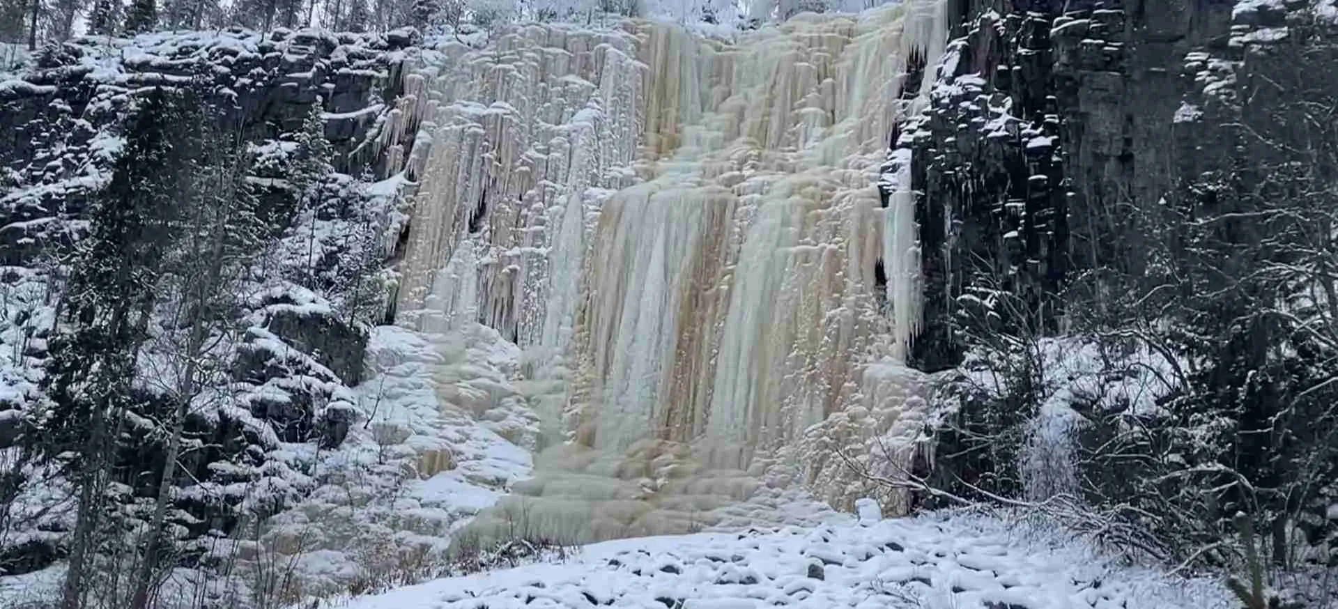
Korouoma Canyon ranks among Finnish Lapland’s most spectacular natural wonders, featuring dramatic rock formations rising 130 meters above a forested valley floor and frozen waterfalls that create ethereal ice sculptures during winter months. Located 150 kilometers northeast of Rovaniemi, this protected nature reserve offers accessible wilderness hiking combined with geological marvels that showcase the raw power of Arctic nature across millennia.
Key Takeaways
- Geological Wonder: Korouoma formed through fracture valley processes over 2 billion years, creating the deepest canyon system in Finland with vertical cliffs exposing ancient bedrock
- Frozen Waterfall Spectacle: Winter transforms 30+ waterfalls into massive ice formations reaching 40-50 meters height, creating world-class ice climbing venues and photographic subjects
- Accessible Wilderness: Well-maintained trails accommodate varying fitness levels, from easy 3km riverside walks to challenging 13km canyon rim circuits requiring 4-6 hours
- Day Trip Logistics: Round-trip distance from Rovaniemi (300km) makes organized tours practical, though independent visitors with vehicles can manage the journey with proper winter driving skills
- Seasonal Transformations: Each season reveals different character – winter ice sculptures, spring meltwater power, summer green canyon depths, autumn color displays against ancient rock
- Wildlife Habitat: Protected status preserves critical habitat for Arctic species including Siberian jay, three-toed woodpecker, wolverine, and brown bear (though winter visitors miss hibernating bears)
People Also Ask About Korouoma Canyon
What makes Korouoma Canyon’s frozen waterfalls unique compared to other Arctic waterfalls?
Korouoma’s frozen waterfalls achieve exceptional scale and quantity – the canyon contains over 30 distinct waterfalls, with several exceeding 40 meters in height when frozen. The geological structure creates optimal waterfall formation conditions: water seeping through fractures in the canyon walls freezes in stages throughout winter, building massive ice columns layer by layer. Unlike single dramatic waterfalls common elsewhere, Korouoma presents a collection of ice formations in concentrated space, creating amphitheater-like settings where multiple frozen falls surround visitors simultaneously. The ice quality here – dense, blue-tinted, and structurally sound – makes Korouoma one of Europe’s premier ice climbing destinations, attracting professional climbers who rate the formations among the continent’s finest. Additionally, the accessibility distinguishes Korouoma; while many Arctic waterfalls require extreme expeditions, Korouoma’s falls stand within 1-3 kilometers of parking areas via maintained trails.
How difficult is the hiking in Korouoma Canyon and do I need special equipment?
Korouoma offers trail options accommodating different abilities and experience levels. The easiest route – the lower canyon trail along Koronjoki River – remains relatively flat and covers approximately 3 kilometers one-way, suitable for moderately fit hikers with basic winter footwear. The rim trail circling the canyon top presents moderate difficulty, spanning roughly 13 kilometers with elevation changes totaling 200+ meters and requiring 4-6 hours for completion. Winter hiking demands proper equipment regardless of trail choice: insulated waterproof boots with good traction (microspikes or light crampons strongly recommended when icy), layered clothing for varying activity levels, waterproof outer layer, navigation tools (GPS device or smartphone with offline maps), headlamp (winter daylight hours are short), emergency shelter and fire-starting capability. Trekking poles significantly aid stability on uneven frozen terrain. While technical climbing equipment isn’t necessary for standard hiking, those planning to approach cliff bases or photograph frozen waterfalls from optimal angles benefit from ice traction devices and climbing helmets in areas where ice fall hazard exists.
When is the best time to see the frozen waterfalls at their most spectacular?
Peak frozen waterfall conditions typically occur from late January through early April, with February and March offering the most reliable spectacular formations. The freezing process builds gradually – early winter (November-December) shows initial ice formation but waterfalls haven’t achieved full frozen state. By late January, sustained cold temperatures have allowed ice columns to build their maximum mass, creating the dramatic 40-50 meter formations that define Korouoma’s winter character. February brings optimal conditions: waterfalls fully frozen but daylight returning sufficiently for photography (critical given winter’s limited light). March maintains excellent ice while offering substantially longer days and generally more stable weather. April sees ice deterioration as temperatures rise and spring meltwater begins flowing beneath and through ice formations, creating unstable conditions though still visually impressive. The melt transition period (late April-May) presents safety hazards as massive ice columns become structurally unsound and can collapse without warning. Visit timing also should consider daylight availability – December-January’s polar night conditions severely limit viewing time and photography opportunities despite excellent ice formation.
Can I visit Korouoma independently or do I need to join an organized tour from Rovaniemi?
Both independent and organized visits are viable, each offering distinct advantages. Independent travel requires personal vehicle (rental cars suitable if equipped for winter driving), winter driving competence on potentially icy roads, navigation capability, wilderness self-sufficiency, and proper equipment. The drive from Rovaniemi takes approximately 2 hours each direction via Route 5 north then Route 950 east, with final approach on maintained but potentially challenging forest roads. Independent visitors enjoy flexibility in timing, pace, and route selection but assume full responsibility for safety, navigation, and problem-solving in remote wilderness. Organized tours from Rovaniemi eliminate driving concerns, provide guide expertise, include necessary equipment, offer photography assistance, and typically incorporate cultural elements (traditional lunch, wilderness skills demonstrations) beyond pure hiking. Tours cost more than independent travel but deliver value through local knowledge, safety support, and enhanced educational context. The decision depends on personal priorities: adventurous, experienced winter travelers with appropriate skills and equipment often prefer independence; those seeking comprehensive experience without logistical complexity or winter wilderness expertise benefit from organized tours.
Extended multi-day tours – 5+ days
Featured Rovaniemi Multi-Day Tour Packages
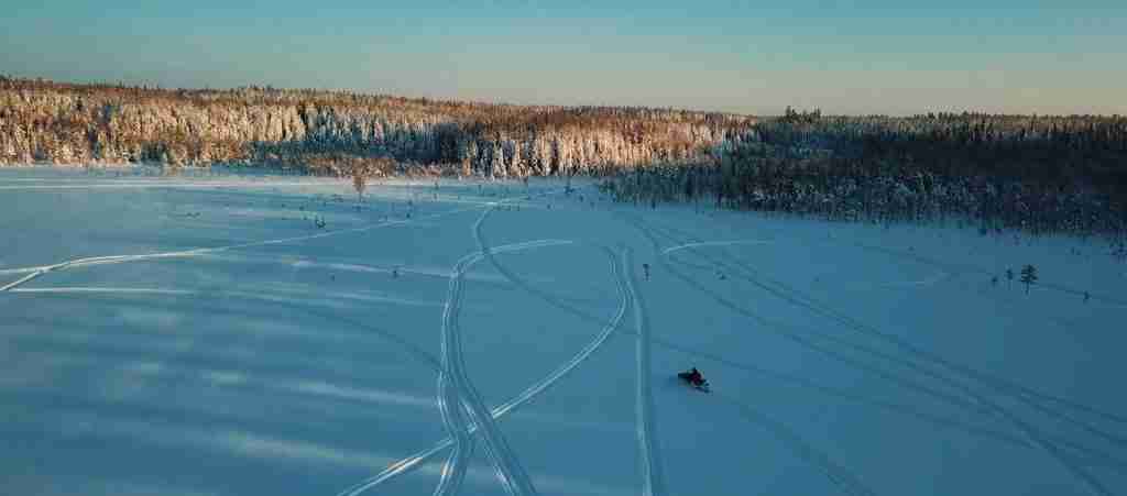
3 days
Rovaniemi 3-Day Discovery Tour
- ✓ Comprehensive Rovaniemi experience
- ✓ Expert local guides included
- ✓ All accommodation included
- ✓ Transportation provided
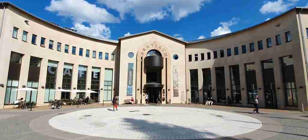
5 days
Rovaniemi 5-Day Highlights Experience
- ✓ Comprehensive Rovaniemi experience
- ✓ Expert local guides included
- ✓ All accommodation included
- ✓ Transportation provided
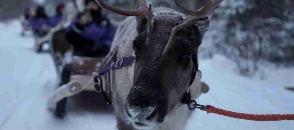
7 days
Rovaniemi 7-Day Cultural Journey
- ✓ Comprehensive Rovaniemi experience
- ✓ Expert local guides included
- ✓ All accommodation included
- ✓ Transportation provided
10 days
Rovaniemi 10-Day Complete Adventure
- ✓ Comprehensive Rovaniemi experience
- ✓ Expert local guides included
- ✓ All accommodation included
- ✓ Transportation provided
Multi-day tour packages powered by TourRadar. Prices and availability subject to change.
Introduction
Approximately 150 kilometers northeast of Rovaniemi, where ancient bedrock fractures have created one of Finland’s most dramatic landscapes, Korouoma Canyon slices through the boreal forest like a geological wound exposing Earth’s deep history. This fracture valley – formed through tectonic movements spanning billions of years – achieves depths of 130 meters while extending roughly 30 kilometers, creating an Arctic canyon system that rivals better-known formations in accessibility while maintaining raw wilderness character.
The canyon’s fame rests primarily on its winter transformation, when dozens of waterfalls emerging from canyon walls freeze into massive ice sculptures that attract international ice climbers and photographers. These frozen cascades – some exceeding 40 meters in height – build gradually through autumn and early winter as seeping groundwater freezes in successive layers, creating blue-tinted ice columns of remarkable strength and beauty. By midwinter, Korouoma presents what many consider Europe’s finest concentration of frozen waterfalls, a natural ice gallery accessible to determined hikers willing to venture into Lapland’s interior.
Yet Korouoma rewards visits beyond winter’s ice spectacle. Summer reveals the canyon’s true depth as you descend through multiple vegetation zones, from upland pine forest to rich valley-bottom riparian habitat where the Koronjoki River carves continuously through bedrock. Autumn transforms the landscape into a palette of reds, yellows, and browns as birch and aspen leaves turn while the first frosts dust the canyon rim. Spring showcases raw hydrological power as snowmelt swells the river and waterfalls thunder with seasonal runoff.
The canyon’s protected status as a nature reserve ensures its ecosystems remain largely pristine. Rare bird species including Siberian jay and three-toed woodpecker find refuge in old-growth forest patches. Large predators – wolverine, lynx, and brown bear – traverse the canyon system as part of their territories, though human visitors rarely encounter these secretive animals. The ecological value extends beyond individual species to encompass entire habitat complexes that have become increasingly rare in managed Scandinavian forests.
For visitors based in Rovaniemi, Korouoma represents an achievable day trip combining natural spectacle with authentic wilderness immersion. The journey itself provides interest, traversing landscapes that shift from Rovaniemi’s tourist infrastructure through increasingly remote forest country where reindeer outnumber people. Whether joining organized tours or venturing independently, the commitment to reach Korouoma separates casual sightseers from those seeking genuine engagement with Lapland’s wild heart.
Understanding Korouoma Canyon
Korouoma Canyon’s dramatic topography results from geological processes operating across incomprehensible timescales. Understanding this formation story – and the ongoing natural forces continuing to shape the landscape – enriches appreciation of what you’re experiencing during a visit.
Geological Formation and History
The bedrock exposed in Korouoma’s cliffs dates to approximately 2-2.5 billion years before present, representing some of Earth’s oldest rock formations. These ancient granites and gneisses formed during the Precambrian era through volcanic activity and metamorphic processes deep within the planet’s crust. Over subsequent eons, erosion removed overlying material, exposing these deep rocks at the surface.
The canyon itself formed much more recently – in geological terms – through fracture valley processes. Rather than water erosion creating the valley (as with many canyon systems), tectonic forces fractured the bedrock along weakness planes, creating parallel fissures. Subsequent erosion by water and ice preferentially removed material along these fractures, gradually deepening the valley between resistant rock walls. This differential erosion continues today, though at rates imperceptible over human timescales.
Glacial periods profoundly influenced Korouoma’s current form. During the last ice age (ending approximately 10,000 years ago), massive ice sheets covered Scandinavia to depths exceeding one kilometer. The tremendous weight and movement of glacial ice scoured the landscape, widening valleys, smoothing rock faces, and depositing erratic boulders that still litter the canyon floor. When the ice finally retreated, it left behind the U-shaped valley profile characteristic of glacially modified landscapes.
Canyon Dimensions and Structure
Korouoma Canyon extends approximately 30 kilometers from its upper reaches to where the Koronjoki River emerges into more open terrain. The most dramatic section – and the focus of most visitor attention – spans roughly 5 kilometers where vertical cliffs achieve maximum height and frozen waterfalls concentrate most densely.
Maximum canyon depth reaches 130 meters, measured from the highest rim points to the river valley floor. This depth isn’t uniform; the canyon floor rises and falls following the river gradient, while rim elevation varies based on local topography. The result is constantly changing perspective as you move through the canyon – areas of dramatic vertical exposure alternating with more gradual slopes where hiking descent becomes feasible.
Canyon width varies from approximately 100 meters at narrowest points to 500+ meters where the valley broadens. The narrowest sections create the most dramatic vertical perspectives, with walls rising nearly sheer on both sides. These constricted areas also tend to harbor the largest frozen waterfalls, as water seeping through cliff faces has less distance to fall before reaching valley floor.
Ecological Zones and Habitats
The canyon’s depth creates distinct ecological zones, each supporting different plant and animal communities based on microclimate, soil depth, and light availability. Understanding these zones helps identify optimal areas for specific wildlife viewing or botanical interest.
The canyon rim supports typical boreal forest dominated by Scots pine on drier sites and Norway spruce in moister locations. These exposed areas experience full wind force, limiting tree height and creating gnarled, weathered forms in the most exposed locations. Ground vegetation includes lingonberry, blueberry, and various lichen species adapted to acidic soils and short growing seasons.
Mid-slope environments show transitional characteristics. Reduced wind exposure allows taller trees, while increased moisture from seepage creates richer soil supporting broader plant diversity. Birch becomes more common, along with rowan and willow in protected niches. These mid-slope areas often harbor the richest bird diversity, providing nesting habitat for woodpeckers, owls, and various passerines.
The valley floor represents the richest ecosystem zone. Alders grow along the river, their root nodules fixing atmospheric nitrogen and enriching soil. The river itself supports aquatic insects, small fish, and provides watering locations for large mammals. Rich soil in protected locations supports herb layers rarely seen in exposed upland areas. This concentration of resources makes valley floors prime wildlife movement corridors.
Protection Status and Management
Korouoma achieved protected status as a nature reserve, ensuring long-term conservation of its ecological and geological values. Finnish nature reserve designation restricts development, prohibits commercial logging, limits motorized vehicle access to designated routes, and establishes protocols for recreation use that minimize environmental impact.
Despite protection, the reserve remains accessible to the public through established trail systems. This “outdoor recreation area” designation within the larger reserve balances conservation with traditional Finnish access rights (everyman’s rights) that guarantee public wilderness access. The management approach emphasizes minimal infrastructure – trails remain relatively primitive, facilities limited to basic necessities – preserving wilderness character while enabling safe visitation.
Conservation priorities focus on old-growth forest protection, maintaining habitat connectivity for wide-ranging species (particularly large carnivores), and preserving the canyon’s hydrological systems that drive waterfall formation. Ongoing monitoring tracks visitor numbers, assesses trail erosion, and documents wildlife populations to inform adaptive management adjustments.
The Frozen Waterfalls Phenomenon
Korouoma’s frozen waterfalls represent far more than simple aesthetic beauty – they’re complex physical phenomena resulting from specific geological, hydrological, and climatic conditions that occur in remarkable concentration within the canyon system.
Formation Process and Physics
Waterfall freezing follows predictable but variable patterns depending on water volume, temperature fluctuations, and environmental conditions. Understanding this process helps predict optimal viewing times and explains the dramatic variation in ice formation quality between seasons and individual waterfalls.
The process begins in autumn as temperatures drop below freezing. Initial ice forms along waterfall edges and at points where water flow rate decreases, typically at the base where falling water impacts accumulated ice. This marginal ice provides nucleation points for continued growth. As water continues flowing (most Korouoma waterfalls never freeze solid, maintaining liquid flow beneath and within ice formations), splashing droplets freeze upon contact with existing ice, gradually building outward and upward.
Layer-by-layer growth creates the characteristic blue coloration in mature ice formations. Each freezing layer traps minimal air, creating dense ice that absorbs red wavelengths of light while transmitting and reflecting blue. Thicker ice intensifies the blue coloration, with the deepest sections of established formations displaying almost sapphire tones under direct sunlight.
Not all waterfalls freeze equally. Water volume plays a critical role – low-volume seeps freeze solid, creating delicate ice curtains and icicle formations. High-volume falls maintain liquid cores throughout winter, with ice forming shell-like structures around flowing water. This flowing water beneath solid-appearing ice creates serious safety hazards for those who venture too close without proper training and equipment.
Major Frozen Waterfalls
Korouoma contains over 30 distinct waterfalls that freeze during winter, though several achieve particular prominence through their size, accessibility, or technical climbing significance.
Ruskeavirta represents one of the canyon’s largest formations, reaching approximately 40 meters in height when fully frozen. The waterfall forms along the canyon’s southern wall, where substantial water volume creates a massive free-hanging ice column visible from multiple viewpoints along both rim and valley trails. Ice climbers consider Ruskeavirta one of Europe’s classic winter climbs, with multiple route variations offering different technical challenges.
Mammuttiputoukset (Mammoth Falls) earns its name through sheer scale – a broad cascade that freezes into a curtain of ice spanning 30+ meters wide and 35 meters tall. The formation resembles a frozen wave, with multiple parallel ice flows creating complex three-dimensional structure. The broad face allows sunlight penetration that illuminates internal ice structure, creating translucent blue layers of extraordinary beauty.
Countless smaller waterfalls contribute to Korouoma’s winter character without achieving individual fame. Seepage falls – where groundwater emerges from cliff faces rather than flowing as defined streams – create delicate ice formations including hollow tubes where water freezes around flowing core, ice curtains hanging from rock overhangs, and frozen spray gardens where mist crystallizes on surrounding vegetation. These smaller formations often provide the most intimate and photogenic subjects, their scale allowing detail appreciation impossible with massive formations.
Ice Quality and Seasonal Variation
Ice formation quality varies substantially between years and throughout individual winters based on temperature patterns, precipitation, and water flow volumes. Understanding these variations helps set realistic expectations and plan optimal visit timing.
Cold, dry winters produce the best ice quality – consistent temperatures below -10°C allow gradual layer-by-layer growth creating dense, strong ice with minimal air inclusion. These formations achieve maximum size and structural integrity. Warm winters with frequent freeze-thaw cycles create inferior ice – repeated melting and refreezing introduces air pockets, creates weak layers, and produces white, opaque ice lacking the characteristic blue coloration.
Early winter (November-December) shows initial formation stages. Most waterfalls display partial freezing – ice accumulating at bases and edges while central flows remain liquid. Coloration tends toward white as rapid freezing traps air. The formations lack the mass and architectural complexity of mature ice.
Midwinter (January-February) typically presents optimal conditions. Sustained cold has allowed maximum ice accumulation. Flows have stabilized, creating consistent formation geometry. Blue coloration intensifies as ice density increases. This period offers the most reliable spectacular viewing, though short daylight hours (especially in January) limit photography opportunities.
Late winter (March-April) presents transition conditions. Ice formations remain massive and impressive, but degradation begins as increasing solar radiation and occasional warmer days initiate melting. Surface ice develops rough texture from differential melting. Internal structure weakens as meltwater penetrates through cracks. The formations remain visually stunning but safety margins decrease as structural stability declines.
Getting There from Rovaniemi
The journey from Rovaniemi to Korouoma covers approximately 150 kilometers, requiring careful planning regarding transportation, timing, and route selection. Understanding options and requirements helps ensure safe, efficient travel.
Driving Routes and Road Conditions
The most direct route follows Route 5 (E63) north from Rovaniemi for approximately 65 kilometers to Vikajärvi, then Route 950 east for 75 kilometers to Korouoma parking areas. Total driving time under good conditions runs 1.5-2 hours, though winter weather can extend this substantially.
Route 5 maintains high standards as a primary north-south connection – paved, regularly plowed, generally well-maintained throughout winter. This section typically presents minimal difficulty for winter drivers with appropriate vehicles and basic snow driving competence. Traffic remains moderate except during peak tourist season (Christmas-New Year, February school holidays) when buses and tourist vehicles increase substantially.
Route 950 represents more challenging driving. This east-west connection sees less traffic and receives lower maintenance priority. Snow clearing happens less frequently, allowing snow and ice accumulation that demands careful driving. The road features numerous hills, curves, and sections where falling snow or blowing ground snow create temporary whiteout conditions. Reduced traffic means help is less readily available if problems occur.
The final approach to Korouoma uses forest roads maintained for reserve access. These unpaved routes receive basic winter maintenance but expect rutted, potentially icy conditions. Clearance matters – compact cars may struggle with deep ruts created by larger vehicles. Four-wheel drive provides significant advantage, though careful driving in two-wheel drive vehicles remains feasible in most conditions.
Vehicle Requirements and Preparation
Winter driving in Lapland demands properly equipped vehicles and driver preparation. Finnish law requires winter tires (M+S designation minimum, dedicated winter tires strongly recommended) from December 1 through February 28, though practical need extends from November through April. Studded tires provide optimal performance on ice, though modern friction tires (non-studded winter tires) perform adequately in most conditions.
Rental vehicles should include: ice scraper and brush (essential for snow/ice removal), spare fuel (forest road sections lack services), emergency equipment (tow strap, shovel, jump cables), and warm blankets or sleeping bag (in case of breakdown in remote areas). Verify rental company policies regarding forest road use – some prohibit unpaved road travel, though enforcement varies.
Before departing Rovaniemi, check: fuel level (fill completely – final fuel before Korouoma is at Vikajärvi, 85km from canyon), weather forecast (road conditions website tieliikennekeskus.fi provides real-time updates), daylight availability (limited in midwinter), and communication capability (verify mobile coverage though expect limited service in remote sections).
Organized Tour Options
Multiple Rovaniemi operators offer Korouoma day trips, eliminating driving concerns while adding guide expertise and convenience. Tour structures vary but typically include: hotel pickup/return, transportation in vehicles equipped for winter conditions, guide services throughout the visit, basic hiking equipment if needed (snowshoes, trekking poles), and lunch (varying from packed lunches to traditional grilled meals).
Standard tours run approximately 8-10 hours total (6-7 hours excluding hotel transfers), allowing 3-4 hours at the canyon for hiking and photography. Guides select routes based on group capability, conditions, and participant interests. Most tours target the lower canyon trails and major frozen waterfalls, though some operators offer more demanding rim trail circuits for fit participants.
Tour advantages extend beyond eliminated driving: guides provide geological and ecological context, identify wildlife and track signs easily missed by independent visitors, handle navigation allowing full attention to landscape appreciation, manage timing to optimize daylight usage, and provide safety backup if problems occur. The social aspect appeals to solo travelers or those seeking shared experience.
Tour limitations include reduced flexibility (fixed schedules, predetermined routes, limited ability to extend time at particularly interesting locations) and increased cost compared to independent travel. The group pace may frustrate faster hikers or bore those preferring slower exploration. Tour selection requires balancing personal preferences against practical considerations.
Parking and Access Points
Korouoma provides designated parking areas serving different trail systems and access points. The main parking area, located near the nature reserve information board, accommodates approximately 20-30 vehicles and serves as the primary trailhead for lower canyon routes and the frozen waterfall area. This location provides the shortest access to major formations – approximately 1 kilometer to first significant frozen falls.
Alternative parking exists at the canyon’s western end, providing access to rim trails and less-visited sections. This area sees substantially less use, offering solitude for those willing to hike longer distances to reach major frozen waterfalls. The tradeoff involves increased hiking distance (2-3 kilometers to prime formations) against decreased crowding and enhanced wilderness atmosphere.
Parking facilities remain primitive – plowed areas without formal marking, no services (no restrooms, water, or shelters at parking areas), and limited snow storage creating space challenges during high-use periods. Arrive early during peak season (February-March weekends) to ensure parking availability. Overnight parking is prohibited unless specifically camping with required permits in designated locations.
Hiking Routes and Trail Options
Korouoma’s trail system offers multiple route options accommodating different abilities, interests, and available time. Understanding these routes helps match selection to personal capabilities and objectives while managing expectations about difficulty and time requirements.
Lower Canyon Trail
The lower canyon trail follows the Koronjoki River valley floor, providing the most direct access to frozen waterfalls with minimal elevation change. The route extends approximately 3 kilometers one-way from the main parking area to the canyon’s deepest section, requiring 1-1.5 hours hiking each direction at moderate pace.
Trail character remains relatively gentle – following the valley with gradual ascent toward canyon head. The path crosses the river via bridges in multiple locations, weaving between both banks to access optimal waterfall viewing positions. Trail width varies from well-defined single-track to broader sections where multiple use has created parallel paths.
Winter trail conditions depend on recent use and snowfall. Frequently traveled sections develop packed snow surface offering good traction. Fresh snow requires trail-breaking, substantially increasing effort and time. Microspikes or light crampons provide security on ice sections that develop where packed snow melts and refreezes, particularly near river crossings and beneath cliff overhangs where meltwater creates glazed surfaces.
The lower trail provides access to Korouoma’s most famous frozen waterfalls. Major formations appear at 1km (first significant falls), 2km (multiple medium formations), and 2.5-3km (the largest formations including Ruskeavirta). The concentrated waterfall density along this section makes it ideal for those prioritizing frozen fall viewing over extensive hiking.
Rim Trail Circuit
The rim trail circles the canyon’s upper edge, offering dramatic vertical perspectives and panoramic views while demanding substantially more physical effort than valley floor routes. The complete circuit spans approximately 13 kilometers, requiring 4-6 hours depending on pace, stops, and conditions.
The trail maintains relatively consistent elevation following the canyon rim, though numerous small valleys intersecting the main canyon require descents and ascents that accumulate to 200+ meters total elevation change. These interruptions prevent rhythm development, making the route more demanding than distance alone suggests.
Rim trail highlights include multiple canyon overlooks providing vertical perspectives impossible from valley floor, passage through varied forest types (exposed pine woods, protected spruce stands, mixed birch groves), and solitude – rim routes see substantially less traffic than valley trails. The overlooks allow photography of frozen waterfalls from above and across canyon, revealing their full scale and relationship to surrounding geography.
Winter rim hiking presents specific challenges: exposed sections face full wind force, dramatically increasing cold perception even at moderate temperatures. Snow depth can vary substantially – wind-scoured exposed areas may show bare ground while protected sections accumulate meter-deep drifts. Navigation demands more attention than valley trails – cairns mark the route but can disappear under snow, requiring map and compass or GPS capability for confident progress.
Combined Routes and Variations
Experienced hikers often combine rim and valley sections, creating loops that maximize diverse perspectives while managing distance and elevation. The most popular combination descends from rim to valley via natural break in cliffs approximately 2 kilometers along the rim trail, follows the valley floor to major frozen waterfalls, then ascends back to rim via another natural grade at canyon head.
This loop totals approximately 8-10 kilometers and requires 4-5 hours including photography and rest stops. The combination provides vertical perspectives from above, intimate encounters with frozen falls from valley, and the satisfaction of circular route completion without retracing steps.
Shorter variations exist for those with limited time or reduced capability: the “waterfall loop” accesses just the densest frozen fall concentration (5km, 2-3 hours), the “overlook circuit” follows rim to major viewpoints then returns (6km, 2-3 hours), or simple out-and-back valley floor walks targeting specific falls (distance and time variable based on objective selection).
Winter Navigation and Trail Finding
Winter conditions can obscure trails, making navigation more challenging than summer hiking. Snow cover hides trail tread, making route-finding dependent on marker recognition rather than following obvious path. Korouoma’s trails use painted markers on trees – colored rectangles or circles indicating route direction. These markers appear every 20-50 meters in forested sections, though placement intervals increase in open areas where longer sight lines make distant markers visible.
Marker color coding indicates different routes, though the system isn’t always consistent or clearly explained. Pay careful attention to marker patterns at trail junctions, noting color changes that signal route divergence. Photograph junction markers if uncertain, providing reference for return navigation.
Cairns (stacked rock piles) mark routes above treeline or in rocky areas where tree markers aren’t feasible. Winter snow can partially or completely bury cairns, making them less reliable than summer. If cairns become unclear, use compass bearings or GPS navigation rather than wandering in search of next marker – getting off-route in featureless terrain creates serious navigation problems.
Map and compass remain essential regardless of trail familiarity. Finnish topographic maps (1:25,000 or 1:50,000 scale) show terrain detail supporting position identification through terrain association. GPS devices or smartphone applications (ensure offline map capability – mobile coverage is unreliable) provide backup navigation, though battery performance degrades rapidly in cold temperatures.
Photography Opportunities
Korouoma offers extraordinary photographic potential combining dramatic geological features, unique ice formations, and Arctic light quality. Understanding optimal shooting locations, timing, and technical approaches maximizes photographic success while managing the practical challenges of winter conditions.
Frozen Waterfall Photography
Photographing frozen waterfalls demands balancing technical challenges including extreme brightness range, limited light in canyon depths, and cold-related equipment management. The most successful approaches address these factors through preparation and adaptive technique.
Light direction dramatically affects ice appearance and photographic quality. Direct sunlight creates extreme contrast – brilliant ice highlights against dark rock and forest, often exceeding camera dynamic range. Diffuse overcast light reduces contrast, rendering ice texture and blue coloration more evenly while eliminating blown highlights. Many photographers consider light overcast optimal for frozen waterfall photography despite sunny day’s appeal to direct observation.
Time of day matters significantly in winter months when sun angle remains low throughout available daylight. Midday (10 AM – 2 PM) provides maximum light penetration into canyon depths, crucial for illuminating formations on north-facing walls. Morning and afternoon create more dramatic lighting but often leave major formations in deep shadow. Plan shooting schedule around specific waterfall orientations – east-facing falls photograph best in morning light, west-facing in afternoon, south-facing near midday.
Composition benefits from including scale references – human figures, trees, or recognizable objects that convey ice formation size. Absent scale indicators, even 40-meter formations can appear modest in photographs. Position human subjects carefully, using them to direct viewer attention toward key features rather than dominating composition.
Technical settings for frozen waterfall photography: aperture f/8-f/11 for adequate depth of field (capturing both near ice detail and distant canyon walls), ISO 400-800 for reasonable shutter speeds in limited light, exposure compensation +1 to +1.5 stops to prevent snow and ice underexposure, RAW capture for maximum post-processing flexibility. Bracket exposures when facing extreme contrast situations, capturing detail in both highlights and shadows for potential HDR processing.
Canyon Landscapes and Vertical Perspectives
The canyon’s vertical topography creates dramatic photographic opportunities beyond individual frozen waterfalls. Rim overlooks provide sweeping perspectives revealing canyon scale and character, while valley floor positions allow looking up at towering cliff faces.
From rim positions, emphasize vertical depth through composition including foreground elements (trees, rocks, snow features) that establish near distance, middle ground showing canyon walls and valley, and background revealing distant landscape beyond canyon. This layering creates three-dimensional sense that single-plane compositions lack. Vertical format often works better than horizontal for canyon depths, allowing full height representation from rim to valley floor.
Wide-angle lenses (16-35mm equivalent) suit canyon photography, capturing breadth and drama while allowing foreground inclusion even from constrained positions. Ultra-wide angles (14mm or wider) can create powerful images but risk distortion that diminishes rather than enhances impact. Moderate wide angles (24-35mm) often provide optimal balance between dramatic perspective and natural rendering.
Winter atmospheric conditions – snow, ice fog, or blowing snow – can transform canyon landscapes through diffused light and obscured distances creating layered depth. These conditions often produce more compelling images than clear days despite reducing visibility and complicating exposure.
Arctic Light and Seasonal Conditions
Lapland’s extreme latitude creates unique light quality that varies dramatically through seasons and even within single days during transitional periods. Understanding and utilizing these characteristics separates adequate images from exceptional ones.
December-January’s polar night period (sun barely rising above horizon) creates extended twilight conditions – soft, directional light lasting 3-4 hours around midday. This light quality flatters canyon features, minimizing harsh shadows while providing gentle modeling. The blue-hour quality persists much longer than temperate latitudes, allowing extended shooting periods in atmospheric conditions that last mere minutes elsewhere.
February-March sees rapidly increasing daylight combined with sun angles still creating dramatic long shadows and warm light coloration. Golden hour extends substantially – the period of warm, low-angle light lasts 1-2 hours rather than the 20-30 minutes typical at lower latitudes. Plan shooting around this extended golden hour, positioning at key locations 30-45 minutes before optimal light arrival.
Overcast conditions, while disappointing for many photographers, actually provide excellent canyon photography opportunities. The diffused light eliminates extreme contrast, allows detail capture throughout tonal range, and emphasizes ice blue coloration that direct sun can wash out. Some of Korouoma’s most atmospheric images were captured under overcast skies that might have seemed photographically unpromising.
Equipment Management in Extreme Cold
Successful winter photography in Korouoma requires managing equipment challenges created by temperatures that can reach -30°C or colder with wind chill. Preparation and technique prevent technical problems while maintaining image quality.
Battery performance degrades dramatically in cold – expect 50-75% reduced battery life compared to room temperature operation. Carry multiple spare batteries kept warm inside jacket inner pockets, rotating fresh batteries into camera as working battery depletes. Some photographers use chemical hand warmers taped to camera bodies (avoiding blocking controls) to maintain moderate operating temperature.
Condensation threatens equipment when transitioning from cold exterior to warm interior. Water vapor immediately condenses on and inside cold cameras brought into heated spaces. Prevention requires slow temperature transition – seal camera in plastic bag while still cold, allow gradual temperature equalization over 30-60 minutes before removing from bag. This discipline proves essential for preventing internal condensation that can damage electronics and optics.
Lens fogging occurs when warm breath contacts cold lens surfaces. Avoid breathing toward camera, use viewfinder rather than rear screen when possible (reducing face proximity to lens), and consider lens hoods or clear filters that can be wiped without touching primary lens element.
Tripod stability on snow and ice demands attention. Standard rubber feet often slip on ice; replace with spiked feet or fabricate snow baskets (large plastic or foam discs preventing tripod legs from sinking into soft snow). When deploying on snow, compress snow around each leg, giving time for compression to stabilize before mounting camera. Slight leg sink and shift during exposure creates noticeable blur in otherwise sharp images.
What to Bring and Wear
Proper preparation through appropriate equipment and clothing makes the difference between enjoyable Korouoma experience and potential safety-compromising cold exposure or equipment failure. Understanding essential items and effective layering strategies ensures comfortable, safe visits.
Essential Clothing Layers
Effective winter clothing relies on layering system allowing adjustment for varying activity levels and conditions. The standard three-layer approach (base, insulation, shell) provides framework for Korouoma conditions.
Base layer provides moisture management and initial insulation. Merino wool or synthetic technical fabrics work well; avoid cotton which retains moisture and loses insulating value when damp. Weight selection depends on activity level and temperature – lightweight for active hiking in moderate cold (-10°C to 0°C), midweight for moderate activity in severe cold (-20°C to -10°C), heavyweight for minimal activity or extreme cold (below -20°C). Consider bringing spare base layer for changing mid-day if original becomes damp from perspiration.
Insulation layer provides primary warmth. Fleece offers good warmth-to-weight ratio, breathability, and moisture tolerance. Down provides maximum warmth for minimal weight but loses effectiveness when wet – viable for Korouoma’s typically dry cold. Synthetic insulated jackets compromise between fleece breathability and down warmth. Pants often need less insulation than torso – lightweight fleece or softshell pants suit most conditions, with insulated pants reserved for extreme cold or minimal activity.
Shell layer blocks wind and precipitation while allowing moisture vapor escape. Waterproof-breathable fabrics (Gore-Tex or equivalents) provide optimal performance though hard-shell rigidity can compromise comfort. Softshell materials offer good wind resistance with better breathability and comfort, sacrificing only waterproofness (rarely needed in Korouoma’s dry winter climate). Ensure shell jacket accommodates insulation layers beneath without restricting movement.
Extremity Protection
Hands, feet, and head lose heat disproportionately and require particular attention in Arctic conditions. Inadequate extremity protection causes discomfort that compromises entire experience regardless of core warmth.
Footwear demands waterproof insulated boots rated to expected temperatures. Pac boots (removable felt liners within waterproof shell) provide excellent performance in extreme cold. Quality winter hiking boots with insulation ratings to -20°C or -30°C suit most Korouoma conditions. Fit must accommodate thick socks without compression (which reduces insulation). Consider one size larger than normal summer hiking boots to allow sock layering. Gaiters prevent snow entry at boot-pant interface, maintaining foot dryness.
Sock layering increases warmth and blister protection. Thin liner sock (synthetic or merino) manages moisture and reduces friction. Thick outer sock (wool or wool blend) provides insulation and cushioning. Avoid too many sock layers which compress feet reducing circulation and warmth – two layers maximum for most people. Bring spare socks for changing if originals become damp.
Hand protection requires balancing warmth against dexterity for camera operation, navigation, and gear management. The liner-plus-mitten system works well – thin glove liners maintain basic dexterity for detailed tasks, heavy mittens over liners provide maximum warmth during hiking. Some photographers use photographer’s mitts (mittens with fold-back finger sections) allowing brief dexterity while maintaining hand warmth. Chemical hand warmers supplement insulation in extreme cold.
Head covering prevents heat loss from highly vascular scalp. Wool or synthetic beanie suits moderate conditions. Balaclava or face mask becomes necessary in severe cold or wind, protecting facial skin from frostbite while warming inhaled air. Neck gaiter provides versatile protection – worn around neck in moderate conditions, pulled up over face when needed.
Navigation and Safety Equipment
Beyond clothing, specific equipment ensures safe navigation and emergency preparedness during Korouoma visits. While trails are generally well-marked, winter conditions and relative remoteness make self-sufficiency essential.
Navigation tools include topographic map (1:25,000 or 1:50,000 scale showing trail detail), compass (adjusted for local magnetic variation), and GPS device or smartphone with offline maps. Know how to use each – GPS failures happen through battery depletion, damage, or technical failure. Paper map and compass provide backup requiring no batteries or electronics.
Emergency communication capability remains important despite unreliable mobile coverage. Carry fully charged phone in inner pocket (maintaining battery warmth), though expect limited or no signal in canyon depths. Satellite communicators (Garmin InReach or similar) provide reliable emergency contact regardless of cell coverage, though rental options remain limited in Rovaniemi.
First aid kit should include: blister treatment (moleskin or similar), basic wound care (bandages, antiseptic), pain relievers, any personal medications, emergency thermal blanket, and fire-starting materials. Winter-specific additions include hand/foot warmers and knowledge of cold injury recognition and treatment.
Survival equipment for winter wilderness includes: headlamp with spare batteries (daylight hours are limited), emergency fire-starting materials (waterproof matches, lighter, fire steel), emergency shelter (lightweight tarp or bivy), and high-energy food beyond planned snacks (providing caloric buffer if trip extends longer than planned).
Photography-Specific Items
Photographers face additional equipment needs beyond standard hiking gear, including items that increase photographic success while managing cold-related challenges.
Camera-specific items: multiple spare batteries (kept warm), lens cleaning materials (including anti-fog wipes), hand warmers (for camera warming and personal comfort during stationary shooting), plastic bags (for condensation prevention when returning to warmth), and battery insulation wraps (commercial products or improvised foam wrapping).
Tripod selection matters – carbon fiber legs don’t conduct cold to hands like aluminum (though cost substantially more), and rubber leg covers improve handling comfort. Ensure tripod accommodates thick gloves during deployment and adjustment. Practice all camera and tripod operations while wearing gloves before field use.
Protective gear includes: camera body wrap or case providing cold insulation, rain cover (protecting against occasional snow), and lens hoods (reducing flare and protecting front element). Some photographers bring chemical warmers specifically for camera warming, though placement requires care to avoid blocking controls or creating uneven heating.
Best Seasons for Visiting
Korouoma reveals different character through seasonal transformations, each period offering distinct advantages and presenting specific challenges. Understanding these variations helps align visit timing with personal interests and tolerance for conditions.
Winter: Frozen Waterfall Spectacle
Winter (November through April) attracts the most visitors, drawn by frozen waterfall formations and dramatic ice landscapes. The season subdivides into distinct periods with varying characteristics.
Early winter (November-December) shows initial ice formation and short daylight hours. Waterfalls begin freezing but haven’t achieved full development. Polar night conditions (sun barely rising) create extended twilight and challenging photography conditions. Benefits include minimal crowds and pristine snow cover unmarred by tracked trails. Challenges involve incomplete ice formations, very short days, and variable temperatures that can create unstable ice and unpredictable conditions.
Midwinter (January-February) offers peak frozen waterfall viewing. Sustained cold has built ice formations to maximum size and stability. The ice achieves characteristic deep blue coloration. Challenges include shortest daylight period (especially January), extreme cold (temperatures regularly below -20°C), and often-difficult winter driving conditions. February balances excellent ice with improving daylight and weather.
Late winter (March-April) presents transitional conditions. Ice formations remain impressive though degradation begins. Dramatically lengthening days improve photography opportunities and hiking convenience. Weather tends more stable than earlier winter. Spring bird migration begins in late March. Challenges include decreasing ice stability as temperatures warm, potentially slushy snow conditions, and spring thaw beginning in April making some areas impassable.
Summer: Green Canyon Depths
Summer transformation (June-August) reveals Korouoma’s vegetated character and flowing water power absent during frozen months. The canyon fills with greenery as birch and understory vegetation leafs out. Waterfalls thunder with snowmelt in June, gradually decreasing through summer but maintaining impressive flow.
Advantages include: midnight sun period (no darkness, unlimited photography hours), warmest temperatures (comfortable hiking), full vegetation display showing ecosystem richness, flowing waterfalls revealing formations obscured by winter ice, and excellent wildlife viewing as birds nest and raise young. The river becomes navigable for experienced kayakers, offering water-based canyon perspectives impossible in other seasons.
Summer challenges: peak mosquito and biting insect season (June especially brutal, requiring head nets and repellent), crowded trails (summer sees highest visitor numbers), and loss of the dramatic ice formations that define winter character. Some photographers find summer landscapes less distinctive – the green canyon resembles many boreal valley systems rather than presenting unique character.
Autumn: Color Transformation
Autumn (September-October) provides arguably the most photogenic period despite relatively brief duration. The birch and aspen transform to brilliant yellows contrasting against evergreen pines and dark rock faces. The transformation lasts 2-3 weeks at peak, typically mid-September, though timing varies by weather patterns.
Photography benefits from color intensity, lower sun angles creating dramatic lighting, and fewer visitors than summer peak. Weather often stabilizes in early autumn after summer’s variable conditions. The first snows can appear on canyon rim by late September, creating dramatic combinations of autumn color, fresh snow, and dark cliffs.
Autumn challenges include short season (miss peak color by a week and intensity fades substantially), unpredictable timing (warm autumns delay color, early cold advances it), and transition period difficulties (too late for summer hiking conditions, too early for stable winter travel). Day length decreases rapidly – by late October, daylight hours approach winter’s limited windows.
Seasonal Wildlife Patterns
Wildlife viewing success correlates strongly with seasonal patterns. Summer provides maximum diversity as migratory birds return to breed. Siberian jays, three-toed woodpeckers, various warblers, and raptors actively nest and raise young. Dawn and dusk (though twilight lasts all night in midsummer) offer best observation opportunities.
Autumn migration (August-September) concentrates birds moving south, creating brief periods of high activity. Large mammal observation improves as moose enter rut and bears intensify feeding before hibernation.
Winter reduces visible wildlife substantially. Bears hibernate, migratory birds have departed, and remaining species maintain low profiles in extreme conditions. However, tracking becomes dramatically easier – fresh snow reveals animal movements through clear print evidence. Patient observers can identify passages of hares, foxes, martens, and occasionally lynx or wolverine through track analysis.
Spring transition (April-May) brings returning migrants and emerging bears, though deep snow often persists making access challenging. The canyon’s south-facing slopes melt earlier than surrounding terrain, potentially creating wildlife concentration areas as animals seek bare ground and emerging vegetation.
Safety Considerations
Korouoma’s combination of extreme weather potential, vertical topography, remote location, and natural hazards requires serious safety attention. Understanding risks and maintaining appropriate margins prevents accidents while enabling confident wilderness enjoyment.
Cold Injury Prevention and Recognition
Hypothermia and frostbite represent the primary cold-related threats in Korouoma’s winter environment. Recognition and prevention prove far more effective than treatment, which requires warm shelter and often medical intervention.
Hypothermia progresses through stages: mild (shivering, reduced coordination), moderate (violent shivering or shivering cessation, confusion, lethargy), severe (unconsciousness, apparent death). Prevention requires maintaining energy through adequate food intake (high-calorie snacks every 1-2 hours), staying dry (managing perspiration through layering adjustments), and avoiding exhaustion. If someone shows hypothermia symptoms: stop immediately, add insulation, provide warm drinks if conscious, and initiate fire or shelter warming. Severe hypothermia demands immediate evacuation and medical care.
Frostbite affects extremities – fingers, toes, nose, ears, cheeks. Early warning signs include numbness, tingling, and white or grayish skin color. Prevention through proper clothing and awareness exceeds treatment effectiveness. If frostbite suspected: warm affected area gradually (never rub or apply direct heat), protect from refreezing (which causes severe additional damage), and seek medical evaluation. Deep frostbite requires professional medical treatment – field rewarming of severely frostbitten tissue should only occur if evacuation to medical care within hours is certain and refreezing during evacuation won’t occur.
Ice and Waterfall Hazards
Frozen waterfalls and surrounding ice create specific hazards beyond standard cold exposure risks. Understanding these dangers prevents potentially fatal accidents.
Ice fall represents serious threat near frozen waterfalls, especially during temperature transitions. Ice chunks ranging from fist-sized to massive blocks can detach without warning, falling with lethal force. Safe observation requires maintaining distance from waterfall bases – minimum 10 meters for small falls, 20+ meters for large formations. Watch for warning signs including creaking sounds, small ice chunks falling, or visible cracks developing in ice structure.
Hidden water flows beneath apparently solid ice create breakthrough hazards. Many frozen waterfalls maintain liquid cores despite solid-appearing surfaces. Never walk on frozen waterfalls or approach bases where hollow ice might cover flowing water. Ice climbers use specialized techniques and equipment for safe approach – hikers and photographers should view from maintained distances.
Cliff edges present obvious fall hazards exacerbated by snow and ice reducing traction. Rim trail overlooks require careful approach, ideally identifying cliff edges before snow obscures visual warning of drop-offs. Snow cornices (overhanging snow accumulations extending beyond cliff edges) can collapse under weight with no warning. When approaching overlooks, probe ahead with trekking poles and avoid areas where snow surface feels hollow or appears lighter (indicating undercut areas).
Navigation and Communication
Getting lost in winter wilderness creates serious problems – darkness falls quickly, temperatures plunge, and rescue responds slowly from remote locations. Prevention through competent navigation far exceeds recovery from navigation errors.
Trail following requires constant attention in winter. Snow obscures tread, markers can be difficult to locate, and whiteout conditions eliminate visual navigation. Maintain awareness of: recent marker positions (allowing backtracking if forward markers disappear), general direction of travel (preventing 180-degree errors), and elapsed time/distance from last known position. If markers become unclear, stop rather than continuing hopefully – it’s easier to backtrack to last known position than recover from extended wrong-direction travel.
Mobile phone coverage remains unreliable throughout much of Korouoma. Test coverage at parking area – if signal exists there, note carrier and strength. In canyon depths, coverage typically disappears. Don’t depend on phone navigation or emergency communication. Satellite communicators provide reliable contact but require prior rental or purchase.
Emergency protocols if lost or injured: stop moving once recognition that position is uncertain occurs. Continued travel while disoriented usually worsens situations. Assess: current position (best estimate), remaining daylight, weather conditions, group capabilities, and available resources. If reasonably certain of general direction to safety and conditions allow, proceed carefully with constant position awareness. If uncertain or conditions deteriorating, establish emergency camp, initiate fire if possible, and prepare for extended wait. Finnish rescue services respond effectively but remote locations mean rescue times of several hours even once alarm raised.
Weather Monitoring and Response
Arctic weather changes rapidly. Morning clear skies can deteriorate to blizzard conditions within hours. Monitoring and appropriate response prevents weather-caused emergencies.
Before departing Rovaniemi, check detailed forecasts (Finnish Meteorological Institute provides reliable local forecasts). Note predicted temperature minimums, wind speeds, and precipitation probability. Understand that canyon conditions often differ from regional forecasts – local topography creates microclimates with different characteristics.
During hikes, monitor conditions continuously: increasing wind, dropping visibility, temperature changes, and cloud development. Winter blizzards can develop quickly – what starts as light snow can intensify to whiteout conditions preventing navigation and creating rapid heat loss from wind chill. If weather deteriorates significantly: shorten routes, return to trailhead, or seek shelter rather than pushing toward destinations. Summits, overlooks, and exposed sections can wait for better conditions.
Emergency shelter knowledge proves valuable if weather forces unplanned overnight. Understanding how to: select protected locations (dense evergreen groves, natural rock shelters, terrain features blocking wind), construct emergency shelters from available materials (branches, snow), and maintain warmth through insulation and fire can prevent cold injury during unexpected delays.
Frequently Asked Questions
How long should I plan to spend at Korouoma Canyon for a day trip from Rovaniemi?
A complete day trip requires 8-10 hours total when accounting for driving time (3-4 hours round-trip) and meaningful canyon exploration (4-6 hours on-site). This allows time for hiking to major frozen waterfalls, photography, and experiencing the canyon environment without rushing. Shorter visits are possible – some organized tours complete the excursion in 6-7 hours by limiting canyon time to 2-3 hours, though this provides only brief exposure to the area’s highlights. For serious photography or extensive hiking (rim trail circuit), consider 10-12 hour total commitment. Winter daylight limitations affect planning – December-January’s short days constrain on-site time regardless of total hours available, while February-March allow more flexible scheduling with adequate daylight extending through afternoon.
Is it safe to approach and touch the frozen waterfalls?
No, approaching frozen waterfalls closely enough to touch creates serious safety hazards and should be avoided by anyone without specialized ice climbing training and equipment. The primary dangers include ice fall (chunks ranging from small fragments to massive blocks detaching without warning), hidden flowing water beneath apparently solid ice surfaces creating breakthrough risks, and structural collapse of hollow ice formations. Safe viewing requires maintaining minimum distances: 10 meters from small formations, 20+ meters from large waterfalls. Ice climbers approach safely using specialized techniques, equipment, and training to assess ice stability and manage fall risks – their presence climbing formations doesn’t indicate safety for unequipped observers. Photography can capture impressive detail from safe distances using telephoto lenses (70-200mm or longer focal lengths) that don’t require physical proximity to frozen falls.
What wildlife might I encounter during winter visits to Korouoma?
Winter wildlife viewing at Korouoma emphasizes track observation rather than direct animal encounters, as most species maintain low visibility during extreme cold. Reindeer tracks appear frequently – the semi-domesticated herds traverse the area regularly and occasionally individuals or small groups are visible. Mountain hare tracks are common throughout forested areas, though the animals’ white winter camouflage makes visual detection difficult despite their presence. Red squirrel activity becomes evident through tracks and occasional sightings in pine and spruce forests. Bird life is limited but includes: corvids (ravens, crows), various tit species, occasionally three-toed woodpecker or Siberian jay (both rare and significant sightings). Large predator tracks (lynx, wolverine, wolf) appear rarely but create excitement when discovered – direct sightings of these cryptic species are exceptionally uncommon. Brown bears hibernate throughout winter and are never encountered. For mammal observation, fresh snow provides optimal tracking conditions, revealing overnight and early morning animal movements before human traffic obscures prints.
Can I camp overnight in Korouoma Canyon and what are the regulations?
Camping is permitted in Korouoma Nature Reserve under Finland’s “everyman’s rights” (jokaisenoikeus) with specific restrictions and responsibilities. Designated camping occurs only in marked areas near parking facilities. Backcountry camping follows rules: camp only on durable surfaces away from trails and waterways (minimum 150 meters from trails for extended stays), use established fire rings where available rather than creating new ones, carry out all waste (pack it in, pack it out principle), and minimize visual impact. Winter camping demands substantial experience and specialized equipment – temperatures below -30°C require four-season tents, winter-rated sleeping systems, and knowledge of snow camping techniques. Open fires require caution – dead, fallen wood may be collected for fires, but living or standing dead trees cannot be cut. During high fire danger periods (uncommon in winter but possible during dry springs), authorities may prohibit open fires entirely. Register camping intentions with someone outside the party, noting planned location and expected return, as overnight winter camping in remote locations carries inherent risks requiring emergency backup plans. Most day visitors from Rovaniemi don’t camp, but those seeking extended wilderness immersion find camping allows multi-day exploration impossible as day trips.
What makes Korouoma Canyon geologically significant and how was it formed?
Korouoma represents Finland’s deepest canyon system and one of Scandinavia’s most impressive fracture valleys, formed through processes spanning billions of years. The exposed bedrock dates to 2-2.5 billion years ago (Precambrian era), representing some of Earth’s oldest surface rocks. The canyon itself formed much more recently through fracture valley processes: tectonic forces created parallel fissures in the ancient bedrock along natural weakness planes, then erosion (water, ice, and weathering) preferentially removed material along these fractures, gradually deepening the valley between resistant rock walls. The last ice age (ending approximately 10,000 years ago) profoundly modified the canyon – massive glacial ice sheets scoured the landscape, widened the valley, smoothed rock faces, and deposited erratic boulders still visible on the canyon floor. The current geomorphology results from post-glacial processes including river erosion, freeze-thaw cycles, and mass wasting (rock falls, soil slumping) that continue shaping the canyon today. The vertical cliff exposures provide geological cross-sections allowing study of ancient rock formations, structural features, and the transition between different bedrock types rarely visible elsewhere in the region’s generally forested terrain.
How do I choose between independent visit and organized tour for Korouoma?
The decision depends on weighing experience level, resources, priorities, and personal preferences. Choose independent travel if you: possess competent winter driving skills and appropriate vehicle, own or can rent necessary hiking and safety equipment, feel confident with winter wilderness navigation, prefer flexible timing and route selection, and want to minimize cost despite equipment investment and fuel expenses. Independent travel requires self-sufficiency – you handle all planning, navigation, safety, and problem-solving without guide support. Benefits include solitude (avoiding group pace and schedule constraints), ability to extend time at particularly interesting locations, and satisfaction of self-reliant wilderness experience. Choose organized tours if you: lack winter driving experience or appropriate vehicle, want guide expertise about geology, ecology, and local culture, prefer not to manage logistics and navigation, desire safety backup and group support, or are traveling solo and want social interaction. Tours eliminate driving stress, provide comprehensive experience with minimal planning, and often include elements (traditional lunch, cultural insights, photography assistance) not available to independent visitors. The cost premium over independent travel (typically 100-150 euros per person) buys convenience and expertise rather than just transportation. Many visitors compromise: join organized tour for first Korouoma visit (learning the area and assessing personal capabilities), then return independently if experience and confidence permit, applying knowledge gained from guided experience to enhanced independent exploration.
What are the ice climbing opportunities at Korouoma and can beginners participate?
Korouoma ranks among Europe’s premier ice climbing destinations, featuring over 30 frozen waterfalls offering routes from beginner-friendly to extreme technical challenges. The formations provide exceptional ice quality – dense, well-bonded, and structurally sound – with route variety accommodating all skill levels. However, ice climbing demands specialized equipment (crampons, ice tools, harness, ropes, protection devices), technical skills (ice tool placement, crampon technique, rope management, belay systems), and ideally formal instruction or experienced mentorship. Beginners should not attempt ice climbing without proper training – the activity carries serious injury potential including falls from height, ice tool injuries, and environmental hazards. Several approaches exist for beginners interested in ice climbing: organized ice climbing courses offered by Rovaniemi operators (typically 1-2 day programs teaching basics with equipment provided), guided climbing where professional guides manage safety while teaching technique, or apprenticeship with experienced climbers who can mentor skill development. Standard hiking visitors should observe ice climbers from safe distances, appreciating their skill without attempting to approach or climb frozen falls themselves. The climbing typically occurs January through March when ice achieves optimal condition – early season formations may be insufficiently developed, late season ice becomes unstable as warming begins. Local climbing guide services understand current conditions, route selection appropriate to ability, and safety protocols essential for this inherently risky but rewarding pursuit.
Are there any facilities or services available at Korouoma Canyon?
Korouoma maintains minimal facilities consistent with wilderness reserve designation, requiring visitors to arrive self-sufficient rather than depending on on-site services. The main parking area includes an information board displaying trail maps and basic reserve regulations, but offers no restrooms, water sources, shelters, or warming huts. The parking area itself is simply a plowed clearing without formal marking or amenities. Along trails, no facilities exist – hikers find no benches, shelters, designated camping areas with infrastructure, or waste facilities. This primitive character preserves wilderness qualities while demanding visitors practice Leave No Trace principles: pack out all waste, carry sufficient water or purification capability, bring emergency shelter and warming supplies, and maintain complete self-sufficiency throughout visits. The nearest services (fuel, food, restrooms) exist in Posio village approximately 25 kilometers from Korouoma, or back toward Rovaniemi at Vikajärvi (85 kilometers). Some organized tour operators maintain private wilderness huts in the area for client use, but these aren’t accessible to independent visitors. The facility absence means thorough preparation becomes essential – carry adequate water (or purification method for stream water), pack appropriate food and emergency rations, bring all necessary safety and comfort equipment, and plan for self-rescue capability since help response times from remote locations extend to hours even after alarm is raised.
How do snow conditions affect hiking difficulty and what equipment helps?
Snow conditions dramatically impact Korouoma hiking difficulty, with the same trail requiring vastly different effort levels depending on snow depth, density, and recent traffic. Freshly fallen powder (30+ centimeters) without prior trail traffic demands trail-breaking – leading hiker postholing (leg sinking deeply with each step) while creating packed path for followers. This exhausting work can reduce hiking speed to 1 kilometer per hour or slower, making standard routes substantially longer in time commitment. Consolidated snow from previous traffic or natural settling provides firm surface supporting body weight, allowing normal hiking pace. Crusty snow (from freeze-thaw cycles) can be treacherous – supporting weight momentarily before breaking through, creating jarring leg plunges and substantially increasing injury risk. Icy conditions (from rain-on-snow events or repeated freeze-thaw) create slippery surfaces demanding careful foot placement and traction aids. Equipment significantly improves snow travel: microspikes or light crampons provide traction on icy sections and hard-packed snow, preventing slips and falls. Snowshoes distribute weight across surface area, preventing postholing in deep powder and enabling reasonable pace in untracked snow. Trekking poles provide balance and stability on uneven surfaces, assist with uphill effort, and reduce knee stress on descents. Gaiters prevent snow entry into boots at the pant-boot interface, maintaining foot warmth and dryness. Variable conditions within single hikes are common – sheltered forest sections might hold deep powder while exposed areas show wind-scoured bare ground or ice. Successful winter hikers carry traction devices and potentially snowshoes, deploying appropriate equipment as conditions change rather than committing to single approach for entire route.
What is the best strategy for photographing the frozen waterfalls with limited daylight in winter?
Maximizing frozen waterfall photography during winter’s limited daylight requires strategic planning combining timing optimization, location prioritization, and efficient workflow. Begin with pre-trip planning: identify specific waterfalls you want to photograph using trail maps and guidebook information, note their orientations (east, west, south-facing) affecting lighting timing, calculate available daylight hours for your visit date (Finnish Meteorological Institute provides sunrise/sunset data), and create shooting schedule prioritizing formations in order matching optimal light. Arrive at Korouoma at first light (or earlier, using headlamp for approach hiking), positioning at priority location before useful light begins. Dawn light often provides optimal atmospheric conditions with soft directional illumination. Work efficiently through your location list – shoot primary compositions relatively quickly (15-30 minutes per major formation), bracket exposures for insurance, then move to next location rather than perfecting single site. Save detailed composition refinement for afternoon return to strongest locations. Use midday (10 AM – 2 PM) when light penetrates deepest into canyon for photographing formations on north-facing walls or deep canyon locations. Late afternoon provides second golden hour opportunity – return to highest-priority location for final shooting session utilizing warm directional light. Accept that you cannot photograph everything in single visit – winter daylight constraints demand prioritization and focus on quality at selected locations over comprehensive coverage. Consider multi-day strategy if photography is primary objective – spreading work across 2-3 days allows targeting different formations under varying conditions (overcast for some, sunny for others) while reducing daily time pressure. Prepare equipment completely before dawn departure – set camera to manual mode with appropriate settings, test autofocus/manual focus preference, confirm battery charge and spare availability – eliminating fumbling with controls in dim light wearing gloves. This systematic approach maximizes photographic productivity despite winter’s compressed daylight window.