
Isla Incahuasi 2026: The Cactus Island in the Salt Flats
Key Takeaways
- Isla Incahuasi rises from the Salar de Uyuni’s center, covered with giant Trichocereus cacti up to 12 meters tall and 1,200 years old
- Entrance fee costs 30 Bolivianos ($4.30 USD) in 2026, typically included in tour packages
- A 45-minute hiking trail climbs to a 360-degree viewpoint overlooking the endless salt flats
- The island is actually ancient coral reef, featuring fossilized marine deposits from prehistoric Lake Minchin
- Most tours allow 60-90 minutes on the island, sufficient for the complete hiking circuit and photography
- Best photography occurs during golden hour when warm light illuminates cacti against white salt backgrounds
Introduction to Isla Incahuasi in 2026
Rising from the endless white expanse of the Salar de Uyuni like a mirage made real, Isla Incahuasi stands as one of Bolivia’s most surreal natural wonders. This rocky outcrop, carpeted with thousands of giant columnar cacti, emerges from the world’s largest salt flat at its approximate geographic center, creating an image so unlikely it challenges photographic credibility. For 2026 visitors to the Uyuni region, Isla Incahuasi represents the essential combination of geological wonder, botanical marvel, and photographic opportunity that defines the salt flats experience.
The island’s name derives from Quechua, meaning “house of the Inca” (inca = Inca, huasi = house), though archaeological evidence suggests the site held ceremonial rather than residential significance to pre-Columbian peoples. Local guides sometimes use the alternative name “Isla del Pescado” (Fish Island), referencing its vaguely fish-like shape when viewed from elevation, though this name more accurately applies to a different island in the salt flats’ northern section. Regardless of naming conventions, Isla Incahuasi anchors every Uyuni tour itinerary as the defining landmark of this vast white landscape.
What makes Isla Incahuasi extraordinary extends beyond its dramatic visual contrast. The island represents the exposed peak of an ancient volcanic formation, surrounded not by ocean but by crystallized salt stretching to every horizon. Its surface hosts a thriving ecosystem of giant Trichocereus atacamensis cacti, some specimens exceeding 1,200 years in age and reaching 12 meters in height. The coral and algae fossils embedded throughout the island’s rocky substrate tell an even older story—evidence of Lake Minchin, the prehistoric body of water that covered this region during the Pleistocene epoch before evaporating to leave the salt deposits visible today.
People Also Ask About Isla Incahuasi 2026
How much does it cost to visit Isla Incahuasi in 2026?
Entrance to Isla Incahuasi costs 30 Bolivianos ($4.30 USD) per person in 2026 (check locally for current rates as fees may adjust). This fee is collected at the island’s entrance point and typically comes included in standard Uyuni tour packages—verify inclusion with your tour operator before departure. The fee supports island maintenance, trail preservation, and the small community that manages the site. Independent visitors arriving by private vehicle pay the same entrance rate. The modest cost provides unlimited time on the island within your tour’s schedule constraints, including full access to the hiking trail and viewpoint.
How long do you need to explore Isla Incahuasi in 2026?
Most visitors find 60-90 minutes sufficient for a complete Isla Incahuasi experience. This timeframe allows 45 minutes for the complete hiking trail to the summit viewpoint and back, plus additional time for photography at various levels and rest breaks. Serious photographers often wish for more time—the interplay of light, cacti, and salt creates endless compositional possibilities. Standard 1-day and 3-day tours allocate 60-90 minutes at the island; private tours can extend this duration. The hiking trail itself takes 30-45 minutes round-trip depending on pace and fitness level; the remainder goes to photography and exploration.
Is the Isla Incahuasi hike difficult in 2026?
The hiking trail presents moderate difficulty due primarily to elevation rather than technical demands. The path climbs approximately 80 meters from the salt flat surface (3,656m) to the summit viewpoint (3,736m), using well-maintained stone steps and marked trails. At this altitude, even fit travelers experience shortness of breath during the ascent. The trail takes 20-25 minutes climbing, 15-20 minutes descending, with multiple rest points offering spectacular intermediate views. Sturdy footwear is recommended though not essential—the trail is well-defined. Travelers with mobility limitations can enjoy the island’s lower sections and entrance area without attempting the complete summit hike.
What makes the cacti on Isla Incahuasi special?
The Trichocereus atacamensis cacti covering Isla Incahuasi rank among the oldest and largest specimens of their species anywhere. Individual cacti reach 12 meters (40 feet) in height and live for over 1,200 years—the oldest specimens on the island sprouted during the early medieval period. These giant columnar cacti grow approximately 1 centimeter per year in this harsh high-altitude environment, meaning a 10-meter cactus represents roughly a millennium of growth. The species is specially adapted to the extreme conditions: intense UV radiation, freezing nights, minimal rainfall, and nutrient-poor volcanic soil. Hundreds of cacti cover the island, creating a forest-like density unique to this isolated ecosystem.
Extended multi-day tours – 5+ days
Featured Bolivian Altiplano Multi-Day Tour Packages

3 days
Bolivian Altiplano 3-Day Discovery Tour
- ✓ Comprehensive Bolivian Altiplano experience
- ✓ Expert local guides included
- ✓ All accommodation included
- ✓ Transportation provided

5 days
Bolivian Altiplano 5-Day Highlights Experience
- ✓ Comprehensive Bolivian Altiplano experience
- ✓ Expert local guides included
- ✓ All accommodation included
- ✓ Transportation provided

7 days
Bolivian Altiplano 7-Day Cultural Journey
- ✓ Comprehensive Bolivian Altiplano experience
- ✓ Expert local guides included
- ✓ All accommodation included
- ✓ Transportation provided
10 days
Bolivian Altiplano 10-Day Complete Adventure
- ✓ Comprehensive Bolivian Altiplano experience
- ✓ Expert local guides included
- ✓ All accommodation included
- ✓ Transportation provided
Multi-day tour packages powered by TourRadar. Prices and availability subject to change.
Geological and Natural History of Isla Incahuasi 2026
Understanding the Island’s Ancient Origins 2026
Isla Incahuasi’s existence tells a story spanning millions of years of Andean geological transformation. The island represents an exposed volcanic peak—part of the Tunupa volcanic complex that shaped southwestern Bolivia’s landscape during the late Tertiary and Quaternary periods. What visitors see today as a lonely island once stood as a mountainous peninsula extending into Lake Minchin, a vast prehistoric lake that covered the Altiplano during the Pleistocene epoch (roughly 40,000 years ago).
Lake Minchin reached depths exceeding 100 meters, covering the entire area now occupied by the Salar de Uyuni, Salar de Coipasa, and multiple smaller salt flats. Marine and lacustrine organisms thrived in these waters, and their remains now appear as fossils throughout Isla Incahuasi’s rocky surface. Visitors exploring the island encounter coral formations, stromatolite structures, and algae deposits embedded in the volcanic substrate—evidence of a dramatically different ecosystem existing at this same elevation millennia ago.
As climate patterns shifted approximately 10,000-15,000 years ago, Lake Minchin began evaporating. A smaller successor lake, Lake Tauca, covered portions of the same basin before it too disappeared. The evaporation process concentrated dissolved minerals—primarily sodium chloride (table salt)—creating the vast salt deposits now spanning 10,582 square kilometers around Isla Incahuasi. The island’s volcanic core, more resistant to erosion than surrounding sediments, remained elevated as the prehistoric lake transformed into the world’s largest salt flat.
The Giant Cacti Ecosystem 2026
The Trichocereus atacamensis cacti dominating Isla Incahuasi represent a remarkable adaptation to extreme conditions. Native to the high-altitude deserts of Bolivia, Chile, and Argentina, this species has evolved specialized survival mechanisms for environments where rainfall measures less than 200mm annually, nighttime temperatures regularly drop below freezing, and UV radiation intensity exceeds sea-level exposure by 50% or more.
The cacti’s columnar form maximizes internal water storage while minimizing surface area exposed to evaporation. Their thick waxy skin reflects intense solar radiation while retaining moisture. Spines create micro-shade reducing surface temperature and deter herbivores in this resource-scarce environment. The root systems spread widely rather than deeply, capturing surface moisture from rare precipitation events and morning dew condensation.
Growth rates on Isla Incahuasi average 1 centimeter annually—among the slowest growth rates recorded for columnar cacti anywhere. This slow development reflects the harsh conditions: limited water, short growing seasons, and nutrient-poor volcanic soil. The oldest specimens on the island, estimated at 1,200+ years old, sprouted approximately when the Byzantine Empire ruled Constantinople and the Tang Dynasty governed China. These ancient individuals have survived countless droughts, temperature extremes, and environmental changes that would eliminate faster-growing species.
The cacti support a small but specialized ecosystem. Viscachas (Andean rabbits) shelter among the rocks and feed on seasonal vegetation. Various bird species nest in cactus cavities and among rocky crevices. Insects pollinate cactus flowers that bloom briefly during the December-February growing season, producing red fruits that provide food for wildlife during otherwise barren months.
Visiting Isla Incahuasi in 2026
Access and Tour Arrangements 2026
Isla Incahuasi sits approximately 70 kilometers from Uyuni town, positioned near the salt flats’ geographic center. No public transportation reaches the island—access requires organized tour participation or private 4×4 vehicle hire. The journey from Uyuni crosses the salt flats’ surface directly, following established vehicle tracks that local guides navigate from experience rather than marked roads.
Both 1-day and 3-day tours from Uyuni include Isla Incahuasi as a standard itinerary component. 1-day tours typically arrive mid-afternoon (3:00-4:00 PM) after completing the train cemetery, Colchani village, and salt flats photography stops. 3-day tours often visit during Day 1’s afternoon or occasionally incorporate the island into early morning schedules for different lighting conditions. Tour groups arrive in Toyota Land Cruiser 4×4 vehicles carrying 6-7 passengers, with multiple vehicles often converging at the island simultaneously during peak hours.
For 2026 visitors arranging independent visits, 4×4 vehicle hire with driver costs $200-300 USD per day from Uyuni. This option provides schedule flexibility unavailable with group tours—particularly valuable for photographers seeking specific lighting conditions. However, navigation across the featureless salt flats requires local expertise; attempting independent travel without experienced guides risks disorientation and vehicle damage.
What to Expect on Arrival in 2026
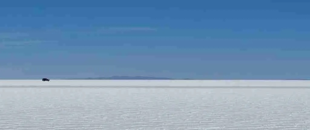
Vehicles approach Isla Incahuasi across perfectly flat white salt, the island appearing gradually on the horizon as a dark shape rising from the endless white surface. The visual effect intensifies as you near—the contrast between bright white salt and the dark rocky island covered with green-gray cacti creates an almost artificial appearance, as if someone placed a botanical display in the middle of a blank canvas.
The entrance area features basic facilities including a small visitor center, toilet facilities (30 Bolivianos/$4.30 USD already covers usage), and a covered seating area. Local vendors sell drinks, snacks, and handcrafted souvenirs—llama wool items, salt carvings, and quinoa products. Prices are predictably elevated given the remote location; expect to pay 20-30 Bolivianos ($3-4 USD) for bottled water and 30-50 Bolivianos ($4-7 USD) for basic snacks.
The entrance fee collection point operates during daylight hours when tours are active. Fee collection occurs through a simple ticket system—retain your ticket as guides occasionally verify payment during island visits. The fee directly supports the community managing the site and funds ongoing trail maintenance.
The Hiking Trail Experience 2026
A well-maintained trail system ascends from the entrance area to the island’s summit viewpoint. The path follows a roughly circular route, allowing visitors to ascend via one path and descend via another, experiencing different perspectives throughout. Stone steps constitute much of the trail’s steeper sections, providing stable footing despite the island’s rocky terrain.
The initial trail section passes through dense cactus formations at the island’s base. Here the ancient specimens grow in greatest concentration, their massive columnar forms creating narrow passages between trunks. Pause to examine individual cacti up close—the density of spines, the subtle green coloration beneath protective waxy coating, and the evidence of decades or centuries of growth become apparent at arm’s length. Photography in this lower section benefits from dramatic cactus foregrounds against salt flat backgrounds visible through gaps in the vegetation.
The mid-level traverse crosses the island’s rocky core, exposing geological features including fossil-bearing stone surfaces. Sharp-eyed visitors identify coral structures, stromatolite patterns, and marine deposits embedded in the volcanic matrix. These formations provide tangible evidence of Lake Minchin’s prehistoric presence—this same stone once lay beneath deep lake waters teeming with marine life. The trail continues upward through increasingly sparse vegetation as elevation increases and soil becomes thinner.
The summit viewpoint crowns the experience. At approximately 3,736 meters (80 meters above the surrounding salt flat), this observation point provides unobstructed 360-degree panoramas across the Salar de Uyuni. On clear days, visibility extends 50+ kilometers in every direction—nothing but white salt meeting pale blue sky at a horizon that seems impossibly distant. The nearby volcanoes of the Western Cordillera punctuate the western skyline, including Tunupa (5,432m) to the north and distant peaks marking the Chilean border to the southwest.
Time Allocation Guide 2026
Plan your Isla Incahuasi visit according to available time and interests:
Minimum Visit (45 minutes): Complete the basic hiking trail circuit with brief photo stops. Sufficient for capturing the essential views and experiencing the island’s unique environment. Rushed but adequate for travelers on tight 1-day tour schedules.
Standard Visit (60-75 minutes): Comfortable pace for the complete hiking trail, extended summit viewpoint time, and exploration of the lower cactus forest. Allows proper photography without rushing. Most 1-day and 3-day tours allocate this duration.
Extended Visit (90-120 minutes): Thorough exploration including secondary trails, detailed fossil examination, unhurried photography sessions at multiple locations, and rest time. Requires advance arrangement with tour operators or private vehicle hire.
Photography-Focused Visit (2+ hours): Optimal for serious photographers seeking varied lighting conditions. Best achieved through private tour arrangements allowing arrival during golden hour (early morning or late afternoon). Few standard tours accommodate this extended duration.
Photography Guide for Isla Incahuasi 2026
Best Times for Photography in 2026
Light quality dramatically affects Isla Incahuasi photography. The midday sun, while providing visibility, creates harsh shadows among cacti and reduces the salt flats to a featureless white glare. Professional photographers and serious enthusiasts prioritize golden hour visits when warm angled light transforms both island and salt flat.
Early morning arrivals (7:00-9:00 AM) capture soft light illuminating the cacti’s eastern faces while long shadows add dimensionality to both island terrain and surrounding salt polygon patterns. Morning visits require private tour arrangements, as standard departures from Uyuni reach the island well after optimal morning light fades. The salt flats often retain overnight moisture during dry season mornings, creating subtle reflective surfaces before evaporation occurs.
Late afternoon sessions (4:00-6:00 PM) provide warm golden light from the west, illuminating the salt flats while casting dramatic shadows across the island. Standard 1-day tours often reach Isla Incahuasi during this window, though departure schedules may limit extended golden hour shooting. The setting sun transforms the white salt flats into shades of pink, orange, and gold—colors that complement the cacti’s green-gray tones beautifully.
Sunset photography from the island summit offers extraordinary opportunities when schedules permit. The western horizon over the salt flats, backed by Andean volcanoes, creates spectacular color gradations as the sun descends. Few standard tours accommodate sunset on the island itself, as return timing to Uyuni becomes problematic after dark.
Composition Techniques for 2026
The island’s visual elements—ancient cacti, rocky terrain, fossil formations, and endless salt flats—provide rich compositional material for 2026 visitors:
Cactus Foreground Compositions: Use towering cacti in the image foreground with the salt flats stretching behind. This technique conveys scale—the massive cacti become reference points against the endless white expanse. Wide-angle lenses (14-35mm) work well for these dramatic perspective shots, though be mindful of lens distortion affecting cactus uprightness.
Summit Panoramas: The 360-degree viewpoint invites panoramic capture. Multi-image stitches create ultra-wide perspectives showing the full horizon circle. Even smartphone panorama modes produce impressive results from this location. Wait for optimal light and minimal haze for best panorama clarity.
Detail Studies: Move beyond landscape compositions to capture intimate details: cactus spine patterns, fossil textures in rock surfaces, coral formations, individual cactus flowers (December-February), and the salt crystal structures visible at the island’s edge. Macro capabilities or telephoto lenses enable these closer studies.
Human Scale Reference: Include people in compositions to convey the cacti’s impressive size. A person standing beside a 10-meter cactus immediately communicates scale that pure landscape shots cannot. The contrast also adds human interest to documentary images.
Salt Flat Perspectives: Though not on the island itself, the surrounding salt provides classic forced-perspective photography opportunities. Groups often shoot these images near the island where vehicles park, using the cactus-covered slopes as background elements for their impossible-scale trick photographs.
Equipment Recommendations for 2026
Essential camera gear for Isla Incahuasi photography includes:
Lens Selection: Wide-angle (14-35mm equivalent) for dramatic landscape and cactus compositions; standard zoom (24-70mm) for versatile coverage; telephoto (70-200mm or beyond) for detail work and volcano shots on the horizon. A single high-quality zoom covering 24-105mm serves most travelers well.
Protection: Lens cleaning supplies are essential—salt dust covers everything, and even slight precipitation creates mineral deposits on glass surfaces. A protective filter for your primary lens shields against scratching from salt particles. Camera bags should be kept closed when not actively shooting.
Batteries: Cold temperatures (especially morning visits or 3-day tour overnights) drain batteries rapidly. Carry spares and keep them warm in pockets close to your body until needed. Expect 30-50% battery capacity reduction in cold conditions.
Tripod: Essential for serious landscape photography, particularly during golden hour and for panorama stitching. Standard tours may not provide sufficient time for extensive tripod work, but the stability proves valuable for maximum image quality when schedules allow.
Polarizing Filter: Reduces glare from the highly reflective salt surface and enhances sky saturation. Particularly valuable for midday shooting when harsh light would otherwise compromise image quality.
Practical Information for 2026 Visits
What to Bring to Isla Incahuasi 2026
Prepare for your island visit with these essential items:
Sun Protection: Sunscreen SPF 50+ and quality sunglasses are non-negotiable. The combination of high altitude (intense UV radiation) and salt reflection (amplified exposure from below) creates serious sunburn and eye strain risks. Reapply sunscreen before beginning the hike.
Water: Carry at least 1 liter for the 60-90 minute visit. The dry altitude dehydrates rapidly, and the hiking trail provides no shade. Water is available for purchase at the entrance area but at premium prices—bring your own from Uyuni when possible.
Footwear: Sturdy closed-toe shoes provide best traction on the rocky trail. Sandals and flip-flops are inadequate for the summit hike. The salt flat surface itself is generally firm, but transitioning to the island’s rocky terrain requires proper footwear.
Layers: Even during warm midday periods, wind on the exposed summit creates significant wind chill. Carry a light jacket or windbreaker. Early morning and late afternoon visits require additional warmth—temperatures at 3,700 meters drop rapidly outside direct sunlight.
Cash: Bring small Boliviano notes for souvenirs, additional drinks, or bathroom facilities. The entrance fee may be separate from tour payments depending on your operator’s arrangements. Credit cards are not accepted on the island.
Health Considerations for 2026
Altitude affects nearly all visitors to Isla Incahuasi. At 3,656-3,736 meters, oxygen availability is approximately 35% lower than at sea level. The hiking trail’s ascent, though relatively short, demands increased cardiovascular effort in these conditions.
Common symptoms include shortness of breath during the climb, mild headache, and fatigue. These reactions are normal at this elevation and typically resolve with rest. Climb at a comfortable pace, rest when needed, and avoid rushing even if tour schedules seem pressing. The viewpoint will wait.
Travelers who have recently arrived at high altitude face greater risk of more severe symptoms. Ideally, spend at least one night acclimatizing in La Paz (3,640m), Potosí (4,090m), or Uyuni (3,656m) before your salt flats tour. Arriving directly from low-altitude origins (Lima, Santa Cruz, coastal cities) significantly increases altitude sickness risk.
Hydration is critical. Drink water before, during, and after your island visit. Alcohol consumption the night before exacerbates altitude symptoms—avoid or minimize drinking in Uyuni prior to your tour departure.
Accessibility Information 2026
Isla Incahuasi presents challenges for visitors with mobility limitations. The hiking trail includes stone steps, uneven rocky surfaces, and consistent uphill gradient. No wheelchair-accessible routes exist, and the terrain prevents standard mobility device use.
Visitors who cannot complete the summit trail can still experience significant portions of the island. The entrance area and lower cactus forest are relatively accessible, with careful walking allowing close-up cactus viewing without tackling the steeper trail sections. The visual impact of cacti against salt flat backgrounds is fully apparent from ground level. Discuss specific needs with tour operators before booking—some can arrange extended vehicle time near the island or modified visit approaches.
Isla Incahuasi in Context: 2026 Comparison with Other Salt Flat Islands
Isla Incahuasi vs. Fish Island (Isla del Pescado) 2026
Confusion frequently arises between Isla Incahuasi and the separate “Fish Island” (Isla del Pescado). Both islands feature giant cacti and rocky terrain within the Salar de Uyuni, but they are distinct formations. The true Isla del Pescado sits approximately 30 kilometers north of Isla Incahuasi, is significantly smaller, and receives far fewer tour visits.
Standard Uyuni tours visit Isla Incahuasi despite some operators using the “Fish Island” name interchangeably. The islands’ similar appearance leads to the naming confusion. For 2026 visitors, the distinctions matter little—both offer comparable cactus-covered landscapes—but Isla Incahuasi’s larger size, better facilities, and established trail system make it the primary tour destination.
Why Isla Incahuasi Dominates Tour Itineraries 2026
Several factors establish Isla Incahuasi as the definitive salt flat island experience for 2026 tours:
Central Location: The island’s position near the salt flat’s geographic center provides optimal approach routes from Uyuni while offering views across the vast expanse in every direction. Other islands sit closer to the flats’ edges, limiting panoramic perspectives.
Developed Facilities: The entrance area, marked trails, toilet facilities, and vendor services create a manageable visitor experience. Alternative islands lack these amenities, complicating tour logistics.
Trail Quality: The maintained hiking path with stone steps enables safe ascent for visitors of varying fitness levels. Rougher terrain on other islands restricts access and increases liability concerns for tour operators.
Cactus Density: Isla Incahuasi hosts among the highest concentrations of mature Trichocereus cacti in the salt flat ecosystem. The forest-like density creates more dramatic visual impact than sparser populations on alternative islands.
Frequently Asked Questions: Isla Incahuasi 2026
Can I visit Isla Incahuasi without a tour in 2026?
Technically possible but practically challenging. Independent visits require 4×4 vehicle hire with experienced driver ($200-300 USD per day), as GPS coordinates alone are insufficient for safe navigation across the featureless salt surface. Local guides know the firmest routes and avoid soft areas that trap vehicles. The cost and logistical complexity make tour participation the logical choice for most travelers—a $40-50 USD day tour includes the island visit along with multiple other stops.
Are the cacti on Isla Incahuasi protected in 2026?
Yes. The island operates under community management with conservation priorities. Visitors must remain on marked trails to prevent soil erosion and root damage. Touching, climbing, or damaging cacti is prohibited. The slow growth rates mean any damage takes decades or centuries to recover. Respect trail boundaries and avoid physical contact with the ancient plants.
What wildlife might I see on Isla Incahuasi in 2026?
Viscachas (Andean rabbits) are the most commonly spotted mammals, often seen resting on rocky outcrops during warm afternoon hours. Various bird species nest among cacti and rocks. Cactus flowers attract pollinating insects during the December-February blooming season. The ecosystem is sparse due to harsh conditions, so wildlife sightings are bonuses rather than expectations.
Does Isla Incahuasi have restaurants or food service in 2026?
No formal restaurants operate on the island. Vendors sell packaged snacks, drinks, and basic prepared items (sandwiches, empanadas) at elevated prices. Tour packages include lunch, typically served on the salt flats before or after the island visit rather than on Isla Incahuasi itself. Bringing personal snacks is advisable if you have dietary requirements or preferences.
How crowded does Isla Incahuasi get in 2026?
Crowding varies dramatically by season and timing. Peak periods (July-August, 10:00 AM-2:00 PM) bring multiple tour groups simultaneously—expect 50-100+ visitors on the island creating congested trails and busy viewpoints. Shoulder seasons and early morning/late afternoon visits offer relative solitude. The island absorbs crowds reasonably well due to distributed trail systems, but the summit viewpoint becomes cramped during peak convergences. Private tours with flexible timing avoid the worst crowding.
Is Isla Incahuasi affected by the wet season in 2026?
The island itself remains accessible year-round, but approach routes across the salt flats may be modified during wet season (November-April). Heavy rains can flood low-lying areas, requiring drivers to navigate alternative paths. The island’s rocky surface is unaffected by salt flat water accumulation. Wet season visits often provide dramatic photography opportunities with water reflections surrounding the island’s base—the cactus-covered outcrop rising from mirror-still water creates extraordinary images.
Can I spend the night on Isla Incahuasi?
No overnight accommodation exists on the island. All visitors depart before dark, returning to Uyuni (1-day tours) or continuing to salt hotels/refugios (3-day tours). The island has no facilities supporting overnight stays, and independent camping is not permitted. The nearest accommodations are salt hotels approximately 40-60 kilometers from the island along the salt flat edges.
How much should I budget for an Isla Incahuasi visit in 2026?
Within a standard day tour: the $4.30 USD entrance fee (often included in tour price), $5-10 USD for souvenirs and snacks, $5-8 USD for tips to guides. Total additional spending: $15-20 USD beyond base tour cost. Independent visits cost substantially more due to vehicle hire requirements.
Planning Your 2026 Isla Incahuasi Visit
Recommended Itinerary Integration 2026
Isla Incahuasi fits into various Uyuni exploration approaches:
Standard 1-Day Tour Integration: Most 1-day tours reach the island between 3:00-4:30 PM after completing morning stops. This timing provides adequate afternoon light for photography and allows comfortable return to Uyuni before dark. The island serves as the day’s highlight, positioning perfectly for late-afternoon golden hour when conditions favor photography.
3-Day Tour Integration: Extended tours typically incorporate Isla Incahuasi on Day 1, allowing thorough exploration before continuing toward overnight accommodation. Some operators offer Day 1 sunset on the salt flats near the island, extending the visual experience. The 3-day format provides flexibility for return visits if initial conditions prove unfavorable.
Photography-Focused Approach: Serious photographers should arrange private tours with specific timing requests—early morning arrival or sunset positioning on the island. Communicate your priorities clearly when booking; standard departure times exist for logistical reasons but can be modified with advance arrangement and potentially increased cost.
Best 2026 Seasonal Timing for Isla Incahuasi
Each season offers distinct Isla Incahuasi experiences:
Dry Season (May-October): Clear skies, reliable access routes, and classic white salt appearance characterize dry season visits. The island’s cacti stand against uninterrupted white backgrounds—the iconic imagery defining Uyuni globally. June-August brings coldest temperatures but minimal precipitation risk. September-October offers warmer conditions with continued dry weather.
Wet Season (November-April): Water accumulation on the salt flats creates extraordinary mirror effects. When conditions align, the island rises from perfectly reflective water surfaces, creating doubled images of cacti against sky reflections. January-March provides the best mirror photography opportunities but also highest rainfall probability. Access routes may require modification during heavy rain periods.
Shoulder Seasons (April-May, October-November): Transitional periods offer combinations of both conditions. Early dry season (April-May) may retain some wet season mirror effects while providing improving access. Late dry season (October-November) begins seeing occasional precipitation while maintaining summer-like temperatures. Crowds diminish during shoulder periods, enhancing the experience.
Isla Incahuasi 2026 Visit Summary
Isla Incahuasi represents the essential Salar de Uyuni experience—the visual confirmation that this impossible landscape truly exists. The ancient cacti standing against endless white salt, the prehistoric coral embedded in volcanic rock, and the 360-degree horizon views from the summit create memories that define Bolivia travel for countless visitors.
For 2026 visitors, the island offers accessible wonder within straightforward tour structures. The $4.30 USD entrance fee provides extraordinary value for what remains one of South America’s most photographed and recognizable natural landmarks. Whether you’re capturing forced-perspective photographs, contemplating millennium-old cacti, or simply absorbing the surreal beauty of stone rising from salt, Isla Incahuasi delivers experiences that justify the journey to Bolivia’s remote southwest corner.
Plan your visit with appropriate expectations—60-90 minutes suffices for most travelers, though photographers benefit from extended timing. Prepare for altitude, sun, and wind. Bring water, sun protection, and proper footwear. Then surrender to the island’s extraordinary character—a place where geological time becomes visible, where life persists against remarkable odds, and where the line between reality and imagination blurs beneath the high Altiplano sky.