
Icefields Parkway Guide: Canada’s Most Scenic Drive
The Icefields Parkway stretches 232 kilometres through the heart of the Canadian Rockies, connecting Lake Louise in Banff National Park with Jasper, passing ancient glaciers, turquoise lakes, and towering peaks. Consistently ranked among the world’s most spectacular drives by Condé Nast Traveler, this route offers unmatched access to wilderness, wildlife, and geological wonders. Whether dedicating a full day or several days to exploration, the parkway reveals landscapes that define the grandeur of Canada’s mountain heritage.
Key Takeaways:
- Route and Distance: Highway 93 North spans 232 kilometres (144 miles) between Lake Louise and Jasper, requiring a minimum three to four hours driving time without stops, though most travelers allocate a full day or multiple days to experience major viewpoints, short walks, and natural attractions along the route.
- Columbia Icefield Complex: The largest ice field in the Canadian Rockies lies at the midpoint of the parkway, feeding multiple glaciers including the accessible Athabasca Glacier where visitors walk on 10,000-year-old ice via specialized vehicles, while the Glacier Skywalk extends 280 metres above the Sunwapta Valley on a glass-floored platform.
- Wilderness Infrastructure: Services remain minimal throughout the 232-kilometre route, with Saskatchewan River Crossing offering the only fuel stop during summer months, no cell phone coverage along the entire parkway, and limited seasonal services available only from June through September at four hotel locations.
- Wildlife Encounters: The parkway traverses critical habitat for grizzly bears, black bears, elk, bighorn sheep, mountain goats, and caribou, requiring visitors to maintain a minimum three bus-length distance from all wildlife and to store food properly in bear-proof containers at all campgrounds and day-use areas.
- Seasonal Accessibility: While the parkway remains open year-round, winter travel demands preparation with mandatory winter tires or chains between November 1 and March 31, frequent avalanche control closures, reduced services, and significantly more challenging driving conditions requiring constant attention to weather forecasts and road status updates.
- Photography Opportunities: Herbert Lake, Peyto Lake, Bow Lake, Crowfoot Glacier, Mistaya Canyon, Sunwapta Falls, and Athabasca Falls provide iconic viewpoints accessible within short walks from designated parking areas, while early morning and late afternoon light creates optimal conditions for capturing the parkway’s dramatic mountain landscapes.
People Also Ask About Icefields Parkway
How long does it take to drive the Icefields Parkway?
The 232-kilometre drive between Lake Louise and Jasper takes three to four hours of continuous driving without stops. Most travelers allocate a full day to experience major viewpoints, short trails, and natural attractions, while photography enthusiasts and hikers often spread the journey across two or three days. The route contains numerous pullouts, scenic overlooks, and trailheads that reward frequent stops, making rushed transit ill-advised for first-time visitors seeking to appreciate the parkway’s landscapes.
What makes the Icefields Parkway one of the world’s best drives?
The concentration of accessible wilderness distinguishes this route from other mountain highways worldwide. Within 232 kilometres, travelers pass over 100 glaciers visible from the road, dozens of waterfalls, numerous turquoise lakes colored by glacial sediment, and unobstructed views of peaks exceeding 3,000 metres. The Columbia Icefield, the largest ice field south of the Arctic Circle in the Rocky Mountains, lies directly adjacent to the highway at the route’s midpoint. Wildlife viewing opportunities surpass most other accessible mountain corridors, with frequent sightings of bears, elk, bighorn sheep, and mountain goats along roadside meadows and alpine slopes.
Do I need a Parks Canada pass for the Icefields Parkway?
A Parks Canada Discovery Pass or daily admission pass remains mandatory for all travel on the Icefields Parkway, as the entire route traverses Banff and Jasper National Parks. The annual Discovery Pass costs $168 for families or groups (up to seven people in one vehicle), $84 for adults, and $72 for seniors, providing unlimited admission to over 80 Parks Canada sites for 12 months from purchase date. Daily admission costs $12 per adult, though multi-day trips make the annual pass more economical. Youth aged 17 and under enter free. During the Canada Strong Pass period from June 19 to September 7, admission becomes free for all visitors.
Can you drive the Icefields Parkway in winter?
The Icefields Parkway remains open throughout winter, though conditions demand significant preparation and flexibility. Winter tires or chains become legally mandatory between November 1 and March 31, while avalanche control work causes unpredictable closures lasting hours or occasionally days. The single fuel station at Saskatchewan River Crossing closes for winter, requiring full tanks from either Banff or Jasper before departure. Cell coverage remains absent year-round, eliminating real-time weather updates along the route. Most services, viewpoints, and trails close for winter, and severe cold frequently reaches -30°C or lower. Winter driving rewards prepared travelers with solitude, clear air, frozen waterfalls, and exceptional wildlife viewing, but requires constant monitoring of Alberta 511 road conditions and weather forecasts.
Extended multi-day tours – 5+ days
Featured Banff National Park Multi-Day Tour Packages

3 days
Banff National Park 3-Day Discovery Tour
- ✓ Comprehensive Banff National Park experience
- ✓ Expert local guides included
- ✓ All accommodation included
- ✓ Transportation provided

5 days
Banff National Park 5-Day Highlights Experience
- ✓ Comprehensive Banff National Park experience
- ✓ Expert local guides included
- ✓ All accommodation included
- ✓ Transportation provided

7 days
Banff National Park 7-Day Cultural Journey
- ✓ Comprehensive Banff National Park experience
- ✓ Expert local guides included
- ✓ All accommodation included
- ✓ Transportation provided
10 days
Banff National Park 10-Day Complete Adventure
- ✓ Comprehensive Banff National Park experience
- ✓ Expert local guides included
- ✓ All accommodation included
- ✓ Transportation provided
Multi-day tour packages powered by TourRadar. Prices and availability subject to change.
Introduction
The Icefields Parkway represents the culmination of early 20th-century efforts to make Canada’s Rocky Mountain wilderness accessible without diminishing its grandeur. Completed in 1940 as a Depression-era public works project, the highway provided the first reliable vehicle route between Banff and Jasper, replacing treacherous horse trails that required weeks to traverse. Engineers routed the highway to maximize scenic impact while minimizing environmental disruption, creating a corridor that reveals landscapes previously accessible only to mountaineers and outfitters.
The parkway’s official designation as Highway 93 North understates its significance. Unlike utilitarian transportation corridors, this route functions as a linear national park experience, with the journey itself serving as the primary attraction. The highway traces ancient valleys carved by glaciers during successive ice ages, following routes used for millennia by Indigenous peoples including the Stoney Nakoda, Ktunaxa, and Secwepemc nations who traversed these mountains seasonally for hunting, trading, and ceremonial purposes.
Today’s travelers encounter an engineered wilderness experience. Pullouts, viewpoints, and interpretive signs provide structured access to dramatic landscapes, while the absence of commercial development beyond minimal service nodes preserves the sense of remoteness. The parkway bisects two UNESCO World Heritage Sites—Banff and Jasper National Parks—encompassing ecosystems ranging from montane valley bottoms to alpine tundra, each supporting distinct plant and animal communities adapted to extreme conditions.
The route’s character changes dramatically with seasons. Summer brings long daylight hours, wildflower meadows, accessible trails, and crowded parking lots at popular stops. Autumn transforms larch forests to gold, reduces visitor numbers, and introduces volatile weather. Winter creates a stark landscape of frozen waterfalls and snow-draped peaks, accessible only to travelers prepared for severe conditions. Spring remains transitional, with avalanche risk, unpredictable weather, and limited services making it the least predictable season for parkway travel.
Route Overview and Geography
The Icefields Parkway extends 232 kilometres (144 miles) along Highway 93 North, beginning at the Trans-Canada Highway junction near Lake Louise and terminating at the Yellowhead Highway junction in Jasper. The route remains a two-lane highway throughout its length, with wide shoulders accommodating recreational vehicles and designated pullouts preventing traffic disruption at popular viewpoints.
The parkway’s first 122 kilometres traverse Banff National Park, rising from the Lake Louise junction at 1,540 metres elevation to Sunwapta Pass at 2,035 metres, the route’s highest point and the boundary between Banff and Jasper National Parks. This southern section passes Bow Lake, Peyto Lake, and the Mistaya Valley, with dramatic views of the Waputik and Wapta Icefields visible to the west.
North of Sunwapta Pass, the remaining 110 kilometres descend through Jasper National Park, passing the Columbia Icefield, Athabasca Glacier, and Sunwapta Falls before reaching the wider valleys approaching Jasper townsite. This northern section provides closer access to massive glaciers and more frequent wildlife sightings in the broader valleys that characterize Jasper’s landscape.
The Continental Divide follows the parkway’s western flank throughout most of the route, separating watersheds flowing to the Pacific Ocean from those reaching the Atlantic or Arctic. Rivers crossed by the parkway—the Bow, North Saskatchewan, Sunwapta, and Athabasca—eventually reach three different oceans, a hydrological distinction highlighted by interpretive signs at Sunwapta Pass.
Geological forces created the parkway’s landscapes over hundreds of millions of years. Ancient seabeds compressed into sedimentary rock layers, then thrust upward during mountain-building events beginning 80 million years ago. Subsequent glaciation carved U-shaped valleys, cirques, and hanging valleys visible throughout the route. Recent glacial retreat—documented by comparing modern glaciers to historical photographs—continues reshaping the landscape at rates accelerated by climate change.
Essential Planning Information
Parks Canada admission requirements apply to all parkway travel. The Discovery Pass costs $168 annually for families or groups (up to seven people in one vehicle), $84 for individual adults, and $72 for seniors aged 65 and older. Youth aged 17 and under enter free. Daily admission costs $12 per adult for Rocky Mountain parks. Passes can be purchased online or at park gates at either end of the parkway. During the Canada Strong Pass period from June 19 to September 7, all admission fees are waived.
Fuel availability remains critically limited. Saskatchewan River Crossing, located approximately at the parkway’s midpoint, operates the only fuel station along the entire 232-kilometre route, and only during summer months from approximately May through September. Outside this period, no fuel exists between Lake Louise and Jasper. Vehicles must depart with full tanks from either endpoint, as the round-trip distance exceeds most vehicles’ range. Fuel prices at Saskatchewan River Crossing reflect the remote location and limited competition.
Cell phone coverage does not exist anywhere along the Icefields Parkway. Emergency communication requires driving to either Jasper or Lake Louise, or locating park staff at the Columbia Icefield Glacier Discovery Centre during summer operating months. Travelers should download maps, directions, and any needed information before departure, and inform others of their route and expected arrival time.
Services along the parkway remain minimal by design. Four seasonal lodge operations—Num-Ti-Jah Lodge at Bow Lake, Crossing Resort at Saskatchewan River Crossing, Glacier View Lodge at the Columbia Icefield, and Sunwapta Falls Lodge—provide limited accommodation, dining, and supplies from approximately May through September only. Outside these facilities, no services exist. Most day-use areas feature only basic dry toilets, picnic tables, and interpretive signs.
Eleven Parks Canada campgrounds line the parkway, operating seasonally from approximately late May through September. These campgrounds offer vehicle camping with basic facilities including fire pits, picnic tables, and toilet buildings, but no electrical hookups or showers. Sites operate on a first-come, first-served basis, typically filling by early afternoon during peak summer months. Five Hostelling International wilderness hostels provide budget accommodation for travelers without vehicles or seeking social atmosphere.
Wildlife safety protocols apply throughout the parkway. Parks Canada regulations require maintaining a minimum distance of three bus lengths (approximately 90 metres) from bears, elk, and other large mammals, and one bus length (approximately 30 metres) from smaller animals. Stopping on the highway to view wildlife creates dangerous traffic conditions and habituates animals to vehicles. Designated pullouts provide safe wildlife viewing locations. All food, coolers, and scented items must remain locked in vehicles or stored in provided bear-proof containers at campgrounds.
Weather conditions change rapidly in mountain environments. Summer temperatures range from 5°C to 25°C, with afternoon thunderstorms common in July and August. Snow can fall any month of the year at higher elevations. Layered clothing, rain gear, and warm layers remain essential regardless of season. Winter temperatures frequently reach -20°C to -40°C, with windchill creating life-threatening conditions for unprepared travelers. Current road conditions are available through Alberta 511, though without cell coverage, travelers must check before departure and cannot access updates while traveling.
Columbia Icefield Adventures
The Columbia Icefield dominates the parkway’s midpoint, representing the largest ice field in the Canadian Rockies at 200 square kilometres. This remnant of the ice ages feeds eight major glaciers, including the Athabasca Glacier visible and accessible directly from the parkway. The ice field straddles the Continental Divide, with meltwater eventually reaching the Pacific, Atlantic, and Arctic Oceans—one of the few hydrological apex points in the world.
The Athabasca Glacier extends from the ice field like a frozen river, its toe currently positioned approximately two kilometres from the Columbia Icefield Glacier Discovery Centre parking area. Historical markers along the access trail document the glacier’s dramatic retreat, with the ice having receded over 1.5 kilometres since 1890. The glacier’s thickness exceeds 300 metres at its deepest point, approximately the height of the Empire State Building.
Glacier Adventure experiences operate from the Discovery Centre, where massive Ice Explorer vehicles transport visitors onto the glacier surface for walking opportunities on ancient ice. The Columbia Icefield Adventure combines the Ice Explorer glacier tour with admission to the Glacier Skywalk for $125 per adult and $81 for youth aged 6-15 (check official websites for current rates as pricing varies seasonally). Tours depart every 15 to 30 minutes during operating season from May through September, with tickets valid for any departure on the selected day.
The Ice Explorer vehicles represent specialized engineering designed specifically for glacier travel. These massive six-wheel-drive machines navigate steep ice slopes that would destroy conventional vehicles, carrying up to 56 passengers in heated cabins. On the glacier, visitors disembark for approximately 30 minutes of supervised exploration, drinking from meltwater streams and photographing crevasses under the guidance of trained driver-interpreters who explain glaciology, climate change, and the ice field’s history.
The Glacier Skywalk extends 400 metres along a cliff-edge walkway, culminating in a glass-floored platform suspended 280 metres above the Sunwapta Valley. The interpretive pathway features displays about glacial geology, fossils, and the forces that shaped this landscape. The glass-floored observation platform provides unobstructed views straight down to the valley floor, with glaciers, waterfalls, and mountain peaks framing the perspective. Visitors proceed at their own pace, with no time restrictions beyond operating hours.
Independent glacier access remains possible for experienced mountaineers via approach trails, though crevasse danger and rapidly changing conditions make unguided glacier travel extremely hazardous. The glacier toe area accessible from the Discovery Centre parking lot allows visitors to approach the ice margin and observe meltwater streams, though stepping onto the glacier itself outside guided tours is prohibited and dangerous due to hidden crevasses and unstable ice.
The Discovery Centre itself functions as the parkway’s primary visitor services hub during summer months, featuring interpretive exhibits about the Columbia Icefield’s geology, climate change impacts, and ecological significance. A large-format theater presents films about the ice field and mountain environment. Restaurants, a Starbucks, and gift shop provide services unavailable elsewhere along most of the parkway. Restrooms, water, and covered waiting areas accommodate the thousands of daily visitors during peak summer season.
Herbert Lake and Early Route Highlights
Herbert Lake appears four kilometres north of the Lake Louise junction, marking the parkway’s first major photographic opportunity. This small glacial lake provides mirror-perfect reflections of Mount Temple and the Bow Range peaks when conditions allow still water, typically during early morning hours before wind disturbs the surface. A short trail from the parking area reaches the lakeshore, where picnic tables and interpretive signs explain the lake’s formation and ecology.
The lake’s turquoise color results from glacial flour—fine rock particles ground by glaciers and suspended in the water. These particles reflect blue and green wavelengths of light while absorbing other colors, creating the distinctive hue characteristic of glacial lakes throughout the Canadian Rockies. The color intensity varies with sediment concentration, appearing most vivid during summer when glacial melt peaks.
Crowfoot Glacier and Bow Lake
Crowfoot Glacier viewpoint lies 33 kilometres from Lake Louise, providing a pullout directly opposite this distinctive glacier on Crowfoot Mountain. When named over a century ago, the glacier resembled a bird’s three-toed foot. Climate change has caused one “toe” to retreat and separate from the main ice mass, though the formation remains visually striking against the mountain’s limestone face.
Bow Lake stretches across the valley floor three kilometres beyond Crowfoot, ranking among the largest lakes in Banff National Park at approximately three kilometres long. Num-Ti-Jah Lodge occupies the lake’s eastern shore, built in the 1940s by legendary outfitter Jimmy Simpson who pioneered early tourism in this region. The historic lodge operates as a seasonal hotel and restaurant, maintaining period architecture and decor that evokes the parkway’s early tourism era.
From Bow Lake’s shoreline, Bow Glacier becomes visible at the valley’s head, though significantly retreated from historical positions documented in old photographs displayed at the lodge. The lake drains via the Bow River, which eventually flows through Calgary and joins the South Saskatchewan River system. A trail from the parking area follows the lakeshore toward the glacier, providing an easy walk suitable for families seeking closer views without technical hiking.
Peyto Lake Overlook
Peyto Lake viewpoint sits 40 kilometres from Lake Louise, reached via a short steep trail from Bow Summit, the parkway’s highest point at 2,088 metres elevation. This lake ranks among the Canadian Rockies’ most photographed landscapes due to its intense turquoise color and distinctive shape resembling a wolf’s head or fox viewed from above.
The viewpoint platform provides a bird’s-eye perspective 250 metres above the lake surface, revealing the full extent of Peyto Glacier feeding meltwater into the lake’s head. Peak glacial melt in July and August produces the lake’s most intense color, as concentrated glacial flour creates maximum light scattering. The lake was named for Bill Peyto, an early outfitter and trail guide whose exploits became legendary in Rocky Mountain history.
Morning light favors Peyto Lake photography, with the sun illuminating the vibrant blue-green water while shadows define the surrounding peaks. The viewpoint becomes extremely crowded during summer midday hours, with limited parking creating traffic delays. Early morning or late afternoon visits avoid peak crowds while providing superior lighting conditions.
Mistaya Canyon
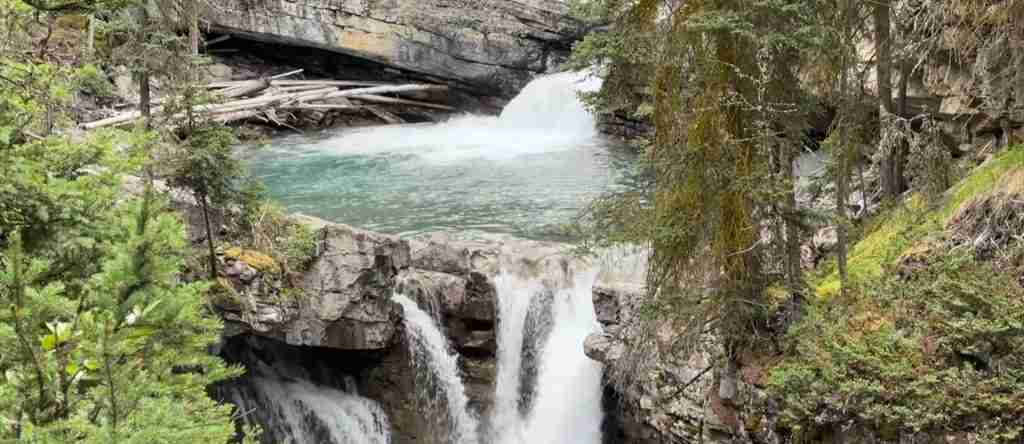
Mistaya Canyon lies 71 kilometres from Lake Louise, accessible via a short 800-metre forest trail from the parking area. The Mistaya River has carved a narrow limestone gorge through this location, creating dramatic waterfalls, potholes, and sculpted rock formations visible from a bridge spanning the canyon.
The canyon’s formation demonstrates the erosive power of water charged with glacial sediment. The Mistaya River drops through a series of cascades and chutes, swirling through potholes that have ground smooth circular depressions into the bedrock over thousands of years. The bridge provides an excellent vantage point for observing these geological processes in action, with interpretive signs explaining the canyon’s formation.
The trail to Mistaya Canyon follows an old roadbed through mature spruce forest, providing easy walking suitable for all ages. The forest itself showcases subalpine ecology, with interpretive information about fire history, tree species, and wildlife habitat along the route. The canyon visit typically requires 30 to 45 minutes round-trip including photography time.
Saskatchewan River Crossing
Saskatchewan River Crossing marks the parkway’s approximate midpoint at 77 kilometres from Lake Louise and 155 kilometres from Jasper. This location takes its name from the North Saskatchewan River crossing, where the parkway bridges this major waterway flowing from Saskatchewan Glacier on the Continental Divide.
The Crossing Resort provides the parkway’s only fuel station during summer months, along with a restaurant, small market, and basic accommodations. Services close entirely from approximately October through April, leaving no facilities available during winter months. Fuel prices reflect the remote location and absence of competition, typically exceeding prices in Banff or Jasper by significant margins.
The North Saskatchewan River visible at this location flows eventually to Hudson Bay and the Atlantic Ocean, representing one branch of the triple-ocean watershed divide created by the Columbia Icefield region. Interpretive signs explain the river’s route and historical significance as a major fur trade transportation corridor in the 18th and 19th centuries.
Parker Ridge Trail
Parker Ridge trailhead sits 118 kilometres from Lake Louise, approximately four kilometres south of the Columbia Icefield Discovery Centre. This trail climbs 250 metres over 2.7 kilometres to a ridge crest providing spectacular views of Saskatchewan Glacier, the Columbia Icefield’s largest outlet glacier.
The trail switchbacks up a steep alpine slope above treeline, traversing meadows that explode with wildflowers during July and August. Alpine ecology thrives in this harsh environment, with interpretive signs identifying plant species specially adapted to extreme cold, high winds, and short growing seasons. Pikas and ground squirrels inhabit the boulder fields, while ptarmigan occasionally appear on the upper slopes.
From the ridge crest, Saskatchewan Glacier spreads across the valley floor below, its surface crisscrossed with crevasses and medial moraines marking the confluence of multiple ice streams. The glacier extends over nine kilometres from the Columbia Icefield to its terminus, making it one of the longest glaciers accessible by maintained trail in the Canadian Rockies. Historical photographs show dramatic retreat over the past century, with the glacier’s terminus having receded several kilometres during this period.
The ridge provides 360-degree views, with the parkway visible far below threading through the valley, Mount Athabasca dominating the southern horizon, and unnamed peaks extending in all directions. This viewpoint offers a comprehensive perspective on the scale of the Columbia Icefield region impossible to grasp from the valley floor.
Sunwapta Falls
Sunwapta Falls appears 178 kilometres from Lake Louise, approximately 55 kilometres south of Jasper. The Sunwapta River, fed by meltwater from the Athabasca Glacier, plunges through a narrow canyon at this location, creating multiple cascades visible from short trails and viewpoints.
A paved path from the parking area reaches the upper falls overlook within five minutes’ walk, providing views of the main cascade where the river drops into a confined limestone gorge. The force of the water has carved potholes and sculpted channels in the bedrock, demonstrating ongoing erosive processes. Mist from the falls creates microclimate conditions supporting unique plant communities in the spray zone.
A longer trail continues to the lower falls, approximately one kilometre downstream, where additional cascades and canyon features appear. This trail remains unpaved but well-maintained, suitable for most visitors. The lower falls viewpoint provides different perspectives on the canyon’s geology and the river’s continued erosion of the limestone bedrock.
The Sunwapta River’s name derives from a Stoney word meaning “turbulent water,” aptly describing the river’s character at this location. During peak glacial melt in July and August, the volume of water thundering through the canyon increases dramatically, creating a deafening roar audible from the parking area.
Athabasca Falls
Athabasca Falls lies 30 kilometres south of Jasper, representing the most powerful waterfall accessible directly from the Icefields Parkway. Unlike many Rocky Mountain waterfalls that impress through height, Athabasca Falls derives its impact from the sheer volume of water thundering through a narrow canyon carved into quartzite bedrock.
The Athabasca River drops 23 metres at this location, funneling through a canyon less than 20 metres wide. During peak flow in June and July, over 100 cubic metres of water per second crashes through this constriction, creating massive turbulence, spray, and noise that dominates the experience. Interpretive trails with multiple viewpoints allow visitors to observe the falls from various perspectives, including platforms directly above the main drop where spray soaks those approaching closely.
The canyon’s formation showcases differential erosion, with harder quartzite layers creating the canyon walls while softer shale layers have eroded more rapidly, sculpting potholes and channels in the riverbed. These potholes, some several metres deep, formed as stones trapped in swirling water ground circular depressions into the rock over thousands of years.
The trail system around Athabasca Falls connects multiple viewpoints via paved and gravel paths totaling approximately two kilometres, though the main overlooks lie within 200 metres of the large parking area. Interpretive signs explain the waterfall’s geology, the canyon’s formation, and the Athabasca River’s role as a major drainage for Jasper National Park. The falls remain spectacular year-round, with winter ice formations creating additional visual drama around the cascades.
Wildlife Along the Parkway
The Icefields Parkway traverses critical wildlife habitat supporting diverse species adapted to mountain environments. Grizzly bears and black bears range throughout the corridor, particularly in spring when emerging from hibernation to feed on roadside vegetation, and in late summer when berries ripen in avalanche slopes adjacent to the highway. Early morning and evening hours provide optimal viewing opportunities, as bears avoid midday heat and human activity.
Elk congregate in valley bottom meadows throughout the parkway, particularly near Sunwapta Pass and in the broader valleys approaching Jasper. Large bulls develop impressive antlers during summer, reaching full size by September for the autumn rut when males compete for breeding access to females. Elk habituated to vehicles often approach roadways, creating photography opportunities but also collision hazards requiring driver vigilance.
Bighorn sheep favor steep terrain near mineral licks, with several known locations along the parkway where these animals congregate to lick mineral-rich soil and rocks. Males display massive curved horns growing throughout their lives, reaching full curl in mature rams. Sheep populations concentrate near specific roadside locations, particularly around the Goat Creek area and near Mount Kerkeslin.
Mountain goats inhabit the highest, steepest terrain, their white coats visible against dark rock faces when scanning with binoculars. These animals possess remarkable climbing abilities, occupying cliffs and crags inaccessible to predators. Goats occasionally descend to roadside locations to access mineral licks, providing rare close viewing opportunities for travelers.
Moose browse in willows bordering streams and wetlands, particularly in Jasper’s broader valleys. These massive ungulates prefer wet areas where aquatic vegetation provides optimal nutrition. Bulls grow impressive palmate antlers reaching over one metre in spread, shedding them each winter and growing new sets the following spring.
Caribou populations have declined dramatically in recent decades due to habitat loss and predation pressure, but small herds persist in alpine areas near Sunwapta Pass. These shy animals typically remain far from roads, visible only with binoculars or spotting scopes when crossing alpine meadows well above treeline.
Wolves range throughout the parkway corridor but remain rarely seen due to their wariness of humans. Occasional sightings occur, particularly in winter when wolves follow elk herds into valley bottoms. Tracks in snow provide evidence of wolf presence even when the animals themselves remain invisible.
Golden eagles and bald eagles patrol the parkway’s length, hunting ground squirrels and marmots in alpine meadows. These raptors often perch in prominent trees near roadside clearings, their large size making them conspicuous even from moving vehicles. Ravens, jays, and Clark’s nutcrackers frequent campgrounds and picnic areas, their intelligence and boldness making them common visitors.
Parks Canada regulations require maintaining minimum distances from all wildlife: three bus lengths (approximately 90 metres) from bears, wolves, elk, moose, and other large mammals; one bus length (approximately 30 metres) from smaller animals. Violating these distances risks wildlife and visitor safety, as habituated animals often become aggressive and may be destroyed by park managers. Stopping vehicles on the roadway to view wildlife creates traffic hazards and is prohibited—designated pullouts provide safe stopping locations.
Photography Guide
The Icefields Parkway offers exceptional photography opportunities throughout its length, though understanding light conditions, composition principles, and logistical constraints maximizes results. Early morning and late afternoon provide optimal lighting, with low-angle sun creating dimension and color saturation impossible to achieve during midday hours when harsh overhead light flattens scenes and washes colors.
Herbert Lake delivers classic reflection shots during calm morning conditions before wind disturbs the water surface. Arriving at sunrise or within an hour after captures the lake at its most mirror-like, with Mount Temple and surrounding peaks doubling in perfect symmetry. A wide-angle lens encompasses the full scene, while a polarizing filter reduces surface glare and intensifies sky and water colors.
Peyto Lake demands a standard to slightly wide lens to capture the lake’s distinctive shape and intense turquoise color. The elevated viewpoint eliminates the need for wide-angle distortion, with a 24-70mm zoom covering most desired compositions. Midday light actually works reasonably well here due to the overhead perspective, though morning light creates warmer tones and afternoon light emphasizes the surrounding peaks’ texture.
Bow Lake benefits from varied compositions, from wide-angle shots encompassing Num-Ti-Jah Lodge with Bow Glacier as backdrop, to telephoto compressions isolating glacial details. Early morning mist sometimes rises from the lake’s surface, creating ethereal conditions worth the pre-dawn drive from Lake Louise. The lake’s outlet stream provides foreground interest for wider compositions.
Athabasca Falls rewards experimentation with shutter speeds. Fast speeds (1/500 second or faster) freeze water droplets in mid-air, revealing the water’s chaotic motion. Slow speeds (one second or longer) blur the water into silky flows, creating the smooth appearance common in waterfall photography. A tripod becomes essential for slow-shutter work, with neutral density filters allowing long exposures even in bright daylight.
Columbia Icefield photography faces challenges from the location’s popularity and midday tour schedules. The Ice Explorer vehicles themselves make interesting subjects against the ice, though capturing them requires timing tours’ movements. The Glacier Skywalk provides unusual perspectives, with wide-angle lenses emphasizing the platform’s transparent floor against the void below. Photographing from the platform requires managing reflections and glare off the glass surface.
Wildlife photography demands long lenses, with 400mm or longer providing sufficient magnification to fill the frame while respecting required minimum distances. Panning techniques help capture moving animals sharply while blurring backgrounds to isolate subjects. Patience proves essential—successful wildlife photography involves waiting for animals to move into good light, adopt interesting poses, or interact with other individuals.
Mountain landscapes along the parkway benefit from foreground elements—streams, wildflowers, rocks—providing depth and scale to compositions. Lacking foreground interest, mountain photographs often fail despite spectacular subjects, as nothing establishes perspective or draws the viewer’s eye into the scene. Searching for leading lines, natural frames, and layered compositions transforms ordinary snapshots into compelling images.
Weather adds drama to parkway photography. Storm clouds, shafts of sunlight breaking through overcast, rainbows, and fresh snow all create conditions surpassing typical blue-sky perfection. Protecting gear from moisture becomes critical during precipitation, but the images captured during marginal weather often exceed those from perfect conditions.
Hiking Trails and Backcountry Access
Beyond roadside viewpoints, the Icefields Parkway provides access to over a dozen maintained hiking trails ranging from short walks to multi-day backcountry routes. Trail conditions vary seasonally, with many high-elevation routes remaining snow-covered until mid-July and becoming snow-buried again by late September.
Helen Lake trail leaves from Crowfoot Glacier viewpoint, climbing 455 metres over six kilometres to an alpine lake basin renowned for wildflower displays during July and August. The trail breaks treeline early, traversing meadows where avalanche lilies, paintbrush, and dozens of other species create colorful carpets. Pikas and ground squirrels inhabit the boulder fields, while mountain goats sometimes appear on surrounding ridges. The round-trip requires four to five hours for moderately fit hikers.
Bow Glacier Falls trail follows Bow Lake’s western shore before climbing to a dramatic waterfall fed directly by Bow Glacier. The trail covers 4.8 kilometres one-way with 155 metres elevation gain, passing through old-growth forest before emerging into a glacial valley where the waterfall thunders down a limestone cliff. This trail provides close access to an active glacier’s terminus, with massive ice cliffs visible across the valley. Round-trip time averages three hours.
Parker Ridge trail, detailed earlier, rewards moderate effort with extraordinary glacier views from the ridge crest. At 5.4 kilometres round-trip with 250 metres elevation gain, this trail ranks among the parkway’s most rewarding short hikes. Snow lingers on north-facing slopes into August, requiring careful footing on slippery sections.
Wilcox Pass trail starts three kilometres south of the Columbia Icefield Discovery Centre, climbing rapidly above treeline to expansive meadows providing panoramic views of the ice field and surrounding peaks. The trail reaches a first viewpoint after 2.4 kilometres (one hour), suitable as a short hike, or continues to Wilcox Pass itself at four kilometres (two to three hours round-trip). The trail’s elevation gain of 340 metres comes quickly in the initial switchbacks, testing cardiovascular fitness.
Valley of the Five Lakes trail near Jasper loops past five small turquoise lakes created by glacial deposition. The 4.5-kilometre loop involves minimal elevation gain (66 metres), making it suitable for families with children. Each lake displays slightly different coloring due to varying depths and sediment concentrations. The trail ranks as a local favorite, with heavy use during summer weekends.
Backcountry campgrounds along the parkway provide overnight hiking destinations. These primitive sites feature tent pads, pit toilets, and bear-proof food storage, but no other facilities. Overnight backcountry travel requires purchasing a wilderness pass ($10 per person per night) and completing trip registration with Parks Canada. Popular backcountry destinations include Nigel Pass, Poboktan Creek, and Jonas Pass, each offering multi-day routes into remote wilderness.
Trail conditions information, closures, and wildlife warnings are posted at trailheads and available from Parks Canada visitor centers in Lake Louise and Jasper. Many trails close seasonally due to bear activity, particularly during berry season in August and September when grizzlies and black bears concentrate in avalanche paths feeding on buffalo berries and other fruit.
Seasonal Experiences
Summer defines peak season on the Icefields Parkway, with June through September bringing maximum daylight hours, warm temperatures, accessible trails, and full services. Wildflowers bloom from valley bottoms (June) to alpine heights (mid-July to August), creating dynamic displays that change weekly as the snow line retreats upslope. All facilities operate, trails become snow-free, and wildlife viewing peaks as animals move to high country. Crowds concentrate at major attractions, with parking lots filling by mid-morning at popular stops like Peyto Lake and Athabasca Falls.
July and August represent the busiest months, with thousands of vehicles traveling the parkway daily. Tour buses, RVs, and passenger vehicles share the narrow two-lane highway, creating traffic congestion at popular pullouts. Wildlife traffic jams occur frequently when bears, elk, or other animals appear near the road, as vehicles stop to observe and photograph. Wildflower displays peak in late July and early August at alpine elevations, though lower elevation blooms finish earlier.
September brings autumn colors as larch trees turn gold against evergreen slopes. The first significant snowfalls dust high peaks by month’s end, creating dramatic contrasts. Traffic decreases substantially after Labor Day, with many popular viewpoints becoming quiet enough to enjoy solitude. Elk rutting season creates opportunities to witness and hear competing bulls bugling in meadows near the road. Temperatures cool significantly, with freezing nights common and daytime highs rarely exceeding 15°C.
October through November marks shoulder season, with unpredictable weather, reduced services, and increasing snow at higher elevations. Many facilities close by mid-October, including all but one or two campgrounds. The parkway remains open for vehicles, though autumn storms can bring heavy snow requiring winter tires. Some of the year’s most dramatic photography occurs during this period, with storm clearings creating spectacular lighting and fresh snow emphasizing mountain forms.
Winter transforms the parkway into a stark, silent landscape accessible only to prepared travelers. All services except Saskatchewan River Crossing close, and that facility typically closes as well by late October. Winter tires or chains become legally mandatory November 1 through March 31. Temperatures frequently reach -30°C or colder, with wind chill creating potentially fatal conditions for travelers stranded by vehicle problems. The single fuel station closure means travelers must complete the entire journey on one tank, requiring vehicles with sufficient range for 450+ kilometre round-trips from either Banff or Jasper.
Despite challenges, winter offers rewards unavailable in warmer months. Solitude becomes nearly absolute, with sometimes only a handful of vehicles traveling the parkway daily. Frozen waterfalls create ice formations adorning cliff faces. Wildlife viewing improves as animals concentrate in valley bottoms where foraging remains possible. Clear, cold air produces exceptional visibility, with mountain details sharp from vast distances.
Ice climbers arrive in winter to ascend frozen waterfalls, particularly at Weeping Wall where multiple ice routes form each season. Cross-country skiers use some summer trails when snow conditions permit. Avalanche danger becomes extreme on slopes adjacent to the parkway, with frequent control work closing the highway while explosives trigger preventive avalanches.
Spring arrives slowly in the Canadian Rockies, with May and early June bringing variable conditions. Snow persists at higher elevations well into June, limiting trail access. Avalanche risk remains high through May as warming temperatures destabilize snowpack. Services begin reopening in May, though most campgrounds and many facilities wait until June. Spring snowmelt creates maximum water flow in rivers and waterfalls, making this season excellent for waterfall photography despite muddy trails and lingering snow.
Campgrounds and Accommodation
Eleven Parks Canada campgrounds line the Icefields Parkway, providing the most economical overnight options while maximizing time along the route. These campgrounds operate seasonally from approximately late May or early June through September, with exact dates varying by location and snow conditions. All sites operate first-come, first-served—no reservations accepted—making early afternoon arrival advisable during peak season when popular campgrounds fill completely.
Mosquito Creek campground, located 24 kilometres north of Lake Louise, offers 32 sites in dense forest with basic facilities including pit toilets, fire pits, picnic tables, and bear-proof food storage. This campground serves as a popular first-night stop for travelers heading north, particularly those departing Lake Louise in afternoon. Sites accommodate tents and small RVs, though longer vehicles may find access challenging on the narrow campground loop.
Waterfowl Lakes campground sits 57 kilometres from Lake Louise, providing 116 sites spread across multiple loops near two scenic lakes. This larger campground accommodates RVs up to 30 feet, with some pull-through sites simplifying maneuvering. Interpretive programs operate during summer, with park interpreters presenting evening talks about wildlife, geology, and park history. The campground’s size means sites remain available later in the day compared to smaller options.
Rampart Creek campground occupies a riverside location 90 kilometres from Lake Louise, offering 50 sites in a mix of forested and open settings. This mid-parkway location suits travelers breaking the journey into two days, positioning them to explore both ends of the route from a central base. The North Saskatchewan River flows adjacent to the campground, providing water sounds and fishing opportunities.
Jonas Creek campground, located 125 kilometres from Lake Louise, sits just south of the Columbia Icefield in a subalpine setting. The 25 sites place campers close to several excellent hiking trails including Wilcox Pass. This campground appeals to hikers prioritizing trail access over campground amenities. Sites fill early during peak season due to limited capacity and prime location.
Multiple smaller campgrounds north of the Columbia Icefield serve travelers heading toward Jasper. Wilcox Creek (46 sites), Columbia Icefield (33 sites), and Honeymoon Lake (35 sites) all provide basic vehicle camping. These campgrounds attract climbers, hikers, and travelers seeking maximum time in the ice field area without backpacking to backcountry sites.
Mount Kerkeslin campground (42 sites), Wabasso campground (228 sites), and Wapiti campground (362 sites) lie progressively closer to Jasper, with Wapiti offering the largest and most developed option. Wapiti provides electrical hookups at some sites, showers, and fuller services appealing to RV travelers, though at higher cost than more primitive options.
Num-Ti-Jah Lodge at Bow Lake provides the parkway’s most historic accommodation, operating since the 1940s with period charm maintained through decades of family ownership. The lodge offers rustic rooms without phones or televisions, emphasizing disconnection from modern distractions in favor of mountain contemplation. Dining room serves breakfast and dinner, with massive windows overlooking Bow Lake and glacier views.
The Crossing Resort at Saskatchewan River Crossing operates as a functional waypoint rather than destination, providing basic motel rooms, restaurant, and fuel. The property serves primarily travelers breaking the parkway journey into multiple days or those requiring emergency accommodation. Advance reservations prove wise during peak season as limited room inventory fills quickly.
Glacier View Lodge sits adjacent to the Columbia Icefield Discovery Centre, providing direct access to glacier tours and skywalk without requiring additional driving. The modern property offers comfortable rooms with mountain views, a lounge area, and dining options. This location suits travelers focusing exploration on the ice field area, though highway noise from passing tour buses affects some rooms during daytime hours.
Sunwapta Falls Lodge operates near the namesake waterfall 55 kilometres south of Jasper, offering lodge rooms and private cabins in a forest setting. The property provides dining, a small market, and fuel during summer months. This location positions guests to explore both the Columbia Icefield area and attractions closer to Jasper during multi-day parkway visits.
Driving Conditions and Safety
The Icefields Parkway presents specific driving challenges requiring attention and preparation. The two-lane highway follows mountain terrain with numerous curves, limited sightlines, and no passing opportunities over long stretches. Speed limits vary from 60 to 90 kilometres per hour depending on terrain and conditions, with lower limits in curves and at major viewpoints.
Wildlife collisions represent a significant hazard throughout the parkway. Elk, deer, bears, and smaller animals frequently cross the highway, particularly during dawn and dusk hours when reduced visibility coincides with peak animal activity. Scan roadsides continuously for movement, reduce speed when animals appear near the road, and never assume an animal’s behavior—their movements remain unpredictable.
Tour buses, large RVs, and slow-moving vehicles create traffic congestion on uphill sections where passing remains impossible. Patience becomes essential, as aggressive driving on mountain roads creates serious collision risks. Designated pullouts allow slower vehicles to permit faster traffic to pass safely. Using these pullouts when operating slower vehicles reduces frustration and improves safety for all travelers.
Weather conditions change rapidly in mountains, with clear skies transforming to snow or rain within minutes. Summer thunderstorms build during afternoon hours, bringing lightning, heavy rain, and occasionally hail. Reduced visibility during storms requires headlights and reduced speed. Heavy rain can create flash flooding in roadside ditches and drainage areas.
Winter driving demands specific preparations beyond summer travel. Winter tires rated for severe snow conditions or tire chains become legally mandatory November 1 through March 31. These tires provide essential traction on ice and packed snow, which covers the highway throughout winter despite plowing. All-season tires prove dangerously inadequate for winter mountain driving.
Vehicle emergency kits should include blankets, additional warm clothing, high-calorie food, water, flashlight, matches, candles, and shovel. Cell coverage remains absent along the entire parkway, eliminating ability to call for help if problems occur. Travelers must either resolve issues themselves or wait for passing vehicles—which may be hours apart during off-season.
Fuel range calculation requires conservative estimates accounting for mountain driving’s higher consumption compared to highway cruising. Vehicles achieve lower fuel economy on mountain roads due to constant elevation changes, lower average speeds, and cold temperatures. Calculate range using pessimistic fuel consumption estimates, not optimistic highway ratings.
Alberta 511 provides current road conditions, closures, and weather warnings for the Icefields Parkway. Check before departure, though information cannot be updated during travel due to absent cell coverage. Winter travelers should check 511 multiple times daily in advance of planned travel, as conditions can change overnight making previously planned trips inadvisable.
Historical Context and Development
The Icefields Parkway originated as a Depression-era public works project, providing employment during economic crisis while creating infrastructure to develop national park tourism. Construction began in 1931 using mostly manual labor—workers with picks, shovels, and wheelbarrows carved the route through mountain terrain, blasting rock and bridging streams with primitive equipment.
Early construction crews faced extreme conditions, living in remote camps along the route with minimal shelter and supplies. Avalanches killed several workers during construction, and harsh weather, dangerous working conditions, and isolation tested those employed on the project. Despite hardships, the workforce persevered, viewing the project as both employment opportunity during desperate economic times and contribution to national heritage.
The completed highway opened in 1940, though “completed” overstates the road’s condition. Early travelers encountered narrow unpaved tracks with sharp curves, steep grades, and minimal safety features. The journey required full-day commitment, with mechanical reliability crucial as assistance remained hours away from any breakdown location. Despite challenges, the highway immediately attracted adventurous tourists seeking Rocky Mountain wilderness previously accessible only via horse trails.
The route followed valleys and passes used for millennia by Indigenous peoples. The Stoney Nakoda people traversed these mountains seasonally, hunting and trading across the Continental Divide. The Ktunaxa people accessed eastern slopes from valleys to the west. Archaeological evidence documents Indigenous presence in these valleys for over 10,000 years, with traditional land use predating European exploration by vast timeframes.
David Thompson, employed by the North West Company fur trading enterprise, crossed Howse Pass near the parkway’s southern section in 1807, establishing the first documented European crossing of the Continental Divide in this region. His route enabled fur trade expansion, though geographic challenges limited its use compared to routes farther north.
Early mountaineering exploration in the 1890s and early 1900s brought climbers, surveyors, and naturalists into the region. Norman Collie’s 1898 discovery and naming of the Columbia Icefield established this feature’s importance to geographic understanding. Scientific expeditions documented glaciers, peaks, and ecological features, laying groundwork for eventual national park establishment.
Modern improvements transformed the parkway from primitive track to engineered highway. Paving occurred progressively from the 1960s through 1980s. Curves were gentled, grades reduced, and bridges strengthened to accommodate larger vehicles. Despite improvements, the parkway retained its essential character—a wilderness route where landscape dominates and human infrastructure remains minimal.
Parks Canada’s management philosophy emphasizes preserving wilderness character while providing controlled access. Facilities remain intentionally limited, concentrated at specific nodes rather than distributed continuously. This approach maintains long stretches of undeveloped landscape between service points, preserving the sense of traveling through wild country rather than developed recreational corridor.
Geological Foundations
The landscapes visible from the Icefields Parkway represent hundreds of millions of years of geological processes. The bedrock forming these mountains originated as sediments deposited in ancient seas covering this region from approximately 600 to 200 million years ago. Sand, silt, and marine organism remains accumulated in layers thousands of metres thick, compressing into sedimentary rock layers visible throughout the parkway corridor.
Tectonic forces beginning approximately 175 million years ago initiated mountain building as the North American plate collided with oceanic plates to the west. These collisions thrust horizontal rock layers upward and tilted them at angles, creating the mountain ranges visible today. The process continued for millions of years, with multiple phases of uplift, erosion, and further uplift creating the complex structure of the Rocky Mountains.
Different rock types create the mountains’ varied appearances. Limestone, formed from compressed marine organisms, creates the light-colored cliffs and peaks characteristic of peaks near Lake Louise and southward. Shale, formed from ancient mud, erodes more readily and creates slopes and valleys between limestone ridges. Quartzite, an extremely hard metamorphosed sandstone, forms some of the highest peaks and most resistant rock faces.
Recent glaciation—geologically speaking—sculpted the present landscape. During ice ages over the past two million years, massive glaciers thousands of metres thick flowed through these valleys, grinding away rock and carving the U-shaped valley profiles visible throughout the parkway. The ice transported enormous quantities of rock, depositing it as moraines when glaciers retreated. The distinctive turquoise lakes visible along the route occupy depressions carved by glacial action and dammed by glacial deposits.
The Columbia Icefield represents a remnant of the ice age glaciation that once covered this entire region. This ice field, along with smaller remnant glaciers visible throughout the parkway, has been retreating since the end of the Little Ice Age around 1850. Temperature increases accelerate this retreat, with glaciers shrinking dramatically compared to their historical extents. Comparing modern photographs with images from even 50 years ago reveals shocking ice loss, with some glaciers retreating over one kilometre during this period.
Active geological processes continue shaping the landscape. Erosion by water, ice, and gravity constantly modifies mountains, with rockslides, avalanches, and stream erosion visible throughout the parkway. These processes operate over timeframes from seconds (individual rockfalls) to millions of years (valley formation), all contributing to the landscape’s ongoing evolution.
Ecological Zones and Adaptation
The Icefields Parkway traverses multiple ecological zones defined by elevation, creating distinct plant and animal communities adapted to progressively harsher conditions. Understanding these zones enriches appreciation of the complex ecosystems sustaining life in mountain environments.
Montane forests occupy valley bottoms and lower slopes up to approximately 1,400 metres elevation. These forests feature Douglas fir, lodgepole pine, and white spruce, with aspen groves in disturbed areas. The relatively warm, dry conditions at these elevations support diverse understory vegetation including shrubs, wildflowers, and grasses. Wildlife density peaks in montane zones, with elk, deer, bears, and smaller mammals exploiting the productivity of these lower elevations.
Subalpine forests extend from montane limits to approximately 2,200 metres, characterized by Engelmann spruce and subalpine fir. These trees adapt to shorter growing seasons, deeper snow, and colder temperatures than montane species. Tree islands and forest clumps alternate with meadows in upper subalpine zones, creating mosaic patterns visible from the parkway. Wildflower displays peak in these meadows during July and August.
Alpine tundra begins where trees can no longer survive, typically above 2,200 metres in this region. This harsh environment supports only low-growing plants adapted to extreme cold, high winds, thin soils, and growing seasons sometimes lasting only six weeks. Alpine plants display remarkable adaptations—cushion growth forms resist wind damage, dark leaf colors absorb maximum solar radiation, and extensive root systems mine nutrients from sparse soils.
Glacial and nival zones represent the highest elevations where permanent ice and snow exist. Very few life forms survive in these extreme conditions. Algae growing on snow and ice create pink or orange coloration visible on some snowfields. Microorganisms live in thin water films on ice surfaces. Otherwise, life remains absent from these highest zones.
Climate change affects all ecological zones, with warming temperatures allowing lower-elevation species to migrate upward into areas previously too cold for their survival. This compression pushes alpine species toward peaks’ summits, with nowhere higher to migrate as conditions change. Some alpine species face potential extinction as suitable habitat disappears entirely.
Conservation Challenges and Initiatives
The Icefields Parkway corridor faces numerous conservation challenges despite its protected national park status. Human presence, even when managed carefully, creates impacts requiring constant mitigation efforts by Parks Canada and visitors.
Wildlife habitat fragmentation results from the highway itself, which creates a barrier to animal movements between habitat areas on either side. Some species, particularly those vulnerable to vehicle collisions, avoid crossing the highway, effectively dividing populations. Parks Canada monitors wildlife crossing patterns and considers wildlife passages in any highway improvement projects, though retrofitting existing infrastructure proves expensive and complex.
Vehicle-wildlife collisions kill dozens of animals annually despite speed limits and warning signs. Elk and deer prove particularly vulnerable, as their behavior patterns bring them near roads during dawn and dusk—precisely when reduced visibility makes them difficult for drivers to detect. Reducing collision rates requires both driver vigilance and ongoing research into effective deterrent measures like wildlife detection systems.
Climate change represents the most significant long-term threat to parkway ecosystems. Glacial retreat documented throughout the corridor has accelerated in recent decades, with some glaciers losing half their volume since 1900. Rising temperatures shift ecological zones upslope, threatening alpine species with habitat loss. Changed precipitation patterns affect water availability, with reduced glacial meltwater potentially impacting stream flows during late summer months.
Invasive species control requires ongoing effort to prevent non-native plants from establishing in disturbed areas along the roadway. Vehicle traffic transports seeds from distant locations, potentially introducing species that outcompete native plants lacking defenses against these invaders. Parks Canada monitors for invasive species and conducts removal efforts where needed.
Visitor impact management balances access with protection. Popular sites like Peyto Lake and Athabasca Falls experience heavy use, with thousands of daily visitors during peak season potentially degrading facilities and surrounding natural areas. Parks Canada continually refines infrastructure to concentrate visitor use in hardened areas while protecting sensitive habitats from trampling and disturbance.
Air quality monitoring documents impacts from vehicle emissions concentrated along the highway corridor. While levels remain far below problematic thresholds, Parks Canada tracks trends to identify any developing concerns. Shifting toward electric vehicle use in park operations demonstrates commitment to reducing emissions, though visitor vehicle choices remain beyond direct park control.
Research programs sponsored by Parks Canada investigate ecosystem functioning, wildlife populations, and climate change impacts throughout the parkway corridor. This scientific work informs management decisions and helps predict future conditions requiring adaptive management responses. Research collaborations with universities and other institutions leverage expertise and resources beyond Parks Canada’s internal capacities.
Frequently Asked Questions
Which direction should I drive the Icefields Parkway?
Both directions provide equally spectacular experiences, as mountain landscapes impress regardless of viewing direction. Some travelers prefer starting from Lake Louise heading north, as this approach presents the Columbia Icefield gradually with building anticipation. Others favor starting from Jasper heading south, allowing Peyto Lake and Bow Lake to serve as climactic features near the drive’s end. Logistical factors often determine direction—visitors staying in Banff naturally head north, while those based in Jasper travel south. Either direction rewards with world-class scenery.
Can I drive the Icefields Parkway without stopping?
While physically possible to drive the parkway’s 232 kilometres in three to four hours without stopping, doing so defeats the highway’s entire purpose. The route functions as a linear park experience rather than transportation corridor, with viewpoints, trails, and natural features constituting the actual attraction. Travelers passing through without stops miss the glaciers, waterfalls, lakes, and landscapes that make this route legendary. Those facing time constraints should consider whether driving the parkway makes sense given inability to experience its highlights properly.
Where should I stay overnight along the Icefields Parkway?
Eleven Parks Canada campgrounds provide economical overnight options, with Waterfowl Lakes campground (116 sites) offering the most capacity and amenities. Four lodge operations—Num-Ti-Jah Lodge at Bow Lake, Crossing Resort at Saskatchewan River Crossing, Glacier View Lodge at the Columbia Icefield, and Sunwapta Falls Lodge near Jasper—provide indoor accommodation. All facilities operate seasonally from approximately May through September only. Campgrounds fill by early afternoon during peak summer months, making early arrival essential for securing sites. Lodge reservations should be made well in advance for July and August travel.
What wildlife might I see on the Icefields Parkway?
Bears (both grizzly and black), elk, deer, bighorn sheep, mountain goats, and occasionally moose represent the most commonly observed large mammals. Smaller animals including ground squirrels, pikas, and various bird species appear frequently at pullouts and picnic areas. Morning and evening hours provide optimal wildlife viewing, as many species avoid midday activity. Spring and fall generally offer better wildlife observation than peak summer, as animals remain more active during cooler conditions. Binoculars greatly enhance wildlife viewing, allowing observation while maintaining safe distances required by park regulations.
How much time should I allocate for driving the Icefields Parkway?
First-time visitors should allocate a full day minimum for the parkway journey, allowing stops at major viewpoints, short trails, and meal breaks. Photography enthusiasts and active hikers benefit from two or three days, staying overnight at campgrounds or lodges along the route. Some major hiking trails require three to five hours round-trip, consuming much of a day when combined with driving and other stops. Travelers seeking to experience the parkway thoroughly without rushing should plan two days minimum, camping overnight or staying at one of the lodges.
What are the best hiking trails along the Icefields Parkway?
Parker Ridge trail provides outstanding glacier views for moderate effort, climbing 250 metres over 2.7 kilometres to a ridge crest overlooking Saskatchewan Glacier. Helen Lake trail near Crowfoot Glacier ascends 455 metres over six kilometres to an alpine basin famous for wildflower displays. Wilcox Pass trail climbs above the Columbia Icefield for panoramic ice field views. Bow Glacier Falls trail follows Bow Lake’s shore to a dramatic waterfall. Valley of the Five Lakes near Jasper offers an easy 4.5-kilometre loop suitable for families. All trails provide spectacular scenery, with difficulty levels accommodating various fitness levels.
When is the best time to visit the Icefields Parkway?
July and August provide warmest temperatures, maximum services, and fully accessible trails, though these months also bring peak crowds and highest prices. June and September offer excellent conditions with fewer visitors, though some trails may remain snow-covered in June and services begin closing by late September. Winter (December through March) rewards prepared travelers with solitude and clear air, but demands winter driving experience and equipment. Spring (April and May) remains unpredictable with variable snow conditions and high avalanche risk. Most visitors find July through early September optimal for balancing weather, services, and crowd levels.
Are there restaurants or stores along the Icefields Parkway?
Dining options remain extremely limited. The four seasonal lodges—Num-Ti-Jah, Crossing Resort, Glacier View Lodge, and Sunwapta Falls Lodge—operate restaurants during summer months only. The Columbia Icefield Discovery Centre provides the most substantial food services including a full restaurant, cafe, and Starbucks. Saskatchewan River Crossing offers basic meals and limited groceries. Beyond these locations, no food services exist. Travelers should carry substantial food supplies, water, and snacks, as driving times between services can exceed two hours and emergency situations might prevent reaching planned meal locations.
Can I visit the Athabasca Glacier without taking a tour?
Independent access to the glacier toe area is possible via a short trail from the Columbia Icefield parking area, allowing visitors to approach the ice margin and observe meltwater streams without purchasing tour tickets. However, walking onto the glacier itself outside guided tours is prohibited and dangerous due to hidden crevasses that can appear as innocent snow-covered surfaces. The Ice Explorer tours provide the only safe method for experiencing the glacier surface, with professional drivers navigating hazards and interpreters explaining glaciology while ensuring visitor safety.
How do I check current road conditions for the Icefields Parkway?
Alberta 511 provides current road conditions, closures, and weather warnings via website (511.alberta.ca) or phone (dial 511 from within Alberta). This service updates frequently with information about accidents, weather conditions, construction, and closures. Parks Canada websites for Banff and Jasper National Parks also post significant closure information and safety warnings. Travelers should check conditions before departure, though cell coverage remains absent along the entire parkway, preventing real-time updates during travel. Winter travelers should check multiple times daily in advance of planned trips, as conditions can deteriorate rapidly.