
Hydraulic Genius of the Alban Volcano: The Pre-Roman Emissarium of Lake Nemi and Bernini’s Infrastructure at Ariccia
From the same volcanic substrate that gave central Lazio its dramatic hills emerged two extraordinary engineering achievements, separated by more than two millennia yet bound by identical geological logic. Beneath Lake Nemi’s crater, a tunnel cut through volcanic tuff before Rome rose to regional power has regulated a sacred lake since at least the late sixth century BCE; on the Ariccia plateau — hydraulically connected to Nemi by that same ancient subterranean hydrology — Gian Lorenzo Bernini raised a unified Baroque ensemble in the 1660s that rewrote the relationship between architecture and volcanic terrain. Understanding both together reveals the engineering intelligence that the Alban volcano made both necessary and enduring.
Key Takeaways
- The Lake Nemi emissarium is approximately 1,653 meters long and was probably completed by the late sixth or early fifth century BCE, making it one of the oldest surviving hydraulic engineering works in central Italy and predating the better-documented Albano emissarium by roughly a century.
- Rather than draining directly to the Tyrrhenian lowlands, the Nemi tunnel passes through the volcanic ridge into the adjacent Ariccia caldera, which is in turn drained by a second ancient emissarium — a two-stage hydraulic cascade connecting two volcanic basins through coordinated underground engineering.
- Construction used the cuniculus method: vertical access shafts were sunk at intervals from the surface, workers tunneled between them simultaneously, and alignment was maintained with plumb bobs, rope measurements, and by tracking light and sound penetrating through the rock from adjacent shafts.
- Peperino — Lapis Albanus — is the gray-speckled volcanic tuff quarried in the Alban Hills from at least the eighth century BCE; it was the matrix through which the emissaria were cut, the structural fill stone of pre-Roman Lazio, and a core building material of Bernini’s Baroque ensemble at Ariccia.
- Gian Lorenzo Bernini’s commission at Ariccia (1664–1672), executed in collaboration with Carlo Fontana, transformed the entire town into what contemporaries recognized as a Baroque ideal city — a unified ensemble of piazza, circular church, palace, and park set on the very volcanic plateau that the ancient hydraulic engineers had made habitable.
- The famous multi-tiered viaduct spanning the Vallericcia valley at Ariccia — 312 meters long and 59 meters high — was built in 1847–1854 by Ireneo Aleandri for Pope Pius IX, positioned at the topographic hinge that Bernini had already identified as the spatial pivot of the town’s relationship with the valley below.
People Also Ask About the Alban Hills Hydraulic Heritage
What is the emissarium of Lake Nemi and how was it built?
The emissarium of Lake Nemi is an ancient underground drainage tunnel approximately 1,653 meters long, cut through the volcanic tuff of the Alban Hills to regulate the lake’s water level and prevent catastrophic flooding of its crater shores. Based on the presence of the Diana Nemorensis sanctuary at the lake’s northern edge — which provides an archaeological terminus ante quem — the tunnel was probably completed by the late sixth or early fifth century BCE, making it roughly a century older than the Albano emissarium and one of the most ancient hydraulic engineering works in central Italy. The absence of any ancient written record of its construction has led scholars to interpret it as a pre-Roman work, built by communities of the Latin League or their predecessors. Workers used the cuniculus method: vertical shafts were sunk at intervals through the crater wall from the surface, and teams excavated horizontal tunnels between shafts simultaneously. Rather than draining Lake Nemi directly to the external slopes, the tunnel passes beneath the ridge separating the Nemi crater from the neighboring Ariccia caldera, where a second emissarium continues the drainage southward — a two-stage hydraulic cascade unique in the Alban Hills.
How did pre-Roman engineers achieve accurate alignment in underground tunneling?
Without electronic instruments or GPS, pre-Roman engineers maintained tunnel alignment through two complementary techniques. The cuniculus or shaft method involved sinking vertical access shafts at intervals of roughly 30 to 60 meters along the planned tunnel line and excavating horizontal sections between each pair; because each shaft could be sighted and measured from both above and below, alignment errors accumulated only over short spans before correction was possible at the next shaft. The counter-excavation method required teams digging simultaneously from opposite ends to meet inside the mountain, demanding precise surface surveying using instruments such as the groma — a cross-shaped sighting frame on a vertical staff — to establish the tunnel axis before work began. Underground, plumb bobs suspended from rods across each shaft confirmed that shafts were truly vertical and established the relative elevations needed to hold a consistent gradient. Workers tracked their heading by monitoring the direction of light penetrating from adjacent shafts and by listening to the sound of hammering through the intervening rock, correcting their course as they approached.
What engineering role did peperino stone play across the Alban Hills?
Peperino — known to Roman builders as Lapis Albanus — is a gray-brown volcanic tuff erupted by the Colli Albani volcanic system and quarried primarily at Marino. Its distinctive appearance — dark fragments of basalt and scoria in a lithified ash matrix, resembling pepper grains — gave it its Italian name. As a building material, it offered abundance, workability with iron tools, and moderate fire resistance, making it the workhorse stone of pre-Roman and early Roman Lazio from at least the eighth century BCE. In the Alban Hills emissaria, peperino was simultaneously the geological medium through which tunnels were cut and, at intake chambers and masonry-lined sections, the material from which the hydraulic infrastructure was assembled. In Baroque Ariccia, Bernini’s team used peperino for wall infill and lower-stress masonry, reserving the stronger travertine from Tivoli for arched structural elements, columns, and weather-exposed surfaces — the traditional Lazio pairing of the two volcanic region stones.
How does the Lake Nemi emissarium compare to ancient hydraulic systems elsewhere?
The Nemi emissarium belongs to a global pattern of convergent hydraulic engineering intelligence. Persian qanats, built by the Achaemenid world from at least the first millennium BCE onward, used virtually the same construction logic — vertical access shafts connected by gently sloping horizontal tunnels — but served the opposite purpose: where the Nemi tunnel drained excess water from a volcanic crater to prevent flooding, qanats extracted scarce groundwater from mountain aquifers to irrigate arid lowlands. At Tiwanaku in the Bolivian altiplano, pre-Columbian hydraulic engineers managed the seasonal water fluctuations of the Lake Titicaca basin through networks of raised agricultural fields and surface canals, addressing highland lake hydrology through earthworks rather than tunnels. All three traditions reflect independent responses to the universal constraints of water physics and terrain: societies separated by geography and culture arrived at comparable strategies because the underlying physical problem — managing water against the logic of gravity and geology — posed fundamentally the same challenge in each setting.
Extended multi-day tours – 5+ days
Featured Lazio Marche Abruzzo Multi-Day Tour Packages
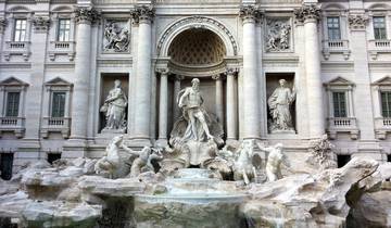
5 days
5 Day Rome Self Guided: Discover the Eternal City
- ✓ Comprehensive Lazio Marche Abruzzo tour
- ✓ Expert local guides included
- ✓ All accommodation arranged
- ✓ Transportation provided
3 days
Rome City Break – 3 Days/2 Nights
- ✓ Comprehensive Lazio Marche Abruzzo tour
- ✓ Expert local guides included
- ✓ All accommodation arranged
- ✓ Transportation provided
9 days
Paris & Rome: Magical Duo
- ✓ Comprehensive Lazio Marche Abruzzo tour
- ✓ Expert local guides included
- ✓ All accommodation arranged
- ✓ Transportation provided
4 days
The Best Of Rome: 4 Days Adventure
- ✓ Comprehensive Lazio Marche Abruzzo tour
- ✓ Expert local guides included
- ✓ All accommodation arranged
- ✓ Transportation provided
Multi-day tour packages powered by TourRadar. Prices and availability subject to change.
The Colli Albani: Volcanic Landscape as Engineering Challenge
The Alban Hills rise southeast of Rome as the eroded remnant of one of Lazio’s most geologically significant volcanic complexes. The Colli Albani form what geologists classify as a quiescent polygenetic volcano — a compound system built from successive eruption cycles, the most recent of which produced the prominent landforms still visible today: a large outer caldera whose rim forms the hills’ highest ground, and within it smaller subsidiary calderas, two of which retain standing water. The larger, oval Lake Albano occupies the westernmost of these depressions; the smaller, rounder Lake Nemi lies to the east. Between them, and adjacent to the Nemi crater, a third notable caldera — the Ariccia depression — sits lower on the volcanic system’s inner flank, connected to the Nemi crater by the same volcanic ridge that the ancient emissarium would eventually penetrate. The highest point of the Alban Hills, Monte Cavo, reaches approximately 950 meters, and the hills’ volcanic slopes provide the mineral-rich agricultural soils and the reliable rainfall that made the Castelli Romani region one of the most densely settled areas of pre-Roman Latium.
The geological substrate throughout the Alban Hills is dominated by pyroclastic deposits, ignimbrites, and ash flows consolidated over tens of thousands of years into a suite of volcanic rocks that differ in hardness, density, and workability depending on the temperature, speed, and chemical composition of the original eruption. The most important of these rocks for both ancient hydraulics and later construction is peperino — the local gray-speckled tuff known geologically as Lapis Albanus — quarried primarily at Marino and used continuously from at least the eighth century BCE. Harder volcanic rocks, including leucitite, also outcrop across the hills and formed the matrix through which the deepest sections of the emissaria were cut.
For ancient communities living on and around the crater lakes, this volcanic landscape posed a distinctive and persistent hydrological challenge. Crater lakes form in depressions with no natural surface outlet: all water input comes from rainfall and subsurface seepage, and all natural water loss occurs through evaporation and slow underground percolation. In wet seasons or during years of exceptional precipitation, the lake levels rise toward the crater rim; in geological time, lakes periodically overflow their craters entirely, causing catastrophic erosion of the rim and dangerous flooding of the slopes below. Managing this risk — stabilizing lake levels below the overflow point while preserving reliable water bodies for settlement and agriculture — was an engineering necessity for any community aiming to occupy the crater shores permanently. At Lake Nemi, the challenge carried additional weight: the sacred grove and sanctuary of Diana Nemorensis occupied the northern shore, and the lake’s stability was inseparable from the sanctuary’s continued function.
The engineering solution available to pre-Roman builders was elegant in its simplicity: cut a tunnel through the volcanic rock at the desired maximum water level on the lake side, slope it gently downward through the crater wall, and allow gravity to drive the drainage. As the lake rises above the tunnel inlet, drainage accelerates automatically; as it falls back to the inlet level, drainage ceases. No moving parts, no operator intervention, no risk of catastrophic overflow — only the tunnel itself needed to hold. Achieving this required the ability to cut through volcanic rock across distances of more than a kilometer, maintaining a consistent downward gradient and accurate horizontal direction throughout, without any of the precision instruments available to modern engineers.
The Subterranean Tuff Tunneling of the Nemi Hydraulic Outlet
The emissarium of Lake Nemi is approximately 1,653 meters long — an underground passage cut through the volcanic tuff of the Alban Hills that, by the evidence of the Temple of Diana at the lake’s northern shore, was already in existence by the end of the sixth or the beginning of the fifth century BCE. The sanctuary of Diana Nemorensis was established no later than this period, as the temple remains suggest, and the sanctuary’s continued function required a stable lake environment that the emissarium provided; its presence therefore constitutes a terminus ante quem for the tunnel’s completion. This pre-Roman dating — about a century before the better-documented Albano emissarium, traditionally connected by Livy to the Roman siege of Veii around 398 to 397 BCE — and the complete absence of any ancient written record of the Nemi tunnel’s construction strongly suggest that it was built not by Roman engineers but by the communities of the Latin League or their predecessors, whose hydraulic capabilities have been insufficiently recognized in standard histories of ancient engineering.
The tunnel’s route is unusual within the regional context. Rather than following the most direct path to the outer slopes of the Alban Hills, it passes beneath the ridge separating the Nemi crater from the adjacent Ariccia caldera, discharging Nemi’s excess water into that neighboring depression. The Ariccia caldera is in turn drained by a second, shorter tunnel crossing its southern border, which carries the combined waters to the lowlands below. This two-stage hydraulic cascade — Nemi to Ariccia, Ariccia to the plains — represents a sophisticated reading of the inter-crater topography, routing water through the path of least geological resistance rather than attempting to penetrate the volcano’s thicker outer flanks. The practical consequence of this design was that both volcanic basins were managed by a coordinated hydraulic system: the Ariccia caldera floor, receiving and then passing on the water that Nemi shed in wet years, could remain stable and habitable rather than flooded. The plateau that would later bear Bernini’s Baroque ensemble was, in a literal sense, made available for permanent settlement by the hydraulic engineering of the Nemi emissarium and its associated Ariccia outlet.
The rock through which the tunnel was cut is a consolidated pyroclastic deposit of the Colli Albani volcanic series — softer than the leucititic lavas exposed elsewhere in the hills, but hard enough to require iron tools and organized labor. The tunnel walls, where accessible to inspection, show the marks of picks and chisels worked in short horizontal and vertical strokes, consistent with hand excavation using iron implements. Lighting in such a confined environment came from small clay oil lamps — a practice well attested in comparable ancient tunnel systems across the Roman world — hung at intervals or carried by individual workers. Excavated material — tuff rubble and volcanic grit — was hauled to the surface in baskets through the vertical access shafts that punctuated the tunnel’s route, a system of spoil removal that was both the main engineering challenge and the principal logistical achievement of the construction.
Surveying Techniques and Counter-Trenching Accuracy in Archaic Underground Engineering
The central engineering problem of the Nemi emissarium — and of every comparable tunnel cut without modern instruments — was maintaining a consistent gradient and horizontal direction over a distance too long to sight through from a single vantage point. Two complementary excavation methods addressed this problem, and both appear to have been employed in the Alban Hills emissaria, with the choice between them governed by the specific topography of each tunnel segment.
The first method, known as the cuniculus or shaft method, involved sinking a series of vertical access shafts from the surface at intervals of roughly 30 to 60 meters along the planned tunnel line. Workers descended these shafts and excavated horizontally between adjacent shafts, connecting each pair with a short tunnel section. The shafts served multiple functions simultaneously: they provided ventilation for the workers below, served as conduits for hauling excavated rock and tuff to the surface, allowed supervisors to monitor progress from above, and — critically — functioned as survey control points. Ensuring each shaft was truly vertical required engineers to suspend a plumb bob from a rod laid across the shaft mouth and verify that the hanging weight descended to the center of the shaft floor; the same plumb line measured the shaft’s depth and thereby established the precise floor elevation needed to maintain the tunnel’s overall gradient. By controlling each short section between adjacent shafts, engineers limited the accumulation of error over the full tunnel length: even a small error in one inter-shaft section could be detected at the next shaft and corrected in the following section, preventing small deviations from compounding into major misalignments over the full kilometer-plus of the tunnel.
The second method, counter-excavation — the technique to which the locked heading’s phrase “counter-trenching” refers — required teams to begin tunneling simultaneously from two endpoints, working toward each other and meeting inside the mountain. This approach was especially suited to segments where the surface topography made shaft-sinking impractical, or where the tunnel needed to cross a high point in the ridge without a series of progressively deeper shafts. Counter-excavation demanded substantially greater precision in the initial surface survey, because any misalignment of the two tunnel axes at the surface would result in the two approaching teams missing each other underground — a failure mode documented in Roman engineering history: ancient sources record that builders of the aqueduct serving the North African city of Saldae (modern Béjaïa, Algeria) failed to meet correctly inside their mountain crossing and had to be corrected by the engineer Nonius Datus, who excavated a lateral connecting link between the two misaligned corridors. Surface alignment for counter-excavation used instruments available to pre-Roman surveyors including the groma — a cross-shaped sighting frame mounted on a vertical staff — which allowed surveyors to establish straight horizontal lines across broken terrain and transfer them to the shaft openings at each tunnel portal. Rope or chain measurements at consistent tension provided repeatable distance references for establishing the planned tunnel length above ground before excavation began below.
Underground, workers tracked the heading of the approaching opposite team through sensory cues unavailable to modern tunnel operators but highly effective in the quiet of a pre-industrial construction environment. By hammering on the rock wall at regular intervals, the approaching team announced its position; the receiving team could hear the sound through the rock, estimate its direction and distance, and correct their heading accordingly. As the two headings approached within a few meters of each other, the sound of excavation itself — the rhythmic clink of picks on tuff — guided the final approach. The accuracy achieved by this method across the better-documented examples of ancient tunneling was impressive: the Albano emissarium, cut perhaps a century after the Nemi tunnel, maintains a documented gradient of approximately 2 percent — steep enough to sustain continuous water flow without sediment accumulation, gentle enough to prevent erosive velocities that would wear away the tunnel floor over centuries of operation. Whether the Nemi emissarium observes a comparable gradient along its full length has not been established in published survey data, but the hydraulic requirements of a lake-drainage system are identical regardless of era, and a broadly similar slope profile may be inferred as probable.
The resulting accuracy across more than a kilometer of underground work, achieved without electronic instruments, stands as a monument to the geometrical and practical knowledge of pre-Roman builders in central Italy. Their skill was transmitted through craft experience and professional tradition rather than formal written instruction — a body of know-how as technically demanding as any in the ancient world, and more durable in its physical outcomes than many of the political structures of the same period.
Siphon Mechanics and Water-Level Control in Volcanic Crater Basins
Understanding how the Nemi emissarium maintains the lake’s water level requires a careful distinction between two hydraulic mechanisms that ancient engineers implicitly understood and applied according to the specific geometry of each situation.
Simple gravity drainage — the regime that governs most lake emissaria, including the Albano tunnel — operates on straightforward principles. The tunnel’s inlet is cut into the crater wall at the desired maximum water elevation; as long as the lake surface is above that inlet, water flows through the tunnel under the pressure head created by the difference in elevation between the lake surface and the tunnel outlet. Flow rate increases as the lake rises above the inlet and decreases as it approaches the inlet level, creating a self-regulating system that responds passively and proportionally to hydrological conditions. When the lake surface falls to the inlet elevation, drainage ceases automatically. No operator intervention is required; the system functions continuously for as long as the tunnel remains unobstructed — which, in the case of the Alban Hills emissaria, has been for more than two millennia.
A hydraulic siphon operates on different principles and addresses a different engineering problem. In an inverted siphon — a device employed by both ancient Greek and Roman engineers in aqueduct construction — a sealed pipeline descends from a water source, crosses a topographic depression, rises on the far side to pass over an intermediate ridge, and descends again to the outlet. For water to flow continuously through the rising section, the pressure of the water column in the descending arm must overcome the atmospheric pressure that would otherwise halt flow at the highest point of the siphon pipe. This limits the effective height of a gravity-driven siphon to approximately ten meters under standard atmospheric conditions; beyond that height, the suction effect exceeds what atmospheric pressure can sustain, air enters the pipe, and the water column breaks. Ancient Roman engineers used inverted siphons precisely in aqueduct routes where crossing deep valleys by bridge would have been prohibitively expensive, accepting the ten-meter height limitation as a constraint on their routing options.
Whether the Nemi emissarium incorporates true siphon mechanics along any section of its route depends on the tunnel’s elevation profile through the volcanic ridge — specifically, whether the ridge geometry required the tunnel to pass through any section at an elevation above the lake’s normal water surface before descending into the Ariccia caldera. If the tunnel was cut through the lowest accessible point of the ridge at an elevation below the lake surface throughout its full length, the system operates as pure gravity drainage into the Ariccia basin. If, on the other hand, local geological conditions — a hard rock layer, a zone of unstable tuff, or an unexpected ridge geometry — forced the tunnel profile to rise above the lake surface at an intermediate point before descending, the system would incorporate an inverted siphon section that activated only when the lake rose sufficiently to generate the pressure head needed to drive water through it. In the latter case, the lake would show a more complex level-control behavior: drainage would begin only once the lake reached the siphon’s activation threshold, and would then proceed at high flow until the lake returned to the threshold level. The published literature on the Nemi emissarium does not provide a complete elevation survey of the tunnel profile adequate to resolve this question definitively; the hydraulic mechanics of the system’s specific geometry remain an open question for future geophysical investigation.
What is unambiguous is the outcome. Lake Nemi occupies a closed volcanic crater of approximately 1.67 square kilometers in surface area. The Alban Hills receive substantial seasonal rainfall each autumn and winter, and without any drainage outlet the lake level would fluctuate by several meters between wet and dry years, periodically threatening the inhabited and sacred areas of the northern shore. With the emissarium operating across the centuries, those fluctuations have been constrained: excess water passes into the Ariccia caldera rather than overtopping the crater rim. The result is a self-regulating water-control system whose functional principle — setting a fixed overflow threshold and allowing gravity to do the rest — anticipates the design logic of modern reservoir overflow weirs and constant-level control structures, achieved entirely through the passive geometry of a rock-cut tunnel rather than through mechanical valves or operator-controlled gates.
Diana’s Sacred Lake and the Politics of Water Control
Lake Nemi was not merely a body of water in the ancient world; it was a sanctuary. Its ancient name — Lacus Nemorensis, the Lake of the Grove — identified it with the dense woodland that surrounded its shores, within which stood one of the most important religious sites in pre-Roman Latium: the sanctuary of Diana Nemorensis. Diana, goddess of the hunt, the moon, and the boundaries between civilization and wilderness, found in the enclosed crater lake and its surrounding forest an archetype of her domain — wild, bounded, and luminous on still nights when the full moon reflected across the water. The sanctuary attracted pilgrims from across the Latin cities and beyond, and its rituals included one of the most striking of the ancient world: the institution of the Rex Nemorensis — the King of the Grove — who held his priestly office only as long as he could defend it in combat against any challenger who succeeded in breaking a branch from a sacred tree. James George Frazer’s opening chapters of The Golden Bough famously begin with the puzzle of this institution, though the precise nature of the ritual remains a matter of interpretive debate among ancient historians.
The decision to build a hydraulic drainage tunnel beneath this lake was therefore not a purely utilitarian act. It engaged the relationship between human engineering and a landscape understood as divinely inhabited. In pre-Roman Latium, the Diana Nemorensis sanctuary appears to have been shared property of the Latin League — the confederation of Latin cities occupying the Alban Hills and surrounding plain — and no single city could unilaterally alter the sanctuary’s hydrological environment without collective sanction. The construction of the emissarium, requiring the mobilization of organized labor across what must have been years of sustained work, represents an act of collective political will by the communities of the League, probably organized around the sanctuary itself as a common institution. The engineering project and the religious institution were not in conflict; rather, the engineering served the religious setting by making the lake’s shores permanently stable and habitable for the sanctuary’s operation.
The contrast with the Albano emissarium is instructive. The Albano tunnel, built approximately a century later, is embedded in a famous literary account. Livy, in the fifth book of his history of Rome, describes how around 398 to 397 BCE the Alban Lake rose to an unprecedented level while Roman forces besieged the Etruscan city of Veii. Roman envoys consulted the Delphic oracle, and a captured Etruscan haruspex revealed that Veii would not fall until the Romans had drained the Alban Lake so that its waters did not reach the sea — that is, until they had diverted the drainage inland for agricultural use rather than allowing it to flow to the coast. The Romans constructed the tunnel in response to this religious directive, producing a hydraulic work that served simultaneously as an act of piety, a display of engineering capability, and a practical improvement to the agricultural land around the lake’s outlet. The Nemi emissarium has no Livian narrative to anchor it to a specific historical moment or a named political decision; its completion before the period of Roman historical writing means it belongs to a pre-textual engineering tradition whose social and political organization can only be inferred from the engineering itself.
Both emissaria reflect a basic truth about ancient water management in the volcanic Alban Hills: the communities that settled these crater landscapes recognized that the geological setting required active hydraulic intervention to remain habitable, and they mobilized the collective resources necessary to provide it. The political authority capable of sustaining such projects — whether the Latin League at Nemi or the early Roman republic at Albano — was, among its other functions, an engineering organization, managing the landscape on which its population depended.
Emissaria of the Alban Hills: Nemi in Regional Context
The Alban Hills emissaria form part of a broader tradition of underground hydraulic works in pre-Roman and early Roman central Italy, and situating the Nemi tunnel within this regional context reveals both its exceptional features and its continuity with a wider engineering culture that predates the Roman state.
The Albano emissarium is the best-documented of the group and provides the most useful basis for comparison. Approximately 1,350 meters long — with some surveys suggesting a total passage of up to 1,500 meters when the intake chamber and external canal section are included — it was cut to a height of approximately two meters and a width of roughly 1.2 meters, dimensions very close to those of the Nemi tunnel and suggesting a common regional standard for emissarium design in the volcanic Alban Hills. The tunnel runs through leucitite (a dense volcanic rock) at depths reaching up to 120 meters below the crater surface at its deepest point, and it features five vertical access shafts that served during construction as ventilation points and spoil-removal routes. The Albano emissarium maintains a documented gradient of approximately 2 percent along its length, sufficient to sustain continuous gravity-driven flow without sediment accumulation. Most remarkably, it remains hydraulically functional today, still regulating Lake Albano’s water level more than 2,400 years after its construction — a demonstration of engineering adequacy that no amount of historical or archaeological analysis can surpass.
Other emissaria in central Italy extend the tradition to different geological settings and scales of ambition. The Lake Trasimeno emissarium in Umbria takes the form of an open channel rather than a fully enclosed underground tunnel, and is attributed to Etruscan or early Roman construction; it demonstrates the application of the same basic drainage principle to a non-volcanic enclosed lake, adapted to the local geology and terrain. The Lake Fucino emissarium in Abruzzo — at approximately 5.6 kilometers long, the most ambitious hydraulic work of the emissarium tradition in Italy — was constructed under Emperor Claudius between 41 and 52 CE, requiring approximately 30,000 workers over eleven years and featuring 32 vertical shafts reaching depths of up to 122 meters. Its scale dwarfs the Alban Hills examples, but the fundamental technique — shaft-and-tunnel construction with coordinated counter-excavation from multiple points — is the same.
Beyond Italy, ancient lake drainage works appear in other hydraulically challenging landscapes. The draining of ancient Lake Copais in Boeotia, Greece, through tunnels that may be of Bronze Age origin, demonstrates that the principle of engineering a crater or enclosed basin’s outlet was not confined to the Italic world. The emissaria of Sicily mentioned in ancient sources show that the technique was applied across the Mediterranean wherever enclosed water bodies posed agricultural or settlement risks. None of these parallels, however, rivals the Alban Hills examples in continuity of function: both the Nemi and Albano tunnels remain active hydraulic structures, their ancient cuts still guiding water through volcanic rock after a span of human time that encompasses the rise and fall of the Roman Empire, the medieval period, the Renaissance, and modernity.
Within this regional and Mediterranean context, the Nemi emissarium stands apart for its pre-Roman dating and its unusual routing through the Ariccia caldera. These features suggest that the tunnel’s builders had a detailed understanding of the inter-crater topography of the Alban Hills that goes well beyond simple drainage engineering — they recognized the connected hydrology of the Nemi and Ariccia basins and exploited that connection to produce a two-stage system more efficient, in terms of tunneling distance and depth, than any direct route to the outer slopes would have been. This reading of the volcanic landscape’s hydraulic structure is the most impressive aspect of the emissarium’s design, and the one least susceptible to explanation by simple trial-and-error: it required a conceptual model of the Alban Hills’ subsurface hydrology that the builders must have developed through observation, inference, and accumulated local knowledge before the first shaft was sunk.
Caligula’s Ships and the Modern Life of an Ancient Outlet
Lake Nemi’s hydraulic history acquired a modern chapter that connects the ancient emissarium directly to twentieth-century archaeology, demonstrating the tunnel’s functional continuity in the most dramatic possible terms. The lake had long been known as the site of two extraordinarily large floating platforms built during the reign of Emperor Caligula (37 to 41 CE) — not conventional vessels for travel or commerce but enormous wooden barges decorated with bronze fittings, marble pavements, and elaborate mechanical devices, that served as floating pleasure palaces for imperial entertainment on the lake’s placid surface. Ancient sources described their luxury and scale in terms that were long considered exaggerated; divers and salvagers working the lake from the fifteenth century onward had occasionally retrieved bronze fittings, anchors, and wooden fragments that confirmed their existence without establishing their full dimensions.
Caligula’s assassination in 41 CE ended the official use of the ships, and they sank — whether deliberately scuttled, accidentally lost, or simply abandoned to waterlogging — to the lake floor. Over the following centuries, the compressed, low-oxygen sediment at the lake bottom preserved the wooden hulls, bronze decorations, and mechanical equipment in a condition of remarkable completeness, insulated from the decay that destroys organic material in aerobic environments. In 1927, under the government of Benito Mussolini, a decision was made to lower the lake level sufficiently to expose the hull remains on the bottom and allow the ships to be recovered intact. The drainage method was precisely the ancient tunnel: the emissarium was reopened and its inlet section modified to increase its flow capacity, allowing the lake level to fall and exposing the vessel hulls on the shallowing floor. Between 1929 and 1932, the two ships — each more than 70 meters long, making them among the largest watercraft known from antiquity — were raised and transported to a purpose-built museum building on the lake’s northeastern shore.
The museum and its irreplaceable contents were destroyed by fire in May 1944 during the last stages of the Italian campaign of the Second World War; the fire’s origin, whether deliberate or accidental, has remained contested in the subsequent historical literature. The Museum of Roman Ships was subsequently rebuilt and today presents scale models of the vessels alongside bronze fittings, lead pipes, anchors, and other recovered artifacts, together with interpretive displays of the lake’s hydraulic history and the emissarium’s role in the recovery project. The ancient tunnel, reactivated in the twentieth century to serve archaeological rather than agricultural purposes, demonstrated its functional durability across a span of more than 2,500 years — a hydraulic mechanism so well proportioned to the lake’s natural hydrology that it required only opening, not redesign, to serve a new purpose.
Peperino Stone: Geology, Properties, and the Architecture of the Volcanic Hills
The building material that connects the pre-Roman hydraulic engineering of Lake Nemi to the Baroque architecture of Ariccia is peperino — the gray-brown volcanic tuff that the Romans called Lapis Albanus, quarried since at least the eighth century BCE in the Alban Hills that produced it. Its Italian vernacular name derives from the characteristic appearance of the stone: dark fragments of basalt, scoria, and incompletely fused rock embedded in a lighter gray matrix of consolidated volcanic ash, so closely resembling a scattering of peppercorns that the name became immediate and universal among builders and quarrymen who worked it.
Geologically, peperino is a pyroclastic flow deposit — the consolidated product of a dense, hot mixture of volcanic gas and fragmented rock that poured rapidly from the erupting Colli Albani caldera and settled into a compacted mass as it cooled over the surrounding terrain. The Alban Hills pyroclastic deposits formed during the most energetic phases of the volcanic system’s history, long before human settlement of the region, and their subsequent geological consolidation over tens of thousands of years produced rocks of varying quality and hardness depending on the local cooling rate, chemical composition, and depth of the flow. The variety quarried at Marino — the principal ancient and modern extraction site — is characterized by a well-lithified, granular texture, a distinctive gray color, and a mineralogical content that includes carbonate rock fragments, leucite and pyroxene crystals, and poorly vesiculated scoriae; geochemical studies have established that these compositional signatures distinguish Lapis Albanus from other “peperino” tuffs quarried at different sites in the region, allowing modern analysts to trace ancient building stones to their source quarries.
As a construction material, peperino offered the builders of early Roman and pre-Roman Lazio a combination of properties that made it indispensable. It is abundant throughout the Alban Hills and could be quarried and transported at low cost to settlements throughout the Castelli Romani and to Rome itself via road and river. It cuts cleanly with iron tools when freshly quarried, allowing precise shaping of blocks, arch voussoirs, column drums, and decorative elements; the stone hardened somewhat after prolonged exposure to air, providing additional structural strength once set in place. It is moderately fire-resistant — a property that made it preferred over softer volcanic tuffs for building elements near hearths and kilns, and that contributed to its use in the construction of early city fortifications. Its primary limitation in exposed outdoor use is a susceptibility to surface degradation: peperino weathers more rapidly than the denser travertine limestone quarried at Tivoli, losing surface definition and structural integrity in the outer few centimeters when exposed to prolonged rain and freeze-thaw cycles. Building traditions throughout the Alban Hills and Rome accordingly used peperino for structural fill, interior walls, protected courtyard surfaces, and secondary elements, while travertine was reserved for columns, arch rings, and principal facades where durability and precision mattered most.
In the context of the ancient hydraulic works, peperino occupied a paradoxical role: it was simultaneously the geological obstacle through which the emissarium was cut and, at the intake chamber and masonry-lined sections of the tunnel, the structural material from which the tunnel was reinforced. The same volcanic tuff that challenged tunnel-cutters with its consolidated hardness served, once excavated, as the walls of the passage it had itself become. At the tunnel inlet — where lake water entered and exerted continuous hydraulic pressure on the surrounding rock, and where biological and chemical processes accelerated surface degradation — cut-stone blocks of peperino or harder volcanic material lined the intake chamber, creating a durable surface resistant to hydraulic abrasion over the centuries of the tunnel’s operation.
In Baroque Ariccia, nearly two thousand years after the emissarium builders first worked this stone, peperino retained its role as the local volumetric material of choice. Bernini and Carlo Fontana combined it with travertine in the material hierarchy that governed all high-quality Baroque construction in volcanic Lazio: travertine for the structural arch voussoirs, lintels, column shafts, and high-stress masonry elements where maximum compressive strength and weather resistance were required; peperino for wall cores, secondary walls, garden structures, and background surfaces where workability and local availability were primary considerations. The resulting composite masonry — warm cream travertine against gray-speckled peperino — is the characteristic material texture of the Ariccia ensemble and of Baroque Lazio more generally, a palette produced by the geological logic of the volcanic landscape as much as by aesthetic choice.
Global Hydraulic Parallels: Qanats, Tiwanaku, and Convergent Engineering Intelligence
The engineering intelligence that produced the Lake Nemi emissarium was not unique to the Alban Hills or to the broader Roman and pre-Roman world. Across the ancient world, civilizations confronting different but structurally analogous hydrological challenges arrived independently at overlapping engineering solutions — a convergent technological pattern that reveals the underlying logic of water physics as much as the ingenuity of any particular culture.
The most precise structural parallel to the Italian emissaria is provided by the Persian qanat, a system of underground water delivery that constitutes one of the oldest and most geographically extensive hydraulic engineering traditions in the world. A qanat begins with a “mother well” sunk deep into the water-bearing alluvium or bedrock at the foot of a mountain range, where the groundwater table is accessible at depth and the hydrostatic pressure ensures a reliable supply. From the mother well, a gently sloping underground channel — typically some 0.6 meters wide and 1.2 to 1.5 meters high, dimensions nearly identical to those of the Alban Hills emissaria — runs downhill through rock and soil, cutting at a gradient of roughly one to two percent until the channel emerges at the surface in agricultural lowlands many kilometers from its mountain origin. The water flows entirely by gravity throughout its underground journey — the same fundamental hydraulic principle governing the Italian lake drainage tunnels — and requires no pumping, no mechanical lift, and no energy input beyond the gravitational potential established by the mountain topography.
The construction method is strikingly familiar. Vertical shafts are sunk at intervals of approximately 20 to 30 meters along the planned channel route — somewhat more closely spaced than the cuniculi of the Roman tunneling tradition, perhaps reflecting differences in the geological materials being excavated and the tools available. Persian shafts are typically circular in cross-section, distinguishing them from the square or rectangular forms preferred by Etruscan and Roman cuniculus builders, but their functional logic is identical: access for workers during construction, ventilation of the underground working environment, and ongoing maintenance access once the channel is in operation. Teams worked the horizontal sections between adjacent shafts simultaneously, progressing from each shaft in both directions, and alignment was controlled by plumb lines, rope measurements, and the accumulated skill of the muqqanis — the professional guild of qanat builders who held and transmitted the craft knowledge of the qanat tradition across generations and across the vast territory of the Achaemenid Empire and its successors. The tradition was ancient in Persia well before the Achaemenid period, with origins placed by scholars no later than the first millennium BCE, and it spread through the Achaemenid world across the Middle East and North Africa, carried by the muqqanis whose knowledge of groundwater geology and tunneling technique was a professional inheritance of enormous practical value.
The critical difference between qanats and emissaria is directional and purposive. The qanat extracts scarce water from a highland aquifer and distributes it as an agricultural and domestic resource to arid lowlands that would otherwise be uninhabitable or marginally productive; it solves the problem of water scarcity through underground gravity flow. The emissarium drains excess water from a highland enclosed basin to prevent flooding of the inhabited crater shore; it solves the problem of water surplus through the same underground gravity flow. Both use the same physical architecture — vertical shafts connected by sloping horizontal tunnels — to manipulate water through the constraints of gravity and geology. They are mirror images of each other in hydraulic purpose, produced by the same engineering logic applied in opposite environmental circumstances.
No historical evidence connects the builders of the Nemi or Albano emissaria to the qanat tradition of Achaemenid Persia, or vice versa; the convergence in construction technique reflects independent responses to the universal physical constraints of hand-tool underground excavation in hard geological materials. When a builder must cut a tunnel through rock using only iron tools, and must maintain a precise gradient over hundreds of meters without optical instruments, the vertical-shaft-with-horizontal-tunnel method is the engineering solution that the physics of the problem naturally generates — and it emerged, independently and in recognizably similar form, in the volcanic hills of central Italy and in the mountain piedmonts of Iran and Central Asia. This is convergent engineering intelligence: different cultures arriving at comparable technical solutions not because of contact or diffusion, but because the same physical problem has the same small set of viable solutions.
A second and more distant parallel is provided by the hydraulic engineering of the Tiwanaku civilization, whose extraordinary agricultural and urban infrastructure developed in the high-altitude altiplano of the Lake Titicaca basin in modern Bolivia, at elevations of approximately 3,850 meters above sea level. The Tiwanaku engaged a hydrological challenge in some ways comparable to that of the Alban Hills communities: a highland lake environment with strong seasonal water fluctuations, where the stability of agricultural land adjacent to the lake depended on the management of water levels through engineered infrastructure. Their engineering response was, however, fundamentally different in technique. Rather than underground tunnels, the Tiwanaku constructed vast networks of raised agricultural fields — the suka kollus — elevated planting platforms between 5 and 20 meters wide and up to 200 meters long, separated by water-filled canals. The water retained in the inter-field canals served multiple purposes simultaneously: it irrigated crops during the dry season, regulated soil moisture against drought, and absorbed solar radiation during the day and released it as thermal heat at night, creating microclimates several degrees warmer than the surrounding open altiplano and protecting crops from the nightly frost that would otherwise have been lethal to high-altitude agriculture. Research combining satellite remote sensing with archaeological survey has established that the suka kollu system in the core Tiwanaku region extended across tens of thousands of hectares — a landscape of engineered agriculture on a scale comparable to the largest Roman irrigation works.
The city of Tiwanaku itself was also enclosed by a perimeter drainage channel connected to a network of supply canals drawing water from local rivers and aquifer seepage, a hydraulic network built beginning around 200 BCE and reorganized in response to changing precipitation patterns before approximately 800 CE. This urban water system controlled seasonal flooding, separated the ceremonial core from residential zones, and sustained the urban population’s water supply through dry periods — functions directly parallel to those served by the emissarium system in the Alban Hills, though achieved through surface earthworks rather than underground tunnels. The parallel between Tiwanaku’s drainage infrastructure and the Nemi emissarium is not one of technique but of engineering conception: both represent systematic interventions in a highland lake landscape to make it reliably habitable, requiring sustained collective organization, specialized hydrological knowledge, and an accurate reading of the landscape’s water behavior before any earth was moved or any stone was cut.
Across all three traditions — Alban Hills emissaria, Persian qanats, and Tiwanaku hydraulic earthworks — the pattern is one of convergent problem-solving: societies separated by geography, culture, and centuries arrived at different but structurally comparable strategies because the underlying physical challenge — managing water through the geometry of terrain and geology — presented each with the same fundamental constraints. What unites these traditions is not historical connection but the universality of hydraulic physics and the limited range of solutions available to builders working before industrialization. The sophistication of each tradition reflects not cultural inheritance but the accumulated empirical intelligence of communities that could not afford to get water management wrong.
Baroque Structural Engineering: Gian Lorenzo Bernini’s Arched Viaduct at Ariccia
When Cardinal Flavio Chigi and his brothers Mario and Agostino purchased the Ariccia fief from the Savelli family in July 1661 for 358,000 scudi, they acquired not only a medieval town and its agricultural hinterland but a volcanic landscape shaped by the same geological forces that had determined the Nemi emissarium nearly two thousand years earlier. The Ariccia plateau — occupying the floor and lower rim of the caldera that had received the Nemi tunnel’s drainage for centuries — sat at the edge of the Vallericcia, a deep ravine cutting northward through the volcanic rock of the Alban Hills immediately adjacent to the town. This ravine defined the spatial character of the plateau and the structural challenges of any architecture placed at its rim: the plateau’s flat caldera floor was surrounded by the dramatic topographic drop of the valley, and any comprehensive urban design for Ariccia had to reckon with the relationship between the built ensemble on the plateau and the deep landscape below.
Gian Lorenzo Bernini, called to the commission in 1664 by Pope Alexander VII’s family, did not arrive at a blank canvas. The town’s topography was already fixed by its geological history: the caldera floor, the ravine, the Via Appia Nuova threading through the valley below. His design for Ariccia has been recognized by architectural historians as one of the most complete applications of Baroque urban planning principles to a small peripheral center in Italy — a transformation comparable in its ambition to what Pienza represented for the Renaissance. Bernini conceived the ensemble not as a collection of individual buildings but as a unified spatial composition in which palazzo, church, piazza, and park functioned as a single architectural organism, with the volcanic landscape as its stage. Contemporary sources and later scholars describe the result as a Baroque ideal city in miniature, a “Chigi state” in the Castelli Romani that expressed the family’s cultural aspiration through the grammar of Roman Baroque urbanism applied to a hilltop volcanic town.
The arched structures at Ariccia that give the ensemble its Baroque structural identity are principally the two curved porticoes flanking the Church of Santa Maria Assunta on the Piazza di Corte. These curved colonnaded wings — each a continuous series of round-arched openings carried on engaged masonry piers — curve inward to frame the circular church at the piazza’s far end, creating an oval space that operates simultaneously as a forecourt to the palazzo, an entrance composition for the church, and a civic gathering place for the town. The structural logic of these porticoes is the adapted Roman colonnade: round arches spring from piers rather than columns in the classical sense, concentrating compressive load in a masonry skeleton that transmits thrust outward and downward to the volcanic bedrock below. The choice of round rather than pointed arches reflects the structural knowledge codified through centuries of Roman and Renaissance masonry practice: round arches generate more manageable horizontal thrusts for a given span than pointed arches and allow supporting piers to be designed primarily for vertical compression, without the elaborate buttressing systems that Gothic pointed arches required to resist their more aggressively outward-directed thrust.
The Church of Santa Maria Assunta itself — consecrated in 1664 and formally rededicated in 1665 by Cardinal Flavio Chigi — demonstrates Bernini’s structural handling of the circular form. The church’s exterior echoes the Pantheon: an austere cylindrical drum topped by a low dome, with a three-arched entrance portico of Doric character. The three round arches of the portico are the building’s most explicit structural statement, opening the enclosed rotunda volume to the piazza through a sequence of arched openings that manage the load transition from the massive drum above to the lighter portico below. Each arch carries the weight of the wall above it by converting that downward load into compressive forces directed along the curve of the arch and transmitted to the piers flanking each opening; the piers in turn carry the combined compressive load to the foundations in the volcanic rock.
The full expression of arched infrastructure at the Ariccia site as a spanning structure came from the nineteenth century. The famous multi-tiered viaduct crossing the Vallericcia valley — positioned so that it approached the town directly at the level of Bernini’s Piazza di Corte sequence, with the Palazzo Chigi-Odescalchi occupying the terminal point of the bridge’s arrival on the plateau — was built between 1847 and 1854 by the architect Ireneo Aleandri under commission from Pope Pius IX. Aleandri’s structure replaced the steep ramps of the old Via Appia access with a level crossing 312 meters long and 59 meters high, featuring a prominent semicircular central arch of approximately 40 meters span and two flanking tiers of smaller arches below it. Its materials were travertine for the facing and structural arch elements, over a rubble and brick core — the same material hierarchy governing Baroque construction at Ariccia. Damaged by Allied bombing in 1944 and suffering a partial structural collapse in 1967, the viaduct was rebuilt with reinforced concrete while its original travertine arch profile and facing were preserved, so that the structure’s visual language — the sequence of semicircular arches spanning the volcanic ravine — remains continuous with the Baroque masonry vocabulary of Bernini’s ensemble above.
Bernini himself did not design the valley-spanning viaduct, which postdated him by nearly two centuries; but his placement of the palazzo at the topographic hinge between the plateau and the ravine edge anticipated with precision the spatial logic that the nineteenth-century infrastructure architects subsequently exploited. By situating the Chigi palazzo at the very point where the volcanic plateau meets the Vallericcia drop, Bernini identified the structural and spatial pivot of Ariccia’s relationship with the valley — the point from which the building commands the landscape most completely and from which a spanning structure of sufficient ambition would, inevitably, one day reach across to connect the plateau to the approach road below. The viaduct confirms the accuracy of Bernini’s reading of the site.
Load Distribution and Travertine-Peperino Masonry in High-Span Bridges
The structural mechanics of a masonry arch — whether built in the pre-Roman world, in Baroque Ariccia, or in nineteenth-century Lazio — reduce to a single organizing principle: the arch converts the downward force of gravity into forces that act primarily along the curved geometry of the arch ring, and transmits those forces as horizontal thrusts at the arch’s endpoints, the springing points where the arch meets its supporting piers or abutments. Provided that the resultant compressive force — the line of thrust — stays within the physical thickness of the arch ring at every point along its profile, the arch is in pure compression and the masonry is stable; if the thrust line exits the ring, a bending moment develops at that point, and unreinforced masonry, which cannot resist tension, cracks. The stability of any masonry arch therefore reduces to a geometric question: is the arch thick enough, and is the arch’s profile appropriately shaped, to keep the thrust line within the arch thickness under all expected loading conditions?
This principle, though not formally articulated until the mathematician Robert Hooke stated it in the late seventeenth century — “as hangs a flexible cable, so but inverted, will stand a rigid arch” — was implicitly understood by masonry builders through accumulated empirical tradition long before its mathematical formalization. The rules governing Roman arch proportioning, refined over centuries of bridge and aqueduct construction across the Mediterranean world, specified the relationship between span, arch thickness, and pier dimensions that kept the thrust line within safe bounds under normal loading; these rules were transmitted through the Renaissance building tradition and arrived at Baroque practice essentially intact. Bernini and his collaborators operated within this inherited structural knowledge, applying it to the specific conditions of volcanic Lazio — a landscape where the available stone materials and the local geological context shaped both the possibilities and the limits of arched construction.
In a multi-span bridge or viaduct of the Ariccia type — whether Bernini’s piazza porticoes or Aleandri’s valley-spanning structure — additional structural challenges arise beyond those of a single arch. In a continuous series of arches, each arch thrusts its horizontal loads into the pier separating it from the adjacent arch; for interior piers, these thrusts from opposing arches ideally cancel, and the pier carries primarily the vertical loads from the arch above. At the end piers and abutments, however, only one arch provides thrust — from the interior — and the full horizontal force of that arch must be absorbed by the abutment mass alone. This is why the terminal piers and abutments of masonry viaducts are disproportionately massive compared to the intermediate piers: they carry an asymmetric horizontal load that the interior piers share between two opposing arches. In the Ariccia viaduct’s three-tiered structure, the load path is further complicated by the stacking of arch tiers: the upper tier’s arch loads must be transferred through the second tier’s piers to the first tier, and the cumulative compressive load at the base dictates the critical design zone for both the masonry and the foundations. At Ariccia, those foundations rest on the volcanic peperino bedrock of the caldera plateau’s edge — a material whose compressive strength, while lower than travertine, is adequate for the foundation conditions of a structure of this scale provided the loading is distributed over a sufficient bearing area.
The pairing of travertine voussoirs with peperino infill and background masonry in the Ariccia structures represents the optimal material strategy for volcanic Lazio: travertine, with its substantially higher compressive strength and lower susceptibility to surface weathering, handles the arch ring, the key structural elements of the springing zone, and the weather-exposed facing; peperino fills the non-structural volumes that give the arched structure its visual mass and thermal stability, and provides the local material for secondary walls and infill that do not carry the principal structural loads. In the composite masonry wall that results — travertine skeleton, peperino fill — the differential elastic properties of the two materials are sufficiently similar that the system behaves, under normal service loads, as a unified structural body rather than as two separate materials in competition. The visual result — warm cream travertine against the gray-speckled cooler tone of peperino — is the material signature of the Alban Hills Baroque, as distinctive and as geologically determined as the landscape that produced both stones.
Bernini’s Unified Vision: Piazza, Palace, Park, and the Volcanic Landscape
Bernini’s Ariccia commission is remarkable in the history of Italian Baroque architecture not only for its individual monuments but for its ambition to transform an entire town through a unified design vision. The ensemble carried to completion by Carlo Fontana between 1664 and 1672, under Bernini’s direction and conceptual authorship, encompasses three scales of architectural intervention that work together to produce a coherent spatial experience of exceptional completeness for a provincial hilltop town.
At the urban scale, Bernini reorganized the existing medieval fabric of Ariccia around a new focal space — the Piazza di Corte — that created a visual and ceremonial axis connecting the palazzo, the church, and the town’s principal approach route. The piazza’s oval form, enclosed by the two curved porticoes, operated simultaneously as a forecourt to the palazzo, an entrance composition for the church, and a civic gathering space for the town’s inhabitants. The oval plan — not a perfect ellipse but a pragmatic curve adapted to the site’s dimensions — achieves spatial enclosure while admitting light and air from the gaps between the curved wings and the straight building faces flanking them. Contemporary architectural theory recognized the Ariccia ensemble as an exemplary application of Baroque spatial thinking: the principle of the “meraviglioso composto,” the marvelous composite, in which architecture, sculpture, and setting fuse into a unified aesthetic experience greater than the sum of its parts.
At the architectural scale, the Palazzo Chigi-Odescalchi was transformed from a medieval fortified Savelli residence into a Baroque palazzo through the regularization of the facade, the addition of new wings completing the building’s U-shaped plan, and the comprehensive decoration of the interior. The palace’s piano nobile rooms preserve their original furnishings to an exceptional degree: gilt-leather wall hangings in the principal salons, fresco cycles on the vault and ceiling surfaces, and the small chapel decorated with a sanguine drawing of Saint Joseph with the Child bearing Bernini’s signature and dated 1663 — a direct autograph of the master’s hand in the building he directed. The exterior presents the restrained travertine facade with angular corner towers and a grand portal that characterizes Bernini’s approach to secular Baroque architecture: grandeur achieved through proportion and material quality rather than decorative excess. The church of Santa Maria Assunta, consecrated in 1664, offers the counterpoint of controlled Baroque ornament in its interior against the severity of its Pantheon-inspired exterior — a circular rotunda whose dome interior is richly painted and whose side chapels are fitted with altarpieces and sculptural decoration.
At the landscape scale, Bernini and Fontana supervised the expansion and reorganization of the Parco Chigi, the 28-hectare wooded park adjacent to the palazzo. New paths, fountains, and garden structures were introduced, bringing the park’s infrastructure into alignment with the Baroque aesthetic of the ensemble above. The park occupies the caldera floor and inner slopes of the Ariccia volcanic depression — the same caldera that received the Nemi emissarium’s discharge across the centuries — and the management of its surface water, the drainage of its terraced garden areas, and the maintenance of its hydraulic features engaged directly with the ancient hydrological conditions that the emissarium system had established and stabilized. The mature woodland that fills the Parco Chigi today masks much of this infrastructure, but the terraced garden levels and the historic path alignments preserve the designed landscape’s relationship with the volcanic terrain beneath it.
The palazzo’s position at the northern edge of the volcanic plateau — where the Chigi park descends from the caldera rim toward the Vallericcia ravine — defines the ensemble’s relationship to the dramatic natural topography that Bernini had to reckon with and that his design exploited. Placing the palazzo at this topographic hinge gave the building commanding views of the ravine and the valley beyond, framed the approach to the town from the north through the palazzo’s massive bulk at the plateau’s edge, and set up the spatial conditions that the nineteenth-century viaduct would subsequently exploit to connect the plateau level with the Via Appia road below. Bernini’s reading of the site was sufficiently accurate that the infrastructure architects of Pius IX’s road program placed their great spanning structure at precisely the point his building had identified as the spatial and structural pivot of Ariccia’s relationship with the landscape.
From Archaic Emissarium to Baroque Arch: Two Millennia of Engineering Continuity
The span between the construction of the Nemi emissarium — probably in the late sixth or early fifth century BCE — and Gian Lorenzo Bernini’s Ariccia ensemble of the 1660s CE exceeds two thousand years. Yet the engineering traditions they represent share threads of continuity that operate at multiple levels of abstraction and material reality, making the two works not merely geographically adjacent but conceptually related as successive interventions in the same volcanic landscape.
The most direct continuity is material. Peperino — the gray-speckled volcanic tuff that tunnel-cutters worked through with iron picks in the early fifth century BCE — was still the primary local building stone when Bernini’s team quarried it for the Ariccia ensemble in the 1660s CE. The quarries at Marino in the Alban Hills had been supplying peperino continuously for more than two thousand years between these two moments of construction; the stone’s geological identity, its physical properties, and its extraction locations had not changed. The same rock that was once cut away to create a water-passage through the volcanic ridge was now assembled, block by block, to create an architectural space above the caldera that the water-passage had helped make habitable.
The second continuity is conceptual: both the emissarium engineers and Bernini’s team were engaged in making a volcanic landscape continuously inhabitable. The emissarium solved the flooding threat that made permanent settlement on the Nemi crater shore and the Ariccia caldera floor problematic without hydraulic intervention; Bernini’s ensemble solved the organizational and representational problem of concentrating urban life on a volcanic plateau in a way that expressed the cultural aspiration and political authority of the Chigi family. Hydraulic engineering made the land usable; Baroque architecture made the usable land meaningful. These are successive acts of the same long civilizing project, separated by two thousand years of accumulated history but unified by the volcanic geology that both had to reckon with.
The third continuity is structural. The Roman arch — whether in the linteled intake chamber of a drainage tunnel, in the curved porticoes of a Baroque piazza, or in the soaring spans of a nineteenth-century viaduct — is a structural technology that the Italic world developed and refined over centuries, finding in the volcanic stone of central Lazio exactly the right material for its demands: available in sufficient quantity and block size, strong enough in compression to carry arch loads, workable enough to be shaped to the voussoir geometry that an arch ring requires. Archaic tunnel builders who cut arched masonry entries into the Nemi crater wall applied the arch’s structural logic in its simplest form; Bernini’s team extended it into an instrument of Baroque spatial choreography; Aleandri’s engineers extended it again into a landscape-scale structural achievement spanning a volcanic ravine. The arc of masonry arch technology in the Alban Hills runs from pre-Roman hydraulic works to nineteenthcentury civil engineering through a geological and material continuity that binds the full sequence together.
Visiting the Alban Hills Hydraulic and Baroque Heritage
The Alban Hills offer visitors one of the densest concentrations of engineering heritage in central Italy, spanning a full arc from pre-Roman hydraulic works to Baroque urbanism within a compact and highly accessible volcanic landscape. Both principal sites — Lake Nemi and Ariccia — lie within approximately 30 to 40 kilometers of central Rome and can be combined in a single day trip, following the route that the ancient emissarium itself traces underground beneath the volcanic ridge.
Lake Nemi village sits on the northern rim of the crater at an elevation of approximately 521 meters, commanding sweeping views across the lake below and its densely wooded crater slopes. The lake occupies the crater floor at approximately 316 meters above sea level, and the descent from the village to the shore follows a winding road through the wooded rim. The Museum of Roman Ships on the lake’s northeastern shore — rebuilt after the 1944 fire — presents the story of Caligula’s lake vessels through scale models, recovered bronze fittings, lead pipe sections, anchor components, and interpretive displays that include the lake’s hydraulic history and the emissarium’s central role in the twentieth-century recovery effort. The emissarium inlet is accessible near the lakeshore level along a footpath following the lake’s perimeter, and the intake chamber’s masonry features can be observed from the exterior; the tunnel interior is not open to general visitors for safety reasons. The lake’s scenic perimeter road, approximately four kilometers in length, allows a complete circuit of the crater rim and provides changing perspectives on the enclosed volcanic landscape that made hydraulic management both necessary and possible for the lake’s ancient communities.
Ariccia is readily reachable from Rome by car along the Via Appia Nuova — approximately 30 kilometers from the city center — or by train from Termini station to Albano Laziale followed by a local bus connection, in approximately one hour total travel time. The Palazzo Chigi-Odescalchi, now administered by the Ariccia municipal authority, is open to the public as the Museum of Roman Baroque Art — the Museo del Barocco Romano — hosting the permanent Lemme Collection of Baroque paintings in its original period rooms alongside the preserved gilt-leather hangings, frescoed ceilings, and Bernini’s chapel sanguine. The Piazza di Corte and the Church of Santa Maria Assunta are freely accessible at all times; the spatial experience of Bernini’s oval piazza framed by the two curved porticoes, with the circular church drum at one end and the palazzo facade at the other, represents one of the most complete surviving Baroque urban compositions in Lazio outside Rome. The Parco Chigi, the 28-hectare wooded park adjacent to the palazzo, opens to the public on weekends and public holidays; its mature woodland, terraced paths, and views over the Vallericcia ravine provide the landscape context within which the Baroque ensemble was designed to be experienced. The famous arched viaduct spanning the Vallericcia — rebuilt with reinforced concrete behind its original travertine facing — is prominently visible from the park’s rim and from the piazza itself, and the view from the bridge down into the canopy of the Parco Chigi below gives the most visceral sense of the topographic drama that shaped both the ancient hydraulic and the Baroque architectural responses to this volcanic setting.
The road route between Lake Nemi and Ariccia — approximately six kilometers through the woodland and vineyard country of the Castelli Romani — follows the surface of the volcanic plateau through which the ancient emissarium runs underground. Driving this stretch with the knowledge that the tunnel passes beneath gives the landscape a different dimension: every low ridge, every wooded swale, every vineyard terrace is the surface expression of the same volcanic geology that two sets of engineers — separated by more than two thousand years — were reading and responding to in their own ways.
Conservation Challenges and Ongoing Scholarship
The hydraulic and architectural heritage of the Alban Hills faces conservation challenges that differ substantially in character between its underground infrastructure and its above-ground Baroque monuments, but that share a common dependency on sustained institutional attention and the application of systematic archaeological and structural monitoring.
The Nemi emissarium, like most ancient underground hydraulic works in volcanic terrain, is vulnerable primarily to the geomorphic processes that affect consolidated tuff in the absence of active maintenance. The tunnel’s rock walls are subject to gradual weakening by groundwater infiltration through fractures in the tuff, and the vertical access shafts — cut nearly 2,500 years ago — are in varying states of preservation depending on whether they have been periodically stabilized or have been left to close gradually through natural erosion and vegetation root action. The Albano emissarium, for which comparative data are somewhat more accessible in published form, remains hydraulically active and has been subject to periodic inspection; the full current condition of the Nemi tunnel walls along its 1,653-meter length is less comprehensively documented in the scholarly literature accessible to non-specialist readers, and represents an open area for systematic archaeohydrological investigation. Ground-penetrating radar and electrical resistivity tomography — geophysical survey methods that allow subsurface mapping without physical intrusion into the tunnel — offer the prospect of establishing the tunnel’s complete elevation profile and shaft sequence without disturbing the archaeological environment; applied systematically along the tunnel route, such a survey would resolve the outstanding questions about the tunnel’s hydraulic regime, its gradient profile, and any siphon mechanics that may operate in specific sections of its route through the volcanic ridge.
The Palazzo Chigi-Odescalchi and the Ariccia Baroque ensemble present different conservation pressures. Since the palazzo passed from the Chigi-Albani-della-Rovere family to the Ariccia municipal administration in 1988 and was opened to the public as a museum in 1999, sustained restoration work has addressed the condition of the period rooms, the painting collection, and the palace fabric. Bernini’s piazza porticoes — exposed to weather and continuous visitor use — require ongoing structural monitoring and periodic repointing of the peperino masonry joints, while the travertine arch elements need protection against the slow dissolution of their calcareous matrix by rainwater acidified by atmospheric pollution. The Parco Chigi, at 28 hectares, requires sustained landscape management to maintain the designed character of the historic garden while preserving the ecological value of its mature woodland and the drainage function of its ancient terrace infrastructure.
Scholarly work on the Alban Hills emissaria builds on the foundation laid by Vittorio Castellani and Walter Dragoni in a series of studies from the 1980s and 1990s that surveyed and classified the principal ancient underground hydraulic works of central Italy, published across conference proceedings of Italian speleological and archaeological associations and in international symposia on underground structures. These studies established the comparative framework within which the Nemi and Albano tunnels are still understood, and identified the key interpretive questions — dating, hydraulic mechanics, construction method, and social organization — that subsequent research must address. For the Ariccia Baroque ensemble, the primary scholarly foundation is provided by the studies of Francesco Petrucci and colleagues, published in volumes dedicated to the Bernini-Chigi relationship at Ariccia between 1998 and 2007, and by the documentation compiled for the Discover Baroque Art virtual museum associated with the World Monuments Fund network — resources that establish both the historical significance and the current conservation status of the ensemble within the broader landscape of Italian Baroque heritage.
Frequently Asked Questions
What is the Lake Nemi emissarium and how old is it?
The Lake Nemi emissarium is an ancient underground drainage tunnel approximately 1,653 meters long, cut through the volcanic tuff of the Alban Hills to regulate the crater lake’s water level and prevent catastrophic flooding of its shores and the sacred sanctuary at the lake’s northern edge. Based on the presence of the Temple of Diana Nemorensis — which provides an archaeological terminus ante quem — the tunnel was probably completed by the late sixth or early fifth century BCE, making it roughly a century older than the Albano emissarium and one of the most ancient surviving hydraulic engineering works in central Italy. Unlike the Albano tunnel, which Livy connects to a specific historical moment around 398 to 397 BCE, there is no ancient written record of the Nemi tunnel’s construction; scholars, including Castellani and Dragoni in their systematic studies of Italian ancient underground hydraulics, interpret this silence as evidence of pre-Roman origin, before Roman historical writing existed to record such an achievement.
Why does the Nemi emissarium route through the Ariccia caldera?
The Nemi emissarium passes under the volcanic ridge between the Nemi crater and the adjacent Ariccia caldera rather than cutting directly through the Alban Hills’ outer flanks because this route followed the path of least geological resistance through the volcanic terrain. Tunneling through the shorter inter-crater ridge required considerably less depth and distance than any direct route to the outer slopes of the volcano, making the construction both feasible and efficient with the tools and labor available to the pre-Roman builders. The consequence of this routing decision was to create a two-stage hydraulic cascade: the Nemi tunnel discharges excess lake water into the Ariccia caldera, and a second shorter emissarium crossing the Ariccia caldera’s southern border drains the accumulated water to the lowlands below. Both volcanic basins were thereby managed by a coordinated hydraulic system whose operation stabilized the Ariccia caldera floor — the plateau that two thousand years later would bear Bernini’s Baroque ensemble — for permanent settlement.
How does the Albano emissarium compare to the Nemi tunnel?
The Albano emissarium and the Nemi tunnel are closely similar in construction method, cross-sectional dimensions, and hydraulic purpose, suggesting a shared regional engineering tradition. The Albano tunnel is approximately 1,350 to 1,500 meters long and was cut to a height of about 2 meters and a width of roughly 1.2 meters — dimensions very close to those of the Nemi tunnel. It features five vertical access shafts, maintains a documented gradient of approximately 2 percent, and was cut through leucitite (a hard volcanic rock) at depths reaching up to about 120 meters below the crater surface. Livy’s account in Book V of his history connects the Albano emissarium to a Delphic oracle during the siege of Veii around 398 to 397 BCE, making it historically documented in a way the Nemi tunnel is not; the Nemi tunnel appears to predate it by roughly a century. The Albano emissarium remains hydraulically functional today, still regulating Lake Albano’s water level more than 2,400 years after construction.
What are the properties of peperino stone and how was it used in ancient construction?
Peperino — Lapis Albanus — is a gray-brown volcanic tuff quarried primarily at Marino in the Alban Hills, characterized by its distinctive speckled appearance: dark fragments of basalt, scoria, and other volcanic material embedded in a lithified ash matrix, giving the stone the visual impression of scattered pepper grains. It is a pyroclastic flow deposit from the Colli Albani volcanic system, consolidated over tens of thousands of years into a rock of moderate hardness. As a building material, peperino was abundant in the Alban Hills area, workable with iron tools, and moderately fire-resistant; it has been documented in Roman construction from at least the eighth century BCE. Its principal limitation is susceptibility to surface weathering, which made it most suitable for structural fill, protected interior walls, and secondary masonry, while travertine — the denser limestone quarried at Tivoli — was preferred for arch rings, column shafts, and weather-exposed facades. The two stones were used in combination throughout the Alban Hills and Baroque Rome.
What did Bernini actually design and build at Ariccia?
Gian Lorenzo Bernini directed the transformation of Ariccia into a unified Baroque ensemble following the Chigi family’s purchase of the town in 1661, with design execution carried out by his pupil Carlo Fontana between 1664 and 1672. His documented contributions encompass three principal components: the Palazzo Chigi-Odescalchi, transformed from a medieval Savelli fortification into a Baroque residence with regularized facades, new wings, and richly decorated period rooms; the Church of Santa Maria Assunta, a circular church consecrated in 1664 whose exterior echoes the Pantheon with a three-arched portico and a drum beneath a low dome; and the Piazza di Corte, an oval piazza enclosed by two curved arcaded porticoes that frame the church at one end and the palazzo at the other. Bernini also supervised the reorganization of the Parco Chigi — the 28-hectare wooded park adjacent to the palazzo — in collaboration with Fontana. The famous multi-tiered viaduct spanning the Vallericcia ravine was built in 1847 to 1854 by Ireneo Aleandri for Pope Pius IX, positioned at the spatial hinge point that Bernini’s palazzo had already identified as the structural and visual pivot of the town’s relationship with the valley.
Who built the famous viaduct at Ariccia and when?
The multi-tiered arched viaduct spanning the Vallericcia valley north of Ariccia — 312 meters long, 59 meters high, and featuring a prominent semicircular central arch of approximately 40 meters span — was built between 1847 and 1854 by the architect Ireneo Aleandri, commissioned by Pope Pius IX to replace the steep ramp access that had previously connected the Via Appia Nuova in the valley to the town on the plateau above. The viaduct’s travertine-faced arched structure extended the Baroque masonry vocabulary of Bernini’s ensemble to the landscape scale of a valley crossing, and its position — approaching the town at the level of Bernini’s piazza — confirmed that Bernini had accurately identified the spatial and structural pivot of Ariccia’s topographic setting. Damaged by Allied bombing in 1944 and suffering a major structural failure in 1967, the viaduct was subsequently rebuilt with a reinforced concrete structure behind a restored travertine arch facing.
How do siphon mechanics relate to ancient lake drainage tunnels?
True hydraulic siphons — inverted U-shaped conduits in which a water column in the descending arm drives flow upward through a rising section before the water descends again to the outlet — were used by Roman engineers in aqueduct construction to cross valleys without tall bridge structures, and could function for heights up to approximately ten meters before atmospheric pressure limits were reached. In lake emissaria, the primary hydraulic mechanism is simple gravity drainage: the tunnel inlet is set at the desired maximum water level, and the lake’s elevation above that inlet generates the pressure head that drives flow through the tunnel. Whether any section of the Nemi emissarium operates on siphon principles depends on its elevation profile through the volcanic ridge — specifically whether any section of the tunnel rises above the lake’s surface before descending into the Ariccia caldera — a question not yet resolved by comprehensive published survey data. What is established is the outcome: the tunnel regulates the lake’s water level passively and continuously, preventing flooding of the crater shore and the Diana sanctuary.
How does the Tiwanaku hydraulic system compare to the Nemi emissarium?
The Tiwanaku civilization — centered near the southern shore of Lake Titicaca in modern Bolivia at roughly 3,850 meters altitude — managed the seasonal water fluctuations of a highland lake environment through fundamentally different engineering means than the Nemi emissarium, but with analogous hydraulic goals. Where the Nemi tunnel is a rock-cut underground conduit that drains excess crater lake water by gravity, Tiwanaku’s primary hydraulic infrastructure consisted of surface earthworks: vast networks of raised agricultural fields (suka kollus) separated by water-filled canals, a perimeter drainage channel enclosing the ceremonial center, and supply canals fed by rivers and aquifer seepage. The Tiwanaku system’s water-filled canals served multiple purposes — irrigation, frost protection through thermal regulation, and flood control — while the Nemi emissarium served the single purpose of lake-level regulation. The conceptual parallel between the two is the shared recognition that a highland lake environment requires systematic engineered intervention to remain safely and productively inhabited; the specific technical solutions reflect the different geological contexts and engineering traditions of the two cultures.
Can the Lake Nemi emissarium and the Ariccia ensemble be visited in a single day?
Both sites are readily combined in a single day trip from Rome. Lake Nemi village is approximately 35 to 40 kilometers from central Rome via the Via Appia Nuova and the Castelli Romani roads, typically 45 minutes to one hour by car. The Museum of Roman Ships on the lake’s northeastern shore and the emissarium intake visible along the lakeshore path can be visited in two to three hours. Ariccia is approximately six kilometers from Lake Nemi by the road crossing the volcanic plateau, adding a short drive between the two sites. The Palazzo Chigi-Odescalchi museum and the Piazza di Corte ensemble typically require one to two hours; the Parco Chigi adds additional time on weekends when it is open. A combined itinerary leaving Rome in the morning, visiting Lake Nemi first, then crossing to Ariccia for lunch — the town is famous for its porchetta roast pork — and the Baroque ensemble in the afternoon fits comfortably within a single day.
What scholarly resources are available for further study of the Alban Hills emissaria?
The most systematic published work on the Alban Hills emissaria as a group derives from the research of Vittorio Castellani and Walter Dragoni, who surveyed and classified the ancient underground hydraulic works of central Italy across a series of studies from the 1980s and 1990s, published in proceedings of Italian speleological associations and international symposia on underground structures; their 1992 chapter “Opere arcaiche per il controllo del territorio: gli emissari artificiali dei laghi albani,” published in the volume Gli Etruschi maestri di idraulica (Electa, Perugia), provides the most detailed treatment of the Nemi and Albano tunnels in comparative perspective. A broader academic treatment of Roman and pre-Roman tunnel construction appears in the literature on hydraulic engineering history, including contributions to the proceedings of the International Association of Hydrogeologists. For the Ariccia Baroque ensemble, Francesco Petrucci’s studies published in volumes including L’Ariccia del Bernini (Rome, 1998) and the subsequent Piazza di Corte restoration publication (Rome, 2000) provide the primary architectural-historical scholarly foundation; the Discover Baroque Art database associated with the World Monuments Fund network documents the palazzo and its significance for the broader context of Italian Baroque heritage conservation.