Glacier Bay National Park: Complete UNESCO Guide
Glacier Bay National Park represents one of Earth’s most dynamic glacial landscapes, where more than 1,000 glaciers flow from the largest non-polar icefield in the world toward a labyrinth of fjords carved by retreating ice. As part of the Kluane / Wrangell-St. Elias / Glacier Bay / Tatshenshini-Alsek transnational UNESCO World Heritage site inscribed in 1992, this 3,283,000-acre Alaska wilderness protects spectacular tidewater glaciers, mountains exceeding 15,000 feet elevation, and ecosystems transitioning from pioneer vegetation on recently exposed bedrock to mature coastal rainforests—all accessible only by boat or aircraft from the remote gateway town of Gustavus.
Key Takeaways About Glacier Bay National Park
- UNESCO World Heritage Significance: Glacier Bay forms the Alaskan component of the world’s largest transnational protected area, inscribed on the World Heritage List in 1992 as an extension to the 1979 Kluane-Wrangell-St. Elias designation. This serial property spanning the U.S.-Canada border encompasses 9,839,121 hectares (24,300,000 acres), protects the planet’s largest non-polar icefield system, and demonstrates outstanding examples of glacier processes, ecological succession, and wildlife habitats supporting grizzly bears, caribou, and Dall sheep across international boundaries.
- Fastest Documented Glacier Retreat: Two centuries ago, the entire Glacier Bay basin existed as solid ice—a massive glacier 4,000 feet thick and 20 miles wide completely filling what is now a 65-mile-long fjord system. The ice has retreated this full distance in just 200 years, representing the fastest documented glacier retreat on Earth. This dramatic transformation provides scientists with an unparalleled natural laboratory for studying glacial dynamics, climate responses, and the ecological succession occurring as vegetation colonizes newly exposed terrain.
- Seven Tidewater Glaciers: While the park contains more than 1,000 glaciers and over 50 named ice masses, seven major tidewater glaciers currently terminate in saltwater: Margerie, Grand Pacific, McBride, Lamplugh, Johns Hopkins, Gilman, and LaPerouse. Four of these actively calve massive icebergs into the bay with thundering crashes Tlingit peoples call “white thunder.” Johns Hopkins Glacier stands as the only advancing tidewater glacier in the park, while most others continue the long-term retreat pattern accelerating since the Little Ice Age ended.
- Boat-Only Access and Visitor Limits: Glacier Bay National Park contains no roads and remains accessible solely by boat or aircraft, making it fundamentally different from road-accessible national parks. The National Park Service strictly limits vessel traffic to protect marine ecosystems and wilderness character, allowing only two cruise ships, three tour vessels, six charter boats, and 25 private vessels daily from June through August. This regulatory framework ensures nearly 700,000 annual visitors experience the park’s glaciers without overwhelming the sensitive marine environment supporting humpback whales, harbor seals, and seabirds.
- Wilderness Designation and Free Access: Approximately 85 percent of Glacier Bay’s 3,283,000 acres carries federal Wilderness designation under the 1964 Wilderness Act, preserving pristine backcountry for primitive recreation and wildlife habitat. Uniquely among major national parks, Glacier Bay charges no entrance fees, no camping fees, and no boating permit fees—visitors access this UNESCO World Heritage site without the standard National Park Service fee structure, though commercial tour operators and cruise lines require payment for their services.
- Ecological Succession Laboratory: The rapid glacier retreat exposes bare bedrock and glacial debris at unprecedented rates, creating ideal conditions for observing ecological succession from sterile mineral soil to complex forest ecosystems. Pioneer plant species including lichens, mosses, and fireweed colonize newly deglaciated terrain within years, gradually building soil that enables shrubs like alder and willow to establish, eventually facilitating Sitka spruce and western hemlock rainforests. Visitors traveling from the bay mouth toward glaciers at the head witness this successional timeline compressed into a single journey—from 250-year-old forests near Bartlett Cove to bare rock exposed just months ago near active ice faces.
People Also Ask About Glacier Bay National Park
What makes Glacier Bay a UNESCO World Heritage site?
Glacier Bay National Park achieved UNESCO World Heritage designation in 1992 as the Alaskan extension of a transnational property encompassing Canada’s Kluane National Park, Wrangell-St. Elias National Park, and Tatshenshini-Alsek Provincial Park. This combined property met UNESCO’s natural heritage criteria by protecting the largest non-polar icefield system on Earth, demonstrating outstanding examples of major stages in Earth’s geological history including ongoing glacier processes, and preserving superlative natural phenomena including some of the world’s longest and most spectacular glaciers. The site’s ecological significance extends beyond glaciology—the transboundary protected area encompasses complete ecosystems transitioning from coastal marine environments through temperate rainforests to alpine tundra and permanent ice, supporting intact wildlife populations of grizzly bears, mountain goats, marine mammals, and migratory seabirds across landscapes shaped by active glacial processes.
Can you drive to Glacier Bay National Park?
Glacier Bay National Park contains no roads and cannot be reached by automobile—this fundamental characteristic distinguishes it from most mainland national parks accessible via highway systems. Visitors reach the park exclusively by boat or aircraft, typically flying or taking the Alaska Marine Highway ferry to Gustavus, the gateway community on Icy Strait near the park boundary. From Gustavus, visitors access Bartlett Cove (the park headquarters and lodge location) via a 10-mile road, but this represents the park’s only road infrastructure and does not penetrate into Glacier Bay itself. The absence of roads preserves wilderness character while necessitating that visitors experience the park’s glaciers, fjords, and wildlife from vessels ranging from cruise ships and tour boats to kayaks and charter craft. This boat-dependent access pattern means most of Glacier Bay’s nearly 700,000 annual visitors arrive on cruise ships as part of Alaska Inside Passage itineraries, with smaller numbers flying to Gustavus for lodge-based or backcountry experiences.
How many glaciers are in Glacier Bay National Park?
Glacier Bay National Park contains more than 1,000 glaciers covering approximately 1,375 square miles—roughly 27 percent of the park’s total area. Among these thousand-plus ice masses, over 50 bear official names, with seven classified as tidewater glaciers that flow directly into saltwater and terminate in actively calving ice faces: Margerie Glacier, Grand Pacific Glacier, McBride Glacier, Lamplugh Glacier, Johns Hopkins Glacier, Gilman Glacier, and LaPerouse Glacier. Additional high tidewater glaciers including Riggs, Reid, Lituya, and North Crillon glaciers flow nearly to sea level but have retreated onto land in recent decades. Four glaciers actively calve massive icebergs into the bay with sufficient frequency that visitors have reasonable chances of witnessing calving events during single-day visits. The glaciers originate in mountains ranging from 8,000 to 15,300 feet elevation, with Mount Fairweather representing the park’s highest peak and a major source of glacial ice flowing toward both the bay and the Pacific Ocean.
What is the best way to see Glacier Bay glaciers?
The most comprehensive glacier viewing experience involves boarding the park’s concessioner-operated day boat from Bartlett Cove, which travels 65 miles up Glacier Bay to the tidewater glaciers and back during an eight-hour narrated journey accompanied by National Park Service rangers providing interpretation about glaciers, wildlife, and Tlingit history. This daily tour boat accommodates visitors staying at Glacier Bay Lodge or flying in specifically for the glacier cruise, operating from late May through early September with advance reservations essential during peak season. Cruise ship passengers comprise the largest visitor category, experiencing Glacier Bay during daylight transits that typically approach Margerie and Grand Pacific glaciers in Tarr Inlet while rangers board ships to provide interpretation. Small-ship expedition cruises offer more intimate experiences with extended time in side inlets, zodiac excursions near glacier faces, and flexible itineraries exploring areas beyond the main thoroughfares. Adventure-oriented visitors choose sea kayaking expeditions ranging from day paddles near Bartlett Cove to multi-day wilderness trips penetrating remote inlets, though kayakers must maintain safe distances from active calving faces to avoid waves generated by falling ice.
Extended multi-day tours – 5+ days
Featured Alaska Multi-Day Tour Packages
13 days
13-Day Alaskan Highlight Lodging Adventure Tour
- ✓ Comprehensive Alaska tour
- ✓ Expert local guides included
- ✓ All accommodation arranged
- ✓ Transportation provided
6 days
6-Day Best of Grand Alaska Highlights over 50's Tour
- ✓ Comprehensive Alaska tour
- ✓ Expert local guides included
- ✓ All accommodation arranged
- ✓ Transportation provided
7 days
Nature's Best: Alaska
- ✓ Comprehensive Alaska tour
- ✓ Expert local guides included
- ✓ All accommodation arranged
- ✓ Transportation provided
20 days
Alaska Adventure – 20 Days
- ✓ Comprehensive Alaska tour
- ✓ Expert local guides included
- ✓ All accommodation arranged
- ✓ Transportation provided
Multi-day tour packages powered by TourRadar. Prices and availability subject to change.
Introduction: Witnessing Glacial Processes at Global Scale
Glacier Bay National Park occupies a unique position in both global conservation and scientific understanding of glacial processes. Unlike most protected areas designated primarily for their existing conditions, Glacier Bay derives exceptional value from its ongoing, observable transformation—a landscape literally rewriting itself as glaciers that dominated the terrain just centuries ago continue retreating at rates exceeding anywhere else on Earth. This dynamic quality makes the park simultaneously a monument to vanished ice and an active demonstration of how glacial systems respond to climate shifts, providing scientists with real-time data about processes that shaped much of the Northern Hemisphere during the Pleistocene epoch.
The Glacier Bay region’s transformation from complete ice coverage to a complex fjord system occurred within documented history, beginning when explorer Jean-François de La Pérouse encountered an ice wall blocking the bay entrance in 1786. By 1879 when naturalist John Muir visited with Tlingit guides, ice had retreated approximately 48 miles up the bay, exposing water, land, and the early stages of ecosystem development. By 1916, the Grand Pacific Glacier had withdrawn to the head of Tarr Inlet some 65 miles from the bay mouth—this astonishing retreat spanning just 130 years established Glacier Bay’s reputation among scientists studying glacier dynamics and climate responses.
The park’s UNESCO World Heritage designation in 1992 recognized this global significance by incorporating Glacier Bay into the larger Kluane / Wrangell-St. Elias / Glacier Bay / Tatshenshini-Alsek transnational property. This serial designation—spanning the Alaska-Canada border and protecting nearly 10 million hectares—acknowledged that glacial and ecological processes transcend political boundaries, requiring international cooperation to preserve landscapes shaped by ice moving from source areas in one nation toward terminal positions in another. The transboundary approach ensures comprehensive protection for the complete icefield system, from accumulation zones high in the Saint Elias and Fairweather ranges to the tidewater termini where ice meets sea.
Beyond scientific and conservation values, Glacier Bay holds profound cultural significance for Tlingit peoples whose ancestors inhabited the region before ice advanced during the Little Ice Age approximately 250 years ago. Oral traditions passed through generations describe villages at locations now covered by hundreds of feet of saltwater, providing ethnographic evidence corroborating geological data about the glacier’s advance and subsequent retreat. The National Park Service maintains government-to-government agreements with the Hoonah Tlingit and Yakutat Tlingit, recognizing their ancestral connections to the landscape and involving tribal members in park management decisions affecting cultural resources and traditional use areas.
Today’s visitors experience Glacier Bay as a wilderness largely devoid of permanent human infrastructure beyond the small developed area at Bartlett Cove. The park headquarters, visitor center, and Glacier Bay Lodge occupy this single node of development at the bay’s entrance, with the entire remainder of the park—over 3.2 million acres—maintained as designated Wilderness or backcountry preserving natural conditions. This infrastructure pattern reflects management philosophy emphasizing wilderness preservation over visitor accommodation, ensuring the landscapes, seascapes, and ecological processes that earned UNESCO recognition remain fundamentally unimpaired for future generations to witness.
UNESCO World Heritage Designation and Transnational Significance
The UNESCO World Heritage Committee inscribed the Kluane / Wrangell-St. Elias / Glacier Bay / Tatshenshini-Alsek property through a phased process beginning in 1979 and concluding with Tatshenshini-Alsek’s addition in 1994. This transnational serial property represents collaboration between the United States and Canada to protect interconnected glacial and mountain ecosystems spanning international boundaries. The property’s four components—two in Alaska (Glacier Bay and Wrangell-St. Elias) and two in Canada (Kluane National Park in Yukon Territory and Tatshenshini-Alsek Provincial Park in British Columbia)—function as a single integrated system despite administration by multiple agencies across two nations.
The World Heritage Committee’s inscription statement emphasized the property’s outstanding universal value through several key attributes. The site contains the largest non-polar icefield in the world, with massive accumulations of permanent ice feeding dozens of major glaciers flowing through mountain valleys toward the Pacific Ocean and interior river systems. Some of Earth’s longest and most spectacular glaciers occur within the property, including Hubbard Glacier (Wrangell-St. Elias), which exceeds 75 miles in length from source to terminus, and numerous tidewater glaciers in Glacier Bay demonstrating the full range of glacial behaviors from rapid advance to accelerating retreat.
The geological significance extends beyond the glaciers themselves to encompass the tectonic processes that created the towering mountains feeding these ice masses. The property straddles the boundary between the North American and Pacific tectonic plates, resulting in active mountain building that produces the dramatic relief necessary for extensive glaciation. Mount Logan in Kluane National Park stands as Canada’s highest peak at 19,551 feet, while Mount Saint Elias on the Wrangell-St. Elias boundary reaches 18,008 feet. In Glacier Bay, Mount Fairweather rises to 15,300 feet just 15 miles from tidewater, creating exceptional vertical relief that drives rapid glacier flow and dramatic calving events at sea level.
Ecological values contributed substantially to the UNESCO designation, as the property protects complete ecosystem transitions from coastal marine environments through temperate rainforests, subalpine meadows, alpine tundra, and permanent icefields. This environmental gradient supports extraordinary biodiversity including grizzly bears, black bears, mountain goats, Dall sheep, caribou, moose, wolves, wolverines, and numerous smaller mammals adapted to varying elevations and habitat types. Marine ecosystems in Glacier Bay host humpback whales, orcas, harbor seals, Steller sea lions, sea otters, and diverse seabird colonies nesting on coastal cliffs and foraging in nutrient-rich waters mixing glacial meltwater with ocean currents.
The property’s designation as a Biosphere Reserve in 1986 under UNESCO’s Man and the Biosphere Programme added another layer of international recognition. The Glacier Bay-Admiralty Island Biosphere Reserve encompasses 1,515,015 hectares, extending beyond the national park boundaries to include adjacent Admiralty Island National Monument with its exceptional brown bear populations. Biosphere Reserve status emphasizes sustainable relationships between human communities and natural systems, supporting research, education, and traditional use patterns consistent with conservation objectives.
Management of the transnational World Heritage property requires ongoing coordination between the United States National Park Service, Parks Canada, and provincial authorities in British Columbia. Formal agreements establish protocols for addressing issues that transcend boundaries, including wildlife management for species like grizzly bears and Dall sheep that move freely across the international border, coordinated research programs studying glacier dynamics and climate responses, and joint responses to threats affecting the property’s outstanding universal value. The cooperative management regime acknowledges that effective conservation of interconnected natural systems demands collaboration extending beyond political jurisdictions.
Climate change represents the most significant long-term challenge to the property’s outstanding universal value. Accelerating glacier retreat, while scientifically valuable for documenting climate responses, fundamentally alters the glacial landscapes that earned World Heritage recognition. Scientists monitoring glaciers throughout the property document increasing retreat rates, thinning ice, and the transformation of tidewater glaciers into terrestrial ice masses no longer reaching the ocean. The UNESCO World Heritage Committee’s periodic reviews examine these changes, assessing whether the property continues meeting the criteria justifying inscription while acknowledging that dynamic glacial processes—including retreat—contribute to rather than diminish the site’s scientific significance.
Glacier Bay’s Glacial Geography and Ice Dynamics
Glacier Bay’s geography centers on an elongated fjord system extending approximately 65 miles from Icy Strait to the tidewater glaciers at the head of Tarr Inlet and Johns Hopkins Inlet. This Y-shaped waterway divides into West Arm and East Arm, with the West Arm containing the majority of accessible tidewater glaciers currently visible to visitors. The bay’s configuration reflects the erosive power of the massive ice masses that carved these valleys, grinding bedrock into the characteristic U-shaped profiles that distinguish glacially formed valleys from the V-shaped valleys created by river erosion.
The glaciers feeding into Glacier Bay originate in the Fairweather Range, which forms the spine of the region between the bay and the Pacific Ocean. The range captures moisture from Pacific storms, generating extraordinary snowfall at high elevations—often exceeding 100 inches annually in accumulation zones above 10,000 feet. This heavy precipitation supplies the icefields with the mass necessary to sustain glacial flow, though recent decades have shown decreasing snowfall contributing to widespread glacier thinning and retreat. The Brady Icefield caps portions of the Fairweather Range west of the bay, feeding several major glaciers including Lamplugh and Reid.
Margerie Glacier ranks among the park’s most visited tidewater glaciers, located in Tarr Inlet at the head of the West Arm approximately 55 nautical miles from Bartlett Cove. The glacier measures approximately one mile wide with an ice face rising 250 feet above waterline while extending another 100 feet below sea level. Approximately 21 miles long from source snowfields in the Fairweather Range to its terminus, Margerie flows at rates between 3 and 7 feet daily—sufficient movement to generate regular calving events as ice reaching the terminus breaks away and crashes into the bay. Until 1992, Margerie Glacier connected with Grand Pacific Glacier forming a continuous ice wall, but Grand Pacific’s retreat has separated the two ice masses.
Grand Pacific Glacier represents the last remnant of the massive ice sheet that filled Glacier Bay two centuries ago. This glacier extends more than 20 miles from its source to its current terminus location, which has retreated to the Canada-United States border. The glacier measures 1.35 miles wide with ice faces ranging from 65 to 165 feet in height. Flow rates average 0.5 to 1 foot daily—substantially slower than Margerie Glacier’s movement, consistent with Grand Pacific’s overall retreat pattern. By 1992, the glacier’s recession had broken its connection with Margerie, and continued retreat threatens to position the terminus entirely within Canadian territory, technically removing it from Glacier Bay National Park boundaries.
Johns Hopkins Glacier stands as the park’s most actively advancing tidewater glacier, bucking the regional trend toward retreat. Located in Johns Hopkins Inlet approximately 63 nautical miles from Bartlett Cove, this glacier flows from the eastern slopes of Lituya Mountain and Mount Salisbury through a spectacular valley flanked by peaks of the Fairweather Range. The glacier measures roughly one mile wide with an ice face rising 225 to 300 feet above the waterline. Flow rates reach 10 to 15 feet daily, and the glacier has advanced approximately one mile and increased in thickness by more than 300 feet during the past 80 years. This advance results from a submarine moraine at the terminus that reduces calving rates, allowing ice accumulation to exceed losses and driving the glacier forward.
Johns Hopkins Inlet experiences seasonal closures during May and June to protect harbor seal populations. More than 2,000 harbor seals congregate in the inlet annually for pupping and molting, making it the largest harbor seal concentration anywhere in Glacier Bay. The seals rely on icebergs calved from Johns Hopkins Glacier as haul-out platforms providing safety from predators and secure locations for birthing pups. National Park Service regulations prohibit vessel traffic in portions of the inlet during this critical reproductive period, prioritizing wildlife protection over visitor access—a management decision reflecting the park’s wilderness preservation mandate.
Lamplugh Glacier flows from the Brady Icefield into Reid Inlet on the West Arm, measuring over 10 miles in length and approximately 0.75 miles wide. The glacier’s terminus varies between tidewater and terrestrial status depending on tidal cycles—at high tide, saltwater reaches portions of the ice face, while at low tide, the glacier rests entirely on land behind a moraine it has built through sediment deposition. Subglacial streams discharge sediment-laden meltwater from beneath the glacier, creating milky tan water in the small embayment at the ice edge. Since 2010, sediment accumulation has formed extensive mudflats along the entire glacier face, dramatically altering the terminus environment and raising questions about the glacier’s future classification as a tidewater ice mass.
McBride Glacier in the East Arm represents the transformation many Glacier Bay glaciers have undergone in recent decades. This glacier formerly served as a primary destination for the park’s tour boat operations, but significant retreat has rendered it less spectacular than the West Arm tidewater glaciers. McBride remains the only tidewater glacier in the East Arm, located approximately 40 nautical miles from Bartlett Cove in Muir Inlet. The retreat of McBride and other East Arm glaciers prompted tour operators to redirect their routes to the West Arm in the late 1980s, concentrating visitor traffic on glaciers like Margerie and Johns Hopkins that continue exhibiting active tidewater characteristics.
LaPerouse Glacier occupies a unique position as North America’s only glacier that calves directly into the Pacific Ocean rather than into a protected fjord. Located on the western side of the Fairweather Range, LaPerouse flows to a terminus on the open coast where massive swells and storms create dramatically different conditions than the relatively protected waters of Glacier Bay itself. This glacier maintains a relatively stable terminus position, contrasting with the general retreat trend affecting most park glaciers. Its exposure to Pacific storms provides scientists with data about how coastal glaciers respond to marine influences differing from the fjord-based tidewater glaciers receiving primary visitor attention.
Ecological Succession: From Bare Rock to Rainforest
Glacier Bay National Park functions as a living laboratory for studying primary succession—the process by which complex ecosystems develop on surfaces completely devoid of soil or vegetation. The rapid glacier retreat exposes thousands of acres of bare bedrock and glacial till annually, creating ideal conditions for observing how pioneer plant species colonize sterile substrates and gradually build the soil and biological complexity supporting mature forest ecosystems. Visitors traveling from the bay mouth toward glaciers at the head witness a compressed timeline of succession, moving from 250-year-old forests near Bartlett Cove through progressively younger plant communities until reaching terrain exposed just months ago near active ice faces.
The succession process begins almost immediately after ice retreat exposes mineral surfaces. Lichens and mosses represent the first colonizers, capable of surviving on bare rock without soil. These pioneer organisms extract nutrients from atmospheric deposition and mineral weathering while secreting acids that accelerate rock breakdown. Dead organic matter from these early colonizers accumulates in rock crevices, creating microhabitats where seeds of vascular plants can establish. This initial phase may span several years to decades depending on environmental conditions including microclimate, substrate type, and proximity to seed sources in adjacent vegetated areas.
Herbaceous plants including fireweed, lupine, and various grasses colonize areas where lichens and mosses have created minimal soil accumulation. Fireweed proves particularly prominent, covering recent moraines and glacial outwash plains with brilliant magenta blooms during summer months. Lupines contribute nitrogen fixation—converting atmospheric nitrogen into forms usable by plants—thereby enriching the developing soil and facilitating establishment of species unable to grow in nitrogen-poor substrates. These flowering plants attract pollinators and produce seeds consumed by birds and small mammals, establishing the first links in food webs that become increasingly complex as succession proceeds.
Shrub species including willow, alder, and cottonwood establish within years to decades of deglaciation, often forming dense thickets that dramatically alter site conditions. Alders provide particularly important ecological services through nitrogen fixation via symbiotic bacteria in their root nodules, substantially increasing soil nitrogen availability and enabling establishment of tree species requiring richer substrates. The shrub layer provides wildlife habitat supporting nesting birds, browsing mammals including moose and black bears feeding on berries, and small mammals utilizing the cover for predator protection. Shrub roots further stabilize soil, reducing erosion and enabling organic matter accumulation.
Sitka spruce represents the dominant tree species colonizing recently deglaciated terrain in coastal areas, establishing in shrub thickets and gradually overtopping the shorter woody plants. Spruce seedlings tolerate the relatively harsh conditions of young successional communities, surviving in partial shade beneath alder and willow while accessing improved soil created by decades of shrub growth. As spruce trees mature and begin reproducing, they shade out many shrub species intolerant of low light, fundamentally altering community composition. Western hemlock eventually joins spruce, establishing in the shade of mature spruce and forming mixed forests characteristic of Southeast Alaska coastal rainforests.
The mature Sitka spruce-western hemlock forests near Bartlett Cove represent the current climax community—the stable forest composition that persists barring major disturbance. These forests feature trees exceeding 150 feet in height and several feet in diameter, dense understories of shade-tolerant shrubs including devil’s club and blueberry, and thick moss carpets covering the forest floor and draping from tree branches. The deep shade and acidic conditions created by thick organic layers favor shade-tolerant species while excluding most light-demanding pioneers that initiated succession. These forests support diverse wildlife including black bears, deer, martens, varied thrushes, and numerous smaller species dependent on old-growth forest characteristics.
The succession timeline in Glacier Bay demonstrates remarkable variation depending on local conditions. Terrain near Bartlett Cove deglaciated approximately 200 to 250 years ago and now supports mature forests approaching climax conditions. Areas mid-bay exposed 100 to 150 years ago show mixed spruce-hemlock stands with well-developed understories. Upper bay locations deglaciated within the past 50 years support shrub thickets and scattered young spruce. Terrain exposed within the past decade exhibits only the earliest pioneer species—lichens, mosses, and hardy herbs. This spatial gradient enables researchers to study multiple successional stages simultaneously rather than waiting decades to observe changes at single locations.
Climate change complicates predictions about future successional trajectories. Warming temperatures may accelerate tree growth rates and enable species currently limited by cool conditions to expand their ranges into upper bay locations. Conversely, increased drought stress, changing precipitation patterns, or novel disturbance regimes could favor different species compositions than those observed in forests that developed under historical climate conditions. Scientists monitoring permanent plots throughout the park document changes in growth rates, species abundance, and community composition, providing data about how climate shifts influence ecosystem development on recently deglaciated terrain.
Wildlife of Glacier Bay: Marine and Terrestrial Ecosystems
Glacier Bay National Park protects exceptional wildlife populations spanning marine and terrestrial environments, with species diversity reflecting the ecosystem transitions from saltwater through coastal forests to alpine tundra and permanent icefields. The park’s UNESCO World Heritage designation specifically recognized its importance for grizzly bears, caribou, and Dall sheep as part of the larger transboundary property, though Glacier Bay itself provides critical habitat for numerous marine mammals, seabirds, and forest-dwelling species adapted to the dynamic landscapes created by retreating glaciers.
Humpback whales represent Glacier Bay’s most charismatic marine species, with populations recovering dramatically since receiving protection under the Endangered Species Act. During summer months (May through September), approximately 150 to 200 individual humpback whales feed in Glacier Bay waters, consuming enormous quantities of krill, herring, and other prey species concentrated by upwelling currents and tidal mixing. These whales employ various feeding strategies including bubble-net feeding, where coordinated groups blow bubbles to corral prey before lunging upward through the concentrated fish schools with mouths agape. Whale watching ranks among visitors’ most sought-after experiences, with cruise ships and tour boats frequently encountering multiple whales during single transits through the bay.
Concerns about vessel traffic impacts on humpback whale populations drove the National Park Service to implement strict daily limits on boats entering Glacier Bay. Studies conducted in the 1970s and 1980s documented changes in whale behavior in response to increasing vessel presence, prompting regulations that cap cruise ships at two daily entries, tour vessels at three, charter boats at six, and private vessels at 25. This permitting system balances public access with marine wildlife protection, ensuring vessel numbers remain compatible with whale foraging behaviors and reducing collision risks, acoustic disturbances, and disruption of critical feeding activities.
Orcas (killer whales) appear less frequently than humpbacks but generate exceptional excitement when encountered. Both fish-eating resident orcas and mammal-hunting transient orcas visit Glacier Bay, with transients occasionally hunting harbor seals, sea lions, and even juvenile humpback whales. The distinctive black-and-white coloration and tall dorsal fins make orcas unmistakable, and their social structures—matriarchal pods maintaining cohesion over decades—fascinate researchers studying cetacean intelligence and communication. Underwater recordings capture orca vocalizations including echolocation clicks, calls, and whistles that facilitate coordination during hunting and maintain social bonds.
Harbor seals constitute Glacier Bay’s most abundant marine mammal, with populations exceeding 10,000 individuals throughout the park. These seals haul out on icebergs calved from tidewater glaciers, utilizing the floating ice platforms as secure locations for resting, pupping, and molting while remaining inaccessible to terrestrial predators. Johns Hopkins Inlet supports the bay’s largest seal concentration, with more than 2,000 individuals gathering during the May-June pupping season. The seals’ dependence on glacier-generated icebergs creates concerns about population futures as glaciers retreat and iceberg production potentially declines, eliminating critical habitat for reproduction and predator avoidance.
Steller sea lions frequent rocky shores and offshore reefs throughout Glacier Bay, hauling out on wave-washed rocks where their bulk provides protection from most predators. These massive pinnipeds—adult males may exceed 2,000 pounds—feed primarily on fish and occasionally squid, diving to depths exceeding 600 feet during foraging trips. Sea lion populations in Alaska declined dramatically during the late 20th century for reasons that remain incompletely understood, though recent years show signs of stabilization or modest recovery. Glacier Bay populations contribute to the broader Gulf of Alaska metapopulation, with individuals moving between the park and coastal areas extending hundreds of miles.
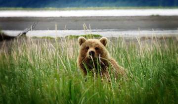
Brown bears (grizzlies) inhabit coastal areas, river valleys, and alpine zones throughout the park, feeding on salmon during spawning runs, grazing on sedges in wetland meadows, excavating ground squirrel burrows, and consuming berries during late summer. Bear densities remain relatively low compared to nearby Admiralty Island—famous for supporting North America’s highest brown bear densities—though encounters occur regularly along shorelines and in areas with high food availability. Backcountry travelers must employ proper bear safety protocols including carrying bear-resistant food containers, making noise to avoid surprising bears at close range, and knowing appropriate responses if encounters develop despite precautions.
Black bears occur throughout forested and shrubby habitats, with populations likely increasing as forests mature on terrain deglaciated during recent decades. Black bears prove more adaptable to human-modified landscapes than brown bears, successfully inhabiting areas near Bartlett Cove where development and visitor activity would exclude most grizzlies. These bears feed omnivorously on plants, insects, salmon, carrion, and occasional small mammals, fattening during summer and fall before entering winter dens for hibernation lasting roughly November through April depending on weather and individual body condition.
Mountain goats inhabit steep cliffs and alpine zones throughout the Fairweather Range, visible as white specks on distant rock faces when viewed from vessels in Glacier Bay. These sure-footed ungulates thrive in terrain too precipitous for most predators, grazing alpine vegetation during summer while descending to lower elevations during severe winter weather. Goat populations fluctuate in response to winter severity—deep snow and prolonged cold periods increase mortality, while mild winters support population growth. Biologists monitor populations through aerial surveys, documenting distribution patterns and assessing habitat use across elevational gradients.
Seabird colonies occupy coastal cliffs, offshore rocks, and islands throughout the park, with species including black-legged kittiwakes, glaucous-winged gulls, common murres, pigeon guillemots, and tufted puffins nesting in dense aggregations during summer. These birds feed on forage fish concentrated by tidal currents and upwelling associated with glacial discharge, diving to capture prey or picking fish from surface waters. Kittiwakes construct mud nests on narrow cliff ledges, laying eggs and raising chicks while adults fly constant foraging trips to nearby feeding areas. The harsh cries of kittiwake colonies create a characteristic soundscape near nesting cliffs, while the visual spectacle of thousands of birds swirling around breeding colonies impresses visitors witnessing these concentrations.
Bald eagles perch in shoreline trees throughout the bay, feeding opportunistically on fish, seabirds, carrion, and occasionally small mammals. Eagle densities exceed most regions outside Alaska, with trees near productive fishing areas supporting multiple nests within small areas. Eagles construct massive stick nests used for decades, adding material annually until structures weigh hundreds of pounds and measure six feet or more across. Immature eagles lacking the distinctive white head and tail of adults may comprise half the eagle population in some areas, with young birds requiring four to five years to develop adult plumage and begin breeding.
Access and Visitor Experience in Glacier Bay
Glacier Bay National Park’s complete lack of road access fundamentally shapes visitor experience, requiring all guests to reach the park by boat or aircraft and limiting infrastructure to the small developed area at Bartlett Cove. This access pattern eliminates the drive-through tourism common at road-accessible parks, ensuring visitors commit time and resources specifically to experiencing Glacier Bay rather than passing through as one stop on broader road trips. The result is a visitor population generally more engaged with the park’s natural and cultural resources than typical drive-through traffic, though absolute visitor numbers remain constrained by transportation logistics.
The majority of Glacier Bay’s nearly 700,000 annual visitors arrive on cruise ships transiting the bay as part of Alaska Inside Passage itineraries. Large cruise ships carrying 1,000 to 3,000 passengers enter Glacier Bay early morning, travel to Margerie and Grand Pacific glaciers in Tarr Inlet where they maneuver to provide passengers close views of the ice faces, then depart before evening—typical transits span eight to twelve hours. National Park Service rangers board cruise ships at the bay entrance, providing interpretation via ship public address systems while passengers observe glaciers, wildlife, and successional landscapes from open decks and indoor viewing areas. The two-cruise-ship daily limit means this experience remains relatively uncrowded compared to port cities where multiple large ships may dock simultaneously.
Independent travelers seeking more intimate experiences book small-ship expedition cruises operated by companies including UnCruise Adventures, Alaskan Dream Cruises, and Lindblad Expeditions. These vessels carry 50 to 100 passengers and typically spend multiple days exploring Glacier Bay’s inlets, launching zodiacs for close approaches to glaciers and wildlife, facilitating kayak excursions in protected coves, and offering opportunities for hiking on beaches and moraines. Small ships can access narrow inlets impractical for large cruise ships, enabling exploration of areas like Johns Hopkins Inlet and various side fjords seeing minimal large-vessel traffic. The expedition cruise experience emphasizes natural history interpretation, photography opportunities, and flexibility to adapt itineraries based on wildlife sightings and weather conditions.
Visitors staying at Glacier Bay Lodge in Bartlett Cove access the park’s day boat—a tour vessel departing daily from late May through early September for eight-hour cruises to the tidewater glaciers. This concessioner-operated service carries approximately 150 passengers and provides the most comprehensive glacier-viewing experience available to non-cruise-ship visitors, traveling the full 65-mile distance to Tarr Inlet with National Park Service ranger interpretation throughout. Day boat tickets typically cost $200 to $250 per person and should be reserved well in advance during peak season (June through August) when demand exceeds available space. The day boat experience appeals to independent travelers flying to Gustavus specifically to visit Glacier Bay, as well as Alaska residents and visitors based in nearby Juneau who fly over for single-day or overnight glacier-viewing trips.
Gustavus, the gateway community located on Icy Strait near the park entrance, supports a population of approximately 600 permanent residents and offers limited visitor services including lodges, bed-and-breakfast accommodations, restaurants, and activity outfitters. Alaska Airlines provides daily jet service from Juneau to Gustavus during summer (late May through early September), with flight times of approximately 30 minutes. The Alaska Marine Highway System operates ferry service to Gustavus from Juneau roughly three times weekly during summer, with the journey requiring approximately four hours. Private aircraft can land at Gustavus Airport, and charter float planes serve visitors arriving from Juneau, Skagway, or other Southeast Alaska communities.
Backcountry visitors obtain permits for camping throughout Glacier Bay’s extensive wilderness areas, though this option demands substantial outdoor skills given the challenges of traveling in coastal Alaska environments. Kayakers comprise the largest backcountry user group, typically arranging drop-off via water taxi at various inlet locations and paddling multi-day routes returning to Bartlett Cove or arranging pickup at predetermined locations. Popular kayaking areas include Muir Inlet, Blue Mouse Cove, and various West Arm locations offering protected paddling, wildlife viewing, and opportunities to camp on beaches and moraines. Kayakers must understand tidal ranges exceeding 20 feet in some locations, plan campsites above high water to avoid being trapped, and employ food storage techniques preventing bear access to provisions.
The National Park Service requires permits for all private vessels entering Glacier Bay from June 1 through August 31, with daily limits of 25 boats protecting marine wildlife and wilderness character. Permit applications are accepted beginning in late February with many dates fully booked within hours of the reservation system opening, reflecting strong demand for private boating access. Permitted boaters must attend an orientation covering wildlife protection regulations, navigation hazards, weather considerations, and proper anchoring techniques in deep fjords. The permit system enables cruisers, sailors, and small powerboat operators to explore Glacier Bay independently, accessing remote inlets and anchorages far from areas frequented by commercial vessels.
Uniquely among major national parks, Glacier Bay charges no entrance fees, no camping fees, and no permit fees for backcountry travel or private vessel access. This no-fee structure reflects the significant expenses visitors already incur reaching this remote park by air or water—charging additional park fees would impose relatively modest additional costs on visitors already spending hundreds to thousands of dollars on transportation and accommodations. However, commercial services including cruise ships, tour boats, charter operators, and the day boat from Bartlett Cove charge substantial fees reflecting their operational costs and the premium nature of guided glacier-viewing experiences in protected wilderness settings.
Cultural Heritage: Tlingit History and Contemporary Partnerships
Glacier Bay National Park encompasses landscapes holding profound significance for Tlingit peoples whose ancestors inhabited the region for thousands of years before glacier advances during the Little Ice Age destroyed villages and forced evacuation of the bay area approximately 250 years ago. Oral histories passed through generations preserve detailed knowledge of village locations, resource use patterns, clan territories, and the traumatic experience of retreat as advancing ice rendered ancestral lands uninhabitable. These oral traditions provide cultural perspectives complementing scientific data about glacier advances and retreats, demonstrating sophisticated environmental observation spanning centuries before Western explorers entered the region.
The Hoonah Tlingit trace direct ancestry to peoples living in Glacier Bay before the ice advance. According to oral history, the glacier advanced with sufficient speed that villagers had limited time to gather possessions before fleeing toward safer locations. The displaced peoples ultimately established new communities including Hoonah on Chichagof Island approximately 40 miles southeast of Glacier Bay. Traditional stories describe life in the bay area before the advance, including specific place names, resource gathering locations, and social structures that organized community life. These narratives maintain cultural connections to landscape features now buried beneath hundreds of feet of ice or submerged beneath frigid waters, providing contemporary Tlingit peoples with historical links to territories their ancestors occupied.
Following glacier retreat beginning in the late 1700s, Tlingit peoples resumed using Glacier Bay for seasonal resource gathering, though they did not reestablish permanent villages given uncertainties about ice stability and the decades required for forests to regenerate on recently deglaciated terrain. Traditional uses included hunting seals and sea lions, gathering seabird eggs from nesting colonies, fishing for salmon and halibut, and collecting plant materials including spruce roots for basket weaving and mountain goat wool for ceremonial blankets. These activities continued into the 20th century, with Tlingit families traveling from Hoonah and other communities to harvest seasonal resources in areas their ancestors occupied before the ice advance.
The creation of Glacier Bay National Monument in 1925 and subsequent expansion and redesignation as a national park in 1980 complicated Tlingit traditional use of ancestral territories. National Park Service regulations prohibiting hunting, restricting fishing, and limiting resource gathering conflicted with Tlingit cultural practices and subsistence traditions extending back millennia. This tension between Western conservation paradigms emphasizing preservation from human use and indigenous resource management approaches integrating sustainable harvest created friction lasting decades and requiring fundamental rethinking of how the National Park Service engages with Alaska Native peoples maintaining cultural connections to park lands.
The 1994 Memorandum of Understanding between the National Park Service and the Hoonah Indian Association established government-to-government consultation protocols acknowledging Tlingit sovereignty and traditional knowledge systems. This agreement created frameworks for Tlingit involvement in park management decisions affecting cultural resources, traditional use areas, and interpretation programs presenting indigenous perspectives to park visitors. The MOU recognizes that Glacier Bay represents Tlingit ancestral homeland rather than wilderness empty of human history, requiring that park management and interpretation incorporate indigenous knowledge alongside Western scientific understanding.
Subsequent agreements have expanded Tlingit participation in park programs, including authorizations for tribal members to harvest traditional use items including spruce roots for basket weaving, edible plants like beach greens and goose tongue, and other culturally significant materials unavailable or degraded in communities distant from Glacier Bay. These harvests occur under agreements ensuring sustainable collection levels while respecting spiritual and cultural protocols governing appropriate gathering methods and locations. The authorizations acknowledge that indigenous cultural survival requires ongoing relationships with ancestral landscapes, not merely intellectual knowledge divorced from practical engagement with traditional territories.
In 2016, the park completed construction of Xunaa Shuká Hít (Huna Ancestors’ House), a traditional Tlingit clan house at Bartlett Cove designed and built through collaboration between the National Park Service, Hoonah Tlingit, and master carvers and builders from throughout Southeast Alaska. This structure features hand-carved house posts, painted screens depicting clan crests, and traditional architectural details following protocols governing proper clan house construction. The building serves multiple functions including providing space for cultural programs introducing visitors to Tlingit history and traditions, enabling tribal members to conduct ceremonies in appropriate settings, and asserting ongoing Tlingit presence in landscapes often mischaracterized as pristine wilderness devoid of human heritage.
Ranger programs at Bartlett Cove increasingly incorporate Tlingit perspectives and traditional knowledge, with tribal cultural interpreters presenting programs about indigenous history, oral traditions, and contemporary connections to Glacier Bay. These presentations challenge wilderness narratives that erase indigenous presence, educating visitors about the complex human history predating and persisting through glacier advances and retreats. The programs also address difficult histories including displacement, loss of access to traditional territories following park establishment, and ongoing negotiations about appropriate roles for indigenous peoples in managing lands and waters their ancestors inhabited for millennia.
Scientific Research and Climate Change Monitoring
Glacier Bay National Park functions as an internationally significant research site where scientists study glaciology, ecology, geology, marine biology, and climate change impacts in one of Earth’s most dynamic natural laboratories. The rapid environmental changes occurring as glaciers retreat and ecosystems develop provide researchers with opportunities to observe processes that would require decades or centuries to document in more stable landscapes. The park’s UNESCO World Heritage designation and Biosphere Reserve status emphasize scientific research as a core park value alongside conservation and visitor experience, resulting in robust research programs addressing questions with implications extending far beyond park boundaries.
Glaciological research in Glacier Bay dates to the late 19th century when scientists began documenting the extraordinary ice retreat that had transformed the landscape within living memory. Contemporary glacier monitoring employs technologies including repeat photography from fixed positions, laser altimetry measuring ice surface elevations, GPS receivers tracking glacier movement rates, and satellite imagery documenting terminus positions over time. These data reveal that while most Glacier Bay glaciers continue retreating, retreat rates vary substantially among individual ice masses depending on factors including glacier size, elevation range, exposure to maritime influences, and local topography affecting ice flow.
Long-term monitoring documents correlations between glacier behavior and climate variables including temperature, precipitation, and cloud cover. Warming temperatures increase melt rates at glacier surfaces and termini, while reduced winter snowfall decreases mass accumulation in source areas. The combination of increased ablation (loss) and decreased accumulation drives the negative mass balance causing most glaciers to thin and retreat. However, local variations complicate simple correlations—some glaciers in protected valleys maintain relatively stable termini despite regional warming, while exposed coastal glaciers show accelerated retreat reflecting their vulnerability to ocean temperature changes and altered precipitation patterns.
Ecological research examines succession processes transforming bare substrates into complex forest ecosystems, with permanent monitoring plots established at various locations representing different time periods since deglaciation. Scientists document changes in plant community composition, soil development, nutrient cycling, and wildlife use, generating datasets spanning multiple decades that reveal how succession proceeds and whether trajectories match predictions based on space-for-time substitution (using current spatial patterns to infer temporal changes). Research findings contribute to understanding how climate change may alter succession pathways, as warming temperatures potentially favor different plant communities than those developing under historical conditions.
Marine ecosystem research investigates relationships among glacier discharge, nutrient dynamics, productivity, and wildlife populations. Glacial meltwater carries high sediment loads creating turbidity that affects light penetration and primary productivity, while also delivering nutrients including iron that may stimulate phytoplankton growth. Understanding these complex relationships helps predict how continued glacier retreat will affect marine food webs supporting commercially important fish species, seabirds, and marine mammals. Studies examining humpback whale distribution and feeding behavior provide data about how these endangered species use Glacier Bay, informing management decisions about vessel traffic regulations and seasonal area closures protecting critical feeding areas.
Seismic monitoring addresses earthquake and landslide hazards in this tectonically active region straddling plate boundaries. The area experiences frequent earthquakes including occasional large events capable of triggering massive landslides and generating tsunamis in the confined waters of Glacier Bay’s inlets. The 1958 Lituya Bay tsunami—generated by an earthquake-induced landslide that created waves exceeding 1,700 feet in height—occurred just outside current park boundaries, demonstrating the catastrophic potential of slope failures in glacially-carved valleys. Ongoing monitoring provides data about seismic patterns while informing hazard assessments for visitor facilities and vessel operations.
Climate change represents the dominant focus of contemporary research, as Glacier Bay provides a bellwether for understanding how warming temperatures affect glacial and ecological systems throughout Alaska and beyond. Accelerating ice loss, shifts in wildlife distributions, changes in vegetation communities, and alterations to marine ecosystem productivity all reflect climate change impacts observable in real-time. Research findings from Glacier Bay contribute to global climate assessments including Intergovernmental Panel on Climate Change reports that synthesize scientific understanding of climate change causes, consequences, and adaptation strategies.
The Inventory and Monitoring Program established by the National Park Service maintains long-term datasets tracking vital signs of ecosystem health including water quality, wildlife population trends, vegetation community changes, and visitor use patterns. These standardized monitoring efforts generate consistent data comparable across years and among parks, enabling detection of changes that might otherwise remain obscured by natural variability. The program exemplifies the shift from reactive management addressing problems after they develop toward proactive adaptive management anticipating changes and implementing responses before irreversible degradation occurs.
Frequently Asked Questions About Glacier Bay National Park
How long does it take to visit Glacier Bay National Park?
Cruise ship passengers typically spend eight to twelve hours transiting Glacier Bay, entering early morning and departing before evening after traveling to the tidewater glaciers at the head of Tarr Inlet and returning to Icy Strait. The park’s day boat from Bartlett Cove operates on a similar eight-hour schedule, departing mornings and returning late afternoon after the 130-mile round trip to the glaciers. Independent travelers staying at Glacier Bay Lodge or Gustavus area accommodations typically spend two to four days in the region, allowing time for the day boat glacier cruise, kayaking or fishing excursions, interpretive programs at Bartlett Cove, and exploring the trails and beaches near park headquarters. Backcountry kayakers and boaters commonly spend five to ten days or longer exploring remote inlets, camping on wilderness beaches, and experiencing the park beyond areas accessible during day trips. The complete absence of roads means visitors cannot drive through the park in a few hours as is possible at many national parks—meaningful Glacier Bay experiences require committing to boat-based exploration spanning at minimum a full day.
When is the best time to visit Glacier Bay?
June through August constitute peak season when cruise ships operate daily, the day boat from Bartlett Cove runs its full schedule, weather generally remains most stable, and all visitor services function at maximum capacity. Late May and early September represent shoulder season offering advantages including reduced crowding, lower accommodation costs, and excellent wildlife viewing as humpback whales remain abundant while cruise ship traffic decreases. Whale populations peak in July and August when approximately 150 to 200 individuals feed in Glacier Bay waters, making summer optimal for marine mammal observation. Bear viewing opportunities concentrate during July through September when salmon runs attract bears to streams and beaches. Weather proves unpredictable year-round in Southeast Alaska’s maritime climate—visitors should expect rain regardless of season and pack waterproof clothing, though summer months generally experience less precipitation and milder temperatures than fall and winter. The park essentially closes to casual visitors October through April when cruise ships cease operations, the day boat suspends service, Alaska Airlines reduces Gustavus flights to minimal levels, and winter weather creates challenging conditions for the small number of hardy visitors choosing to experience Glacier Bay’s winter character.
Can you see glaciers from Glacier Bay Lodge?
No glaciers are visible from Glacier Bay Lodge at Bartlett Cove—the lodge sits at the bay entrance approximately 65 miles from the nearest tidewater glaciers at the head of the West Arm. The landscape surrounding Bartlett Cove consists of mature Sitka spruce-western hemlock rainforest developed on terrain deglaciated approximately 200 years ago, with no ice visible despite the park’s name. This geographical reality surprises some visitors expecting glacier views from the lodge, though it accurately reflects the bay’s configuration as an elongated fjord requiring boat travel to reach the ice. The Fairweather Range rising to the west remains snow-covered year-round and visible on clear days from Bartlett Cove, providing dramatic mountain backdrop if not actual glaciers. Visitors staying at the lodge and wanting glacier views must book the day boat excursion or arrange charter flights providing aerial perspectives of the icefields and glaciers inaccessible by surface vessels. The lodge’s beachfront location does offer excellent opportunities for observing marine wildlife including whales occasionally visible from shore, seals hauling out on nearby rocks, and abundant seabirds feeding in the nutrient-rich waters of Icy Strait.
Is Glacier Bay crowded?
Glacier Bay experiences substantially lower crowding than most major national parks due to its boat-only access, limited infrastructure, and National Park Service regulations capping daily vessel entries. The two-cruise-ship limit means at most 6,000 to 8,000 passengers visit on peak days, spread across the 65-mile length of the bay rather than concentrated at single developed viewpoints as occurs at road-accessible parks. Tour boats, charter vessels, and private craft add modest additional numbers but remain dispersed throughout the bay’s multiple inlets and arms. Bartlett Cove, the only developed area, hosts relatively few simultaneous visitors given the limited facilities and the pattern of day boat passengers departing early morning and not returning until afternoon. Backcountry areas experience minimal use with kayakers and boaters rarely encountering other parties in remote inlets—entire days may pass without seeing other humans beyond cruise ships transiting distant channels. The perception of crowding depends heavily on visitor expectations and prior national park experience: cruise ship passengers accustomed to urban-level densities in places like Denali typically find Glacier Bay uncrowded despite sometimes seeing another large ship at the glaciers, while wilderness kayakers consider any encounter with motorized vessels as intrusion regardless of actual numbers. Overall, Glacier Bay provides among the least crowded experiences available in Alaska’s most-visited parks, though this depends on accepting boat-based viewing rather than expecting the isolation possible at remote wilderness parks receiving virtually no visitors.
What wildlife can you see in Glacier Bay?
Marine mammals represent Glacier Bay’s most reliably observed wildlife, with humpback whales visible on the vast majority of summer cruise and tour boat excursions. Approximately 150 to 200 individual humpback whales feed in the bay from May through September, frequently surfacing near vessels and occasionally performing spectacular breaches. Harbor seals hauling out on icebergs and shoreline rocks appear throughout the bay, with concentrations exceeding 2,000 individuals in Johns Hopkins Inlet during the May-June pupping season. Orcas appear less frequently than humpbacks but generate exceptional excitement when encountered, with both fish-eating resident pods and mammal-hunting transient orcas visiting the bay. Sea otters float in kelp beds near rocky shores, sea lions haul out on wave-washed rocks, and occasional porpoises swim in bow waves of vessels. Seabirds including black-legged kittiwakes, glaucous-winged gulls, murres, guillemots, and puffins nest on coastal cliffs and feed in productive waters mixing glacial meltwater with marine currents. Bald eagles perch in shoreline trees throughout the bay, visible from vessels and beach landing sites. Land mammals prove more challenging to observe from boats, though brown bears and black bears occasionally appear on beaches and fishing streams visible from the water. Mountain goats appear as white specks on distant cliffs and alpine zones, requiring binoculars or spotting scopes for detailed observation from vessels. Moose inhabit forested and shrubby areas but rarely venture to shorelines where they would be visible to boat-based visitors. The most comprehensive wildlife viewing occurs during small-ship expedition cruises and multi-day kayaking trips spending extended time in various habitats, while cruise ship transits and day boat excursions focus primarily on the marine species most reliably encountered during single-day visits.
Why is Glacier Bay retreating so fast?
Glacier Bay’s extraordinary retreat rate—65 miles in approximately 200 years representing the fastest documented glacier retreat globally—results from complex interactions among climate patterns, glacier dynamics, and fjord geometry. The retreat began following the Little Ice Age, a period of cooler temperatures that drove glacier advances throughout the Northern Hemisphere during the 16th through 19th centuries. As climate warmed in the late 1700s and 1800s, the massive ice sheet filling Glacier Bay became unstable and began retreating through processes amplified by the fjord environment. Tidewater glaciers terminating in deep water experience different dynamics than glaciers ending on land—when the ice front retreats into progressively deeper water, larger portions of the glacier float rather than resting on bedrock, accelerating calving rates as floating ice breaks apart more readily than grounded ice. This flotation feedback mechanism can drive rapid retreat regardless of climate conditions, as seen in some Glacier Bay glaciers that continued retreating even during periods when climate would favor stability or advance. The exceptionally deep water in Glacier Bay’s fjords—exceeding 1,400 feet in places—meant retreating ice encountered progressively deeper basins that enhanced flotation and calving, driving retreat rates far exceeding those of glaciers terminating on land or in shallow water. Contemporary climate warming adds additional retreat pressure by increasing surface melt and reducing snow accumulation in source areas, though the fundamental retreat pattern was established by fjord geometry and tidewater glacier dynamics initiated when the Little Ice Age ended. Understanding Glacier Bay’s retreat mechanisms helps scientists predict behaviors of similar tidewater glaciers in Greenland and Antarctica, where accelerating retreat contributes substantially to global sea level rise.
Do I need a permit to visit Glacier Bay?
Cruise ship passengers, tour boat passengers, and day boat users from Bartlett Cove require no permits—the vessels they travel on hold the necessary commercial operating permits, and individual passengers board without additional authorization. Private vessel operators must obtain permits to enter Glacier Bay from June 1 through August 31, with a daily cap of 25 boats protecting marine wildlife and wilderness character. The permit system opens for reservations in late February with popular dates typically fully booked within hours, requiring advance planning for anyone hoping to boat Glacier Bay during peak season. Private vessel permits are free but mandatory, with substantial penalties for entering without authorization during the permit season. Backcountry campers and kayakers traveling from Bartlett Cove or receiving water taxi drop-offs at various inlets need no permits for the camping itself—the park charges no fees for wilderness camping and maintains minimal regulations beyond standard food storage and Leave No Trace practices. However, kayakers arriving by water taxi travel on permitted charter vessels, and kayakers using private boats for transportation fall under the vessel permit requirements. The absence of camping permits and fees distinguishes Glacier Bay from many wilderness parks requiring advance reservations and charging fees for backcountry use, reflecting management philosophy emphasizing wilderness access for properly equipped and experienced visitors while recognizing that boat-based access already limits numbers far below carrying capacity for dispersed camping.
Are there hiking trails in Glacier Bay?
Developed hiking trails exist only in the immediate Bartlett Cove area near park headquarters, with the Forest Trail forming a one-mile loop through mature spruce-hemlock rainforest and the Bartlett River Trail extending approximately four miles along the river to the beach at Bartlett Cove’s northwest shore. These maintained trails provide accessible options for lodge guests and day boat passengers awaiting departures, offering opportunities to experience the coastal rainforest ecosystem developed on terrain deglaciated two centuries ago. Beyond Bartlett Cove, the park contains no maintained trails—over 3.2 million acres of designated Wilderness preserves backcountry in primitive condition without developed paths, signs, or facilities. Adventurous hikers explore off-trail across beaches, moraines, alpine ridges, and glacier margins, though this requires substantial wilderness skills including navigation without trails, river crossing techniques, bear safety protocols, and emergency self-sufficiency given the extreme remoteness and absence of rescue infrastructure. Cruise ship and tour boat passengers occasionally land at specific locations for guided beach walks exploring moraines, examining glacial erratics (boulders transported by ice), and observing pioneer plant communities, though these constitute brief shore excursions rather than extended hikes. Small-ship expedition cruises may offer more substantial hiking opportunities including bushwhacking through shrub thickets to reach viewpoints, traversing lateral moraines for elevated perspectives of glaciers, and climbing moderate peaks for panoramic views. The general absence of trails reflects management philosophy preserving Glacier Bay as wilderness rather than developing recreational infrastructure that would fundamentally alter the park’s character and increase visitation beyond levels compatible with resource protection.
What is the largest glacier in Glacier Bay?
Johns Hopkins Glacier ranks as Glacier Bay’s longest actively flowing tidewater glacier, extending approximately 12 miles from source areas in the Fairweather Range to its terminus in Johns Hopkins Inlet. However, Grand Pacific Glacier exceeds 20 miles in total length from distant accumulation zones to its current terminus position near the Canada-United States border, though portions of this glacier flow outside current park boundaries. The Fairweather Glacier on the range’s western slopes drains toward the Pacific Ocean rather than into Glacier Bay proper, spanning substantial distances and feeding LaPerouse Glacier, which calves directly into the open ocean. Determining the “largest” glacier depends on whether the question addresses tidewater glaciers visible to visitors within the bay itself (Johns Hopkins), total glacier length regardless of visibility (Grand Pacific or Fairweather), or glacier volume and ice mass (difficult to measure precisely and constantly changing). Margerie Glacier, while shorter than Johns Hopkins at approximately 21 miles, receives more visitor attention due to its accessibility at the head of Tarr Inlet where cruise ships and tour boats approach for optimal viewing. The focus on accessible tidewater glaciers in visitor experience means most people remain unaware of the extensive glacier systems in the Fairweather Range backcountry—ice fields and valley glaciers that dwarf the famous tidewater termini but remain invisible from vessels in the bay and inaccessible to all but mountaineers and scientists conducting aerial surveys.
How deep is the water in Glacier Bay?
Glacier Bay’s fjords reach exceptional depths exceeding 1,400 feet in places, with the deepest soundings occurring in the main channel between the bay mouth and the upper inlets. These profound depths result from glacial erosion during periods when massive ice sheets occupied the bay—moving ice scoured bedrock to depths far below current sea level, creating basins that filled with seawater as the glacier retreated. The depth varies substantially throughout the bay, with relatively shallow areas over submerged moraines deposited by the glacier during temporary stillstands contrasting with deep trenches where ice flow concentrated erosive power. Near tidewater glacier termini, water depth typically ranges from 100 to 300 feet immediately in front of the ice face, though this varies based on submarine moraine positions and sediment accumulation from glacial discharge. The extreme depths complicate anchoring for recreational boaters and affect marine ecosystems by creating stratified water columns where deep cold water remains isolated from surface mixing, influencing nutrient distribution and productivity patterns. Understanding bathymetry (underwater topography) proves essential for safe navigation, as shallow areas over moraines can create hazards for larger vessels, while deep water channels generally provide safe passage. The National Park Service provides nautical charts showing depths throughout the bay, and boaters must consult these charts to avoid grounding or encountering unexpected shallows. The depths also affect how glaciers behave—when retreating ice fronts move into progressively deeper water, increased buoyancy accelerates calving and drives rapid retreat through feedback mechanisms that have shaped Glacier Bay’s configuration over the past two centuries.