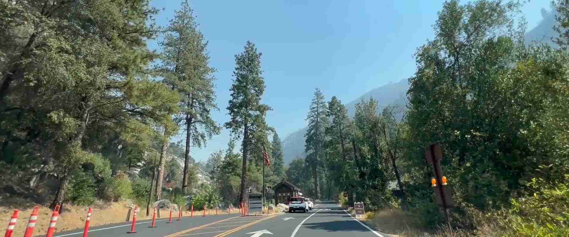
Getting to Yosemite National Park 2026: Complete Transportation Guide
Reaching Yosemite National Park in 2026 involves strategic planning that accounts for seasonal conditions, entrance choices, and transportation preferences.
Key Takeaways
- Four main entrances serve Yosemite year-round, with Highway 120 West (Big Oak Flat) and Highway 140 (El Portal) providing the most reliable winter access
- YARTS bus service connects major California cities to Yosemite Valley with fares starting at $15 one-way from Merced, offering an affordable alternative to driving
- Park entrance fees cost $35 per vehicle for seven days in 2026 (check nps.gov/yose for current official rates as pricing may vary), with annual passes available at $70
- Free shuttle systems operate throughout Yosemite Valley and to key destinations, eliminating parking challenges during peak season
- Advance planning for seasonal road closures and weather conditions ensures successful arrival, particularly during winter months when chains become mandatory
- Regional airports in Fresno, San Francisco, and Oakland provide gateway access, with rental car services and connecting ground transportation to the park
Introduction: Planning Your Journey to Yosemite
Located in California’s Sierra Nevada mountains, the park sits approximately 170 miles east of San Francisco and 320 miles north of Los Angeles, requiring travelers to navigate mountain roads and varying elevations. Understanding your transportation options creates the foundation for a successful visit to this UNESCO World Heritage site.
Four primary entrances provide access to Yosemite, each offering distinct advantages depending on your origin point and seasonal timing. Highway 120 West through Big Oak Flat, Highway 140 through El Portal, Highway 41 through Wawona, and Highway 120 East through Tioga Pass serve different regions and operate on varying schedules. Winter conditions close certain routes, while summer brings increased traffic that affects travel times significantly.
Transportation planning extends beyond simply reaching park boundaries. Internal shuttle systems, parking availability, road construction projects, and weather-related closures all influence your journey. This comprehensive guide provides current information for planning your 2026 arrival, covering driving routes, public transportation, shuttle services, costs, and practical strategies for smooth travel to Yosemite Valley and beyond.
People Also Ask About Getting to Yosemite 2026
What’s the easiest way to get to Yosemite National Park in 2026?
Highway 140 through El Portal provides the easiest year-round access to Yosemite, remaining open during most winter conditions when other routes close. This entrance follows the Merced River canyon at lower elevations, reducing snow accumulation and eliminating steep grades that require chains. The route offers scenic canyon views while maintaining reliable access from major population centers.
From the San Francisco Bay Area, drivers take Interstate 580 to Highway 120 East, then connect to Highway 140 near Mariposa. This 190-mile journey takes 4-4.5 hours under normal conditions. From Southern California, travelers use Interstate 5 North to Highway 99 North, then Highway 140 East through Merced, covering approximately 330 miles in 6-7 hours. The route’s reliability makes it the preferred choice for first-time visitors and those traveling during uncertain weather periods.
How much does it cost to drive to Yosemite in 2026?
Private vehicle entrance fees cost $35 for seven-day access in 2026 (check nps.gov/yose for current official rates). Fuel costs from San Francisco total $40-60 for a round trip covering 380 miles, while Southern California visitors spend $80-120 on gas for the 640-mile journey. Adding these expenses to potential accommodation and meal costs along the route, Bay Area visitors budget $75-95 for basic transportation, while Los Angeles travelers plan for $115-155 in driving expenses.
Annual park passes cost $70, providing value for visitors making multiple trips throughout the year. These passes cover entrance fees for all passengers in a private vehicle, making them economical for families or groups planning two or more visits. Gas prices fluctuate seasonally, with summer months bringing higher costs that add $10-20 to estimated fuel expenses.
Can you take public transportation to Yosemite in 2026?
YARTS (Yosemite Area Regional Transportation System) operates bus service from multiple California locations directly to Yosemite Valley, providing a convenient alternative to driving. Routes connect from Merced (starting at $15 one-way), Mammoth Lakes ($25 one-way summer season), Fresno ($20 one-way), and Sonora ($15 one-way). These fares include park entrance, making them economical compared to driving costs.
Service frequency varies by route and season, with Merced and Mammoth Lakes offering daily departures during peak summer months. Winter schedules reduce frequency, with some routes operating weekends only. Advance reservations ensure seat availability, particularly during holiday weekends and peak visitation periods in June through August. The buses connect with Amtrak stations in Merced, allowing rail travelers seamless access to the park from major California cities.
Do you need chains to drive to Yosemite in winter 2026?
Chain requirements become mandatory on all routes entering Yosemite when winter storms bring snow and ice to mountain roads. California law requires vehicles to carry chains from November through March, even on clear days, with potential fines for non-compliance. Rangers enforce chain installation when conditions warrant, turning back vehicles without proper equipment regardless of vehicle type or tire specifications.
All-wheel drive vehicles must carry chains, though they receive chain-up requirements less frequently than two-wheel drive cars. Proper installation requires practice before departure, as roadside installation in challenging weather creates safety hazards. Rental equipment costs $30-50 for chain sets, while installation services charge $30-50 at chain-up areas outside park boundaries. Highway 140 requires chains least frequently due to lower elevation, though severe storms bring requirements even on this route.
Extended multi-day tours – 5+ days
Featured Park Yosemite National Park Multi-Day Tour Packages
3 days
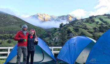
Yosemite Escape Camping – 3 Days
- ✓ Comprehensive Park Yosemite National Park tour
- ✓ Expert local guides included
- ✓ All accommodation arranged
- ✓ Transportation provided
6 days
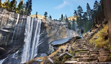
Hiking in Yosemite National Park
- ✓ Comprehensive Park Yosemite National Park tour
- ✓ Expert local guides included
- ✓ All accommodation arranged
- ✓ Transportation provided
3 days
Yosemite Escape Lodging – 3 Days
- ✓ Comprehensive Park Yosemite National Park tour
- ✓ Expert local guides included
- ✓ All accommodation arranged
- ✓ Transportation provided
8 days
Hiking Sequoia, Kings Canyon, and Yosemite
- ✓ Comprehensive Park Yosemite National Park tour
- ✓ Expert local guides included
- ✓ All accommodation arranged
- ✓ Transportation provided
Multi-day tour packages powered by TourRadar. Prices and availability subject to change.
Essential Planning Information 2026
Park Entrance Fees and Passes
Yosemite National Park charges $35 per private vehicle for seven consecutive days of access in 2026 (check nps.gov/yose for current official rates as pricing may vary). This fee covers all passengers in the vehicle and provides unlimited entries during the seven-day period. Motorcycles pay $30, while individuals entering on foot, bicycle, or via non-commercial bus pay $20 per person for the same seven-day access.
The Yosemite Annual Pass costs $70, providing unlimited vehicle access for 12 months from purchase date. Visitors planning two or more trips within a year save money with this option. The America the Beautiful Annual Pass costs $80, covering entrance fees at all U.S. National Parks and federal recreation sites, offering exceptional value for travelers visiting multiple parks during the year.
Senior citizens age 62 and older qualify for the Senior Pass at $20 annually or $80 for lifetime access. Military members and veterans, along with fourth-grade students through the Every Kid Outdoors program, enter free with appropriate documentation. These passes cover the passholder plus passengers in a private vehicle, extending benefits to entire travel groups.
Passes can be purchased online before arrival, at entrance stations upon entry, or at visitor centers within the park. Online purchase through recreation.gov allows advance planning, though entrance stations accept cash, credit cards, and checks for immediate purchase. Digital passes sent via email provide entry authorization, while physical passes arrive by mail within 2-3 weeks of purchase.
Seasonal Access and Road Conditions
Yosemite’s four main entrances operate on different seasonal schedules based on elevation and weather patterns. Highway 120 West (Big Oak Flat entrance) and Highway 140 (El Portal entrance) remain open year-round under most conditions, providing the most reliable access during winter months. Highway 41 (South entrance through Wawona) closes occasionally during severe winter storms but reopens quickly once plowing completes.
Highway 120 East through Tioga Pass closes annually around November and remains closed until late May or early June, depending on snow accumulation and clearing operations. This high-elevation route crosses the Sierra Nevada at 9,945 feet, making it impassable during winter months. Summer access opens spectacular high-country scenery but requires monitoring for late-season storms that can bring temporary closures even in July.
Glacier Point Road closes at Badger Pass Ski Area during winter, typically from November through late May. The road provides access to Glacier Point’s panoramic views during summer months but becomes a cross-country ski and snowshoe route in winter. Spring opening dates vary annually based on snowpack levels, with some years seeing June openings after heavy winter precipitation.
Current road conditions require checking before departure through the park’s website, recorded phone information at 209-372-0200, or social media channels that provide real-time updates. Weather conditions change rapidly in mountain environments, with clear morning conditions giving way to afternoon storms that affect road accessibility and safety.
Driving to Yosemite: Route Planning and Navigation
From San Francisco Bay Area (4-4.5 Hours, 190 Miles)
Bay Area travelers choose between two primary routes depending on final destination within the park. The northern route via Highway 120 through Groveland provides fastest access to Yosemite Valley, while Highway 140 through Mariposa offers more reliable winter conditions and scenic canyon driving along the Merced River.
For the Highway 120 route, depart San Francisco on Interstate 580 East toward Tracy, continuing to Interstate 205 East, then Highway 120 East through Manteca, Oakdale, and Groveland. The route climbs steadily through Gold Rush country, passing through historic towns before entering the park at the Big Oak Flat entrance. Total distance covers approximately 195 miles with 4-4.5 hour driving time under normal conditions.
The Highway 140 route follows Interstate 580 East to Highway 99 South, then Highway 140 East through Merced and Mariposa. This scenic route follows the Merced River canyon, offering dramatic views while maintaining lower elevations that reduce snow and ice hazards. Distance totals 190 miles with similar 4-4.5 hour timing, though summer traffic through the narrow canyon can extend travel times during peak afternoon hours.
Departure timing significantly affects arrival experience. Leaving the Bay Area by 6-7 AM allows arrival before 11 AM, securing parking in Yosemite Valley and avoiding peak traffic congestion. Friday afternoon and Saturday morning departures encounter heaviest traffic, while Sunday and weekday travel provides smoother conditions. Return trips on Sunday afternoons face significant congestion, making early morning or evening departures preferable.
From Los Angeles and Southern California (6-7 Hours, 320 Miles)
Southern California visitors reach Yosemite via Interstate 5 North to Highway 99 North, then choose between Highway 41 through Oakhurst or Highway 140 through Merced. Highway 41 provides the most direct access to Yosemite Valley, entering through the South entrance and passing near Wawona and the Mariposa Grove of Giant Sequoias.
The recommended route follows Interstate 5 North from Los Angeles to Highway 99 North near Bakersfield, continuing through Fresno to Highway 41 North at Fresno. The route climbs through Sierra foothills and pine forests, entering the park at the South entrance near Wawona. Total distance covers 320 miles with 6-7 hours driving time, depending on Los Angeles departure point and traffic through the Central Valley.
Alternative routing through Highway 140 adds 30-40 minutes but provides more reliable winter access and connects with YARTS bus service in Merced. This option works well for travelers willing to extend driving time for enhanced route reliability during uncertain weather periods. Some visitors split the journey with overnight stops in Fresno or Oakhurst, reducing driving fatigue and allowing fresh morning arrivals at the park.
Summer heat through the Central Valley creates challenging driving conditions, with temperatures exceeding 100°F from June through September. Air conditioning strain and increased fuel consumption affect vehicle performance, making early morning departures (before 6 AM) advisable during summer months. Winter fog in the Central Valley reduces visibility and slows traffic, requiring extra caution and additional travel time.
From Sacramento and Northern California (3.5-4 Hours, 175 Miles)
Sacramento visitors access Yosemite via Highway 99 South to Highway 120 East through Oakdale and Groveland. This route covers approximately 175 miles with 3.5-4 hours driving time, making Sacramento one of the closest major cities to the park. The route passes through historic Gold Rush towns, offering opportunities for fuel, food, and exploration before entering the park.
Alternative routing through Highway 140 requires taking Highway 99 South to Merced, then Highway 140 East through Mariposa. This adds 20-30 minutes to total travel time but provides the most reliable winter access. Travelers prioritizing scenic beauty over speed prefer the Highway 140 canyon route, while those seeking fastest arrival choose Highway 120.
From Reno, Nevada and Eastern Sierra (3-5 Hours, Seasonal)
Eastern access via Highway 120 East (Tioga Pass) operates only during summer months, typically late May through October. This spectacular high-country route crosses the Sierra Nevada at 9,945 feet, providing access to Tuolumne Meadows and Yosemite’s high country before descending to Yosemite Valley. The route covers 195 miles from Reno with 3.5-4 hours driving time when open.
Winter access from the east requires routing south through Mammoth Lakes, Bishop, and north through the Central Valley, adding 6-8 hours to the journey. This significant detour makes eastern access practical only during summer months when Tioga Pass opens. Travelers from Reno plan accordingly, scheduling visits during June through September for direct access or choosing winter visits from western approaches.
Public Transportation Options 2026
YARTS Bus Service
The Yosemite Area Regional Transportation System operates scheduled bus service from multiple California communities directly to Yosemite Valley. Fares include park entrance fees, making YARTS economical compared to driving costs. Service operates year-round from some locations, with seasonal expansion during summer months to additional communities.
The Merced route provides daily service year-round, with buses departing from the Merced Transpo Center connecting with Amtrak trains from the Bay Area and Southern California. One-way fares cost $15 for adults, $13.50 for seniors (62+) and disabled passengers, and $7.50 for children ages 5-12 (children under 5 ride free). The route includes stops in Mariposa before reaching Yosemite Valley, with total travel time of 2.5-3 hours from Merced.
Summer service from Mammoth Lakes operates from approximately mid-June through early September, providing access for visitors exploring the Eastern Sierra. One-way fares cost $25 for adults, with service stopping at June Lake, Lee Vining, and Tuolumne Meadows before reaching Yosemite Valley. This scenic route crosses Tioga Pass, offering spectacular high-country views during the journey.
Additional seasonal routes serve Fresno, Sonora, and other communities during peak summer months. Fresno service costs $20 one-way for adults, departing from Fresno Yosemite International Airport and downtown locations. Sonora service charges $15 one-way, serving the Highway 120 corridor through Groveland.
Reservations secure seats during peak periods, particularly summer weekends and holiday periods. Online booking through yarts.com allows advance purchase up to 90 days ahead, while phone reservations (877-989-2787) serve those without internet access. Same-day space-available boarding works during off-peak periods, though advance booking ensures guaranteed transportation.
Amtrak Connections
Amtrak San Joaquin trains connect the Bay Area, Sacramento, and Southern California to Merced, where passengers transfer to YARTS buses for the final leg to Yosemite. This combined rail-bus journey provides a car-free option for reaching the park, with coordinated schedules ensuring smooth connections.
From the Bay Area, trains depart Oakland and Richmond, reaching Merced in approximately 3 hours. From Southern California, trains originate in Bakersfield with connections from Los Angeles via Amtrak Thruway buses. The San Joaquin route offers comfortable coach seating, business class options, cafe service, and WiFi on most trains.
Combined Amtrak-YARTS fares cost $50-80 one-way from the Bay Area to Yosemite Valley, $70-100 from Southern California, depending on travel dates and booking timing. Advance purchase provides lowest fares, while same-day tickets cost more. The journey takes 6-7 hours total from Oakland, 8-10 hours from Los Angeles, comparable to driving times when accounting for traffic and rest stops.
Commercial Tour Operators
Numerous tour companies offer guided transportation from major California cities, combining round-trip transit with interpretive guides, park tours, and meal options. These services cost $150-250 per person for day trips from San Francisco, $200-300 from Los Angeles, providing convenience for travelers without vehicles or those preferring guided experiences.
Tours depart early morning (typically 5-7 AM) and return evening (8-10 PM), allowing full days in the park despite long travel times. Itineraries include major valley attractions like Yosemite Falls, El Capitan, Half Dome views, and Bridalveil Fall, with some offering optional extensions to Glacier Point or Mariposa Grove during appropriate seasons.
Airport Access and Car Rentals
Nearest Commercial Airports
Fresno Yosemite International Airport (FAT) serves as the closest major airport to Yosemite, located 90 miles south of the park. Major airlines including Alaska, American, Delta, and United operate flights to Fresno from hubs throughout the United States. The airport offers rental car services from all major companies, with one-way rentals available for travelers not returning to Fresno.
The drive from Fresno to Yosemite takes 2-2.5 hours via Highway 41 North through Oakhurst and into the South entrance. This route provides scenic foothill and forest driving, climbing gradually from Central Valley elevations to the park’s 4,000-foot elevation at Wawona. Rental car costs start at $50-70 per day for economy vehicles, with SUVs and larger vehicles costing $90-140 daily during peak seasons.
San Francisco International Airport (SFO), Oakland International Airport (OAK), and San Jose International Airport (SJC) provide more flight options from international and domestic origins. These Bay Area airports sit 170-200 miles from Yosemite, requiring 4-4.5 hours driving. Larger rental car inventory and more competitive rates sometimes offset longer driving distances, particularly for international travelers requiring specific vehicle features or one-way rentals.
Sacramento International Airport (SMF) offers another option for Northern California access, located 175 miles from Yosemite with 3.5-4 hours driving time. Alaska, American, Delta, Southwest, and United serve Sacramento with flights from major U.S. cities. Rental car availability equals Bay Area airports, with similar pricing and vehicle selection.
Rental Car Considerations
Vehicle selection affects Yosemite travel experiences significantly, particularly during winter months or when planning high-country exploration. Compact and economy cars provide adequate transportation for summer visits focused on Yosemite Valley, while SUVs and AWD vehicles offer advantages for winter travel, Tioga Road exploration, or unpaved access roads to trailheads.
Winter travel requires vehicles capable of handling snow and ice, with mandatory chain carrying from November through March. Rental agencies provide chains for additional fees ($30-50), though installation responsibility falls to renters. All-wheel drive vehicles reduce chain-up frequency but don’t eliminate the requirement, as severe storms mandate chains on all vehicles regardless of drive configuration.
One-way rentals allow different pickup and drop-off airports, useful for travelers combining Yosemite with other California destinations. One-way fees range from $50-200 depending on locations and rental company policies. Advance booking secures lowest rates, particularly during summer months when demand peaks and vehicle availability becomes limited.
Internal Park Transportation
Free Shuttle Services
Yosemite Valley operates free shuttle buses year-round, serving major lodges, campgrounds, trailheads, and attractions throughout the valley floor. Shuttles run every 10-20 minutes during peak summer season (7 AM – 10 PM), with reduced frequency during off-peak periods (9 AM – 6 PM). The system eliminates parking challenges and reduces traffic congestion, making it the preferred transportation method for valley exploration.
Route maps show 21 numbered stops including Yosemite Village, Yosemite Valley Lodge, Curry Village, Happy Isles Nature Center, Mirror Lake trailhead, and all valley campgrounds. Each stop displays current schedules and system maps. Buses accommodate wheelchairs and feature bike racks for cyclists combining riding with shuttle use. All shuttles provide heating, while summer-season vehicles add air conditioning.
Additional shuttle routes serve El Capitan (summer only), connecting the Four Mile trailhead with valley locations, and Badger Pass (winter only), providing ski area access from valley lodges. The Tuolumne Meadows shuttle operates during summer along Tioga Road, connecting campgrounds, trailheads, and the Tuolumne Meadows Visitor Center.
Parking in Yosemite Valley
Parking availability in Yosemite Valley becomes extremely limited during peak season (May through September), with lots filling by 9-10 AM on summer weekends and holidays. Day-use parking concentrates at Curry Village, Yosemite Village, and Yosemite Valley Lodge, with spaces averaging 400-500 total capacity serving thousands of daily visitors.
Arriving before 9 AM secures parking during most summer days, while 7-8 AM arrival ensures spaces on peak weekends. Once parked, using the free shuttle system for all valley transportation eliminates the need to move vehicles and search for new parking throughout the day. Overnight guests at valley lodges and campgrounds receive designated parking at their accommodations.
Alternative parking strategies include using satellite lots at Curry Village and taking shuttles to destinations, or parking at El Capitan Picnic Area and using the seasonal shuttle into the valley. Some visitors park outside the valley at Bridalveil Fall or along Southside Drive (where legal), then walk or bike to destinations, though this requires careful attention to parking restrictions and no-parking zones marked with signs.
Seasonal Transportation Strategies
Summer Planning (June-September)
Summer brings peak visitation that creates significant transportation challenges requiring strategic planning. Traffic congestion extends travel times by 30-60 minutes beyond normal conditions, with Friday afternoons and Saturday mornings experiencing worst delays. Arriving early (before 9 AM) or late (after 6 PM) reduces congestion impacts, while weekday travel provides smoother conditions than weekends.
Highway 140 through Merced experiences afternoon bottlenecks during summer weekends, with slow-moving traffic through the narrow canyon adding 30-45 minutes to expected travel times. Highway 41 from Fresno sees similar congestion, particularly near the South entrance on Saturday mornings. Planning buffer time into schedules prevents missed reservations or rushed experiences.
Tioga Road opens for summer access typically in late May or early June, providing eastern access via Highway 120 East and connecting to Tuolumne Meadows. This route offers spectacular high-country scenery but requires monitoring for temporary closures during thunderstorm periods that bring hail, lightning, and occasional snow even in July and August.
Winter Access (November-March)
Winter transforms Yosemite access patterns, with snow and ice requiring chain carrying on all routes and creating mandatory chain installation during active storms. Highway 120 West and Highway 140 remain open year-round under most conditions, though severe storms bring temporary closures lasting hours to days until plowing and safety clearing completes.
Chain installation requirements activate when rain turns to snow, when accumulated snow covers roadways, or when ice creates hazardous conditions. Rangers staff chain control points at park boundaries, verifying all vehicles carry proper equipment before allowing entry. Vehicles without chains face turn-around and potential citations, regardless of tire type or all-wheel drive capabilities.
Winter storms often arrive with little warning, making departure flexibility essential. Monitoring weather forecasts, road condition reports, and park alerts through official channels prevents getting stranded or encountering unexpected closures. Some visitors choose to stay extra days when storms approach rather than risking travel during active weather, requiring flexible schedules and backup accommodation options.
Spring and Fall Transition (March-May, October-November)
Shoulder seasons bring unpredictable weather that combines winter storm potential with increasing summer visitation. March through May sees significant weather variability, with warm sunny days followed by snowstorms that close roads and require chain installation. Tioga Road remains closed during this period, with opening dates ranging from late May to early July depending on annual snowpack.
Fall visitation (September-October) provides excellent weather with reduced crowds compared to summer, though early season storms begin affecting high-country access in September. Tioga Road closure happens suddenly when first significant autumn storms arrive, sometimes as early as late October but occasionally extending into November. Planning high-country access requires flexibility and backup plans for valley-focused itineraries when closures occur.
Cost Analysis: Transportation Budget Planning
Driving Cost Breakdown
San Francisco Bay Area visitors budget $75-95 total for round-trip driving costs to Yosemite. This includes $35 park entrance fee, $40-60 fuel costs for 380 miles round-trip at current California gas prices ($4.50-5.50 per gallon average), assuming vehicles averaging 25-30 miles per gallon. Southern California visitors from Los Angeles budget $115-155, including the same $35 entrance fee and $80-120 fuel costs for 640 miles round-trip.
Additional costs include potential chain rentals ($30-50) for winter travel, overnight parking at trailheads or campgrounds (included with camping fees), and vehicle wear factors like tire wear, oil changes, and brake use on mountain roads. Some visitors factor in $30-50 for meals and rest stops during longer drives, particularly when traveling with children requiring regular breaks.
Carpooling reduces per-person costs significantly. A group of four sharing one vehicle from the Bay Area pays approximately $19-24 each for round-trip transportation, while the same group from Los Angeles pays $29-39 each. The annual park pass ($70) provides value for anyone making two trips, covering all vehicle occupants and eliminating the $35 per-visit entrance fee.
Public Transportation Cost Comparison
YARTS bus service from Merced costs $30 round-trip per adult, including park entrance fees. Families of four pay $90 total ($60 for two adults, $30 for two children ages 5-12), significantly less than $115-155 for driving from Southern California. Adding Amtrak from the Bay Area or Los Angeles brings total costs to $100-160 round-trip per person, comparable to driving when accounting for fuel, parking, and vehicle wear.
The combined rail-bus option provides value through included amenities like WiFi, electrical outlets, restrooms, and the ability to work or relax during travel rather than focusing on driving. Groups of 3-4 find driving more economical, while solo travelers or pairs save money using public transportation, particularly when considering parking challenges and traffic stress avoided.
Tour Package Pricing
Guided day tours from San Francisco cost $150-250 per person, including round-trip transportation, driver-guide services, park entry, and some meals. Tours from Los Angeles cost $200-300 per person with similar inclusions. While more expensive than independent travel, these options provide value through interpretive guidance, optimized routing that maximizes valley sightseeing, and elimination of driving responsibilities.
Multi-day tour packages range from $500-1,200 per person depending on accommodation level, meal inclusions, and additional activities. These packages work well for international travelers unfamiliar with U.S. road conditions or those preferring fully organized experiences with guaranteed accommodations and reservations during peak seasons.
Practical Tips for Smooth Travel
Pre-Trip Preparation
Vehicle maintenance checks prevent breakdown headaches during mountain travel. Verify tire condition and pressure, brake function, coolant and oil levels, windshield wiper condition, and fuel system reliability before departure. Mountain driving stresses vehicles differently than city or highway driving, with steep grades, elevation changes, and temperature swings testing cooling systems, brakes, and fuel delivery.
Pack emergency supplies including water (one gallon per person), non-perishable snacks, first-aid kit, flashlight, extra phone charging cables and battery packs, warm layers and blankets (even in summer), basic tools, and tire pressure gauge. Winter additions include ice scraper, snow brush, chains, traction mats, and extra warm clothing. These supplies transform potential emergencies into minor inconveniences.
Download offline maps before departure, as cell service becomes unreliable in the Sierra Nevada foothills and nonexistent in many park areas. Google Maps, Apple Maps, and dedicated GPS devices offer offline functionality when properly configured. Physical maps provide backup navigation, available free at entrance stations or purchased in advance through park visitor centers and online retailers.
Timing Your Arrival
Gate times vary by entrance but follow similar patterns. South entrance (Highway 41) operates 24 hours during peak season, with reduced hours in winter. Highway 140 entrance remains open continuously year-round. Highway 120 West operates 24 hours in summer, with varying winter hours. Arriving during staffed hours (typically 8 AM – 8 PM summer, 8 AM – 5 PM winter) provides visitor information, maps, and immediate assistance if needed.
Entering the park during early morning hours (6-8 AM) secures parking in Yosemite Valley and allows full-day exploration before crowds peak. Afternoon arrivals (after 3 PM) face significant parking challenges during summer, often requiring patience and flexibility regarding parking locations. Some visitors time arrival for late afternoon (5-6 PM) when day visitors depart, opening parking spaces and reducing congestion.
Fuel and Services
Gas stations within Yosemite operate at Crane Flat and Wawona year-round, with Tuolumne Meadows open during summer season only. Prices run $1-2 per gallon higher than outside the park, making fueling before entry economical. Stations in Mariposa, Oakhurst, Groveland, and other gateway communities provide last chances before park boundaries.
ATMs operate at Yosemite Village, Curry Village, and major lodges, though bringing sufficient cash for incidental expenses prevents reliance on limited machines. Cell service works inconsistently throughout the park, with reliable coverage at Yosemite Village and major valley locations but no service in many areas. This affects mobile payment capabilities and requires carrying traditional payment methods.
Special Circumstances and Accessibility
RV and Trailer Access
RV length restrictions vary by park area, with maximum 40-foot length limits in Yosemite Valley and most campgrounds. Some areas restrict RVs over 25-30 feet due to narrow roads, tight turns, and limited parking. Checking specific restrictions for planned destinations prevents arrival difficulties and potential requirement to unhitch and leave trailers at designated storage areas.
The combined vehicle and trailer length cannot exceed 40 feet on most park roads. Vehicles over 30 feet face restrictions on certain routes, with complete prohibitions on some narrow roads and in specific areas. Hetch Hetchy Road prohibits RVs and trailers entirely, while Mariposa Grove Road limits to 25 feet maximum. Planning routes and destinations around these restrictions ensures successful RV visits.
Motorcycle Access
Motorcycles pay $30 entrance fees for seven-day access, with annual passes available. Chain requirements apply equally to motorcycles during winter conditions, requiring riders to carry appropriate equipment or face entry denial. Mountain roads feature numerous curves, elevation changes, and varying pavement conditions that demand experienced riding skills and appropriate safety equipment.
Accessible Transportation
All park shuttle buses accommodate wheelchairs and feature accessibility equipment including lifts and designated seating areas. YARTS buses provide similar accessibility features, with advance notification ensuring appropriate vehicle assignment. Parking lots throughout the park include designated accessible spaces near attractions, restrooms, and facilities.
Accessible parking permits from any state receive recognition throughout the park. Displaying valid permits secures designated parking spaces that provide easier access to shuttles, attractions, and facilities. Some accessible parking requires reservations during peak periods, particularly at Glacier Point and areas with limited total capacity.
Emergency Contacts and Resources
Park Information Contacts
The park’s main information line (209-372-0200) provides automated road and weather updates 24 hours daily, with ranger-staffed extensions available during business hours. Emergencies require calling 911, which connects to park dispatch for emergency services including medical, fire, and law enforcement response. Cell service limitations make noting these numbers before arrival essential, as emergency calls sometimes connect when regular service fails.
Road condition updates post to nps.gov/yose/planyourvisit/conditions.htm with current information on closures, chain requirements, and construction delays. Social media accounts (@YosemiteNPS on Twitter/X and Facebook) provide real-time updates during active weather events and changing conditions. Subscribing to alerts before travel ensures notification of significant changes affecting travel plans.
Roadside Assistance
Auto club membership (AAA, Better World Club) provides towing and roadside assistance, though mountain terrain extends response times to 2-4 hours or more during peak periods or in remote areas. Service coverage typically extends to park boundaries and major roads, with some services declining calls from remote park areas due to access difficulties. Verifying coverage before relying on these services prevents surprises during breakdowns.
Park concessionaire garages in Yosemite Valley provide basic services including tire repair, battery replacement, and minor repairs, though availability varies seasonally and inventory limits extensive repair capabilities. Major mechanical work requires towing to gateway communities like Mariposa or Oakhurst where full-service facilities operate. Planning extra time for mechanical contingencies prevents schedule stress when issues arise.
Planning Your 2026 Visit
Booking Timeline
Advance planning improves Yosemite experiences significantly, particularly for summer visits requiring campground or lodging reservations. Transportation planning connects with accommodation booking, as arrival times determine parking availability and first-day activity options. Coordinating all elements creates smooth experiences without last-minute challenges.
YARTS bus reservations open 90 days before travel, with popular routes (particularly summer Mammoth Lakes service) selling out quickly. Booking immediately when reservations open secures desired dates and departure times. Last-minute space-available travel works during shoulder seasons (April-May, September-October) when demand decreases.
Car rentals booked 2-3 months ahead provide better rates and vehicle selection compared to last-minute bookings. Summer peak season (July-August) requires even earlier booking (4-6 months) to ensure availability, particularly for larger vehicles or one-way rentals. Winter bookings need less advance time, though snow-capable vehicle availability decreases as storms approach.
Recommended Arrival Days
Arriving Sunday through Thursday provides better experiences than Friday-Saturday arrivals during peak season. Weekend arrival coincides with maximum visitation, creating parking challenges, crowded attractions, and congested roads. Midweek arrival offers quieter conditions with better parking availability and easier access to popular locations.
Holiday weekends (Memorial Day, Independence Day, Labor Day) bring exceptional crowds requiring extra planning and extreme patience. Some visitors avoid these peak periods entirely, choosing weeks before or after holidays when crowds decrease significantly while weather remains excellent. Spring and fall shoulder seasons provide ideal conditions with substantially reduced visitation compared to summer.
2026 Updates & Current Information
Construction and Road Projects
Ongoing road maintenance and improvement projects affect access and travel times annually. Highway 140 through the Merced River canyon undergoes periodic rock scaling and slide repair, occasionally requiring one-way traffic control and delays of 10-30 minutes. Checking current construction schedules before departure prevents surprise delays and allows realistic timing estimates.
Major bridge repairs, tunnel work, and road widening projects happen during shoulder seasons when possible, though some work continues year-round due to safety requirements. Construction updates post to the park website with current project status, expected delays, and alternative routing when available. Adding 30-60 minutes buffer time to expected travel during construction periods prevents schedule stress.
Transportation Innovations
Electric vehicle charging stations operate at Yosemite Valley Lodge and Curry Village, providing Tesla and universal J1772 standard charging. Level 2 chargers require 4-8 hours for full charges, making overnight stays practical for EV travelers. Planning charging around dining or activity schedules optimizes time use during charging periods.
Some tour operators introduce electric bus services, reducing emissions while providing quiet transportation experiences. Bike rental programs expand through concessionaire operations, offering additional valley transportation options that reduce shuttle demand and provide active exploration methods.
FAQ: Transportation to Yosemite 2026
What’s the most reliable entrance to Yosemite in winter?
Highway 140 through El Portal provides the most reliable winter access, remaining open during most winter storms due to lower elevations that reduce snow accumulation. This entrance rarely closes, though severe storms can bring temporary closures lasting several hours until plowing completes.
Can you visit Yosemite without a car?
YARTS bus service provides car-free access from Merced, Mammoth Lakes, Fresno, and other communities, with connections to Amtrak trains from major California cities. Once in the park, free shuttle systems serve all valley attractions, eliminating vehicle need for valley-focused visits.
How early should you arrive to find parking in summer?
Arriving before 9 AM secures parking on most summer days, while 7-8 AM arrival ensures spaces on peak weekends and holidays. Lots fill completely by mid-morning during July and August weekends, requiring late arrivals to park outside the valley or wait for departing vehicles.
Do I need a high-clearance vehicle for Yosemite?
Standard passenger cars access all paved park roads including the valley, Glacier Point Road, Tioga Road, and Wawona. High-clearance vehicles benefit travelers using unpaved roads to remote trailheads, though these represent a small fraction of total park access points.
What’s the cheapest way to get to Yosemite from San Francisco?
YARTS bus service from Merced ($15 one-way) combined with Amtrak from the Bay Area ($25-40) provides the most economical transportation at $80-110 round-trip per person. Carpooling reduces driving costs to similar levels when splitting fuel and entrance fees among four passengers.
How long does it take to drive through Yosemite?
Driving from the west side (Highway 120 or 140 entrance) through Yosemite Valley to the South entrance (Highway 41) takes 45-60 minutes covering approximately 35 miles. Crossing the park via Tioga Road (Highway 120) from west to east requires 2.5-3 hours for 80 miles of mountain driving when open during summer.
Are there gas stations inside Yosemite?
Crane Flat and Wawona gas stations operate year-round, with Tuolumne Meadows open during summer season. Prices run $1-2 per gallon above gateway community rates, making fueling before park entry economical. Credit card payment works 24 hours at automated pumps.
Can I take my RV to Yosemite Valley?
RVs up to 40 feet access Yosemite Valley, though maneuvering tight curves and parking limitations make smaller RVs (under 30 feet) more practical. Some valley campgrounds restrict RV length to 35 feet or less, requiring verification of specific site capabilities before arrival.
What happens if I get stuck in snow trying to reach Yosemite?
Pull safely off the road, call 911 for emergency assistance, and wait in your vehicle with emergency flashers activated. Rangers and highway patrol monitor roads during storms, providing assistance to stranded travelers. Carrying emergency supplies (water, food, blankets, warm clothes) ensures safety during wait times that can extend 2-4 hours during severe weather.
Is there cell phone service on the drive to Yosemite?
Cell service works reliably in populated areas along highways outside the park but becomes intermittent in Sierra Nevada foothills and fails completely in many park areas. Downloading offline maps and planning navigation before departure prevents reliance on cell connectivity for directions.